
 |
Detailed Area Plant List for Mono Basin, Mono County, United States.
Edited by Tom Schweich
This list is assembled from personal collections, herbarium vouchers, and published lists. For California, much of the data is provided by the participants of the Consortium of California Herbaria as indicated by a single dagger “†.” Their web site is at: (http://ucjeps.berkeley.edu/consortium/). For Colorado, much of the data is provided by the Southwest Environmental Information Network as indicated by a double dagger “‡,” which web site is found at (http://swbiodiversity.org). See their respective websites for copyright information and recommended citation formats.
For a complete list of Locations included in this Area List, see the Locations Included section, below.
For a check list, please see: Check List for Mono Basin, Mono County, United States.
Dryopteridaceae
Cystopteris fragilis (L.) Bernh. Brittle Bladderfern. CalPhotos. Jepson eFlora. SEINet Taxon.
Plants, terrestrial, to 35 cm.; Fronds, petiole scales very sparse, widest at middle, bipinnately compound + lobed, abaxial surface glabrous, margins flat; Sori, between midrib and leaflet margin, round, indusium hood-like at base then divided into filiform segments. (Described from Coll. No. 2890, 20 July 2022.)
- Fern Creek, Sierra Nevada: Fern Creek, near Silver Lake Mary DeDecker 1288. 13 Aug 1960. ( RSA624266† ) .
- Pilot Spring,
Yellow pine forest with a small damp area from the spring.
Inyo National Forest at Pilot Spring, ca. 5 mi. SE of CA Hwy 120 (SE of Mono Lake & N of Mono Craters).
George K. Helmkamp 2337.
10 Sep 1997.
(
UCR103815†
)
.
.
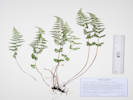
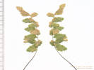
Woodsia scopulina D. C. Eaton. Rocky Mountain Woodsia. CalPhotos. Jepson eFlora. SEINet Taxon.
- Lundy, 8000-9000 ft vicinity of Lundy Miss Maud Minthorn 140. 6 Aug 1908. ( UC163459† ) 8000-9000 ft vicinity of Lundy Miss Maud Minthorn 198. 26 Aug 1908. ( UC163461† ) .
Equisetaceae
Equisetum arvense L. Field Horsetail. CalPhotos. Jepson eFlora. SEINet Taxon.
- Lee Vining Canyon, 7500-8000 ft Edward Lee 12 Aug 1956. ( JEPS79603† ) .
- Lee Vining Ranger Station, near Lee Vining Ranger Station along Lee Vining Creek Jack L. Reveal and James L. Reveal 127. 9 Jun 1962. ( UC1338749† ) .
- Parker Creek,
Deep shade at streamside.
Just upstream from the informal campground on Parker Creek, at the end of Forest Road 01S25 "Parker Creek Road," 3.5 miles by air southwest of the intersection of US Highway 395, and California Highway 158.
Tom Schweich 870.1
23 Jun 2012.
(
UC2015302‡
)
.
.
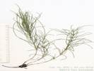
Equisetum telmateia Ehrh. ssp. braunii (Milde) Hauke. CalPhotos. Jepson eFlora. SEINet Taxon.
- Lee Vining Canyon, wet seepage meadow in riparian setting MONO BASIN; Lee Vining Creek, about 1.5 miles upstream from the Ranger Station; Inyo National Forest Dean Wm. Taylor 15564. 21 Sep 1995. ( JEPS104913† ) .
Pteridaceae
Aspidotis densa (Brack.) Lellinger. Indian's Dream. CalPhotos. Jepson eFlora. SEINet Taxon. Lundy Cyn 8000-9000 ft May have been collected in upper Mono Basin.
- Lundy, 8000-9000 ft vicinity of Lundy Miss Maud Minthorn 197. 26 Aug 1908. ( UC167795† ) . .
Cheilanthes gracillima D. C. Eaton. Lace Lipfern. CalPhotos. Jepson eFlora. SEINet Taxon.
- Lundy Canyon, rocky crevices, east slopes north side of Lundy Lake Carl B. Wolf 4 Nov 1931. ( UC527739† UCR95783† ) . .
Cryptogramma acrostichoides R. Br. American Rockbrake. CalPhotos. Jepson eFlora. SEINet Taxon.
- Lee Vining Ranger Station, Pinyon-Juniper Woodland - along stream. Ranger Station, 1 mile west of Lee Vining Robert D. Briggs 1881. 2 Apr 1966. ( CHSC3645† ) .
- Lundy Canyon, base of boulders along trail above Lundy Lake, east side of Sierra Nevada William Doyle Jun 1976. ( UCSC2901† ) . .
Pellaea breweri D. C. Eaton. Brewer's Cliffbrake. CalPhotos. Jepson eFlora. SEINet Taxon.
- Bloody Canyon, Chesnut and Drew 21 Jul 1889. ( UC71284† ) .
- Lundy, 8000-9000 ft vicinity of Lundy Miss Maud Minthorn 20 Jun 1908. ( UC170470† ) . .
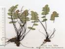
Pellaea bridgesii Hook. Bridges' Cliffbrake. CalPhotos. Jepson eFlora. SEINet Taxon.
Perennial terrestrial fern, to 15 cm; Fronds many, mono-morphic, once pinnate, underside glabrous; Pinnae flat (not recurved to cover sori), basal unlobed; Sori on margin of frond (Described from Coll. No. 699, 13 Nov 2011).
- Lee Vining Canyon, In a rock crevice on a bedrock ridge about 0.4 miles northwest of the Aspen Campground, north side of Poole Power Station Road. Tom Schweich 699. 9 Aug 2010. ( UC1980454‡ ) .
- Lundy,
8000-9000 ft
vicinity of Lundy
Miss Maud Minthorn
1 Jul 1908.
(
UC170469†
)
.
Cupressaceae
Juniperus communis L. Common Juniper. CalPhotos. Jepson eFlora. SEINet Taxon.
- Lee Vining Canyon, Southeast slope of Lee Vining Canyon, 2.5 miles east of Camp Tioga, growing over rocks. Jens Clausen 807. 23 Aug 1933. ( UC532142† ) . .
Juniperus grandis R. P. Adams. (Syn: J. occidentalis Hook. var. australis (Vasek) A.& N. Holmgren ) Sierra Juniper, Western Juniper. CalPhotos. Jepson eFlora. SEINet Taxon.
- Grant Lake, Canyon above Grant Lake on the road to Silver Lake. F. C. Vasek 14 Sep 1964. ( UCR3805† ) Leaves scale-like, whorls of 3, berries blue-black, bark red-brown. At the Grant Lake Overlook day use area at the south end of Grant Lake. Tom Schweich 901. 24 Aug 2012. ( UC ) .
- Lundy Canyon, Bottom of canyon with sandy granitic soil. Floor of Lundy Canyon about 5 miles west on road to Lundy Lake from US Hwy 395. Ian G. Gillespie 75. 1 Aug 2000. ( UCR133035† ) .
- Mono Basin,
At the junction of June Lake Road and US Hwy 395.
F. C. Vasek
1 Sep 1965.
(
UCR4281†
)
.
.
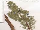
Juniperus occidentalis Hook. Western Juniper. CalPhotos. Jepson eFlora. SEINet Taxon.
- Bloody Canyon, Unknown 1 Sep 1897. ( UC333743† ) .
- Lundy, Rocky east slope, Transition. 0.5 miles northwest of Lundy. Carl B. Wolf 2533. 4 Nov 1931. ( UC527154† ) .
- Mono Basin, 587. 587. Winkler, David W., 1977 .
- MBRG P-6, Observation per MBRG voucher 850. 850. . .
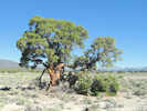
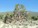
Juniperus osteosperma (Torrey) Little. Utah Juniper. CalPhotos. Jepson eFlora. SEINet Taxon.
- Cedar Hill, Collected in an area that has been described as having unusually large specimens due to absence of fire. Mineral County, Nevada, on the south side of Nevada State Route 359 (California Highway 167) 0.5 mi (0.9 km) east of California-Nevada border, 3.7 mi (6.0 km) southwest of Cedar Hill. Tom Schweich 571. 7 Jul 2009. ( CAS1117381‡ UC1973781‡ ) Collected in an area that has been described as having unusually large specimens due to absence of fire. Mono County, California, about 1.2 mi (2.0 km) west of California-Nevada state border on the north side of California Highway 167. Tom Schweich 572. 7 Jul 2009. ( UC1973782‡ ) . [ See my image: IMG_1956.JPG ]
- Mono Basin, North of Mono Lake, along Hawthorne Road, about 13 miles east of US Hwy 395. F. C. Vasek 3. 17 Jun 1975. ( UCR17456† ) .
- Mono Lake,
Alluvial slopes with fine pumice sand. Sagebrush scrub/juniper woodland with Artemisia tridentata, Chrysothamnus nauseosus, C. viscidiflorus, Juniperus osteosperma, Tetradymia canescens, etc.
East side of Mono Lake about 2 miles from the shore at about 38° North latitude.
Andrew C. Sanders 7138.
11 Jul 1987.
(
UCR51884†
)
.


Ephedraceae
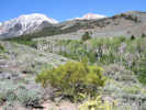
Ephedra viridis Cov. Green Ephedra. CalPhotos. Jepson eFlora. SEINet Taxon.
- Bloody Canyon, Chesnut and Drew 19 Jul 1889. ( UC160460† UC34973† ) .
- Bridgeport Canyon, On the old sandy beach soil of Mono Lake, 1 mile north of Hiway 31 (Pole Line Road) along the Bridgeport Canyon road. Jack L. Reveal and James L. Reveal 100. 9 Jun 1962. ( UC1338611† ) .
- Lee Vining Canyon, South facing slope. Carl W. Sharsmith 5505. 25 May 1947. ( SJSU13089† ) Rocky slope. Lee Vining Canyon near USGS benchmark. Carl W. Sharsmith 7548. 28 Aug 1967. ( SJSU4209† ) Dry slope of Lee Vining Canyon. George B. Rossbach 205. 17 Oct 1954. ( UC1073277† ) John Thomas Howell 27421. 28 Jul 1950. ( UC1042581† ) Near the mouth of Lee Vining Canyon. Milo S. Baker 5827. 4 Jul 1932. ( UC813738† ) .
- Mono Basin, 637. 637. Winkler, David W., 1977 .
- Mono Lake (southwest sector),
Along Test Station Road, about 0.4 m east of Rush Creek, and 1.5 mi northwest of South Tufa Parking Area.
Tom Schweich 954.
21 May 2013.
(
CAS1160963‡
UC
)
.


Pinaceae
Abies concolor (Gordon & Glend.) Lindl. ex Hildebr. White Fir. CalPhotos. Jepson eFlora. SEINet Taxon.
- Lundy Canyon, rocky east slope in sun 0.5 miles northwest of Lundy Carl B. Wolf 2535. 4 Nov 1931. ( UC527155† ) . .
Pinus albicaulis Engelm. Whitebark Pine. CalPhotos. Jepson eFlora. SEINet Taxon.
- Mono Craters, west-facing volcanic slopes near summit of Mono Craters Edward Lee and Carl W. Sharsmith 2499. 9 Aug 1936. ( JEPS75981† JEPS75982† ) . .
Pinus contorta Loudon ssp. murrayana (Grev. & Balf.) Critchf. (Syn: P. m. Balf. ) Sierra Lodgepole Pine. CalPhotos. Jepson eFlora. SEINet Taxon.
- Bloody Canyon, Unknown 1 Sep 1897. ( UC336364† ) .
- Grant Lake, Along small stream with Salix caudata bryantiana, S. hindsiana, S. ligulifolia, Populus tremuloides, Rosa californica, etc. Small stream feeding Grant Lake, Inyo National Forest. Robert F. Thorne 32812. 16 Jul 1963. ( CAS577271† RSA175183† ) .
- June Lake Junction, With Pinus jeffreyi, Pinus monticola, and Abies concolor. 3.5 miles north of Deadman's Pass, Highway 395, south of Mono Lake E. K. Balls 18053. 5 Oct 1952. ( NY49922† RSA81986† ) .
- June Mountain Ski Lodge, Jeffrey pine woodland. June Mtn. Ski Lift, Hwy. 158, 1.90 mi. S of June Lake city limits, Bulk Collection # 11 Wendell Wood 255. 14 Aug 1970. ( HSC12598† ) .
- Lee Vining, Edge between riparian zone and Great Basin scrub. Lee Vining, electrical substation at the south end of town John F. Green 19 Sep 2006. ( UCR182806† ) .
- Lundy Canyon, Mill Creek, 1 1/2 miles below Lundy Lake Dam, east slope of Sierra Nevada. C. B. Wolf 2542. 4 Nov 1931. ( DS243505† LA6058† POM213112† RSA2951† ) decomposed granite, Transition Mill Creek 1.5 miles below Lundy Lake Dam, Carl B. Wolf 4 Nov 1931. ( UC527158† ) .
- Lundy Lake, Lundy Lake, east slope of teh Sierra Nevada Mountains, Mono Lake Region. Elmer I. Applegate 6871. 4 Nov 1931. ( DS211994† ) .
- Mono Basin, 391. 391. Jones & Stokes Associates, 1993 pumice soil 12.7 miles east of junction of CA 120 and US 395, on logging road 1.5 miles from junction with 120 Ralph F. 205. 27 Jun 1959. ( UCSB122† ) . [ Collector name of "Ralph F." is probably a typographical error for "F. T. Ralph." ]
- Sagehen Spring, Along a watercourse just below Sagehen Spring. Tom Schweich 946. 21 May 2013. ( UC ) .
- Silver Lake,
Freda Detmers 17862.
28 Aug 1933.
(
RSA384442†
)
.
.

Pinus flexilis E. James. Limber Pine. CalPhotos. Jepson eFlora. SEINet Taxon.
- Mono Craters, west-facing volcanic slopes Edward Lee and Carl W. Sharsmith 2500. 9 Aug 1936. ( JEPS75979† JEPS75980† ) . .
Pinus jeffreyi Grev. & Balf. Jeffrey Pine. CalPhotos. Jepson eFlora. SEINet Taxon.
- Lee Vining Canyon, On Lee Vining grade of Tioga Pass Highway about 3 miles above Lee Vining Post Office. Ira L. Wiggins 9247. 15 Jul 1939. ( UC813265† UC941128† ) .
- Lundy, Transition, rocky east slope, in sun. 0.5 miles northwest of Lundy, east slope of Sierra Nevada. Carl B. Wolf 2536. 4 Nov 1931. ( UC527176† ) .
- Lundy Lake, Northwest of Lundy Lake, east slope of Sierra Nevada. Elmer I. Applegate 6868. 4 Nov 1931. ( UC496206† ) .
- Mill Creek, On Mill Creek and Lundy Lake Road, 2.5 miles west of US Hwy 395. C. Simis 105. 8 Feb 1964. ( UCSB192292† ) .
- Mono Basin, 389. 389. Jones & Stokes Associates, 1993 588. 588. Winkler, David W., 1977 .
- Mono Lake, Desert of granitic sand and gravel. Extensive forests. Just east of Mono Craters and north of: South end of Mono Lake Mono Mills - Mono Lake Elmer I. Applegate 6894. 5 Nov 1931. ( UC496179† ) .
- Mono Lake, F. P. McLean 400271. 1 Jul 1875. ( UC400271† ) .
- Mono Mills, Sun, pumice gravel flat, Transition. 2.8 miles northwest of Mono Mills. Carl B. Wolf 2552. 5 Nov 1931. ( UC527177† ) Low desert hills, granitic sand and gravel. Mono Mills, south of Mono Lake. Elmer I. Applegate 6895. 5 Nov 1931. ( UC496201† ) Open forest. Mono Mills at east base of Mono Craters. H. M. Hall 11706. 15 Sep 1921. ( UC217455† ) .
- Sagehen Meadow, Tom Schweich 894. 9/1/2010. .
- Sagehen Spring, Slopes above the spring and campground. Tom Schweich 945. 21 May 2013. . .
Pinus monophylla Torrey & Fremont. Single Leaf Pinyon Pine. CalPhotos. Jepson eFlora. SEINet Taxon.
- Dechambeau Creek, Dechambeau Creek, old lake terrace, northwest of Mono Lake. C. Simis 104. 9 Feb 1964. ( UCSB18731† ) .
- Lee Vining Creek, Exposed dry south slopes, Arid Transition Zone or even Upper Sonoran Zone. Peter Kamb 14. Aug 1944. ( UC1200631† ) .
- Lee Vining Canyon, On Lee Vining grade of Tioga Pass Highway about 3 miles above Lee Vining Post Office. Ira L. Wiggins 9244. 15 Jul 1935. ( UC941127† ) .
- Mono Basin, 589. 589. Winkler, David W., 1977 .
- Mono Lake, Geological Survey of California 6052. 1863. ( UC400321† ) Tree about 25 feet high. Near Mono Lake. Robert J. Rodin 6165. 1 Sep 1956. ( UC1362035† UC1362036† ) .
- MBRG P-6,
Observation per MBRG voucher
851.
851.
.
.
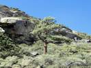
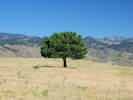
Pinus ponderosa Laws. Ponderosa Pine. CalPhotos. Jepson eFlora. SEINet Taxon.
- Mono Basin, Mono Lake Unknown 1 Sep 1866. ( UC403203† ) .
- Rush Creek (in Horseshoe Canyon),
A few trees above and below California Highway 158 at the Gaging Station about 0.4 miles south of Grant Lake.
Tom Schweich 908.
26 Aug 2012.
.

Adoxaceae
Sambucus nigra L ssp. caerulea Bolli. Common Elderberry. CalPhotos. Jepson eFlora. SEINet Taxon. Formerly S. mexicana and S. nigra ssp. canadensis, both of which were mis-applied as valid names for taxa not occurring in California.
- Conway Ranch, sage 0.8 miles northeast of Conway's Ranch, Bridgeport quadrangle T. M. Hendrix 608. 30 Aug 1937. ( UC1119913† UC579376† ) .
- Lee Vining, burned area in Artemisia scrub on granitic sand disturbed hillside on old lake terrace above Lee Vining Dean Wm. Taylor 7516. 22 Jul 1979. ( JEPS90729† ) .
Amaranthaceae
Amaranthus albus L. Tumble Pigweed. CalPhotos. Jepson eFlora. SEINet Taxon.
- Paoha Island,
vegetation type bare
south slope near steam vents, PLSS location 02N27E.
A. D. Gifford 870.
20 Aug 1937.
(
UC1136531†
UC577792†
)
.
[
SMASCH records state that Voucher UC577792 is ADG Coll #970 from Paoche Island. I believe this should be Coll #870 and the location should be Paoha Island.
]
.

Amaranthus blitoides S. Watson. (Syn: A. graecizans L. ) Mat Amaranth. CalPhotos. Jepson eFlora. SEINet Taxon.
- Mono Lake, Mono Lake, Mono County. John Thomas Howell 21521. 28 Sep 1945. ( CAS370178† ) .
- Mono Lake (southwest sector), West shore of Mono Lake on roadside, el. Ca. 6700 ft., Mono Co. John Thomas Howell 41387. 15 Sep 1965. ( CAS580938† ) . .
Amaranthus californicus (Moq.) S. Watson. California Amaranth. CalPhotos. Jepson eFlora. SEINet Taxon.
- Dechambeau Ponds, with a few Salix exigua thickets black pumice bordering warm spring outflow Dean Wm. Taylor 16977. 23 Aug 1998. ( JEPS96752‡ ) . .
Nitrophila occidentalis (Moq.) S. Watson. boraxweed. CalPhotos. Jepson eFlora. SEINet Taxon. Vouchers at CAS
- Mono Basin, This is the only collection of this taxon from Mono Basin. 628. 628. Winkler, David W., 1977 .
- MBRG P-12, Site 12 Plot 4 Station 5, horizontal distance above shore 272 ft., elevation above lake (6378 ft.) 16 ft J. Burch, J. Robins, & T. Wainwright 313. 21 Aug 1975. ( DS744201† ) .
- MBRG P-7, Observation per MBRG voucher 788. 788. Site 7 Plot 6 Station 11, horizontal distance above shore 3549 ft., elevation above lake (6378 ft.) 21 ft. J. Burch, J. Robins, & T. Wainwright 203. 5 Aug 1876. ( DS744200† ) .
Apiaceae
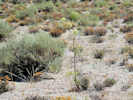
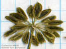
Angelica lineariloba A. Gray. Poison Angelica. CalPhotos. Jepson eFlora. SEINet Taxon.
- Bloody Canyon, Enid Michaels Sep 1937. ( CAS250773† ) Enid Michaels 26 Sep 1939. ( CAS251993† ) Enid Michaels Aug 1923. ( CAS42762† ) .
- East Craters Sand Flat, on Forest Road 1N24 on east side of East Craters Sand Flat, Tom Schweich 556. 13 Aug 2008. ( UC1953406‡ ) .
- Lee Vining Canyon, Herbert L. Mason 11482. 1 Aug 1936. ( UC583740† UC583741† ) .
- Lundy, near Lundy J. W. Congdon 20 Aug 1894. ( UC1041103† UC188160† ) .
- Mono Craters, east slope of Mono Craters Carl W. Sharsmith 5676.1 27 Aug 1948. ( SJSU13289† ) east slope of Mono Craters Carl W. Sharsmith 5676.2 27 Aug 1948. ( SJSU13290† ) in silicon gravels of volcanic origin, at base of a crater This lone colony 50 m. long included all the plants observed. Plants 8 to 12 dm. high; the stems somewhat leafy; flowers white. north base of Mono Craters, 1 mile west of Mono Mills, south of Mono Lake David D. Keck and L. R. Abrams 2906. 30 Jun 1934. ( DS249079† DS681874† UC583754† ) Tom Schweich 890. 8/1/2010. .
- Sagehen Peak,
Recognized from last year's infloresence and this year's leaves.
Tom Schweich 887.
7/22/2010.
Beside Sagehen Meadows Road below peak.
Tom Schweich 892.
9/1/2010.
.
.

Berula erecta (Huds.) Coville. Cut-Leaf Water Parsnip. CalPhotos. Jepson eFlora. SEINet Taxon.
- Mono Basin, 377. 377. Jones & Stokes Associates, 1993 678. 678. Winkler, David W., 1977 .
- MBRG P-8, Site 8, Plot 6, Station 9. Mono Lake and vicinity, north (sic) of Lee Vining. Plot 8 is at Simon Spring. J. Burch, J. Robins, & T. Wainwright 224. 6 Aug 1976. ( DS741087† ) .
- MBRG P-9, Site 9, Plot 3, Station 6. Mono Lake and vicinity, north of Lee Vining. J. Burch, J. Robins, & T. Wainwright 249. 11 Aug 1976. ( DS741090† ) .
- Mono Lake, west of (as a collection locality), Subsaline marshy area. West margin of Mono Lake, about 2 miles north of Lee Vining. Carl W. Sharsmith 8731. 7 Sep 1982. ( SJSU9713† ) Mono Lake and vicinity, north of Lee Vining. Altitude about 6400 ft. J. Burch, J. Robins, & T. Wainwright 351. 1 Sep 1976. ( DS741082† ) . [ Site, Plot, and Station are blank. ]
- Mono Vista Spring, Marshy area on northwestern shore of Mono Lake. Malcolm A. Nobs and S. Galen Smith 1705. 1 Sep 1949. ( CAS417886† DS415510† UC11191933† ) .
- Rush Creek delta,
On a former strand of Mono Lake in the Rush Creek delta, 1 km downstream from Test Station Road, 6 km by air east of Lee Vining, Mono County, California.
Tom Schweich, with Kim Kersh 717.1
30 Aug 2010.
(
UC1980415†
)
.
.

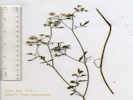
Cicuta douglasii (DC.) J. M. Coult. & Rose. Western Water Hemlock. CalPhotos. Jepson eFlora. SEINet Taxon.
- Mono Basin, 679. 679. Winkler, David W., 1977 .
- Mono Lake, marshy meadow, stems to 5.5' tall by west shore of Mono Lake near outlet of Mill Creek Carl W. Sharsmith 9219. 18 Aug 1991. ( SJSU14674† ) . .
Cicuta maculata L. var. angustifolia Hook. Spotted Water Hemlock. CalPhotos. Jepson eFlora. SEINet Taxon.
- Bohler Canyon, Along the dirt road on the south side of Bohler Canyon, 1.8 mi (3.0 km) by air west of US Highway 395. Tom Schweich 499. 2 Aug 2007. ( CAS1121270‡ UC1973698‡ ) .
- Mono Vista Spring,
marshy area on the northwestern shore of lake
on northwest shore of Mono Lake at Mono Vista Springs
Malcolm A. Nobs and S. Galen Smith 1706.
1 Sep 1949.
(
UC1191962†
)
.
.
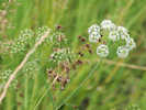
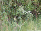
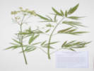

Cymopterus cinerarius A. Gray. Gray Springparsley. CalPhotos. Jepson eFlora. SEINet Taxon. Restricted to pumice soils, under trees.
- Mono Basin, Around Jeffrey pines, in pine needles, and other places with more organic matter than typically found in the volcanic cinder sands. Along California Highway 120, 8 miles east of US Highway 395. Tom Schweich 754. 16 Jun 2011. ( UC1980491‡ ) .
- Mono Craters, In the open sand flat just north of Mono Craters, 4 miles south of Mono Lake, Mono County, at 6900 feet elevation. David D. Keck and L. R. Abrams 2901. 30 Jun 1934. ( DS242434† DS694432† ) volcanic gravel with Abronia, Hulsea, Arabis, Eriophyllum, Lupinus, Purshia and scattered Pinus Jeffreyi east slope of Mono Craters L. Constance and R. Bacigalupi 3436. 3 Jul 1952. ( UC967285† ) In pine needle-covered areas beneath Jeffrey pines. 1.4 miles southeast of Crater Mountain, on a small ridge of cinders. Tom Schweich 703. 16 Aug 2010. ( UC1973771‡ ) TYPE! volcanic summit south of Mono Lake Wm. H. Brewer 1825. 8 Jul 1863. ( JEPS15980† ) .
- Mono Mills,
pumice gravel with sand beneath, moist at a depth of ca. 4 inches, surrounded by forest of Pinus jeffreyi
sand flat on east side of Mono Craters, along Highway 120 about 10 miles east of junction with Highway 395
Ann Howald 1926.
24 Jun 1995.
(
JEPS105490†
)
.
.
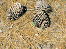
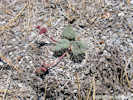
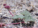

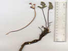

Cymopterus globosus (S. Watson) S. Watson. Globe Spring-Parsley. CalPhotos. Jepson eFlora. SEINet Taxon.
- Larkin Lake, Low dunes. Larkin Lake Mono Basin, Trench Canyon (e side, ca 100 m w of Nevada State Line), PLSS location 4N28E14. Coordinates as "...NW1/4 of SE1/4 Sec 14" Dean Wm. Taylor 16774. 2 Jul 1998. ( UC1731440† ) . .
Cymopterus terebinthinus (Hook.) Torr. & A. Gray var. californicus (J. M. Coult. & Rose) Jeps. (Syn: Pteryxia terebinthina (Hook.) J. M. Coult & Rose var. californica (J. M. Coult. & Rose) Mathias ) CalPhotos. Jepson eFlora. SEINet Taxon.
- Horseshoe Canyon Moraine,
Between lateral moraines on Inyo Forest Road 01S31 “Reversed Peak” road, 1.5 miles south of the Rush Creek Return Ditch Gatehouse, and 2.6 miles north of Reversed Peak.
Tom Schweich 775.
20 Jun 2011.
(
UC2045752‡
UCR262130‡
)
.
.
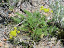

Lomatium dissectum (Nutt.) Mathias & Constance var. multifidum (Nutt.) Mathias & Constance. (Syn: Lomatium dissectum (Torr. & A. Gray) Mathias & Constance var. eatonii (J. M. Coult. & Rose) Cronq. ) CalPhotos. Jepson eFlora. SEINet Taxon.
- Lee Vining, in bank below road Annie M. Alexander and Louise Kellogg 4305. 25 Jun 1945. ( DS341865† UC736083† UTC76926† ) Julie Oxford 286. 23 May 1981. ( OBI70414† RSA778546† ) .
- Lee Vining Ranger Station, Veg. Type: Sage, slope east 2 miles soutn and 1 mile east of Lee Vining Ranger Station R. W. Lundh 329. 10 Jul 1934. ( UC1122988† ) . .
Lomatium foeniculaceum (Nutt.) J. M. Coult. & Rose ssp. fimbriatum W. L. Theob. CalPhotos. Jepson eFlora. SEINet Taxon.
- Anchorite Hills,
Growing with Artemisia arbuscula on open rocky flats with clay soils.
Mineral Co., Anchorite Hills, 2.9 road miles east of stateline on only road into the range from Alameda Well, T3N, R29E, S11..
Arnold Tiehm and Jan Nachlinger 12391.
15 Jun 1998.
(
CAS962999‡
)
.
[
Unable to find this voucher in CCH2.
]
.
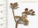
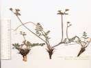
Lomatium nevadense (S. Watson) J. M. Coult. & Rose var. nevadense. CalPhotos. Jepson eFlora. SEINet Taxon.
Perennial, spreading, to 10 cm. above ground, from a stout (6 mm. dia.) tap root ≥ 9 cm., in dry soil at undisturbed places, not scented, plant nearly completely glabrous; Stem, ±0; Leaves, 2-3 pinnate, to 6 cm., basal sheaths purple, leaf segments, many, small, oblong, 1-2 mm. wide, sparse short straight white hairs; Inflorescence, compound umbel, involucel inconspicuous, umbels not head like; Pedicels, in fruit 3 mm.; Petals, white or cream; Ovary, glabrous, tip projection 0; Seed, 5 mm. × 2 mm. wide, elliptic, compressed front to back, not notched at base and tip, ribs ±equal, lateral ribs only slightly expanded as wings, glabrous (Described from Coll. No. 960, 22 May 2013).
- Bridgeport Canyon, Along Coyote Springs Road, about ⅓ mile southeast of the pass, at a watercourse crossing the road from southwest to northeast, 6˝ miles by road north of California Highway 167. Tom Schweich 960. 22 May 2013. ( CAS1161743‡ UC ) .
- Mono Basin,
No collections reported from Mono Basin. However, the species is common enough in nearby areas that it could be expected in the Mono Basin.
Tom Schweich 478.
6/5/2007.
.
.
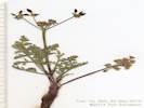
Lomatium plummerae (J. M. Coult. & Rose) J. M. Coult. & Rose. CalPhotos. Jepson eFlora. SEINet Taxon.
- Lundy Canyon, North-facing slope. Area dominated by sage brush (Artemisia tridentata) mixed with Pinon-juniper. Mono County: Lundy Canyon just northwest of Mono Lake. Located south moraine of the canyon approximately 125 meters up 4x4 road running 50 meters west of Deer Creek from the dam at Lundy Lake M. Klapp 24. 1 Jun 1996. ( UCD127711† ) . .
Lomatium utriculatum (Nutt. ex Torr. & A. Gray) J. M. Coult. & Rose. Spring Gold Desert Parsley. CalPhotos. Jepson eFlora. SEINet Taxon.
- June Lake, Sierra Nevada: June Lake Mrs. J. D. Wright 5 Jul 1929. ( SBBG59764† ) . .
Osmorhiza berteroi DC. Sweet Cicely. CalPhotos. Jepson eFlora. SEINet Taxon.
- Lee Vining Canyon,
riparian setting, forest of Pinus contorta, Pinus jeffreyi, Carex lauginosa
Lee Vining Creek 0.4 miles upstream from DWP diversion intake
Dean Wm. Taylor 16967.
22 Aug 1998.
(
UC1731432†
)
.
.
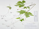
Osmorhiza occidentalis (Nutt.) Torr. CalPhotos. Jepson eFlora. SEINet Taxon.
- Bloody Canyon, Chesnut and Drew 21 Jul 1889. ( UC32475† ) .
- Lundy Canyon, Along creek 1 mi. below Lundy Lake Dam; road west of U. S. 395 Ira L. Wiggins 14191. 27 Jun 1957. ( DS508446† ) .
- Walker Lake, near Mono Lake J. W. Congdon 15 Aug 1898. ( UC21182† ) . .
Perideridia bolanderi (A. Gray) A. Nelson & J. F. Macbr. ssp. bolanderi. Bolander Yampah. CalPhotos. Jepson eFlora. SEINet Taxon.
Perennial, from elongated (7 cm.) tuber, to 50 cm., undisturbed places in dry rocky soil, glabrous, not scented; Leaves, 2°-pinnate and pinnate-ternate, leaf segments wider than thread-like, ultimate leaflet of mature leaf 3.5 mm. wide, not as dimorphic as Taylor (2010) describes; Inflorescence, compound umbel; Involucel, lobes 3.5 mm.; Pedicel, 2.5 mm.; Corolla, white; Ovary, 1.5 mm.; Styles, 1.5 mm.; Fruit, immature, no ribs expanded as wings at this stage (TJM2 Apiaceae 28-28') (Described from Coll. No. 961, 22 May 2013).
- Bridgeport Canyon,
Along Coyote Springs Road, about ⅓ mile southeast of the pass, at a watercourse crossing the road from southwest to northeast, 6˝ miles by road north of California Highway 167.
Tom Schweich 961.
22 May 2013.
(
UC
UCR250020‡
)
.
.

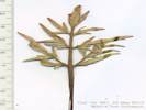
Perideridia lemmonii (J. M. Coult. & Rose) T. I. Chuang & Constance. Lemmon's Yampa. CalPhotos. Jepson eFlora. SEINet Taxon.
- Bridgeport Canyon, Ephemeral spring 0.5 mi. S of summit on road between Mormon Meadow and Bridgeport Canyon, 03N26E09. Tim Messick 1603. 30 Jun 1981. ( HSC80484† ) . .
Perideridia parishii (J. M. Coult. & Rose) A. Nelson & J. F. Macbr. ssp. latifolia (A. Gray) Chuang & Constance. Parish's Yampah. CalPhotos. Jepson eFlora. SEINet Taxon.
- June Lake, Moist Mountain Meadow. N. C. Cooper 2740. 31 Aug 1944. ( RSA459093† ) .
- Reversed Creek,
meadow
along creek 1.1 miles west of Gull Lake
T. I. Chuang and R. Bacigalupi 5899.
31 Jul 1963.
(
UC389964†
)
.
.
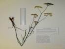
Sanicula graveolens DC. CalPhotos. Jepson eFlora. SEINet Taxon. Only collection from Mono County. Nearest other collection is 44 miles southwest at Huntington Lake, Fresno County.
- Pilot Spring, Inyo National Forest at Pilot Spring, about 5 miles southeast of California Highway 120 (southeast of Mono Lake and north of Mono Craters), George K. Helmkamp 2340. 10 Sep 1997. ( UCR103827† ) . .
Sium suave Walter. Hemlock Water Parsnip. CalPhotos. Jepson eFlora. SEINet Taxon.
- Danburg Beach,
Mono Lake Mono County park at Danburg Beach, W end of Mono Lake, 0.5 mi NE of Hwy 395, N of the community of Mono Lake, Sphenosciadium capitellatum A. Gray.
CalPhotos.
Jepson eFlora.
SEINet Taxon.
- Lundy,
8000-9000 ft
vicinity of Lundy
Miss Maud Minthorn
6 Aug 1908.
(
UC148773†
)
.
- Lundy Canyon,
Aspen forest (Populus tremuloides) with Poa, Salix, Cornus, Juncus sp., Senecio
Lundy Canyon, north side of Mill Creek just west of lowest beaver pond
Ian G. Gillespie 73.
29 Jul 2000.
(
UCR132872†
)
.
- Mono Basin,
680.
680.
Winkler, David W., 1977
.
- Mono Lake,
J. W. Congdon
24 Aug 1895.
(
DS28475†
UC106121†
)
.
- MBRG P-9,
Site 9 Plot 6 Station 10, horizontal distance above shore 1067 ft., elevation above lake (6378 ft.) 25 ft., time since area was last covered by Mono Lake 21 yrs.
J. Burch, J. Robins, & T. Wainwright 270.
11 Aug 1976.
(
DS741092†
)
.
Apocynaceae Apocynum androsaemifolium L.
Bitter Dogbane.
CalPhotos.
Jepson eFlora.
SEINet Taxon.
- Lee Vining Canyon,
Lee Vining Canyon - Tioga Road at about 7600'
Jack L. Reveal
18 Jul 1965.
(
SD87935†
)
Leevining Canyon, east wall of Dana Plateau.
Mrs. Elizabeth C. Wright
Summer 1923.
(
CAS128319†
)
.
- Lundy,
vicinity of Lundy, 8000-9000 ft
Miss Maud Minthorn
8 Sep 1908.
(
UC449674†
)
.
Asteraceae Achillea millefolium L.
(Syn:
A. lanulosa Nutt.
,
A. m. L. var. alpicola (Rydb.) Garrett
,
A. m. L. var. lanulosa (Nutt.) Piper
,
A. m. L. var. occidentalis DC.
)
Common Yarrow.
CalPhotos.
Jepson eFlora.
SEINet Taxon.
Perennial herb to 50 cm.;;
Leaves alternate, tendrils absent, finely dissected, aromatic when fresh;
Inflorescence, heads enclosed by an involucre, in flat-topped clusters;
Phyllaries in 2+ series;
Receptacles bearing scale-like bracts (paleate);
Perianth in 2 or more whorls, parts in 5s;
Phyllaries in 2+ series, not all subtending ray flowers;
Flowers open, bisexual, two kinds, some with strap-shaped corollas;
Petals fused into a tube;
Ray flowers, white, lobe ovate;
Disc flowers, white;
Stamens = in number to corolla lobes;
Ovary inferior.
Pistils, 1 per flower
(Described from Coll. No. 482, 30 Nov 2011, and Coll. No. 1023, 24 Jul 2013). - Bohler Canyon,
Wet meadow along the dirt road on the south side of Bohler Canyon, 1.8 mi (3.0 km) by air west of US Highway 395.
Tom Schweich 503.
2 Aug 2007.
(
CAS1121621‡
UC1973738‡
)
.
- Coyote Spring,
Growing in the meadow at Coyote Spring, Bridgeport Canyon, 4 miles north of California Highway 167.
Tom Schweich 482.
26 Jun 2007.
(
CAS1131490‡
UC1980450‡
)
.
- Lee Vining Canyon,
herb growing near a creek
collected 6.9 miles west of U S Hwy 395 along Tioga Pass Road (State Highway 120)
F. T. Ralph 221.
27 Jun 1959.
(
UCSB6316†
)
.
- Mono Basin,
Listed as A. lanulosa (Nutt.) Piper
591.
591.
Winkler, David W., 1977
.
- Murphy Spring,
Tom Schweich 889.
7/25/2010.
.
- Simis Ranch,
moist ground in open field
Simis Ranch (Sylvester Ranch) Dechambeau Creek near west shore of Mono Lake
Carl W. Sharsmith 7626.1
29 Aug 1969.
(
SJSU4573†
)
moist ground in open field
Simis Ranch (Sylvester Ranch) Dechambeau Creek near west shore of Mono Lake
Carl W. Sharsmith 7626.2
29 Aug 1969.
(
SJSU4578†
)
.
- Walker Creek (Lower),
In Pumice Valley, near the banks of lower Walker Creek, where crossed by an old alignment of US Highway 395, 4.5 miles by road south of Lee Vining.
Tom Schweich 1023.
24 Jul 2013.
(
OBI126712‡
UCR262294‡
)
.
.
Ageratina occidentalis (Hook.) R. M. King & H. Rob.
Western Snakeroot.
CalPhotos.
Jepson eFlora.
SEINet Taxon.
- Lee Vining Canyon,
Herbert L. Mason 11487.
1 Aug 1936.
(
UC1081560†
)
.
- Lundy,
8000-9000 ft.
vicinity of Lundy
Miss Maud Minthorn 187.
17 Aug 1908.
(
UC194432†
)
.
- Reversed Creek,
in granote under cottonwood and aspen at foot of granitic cliffs
near Reversed Creek between Gull and Silver Lakes
L. Constance 2441.
9 Aug 1938.
(
UC614529†
)
.
.
Agoseris glauca (Pursh) Raf. var. glauca.
Pale Goat-Chicory.
CalPhotos.
Jepson eFlora.
SEINet Taxon.
- Sagehen Meadow,
Gently E-sloping heavily grazed dry meadow of soft silty pumice alluvium over granitic bedrock. Uplands of Artemisia tridentata / Purshia tridentata scrub.
Occasional throughout meadow. Flws close-up when picked.;
GLASS MOUNTAIN REGION Sagehen Meadow area; along 4WD road running S from Gaspipe Spring and Hwy 120 as it crosses dry springfed drainages. Appx. 1/2 mi. NE of Sagehen Spr. campground. 01S28E11
Michael Honer 977.
21 Jun 2001.
(
RSA682392
)
South side of meadow.
Tom Schweich 631.
5 Jul 2010.
(
CAS1120830‡
UC
)
.
.
Agoseris monticola Greene.
(Syn:
A. glauca (Pursh) Raf. var. m. (Greene) Q. Jones
)
Sierra Nevada Goat-Chicory.
CalPhotos.
Jepson eFlora.
SEINet Taxon.
June
Status unresolved, some specimens annotated as this by G. I. Baird, 1998, synonym for Agoseris glauca (Pursh) Raf. var. monticola (Greene) Q. Jones. Another voucher of the same collection (Bacigalupi #8908) determined Agoseris aurantiaca (Hook.) Greene.
- Gull Lake,
in a sloping meadow just above creek
1.1.miles west of Gull Lake, in meadow above Reversed Creek
Rimo Bacigalupi and Tsan Iang Chuang 8908.
31 Jul 1963.
(
JEPS81948†
)
sloping meadow
1.1 miles west of Gull Lake, in meadow above Reversed Creek
Rimo Bacigalupi and Tsan Iang Chuang 8908.1
31 Jul 1963.
(
JEPS34431†
)
.
.
Agoseris parviflora (Nutt.) D. Dietr.
(Syn:
A. glauca (Pursh) Raf. var. laciniata (D. C. Eaton) Smiley
,
Troximon parviflorum Nutt.
,
Troximon pubescens (Rydb.) A. Nels.
)
Steppe Goat-Chicory.
CalPhotos.
Jepson eFlora.
SEINet Taxon.
Perennial herb, to 20 cm.;
Leaves, basal, to 180 mm. × 6 mm. wide,
not prickly,
margins, generally straight (not wavy),
0- to 6-toothed, sparsely ciliate or hairy;
Inflorescence, single heads on scape to 15 cm.;
Phyllaries, in 2+ graduated series,
10-13-16 mm.,
generally green, mid-vein dark purple, margin scarious,
outer phyllaries, mid-vein and margin ciliate;
Ray flowers,
corolla, 20-22 mm.,
yellow (drying more purple than pink),
lobes 5;
Disc flowers 0;
Pappus, simple capillary bristles;
Achene, surface smooth, beak unknown (immature).
(Described from Coll. No. 1101, 3 May 2015) - Conway Summit,
in sagebrush
toward Bridgeport along Highway 395 (above highway just north of road summit)
Milo S. Baker 9350.
9 Jun 1939.
(
UC679523†
)
.
- Lee Vining,
F. Howard
12 Jun 1962.
(
SBBG66202†
)
.
.
Agoseris retrorsa (Benth.) Greene.
Spear-Leaf Goat-Chicory.
CalPhotos.
Jepson eFlora.
SEINet Taxon.
- Lundy Lake,
along creek 1 mile below Lundy Lake Dam, take road west of U. S. Highway 395
Ira L. Wiggins 14188.
27 Jun 1957.
(
UC1190334†
)
.
.
Ambrosia acanthicarpa Hook.
Flat-Spine Burr-Ragweed.
CalPhotos.
Jepson eFlora.
SEINet Taxon.
- Lee Vining,
sandy flats
Lewis S. Rose 68148.
17 Jul 1968.
(
JEPS59942†
SBBG33984†
)
.
.
Anisocoma acaulis Torr. & A. Gray.
Scale Bud.
CalPhotos.
Jepson eFlora.
SEINet Taxon.
- Big Sand Flat,
herb growing in sandy pumic soil, of a dry east slope
collected 15.8 miles east of US Highway 395 along State Highway 120 (road to Benton)
F. T. Ralph 199.
27 Jun 1959.
(
UCSB6336†
)
Also found at this location, Astragalus monoensis.
Northwest side of CA Hwy 120, near center of Big Sand Flat and intersection of CA Hwy 120 and Forest Road 01S04 “Pilot Springs Road.”
Tom Schweich 1151.
22 Jun 2015.
(
CS
OBI82189‡
RENO87068‡
UC2046090‡
UCR265724‡
)
.
- Indian Spring,
sandy soils
along old roadway McPherson Grade [about 1 mile west of Indian Spring, the closest named location]
Dean Wm. Taylor 7742.
2 Jul 1980.
(
JEPS89487†
)
.
- Mono Lake,
near Mono Lake
Blake
1 Jul 1934.
(
UC584422†
)
Sierra Nevada; Southern Sierra Nevada region Mono Lake.
Marcus E. Jones
29 Jun 1929.
(
POM160350†
)
Volcanic sand flat.
Between Mono Lake and Mono Craters
S. F. Blake 11826.
30 Jun 1934.
(
DS693768†
UC584422†
)
.
- Sagehen Meadow,
Disturbed places near residence.
Tom Schweich 824.
31 May 2012.
(
CAS1149127‡
UC2015274‡
)
.
.
Antennaria rosea Greene.
Rosy Pussytoes.
CalPhotos.
Jepson eFlora.
SEINet Taxon.
Perennial herb, to 9 cm.,
stoloniferous 4-5 cm.,
forming loose mats in wet muddy soil,
all sixteen plants collected pistillate (gynoecious?);
Leaves, simple, white tomentose both sides,
basal, 35 mm. × 9 mm wide, oblanceolate,
cauline, 11-13 mm., linear;
Inflorescence, >> basal leaves;
Involucre, 5.5-7.0 mm.;
Bracts (phyllaries),
5.0-6-5 mm. × 1.1-0.7 mm. wide,
green at base, purplish band in middle,
tips, white, scarious.
(Described from Coll. No. 1083, 25 April 2015). - Lundy,
8000-9000 ft
vicinity of Lundy
Miss Maud Minthorn
23 Jun 1908.
(
UC148725†
)
.
- Reversed Creek,
Silver Lake region
Frank W. Peirson 6130.
28 Jun 1925.
(
UC98345†
)
.
- Rush Creek (in Horseshoe Canyon),
above stream
between Silver and Grant Lakes
Joseph and Hilda W. Grinnell 1069.1
18 Jun 1937.
(
UC569612†
)
.
.
Arnica chamissonis Less.
(Syn:
A. chamissonis Less. ssp. foliosa (Nutt.) Maguire
)
Chamisso Leopardbane.
CalPhotos.
Jepson eFlora.
SEINet Taxon.
Herbaceous perennial, 60 cm.;
Stem, proximal axils white hairy;
Leaves opposite,
petiole 65 mm, blade 68 mm. × 15 mm. wide,
length 4.5 × width;
Inflorescence 2-3 heads;
Heads, 2 kinds of flowers;
Phyllaries in 2 series, 8 mm., outer ≥ inner,
stalked glandular,
adaxial face glabrous, hair tufted near tip, tip acute;
Receptacle epaleate;
Ray corolla yellow;
Disc corolla should be stalked-glandular but can't see;
Pappus of well-developed bristles on both kinds of flowers,
6 mm., white, short plumose;
Achene, sparsely glandular
(Described from Coll. No. 510, 2 Aug 2007). - Bohler Canyon,
Wet meadow along the creek in Bohler Canyon, about 2.0 mi (3.1 km) by air west of US Highway 395, in grasses and sedges at creekside.
Tom Schweich 510.
2 Aug 2007.
(
UC
UCR250028‡
)
.
- Dechambeau Creek,
seasonally wet pasture-land
"Deschambeau Creek" near west shore of Mono Lake
Carl W. Sharsmith 8262.
10 Jul 1977.
(
SJSU7478†
)
.
- Farrington Ranch,
[Farringtons] Farrington
Alice Eastwood
20 Aug 1906.
(
CAS2380†
)
Clump. In grass.
by roadside, near Farrington Ranch, near Mono Lake
S. F. Blake 11822.2
30 Jun 1934.
(
DS713954†
)
.
- Fern Creek,
near June Lake
H. Dearing, M. Dearing 1919.
24 Jul 1936.
(
SBBG7579†
)
.
- June Lake,
Amongst tall grass along shores of lake.
Frank J. Kirby 1002.
Aug 1957.
(
CAS912488†
)
.
- June Lake,
Wet meadow.
At the head of June Lake.
Freda Detmers
27 Aug 1933.
(
RSA417128†
)
.
- Lee Vining,
Moist mountain meadow
N. C. Cooper 2450.
25 Aug 1944.
(
RSA417134†
)
.
- Lee Vining Canyon,
Meadow.
3 mi. w. of [Leevining] Lee Vining
Lewis S. Rose 50194.
26 Jul 1950.
(
CAS367416†
)
.
- Mono Lake,
wet meadows
"Lake Mono"
Chesnut and Drew
19 Jul 1889.
(
UC34556†
)
Ynez Whilton Winblad
26 Jul 1938.
(
CAS287940†
)
.
- Parker Creek,
On the moraine ridge, in a small dry meadow area.
James L. Reveal and Jack L. Reveal 446.
29 Jul 1962.
(
UC1338630†
)
.
- Pumice Valley,
Pumice Valley, south of Mono Lake, PLSS location: 1N27E19.
G. Douglas Barbe and Ed W. Hale 2291.
21 Jul 1977.
(
CHSC85491†
)
.
- Silver Lake,
Lewis S. Rose 40744.
3 Jul 1940.
(
CAS281341†
OBI49177†
)
.
- Snow Ponds,
June Lake area, on margin of small ponds. PLSS: 01S26E16.
Dean W. Taylor 7875.
26 Jun 1981.
(
JEPS89502†
)
.
.
Arnica nevadensis A. Gray.
Sierran Leopardbane.
CalPhotos.
Jepson eFlora.
SEINet Taxon.
- Lundy Canyon,
Damp S facing slope w/ Populus tremuloides, Pinus murrayana, Aquilegia formosa, Ledum glandulosum, and Acontium columb.
lower Lundy Canyon west of Highway 395 north of Lee Vining
W. Wisura, T. Hayduk, Q. Junzhuan 4556.
24 Aug 1991.
(
RSA531299†
)
.
.
Arnica sororia Greene.
Twin Leopardbane.
CalPhotos.
Jepson eFlora.
SEINet Taxon.
Perennial spreading by rhizomes;
Leaves opposite, cauline 4 pairs, reduced above, w/o embedded oil glands;
Involucre 10 mm, 12 mm dia.;
Receptacle naked;
Phyllaries ~14, in one series, 9 mm, w/o embedded oil glands;
Rays ~ 12, yellow, 15 mm, strap 10 mm x 3 mm wide;
Disc flowers ~40, yellow, 6 mm, 2 mm wide;
Achenes black, 3 mm, pappus of hairs, white, short-barbed
(Described from Coll. No. 692, 10 Nov 2011).
Subtribe Arnicinae is a subtribe Madieae with Madiinae (tarweeds) and Hulseinae, which contains Hulsea and Eatonella, both common in the Mono Lake basin. - Sagehen Meadow,
Sagebrush scrub with aspen stands and small moist meadows.
Eastern Sierra/ Mono Basin 4.9 mi. SE of Calif. Hwy 120 on Sagehen Meadows Road
George K. Helmkamp and E. A. Helmkamp 2321.
10 Sep 1997.
(
UCR122326
)
Tom Schweich 692.
26 Jul 2010.
(
CAS1131465‡
UC1980394‡
)
.
.
Artemisia arbuscula Nutt.
Little Sagebrush.
CalPhotos.
Jepson eFlora.
SEINet Taxon.
Several collections from upper Mono Lake basin.
- Mono Basin,
near [Mono Lake]
J. W. Congdon
18 Aug 1894.
(
UC91247†
)
.
.
Artemisia cana Pursh ssp. bolanderi (A. Gray) G. H. Ward.
Silver Sagebrush.
CalPhotos.
Jepson eFlora.
SEINet Taxon.
Subshrub woody at base, 30-35 cm tall, unarmed;
Leaves linear, entire, 15 mm, < 2 mm wide;
Heads erect, 3 mm dia. (less than 5 mm per TJM1, 2, & D)
(Described from Coll. No. 715, 20 Nov 2011). - Big Sand Flat,
sunny pumice gravel flat
Big Sand Flat, west of Dry Creek, 3.8 miles southeast of Mono Mills, on road to Benton
Carl B. Wolf 2556.
5 Nov 1931.
(
POM213405†
UC527131†
)
Sand flat, about 25 miles east of Lee Vining, East Mono Lake
E. C. Nord
12 Dec 1965.
(
UCR27090†
)
in dense sod of small Sporobolus
Sand Flat south of Mono Lake
H. M. Hall 11702.
15 Sep 1921.
(
UC217081†
)
[
There are, however, no collections of Sporobolus in the Mono Basin.
]
edge of Transition Zone, on exposed flats near streams or moist streamways
Sand Flat south of Mono Lake
H. M. Hall 11877.
27 Aug 1923.
(
UC311622†
)
.
- Sagehen Meadow,
On the drying edges of the wet meadow.
Tom Schweich 716.
28 Aug 2010.
(
CAS1131424‡
UC1980417‡
)
.
.
Artemisia ludoviciana Nutt.
Silver Wormwood.
CalPhotos.
Jepson eFlora.
SEINet Taxon.
- Lee Vining,
Alan A. Beetle 12946.
13 Aug 1957.
(
UCD129320†
)
.
- Lundy Canyon,
Eastern Sierra Nevada Mtns. mouth of Lundy Canyon, just off Hwy 395, 1 mile WNW of Mono City, PLSS: 02N25E12.
M. D. Wilcox, Scott Chandler
8 Sep 2011.
(
UCR234440†
)
.
[
Scrub with Elymus cinereus, Wyethia, Poa, Prunus andersonii, Purshia tridentata, Stephanomeria spinosa, Chrysothamnus nauseosus, Salix exigua, Artemisia tridentata, A. ludoviciana, Stipa hymenoides, Eriogonum umbellatum, Tetradymia canescens, Bromus tectorum, etc.
]
- Mono Basin,
as Artemisia ludoviciana no subspecies specified
436.
436.
Jones & Stokes Associates, 1993
.
.
Artemisia ludoviciana Nutt. ssp. incompta (Nutt.) D. D. Keck.
White Sagebrush.
CalPhotos.
Jepson eFlora.
SEINet Taxon.
- Bloody Canyon,
Bloody [Cańon] Canyon
J. W. Congdon
13 Aug 1898.
(
DS2157†
)
.
- Lee Vining Canyon,
Moist bank
Le[e vining?] Grade
H. M. Hall 11709.
15 Sep 1921.
(
UC217058†
)
.
- Lundy Canyon,
in woods
Lundy Canyon, Mill Creek
Frank W. Peirson 12143.
30 Jul 1937.
(
RSA94171†
)
.
- Mono Lake,
Henry N. Bolander 6151.
1 Jan 1866.
(
UC29684†
UC29685†
)
Wm. H. Brewer 6151.
1 Jan 1866.
(
JEPS36974†
)
.
.
Artemisia ludoviciana Nutt. ssp. ludoviciana.
(Syn:
A. britonii Rydb.
)
White Sagebrush.
CalPhotos.
Jepson eFlora.
SEINet Taxon.
Perennial herb, to 40 cm, unarmed, spreading by rhizomes;
Leaf
tomentose abaxially, sparse tomentose adaxially,
proximal wedge-shaped, 40 mm × 15 mm wide, 3+-toothed,
≤⅓ leaf-width,
distal lanceolate, entire
(Described from Coll. No. 898, 24 August 2012,
Frequency and depth of leaf lobing distinguishes between ssp. ludoviciana and
ssp. incompta.
These leaves are neither 2°-divided, nor deeper than ⅓-width, nor divided
nearly to the mid-rib. Therefore, ssp. ludoviciana is applied rather than ssp.
incompta). - Mono Lake, northwest shore (as a col. locality),
Yard of old ranch house along north shore of Mono Lake
Frank W. Peirson 9191.
12 Aug 1930.
(
RSA94413†
)
.
- Rattlesnake Gulch,
Along the watercourse at a cabin, about 300 m east of the GNIS location of Mono Diggings, 10.6 miles by road north of Lee Vining.
Tom Schweich 898.
24 Aug 2012.
(
CAS1157591‡
UC
)
.
.
Artemisia nova A. Nelson.
(Syn:
A. arbuscula Nutt. ssp. nova (A. Nelson) G. H. Ward
)
Black Sagebrush.
CalPhotos.
Jepson eFlora.
SEINet Taxon.
There are several collections of this taxon in the Bodie Hills.
- Mono Lake,
Sand flat.
Collected on sand flat near Mono Lake. Common Name: Sagebrush, Wormwood Native
Doris (Hoover) Bowers 544.
27 Jul 1965.
(
RSA764562†
)
.
.
Artemisia rothrockii A. Gray.
Timberline Sagebrush.
CalPhotos.
Jepson eFlora.
SEINet Taxon.
- Walker Lake,
Unknown
16 Aug 1896.
(
UC138184†
)
.
.
Artemisia tridentata Nutt.
Big Sagebrush.
CalPhotos.
Jepson eFlora.
SEINet Taxon.
- Mono Basin,
590.
590.
Winkler, David W., 1977
.
- MBRG P-10,
Observation per MBRG voucher
864.
864.
.
- MBRG P-12,
Observation per MBRG voucher
824.
824.
.
- MBRG P-7,
Observation per MBRG voucher
784.
784.
.
- Mono Valley,
Associated with Achnatherum hymenoides. On sandy soil with volcanic ash.
Mono Basin, Hawthorne Road, north of Lake.
L. [M.] Shultz, D. Tart, Clint McArthy 19783.
20 Sep 2004.
(
UTC245378†
)
.
- Pumice Valley,
Mono County: 6 - 7 miles south of Leevining
Beecher Crampton 9428.
23 Sep 1976.
(
UCD34121†
)
.
- Rattlesnake Gulch,
923.
8/24/2012.
.
- Sagehen Meadow,
Tom Schweich 893.
9/1/2010.
.
.
Artemisia tridentata Nutt. ssp. parishii (A. Gray) H. M. Hall & Clem.
San Bernardino Big Sagebrush.
CalPhotos.
Jepson eFlora.
SEINet Taxon.
- Mono Lake, south shore (as a collection locality),
Volcanic sand flats. Note reflexed branches of inflorescence.
Mono County: between south side of Mono Lake and Mono Craters.
Alan A. Beetle 12929.
11 Aug 1957.
(
UCD129365†
)
.
.
Artemisia tridentata Nutt. ssp. tridentata.
Big Sagebrush.
CalPhotos.
Jepson eFlora.
SEINet Taxon.
- Big Sand Flat,
On tops of sandy hills
Sand Flats, along Dry Creek, S of Mono Lake
George H. Ward, Birmingham 963.
16 Jul 1950.
(
DS410166†
)
.
- Conway Summit,
With Artemisia sp. and Ribes sp.
Hillside N of Hwy. 395 on Conway Summit grade, 0.5 mi. E of Mono Lake Vista, PLSS: 03N25E36.
Tim Messick 1379.
18 Aug 1980.
(
HSC79970†
)
.
- East Craters Sand Flat,
Mono Basin sand flat at east base of Mono Craters
David D. Keck 5024.
4 Sep 1939.
(
DS703768†
RSA34214†
)
.
- Farrington Ranch,
Sandy flat in sun, Upper Sonoran
SW side of Mono Lake, Farington Ranch, (about 3.5 miles north of Leevining)
Carl B. Wolf 1374.
3 Nov 1931.
(
POM212241†
)
Farington Ranch, southwest side of Mono Lake
Carl B. Wolf 2521.
3 Nov 1931.
(
ARIZ52669†
DS243483†
DS281661†
DS703808†
SD28145†
)
Farmington Ranch, SW side of Mono lake
Carl B. Wolf 3903.
3 Nov 1931.
(
POM256983†
RSA16810†
)
.
- Grant Lake,
Hwy. 158, N end of Grant Lake. Privy Point
Wendell Wood 259.
14 Aug 1970.
(
HSC12597†
)
.
- June Lake,
Dry mountainside
N. C. Cooper 2741.
31 Aug 1944.
(
RSA417405†
)
.
- Lundy,
8000-9000 ft
vicinity of Lundy
Miss Maud Minthorn 183.
17 Aug 1908.
(
UC148767†
)
.
- Lundy Canyon,
Other plant species include Purshia tridentata, Oryzopsis hymenoides, and Stipa sp.
Mono Lake and vicinity, north of Lee Vining. 2 miles west of highway 395
J. Burch, J. Robins, T. Wainwright 324.
29 Aug 1976.
(
DS741080†
)
.
- Mill Creek,
on dry sandy soil
Mill Creek at Mill Creek crossing, 1 mile west of De Chambeau's sheep ranch
James L. Reveal and Caroline G. Reveal 462.
11 Sep 1962.
(
CAS486649†
RSA185074†
UC1338657†
UTC100988†
)
.
[
There may be two collections #462
]
- Mono Lake,
on sand and gravelly soil of old lakeshore
1/2 mile east of Mono Lake Cemetary, north side of Mono Lake on the old lakeshore
Jack L. Reveal and David Mason 209.
29 Sep 1962.
(
CAS486650†
UC1338593†
UTC101988†
)
.
- MBRG P-12,
Size of plant community plot: 200 m2. Tree coverage: 0, Shrub coverage: 5, Herb coverage: 40, Av. height: 1 m, Av. height: 1.5 dm, Av. clearance: 2 dm.
Mono Lake and vicinity, north of Lee Vining Site: 1, Plot: 5, Station: 15 (see map); Horizontal distance above shore: 1884 ft.; Elevation above lake (6378ft.): 41 ft. (Maybe Site P-12 rather than P-1).
J. Burch, J. Robins, T. Wainwright 110.
7 Jul 1976.
(
DS741098†
)
.
[
Time since area was last covered by Mono Lake: 45 yrs. Water availability: 5. Soil Color: gray/light brown. Soil pH: 8.0. Species list and percent of cover at collection site: Chrysothamnus nauseosus 2, Gilia sp., Artemisia tridentata, Mentzelia albicaulis, Distichlis spicata 2, Oenothera boothill 1, Juncus effusus, Cryptantha circumscissa.
]
- MBRG P-2,
Mono Lake and vicinity, north of Lee Vining. 70 yds southeast of cemetary on the North shore of Mono Lake Elevation above lake (6378 ft.): about 75 ft.
J. Burch, J. Robins, T. Wainwright 93.
1 Jul 1976.
(
DS744325†
)
.
[
Time since area was last covered by Mono Lake: more than 100 years. Soil pH: 6.8. Species list at collection site: Gilia sp., Cryptantha circumscissa, Chrysothamnus nauseosus, Bromus tectorum, Cryptantha watsonii, Descurainia pinnata, Elymus cinercus, Oenothera dentata, Oryzopsis hymenoides, Chrysothamnus viscidiflorus, Coldenia nuttallii, Artemisia tridentata, Lygodesmia spinosa, Distichlis spicata, Juncus effusus, Erodium cicutarium, Carex douglasii, Sitanion sp., Salsola pestifera.
]
- MBRG P-5,
Species list and percent of cover at collection site: Salix hindsiana, Salix sp., Rosa woodsii, Poa sp., Artemisia tridentata, Iris missouriensis.
Mono Lake and vicinity, north of Lee Vining
J. Burch, J. Robins, T. Wainwright 320.
29 Aug 1976.
(
DS741079†
)
Mono Lake and vicinity, north of Lee Vining
J. Burch, J. Robins, T. Wainwright 329.
29 Aug 1976.
(
DS741081†
)
.
- Mono Lake (southwest sector),
Mono Lake just south of [Leevining] Lee Vining
Elmer I. Applegate 6852.
3 Nov 1931.
(
DS216730†
DS216731†
)
.
- Mono Lake, west of (as a collection locality),
hillsides west shore of Mono Lake
Mrs. E. C. Wright
Summer 1923.
(
CAS128321†
)
.
- Mono Mills,
Mono Basin, Sage Flats south of Highway 120 just off Mono Craters Rd.
Brian Miller 1092.
23 Sep 1992.
(
CAS921101†
)
in deep volcanic sand
Mono Mills, south of Mono Lake
David D. Keck 5020.
4 Sep 1939.
(
UC646492†
)
In deep volcanic snad among good stand of Pinus ponderosa jeffreyi.
Mono Mills, south of Mono Lake
David D. Keck 5021.
4 Sep 1939.
(
GH427511†
POM256737†
UTC59903†
)
In deep volcanic sand among good stand of Pinus ponderosa jeffreyi.
Mono Mills, south of Mono Lake Elevation 7350 feet (2240 m.).
David D. Keck 5022.
4 Sep 1939.
(
DS703775†
)
sand flat. In Pinus ponderosa jeffreyi forest.
Between Mono Mills and Mono Basin sand flat, south of Mono Lake at 7250 feet elevation (2210 m.).
David D. Keck 5023.
4 Sep 1939.
(
DS703767†
)
.
- Mono Valley,
Sandy sagebrush slope.
along county road betw. Mono Lake and Bodie, ca. 2 mi. from Mono Lake
Roxanna S. Ferris 13398.
18 Sep 1959.
(
DS419791†
)
.
- Negit Island,
on slopes of volcanic sand and gravel
Negit Island, Mono Lake
Edward Pittman 127.
5 Sep 1965.
(
CAS609057†
)
.
- Pumice Valley,
Pumice valley, S of Mono lake, on the bishop to Mono lake highway (1 mi. S of junction with Benton road)
Carl B. Wolf 1373.
3 Nov 1931.
(
POM212242†
POM256976†
RSA2912†
)
in sun on pumice sand, Upper Sonoran
Pumice Valley, south of Mono Lake on Bishop-Mono Lake Highway 1 mile south of junction with Benton Road
Carl B. Wolf 2520.
3 Nov 1931.
(
DS243482†
DS281672†
DS703807†
UC527142†
)
Pumice valley, south of Mono Lake
Carl B. Wolf 3891.
3 Nov 1931.
(
RSA16819†
)
Pumice Valley, West of Mono Craters, S. of Mono Lake, near Rush Creek at 6800 feet (2070 m.)
David D. Keck 5026.
4 Sep 1939.
(
DS267386†
GH427512†
)
Highway 120 near junction with Highway 395
Jean L. Pawek 534.
24 Aug 1958.
(
DS616356†
)
.
- South Tufa Area,
Mono County: Mono Lake Tufa. Shrubland in dry and alkaline soils
D. Sanchez-Mata
18 Aug 1996.
(
UCD67582†
)
.
- Tioga Lodge,
Tioga Lodge, Mono Lake.
Lewis S. Rose 50182.
25 Jul 1950.
(
RSA70725†
)
.
.
Artemisia tridentata Nutt. ssp. vaseyana (Rydb.) Beetle.
Mountain Big Sagebrush.
CalPhotos.
Jepson eFlora.
SEINet Taxon.
- Farrington Ranch,
sandy flat in sun, Upper Sonoran
Farington Ranch, 3 1/2 miles north (?-Ed.) of Lee Vining, southwest side of lake
Carl B. Wolf 2521.
3 Nov 1931.
(
UC527143†
)
.
[
There may be two collections #2521.
]
- June Lake,
Common low brush cover on dry hills.
O. H. Kappler 1545.
11 Jul 1947.
(
LA83482†
)
.
- Mono Lake,
Shores of Mono Lake.
Robert J. Rodin 6167.
1 Sep 1957.
(
OBI30794†
)
.
- Pumice Valley,
Edge of erosional cut, dry area of fine soils, open sagebrush meadow.
5 miles south of Lee Vining along highway 395
Leila M. Shultz, John S. Shultz 5712.
26 Oct 1981.
(
UTC191578†
)
.
- Sagehen Meadow,
Jack L. Reveal 217.
10 Oct 1962.
(
UTC101970†
)
.
.
Balsamorhiza sagittata (Pursh) Nutt.
Arrow-Leaf Balsamroot.
CalPhotos.
Jepson eFlora.
SEINet Taxon.
Perennial herb, to 50 cm.;
Leaves, mostly basal, 20 cm. × 12 cm,
widely triangular, base sagittate, tomentose,
cauline much reduced;
Inflorescence,
solitary heads on 40 cm. scape,
radiate,
composed of 2 kinds of flowers, some strap-shaped;
Phyllaries, in 2+ series,
not all subtending ray flowers, eglandular,
outer lance-linear,
18 mm. × 4 mm. wide,
veins, 5, prominent,
base to full length tomentose abaxially, adaxially distally,
inner obovate,
11 mm. × 4 mm. wide,
distal abaxial tomentose and ciliate;
Receptacle, paleate;
Paleae,
11 mm × 3 mm. wide,
ciliate, and distal abaxial tomentose,
palea covers all abaxial side of disc flower ovary,
and is barely folded around one edge,
not fully enclosing ovary;
Pappus 0;
Ray flower,
fertile,
stamens present but degenerate (?) and not functional (?),
corolla,
tube 2 mm. + blade 27-32 mm. × 11-12 mm. wide,
yellow;
Disc flowers, bisexual, corolla, 6 mm., yellow;
Achene, 9 mm., compressed radially.
Described from Coll. No. 956, 22 May 2013 (Mono County, CA) and
Coll. No. 1109, 14 May 2015 (Jefferson County, CO). - Copper Mountain,
In a limestone canyon of Copper Mountain, just below the mine tunnel, 1.1 miles west of the intersection of US Highway 395 and Mill Creek Powerhouse Road.
Tom Schweich 782.
22 Jun 2011.
(
CAS1131360‡
UC1980465‡
)
.
- Pumice Valley,
On Forest Road 01N17 “Farrington Siphon,” between the Sawmill Canyon and Bloody Canyon moraines, 6.3 miles by road south of Lee Vining, from below the aqueduct to the tops of the moraines.
Tom Schweich 956.
22 May 2013.
(
CAS1161742‡
UC
UCR250023‡
)
.
- Walker Creek (Lower),
on the Walker Creek Road to the Walker Lake Trail
Jack L. Reveal and David Mason 79.
30 May 1962.
(
UC1338703†
)
.
.
Brickellia californica (Torrey & A. Gray) A. Gray.
California Brickelbush.
CalPhotos.
Jepson eFlora.
SEINet Taxon.
- Lundy Lake,
Lundy Lake, west of Mono Lake. Desert foothills of the Sierra Nevada Mountains.
Elmer I. Applegate 6869.
4 Nov 1931.
(
DS216224†
)
.
.
Brickellia grandiflora (Hook.) Nutt.
Tasselflower Brickellbush.
CalPhotos.
Jepson eFlora.
SEINet Taxon.
- Lundy Lake,
north side of Lundy Lake
T. M. Hendrix 580.
24 Aug 1937.
(
UC1119080†
)
.
.
Brickellia microphylla (Nutt.) A. Gray var. microphylla.
Littleleaf Brickellbush.
CalPhotos.
Jepson eFlora.
SEINet Taxon.
- Black Point,
barren, s slope, surrounding type Atr, plants found growing on rocky ledge exposed to strong winds
top of Black Point, northwest side of Mono Lake
A. D. Gifford 900.
4 Sep 1937.
(
RSA121117†
UC1119084†
)
.
- Lundy,
8000 - 9000 ft
vicinity of Lundy
Miss Maud Minthorn
7 Oct 1908.
(
UC186053†
)
.
.
Brickellia oblongifolia Nutt. var. linifolia (D. C. Eaton) B. L. Rob.
Narrowleaf Brickellbush.
CalPhotos.
Jepson eFlora.
SEINet Taxon.
- Rush Creek,
gravel bed of creek
bed of Rush Creek at Highway 395
Dean Wm. Taylor 7847.
5 Aug 1980.
(
JEPS89310†
)
.
.
Calycoseris parryi A. Gray.
Yellow Tackstem.
CalPhotos.
Jepson eFlora.
SEINet Taxon.
- Negit Island,
D. W. Johnston
20 Jun 1953.
(
UC999239†
)
.
.
Chaenactis (Hook.) Hook. & Arn.
Douglas' Dustymaiden.
CalPhotos.
Jepson eFlora.
SEINet Taxon.
- June Lake,
Mrs. J. D. Wright
6 Jul 1929.
(
SBBG65668†
)
.
- Lee Vining,
disturbed hillside on old lake terrace, burned area in Artemisia tridentata scrub on granitic sand
above the town of Lee Vining
Dean Wm. Taylor 7514.2
22 Jul 1979.
(
JEPS89457†
)
.
- Lee Vining Creek,
dry, rocky mountain side near Lee Vining Creek
about 8 miles from Mono Post Office
Beecher Crampton 277.
10 Jul 1941.
(
UCD38114†
)
.
.
Chaenactis A. Gray.
Fleshcolor Pincushion.
CalPhotos.
Jepson eFlora.
SEINet Taxon.
- Lee Vining Creek,
open sandy soils in sagebrush-jeffrey pine ecotone
along Lee Vining Creek about 0.5 miles south of Lee Vining
Dean Wm. Taylor 7857.
12 Jun 1981.
(
JEPS89469†
)
.
- Paoha Island,
Herbert L. Mason 15213.
24 Jun 1963.
(
UC1275788†
)
.
.
Chaenactis douglasii (Hook.) Hook. & Arn. var. douglasii.
Douglas' Dustymaiden.
CalPhotos.
Jepson eFlora.
SEINet Taxon.
Also collected in the Trout Creek Pass Area, Park and Chaffee Counties, Colorado.
Annual to Perennial, becoming woody at base, to 40 cm., not thistle-like, not scapose, proximal hairs cobwebby, white,
becoming glandular distally,
some reddish-purple color on stems, leaves, and phyllaries;
Leaves basal and cauline, deeply lobed, margins rolled (i.e., leaf blade not flat);
Inflorescence, flowers of 1 kind, rayless, discoid;
Heads 20+, solitary on peduncles (1.5)4-6 cm. at flowering;
Receptacle not chaffy, epaleate;
Phyllaries in 2+ series, 5-9 mm x 2 mm wide, outer < inner, tips appressed;
Flowers yellow, no ray flowers;
Pappus a well-developed crown of scales, 1.0-5.0 mm., not alternating with awns or bristles;
Achenes 6 mm, hairy
(Described from Coll. No. 764.1, 20 Jan 2012, and Coll. No. 829, 26 Jan 2013, Mono County, California, and Coll. No. 2562, 12 July 2021, Park County, Colorado). - Adobe Hills Spillway,
Growing in the fresh water sandstone at the spillway, 16.6 miles east of US Highway 395 on California Highway 167, then 8.0 miles southeast on Dobie Meadows Road.
Tom Schweich 620.
29 Jun 2010.
(
OBI82216‡
UCR262141‡
)
.
- Lee Vining Canyon,
P. Stockwell 1320.
20 Jul 1935.
(
JEPS30916†
)
2 miles west of Lee Vining
P. Stockwell 1322.
20 Jul 1935.
(
JEPS30918†
)
.
- Mono Basin,
Reported as Chaenactis sp.
603.
603.
Winkler, David W., 1977
With Pinyons (no Junipers), Sagebrush, Bitterbrush, and Ephedra, in the mixed sandy and rocky ground where the foot of the Bodie Hills meets the Mono Dunes.
Along Goat Ranch Road, 3.25 miles east northeast of the intersection of US Highway 395 and California Highway 167 (sometimes called Pole Line Road).
Tom Schweich 764.1
19 Jun 2011.
(
CAS1131402‡
UC1980481‡
)
.
- Mono Lake,
in a wet place
Anna E. Ehlers 823.
5 Jul 1920.
(
JEPS34189†
)
.
- Tioga Lodge,
This area burned several years ago.
Granite outcrop surrounded by very sandy soil, likely a former shoreline or deltaic deposit from a high-stand of Mono Lake, above Tioga Lodge, along a powerline road, 2.8 miles north of Lee Vining.
Tom Schweich 829.
18 Jun 2012.
(
CAS1149310‡
UC2015271‡
)
.
.
Chrysothamnus viscidiflorus (Hook.) Nutt. ssp. axillaris (D. D. Keck) L. C. Anderson.
Yellow Rabbitbrush.
CalPhotos.
Jepson eFlora.
SEINet Taxon.
- South Tufa Area,
Mono County: Mono Lake. Mono Lake Tufa. Shrubland in dry and alkaline soils
D. Sanchez-Mata
18 Aug 1996.
(
UCD67586†
)
.
.
Chrysothamnus viscidiflorus (Hook.) Nutt. ssp. puberulus (D. C. Eaton) H. M. Hall & Clem.
Yellow Rabbitbrush.
CalPhotos.
Jepson eFlora.
SEINet Taxon.
Perennial shrub, to 1 m., juice with latex, not thistle-like;
Stem generally glabrous (very few hairs), young stem few hairs (but not
tomentose);
Leaves alternate, linear, 30 mm. x 0.8-1.2 mm. wide, margins entire, not
ciliate, adaxial surface with tangled hairs, oil glands 0;
Heads, conical, not overtopped by distal leaves, ray flowers 0, disc flowers
present;
Involucre obconic, 8-9 mm.;
Phyllaries in 3 distinct vertical ranks, graduated in size, lower << rest of
involucre, opaque, tips acute, oil glands 0;
Flowers 6;
Pappus of many bristles, ±cylindric;
Corollas yellow;
Style, appendages (2.0 mm.) > stigmatic portion (1.6 mm.);
Fruit moderately hairy
(Described from Coll. No. 887, 22 Aug 2012). - Alameda Well,
in deep beach alluvial
nearly one mile south of Alameda Wells, east of Mono Lake
Jack L. Reveal 884.
14 Sep 1963.
(
GH387051†
UC1338463†
UCD130460†
)
East of Mono Lake in deep alluvial bench, nearly 1 mile south of Alameda Well.
Jack L. Reveal and David Mason 884.
14 Sep 1963.
(
UC1338463†
)
.
- Black Point,
North shore, foot of black pumice hill.
Frank W. Peirson
1 Aug 1933.
(
UC511804†
)
north shore at foot of black pumice hill (Presumably Black Point -- Ed.)
Frank W. Peirson 9207.
12 Aug 1930.
(
RSA90659†
SD87653†
)
.
- Lee Vining,
on steep slope
From behind Gateway Motel, slope east of main street of downtown Lee Vining
Walter Knight, Irja Knight 4219.
13 Jul 1981.
(
CAS649083†
)
.
- Mono Lake,
Henry N. Bolander 6142.
1866.
(
GH387052†
UC31175†
)
.
- Sagehen Meadow,
North of the meadow, in sagebrush, just at the edge of the Jeffrey pines.
Tom Schweich 887.
22 Aug 2012.
(
UC
UCR248618‡
)
.
.
Chrysothamnus viscidiflorus (Hook.) Nutt. ssp. viscidiflorus.
Yellow Rabbitbrush.
CalPhotos.
Jepson eFlora.
SEINet Taxon.
Perennial shrub, to 1 m.;
Stems woody at base, glabrous (few stray hairs), juice latex (?);
Leaves alternate, entire, linear-lanceolate, to 24 mm. × 1.5 mm. wide, twisted > 360° (or not), eglandular, margin (very) sparsely ciliate;
Inflorescence triangular (i.e., not flat-topped), a head enclosed by involucre, not overtopped by leaves, flowers of 1 kind,
no strap-shaped corollas;
Involucre, 9 mm.;
Receptacle epaleate;
Phyllaries 3± unequal series, tending to be aligned in vertical ranks, but not always, not transparent or scarious, eglandular;
Perianth 2 or more whorls, parts 5 per whorl;
Flowers all disc flowers, 5-6, open, bisexual;
Pappus of many well-developed bristles;
Corolla, strap-shaped 0, yellow, tube 3.5 mm. + throat 0.5 mm. +
fused lobes 3.0 mm. + free lobes 0.5 mm. = 7.5 mm., throat expanding gradually above tube;
Stamens = in number to corolla lobes;
Ovary inferior;
Pistil, 1 per flower, 6.0 mm. + stigmatic portion 1.2 mm. +
appendages 1.0 mm. = 8.2 mm.;
Stigmas 2;
Achenes (moderately) hairy
(Described from Coll. No. 137, 22 Sep 1997, Coll. No. 150, 3 Oct 1997, Coll. No. 705, 15 Nov 2011).
Leaves twisted at Rush Creek and Sagehen Meadow, not in eastern Mojave. Phyllaries not in vertical ranks in eastern Mojave. - Big Sand Flat,
2 miles east of Big Sand Flat, along Highway 120 at the junction of the Sagehen Meadow Road.
Jack L. Reveal and David Mason 196.
8 Sep 1962.
(
CAS490362†
UC1338717†
)
.
- Cowtrack Mountain,
Inside old burn, appearing to be primary invader after fire.
Cowtrack Mountain 5 miles southeast of Mono Lake.
R. E. Douglas 50.
28 Jul 1964.
(
SJSU3008†
)
.
- Dechambeau Ranch,
0.5 miles northwest of Dechambeau Ranch on north shore of Mono Lake.
Jack L. Reveal and David Mason 918.
6 Oct 1963.
(
CAS490363†
UC1338457†
)
About 1 mile west of Dechambeau Sheep Ranch at Mill Creek crossing, on dry sandy soil.
James L. Reveal 462.
11 Sep 1962.
(
CAS490364†
CS60365†
RSA185199†
UC1338722†
)
.
- Farrington Ranch,
Sun, sandy flat, Upper sonoran.
S.W. side of Mono Lake, Farington Ranch, about 3˝ mi. no. of Lee Vining
C. B. Wolf 1376.
3 Nov 1931.
(
CAS219942†
DS243485†
)
Upper Sonoran
Farington Ranch, S.W. side of Mono Lake
C. B. Wolf 2523.
3 Nov 1931.
(
DS281683†
DS702174†
OBI5964†
OBI5966†
RSA2909†
SD11852†
)
Farington Ranch, southwest side of Mono Lake, about 3.5 miles north of Lee Vining.
Carl B. Wolf
3 Nov 1931.
(
UC527145†
)
Farington Ranch, southwest side of Mono Lake
Carl B. Wolf 3878.
3 Nov 1931.
(
SD28143†
)
.
- Grant Lake,
Dry hillside.
Hwy. 158, N end of Grant Lake. Privy Point
Wendell Wood 258.
14 Aug 1970.
(
HSC12803†
)
.
- Lee Vining,
bench 2.0 miles south of Lee Vining
Jack L. Reveal 2636.1
13 Jul 1980.
(
SD109199†
)
.
- Lee Vining Creek,
Lee Vining Creek, Tioga Pass Road
Elmer I. Applegate 6878.
6 Nov 1931.
(
DS215759†
)
.
- Lee Vining Ranger Station,
Sun, dec. granite loam. Transition.
Ľ mile above Lee Vining Ranger Station
C. B. Wolf 1388.
5 Nov 1931.
(
CAS219956†
DS243498†
)
Sun, dec. granite, loam. Transition (?) 2 ft. high, 3 ft. spread, trunk 2 in. diam.
Ľ mile above the Lee Vining Ranger Station
C. B. Wolf 2544.
5 Nov 1931.
(
DS702175†
OBI6004†
RSA2949†
)
In sun, decomposed granite loam, Transition.
Carl B. Wolf
5 Nov 1931.
(
UC527160†
)
On moraine soil with Pinyon-Juniper.
Jack L. Reveal and David Mason 191.
2 Sep 1962.
(
CAS584913†
CS60363†
RSA185264†
UC1338872†
)
.
- Lower Horse Meadow,
rocky moraine soil
side hill north of Lower Horse Meadow
J. L. Reveal 887.
1962.
(
CS60362†
)
.
- Mono Basin,
Reported without subspecies, but see BRW #88
595.
595.
Winkler, David W., 1977
Near Deep Wells Road along Highway 31 (Poleline Road), in the northeast corner of Mono Lake Basin, in deep pumice sand.
Jack L. Reveal and David Mason 924.
23 Oct 1962.
(
UC1338455†
)
.
- Mono Lake,
H. N. Bolander
1866.
(
UC31176†
)
H. N. Bolander 6142.
1866.
(
UC31174†
)
Mrs. [Elizabeth C.] Wright
Aug 1917.
(
CAS6048†
)
W. T. Swingle, F. A. Thackery, R. H. Peebles
10 Sep 1931.
(
DS299118†
)
.
- Mono Lake, northwest shore (as a col. locality),
Mono Lake and vicinity, north of Lee Vining - 70 yards southeast of cemetary on the North shore of Mono Lake
J. Burch, J. Robins, T. Wainwright 88.
1 Jul 1976.
(
DS744324†
)
.
[
Soil pH 6.8 - With Gilia sp., Elymus cinereus, Cryptantha circumscissa, Chrysothamnus nauseosus, Bromus tectorum, Cryptantha watsonii, Descurainia pinnata, Oenothera dentata, Orysopsis hymenoides, Chrysothamnus viscidiflorus, Coldenia nuttallii, Artemisa tridentata, Lygodesmia spinosa, Distichlis spicata.
]
- Mono Lake, west of (as a collection locality),
West side of Mono Lake.
H. M. Hall 10857.
21 Sep 1918.
(
UC205543†
)
.
- Mono Mills,
Sun, pumice gravel flat, in Yellow Pine Forest - Transition
C. B. Wolf 1395.
5 Nov 1931.
(
DS243460†
)
Sun, pumice gravel flat, in Yellow Pine Forest - Transition
C. B. Wolf 2554.
5 Nov 1931.
(
DS702173†
RSA3075†
)
In sun, pumice gravel flat, in transition to Yellow Pine Forest.
Carl B. Wolf
5 Nov 1931.
(
UC527167†
)
Among Jeffrey pines.
Mono Mills, south of Mono Lake
Elmer I. Applegate 6896.
5 Nov 1931.
(
DS215706†
)
.
- Mono Valley,
Sandy sagebrush slope along road.
Along County road betw. Mono Lake and Bodie, ca. 2 mi. from Mono Lake
Roxana S. Ferris 13401.
18 Sep 1959.
(
DS419793†
DS419795†
DS419796†
)
.
- Sagehen Meadow,
North of the meadow and the house, on loose granitic sand slopes.
Tom Schweich 705.
17 Aug 2010.
(
CAS1131416‡
UC1980384‡
)
.
- Sagehen Summit,
2 mi e Big Sand Flat (along Highway 120 at the junction of the Sagehen Meadow Road)
Jack L. Reveal and David Mason 196.
8 Sep 1962.
(
CS60364†
UC1338717†
)
.
.
Cirsium andersonii (A. Gray) Petr.
Rose Thistle.
CalPhotos.
Jepson eFlora.
SEINet Taxon.
- Lundy Canyon,
among boulders along a dry canyon bottom, scattered Jeffrey pine association
Ernest C. Twisselmann 5765.
14 Sep 1959.
(
JEPS31032†
)
.
.
Cirsium scariosum Nutt. var. congdonii (Moore & Frank.) Keil.
Meadow Thistle.
CalPhotos.
Jepson eFlora.
SEINet Taxon.
- Bloody Canyon,
foot of Bloody Canyon
Chesnut and Drew
19 Jul 1889.
(
UC34642†
)
.
- Bridgeport Canyon,
Road side at the upper, unnamed spring in Bridgeport Canyon, along Coyote Spring Road, 4.9 road miles north northwest of the intersection of Cottonwood Canyon Road and California Highway 167.
Tom Schweich 855.
21 Jun 2012.
(
CAS1157546‡
UC
)
.
- June Lake,
Lewis S. Rose 40726.
2 Jul 1940.
(
UC894963†
)
.
- Lee Vining Canyon,
moist ground in grassy meadow
by Lee Vining Creek
Carl W. Sharsmith 5481.
6 Aug 1946.
(
SJSU13485†
)
.
- Walker Creek (Lower),
Tom Schweich 969.
7/24/2013.
.
.
Cirsium vulgare (Savi) Ten.
Bull Thistle.
Weed:
CAL-IPC, List: Moderate.
Inyo National Forest, priority: Moderate, List: C.
CalPhotos.
Jepson eFlora.
SEINet Taxon.
Leaves,
adaxial face with slender appressed bristle-like prickles. - Mono Basin,
602.
602.
Winkler, David W., 1977
.
- Mono Lake (southwest sector),
Moist alkaline seep dominated by Juncus nevadensis, J. americanus & Distichlis spicata.
southwest side of Mono Lake, between the lake and US Highway 395
George K. Helmkamp
8 Sep 1988.
(
UCR59976†
)
.
- Paoha Island,
Md, flat
east shore
A. D. Gifford 865.
20 Aug 1937.
(
UC1119196†
UC578003†
)
.
.
Conyza canadensis (L.) Cronquist.
(Syn:
Erigeron canadensis (L.) Cronquist
)
Canadian Horseweed.
CalPhotos.
Jepson eFlora.
SEINet Taxon.
Retained in Conyza per FNANM.
- Lower Horse Meadow,
Meadow border on granitic substrate, growing on margin of a dirt road.
Dean Wm. Taylor 16988.
24 Aug 1998.
(
UC1731291†
)
.
- Paoha Island,
A. D. Gifford 862.
20 Aug 1937.
(
UC577955†
)
.
- Walker Creek (Lower),
Also collected here: Eriogonum brachyanthum, and Nicotiana attenuata.
Lower Walker Creek at the transition from Bloody Canyon to Pumice Valley, just below the aqueduct and Forest Road 01N17 “Farrington Siphon,” on the north side of Walker Creek.
Tom Schweich 518.
2 Aug 2007.
(
CAS1202034‡
UC2045726‡
)
.
.
Crepis acuminata Nutt.
Tapertip Hawksbeard.
CalPhotos.
Jepson eFlora.
SEINet Taxon.
- Conway Summit,
along U. S. Highway 395 about 8.7 miles north of Lee Vining
Darley Howe
22 Jun 1978.
(
SD102792†
)
.
- Lundy,
8000-9000 ft
vicinity of Lundy
Miss Maud Minthorn 100.
15 Jul 1908.
(
UC485365†
)
.
- Walker Lake,
dry rocky ground
base of Bloody Canyon near Walker Lake
Carl W. Sharsmith 8728.
18 Jul 1982.
(
SJSU9748†
)
.
.
Crepis intermedia A. Gray.
Limestone Hawksbeard.
CalPhotos.
Jepson eFlora.
SEINet Taxon.
Perennial 6 dm tall;
Leaves alternate, pinnately lobed;
Infloresence a panicle with 7-19 heads;
Involucre 10 mm long;
Phyllaries in 2 series, 4 outer << inner, 4 inner black tipped;
Receptacle naked;
Flowers unable to discern color or ray vs. disk;
Achenes 6, pappus of bristles
(Described from Coll. No. 687, 7 Nov 2011). - Cottonwood Canyon,
Western portion of the uppermost reaches of Cottonwood Canyon, about 1 mile (1.6 km) north northwest of Mount Biedeman, and 1.75 mi (2.8 km) south of Murphy Spring.
Tom Schweich 687.
25 Jul 2010.
(
CAS1131435‡
UC1980400‡
)
.
- Tioga Lodge,
on highway 1 1/2 miles south of Tioga Lodge
E. B. Babcock 409.
30 Jun 1934.
(
UC581209†
)
.
.
Crepis occidentalis Nutt.
(Syn:
Psilochenia occidentalis (Nutt.) Nutt.
)
Largeflower Hawksbeard.
CalPhotos.
Jepson eFlora.
SEINet Taxon.
Perennial,
herb,
to 25 cm.,
taprooted;
Stem,
green,
tomentose,
glandular,
no bristles;
Leaves,
basal and cauline,
alternate,
petiole 20 mm. + blade 56 mm. × 17 mm. wide,
reduced distally,
pinnately lobed nearly to mid-rib,
segments deltoid,
tomentose, glandular;
Inflorescence,
heads #3 per stem,
showy,
>leaves;
Peduncles,
23 mm.;
Involucre,
12 mm. × 12 mm. wide,
cyindric,
tomentose;
Phyllaries,
2 graduated series,
3.5 mm. &tmes; 2 mm. wide,
deltoid,
12.5 mm. × 3 mm. wide,
lanceolate,
±flat,
tomentose,
gland-tipped black bristles evenly distributed;
Receptacle,
epaleate;
Ray flowers (ligules),
many,
tube 6 mm. + blade 12.5 mm. × 2.4 mm. wide,
yellow;
Pappus,
9 mm.
well-developed,
bristles,
±equal,
smooth;
Fruit,
2 mm. × 1.3 mm. wide,
brown,
glabrous.
(Described from Coll. No. 1894, 28 May 2018). - Conway Summit,
in sagebrush
3 miles west of Conway Pass summit near highway from Tioga Lodge to Bridgeport
E. B. Babcock 411.
1 Jul 1934.
(
UC581324†
)
.
- Tioga Lodge,
in sagebrush along highway
along highway between Lee Vining and Tioga Lodge
E. B. Babcock 408.
30 Jun 1934.
(
UC81284†
)
.
.
Dieteria canescens (Pursh) Nutt.
(Syn:
Machaeranthera c. (Pursh) A. Gray
)
Hoary Tansyaster.
CalPhotos.
Jepson eFlora.
SEINet Taxon.
- Lundy Canyon,
bottom of canyon with sandy granitic soil
about 5 miles west on road to Lundy Lake from Highway 395
Ian G. Gillespie 65.
28 Jul 2000.
(
UCR133171†
)
.
- Mono Basin,
Listed as the synonym Machaeranthera canescens (Pursh) A. Gray.
597.
597.
Winkler, David W., 1977
.
- MBRG P-12,
Observation of Machaeranthera canescens per MBRG voucher
826.
826.
.
.
Eatonella nivea (D.C.Eaton) A. Gray.
White False Tickhead.
CalPhotos.
Jepson eFlora.
SEINet Taxon.
- Mono Basin,
The mature plants in the fragment packet were wet when collected 11 Sep 2011. The hairs were sticky and binding seeds and grains of sand in the mass of hairs.
Approximately 0.7 mi east on Forest Road 1N23 from California Highway 120, 6.2 miles by road east of the south junction of US Highway 395 and California Highway 120. Northeast flank of a gravel pit.
Tom Schweich 755.
16 Jun 2011.
(
CAS1131407‡
UC1980490‡
)
The materials of this collection were combined with Coll. No. 755 when deposited at UC and CAS.
Approximately 0.7 mi east on Forest Road 1N23 from California Highway 120, 6.2 miles by road east of the south junction of US Highway 395 and California Highway 120. Northeast flank of a gravel pit.
Tom Schweich, with Kim Kersh 801.
11 Sep 2011.
(
CAS1131408‡
)
.
- Paoha Island,
Mary DeDecker 3790.
24 Apr 1975.
(
RSA620810†
)
.
.
Ericameria discoidea (Nutt.) G. L. Nesom.
Whitestem Goldenbush.
CalPhotos.
Jepson eFlora.
SEINet Taxon.
- Bloody Canyon,
J. W. Congdon
16 Aug 1894.
(
UC86599†
)
.
.
Ericameria nana Nutt.
dwarf goldenbush.
CalPhotos.
Jepson eFlora.
SEINet Taxon.
- Mono Basin,
Listed as a synonym Haplopappus nanus (Nutt.) D. C. Eaton
596.
596.
Winkler, David W., 1977
.
- MBRG P-6,
Observation of Haplopappus nanus per MBRG voucher
854.
854.
.
.
Ericameria nauseosa (Pall. ex Pursh) G. I. Nesom & G. I. Baird.
Rubber Rabbitbush.
CalPhotos.
Jepson eFlora.
SEINet Taxon.
- Mono Basin,
353.
353.
Toft, Catherine, and Deborah Elliott-Fisk, 2002
Listed as a synonym: Chrysothamnus nauseosus (Pall.ex Pursh) Britton
594.
594.
Winkler, David W., 1977
.
- MBRG P-10,
Observation of Chrysothamnus nauseosus per MBRG voucher
862.
862.
.
- MBRG P-12,
Observation of Chrysothamnus nauseosus per MBRG voucher
823.
823.
.
- MBRG P-2,
Observation of Chrysothamnus nauseosus per MBRG voucher
830.
830.
.
- MBRG P-4,
Observation of Chrysothamnus nauseosus per MBRG voucher
812.
812.
.
- MBRG P-6,
Observation of Chrysothamnus nauseosus per MBRG voucher
853.
853.
.
- MBRG P-7,
Observation of Chrysothamnus nauseosus per MBRG voucher
786.
786.
.
- MBRG P-8,
Observation of Chrysothamnus nauseosus per MBRG voucher
806.
806.
.
.
Ericameria nauseosa (Pall. ex Pursh) G. I. Nesom & G. I. Baird var. hololeuca (A.Gray) G.L.Nesom & G.I.Baird.
Rubber Rabbitbush.
CalPhotos.
Jepson eFlora.
SEINet Taxon.
- Bohler Canyon,
Dry areas on the edge of a wet meadow along the creek in Bohler Canyon, about 2.0 mi (3.1 km) by air west of US Highway 395.
Tom Schweich 513.
2 Aug 2007.
(
CAS1120732‡
UC1973765‡
)
.
- Dechambeau Ranch,
In deep wind-blown pumice sand.
In sand dunes north of Highway 31 (Pole Line Road), near De Chambeau Ranch.
Jack L. Reveal and David Mason 913.
6 Oct 1963.
(
UC1338458†
)
In sand dunes north of Highway 31 (Pole Line Road), near De Chambeau Ranch.
Jack L. Reveal and David Mason 914.
6 Oct 1963.
(
UC1338456†
)
In sand dunes north of Highway 31 (Pole Line Road), near De Chambeau Ranch.
Jack L. Reveal and David Mason 915.
6 Oct 1963.
(
UC1338453†
)
.
- Lee Vining,
Habitat: Great Basin Sagebrush.
South of Lee Vining at junction of Tioga Pass Road and U. S. Highway 395.
Joseph M. Keefe
6 Oct 1974.
(
RSA669973†
)
.
- Lee Vining Ranger Station,
On moraine soil associated with Pinyon-Juniper
Jack L. Reveal and David Mason 192.
2 Sep 1962.
(
UC1338719†
)
.
- Mono Basin,
On deep sand and pumice.
On Bodie Road near the turn off of Pole Line Road, in beach soil of old Mono Lake.
Jack L. Reveal and David Mason 208.
15 Sep 1962.
(
UC1338647†
)
.
- Mono Lake, north shore (as a collection locality),
On north shore of lake.
Frank W. Peirson 9206.
12 Aug 1930.
(
SD87740†
)
.
- Negit Island,
South slope with sage.
A. D. Gifford 856.
19 Aug 1937.
(
UC1119860†
UC577790†
)
.
- Sagehen Meadow,
Northwest edge of the meadow, in an area of mixed Sagebrush and Jeffrey pines.
Tom Schweich 885.
22 Aug 2012.
(
CAS1157596‡
UC
)
In a recently disturbed area of brush just north-northwest of the meadow.
Tom Schweich 886.
22 Aug 2012.
(
CDA39241‡
UCR248619‡
)
.
.
Ericameria nauseosa (Pall. ex Pursh) G. I. Nesom & G. I. Baird var. oreophila (A.Nelson) G.L.Nesom & G.I.Baird.
Rubber Rabbitbush.
CalPhotos.
Jepson eFlora.
SEINet Taxon.
- Black Point,
Shrub 5 feet tall.
Black Point on northwest shore of Mono Lake.
Carl W. Sharsmith 9228.
18 Aug 1991.
(
SJSU14679†
)
.
- Dechambeau Ranch,
in deep heavy beach alluvial
Hot Springs Flat, 1/2 mile east of Dechambeau Ranch
Jack L. Reveal and David Mason 916.
6 Oct 1963.
(
UC1338472†
)
.
- Farrington Ranch,
Upper Sonoran.
Owens Valley, southwest side of Mono Lake, Farington Ranch, ca 3.5 mi N of Lee Vining.
Carl B. Wolf 2524.
3 Nov 1931.
(
UCR143383†
)
.
- Fern Creek,
Mary DeDecker 1292.
14 Aug 1960.
(
RSA624281†
)
.
- Goat Ranch,
"Rubber series no. 467; Rubber 1.736%"
near Goat Ranch north side of Mono Lake
H. M. Hall 10862.
22 Sep 1918.
(
UC203076†
)
near Goat Ranch north side of Mono Lake
H. M. Hall 10864.
9/22/1918.
(
UC203067†
)
.
- Mill Creek,
on dry sandy soil
Mill Creek Canyon about 1 mile west of Dechambeau Sheep Camp
James L. Reveal 463.
11 Sep 1962.
(
UC1338721†
)
.
- Mono Basin,
415.
415.
Jones & Stokes Associates, 1993
.
- Mono Lake, north shore (as a collection locality),
On the north shore of the lake.
Frank W. Peirson 9205.
12 Aug 1930.
(
SD87741†
)
.
- Mono Lake (southwest sector),
southwest of Mono Lake
H. M. Hall 10846.
19 Sep 1918.
(
UC203084†
)
.
- Mono Mills,
sun, pumice gravel flat, in Yellow Pine Forest, Transition
Carl B. Wolf
5 Nov 1931.
(
UC527129†
)
sun, pumice gravel flat, in Yellow Pine Forest, Transition
Carl B. Wolf
5 Nov 1931.
(
UC527130†
)
.
- Pumice Valley,
in deep pumice sand
Pumice Valley west of the Mono Craters, south of Mono Lake
Jack L. Reveal and David Mason 879.
8 Sep 1963.
(
UC1338446†
)
.
- Walker Creek (Lower),
In Pumice Valley, along old US Highway 395 just south of the crossing of Walker Creek, about 4.5 miles by road south of Lee Vining.
Tom Schweich 1025.
24 Jul 2013.
(
CAS1202030‡
UC2045732‡
)
.
.
Ericameria nauseosa (Pall. ex Pursh) G. I. Nesom & G. I. Baird var. speciosa (Nutt.) G.L.Nesom & G.I.Baird.
Rubber Rabbitbush.
CalPhotos.
Jepson eFlora.
SEINet Taxon.
- Conway Summit,
south slope in sage
1.1 miles southeast of Conway Summit
T. M. Hendrix 605.
30 Aug 1937.
(
UC1119845†
)
.
- Lee Vining,
Common.
Near Lee Vining.
Helen V. Witham 626.
13 Oct 1969.
(
SD76209†
)
.
- Lee Vining Canyon,
dry slope of canyon
George B. Rossbach 523.
17 Oct 1954.
(
JEPS17969†
UC1073278†
)
south slope
H. M. Hall 10852.
9/20/1918.
(
UC203098†
)
Dry bank.
Near foot of Lee Vining Canyon
T. M. Neely
31 Aug 1972.
(
SJSU6316†
)
.
- Lee Vining Ranger Station,
Lee Vining Creek Canyon, 1/4 mile above Lee Vining Ranger Station.
Carl B. Wolf 2543.
5 Nov 1931.
(
SD11853†
)
Lee Vining Creek Canyon, 1/4 mile above the Ranger Station.
Carl B. Wolf 4183.
17 Aug 1932.
(
SD40904†
)
Lee Vining Creek below Ranger Station.
Jack L. Reveal 2637.
13 Jul 1980.
(
SD109325†
)
along the side hills in glacial moraine
1/2 mile east of the Lee Vining Ranger Station
Jack L. Reveal and David Mason 925.
10/23/1963.
(
UC1338429†
)
.
- Lundy,
8000-9000 ft
vicinity of Lundy
Miss Maud Minthorn
19 Aug 1908.
(
UC195540†
)
.
- Lundy Lake,
Transition, sun, rocky slope
north side of Lundy Lake
Carl B. Wolf
4 Nov 1931.
(
UC527157†
)
.
- Maloney Place,
on gravelly soil
Maloney's Place on the north shore of Mono Lake
James L. Reveal and Jack L. Reveal 193.
3 Sep 1962.
(
UC1338716†
)
.
- Mono Basin,
414.
414.
Jones & Stokes Associates, 1993
n deep pumice sand and old beach alluvial
2 1/2 miles east of Highway 395 on Highway 31 (Pole Line Road) north of Mono Lake
Jack L. Reveal and David Mason 911.
29 Sep 1963.
(
UC1338452†
)
.
- Mono Craters,
in deep pumice sand
1 mile east of the Mono Craters, north end of Mono Craters, along Highway 120
Jack L. Reveal and David Mason 878.
9 Sep 1963.
(
UC1338470†
)
.
- Mono Lake,
border of Mono Lake
Henry N. Bolander 6143.
1866.
(
UC31186†
)
.
- Mono Lake, south shore (as a collection locality),
south side of Mono Lake
H. M. Hall 10845.
19 Sep 1918.
(
UC203095†
)
.
- Tioga Lodge,
near Tioga Lodge west shore of Mono Lake
C. J. Kraebel
27 Sep 1930.
(
UC420779†
)
slope above lake
Ethel Crum 1530.
17 Sep 1933.
(
UC903232†
)
1 mile south of Hammonds, west of Mono Lake
H. M. Hall 10853.
20 Sep 1918.
(
UC203100†
UC404031†
)
among rocks
south of Hammonds, belt on slopes west of lake
H. M. Hall 10854.
9/20/1918.
(
UC203101†
)
"Hammonds"
H. M. Hall 10858.
21 Sep 1918.
(
UC203097†
)
"Hammonds"
H. M. Hall 10859.
21 Sep 1918.
(
UC203096†
)
.
.
Ericameria parryi (A. Gray) G. I. Nesom & G. I. Baird var. aspera (Greene) G. L. Nesom & G. I. Baird.
Rough Rabbitbrush.
CalPhotos.
Jepson eFlora.
SEINet Taxon.
- Big Sand Flat,
dry pumice flats
road to Benton, 12 miles southeast of Lee Vining (Location uncertain - Ed.)
Lewis S. Rose 68139.
17 Jul 1968.
(
JEPS59934†
SBBG32400†
)
.
- Bloody Canyon,
Bloody Canon
Unknown
13 Aug 1898.
(
UC31165†
)
.
- Little Sand Flat,
Open pumice flat surrounded by Pinus jeffryi and P. contorta forest. Deep pumice ashfall from Mono Craters W.
Along 4WD road cutting across south tip of flat, PLSS: 01S27E36, NE 1/4 of SE 1/4.
Michael Honer 1217.
21 Jul 2001.
(
UC1786950†
UC1786955†
)
.
- Mono Mills,
coarse pumice sand, slope 3%, disturbed areas
in old Mono Mills burn
E. C. Nord and W. R. Bentley 68.
1 Aug 1957.
(
UC1093142†
)
sandy soil in open forest of Pinus ponderosa
H. M. Hall 11705.
15 Sep 1921.
(
UC217116†
)
.
- Mount Biedeman,
1 mile south of Mount Biedman
A. D. Gifford 22063.
15 Sep 1937.
(
UC579398†
)
.
- Pumice Valley,
in loose lava soil in Sagebrush climax
H. M. Hall 10903.
1 Sep 1923.
(
UC221406†
)
.
- Railroad Sand Flat,
Growing in loose volcanic cinder sand.
Near the former Bodie & Benton Railway roadbed about 50 m north of Forest Road 01S91 “Old Stationhouse Road”, 3 miles by that road south of Mono Mills.
Tom Schweich 991.
20 Jun 2013.
(
Alameda
)
.
- Sagehen Meadow,
on pumice soil
Jack L. Reveal and David Mason 197.
2 Sep 1962.
(
UC1338718
)
.
.
Ericameria parryi (A. Gray) G. I. Nesom & G. I. Baird var. monocephala (A. Nelson & P. B. Kenn.) G. I. Nesom & G. I. Baird.
One-Headed Rabbitbrush.
CalPhotos.
Jepson eFlora.
SEINet Taxon.
- Bloody Canyon,
Bludy Canon
Unknown
16 Aug 1894.
(
UC87226†
)
.
- Lundy,
8000-9000 ft
vicinity of Lundy
Miss Maud Minthorn 224.
8 Sep 1908.
(
UC195489†
)
.
- Mono Basin,
502.
502.
.
.
Ericameria parryi (A. Gray) G. I. Nesom & G. I. Baird var. nevadensis (A. Gray) G. L. Nesom & G. I. Baird.
Parry's Rabbitbrush.
CalPhotos.
Jepson eFlora.
SEINet Taxon.
- Lee Vining Ranger Station,
dry upland site on terminal morainal debris in scrub
about 1.5 miles upstream from Ranger Station
Dean Wm. Taylor 15584.
15 Sep 1995.
(
JEPS90491†
JEPS90494†
)
.
.
Ericameria parryi (A. Gray) G. I. Nesom & G. I. Baird var. vulcanica (Greene) G. I. Nesom & G. I. Baird.
Vulcan Rabbitbrush.
CalPhotos.
Jepson eFlora.
SEINet Taxon.
- Big Sand Flat,
very sparsely vegetated area
Big Sand Flat along CA Hwy 120 at Pilot Spring Rd (southeast of Mono Lake)
George K. Helmkamp 2327.
10 Sep 1997.
(
UCR102566†
)
.
- Mono Basin,
500.
500.
.
.
Erigeron aphanactis (A. Gray) Greene var. aphanactis.
Rayless Shaggy Fleabane.
CalPhotos.
Jepson eFlora.
SEINet Taxon.
Perennial herb to 10 cm;
Stem branched in proximal 1/2;
Leaves entire, cauline reduced;
Inforesence 1-few-flowered;
Phyllaries in 2 series, 5 mm x 1 mm wide, hairy, not enfolding marginal achenes, margins white
(scarious), tips green to brown (not black);
Flowers rays absent, disk flowers yellow;
Achenes with a pappus of 12± bristles
(Described from Coll. No. 769, 22 Jan 2012). - Horseshoe Canyon Moraine,
On the ridge of Horseshoe Canyon Moraine overlooking Grant Lake, 1.4 miles south of the Rush Creek Return Ditch Gatehouse on Forest Road 1S104.
Tom Schweich 769.
20 Jun 2011.
(
CAS1131403‡
UC1980477‡
)
.
- Lee Vining Ranger Station,
Alice M. Ottley 1074.
5 Jul 1920.
(
JEPS41416†
)
.
- Mill Creek,
near Mill Creek on plain at northwest corner of Mono Lake
R. F. Hoover 5420.
5 Jul 1941.
(
UC762716†
)
.
- Negit Island,
sage, south slope
A. D. Gifford 857.
19 Aug 1937.
(
UC1118120†
)
.
.
Erigeron breweri A. Gray var. breweri.
Brewer's Fleabane.
CalPhotos.
Jepson eFlora.
SEINet Taxon.
- Lee Vining Canyon,
Herbert L. Mason 11490.
1 Aug 1936.
(
UC712477†
)
.
.
Erigeron clokeyi Cronquist var. pinzliae G. L. Nesom.
Clokey's Fleabane.
CalPhotos.
Jepson eFlora.
SEINet Taxon.
- Bloody Canyon,
"Bloody Canon"
R. A. Gibbs
1 Aug 1898.
(
UC73996†
)
.
.
Erigeron compositus Pursh.
(Syn:
E. compositus Pursh var. discoideus A. Gray
,
E. compositus Pursh var. glabratus Macoun
)
Cutleaf Daisy.
CalPhotos.
Jepson eFlora.
SEINet Taxon.
Perennial herb, from woody caudex, 10 cm.;
Leaves,
basal,
petiole, 18-22 mm.,
5 mm. × 6 mm. wide,
ternately divided,
glandular,
straight multicellular hairy;
Inflorescence,
1 head per stem;
Peduncles,
40 mm.,
glandular,
short straight spreading hairs;
Involucre,
5 mm. × 10 mm. wide;
Phyllaries,
2+ series,
6 mm. × 1.3 mm. wide,
outer phyllaries glandular hairy,
green mid-rib and distally,
chartaceous then scarious toward margin,
tip, acute, purplish;
Receptacle,
epaleate;
Flowers,
of 2 kinds;
Ray flowers,
#25,
tube 1.8 mm. + blade 5.3 mm. × 1 mm. wide,
white,
fertile;
Disk flowers,
many,
tube 3.5 mm. + lobes 0.3 mm.,
expanding gradually,
yellow,
open;
Pappus,
well-developed,
bristles,
3.5-3.8 mm.,
±equal,
capillary;
Cypsela,
2.2 mm. × 0.6 mm. wide,
angled,
brown,
hairy.
(Described from Coll. No. 1901, 31 May 2018). - Bloody Canyon,
"Bludy Canon"
Unknown
16 Aug 1894.
(
UC87793†
)
.
.
Erigeron coulteri Porter.
Large Mountain Fleabane.
CalPhotos.
Jepson eFlora.
SEINet Taxon.
- Bloody Canyon,
Chesnut and Drew
26 Jul 1889.
(
UC34632†
)
.
- Lee Vining Creek,
in meadow along Lee Vining Creek, about 8 miles from Mono Post Office
Beecher Crampton 275.
10 Jul 1941.
(
UCD38112†
)
.
- Lundy,
8000-9000 ft
vicinity of Lundy
Miss Maud Minthorn 55.
29 Jun 1908.
(
UC148768†
)
.
- Reversed Creek,
grasslands near stream
Reverse Creek, Silver Lake Region
Frank W. Peirson 6143.
28 Jun 1925.
(
SD87804†
)
.
.
Erigeron divergens Torr. & A. Gray.
Spreading Fleabane.
CalPhotos.
Jepson eFlora.
SEINet Taxon.
Annual or short-lived perennial,
to 15 cm.,
tap-rooted,
±spreading hairy throughout,
becoming minutely glandular above,
hairs multicellular with clear crosswalls;
Leaves,
basal,
absent or withered;
cauline,
alternate,
petiole ±10 mm. + blade ±12 mm. × 2.4 mm. wide,
uniformly hairy,
somewhat reduced above;
Inflorescence,
heads borne singly on leafy stems,
peduncles spreading or decurved, but cannot be described as “heads nodding;”
Involucre,
3 mm. × limb 12 mm.;
Receptacle,
epaleate;
Flowers,
2 kinds;
Rays,
corolla, 3.5 mm., white fading blue;
Disk flowers,
corolla, 1.7 mm., yellow;
Pappus,
short scales and longer capillary bristles,
similar on ray and disk flowers;
Cypsela,
0.8 mm.
(Described from Coll. No. 1489. 13 July 2016. See also Coll. No. 3381). - Dechambeau Ranch,
swale in open field
Deschambeaus Ranch near northwest shore of Mono Lake
Carl W. Sharsmith 7623.
29 Aug 1969.
(
SJSU4646†
)
.
- Lee Vining Creek,
Alice M. Ottley 1092.
6 Jul 1920.
(
JEPS41789†
)
.
- Lee Vining Canyon,
granitic rock outcrops
in Lee Vining Canyon
Dean Wm. Taylor 6508.
23 Jun 1977.
(
JEPS89699†
)
.
.
Erigeron eatonii A. Gray var. sonnei (Greene) G. L. Neson.
Sonne's Daisy.
CalPhotos.
Jepson eFlora.
SEINet Taxon.
- Bridgeport Canyon,
W of road in Bridgeport Canyon, 2.8 mi. from Mormon Meadow, PLSS: 03N26E09.
Tim Messick 1004.
21 Jun 1980.
(
HSC80599†
)
Along Coyote Springs Road, about 1/3 mile southeast of the pass, at a watercourse crossing the road from southwest to northeast, 6˝ miles by road north of California Highway 167.
Tom Schweich 968.
22 May 2013.
(
CAS1160957‡
RENO64687‡
UC
)
.
.
Erigeron lonchophyllus Hook.
(Syn:
Trimorpha lonchophylla (Hook.) G. L. Nesom
)
Short Ray Fleabane.
CalPhotos.
Jepson eFlora.
SEINet Taxon.
Perennial herb to 2 dm;
Leaves basal and cauline, basal narrowly elliptic, petiole 2 cm, blade 5 cm, 7mm wide, cauline alternate linear;
Phyllaries in 3 series, outer 1/2 x inner 2 series, scarious only on edges, purple tips;
Flowers white, rays - Big Sand Flat,
Wet area where Dry Creek enters Big Sand Flat.
Tom Schweich 709.
26 Aug 2010.
(
CAS1131420‡
UC1980380‡
)
.
- June Lake,
wet meadow
at head of June Lake
Freda Detmers
27 Aug 1933.
(
UCR20411†
)
.
.
Erigeron philadelphicus L.
Philadelphia Fleabane.
CalPhotos.
Jepson eFlora.
SEINet Taxon.
- Lee Vining,
found in pasture
Robert D. Briggs 96.
2 Apr 1966.
(
CHSC3655†
)
.
.
Erigeron pygmaeus (A. Gray) Greene.
Pygmy Fleabane.
CalPhotos.
Jepson eFlora.
SEINet Taxon.
- Bloody Canyon,
J. W. Congdon
16 Aug 1894.
(
UC87595†
UC87597†
)
.
.
Eriophyllum lanatum (Pursh) J. Forbes var. integrifolium (Hook.) Smiley.
(Syn:
Erigeron monoense Rydb.
)
Oregon Sunshine.
CalPhotos.
Jepson eFlora.
SEINet Taxon.
Perennial subshrub, not thistle-like;
Leaves entire to 3-(5-)lobed (not compound), margins flat;
Headsradiate, > 15 mm wide including ligules (obs: 17-18 mm wide);
Phyllaries 5-10 or < 15 (1 obs = 8), keeled;
Receptacle naked;
Flowers not all ligulate, color yellow;
Ray flowers present ±8 (1 obs = 7);
Achenes with a small crown-like pappus of scales
(Described from Coll. No. 681, 3 Nov 2011). - Dry Creek,
Sandy soils among Jeffrey pines near the top of Dry Creek, near the intersection of Forest Roads 1S55 and 1S56.
Tom Schweich 681.
23 Jul 2010.
(
CAS1131432‡
UC1980358‡
)
.
- Mono Basin,
under Jeffrey Pine
highway south of Mono Lake
Annie M. Alexander and Louise Kellogg 1824.
3 Jul 1940.
(
UC669143†
)
.
- Mono Craters,
volcanic gravel, open places among Jeffrey pines
east slopes of Mono Craters
Rimo Bacigaluipi and L. Constance 3840.
3 Jul 1952.
(
JEPS5178†
)
near summit of volcanic hills south of Mono Lake
Wm. H. Brewer 1823.
8 Jul 1863.
(
UC31733†
)
.
[
Type of E. monoense Rydb.
]
- Sagehen Peak,
Scattered along roadsides and edge of Aspen woodland, with Symphoricarpos rotundifolius, Linanthus pungens.
Populus tremuloides woodland bisected by road, surrounded by open slopes of Artemisia tridentata / Purshia tridentata scrub. Ashy pumice alluvium above contact of granitic and basaltic bedrock.
Glass Mountain Region Sagehen Peak area; along FS Rd. 1N02 near SW base of Sagehen Peak.
Michael Honer 988.
21 Jun 2001.
(
RSA680697
UC1787106
)
.
.
Gnaphalium palustre Nutt.
Western Marsh Cudweed.
CalPhotos.
Jepson eFlora.
SEINet Taxon.
- Mono Basin,
wet seepage area along side of highway
5 miles north of Mono Lake (town) along west side of Highway #395
Malcolm A. Nobs and S. Galen Smith 1704.
1 Sep 1949.
(
UC1192115†
)
.
- Paoha Island,
A. D. Gifford 863.
20 Aug 1937.
(
UC577883†
)
.
- Rush Creek,
Found in a collection of Mimulus pilosa from this location.
Sandy areas on recently flooded banks of Rush Creek, 2.7 mi. downstream from US Highway 395, and 1.6 mi. upstream from Test Station Road.
Tom Schweich 719.1
30 Aug 2010.
.
.
Grindelia camporum Greene.
Great Valley Gumweed.
CalPhotos.
Jepson eFlora.
SEINet Taxon.
- Lee Vining,
Dry roadside.
Robert L. Rutherford 2449.
25 Aug 1944.
(
POM359066†
)
.
.
Grindelia squarrosa (Pursh) Dunal var. serrulata (Rydb.) Steyerm.
Curlycup Gumweed.
CalPhotos.
Jepson eFlora.
SEINet Taxon.
- Conway Summit,
East side of US Highway 395 just north of Conway Summit.
Tom Schweich 893.
24 Aug 2012.
(
CAS1157594‡
CDA39242‡
UC
)
.
- Simis Ranch,
1.3 miles northwest of Tioga Lodge, PLSS: S24, T2N, R25E.
A. D. Gifford 894.
1 Sep 1937.
(
RSA122474†
UC579428†
)
open field
Simis Ranch (Sylvester Ranch), Deschambeau Creek near west shore of Mono Lake
Carl W. Sharsmith 7625.
n.d..
(
SJSU4572†
)
sub-irrigated dry meadow border
northwest corner of Mono Lake, Dechambeau Creek, Simis place
Jack L. Reveal 2638.
13 Jul 1980.
(
SD109189†
)
.
.
Helenium bigelovii A. Gray.
Bigelow's Sneeze Weed.
CalPhotos.
Jepson eFlora.
SEINet Taxon.
Perennial,
Stems, to 50 cm. (hanging over a creek from the bank);
Leaves, alternate, cauline, lanceolate, slightly arcuate, entire,
largest 13 cm. × 2.6 cm. wide,
decurrent on stem 4.5 cm. forming wings;
Heads, single on peduncle 15 cm.,
composed of two kinds of flowers, some with strap-shaped corollas;
Phyllaries, 2 series, overlapping slightly, ±equal, reflexed;
Receptacle, epaleate, smooth, spheric;
Ray, yellow, corolla withering (not papery);
Pappus of well-developed scales, #±6, ± equal
(Described from Coll. No. 1027, 24 Jul 2013). - Reversed Creek,
Moist stream bank.
June Lake (Rush Creek).
Willa Rutherford 2727.
31 Aug 1944.
(
POM359740†
)
.
- Silver Lake,
Grassy area.
Hwy. 158. S end of Silver Lake.
Wendel Wood 210.
5 Aug 1970.
(
HSC11981†
)
.
- Walker Creek (Lower),
Pumice Valley, along the bank of Walker Creek, just above the crossing of old US Highway 395, growing in the creek bank and hanging over the creek.
Tom Schweich 1027.
24 Jul 2013.
(
UC2045730‡
UCR262134‡
)
.
.
Helianthus annuus L.
Common Sunflower.
CalPhotos.
Jepson eFlora.
SEINet Taxon.
- Lee Vining Canyon,
Leevining [Lee Vining] Creek, Tioga road
Elmer I. Applegate 6873.1
3 Nov 1931.
(
DS215837†
)
.
.
Helianthus nuttallii Torr. & A. Gray ssp. nuttallii.
Nuttall's Sunflower.
CalPhotos.
Jepson eFlora.
SEINet Taxon.
- Lee Vining,
marshy seepage area
2.5 miles north of Lee Vining on west shore of Mono Lake
Malcolm A. Nobs and S. Galen Smith 1724.
1 Sep 1949.
(
UC1192216†
)
.
.
Hemizonella minima (A. Gray) A. Gray.
Opposite-leaved Tarweed.
CalPhotos.
Jepson eFlora.
SEINet Taxon.
- Grant Lake,
Sandy, dry northwest slope above Grant Lake, at the south end of Forest Road 01S30 “Grant Lake”, 125 m southeast of the nominal shore, and 25 m above nominal lake level.
Tom Schweich 1194.
26 Jun 2015.
(
UC2045759‡
)
.
.
Hieracium horridum Fr.
Prickly Hawkweed.
CalPhotos.
Jepson eFlora.
SEINet Taxon.
- Mono Basin,
open west slope of small lava butte
about 19 miles south of Mono Lake near Crest View
Lincoln Constance 2413.
7 Aug 1938.
(
UC614541†
)
.
.
Hulsea vestita A. Gray.
Pumice Alpinegold.
CalPhotos.
Jepson eFlora.
SEINet Taxon.
- Big Sand Flat,
very sparsely vegetated area
Big Sand Flat along California Highway 120 at Pilot Spring Road (southeast of Mono Lake)
George K. Helmkamp 2329.
10 Sep 1997.
(
SD2329†
UCR102563†
)
Sand Flat on Benton-Mono Road
Joseph and Hilda W. Grinnell 1056.1
16 Jun 1937.
(
UC569579†
)
dry pumice flats
12 miles southeast of Lee Vining on the road to Benton
Lewis S. Rose 68140.
17 Jul 1968.
(
JEPS59933†
)
.
- June Lake,
In coarse sand of public beach at east end of lake.
eastern end of June Lake
James B. Roof and Irja
15 Jul 1964.
(
JEPS35726†
)
.
- Mono Craters,
in completely open places, pumice flats
pumice flats between Mono Craters and the southeast end of Mono Lake
Arthur J. Cronquist 11085.
25 Jul 1973.
(
UC1399862†
)
pumice gravels and sands with Calyptridium umbellatum var caudiciferum & Mimulus coccineus
north coulee of Mono Craters
Carl W. Sharsmith 8259.
10 Jul 1977.
(
SJSU7479†
)
bare pumice and obsidian slope
southeast slope of Mono Craters
Laura Lorraine
6 Aug 1938.
(
UC604907†
)
volcanic gravel, open spaces among pines, e slopes craters
east slopes of Mono Craters
Rimo Bacigalupi (with Lincoln Constance) 3839.
3 Jul 1952.
(
JEPS13965†
SD51658†
)
very dry volcanic ashes near summit
ISOTYPE!
south of Mono Lake in volcanic mountains near summit
Wm. H. Brewer 1824.
8 Jul 1863.
(
UC32860†
)
.
- Mono Lake,
In cold, nearly barren coarse sand.
Sand flat south of Mono Lake.
H. M. Hall 11703.
15 Sep 1921.
(
UC217463†
)
.
- Mono Mills,
in a very broad barren pumice field in pine woods
8.5 miles east of U. S. Highway 395 at Mono Lake
Ernest C. Twisselmann 5722.
12 Sep 1959.
(
JEPS27852†
)
on pumice flats or washes which are otherwise nearly barren
sand flat near Mono Mills
Victor Duran 3342.
15 Jul 1932.
(
UC519670†
)
.
- Wilson Butte,
soft, powdery volcanic pumice bordering dry lake
East of Wilson Butte off Highway 395 and about 3 miles east of June Lake, PLSS location: 02S30E09.
R. D. Goeden 79813.
26 Jul 1998.
(
UCR107725†
)
.
[
Collector's PLSS location would be over in Sawmill Canyon northeast of Glass Mountain. Not sure of the source of geographic coordinates at CoCH, but they seem reasonable.
]
.
Hulsea vestita A. Gray ssp. vestita.
Pumice Alpinegold.
CalPhotos.
Jepson eFlora.
SEINet Taxon.
- Big Sand Flat,
Sand Flat along State Highway 120 (road to Benton), 13.6 miles east of junction with US Highway 395
F. T. Ralph 202.
25 Jun 1959.
(
SBBG15529†
UCSB6531†
)
very sparsely vegetated area
Big Sand Flat along California Highway 120 at Pilot Spring Road (southeast of Mono Lake)
George K. Helmkamp 2329.
10 Sep 1997.
(
SD2329†
UCR102563†
)
on dry pumice sand soil
southeast of Mono Lake along Highway 120 on Sand Flat
James L. Reveal and Caroline G. Reveal 355.
16 Jun 1962.
(
UC1339689†
)
sagebrush slopes and open bolsas
along Calif Highway 120, on road burn (berm? - Ed.), 11.5 miles east of junction with US Highway 395
Rimo Bacigalupi 3507.
11 Aug 1951.
(
SD46191†
)
Also collected at this site: Abronia turbinata, Calyptridium umbellatum, Lupinus duranii, and Mimulus nanus var. mephiticus.
Collected at the base of the slope on the northwest side of Big Sand Flat, the opposite side of the flat from California Highway 120, about 13 1/2 miles east of US Highway 395.
Tom Schweich 464.
25 Jun 2007.
(
CAS1131478‡
UC1980443‡
)
In very soft sandy soil near mouth of Dry Creek where it enters Big Sand Flat, and near California Highway 120.
Tom Schweich 641.
5 Jul 2010.
(
UC1973786‡
)
.
- Mono Craters,
herb growing in pumice talus
collected 6.9 miles east of US Highway 395 along State Highway 120 near the Mono Crater
Dieter H. Wilken 8200.
29 Jul 1969.
(
UCSB26739†
)
State Hwy 120 about 10 miles southeast of Lee Vining on the northeast side of Mono Craters
F. C. Vasek 5706262.
26 Jun 1957.
(
UCR4550†
)
sand flat with Hulsea, Eriogonum, and Lupinus
Common; dominating the entire sand flat along with Lupinus duranii and Eriogonum spergulinum
Pumice Mine Road 0.9 miles north of Devil's Punch Bowl
George K. Helmkamp 4435.
13 Aug 1998.
(
UCR123396†
)
in pumice flat east of Craters
east of Mono Craters on Benton Road
Roxana S. Ferris 12578.
4 Sep 1952.
(
JEPS3345†
)
.
- Mono Mills,
flat, wash
near Mono Hills (Mono Mills? -- Ed.)
Victor Duran 2363.
15 Jul 1932.
(
SBBG28008†
)
.
- Pumice Valley,
June Lake area, Highway 158 at June Lake Junction
Kathy Harper
25 Jul 1989.
(
UCR62184†
)
.
.
Ionactis alpina (Nutt.) Greene.
(Syn:
Aster scopulorum A. Gray
)
Lava Ankle-Aster.
CalPhotos.
Jepson eFlora.
SEINet Taxon.
Perennial, tufted herb, to 8 cm.;
Stem unarmed;
Leaves,
alternate, sessile, 5.5 mm. × 2 mm. wide,
firm, oblong, tip acuminate,
margin white, entire,
scabrous;
Inflorescence of two kinds of flowers, radiate;
Heads solitary;
Receptacle, epaleate (single ring of paleae buried among the
disk flowers);
Phyllaries, in 3 ±defined series,
graduated, outer < inner,
inner bases white, tips herbaceous, margin scarious,
veins 1, resin-filled unknown;
Rays, blue, oblong, style present;
Disk, corolla, yellow;
Pappus of well-developed bristles, #>20,
few short outer bristles, many long inner bristles,
cylindric, short plumose
(Described from Coll. No. 966, 22 May 2013).
Nine other collections in the Bodie Hills. One collection (CAS277426) from Long Valley that needs confirmation. - Bridgeport Canyon,
thin basalt soils
at summit
Jack L. Reveal 1113.
13 Jun 1965.
(
SD87938†
)
Along Coyote Springs Road, about ⅓ mile southeast of the pass, at a watercourse crossing the road from southwest to northeast, 6˝ miles by road north of California Highway 167.
Tom Schweich 966.
22 May 2013.
(
CAS1161740‡
UC
UCR250005‡
)
.
- Mono Basin,
499.
499.
.
.
Iva axillaris Pursh.
(Syn:
I. a. Pursh ssp. robustior (Hook.) Basset
)
Povertyweed.
CalPhotos.
Jepson eFlora.
SEINet Taxon.
Perennial, herb, to 50 cm;
Stems ascending;
Leaves alternate, all cauline, lanceolate, 20 mm x 5 mm wide, margin entire,
tendrils 0; tip obtuse, both faces alike, strigose, gland-dotted, petiole 2 mm;
Inflorescence, a head enclosed in an involucre, head disciform (ray flowers
0);
[Perianth, 2 or more whorls, 4 or 5 parts per whorl;]
Phyllaries, few, 1 series, fused, margins green;
Flowers, not imbedded in wooly hairs, open, of 2 kinds, all with corollas,
staminate and pistillate flowers in same head, outer flowers pistillate;
Palea, linear;
Ovary inferior;
Pappus 0;
Petals fused into a ring;
Pistil 1;
Style tip branched (should be truncate or tack-shaped);
Stamens, number equals corolla lobes;
Anthers fused (?)
(Described from Coll. No. 895, 24 August 2013). - Coyote Spring,
60 m west of Coyote Spring in Bridgeport Canyon, 4.1 miles by road, north northwest of the intersection of Cottonwood Canyon Road and California Highway 167.
Tom Schweich 895.
24 Aug 2012.
(
CAS1157593‡
UC
)
.
- Larkin Lake,
Larkin Lake in Trench Canyon
Dean Wm. Taylor 7776.
15 Jul 1980.
(
JEPS89787†
)
.
.
Madia glomerata Hook.
Mountain Tarweed.
CalPhotos.
Jepson eFlora.
SEINet Taxon.
- Bodie Hills,
This collection was an attempt to relocate Tim Messick #1155 of Madia gracilis (HSC81306).
Outside the Mono Lake basin, along Coyote Springs Road, 0.9 miles south of California Highway 270.
Tom Schweich 894.
24 Aug 2012.
(
UC
)
.
- Reversed Creek,
Open sunny waste place that may have been mowed earlier in the season.
In a open field at the west end of Minaret Road, Peterson Tract, south of the Reverse Creek Lodge, and 2 miles west of the town of June Lake (as measured from the Tiger Bar).
Tom Schweich 902.
25 Aug 2012.
(
CAS1157699‡
UC
UCR248615‡
)
.
.
Madia gracilis (Sm.) D. D. Keck & J. C. Clausen ex Applegate.
Grassy Tarweed.
CalPhotos.
Jepson eFlora.
SEINet Taxon.
Annual, to 6 cm.;
Stems, red-brown,
more hairy proximally,
stalked black glandular distally;
Leaves, cauline, opposite,
5 mm. × 1.3 mm. wide,
hairy, light-colored glandular,
margin entire, tip rounded;
Inflorescence, not showy, open, heads borne singularly;
Peduncles, to 4 mm.;
Phyllaries,
completely enclosing flowers,
persistent,
glands stalked, black;
Ray flowers, 0-3,
fruit, 2 mm. × 0.8 mm.,
not compressed side-to-side, maybe 3-angled,
black;
Disc flowers ≤5, bisexual,
corolla 1.7 mm., yellow;
Anthers light brown.
(Described from Coll. No. 1194, 26 Jun 2015). - Silver Lake,
About hillside spring on canyon slope west of camp.
Frank W. Peirson 7572.
27 Jul 1927.
(
CAS187559†
RSA94368†
)
.
.
Malacothrix glabrata A. Gray.
Desert Dandelion.
CalPhotos.
Jepson eFlora.
SEINet Taxon.
- Negit Island,
plentiful on volcanic gravel at the southeast part of the island
Mary DeDecker 3789.
25 Apr 1975.
(
RSA620811†
)
.
- Paoha Island,
Herbert L. Mason 15214.
24 Jun 1963.
(
UC1275794†
)
.
.
Packera cana (Hook.) W. A. Weber & Á. Löve.
(Syn:
Senecio canus Hook.
)
Woolly Groundsel.
CalPhotos.
Jepson eFlora.
SEINet Taxon.
- Lundy,
8000-9000 ft
vicinity of Lundy
Miss Maud Minthorn 17.
20 Jun 1908.
(
UC148727†
)
.
.
Pleiacanthus spinosus (Nutt.) Rydb.
(Syn:
Lygodesmia s. (Nutt.) Tomb
,
Stephanomeria spinosa (Nutt.) Tomb
)
Thorny Skeletonweed.
CalPhotos.
Jepson eFlora.
SEINet Taxon.
- Black Point,
foot of black pumice hill
north shore of Mono Lake
Frank W. Peirson
1 Aug 1933.
(
UC511805†
)
.
- Lee Vining,
Darley F. Howe
2 Aug 1969.
(
SD73149†
)
.
- Mono Basin,
504.
504.
Listed as a synonym Lygodesmia spinosa (Nutt.) Tomb.
600.
600.
Winkler, David W., 1977
.
- Mono Lake,
in gravel
near Mono Lake
Jens Clausen 805.
23 Aug 1933.
(
UC547757†
)
.
- MBRG P-2,
Observation of Lygodesma spinosa per MBRG voucher
834.
834.
.
- MBRG P-4,
Observation of Lygodesmia spinosa per MBRG voucher
814.
814.
.
- MBRG P-6,
Observation of Lygodesmia spinosa per MBRG voucher
861.
861.
.
- Tioga Lodge,
on chaparral slopes
[Hammond Station]
H. M. Hall 10855.
21 Sep 1918.
(
UC205539†
)
.
.
Psathyrotes annua (Nutt.) A. Gray.
Annual Psathyrotes.
CalPhotos.
Jepson eFlora.
SEINet Taxon.
- Black Point,
loose black volcanic lapilli
northwest shore of Mono Lake
Carl W. Sharsmith 9227.
18 Aug 1991.
(
SJSU14689†
)
.
- Dechambeau Ranch,
veg type Mzl, slope flat
0.9 miles east-southeast of Dechambeau's Ranch
T. M. Hendrix 609.
30 Aug 1937.
(
UC1070074†
)
.
- Mill Creek,
dry pumice-gravels near edge of lake
west end of Mono Lake near outlet of Mill Creek
Carl W. Sharsmith 6460.
30 Aug 1957.
(
SJSU2010†
)
.
- Mono Basin,
604.
604.
Winkler, David W., 1977
.
- Mono Lake,
pumice gravels and sand
by south shore of Mono Lake about 0.5 miles west of inlet of Rush Creek
Carl W. Sharsmith 5479.
6 Aug 1946.
(
SJSU7253†
)
.
- Mono Lake,
herb growing in alkaline soil, along shore of lake
C. Simis
10 Sep 1964.
(
UCSB18801†
)
Henry N. Bolander 6130.
1866.
(
UC35738†
)
On the southwest shore of Mono Lake, 0.75 mi (1.2 km) northwest of South Tufa.
Tom Schweich 525.
2 Aug 2007.
(
CAS1121457‡
UC1973755‡
)
.
- MBRG P-1,
Observation per MBRG voucher
802.
802.
.
- MBRG P-8,
Observation per MBRG voucher
809.
809.
.
- Mono Lake, north shore (as a collection locality),
gravelly alkaline soil, vegetation very sparse
north beach of lake
Roman Gankin 246.
30 Aug 1957.
(
UC1087520†
UCD18633†
)
.
- Mono Lake, northwest shore (as a col. locality),
soil dry, gravelly and alkaline
northwest shore of Mono Lake
Rimo Bacigalupi and Gronkin 246.
30 Aug 1957.
(
JEPS18994†
)
.
.
Pseudognaphalium thermale (E. E. Nelson) G. L. Nesom.
(Syn:
Gnaphalium canescens DC. ssp. thermale (E. E. Nelson) Stebbins & D. J. Keil
)
CalPhotos.
Jepson eFlora.
SEINet Taxon.
- Lundy Lake,
veg. type J, Atr, slope south
1 mile northeast of Lundy Lake
T. M. Hendrix 581.
24 Aug 1937.
(
UC1118459†
UC577758†
)
.
- Mono Basin,
503.
503.
.
.
Pyrrocoma apargioides (A. Gray) Greene.
Alpine Flames.
CalPhotos.
Jepson eFlora.
SEINet Taxon.
- Walker Lake,
road from Walker Lake to Mono Lake
Unknown
18 Aug 1894.
(
UC86646†
)
.
.
Pyrrocoma lanceolata (Hook.) Greene.
(Syn:
Haplopappus lanceolatus (Hook.) Torr. & A. Gray
)
Intermountain Pyrrocoma.
CalPhotos.
Jepson eFlora.
SEINet Taxon.
- Mono Basin,
388.
388.
Jones & Stokes Associates, 1993
.
.
Pyrrocoma lanceolata (Hook.) Greene var. lanceolata.
Intermountain Pyrrocoma.
CalPhotos.
Jepson eFlora.
SEINet Taxon.
- Big Sand Flat,
Broad sand flat of coarse pumice soil, bordered by Pinus jeffryi forest on S, Atremesia tridentata scrub on N, with few shrubs on flat
near turnoff to Crroked Meadows (FS Rd 1S17)
Michael Honer
25 Jul 2001.
(
RSA700588†
)
associated species Calyptridium umbellatum, Lupinus duranii, Chrysothamnus parryi, Gayophytum diffusum, Elymus elymoides, Mimulus mephiticus, Achnatherum occidentale.
Uncommon but widespread across flat.
Broad sand flat of coarse pumice soil, bordered by Pinus jeffryi forest on S, Atremesia tridentata scrub on N, with few shrubs on flat.
Michael Honer 1359.2
25 Jul 2001.
(
UC1786836†
)
Uncommon but widespread across flat, with Calyptridium umbellatum, Lupinus duranii, Chrysothamnus parryi, Gayophytum diffusum, Elymus elymoides, Mimulus mephiticus, Achnatherum occidentale
along Hwy 120, near turnoff to Crooked Meadows (FS. Rd. 1S17), 01S28E16, NW 1/4 of NW 1/4.
Michael Honer 1359.2
25 Jul 2001.
(
UC1786836†
)
.
.
Pyrrocoma racemosa (Nutt.) Torr. & A. Gray var. paniculata (Nutt.) Kartesz & Gandhi.
Clustered Goldenweed.
CalPhotos.
Jepson eFlora.
SEINet Taxon.
Perennial herb to 35 cm;
Stem curved ascending, sparsely tomentose;
Leaves alternate, reduced above, narrowly oblanceolate, either sessile or with winged petiole, small-serrate, glabrous;
Heads 3, 15-20 mm across, racemose (not flat-topped clusters), not gummy/sticky;
Pedicels 4-5 cm;
Phyllaries in > 2 series, to 7 mm, white margined below, green tip 2 mm x 1 mm wide;
Receptacle naked;
Flowers both ray and disc, yellow;
Achenes silky pubescent, with a pappus of bristles of uniform length (one series)
(Described from Coll. No. 710, 17 Nov 2011). - Big Sand Flat,
Wet area where Dry Creek enters Big Sand Flat.
Tom Schweich 710.
26 Aug 2010.
(
UC1980421‡
)
.
- Mono Lake,
Mono Lake
J. W. Congdon
17 Aug 1898.
(
UC86532†
)
.
- Mono Lake, northwest shore (as a col. locality),
3.2 miles east of Stage Station (Hammond's? -- Ed.) northwest of Mono Lake
T. M. Hendrix 630.
18 Sep 1937.
(
UC579362†
)
.
.
Pyrrocoma racemosa (Nutt.) Torr. & A. Gray var. sessiliflora (Greene) G. K. Br. & D. J. Keil.
Clustered Goldenweed.
CalPhotos.
Jepson eFlora.
SEINet Taxon.
- Mono Lake, north shore (as a collection locality),
in rather hard ground back of beach
back of beach on north shore of Mono Lake
Frank W. Peirson 10762.
31 Jul 1933.
(
JEPS20190†
)
.
.
Senecio fremontii Torr. & A. Gray var. occidentalis A. Gray.
dwarf mountain ragwort.
CalPhotos.
Jepson eFlora.
SEINet Taxon.
- Bloody Canyon,
Chesnut and Drew
20 Jul 1889.
(
UC34658†
)
.
.
Senecio hydrophiloides Rydb.
Tall Groundsel.
CalPhotos.
Jepson eFlora.
SEINet Taxon.
- Mono Lake,
marshy subsaline area (moisture from Mill Creek)
by north shore of Mono Lake
Carl W. Sharsmith 8733.
7 Sep 1982.
(
SJSU9711†
)
marshy meadow
west shore of Mono Lake near outlet of Mill Creek
Carl W. Sharsmith 9218.
18 Aug 1991.
(
SJSU14673†
)
.
.
Senecio hydrophilus Nutt.
Alkali-Marsh Butterweed.
CalPhotos.
Jepson eFlora.
SEINet Taxon.
Herbaceous plant of sand bar in Rush Creek delta, likely with some alkali, life history, rhizome, or caudex unknown, mostly glabrous;
Leaves, basal: rosette unknown, lower: petiole 10 cm, not winged, blade to 33 cm × 6.5 cm wide, lanceolate, entire, upper: reduced in size, to 11 cm × 3 cm wide, sessile, denticulate;
Heads radiate;
Phyllaries in 1 series, tip dark, margin scarious;
Receptacle epaleate;
Flowers, ray pistillate, 11 mm, disc bisexual;
Pappus of well-developed equal bristles in a single series;
Corolla yellow;
cypsela 3 mm, glabrous
(Described from Coll. No. 907, 26 Aug 2012). - Mono Basin,
358.
358.
Jones & Stokes Associates, 1993
605.
605.
Winkler, David W., 1977
.
- Mono Lake,
Herbert L. Mason 11495.
1 Aug 1936.
(
UC1081541†
)
.
- Mono Lake County Park,
Wet meadows and willow thickets.
Northwest shore.
Dean Wm. Taylor 7654.
3 Sep 1979.
(
JEPS88656†
)
.
- Rush Creek delta,
On the edge of a fresh-water lagoon, southeast side of the Rush Creek delta, very near the alkaline water of Mono Lake.
Tom Schweich 907.
26 Aug 2012.
(
CAS1157552‡
UC
)
.
.
Senecio integerrimus Nutt.
Columbia Ragwort.
CalPhotos.
Jepson eFlora.
SEINet Taxon.
- Bridgeport Canyon,
Variety exaltatus (Nutt.) Cronquist if infraspecific names are to be applied.
Along Coyote Springs Road, about 1/3 mile southeast of the pass, at a watercourse crossing the road from southwest to northeast, 6˝ miles by road north of California Highway 167.
Tom Schweich 972.
22 May 2013.
(
CAS1160955‡
UC
)
.
.
Senecio integerrimus Nutt. var. exaltatus (Nutt.) Cronquist.
Columbia Ragwort.
CalPhotos.
Jepson eFlora.
SEINet Taxon.
Perennial herb,
short-lived,
25-35 cm.,
roots, unbranched, fibrous,
pubescence floccose or arachnose, appearing to thin with age;
Leaves of varying shapes,
largest proximal,
petiole, 15-70 mm., some slightly winged,
+ blade to 50-80 mm. × 25-28 mm. wide,
elliptical, margin slightly toothed, scalloped, or wavy
with reddish spots every 2-5 mm. (is this the callous denticle?),
distal,
reduced,
40-50 mm., × 5 mm. wide,
lance-linear, sessile;
Inflorescence,
terminal corymb,
flowers of 2 kinds;
Peduncles,
to 18 mm.,
black exudate;
Heads, #7-8, radiate;
Involucre, 9 mm. × 10 mm. wide;
Phyllaries, in 1+ slightly overlapping series,
6-9 mm. × 1.5-2.2 mm. wide,
without oil glands, tip black;
Receptacle, epaleate;
Rays, #9, fertile;
Corolla, yellow, tube 3.5 mm. + blade 5 mm. = 8.5 mm.;
Disk flowers, yellow, lobes dark;
Pappus, of well-developed capillary bristles, in 1 series, 4 mm.
(Described from Coll. No. 972, 22 May 2013, and Coll. No. 1476, 29 Jun 2016).
CA: Found mostly in the upper Mono Lake basin, sparingly in the Bodie Hills. - Reversed Creek,
Along Reverse Creek, June Lake area
O. H. Kappler 1552.
11 Jul 1947.
(
LA83432†
)
.
.
Senecio serra Hook. var. serra.
Tall Ragwort.
CalPhotos.
Jepson eFlora.
SEINet Taxon.
- Lundy Canyon,
Luncy [sic] Canyon (Mill Cr) c. 7 mi west of west shore of Mono Lake
Carl W. Sharsmith 8896.
29 Jul 1984.
(
SJSU11942†
)
.
.
Senecio spartioides Torr. & A. Gray.
(Syn:
S. multicapitatus Greenm. ex Rydb.
)
Broomlike Ragwort.
CalPhotos.
Jepson eFlora.
SEINet Taxon.
Perennial herb, to 50 cm.;
Leaves,
basal, unknown,
cauline,
alternate,
90 mm. × 3 mm. wide, narrowly oblanceolate,
reduced above to 30 mm. × 1 mm. wide,
variously hairy in axils and ±lower surface;
Involucre,
12.5 mm. × 6 mm.,
narrowly campanulate,
bractlets not prominent;
Phyllaries, 2 series? or 1 series with 2 forms?
outer, 7.5 mm. × 0.7 mm. wide, all green,
inner, 7.5 mm. × 1.3 mm. wide,
centrally green with margins chartaceous,
all tips dark;
Receptacle, epaleate;
Rays, fertile,
corolla, tube 5 mm. + blade 9 mm. × 2 mm. wide,
yellow, lobes 3;
Disk flowers,
corolla, 6 mm., yellow;
Pappus, 1 series of fine capillary bristles, 5 mm.;
Cypsela, 4 mm., 5-angled,
dark gray, “hirtellous” throughout (not just the angles).
Described from Coll. No. 1298, 23 Sep 2015. - Mono Basin,
pumice slope, summit
summit between Crestview and Mono Lake
John Thomas Howell 27462.
29 Aug 1950.
(
UC1042570†
)
Sagebrush Scrub on the s side of the road on pumice soils. Corolla yellow. Many-stemmed perennial. With Castilleja chromosa.
on south side of graded road, south side of Mono Lake, about 3/4 mile east of Rush Creek and Fish Hatchery, about 5 miles east of Lee Vining T/R/S: 01N27E18 SW 1/4
M. S. Taylor 4862.
17 Jul 1982.
(
CHSC36845†
)
.
- Mono Craters,
east slope of Mono Craters
Carl W. Sharsmith 5672.
27 Aug 1948.
(
SJSU13651†
)
from Jeffrey Pine forest to pumice vegetation, pumice and dacite outcrops
8000-9500 ft
Dean Wm. Taylor 7530.
27 Jul 1979.
(
JEPS89350†
)
soft pumice around craters
The most common plant in a very sparsely vegetated area
Pumice Mine Road, running northeast from US Hwy 395, (north of the June Lake area), at south edge of Mono Craters
George K. Helmkamp 2418.
12 Sep 1997.
(
UCR102608†
)
.
- Mono Lake, south shore (as a collection locality),
in open forest of Yellow Pine
south of Mono Lake
H. M. Hall 11704.
15 Sep 1921.
(
UC217462†
)
.
- Mono Mills,
with scattered Jeffrey pine and in completely open places, pumice flats between craters and lake
pumice flats between Mono Craters and the southeast end of Mono Lake
Arthur J. Cronquist 11087.
25 Jul 1973.
(
UC1399869†
)
.
.
Senecio triangularis Hook.
Arrowleaf Ragwort.
CalPhotos.
Jepson eFlora.
SEINet Taxon.
Also collected in Lake County, Colorado.
Perennial herb, to 80 cm., in shaded streamside, not strongly scented;
Root and caudex unknown;
Petiole 100 mm.;
Leaves alternate, largest 100 mm. x 60 mm., distributed along stem gradually becoming smaller, ovate, base
truncate, margin toothed, adaxial surface sticky with glandular exudate, glands inconspicuous;
Inflorescence gen. flat-topped, 10-15 flowers;
Phyllaries, in 1-series, few short narrow outer phyllaries, tips dark brown macroscopically;
Receptacle palea 0;
Flowers of 2 kinds, both ray and disk;
Pappus of bristles (no scales or needle-like awns), well developed on ray and disk flowers;
Ray flowers yellow, exceeding involucre
(Described from Coll. No. 874, 23 June 2013). - Parker Creek,
Very sticky when collected, dried leaves are very thin, and have a glandular exudate on adaxial surface.
Along Parker Creek Road (F. R. 01S25), where it crosses a small unnamed creek, 3.2 miles southwest of the intersection of California Highway 158 and US Highway 395.
Tom Schweich 874.
23 Jun 2012.
(
CAS1157547‡
UC
)
.
.
Solidago elongata Nutt.
(Syn:
S. canadensis L. ssp. e. (Nutt.) D. D. Keck
)
CalPhotos.
Jepson eFlora.
SEINet Taxon.
- Bloody Canyon,
stream bank
Chesnut and Drew
20 Jul 1889.
(
UC201695†
)
.
- Lee Vining Creek,
among scattered lodgepole pines in dry grassy area
H. L. Buckalew
3 Aug 1958.
(
SJSU8869†
)
.
- Mono Basin,
as S. canadensis L.
598.
598.
Winkler, David W., 1977
.
- Mono Lake County Park,
seepage area on northwest end of lake
at Mono County Park, on northwest end of Mono Lake
Dean Wm. Taylor 6067.
30 Jul 1976.
(
JEPS89394†
)
.
- Tioga Lodge,
boggy thickets...within an Artemisia consociation, foot of dry hill near w edge lake
near west edge of Mono Lake 1.25 miles north of Mono Lake Post Office
L. Constance 2411.
7 Aug 1938.
(
UC614517†
)
.
.
Solidago spectabilis (D. C. Eaton) A. Gray.
Basin Goldenrod.
CalPhotos.
Jepson eFlora.
SEINet Taxon.
Perennial herb to 75 cm.;
Stem hairy distally, fewer hairs proximally, not waxy,
distal nodes with axillary leaf clusters;
Leaves alternate, lanceolate, 85 mm. × 13 mm. wide,
generally glabrous,not resinous,
proximal leaves withered at flowering (assumed to having been equal in size to mid-cauline leaves),
margins weakly serrate, and with very small hairs;
Inflorescence pyramid-shaped;
Peduncle bracts not glandular;
Involucre 3 mm.;
Phyllaries in 2+ graduated series, outer without oil glands;
Heads many, small (5 mm. × 4 mm. dia.), not resinous;
Flowers of two kinds, at least some strap-shaped;
Receptacle epaleate;
Rays, yellow, fertile;
Disc, yellow, fertile;
Pappus of well-developed bristles, in single row
(Described from Coll. No. 1022, 24 July 2014). - Mono Basin,
362.
362.
Jones & Stokes Associates, 1993
599.
599.
Winkler, David W., 1977
.
- Mono Lake,
Marshy open meadow.
by W shore, Mono L, Mill Cr drainage
Carl W. Sharsmith 9921.
18 Aug 1991.
(
SJSU14675†
)
Scirpus thickets bordering warm sulphur spring outflow, with a few Salix thickets
Sulphur pond 1.5 miles east of the northeast shore of Mono Lake
Dean Wm. Taylor 16972.
23 Aug 1998.
(
UC1731285†
)
.
- MBRG P-12,
Observation per MBRG voucher
819.
819.
.
- MBRG P-9,
Observation per MBRG voucher
867.
867.
.
- Mono Lake, northwest shore (as a col. locality),
Meadow along northwest part of Mono Lake.
Robert A. Schlising, G, Keator, A. Weston 2642.4
25 Aug 1963.
(
CHSC22942†
)
.
- Mono Lake (southwest sector),
Moist alkaline seep dominated by Juncus nevadensis, J. americanus & Distichlis spicata.
SW side of Mono Lake, between the lake and US Hwy 395
George K. Helmkamp 60014.
8 Sep 1988.
(
UCR60014†
)
.
- Old Marina,
Along the western shore of Mono Lake, 1.6 mi (2.6 km) north of Lee Vining.
Tom Schweich 495.
1 Aug 2007.
(
CAS1121728‡
UC1973763‡
)
.
- Walker Creek (Lower),
In Pumice Valley, near the banks of lower Walker Creek, where crossed by an old alignment of US Highway 395, 4.5 miles by road south of Lee Vining.
Tom Schweich 1022.
24 Jul 2013.
(
UCR262295‡
)
.
.
Sphaeromeria cana (D. C. Eaton) A. Heller.
Gray Chickensage.
CalPhotos.
Jepson eFlora.
SEINet Taxon.
- Bloody Canyon,
Bldy Canyon
Unknown
16 Aug 1894.
(
UC91168†
)
.
- Lundy,
8000-9000 ft.
vicinity of Lundy
Miss Maud Minthorn
1908.
(
UC147165†
)
.
.
Sphaeromeria potentilloides (A. Gray) A. Heller var. nitrophila (Cronq.) Holmgren, Schultz & Low.
Alkali Tansy-Sage.
CalPhotos.
Jepson eFlora.
SEINet Taxon.
- Alkali Lake,
Habitat: White, crusty saline flats. Associated Species: Carex.
(Collection record #7000 in my data base.)
Nevada, Mineral, Alkalai Valley west of Mt. Hicks, Alkali Lake, 0.15 road miles NNW of the lake. Verbatim Coordinates: 38° 16.934' N 118° 45.687' W; TRS: T5N R29E sec 21.
Arnold Tiehm and Jan Nachlinger 16560.
5 Jun 2013.
(
ASC00110826‡
BRY0151767‡
DES00089070‡
NY02212071‡
RENO23185‡
UCR263316‡
UNLV64018‡
)
Habitat: plants growing with Chrysothamnus in saline areas near the lake
Alkali Valley on SW side of Wassuk Range, north side of Alkali Lake
Arnold Tiehm and Matt Lavin 8137.
12 Jul 1983.
(
COLO01376367‡
NY3071716‡
UTC191692‡
)
Northwest margin of Alkali Lake, in silty alkali flat with rabbitbrush.
Tom Schweich 623.1
29 Jun 2010.
(
UC1980378‡
)
.
.
Stenotus acaulis (Nutt.) Nutt.
Cushion Goldenweed.
CalPhotos.
Jepson eFlora.
SEINet Taxon.
Perennial tufted herb, to 8 cm.,
from a branched caudex,
few short stalked glands;
Leaves, (look opposite to me) alternate,
cauline leaves only at base,
winged petiole 4 mm. + blade 9 mm. = 13 mm. ×
2.5 mm. wide,
elliptic, entire, tip acuminate,
3-veined, outer 2 veins irregularly curved;
Inflorescence, of 2 kinds of flowers,
Heads, solitary, 13 mm. × 10-12 mm. wide;
Phyllaries, in 2 graduated series, not in vertical ranks;
Receptacle, epaleate;
Rays, #4-5, 12 mm., yellow, fertile;
Pappus, of well-developed bristles in single series, white
(Described from Coll. No. 971, 22 May 2013).
Other collections from the Bodie Hills and Glass Mountain. - Bridgeport Canyon,
Along Coyote Springs Road, about 1/3 mile southeast of the pass, at a watercourse crossing the road from southwest to northeast, 6˝ miles by road north of California Highway 167.
Tom Schweich 971.
22 May 2013.
(
CAS1160956‡
UC
UCR250007‡
)
.
- Mount Biedeman,
W slope of Mt. Biedman (sic), PLSS: 03N26E02
Tim Messick 527.
18 Jun 1979.
(
HSC81310†
)
.
.
Stephanomeria exigua Nutt.
Small Wirelettuce.
CalPhotos.
Jepson eFlora.
SEINet Taxon.
- Black Point,
Sandy pumice soil in Sagebrush Scrub. Corolla pink. With Grayia spinosa, Chaenactis douglasii.
spur road on east side of Black Point about 5 miles northeast of Lee Vining
M. S. Taylor 4874.
17 Jul 1982.
(
CHSC36844†
)
.
.
Stephanomeria exigua Nutt. ssp. coronaria (Greene) Gottlieb.
Whiteplume Wirelettuce.
CalPhotos.
Jepson eFlora.
SEINet Taxon.
- Tioga Lodge,
in sandy soil of terrace above lake
terrace above Mono Lake at Tioga Lodge
G. L. Stebbins, Jr. 2521.
29 Jul 1938.
(
UC589837†
)
.
- Walker Lake,
Unknown
17 Aug 1895.
(
UC92352†
)
.
.
Stephanomeria exigua Nutt. ssp. exigua.
Small Wirelettuce.
CalPhotos.
Jepson eFlora.
SEINet Taxon.
- Bohler Canyon,
Growing in sand and gravel with Artemisia tridentata.
Along the dirt road on the south side of Bohler Canyon, 1.8 mi (3.0 km) by air west of US Highway 395.
Tom Schweich 496.
02 Aug 2007.
(
CAS1121727‡
UC1973764‡
)
.
- Negit Island,
veg type sage, slope flat
PLSS Location 02N27E.
A. D. Gifford 851.
19 Aug 1937.
(
UC1070297†
UC577772†
)
[
Stephanomeria exigua L. D. Gottlieb Apr 1 1969 annot. Followed by " ssp exigua and ssp. Coronaria"
]
volcanic flows
Dean Wm. Taylor 6166.
16 Aug 1976.
(
JEPS89401†
)
.
- Sagehen Meadow,
North side of meadow, near house.
Tom Schweich 704.
17 Aug 2010.
(
CAS1131415‡
UC1980385‡
)
.
[
I'm going with S. exigua and especially ssp. exigua on the strength of slightly glandular stems and infloresences. Should have paid attention to annual vs. perennial when I collected them.
]
.
Stephanomeria tenuifolia (Raf.) H. M. Hall.
CalPhotos.
Jepson eFlora.
SEINet Taxon.
- Lundy,
8000-9000 ft
Miss Maud Minthorn
7 Oct 1908.
(
UC485638†
)
.
.
Stephanomeria virgata Benth.
Rod Wirelettuce.
CalPhotos.
Jepson eFlora.
SEINet Taxon.
- June Lake,
rocky slopes
R. Hoffmann
11 Jul 1930.
(
SBBG67946†
)
.
.
Symphyotrichum ascendens (Lindl.) G. L. Neson.
(Syn:
Aster a. Lindl.
)
Western Aster.
CalPhotos.
Jepson eFlora.
SEINet Taxon.
- Conway Summit,
Conway Summit, 5 mi. n. of Mono Lake
Lewis S. Rose 50168.
25 Jul 1950.
(
CAS367434†
)
.
- Lee Vining,
Moist mountain meadow.
Robert L. Rutherford 2451.
25 Aug 1944.
(
RSA417604†
)
.
- Mono Inn,
Rays purple: perennial from runners.
Mono Basin, meadows east of Mono Inn.
Jack Reveal 1164.
4 Sep 1965.
(
RSA220796†
)
.
- Mono Lake,
Meadow section.
Mono lake Region
L. E. Hoffman
7 Sep 1932.
(
RSA417602†
RSA417603†
)
.
- Mono Lake, west of (as a collection locality),
Meadow above west shore of Mono Lake
John Thomas Howell 41386.
15 Sep 1965.
(
CAS912743†
)
.
- Simis Ranch,
moist ground in open field
Simis Ranch (Sylvester Ranch), Deschambeau Creek near west shore of Mono Lake
Carl W. Sharsmith 7627.
29 Aug 1969.
(
SJSU4587†
)
.
.
Symphyotrichum bracteolatum (Nutt.) G.L. Nesom.
(Syn:
Aster eatonii (A. Gray) Howell
,
Symphyotrichum eatonii (A. Gray) G. L. Nesom
)
Eaton's Bracted Aster.
CalPhotos.
Jepson eFlora.
SEINet Taxon.
- Conway Summit,
Seep with Aster and Juncus.
Old Conway Summit grade below and 0.1 mi. E of Mono Lake vista point, Hwy. 395, PLSS: 03N25E36.
Tim Messick 1453.
23 Aug 1980.
(
HSC81222†
)
.
- Mono Lake,
J. W. Congdon
16 Aug 1898.
(
DS6148†
UC86780†
)
.
- Mono Lake, northwest shore (as a col. locality),
NW corner of Mono Lake.
Frank W. Peirson 9193.
12 Aug 1930.
(
RSA93794†
)
Mono Basin, near mouth of Deschambeau Creek, near NW shore of Mono Lake, PLSS: 02N26E19.
Tim Messick 1766.
20 Aug 1981.
(
HSC77428†
)
.
- Mono Lake (southwest sector),
Growing in tufts. Uncommon; dominated by Juncus nevadensis, Juncus americanus, Distichlis spicata. Moist alkaline seep.
SW side of Mono Lake, between the lake and Highway 395
George K. Helmkamp
8 Sep 1988.
(
RSA511536†
)
.
- Mono Lake, west of (as a collection locality),
Common, marsh.
West shore of Mono Lake and adjacent slopes ca. 2 miles north of Lee Vining along Hwy 395.
David J. Keil 21040.
24 Aug 1988.
(
OBI75614†
)
.
- Mono Vista Spring,
marshy area
at Mono Vista Springs on the northwest shore of Mono Lake
Malcolm A. Nobs and S. Galen Smith 1708.
1 Sep 1949.
(
UC1192067†
)
.
- Tioga Lodge,
wet bank of ditch
5 miles north of Tioga Lodge, Mono Lake
Philip A. Munz 24291.
13 Sep 1960.
(
UC1188100†
)
.
.
Symphyotrichum campestre (Nutt.) G. L. Nesom.
(Syn:
Aster campestris Nutt.
)
Western Meadow Aster.
CalPhotos.
Jepson eFlora.
SEINet Taxon.
Perennial herb to 50 cm.;
Stems ascending, appressed short hairy;
Leaves, alternate, sessile, strap-like, to 22 mm., short hairy glandular, margins entire;
Peduncle barely glandular;
Involucre 5 mm., glandular;
Phyllaries, 2.5 - 4.5 mm., in 4+ series, herbaceous especially at tips, tips appressed, densely glandular, inner bases straw colored, margins
scarious;
Heads radiate, composed of 2 kinds of flowers, in few flowered flat topped clusters;
Receptacle epaleate,
Pappus of single bristles, not alternating with scales, 16 (but going with > 20 while keying), well-developed in ray and disk flowers, ± cylindric,
small plumose;
Rays blue-purple, conspicuous, fruiting, style present;
Disk corolla 4 mm, yellow
(Described from Coll. No. 830, 18 Jun 2013). - Mono Lake (southwest sector),
Below Walker Lake. Walker Lake to Mono Lake.
J. W. Congdon 5834.
16 Aug 1898.
(
DS5834†
UC135412†
)
.
- Tioga Lodge,
Granite outcrop surrounded by very sandy soil, likely a former shoreline or deltaic deposit from a high-stand of Mono Lake, above Tioga Lodge, along a powerline road, 2.8 miles north of Lee Vining.
Tom Schweich 830.
18 Jun 2012.
(
CAS1130740‡
CDA39620‡
UC2015314‡
)
.
.
Symphyotrichum frondosum (Nutt.) G. L. Nesom.
(Syn:
Aster frondosus (Nutt.) Torr. & A. Gray
)
Short-Rayed Alkali Aster.
CalPhotos.
Jepson eFlora.
SEINet Taxon.
Annual herb, to 30 cm., sap milk unknown;
Root neither clearly fibrous nor a single tap root;
Stem branched at base or not, young stem sparsely hairy;
Leaves cauline, alternate, 4 cm × 6 mm wide, oblanceolate, puberulent,
sparsely ciliate;
Inflorescence, head enclosed by involucre, not overtopped by leaves;
Involucre bell- or conic-shaped;
Phyllaries unequal, in 3± series, inner thin, nearly transparent;
Receptacle epaleate;
Flowers of 2 kinds,
ray flowers, blade 2 mm, lavender, inconspicuous;
disc flowers ...;
Pappus of many well-developed bristles, ±equal, barely plumose,
some disc flowers also have a single long scale
(Described from Coll. No. 904, 26 Aug 2012). - June Lake,
Wet meadow.
At the head of June Lake.
Freda Detmers 17921.
27 Aug 1933.
(
POM351092†
)
.
- Mono Basin,
Listed as a synonym: A. frondosus (Nutt.) Torr. & A. Gray
592.
592.
Winkler, David W., 1977
.
- Mono Lake, north shore (as a collection locality),
Seepage areas.
Old shoreline of Mono Lake, east of Black Point.
Dean Wm. Taylor 6086.
30 Jul 1976.
(
RSA529946†
)
.
- Mono Lake, northwest shore (as a col. locality),
moist alkaline seeps
by west end of Mono Lake near outlet of Mill Creek
Carl W. Sharsmith 6461.
30 Aug 1957.
(
SJSU2011†
)
.
- Mono Lake, west of (as a collection locality),
Saline strand of Mono Lake near Lee Vining
John Thomas Howell 40998.
24 Oct 1964.
(
CAS902696†
)
Sprawling on springy slope; with Veronica americana, Scirpus nevadensis, S. americanus, Castilleja exillis, etc.
slope near Mono Lake on W. side near Hwy. 395
R. F. Thorne, C. W. Tilforth 39281.
7 Mar 1970.
(
CAS577396†
RSA252463†
)
.
- Paoha Island,
Vegetative type: Md_
west side of Paoha Island
A. D. Gifford 873.
20 Aug 1937.
(
DS256293†
RSA122564†
UC1119637†
)
.
- Rush Creek delta,
Herbert L. Mason 13643.
4 Sep 1948.
(
UC1192075†
)
On low-lying very wet strands in the Rush Creek delta.
Tom Schweich 904.
26 Aug 2012.
(
CAS1157553‡
UC
UCR248637‡
)
.
- Tioga Lodge,
shore of lake
shore of Mono Lake at Tioga Lodge
Dean Wm. Taylor 8162.
15 Sep 1982.
(
JEPS89330†
)
shore of Mono Lake, Tioga Lodge
Dean Wm. Taylor 8163.
15 Sep 1982.
(
CAS887698†
)
.
.
Symphyotrichum lanceolatum (Willd.) G. L. Nesom ssp. hesperium (A. Gray) G. L. Nesom.
(Syn:
Aster lanceolatus Willd. ssp. hesperius (A. Gray) Semple & J. Chmielewski
)
Western Lance-Leaved Aster.
CalPhotos.
Jepson eFlora.
SEINet Taxon.
- Mill Creek,
open marshy meadow
by west shore of Mono Lake, Mill Creek drainage
Carl W. Sharsmith 9222.
18 Aug 1991.
(
SJSU14672†
)
.
- Mono Basin,
498.
498.
.
- Rattlesnake Gulch,
922.
8/24/2012.
.
.
Symphyotrichum spathulatum (Lindl.) G. L. Nesom.
(Syn:
Aster occidentalis (Nutt.) Torr. & A. Gray
,
Aster occidentalis (Nutt.) Torr. & A. Gray var. fremontii
)
Western Mountain Aster.
CalPhotos.
Jepson eFlora.
SEINet Taxon.
Perennial from fibrous roots, generally ≤ 40 cm tall
(obs: 37-40 cm);
Stem, becoming hairy distally, but never strigose;
Leaves, basal and cauline, alternate, reduced above,
lanceolate,
lower leaf petiole 80 mm. + blade 70 mm. ×
6 mm. wide,
length > 7 × longer than wide (obs: 11.5-13 × longer),
glabrous, margins minutely dentate, without spinulose tip, basal
present at flowering;
Inflorescence, 3-13 heads (3,4,8,13 observed);
Heads, flowers of two kinds;
Peduncles 2-8 cm, hairy, eglandular;
Involucre 15 mm, non-glandular;
Phyllaries in 2+ series, slightly overlapping, graduated, outer
< inner, ±herbaceous, not paper-like (chartaceous), lower
margin scarious, elongate green tip 3x width, tip acute to obtuse;
Receptacle epaleate;
Flowers both ray and disc;
Pappus of bristles, single series, #25-30, cylindric, short
plumose;
Rays conspicuous, 13 mm., much exceeding disc
flowers, blue/lavender;
Disc flower, style present;
Style branches minutely glandular, not tufted hairy;
Achenes with a pappus of bristles, whitish
(Described from Coll. No. 498, 2 Aug 2007, and Coll. No. 708, 16 Nov
2011).
Taylor (2010) refers all collections of Symphyotrichum spathulatum made in the central Sierra Nevada (cSN) to var. yosemitanum based upon the character of linear leaves. However, so far, my collections (498, 708, 715, & 724) of the taxon in the Mono Lake basin have had lanceolate to narrowly elliptic leaves, which would lead one to var. spathulatum. - Big Sand Flat,
In the east end of Big Sand Flat where Dry Creek enters the flat.
Tom Schweich 708.
26 Aug 2010.
(
CAS1131419‡
UC1980381‡
)
.
- Bloody Canyon,
foot of Bloody Canyon
Chesnut and Drew
20 Jul 1889.
(
UC202933†
)
Chesnut and Drew
21 Jul 1889.
(
UC202935†
)
Chesnut and Drew
26 Jul 1889.
(
UC53990†
)
.
- Bohler Canyon,
Along the dirt road on the south side of Bohler Canyon, 1.8 mi (3.0 km) by air west of US Highway 395.
Tom Schweich 498.
2 Aug 2007.
(
UCR250026‡
)
.
- Conway Summit,
5 miles north of Mono Lake on Conway Creek at summit of Conway Grade.
Jens Clausen 1770.
16 Aug 1939.
(
CAS293876†
DS300161†
DS718062†
UC1278837†
)
.
[
This collection is cited by Taylor (2010) as an example of var. yosemitanum as found on the east slope. With regard to the location of this collection, t
here is no Conway Creek. I suspect the collector is referring to the Mono Ditch that takes water from Virginia Creek and delivers it to Mono Diggins.
]
- June Lake,
Wet meadow.
At the head of June Lake.
Freda Detmers 17898.
27 Aug 1933.
(
RSA417712†
)
Lewis S. Rose 40734.
2 Jul 1940.
(
CAS281369†
)
Moist stream bank.
N. C. Cooper 2738.
31 Aug 1944.
(
RSA417702†
)
.
- June Mountain Ski Lodge,
Hwy. 158, June Mt., Ski Lift, 1 mi. S of June Lake city limits.
Wendell Wood 175.
24 Jul 1970.
(
HSC12331†
)
.
- Lee Vining,
in broad recently moist sandy meadow, sagebrush association
about 3 miles south of Lee Vining on U S Highway 395
Ernest C. Twisselmann 5769.
14 Sep 1959.
(
CAS437890†
CAS606367†
JEPS31066†
)
[
CAS437890 and CAS606367 are determined as S. ascendens.
]
in a semi-alkaline, moist meadow with grasses, etc., light loamy soil of volcanic origin
2.5 miles south of Lee Vining
William M. Hiesey 409.
17 Sep 1939.
(
CAS293889†
DS313333†
DS718072†
UC1071723†
)
.
- Lee Vining Canyon,
Meadow along Tioga Road, Mono Lake, Yosemite National Park.
G. R. Johnstone
6 Sep 1929.
(
RSA417701†
)
.
- Lower Horse Meadow,
meadow border on granitic substrate
Dean Wm. Taylor 16984.
24 Aug 1998.
(
UC1731280†
)
meadow border on granitic substrate
Dean Wm. Taylor 16985.
24 Aug 1998.
(
UC1731278†
)
.
- Lundy,
vicinity of Lundy
Miss Maud Minthorn
15 Jul 1908.
(
UC469004†
)
8000-9000 ft
vicinity of Lundy
Miss Maud Minthorn 191.
26 Aug 1908.
(
JEPS40766†
)
.
- Mono Inn,
adjacent to a stream, in a meadowy swale
few hundred feet south of Mono Inn adjacent to a stream entering Mono Lake
William M. Hiesey 410.
17 Sep 1939.
(
DS313344†
UC1071836†
)
.
[
DS313344 is determined S. bracteolatum.
]
- Mono Lake,
Mono Lake and vicinity, north of Lee Vining
J. Burch, J. Robins, T. Wainwright 307.
21 Aug 1976.
(
CAS1170105†
)
[
Associated species and persent of cover - Salix hindsiana 2, Aster occidentalis +, Salix lutea 2, Scirpus americanus 3, Soldiago spectabilis + Juncus sp. +, Melilotus albus 2, Polypogon sp. +, Epilobium adenocaulon +, Medicago lupulina +, Castilleja exilis +, Muhlenbergia asperifolia 1, Agrostis alba +, Juncus macrandus +, Juncus effusus +, Smilacina stellata +. Size of plant community plot - 200 Soil pH 8.1 Soil color brown.
]
J. W. Congdon
19 Aug 1894.
(
UC87058†
)
J. W. Congdon
19 Aug 1894.
(
UC87091†
)
Meadow.
3 mi. e. of Leevining.
Lewis S. Rose 50189.
26 Jul 1950.
(
CAS367432†
)
.
- Mono Lake, west of (as a collection locality),
meadow
west of Mono Lake
Annie M. Alexander and Louise Kellogg 2606.
18 Jul 1941.
(
DS292183†
UC669900†
)
.
- Rush Creek,
On the bank of Rush Creek, 3.2 mi. downstream from US Highway 395, and 1.1 mi. upstream from Test Station Road.
Tom Schweich 724.
1 Sep 2010.
(
CAS1131428‡
UC1980408‡
)
.
- Sagehen Meadow,
On the edge of the swale draining the meadow.
Tom Schweich 715.
28 Aug 2010.
(
CAS1131423‡
UC1980418‡
)
.
- Silver Lake,
5000-6000 ft
North side of lake amongst tall grasses.
Frank J. Kirby 999.
Aug 1957.
(
CAS437898†
)
.
- Thompson Ranch,
meadows on sandy loam soil
meadows north of Mono Lake, 0.5 miles east of Highway 395, near Mono Inn, PLSS: 02N26E19.
James L. Reveal and Jack L. Reveal 194.
3 Sep 1962.
(
CAS887376†
RSA185147†
UC1338617†
)
.
[
RSA185147 is determined as Aster ascendens.
]
- Walker Lake,
J. W. Condgon
17 Aug 1894.
(
UC86721†
)
.
.
Symphyotrichum spathulatum (Lindl.) G. L. Nesom var. intermedium (A. Gray) G. L. Nesom.
(Syn:
Aster occidentalis (Nutt.) Torr. & A. Gray var. intermedius A. Gray
)
Larger Western Mountain Aster.
CalPhotos.
Jepson eFlora.
SEINet Taxon.
Coll. No. 1018, 24 July 2013, characters observed while keying:
Perennial herb, to 70 cm.;
Stem, glabrous proximally, hairy distally, hairs not obviously in lines;
Leaves, 110 mm. × 8 mm. wide, 13 × longer than wide,
largest proximally, gradually reducing above,
oblanceolate, entire, margins of short curved hairs;
Inflorescence panicle-like;
Heads, #20-24;
Phyllaries, graduated in 2-3 series, green full length, glabrous, margins white, hairy,
outer phyllaries, pale margined at base, green area at tip 1.5 mm. × 0.4 mm.
wide, 3.7 × longer than wide, tip obtuse;
Receptacle epaleate;
Flowers, of two kinds, at least some strap-shaped, rays, 7 mm., blue, fruiting
(though style in very difficult to see), disc yellow;
Pappus of well-developed bristles, one series, #20-24, cylindric, short plumose. - Walker Creek (Lower),
In the bank of the creek.
On the edge of Walker Creek, just downstream from the crossing of old US Highway 395, 4.5 miles by road south of Lee Vining.
Tom Schweich 1018.
24 Jul 2013.
(
CAS1202038‡
OBI176848‡
UC2045740‡
UCR262142‡
)
.
.
Tanacetum vulgare L.
Common Tansy.
CalPhotos.
Jepson eFlora.
SEINet Taxon.
- Mill Creek,
roadside
by west end of Mono Lake near outlet of Mill Creek
Carl W. Sharsmith 6457.
29 Aug 1957.
(
SJSU2007†
)
.
.
Taraxacum officinale F. H. Wigg.
(Syn:
T. laevigatum (Willd.) DC.
)
Common Dandelion.
Weed:
Inyo National Forest, priority: Very low,
CalPhotos.
Jepson eFlora.
SEINet Taxon.
- Mono Basin,
379.
379.
Jones & Stokes Associates, 1993
601.
601.
Winkler, David W., 1977
There are no collections of T. officinale from within Mono Basin deposited in the Consortium of California Herbaria.
Tom Schweich 441.
12/22/2006.
There are no collections of this taxon in the Mono Basin. However, it should be present.
Tom Schweich 485.
8/14/2007.
.
.
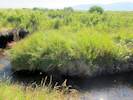


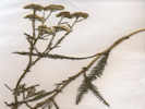
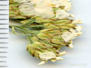
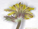
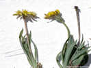
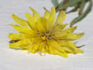
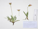

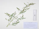
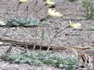
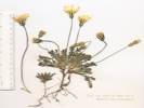
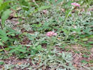

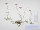
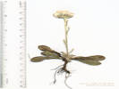


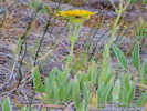
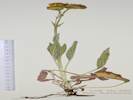

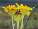
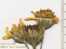
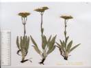
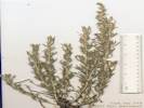
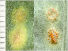
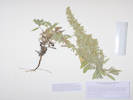


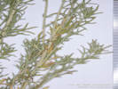

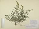


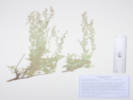
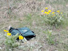
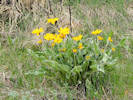
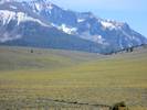
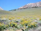

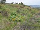
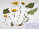

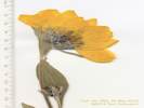


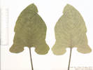
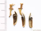


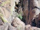

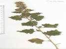
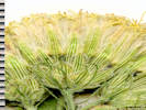
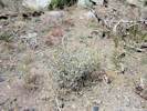
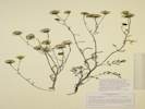

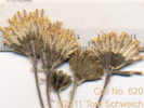
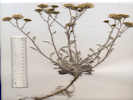
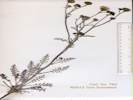
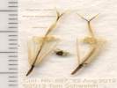
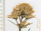

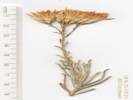
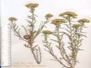


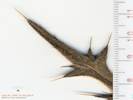
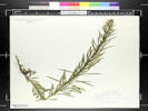
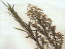
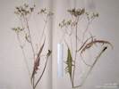
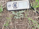
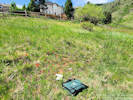
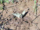

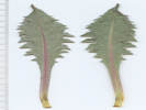

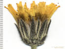

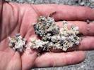

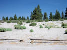
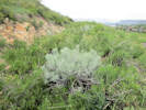
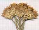
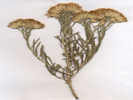
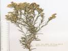
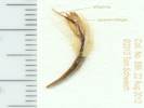

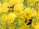
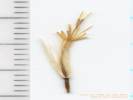


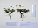
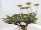

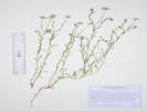
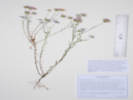

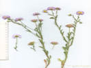
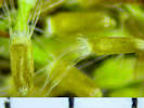
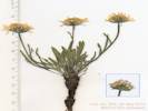
absent inconspicuous, pistillate and staminate flowers in same head, outer flowers without corollas;
Achenes with a pappus of bristles
(Described from Coll. No. 709, 16 Nov 2011).

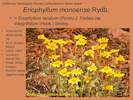
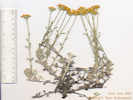

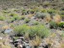
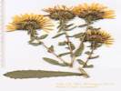
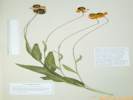
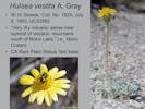
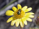
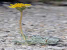


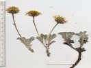
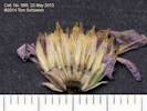
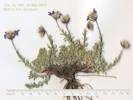
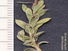
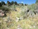
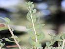
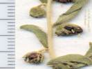
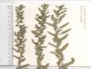


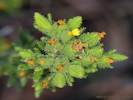
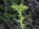
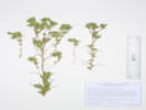
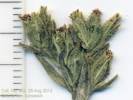
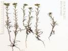
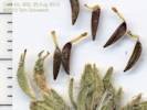
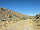
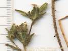
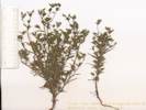

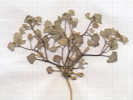

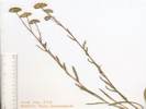
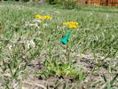


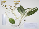
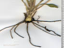
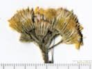
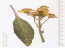
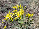
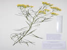
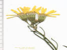

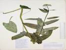
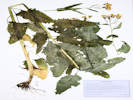
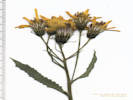
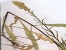
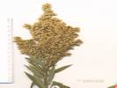
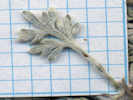
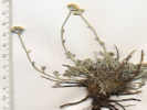
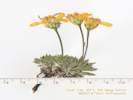
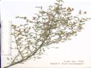
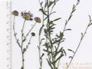
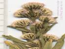
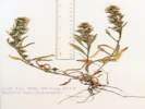
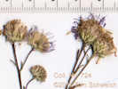
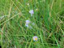

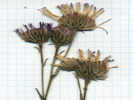

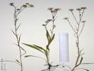


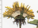
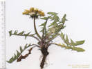
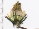
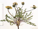
There are 5 taxa of Tetradymia found in the Mono Lake basin.
1. Stem unarmed (leaves not forming spines)
2. Main leaves tomentose or silvery; clustered leaves ± (ob)lanceolate (Flowers 4 (5) per head; pappus present;) ….. T. canescens
2' Main leaves glabrous or sparsely tomentose; clustered leaves thread-like to linear-oblanceolate
3. Main leaves narrowly awl-shaped, stiffly ascending or appressed, generally 5–10 mm; clustered leaves generally 3–10 mm, glabrous; fruit generally 3–4 mm, short-stiff-hairy; pappus of ± 100 bristles ….. T. glabrata
3' Main leaves ± thread-like, soft, 10–40 mm; clustered leaves generally 10–20 mm, loosely tomentose; fruit 5–6 mm, long-soft-hairy; pappus of ± 20 stiff bristles or slender scales (± hidden by fruit hairs) ….. T. tetrameres
1' Stem armed with spines derived from main leaves (Fr ± long soft-hairy, pappus present)
4. Spines sharply recurved, 5–25 mm, tomentose; involucre generally 8–12 mm, ± bell-shaped; fruit generally 6–8 mm ….. T. spinosa
4' Spines straight, (1)2–5 cm, becoming glabrous; involucre generally 7–9 mm, obconic; fruit generally 4–5 mm ….. T. axillaris
[5. Involucre and peduncle glabrous; fruit hairs generally 6–8 mm ….. var. axillaris]
5' Involucre and peduncle tomentose; fruit hairs generally 9–11 mm ….. var. longispina
Tetradymia axillaris A. Nelson var. longispina (M. E. Jones) Strother. Long-Spined Horse Brush. CalPhotos. Jepson eFlora. SEINet Taxon.
- Little Sand Flat, Sand Flat south of Mono Lake, in lower edge of Transition Zone (location copied from GH427464). John C. Roos 12 Sep 1960. ( LA102221† ) . [ See also HSC78523, UCD136831, and UCR26074, which are determined as T. spinosa. These are Roos' only other collections in September 1960. The coordinates are taken from GH427464 is H. M. Hall's #11877 ofArtemisia cana subsp. bolanderi (A. Gray) G. H. Ward at location “Sand Flat, south of Mono Lake.” It is unclear as to why or how those coordinates were applied to this collection. ]
- Mono Basin, likely var. longispina 606. 606. Winkler, David W., 1977 .
- MBRG P-4, Observation per MBRG voucher, likely var. longispina 816. 816. .
- Mono Lake, northwest shore (as a col. locality), Mono Lake and vicinity, north of Lee Vining. J. Burch, J. Robins, T. Wainwright 159. 20 Jul 1976. ( DS744298† ) . .
Tetradymia canescens DC. Spineless Horsebush. CalPhotos. Jepson eFlora. SEINet Taxon.
Perennial shrub, to 1 m., woody below, unarmed; Stems some sharp-pointed, 2nd+ year stems pubesence interrupted by linear glabrescent streaks (Sect. Tetradymia, incl. stenolepis, canescens, and glabrata); Leaves distal only, lanceolate, 15 mm. × 2 mm. wide, entire, gray tomentose (not green glabrous), not forming spines; Heads, with only disc flowers (discoid); Involucre cylindric; Phyllaries 4, in one equal series or 2-ranked (which doesn't really matter when keying), 9 mm., wooly, carinate (keeled), not scarious or transparent, tips not black; Receptacle epaleate; Disc flowers, 4; Corolla, 5-lobed, yellow; Pappus of many well-developed bristles. Achenes glabrous (Described from Coll. No. 706, 15 Nov 2011, and Coll. No. 1029, 24 Jul 2013).
- Bloody Canyon, Name on collection label; on sheet with UC34721 foot of Bloody Canyon Chesnut and Drew 20 Jul 1889. ( UC34720† ) .
- Cowtrack Mountain, Rolling topography along a ridgeline. Dense Great Basin shrub habitat dominated by Artemisia tridentata. Dry, loose soils. California, Mono, In the Cowtrack Mountains on Rd 1N06 about 4.3 km N of Hwy 120. Shannon M. Still, Nick Jensen 55. 15 Jul 2012. ( CHIC17830‡ ) deep fine sand on S-facing slope cowtrack Mt 5 mi SE of Mono L R. E. Douglas 47. 28 Jul 1964. ( SJSU5627† ) .
- Grant Lake, west side of Grant Lake Milo S. Baker 9154. 29 Jul 1938. ( UC830618† ) There is a historic collection from approximately this location: Milo S. Baker, #9154, 29 Jul 1938, UC830618. Along California Highway 158, 0.4 mile south of the entrance to the Grant Lake Marina, west side of Grant Lake, along a trail to the spring box that collects water for the Grant Lake Marina. Tom Schweich 1029. 24 Jul 2013. ( OBI82088‡ UCR261799‡ ) .
- Lee Vining Canyon, Dry, S-facing slope among pinon with Pinus monophylla, Artemisia tridentata, Purshia, Happlopappus, Chrysothamnus, etc. Shrub about 0.5 m tall. Wild: native/naturalized. Near Leevining Creek, E of Tioga Pass near jct of the Tioga Pass Road with Route 395. R. F. Thorne, James Henrickson 33208. 11 Aug 1963. ( CAS579063† RSA167476† ) Herbert L. Mason 11480. 1 Aug 1936. ( UC1081555† ) 3.5 miles W of Leevining Jens Clausen 798. 23 Aug 1933. ( DS713529† ) .
- Lundy Canyon, growing in light gravelly soil, sagebrush association. just above the mouth of the canyon Ernest C. Twisselmann 5768. 14 Sep 1959. ( JEPS31033† ) Eastern Sierra Nevada Mtns. mouth of Lundy Canyon, just off Hwy 395, 1 mile WNW of Mono City. PLSS: 02N25E12. Michael D. Wilcox 8 Sep 2011. ( UCR234443† ) . [ Scrub with Elymus cinereus, Wyethia, Poa, Prunus andersonii, Purshia tridentata, Stephanomeria spinosa, Chrysothamnus nauseosus, Salix exigua, Artemisia tridentata, A. ludoviciana, Stipa hymenoides, Eriogonum umbellatum, Tetradymia canescens, Bromus tectorum, etc. ]
- Mono Basin, 608. 608. Winkler, David W., 1977 .
- Mono Craters, Carl W. Sharsmith 5670. 27 Aug 1948. ( SJSU13542† ) .
- Mono Lake, In deep pumice soil. Mono lake. B. D. Rogers Jul 1964. ( HSC6278† ) from J W Congdon Herb; with UC34720, Chesnut & Drew, Jul 1889, Bloody Cyn, Tetradymia canescens DC.; J. W. Congdon 16 Aug 1898. ( DS1843† UC34721† ) Unknown (State Survey). 6144. n.d.. ( UC34168† ) .
- Mono Lake, north of (as a collection locality), sandy wash 0.25 miles north of Mono Lake John L. Strother 681. 30 May 1968. ( UC1393158† ) .
- Mono Lake, north shore (as a collection locality), Desert scrub vegetation dominated by Sarcobatus vermiculatus, Artemisia tridentat, Ericameria nauseosa. Flat area with small sand dunes; Occasional shrub to > 1 m tall North end of Mono Lake. David J. Keil 20890. 19 Aug 1988. ( OBI75575† ) Shore of Mono Lake. Frank W. Peirson 9189. 12 Aug 1930. ( RSA94952† ) .
- Mono Lake, southeast of (as a collection locality), S. of Leevining. L. S. Rose 26 Jul 1942. ( GH427876† ) .
- Mono Lake, south shore (as a collection locality), Gravelly soil. Other plants include: Artemisia tridentata, Purshia tridentata, Prunus andersonii. Mono Lake and vicinity, north of Lee Vining, southwest short of lake about 500 yards from the shore. (location copied from DS741013) J. Burch, J. Robins, T. Wainwright 238. 8 Aug 1976. ( DS744304† ) .
- Mono Lake, west of (as a collection locality), in sagebrush. Highway along Mono Lake Milo S. Baker 5825. 4 Jul 1932. ( CAS200124† ) Dry, edge of bank, above road. Above road near Leevining. S. F. Blake 11827. 30 Jun 1934. ( DS713505† ) .
- Sagehen Meadow,
In loose soil derived from granite and pumice.
Near the top of the granitic hills north of the meadow.
Tom Schweich 706.
17 Aug 2010.
(
CAS1131417‡
UC1980383‡
)
.
.
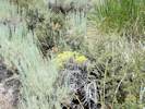
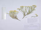
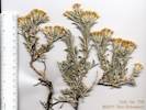
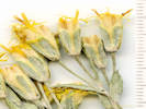
Tetradymia glabrata Torrey & A. Gray. Littleleaf Horsebrush. CalPhotos. Jepson eFlora. SEINet Taxon.
Perennial woody shrub, to 1 m., drying quite brittle; Stems, pubescence of stems interrupted by glabrescent streaks; Leaves, eglandular, primary leaf an appressed thorn, 4.5 mm., early deciduous, secondary leaves clustered in axils, 5.0 mm. × 0.8 mm. wide, linear to oblanceolate; Inflorescence, 7-8 heads on ends of short branches, none of flowers with strap-shaped corollas, flowers of one kind (disk flowers); Peduncle, 5.5-6.0 mm., tomentose; Involucre, cylindric; Phyllaries, #4, in 1 series, 6 mm., ±keeled, tomentose abaxially; Receptacle, epaleate; Flowers, #4; Corolla, yellow; Pappus of many well-developed bristles; Fruit, long soft hairy; Described from Coll. NO. 1168, 24 Jun 2015.
- Bodie Hills, in canyon ridge north of Mono Lake, along road to Bodie, about 4.3 miles north of Hawthorne Road F. C. Vasek 7506173.5 17 Jun 1975. ( UCR17256† ) .
- Cottonwood Canyon, Ridge north of Mono Lake, [Cottonwood Canyon] along road to Bodie, c. 4.3 mi north of [Hwy 167] Hawthorne Rd. Frank C. Vasek 7506173.5 17 Jun 1975. ( UCR17256† ) .
- Dechambeau Ranch, veg type sage, slope flat 3 miles northeast of Dechambeau's Ranch, PLSS: 03N26E36. T. M. Hendrix 619. 1 Sep 1937. ( UC1070370† ) .
- Mono Basin, 607. 607. Winkler, David W., 1977 .
- Mono Lake, Alluvial slopes with fine pumice sand. Sagebrush scrub/juniper woodland with Artemisia tridentata, Chrysothamnus nauseosus, C. viscidiflorus, Juniperus osteosperma, Tetradymia canescens, etc. east side of Mono lake about 2 miles from the shore at about 38 degree north latitude Andrew C. Sanders 7139. 11 Jul 1987. ( UCR51883† ) .
- MBRG P-4, Observation per MBRG voucher 815. 815. .
- MBRG P-7, Observation per MBRG voucher 785. 785. .
- Mono Lake, northwest shore (as a col. locality), Shrub coverage: 5%, Herb coverage: 5%, Av. height: 4 dm., Av. height: 2 dm. Mono Lake and vicinity, north of Lee Vining. J. Burch, J. Robins, T. Wainwright 157. 20 Jul 1976. ( DS744318† ) . [ Horizontal distance above shore: 1917 ft. Elevation above lake (6378 ft.): 98 ft. Time since area was last covered by Mono Lake: more than 100 yrs. Water availability: 5. Soil color: black/gray. Soil pH: 9.5. Size of plant community plot: 200 m2. Species list and percent of cover at collection site: Mentzelia torreyi, Lygodesmia spinosa 1, Prunus andersonii +, Chrysothamnus nauseosus +, Tetradymia glabrata +, Cryptantha confertiflora 1, Oenothera boothii, Oryzopsis hymenoides. ]
- Mono Valley,
Also collected nearby, Sarcobatus vermiculatus.
Along Forest Road 02N47 “Waford Springs Cutoff,” near the intersection of California Highway 267 and Cottonwood Canyon Road, 8.4 km northeast of Lee Vining.
Tom Schweich 1168.
24 Jun 2015.
(
UC2046096‡
)
.
.
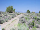
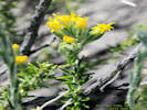
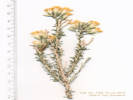

Tetradymia spinosa Hook. & Arn. Shortspine Horsebush. CalPhotos. Jepson eFlora. SEINet Taxon.
- Mono Lake, north of (as a collection locality), north slope of Mono Lake John C. Roos 12 Sep 1960. ( HSC78523† UCD136831† UCR26074† ) . [ See also LA102221, determined as T. axillaris var. longispina. That one collection is Roos' only other collection in September 1960. It seems unlikely that a collector would collect just one taxon on the south side of the lake and then collect another closely related taxon on the north side of the lake on the same day as one's only collections in a given month. Therefore, it seems likely that these vouchers represent a single collection, and one or the other is misidentified and mis-located. ]
- Paoha Island, veg type sage, slope south A. D. Gifford 859. 20 Aug 1937. ( UC1070389† ) Paoha Island, Mono Lake, mostly in northeast portion of island in gullies and drpressions Mary DeDecker 3777. 24 Apr 1975. ( RSA620809† ) . .
Tetradymia tetrameres (S. F. Blake) Strother. Four-part Horsebush. CalPhotos. Jepson eFlora. SEINet Taxon.
- Dechambeau Ranch, Veg type Atr, Pad 1 mile west of Dechambeau's Ranch. T. M. Hendrix 574. 18 Aug 1937. ( UC1070356† ) .
- Hector Station, Stage-station region. Anna E. Ehlers 811. 5 Jul 1920. ( JEPS38091† ) .
- Mono Basin, 4 miles east of Highway 395, on Highway 167, north of Mono Lake Darley F. Howe 3 Aug 1969. ( SD73130† ) [ Determined as T. comosa, which is clearly incorrect. Location of collection suggests T. tetrameres, until someone can actually examine this collection. ] along roadside, loamy sand to sandy, slope 1-5%, exposure open, sagebrush-rabbitbrush 3 miles east-northeast of Junction of US Hwy 395 and Pole Line Road (CA Hwy 167). Gene Gerdes 1184096. 2 Aug 1960. ( UC1184096† ) About 3.4 miles east of US Hwy 395 along CA Hwy 167. John L. Strother 682. 30 May 1968. ( NMC41483‡ UC1393157† ) .
- Mono Dunes, Mono County: Mono Dunes, northeast shore of Mono Lake. (Location determined by Geolocate, copied from UCD100488) Bruce M. Pavlik 54. 27 Jul 1979. ( UCD136837† ) On stabilized dunes, north side of California Highway 167, 4.2 miles east of US Highway 395. Tom Schweich 720. 30 Aug 2010. ( CAS1121622‡ UC1980412‡ ) .
- Mono Valley, Mono County: Mono Basin, 10 miles E of Highway 167, junction 395. C. A. Toft 30 Jul 1980. ( UCD136838† ) .
- Sulphur Pond,
355.
355.
Toft, Catherine, and Deborah Elliott-Fisk, 2002
.
.
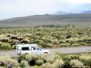
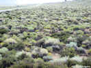
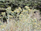
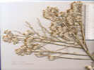
Wyethia mollis A. Gray. Woolly Mule-Ears. CalPhotos. Jepson eFlora. SEINet Taxon.
- Lee Vining Canyon, near foot of Lee Vining Grade about 3 miles from Mono Lake (State Hwy 120) Ira L. Wiggins 14155. 26 Jun 1957. ( UC1190328† ) .
- Lundy Canyon, bottom of canyon with sandy granitic soil Lundy Canyon about 5 miles west on road to Lundy Lake from Highway 395 Ian G. Gillespie 66. 28 Jul 2000. ( UCR132881† ) .
- Mill Creek,
Open stony ground near Mill Creek, on Forest Road 02N14, just above US Highway 395.
Tom Schweich 850.
21 Jun 2012.
(
CAS1157544‡
UC
UCR248630‡
)
.
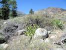
Betulaceae
Betula occidentalis Hook. (Syn: Betula fontinalis Sarg. ) Water Birch. CalPhotos. Jepson eFlora. SEINet Taxon.
- Mono Basin,
430.
430.
Jones & Stokes Associates, 1993
This plant is common in the Rock Creek and Convict Creek drainages, and found in the White & Inyo Mountain. However, there are no collections of this species from within the Mono Basin that are deposited in the Consortium of California Herbaria.
442.
442.
.

Boraginaceae
Cryptantha Lehm. ex G. Don. Cryptantha. CalPhotos. Jepson eFlora. SEINet Taxon.
- Deadman Summit,
Pumice flats, Deadman Summit, 2 miles north of Crestview, el. 8040 ft., Mono County
John Thomas Howell with T. C. Fuller, G. Douglas Barbe 54605.
14 Aug 1981.
(
CAS885804†
)
.
[
Very dense and hairy growth habit.
]
.
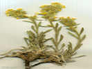
Cryptantha ambigua (A. Gray) Greene. Basin Cryptantha. CalPhotos. Jepson eFlora. SEINet Taxon.
Annual, to 20 cm.; Inflorescence terminal; Bracts 0; Flowers many; Corolla salverform, limb 4.5 mm.; Petals white, appendages white; Ovary deep lobed, style base hidden within lobes; Nutlet, 1.8 mm., erect, abaxial ridge 0, “rough” (≤½surface area short papillate), scar lateral, without thick rim, grooved above scar, margin prickles 0 (Described from Coll. No. 986, 20 June 2013).
- Conway Summit, Conway Grade north of Mono Lake John Thomas Howell 27409. 28 Jul 1950. ( CAS362553† DS348270† UC1042576† ) .
- Mono Basin, soft pumice around craters Pumice Mine Road, running northeast from US Hwy 395 (north of the June Lake area), at south edge of Mono Craters George K. Helmkamp 2419. 12 Sep 1997. ( CAS960040† UCR102607† ) .
- Mono Valley,
with Mimulus, Phacelia bicolor, Purshia, and Ericameria.
Collection no. 986 made in same location on 20 June 2015 has mature nutlets.
On Forest Road 01N23 about 100 m east of California Highway 120, and 5.6 miles east of the intersection of California Highway 120 with US Highway 395.
Tom Schweich 952.
21 May 2013.
(
CAS1203773‡
OBI
UC2045746‡
UCR262122‡
)
with Mimulus, Phacelia bicolor, Purshia, and Ericameria.
On Forest Road 01N23 about 100 m east of California Highway 120, and 5.6 miles east of the intersection of California Highway 120 with US Highway 395.
Tom Schweich 986.
20 Jun 2013.
(
CAS1203772‡
OBI116743‡
UC2045745‡
UCR262124‡
)
.
.
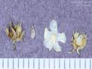
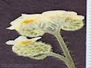
Cryptantha barbigera (A. Gray) Greene. Bearded Cryptantha. CalPhotos. Jepson eFlora. SEINet Taxon.
- Lee Vining, irrigated site with 'wildflower' seed mix, Centaurea cyanis obvious Lee Vining, at junction of Highway 395 and Highway 120, weed in recently revegetated area Dean Wm. Taylor 16841. 20 Jul 1998. ( JEPS101571† ) . .
Cryptantha cinerea (Greene) Cronquist var. abortiva (Greene) Cronquist. Bow-Nut Forget-Me-Not. CalPhotos. Jepson eFlora. SEINet Taxon.
- Cottonwood Canyon, semi-alkaline soils Mono Lake Basin, Bodie Hills, Cottonwood Creek drainage, 2.5 miles up canyon from mouth Dean Wm. Taylor 7895. 18 Jul 1980. ( JEPS90287† ) . .
Cryptantha circumscissa (Hook. & Arn.) I. M. Johnst. Cushion Cryptantha. CalPhotos. Jepson eFlora. SEINet Taxon.
- Big Sand Flat, very sparsely vegetated area Big Sand Flat along California Highway 120 at Pilot Spring Road (southeast of Mono Lake) George K. Helmkamp 2333. 10 Sep 1997. ( UCR102569† ) .
- Bloody Canyon, Chesnut and Drew 20 Jul 1889. ( UC32602† UC402802† ) .
- Lee Vining, Lee Vining on roadside at Southern California Edison substation, Highway 395 Scott D. White 5442. 4 Aug 1997. ( CAS1084871† UCR117628† ) .
- Mono Basin, 610. 610. Winkler, David W., 1977 .
- MBRG P-2, Observation per MBRG voucher 829. 829. .
- Mono Mills, Jeffrey pine forest on very fine pumice soil State Highway 120 at point about 1.5 miles northwest of Mono Hills (Mills? - Ed.) W. A. Kelley 8725. 16 Jun 1987. ( UCR51374† ) .
- Panum Crater, sandy pumice flats in Pushia-Artemisia scrub on Test Station Road at north base of Panum Crater Dean Wm. Taylor 16745. 1 Jul 1998. ( UC1731368† ) Sandy pumice flats in Purshia-Artemisia scrub on Test Station Road at north base of Panum Crater Dean Wm. Taylor 16746. 1 Jul 1998. ( UC1731369† ) .
- Pumice Valley,
Great Basin scrub, recently burned.
Mono Lake, along Mono Lake Basin Road, about 3 miles S of the lake and 2.5 miles from the junction of Hwy.
J. M. Porter, Laren Machen 15109.
27 May 2012.
(
RSA803563†
)
.
.
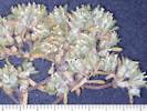
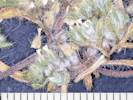
Cryptantha circumscissa (Hook. & Arn.) I. M. Johnst. var. circumscissa. Cushion Cryptantha. CalPhotos. Jepson eFlora. SEINet Taxon.
Coll. No. 763, 19 Jan 2012, characters observed while keying: Annual 2-5 cm, generally wider than tall, root reddish but not staining; LeafBracts present; Calyx circumscissile; Corolla white, limb 2 mm when dry.
- Mono Basin,
With Pinyons (no Junipers), Sagebrush, Bitterbrush, and Ephedra, in the mixed sandy and rocky ground where the foot of the Bodie Hills meets the Mono Dunes.
One of three Cryptanthas collected at this location.
Along Goat Ranch Road, 3.25 miles east northeast of the intersection of US Highway 395 and California Highway 167 (sometimes called Pole Line Road).
Tom Schweich 763.
19 Jun 2011.
(
UC1980483‡
)
.
.
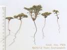
Cryptantha confertiflora (Greene) Payson. Basin Yellow Cryptantha. CalPhotos. Jepson eFlora. SEINet Taxon.
Perennial, to 35 cm., taller than wide; Leaves, (appearing) basal and cauline; Bracts 0; Corolla, yellow, tube > calyx; Style, 11 mm., unable to confirm heterostyly across three specimens; Nutlets, #4, immature (Described from Coll. No. 416, 25 May 2004).
- Black Point, Corolla yellow. With Mentzelia torreyi, Abronia turbinata on pumice soils. end of spur road in south side of Black Point facing Negit Island land bridge, north side of Mono Lake, about 5 air miles northeast of Lee Vining M. S. Taylor 4872. 17 Jul 1982. ( CHSC36982† ) .
- Copper Mountain, At the mine tunnel in a canyon of Copper Mountain, 1.1 miles west of the intersection of US Highway 395 and Mill Creek Powerhouse Road. Tom Schweich 779. 22 Jun 2011. ( CAS1131358‡ UC1980468‡ ) .
- Lee Vining Canyon, near foot of grade R. F. Hoover 5402. 5 Jul 1941. ( UC765616† ) .
- Mono Basin, 611. 611. Winkler, David W., 1977 near Mono Lake Unknown 1822. n.d.. ( UC25008† ) .
- Mono Craters, in pumice Carl W. Sharsmith 5669. 27 Aug 1948. ( SJSU13471† ) .
- Mono Lake, near Mono Lake Alice M. Ottley 1070. 5 Jul 1920. ( JEPS70795† ) .
- MBRG P-6, Observation per MBRG voucher 856. 856. .
- Panum Crater, On rocky pumice and obsidian rocky soil. In the center of the North Crater on south shore of Mono Lake. James L. Reveal and Caroline G. Reveal 352. 16 Jun 1962. ( RSA298046† NY1084868† NY1084870† RSA185069† UC1338660† ) . [ North Crater is a synonym of Panum Crater. ]
- Pumice Valley, at edge of Artemisia tridentata, in pumice sand Pumice Flat, trip to Mono Lake and Mono Craters via Lee Vining Canyon Edward Lee and Carl W. Sharsmith 2492. 9 Aug 1936. ( JEPS78592† ) West base of Mono Craters at end of Inyo Forest Road 1S09, 4 air miles east of the south intersection of US Highway 395 and California Highway 120. Tom Schweich 753. 15 Jun 2011. ( UC1980492‡ ) .
- Rush Creek delta,
About 200 m south of the delta, on old deltaic deposits, and near a lone cottonwood tree, 0.9 km north northeast of the intersection of Forest Roads 01N51 “South Tufa Road” and 01N50 “Rush Creek Road”, 6 km east of Lee Vining.
Tom Schweich 1179.
25 Jun 2015.
(
CS
OBI83185‡
RENO87136‡
UCR265727‡
)
.
.
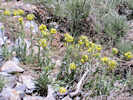
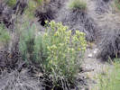
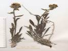
Cryptantha echinella Greene. Prickly Cryptantha. CalPhotos. Jepson eFlora. SEINet Taxon.
- Mono Basin, There are no collections of this taxon in the Mono Basin. However, it occurs commonly in nearby areas and therefore may be found in the Mono Basin. Tom Schweich 486. 8/15/2007. . .
Cryptantha flavoculata (A. Nelson) Payson. Roughseed Cryptantha. CalPhotos. Jepson eFlora. SEINet Taxon.
Perennial to 20 cm.; Hairs of two kinds, short appressed, long single-celled “bulbous-based bristles;” Leaves basal and cauline, cauline alternate, to 65 mm. × 12 mm. wide; Corolla, salverform, white, tube 4 mm. + lobe 3.5 mm., appendages prominent; Nutlets not sufficiently developed (Described from Coll. No. 222, 27 April 2000).
- Mono Basin,
There are no collections of this taxon in the Mono Basin. However, it occurs commonly in nearby areas and therefore may be found in the Mono Basin.
Tom Schweich 487.
8/15/2007.
.
.

Cryptantha glomeriflora Greene. Truckee Cryptantha. CalPhotos. Jepson eFlora. SEINet Taxon.
- Mono Basin, There are no collections of this taxon in the Mono Basin. However, it occurs commonly in nearby areas and therefore may be found in the Mono Basin. Tom Schweich 488. 8/15/2007. .
- Sagehen Meadow, Sagebrush scrub with aspen stands and small moist meadows. USGS quad: Dexter Canyon 7.5' Q.; Fairly common roadside plant.; Eastern Sierra/ Mono Basin 4.9 mi. SE of Calif. Hwy 120 on Sagehen Meadows Road George K. Helmkamp and E. A. Helmkamp 2319. 10 Sep 1997. ( UCR122324† ) . .
Cryptantha micrantha (Torr.) I. M. Johnst. var. micrantha. Redroot Cryptantha. CalPhotos. Jepson eFlora. SEINet Taxon.
Annual root red-purple, staining; Calyx not circumscissile; Corolla limb 2-3 mm when dry, appendages minute, persistent (Described from Coll. No. 762, 19 Jan 2012).
- Mono Basin,
With Pinyons (no Junipers), Sagebrush, Bitterbrush, and Ephedra, in the mixed sandy and rocky ground where the foot of the Bodie Hills meets the Mono Dunes.
One of three Cryptanthas collected at this location.
Along Goat Ranch Road, 3.25 miles east northeast of the intersection of US Highway 395 and California Highway 167 (sometimes called Pole Line Road).
Tom Schweich 762.
19 Jun 2011.
(
UC1980484‡
)
.
.
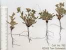
Cryptantha muricata (Hook. & Arn.) A. Nelson & J. F. Macbr. (Syn: C. jonesii (A. Gray) Greene , C. m. (Hook. & Arn.) A. Nelson & J. F. Macbr. var. denticulata (Greene) I. M. Johnst. , C. m. (Hook. & Arn.) A. Nelson & J. F. Macbr. var. jonesii (A. Gray) Jtn. ) Pointed Cryptantha. CalPhotos. Jepson eFlora. SEINet Taxon.
- June Lake, At the June Lake Junction on U. S. Highway 395 Darley Howe 22 Jun 1978. ( SD103540† ) .
- Lee Vining, John Thomas Howell 27414. 28 Jul 1950. ( UC1042579† ) Lewis S. Rose 50218. 28 Jul 1950. ( UC942866† ) Peter H. Raven 2688. 29 Jul 1950. ( UC1177094† ) .
- Lee Vining Canyon,
rock slopes
Lewis S. Rose 37706.
29 Sep 1937.
(
UC857195†
)
near foot of grade
R. H. Hoover 5410.
5 Jul 1941.
(
CAS?†
UC762189†
)
.
[
Determination at CAS is C. jonesii with no annotations, check UC 762189 for annotations. Collection was distributed by UC.
]
.
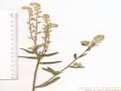
Cryptantha nubigena (Greene) Payson. Sierra Cryptantha. CalPhotos. Jepson eFlora. SEINet Taxon.
- Mono Craters, pumice gravels and rock crevices Carl W. Sharsmith 5673. 27 Aug 1948. ( SJSU13472† ) habitats visited ranging from Jeffrey Pine Forest to Pumice veg. with...; Pumice and dacite outcrops, 8000-9500 ft Dean Wm. Taylor 7534. 27 Jul 1979. ( JEPS90329† ) upper west-facing slopes of Mono Craters Edward Lee 2503. 9 Aug 1936. ( JEPS73588† ) . .
Cryptantha oxygona (A. Gray) Greene. Sharpnut Cryptantha. CalPhotos. Jepson eFlora. SEINet Taxon.
- Mono Mills, loose sandy (tephra derived) soils in Purshia tridentata-Artemisia tridentata scrub 3 miles northeast of Mono Mills, southeast side of Mono Lake, in vicinity of watertank shown on Cowtrack Mountain 15' USGS quadrangle Dean Wm. Taylor 15228. 18 Jul 1995. ( JEPS90905† ) . .
Cryptantha pterocarya (Torr.) Greene. Wingnut Cryptantha. CalPhotos. Jepson eFlora. SEINet Taxon.
- Bridgeport Canyon,
on old sandy beach soil
1 mile snorth of Highway 31 (Pole Line Road), along Bridgeport Canyon road on beach of Mono Lake
Jack L. Reveal and James L. Reveal 106.
9 Jun 1962.
(
UC1338570†
)
.
.
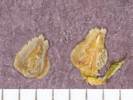
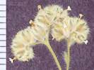
Cryptantha torreyana (A. Gray) Greene. Torrey's Cryptantha. CalPhotos. Jepson eFlora. SEINet Taxon.
- Bloody Canyon, Chesnut and Drew 20 Jul 1889. ( UC32550† ) .
- Lundy, 8000-9000 ft Miss Maud Minthorn 7. 15 Jun 1908. ( UC402794† ) . .
Cryptantha watsonii (A. Gray) Greene. Watson's Cryptantha. CalPhotos. Jepson eFlora. SEINet Taxon.
Annual 20-40 cm, generally taller than wide; Leaf 12-40 mm, linear; Bracts present; Calyx lobes 3 mm, hairs straight not hooked, lobe tip bristles straight; Corolla limb quite small (1-2 mm); Nutlets 4, approximately equal size, smooth, scar centered, extends to tip (Described from Coll. No. 761, 19 Jan 2012).
- Mono Basin, With Pinyons (no Junipers), Sagebrush, Bitterbrush, and Ephedra, in the mixed sandy and rocky ground where the foot of the Bodie Hills meets the Mono Dunes. One of three Cryptanthas collected at this location. Along Goat Ranch Road, 3.25 miles east northeast of the intersection of US Highway 395 and California Highway 167 (sometimes called Pole Line Road). Tom Schweich 761. 19 Jun 2011. ( CAS1131400‡ UC1980485‡ ) .
- Mono Inn, 0.12 mile east of Canway Road Meadow, 1.0 mile northeast of Mono Inn, on the north shore of Mono Lake Jack L. Reveal and James L. Reveal 114. 9 Jun 1962. ( UC1338678† ) .
- MBRG P-2, Observation per MBRG voucher 832. 832. .
- Negit Island, Mary DeDecker 3791. 25 Apr 1975. ( RSA620848† ) .
- Panum Crater,
sandy pumice flats in scrub
Test Station Road at north base of Panum Crater (Given longitude is doubtful - Ed.)
Dean Wm. Taylor 16748.
1 Jul 1998.
(
UC1731345†
)
.
.
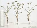
Hackelia . Stickseed. CalPhotos. Jepson eFlora. SEINet Taxon.
- Lundy Lake Campground, (Campground assumed to be the private campground at Lundy Resort, rather than the recreation site below the lake. -- Ed.) Lundy Lake Campground, north of Mono Lake D. M. Ferguson 6. 18 Jun 1993. ( GH420002† GH420003† GH420004† ) . .
Hackelia floribunda (Lehm.) I. M. Johnst. Many-Flowered Stickseed. CalPhotos. Jepson eFlora. SEINet Taxon.
- Bloody Canyon, Mono County: Bloody Canyon V. King Chesnut 20 Jul 1889. ( POM126214† ) .
- June Lake, Sierra Nevada: June Lake Mrs. J. D. Wright 5 Jul 1929. ( SBBG63463† ) .
- Lundy Canyon, Under Poplars In canyon, 3 mi. above Lundy Lake (off Hwy. 395, 7 mi. N of Lee Vining) Wendell Wood 221. 19 Jul 1970. ( HSC12385† ) .
- Pumice Valley,
Pumice Valley Pumice Valley, S of Mono Lake.
G. D. Barbe, Ed W. Hale 2299.
21 July 1977.
(
CDA18330†
)
.
.
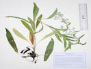
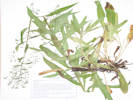
Hackelia micrantha (Eastw.) J. L. Gentry. (Syn: H. jessicae (E. A. McGregor) Brand ) Jessica Sticktight. CalPhotos. Jepson eFlora. SEINet Taxon.
- Lundy, Vicinity of Lundy Miss Maud Minthorn 49. 29 Jun 1908. ( POM126238† ) .
- Lundy Canyon, along creek road west of U. S. 395 about 1 mile below Lundy Lake Dam Ira L. Wiggins 14187. 27 Jun 1957. ( UC1190333† ) Flower with blue limbs and white throat. Abundant herb 15-25cm high. Area dominated by sage brush (Artemisia tridentata) mixing with Pinon-juniper. Mono County: In Lundy Canyon just north west of Mono Lake. Located on south moraine of the canyon (N. slope) approximately 375m up 4x4 road running 50m west of Deer Creek from the dam at Lundy Lake. Deer Creek from the dam at Lundy Lake M. Klapp 17. 1 Jun 1996. ( UCD119401† ) Area dominated by sage brush (Artemesia sp.). Herb, approx. 15-20 cm tall. Lundy Canyon, northwest of Mono Lake. Roughly 100 m up a dirt road running from Lundy Lake Dam along Deer Creek. S. Quick 25. 1 Jun 1996. ( UCD69646† ) .
- Mono Basin, as Myosotis sp. 381. 381. Jones & Stokes Associates, 1993 . .
Heliotropium curassavicum L. Seaside Heliotrope. CalPhotos. Jepson eFlora. SEINet Taxon. Citation of W. H. Shockley 437. 6/1/1885 ( JEPS67989 ) from Walker Lake is in error because the collection was actually made at Walker Lake, Mineral County, Nevada.
- Mono Basin, as Heliotropum sp. 613. 613. Winkler, David W., 1977 .
- Rush Creek delta,
On a former strand of Mono Lake in the Rush Creek delta, 0.7 mi downstream from Test Station Road.
Tom Schweich, with Kim Kersh 717.
30 Aug 2010.
(
CAS1131425‡
UC1980416†
)
.
.

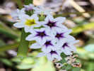
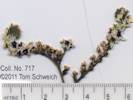
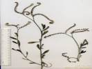

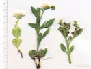
Hesperochiron californicus (Benth.) S. Watson. California Monkey-Fiddle. CalPhotos. Jepson eFlora. SEINet Taxon.
- Alkali Lake,
Open, drying, alkaline mud flats.
On the south side of Alkali Lake, where the old road breaks out of the sagebrush.
Tom Schweich 625.
29 Jun 2010.
(
CAS
UC1973809‡
)
.
.
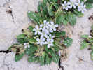
Lappula redowskii (Hornem.) Greene. (=Lappula occidentalis (S. Watson) Greene) Stickseed. CalPhotos. Jepson eFlora. SEINet Taxon.
- Dechambeau Ranch, dry sandy volcanic gravels of sagebrush flats about 1.5 miles north of Black Point, Mono Lake Carl W. Sharsmith 8715. 5 Jul 1982. ( SJSU9736† ) .
- Lundy, 8000-9000 ft vicinity of Lundy Miss Maud Minthorn 15 Jul 1908. ( UC148745† ) . .
Lappula redowskii (Hornem.) Greene var. redowskii. (=Lappula occidentalis (S. Watson) Greene var. occidentalis ) Stickseed. CalPhotos. Jepson eFlora. SEINet Taxon.
Annual, to 40 cm., without milky juice, ; Flowers 1 per axil; Pedicel erect in fruit; Calyx, lobes w/o teeth in fruit; Corolla, 2 mm., ±tubular, lobes blue; Receptacle, conic, ±=nutlet; Ovary, deep-lobed, style base hidden within lobes; Nutlets, ±erect (not spreading), scar lateral, straight w/o thick rim, margin prickles in 1 row, wider at base, not fused into crown, barbed (Described from Coll. No. 480 and Coll. No. 1019).
- Coyote Spring, Growing in the meadow at Coyote Spring, Bridgeport Canyon, four miles north of California Highway 167. Tom Schweich 480. 26 Jun 2007. ( CAS1131489‡ UC1980434‡ ) .
- Lee Vining Canyon, sandy granitic slopes with Artemisia Dean Wm. Taylor 6506. 23 Jun 1977. ( JEPS90177† ) .
- Mono Basin, as Lappula redowskii 614. 614. Winkler, David W., 1977 .
- Walker Creek (Lower),
Dryer spots near the edge of Walker Creek, just downstream from the crossing of old US Highway 395, about 4.5 miles by road south of Lee Vining.
Tom Schweich 1019.
24 Jul 2013.
(
OBI131008‡
UCR261797‡
)
.
.
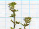
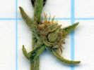
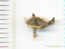
Myosotis laxa Lehm. Bay Forget-Me-Not. CalPhotos. Jepson eFlora. SEINet Taxon.
Herbaceous annual or perennial, to 20 cm.; Roots fibrous; Leaves 25 mm x 5 mm wide, oblanceolate, upper cauline much-reduced, elliptical-lanceolate; Inflorescence scorpioid cyme; Calyx tube ±= lobes, tube hairs simple, appressed; Receptacle flat; Corolla salverform, radial, yellow-white tube 1.3 mm + yellow appendages + blue lobes 1 mm = 2.3 mm. x 3 mm. dia.; Stamens included; Anthers 0.6 mm.; Ovary deep-lobed; Style 1, base hidden among lobes, < nutlets; Nutlets, 1.5 mm., black, erect, margin prominent, scar basal without thick rim (Described from Coll. No. 846, 21 Jun 2013).
- Andy Thompson Creek, Growing in fresh water near the shore of Mono Lake. 978. 978. .
- Lee Vining Creek, Growing in a small distributary in the delta of Lee Vining Creek. 980. 980. A recent introduction, outside of its natural range, found in all three major creeks entering Mono Lake, i.e., Mill Creek, Lee Vining Creek, and Rush Creek, and in other nearby wetland areas. On a former beach strand of Mono Lake, now exposed by falling lake levels, in the delta of Lee Vining Creek, 2.75 km northeast of the GNIS location of Lee Vining. Tom Schweich 1185. 25 Jun 2015. ( CS UC2046099‡ ) .
- Mill Creek, Moist partially shaded areas along creek, about 240 m upstream of Cemetery Road. Tom Schweich 846. 21 Jun 2012. ( Alameda CAS1157702‡ UCR248632‡ ) On a small island on the edge of Mill Creek, just downstream of US Highway 395. Adjacent to Mono City and accessed from the west end of Twin Lakes Drive. Tom Schweich 1013. 22 Jul 2013. ( OBI131096‡ RENO87133‡ ) .
- Mono Lake County Park, Growing beside the lower portion of the boardwalk. 977. 977. .
- Mono Lake, northwest shore (as a col. locality), In the delta of Mill Creek, on the northwest shore of Mono Lake. Tom Schweich 1006. 22 Jul 2013. ( CAS1202712‡ OBI82075‡ RENO87131‡ UC2045741‡ UCR262153‡ ) .
- Picnic Grounds, Growing adjacent to the boardwalk. 979. 979. .
- Rush Creek delta, Growing in waterlogged gravels creekside. Substantially outside the natural range of this taxon in California, but well-established in the Mono Lake basin; perhaps a garden escapee. Beside the newly incised main channel of Rush Creek, 1 km north northeast of the intersection of Forest Roads 01N51 “South Tufa Road” and 01N50 “Rush Creek Road”, 5.8 km east of Lee Vining. Tom Schweich 1170. 25 Jun 2015. ( CAS1205200‡ CS UCR265620‡ ) .
- Thompson Ranch,
Collected in tall grass with Hypericum scouleri.
The irrigation ditch is fed from Dechambeau Creek, and it is not clear whether it is being maintained or not. The creek was formerly augmented by water brought from Mill Creek by two ditches.
Along an irrigation ditch in former Thompson Ranch, about 250 meters northwest of the parking lot of Mono Lake County Park.
Tom Schweich 1010.
22 Jul 2013.
(
OBI131099‡
RENO87132‡
UC2045734‡
)
.
.
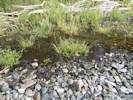
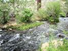
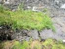
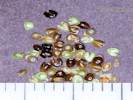
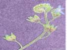
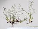
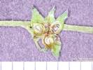
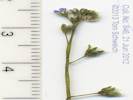
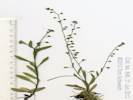
Nama aretioides (Hook. & Arn.) Brand. Sagebrush Nama. CalPhotos. Jepson eFlora. SEINet Taxon.
- Mono Valley, In loose pumice in Pinion-juniper woodland with Cryptantha circumscissa, Calyptridium roseum, Mimulus biglovii and Camissonia parvula. 1.0 mi E of entrance to Tufa State Reserve on State Highway 120, and S of Mono Lake; ca. 10 m. S of roadway R. N. Bowman 3218. 14 Jun 1982. ( CHSC37788† ) .
- Pumice Valley, Great Basin scrub, recently burned. Mono Lake, along Mono Lake Basin Road, about 3 miles S of the lake and 2.5 miles from the junction of Hwy. J. M. Porter, Laren Machen 15108. 27 May 2012. ( RSA803562† ) . .
Nama aretioides (Hook. & Arn.) Brand var. mulriflorum (A. Heller) Jeps. Sagebrush Nama. CalPhotos. Jepson eFlora. SEINet Taxon.
- Navy Beach, Sandy soil a few meters above waterline. Mono Lake Tufa State Natural Reserve, East navy Beach at S end of lake R. C. Wenk, P. Hopkinson, M. Hammond, P. Brownsey 857. 18 Jun 2008. ( CAS1097992† ) . .
Nama demissum A. Gray. Desert Purple Mat. CalPhotos. Jepson eFlora. SEINet Taxon.
- Lee Vining Creek, Collector's location description would place collection near Lower Lee Vining Campground. Leevining Creek 5 mi above Mono Lake, gravelly flats and roadside Mono Lake - Leevining Creek Peter Kamb 31 Jul 1948. ( UCSC894† ) . .
Nama densum Lemmon. Leafy Nama. CalPhotos. Jepson eFlora. SEINet Taxon.
- Bodie Hills, .2 mi. E of hill 7342, 2.1 mi. NNW of Deschambeau Ranch, PLSS: 03N26E33. Tim Messick 1536. 19 Jun 1981. ( HSC77414† ) .
- Mono Basin, in sagebrush slopes and open bolsas along California Highway 120, on road burn (berm? -- Ed.), 11.5 miles east of junction with U. S. Highway 395 Rimo Bacigalupi 3508. 11 Aug 1951. ( SD46192† ) .
- Pumice Valley, In flats above road 1 mile southwest of Leevining A. M. Alexander 4304. 25 Jun 1945. ( NY1082380† POM275360† UC736056† ) . .
Nama densum Lemmon var. densum. Leafy Nama. CalPhotos. Jepson eFlora. SEINet Taxon.
Annual, low, mounded, to 3 cm.; Hairs, dense, spreading; Calyx, free from ovary; Corolla, 3.2 mm., limb 2.0-2.3 mm.; Style, #1, 0.4 mm. (Described from Coll. No. 928, 20 May 2014).
- Pumice Valley, Oil Plant Road at Old Highway 395, 3 1/2 miles by road south of Lee Vining Tom Schweich 928. 20 May 2013. ( Alameda ) .
- Reversed Peak,
Collected with Taraxia tanacetifolia and Potentilla anserina.
On the drying shore of natural ponds called “Snow Ponds” by local residents, south flank of Reversed Peak, about 1 mile northwest of Gull lake.
Tom Schweich 563.
14 Aug 2008.
(
CAS1202605‡
)
.
.
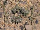
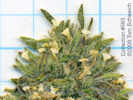
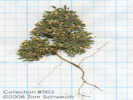
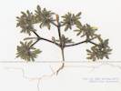
Nama rothrockii A. Gray. Rothrock's Purple Mat. CalPhotos. Jepson eFlora. SEINet Taxon.
- Horseshoe Canyon, Mono County: Highway 158, 0.5 mile north of Silver Lake, near June Lake L. Davis, L. Kreps 29 Aug 1973. ( UCD119545† ) .
- Lee Vining Canyon, dry rocky gravels by roadside on S-facing slope C. W. Sharsmith 5613. 22 Jul 1948. ( SJSU13505† ) Leevining Canyon near foot of grade Leevining Canyon R. F. Hoover 5409. 5 Jul 1941. ( UC1220359† UC765597† ) . .
Nemophila spatulata Coville. Sierra Baby Blue Eyes. CalPhotos. Jepson eFlora. SEINet Taxon.
- Reversed Creek, Reverse Creek Frank W. Peirson 6137. 28 Jun 1925. ( SD87858† ) . .
Phacelia Juss. Phacelia. CalPhotos. Jepson eFlora. SEINet Taxon.
- Mono Mills,
oose sandy tephra derived soils in Purshia tridentata-Artemisia tridentata scrub
3 miles northeast of Mono Mills in the vicinity of watertank shown on Cowtrack Mtn 15' USGS quadrangle
Dean Wm. Taylor 15225.
18 Jul 1995.
(
JEPS91090†
)
.
.

Phacelia bicolor Torr. ex S. Watson var. bicolor. Two-Color Phacelia. CalPhotos. Jepson eFlora. SEINet Taxon.
Annual of widely varying sizes, generally less than 2 dm.; Stem sometimes branched at base, decumbent to erect, sparsely glandular hairy; Leaf ovate in outline, to 2 cm, odd pinnate; Leaflets toothed to 2°-pinnate; Pedicels 1-2 mm, glandular hairy; Bracts strap-like, 5 mm, glandular hairy; Corolla 13 mm x 8-10 mm wide, deciduous, tube yellow, lobes blue; Stamens 6 mm; Filaments few small hairs near base, but are glabrous rather than the expected puberulent; Ovary bristly near top; Style 4 mm, small straight hairy rather than the expected puberulent (Described from Coll. No. 748, 16 Jan 2012). Compared to P. fremontii, the leaves of P. bicolor tend to be compound rather than simply deeply lobed. I also think the calyx lobes are more narrow.
- Big Sand Flat, Collected on the ridge just northwest of Big Sand Flat in an area that had burned several years previously. Tom Schweich 466. 25 Jun 2007. ( CAS1131479‡ UC1980442‡ ) About 1.5 km north of Big Sand Flat, on the hill with a monument named "Sand." Tom Schweich 609. 22 Jun 2010. ( CAS ) .
- Bloody Canyon, Chesnut and Drew 20 Jul 1889. ( UC35532† ) .
- Danburg Beach, Herbert L. Mason 15207. 12 Jun 1963. ( UC1275798† ) .
- Dechambeau Ranch, sandy volcanic gravels on dry sagebrash flat near Dechambeau's Ranch about 1.5 miles north of Black Point Carl W. Sharsmith 8711. 5 Jul 1982. ( SJSU9732† ) .
- June Lake, Mrs. J. D. Wright 6 Jul 1929. ( SBBG64840† ) R. Hoffman 10 Jul 1930. ( SBBG64842† ) .
- Lee Vining Ranger Station, dry gravels Lee Vining Canyon about 1.5 miles west of Lee Vining Ranger Station Carl W. Sharsmith 7544. 28 Jul 1967. ( SJSU4202† ) .
- Little Sand Flat, nitrophile on margin of sheep bedding area at water tank PLSS location: 1S28E30. Dean Wm. Taylor 6524. 28 Jun 1977. ( JEPS91363† ) .
- Mill Creek, Mono Lake, near Mill Creek on plain at northwest corner of lake R. F. Hoover 5416. 5 Jul 1941. ( UC765596† ) .
- Mono Basin, as Phacelia bicolor 639. 639. Winkler, David W., 1977 corolla tube yellow, limb lavender on Lundy Lake Road 0.5 mile west of junction with Hwy 395 M. L. Conrad, Morris, and Dunn 6797. 24 May 1973. ( UC1481902† ) .
- Mono Lake, pumice sand near margin of south side of Mono Lake Carl W. Sharsmith 5507. 25 May 1947. ( SJSU13467† ) .
- Mono Lake, near Mono Lake Alice M. Ottley 1051. 5 Jul 1920. ( JEPS1460† ) .
- Mono Lake (southwest sector), under shelter of Artemisia southwest end Joseph and Hilda W. Grinnell 1061. 16 Jun 1937. ( JEPS15421† UC569600† ) .
- Mono Mills, pumice under pine State Hwy 120 8 miles east of Hwy 395 Mildred E. Mathias, Henry J. Thompson, and J. R. Haller 1157. 26 Jul 1955. ( UC1034262† ) .
- Negit Island, sandy slope of highest point Mary DeDecker 37870. 25 Apr 1975. ( RSA620812† ) .
- Pilot Spring, In open areas southeast of the spring. Tom Schweich 645. 8 Jul 2010. ( CAS UC1973713‡ ) .
- Pumice Valley, Found on the edge of an area that burned July 26-27, 2010. Pumice flats near the north end of Mono Craters, just south of California Highway 120 on Inyo Forest Road 1N11, 3 miles northeast of US Highway 395. Tom Schweich 748. 15 Jun 2011. ( UC1980497‡ ) .
- Sagehen Meadow, Growing in disturbed area, plants of many different sizes. North side of Sagehen Meadow. Tom Schweich 594. 16 Jun 2010. ( CAS UC1973708‡ ) .
- Tioga Lodge,
pumice slope
west side of Mono Lake on the road to Lee Vining 1 mile south of Mono P. O.
William M. Hiesey 269.
12 Jun 1934.
(
UC646498†
)
.
.
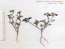
Phacelia distans Benth. Distant Phacelia. CalPhotos. Jepson eFlora. SEINet Taxon. Probably mis-identified, nearest collection are near Big Pine and Westgard Pass.
Annual, to 20 cm., green, photosynthetic, growing on steep colluvial slopes among Pinyons; Stem, sparsely straight-hairy and glandular throughout; Leaves, cauline, ± alternate, deeply pinnately lobed; Pedicels, stout, short glandular-hairy; Calyx, lobes 5, 4.5 mm. x 1 mm. wide, ± alike, short hairy, sinus appendages 0; Corolla, tube 6 mm. + lobe 2 mm., blue, deciduous; Ovary, entire, straight hairy; Style, 1, 8.5 mm., arising from tip of ovary, exserted; Stigma, 2; Stamens, 5, 9.5 mm., equal, exserted; Fruit, (young) 2 mm. << sepals (4.5 mm.), stiff straight hairy; Seeds, 4, quarter-moon shape, 1.5 mm., adaxial surface with central ridge separating 2 longitudinal grooves (Described from Coll. No. 415, keyed 15 Jan 2013).
Calyx lobes are too narrow and fruit too hairy to fit into P. crenulata.
Originally determined as Phacelia cf. amabilis. Received advice from Andy Sanders that my 415 was P. distans.
- June Lake,
H. Dearing 1470.
24 Jun 1936.
(
SBBG11768†
)
.
.
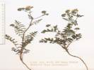
Phacelia glandulifera Piper. Sticky Phacelia. CalPhotos. Jepson eFlora. SEINet Taxon.
- Lime Kiln, frequent in sandy soil in Artemisia scrub Dean Wm. Taylor 7775. 15 Jul 1980. ( JEPS91349† ) . .
Phacelia gymnoclada Torr. ex S. Watson. Nakedstem Phacelia. CalPhotos. Jepson eFlora. SEINet Taxon.
Small annual to 3 cm., max., short hairy glandular; Leaf 6 mm. x 5 mm wide, elliptical, lobed, petiole 3 mm.; Pedicel 0.7-0.9 mm.; Calyx lobes 5, ± alike, to 4 mm. x 0.7 mm. wide, slightly oblanceolate; Corolla lobes 5, blue, tubes 8 mm. + lobes 3.5 mm. = 11.5 mm. x 8 mm. wide, glabrous inside; Ovary 1.5 mm., distally short-hairy (two placentas easily visualized on dissection); Style 4 mm., included; Stigma 2, short; Stamens 5, different lengths, included; Seeds 8-12, but too young to be sure (Described from Coll. No. 393, keyed 18 Jan 2013).
- Mono Lake,
J. W. Congdon
18 Aug 1894.
(
UC107304†
)
.
.
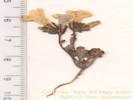
Phacelia hastata Douglas ex Lehm. var. compacta (Brand) Cronquist. (Syn: Phacelia hastata Douglas ex Lehm. ssp. compacta (Brand) Heckard ) Compact Phacelia. CalPhotos. Jepson eFlora. SEINet Taxon.
- Big Sand Flat, Small sand flat approximately 1 mile southwest of Big Sand Flat, bisected by Forest Road 1S12, also known as "Logging Camp Road." Tom Schweich 684. 23 Jul 2010. ( UC1980403‡ ) .
- Bloody Canyon, Willis Linn Jepson 4457. 18 Jul 1911. ( JEPS2038† ) .
- Little Sand Flat, sandy pumice soil Little Sandy Flat northeast end of Mono Craters, PLSS location: 01N27E33. Jack L. Reveal 134. 11 Jun 1962. ( UC1287811† ) .
- Mono Craters, volcanic gravel east slope L. Constance and R. Bacigalupi 3435. 3 Jul 1952. ( UC967199† ) bare pumice and obsidian slopes southeast slope Laura Lorraine 6 Aug 1938. ( UC604903† ) .
- Mono Mills, pumice under Jeffrey Pine State Highway 120 8 miles east of Highway 395 Mildred E. Mathias, Henry J. Thompson, and J. R. Haller 1158. 26 Jul 1955. ( UC1034264† ) . .
Phacelia hastata Douglas ex Lehm. var. hastata. (Syn: Phacelia hastata Douglas ex Lehm. ssp. hastata ) Silverleaf Phacelia. CalPhotos. Jepson eFlora. SEINet Taxon.
- East Craters Sand Flat, At the north end of East Craters Sand Flat along Forest Road 1S24, 2.9 mi (4.7 km) southwest of Mono Mills. Tom Schweich 584. 7 Jul 2009. ( CAS UC1973784‡ ) . [ Erect plant, some hairs appressed, calyx lobes not glandular. ] .
Phacelia heterophylla Pursh var. virgata (Greene) Heckard. (Syn: P. h. Pursh ssp. v. (Greene) Heckard ) Varileaf Phacelia. CalPhotos. Jepson eFlora. SEINet Taxon.
- Copper Mountain, Above the mine tunnel in a canyon of Copper Mountain, 1.1 miles west of the intersection of US Highway 395 and Mill Creek Powerhouse Road. Tom Schweich 780. 22 Jun 2011. ( UC1980467‡ ) .
- Fern Creek, H. Dearing 1486. 24 Jul 1936. ( SBBG11374† ) .
- June Lake, Mrs. J. D. Wright 5 Jul 1929. ( SBBG64959† ) .
- Lundy, 8000-9000 ft vicinty of Lundy Miss Maud Minthorn 59. 30 Jun 1908. ( JEPS2087† ) .
- Lundy Canyon, L. R. Heckard and R. Bacigalupi 198. 10 Aug 1951. ( UC1051768† ) L. R. Heckard and R. Bacigalupi 200. 10 Aug 1951. ( UC1051770† ) .
- Tioga Lodge,
east facing slope 2 miles north of Mono Lake Post Office
Joseph and Hilda W. Grinnell 1065.1
17 Jun 1937.
(
UC569598†
)
.
.

Phacelia humilis Torr. & A. Gray. Low Phacelia. CalPhotos. Jepson eFlora. SEINet Taxon.
- Big Bend Campground, Coordinates added by herbarium. Label says Colorado State University Herbarium. Ca. .2 mile E of Big Bend Campground and ca. 2.5 miles W of Lee Vining; ca. 20 m N of road R. N. Bowman 3209. 13 Jun 1982. ( CHSC37783† ) .
- Bloody Canyon, Chesnut and Drew 18 Jul 1889. ( JEPS2115† ) .
- Bridgeport Canyon, On rocky soil. Associated with Artemisia. Bridgeport Canyon. J. L. Reveal 86. 2 June 1962. ( NY1057843† ) .
- Conway Summit, along U. S. Highway 395, Conway Pass Beecher Crampton 279. 10 Jul 1941. ( UC1278080† UCD38116† ) Conway Summit, on road from Mono Lake to Bridgeport R. F. Hoover 5425. 5 Jul 1941. ( NY1057837† UC762415† ) .
- Grant Lake, Roadside. Hwy. 158 near turn off to Grant Lake Marina Wendell Wood 109. 13 Jul 1970. ( HSC12627† ) .
- Lee Vining Canyon, ridge near Leevining Canyon Alice M. Ottley 1803. 5 Jul 1920. ( JEPS2118† ) ridge near Lee Vining Canyon Alice M. Ottley 1983. 5 Jul 1920. ( JEPS2118† ) .
- Lundy, 8000-9000 ft vicinity of Lundy Miss Maud Minthorn 48. 29 Jun 1908. ( JEPS2121† ) .
- Upper Horse Meadow, rocky soil 1/4 mile east of Upper Horse Meadow, southwest of Lee Vining Jack L. Reveal 145. 26 Jun 1962. ( UC1287809† ) . .
Phacelia humilis Torr. & A. Gray var. dudleyi J. T. Howell. Dudley's Phacelia. CalPhotos. Jepson eFlora. SEINet Taxon.
Annual, to 8 cm., hairy throughout, straight white eglandular hairs; Leaves, simple, petiole 3.5 mm., blade, 22 mm. × 6.5 mm. wide, elliptical, margin entire; Corolla, 6 mm., deciduous; Stamens, #5, exserted 2 mm.; Filaments, sparsely long hairy, which conflicts with “short hairy” in TJM2, but is consistent with “filamentis sparse et longe pilosis” per Howell (1943). Described from Coll. No. 1192, 26 June 2015.
- Grant Lake,
Exposed sandy, north-facing slope, well above the highest level of Grant Lake.
South end of Grant Lake, east side of the lake, at the end of Forest Road 01S30 “Grant Lake Road.”
Tom Schweich 1192.
26 Jun 2015.
(
CAS1205202‡
UCR267674‡
)
.
.


Phacelia humilis Torr. & A. Gray var. humilis. Low Phacelia. CalPhotos. Jepson eFlora. SEINet Taxon.
Annual or Perennial herb, to 15 cm; Stem pubescent with sparse long hairs, not particularly glandular; Leaves simple; Infloresence scorpoid, elingate, 4 cm.; Calyx 5-merous, hairy (not ciliate), to 5(6) mm in fruit; Corollas blue, 6 mm wide, deciduous; Stamens 5-6 mm, exserted; Filaments glabrous at base, subtended by bristles. Identified as var. dudleyi when collected but changed to var. humilis on the short length of the calyx and stamens. (Described from Coll. No. 793, 15 Dec 2011.)
- Conway Summit, North slope of grade north of Mono Lake. Frank W. Peirson 6152. 29 Jun 1925. ( RSA74492† ) .
- Mono Lake,
Shore of Mono Lake.
Frank W. Peirson 9190.
12 Aug 1930.
(
RSA91067†
)
.
.
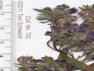
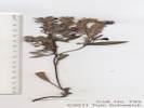
Phacelia ramosissima Douglas ex Lehm. (Syn: P. r. Douglas ex Lehm. var. eremophila (Greene) J. F. Macbr. , P. r. Douglas ex Lehm. var. ramosissima , P. r. Douglas ex Lehm. var. subglabra M. Peck ) Branching Phacelia. CalPhotos. Jepson eFlora. SEINet Taxon.
Perennial, sprawling when shaded, to 35 cm. tall or 60 cm. horizontally, glandular and straight hairy; Stem decumbent to ascending, sparse short and long hairs; Leaves alternate, to 7 cm., pinnate compound, 5 or 7 lobes, pinnae lobed or coarsely toothed, terminal lobes larger than lateral lobes, sparsely short hairy and glandular; Inflorescence coiled, sometimes loosely when shaded, unrolling, 12-15 flowers, perianth in 2 or more whorls, parts in 5s, bisexual; Pedicels, 1-3 mm, elongating as fruit matures; Calyx lobes 5, free, 6-7.5 mm., elliptic-lanceolate, tip acute, glandular-hairy; Corolla, blue, tube fused 4-6 mm + lobes (5) 2-3.5 mm., = 6-10 mm x 8 mm. wide, radial; Ovary superior, 1 mm., entire, straight hairy distally; Style, arising from top of ovary, 7 mm., hairy proximally, forked at approximate middle; Stigmas 2, exserted; Stamens 5, alternate, all fertile; Filaments fused near base (with accessory tissue where fused), turning downward at anther; Anthers purple; Fruit, 3 mm., ovoid; Seeds, 4, 2.5 mm, light brown, pitted. (Described from Coll. No. 96, 13 Jan 2013, and Coll. No. 321, 19 Jan 2013).
- Bloody Canyon, Chesnut and Drew 20 Jul 1889. ( UC35534† ) .
- Grant Lake, South end of Grant Lake, east side of the lake, at the end of Forest Road 01S30 “Grant Lake Road.” Tom Schweich 1190. 26 Jun 2015. ( OBI83220‡ UCR267672‡ ) .
- Panum Crater, sandy pumice flats in Purshia tridentata-Artemisia tridentata tridentata scrub Mono Basin: Test Station Road at north base of Panum Crater, PLSS location: 01N27E. Dean Wm. Taylor 16743. 1 Jul 1998. ( JEPS101544† ) .
- Sagehen Meadow, Upper slope of hill north of Sagehen Meadow. Tom Schweich 669. 16 Jul 2010. ( CAS1120820‡ UC1973773‡ ) .
- Tioga Lodge,
Mono Lake, 3 miles north of Tioga Lodge
Lewis S. Rose 50204.
26 Jul 1950.
(
UC942885†
)
in pumice slope
west side of lake 1 mile south of Mono P. O. on road to Lee Vining
William M. Hiesey 261.
12 Jun 1934.
(
UC646497†
)
.
.

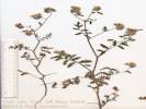
Phacelia tetramera J. T. Howell. Four Part Phacelia. CalPhotos. Jepson eFlora. SEINet Taxon.
- Alkali Lake, Habitat: White, crusty saline flats. Associated Species: Carex. Nevada, Mineral, Alkalai Valley west of Mt. Hicks, Alkali Lake, 0.15 road miles NNW of the lake. Verbatim Coordinates: 38° 16.934' N 118° 45.687' W; TRS: T5N R29E sec 21. Arnold Tiehm and Jan Nachlinger 16561. 5 Jun 2013. ( RENO23083‡ ) . .
Plagiobothrys hispidus A. Gray. Cascade Popcornflower. CalPhotos. Jepson eFlora. SEINet Taxon.
- Lee Vining Creek, Marsy stream bank Near Leevining at Mono Lake, foot of Tioga Pass Rd. B. Lindner, E. Robinson 37. 9 Jun 1936. ( RSA74218† ) . .
Plagiobothrys kingii (S. Watson) A. Gray. Great Basin Popcornflower. CalPhotos. Jepson eFlora. SEINet Taxon.
- Lee Vining Canyon, basin sagebrush scrub Lee Vining Creek 5 miles above Mono Lake, gravelly flats and roadsides Peter Kamb 1259. 31 Jul 1948. ( UC1178532† ) .
- Mono Basin, 615. 615. Winkler, David W., 1977 .
- MBRG P-2, Observation per MBRG voucher 849. 849. . .
Plagiobothrys kingii (S. Watson) A. Gray var. harknessii (Greene) Jepson. Harkness' Popcornflower. CalPhotos. Jepson eFlora. SEINet Taxon.
Annual, cotyledons persistent, to 7 cm., tap-rooted, branched at base; Stems, ±equally tall; Leaves, basal rosette 0, cauline alternate; Corolla, white, limb 5 mm., appendages yellow, prominent; Nutlets, #4, light tan, ovoid, 2.6 mm. × 1.5 mm. wide, adaxially keeled above scar, scar, lateral, sessile, raised, flat without thick rim, margin prickles 0, cross-ribs irregular (Described from Coll. No. 611, 22 Jun 2010).
- Big Sand Flat, About 1.5 km north of Big Sand Flat, on the hill with a monument named "Sand." Tom Schweich 611. 22 Jun 2010. ( UC2045753‡ UCR262125‡ ) .
- Black Point, in black cinder soil along road East side of Black Point along road to cinder plant Jack L. Reveal 1086. 29 Apr 1965. ( UC1338442† ) .
- Mono Lake,
H. W. Harkness
Jun 1886.
(
UC78017†
)
.
[
Is this a type?
,
Basionym: Sonnea harknessii Greene Pittonia 1(2): 23. 1887.
]
.

Plagiobothrys kingii (S. Watson) A. Gray var. kingii. Great Basin Popcornflower. CalPhotos. Jepson eFlora. SEINet Taxon.
- Sagehen Peak, 20° S-facing slope of soft decomposed granite soil, with occasional granite outcrops. With Artemisia tridentata, Purshia tridentata, Chrysothamnus viscidiflorus, Phacelia bicolor, Grayia spinosa. Dexter Cyn. quad; Occasional on disturbed loose roadside soil. GLASS MOUNTAIN REGION Sagehen Peak; 150m S of peak along steep deeply rutted 4WD road, PLSS: 01S28E13. Michael Honer 992. 21 Jun 2001. ( RSA680594† ) . .
Tiquilia nuttallii (Hook.) A. T. Richardson. (Syn: Coldenia n. Hook. ) Nuttall's Crinklemat. CalPhotos. Jepson eFlora. SEINet Taxon.
- Alameda Well, in stabilized dune, which was probably an old beach strand. in Mono Valley, 20 meters west of and above Dobie Meadows Road, 1.7 mi (2.7 km) northwest of Alameda Well Tom Schweich 573. 7 Jul 2009. ( UC1973778‡ ) . [ See my image: IMG_1959.JPG ]
- Bloody Canyon, Chesnut and Drew 32427. 21 Jul 1889. ( UC32427† ) .
- Mill Creek, Near Mill Creek on plain at northwest corner of Mono Lake. R. F. Hoover 5417. 5 Jul 1941. ( UC762985† ) .
- Mono Basin, as Tiquilia plicata 396. 396. Jones & Stokes Associates, 1993 Listed as a synonym Coldenia nuttallii Hook. 609. 609. Winkler, David W., 1977 .
- Mono Craters, Pumice and obsidian soil. Herbert L. Mason 13680. 5 Sep 1948. ( UC1191833† ) .
- Mono Lake, Dry gravels of old lake terraces. Above west shore of Mono Lake about 2 miles north of Lee Vining Creek. Carl W. Sharsmith 6291. 18 Jul 1955. ( SJSU1683† ) 3 miles north of Mono Lake. Herbert L. Mason 11500. 1 Aug 1936. ( UC1081527† ) Moist ground. Sulphur Springs near Artesian Well, northeast shore of Mono Lake. Herbert L. Mason 15223. 4 Jul 1963. ( UC1275783† ) .
- Mono Lake Cemetery, On sandy soil. Grounds north of Mono Lake Cemetary. James L. Reveal and Jack L. Reveal 411. 14 Jul 1962. ( UC1338684† ) .
- Mono Lake, Alice M. Ottley 1058. 5 Jul 1920. ( JEPS67397† ) Sandy soil at lake. Henry N. Bolander 6407. 1866. ( UC24640† ) Desert slopes. Lewis S. Rose 37699. 29 Sep 1937. ( UC1347191† UC881479† ) Unknown 78324. 24 Aug 1896. ( UC78324† ) .
- MBRG P-2, Observation of Coldenia nuttallii per MBRG voucher 841. 841. .
- Mono Lake, southeast of (as a collection locality), Punice sands 1 mile southeast of Mono Lake. Carl W. Sharsmith 5478. 6 Aug 1946. ( SJSU13502† ) .
- Mono Mills, loose sandy (tephra derived) soils in Purshia tridentata-Artemisia tridentata scrub About 3 miles northeast of Mono Mills, in the vicinity of watertank shown on Cowtrack Mountain 15' USGS quadrangle. Dean Wm. Taylor 15223. 18 Jul 1995. ( JEPS90904† ) Sand flat, in deep sand of volcanic origin. South of Mono Lake, 4 miles north of Mono Mills. L. R. Abrams and David D. Keck 2875. 30 Jun 1934. ( UC532136† ) .
- Rush Creek, On formerly flooded and now drying sandy banks of Rush Creek, 2.8 mi. downstream from US Highway 395, and 1.5 mi. upstream from Test Station Road. Tom Schweich 726. 1 Sep 2010. ( UC1980406‡ ) .
- Tioga Lodge,
Brassicaceae Boechera bodiensis (Rollins) Al-Shehbaz.
(Syn:
Arabis bodiensis Rollins
)
Bodie Hills Rock Cress.
CalPhotos.
Jepson eFlora.
SEINet Taxon.
- Cottonwood Canyon,
Steep rocky slope, Pinus monophylla forest
E side of Cottonwood Canyon, 5.1 mi. S of Bodie, PLSS: 03N27E08.
Tim Messick 992.
20 Jun 1980.
(
HSC70667†
)
.
- Mount Biedeman,
With Eriogonum microthecum, Leptodactylon pungens, Phoenicaulis cheiranthoides
Near summit of Mt. Biedeman, 5.1 mi. SW of Bodie, PLSS: 03N26E01.
Tim Messick 515.
18 Jun 1979.
(
HSC70666†
)
.
.
Boechera cobrensis (M. E. Jones) Dorn.
(Syn:
Arabis cobrensis M. E. Jones
)
Sagebrush Rockcress.
CalPhotos.
Jepson eFlora.
SEINet Taxon.
- Mono Basin,
along US Highway 395, 8 miles south of Lee Vining
Darley Howe 5047.
22 Jun 1978.
(
SD102803†
SDSU2626†
)
.
- Alkali Lake,
Habitat: In and around sand dunes. Associated Species: Chrysothamnus viscidiflorus.
Nevada, Mineral, Alkalai Valley west of Mt. Hicks, 0.7 road miles NNE of the lake
Arnold Tiehm and Jan Nachlinger 16563.
5 Jun 2013.
(
RENO23078‡
)
.
.
Boechera pinetorum (Tidestr.) Windham & Al-Shehbaz.
(Syn:
Arabis holboellii Hornem. var. p. (Tidestr.) Rollins
)
Holboell's Rockcress.
CalPhotos.
Jepson eFlora.
SEINet Taxon.
- Lee Vining,
disturbed hillside on old lake-terrace; burned area in artemisia tridentata scrub on granitic sand
hillside on old lake-terrace above town of Lee Vining
Dean Wm. Taylor 7504.
22 Jul 1979.
(
JEPS90215†
)
.
- Lundy Canyon,
along creek
road west of U. S. Hwy 395 1 mile below Lundy Lake Dam
Ira L. Wiggins 14183.
27 Jun 1957.
(
DS409432†
UC1190331†
)
.
- Mono Craters,
In open yellow pine forest.
West slope of Mono Craters.
Laura Lorraine
6 Aug 1938.
(
DS285724†
)
.
- Pilot Spring,
In open areas southeast of the spring.
Tom Schweich 646.
8 Jul 2010.
(
CAS1121950‡
UC1973746‡
)
.
- Sagehen Meadow,
In the heavy gravel of the access road to the Robert Lane house, adjacent to sagebrush above the meadow.
Tom Schweich 589.
15 Jun 2010.
(
UC1973716‡
)
Among sagebrush.
Lower part of the meadow, above swale.
Tom Schweich 591.
15 Jun 2010.
(
CAS1121440‡
UC1973720‡
)
.
.
Boechera platysperma (A. Gray) Al-Shehbaz.
(Syn:
Arabis platysperma A. Gray
)
Pioneer Rockcress.
CalPhotos.
Jepson eFlora.
SEINet Taxon.
- Mono Craters,
volcanic gravel, open spaces among Jeffrey Pines
east slopes of Mono Craters
Rimo Bacigalupi (with Lincoln Constance) 2841.
3 Jul 1952.
(
JEPS14038†
)
.
.
Boechera pulchra (M. E. Jones ex S. Watson) W. A. Weber.
(Syn:
Arabis pulchra M. E. Jones ex S. Watson
)
Beautiful Rockcress.
CalPhotos.
Jepson eFlora.
SEINet Taxon.
- Conway Summit,
"Sierra Nevada, Conway Summit, Lee Vining"
F. Howard
12 Jun 1962.
(
SBBG72407†
)
.
.
Boechera repanda (S. Watson) Al-Shehbaz.
(Syn:
Arabis repanda S. Watson var. greenei Jeps.
)
Greene's Rockcress.
CalPhotos.
Jepson eFlora.
SEINet Taxon.
- Mono Craters,
habitats visited ranging from Jeffrey Pine Forest to Pumice veg. with...; Pumice and dacite outcrops, 8000-9500 ft
Dean Wm. Taylor 7504.1
27 Jul 1979.
(
JEPS90258†
)
.
.
Brassicaceae .
Mustard Family.
CalPhotos.
Jepson eFlora.
SEINet Taxon.
- Coyote Spring,
Adjacent to the pool in the main part of the Coyote Spring, next to Bridgeport Canyon Road.
Tom Schweich 853.
21 Jun 2012.
.
.
Cardamine breweri S. Watson.
(Syn:
C. b. S. Watson var. breweri
,
C. b. S. Watson var. orbicularis (Greene) Detling
)
Brewer's Bittercress.
CalPhotos.
Jepson eFlora.
SEINet Taxon.
Type: Sonora Jct, Brewer #1890``
Perennial herb, to 50 cm., erect, terrestrial, growing in a shaded streamside;
Rooting at nodes;
Hairs 0;
Leaves cauline, compound, pinnate lobed, leaflets 3, lower cauline leaves withering at flowering;
Flowers radial;
Petals white, 5 mm. x 2.5 mm. wide, blade wider than claw;
Stamens 6, 4 long 2 short;
Ovary linear;
Fruit a silique, linear 28 mm. x 1 mm wide, dehiscent by valves, not stipitate;
Seeds 14, wingless
(Described from Coll. No. 875, 23 June 2012). - Bohler Canyon,
Sterile collection. Same as my collection #875.
Wet meadow along the dirt road on the south side of Bohler Canyon, 1.8 mi (3.0 km) by air west of US Highway 395.
Tom Schweich 506.
2 Aug 2007.
.
- Coyote Spring,
Growing in the Meadow at Coyote Spring, Bridgeport Canyon, 4 miles north of California Highway 167.
Tom Schweich 479.
26 Jun 2007.
(
UC1980435‡
)
.
[
Coll. No. 479, 30 Nov 2011, characters observed while keying:
Plant glabrous;
Stems terete;
Leaves mid-cauline sessile and auriculate,
4-5 cm x 15 mm wide
pinnately lobed, 5 to 9 lobes;
Petals yellow, obovate, 5 mm, 2+ mm wide;
Stamens 6, all appearing equal in length, included;
Style 0.5 mm;
Fruit silique, linear, 14-24 mm x 1.5 mm wide,
not stipitate,
appressed to ascending,
strongly flattened,
compressed parallel to the replum
(which appears mostly as a thin membrane),
dehiscent by valves,
valves 1-veined
(some 2nd and 3nd anastomosing veins);
Seeds many, brown scaly (?).
]
- Fern Creek,
growing in streamlet
June Lake Loop, Fern Creek
Mary DeDecker 2179.
20 Jul 1969.
(
RSA617061†
)
.
- Lee Vining Canyon,
Wet spot.
About halfway down the Lee Vining Grade.
Milo S. Baker 5845.
4 Jul 1932.
(
CAS200129†
)
Cold spring, near highway, Lee Vining Canyon.
Reed Clark Rollins 4194.
11 Jul 1947.
(
DS328133†
RSA45287†
)
.
- Lee Vining Ranger Station,
Along Lee Vining Creek, near the Lee Vining Ranger Station
Jack L. Reveal 126.
9 Jun 1962.
(
NY119879†
)
.
- Lundy Lake,
Fresh water spring.
Lundy Lake off Hwy. 395, 7 mi. N of Lee Vining
Wendell Wood 129.
17 Jul 1970.
(
HSC12611†
)
.
- Parker Creek,
Along Parker Creek Road (F. R. 01S25), where it crosses a small unnamed creek, 3.2 miles southwest of the intersection of California Highway 158 and US Highway 395.
Tom Schweich 875.
23 Jun 2012.
(
CAS1157548‡
UC
)
.
- Walker Lake,
From J. W. Congdon Herbarium, probably coll. by J. W. Congdon.
J. W. Congdon
25 Aug 1895.
(
UC117830†
)
Loc: appears to be spelled "Bludy Canyon;" From J. W. Congdon Herb., probably coll. by J. W. Congdon.
Bloody Canyon, Walker Lake
J. W. Congdon
17 Aug 1894.
(
UC117831†
)
.
.
Caulanthus sierrae ined.
Sierra Jewelflower.
CalPhotos.
Jepson eFlora.
SEINet Taxon.
This taxon is awaiting publication by Roy Buck. There are 27 vouchers from Inyo and Mono counties that have been annotated with this name.
Perennial, from tap root, to 75 cm., caudex woody, hairs proximal simple, distal 0;
Leaves basal withered, cauline petioled lobed, distal sessile, smaller than mid cauline;
Raceme not bracted, terminal cluster fertile;
Pedicels 2 mm. in flower to 3.5 mm. in fruit;
Flowers radial;
Stigma entire;
Stamens 6, ± equal in length, well exserted;
Fruit ascending silique, ± sessile on receptacle, linear, glabrous
(Described from Coll. No. 831, 18 Jun 2013).
Keys poorly in TJM2, can be forced into C. pilosus.
Keys fairly easily to C. sp. in Taylor (2010), i.e., the undescribed Sierra Jewelflower (Caulanthus sierrae ined.). - Tioga Lodge,
east-facing slope, B.M. 6761 ft.
two miles north of Mono Lake Post Office
Joseph and Hilda W. Grinnell 1066.1
17 Jun 1937.
(
UC569647†
)
Granite outcrop surrounded by very sandy soil, likely a former shoreline or deltaic deposit from a high-stand of Mono Lake, above Tioga Lodge, along a powerline road, 2.8 miles north of Lee Vining.
Tom Schweich 831.
18 Jun 2012.
(
UC2015297‡
)
.
.
Cusickiella douglasii (A. Gray) Rollins.
Alkali False Whitlow-Grass.
CalPhotos.
Jepson eFlora.
SEINet Taxon.
Perennial herb to 2.5 cm.,
from a branched woody caudex, scapose;
Leaves, 5-7 mm., entire, few short simple hairs;
Inflorescence, bract absent;
Fruit, 3.5 mm. × 2.7 mm. wide, 2-sided;
Seed, #1-2, 2.5 mm.
(Described from Coll. No. 970, 22 May 2013). - Bridgeport Canyon,
Soil - thin, rocky basalt.
Growing in Bridgeport Canyon on summit and about 1/2 mile south.
Jack L. Reveal 1094.
9 May 1965.
(
UTC109988‡
)
Along Coyote Springs Road, about ⅓ mile southeast of the pass, at a watercourse crossing the road from southwest to northeast, 6˝ miles by road north of California Highway 167.
Tom Schweich 970.
22 May 2013.
(
CAS1160954‡
UC
UCR250017‡
)
.
.
Cusickiella quadricostata (Rollins) Rollins.
(Syn:
Draba quadricostata Rollins
)
Bodie Hills Draba.
CalPhotos.
Jepson eFlora.
SEINet Taxon.
- Mono Basin,
as Draba quadracostata
367.
367.
Jones & Stokes Associates, 1993
.
- Rancheria Gulch,
Tre substrate in Artemisia arbuscula habitat; no to few flowers this dry year
Bodie Hills (Location defined by latitude and longitude is in Rancheria Gulch -- Ed.)
Dean Wm. Taylor 7860.
16 Jun 1981.
(
UC1548515†
)
.
.
Descurainia californica (A. Gray) O. E. Schulz.
Sierra Tansymustard.
CalPhotos.
Jepson eFlora.
SEINet Taxon.
Annual, to 90 cm.;
tap root;
Hairs branched, but not stellate;
Leaves
basal ? withered;
cauline many, petioled, pinnate dissected, not rigid;
Infloresence not bracted;
Stigma simple, entire;
Fruit a silique, 3-4 mm x < 1 mm. dia., fusiform, cylindric in cross-section,
many have a little circum-silique dimple or crimp, surface glabrous
Described from Coll. No. 871, 23 Jun 2012) - Bloody Canyon,
Chesnut and Drew
19 Jul 1889.
(
UC14400†
)
.
- Mono Lake,
Wm. H. Brewer
1850.
(
UC10823†
)
.
- Parker Creek,
Near the intersection of Parker Creek Trail Road (01S25A) and Parker Creek Road (01S25), 3.1 miles south southwest of the intersection of California Highway 158 and US Highway 395.
Tom Schweich 871.
23 Jun 2012.
.
.
Descurainia incisa (Engelm.) Britton.
Mountain Tansymustard.
CalPhotos.
Jepson eFlora.
SEINet Taxon.
- Silver Lake,
Mrs. J. D. Wright
9 Jul 1929.
(
SBBG72181†
)
.
.
Descurainia paradisa (A. Nelson & P. B. Kenn.) O. E. Schulz.
(Syn:
D. paradisa (A. Nelson & P. B. Kenn.) O. E. Schulz ssp. paradisa
,
D. pinnata (Walter) Britton ssp. paradisa (A.Nelson & P.B.Kenn.) Detling
)
Paradise Tansymustard.
CalPhotos.
Jepson eFlora.
SEINet Taxon.
- Lee Vining Canyon,
meadow
Tioga Road, west of Lee Vining at bottom of grade
F. C. Vasek 6706242.
24 Jun 1967.
(
UCR6300†
UCR6305†
)
.
- Panum Crater,
sandy pumice flats in Purshia tridentata-Artemisia tridentata tridentata scrub
Test Station Road at north base of Panum Crater (Latitude given is doubtful -- Ed.)
Dean Wm. Taylor 16741.
1 Jul 1998.
(
JEPS96922†
)
.
- Paoha Island,
volcanic area southeast corner of island
Mary DeDecker 3783.
24 Apr 1975.
(
RSA620814†
)
.
.
Descurainia pinnata (Walter) Britton.
Western Tansymustard.
CalPhotos.
Jepson eFlora.
SEINet Taxon.
- Mono Basin,
632.
632.
Winkler, David W., 1977
.
- MBRG P-2,
Observation per MBRG voucher
833.
833.
.
- Paoha Island,
Herbert L. Mason 15210.
24 Jun 1963.
(
UC1275795†
)
.
.
Descurainia sophia (L.) Webb.
Tansy Mustard.
Weed:
CAL-IPC, List: Limited.
CalPhotos.
Jepson eFlora.
SEINet Taxon.
Sole collection in Mono Basin by MBRG, may be deposited at CAS.
Annual, 30 cm. (to 50 cm. when growing among grasses), not scapose;
Tap root;
Stem simple at base, branched distally;
Hairs many-branched;
Leaves basal 0, cauline compound, 2-3 pinnately dissected, sessile, not basally lobed, sagittate, or clasping;
Inflorescence not bracted;
Pedicel, in fruit diverging 30–45°;
Petals yellow, 2.5 mm.;
Ovary linear;
Stigma ±entire (there are clearly two separate segments of the stigma that are receptive, but there is no central
cleft between them);
Fruit (7-15 mm.) -25 mm., linear (not fusiform or club-shaped), glabrous, not appressed;
Septum veined
Seeds, multiseriate
(Described from Coll. Nos. 404, 854, and 935). - Bohler Canyon,
Opening or meadow near falling-down cabin, near Bohler Creek, and just outside the curve of Forest Road 01N106A where it turns from westerly to northerly and crosses Bohler Creek, 6.1 miles by road south of Lee Vining, CA.
Tom Schweich 935.
20 May 2013.
(
CAS1202604‡
OBI100728‡
)
.
- Coyote Spring,
Coyote Spring has an disused water trough, near-by meadows are grazed by sheep.
At Coyote Spring in Bridgeport Canyon, adjacent to Bridgeport Canyon Road, 4.1 miles by road from the intersection of Cottonwood Canyon Road and California Highway 167.
Tom Schweich 854.
21 Jun 2012.
(
CDA39621‡
UC
UCR248628‡
)
.
- Mono Basin,
633.
633.
Winkler, David W., 1977
.
- Mono Lake,
Mono Lake and vicinity, north of Lee Vining.
J. Burch, J. Robins, T. Wainwright 106.
7 Jul 1976.
(
DS744455†
)
Mono Lake and vicinity, north of Lee Vining.
J. Burch, J. Robins, T. Wainwright 132.
18 Jul 1976.
(
DS744457†
)
Mono Lake and vicinity, north of Lee Vining.
J. Burch, J. Robins, T. Wainwright 233.
6 Aug 1976.
(
DS744444†
)
.
.
Draba breweri S. Watson.
Cushion Draba.
CalPhotos.
Jepson eFlora.
SEINet Taxon.
- Mono Craters,
habitats visited ranging fr Jeffrey Pine Forest to Pumice veg..Pumice & dacite outcrops, 8000-9500 ft
Dean Wm. Taylor 7539.
27 Jul 1979.
(
UC1548504†
)
.
.
Erysimum capitatum (Hook.) Greene.
Sanddune Wallflower.
CalPhotos.
Jepson eFlora.
SEINet Taxon.
Author citation variously “(Douglas) Greene,” “(Douglas ex Hook.) Greene,” and “(Hook.) Greene,” the latter current per TJM2.
Perennial or at least biennial,
16 cm. 25-45 cm.,
hairs dolabriform throughout;
Root,
tap;
Stems,
erect,
leafy,
proximal not woody
hairs as above;
Leaves,
basal and cauline,
basal,
petiole,
indistinct,
±10 mm.,
+ blade, 50-100 mm. × 2.5-3 mm. wide,
narrowly oblanceolate,
margin 1-3 shallowly pinnate dentate,
cauline,
nearly sessile,
42 mm. × 2.5 mm. wide,
±linear,
margin,
entire,
reduced distally;
Inflorescence,
raceme
130 mm. × 45 mm. wide,
not bracted;
Pedicels,
3-6 mm.,
elongating as flower matures,
ascending;
Flowers,
radial;
Sepals,
#4,
rows, 1,
7 mm. × 1-1.5 mm. wide,
narrow and wide pairs opposite,
lateral pair basally saccate;
Petals,
claw, 10-11 mm. +
blade 6-9 mm. × 4-6 mm. wide,
spoon-shaped,
margin, entire,
color, yellow, orange;
Stamens,
#6,
11 & 15 mm.,
tetradynamous (2 short, 4 long);
Anthers,
4.5 mm.;
Ovary,
4 mm.;
Style,
9 mm.;
Stigma,
capitate;
Fruit,
17-34 mm. × 1 mm. wide,
4-angled,
ascending,
hairy as above;
Seeds, unknown
(Described from Coll. Nos. 206, 1835, & 2306). - Mono Mills,
Joseph and Hilda W. Grinnell 1058.1
16 Jun 1937.
(
UC569577†
)
.
- Railroad Sand Flat,
Growing in loose volcanic cinder sand.
Near the former Bodie & Benton Railway roadbed about 50 m north of Forest Road 01S91 “Old Stationhouse Road”, 3 miles by that road south of Mono Mills.
Tom Schweich 990.
20 Jun 2013.
(
Alameda
OBI100981‡
UCR262128‡
)
.
- Walker Creek (Lower),
moraine soil
east to south exposed gentle slopes in Walker Creek drainage 5 miles south of Lee Vining
Jack L. Reveal and David Mason 70.
27 May 1962.
(
UC1338680†
)
.
.
Erysimum capitatum (Hook.) Greene var. capitatum.
Sanddune Wallflower.
CalPhotos.
Jepson eFlora.
SEINet Taxon.
- Bohler Canyon,
Growing in sagebrush.
North slope near base of north limb of Bloody Canyon moraine, near Forest Road 01N106A, 0.2 miles west of Forest Road 01N17 “Farrington Siphon,” 5.2 miles by road south of Lee Vining, CA.
Tom Schweich 938.
20 May 2013.
(
OBI100939‡
RENO87128‡
UC2045713‡
UCR262146‡
)
.
- East Craters Sand Flat,
At the north end of East Craters Sand Flat along Forest Road 01N24, 2.7 mi (4.4 km) southwest of Mono Mills
Tom Schweich 585.
7 Jul 2009.
(
CAS1160958‡
UC
)
.
[
Coll. No. 585, 7 Jul 2009, characters observed:
Perennial, to 35 cm., not scapose;
Hairs, most simple, some appear “double-ended,” presumably because they are
sessile, and branched at the point of attachment;
Stem, proximal not woody;
Leaves, basal, 40 mm., oblanceolate,
cauline, present, sessile, not basally lobed or clasping, simple;
Inflorescence, not bracted, elongate;
Pedicel, 4 mm.;
Flowers, radial;
Petals, claw 9 mm. + blade 5 mm. × 3 mm. wide;
Stamens, 6, arrangement not clear;
Ovary, 5 mm., linear;
Style, 1.5 mm.;
Fruit, 75 mm., not constricted between seeds, ascending;
Seed, 2.2 mm. × 0.8 mm. wide, winged at tip.
]
- Sagehen Peak,
Occasional in shady Aspen woodland.; With Symphoricarpos rotundifolius, Linanthus pungens.
Populus tremuloides woodland bisected by road, surrounded by open slopes of Artemisia tridentata / Purshia tridentata scrub. Ashy pumice alluvium above contact of granitic and basaltic bedrock.
GLASS MOUNTAIN REGION Sagehen Peak area; along FS Rd. 1N02 near SW base of Sagehen Peak.
Michael Honer 984.
21 Jun 2001.
(
RSA680701†
)
.
.
Lepidium chalepense L.
(Syn:
Cardaria chalepensis (L.) Hand.-Mazz.
,
Lepidium draba L. ssp. chalepense (L.) Thell.
)
Weed:
CAL-IPC, List: Moderate.
Inyo National Forest, priority: High, List: B.
CalPhotos.
Jepson eFlora.
SEINet Taxon.
- Dechambeau Ponds,
black pumice bordering warm spring outflow, with a few Salix exigua thickets
Dechambeau Ponds about 1.5 miles north of north shore of Mono Lake
Dean Wm. Taylor 16979.
23 Aug 1998.
(
JEPS96906‡
)
.
- Mono Basin,
as Lepidium draba L. ssp. chalepense (L.) Thell.
505.
505.
.
.
Lepidium densiflorum Schrad.
(Syn:
L. d. Schrad. var. macrocarpum G. A. Mulligan
)
Bigseed Pepperweed.
CalPhotos.
Jepson eFlora.
SEINet Taxon.
- Lower Horse Meadow,
meadow border on granitic substrate with Artemisia tridentata, Iris missouriensis
Dean Wm. Taylor 16983.
24 Aug 1998.
(
JEPS96918†
)
.
- Mono Lake,
Alice M. Ottley 1056.
5 Jul 1920.
(
JEPS53593†
)
.
.
Lepidium lasiocarpum Nutt.
Shaggyfruit Pepperweed.
CalPhotos.
Jepson eFlora.
SEINet Taxon.
Sole collection in Mono Basin by MBRG, may be deposited at CAS.
- Mono Basin,
635.
635.
Winkler, David W., 1977
.
- MBRG P-12,
Observation per MBRG voucher
822.
822.
.
.
Lepidium montanum Nutt.
(Syn:
Lepidium montanum Nutt. var. canescens (Thellung) C.L. Hitchc.
,
Lepidium montanum Nutt. var. cinereum (C. L. Hitchc.) Rollins
,
Lepidium montanum Nutt. var. montanum
)
Mountain Peppergrass.
CalPhotos.
Jepson eFlora.
SEINet Taxon.
- Mono Valley,
Growing with Juniperus, Artemisia tridentata on light colored clay outcrops.
Mono Valley, 0.65 road miles E of state line on highway 167 to Hawthorne, then 2.0 road miles S on E fork of a Pole Line road, T3N, R29E, S10
A. Tiehm 12581.
6 Jul 1998.
(
CAS962705†
GH379742†
NY280323†
UTC226087‡
)
.
- Alkali Lake,
Plants growing with Chrysothamnus in saline areas near the lake.
Alkali Valley on the southwest side of the Wassuk Range, north side of Alkali Lake. Verbatim Coordinates: 38° 17' N 118° 45' W.
A. Tiehm and Matt Lavin 8139.
12 Jul 1983.
(
NY76315‡
UTC191691‡
)
Habitat: White, crusty saline flats.Associated Species: Distichlis spicata.
Nevada, Mineral, Alkalai Valley west of Mt. Hicks, Alkali Lake, near NW edge of the lake
Arnold Tiehm and Jan Nachlinger 16559.
5 Jun 2013.
(
RENO23148‡
)
.
.
Lepidium perfoliatum L.
Clasping Pepperweed.
CalPhotos.
Jepson eFlora.
SEINet Taxon.
- Paoha Island,
Paoha Island, Mono Lake, volcanic area, southeast corner of island
Mary DeDecker 3784.
24 Apr 1975.
(
RSA620851†
)
.
.
Nasturtium officinale W. T. Aiton.
(Syn:
Rorippa nasturtium-aquaticum (L.) Hayek
)
Watercress.
CalPhotos.
Jepson eFlora.
SEINet Taxon.
Perennial herb to 15 cm., aquatic, hairs 0;
Caudex 0;
Roots, fibrous, rooting at nodes;
Stem decumbent, leafy;
Leaves cauline, compound, pinnately divided, petioled,
Inflorescence not bracted, not one-sided;
Flowers radial;
Sepals 2-2.3mm., ovate to obovate;
Petals 2.5-4.0 mm., white, obovate to spoon-shaped, margins entire;
Stamens 6;
Filaments plain;
Fruit, young linear, mature 13 mm. x 1.8 mm. wide;
Ovules (seeds) many, 2 rows.
Treated as native to California by TJM2 and Colorado by Ackerfield (2015), but alien by Weber & Wittmann (2012) and introduced by USDA Plants.
(Described from Coll. No. 889, 23 August 2012, and 2133, 7 Jul 2019). - Indian Spring,
Collected about a week after the Indian Fire of August 8-15,2012.
About 4.1 miles by air north of Sagehen Summit, collected near the water tank about 350 m downstream from the GNIS location of Indian Spring.
Tom Schweich 889.
23 Aug 2012.
(
CAS1157700‡
UC
)
.
- Mono Basin,
431.
431.
Jones & Stokes Associates, 1993
.
- Mono Vista Spring,
marshy area at springs
Mono Vista Springs on northwestern shore of Mono Lake
Malcolm A. Nobs and S. Galen Smith 1710.
1 Sep 1949.
(
UC1191535†
)
.
.
Phoenicaulis cheiranthoides Nutt.
Wallflower Phoenicaulis.
CalPhotos.
Jepson eFlora.
SEINet Taxon.
- Lee Vining Creek,
gravelly basin of creek
Dean Wm. Taylor 7733.
6 May 1980.
(
JEPS90371†
)
.
.
Physaria kingii (S. Watson) O'Kane & Al-Shehbaz.
(Syn:
Lesquerella k. (S. Watson) S. Watson
)
King Bladderpod.
CalPhotos.
Jepson eFlora.
SEINet Taxon.
- Copper Mountain,
limestone outcrops just north of mouth of Lundy Canyon into Mono Basin
Dean Wm. Taylor 6511.
13 Jul 1977.
(
CAS885851†
JEPS90374†
)
Growing on rocky metamorphic limestone; ass. With Artemisia.
West of the lower mine tunnel at the copper mine in canyon NE of Copper Mts, PLSS: 02N25E11.
Jack L. Reveal, and James L. Reveal.
7 Jul 1963.
(
RSA220823†
UCD116149†
)
.
- Lundy Canyon,
Mono County: In Lundy Canyon just north west of Mono Lake. Located on south moraine of the canyon (N. slope) approximately 300m up 4x4 road running 40m west of Deer Creek from the dam at Lundy Lake
M. Klapp 23.
1 Jun 1996.
(
UCD116148†
)
.
- Mono Basin,
506.
506.
.
.
Physaria ludoviciana (Nutt.) O'Kane & Al-Shehbaz.
Foothill Bladderpod.
CalPhotos.
Jepson eFlora.
SEINet Taxon.
- Anchorite Hills,
On dirt road. Growing with Artemisia tridentata in areas of compacted silty sand.
Anchorite Hills, 3.3 road miles east northeast of state line on highway 359 from Hawthorne, then 3.6 road miles SW. PLSS: 03N29E04.
Arnold Tiehm, Jan Nachlinger 14462.
26 May 2004.
(
CAS1049527‡
JEPS113350‡
NY850848‡
UC1873562‡
)
On dirt road. Growing with Artemisia tridentata in areas of compacted silty sand.
Anchorite Hills, 3.3 road miles east northeast of state line on highway 359 from Hawthorne, then 3.6 road miles SW.
Arnold Tiehm 14986.
15 Jul 2005.
(
CAS1094525‡
NY850847‡
UTC248653‡
)
.
.
Polyctenium fremontii (S. Watson) Greene.
(Syn:
Polyctenium fremontii (S. Watson) Greene var. confertum Rollins
,
Polyctenium williamsiae Rollins
)
Desert Combleaf.
CalPhotos.
Jepson eFlora.
SEINet Taxon.
- Larkin Lake,
Plants forming clumps in drying areas at the edge of the lake
Bodie Hills, Larkin Lake at the northeast end of Trench Canyon, T4N R28E, Sec. 14
Arnold Tiehm and Matt Lavin 8118.
12 Jul 1983.
(
RSA323761†
)
[
Type of P. fremontii var. confertum Rollins, Harvard Pap. Bot. 4: 47. 1993 8549
]
drying lake margin
Mono Basin, Trench Canyon, Larkin Lake
Dean Wm. Taylor 7782.
15 Jul 1980.
(
JEPS90365†
)
Light gray subalkaline mud; meadow bordering large lakebed, Iva axillaris - Muhlenbergia richardsonis meadow bordering large Eleocharis macrostachya lakebed.
Dean Wm. Taylor 16772.
2 Jul 1998.
(
JEPS96678†
JEPS96925†
UC1736734†
)
.
.
Rorippa sphaerocarpa (A. Gray) Britton.
Roundfruit Yellowcress.
CalPhotos.
Jepson eFlora.
SEINet Taxon.
- Larkin Lake,
drying lake margin
Mono Basin, Larkin Lake in Trench Canyon
Dean Wm. Taylor 7781.
15 Jul 1980.
(
JEPS90359†
)
.
.
Sisymbrium altissimum L.
Tall Tumblemustard.
Weed:
Inyo National Forest,
CalPhotos.
Jepson eFlora.
SEINet Taxon.
Annual terrestrial herb,
to 50 mm.;
Roots,
tap;
Stem,
erect,
branched above,
leafy,
few simple hairs;
Leaves,
basal and cauline,
basal:
compound,
(petiole short if at all present),
120 mm. × 28 mm. wide,
oblong,
pinnately divided,
few simple hairs on petioles, mid-ribs, and margins;
cauline:
nearly sessile,
lanceolate,
very finely pinnately divided;
Flowers,
radial;
Sepals,
#4,
rows, 1,
3.5-4.5 mm. × 0.8 mm. wide,
small hood-shaped appendage at tip;
Petals,
7 mm. × 1.5 mm. wide,
margin, entire,
color, yellow;
Stamens,
tetradynamous,
3.6, 5.2 mm.;
Filaments,
plain;
Anthers,
2 mm.;
Stigma,
(weakly) 2-lobed;
Fruit,
17 mm. × 0.5 mm. wide,
ascending,
glabrous.
Described from Coll. No. 1845, 18 May 2018. - Mono Lake (southwest sector),
In tufa in a moist alkaline seep; dominated by Juncus nevadensis, J. americanus and Distichlis spicata
southwest side of Mono Lake, between the lake and US Hwy 395
George K. Helmkamp 60020.
8 Sep 1988.
(
UCR60020†
)
.
- Tioga Lodge,
Lewis S. Rose 50183.
25 Jul 1950.
(
UC942939†
)
.
.
Streptanthus oliganthus Rollins.
Masonic Mountain Jewelflower.
CalPhotos.
Jepson eFlora.
SEINet Taxon.
- Copper Mountain,
in metamorphic limestone and rocks in canyon bottom
Copper Mine Canyon northeast Copper Mountain
Jack L. Reveal and James L. Reveal 525.
7 Jul 1963.
(
CAS569537†
NY189011†
UC1338479†
)
.
.
Streptanthus tortuosus Kellogg.
Shieldplant.
CalPhotos.
Jepson eFlora.
SEINet Taxon.
- Lundy,
8000-9000 ft
vicinity of Lundy
Miss Maud Minthorn 176.
14 Aug 1908.
(
UC402746†
)
.
- Sagehen Peak,
Uncommon, scattered in an near pure stand of Lupinus argenteus var. argenteus on sand slopes that appear barren until mid-summer.
About 1/3 mile north northwest of Sagehen Peak, and east of Sagehen Meadows Road.
Tom Schweich 676.
22 Jul 2010.
(
CAS1121438‡
UC1980363‡
)
.
.
Thelypodium crispum Payson.
Crisped Thelypody.
CalPhotos.
Jepson eFlora.
SEINet Taxon.
- Big Sand Flat,
Broad sand flat of coarse pumice soil, bordered by Pinus jeffryi forest on S, Atremesia tridentata scrub on N, with few shrubs on flat.
Big Sand Flat; along Hwy 120, near turnoff to Crooked Meadows (FS. Rd. 1S17)
Michael Honer 1354.
25 Jul 2001.
(
RSA700816†
UC1787160†
)
.
- Bloody Canyon,
dry soil
Chesnut and Drew
20 Jul 1889.
(
UC14395†
)
.
- Mono Lake,
Camp 120 near Mono Lake
Wm. H. Brewer 1819.
7 Jul 1863.
(
UC10931†
UC10933†
)
.
- Alkali Lake,
White saline flats. Associated Species: Distichlis spicata.
Nevada, Mineral, Alkalai Valley west of Mt. Hicks, Alkali Lake, near NW edge of the lake. Verbatim Coordinates: 38° 16.678' N 118° 45.672' W; TRS: T5N R29E sec 21
Arnold Tiehm and Jan Nachlinger 16558.
5 Jun 2013.
(
NY2168974‡
RENO23082‡
UNLV64016‡
)
Plants growing with Chrysothamnus.
Alkali Valley on the SW side of the Wassuk Range, north side of Alkali Lake. Verbatim Coordinates: 38 17 0.00 N 118 45 0.00 W .
Arnold Tiehm and Matt Lavin 8138.
12 Jul 1983.
(
NY215396‡
)
Northwest side of Alkali Lake, in alkaline soils with rabbitbrush.
Tom Schweich 622.
29 Jun 2010.
(
CAS
UC1973811‡
)
.
.
Thelypodium integrifolium (Nutt.) Endl. ex Walp. ssp. complanatum Al-Shehbaz.
Entireleaved Thelypody.
CalPhotos.
Jepson eFlora.
SEINet Taxon.
Rare: CNPS 2.2
- Kirkwood Spring,
Southern exposure.
Upper Kirkwood Spring.
Jack L. Reveal 1019.
2 Aug 1964.
(
NY215620†
)
.
- Mono Lake, north shore (as a collection locality),
Growing with Chrysothamnus species. Plants 6 ft high. Fruiting ;
N shore of Mono Lake. E of Sierra Nevada.
Frank W. Peirson 9201.
12 Aug 1930.
(
POM175529†
RSA66833†
)
.
- Sulphur Pond,
Scirpus thickets bordering warm sulphur spring outflow, with a few Salix exigua thickets
Sulphur Pond about 1.5 miles east of northeast shore of Mono Lake
Dean Wm. Taylor 16971.2
23 Aug 1998.
(
JEPS96907†
)
See Collection No. 840.
Edge of wet area.
Tom Schweich 837.
20 Jun 2012.
Tom Schweich 840.
20 Jun 2012.
(
CAS1148725‡
UC2015315‡
UCR241441‡
)
.
.
Thelypodium laciniatum (Hook.) Endl. ex Walp.
Cutleaf Thelypody.
CalPhotos.
Jepson eFlora.
SEINet Taxon.
- Mono Basin,
crevices of sandstone rocks
21 miles southeast of Lee Vining
Reed C. Rollins 57349.
15 Aug 1957.
(
NY215655†
UC1250709†
)
.
.
Thelypodium milleflorum A. Nelson.
Many-Flower Thelypody.
CalPhotos.
Jepson eFlora.
SEINet Taxon.
Annual or short-lived Perennial, terrestrial, to 50 cm.;
Stem solid throughout, glabrous;
Hairs 0;
Glands 0;
Leaves basal clasping, petioles not ciliate,
cauline, not basally lobed or clasping, all petioled,
petiole ≤20 mm.,
blade, ovoid, largest 70 mm. × 40 mm. wide, dentate,
reduced above,
mid-cauline 4-6 cm, dentate, petioled 3-4 cm;
Inflorescence, 7-12 cm., single spike per stem,
Pedicels mostly straight, few upcurved;
Flowers, radial, bisexual, all parts spreading;
Sepals ±erect;
Petals 7-9 mm., white, oblanceolate (between linear and spoon-shaped);
Stamens 6, ±equal in length, exserted;
Anthers coiled >360° in maturity;
Ovary stalk above receptacle distinct in flower;
Fruit, (immature) stalk 1.5 mm. + body 12 mm. + style 0.3 mm., spreading to erect (not appressed).
Distinguished from Streptanthus and Caulanthus because stamens are exserted, and ovary stalk above receptacle distinct in flower
(Described from Coll. No. 579, 7 Jul 2009 and Coll. No. 764, 20 Jan 2012). - Adobe Hills Spillway,
Along the side of Dobie Meadows Road, just below the Adobe Hills Spillway, 32 km by air east northeast of Lee Vining, California, or 16.6 miles east on CA Highway 167 from US Highway 395, then 7.9 miles southeast on Dobie Meadows Road.
Tom Schweich 579.
7 Jul 2009.
(
CAS1160959‡
UCR250012‡
)
.
- Hector Station,
On Goat Ranch Road, 5.3 miles by road east north east of the intersection of US Highway 395 and California Highway 167 (Pole Line Road).
Tom Schweich 764.
19 Jun 2011.
(
CAS1131401‡
UC1980482‡
)
.
- Mono Basin,
At the base of a volcanic cliff. Abundant among rocks.
Biennial; stems usually single, simple or branched above, usually inflated; inflorescence up to 10 dm. long.
7.6 mi S of Bodie.
Reed C. Rollins 81133.
26 May 1981.
(
NY215708†
)
.
Cactaceae Opuntia polyacantha Haw. var. erinacea (Engelm. & Bigelow) Parfitt.
(Syn:
O. erinacea Engelm. & J. Bigelow var. e.
)
Grizzly Bear Pricklypear.
CalPhotos.
Jepson eFlora.
SEINet Taxon.
- Mono Basin,
This taxon is found as close to the Mono Basin as Granite Mountain, north of CA Highway 120, determined as Opuntia erinacea Engelm. & J. Bigelow var. erinacea.
Tom Schweich 494.
8/19/2007.
.
Caprifoliaceae Symphoricarpos longiflorus A. Gray.
Fragrant Snowberry.
CalPhotos.
Jepson eFlora.
SEINet Taxon.
- Rush Creek (in Horseshoe Canyon),
shrub 3 ft tall, flowers pink
6 miles west of Hwy 395 on south end of June Lake Loop in Sierra Nevada at stream woodland.
A. Brenholt
3 Jul 1967.
(
CHSC34460†
)
.
.
Symphoricarpos r. A. Gray var. rotundifolius.
(=Symphoricarpos rotundifolius A. Gray)
Roundleaf Snowberry.
CalPhotos.
Jepson eFlora.
SEINet Taxon.
- June Lake,
Steep hillside.
Darley F. Howe 2733.
29 Jul 1959.
(
SD113368†
)
.
- Lundy,
8000-9000 ft
vicinity of Lundy
Miss Maud Minthorn
15 Jul 1908.
(
UC148748†
)
.
- Mono Basin,
507.
507.
.
- Walker Lake,
Willis Linn Jepson 4452.
18 Jul 1911.
(
JEPS12669†
)
.
.
Symphoricarpos rotundifolius A. Gray.
(Syn:
S. oreophilus A. Gray
,
S. rotundifolius A. Gray var. parishii (Rydb.) Dempster
,
S. rotundifolius A. Gray var. rotundifolius
,
S. vaccinioides Rydb.
)
Roundleaf Snowberry.
CalPhotos.
Jepson eFlora.
SEINet Taxon.
Shrub, to 70 cm.;
Leaves,
opposite,
12 mm. × 9 mm. wide,
ovate,
margin entire;
Inflorescence, terminal racemes on short branches;
Calyx, 1.5 mm.;
Corolla,
tube 10 mm. + lobes 1.7 mm.,
color ochroleucus,
few hairs near base of tube (around the style);
Stamens, #5;
Filaments, free 2 mm.;
Ovary, inferior;
Style, 3.5 mm., glabrous;
Fruit, berry, white.
Described from Coll. No. 1654, 1 Jun 2017. - Sagehen Meadow,
North of the meadow among sagebrush.
Tom Schweich 665.
16 Jul 2010.
(
CAS1120824‡
UC1973694‡
)
.
Caryophyllaceae Arenaria paludicola Rob.
marsh sandwort.
CalPhotos.
Jepson eFlora.
SEINet Taxon.
Sole collection in Mono Basin by DWT, deposited at UCD.
- Mono Basin,
żTypically a coastal species?
618.
618.
Winkler, David W., 1977
.
.
Eremogone Fenzl.
Sandwort.
CalPhotos.
Jepson eFlora.
SEINet Taxon.
- Bridgeport Canyon,
Along Coyote Springs Road, about 1/3 mi southeast of the pass, at a watercourse crossing the road from southwest to northeast.
Tom Schweich 964.
22 May 2013.
.
.
Eremogone kingii (S. Watson) Ikonn. var. glabrescens (S. Watson) Dorn.
(Syn:
Arenaria kingii (S. Watson) M. E. Jones ssp. compacta (Coville) Maguire
,
Arenaria kingii (S. Watson) M. E. Jones ssp. glabrescens (S. Watson) Maguire
)
King's Sandwort.
CalPhotos.
Jepson eFlora.
SEINet Taxon.
Perennial tufted or mat-forming, from woody underground rootstocks, to 9 cm.;
Stipules 0;
Leaves, opposite, congested at base of flower stems, 6-20 mm. × 0.7 mm., needle-like, spine-tipped;
Inflorescence not umbel-like;
Sepals ±free, 4-5 mm. × 1.5 mm., acute (not obtuse or rounded), spine-tipped;
Petals, #5, 5 mm., white, entire;
Styles, #3;
Fruit a capsule
(Described from Coll. No. 433, 31 Jul 2004, and Coll. No. 965, 22 May 2013). - Bridgeport Canyon,
Along Coyote Springs Road, about ⅓ mile southeast of the pass, at a watercourse crossing the road from southwest to northeast, 6˝ miles by road north of California Highway 167.
Tom Schweich 965.
22 May 2013.
(
CAS1161739‡
UC
UCR250004‡
)
.
.
Gypsophila paniculata L.
(Syn:
G. paniculata L. var. p.
)
Baby's Breath.
CalPhotos.
Jepson eFlora.
SEINet Taxon.
- Lee Vining,
disturbed margin of roadside and in adjacent undisturbed sagebrush scrub vegetation; calcareous....
Lee Vining at the far southwest extent of the town
Dean Wm. Taylor 15550.
19 Sep 1995.
(
JEPS90909†
)
.
- Mono Basin,
508.
508.
.
.
Minuartia nuttallii (Pax) Briq. var. fragilis (Maguire & A.H. Holmgren) Rabeler & R.L. Hartm.
(Syn:
Arenaria n. (Pax) Briq. ssp. f. (Maguire & A. H. Holmgren) McNeill
,
M. n. (Pax) Briq. ssp. f. (Maguire & A. H. Holmgren) McNeill
)
CalPhotos.
Jepson eFlora.
SEINet Taxon.
- Lundy Canyon,
limestone rock on east face of mountain
east face of Copper Mountain near Lundy Canyon
Dean Wm. Taylor 6516.
23 Jun 1977.
(
JEPS90756†
)
.
- Mono Basin,
509.
509.
.
.
Saponaria officinalis L.
Bouncingbet.
Weed:
CAL-IPC, List: Limited.
Inyo National Forest, priority: High,
CalPhotos.
Jepson eFlora.
SEINet Taxon.
- Lee Vining,
Garden escape growing on east facing slope at Lee Vining. Mono County. Assoc. plants Prunus andersonii and Eriogonum baileyi.
Walter & Irja Knight with Keith Wagnon and James Vale 4323.
13 Jul 1981.
(
CAS888610†
)
.
- Mono Basin,
420.
420.
Jones & Stokes Associates, 1993
.
- Simis Ranch,
Open field.
Simis Ranch (Sylvester Ranch), Dechambeau Creek near west shore of Mono Lake.
Carl W. Sharsmith 7628.
29 Jul 1969.
(
SJSU4571†
)
.
.
Silene bernardina S. Watson.
Palmer's Catchfly.
CalPhotos.
Jepson eFlora.
SEINet Taxon.
- Lee Vining Canyon,
Near foot of Lee Vining grade, ca. 3 mi. from Mono Lake (State Highway 120)
Ira L. Wiggins 14156.
26 Jun 1957.
(
DS508397†
)
.
- Lundy,
8000-9000 ft
vicinity of Lundy
Miss Maud Minthorn
8 Aug 1908.
(
UC465703†
)
.
.
Silene menziesii Hook.
(Syn:
S. m. Hook. ssp. dorrii (Kellogg) C. L. Hitchc. & Maguire
)
Menzies' Campion.
CalPhotos.
Jepson eFlora.
SEINet Taxon.
Perennial of forest floor, to 10 cm.,
rhizomatous;
Leaves,
cauline,
opposite,
sessile,
31 mm. × 7 mm. wide,
adaxially glabrous, abaxially short curved hairs,
margin entire, ciliate, purple;
Flowers,
upper axils,
pedicel, 8 mm., glandular;
Calyx,
tube 5 mm. + lobes (#5) 1.7 mm.,
veins, #10,
glandular;
- Fern Creek,
Sierra Nevada, June Lake Loop, Fern Creek
Mary DeDecker 2182.
20 Jul 1969.
(
RSA617051†
)
.
- Mono Lake,
Camp 121 west of Mono Lake
Wm. H. Brewer 1829.
9 Jul 1863.
(
UC8475†
)
.
.
Silene oregana S. Watson.
Oregon Silene.
CalPhotos.
Jepson eFlora.
SEINet Taxon.
- Lee Vining,
growing in open Pine forest
Inyo National Forest, west of Lee Vining
C. R. Annable, Nick Sloan 2515.
6 Jul 1995.
(
RSA663940†
)
.
.
Stellaria longipes Goldie ssp. longipes.
(Syn:
S. l. Goldie var. l.
)
Longstalk Starwort.
CalPhotos.
Jepson eFlora.
SEINet Taxon.
Perennial herb, to 20 cm.;
spreading by rhizomes, without tuber-like thickening or vertical fleshy root;
Leaves opposite;
Stipules 0;
Inflorescence panicle;
Flowers 4-9(10);
Pedicels ascending;
Sepals free;
Petals 2-lobed, > sepals;
Fruit a capsule, ovoid (turns wetting solution purple);
Seed many, 0.8 mm, ovoid, light brown, slightly rugose
(Described from Coll. No. 862, 23 Jun 2012). - Big Sand Flat,
Also collected at Sagehen Meadow.
In a damp area beside Dry Creek where it enters Big Sand Flat.
Tom Schweich 603.
22 Jun 2010.
(
UC1973727‡
)
.
- Dry Creek,
In the middle reaches of upper Dry Creek, i.e., above Big Sand Flat.
Tom Schweich 654.
12 Jul 2010.
(
UC1973714‡
)
.
- Lee Vining Canyon,
meadow
Tioga Road west of Lee Vining at bottom of grade
F. C. Vasek 670624.
24 Jun 1967.
(
UCR6323†
)
.
- Lee Vining Ranger Station,
in meadows on damp loam soil
west of Lee Vining Ranger Station, Sec. 17. T 1 N. R 26 E.
Jack L. Reveal and James L. Reveal 128.
9 Jun 1962.
(
CAS882845†
UC1338669†
)
.
- Lundy,
8000-9000 ft
vicinity of Lundy
Miss Maud Minthorn 51.
29 Jun 1908.
(
UC148743†
)
.
- Mono Basin,
510.
510.
wet seepage area along west side of highway
5 miles north of Mono Lake (town) along west side of Highway 395
Malcolm A. Nobs and S. Galen Smith 1702.
1 Sep 1949.
(
UC1101389†
)
.
- Mono Lake County Park,
Mono Lake and vicinity, north of Lee Vining. Altitude about 6450 feet. Collected in Mono Park.
J. Burch, J. Robins, & T. Wainwright 70.
28 Jun 1976.
(
DS744268†
)
.
- Parker Creek,
In a small wetland near Parker Creek intake to the Los Angeles aqueduct, just below the aqueduct road, about 2 miles southwest of the intersection of California Highway 158 and US Highway 395.
Tom Schweich 862.
23 Jun 2012.
(
CAS1149119‡
UCR248626‡
)
.
- Reversed Creek,
Reverse Creek, Mono County, 7500 ft.
Frank W. Peirson 6133.
28 June 1925.
(
CAS187477†
)
.
- Sagehen Meadow,
In the swale draining the meadow, southeast corner.
Tom Schweich 636.
5 Jul 2010.
(
CAS1120834‡
UC1973741‡
)
.
Chenopodiaceae Allenrolfea occidentalis (S. Watson) Kuntze.
Iodinebush.
CalPhotos.
Jepson eFlora.
SEINet Taxon.
Occurs in Mono County at Fish Slough. Not collected elsewhere in county.
534.
2/20/2008.
.
Atriplex argentea Nutt.
Silverscale Saltbush.
CalPhotos.
Jepson eFlora.
SEINet Taxon.
- Mono Basin,
620.
620.
Winkler, David W., 1977
.
- MBRG P-7,
Site 7 Plot 4 Station 9
J. Burch, J. Robins, & T. Wainwright 200.
5 Aug 1976.
(
DS741083†
)
.
.
Atriplex argentea Nutt. var. hillmanii.
Silverscale Saltbush.
CalPhotos.
Jepson eFlora.
SEINet Taxon.
- Alkali Valley,
Plants growing with Artemisia in areas of compacted sand.
Mineral County, Bodie Hills, 0.2 road miles east of the state line on the road from Larkin Lake, T4N, R28E, sec. 14. 6750 ft.
Arnold Tiehm and Matt Lavin 8119.
12 Jul 1983.
(
CAS823902‡
NY527966‡
)
.
.
Atriplex canescens (Pursh) Nutt. var. canescens.
Four-wing Saltbush.
CalPhotos.
Jepson eFlora.
SEINet Taxon.
- Black Point,
N shore of Mono Lake. E of Sierra Nevada. Top of black pumice hill.
Frank W. Peirson 9203.
12 Aug 1930.
(
RSA65362†
)
Shrub ca. 4 ft tall. Black pumice soil in Sagebrush Scrub. With Camissonia, Gilia, Salsola.
T2N R26E sw 1/4 Sec 14?, end of spur road on south side of Black Point facing Negit Island land bridge, north side of Mono Lake, about 5 miles northeast of Lee Vining
M. S. Taylor 4871.
17 Jul 1982.
(
CAS884179†
CHSC36191†
)
.
[
CHSC36191 identified as Atriplex confertifolia, CAS884179 annotated by Welsh as Atriplex confertifolia.
]
- Mono Dunes,
Only one shrub seen, about 5 meters south of the highway.
In stabilized dunes on the south side of California Highway 167, 4.2 miles east of US Highway 395.
Tom Schweich, with Kim Kersh 721.
30 Aug 2010.
(
CAS1121739‡
UC1980411†
)
.
.
Atriplex confertifolia (Torr. & Frém.) S. Watson.
Shadscale Saltbush.
CalPhotos.
Jepson eFlora.
SEINet Taxon.
- Mono Lake,
island in Mono Lake
Herbert L. Mason 13677.1
5 Sep 1948.
(
UC1191366†
)
.
- MBRG P-7,
Site 7 Plot 14 Station 23, [near Warm Spring,] Mono Lake and vicinity, north of Lee Vining.
J. Burch, J. Robins, & T. Wainwright 211.
8 May 1976.
(
DS741018†
)
.
- Paoha Island,
Veg. Type: Sage, south slope
A. D. Gifford 860.
20 Aug 1937.
(
UC1136244†
)
.
.
Atriplex rosea L.
Tumbling Saltweed.
CalPhotos.
Jepson eFlora.
SEINet Taxon.
- Mono Lake (southwest sector),
Moist alkaline seep dominated by Juncus nevadensis, J. americanus & Distichlis spicata.
Southwest side of Mono Lake, between the lake and US Hwy 395.
George K. Helmkamp
8 Sep 1988.
(
UCR59987†
)
.
- Paoha Island,
Site 11 Plot 8 Station 10 [Paoha Island], Mono Lake and vicinity, north of Lee Vining. Altitude about 6400 feet.
J. Burch, J. Robins, & T. Wainwright 300.
20 Aug 1976.
(
DS741014†
)
.
[
Voucher was found in Atriplex rosea folder at CAS. It has not been annotated.
]
.
Atriplex torreyi (S. Watson) S. Watson ssp. torreyi (S. Watson) H. M. Hall & Clem.
(Syn:
Atriplex lentiformis (Torr.) S. Watson ssp. torreyi (S. Watson) H. M. Hall & Clem.
)
Torrey Quailbush.
CalPhotos.
Jepson eFlora.
SEINet Taxon.
Several collections of this taxon in Mono County at Fish Slough, but none in the Mono Basin.
536.
2/21/2008.
.
Atriplex truncata (Torr. ex S. Watson) A. Gray.
Wedgescale Saltbush.
CalPhotos.
Jepson eFlora.
SEINet Taxon.
Collected at Bridgeport, Benton Hot Springs, and Long Valley, but not in the Mono Basin.
537.
2/21/2008.
.
Bassia hyssopifolia (Pall.) Kuntze.
(Syn:
Echinopsilon hyssopifolium (Pall.) Moq.
)
Bassia.
Weed:
Inyo National Forest, priority: Low,
CalPhotos.
Jepson eFlora.
SEINet Taxon.
Annual, to 25 cm., hairs simple;
Stem single erect,
or branched at base 90° and ascending,
not jointed or fleshy,
nodes without spines, hairy;
Leaves alternate, well-developed,
without stipules, well-developed,
7 mm., lanceolate, entire,
weakly fleshy, veins obscure, hairs appressed,
proximal narrowed at base,
distal not clasping, hairs appressed;
Inflorescence in axillary clusters;
Flowers with calyx, bisexual, no tubercules, hooks, or appendages visible;
Calyx, lobes 5, hairy,
not bristly or spine-tipped,
little red things among hairs that could be developing tuberucles or hooks;
Petals 0;
Styles, 2;
Stamens 5;
Fruit, unknown, not developed;
Seed, unknown, not developed;
(Described from Coll. No. 493, 12 Apr 2012) - Mono Basin,
363.
363.
Jones & Stokes Associates, 1993
623.
623.
Winkler, David W., 1977
.
- Mono Lake,
Associated with Artemisia tridentata and Distichlis.
West shore of Mono Lake, ca. 0.5 miles north of Lee Vining
Andrew C. Sanders 2228.
2 Aug 1981.
(
UCR27019†
)
Dry pumice gravels
West end of Mono Lake near outlet of Mill Creek.
Carl W. Sharsmith 6458.
30 Aug 1957.
(
SJSU2008†
)
.
- Mono Lake,
Saline strand of Mono Lake near Lee Vining
John Thomas Howell 40999.
24 Oct 1964.
(
CAS612925†
)
.
- MBRG P-1,
Site 1 Plot 4 Station 13, horizontal distance above shore 1646 ft., elevation above lake (6378 ft.) 29 ft.
J. Burch, J. Robins, & T. Wainwright 107.
7 Jul 1976.
(
DS741097†
)
.
- MBRG P-11,
Site 11 Plot 1, Station 2, 110 ft above shore, 8 ft above lake,
J. Burch, J. Robins, & T. Wainwright 306.
20 Aug 1976.
(
DS741076†
)
.
- MBRG P-2,
Site 2 Plot - MBRG P-3,
Observation per MBRG voucher
790.
790.
.
- MBRG P-5,
Site 5 Plot 3 Station 6 (Sneeker Flat)
J. Burch, J. Robins, & T. Wainwright 170.
22 July 1976.
(
DS741104†
)
.
[
Labeled year is 1979, assumed to be typing error, and entered as 1976.
]
- MBRG P-9,
Observation per MBRG voucher
764.
764.
.
- Negit Island,
Common in mucky saline-volcanic soil along the shore.
Edward Pittman 128.
5 Sep 1965.
(
CAS593918†
)
.
- Old Marina,
Shore of Mono Lake near Marina, on the west side of the lake near Highway 395. Alt. about 6500 ft
J. H. Thomas 10475.
8 Sep 1964.
(
DS509660†
)
On the western shore of Mono Lake, 2 km northeast of the U. S. Forest Service Visitor Center.
Tom Schweich 493.
1 Aug 2007.
(
UC2045754‡
UCR262108‡
)
.
- Paoha Island,
Growing in areas not covered by shrubs.
East side of Paoha Island.
J. Burch, J. Robins, & T. Wainwright 39.
26 Jun 1976.
(
DS744321†
)
.
.
Chenopodium L.
Goosefoot.
CalPhotos.
Jepson eFlora.
SEINet Taxon.
- Alkali Lake,
Flowers, but no seed.
Northwest margin of Alkali Lake, in silty alkali flat with rabbitbrush.
Tom Schweich 623.2
29 Jun 2010.
.
.
Chenopodium album L.
Lambsquarters.
CalPhotos.
Jepson eFlora.
SEINet Taxon.
- Pumice Valley,
south of Mono Lake
G. Douglas Barbe and Ed W. Hale 2294.
21 Jul 1977.
(
CDA18325†
)
.
.
Chenopodium atrovirens Rydb.
Pinyon Goosefoot.
CalPhotos.
Jepson eFlora.
SEINet Taxon.
- Danburg Beach,
Mono Lake, North Shore, above Danbury Beach, just west of outlet of Mill Creek
Mary DeDecker 4411.
22 Sep 1977.
(
RSA620757†
RSA620758†
UCR110124†
)
.
- Mono Basin,
624.
624.
Winkler, David W., 1977
.
- Paoha Island,
Veg. Type: Md Chenopodium berlandieri Moq.
Pitseed Goosefoot.
CalPhotos.
Jepson eFlora.
SEINet Taxon.
Collected along Bodie Creek in the Bodie Hills, and the Owens River at Arcularius Ranch in Long Valley, but not in the Mono Basin.
538.
2/21/2008.
.
Chenopodium chenopodioides (L.) Aellen.
Low Goosefoot.
CalPhotos.
Jepson eFlora.
SEINet Taxon.
Collected in mudflats at the East Walker River Reservoir, but not in the Mono Basin.
539.
2/21/2008.
.
Chenopodium desiccatum A. Nelson.
Aridland Goosefoot.
CalPhotos.
Jepson eFlora.
SEINet Taxon.
- Cowtrack Mountain,
sagebrush-grassland
Cowtrack Mountain 5 miles southeast of Mono Lake
R. E. Douglas 48.
28 Jul 1964.
(
SJSU10586†
)
.
- Little Sand Flat,
sheep holding beds
PLSS Location: 1S27E25
Dean Wm. Taylor 6526.
28 Jun 1977.
(
JEPS90819†
)
.
.
Chenopodium fremontii S. Watson.
Fremont's Goosefoot.
CalPhotos.
Jepson eFlora.
SEINet Taxon.
There are eleven collections of this taxon near Mono Basin, including Sentinel Meadow and Kelty Meadows on Glass Mountain. However, so far there are no collections within the Mono Basin.
540.
2/21/2008.
- Mono Basin,
625.
625.
Winkler, David W., 1977
.
- MBRG P-5,
Observation per MBRG voucher
798.
798.
.
.
Chenopodium glaucum L.
Oakleaf Goosefoot.
CalPhotos.
Jepson eFlora.
SEINet Taxon.
var. glaucum is native to e US, but alien to California, whereas var. salinum is native to California.
Annual herb, to 12 cm.,
growing in flowing water on the shore of Mono Lake;
Stem, not succulent;
Leaves alternate, wedge-shaped,
10 mm. × 4 mm. wide,
1-veined,
margin toothed,
powdery (“farinose”) abaxially;
Inflorescence, upper axillary, 3 mm. dia.,
Calyx lobes 5 when seeds horizontal, ±3 when seeds vertical,
thin and membraneous;
Flowers unknown;
Stamens unknown;
Stigmas 2, fused at base;
Seed, 1 mm., brown
(Described from Coll. No. 1046, 5 Oct 2013, which, as a late-season collection, may be somewhat atypical). - Lee Vining Creek,
On a gravel bar of the Lee Vining Creek delta, near the shore of Mono Lake.
Tom Schweich 1046.
5 Oct 2013.
(
UCR262120‡
)
.
- Mill Creek,
pumice gravels on shore
Mono Lake near mouth of Mill Creek
Carl W. Sharsmith 6459.
30 Aug 1957.
(
SJSU2009†
)
.
- Mono Lake (southwest sector),
Moist alkaline seep dominated by Juncus nevadensis, J. americanus & Distichlis spicata
southwest side of Mono Lake, between the lake and US Hwy 395
George K. Helmkamp
8 Sep 1988.
(
UCR59995†
)
.
- Mono Vista Spring,
marshy area at springs on shore of lake
Mono Vista Springs on northwest shore of Mono Lake
Malcolm A. Nobs and S. Galen Smith 1716.
1 Sep 1949.
(
UC1191340†
)
.
- Rush Creek,
Rush Creek, Mono Lake
Herbert L. Mason 13645.
4 Sep 1948.
(
UC1191342†
)
.
.
Chenopodium hians Standl.
(Syn:
Chenopodium incognitum Wahl
)
Hians Goosefoot.
CalPhotos.
Jepson eFlora.
SEINet Taxon.
Collected at multiple locations in Long Valley. Also collected at Deadman Summit, which could be in the Mono Basin, depending upon the exact location of the collection.
542.
2/29/2008.
.
Chenopodium leptophyllum (Moq.) Nutt. ex S. Watson.
Narrowleaf Goosefoot.
CalPhotos.
Jepson eFlora.
SEINet Taxon.
Annual, to 80 cm., scaly or powdery throughout;
Stem, not jointed, striated;
Leaves, weakly fleshy, flattened,
primary, 31 mm. × 3.5 mm., lance-linear,
1-veined from base,
top acute to rounded, not spine-tipped,
short-petioled to sessile, distal not clasping;
Flowers, bisexual, calyx lobes 5, appendages 0,
condition in fruit unknown;
Stamens 5;
Ovary superior;
Stigma branches 2;
Seeds not available, assumed to be horizontal
(Described from Coll. No. 1012, 22 July 2013). - Deadman Summit,
Deadman Summit, along east side of Highway 395, 100m southeast of turnoff to FS Road 1S05
Michael Honer 1583.
29 Sep 2001.
(
RSA688039†
)
.
- Mono Basin,
626.
626.
Winkler, David W., 1977
.
- Mono Lake, northeast shore (as a col. locality),
Dry alkaline interdune flats and dune slack areas. Annual.
Mono County: NE shore, Mono Lake.
Jim Richards
21 Jul 1992.
(
UCD98213†
)
.
- Mount Biedeman,
N slope of Mt. Biedeman, PLSS: 03N26E02.
Tim Messick 524.
18 Jun 1979.
(
HSC77378†
)
.
- Pumice Valley,
G. Douglas Barbe and Ed W. Hale 2293.
21 Jul 1977.
(
CDA103516†
)
.
- Rush Creek,
In openings of seasonal wetlands, 2.3 mi. downstream from US Highway 395, and 2.0 mi. upstream from Test Station Road.
Tom Schweich 722.
1 Sep 2010.
(
CAS
UC1980410‡
)
.
- Sagehen Peak,
In a flat area beside Sagehen Medows Road about 1/2 mile north of Sagehen Peak,
Tom Schweich 674.
22 Jul 2010.
(
UC1980365‡
)
.
- Sulphur Pond,
Sarcobatus vermiculatus scrub bordering warm sulphur spring outflow, with a few Salix exigua thickets
Sulphur Pond about 1.5 miles northeast of northeast shore of Mono Lake
Dean Wm. Taylor 16835.
13 Jul 1998.
(
JEPS96756†
)
.
- Thompson Ranch,
In a drying field in what was Thompson Ranch, about 265 meters north northwest of Mono Lake County Park parking lot.
Tom Schweich 1012.
22 Jul 2013.
(
CAS1202040‡
)
.
.
Dysphania ambrosioides (L.) Mosyakin & Clemants.
(Syn:
Chenopodium ambrosioides L
,
Chenopodium a. L var. a.
)
CalPhotos.
Jepson eFlora.
SEINet Taxon.
- Dechambeau Ponds,
black pumice bordering warm spring outflow, with a few Salix exigua thickets
Dechambeau Ponds about 1.5 miles north of north shore of Mono Lake
Dean Wm. Taylor 16980.
23 Aug 1998.
(
JEPS96750‡
)
.
.
Dysphania botrys (L.) Mosyakin & Clemants.
(Syn:
Chenopodium b. L
,
Teloxys botrys (L.) Weber
)
Jerusalem Oak Goosefoot.
CalPhotos.
Jepson eFlora.
SEINet Taxon.
- Mono Basin,
496.
496.
Great Basin scrub and riparian transition
scarce
Eastern Sierra Nevadas (sic) Lee Vining area, about 4 miles northwest of Mono Lake and 1 mile southeast of Conway Summit, off Hwy 395 just north of its junction with Hwy 167, point 101
John F. Green, and Nathan Moorhatch
20 Sep 2006.
(
UCR182811†
)
.
- Mono Lake,
roadside
H. S. Yates 6280.
21 Aug 1936.
(
UC1136374†
)
.
- Tioga Lodge,
recent burn on alluvial soil
recent burn 1/2 mile north of Tioga Lodge, south of Mono Lake substation
Jack L. Reveal 824.
15 Aug 1963.
(
UC1338724†
)
.
.
Grayia spinosa (Hook.) Moq.
Spiny Hop Sage.
CalPhotos.
Jepson eFlora.
SEINet Taxon.
- Big Sand Flat,
About 1.5 km north of Big Sand Flat, on the hill with a monument named "Sand."
Tom Schweich 605.
22 Jun 2010.
(
CAS1121590‡
UC1973729‡
)
.
- Bridgeport Canyon,
Associated with Artemisia, Oenothera, and Eriogonum.
1 ile north of Hiway 31, (Pole Line Road) along the Bridgeport Canyon road, on old sandy beach soil of Mono Lake.
Jack L. Reveal and James L. Reveal 102.
9 Jun 1962.
(
CAS533534†
)
.
- Lee Vining,
Darley F. Howe
2 Sep 1969.
(
SD75813†
)
.
- Mono Basin,
386.
386.
Jones & Stokes Associates, 1993
627.
627.
Winkler, David W., 1977
.
- Mono Lake,
Three miles north of Mono Lake, Sierra Nevada, Yosemite National Park.
Herbert L. Mason 11497.
1 Aug 1936.
(
UC1083126†
)
.
- Mono Lake,
H. E. McMinn 3180.
16 Jul 1933.
(
UC1280900†
)
.
- MBRG P-11,
Site 11 Plot 9 Station 11, horizontal distance above shore 89 ft., elevation above lake (6378 ft) 150 ft.
J. Burch, J. Robins, & T. Wainwright 298.
20 Aug 1976.
(
DS741008†
)
.
- MBRG P-4,
Site 4 Plot 5 Station 20, horizontal distance above shore 2091 ft., elevation above lake (6378 ft.) 158 ft.
J. Burch, J. Robins, & T. Wainwright 160.
20 Jul 1976.
(
DS741010†
)
Site 4 Plot 5 Station 20
J. Burch, J. Robins, & T. Wainwright 161.
20 Jul 1976.
(
DS741009†
)
.
- MBRG P-8,
Site 8 Plot 11 Station 16, horizontal distance from lake 2302 ft., elevation above lake (6378 ft.) 35 ft.
J. Burch, J. Robins, & T. Wainwright 232.
6 Aug 1976.
(
DS741004†
)
.
- Mono Lake, west of (as a collection locality),
In pumice slope.
One mile south of the Mono Post Office, on the west side of Mono Lake, on the road to Lee Vining.
William M. Hiesey 273.
12 Jun 1934.
(
DS278020†
UC646466†
)
.
- Sagehen Meadow,
Upper slopes of hill north of Sagehen Meadow.
Tom Schweich 670.
16 Jul 2010.
(
UC1973772‡
)
.
.
Kochia scoparia (L.) Schrad.
(Syn:
Bassia scoparia (L.) A. J. Scott
,
Bassia sieversiana (Pall.) W. A. Weber
)
Common Red Sage.
Weed:
CAL-IPC, List: Limited.
CalPhotos.
Jepson eFlora.
SEINet Taxon.
- Tioga Lodge,
shore of Mono Lake at the Tioga Lodge
Dean Wm. Taylor 8161.
20 Sep 1982.
(
JEPS90824†
)
.
.
Micromonolepis pusilla (Torr. ex S. Watson) Ulbr.
(Syn:
Monolepis p. Torr. ex S. Watson
)
CalPhotos.
Jepson eFlora.
SEINet Taxon.
- Sulphur Pond,
See photos in CalPhotos.
Steve Matson 910.
7/25/2011.
.
- Alkali Lake,
Plants growing with Chrysothamnus in saline areas near the lake.
Mineral County, Alkali Valley on the SW side of the Wassuk Range, north side of Alkali Lake, T5N, R29E, sec. 21. 7040 ft.
Arnold Tiehm and Matt Lavin 8136.
12 Jul 1983.
(
CAS768168‡
NY539902‡
)
.
.
Monolepis nuttalliana (Schult.) Greene.
(=Blitum nuttallianum Schult.)
Nuttall's Poverty Weed.
CalPhotos.
Jepson eFlora.
SEINet Taxon.
- Mount Biedeman,
N slope of Mt. Biedeman, 03N26E02.
Tim Messick 523.
18 Jun 1979.
(
HSC77302†
)
.
.
Monolepis spathulata A. Gray.
Beaver Povertyweed.
CalPhotos.
Jepson eFlora.
SEINet Taxon.
- Big Sand Flat,
growing in gravelly meadow (mostly dry); soil type: gravel, with Carex praegracilis, Hulsea vestita, Mimulus nanus, Mimulus suksdorfii, Abronia turbinata, Thelypodium crispus, Penstemon rydbergii.
along Hwy 120 at Jct FS RD No. 01S17 (road to Crooked Meadow) at Big Sand Flat, approx 10 mi. east of US 395, SE of Mono Lake, 8N13E20SE.
Jim Andre 20437.
Jul 2011.
(
GMDRC5477†
UCR243844†
)
.
.
Salsola gobicola Iljin.
Weed:
Inyo National Forest, priority: Low, List: C.
CalPhotos.
Jepson eFlora.
SEINet Taxon.
- MBRG P-2,
70 yards southeast of the cemetary on the north shore of Mono Lake.
J. Burch, J. Robins, & T. Wainwright 80.
1 Jul 1976.
(
DS744264†
)
Collected just outside Site 2 plot 8. Horisontal distance from shore 2470 ft., elevation above lake (6378 ft.) 68 ft.
J. Burch, J. Robins, & T. Wainwright 143.
18 Jul 1976.
(
DS744263†
)
.
- Sulphur Pond,
Sarcobatus scrub on subalkaline sand
Sulphur Pond about 1.5 miles east of northeast shore of Mono Lake
Dean Wm. Taylor 16973.
23 Aug 1998.
(
JEPS96753†
)
.
.
Salsola tragus L.
(Syn:
S. australis R. Brown
,
S. iberica (Sennen & Pau) Botschantzev ex Czerepanov
,
S. kali
,
S. kali var. tenuifolia Tausch.
,
S. pestifer Nels.
)
Tumbleweed.
Weed:
CAL-IPC, priority: Low, List: Limited.
Inyo National Forest, priority: Low, List: C.
CalPhotos.
Jepson eFlora.
SEINet Taxon.
- Lee Vining,
Dry slope.
Near Lee Vining.
Ethel Crum 1531.
17 Sep 1933.
(
UC903252†
)
Leevining, 6800 ft., Mono Co.
John Thomas Howell 27410.
28 Jul 1950.
(
CAS652478†
)
.
- Lundy Canyon,
Assoc with Populus tremuloides
Lundy Canyon, above lowest beaver pond on south side of road.
Ian G. Gillespie 76.
1 Aug 2000.
(
UCR132876†
)
.
- McDonald Ranch,
1 mile northwest of McDonald's Ranch, northwest of Mono Lake.
T. M. Hendrix 629.
18 Sep 1937.
(
UC579361†
)
.
- Mono Basin,
464.
464.
Jones & Stokes Associates, 1993
Listed as S. pestifer Nels.
629.
629.
Winkler, David W., 1977
.
- Mono Lake,
Location of the green "X" on the map would imply a collection of Lee Vining Canyon or Horse Meadow.
J. Burch, J. Robins, & T. Wainwright 315.
29 Aug 1976.
(
DS744265†
)
.
- MBRG P-1,
Observation of Salsola pestifera per MBRG voucher
805.
805.
.
- Tioga Lodge,
Tioga Lodge, Mono Lake.
Paul F. Covel 1354.
13 Aug 1938.
(
CAS652474†
)
.
- Alkali Valley,
Common in sandy soil. Elevation 7100 feet, juniper-pinyon pine association.
Mono Lake - Hawthorne Highway 2.8 miles east of the state line, Mineral County, Nevada.
Ernest C. Twisselmann 5751.
13 Sep 1959.
(
CAS533536‡
CAS587609‡
)
.
.
Stutzia covillei (Standl.) E. H. Zacharias.
(Syn:
Atriplex c. (Standl.) J.F. Macbr.
,
Atriplex phyllostegia (Torr.) S. Watson
)
CalPhotos.
Jepson eFlora.
SEINet Taxon.
- Goat Ranch,
3 miles east southeast of Goat Ranch
A. D. Gifford 904.
18 Sep 1937.
(
UC1136314†
)
.
- Mono Basin,
as Atriplex phyllostegia (Torr.) S. Watson
360.
360.
Jones & Stokes Associates, 1993
as Atriplex phyllostegia (Torr.) S. Watson
621.
621.
Winkler, David W., 1977
.
- MBRG P-3,
Site 3 Plot 1 Station 6. Mono Lake and vicinity, north of Lee Vining. Altitude about 6400 feet. Growing close to Site 3, Plot 1.
J. Burch, J. Robins, & T. Wainwright 152.
19 Jul 1976.
(
DS741103†
)
.
- MBRG P-7,
Site 7 Plot 6 Station 11. Mono Lake and vicinity, north of Lee Vining. Altitude about 6400 feet.
J. Burch, J. Robins, & T. Wainwright 202.
5 Aug 1976.
(
DS741085†
)
.
- Alkali Lake,
Plants growing with Chrysothamnus in Saline areas near the lake.
Mineral County, Alkali Valley on the southwest side of Alkali Lake, T5N, R29E, sec. 21. 7040 ft.
Arnold Tiehm and Matt Lavin 8141.
12 Jul 1983.
(
BRY0040212‡
CAS824064‡
COLO01172261‡
KANU201881‡
NY528141‡
RENO21876‡
)
.
.
Suaeda calceoliformis (Hook.) Moquin.
(Syn:
S. depressa (Pursh) S. Watson var. depressa
,
S. depressa (Pursh) S. Watson var. erecta S. Watson
)
Pursh Seepweed.
CalPhotos.
Jepson eFlora.
SEINet Taxon.
- Mono Basin,
412.
412.
Jones & Stokes Associates, 1993
.
- Mono Lake,
In area with seepage and Scirpus americanus. Common. Annual
Saline margin of NE shore of Mono Lake.
Dean Wm. Taylor 7854.
18 Sep 1980.
(
UCD99572†
)
.
- Mono Lake (southwest sector),
Moist alkaline seep dominated by Juncus nevadensis, J. americanus & Distichlis spicata.
southwest side of Mono Lake, between the lake and US Hwy 395
George K. Helmkamp
8 Sep 1988.
(
UCR59983†
)
.
- Mono Lake, west of (as a collection locality),
Moist, clay, shore.
Above water level south shore of Mono Lake, 1.5 miles north of Lee Vining
W. Ferren 2323.
25 Aug 1980.
(
UCSB36250†
)
.
.
Suaeda nigra (Raf.) J. F. Macbr.
(Syn:
Suaeda moquinii (Torr.) Greene
,
Suaeda torreyana S. Watson
)
Mojave Seablite.
CalPhotos.
Jepson eFlora.
SEINet Taxon.
Though reported by Jones, Stokes and Associates (1993) to occur in the Mono Basin, there no collections of this taxon from the Mono Basin that are deposited in the Consortium of California herbaria.
Tom Schweich 427.
12/31/2006.
Jones & Stokes Associates, 1993
Cleomaceae Carsonia sparsifolia (S. Watson) Greene.
(Syn:
Cleome s. S. Watson
)
Fewleaf Spiderflower.
CalPhotos.
Jepson eFlora.
SEINet Taxon.
- Mono Lake, north shore (as a collection locality),
in sandy soil back of beach
north shore of Mono Lake
Frank W. Peirson 10761.
31 Jul 1933.
(
UC511798†
)
.
- Sulphur Pond,
Sulphur Springs near Artesian Well on northeast shore of Mono Lake
Herbert L. Mason 15222.
4 Jul 1963.
(
UC1275784†
)
Sulphur Springs near Artesian Well on northeast shore of Mono Lake
Herbert L. Mason 15224.
4 Jul 1963.
(
UC1275800†
)
.
.
Cleomella parviflora A. Gray.
Slender Cleomella.
CalPhotos.
Jepson eFlora.
SEINet Taxon.
- Mill Creek,
under shade of tufaceous rock
west shore of Mono Lake, Mill Creek drainage
Carl W. Sharsmith 9225.
18 Aug 1991.
(
SJSU14678†
)
.
- Mono Basin,
broad wet grassy meadows, soil sandy and/or wet and salt-encrusted, growing in short grass
9 miles east of Hwy 167 junction with Hwy 395 on north side of Mono Lake
Staria S. Vanderpool and Richard Vanderpool 1251.
13 Jun 1986.
(
JEPS83697†
)
.
- Mono Lake,
Fairly-common annual growing on largely barren, recently emerged lake bottom. Fls. yellow. Associated with Bassia and Sueda
west shore of Mono lake, about 0.5 miles north of Lee Vining
Andrew C. Sanders 2226.
2 Aug 1981.
(
UCR26514†
)
.
- Mono Lake County Park,
Shallow water of streamlet thru alkaline marsh.
With Veronica anagallis-aquatica, Zannichellia palustris, Rumex fueginus, Ranunculus cymbalaria saximontanus, etc.
Mono Lake: West end in County Park near Highway 395.
R. F. Thorne, Larry E. DeBuhr 47280.
23 Aug 1975.
(
RSA364222†
)
.
- Mono Lake, northwest shore (as a col. locality),
Mono Basin, near mouth of Deschambeau Creek, near NW shore of Mono Lake, PLSS: 02N26E19.
Tim Messick 1770.
20 Aug 1981.
(
HSC77219†
)
.
- Mono Lake (southwest sector),
Moist, alkaline soil.
Southwest shore of Mono Lake.
Dieter H. Wilkin 12696.
8 Jul 1976.
(
NY242418†
)
.
- Mono Lake, west of (as a collection locality),
in crevices and in shade of large tufaceous rocks
west margin of Mono Lake
Carl W. Sharsmith 8730.
7 Sep 1982.
(
SJSU9747†
)
Saline soil.
At edge of Mono Lake.
F. G. Andrews, Tom Eichlin
15 Jul 1976.
(
CDA25306†
)
.
- Picnic Grounds,
On tufa-covered rocks along the western shore of Mono Lake, at the end of the David Gaines Memorial Boardwalk, accessed from the Picnic Grounds parking lot off of US Highway 395 one mile north of Lee Vining.
Tom Schweich 1016.
23 Jul 2013.
(
CAS1202601‡
UC
UCR262137‡
)
.
- Warm Springs,
Beside a small stream of warm water, on an otherwise bare former shoreline of Mono Lake.
About 450 m south of the GNIS location of Warm Springs, accessed by way of Forest Road 01N54 “East Shore Road”, 20.4 km by air east northeast of Lee Vining, California.
Tom Schweich 1161.
24 Jun 2015.
(
OBI125536‡
)
Growing among tufa-covered rocks around a small warm spring.
About 650 m south of the GNIS location of Warm Springs, accessed by way of Forest Road 01N54 “East Shore Road”, 20.4 km by air east northeast of Lee Vining, California.
Tom Schweich 1164.
24 Jun 2015.
(
CS
RENO86892‡
)
.
- Alkali Lake,
Growing in saline areas near the lake.; Chrysothamnus.
Nevada, Mineral Co., Alkali Valley on the SW side of the Wassuk Range, north side of Alkali Lake.
Arnold Tiehm and Matt Lavin 8135.
12 Jul 1983.
(
BRY0178608‡
COLO02001451‡
NY242427‡
RENO35559‡
)
Northwest margin of Alkali Lake, in silty alkali flat with rabbitbrush.
Tom Schweich 623.3
29 Jun 2010.
(
UCR250014‡
)
.
Convolvulaceae Cressa truxillensis Kunth.
spreading alkaliweed.
CalPhotos.
Jepson eFlora.
SEINet Taxon.
Sole collection in Mono Basin by MBRG, may be deposited at CAS.
- Mono Basin,
This is the only collection of this taxon from Mono County.
631.
631.
Winkler, David W., 1977
.
- MBRG P-2,
Site 2 Plot 1 Station 7. Mono Lake and vicinity, north of Lee Vining.
J. Burch, J. Robins, & T. Wainwright 125.
18 Jul 1976.
(
DS741060†
)
Site 2 Plot 2 Station 9. Mono Lake and vicinity, north of Lee Vining.
J. Burch, J. Robins, & T. Wainwright 133.
18 Jul 1976.
(
DS741061†
)
.
- MBRG P-3,
Site 3 [P-3] Plot __ Station 4. Mono Lake and vicinity, north of Lee Vining.
J. Burch, J. Robins, & T. Wainwright 147.
19 Jul 1976.
(
DS741065†
)
.
Cornaceae Cornus sericea L. ssp. sericea.
(Syn:
C. stolonifera Michaux
)
Creek Dogwood.
CalPhotos.
Jepson eFlora.
SEINet Taxon.
- Lee Vining Canyon,
Alongside Poole Power Station Road, about 0.2 miles east of the power station, between the road and Lee Vining Creek.
Tom Schweich 698.
9 Aug 2010.
(
UC1980388‡
)
.
- Lundy,
Vicinity of Lundy.
Miss Maud Minthorn 148738.
16 Jul 1908.
(
UC148738†
)
.
- Lundy Canyon,
Aspen forest (Populus tremuloides) with Poa, Salix, Cornus, Juncus sp., Senecio.
Lundy Canyon, north side of Mill Creek just west of lowest beaver pond.
Ian G. Gillespie 72.
29 Jul 2000.
(
UCR132873†
)
.
- Mono Basin,
as Cornus stolonifera Michaux.
375.
375.
Jones & Stokes Associates, 1993
.
Elaeagnaceae Shepherdia argentea Nutt.
Buffalo Berry.
CalPhotos.
Jepson eFlora.
SEINet Taxon.
- Mono Basin,
368.
368.
Jones & Stokes Associates, 1993
636.
636.
Winkler, David W., 1977
In Meadow.
On the road to Grant Lake about 1.5 miles from U. S. Highway 395
Roxana S. Ferris and Laura Lorraine 11089.
26 Aug 1945.
(
UC733220†
)
In Meadow.
On the road to Grant Lake about 1.5 miles from U. S. Highway 395
Roxana S. Ferris and Laura Lorraine 11094.
26 Aug 1945.
(
UC733117†
)
.
- Mono Lake,
Alice M. Ottley 1071.
5 Jul 1920.
(
JEPS47165†
)
Along Mono Lake.
Geological Survey of California 6388.
1800.
(
UC5900†
)
Henry N. Bolander 6388.
1866.
(
UC19720†
)
.
- Mono Lake, west of (as a collection locality),
West shore of Mono Lake.
Darley F. Howe 4046.
18 May 1965.
(
SD62096†
)
West end of Mono Lake.
Wm. H. Brewer 1849.
11 Jul 1863.
(
UC19721†
)
.
- Rush Creek,
Among willows between the creek and the sagebrush, 3.2 mi. downstream from US Highway 395, and 1.1 mi. upstream from Test Station Road.
Tom Schweich 723.
1 Sep 2010.
(
CAS1120308‡
UC1980409‡
)
.
Ericaceae Arctostaphylos nevadensis A. Gray.
Pinemat Manzanita.
CalPhotos.
Jepson eFlora.
SEINet Taxon.
- Lee Vining Canyon,
granite soil, S facing slope. Canadian zone.
Leevining Canyon, Sierra Nevada Mtns, Mono Lake watershed.
Lyman Benson 3795.
1 Jul 1932.
(
POM286044†
)
Sub-Alpine Belt. Timbered canyon mountain slopes.
Leevining Creek, Mono Lake region.
Percy Train
29 May 1937.
(
DS258156†
MWI59384†
RSA367356†
)
.
.
Arctostaphylos patula Greene.
Snowbush Manzanita.
CalPhotos.
Jepson eFlora.
SEINet Taxon.
Perennial shrub, >1 m. tall,
burl unknown, sprouting after fire unknown;
Stems, bark reddish, smooth;
Twigs, pubescent with gold-tipped hairs;
Leaves,
alternate,
green, ±shiny, surfaces generally same color, lightly covered with
small gold-tipped hairs,
ovate to elliptic,
35 mm. × 23 mm. wide,
base truncate to rounded,
margin entire,
tip obtuse,
petiole 6 mm., covered with gold-tipped hairs;
Inflorescence, nascent infl. pendent;
Flowers unknown;
Fruit unknown.
Plant typically of high Sierra Nevada (SNH) in this region, collected
frequently in Mammoth Lakes area.
This is possibly the first collection from the Mono Lake basin
(Described from Coll. No. 1043, 3 Oct 2013). - Horseshoe Canyon,
with Juniperus, Pinus, Cercocarpus, and Artemisia.
On a low bench of Reversed Peak, above Horseshoe Canyon and the Forest Service Silver Lake Tract.
Tom Schweich 1043.
3 Oct 2013.
(
CAS1202599‡
OBI113736‡
UC2045727‡
UCR262121‡
)
.
.
Phyllodoce breweri (A. Gray) Maxim.
Purple Mountain Heath.
CalPhotos.
Jepson eFlora.
SEINet Taxon.
- Lundy,
8000-9000 ft
vicinity of Lundy
Miss Maud Minthorn
6 Aug 1908.
(
UC412690†
)
.
.
Rhododendron columbinum (Piper) Harmaja.
(Syn:
Ledum glandulosum Nutt.
)
CalPhotos.
Jepson eFlora.
SEINet Taxon.
- Lundy,
8000-9000 ft
vicinity of Lundy
Miss Maud Minthorn 148.
8 Aug 1908.
(
UC413083†
)
.
Euphorbiaceae Euphorbia serpyllifolia Pers.
(Syn:
Chamaesyce s. (Pers.) Small
)
CalPhotos.
Jepson eFlora.
SEINet Taxon.
- Tioga Lodge,
Lewis S. Rose 50170.
25 Jul 1950.
(
UC1042406†
)
.
Fabaceae Astragalus .
Milkvetch.
CalPhotos.
Jepson eFlora.
SEINet Taxon.
- MBRG P-6,
Observation per MBRG voucher
857.
857.
.
- Sagehen Peak,
Small Astragalus with white woolly seed pods, no flowers seen.
Tom Schweich 888.
7/22/2010.
.
.
Astragalus canadensis L. var. brevidens (Gand.) Barneby.
Short-Tooth Canadian Milkvetch.
CalPhotos.
Jepson eFlora.
SEINet Taxon.
- Black Point,
northwest end of Mono Lake bear Black Point, about 1/4 miles north of the hot springs, and about 3 miles northeast of Highway 395, south of Highway 167
G. F. Pratt
28 Jun 1986.
(
UCR44193†
)
.
- Lundy,
8000-9000 ft
Miss Maud Minthorn
30 Jun 1908.
(
JEPS54573†
)
.
- Snow Ponds,
margin of small ponds
trail north from Gull Lake, margin of small ponds in June Lake Area
Dean Wm. Taylor 7877.
23 Jun 1981.
(
UC1576735†
)
.
- Walker Creek (Lower),
In Pumice Valley, near the banks of lower Walker Creek, where crossed by an old alignment of US Highway 395, 4.5 miles by road south of Lee Vining.
Tom Schweich 1021.
24 Jul 2013.
(
CAS1203240‡
UC
UCR262296‡
)
.
.
Astragalus casei A. Gray.
Case's Milkvetch.
CalPhotos.
Jepson eFlora.
SEINet Taxon.
Perennial, of Great Basin, 35-40 cm.;
Stem erect;
Stipule sheathed 0;
Leaf hairs simple;
Leaflet 15 mm. x 2-2.5 mm. wide, tip obtuse to slightly acuminate, terminal leaflet jointed like lateral leaflets, lateral leaflets not reduced;
Inflorescence 8-flowered;
Calyx base symmetric;
Corolla blue/purple;
Keel 12-14 mm.;
Fruit 27-43 mm., pendent, 1-chambered, stalk base 0
(Described from Coll. No. 400, keyed 30 Nov 2012). - Dechambeau Ranch,
dry sandy volcanic gravels
roadside near Dechambeau's Ranch, about 1.5 miles north of Black Point, Mono Lake
Carl W. Sharsmith 8718.
5 Jul 1982.
(
SJSU9739†
)
.
- Lee Vining,
common in desert brush
Annie M. Alexander and Louise Kellogg 4302.
25 Jun 1945.
(
UC736107†
)
Growing among Artemisia tridentata with Astragalus purshii tinctus.
0.5 miles northeast of Lee Vining
Wayne P. Armstrong 129.3
9 Aug 1982.
(
SD114747†
)
.
- Mono Basin,
sand hills on north lake side
near Bodie Road Junction, north side of Mono Lake
Jack L. Reveal and Arlene H. Reveal 457.
23 Jun 1963.
(
UC1338746†
)
.
- Tioga Lodge,
two miles north of Mono Lake Post Office, north of Mono Lake, east-facing slope at Benchmark 6761 ft
Joseph and Hilda W. Grinnell 1067.
17 Jun 1937.
(
JEPS15417†
UC569646†
)
.
.
Astragalus curvicarpus (A. Heller) Macbr. var. curvicarpus.
Curvepod Milkvetch.
CalPhotos.
Jepson eFlora.
SEINet Taxon.
- Bodie Hills,
southwest of Bodie on a rocky outcrop
Annie M. Alexander and Louise Kellogg 4332.
27 Jun 1945.
(
UC736118†
)
.
.
Astragalus gibbsii Kellogg.
Gibb's Milkvetch.
CalPhotos.
Jepson eFlora.
SEINet Taxon.
- Mono Basin,
along Highway 395, 8.7 miles north of Lee Vining
Darley F. Howe 5048.
22 Jun 1978.
(
SD102831†
)
.
.
Astragalus iodanthus S. Watson var. iodanthus.
Humboldt River Milkvetch.
CalPhotos.
Jepson eFlora.
SEINet Taxon.
- Bodie Hills,
in brush on slope
on a slope southwest of Bodie
Annie M. Alexander and Louise Kellogg 4318.
27 Jun 1945.
(
UC736115†
)
.
.
Astragalus johannis-howellii Barneby.
Long Valley Milk-Vetch.
CalPhotos.
Jepson eFlora.
SEINet Taxon.
393.
393.
Jones & Stokes Associates, 1993
A review of collections through the data base of the Consortium of California Herbaria did not reveal any collections from the Mono Basin. There is a collection from the Adobe Hills.
Tom Schweich 467.
1/5/2007.
- Alkali Lake,
Habitat: Sandy flats. Associated Species: Artemisia tridentata.
Nevada, Mineral, Alkalai Valley west of Mt. Hicks, Alkali Lake, 0.4 road miles NNW of the lake
Arnold Tiehm and Jan Nachlinger 16562.
5 Jun 2013.
(
ASC00110827‡
BRY0151766‡
NY02168973‡
RENO23084‡
RSA0036846‡
UCR263110‡
UNLV64019‡
)
.
.
Astragalus kentrophyta A. Gray var. ungulatus M. E. Jones.
Prickly Milkvetch.
CalPhotos.
Jepson eFlora.
SEINet Taxon.
- Mono Valley,
Growing on light colored clay outcrops, With Juniperus, Artemisia tridentata.
Mono Valley, 0.65 road mile east of state line on highway 167 to Hawthorne, then 2.0 road miles south on E fork of a Pole Line road Astragalus lentiginosus Hook. var. floribundus A. Gray.
Freckled Milkvetch.
CalPhotos.
Jepson eFlora.
SEINet Taxon.
Perennial subshrub of Great Basin sagebrush desert
(Mono Lake basin is in nSNE);
Hairs basifixed, simple;
Root crown, at ground surface;
Leaves, 1-pinnate, odd-pinnate, main axis extending as a leaflet;
Leaflets >> 7, typically 23,
mid leaflets 5 mm. × 2.2 mm. wide, spaced 2 mm., tip rounded,
sparsely hairy, green (not ashy-gray or silvery),
both surfaces ±equal in appearance;
Stipules, 3 mm., not connate, sheaths 0;
Calyx conspicuous, base ±symmetric;
Sepals, fused 3.5 mm. + free 2 mm.;
Flowers, bilateral, 18-20 in a spike, not head-like;
Corolla conspicuous;
Petals ochroleucus (not pink-purple);
Banner 8 mm. when dry;
Wings 8 mm.;
Keel 6 mm.;
Stamens, 9 fused, 1 free;
Style tip and stigma glabrous;
Fruit, 12 mm. long, stipe 0, glabrous, 2-chambered;
Seeds, several
(Described from Coll. No. 619, 29 Jun 2013). - Adobe Hills Spillway,
Along side of Dobie Meadows Road, just below the Adobe Hills Spillway, 32.8 km ENE of Lee Vining, California, 16.6 mi east on CA Hwy 167 from US Hwy 395, 7.9 mi southeast on Dobie Meadows Road.
Tom Schweich 581.
7 Jul 2009.
(
UCR250013‡
)
Growing in the fresh water sandstone at the spillway, 16.6 miles east of US Highway 395 on California Highway 167, then 8.0 miles southeast on Dobie Meadows Road.
Tom Schweich 619.
29 Jun 2010.
(
UC
)
.
- Alameda Well,
Few along side the road, many more seen between here and Adobe Hills Spillway.
Along Dobie Meadows Road 1.8 mi (2.9 km) southeast of Alameda Well.
Tom Schweich 578.
7 Jul 2009.
(
CAS1160960‡
UC
)
.
[
See my image IMG_1964.JPG
]
- Mono Lake,
Near Mono Lake.
Alice M. Ottley 1105.
6 Jul 1920.
(
NY675584†
)
.
- Mono Valley,
Ancient upper shoreline of Mono Lake, rolling terrain, sandy soil with some pumice ash; with Artemisia tridentata, Chrysothamnus viscidiflorus, Sarcobatus vermiculatus, Leptodactylon pungens.
USGS quad: Negit Island 7.5' Q.; Many-stemmed annual or possibly short-lived perennial; banner ochroleucous, wings and keel lilac-tipped. Scattered along roadside.;
East of Sierra Nevada Mtns. northern Mono Basin, Hwy 167, c. 6.5 miles east of its intersection with Hwy 395 [PLSS: 03N27E31]
Ann M. Howald 2880.
23 Jun 2012.
(
UCR235473†
)
Roadside on south side Hwy 167, adjacent to stabilized low dunes; with Chrysothamnus nauseosus, Artemisia tridentata, few Juniperus osteosperma.
USGS quad: Kirkwood Spring 7.5' Q.; Many-stemmed annual or possibly short-lived perennial; banner ochroleucous, wings and keel lilac-tipped. Scattered within old road.;
East of Sierra Nevada northern Mono Basin, Hwy 167, c. 15 miles east of its intersection with Hwy 395, [PLSS: 03N28E09].
Ann M. Howald 2885.
23 Jun 2012.
(
UCR235460†
)
On edges of gravel roadbed, adjacent to stabilized dunes; with Artemisia tridentata, Chrysothamnus viscidiflorus, Leptodactylon pungens, Eriogonum nummulare.
East of Sierra Nevada Mtns.: northern Mono Basin, Dobie Meadow Road, c. 3 miles south of its intersection with Hwy 167 Elev. given as 6787 ft.
Ann M. Howald 2887.
23 Jun 2012.
(
CAS1128348†
)
.
.
Astragalus lentiginosus Hook. var. fremontii (A. Gray) S. Watson.
Fremont's Milkvetch.
CalPhotos.
Jepson eFlora.
SEINet Taxon.
Perennial subshrub, 15-20 cm., Great Basin;
Crown at surface;
Stipule 2-3 mm., sheaths 0;
Leaf hairs simple, sparse or dense (define different couplets in keys);
Leaflet 18-21, spaced, 6-8 mm., 2-2.5 mm. wide, not spine-tipped, lateral leaflets not reduced, terminal leaflet jointed to midrib, joint like that of
lateral leaflets;
Inflorescence raceme, flowers (8)15-25, not head-like;
Peduncles in 1s;
Calyx 4 mm. x 3 mm. dia., lobes 1 mm., asymmetric, pedicel attached below middle, upper side not pouched;
Corolla blue-purple;
Fruit 15 mm., cluster 4 cm., stalk 1.5 mm., pod glabrous, erect, 2-chambered, beak straight
(Described from Coll. No. 418 and 419, keyed 29 Nov 2012. Note: when collected Colls. No. 418 and 419 were described as "e;different&equote;). - Mono Basin,
sand dunes along highway (Pole Line Road); assoc. w/Artemisia, Pinus & Eriogonum
along highway 395 (Pole Line Road) just inside California at California-Nevada State Line (Highway 167? -- Ed.)
Jack L. Reveal and Arlene H. Reveal 454.
22 Jun 1963.
(
UC1338745†
)
.
.
Astragalus lentiginosus Hook. var. ineptus (A. Gray) M. E. Jones.
Freckled Milkvetch.
CalPhotos.
Jepson eFlora.
SEINet Taxon.
- Bloody Canyon,
Chesnut and Drew
24 Jul 1889.
(
UC33517†
)
.
- Dechambeau Ranch,
under thickets of sagebrush in dry sandy volcanic gravels
near Dechambeaus Ranch, about 1.5 miles north of Black Point, Mono Lake
Carl W. Sharsmith 8712.
5 Jul 1982.
(
SJSU9733†
)
.
- Lundy,
8000-9000 ft
vicinity of Lundy
Miss Maud Minthorn
14 Aug 1908.
(
UC148769†
)
.
- Mono Basin,
plants occasional in flat county with thin chaparral
north shore of Mono Lake
Frank W. Peirson 10758.
31 Jul 1933.
(
UC511729†
)
.
.
Astragalus monoensis Barneby.
Mono Milk-Vetch.
CalPhotos.
Jepson eFlora.
SEINet Taxon.
- Big Sand Flat,
Big Sand Flat along Highway 120 near the east end of deep pumic sand. PLSS location: 1S28E9, Coordinates Continue: "T1S R28E NW1/4 S9"
Jack L. Reveal and James L. Reveal 560.
14 Jul 1963.
(
RSA185694†
UC1338437†
UC1504692†
UC1504694†
)
NE end of Big Sand Flat, NW side of Hwy. 120, 3.8 mi. E of Mono Hills
Tim Messick 1775.
21 Jun 1982.
(
HSC77215†
)
East end of flat on very sandy soil with sedges and lupines.
Tom Schweich 642.
5 Jul 2010.
(
CAS1120836‡
UC1973744‡
)
In the road berm at intersection of F.S. Road 1S04 and CA Hwy 120. Field Notes No. 1152.
Tom Schweich 1429.
6/22/2015.
Field Notes No. 1156.
Tom Schweich 1431.
6/23/2015.
Field Notes No. 1157.
Tom Schweich 1432.
6/23/2015.
.
- Little Sand Flat,
Little Sand Flat, near Indiana summit;: Between water tank and north end. MDB&M. T1S R28E sec. 30.
Mary DeDecker 4732.
21 Jun 1978.
(
RSA622943†
)
.
- Mono Basin,
401.
401.
Jones & Stokes Associates, 1993
"Endangered"
728.
728.
Winkler, David W., 1977
Pumice Flat near Wilson Butte east of US Hwy 395 in the sandy pumice and cracks in the surface of the airstrip. PLSS Location: 2S27E9.
Dean Wm. Taylor 8813.
27 Jun 1986.
(
JEPS90999†
JEPS91415†
RSA407650†
)
In a small sand flat northeast of the intersection of 1S06 and 1S13. Field Notes No. 1153.
Tom Schweich 1430.
6/22/2015.
.
.
Astragalus newberryi A. Gray.
Newberry's Milkvetch.
CalPhotos.
Jepson eFlora.
SEINet Taxon.
- Danburg Beach,
Mono Lake, Danburg Beach
Herbert L. Mason 15232.
6 May 1963.
(
UC1275790†
)
.
.
Astragalus newberryi A. Gray var. newberryi.
Newberry's Milkvetch.
CalPhotos.
Jepson eFlora.
SEINet Taxon.
Perennial to 5 cm,
generally of GB, rather than D, or CA-FP;
Caudex base beset with old leaf bases;
Pubesence simple, attached at basal end (rather than middle);
Leaves bases persistent;
Stipules not connate into a sheath;
Leaflets 5, 3 mm wide, not spine-tipped,
terminal leaflet jounted to mid-rib;
Flowers pink-purple;
Pods pubescent, obscuring pod surface,
trichomes long wavy (maybe varying in length, but unable to distinguish separate short and long hairs)
(Described from Coll. No. 768, 22 Jan 2012). - Horseshoe Canyon Moraine,
On the ridge of Horseshoe Canyon Moraine overlooking Grant Lake, 1.4 miles south of the Rush Creek Return Ditch Gatehouse on Forest Road 1S104.
Tom Schweich 768.
20 Jun 2011.
(
UC1980478‡
)
.
.
Astragalus pseudiodanthus Tonopah Milk-Vetch.
Barneby.
CalPhotos.
Jepson eFlora.
SEINet Taxon.
- Alameda Well,
light gray subalkaline pumice flats and low dunes in Chrysothamnus nauseosus consimilis-Artemisia tridentata tridentata scrub
Along the shoulder of Alameda Well Road.
Dean Wm. Taylor 16770.
2 Jul 1998.
(
JEPS101798†
)
.
- Lime Kiln,
Dune sand near Lime Kiln.
Dean Wm. Taylor 7770.
15 Jul 1980.
(
JEPS90973†
)
.
- Mono Basin,
463.
463.
Jones & Stokes Associates, 1993
assoc w/Artemisia and Chrysothamnus
North side of Mono Lake in old beach alluvial sands.
Jack L. Reveal 372.
8 Jun 1963.
(
RSA185288†
UC1338744†
)
.
.
Astragalus purshii Hook. var. lectulus (S. Watson) M. E. Jones.
Woolypod Milkvetch.
CalPhotos.
Jepson eFlora.
SEINet Taxon.
- Lee Vining Ranger Station,
ridge near Lee Vining Creek Ranger Station
Alice M. Ottley 1077.
5 Jul 1920.
(
JEPS54805†
)
.
.
Astragalus whitneyi A. Gray var. whitneyi.
Balloonpod Milkvetch.
CalPhotos.
Jepson eFlora.
SEINet Taxon.
Perennial not densely hairy;
Stipules connate into a sheath;
Leaf hairs simple, appressed;
Leaflets of mid-cauline leaves < 23 (Obs: 11, 13, 17), not spiny;
Pedicel 1 mm;
Calyx 5 mm, base symmetric, pedicel attached ±middle;
Fruit young glabrous and stipitate (has a stalk),
red mottling visible on very young pods
(Described from Coll. No. 767, 20 Jan 2012). - Copper Mountain,
On the access road to the canyon with the mill and mine dump, in the center and wet margin of the road, with water was running down one of the tire tracks; 0.85 mile west northwest of the intersection of US Highway 395 and Mill Creek Powerhouse Road.
Tom Schweich 783.
22 Jun 2011.
(
UC
)
.
- Horseshoe Canyon Moraine,
On the ridge of Horseshoe Canyon Moraine overlooking Grant Lake, 1.4 miles south of the Rush Creek Return Ditch Gatehouse on Forest Road 1S104.
Tom Schweich 767.
20 Jun 2011.
(
UC1980479‡
)
.
- Lundy,
8000-9000 ft
vicinity of Lundy
Miss Maud Minthorn
7 Sep 1908.
(
UC148732†
)
.
.
Hosackia crassifolia Benth. var. crassifolia.
(Syn:
Lotus crassifolius (Benth.) Greene var. crassifolius
)
CalPhotos.
Jepson eFlora.
SEINet Taxon.
- Conway Summit,
roadcut, granitic substrate
1.1 miles south of Conway Summit along Highway 395
Dean Wm. Taylor 7920.
7 Aug 1981.
(
UC1520655†
)
hillside; Purshia-Artemisia-Prunus-Ribes-Holodiscus Scrub
north of State Route 395, 0.5 miles east of Mono Lake Vista, Bodie Hills
Tim Messick 1378.
18 Aug 1980.
(
SJSU9078†
)
.
.
Ladeania lanceolata (Pursh) A. N. Egan & Reveal.
(Syn:
Psoralea lanceolata Pursh
,
Psoralidium lanceolatum (Pursh) Rydb.
)
Dune Scurfpea.
CalPhotos.
Jepson eFlora.
SEINet Taxon.
- Alameda Well,
in stabilized dune that may also be a former beach strand.
in Mono Valley, 20 meters west of and above Dobie Meadows Road, 1.7 mi (2.7 km) northwest of Alameda Well
Tom Schweich 576.
7 Jul 2009.
(
UC1973702‡
)
.
[
See my image 1959.
]
- Kirkwood Spring,
in Artemisia tridentata-Purshia tridentata-Chrysothamnus nauseosus scrub mosaic, particularly dominant within a corral
Mono Basin, Kirkwood Spring; meadow about 4 mi N of N shore Mono Lake
Dean Wm. Taylor 16834.
13 Jul 1998.
(
JEPS100874†
)
.
- Mono Basin,
in scattered sandy pumice dunes
5.5 miles west of California-Nevada boundary along Highway 31 (Pole Line Road)
Jack L. Reveal 526.
7 Jul 1963.
(
NY702517†
RSA185285†
UC1338438†
UC1504693†
)
.
.
Lupinus L.
Lupine.
CalPhotos.
Jepson eFlora.
SEINet Taxon.
- Lee Vining Creek,
Alice M. Ottley 1098.
6 Jul 1920.
(
JEPS48913†
)
.
- Lee Vining Ranger Station,
ridge
ridge near Leevining Creek Ranger Station
Alice M. Ottley 1078.
5 Jul 1920.
(
JEPS48908†
)
.
- Mono Basin,
394.
394.
Jones & Stokes Associates, 1993
on Mono Desert
F. P. McLean
12 Jul 1875.
(
UC16076†
)
.
.
Lupinus arbustus Douglas.
(Syn:
L. a. Douglas var. arbustus
,
L. a. Douglas ssp. arbustus
)
Long Spur Lupine.
CalPhotos.
Jepson eFlora.
SEINet Taxon.
Perennial of Great Basin, to 45 cm.;
Leaf palmate;
Leaflets 12-14, 35 mm. x 7 mm. wide, strigose;
Calyx 6 mm., hairy, spur 1 mm. +, lower lip folded down;
Bract 4-5 mm.;
Corolla yellow;
Banner 9 mm., back hairy, else glabrous;
Wings 10 mm., dense patch of hair near tip;
Keel ciliate in distal half
(Described from Coll. No. 298, keyed 1 Dec 2012). - Dry Creek,
Deep pumice soil.
Dry Creek 1 miles south of Big Sand Flat.
Jack L. Reveal and James L. Reveal 617.
10 Aug 1963.
(
RSA185201†
UC1338736†
UTC103592†
UTC111654†
)
.
.
Lupinus argenteus Pursh var. argenteus.
Loosely Flowered Silver Lupine.
CalPhotos.
Jepson eFlora.
SEINet Taxon.
Characters observed while keying: Perennial > 1 dm, stem hairs appressed, leaves cauline, petioles 4-4.5mm, calyx spurred <= 1 mm, banner back hairy, keel upper margin ciliate distal half.
Most of the Lupinus argenteus in Golden are var. argenteus. - Sagehen Meadow,
North side of meadow in sagebrush.
Tom Schweich 659.
13 Jul 2010.
(
CAS1119824‡
UC1973787‡
)
.
- Sagehen Peak,
On an otherwise barren sand slope about 1/3 mile north northwest of Sagehen Peak, and east of Sagehen Meadows Road.
Tom Schweich 675.
22 Jul 2010.
(
CAS1120819‡
UC1980364‡
)
.
.
Lupinus argenteus Pursh var. heteranthus (S. Watson) Barneby.
(Syn:
L. c. Kellogg
,
L. i. A. Heller
)
Tailcup lupine.
CalPhotos.
Jepson eFlora.
SEINet Taxon.
- Cain Ranch,
Mono Basin near Cain Ranch south of Lee Vining
Mary DeDecker 1053.
28 Jun 1959.
(
RSA624764†
)
.
- Fern Creek,
Sierra Nevada: Fern Creek, near Silver Lake.
Mary DeDecker 1502.
22 Jul 1962.
(
RSA626344†
)
.
- Grant Lake,
Steep sandy bank.
West shore of Grant Lake, Bush Cr-Mono L drainage.
M. C. Jones
7 Jul 1971.
(
SJSU5617†
)
.
- Lee Vining,
Annie M. Alexander and Louise Kellogg 4303.
25 Jun 1945.
(
UC736196†
)
Aspen belt, Mountain Valley bottom.
Percy Train
28 May 1937.
(
UC865084†
)
.
- Lee Vining Canyon,
shrub growing in sandy soil on a 10 percent S-facing slope
collected at the junction of State Highway 120 and the road along Lee Vining Creek
Eric Wylde 48.
31 May 1986.
(
UCSB10982A†
)
Near foot of Lee Vining grade (State Highway 120) about 3 miles from Mono Lake.
Ira L. Wiggins 14169.
26 Jun 1957.
(
UC1190344†
)
Lee Vining Canyon at foot of grade.
R. F. Hoover 5413.
5 Jul 1941.
(
JEPS65005†
)
.
- Lee Vining Ranger Station,
East slope, sage
Two miles south and 1 mile east of Lee Vining Ranger Station.
R. W. Lundh 330.
10 Jul 1934.
(
UC1129432†
)
.
- Mono Lake,
Dry slopes covered with Artemisia tridentata
Philip A. Munz 7571.
31 Jul 1923.
(
UC284192†
)
Unknown
25 Aug 1895.
(
UC84434†
)
.
- Mono Lake, north of (as a collection locality),
Open country.
North of Mono Lake.
Annie M. Alexander and Louise Kellogg 2607.
18 Jul 1941.
(
UC671595†
)
.
- Tioga Lodge,
On gravelly slope among Artemisia tridentata, near highway.
Near the highway 2 miles north of Mono Lake Post Office.
Joseph and Hilda W. Grinnell 1063.1
17 Jun 1937.
(
UC569574†
)
.
.
Lupinus argenteus Pursh var. meionanthus (A. Gray) Barneby.
Tailcup lupine.
CalPhotos.
Jepson eFlora.
SEINet Taxon.
Perennial, herb, = 3 dm tall (obs: 4.5-5 dm);
Leaves cauline, spread along stem;
Leaflets 22-38 mm, upper surface appressed hairy, not wooly;
Infloresence open;
Pedicels slender, 4-5 mm;
Calyx spur mere bulge;
Bracts persistent;
Flower white, 10-11 mm;
Banner base lightly hairy, back glabrous;
Keel upper margin ciliate claw to tip not uniform, cilia density increases claw to tip
(Described from Coll. No. 679, 5 Nov 2011).
Keys to Lupinus holmgrenanus in TJM1, L. gracilentus in TJM2, L. argenteus var. meionanthus in TJDM, and L. pratensis var. eriostachyus in Taylor (2010). The larger flower size of 10-11 mm is usually what gets one off track while keying. Also, the persistence of the bracts can be a problem. - Lee Vining,
Ridge 1.5 miles northwest of Lee Vining below Point 9603'
Dean Wm. Taylor 7759.
3 Jul 1980.
(
JEPS91013†
)
.
- Sagehen Peak,
Among Jeffrey pines at the northwest base of the peak with the "Crooked" benchmark, at the end of Forest Road 1S161.
Tom Schweich 679.
23 Jul 2010.
(
CAS1131430‡
UC1980360‡
)
.
.
Lupinus argenteus Pursh var. montigenus (A. Heller) Barneby.
(Syn:
L. c. Kellogg ssp. montigenus (A. Heller) L. W. Hess & D. B. Dunn
,
L. m. Heller
)
Kellogg's Spurred Lupine.
CalPhotos.
Jepson eFlora.
SEINet Taxon.
- Horseshoe Canyon Moraine,
On the ridge of Horseshoe Canyon Moraine overlooking Grant Lake, 1.4 miles south of the Rush Creek Return Ditch Gatehouse on Forest Road 1S104.
Tom Schweich 770.
20 Jun 2011.
(
CAS1131404‡
UC1980476‡
)
.
- Mono Basin,
as Lupinus montigenus Heller, "Rare and Not Endangered, Not Listed"
727.
727.
Winkler, David W., 1977
.
.
Lupinus argenteus Pursh var. palmeri (S. Watson) Barneby.
CalPhotos.
Jepson eFlora.
SEINet Taxon.
- Dry Creek,
East of Mono Craters: Crooked Meadows Road, Dry Creek slope; MDB&M T 1S R 28 E sec. 26. Elev. 8800 Feet.
Mary DeDecker 4163.
12 Aug 1976.
(
RSA624436†
)
.
.
Lupinus breweri A. Gray.
Brewer's Lupine.
CalPhotos.
Jepson eFlora.
SEINet Taxon.
- Big Sand Flat,
Shrub growing in pumice soil at a sand flat.
Collected along State Highway 120, 13.6 miles east of US Highway 305.
F. T. Ralph 203.
27 Jun 1959.
(
UCSB3256†
UCSB3257†
)
Very sparsely vegetated area
Big Sand Flat along CA Hwy 120 at Pilot Spring Road.
George K. Helmkamp 2330.
10 Sep 1997.
(
UCR102562†
)
.
.
Lupinus breweri A. Gray var. breweri.
Brewer's Lupine.
CalPhotos.
Jepson eFlora.
SEINet Taxon.
- Big Sand Flat,
Open, treeless shrubless area of loose sand and gravel.
Big Sand Flat along CA Hwy 120 at Pilot Spring Road.
George K. Helmkamp 2408.
12 Sep 1997.
(
UCR102615†
)
.
.
Lupinus breweri A. Gray var. grandiflorus C. P. Sm.
(Syn:
L. m. Eastw.
,
L. t. Eastw. var. grandiflorus (C. P. Sm.) Barneby
)
Matted Lupine.
CalPhotos.
Jepson eFlora.
SEINet Taxon.
- Mono Craters,
Volcanic sand
Compare with RSA38640.
In volcanic sand at the north base of Mono Craters on the road from Benton to Mono Post office.
Philip A. Munz 11795.1
16 May 1947.
(
RSA407101†
SD43476†
)
[
Compare with the other Munz Coll. No. #11795, determined as Lupinus duranii or L. tegeticulatus var. d. (NY748027, RSA38640).
]
Volcanic gravel, open spaces among Jeffrey pines.
East slopes of Mono Craters.
Rimo Bacigalupi (with Lincoln Constance) 3842.
3 Jul 1952.
(
JEPS13966†
SD51707†
)
.
- Mono Mills,
State highway 120 about 10 miles southeast of Lee Vining on the northeast side of Mono Craters
F. C. Vasek
26 Jun 1957.
(
UCR1357†
)
.
.
Lupinus duranii Eastw.
(Syn:
L. t. Eastw. var. duranii (Eastw.) Barneby
)
Mono Lake Lupine.
CalPhotos.
Jepson eFlora.
SEINet Taxon.
Perennial herb from woody caudex, to 10 cm. tall;
Leaves cauline, clustered near base;
Stipules 3 mm.;
Petioles 3-4 cm.;
Leaflets 7, 8-9 mm.;
Bracts deciduous;
Pedicels 2.5-3.0 mm.;
Flower 7(8) mm.;
Banner back glabrous;
Keel margins glabrous
(Described from Coll. No. 751, 17 Jan 2012, which had generally small stipules, petioles, pedicels and flowers than typically described for L. duranii and would have fit into L. breweri. However,
given the west-facing sand slope on which this collection was made, I am assuming it was just a small L.
Duranii.) - Big Sand Flat,
on dry pumice soil assoc w/Mimulus; common on the pumice sand flats along both sides craters
Along Highway 120 southeast of Mono Lake.
James L. Reveal 354.
16 Jun 1962.
(
RSA185175†
UC1338687†
)
Open pumice sand along highway.
Kathleen A. Teare 1401.
26 Jun 1981.
(
JEPS91003†
)
Open pumice sand along highway.
Kathleen A. Teare 1402.
26 Jun 1981.
(
JEPS91247†
)
Broad sand flat of coarse pumice soil, bordered by Pinus jeffryi forest on S, Atremesia tridentata scrub on N, with few shrubs on flat.
Big Sand Flat: along Hwy 120, E of Mono Mills.
Michael Honer 280.
14 Jun 2000.
(
RSA680786†
UC1787177†
)
Broad sand flat of coarse pumice soil, bordered by Pinus jeffryi forest on S, Atremesia tridentata scrub on N, with few shrubs on flat.
Big Sand Flat: E of Mono Mills on Hwy. 120. Within 150m of S side of FS Rd. 1S17 to Crooked Meadows.
Michael Honer 376.
20 Jul 2000.
(
RSA680679†
)
Broad sand flat of coarse pumice soil, bordered by Pinus jeffryi forest on S, Atremesia tridentata scrub on N, with few shrubs on flat.
Big Sand Flat; along Hwy 120, near turnoff to Crooked Meadows (FS. Rd. 1S17).
Michael Honer 1352.
25 Jul 2001.
(
RSA700593†
UC1787163†
)
Also collected at this site: Abronia turbinata, Hulsea vestita, Calyptridium umbellatum, and Mimulus nanus var. mephiticus.
Collected in deep volcanic sand at the base of the slope on the northwest side of Big Sand Flat, the opposite side of the flat from California Highway 120, about 13 1/2 miles east of US Highway 395.
Tom Schweich 461.
25 Jun 2007.
(
CAS1131477‡
UC1980354‡
)
Open flats of pumice sand.
Sand Flat near Mono Mills.
Victor Duran 3343.
15 Jul 1933.
(
RSA105105†
RSA407091†
UC519672†
)
.
- East Craters Sand Flat,
On Forest Road 1S07, east edge of East Craters Sand Flat, 3.9 miles by air east northeast of June Lake Junction.
Tom Schweich 555.
13 Aug 2008.
(
CAS1149303‡
UCR241435‡
)
.
- Mono Basin,
398.
398.
Jones & Stokes Associates, 1993
"Rare, Not Engandered, Threatened"
640.
640.
Winkler, David W., 1977
under Jeffrey pine
South of Mono Lake
Annie M. Alexander and Louise Kellogg 1825.
3 Jul 1940.
(
UC669144†
)
Sandy soils.
Bodie railroad crossing of Dry Creek; T1N R28E S19
Dean Wm. Taylor 7740.
2 Jul 1980.
(
RSA564998†
)
Inyo National Forest, June Lake area; Hwy 158 at June Lake Jct
Kathy Harper 62182.
25 Jul 1989.
(
UCR62182†
)
Sandy soils of pumice on level ground
0,5 miles southwest of Highway 395 on June Lake Road.
M. C. Jones 5654.
7 Jul 1971.
(
SJSU5624†
)
In sun, on open sandy pumice slope
West of jct. road to June Lake with Hwy 395
P. C. Everett and E. K. Balls 22000.
9 Jul 1956.
(
RSA115785†
UC1075625†
)
0.7 miles north of June Lake Junction.
P. Raven 95574.
30 Jun 1951.
(
RSA95574†
)
In volcanic sand.
North base of Mono Craters on road from Benton to Mono Postoffice
Philip A. Munz 11795.
16 May 1947.
(
NY748027†
RSA38640†
)
.
[
Compare with the other Munz #11795, determined as Lupinus breweri var. grandflorus (RSA407101, SD43476).
]
- Mono Craters,
Pumice flats with sparse cover of Chrysothamnus nauseosus
Mono Craters, Inyo National Forest, on summit ridge near top of Crater Mountain.
Dean Wm. Taylor 7531.
27 Jul 1979.
(
JEPS91390†
)
.
- Mono Mills,
With scattered Jeffrey pine and in completely open places; pumice flats
Between Mono Craters and the SE end of Mono Lake; T1N R27/28E;
Arthur J. Cronquist 11083.
25 Jul 1973.
(
RSA245881†
UC1399882†
)
Gravelly soil.
Joseph and Hilda W. Grinnell 1057.1
16 Jun 1937.
(
UC569578†
)
.
- Pumice Valley,
Growing on pumice sands with Pinus Jeffreyi, and Abronia turbinata
South of Mono Lake in Pumice Valley, west side of Mono Craters, south of Highway 120, east of Highway 395.
Steve Matson 1504.
21 Aug 2005.
(
JEPS111273†
)
Open volcanic sand flats with a significant western exposure may account for the relatively small dimensions of this collection.
West base of Mono Craters at end of Inyo Forest Road 1S18, 4 air miles east of the south intersection of US Highway 395 and California Highway 120.
Tom Schweich 751.
15 Jun 2011.
(
CAS1131399‡
UC1980494‡
)
.
.
Lupinus lepidus Douglas ex Lindl. var. confertus (Kellogg) C. P. Sm.
(Syn:
L. c. Kellogg
)
Crowded Lupine.
CalPhotos.
Jepson eFlora.
SEINet Taxon.
The Plant List, which takes its names for Lupinus from
ILDIS (International Legume Database & Information Service),
restores L. lepidus var. confertus to species rank as
L. confertus Kellogg.
Perennial herb, 25-50 cm tall;
Leaves cauline, crowded at base and reduced above,
petiole 8 cm.,
compound, palmate,
upper and lower surfaces hairy, hairs appressed below;
Leaflets , 7,
largest < 40 mm (obs: 10-12 mm, 15-23 mm., 28 mm. × 4 mm. wide),
gray green;
Infloresence > leaves, 4-12 cm, dense, whorls 6-12+ (obs: 6,8, 8, 9, 10, 12, +);
Bracts, 6 mm., lanceolate, tip acuminate, persistent;
Calyx, 5 mm., spur 0 to barely bulged to 1 mm;
Flower 9-10 mm;
Banner,
8 mm., back glabrous, purple, spot yellow,
banner fading to brown while small spot remains yellow;
Wings,
10 mm., blue;
Keel,
upper margin ciliate on distal half, color white proximally to dark (red-)purple at tip
(Described from Coll. Nos. 683, 714, and 1181). - Big Sand Flat,
Broad sand flat of coarse pumice soil, bordered by Pinus jeffryi forest on S, Atremesia tridentata scrub on N, with few shrubs on flat.
Big Sand Flat; along Hwy 120, near turnoff to Crooked Meadows (FS. Rd. 1S17).
Michael Honer 1353.
25 Jul 2001.
(
NY747205†
RSA700592†
)
.
- Bloody Canyon,
Wet meadow.
Foot of Bloody Canyon
Chesnut and Drew
20 Jul 1889.
(
UC33549†
)
.
- Dry Creek,
Uppermost portion of Dry Creek, sandy soil of volcanic cinders, adjacent to Forest Road 1S56.
Tom Schweich 683.
23 Jul 2010.
(
UC1980356‡
)
.
- Fern Creek,
Fern Creek near Gull Lake.
Lewis S. Rose 40739.
3 Jul 1940.
(
OBI78131†
UC865267†
)
.
- Lee Vining Creek,
On the banks of a small distributary in the delta of Lee Vining Creek.
Tom Schweich 1047.
5 Oct 2013.
(
CAS1202598‡
OBI108275‡
UCR262126‡
)
On a former beach strand of Mono Lake, now exposed by falling lake levels, in the delta of Lee Vining Creek, 2.75 km northeast of the GNIS location of Lee Vining.
Tom Schweich 1181.
25 Jun 2015.
(
CS
OBI83158‡
RENO86893‡
UCR267667‡
)
.
- Mono Lake,
Mono Lake
J. W. Congdon
25 Aug 1895.
(
DS37208†
)
.
[
Various comments: type isotype of Lupinus lepidus var. ramosus Jeps.; Mixed collection on sheet, per Barneby.; Lupinus lepidus var. confertus, LeRoy Ellsworth Detling, 1949-04-01.
]
- Mono Lake,
Unknown 82209.
24 Aug 1895.
(
UC82209†
)
.
[
From J. W. Congdon Herbarium, prob. coll. by Congdon; "One..sheet..prob..type of L. lepidus..";
]
- Rush Creek,
Sierra Nevada: Rush Crk
H. Dearing, M. Dearing
24 Jul 1936.
(
SBBG67057†
)
Marshy spots.
H. Dearing, M. Dearing 743.
24 Jul 1936.
(
SBBG3584†
)
.
- Sagehen Meadow,
On slopes of the swale draining the meadow.
Tom Schweich 714.
28 Aug 2010.
(
CAS1131422‡
UC1980419‡
)
.
- Sagehen Meadow Campground,
Sagebrush scrub with aspen stands and small moist meadows.
Eastern Sierra Nevada Mtns./ Mono Basin 4.9 mi. SE of Calif. Hwy 120 on Sagehen Meadows Road.
George K. Helmkamp, E. A. Helmkamp 2323.
10 Sep 1997.
(
RSA667116†
UCR122318†
)
.
- Walker Lake,
Unknown 83093.
17 Aug 1894.
(
UC83093†
)
[
From J. W. Congdon Herbarium, probably coll. by J. W. Congdon;
]
in wet meadows
Willis Linn Jepson 4447.
18 Jul 1911.
(
JEPS65082†
)
.
.
Lupinus lepidus Douglas ex Lindl. var. lobbii (S. Watson) C. L. Hitchc.
(Syn:
L. l. A. Gray
)
Lobb's Tidy Lupine.
CalPhotos.
Jepson eFlora.
SEINet Taxon.
Perennial, montane, = 1 dm, matted, hairy throughout;
Leaves cauline appearing basal;
Infloresence dense or head-like, base sometimes = leaves, top = leaves;
Pedicel 2 mm;
Flower 7 mm;
Calyx spur 0;
Sepals persistent;
Petals blue, persistent;
Banner back glabrous, patch white with blue spots;
Keel upper margin glabrous
(Described from Coll. No. 686: 6 Nov 2011). - Bodie Hills,
On a flat near a small playa on the north side of Mount Biedeman, Bodie Hills, highest reaches of Cottonwood Canyon and therefore within the Mono Lake hydrographic basin.
Tom Schweich 487.
26 Jun 2007.
(
UC1980428‡
)
.
- Cottonwood Canyon,
In flat area in the western section of uppermost Cottonwood Canyon, 0.4 mi (0.7 km) east of CA Hwy 270, 1.5 mi (2.3 km) north of Mount Biedeman, and 1.6 mi (2.6 km) southwest of Murphy Spring.
Tom Schweich 686.
26 Jul 2010.
(
CAS1131434‡
UC1980401‡
)
.
.
Lupinus lepidus Douglas ex Lindl. var. ramosus Jeps.
(Syn:
L. h. Greene
)
Crowded Lupine.
CalPhotos.
Jepson eFlora.
SEINet Taxon.
- Lundy,
Vicinity of Lundy.
Miss Maud Minthorn
15 Jul 1908.
(
UC157386†
)
.
- Mono Lake,
Type.
J. W. Congdon
18 Aug 1894.
(
GH65557†
UC82216†
)
.
[
"See UC82209, One of these sheets is probably the type of Lupinus lepidus Dougl."--Robbins '52
]
.
Lupinus lepidus Douglas ex Lindl. var. sellulus (Kellogg) Barneby.
Donner Lake Lupine.
CalPhotos.
Jepson eFlora.
SEINet Taxon.
- Big Sand Flat,
In loose pumice soil.
Southeast corner of Crooked Meadows Road and Lee Vining-Benton Highway, Highway 120, 4 km east of Mono Mills Site.
T. C. Fuller 20394.
13 Jul 1982.
(
CDA27466†
CDA27467†
)
.
.
Lupinus pusillus Pursh var. intermontanus (A. Heller) C. P. Sm.
Intermountain Lupine.
CalPhotos.
Jepson eFlora.
SEINet Taxon.
- Alameda Well,
ight gray subalkaline pumice flats and low dunes in Chrysothamnus nauseosus consimilis-Artemisia tridentata tridentata scrub
Near Alameda Well, along shoulder of Alameda Well Road.
Dean Wm. Taylor 16771.
2 Jul 1998.
(
JEPS101788†
)
.
- Lime Kiln,
Frequent in sandy soil in Artemisia scrub.
Dean Wm. Taylor 7771.
15 Jul 1980.
(
JEPS100632†
)
.
.
Medicago lupulina L.
Black Medick.
CalPhotos.
Jepson eFlora.
SEINet Taxon.
Annual herb, prostrate, to 1 cm. × 50 cm. wide;
Leaves,
compound,
stipules, leaf-like, 6.5 mm.,
petioles, 11 mm.,
leaflets, #3, obovate, 5 mm. × 5-6 mm. wide,
margin denticulate,
middle leaflet extended beyond lateral leaflet on a petiolule;
Inflorescence,
compact axillary raceme,
8 mm. × 3.5 mm. wide;
Sepals,
1 mm.;
Flowers,
2 mm.,
color yellow;
Fruit,
unknown -- should be curved
(Described from Coll. No. 1803, 7 May 2018). - Mono Basin,
641.
641.
Winkler, David W., 1977
.
.
Medicago sativa L.
Alfalfa.
CalPhotos.
Jepson eFlora.
SEINet Taxon.
- Lee Vining,
Burned area in Artemisia tridentata scrub on granitic sand.
Mono Basin, slopes west of Lee Vining, on highest Pleistocene lake terrace
Dean Wm. Taylor 7501.
22 Jul 1979.
(
JEPS91342†
)
.
.
Melilotus albus Medik.
White Sweet Clover.
Weed:
Inyo National Forest, priority: Moderate,
CalPhotos.
Jepson eFlora.
SEINet Taxon.
- Lee Vining,
Associated with Artemisia tridentata and Distichlis.
west shore of Mono Lake, about 0.5 miles north of Lee Vining
Andrew C. Sanders 2229.
2 Aug 1981.
(
UCR27021†
)
.
- Lee Vining Creek,
On a former beach strand of Mono Lake, now exposed by falling lake levels, in the delta of Lee Vining Creek, 2.75 km northeast of the GNIS location of Lee Vining.
Tom Schweich 1183.
25 Jun 2015.
(
CDA0050042‡
OBI83216‡
)
.
- Mono Basin,
642.
642.
Winkler, David W., 1977
.
- Mono Vista Spring,
marshy area on shore of lake
Mono Vista Springs, northwest shore of lake
Malcolm A. Nobs and S. Galne Smith 1717.
1 Sep 1949.
(
UC191597†
)
.
- Picnic Grounds,
Tom Schweich 917.
6/20/2012.
.
- Tioga Lodge,
At the shoreline of Mono Lake opposite Tioga Lodge, 2.6 miles by road north of Lee Vining, California.
Tom Schweich 827.
17 Jun 2012.
(
CAS1149308‡
CDA43054‡
UC2015273‡
)
.
.
Psorothamnus polydenius (S. Watson) Rydb.
Nevada Dalea.
CalPhotos.
Jepson eFlora.
SEINet Taxon.
- Cedar Hill,
sandy slopes
Cedar Hill, ne Mono Basin, near cinder pit
Dean Wm. Taylor 7789.
15 Jul 1980.
(
UC1736628†
)
.
- Mono Basin,
Alluvial slopes with fine pumice sand. Sagebrush scrub/juniper woodland with Artemisia tridentata, Chrysothamnus nauseosus, C. viscidiflorus, Juniperus osteosperma, Tetradymia canescens, etc.
Great Basin | E side of Mono Lake ca. 2 mi from the shore at ca. 38 deg. N latitude
Andrew C. Sanders 7140.
11 Jul 1987.
(
UCR51882†
)
.
.
Trifolium andersonii A. Gray.
CalPhotos.
Jepson eFlora.
SEINet Taxon.
- Big Sand Flat,
Locality: USA, California, Mono, Inyo National Forest, Big Sand Flat. Ca. 11 mi east of US Highway 395 on State Hwy. 120. Roadside.
Kenneth Heil 8624.
16 July 1994.
(
SJNM
)
.
.
Trifolium andersonii A. Gray var. beatleyae (J. M. Gillett) Isely.
(Syn:
T. monoense Greene
)
CalPhotos.
Jepson eFlora.
SEINet Taxon.
Perennial, short-tufted, from very tough! roots, to 6 cm.,
soft hairy throughout;
Leaf, petioles 2 cm., palmately compound,
leaflets 5, not gland-dotted,
Inflorescence, peduncled 6 cm.,
>> leaves, 2.0-2.5 cm.;
Involucre, vestigal ring;
Sepals, fused 4 mm. + free 8 mm. = 12 mm.,
plumose, lobe hairs ±1 mm;
Flower, bilateral;
Corolla, purple
(Described from Coll. No. 962, 22 May 2013). - Bridgeport Canyon,
Along Coyote Springs Road, about ⅓ mile southeast of the pass, at a watercourse crossing the road from southwest to northeast, 6˝ miles by road north of California Highway 167.
Tom Schweich 962.
22 May 2013.
(
CAS1161737‡
UC
UCR250019‡
)
.
- Mono Basin,
high open country with low chaparral
about 1/2 way Mono Lake to Bridgeport
Frank W. Peirson 6154.
29 Jun 1925.
(
SD87598†
UC555589†
)
.
.
Trifolium longipes Nutt.
Long Stalk Clover.
CalPhotos.
Jepson eFlora.
SEINet Taxon.
- June Lake,
Mrs. J. D. Wright
5 Jul 1929.
(
SBBG67227†
)
.
.
Trifolium longipes Nutt. ssp. hansenii (Greene) J. M. Gillett.
(Syn:
T. longipes Nutt. var. nevadense Jeps.
)
Hansen's Clover.
CalPhotos.
Jepson eFlora.
SEINet Taxon.
… decumbent to erect … - Pumice Valley,
as Trifolium longipes Nutt. Var. nevadense Jeps.
Pumice Valley, south of Mono Lake
G. D. Barbe, and Ed W. Hale 2292.
21 Jul 1977.
(
CDA18323†
)
.
.
Trifolium monanthum A. Gray ssp. grantianum (A. Heller) J. M. Gillett.
(Syn:
T. monanthum A. Gray var. grantianum (A. Heller) Parish
)
Mountain Carpet Clover.
CalPhotos.
Jepson eFlora.
SEINet Taxon.
… small, caespitose, mat-forming … - Walker Lake,
rocky slope
slope of Bloody Canyon just above Walker Lake
Willis Linn Jepson 4451.
18 Jul 1911.
(
JEPS65996†
)
.
.
Trifolium monanthum A. Gray ssp. monanthum.
Mountain Carpet Clover.
CalPhotos.
Jepson eFlora.
SEINet Taxon.
… mat-forming … - Horseshoe Canyon,
Along hiway between Gull and Silver Lakes, a miles or so west of Gull Lake.
Milo S. Baker 9117.
29 Jul 1938.
(
RSA22244†
)
.
- Silver Lake,
about spring on mountain slope above north end of lake
north end of Silver Lake
Frank W. Peirson 7573.
27 Jul 1927.
(
JEPS66070†
RSA90934†
)
.
[
JEPS66070 is determined T. variegatum pusillum; RSA90934 is determined T. monanthum monanthum.
]
.
Trifolium pratense L.
Red Clover.
CalPhotos.
Jepson eFlora.
SEINet Taxon.
Perennial herb, erect, to 50 cm.,
hairs not hooked at tips;
Stem, spreading hairy;
Stipules,
21 mm. × 5 mm. wide, connate,
scarious with several green nerves;
Leaves,
ternately compound,
leaflets, 38 mm. × 20 mm. wide,
margins slightly wavy
tip short mucronate (easier to see on young leaves),
both sides long wavy hairy;
Heads,
sessile,
subtended by stipules and a pair of leaves,
many flowers;
Fruit, unknown.
Introduced.
(Described from Coll. No. 1458, 27 June 2016.) - Horseshoe Canyon,
Roadside.
Hwy. 158, 2.5 mi. S of June Lake City limits
Wendell Wood 126.
15 Jul 1970.
(
HSC98392†
)
.
- June Lake,
Sierra Nevada: June Lake
Mrs. J. D. Wright
6 Jul 1929.
(
SBBG67251†
)
.
- Mono Lake,
Upper Sonoran; granitic soil; s. slope.
Sierra Nevada; Southern Sierra Nevada region Mono Lake. Sierra Nevada mtn range. Mono Lake watershed.
Lyman D. Benson 3821.
1 Jul 1932.
(
NY717504†
RSA277934†
)
.
- Tioga Lodge,
veg type Md, slope ne
1.3 miles northwest of Tioga Lodge
A. D. Gifford 891.
1 Sep 1937.
(
UC1130115†
UCD109286†
)
.
.
Trifolium repens L.
White Clover.
Weed:
Inyo National Forest, priority: Low,
CalPhotos.
Jepson eFlora.
SEINet Taxon.
- June Lake,
Lakeview Dr. June Lake
Wendell Wood 89.
9 Jul 1970.
(
HSC98393†
)
.
- Tioga Lodge,
1.3 miles northwest of Tioga Lodge
A. D. Gifford 892.
1 Sep 1937.
(
UC1130117†
UC577974†
)
.
.
Trifolium wormskioldii Lehm.
Cows Clover.
CalPhotos.
Jepson eFlora.
SEINet Taxon.
Herbaceous perennial, to 40 cm.;
Roots and rhizomes unknown;
Stem ascending;
Leaves, petiole to 40 mm., palmately compound;
Leaflets 3, not gland dotted, toothed-serrate as extensions of
veins, tip acute;
Involucre, conspicuous, when pressed hiding only bases of
flowers, fused 2 mm. + free 3.5 mm., tip acute,
Calyx not inflated in fruit;
Sepals fused ≥½, tube = lobes, glabrous;
Flower bilateral, 12 mm.;
Corolla not inflated in fruit
(Described from Coll. No. 507, 2 Aug 2007). - Big Bend Campground,
Big Bend Campground, Tioga Pass
Doris (Hoover) Bowers 820.
28 Jul 1965.
(
RSA764566†
)
.
- Bohler Canyon,
Wet meadow along the dirt road on the south side of Bohler Canyon, 1.8 mi (3.0 km) by air west of US Highway 395.
Tom Schweich 507.
2 Aug 2007.
(
UC
)
.
- Horseshoe Canyon,
Beside spring.
Hwy. 158 between Grant and Silver Lakes above Upper Rush Creek
Wendell Wood 180.
25 Jul 1970.
(
HSC98394†
)
.
- Kirkwood Spring,
wet meadow
Jack L. Reveal 1016.
2 Aug 1964.
(
SD87941†
)
.
- Lee Vining Canyon,
wet seepage meadow in riparian setting
MONO BASIN; Lee Vining Creek, about 1.5 miles upstream from the Ranger Station; Inyo National Forest
Dean Wm. Taylor 15565.
21 Sep 1995.
(
JEPS105241†
)
.
- Lundy Lake,
Growing in the water.
Robert M. Perkins 296.
15 Aug 1936.
(
POM349610†
)
.
- Mono Basin,
Camp 121 west of Mono Lake
Wm. H. Brewer 1843.
9 Jul 1863.
(
UC16829†
)
.
- Mono Lake,
Freshwater Spring by Mono Lake
Alice M. Ottley 1102.
6 Jul 1920.
(
NY717691†
)
.
- Mono Vista Spring,
marshy area
Mono Vista Springs, northwest shore of Mono Lake
Malcolm A. Nobs and S. Galen Smith 1721.
1 Sep 1949.
(
UC1101405†
)
.
- Tioga Lodge,
Tioga Lodge, shores of Mono Lake
Larry R. Abrams 13604.
1 Jul 1934.
(
NY717690†
)
.
- Walker Lake,
wet meadow
Willis Linn Jepson 4445.
18 Jun 1911.
(
JEPS66086†
)
.
.
Vicia villosa Roth ssp. varia (Host) Corbičre.
Winter Vetch.
CalPhotos.
Jepson eFlora.
SEINet Taxon.
- Conway Ranch,
3.5 miles west of Conway's Ranch
T. M. Hendrix 617.
1 Sep 1937.
(
UC579486†
)
.
- Mono Inn,
in abandoned field trailing over weeds, etc.
Mono Lake at Mono Inn
Frank W. Peirson 7582.
28 Jul 1927.
(
JEPS66200†
)
.
- Mono Lake, west of (as a collection locality),
meadow
west of Mono Lake
Annie M. Alexander and Louise Kellogg 2605.
18 Jul 1941.
(
UC671603†
)
.
Fagaceae Chrysolepis sempervirens (Kellogg) Hjelmq.
Bush Chinquapin.
CalPhotos.
Jepson eFlora.
SEINet Taxon.
- Lee Vining Canyon,
Herbert L. Mason 11486.
1 Aug 1936.
(
UC1081573†
)
About 400 ft. south of Poole Power Station Road, 0.2 miles east of the power station, open places among boulders from scree above.
Tom Schweich 697.
9 Aug 2010.
(
CAS1131470‡
UC1980389‡
)
.
Gentianaceae Frasera puberulenta Davidson.
(Syn:
Swertia albomarginata (S. Watson) Kuntze var. purpusii Jeps.
,
Swertia p. (Davidson) Jeps.
)
Inyo Elkweed.
CalPhotos.
Jepson eFlora.
SEINet Taxon.
July-August
Plant short-lived perennial, chlorophyll, without milky sap, dying after flowering, caulescent;
Leaves, simple, opposite, linear, sessile, lower clasping, narrow white margin, puberulent, 10 mm wide;
Inflorescence open, distal in small cyme;
Corolla regular, rotate, lobed to near base, base of sinus between corolla lobes unappendaged;
Petals 4, fused at base, 1 prominent nectary pit;
Stamens 4, alternate with corolla lobes;
Anthers opening longitudinally;
Ovary superior, chamber 1;
Style 1;
Stigma 2-cleft
(Described from Coll. No. 695, 13 Nov 2011). - June Lake,
Volcanic mountains, in open forest.
Between Deadman Creek and June Lake.
Frank W. Peirson 7560.
26 Jul 1927.
(
JEPS46364†
POM175469†
RSA69438†
)
.
- Mono Craters,
punice flats
on summit ridge near top of Crater Mountain
Dean Wm. Taylor 7529.
27 Jul 1979.
(
JEPS91319†
)
Southern portion of Mono Craters, south of the Pumice Mine, in bare loose cinders in open areas among Jeffrey pines. Mostly north and west slopes.
Tom Schweich 695.
1 Aug 2010.
(
CAS1131468‡
UC1980391‡
)
.
- Punch Bowl,
Tom Schweich 903.
25 Aug 2012.
Rocky south-facing slope of inner crater.
Tom Schweich 914.
6/19/2012.
In draw between two plug domes.
Tom Schweich 916.
6/19/2012.
.
.
Gentiana calycosa Griesb.
Rainier Pleated Gentian.
CalPhotos.
Jepson eFlora.
SEINet Taxon.
Late Summer
- Silver Lake,
Silver Lake, east slope of Sierra Nevada
William M. Maule
6 Oct 1922.
(
JEPS47074†
)
.
[
Collector was likely William H. Maule, who was forest supervisor of the Mono Mational Forest when the collection was made.
]
.
Gentianella amarella (L.) Börner ssp. acuta (Michx.) J. M. Gillett.
Autumn Dwarf Gentian.
CalPhotos.
Jepson eFlora.
SEINet Taxon.
Summer
- Bloody Canyon,
Chesnut and Drew
19 Jul 1889.
(
UC72146†
)
.
.
Gentianopsis holopetala (A. Gray) H. H. Iltis.
Sierra Fringed Gentian.
CalPhotos.
Jepson eFlora.
SEINet Taxon.
July-September
Wet areas.
Annual herb;
Stems 2-4, to 2 cm, branched;
Peduncle to 12 cm;
Calyx appressed to floral tube;
Corolla funnel shaped, to 35 mm, blue,
lobes ±= tube, entire,
base of sinus between lobes unappendaged.
(Described from Coll. No. 785, 5 Dec 2011). - Bloody Canyon,
Chesnut and Drew
19 Jul 1889.
(
UC35454†
)
.
- Gull Lake,
Marshy area west side of Gull Lake, about 50 m west of the Gull Meadows Parking Lot.
Tom Schweich 785.
9 Sep 2011.
(
CAS1131362‡
UC1980463‡
)
.
- June Lake,
wet meadow
at the head of June Lake
Freda Detmers
27 Aug 1933.
(
UCR20414†
)
.
- Lee Vining Creek,
wet seepage meadow in riparian setting
Lee Vining Creek about 1.5 miles upstream from Ranger Station
Dean Wm. Taylor 15563.
21 Sep 1995.
(
JEPS104778†
)
.
- Mono Lake, west of (as a collection locality),
marshy seepage area on shore of lake
West shore of Mono Lake about 2.5 miles north of Lee Vining.
Malcolm A. Nobs and S. Galen Smith 1725.
1 Sep 1949.
(
UC1191688†
)
.
- Reversed Creek,
Among willows.
On the upper portion of Reversed Creek, where it flows through the central median strip of the June Mountain Ski Area parking lot.
Tom Schweich 1044.
3 Oct 2013.
(
OBI128392‡
)
.
.
Gentianopsis simplex (A. Gray) H. H. Iltis.
One-Flower Fringed Gentian.
CalPhotos.
Jepson eFlora.
SEINet Taxon.
August-September
Edges of wet areas.
Annual photosynthetic herb, to 8 cm;
Stems simple, to 4 cm;
Internode 11 mm (compare to peduncle);
Leaves cauline, opposite, sessile, simple, elliptic, 12 mm;
Peduncle 19 mm (> internode);
Infloresence not coiled, single-flowered;
Perianth in 2 whorls (sepals and petals present);
Flowers single, bisexual;
Sepals 4;
Corolla 2 cm, distinct tube, not bell shaped;
Petals 4, connate (congenitally fused at least at base), 17 mm, blue sinuses between petals not appendaged, lobes serrate;
Stamens 4, alternate, filaments fused at base, free upper half;
Ovary 1, superior;
Pistil 1;
Stigma 2-cleft
(Described from Coll. No. 712, 18 Nov 2011). - Big Sand Flat,
Growing in a narrow zone above the Carex growing in water, and below the dry sand slopes, im a similar fashion to those at Crooked Meadows. Late blooming plants: seen late August to September.
East end, wet area, where Dry Creek enters Big Sand Flat.
Tom Schweich 712.
26 Aug 2010.
(
UC1980427‡
)
.
.
Zeltnera venusta (A. Gray) G. Mans.
(Syn:
Centaurium venustum (A. Gray) B. L. Rob.
)
CalPhotos.
Jepson eFlora.
SEINet Taxon.
July
- Lee Vining Canyon,
about 3 miles above Lee Vining P. O. on Tioga Pass Highway
Ira L. Wiggins 9246.
15 Jul 1939.
(
DS269691†
UC652641†
)
.
Geraniaceae Erodium cicutarium (L.) L'Her. ex Aiton.
Hemlock-leav'd Crane's-bill.
Weed:
CAL-IPC, List: Limited.
CalPhotos.
Jepson eFlora.
SEINet Taxon.
- Mono Basin,
638.
638.
Winkler, David W., 1977
.
- MBRG P-12,
Observation per MBRG voucher
827.
827.
.
- MBRG P-2,
Observation per MBRG voucher
844.
844.
.
.
Geranium californicum G. N. Jones & F. L. Jones.
California Cranesbill.
CalPhotos.
Jepson eFlora.
SEINet Taxon.
- Lundy Canyon,
Aspen forest (Populus tremuloides) with Poa, Salix, Cornus, Juncus sp., Senecio.
Lundy Canyon, north side of Mill Creek just west of lowest beaver pond
Ian G. Gillespie 71.
29 Jul 2000.
(
SD186236†
UCR132874†
)
.
.
Geranium richardsonii Fisch. & Trautv.
Richardson's Geranium.
CalPhotos.
Jepson eFlora.
SEINet Taxon.
Perennial, herbaceous, green & photosynthetic, to 60 cm.;
Leaves, simple, palmately lobed, into 5-7 lobes,
largest 44–57 mm. × 87–96 mm. wide,
petioles 17–19 mm.;
Inflorescence (cymules!) 2-flowered;
Pedicels, 9–15 mm.,
hairs topped with purple glands (per Taylor, 2010);
Flowers, open, radial, bisexual, in 5×n parts;
Perianth, 2 whorls;
Petals, 5, free, hairy ≤½ adaxial surface,
15 mm. × 7 mm. wide, white;
tips rounded;
Nectaries,
not wooly or lanate (per TJM2 & Aedo, 2012), but few small straight
hairs, without tuft of hairs on top;
Stamens, 10, 2×petals;
Ovary superior;
Pistil 1;
Stigmas, (in fruit) 3–4 mm.;
Mericarp with basal callus
(Described from Coll. No. 1014, 22 July 2013). - Big Bend Campground,
Big Bend Campground, Tioga Pass
Doris Bowers 603.
28 Jul 1965.
(
RSA763653†
)
.
- June Lake,
Near a fresh water spring.
Lakeview Dr., June Lake.
Wendell Wood 52.
30 Jun 1970.
(
HSC12494†
)
.
- Lee Vining Canyon,
Sierra Nevada: Lee Vining Crk, canyon bottoms.
E. Rockwell 372.
Jun 1925.
(
SBBG67602†
)
Sun and semishade, on boggy slope; with Pinus ponderosa, Salix. Yellow Pine F. Plant Community.
Leevining Grade, 4.2 miles NW Leevining Meadows, State Hwy. 120.
P. C. Everett, E. K. Balls 22005.
10 Jul 1956.
(
RSA115782†
)
.
- Lundy,
Miss Maud Minthorn
30 Jun 1908.
(
JEPS61449†
)
.
- Lundy Canyon,
Bench on north side of upper beaver pond; with Populus tremuloides, Pinus contorta murrayana, Castilleja miniata, Symphoricarpos rotundifolius, grasses, etc.
Eastern Sierra Nevada Mtns. Lundy Canyon trail, Mill Creek drainage, west of Mono Lake; vicinity of trailhead, PLSS: 02N25E19.
Ann Howald 3118.
18 Jun 2014.
(
UCR255633†
)
along creek
road west of U. S. Hwy 395 1 mile below Lundy Lake Dam
Ira L. Wiggins 14178.
27 Jun 1957.
(
NY1003344†
RSA127657†
UC1190340†
)
Moist.
Lundy Canyon.
Robert M. Perkins
Jul 1938.
(
RSA391007†
)
.
- Mill Creek,
On the banks of Mill Creek, 2.4 miles west on Lundy Lake Road from US Highway 395.
Tom Schweich 1014.
22 Jul 2013.
(
CAS1203257‡
UC2045720‡
UCR262136‡
)
.
- Mono Lake,
damp shady thicket
above Mono Lake
Joseph and Hilda W. Grinnell 1074.1
20 Jun 1937.
(
UC569624†
)
.
Grossulariaceae Ribes aureum Pursh.
Golden Currant.
CalPhotos.
Jepson eFlora.
SEINet Taxon.
Coll. No. 1319, 4 May 2016:
Perennial shrub, to 1 m.;
Stem, unarmed;
Leaves, fascicled,
broadly ovate, 29 mm. × 22 mm. wide,
lobes 3, obtuse;
Hypanthium, 9 mm., bright yellow;
Sepals, petaloid, 5 mm.;
Petals, 2.5 mm.;
Ovary, 2 mm. - June Lake,
on beach and in sagebrush at desert end of lake
Northwest end of the beach at east end of June Lake
James B. Roof and Irja
15 Jul 1964.
(
JEPS35727†
)
.
.
Ribes cereum Douglas.
Wax Currant.
CalPhotos.
Jepson eFlora.
SEINet Taxon.
- Bloody Canyon,
foot of Bloody Canyon
Chesnut and Drew
19 Jul 1889.
(
UC14568†
)
.
- Lundy Canyon,
bottom of canyon with granitic soil
Lundy Canyon, ca. 5 miles west on road to Lundy Lake from Hwy 395
Ian G. Gillespie 60.
28 Jul 2000.
(
UCR133216†
)
.
- Mono Craters,
among sagebrush in deep alluvial soil
northwest base of Mono Craters
Jean Langenheim 3696.
29 Apr 1954.
(
UC1250268†
)
.
.
Ribes cereum Douglas var. cereum.
Wax Currant.
CalPhotos.
Jepson eFlora.
SEINet Taxon.
Woody perennial shrub, to 1.5 m., not tendril bearing;
Nodal spines 0;
Leaf, simple, 10 mm., ovate, palmately 5-lobed;
Flowers, open, bisexual;
Bract, tip truncate, 3-4 prominent teeth;
Perianth, parts 5;
Hypanthium, tube-shaped, 4 mm. × 2 mm. wide, clearly exceeding the ovary;
Sepals, 1 mm., pink, reflexed;
Petals, 5, 0.5 mm., white;
Stamens, 5, alternate petals, inserted below level of petals;
Anther tip rounded with a cup-like depression;
Ovary inferior;
Pistil, 1 per flower;
Style, appears to be 1 (2 fused to tip), glabrous (generally hairy);
Ovules, many per chamber
(Described from Coll. No. 745, 7 Jan 2012, andColl. No. 950, 21 May 2013). - Aeolian Buttes,
Approximately four large-size plants in this area.
Around rocks on northeast side of Aeolian Buttes, just above the Aqueduct Road, about 1 mile east of US Highway 395.
Tom Schweich 745.
15 Jun 2011.
(
CAS1131409‡
UC1980500‡
)
.
- Dry Creek,
Along Dry Creek above Big Sand Flat, about 0.9 km upstream (southeast) of California Highway 120
Tom Schweich 950.
21 May 2013.
(
CAS1160964‡
UC
UCR250025‡
)
.
- Sagehen Meadow,
Between the sagebrush and the swale draining the meadow in the lower, eastern part.
Tom Schweich 592.
15 Jun 2010.
(
UC
)
In mixed sagebrush and Jeffrey pine.
Northwest side of the meadow.
Tom Schweich 593.
16 Jun 2010.
(
CAS
UC1973774‡
)
.
.
Ribes inerme Rydb. var. inerme.
White Stem Gooseberry.
CalPhotos.
Jepson eFlora.
SEINet Taxon.
Woody perennial shrub, to 1 m., shaded streamside;
Stem erect;
Nodal spines present (sometimes just a single spine, just below node, often dehiscent), internodal bristles present;
Internode prickles sparse;
Leaves petiole 12 mm. + blade 12-30 mm. × 17 mm. wide, ovate, palmately veined, deeply lobed, toothed, not glandular;
Inflorescence 1-2-flowered;
Calyx, green;
Pedicel,3 mm., joint absent;
Hypanthium, cup-shaped, 2.5 mm. × 3 mm. diameter;
Sepals, 5, 2.5-3.0 mm., reflexed, green, margins purple-tinged;
Petals, 5, 1.5 mm. × 1.5 mm. wide, wedge-shaped, white;
Anthers, slightly longer than wide, exceeding petals;
Filaments exceeding petals by 1 mm.;
Ovary glabrous in fruit;
Style, 6 mm., fused proximal ⅔, hairy proximal 1/2 or hairy middle ⅓, separated distal ⅓, exceeding anthers;
Fruit dark reddish-purple(?), brown when dry
(Described from Coll. No. 870, 23 Jun 2012, and Coll. No. 949, 21 May 2013).
(TJM2 key requires styles hairy at least at base, description is silent about style hairs.) - Bloody Canyon,
Chesnut and Drew
20 Jul 1889.
(
UC14547†
)
.
- Dry Creek,
Ribes cereum Douglas var. cereum also collected here.
Along Dry Creek above Big Sand Flat, about 0.9 km upstream (southeast) of California Highway 120
Tom Schweich 949.
21 May 2013.
(
CAS1160965‡
UC
UCR250024‡
)
.
- Parker Creek,
Shaded streamside.
Just upstream from the informal campground on Parker Creek, at the end of Forest Road 01S25 "Parker Creek Road," 3.5 miles by air southwest of the intersection of US Highway 395, and California Highway 158.
Tom Schweich 870.
23 Jun 2012.
(
CAS1148732‡
UC2015303‡
UCR248620‡
)
.
Haloragaceae Myriophyllum sibiricum V. Komarov.
Shortspike Water Milfoil.
CalPhotos.
Jepson eFlora.
SEINet Taxon.
- June Lake,
shallow water and shore
(Location uncertain, June Lake possible -- Ed.)
Freda Detmers
27 Aug 1933.
(
RSA458027†
)
.
Hypericaceae Hypericum scouleri Hook.
(Syn:
H. formosum Kunth var. scouleri (Hook.) J. M. Coult.
)
Scouler's Gold Wire.
CalPhotos.
Jepson eFlora.
SEINet Taxon.
- Lee Vining,
marshy seepage area on shore of lake
CA Div. of Fish and Game, Fed. Aid in Wildlife Restoration, Project #20-R
about 2.5 miles north of Lee Vining on west shore of Mono Lake
Malcolm A. Nobs and S. Galen Smith 1731.
1 Sep 1949.
(
UC1192268†
)
.
- Lundy,
vicinity of Lundy
Miss Maud Minthorn
8 Sep 1908.
(
UC420711†
)
.
- Thompson Ranch,
Collected in tall grass with Myosotis laxa.
The irrigation ditch is fed from Dechambeau Creek, and it is not clear whether it is being maintained or not. The creek was formerly augmented by water brought from Mill Creek by two ditches.
Along an irrigation ditch in former Thompson Ranch, about 250 meters northwest of the parking lot of Mono Lake County Park.
Tom Schweich 1011.
22 Jul 2013.
(
CAS1202041‡
OBI107191‡
UC2045733‡
UCR262150‡
)
.
Lamiaceae Mentha arvensis L.
(Syn:
Mentha canadensis L.
)
Wild Mint.
CalPhotos.
Jepson eFlora.
SEINet Taxon.
Perennial herb;
Stem erect;
Internodes visible;
Leaves ±equal in size upward;
Infloresence axillary clusters distributed along stem;
Calyx 5-lobed, radially symmetrical, lobes and tips equally hairy;
Flowers radial, 3 mm;
Stamens exserted, fertile 4;
Style exserted
(Described from Coll. No. 718, 20 Nov 2011). - Rush Creek,
On the wet banks of Rush Creek, 2.7 mi. downstream from US Highway 395 and 1.6 mi. upstream from Test Station Road.
Tom Schweich 718.
30 Aug 2010.
(
CAS1131426‡
UC1980414‡
)
.
.
Mentha canadensis L.
(=Mentha arvensis L.)
Wild Mint.
CalPhotos.
Jepson eFlora.
SEINet Taxon.
Mentha canadensis is an accepted name for a taxon native to California. USDA Plants treats the taxon as a synonym for Mentha arvensis L.
Perennial herb, to 30 cm., spreading by rhizomes;
Stem, erect, 4-angles, hairy;
Leaves, opposite, ±equal in size, ovate,
37 mm. × 15 mm. wide, margins serrate,
surfaces nearly hairless;
Petiole 4.5 mm.;
Inflorescence axillary, bract margin hairy;
Calyx, lobes 5, short hairy outside;
Corolla 5 mm.;
Stamens 4, exserted
(Described from Coll. No. 1032.1, 24 Jul 2013).
Notes for Coll. No. 1032.1, Some characters, such as ovate and near-glabrous leaves, suggest
M. arvensis, whereas a short-hairy calyx and 5 mm. corolla
suggest M. canadensis. - June Lake,
Freda Detmers 17802.
27 May 1933.
(
RSA409908†
)
.
- Lundy,
8000-9000 ft
vicinity of Lundy
Miss Maud Minthorn
8 Sep 1908.
(
UC148746†
)
.
- Mono Lake County Park,
wet meadows and willow thickets
Mono County Park on the northwest shore of Mono Lake
Dean Wm. Taylor 7658.
3 Sep 1979.
(
JEPS100999†
)
.
- Mono Lake, west of (as a collection locality),
western shore of Mono Lake about 2.5 miles north of Lee Vining
Malcolm A. Nobs and S. Galen Smith 1733.
1 Sep 1949.
(
UC1191903†
)
.
- Silver Lake,
Growing in deep shade along the shore.
Southwest corner of Silver Lake, near a parking lot providing hiking and fishing access.
Tom Schweich 1032.1
24 Jul 2013.
(
UCR262138‡
)
.
.
Monardella follettii (Jeps.) Jokerst.
Follett's Monardella.
CalPhotos.
Jepson eFlora.
SEINet Taxon.
- Grant Lake,
Mary DeDecker 912.
12 Jul 1958.
(
RSA617248†
)
.
.
Monardella odoratissima Benth.
Mountain Monardella.
CalPhotos.
Jepson eFlora.
SEINet Taxon.
- Conway Summit,
herbage sweet-scented, perennial, branching to about 1 ft. high
on U. S. Highway 395 at Conway Pass
Beecher Crampton 280.
10 Jul 1941.
(
UCD38117†
)
.
.
Monardella odoratissima Benth. ssp. glauca (Greene) Epling.
(Syn:
M. g. Greene
)
Pale Monardella.
CalPhotos.
Jepson eFlora.
SEINet Taxon.
Annual/perennial unknown, but assumed to be a herbaceous perennial or subshrub, to 50 cm.;
Stem, hairs short, sparse;
Leaves, opposite, ovate, 35 mm. × 18 wide mid-cauline, abaxial veins short-
hairy, margins serrate and short-hairy;
Calyx, radial, sepals fused 5 mm + lobes 3 mm = 8 mm., tips acute;
Stamens 2, staminodes 2;
Anthers, sacs fertile 2, attached to filament side by side
(Described from Coll. No. 436, 31 July 2013). - Lee Vining Creek,
Alice M. Ottley 1987.
6 Jul 1920.
(
JEPS63379†
)
.
- Lundy,
8000-9000 ft
vicinity of Lundy
Miss Maud Minthorn 90.
15 Jul 1908.
(
UC148772†
)
.
.
Monardella odoratissima Benth. ssp. pallida (A. Heller) Epling.
Mountain Monardella.
CalPhotos.
Jepson eFlora.
SEINet Taxon.
- Mill Creek,
on rocky soil
Lundy Canyon, Mill Creek, 1/4 mile west of US Highway 395, 200 feet above the old hiway bridge
James L. Reveal 407.
14 Jul 1962.
(
UC1338565†
)
.
.
Trichostema austromontanum H. Lewis ssp. austromontanum.
San Jacinto Bluecurls.
CalPhotos.
Jepson eFlora.
SEINet Taxon.
- Fern Creek,
Fern Creek near Gull Lake
Harlan Lewis 1476.
24 Aug 1941.
(
UCLA54159†
UCLA54168†
UCLA54169†
UCLA54170†
UCLA54171†
UCLA54172†
UCLA54173†
UCLA54174†
UCLA54176†
UCLA54177†
)
.
Lentibulariaceae Utricularia macrorhiza Leconte.
Greater Bladderwort.
CalPhotos.
Jepson eFlora.
SEINet Taxon.
- Snow Ponds,
Small ponds. Moist mud on pond margin and in shallow water.
Mono County: Vicinity of June Lake.
Dean Wm. Taylor 7878.
1 Jul 1981.
(
UCD121903†
)
.
Linaceae Linum lewisii Pursh.
(Syn:
Adenolinum lewisii (Pursh) A. Löve & D. Löve
)
Prairie Blue Flax.
CalPhotos.
Jepson eFlora.
SEINet Taxon.
- Bloody Canyon,
foot of Bloody Canyon
Chesnut and Drew
20 Jul 1889.
(
UC34983†
)
.
- Gull Lake,
Disturbed areas north of Gull Lake, on Leonard Drive, near Lauterbrunnen Strasse.
Tom Schweich 823.
30 May 2012.
(
CAS1149307‡
UC2015275‡
)
.
Loasaceae Mentzelia albicaulis (Douglas ex Hook.) Douglas ex Torr. & A. Gray.
(Syn:
Acrolasia albicaulis (Douglas) Rydb.
,
Bartonia albicaulis Douglas ex Hooker
)
White-Stem Blazing Star.
CalPhotos.
Jepson eFlora.
SEINet Taxon.
Annual, 15-20 cm., taproot;
Leaves, basal and cauline,
deeply pinnately alternately lobed to mid-rib;
Bract lanceolate, 6 mm., entire or 3-lobed, green, not conspicuous, not concealing fruits;
Corolla petals free, 5-6 mm. × 2.0-2.5 mm. wide,
with orange base and yellow tip;
Style, 2.8 mm.;
Fruit cylindric-obconic (Sect. Trachyphytum),
15-20 mm. × 2.5 (4.0) mm. wide,
curved 30°-80°(130°);
Seeds in 4 above mid-fruit,
angular, 1.3 mm. × 0.7 mm. × 0.5 mm.,
dark brown to black in age,
seed coat cells domed on seed surface edges,
seed coat cells flattened away from edges
(Described from Coll. No. 390, 427, and 958). - Big Sand Flat,
About 1.5 km north of Big Sand Flat, on the hill with a monument named "Sand."
Tom Schweich 610.
22 Jun 2010.
(
CAS1121588‡
UC1973731‡
)
.
- Bohler Canyon,
Opening or meadow near falling-down cabin, near Bohler Creek, and just outside the curve of Forest Road 01N106A where it turns from westerly to northerly and crosses Bohler Creek, 6.1 miles by road south of Lee Vining, CA
Tom Schweich 933.
20 May 2013.
(
UC2045750‡
UCR262149‡
)
.
- Mono Basin,
644.
644.
Winkler, David W., 1977
.
- Paoha Island,
Greasewood Scrub
Mary DeDecker 3781.
24 Apr 1975.
(
RSA620847†
)
.
- Pumice Valley,
On Forest Road 01N17 “Farrington Siphon,” between the Sawmill Canyon and Bloody Canyon moraines, 6.3 miles by road south of Lee Vining.
Tom Schweich 958.
22 May 2013.
(
CAS1161750‡
UCR274556‡
)
.
.
Mentzelia congesta Torr. & A. Gray.
United Blazing Star.
CalPhotos.
Jepson eFlora.
SEINet Taxon.
Annual, tap root, 13-35 cm.;
Stem, white, ascending, branched, straight hairy;
Leaves, alternate,
mid-cauline,
sessile,
29 mm. × 5 mm. wide,
lanceolate,
margin entire to lobed;
Inflorescence,
congested;
Floral bracts conspicuous,
though not completely concealing the fruit as per the key,
white to above the middle with green margin, 3-5 toothed;
Petals, 3.5 mm.;
Fruit, somewhat obconic (tapered proximally, cylindric distally),
6-8-9 mm. × 2.1-2.8-3.2 mm. wide,
seed rows >2 above mid-fruit.
Seeds rounded
(Described from Coll. No. 467, 1 Dec 2011, and Coll. No. 832, 18 Jun 2012). - Big Sand Flat,
Collected on the ridge just northwest of Big Sand Flat in an area that had burned several years previously.
Tom Schweich 467.
25 Jun 2007.
(
CAS1131480‡
UC1980441‡
)
.
- Grant Lake,
Exposed sandy, north-facing slope, well above the highest level of Grant Lake.
South end of Grant Lake, east side of the lake, at the end of Forest Road 01S30 “Grant Lake Road.”
Tom Schweich 1193.
26 Jun 2015.
(
CS
OBI83222‡
RENO87126‡
)
.
- Lee Vining Canyon,
John Thomas Howell 14509.
10 Aug 1938.
(
UC872449†
)
Lee Vining Canyon at foot of grade.
R. F. Hoover 5406.
5 Jul 1941.
(
UC765567†
)
.
- Mono Mills,
loose sandy tephra derived soils in Purshia tridentata-Artemisia tridentata scrub
3 miles northeast of Mono Mills in vicinity of watertank shown on Cowtrack Mountain 15' USGS 15' quadrangle, southwast side of Mono Lake.
Dean Wm. Taylor 15230.
18 Jul 1995.
(
JEPS91094†
)
Sagebrush covered flat at edge of extensive sand flat; lower border of Pinus Ponderosa jeffreyi belt
South of Mono Lake, 4 miles north of Mono Mills, lower border of Pinus ponderosa jeffreyi belt.
L. R. Abrams and David D. Keck 2891.
30 Jun 1934.
(
UC532097†
)
Along California Highway 120 about 1 mile east of Mono Mills, while looking for M. monoensis Brokaw & Hufford.
Tom Schweich 832.
18 Jun 2012.
(
UCR241438‡
)
.
.
Mentzelia dispersa S. Watson.
(Syn:
Acrolasia dispersa (S. Watson) Davidson
)
Bushy Blazing Star.
CalPhotos.
Jepson eFlora.
SEINet Taxon.
- Mono Basin,
Sagebrush Scrub on pumice soil. Corolla yellow. With Phacelia bicolor, Salsola australis.
N side of graded road on s side of Mono Lake, ca. 1/2 mi e of Ruch (sic) Creek, ca. 4 mi se of Lee Vining, 01N26E13
M. S. Taylor 4855.
17 Jul 1982.
(
CHSC36983†
)
.
- Mono Lake,
Alice M. Ottley 1036.
4 Jul 1920.
(
JEPS42759†
)
.
.
Mentzelia laevicaulis (Hook.) Torr. & A. Gray.
(Syn:
Nuttallia laevicaulis (Douglas) Greene
)
Smoothstem Blazing Star.
CalPhotos.
Jepson eFlora.
SEINet Taxon.
- Mono Basin,
645.
645.
Winkler, David W., 1977
.
- Mono Lake,
Henry N. Bolander 6256.
n.d..
(
UC19610†
)
Near the shore of Mono Lake at the Picnic Grounds, 1.7 mi (2.7 km) north of Lee Vining.
Tom Schweich 527.
3 Aug 2007.
(
CAS1120317‡
UC1973753‡
)
.
- Negit Island,
PLSS location 02N27E.
A. D. Gifford 849.
19 Aug 1937.
(
UC1121694†
UC578649†
)
.
.
Mentzelia monoensis J. M. Brokaw & L. Hufford.
Mono Craters Blazing Star.
CalPhotos.
Jepson eFlora.
SEINet Taxon.
Annual, to 40 cm., branched near base;
Stem, white-tan, with few barbed hairs;
Leaves, cauline, alternate, simple, lanceolate,
30–40 mm. × 11 mm. wide,
pinnately lobed,
barbed hairs abaxially, less dense adaxially;
Floral bracts, 5 mm., not concealing fruit,
entire, base white, margin green, barbed hairy;
Perianth, 2 or more whorls, 5×n parts;
Flowers, open;
Petals, free, 4 mm. × 3 mm. wide, obovate,
yellow distally, darker proximally;
Stamens, many, inserted on hypanthium (not petals);
Ovary inferior;
Pistil 1;
Style, 1, 2.5 mm.;
Fruit, 9 mm. × 2 mm., cylindric;
Seeds, > 1 row above mid-fruit, coat cells domed (not
pointed)
(Described from Coll. No. 987, 20 June 2012).
In the TJM2 key to Mentzelia, this collection
gets lost at 33-33' because the bracts are entire, but the white base is
conspicuous, while the fruit is small. In the key supplied in Brokaw &
Hufford (2011), this collection keys fairly easily into 8' M.
monoensis. - Aeolian Buttes,
along West Portal Rd E of U.S. Hwy 395
J. M. Brokaw 571.
n.d..
(
WS
)
along West Portal Rd E of U.S. Hwy 395.
J. M. Brokaw 572.
n.d..
(
ACU
WS
)
.
- East Craters Sand Flat,
Coordinates given are along Forest Road 01S08 “Pumice Lupine Road”, at the east edge of the flat where vegetation begins.
in the East Craters Sand Flat, S of Crater Mountain and E of Punch Bowl.
J. M. Brokaw 547.
n.d..
(
ACU
WS
)
.
- Mono Mills,
Approximate type locality near Mono Mills.
909.
909.
Brokaw, Joshua M., and Larry Hufford, 2011
.
- Mono Valley,
California, Mono Co., along State Hwy 120, 8 mi E of U.S. 395.
J. M. Brokaw 367.
16 Jun 2007.
(
NY
UC
WS
)
CA State Hwy 120 N of Mono Mills in barren pumice valley, verbatim coordinates: UTM 11S 4197240mN 325071mE.
J. M. Brokaw 368.
n.d..
(
ACU
WS
)
CA State Hwy 120 NE of Crater Mountain, verbatim coordinates: UTM 11S 4197256mN 325051mE.
J. M. Brokaw 519.
n.d..
(
WS
)
along State 120, 8 mi. E of U.S. 395.
J. Zavortink 2640.
n.d..
(
RSA
WS
)
About 100 m east of California Highway 120 on Forest Road 1N23, 5.6 road miles east of the intersection of California Highway 120 and US Highway 395, slightly northeast of the north end of Mono Craters.
Tom Schweich 987.
20 Jun 2013.
(
UC
UCR262144‡
)
.
- Panum Crater,
on North Crater S of Mono Lake, verbatim coordinates: UTM 11S 4199798mN 319945mE.
J. M. Brokaw 520.
n.d..
(
WS
)
.
- Pumice Valley,
at the junction of U.S. Hwy 395 and CA State Hwy 120
J. M. Brokaw 558.
n.d..
(
ACU
WS
)
(Coordinates given are along Forest Road 01S09 “Aeolian Butte Base” road, about 150 meters east of US Hwy 395.
E of U.S. Hwy 395 S of its junction with West Portal Rd.
J. M. Brokaw 559.
n.d..
(
ACU
WS
)
.
[
Coordinates given are along Forest Road 01S09 “Aeolian Butte Base” road, about 150 meters east of US Hwy 395. This road is signed as West Portal Road. However, the original West Portal Road is about 0.4 miles north.
]
- Sagehen Summit,
along CA State Hwy 120 W of its junction with Sage Hen Meadows Rd.
J. M. Brokaw 554.
n.d..
(
ACU
WS
)
.
- Wilson Creek,
along CA State Hwy 167 at Wilson Creek
J. M. Brokaw 573.
n.d..
(
ACU
WS
)
.
.
Mentzelia montana (Davidson) Davidson.
(Syn:
Acrolasia montana Davidson
)
Variegated-Bract Blazing Star.
CalPhotos.
Jepson eFlora.
SEINet Taxon.
Annual to 15 cm;
Stem light-colored (dark when dry);
Leaves to 10 cm, linear, pinnately lobed;
Floral bracts 3 to 5-toothed, white base, green margin,
not concealing fruit;
Petals yellow, orange at base;
Style 2 mm;
Fruit 8 mm x 2-3 mm wide, not curved;
Seeds in more than one row above the mid-fruit;
Elevation 2100 m
(Described from Coll. No. 749, 16 Jan 2012). - Mono Lake,
Alice M. Ottley 1054.1
5 Jul 1920.
(
JEPS41213†
)
Alice M. Ottley 1054.2
5 Jul 1920.
(
JEPS41214†
)
.
- Pumice Valley,
Found on the edge of an area that burned July 26-27, 2010.
Pumice flats near the north end of Mono Craters, just south of California Highway 120 on Inyo Forest Road 1N11, 3 miles northeast of US Highway 395.
Tom Schweich 749.
15 Jun 2011.
(
CAS1131412‡
UC1980496‡
)
.
.
Mentzelia torreyi A. Gray.
Torrey's Blazing Star.
CalPhotos.
Jepson eFlora.
SEINet Taxon.
- Black Point,
Loose black volcanic lapilli
Black Point, northwest shore of Mono Lake.
Carl W. Sharsmith 9226.
18 Aug 1991.
(
SJSU14671†
)
Loose black volcanic lapilli
Black Point, northwest shore of Mono Lake.
Carl W. Sharsmith 9236.
27 Jun 1992.
(
SJSU15103†
)
slopes of the black pumice hill
Low lake terrace near the black pumice hill, north shore Mono Lake.
Frank W. Peirson
1 Aug 1933.
(
RSA446908†
)
Mono Lake, northeast of Black Point
Mary DeDecker 4412.
22 Sep 1977.
(
RSA620754†
)
Growing on barren windswept slope.
T. M. Hendrix 618.
1 Sep 1937.
(
UC1121706†
)
In volcanic sands on former beach strands.
Tom Schweich 587.
7 Jul 2009.
(
CAS1120311‡
UC1973706‡
)
.
- Black Point (east base),
Dry tufa-cemented pumice.
pumice flats at east base of Black Point on old shoreline of Mono Lake
Dean Wm. Taylor 6080.
30 Jul 1976.
(
JEPS101002‡
)
On slides of fine pumice.
North shore of lake.
Frank W. Peirson 9200.
12 Apr 1930.
(
JEPS89050†
RSA69552†
)
.
- Mono Basin,
646.
646.
Winkler, David W., 1977
.
- MBRG P-8,
Observation per MBRG voucher
810.
810.
.
- South Tufa Area,
Open areas in pumice sand.
Tom Schweich 895.
7/14/2010.
.
- Warm Springs,
On a bare, indurated former shoreline of Mono Lake, away from a small stream of warm water.
About 450 m south of the GNIS location of Warm Springs, accessed by way of Forest Road 01N54 “East Shore Road”, 20.4 km by air east northeast of Lee Vining, California.
Tom Schweich 1162.
24 Jun 2015.
(
CS
UCR265710‡
)
.
.
Mentzelia veatchiana Kellogg.
Veatch's Blazing Star.
CalPhotos.
Jepson eFlora.
SEINet Taxon.
- Danburg Beach,
Herbert L. Mason 15206.
12 Jun 1963.
(
UC1275797†
)
.
Malvaceae Malacothamnus hallii (Eastw.) Kearney.
CalPhotos.
Jepson eFlora.
SEINet Taxon.
- Bloody Canyon,
Henry N. Bolander 6265.
Sep 1866.
(
UC138307†
)
.
.
Malva neglecta Wallr.
Common Mallow.
CalPhotos.
Jepson eFlora.
SEINet Taxon.
- Danburg Beach,
Moist meadow with willows, sedges and rushes.
Central California. Mono County Park at Danburg Beach, W end of Mono Lake, 0.5 mi NE of Hwy 395, N of the community of Mono Lake. Meadow S of park headquarters
G. Douglas Barbe and T. C. Fuller 3922.
24 Aug 1982.
(
CHSC91789†
)
.
.
Sidalcea oregana (Torr. & A. Gray) A. Gray ssp. spicata (Regel) C. L. Hitchc.
Oregon Checkerbloom.
CalPhotos.
Jepson eFlora.
SEINet Taxon.
Perennial herb, rhizomed, 40-65 cm.;
Stem stellate + puberulent (almost strigose);
Leaf, simple, deeply lobed;
Inflorescence dense, 4-5 cm.;
Peduncle 1° short;
Bracts subtending calyx 1, to 6.5 mm., barely > to > youngest buds;
Involucel 0;
Calyx, young 5 mm., in fruit 5-6 mm., stellate + puberulent;
Flower, open, bisexual, showy, generally 17 mm. wide;
Perianth in 2 or more whorls;
Petals 5, lavender-purple, free, fused into a ring at base;
Stamens, > 2 × as many as petals;
Filaments fused into a tube;
Anthers near top of filament tube, in 2 concentric series;
Ovary superior;
Pistil 1;
Stigmas linear;
Fruit of segments;
Segments 6-7, smooth, not net veined or pitted, beak 0.6 mm.
(Described from Colls. No. 437, 1015, and 1028). - Bloody Canyon,
Chesnut and Drew
20 Jul 1889.
(
UC35227†
)
.
- Fern Creek,
Mary DeDecker 1290.
14 Aug 1960.
(
RSA624279†
)
.
- Lee Vining Creek,
damp meadows along stream, Arid Transition Zone/Canadian Zone according to lbl, note in pocket illeg
Lee Vining Creek near Mono Lake
Peter Kamb 439.
16 Aug 1946.
(
UC1178608†
)
.
- Lundy,
8000-9000 ft
Vicinity of Lundy
Miss Maud Minthorn
26 Aug 1908.
(
UC148728†
)
.
- Mill Creek,
On the banks of Mill Creek, 2.7 miles west on Lundy Lake Road from US Highway 395.
Tom Schweich 1015.
22 Jul 2013.
(
OBI123001‡
RENO87134‡
)
.
- Mono Basin,
Unknown (Bolander likely) 6255.
n.d..
(
UC18942†
)
.
- Walker Creek (Lower),
In Pumice Valley, a few meters away from Walker Creek, just above the crossing by an old alignment of US Highway 395.
Tom Schweich 1028.
24 Jul 2013.
(
CAS1203256‡
UC2045722‡
UCR261798‡
)
.
- Walker Lake,
Unknown
17 Aug 1894.
(
UC190802†
)
.
Montiaceae Claytonia rosea Rydb.
Rocky Mountain Springbeauty.
CalPhotos.
Jepson eFlora.
SEINet Taxon.
- Lee Vining Canyon,
dry ground
foot of Leevining Canyon near Leevining
Dean Wm. Taylor 5614.
28 Jul 1948.
(
SJSU13056†
)
.
- Mono Craters,
at edge of timber in deep pumice sand growing in the open areas between Purshia
Mono Craters, north side at edge of timber
Jack L. Reveal and Arlene H. Reveal 424.
17 Jun 1963.
(
UC1338482†
)
.
- Pumice Valley,
Great Basin scrub, recently burned.
Mono Lake, along Mono Lake Basin Road, about 3 miles S of the lake and 2.5 miles from the junction of Hwy.
J. M. Porter, Laren Machen 15107.
27 May 2012.
(
RSA803561†
)
Found on the edge of an area that burned July 26-27, 2010.
Pumice flats near the north end of Mono Craters, just south of California Highway 120 on Inyo Forest Road 1N11, 3 miles northeast of US Highway 395.
Tom Schweich 746.
15 Jun 2011.
(
CAS1131410‡
UC1980499‡
)
Oil Plant Road at Old Highway 395, 3 1/2 miles by road south of Lee Vining
Tom Schweich 927.
20 May 2013.
(
UCR274555‡
)
.
.
Lewisia rediviva Pursh.
Bitter Root.
CalPhotos.
Jepson eFlora.
SEINet Taxon.
- Bridgeport Canyon,
Exposed lava ridge . Associated with Artemisia and Eriogonum.
Exposed lava ridge on the south side of Bridgeport Canyon
Jack L. Reveal 88.
02 Jun 1962.
(
NY497585†
UTC100995†
)
.
- Conway Summit,
ridge w Conway Summit
H. L. Mason 15226.
4 Jul 1963.
(
UC1275799†
)
.
- Upper Horse Meadow,
Soil-shallow, metasediment rock.
Growing in Upper Horse Meadow.
Jack L. Reveal 1110.
12 Jun 1965.
(
UTC109465†
)
.
.
Lewisia rediviva Pursh ssp. minor (Rydb.) Munz.
Bitter Root.
CalPhotos.
Jepson eFlora.
SEINet Taxon.
Perennial, tap-rooted, to 5 cm.;
Leaves, basal, shriveled after flowering, turning brown, cauline
0;
Sepals, 4-6, 11-12 mm., papery, margin entire;
Flowers, pedicelled 1-6 mm.;
Petals, 18 mm.;
Stamens, 37
(Described from Coll. No. 959, 22 May 2013).
Also found various places around Bodie Hills and Glass Mountain. - Bridgeport Canyon,
Plentiful in gravel.
Along Coyote Springs Road, about 0.25 mi southeast of the pass, 6.5 miles by road north of California Highway 167.
Tom Schweich 959.
22 May 2013.
(
CAS
UC
UCR250021‡
)
.
- Rancheria Gulch,
On rocky alluvial soil. With Pinyon and Artemisia.
Rancheria Canyon above Tar Paper Strings on the hillsides north of Mono Lake.
Jack L. Reveal, Arlene H. Reveal 449.1
22 Jun 1963.
(
UTC103610†
)
.
.
Montia chamissoi (Spreng.) Greene.
(Syn:
Crunocallis c. (Ledeb. ex Spreng.) Rydb.
)
Toad Lily.
CalPhotos.
Jepson eFlora.
SEINet Taxon.
- Fern Creek,
growing in streamlet
Sierra Nevada: June Lake Loop, Fern Creek
Mary DeDecker 2182.
20 Jul 1969.
(
RSA617050†
)
.
- Sagehen Meadow,
In the swale draining the meadow, southeast side.
Tom Schweich 638.
5 Jul 2010.
(
UC1973743‡
)
.
Nyctaginaceae Abronia turbinata S. Watson.
Transmontane Sand Verbena.
CalPhotos.
Jepson eFlora.
SEINet Taxon.
- Big Sand Flat,
Open, treeless shrubless area of loose sand & gravel.
Big Sand Flat along CA Hwy 120 at Pilot Spring Rd (SE of Mono Lake)
George K. Helmkamp 2410.
12 Sep 1997.
(
UC102614†
)
in deep pumice sand
On the lower benches above Big Sand Flat
Jack L. Reveal 561.
17 Jul 1963.
(
UC1338483†
)
Also collected at this site: Hulsea vestita, Lupinus duranii, Calyptridium umbellatum, and Mimulus nanus var. mephiticus.
Collected at the base of the slope on the northwest side of Big Sand Flat, the opposite side of the flat from California Highway 120, about 13 1/2 miles east of US Highway 395.
Tom Schweich 462.
25 Jun 2007.
(
UC1980444‡
)
Sandy soil in open pine forests, slope above and northwest of Big Sand Flat, along Forest Road 01S19D, reached by way of Forest Road 01S19 “M&R Tank Rd” from California Highway 120.
Tom Schweich 1158.
23 Jun 2015.
(
CS
OBI139147‡
)
.
- Mono Craters,
growing in sand in hot dry situation
at east base of Mono Craters
Frank W. Peirson 12443.
9 Jul 1938.
(
UC599222†
)
Tom Schweich 904.
6/15/2011.
.
- Mono Lake,
near Lake Mono
Chesnut and Drew
18 Jul 1889.
(
UC160479†
)
.
- Panum Crater,
sandy pumice flats in Purshia tridentata-Artemisia tridentata tridentata scrub
MONO BASIN: Test Station Road at N base Panum Crater
Dean Wm. Taylor 16747.
1 Jul 1998.
(
JEPS96589†
)
.
- Pumice Valley,
Growing on pumice sands with Pinus Jeffreyi, and Lupinus duranii
South of Mono Lake in Pumice Valley, west side of Mono Craters, south of Highway 120, east of Highway 395
Steve Matson 1503.
21 Aug 2005.
(
JEPS111274†
)
.
- Sagehen Meadow Campground,
On loose sand slope just south of the campground.
Tom Schweich 649.
12 Jul 2010.
(
CAS1121480‡
UC1973748‡
)
.
- Sagehen Peak,
In deep powdery sand beside Sagehen Meadows Road, about ˝ mile north northwest of Sagehen Peak.
Tom Schweich 834.
18 Jun 2012.
(
CAS1130741‡
)
.
.
Abronia villosa S. Watson.
Desert Sand Verbena.
CalPhotos.
Jepson eFlora.
SEINet Taxon.
- Grant Lake,
in sagebrush
near highway along west side of Grant Lake
Milo S. Baker 9151.
29 Jul 1938.
(
UC851640†
)
.
Onagraceae Camissonia lacustris P. H. Raven.
(Syn:
Oenothera dentata Cav.
)
Grassland Suncup.
CalPhotos.
Jepson eFlora.
SEINet Taxon.
- MBRG P-2,
Observation per MBRG voucher, as Oenothera dentata Cav.
838.
838.
.
.
Camissonia parvula (Torr. & A. Gray) P. H. Raven.
Lewis River Suncup.
CalPhotos.
Jepson eFlora.
SEINet Taxon.
Annual rosette not present;
Leaf linear, to 2 cm., margin wavy to lightly dentate;
Infloresence nodding;
Sepals 3 (3.5) mm., separating at anthesis, not joined at tip;
Petals 4, yellow, 4 mm x 2 mm wide;
Anthers extend to base of stigma (TJDM & TJM2 keys state anthers surround stigma, but I don't see
them that high);
Style 2 mm.;
Stigma spheric,to 1.5 mm dia.;
and
Capsule sessile
(Described from Coll. No. 759, 18 Jan 2012). - Mono Basin,
With Pinyons (no Junipers), Sagebrush, Bitterbrush, and Ephedra, in the mixed sandy and rocky ground where the foot of the Bodie Hills meets the Mono Dunes.
Along Goat Ranch Road, 3.25 miles east northeast of the intersection of US Highway 395 and California Highway 167 (sometimes called Pole Line Road).
Tom Schweich 759.
19 Jun 2011.
(
CAS1131959‡
UC1980487‡
)
.
- Mono Craters,
Corolla yellow; abundant in loose pumice in Pinyon-juniper woodland with Nama aretioides, Mimulus bigelovii, Cryptantha circumscissa and Calyptridium roseum.
a. 20 m. S of roadway. 1.0 miles E of entrance to Tufa State Reserve on State Highway 120 and S of Mono Lake
R. N. Bowman 3217.
14 Jun 1982.
(
CHSC37796†
)
.
- Mono Mills,
loose sandy tephra derived soils in Purshia tridentata-Artemisia tridentata scrub
3 miles northeast of Mono Mills in vicinity of watertank shown on Cowtrack Mountain 15' USGS quadrangle
Dean Wm. Taylor 15226.
18 Jul 1995.
(
JEPS91097†
)
.
.
Camissonia pusilla P. H. Raven.
Little Wiry Suncup.
CalPhotos.
Jepson eFlora.
SEINet Taxon.
- Pumice Valley,
Great Basin scrub, recently burned.
Mono Lake, along Mono Lake Basin Road, about 3 miles S of the lake and 2.5 miles from the junction of Hwy.
J. M. Porter, Laren Machen 15111.
27 May 2012.
(
RSA803565†
)
.
.
Chamerion angustifolium (L.) Holub.
(Syn:
Epilobium a. L
,
Epilobium angustifolium L var. intermedium
)
Fireweed.
CalPhotos.
Jepson eFlora.
SEINet Taxon.
- Lundy Canyon,
Aspen forest (Populus tremuloides) with Poa, Salix, Cornus, Juncus sp., Senecio.
Lundy Canyon, north side of Mill Creek just west of lowest beaver pond.
Ian G. Gillespie 69.
29 Jul 2000.
(
SD186270†
UCR132869†
)
.
- Mono Basin,
512.
512.
.
.
Chamerion angustifolium (L.) Holub ssp. circumvagum (Mosquin) Hoch.
(Syn:
Epilobium a. L ssp. c. Mosq.
)
Fireweed.
CalPhotos.
Jepson eFlora.
SEINet Taxon.
- June Lake,
Lake margin.
June Lake.
Freda Detmers
27 Aug 1933.
(
RSA448486†
)
.
- Lundy,
Vicinity of Lundy.
Miss Maud Minthorn 135.
6 Aug 1908.
(
UC422936†
)
.
- Lundy Lake,
Growing in the water.
Lundy Lake.
Robert M. Perkins 329.
15 Aug 1936.
(
RSA448487†
)
.
- Mono Basin,
513.
513.
.
.
Chamerion latifolium L.
(Syn:
Epilobium l. L.
)
Dwarf Fireweed.
CalPhotos.
Jepson eFlora.
SEINet Taxon.
- Lundy,
Vicinity of Lundy
Miss Maud Minthorn
8 Sep 1908.
(
UC1714643†
)
.
.
Chylismia claviformis (Torr. & Frém.) A. A. Heller ssp. integrior (P. H. Raven) W.L. Wagner & Hoch.
(Syn:
Camissonia claviformis (Torr. & Frém.) P. H. Raven ssp. integrior (P. H. Raven) P. H. Raven
)
Browneyes.
CalPhotos.
Jepson eFlora.
SEINet Taxon.
- Cedar Hill,
rocky volcanic slope
Cedar Hill near Mono Basin
Dean Wm. Taylor 7788.
15 Jul 1980.
(
JEPS90059†
)
.
- Mono Basin,
TYPE
islands in Mono Lake
Wm. H. Brewer 1845.
11 Jul 1863.
(
UC20520†
)
.
- Paoha Island,
Herbert L. Mason 15212.
24 Jun 1963.
(
UC1275793†
)
Paoha Island, Mono Lake: Beginning to bloom at northeast corner of island on volcanic soil.
Mary DeDecker 3782.
24 Apr 1975.
(
RSA620852†
)
.
.
Chylismia heterochroma (S. Watson) Small.
(Syn:
Camissonia heterochroma (S. Watson) P. H. Raven
)
Shockley's Evening-Primrose.
CalPhotos.
Jepson eFlora.
SEINet Taxon.
- Negit Island,
semi-barren, flat
East portion of Negit Island, 02N27E.
A. D. Gifford 852.
19 Aug 1937.
(
UC1122246†
)
.
.
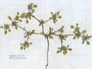
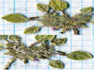
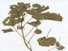
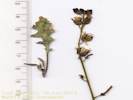
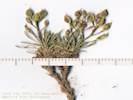
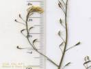
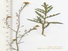
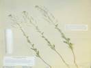
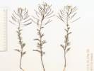
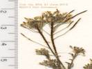
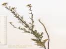
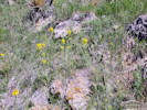
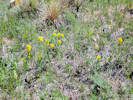
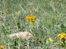

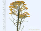
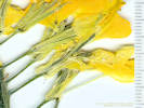

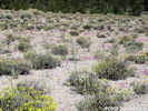
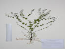
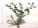
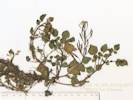

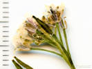
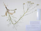
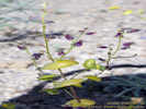
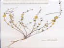
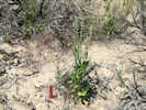
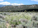
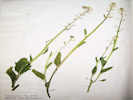

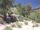
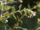
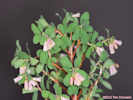
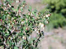
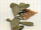
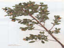


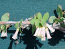
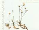
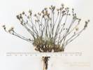
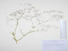
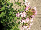
Hypanthium (??), disk-like (??)
Carphophore, 1 mm.;
Petals,
9 mm. × 3 mm. wide, clawed?, notched,
white fading to light yellow,
united at base (??);
Anthers,
#10?, didymous?, white, inserted;
Ovary,
superior,
3 mm. × 1.8 mm.,
Styles, #3, exserted
(Described from Coll. No. 3352, 25 July 2024).
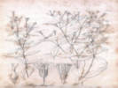
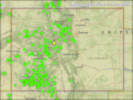
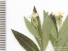
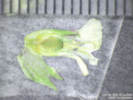
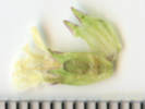

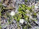
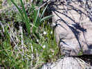
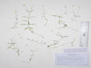

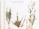
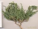
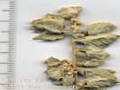
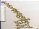

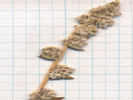


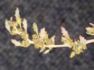
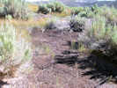
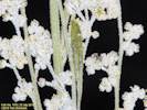
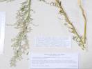
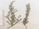

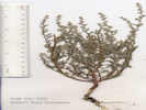

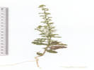
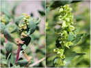


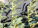
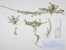
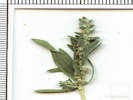

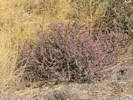


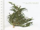
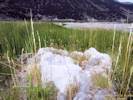
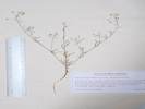
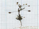
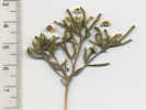
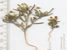
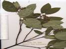
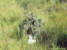
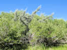
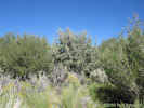
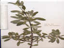


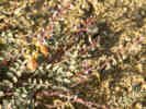
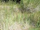
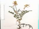


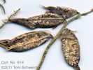
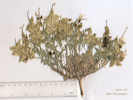

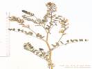
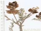

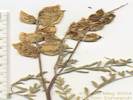

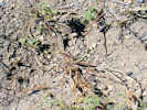
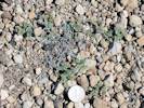
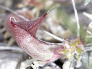
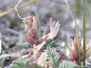
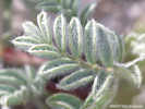
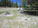
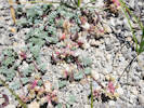


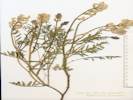
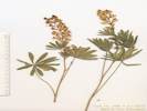

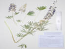
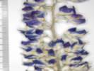
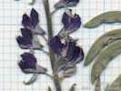
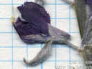
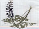
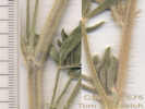


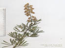

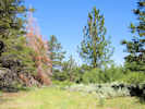
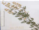


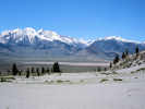
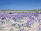
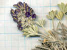
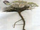
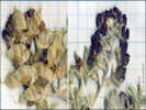
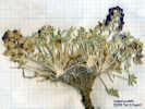

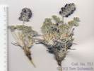
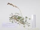
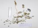


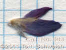
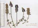

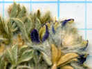
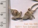
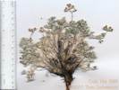


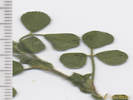
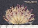
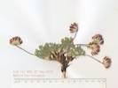
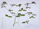
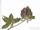
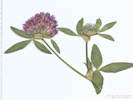
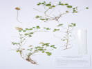
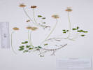
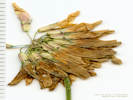
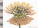
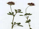
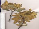
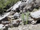
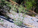
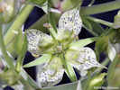
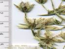
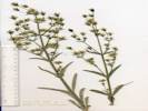
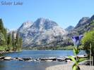
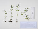
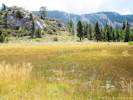

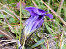
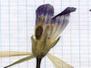
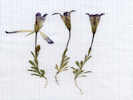
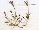



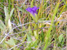
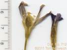
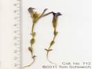
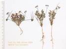
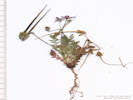
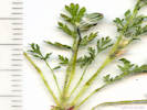

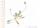

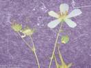

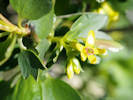

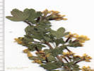
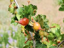
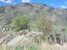
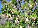
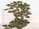
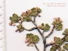
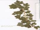
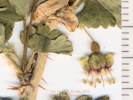
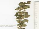
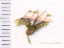
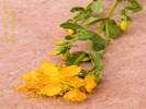
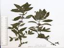
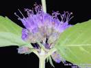
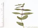
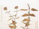

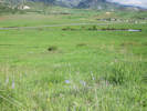
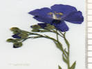
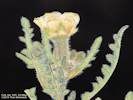


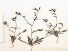
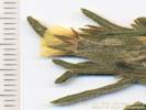
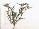
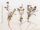
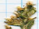
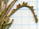

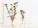
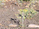
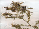
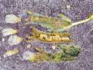
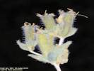
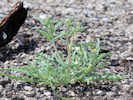
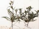


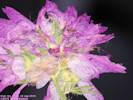


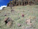
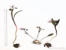
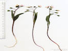
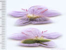
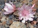

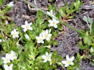
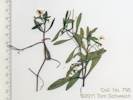
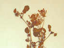
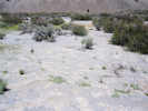

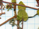
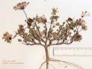
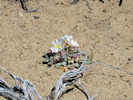

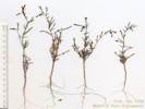
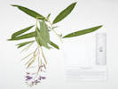
Nearly all the collections of Epilobium in the Mono Lake basin are of E. ciliatum ssp. ciliatum.
0. Leaves generally alternate; hypanthium 0; petals entire; stamens ± equal, in 1 whorl; pollen blue-gray, shed singly. . . . . . Chamerion (Fireweed)
0' Leaves opposite at least at base; hypanthium 0.3–34 mm.; petals notched; stamens in 2 unequal whorls; pollen cream, grains generally shed in 4s. . . . . . Epilobium (Willow Herb)
1' Annual from taproot; leaves opposite only near base, alternate or clustered distally, ± narrowly lanceolate; proximal stem generally peeling. . . . . . none collected in Mono Lake basin.
1' Perennial to subshrub from caudex, taproot 0; leaves generally opposite up to inflorescence, generally (narrowly) lanceolate to ovate; proximal stem not peeling; sepals 1–17.5 mm.; hypanthium generally 0.4–8(16) mm.; petals 1.6–14 mm., white to rose-purple; stigma entire, club-like (occ cylindric).
2. Stem ± erect, with offset rosettes or fleshy underground shoots; leaf veins conspicuous; seed ridged. . . . . . E. ciliatum
3. Petals 2-6(9) mm., white to pink; leaf lanceolate, reduced in open inflorescence -- basal rosette present. . . . . . ssp. ciliatum
3' Petals 4–14 mm., pink to rose-purple; leaf lanceolate to ovate, little reduced on crowded inflorescence; stem with fleshy shoot, inflorescence long. . . . . . ssp. glandulosum
2' Stem ± ascending, clumped, or cespitose; leafy or thread-like stolons sometimes tipped by fleshy bulblets; plant ± glabrous (except scattered inflorescence hairs); plant < 8.5 dm., clumped; stolons short, scaly; pedicels 5–25 mm.; inflorescence crowded (bracts ±= internodes); leaf tip subacute; Lundy Lake. . . . . . E. glaberrimum
Epilobium L. Willowherb. CalPhotos. Jepson eFlora. SEINet Taxon.
Annual, to 1 dm, glabrous; Leaves opposite, to 3 cm, 1 cm wide; Ovary inferior; Sepals 4, 3 mm; Petals 4, white to rose; Stamens 2 x 4 = 8, unequal; Stigma entire (Described from Coll. No. 690.1, 8 Nov 2011).
- Cottonwood Canyon,
at the shack
Tom Schweich 841.
20 Jun 2012.
.
.
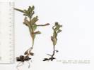
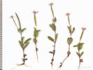
Epilobium ciliatum Raf. Fringed Willowherb. CalPhotos. Jepson eFlora. SEINet Taxon.
- Cottonwood Canyon, At small spring and miner's cabin 0.6 mi (1 km) south southwest of Sugarloaf. Tom Schweich 690.1 25 Jul 2010. ( UC ) .
- Lee Vining Creek,
On a former beach strand of Mono Lake, now exposed by falling lake levels, in the delta of Lee Vining Creek, 2.75 km northeast of the GNIS location of Lee Vining.
Tom Schweich 1186.
25 Jun 2015.
(
UC2046098‡
)
.
.
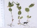
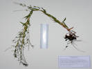
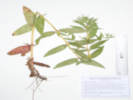
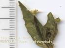

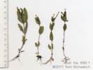

Epilobium ciliatum Raf. ssp. ciliatum. (Syn: E. adenocaulon Hausskn. ) Fringed Willowherb. CalPhotos. Jepson eFlora. SEINet Taxon.
Perennial, to 60 cm.; Roots, tap and fibrous; Stem erect, or ascending after being broken; Leaves basal rosette (expected, not seen), veins conspicuous, opposite up to inflorescence, lanceolate, 33 mm. × 9 mm., reduced in open inflorescence, lanceolate, 11 mm. × 3 mm., glabrous, margins slightly toothed; Inflorescence crowded, leafy, flat-topped, pedicels and buds strigose; Sepals 4, deciduous after flowering; Hypanthium 2 mm.; Corolla, white (cream) to pink; Petals 4–6 mm., white to pink; Stigma entire, club-like or cylindric; Fruit long 50 mm., narrow 1.3 mm. dia.; Seed 1.2 mm., ridged, hair-tufted; (Described from Coll. Nos. 136.1, 848, and 1008).
- Bohler Canyon, Wet meadow along the creek in Bohler Canyon, about 2.0 mi (3.1 km) by air west of US Highway 395, in grasses and sedges at creekside. Tom Schweich 511. 2 Aug 2007. ( CAS UC1973767‡ ) .
- Dry Creek, Associated with Carex and Poa Upper Dry Creek Spring Jack L. Reveal 1003. 18 Jul 1964. ( NY1001461† ) .
- June Mountain Ski Lodge, Creekside. Hwy. 158 June Mt. Ski Lift, 1 mi. S of June Lake city limits. Wendell Wood 232. 8 Aug 1970. ( HSC12520† ) Creekside. Hwy. 158 June Mt. Ski Lift, 1 mi. S of June Lake city limits Wendell Wood 297. 8 Aug 1970. ( HSC12520† ) .
- Lundy, 8000-9000 ft vicinity of Lundy Miss Maud Minthorn 1904. 15 Jul 1908. ( UC422934† ) .
- Mill Creek, In a gravel bar of Mill Creek, about 245 m north of the Cemetery Road crossing. Tom Schweich 848. 21 Jun 2012. ( UC ) .
- Mono Basin, as Epilobium adenocaulon Hausskn. 647. 647. Winkler, David W., 1977 .
- Mono Lake County Park, wet meadows and willow thickets northwest shore of Mono Lake, Mono Lake County Park Dean Wm. Taylor 7662. 3 Sep 1979. ( JEPS89977† ) .
- MBRG P-8, Observation per MBRG voucher, as Epilobium adenocaulon Hausskn. 741. 741. .
- MBRG P-9, Observation per MBRG voucher, as Epilobium adenocaulon Hausskn. 765. 765. .
- MBRG Q-1 "Mono Park", Observation per MBRG voucher, as Epilobium adenocaulon Hausskn. 732. 732. .
- Mono Lake, northwest shore (as a col. locality), Also at this location but not collected, Salix exigua, Ranunculus cymbalaria, and Melilotus alba. In the delta of Mill Creek, on the northwest shore of Mono Lake. Tom Schweich 1008. 22 Jul 2013. ( OBI104317‡ ) .
- Mono Vista Spring, marshy area Mono Vista Springs northwest shore of Mono Lake Malcolm A. Nobs and S. Galen Smith 1709. 1 Sep 1949. ( POM312603† UC1191742† ) .
- Rush Creek, "Marsh Plant Survey of California" Rush Creek Herbert L. Mason 13656. 4 Sep 1948. ( UC1191745† ) .
- Tioga Lodge,
Tioga Lodge, Mono Lake.
L. S. Rose 50178.
25 Jul 1950.
(
RSA74538†
SBBG29165†
)
wet bank of ditch
bank of ditch 5 miles north of Tioga Lodge
Philip A. Munz 24290.
13 Sep 1960.
(
RSA142720†
UC1188099†
)
.
.

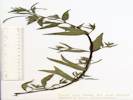
Epilobium ciliatum Raf. ssp. glandulosum (Lehm.) Hoch & P. H. Raven. (Syn: Epilobium glandulosum Lehm. ) Fringed Willowherb. CalPhotos. Jepson eFlora. SEINet Taxon.
- Mono Inn, Damp ground near lake-margin. Near Mono Lake. At Mono Inn. Frank W. Peirson 7579. 28 Jul 1927. ( RSA72168† ) .
- Sulphur Pond, Sarcobatus vermiculatus scrub bordering warm sulphur spring outflow, with a few Salix exigua thickets. Mono Basin, Sulphur Pond, about 1.5 miles east of northeast shore of Mono Lake. Dean Wm. Taylor 16836. 13 Jul 1998. ( JEPS101752† ) . .
Epilobium glaberrimum Barbey. Glaucus Willowherb. CalPhotos. Jepson eFlora. SEINet Taxon.
- Lundy Lake, Lundy Lake. Doris Bowers 416. 6 Jul 1966. ( RSA788409† ) . .
Eremothera boothii (Douglas) W.L. Wagner & Hoch. (Syn: Camissonia boothii (Douglas) Raven ) Booth's Evening Primrose. CalPhotos. Jepson eFlora. SEINet Taxon.
- Mono Basin, as Oenothera boothii Douglas. Booth's Evening Primrose. 649. 649. Winkler, David W., 1977 .
- MBRG P-1, Observation per MBRG voucher, as Oenothera boothii Douglas. Booth's Evening Primrose. 800. 800. . .
Eremothera boothii (Douglas) W.L. Wagner & Hoch ssp. alyssoides (Hook. & Arn.) W.L. Wagner & Hoch. (Syn: Camissonia boothii (Douglas) P. H. Raven ssp. alyssoides (Hook. & Arn.) P. H. Raven ) Pine Creek Evening Primrose. CalPhotos. Jepson eFlora. SEINet Taxon.
- Dechambeau Ranch, sandy volcanic gravels on dry sagebrush flat near Dechambeaus Ranch about 1.5 miles north of Black Point, Mono Lake Carl W. Sharsmith 8710. 5 Jul 1982. ( SJSU9731† ) .
- Mono Basin, as Oenothera alyssoides Hook. & Arn. 650. 650. Winkler, David W., 1977 .
- Mono Lake, south shore (as a collection locality), gravelly pumice sands south shore of Mono Lake Carl W. Sharsmith 5480. 5 Aug 1946. ( SJSU13314† ) . .
Eremothera boothii (Douglas) W. L. Wagner & Hoch ssp. boothii. (Syn: Camissonia boothii (Douglas) Raven ssp. boothii ) Booth's Evening Primrose. CalPhotos. Jepson eFlora. SEINet Taxon.
- Black Point, Great Basin Sage Scrub with Prunus andersonii, Artemisia tridentata, Leptodactylon pungens. Black basalt lava sands with light colored pumice on slopes of lava flows. Black Point parking lot, N side of Mono Lake David Charlton 202. 17 Apr 1986. ( UCR48844† ) near foot of black pumice hill north shore of Mono Lake Frank W. Peirson 9198. 12 Aug 1930. ( RSA75375† ) slopes of the black pumice hill Low lake terrace near the black pumice hill, north shore Mono Lake; elev. 6450 ft Frank W. Peirson 10763. 1 Aug 1933. ( RSA75374† UC511801† ) .
- Dechambeau Ranch, Veg. Type: Mzl, flat 9/10 mile east southeast of Dechambeau's Ranch T. M. Hendrix 610. 30 Aug 1937. ( UC1122148† ) .
- Mono Craters, among low chaparral on north slope Frank W. Peirson 31 Jul 1933. ( JEPS31551† ) .
- Mono Lake, sandy plain near Lake Mono Chesnut and Drew 18 Jul 1889. ( UC35396† ) .
- Panum Crater, sandy pumice flats in Purshia tridentata-Artemisia tridentata tridentata scrub MONO BASIN: Test Station Road at N base Panum Crater Dean Wm. Taylor 16744. 1 Jul 1998. ( JEPS101754† ) .
- Rush Creek, Rush Creek Road on the north side of the crossing of Rush Creek, 0.6 mi (1.0 km) southwest and upstream of Test Station Road. . Tom Schweich 526. 2 Aug 2007. ( UC1973754‡ ) . .
Eremothera boothii (Douglas) W.L. Wagner & Hoch ssp. intermedia (Munz) W.L. Wagner & Hoch. (Syn: Camissonia boothii (Douglas) P. H. Raven ssp. intermedia (Munz) P. H. Raven ) Booth's Hairy Evening Primrose. CalPhotos. Jepson eFlora. SEINet Taxon.
Annual, 8-11 cm.; Stem, 1+ mm. dia., decumbent to ascending, tomentose below to thinning above; Stipules absent; Leaves, basal and cauline, rosette present at flowering, much reduced above, oblanceolate, largest 30 mm x 12 mm, margin entire; Sepals 3 mm., opening separately, deciduous after flowering; Hypanthium 3 mm.; Petals 4, 5 mm., white fading pink; Stamens 8; Stigma 1mm., spherical; Fruit, sessile, to 20 mm. x 1.2 mm. wide at base, wider proximally; Seed, 1.5 mm. x 0.5 mm. wide, elliptical, not-winged, glabrous (Described from Coll. No. 386, keyed 12 Dec 2012).
- Dechambeau Ponds, near edge of salt grass meadow; nectoar source of pseudocopaeodes eunus (Lepidoptera; Hesperiidae) Dechambeau Hot Spring, near north shore of Mono Lake Derham Giuliani 1. 6 Jul 1984. ( RSA639621‡ ) .
- Mono Craters, among low chaparral on north slope Frank W. Peirson 31 Jul 1933. ( JEPS86232† ) .
- Rush Creek delta,
On a former gravel beach bar of Mono Lake, now incised by Rush Creek because of dropping lake levels.
Rush Creek delta near the Mono Lake shoreline, 1 km north northeast of the intersection of Forest Roads 01N51 “South Tufa Road” and 01N50 “Rush Creek Road”, 5.8 km east of Lee Vining.
Tom Schweich 1178.
25 Jun 2015.
(
UC2046100‡
UCR265728‡
)
.
.
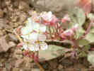
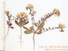


Gayophytum decipiens H. Lewis & Szweyk. Deceptive Groundsmoke. CalPhotos. Jepson eFlora. SEINet Taxon.
- Bloody Canyon, Chesnut and Drew 20 Jul 1889. ( UC73312† ) .
- Lundy, 8000-9000 ft vicinity of Lundy Miss Maud Minthorn 28. 20 Jun 1908. ( UC422810† ) .
- Mono Mills,
lower border of Pinus ponderosa jeffreyi belt, in sagebrush covered flat at edge of exten. sand flat
4 miles north of Mono Mills, south of Mono Lake
L. R. Abrams and David D. Keck 2879.
30 Jun 1934.
(
UC532135†
)
.
.
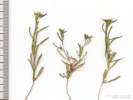
Gayophytum diffusum Torr. & A. Gray ssp. parviflorum H. Lewis & Szweyk. Spreading Groundsmoke. CalPhotos. Jepson eFlora. SEINet Taxon.
- Big Sand Flat, Broad sand flat of coarse pumice soil, bordered by Pinus jeffryi forest on S, Atremesia tridentata scrub on N, with few shrubs on flat. Big Sand Flat; along Hwy 120, near turnoff to Crooked Meadows (FS. Rd. 1S17). Michael Honer 1355. 25 Jul 2001. ( RSA700815† ) About 1.5 km north of Big Sand Flat, on the hill with a monument named "Sand." Tom Schweich 608. 22 Jun 2010. ( CAS UC1973710‡ ) .
- Bohler Canyon, Dry edges of wet meadow along the dirt road on the south side of Bohler Canyon, 1.8 mi (3.0 km) by air west of US Highway 395. Tom Schweich 505. 2 Aug 2007. ( CAS UC1973769‡ ) .
- East Craters Sand Flat, Dry open pumice flat surrounded by Pinus jeffrfyi / P. contorta forest. SE arm of East Craters Sand Flat, as it is crossed by FS Rd. 1S06. Michael Honer 1507. 26 Aug 2001. ( RSA688029† ) .
- Lee Vining Creek, Alice M. Ottley 1093. 6 Jul 1920. ( JEPS27575† ) .
- Lee Vining Canyon, Lee Vining Creek near Nevada and California Power Company. Alice M. Ottley 1093. 6 Jul 1920. ( UC1554396† ) .
- Sagehen Meadow,
Common on disturbed margins of meadow.; Gently E-sloping heavily grazed dry meadow of soft silty pumice alluvium over granitic bedrock. Uplands of Artemisia tridentata / Purshia tridentata scrub.
GLASS MOUNTAIN REGION Sagehen Meadow area; along 4WD road running S from Gaspipe Spring and Hwy 120 as it crosses dry springfed drainages. Appx. 1/2 mi. NE of Sagehen Spr. campground.
Michael Honer 981.
21 Jun 2001.
(
RSA685450
)
.
.

Gayophytum ramosissimum Torr. & A. Gray. Pinyon Groundsmoke. CalPhotos. Jepson eFlora. SEINet Taxon.
- Mono Basin, 648. 648. Winkler, David W., 1977 .
- Mono Mills, in sagebrush-covered flat at edge of extensive sand flat, lower border of P. ponderosa jeffreyi belt 4 miles north of Mono Mills, south of Mono Lake David D. Keck and L. R. Abrams 2880. 30 Jun 1934. ( UC532090† ) .
- Pumice Valley,
Great Basin scrub, recently burned.
Mono Lake, along Mono Lake Basin Road, about 3 miles S of the lake and 2.5 miles from the junction of Hwy.
J. M. Porter, Laren Machen 15110.
27 May 2012.
(
RSA803564†
)
.
.

Oenothera cespitosa Nutt. ssp. marginata (Hook. & Arn.) Munz. Tufted Evening Primrose. CalPhotos. Jepson eFlora. SEINet Taxon.
- Mono Basin, With Pinyons (no Junipers), Sagebrush, Bitterbrush, and Ephedra, in the mixed sandy and rocky ground where the foot of the Bodie Hills meets the Mono Dunes. Along Goat Ranch Road, 3.25 miles east northeast of the intersection of US Highway 395 and California Highway 167 (sometimes called Pole Line Road). Tom Schweich 760. 19 Jun 2011. ( UC1980486‡ ) .
- Mono Valley,
In a slowly filling sand depression of the former railway roadbed.
About 1 km south of California Highway 167 on Forest Road 03N103, which parallels the former Bodie & Benton Railway roadbed.
Tom Schweich 1166.
24 Jun 2015.
(
CAS1205204‡
UCR265707‡
)
.
.

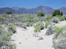
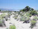

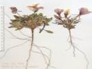

Oenothera deltoides Torr. & Frémont ssp. cognata (Jeps.) W. M. Klein. Birdcage Evening-Primrose. CalPhotos. Jepson eFlora. SEINet Taxon.
- Mono Basin, Associated with Artemisia and Purshia "University of Arizona Annotation Label: This specimen was used in the dissertation research of Margaret E. K. Evans in the Department of Ecology and Evolutionary Biology at the University of Arizona. The locality information was used to locate nearby; 1/4 mile north of highway 31 (Pole Line Road) 3 miles east of Hwy 395 on old sand beach soil of Mono Lake J. L. Reveal 75. 30 May 1962. ( NY998625† ) . .
Oenothera elata Kunth ssp. hirsutissima (S. Watson) W. Dietr. Hooker's Evening-Primrose. CalPhotos. Jepson eFlora. SEINet Taxon.
- Cain Ranch, Great Basin Province; East of Sierra Nevada region Highway 395: Near Cain Ranch, south of LeeVining. Elev. 6800 Feet. Mary DeDecker 913. 12 Jul 1958. ( RSA617247† ) .
- Dechambeau Creek, Mono Basin, beside Dechambeau Creek, 0.5 mi. W of Hwy. 395, PLSS: 02N25E24. Tim Messick 1211. 19 Jul 1980. ( HSC77218† ) .
- Lee Vining Ranger Station, On dry gravelly moraine hillside. Associated with Artemisia and Chrysothamnus. At the Lee Vining Ranger Station. J. L. Reveal 158. 16 Jul 1962. ( NY998667† ) .
- Lundy, 8000-9000 ft vicinity of Lundy Miss Maud Minthorn 8 Aug 1908. ( UC148749† ) .
- Mono Lake, Mono Lake B. D. Rogers Aug 1964. ( HSC16489† ) .
- Walker Creek (Lower), Just below the aqueduct road on the north side of Walker Creek. Tom Schweich 517. 2 Aug 2007. ( UC1973761‡ ) . .
Taraxia tanacetifolia (Torr. & A. Gray) Piper. (Syn: Camissonia tanacetifolia (Torr. & A. Gray) P. H. Raven ssp. tanacetifolia ) Tansy-Leaved Suncup. CalPhotos. Jepson eFlora. SEINet Taxon.
- Conway Summit, growing in open summit of grade north of Mono Lake Frank W. Peirson 6150. 29 Jun 1925. ( UC635275† ) .
- Grant Lake, Growing on former lake bed recently exposed by falling lake levels due to drought. Near the south end of Grant Lake on the east side, near the south end of Forest Road 01S30 “Grant Lake Road.” Tom Schweich 1195. 26 Jun 2015. ( CAS1205201‡ CS OBI83187‡ RENO87069‡ UC2046097‡ UCR267675‡ ) .
- Reversed Peak,
On the drying shore of natural ponds called "Snow Ponds" by local residents, south flank of Reversed Peak, about 1 mile northwest of Gull lake.
Tom Schweich 561.
14 Aug 2008.
(
UC1953405‡
)
.

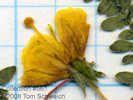
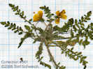
Orobanchaceae
Castilleja applegatei Fernald ssp. pallida (Eastw.) Chuang & Heckard. Wavy-Leaf Indian Paintbrush. CalPhotos. Jepson eFlora. SEINet Taxon.
- Walker Lake, Willis Linn Jepson 4443. 18 Jul 1911. ( JEPS9051† ) . .
Castilleja applegatei Fernald ssp. pinetorum (Fernald) T. I. Chuang & Heckard. Wavy-Leaf Indian Paintbrush. CalPhotos. Jepson eFlora. SEINet Taxon.
- Sagehen Meadow,
North of Sagehen Meadow among sagebrush.
Tom Schweich 666.
16 Jul 2010.
(
CAS1120823‡
UC1973695‡
)
.
.
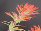
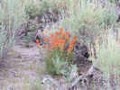
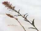
Castilleja chromosa A. Nelson. Desert Indian Paintbrush. CalPhotos. Jepson eFlora. SEINet Taxon. C. angustifolia (Nutt.) G. Don is a name that in California has been misapplied to pls belonging instead to C. chromosa A. Nelson. However, it is not a synonym for C. chromosa A. Nelson.
Perennial subshrub, green, growing out of Artemisia tridentata, or in pinyon-juniper woodland, to 25-40 cm.; Hairs simple throughout; Leaves alternate, sessile, 30-50 mm. × 5 mm. wide, lanceolate to 5-lobed distally, not fleshy, short simple hairy; Inflorescence reddish, not glandular; Bract, 17 mm., 3- or 5-lobed; Calyx, 17-18 mm., divided equally 4-5 mm. (24-28%), lobes not curved upward; Corolla, tube 10-11 mm. + beak 10-13 mm. = 20-24 mm., straight, not curved through abaxial side of side of calyx sinus, upper lobes tip open, projected forward, lower lip small teeth, beak greenish yellow above and reddish below; Stamens, 4, fused in pairs; Anther, sacs per stamen obscured by twinning, looks like at least 3 sacs per pair of stamens; Stigma, lobes obscured by pollen (Described from Coll. No. 217, 27 April 2000 and Coll. No. 422, 26 May 2004).
- Aeolian Buttes, on rocky outcrop 2 miles east of Highway 395, south of the old Mono Highway, Forest Service No. 1S09 James L. Reveal 341. 12 Jun 1962. ( UC1338580† ) .
- Grant Lake, among sagebrush, slopes west of Grant Lake, east of the Sierran escarpment Rimo Bacigalupi (with L. R. Heckard) 3504. 11 Aug 1951. ( JEPS7470† ) .
- Lee Vining Canyon, 4.3 miles west of Lee Vining Canyon junction with U. S. Hwy 395 L. T. Dempster 1079. 13 Jun 1957. ( JEPS17858† ) near foot of grade in Lee Vining Canyon R. F. Hoover 5407. 5 Jul 1941. ( UC765571† ) .
- Lundy Canyon, on talus slope, in canyon (Date is probably August 10, 1951 -- Ed.) about 2.5 miles east and below Lundy, in canyon leading to Lundy Lake Rimo Bacigalupi (with L. R. Heckard) 3500. 10 Apr 1951. ( JEPS8005† ) .
- Mono Basin, sandy granitic mountain slope, 7700 - 7800 ft Route 395 north of Mono Lake Francis W. Pennell 25904. 15 Jun 1940. ( UC1012210† ) growing up in Artemisia tridentata shrub along U. S. Highway 395 0.5 miles north of June Lake Junction Rimo Bacigalupi and Tsan Iang Chuang 8907. 31 Jul 1963. ( JEPS34430† ) .
- Mono Lake (southwest sector), Sagebrush Scrub, pumice soil. on south side of graded road, south side of Mono Lake about 5 miles east of Lee Vining M. S. Taylor 4863. 17 Jul 1982. ( CHSC37296† JEPS81454† ) Along Test Station Road, about 0.75 mi east southeast of Rush Creek, and 0.9 mi west northwest of the South Tufa parking area. Tom Schweich 955. 21 May 2013. .
- Pumice Valley, in rocky soil of openings in shrubs 2 miles north of U. S. Hwy 395, at Forest Service Road 1530, north entrance of June Lake Loop Road L. R. Heckard with T. I. Chuang 6752. 12 Jul 1990. ( JEPS86673† ) .
- Sagehen Meadow Campground, parasitizing Linanthus pungens among bitterbrush and Jeffrey pines. about 1 mile south of Sagehen Meadow Campground on Forest Road 01S160, Tom Schweich 639. 5 Jul 2010. ( CAS UC1973785‡ ) .
- Tioga Lodge,
east-facing slope
2 miles north of Mono Lake Post Office
Joseph and Hilda W. Grinnell 1068.1
17 Jun 1937.
(
UC569645†
)
.
.
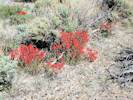
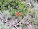

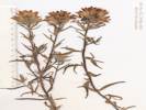
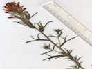
Castilleja linariifolia Benth. Wyoming Indian Paintbrush. CalPhotos. Jepson eFlora. SEINet Taxon.
Annual/perennial unknown, to 50 cm., plants of dry places, growing out of Artemisia; Stem and leaf glabrous; Leaf, linear, proximal 60 mm. × 2 mm. wide, margins curled up, length reduced distally to 15 mm, occasionally 3- or 5-lobed; Inflorescence, simple hairy; Bracts, 3-lobed, <calyx; Calyx, 26 mm., divided 14/26 (54%) abaxially and undivided adaxially, lobes curved upward; Corolla curved out through abaxial calyx sinus, beak described as sparsely puberulent, but unable to see in this collection (Described form Coll. No. 439, 31 Jul 2004).
- Grant Lake, growing among sagebrush, slopes west side of Grant Lake Rimo Bacigalupi (with L. R. Heckard) 3503. 11 Aug 1951. ( JEPS8004† ) .
- June Lake, Mrs. J. D. Wright 5 Jul 1929. ( SBBG66902† ) .
- Lee Vining Canyon, in gravel at foot of grade foot of Lee Vining Grade Jens Clausen 794. 23 Aug 1933. ( UC532108† ) .
- Lundy Canyon, in rocky soil in an aspen covered canyon bottom with a sparse Jeffrey pine forest on its borders Ernest C. Twisselmann 5757. 14 Sep 1959. ( JEPS31046† ) .
- Mono Basin, in seepage from hill above, growing mixed with C. miniata along U. S. Highway 395 at base of Conway Grade, 1.7 miles north of the Conway Grade junction with Lundy Lake Road Rimo Bacigalupi (with L. R. Heckard) 3499. 10 Aug 1951. ( JEPS8006† ) .
- Silver Lake,
Frank W. Peirson 6099.
26 Jun 1925.
(
UCR136637†
)
Lewis S. Rose 40740.
3 Jul 1940.
(
UC885298†
)
.
.
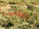
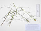

Castilleja miniata Hook. ssp. miniata. Giant Red Indian Paintbrush. CalPhotos. Jepson eFlora. SEINet Taxon.
Perennial herb 45-50 cm; Stems ascending, hairs unbranched, not glandular below spike; Leaves opposite below, alternate above, 70 mm. × 3 mm. wide, reduced above, lance-linear, entire; Inflorescence glandular hairy, reddish; Bract, unlike leaves, 27 mm., lobes 3; Calyx cleft equally half-way on dorsal (adaxial) and ventral (abaxial) side; Corolla, 40 (Described from Coll. No. 897, 24 August 2012, and Coll. No. 1182, 25 June 2015. See also Coll. No. 1467, which may be C. miniata × rhexifolia.).
- Bohler Canyon, In wet areas along the dirt road on the south side of Bohler Canyon, 1.8 mi (3.0 km) by air west of US Highway 395. Tom Schweich 500. 2 Aug 2007. ( CAS UC1973780‡ ) .
- June Lake, Mrs. J. D. Wright 5 Jul 1929. ( POM161161† ) Moist stream bank. (GoogleMaps via BerkeleyMapper (copied from RSA406448)) N. C. Cooper 2736. 31 Aug 1944. ( RSA448747† ) .
- Lee Vining, Stream banks. L. S. Rose 68146. 17 Jul 1968. ( RSA448742† ) .
- Lee Vining Creek, On a former beach strand of Mono Lake, now exposed by falling lake levels, in the delta of Lee Vining Creek, 2.75 km northeast of the GNIS location of Lee Vining. Tom Schweich 1182. 25 Jun 2015. ( CS OBI83186‡ UCR267668‡ ) .
- Lee Vining Canyon, Moist rocky cliff-base. Stems several from the base, usually simple. Spikes Vermilion; bracts 3-lobed, the Vermilion lobes long attentuate, the central one broadest and strongly nerved or sub-carinate. Leevining Grade. D, D, Keck 4477. 22 Aug 1936. ( POM256743† ) [ [4477. Calyx more deeply lobed anteriorly by ca. 6 mm, its lobes long attentuate; galea exerted, greenish except for narrow pale vermillion sides, the margin dilated-thickened; lower-lip dark green only 2 mm. long including the strongly incurved falcate teeth. Frequent from elev. of 2134m. (7000ft.)] ] damp sandy hillside Lee Vining Canyon Road G. Witherspoon 2074. 21 Jun 1940. ( SJSU566† ) meadow, slope flat Mt. Lyell 2 miles above Lee Vining H. S. Yates 6281. 22 Aug 1936. ( UCSC667† ) In partial shade. Bracts scarlet, yellow projecting corolla. Leevining Canyon, n.e. of Yosemite. M. A. Chrysler 1093. 17 Aug 1934. ( RSA104079† ) Sunny bank. Bracts deep scarlet. Leevining Canyon, n.e. of Yosemite. M. A. Chrysler 2002. 17 Aug 1934. ( RSA104080† ) .
- Lee Vining Ranger Station, On wet loam soil, Assoc. with Carex, near Salix, and C. stenantha Gray. Along Lee Vining Creek at the Lee Vining Ranger Station, from the lower end of the campground, PLSS: 01N26E17 Jack Reveal, James L. Reveal 9 Jun 1962. ( RSA220764† ) .
- Lundy Lake, Robert M. Perkins 286. 15 Aug 1936. ( RSA448744† ) .
- Mono Basin, in seepage from hill above along U. S. Highway 395 at base of the Conway Grade, 1.7 miles north of U. S. Highway 395 junction of road leading to Lundy Lake Rimo Bacigalupi (with L. R. Heckard) 3498. 10 Aug 1951. ( JEPS8007† ) .
- Mono Lake, Alice M. Ottley 1066. 5 Jul 1920. ( JEPS9773† ) Upper Sonoran zone. Granite soil. Meadow. Mono Lake, Sierra Nevada, Mono Lake Watershed. Lyman Benson 3809. 1 Jul 1932. ( POM283562† ) .
- Mono Lake, west of (as a collection locality), west Mono Marsh near Mono Lake Herbert L. Mason 15231. 9 Aug 1963. ( UC1275796† ) .
- Rattlesnake Gulch, About 300 m east of the GNIS location of Mono Diggings, 10.6 miles by road north of Lee Vining. Tom Schweich 897. 24 Aug 2012. ( CAS1157592‡ UC ) .
- Reversed Creek, wet places under cottonwood and aspen at foot of high granitic cliffs near Reversed Creek between Gull Lake and Silver Lake L. Constance 2442. 9 Aug 1938. ( UC614498† ) .
- Rush Creek (in Horseshoe Canyon), Hillside next to spring. above Upper Rush Creek between Grant and Silver Lakes Wendell Wood 214. 15 Jul 1970. ( HSC12505† ) .
- Silver Lake, Dry canyon slope. West of north end of Silver Lake. Frank W. Peirson 7467. 27 Jul 1927. ( RSA82247† ) .
- Walker Lake,
From the J. W. Congdon Herbarium, probably collected by J. W. Congdon
J. W. Congdon
17 Aug 1894.
(
UC103489†
)
.
.
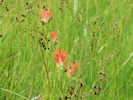

Castilleja minor (A. Gray) A. Gray ssp. minor. (Syn: C. exilis A. Nels. ) Lesser Indian Paintbrush. CalPhotos. Jepson eFlora. SEINet Taxon.
- Lee Vining, sandy grassy soil Near Mono Lake on US Hwy 395 north of Lee Vining Francis W. Pennell 26315. 28 Jul 1940. ( JEPS11709† UC1012457† ) Mono Lake near Lee Vining M. Lewis 615. Aug 1955. ( JEPS19695† ) .
- Mill Creek, in streamside gravel Mill Creek just above its debouchement into Mono Lake Roman Gankin, and Rimo Bacigalupi 247. 30 Aug 1957. ( JEPS18995† ) .
- Mono Basin, as Castilleja exilis A. Nels., a synonym. 423. 423. Jones & Stokes Associates, 1993 as Castilleja exilis A. Nels. 671. 671. Winkler, David W., 1977 Bodie Road at G Ranch (Possibly Goat Ranch - Ed.) Unknown 18 Aug 1898. ( UC26466† ) .
- Mono Lake, Herbert L. Mason 11494. 1 Aug 1936. ( UC1083137† ) Unknown 24 Aug 1895. ( UC103514† ) .
- MBRG P-8, Observation per MBRG voucher, as the synonym C. exilis 744. 744. .
- MBRG P-9, Observation per MBRG voucher, as the synonym C. exilis 763. 763. .
- Mono Lake, west of (as a collection locality), subsaline marshy area By west end of Mono Lake about 2 miles north of Lee Vining Carl W. Sharsmith 8732. 7 Sep 1982. ( SJSU9712† ) .
- Old Marina, On the western shore of Mono Lake. Tom Schweich 494. 1 Aug 2007. ( CAS UC1973779‡ ) .
- Paoha Island, meadow on west shore of Paoha Island A. D. Gifford 877. 20 Aug 1937. ( UC1137474† UC577971† ) .
- Rush Creek, Herbert L. Mason 13651. 1 Sep 1948. ( UC1191866† ) .
- Rush Creek delta, ponds and marshes Rush Creek Wildlife Area southwest shore of Mono Lake Malcolm A. Nobs and S. Galen Smith 1739. 1 Sep 1949. ( UC1191865† ) .
- Tioga Lodge,
lake shore
Edward Lee 2484.
9 Aug 1936.
(
JEPS73330†
)
.
.
Castilleja pilosa (S. Watson) Rydb. (Syn: Orthocarpus pilosus S. Watson ) Parrothead Indian Paintbrush. CalPhotos. Jepson eFlora. SEINet Taxon.
- Sagehen Meadow, USGS quad: Dexter Canyon 7.5' Q.; Uncommon; edge of grassy areas.; Eastern Sierra/ Mono Basin 4.9 mi. SE of Calif. Hwy 120 on Sagehen Meadows Road George K. Helmkamp and E. A. Helmkamp 2322. 10 Sep 1997. ( UCR122319 ) Gently E-sloping heavily grazed dry meadow of soft silty pumice alluvium over granitic bedrock. Uplands of Artemisia tridentata / Purshia tridentata scrub. GLASS MOUNTAIN REGION Sagehen Meadow area; along 4WD road running S from Gaspipe Spring and Hwy 120 as it crosses dry springfed drainages. Appx. 1/2 mi. NE of Sagehen Spr. campground. Michael Honer 980. 21 Jun 2001. ( RSA685451 ) North edge of meadow. Tom Schweich 693. 26 Jul 2010. ( CAS1131466‡ UC1980392‡ ) .
- Walker Lake,
near Walker Lake, at Camp 125 between Mono Lake and the base of the Sierra Nevada, opposite Bloody Canyon (However, compare location with UC27731 - Ed.)
Wm. H. Brewer 1866.
15 Jul 1863.
(
UC26524†
)
.
.
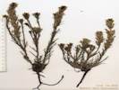
Orobanche corymbosa (Rydb.) Ferris. (Syn: Aphyllon corymbosum (Rydb.) A. C. Schneid. ) Flat-Top Broomrape. CalPhotos. Jepson eFlora. SEINet Taxon.
Parasitic perennial plant, 15 cm., dark-red or purple; Inflorescence branched; Pedicels with bractlets; Calyx lobes 18 mm.; Flowers 15-22; Corolla 24 mm., lower lip 6 mm.; Anthers hairy all over. Described from Coll. No. 1180, 25 Jun 2015.
- Alameda Well, in open places on western slope of vegetation stabilized dune. along Dobie Meadows Road 1 mile (1.6 km) southeast of Alameda Well Tom Schweich 577. 7 Jul 2009. ( CAS1120315‡ UC1973783‡ ) . [ See my images 1960, 1961, and 1962. ]
- Mono Mills, Loose sandy (tephra derived) soils in Purshia tridentata-Artemisia tridentata scrub 3 miles NE of Mono Mills; southeast side of Mono Lake; Inyo National Forest; in vicinity of watertank shown on Cowtrack Mtn. 15' USGS quadrangle, 1962 edition Dean Wm. Taylor 15222. 18 Jul 1995. ( JEPS100257† ) .
- Rush Creek delta,
Open area in loose volcanic cinder soil amid Artemisia tridentata, with some Chrysothamnus and Carex douglasii.
Along a former road to the shore of Mono Lake, now closed and used as a trail, 0.5 km northeast of the intersection of Forest Roads 01N51 “South Tufa Road” and 01N50 “Rush Creek Road”, 5.8 km east of Lee Vining.
Tom Schweich 1180.
25 Jun 2015.
(
CAS1205203‡
UCR265726‡
)
.
.
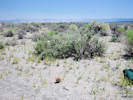


Orthocarpus cuspidatus Greene ssp. cryptanthus (Piper) Chuang & Heckard. Cryptantha Owl's-Clover. CalPhotos. Jepson eFlora. SEINet Taxon.
- Fern Creek, Fern Creek near Silver Lake Mary DeDecker 1500. 22 Jul 1962. ( RSA626641† ) .
- June Lake, Mrs. J. D. Wright 6 Jul 1929. ( SBBG68583† ) .
- Lundy, 8000-9000 ft vicinity of Lundy Miss Maud Minthorn 15 Jul 1908. ( UC148723† ) .
Papaveraceae
Argemone munita Durand & Hilg. (Syn: A. munita Durand & Hilg. ssp. rotundata (Rydb.) G. B. Ownbey ) Flatbud Prickly Poppy. CalPhotos. Jepson eFlora. SEINet Taxon.
- Bloody Canyon, sandy hillside foot of Bloody Canyon Chesnut and Drew 20 Jul 1889. ( UC35229† ) .
- Lee Vining Canyon, Herbage succulent, blue-glaucous; flowers white; plants 1-1.5 feet high. Common on dry hillslopes in decomposed granite or granite talus. Sierra Nevada; Southern Sierra Nevada region | 2 mi. below Warren Creek, a fork of Leevining Creek. Beecher Crampton 270. 10 Jul 1941. ( RSA97470† ) .
- Lundy, 8000-9000 ft vicinity of Lundy Miss Maud Minthorn 1 Sep 1908. ( UC148744† ) .
- Mono Basin, 651. 651. Winkler, David W., 1977 Upper Sonoran; granitic soil; soil slope. Mono Lake watershed; Mono Lake Lyman Benson 209. 1 Jul 1932. ( POM272275† ) Marcus E. Jones 24933. 29 Jun 1929. ( POM192458† ) Marjorie Shaw 30 Aug 1914. ( POM123952† ) .
- Mono Lake, northwest shore (as a col. locality), Plant association with Artemisia tridentata. near Mono Lake C. Simis 19 Jul 1961. ( CHSC1184† ) .
Parnassiaceae
Parnassia palustris L. California Grass of Parnassus. CalPhotos. Jepson eFlora. SEINet Taxon.
- Lundy, 8000-9000 ft vicinity of Lundy Miss Maud Minthorn 8 Sep 1908. ( UC148721† ) .
- Mono Basin, marshy seepage area on western shore of lake Mono Lake about 2.5 miles north of Lee Vining Malcolm A. Nobs and S. Galen Smith 1726. 1 Sep 1949. ( POM312450† UC1191520† ) Camp 121 near Mono Lake Wm. H. Brewer 1832. 9 Jul 1863. ( UC11426† ) .
Phrymaceae
Diplacus bigelovii (A. Gray) G. L. Nesom. (Syn: Mimulus bigelovii (A. Gray) A. Gray ) CalPhotos. Jepson eFlora. SEINet Taxon. These are probably misidentifications of D. mephiticus.
- Big Sand Flat, USA, California, Mono, Inyo National Forest, Big Sand Flat. Ca. 11 mi east of US Highway 395 on State Hwy. 120. Roadside. Kenneth Heil 8626. 16 Jul 1994. ( SJNM ) .
- Pumice Valley, Great Basin scrub, recently burned. Mono Lake, along Mono Lake Basin Road, about 3 miles S of the lake and 2.5 miles from the junction of Hwy. J. M. Porter, Laren Machen 15106. 27 May 2013. ( RSA803560† ) . .
Diplacus mephiticus (Greene) G.L. Nesom. (Syn: Mimulus angustifolius (Greene) A.L. Grant , Mimulus coccineus Congdon , Mimulus densus A.L. Grant , Mimulus nanus Hook. & Arn. var. mephiticus (Greene) D. M. Thomps. ) Skunky Monkey Flower. CalPhotos. Jepson eFlora. SEINet Taxon.
- Big Sand Flat, mesic, lowest gradient position in the flat; deep gray tephra sands along Hwy 120 about 10 miles southeast of Mono Lake Dean Wm. Taylor 16989. 24 Aug 1998. ( UC1731241† ) very sparsely vegetated area Big Sand Flat along CA Hwy 120 at Pilot Spring Road George K. Helmkamp 2328. 10 Sep 1997. ( UCR102565† ) Broad sand flat of coarse pumice soil, bordered by Pinus jeffryi forest on S, Atremesia tridentata scrub on N, with few shrubs on flat. Big Sand Flat along Highway 120 east of Mono Mills Michael Honer 281. 14 Jun 2000. ( RSA682474† ) Broad sand flat of coarse pumice soil, bordered by Pinus jeffryi forest on S, Atremesia tridentata scrub on N, with few shrubs on flat. east of Mono Mills on Hwy 120 within 150 m of south side of FS Road 1S17 to Crooked Meadows Michael Honer 380. 20 Jul 2000. ( NY1246238† RSA681212† ) Also collected at this site: Abronia turbinata, Calyptridium umbellatum, Hulsea vestita, and Lupinus duranii. Collected at the base of the slope on the northwest side of Big Sand Flat, the opposite side of the flat from California Highway 120, about 13 1/2 miles east of US Highway 395. Tom Schweich 465. 25 Jun 2007. ( UC1980446‡ ) Small specimens, growing among sagebrush. Somewhat ambiguous as to var. mephiticus vs. var. nanus. Open slopes above the west end of flat. Tom Schweich 599. 17 Jun 2010. Somewhat ambiguous as to var. mephiticus vs. var. nanus. Above the flat on the north side, bare soil in open areas with Jeffrey pine and sagebrush. Tom Schweich 600. 17 Jun 2010. ( UC1973724‡ ) Open areas among Jeffrey pine, sandy soil. Somewhat ambiguous as to var. mephiticus vs. var. nanus. On top of the north rim of Big Sand Flat. Forest Road 01S19D, about 1/2 mile northeast of Forest Road 01S19 “M&R Tank Road.” Tom Schweich 613. 22 Jun 2010. ( CAS1121587‡ ) .
- Cottonwood Canyon, Rocky slope above rd USA, California, Mono, Cottonwood Cr S of Bodie Annie Alexander and Louise Kellogg 4309. 26 Jun 1945. ( UTC75835† ) Rocky slope above rd USA, California, Mono, Cottonwood Cr S of Bodie Annie Alexander and Louise Kellogg 4310. 26 Jun 1945. ( UTC75839† ) .
- Deadman Summit, Abundant along the rdside in pumice USA, California, Mono, Along Hwy 395 ca 1/2 mi N of Deadman Summit M. J. Williams 76692. 5 Jul 1976. ( UTC173293† ) .
- June Lake, June Lake area, highway 158 at June Lake Junction Kathy Harper 25 Jul 1989. ( UCR62183† ) .
- June Lake Junction, Dry rocky soil in a disturbed area beside highway United States of America, California, Mono Co., Beside Highway 395, 12.8 mi north of the Mammoth Lakes exit. Verbatim Coordinates: 37 47 55.61 N 119 2 27.02 W D. W. McNeal 1967. 7 Jul 1976. ( NY1246215† ) .
- Little Sand Flat, Open pumice flat surrounded by Pinus jeffryi and P. contorta forest. Deep pumice ashfall from Mono Craters W. along 4WD road cutting across south tip of flat Michael Honer 1213. 21 Jul 2001. ( RSA687568† ) .
- Mono Basin, 525. 525. .
- Mono Craters, assoc with Calyptridium umbellatum var caudiciferum & Hulsea vestita in pumice gravels & sands north coulee of Mono Craters Carl W. Sharsmith 8260. 10 Jul 1977. ( SJSU7476† ) in hot dry situations in large artificial ditch east base of Mono Craters Frank W. Peirson 12455. 9 Jul 1938. ( UC599225† ) R. A. Gibbs 1898. ( UC26936† ) in pumice flat Mono Craters east on Benton Road Roxana S. Ferris 12577. 4 Sep 1952. ( JEPS3270† RSA81748† ) .
- Mono Lake, J. W. Congdon 18 Aug 1894. ( NY1246214† ) in pumice sand 1.5 miles south of lake at Mono Tufa reserve turnoff, PLSS location: 1N27E28. M. S. Taylor 4864. 17 Jul 1982. ( CAS915261† JEPS81623† ) Corolla bright purple; in loose pumice in Pinion-juniper woodland with Nama aretioides, Calyptridium roseum, Camissonia parvula and Cryptantha circumscrissa. 1.0 mile E of entrance to Tufa State Reserve on State Highway 120, and S of Mono Lake; ca 10 m. S of roadway R. N. Bowman 3215. 14 Jun 1982. ( CHSC39480† ) .
- Mono Mills, with scattered pine and in completely open places; pumice flats between southeast end of Mono Lake and Mono Craters Arthur J. Cronquist 11084. 25 Jul 1973. ( NY1246234† UC1399880† ) sand flat at lower edge of Pinus jeffreyi belt Carlotta C. Hall 27 Aug 1923. ( UC221330† ) southwest exposure Mono Craters area, near old site of Mono Mills on road from Benton to Lee Vining Charlotte N. Smith 1354. 13 Jun 1965. ( JEPS48106† ) cinder surface from Mono Craters with occasional Pinus jeffreyi in a nearly barren area [about 2 miles northwest of Mono Mills,] along CA Hwy 120, 7.5 miles east of US Hwy 395 George K. Helmkamp 2405. 12 Sep 1997. ( UCR103541† ) Joseph and Hilda W. Grinnell 1059. 16 Jun 1937. ( JEPS15419† UC569601† ) in pumice sand, barren slopes 6 1/2 miles east of US Hwy 395 along CA Hwy 120 Rimo Bacigalupi (with L. R. Heckard) 3505. 11 Aug 1951. ( JEPS8003† ) .
- Panum Crater, in sandy pumice soil south of Mono Lake, south rim of North Crater (Panum Crater -- Ed.) James L. Reveal and Caroline G. Reveal 353. 16 Jun 1962. ( UC1338582† UTC101978† ) .
- Pilot Spring, Somewhat ambiguous as to var. mephiticus vs. var. nanus. In open areas southeast of the spring. Tom Schweich 644. 8 Jul 2010. ( CAS1121644† ) .
- Pumice Valley, Plants not hairy when first collected here on 16 June 2010, see smaller specimen, then hairy when collected 30 Jun 2010, see larger specimen. Along Dross Road to the Mono County Transfer Station. Tom Schweich 626. 30 Jun 2010. very dry sand from the plain to the very summit valley by Mono Lake at foot of Mono Pass Wm. H. Brewer 1821. 7 Jul 1863. ( UC27142† ) .
- Sagehen Meadow, On south-facing slopes in granitic soil, among sagebrush, above the swale. Somewhat ambiguous as to var. mephiticus vs. var. nanus. Tom Schweich 590. 15 Jun 2010. ( UC1973721‡ ) .
- Sulphur Pond,
Sarcobatus vermiculatus scrub bordering warm sulphur spring outflow, with a few Salix exigua thickets
Sulphur Pond about 1.5 miles east of northeast shore of Mono Lake
Dean Wm. Taylor 16837.
13 Jul 1998.
(
UC1731117†
UC1731118†
)
.
.

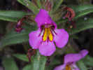
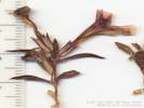
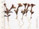
Diplacus nanus (Hook. & Arn.) G.L. Nesom. (Syn: Mimulus nanus Hook. & Arn. ) Dwarf Purple Monkey Flower. CalPhotos. Jepson eFlora. SEINet Taxon.
- Bridgeport Canyon, PLSS: 3N27E24 probably in error, Range should be R26E. 1 mi n Highway 31 (Pole Line Road) - Bridgeport Canyon Jack L. Reveal and James L. Reveal 104. 9 Jun 1962. ( UC1338583† UTC101977† ) [ The collection record at UC is annotated by DWT, "the specimen is cited as var. nanus, [Thompson, David M.], Sys. Bot. Monogr 75, p. 72" ] On upper convex slopes, sandy soil, openings among pinyons. This collection was an attempt to relocate Jack L. Reveal and James L. Reveal #104, 6/9/1962 (UC1338583). Approximately 50 meters west of the stated geographic coordinates and Bridgeport Canyon Road, 0.75 miles north of Goat Ranch Cutoff Road, and 2.70 miles north from California Highway 167. Tom Schweich 601. 20 Jun 2010. .
- Pumice Valley, sandy berm, hybrid with mephiticus? Collector's collection number is 98-66. South side of Hwy 120 2.4 miles east of Hwy 395. S. E. Schoenig 9866. 23 Jun 1998. ( CHSC79581† UC1778580† ) Found on the edge of an area that burned July 26-27, 2010. Most collections at this locality are determined as var. mephiticus, but short lengths of hairs on leaves and calyces of this collection are strongly suggestive of var. nanus. Pumice flats near the north end of Mono Craters, just south of California Highway 120 on Inyo Forest Road 1N11, 3 miles northeast of US Highway 395. Tom Schweich 750. 15 Jun 2011. ( CAS1131371‡ UC1980495‡ ) . .
Throat pouched up, closed. . . . . . E. guttata
Throat ±open. . . . . . E. utahensis
Erythranthe breweri (Greene) G.L. Nesom & N.S. Fraga. (Syn: Mimulus breweri (Greene) Coville ) Brewer's Monkey Flower. CalPhotos. Jepson eFlora. SEINet Taxon.
- Big Bend Campground, corolla entirely yellow; found interspersed in a normal violet-corolla population with yellow corolla plants randomly dispersed. Very rare in depressions among granite boulders about 20 m north of road, about 0.2 miles east of Big Bend Campground and about 2.5 miles west of Lee Vining R. N. Bowman 3210. 13 Jun 1982. ( CHSC37790† CHSC37791† ) .
- Lundy Canyon, 1 1/2 miles above Lundy Lake Rimo Bacigalupi (with L. R. Heckard) 3501. 10 Aug 1951. ( JEPS7468† ) . .
Erythranthe guttata (Fisch. ex DC.) G.L. Nesom. (Syn: Mimulus guttatus DC. ) Seep Monkeyflower. CalPhotos. Jepson eFlora. SEINet Taxon.
- Bohler Canyon, Wet meadow along the dirt road on the south side of Bohler Canyon, 1.8 mi (3.0 km) by air west of US Highway 395. Tom Schweich 504. 2 Aug 2007. ( UC1973770‡ ) .
- June Lake, Near a fresh water spring Lakeview Dr., June Lake Wendell Wood 55. 30 Jun 1970. ( HSC12495† ) .
- Lee Vining, Leevining. Live stream on bank of Mono Lake. N. C. Cooper 2444. 25 Aug 1944. ( DES32041† RSA442792† ) .
- Lee Vining Creek, On a former beach strand of Mono Lake, now exposed by falling lake levels, in the delta of Lee Vining Creek, 2.75 km northeast of the GNIS location of Lee Vining. Tom Schweich 1184. 25 Jun 2015. ( CS OBI83217‡ RENO87137‡ ) .
- Lundy, 8000-9000 ft vicinity of Lundy Miss Maud Minthorn 14 Aug 1908. ( UC446455† ) .
- Lundy Canyon, in cracks of rocks kept wet by seepage 1 1/2 miles above Lundy Lake Rimo Bacigalupi and L. R. Heckard 3502.1 10 Aug 1951. ( JEPS4644† ) .
- Lundy Lake, Lundy Lake. Robert M. Perkins 297. 15 Aug 1936. ( RSA442786† ) .
- Mono Basin, 674. 674. Winkler, David W., 1977 .
- Mono Lake, B. D. Rogers Jul 1964. ( HSC20756† ) by lake G. Ledyard Stebbins 714. 19 Apr 1968. ( UC1462136† ) .
- MBRG P-9, Observation per MBRG voucher 753. 753. Observation per MBRG voucher 872. 872. .
- Mono Lake, west of (as a collection locality), seepage, shelving shore of alkaline lake west shore George B. Rossbach 496. 17 Oct 1954. ( JEPS17968† ) .
- Mono Vista Spring, marshy area Mono Vista Springs, northwest shore of Mono Lake Malcolm A. Nobs S. Galen Smith 1712. 1 Sep 1949. ( UC1191889† ) .
- Rush Creek, Herbert L. Mason 13646. 4 Sep 1948. ( UC1191890† ) .
- Rush Creek delta,
In a former distributary channel of Rush Creek, now drying because of incision of the main channel, due to lowering lake level.
Rush Creek delta near the Mono Lake shoreline, 1 km north northeast of the intersection of Forest Roads 01N51 “South Tufa Road” and 01N50 “Rush Creek Road”, 5.8 km east of Lee Vining.
Tom Schweich 1176.
25 Jun 2015.
(
UCR265729‡
)
.
.
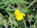
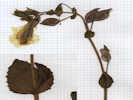
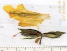


Erythranthe lewisii (Pursh) G.L. Nesom & N.S. Fraga. (Syn: Mimulus lewisii Pursh ) Purple Monkey Flower. CalPhotos. Jepson eFlora. SEINet Taxon.
- Lundy, 8000-9000 ft vicinity of Lundy Miss Maud Minthorn 17 Aug 1908. ( UC446446† ) . .
Erythranthe microphylla (Benth.) G. L. Nesom. (Syn: Mimulus microphyllus Benth. ) Seep Monkey Flower. CalPhotos. Jepson eFlora. SEINet Taxon.
- Old Marina, shallow water of springs dominated by Nasturtium officionale Mono Lake, just north of the town of Lee Vining and about 300 m east of Highway 395 at the site of the old marina Dean Wm. Taylor 11199. 27 Jun 1990. ( UC1755234† ) . .
Erythranthe primuloides (Benth.) G.L. Nesom & N.S. Fraga. (Syn: Mimulus primuloides Benth. ) Primrose Monkey Flower. CalPhotos. Jepson eFlora. SEINet Taxon.
- Cottonwood Canyon, At small spring and miner's cabin 0.6 mi (1 km) south southwest of Sugarloaf. Tom Schweich 690. 25 Jul 2010. ( UC1980396‡ ) .
- Gull Lake, Marshy area west side of Gull Lake, about 50 m west of the Gull Meadows Parking Lot. Tom Schweich 786. 9 Sep 2011. ( CAS1131363‡ UC1980462‡ ) .
- June Lake, wet meadow at the head of June Lake Freda Detmers 27 Aug 1933. ( UCR19598† ) .
- Lundy, 8000-9000 ft vicinity of Lundy Miss Maud Minthorn 134. 6 Aug 1908. ( UC445177† ) .
- Sagehen Meadow,
In the swale draining the meadow, at a log dam intended to reduce erosion.
Tom Schweich 637.
5 Jul 2010.
(
UC1973742‡
)
.
.

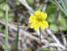
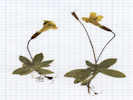

Erythranthe suksdorfii (A. Gray) N.S. Fraga. (Syn: Mimulus suksdorfii A. Gray ) Suksdorf's monkeyflower. CalPhotos. Jepson eFlora. SEINet Taxon.
- Grant Lake Overlook, On the dry sandy edge of a small meadow below Inyo Forest Road 01S31B, about 400 m northeast of Grant Lake Overlook, 2.9 miles south of the Rush Creek Return Ditch Gatehouse. Tom Schweich 772. 20 Jun 2011. ( UC1980474‡ ) .
- Mono Basin, Highway 120 Mono Lake to Benton James T. Vale 3786. 28 Jun 1978. ( CAS790055† ) .
- Negit Island, Negit Island, Mono Lake, sandy slope of highest point Mary DeDecker 3786. 25 Apr 1975. ( RSA620850† ) .
- Pumice Valley, Great Basin scrub, recently burned. Mono Lake, along Mono Lake Basin Road, about 3 miles S of the lake and 2.5 miles from the junction of Hwy. J. M. Porter, Laren Machen 15112. 27 May 2012. ( RSA803566† ) Mature material is Coll. No. 799, made at the same location, 11 Sep 2011. Pumice flats near the north end of Mono Craters, just south of California Highway 120 on Inyo Forest Road 1N11, 3 miles northeast of US Highway 395. Tom Schweich 747. 15 Jun 2011. ( CAS1131411‡ UC1980498‡ ) Combined with collection no. 747. Pumice flats near the north end of Mono Craters, just south of California Highway 120 on Inyo Forest Road 1N11, 3 miles northeast of US Highway 395. Tom Schweich, with Kim Kersh 799. 11 Sep 2011. ( UC ) .
- Reversed Creek,
Sierra Nevada Mtns. Reverse Creek, Silver Lake region
Frank W. Peirson 6139.
28 Jun 1925.
(
UCR208883†
)
.
.
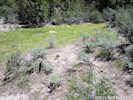


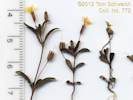


Erythranthe tilingii (Regel) G.L. Nesom. (Syn: Mimulus tilingii Regel ) Tiling's Monkeyflower. CalPhotos. Jepson eFlora. SEINet Taxon.
- June Lake, Mrs. J. D. Wright 5 Jun 1929. ( SBBG66689† ) .
- Lee Vining Canyon,
in crevices between rocks, moist stream bank, 8000-8500 ft
east side of Tioga Pass, 9 miles by road west of Lee Vining
J. M. Tucker 2177.
15 Jul 1951.
(
JEPS4202†
JEPS79791†
)
.
.
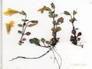
Erythranthe utahensis (Pennell) Nesom. (Syn: Mimulus glabratus Kunth. ssp. utahensis Pennell ) Utah Monkeyflower. CalPhotos. Jepson eFlora. SEINet Taxon.
Coll. No. 847, 21 June 2012, characters observed while keying: Herbaceous annual or perennial, green photosynthetic, suberect to erect, 25-30 cm.; Rhizomes numerous, 0.5-0.8 mm. dia., i.e., larger than filiform; Leaves cauline opposite, glabrous-puberulent; Flowers 12-16; Pedicels at anthesis 13 mm., in fruit 24-25 mm.; Calyx five-angled, cleft < 1/2 length, at anthesis 11 mm., in fruit moderately inflated, upper 13 mm., lower lobes turned upagainst upper lobe; Corolla yellow, upper lobe 20-25 mm., lobes entire, dehiscent soon after anthesis, upper lobes not united, spur absent; Stamens 4, staminode absent; Stigmas 2-lobed.
- Mill Creek, Characters consistent with Erythranthe utahensis (Pennell) Nesom. Moist areas along creek, about 250 m north of the Cemetery Road crossing. Tom Schweich 847. 21 Jun 2012. ( CAS1157903‡ UC UCR248631‡ ) .
- Mono Basin, as Mimulus glabratus Kunth. ssp. utahensis Pennell, a synonym of Erythranthe utahensis (Pennell) Nesom 429. 429. Jones & Stokes Associates, 1993 . .
Mimetanthe pilosa (Benth.) Greene. (Syn: Mimulus pilosus (Benth.) S. Watson ) Downy False-Monkeyflower. CalPhotos. Jepson eFlora. SEINet Taxon.
- Dechambeau Ponds, pumice bordering warm spring outflow, with a few Salix exigua thickets at Dechambeau Ponds about 1.5 miles north of north shore Mono Lake Dean Wm. Taylor 16981. 23 Aug 1998. ( UC1731233‡ ) .
- Mono Craters, in very hot and apparently dry situation in the large artificial ditch east base of Mono Craters Frank W. Peirson 12444. 9 Jul 1938. ( JEPS3120† ) .
- Rush Creek,
Sandy areas on recently flooded banks of Rush Creek, 2.7 mi. downstream from US Highway 395, and 1.6 mi. upstream from Test Station Road.
Tom Schweich 719.
30 Aug 2010.
(
CAS1131427‡
UC1980413‡
)
.

Plantaginaceae
Callitriche L. Water-Starwort. CalPhotos. Jepson eFlora. SEINet Taxon.
- Cain Ranch, exposed muddy margin of roadside ditch, growing below limit of fringing sedges Cain Ranch, along old alignment of Hwy 395 at crossing of Walker Creek Dean Wm. Taylor 11201. 27 Jun 1990. ( JEPS90702† ) . .
Callitriche palustris L. (Syn: Callitriche verna L. ) Vernal Star Wort. CalPhotos. Jepson eFlora. SEINet Taxon.
- Mono Basin, wet seepage area 5 miles north of Mono Lake town along west side of Highway 395 Malcolm A. Nobs and S. Galen Smith 1703. 1 Sep 1949. ( UC1101511† ) . .
Collinsia parviflora Lindl. Maiden Blue-eyed Mary. CalPhotos. Jepson eFlora. SEINet Taxon.
- Mono Basin, near Artesian Well, northeastern shore of Mono Lake, Sulphur Springs Herbert L. Mason 15225.2 4 Jul 1963. ( UC1275787† ) .
- Sagehen Meadow,
In the swale draining the meadow.
Tom Schweich 643.
8 Jul 2010.
(
CAS
UC1973788‡
)
.
.


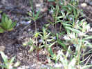

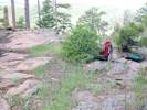
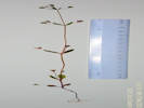
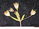

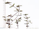

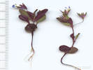
Keckiella breviflora (Lindl.) Straw var. glabrisepala (D. D. Keck) N. H. Holmgren. Bush Beardtongue. CalPhotos. Jepson eFlora. SEINet Taxon.
- Lee Vining Canyon, 2 miles west of Lee Vining near foot of Lee Vining grade David D. Keck 3896. 20 Jul 1935. ( UC579708† ) . .
Penstemon cinicola D. D. Keck. Ash Penstemon. CalPhotos. Jepson eFlora. SEINet Taxon.
- Big Sand Flat, On the northwest margin of Big Sand Flat, on forest road 01S19B, about 1 km north of forest road 01S19, two plants here, one more seen near the end of forest road 01S19B, also collected at Sagehen Meadow. Tom Schweich 604. 22 Jun 2010. ( CAS1131471‡ UC1980423‡ ) Also collected or observed nearby, Abronia turbinata, Astragalus monoensis, Carex douglasii, and Diplacus mephiticus. Along Forest Road 01S19B, northwest side of Big Sand Flat, reached from California Highway 120, northwest 0.25 mi on Forest Road 01S19 “M&R Tank Rd, ” then northeast 0.25 mi on Forest Road 01S19B. Tom Schweich 1155. 23 Jun 2015. ( CS OBI82187‡ RENO87127‡ UCR265712‡ ) .
- Dry Creek, In upper Dry Creek, where it is crossed by Forest Road 1S56, just north of Crooked Meadows. Tom Schweich 648. 8 Jul 2010. ( CAS1131473‡ UC1980374‡ ) .
- Sagehen Meadow,
South side of meadow, locally common at edge of meadow.
Tom Schweich 629.
2 Jul 2010.
(
CAS1131472‡
UC1980377‡
)
.
.
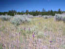
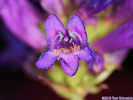
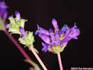


Penstemon heterodoxus A. Gray var. heterodoxus. Sierra Beardtongue. CalPhotos. Jepson eFlora. SEINet Taxon.
- Lundy, alpine form vicinity of Lundy, 8000-9000 ft Miss Maud Minthorn 6 Aug 1908. ( UC148719† ) . .
Penstemon procerus Graham. (Syn: P. confertus Douglas ex Lindl. var. caeruleopurpureus A. Gray ) Little-Flower Penstemon. CalPhotos. Jepson eFlora. SEINet Taxon.
- Lee Vining Creek, common in meadow along Lee Vining Creek, herbage succulent about 8 miles from Mono Post Office Beecher Crampton 274. 10 Jul 1941. ( UCD38113† ) . .
Penstemon roezlii Regel. Roezl's Penstemon. CalPhotos. Jepson eFlora. SEINet Taxon.
- Pumice Valley, in sandy white pumice soil where highway to L. A. intersects road to Benton William M. Hiesey 397. 30 Jul 1935. ( UC648649† ) . .
Penstemon rostriflorus Kellogg. (Syn: P. bridgesii Kellogg ) Bridge Penstemon. CalPhotos. Jepson eFlora. SEINet Taxon.
- Bloody Canyon, loose rocks Chesnut and Drew 20 Jul 1889. ( UC41714† ) .
- Lee Vining Canyon, Lee Vining Canyon Road G. Witherspoon 2068. 19 Jun 1940. ( SJSU489† ) Rocky bank along Poole Power Station Road, about 0.5 miles west of its junction with California Highway 120. Tom Schweich 702. 9 Aug 2010. ( CAS1131414‡ UC1980386‡ ) .
- Lundy, 8000-9000 ft vicinity of Lundy Miss Maud Minthorn 27 Jul 1908. ( UC148718† ) .
- Silver Lake,
Lewis S. Rose 40743.
3 Jul 1940.
(
UC886853†
)
.
.
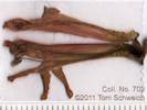
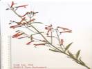
Penstemon rydbergii A. Nelson var. oreocharis (Greene) N. H. Holmgren. Rydberg's Penstemon. CalPhotos. Jepson eFlora. SEINet Taxon.
- Farrington Ranch, Farrington's Ranch, Pumice Valley, 5 miles south of Lee Vining William M. Hiesey 350. 3 Jul 1936. ( UC696720† ) .
- Lee Vining Canyon, meadow 3 miles west of Lee Vining Lewis S. Rose 50188. 26 Jul 1950. ( UC942863† ) .
- Lundy, 8000-9000 ft vicinity of Lundy Miss Maud Minthorn 243. Aug 1908. ( UC148742† ) .
- Parker Creek, meadow beside creek Joseph and Hilda W. Grinnell 1070.1 18 Jun 1937. ( UC569638† ) In a small wetland near the Parker Creek intake to the Los Angeles aqueduct, just below the aqueduct road, about 2 miles southwest of the intersection of California Highway 158 and US Highway 395. Tom Schweich 864. 23 Jun 2012. ( CAS1148730‡ UC2015307‡ ) .
- Pumice Valley, meadow Route 395, 5-6 miles south of Lee Vining Francis W. Pennell 25905. 15 Jun 1940. ( UC1012209† ) .
- Walker Creek (Lower),
probably artificial wet meaow w/shallow water (10-20 cm) surrounded by tall sagebrush shrub
south side of Walker Creek, 4 miles south of Lee Vining
Juha Pykala, D. H. Norris, Heikki Toivonen 2785.
22 Jul 1987.
(
UC1586984†
)
.
.

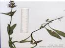
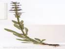
Penstemon speciosus Lindl. Royal Penstemon. CalPhotos. Jepson eFlora. SEINet Taxon.
- Jordan, Alluvial fans at base of Copper Mountain, 0.5 mile north of Jordan, 0.7 mile west of the intersection of US Highway 395 and Mill Creek Powerhouse Road. Tom Schweich 778. 22 Jun 2011. ( UC1980469‡ ) .
- June Lake, Mrs. J. Wright 5 Jul 1929. ( SBBG66515† ) .
- Lee Vining Canyon, Lee Vining Canyon near foot of grade R. F. Hoover 5408. 5 Jul 1941. ( JEPS11389† JEPS11510† ) .
- Pumice Valley, under Jeffrey pine south of Mono Lake Annie M. Alexander and Louise Kellogg 1827. 3 Jul 1940. ( UC669150† ) .
- Sagehen Meadow Campground, Uncommon, on wooded slopes west of the campground, 22 miles by road southeast of Lee Vining, Mono County, California. Tom Schweich 650. 12 Jul 2010. ( UC1980372‡ ) .
- Sagehen Peak,
near highway on gravelly soil, associated with Artemisia and Purshia
On Sagehen Peak near Highway 120, PLSS location 1S28E11.
Jack L. Reveal 168.
24 Jul 1962.
(
UC1338629†
)
Common at this location, nearly finished flowering.
Around the edges of a barren sand slope about 1/3 mile north northwest of Sagehen Peak, and east of Sagehen Meadows Road.
Tom Schweich 677.
22 Jul 2010.
(
CAS
UC1980362‡
)
.
.

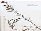
Veronica americana (Raf.) Benth. American Speedwell. CalPhotos. Jepson eFlora. SEINet Taxon.
- June Lake, In a fresh water spring. Lakeview Dr., June Lake Wendell Wood 58. 30 Jun 1970. ( HSC12672† ) .
- Mono Basin, Mono Creek Mrs. Harcourt Jul 1888. ( JEPS16462† ) .
- Walker Creek (Lower),
In western Pumice Valley, growing on a little muddy bar inside the banks of Walker Creek, just below the crossing of old US Highway 395, about 4.5 miles by road south of Lee Vining.
Tom Schweich 1024.
24 Jul 2013.
(
UC
UCR262298‡
)
.
.

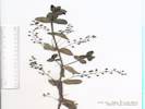
Veronica anagallis-aquatica L. Water Speedwell. CalPhotos. Jepson eFlora. SEINet Taxon.
- Mono Lake County Park, shallow water of streamlet through alkaline marsh with Zannichellia palustris, Muhlenbergia asperifolia, Cleomella parviflora, Ranunculus cymbalaria saximontanus, etc. west end of Mono Lake in County Park near Highway 395 Robert F. Thorne and L. DeBuhr 47277. 23 Aug 1975. ( RSA364212† UC1532815† ) .
- Mono Lake, northwest shore (as a col. locality), marshy area northwest side of Mono Lake K. A. Soper 20 Oct 1974. ( SJSU7735† ) In the delta of Mill Creek, on the northwest shore of Mono Lake. Tom Schweich 1005. 22 Jul 2013. ( OBI82074‡ RENO87130‡ UC2045735‡ ) .
- Mono Lake, west of (as a collection locality), on springy slope west side of Mono Lake near Highway 395 R. F. Thorne and C. W. Tilforth 39280. 7 Mar 1970. ( RSA252396† UC1408963† ) .
- Rush Creek delta,
On the edge of a fresh-water lagoon, southeast side of the Rush Creek delta, very near the alkaline water of Mono Lake.
Tom Schweich 906.
26 Aug 2012.
(
CAS1157694‡
CDA39243‡
UC
UCR248636‡
)
Growing in waterlogged gravels creekside.
Beside the newly incised main channel of Rush Creek, 1 km north northeast of the intersection of Forest Roads 01N51 “South Tufa Road” and 01N50 “Rush Creek Road”, 5.8 km east of Lee Vining.
Tom Schweich 1171.
25 Jun 2015.
(
CS
OBI83183‡
)
.
.

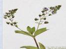
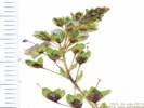
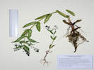
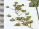
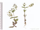
Veronica peregrina L. ssp. xalapensis (Kunth) Pennell. Neckweed. CalPhotos. Jepson eFlora. SEINet Taxon.
- Rush Creek delta,
Growing in waterlogged gravels creekside.
There are two collections of this taxon from the Bodie Hills nearby, but this would appear to be the first collection from the Mono Lake basin.
Beside the newly incised main channel of Rush Creek, 1 km north northeast of the intersection of Forest Roads 01N51 “South Tufa Road” and 01N50 “Rush Creek Road”, 5.8 km east of Lee Vining.
Tom Schweich 1172.
25 Jun 2015.
(
UCR265619‡
)
.
.


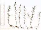


Veronica scutellata L. Skullcap Speedwell. CalPhotos. Jepson eFlora. SEINet Taxon.
- Bloody Canyon, Chesnut and Drew 21 Jul 1889. ( JEPS16495† ) in streams at foot of Bloody Canyon Chesnut and Drew 21 Jul 1889. ( UC41833† ) . .
Veronica serpyllifolia L. ssp. humifusa (Dickson) Syme. (Syn: Veronicastrum serpyllifolium (L.) Fourr. ssp. humifusa (Dickson) Syme ) (=Veronica serpyllifolia L. var. humifusa (Dicks.) SM.) Bright Blue Speedwell. CalPhotos. Jepson eFlora. SEINet Taxon.
- Lundy, vicinity of Lundy, 8000-9000 ft Miss Maud Minthorn 16. 20 Jun 1908. ( UC447242† ) .
- Rush Creek delta, Found in Collection No. 906, Veronica anagalis-aquatica. On the edge of a fresh-water lagoon, southeast side of the Rush Creek delta, very near the alkaline water of Mono Lake. Tom Schweich 906.1 26 Aug 2012. ( UC ) .
Polemoniaceae
Aliciella . Gilia. CalPhotos. Jepson eFlora. SEINet Taxon.
- Sagehen Peak, 20° S-facing slope of soft decomposed granite soil, with occasional granite outcrops. With Artemisia tridentata, Purshia tridentata, Chrysothamnus viscidiflorus, Phacelia bicolor, Grayia spinosa. GLASS MOUNTAIN REGION Sagehen Peak; 150m S of peak along steep deeply rutted 4WD road. Michael Honer 991. 21 Jun 2001. ( RSA680887† UC1787023† ) . .
Aliciella leptomeria (A. Gray) J.M. Porter. (Syn: Gilia leptomeria A. Gray ) Sand Gilia. CalPhotos. Jepson eFlora. SEINet Taxon. There is some question as to whether the taxon originally described by Gray actually occurs in California, and whether the California material is an undescribed species.
- Big Sand Flat, About 1.5 km north of Big Sand Flat, on the hill with a monument named "Sand." Tom Schweich 607. 22 Jun 2010. ( CAS UC1973709‡ ) .
- Dechambeau Ranch, dry sandy volcanic gravels of sagebrush flat near Dechambeaus ranch about 1.5 miles north of Black Point Carl W. Sharsmith 8716. 5 Jul 1982. ( SJSU9737† ) .
- Mono Basin, as Gilia leptomeria A. Gray. 652. 652. Winkler, David W., 1977 .
- Mono Lake, dry pumice sands by beach south side of Mono Lake Carl W. Sharsmith 5506. 25 May 1947. ( SJSU13461† ) sandy pumice flats in Purshia tridentata-Artemisia tridentata tridentata scrub south side of Mono Lake on Test Station Road at north base of Panum Crater Dean Wm. Taylor 16742. 1 Jul 1998. ( JEPS101643† ) . .
Aliciella monoensis J. M. Porter. CalPhotos. Jepson eFlora. SEINet Taxon.
Annual, to 25 cm., tap-rooted; Short stalked glandular, sand encrusted; Leaves, basal and cauline, basal, 16 mm. × 3 mm. wide, cauline, alternate, simple, not bristle-tipped; Calyx, lobes 5, equal, tube 1.5 mm. + lobes 1.0 mm. = 2.5 mm.; Corolla, tube 2.5 mm. + throat 3.0 mm. + lobes 1.5 mm. = 7.0 mm., throat widened near mouth, lobes ovate-acuminate; Style, 3 mm., persistent; Fruit, ellipsoid; Seeds, not gelatinous when wet (Described from Coll. No. 580, 7 Jul 2009).
- Adobe Hills Spillway, Along the side of Dobie Meadows Road, just below the Adobe Hills Spillway of Pleistocene Lake Mono. Tom Schweich 580. 7 Jul 2009. ( UC ) .
- Farrington Ranch, Near Farrington's Ranch, below Leevining. (Coordinates given by RSA, 37.989, -119.142, are incorrect, and are ignored.) Peter H. Raven 3126. 30 Jun 1951. ( RSA95576† ) .
- Mono Craters, open, dry loose sand Slopes of Mono Craters along road to Benton Verne Grant, P. H. Raven, Alva Grant 9749. 5 Jul 1955. ( RSA95678† ) .
- Mono Lake, near Mono Lake; near Mono Lake Alice M. Ottley 1109. 5 Jul 1920. ( JEPS61585† UC1554400† ) .
- Mono Mills, Lower border of Pinus ponderosa jeffreyi belt. South of Mono Lake, 4 mi. N of Mono Mills. L. R. Abrams and D. D. Keck 2884. 30 Jun 1934. ( POM209622† UC532088† ) .
- Mono Valley, Sandy soil of volcanic ash; sagebrush scrub with Artemisia tridentata, Chrusothamnus viscidiflorus, Tetradymia glabrata, etc. Mono Basin, East of Sierra Nevada Mtns. NE of Mono Lake, intersection of Dobie Meadows Rd. (to Alameda Well) and Hwy 167 Andrew C. Sanders 40284. 20 Jun 2012. ( UCR234786† ) Sand dunes and sandy flats, with tall sagebrush scrub with Artemisia tridentata (c. 2-2.5 m tall) dominant. Mono Basin, East of Sierra Nevada Mtns. north of Mono Lake, 0.5 mi. south of Hwy 167 (Pole Line Rd.), on dirt road toward lake and Sulphur Pond, PLSS: 03N27E27. Andrew C. Sanders 40295. 20 Jun 2012. ( UCR234794† ) loose sandy tephra derived soils in Purshia tridentata-Artemisia tridentata scrub; Coords cont. "NW1/4 of SW1/4 Sec 19, 01N28E19, in vicinity of watertank shown on Cowtrack Mtn 15' USGS quad". ; 3 mi ne of Mono Mills (in vicinity of watertank shown on Cowtrack Mountain 15' USGS quadrangle, se side of Mono Lake, Inyo National Forest); Mono Basin, Inyo National Forest, Mono Lake. Dean Wm. Taylor 15227. 18 Jul 1995. ( JEPS91100† ) Gentle brushy slopes. North of Mono Lake along road to Bodie H. L. Mason 12485. 13 Jul 1941. ( JEPS25034† POM264404† UC665614† ) [ POM264404 determined A. monoensis, JEPS25034 & UC665614 A. subacaulis ] sandy soil Along highway 31 (Pole Line Road) 3 miles east of highway 395, PLSS: 02N26E04. Jack L. Reveal, and James L. Reveal 110. 9 Jun 1962. ( RSA185130† UC1338668† ) . [ RSA185130 determined A. monoensis, UC1338668 A. subacaulis. ]
- Pumice Valley,
Great Basin scrub, recently burned.
Mono Lake, along Mono Lake Basin Road, about 3 miles S of the lake and 2.5 miles from the junction of Hwy.
J. M. Porter, Laren Machen 15112.1
27 May 2012.
(
RSA788851†
)
.
.
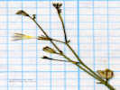
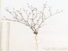
Allophyllum gilioides (Benth.) A. D. Grant & V. E. Grant ssp. violaceum (A. Heller) A. G. Day. Dense False Gilyflower. CalPhotos. Jepson eFlora. SEINet Taxon.
- Lundy, 8000-9000 ft vicinity of Lundy Miss Maud Minthorn 3. 15 Jun 1908. ( UC449751† ) .
- Parker Creek, shaded slope with Jeffrey Pine along trail Parker Creek, 1.5 miles below Parker Lake Dean Wm. Taylor 7761. 5 Jul 1980. ( JEPS101429† ) . [ Coordinates given by CoCH (37.846,-119.019) place the collection on Mono Craters in conflict with the written location description. Perhaps the Range is off by one Range. ] .
Collomia grandiflora Lindl. Grand Collomia. CalPhotos. Jepson eFlora. SEINet Taxon.
- Fern Creek, growing in streamlet June Lake Loop, Fern Creek Mary DeDecker 2181. 20 Jul 1969. ( RSA617049† ) . .
Collomia linearis Nutt. Tiny Trumpet. CalPhotos. Jepson eFlora. SEINet Taxon.
Annual; Stem simple, unbranched; Leaves linear, 20-25 mm; Calyx membrane 0, lobes growing with capsule, becoming papery with age; Corolla white, 6-9 mm (Described from Coll. No. 713, 19 Nov 2011).
- Bloody Canyon, foot of canyon Chesnut and Drew 19 Jul 1889. ( UC199043† ) .
- Fern Creek, growing in streamlet June Lake Loop, Fern Creek Mary DeDecker 2180. 20 Jul 1969. ( RSA617048† ) .
- Lee Vining Creek, Alice M. Ottley 1096. 6 Jul 1920. ( JEPS71057† ) .
- Sagehen Meadow,
Along the dry edges of the swale draining the meadow.
Tom Schweich 713.
28 Aug 2010.
(
CAS1131421‡
UC1980420‡
)
.
.
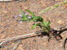
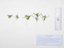

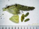
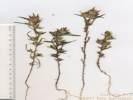
Eriastrum signatum D. Gowen. David's Spotted Wooly Star. CalPhotos. Jepson eFlora. SEINet Taxon.
Annual, not glandular; Corolla lobes blue, throat 4 mm, lobes 1 mm; Stamens attached at corolla sinus, equal (differentiates from E. wilcoxi), exserted < 1/2 corolla lobes; Anthers exserted. (Described from Coll. No. 481, 27 Nov 2011).
- Coyote Spring,
On the shoulder of the road between the road and the meadow.
Tom Schweich 481.
26 Jun 2007.
(
UC1980433‡
)
.
.
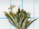
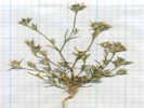
Eriastrum wilcoxii (A. Nelson) H. Mason. Wilcox's Woollystar. CalPhotos. Jepson eFlora. SEINet Taxon.
- Black Point, Growing in thin sands derived from volcanic rocks of Black Point. 0.3 mi (0.4 km) south of the highest point. Tom Schweich 586. 7 Jul 2009. ( CAS UC1973705‡ ) . [ Corolla salverform. ]
- Bloody Canyon, Chesnut and Drew 17 Jul 1889. ( UC449748† ) .
- Dechambeau Ranch, dry sandy volcanic gravels of sagebrush flat near Dechambeaus Ranch about 1.5 miles north of Black Point Carl W. Sharsmith 8714. 5 Jul 1982. ( SJSU9735† ) .
- Lee Vining, Lewis S. Rose 68146. 17 Jul 1968. ( RSA232834† ) .
- Lee Vining Canyon, sagebrush covered sand flats mouth of canyon David D. Keck 3872. 20 Jul 1935. ( UC579702† ) .
- Mono Craters, in spaces among low chaparral north slope Frank W. Peirson 19755. 31 Jul 1933. ( JEPS69065† RSA76372† ) .
- Mono Lake, Alice M. Ottley 1052. 5 Jul 1920. ( JEPS69066† ) near freshwater spring Alice M. Ottley 1100. 6 Jul 1920. ( JEPS69067† ) .
- Mono Mills, lower border of Pinus ponderosa jeffreyi belt 4 miles north of Mono Mills, south of Mono Lake L. R. Abrams, David D. Keck 2883. 30 Jun 1934. ( POM209663† UC532089† ) .
- Paoha Island, southeast portion, sage, southeast slope A. D. Gifford 867. 20 Aug 1937. ( UC1123883† UC577910† ) Herbert L. Mason 15215. 24 Jun 1963. ( UC1275781† ) . [ Per correspondence with David Gowen, the collection of Eriastrum sparsiflorum is probably mis-identified. ]
- Rush Creek, Many insects embedded in this collection. On drying formerly flooded sandy banks of Rush Creek, 2.8 mi. downstream from US Highway 395, and 1.5 mi. upstream from Test Station Road. Tom Schweich 725. 1 Sep 2010. ( CAS UC1980407‡ ) .
- Tioga Lodge,
dry sagebrush slope
between Lee Vining and Tioga Lodge, near Mono Lake
Laura Lorraine
6 Aug 1938.
(
UC604908†
)
.
.
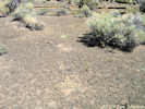
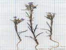
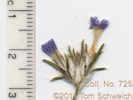
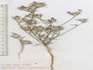
Gilia . Gilia. CalPhotos. Jepson eFlora. SEINet Taxon.
- Mono Lake,
J. W. Congdon
24 Aug 1895.
(
DS25622†
)
.
.

Gilia brecciarum M. E. Jones ssp. brecciarum. Nevada Gilia. CalPhotos. Jepson eFlora. SEINet Taxon.
Annual 10-20 cm; Stem scapose (as opposed to leafy); Leaves basal 25 mm x 7 mm wide, deeply pinnately lobed, lobes pointed but not bristly, petiole winged, cobwebby hairs, not glandular, cauline reduced above, 6 mm, alternate, expanded at base, with glandular trichomes and few hairs; Infloresence open; Flowers in heads of 2-3; Calyx lobes equal, membranous between the segments; Corolla long funnelform not quite salverform, 10 mm, 2 x calyx, throat yellow, wider than tube, exserted from calyx, lobes < tube, pink at center to purple at edges; Seeds > 1 / chamber, gelatinous when wet (Described from Coll. No. 774, 23 Jan 2012). Difficult to key, various keys will easily go to Aliciella leptomeria and Allophyllum giliodes, but repeated careful working led to Gilia brecciarum. Makes me think that all the collections of these three taxa in the Mono Basin should be reviewed.
- Horseshoe Canyon Moraine, Between lateral moraines on Inyo Forest Road 01S31, 1.8 miles north of Reversed Peak, and 2.2 miles south of the Rush Creek Return Ditch Gatehouse. Tom Schweich 774. 20 Jun 2011. ( CAS1131405‡ UC1980472‡ ) .
- Pumice Valley,
On Forest Road 01N17 “Farrington Siphon,” between the Sawmill Canyon and Bloody Canyon moraines, 6.3 miles by road south of Lee Vining, from below the aqueduct to the tops of the moraines.
Tom Schweich 957.
22 May 2013.
(
CAS1161735‡
UC
UCR250022‡
)
.
.


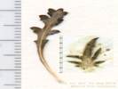
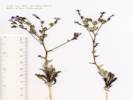
Gilia modocensis Eastw. Modoc Gily-flower. CalPhotos. Jepson eFlora. SEINet Taxon.
- Mono Valley, Along Highway 120 near the turnoff to Mono Lake Tufa area. J. M. Porter 12842. 4 Jun 2001. ( RSA803618† ) . .
Gilia ochroleuca M. E. Jones ssp. ochroleuca. Volcanic Gilia. CalPhotos. Jepson eFlora. SEINet Taxon.
- Sulphur Pond, Dunes. Mono County: Mono Basin Sulfur Springs Road, 10 miles east Hwy 167 junction 395 C. A. Toft 20 Aug 1981. ( UCD135885† UCD135887† ) . .
Gilia sinuata Benth. (Syn: Gilia inconspicua (Sm.) Sweet var. sinuata (Douglas ex Benth.) A. Gray ) Rosy Gilia. CalPhotos. Jepson eFlora. SEINet Taxon.
- Mono Valley, On old sandy beach soil of Mono lake. Associated with Artemsia and Oenothera and Eriogonum 1 mile north of Highway 31 (Pole Line Road) along the Bridgeport Canyon road Jack L. Reveal 107. 9 Jun 1962. ( NY964497† ) . .
Ipomopsis aggregata (Pursh) V. E. Grant ssp. aggregata. Scarlet Gilia. CalPhotos. Jepson eFlora. SEINet Taxon. I. a. (Pursh) V. E. Grant ssp. formosissima (Greene) Wherry misapplied.
- Dry Creek, In cut bank of small road leaving the middle reaches of Dry Creek, i.e., south of Big Sand Flat, yet north of Crooked Meadows. Tom Schweich 657. 12 Jul 2010. ( CAS UC1980368‡ ) .
- Sagehen Meadow, Sagebrush scrub with aspen stands and small moist meadows. USGS quad: Dexter Canyon 7.5' Q.; Solitary plant in an aspen grove.; Eastern Sierra/ Mono Basin 4.9 mi. SE of Calif. Hwy 120 on Sagehen Meadows Road George K. Helmkamp and E. A. Helmkamp 2325. 10 Sep 1997. ( UCR102568† ) .
- Sagehen Peak, Occasional in shady Aspen woodland. Flws scarlet.; With Symphoricarpos rotundifolius, Linanthus pungens. Populus tremuloides woodland bisected by road, surrounded by open slopes of Artemisia tridentata / Purshia tridentata scrub. Ashy pumice alluvium above contact of granitic and basaltic bedrock. GLASS MOUNTAIN REGION Sagehen Peak area; along FS Rd. 1N02 near SW base of Sagehen Peak. Michael Honer 985. 21 Jun 2001. ( RSA680700† UC1786969† ) . .
Ipomopsis congesta (Hook.) V. E. Grant ssp. congesta. Ballhead Ipomopsis. CalPhotos. Jepson eFlora. SEINet Taxon.
Leaves pinnately-lobed.
- Adobe Hills Spillway,
On fresh-water sandstone with fossil snail shells at the Adobe Hills Spillway, 32.8 km by air ENE of Lee Vining, California.
Tom Schweich 582.
7 Jul 2009.
(
CAS
UC1973703‡
)
Growing in fresh water sandstone, with fossil snail shells.
At the spillway of Pleistocene Lake Mono, east side of road, most common in borrow pit, occasional elsewhere nearby.
Tom Schweich 618.
29 Jun 2010.
(
CAS
UC
)
.
.
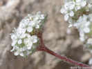
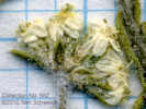
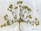
Ipomopsis congesta (Hook.) V. E. Grant ssp. montana (A. Nelson & P. B. Kenn.) V. E. Grant. (Syn: I. c. (Hook.) V. E. Grant ssp. palmifrons (Brand) A. G. Day ) Ballhead Ipomopsis. CalPhotos. Jepson eFlora. SEINet Taxon.
Leaves palmately-lobed.
- Mono Valley, In deep pumice soil associated with Astragalus. Along California Highway 31 ('Pole Line Road'), 0.5 mile west of the Nevada state line, PLSS: 04N29E32 James L. Reveal 484. 6 Jul 1963. ( RSA727236† ) . .
Leptosiphon ciliatus (Benth.) Jeps. (Syn: Linanthus ciliatus (Benth.) Greene , Linanthus ciliatus (Benth.) Greene var. neglectus (Greene) Jeps. ) Whiskerbrush. CalPhotos. Jepson eFlora. SEINet Taxon.
Annual 6-7 cm; Leaves cauline palmately lobed; Flowers in dense bracted heads; Bracts membrane to 1 mm wide compared to bract width 0.5 mm, white ciliate; Corolla salverform, tume 10-15 mm, long exserted, limb 6 mm, throat yellow, lobes lavender (Described from Coll. No. 771, 22 Jan 2012).
- Big Bend Campground, about 0.2 miles east of Big Bend Campground and about 2.5 miles west of Lee Vining, about 20 m north of river R. N. Bowman 3212. 13 Jun 1982. ( CHSC37787† ) .
- Grant Lake Overlook, Approximately 400 m northeast of the Grant Lake Overlook near the end of Forest Road 01S31B, 2.9 miles south of the Rush Creek Return Ditch Gatehouse. Tom Schweich 771. 20 Jun 2011. ( UC1980475‡ ) .
- Horseshoe Canyon Moraine, In a forest opening on both sides of Inyo Forest Road 01S31 at the northeast base of Reversed Peak. Tom Schweich 773. 20 Jun 2011. ( CAS1131962‡ UC1980473‡ ) .
- Reversed Creek,
Silver Lake Region
Frank W. Peirson 6131.
28 Jun 1925.
(
SBBG54432†
UC908431†
)
.
.



Leptosiphon nuttallii (Gray) J. M. Porter & L. A. Johnson ssp. pubescens (R. Patt.) J. M. Porter & L. A. Johnson. (Syn: Linanthus nuttallii A. Gray ssp. pubescens R. Patt. ) Nuttall's Linanthus. CalPhotos. Jepson eFlora. SEINet Taxon.
Herbaceous perennial, woody below, densely short hairy at proximal ends of internodes and on proximal leaf surfaces, less densely hairy on herbaceous surfaces elsewhere; Leaves opposite, primary fused by membrane (though generally not so in Leptosiphon), palmately lobed, lobes 5, 11 mm., secondary leaves difficult to separate and count lobes; Calyx, lobes 5, equal, 9 mm., fused 1/2, short white hairy; Corolla, tube 8 mm. + blade 5 mm., tube < calyx, open in day; Stamens, all attached in throat, barely exserted; Filaments, 1.0 mm (Described from Coll. No. 857, 22 Jun 2013).
- Walker Lake,
Widely distributed on the north slope of the southern moraine of Bloody Canyon, from the Walker Lake Trailhead down to the lake.
Tom Schweich 859.
23 Jun 2012.
(
UC2015309‡
)
.
.

Leptosiphon pachyphyllus (R. Patt.) J. M. Porter & L. A. Johnson. (Syn: Linanthus pachyphyllus R. Patt. ) Sierra Linanthus. CalPhotos. Jepson eFlora. SEINet Taxon.
- Lee Vining Ranger Station, sandy soil along Lee Vining Creek opposite Ranger Station Robert W. Patterson 1000. 21 Jun 1970. ( UCSB28993† ) .
- Lower Horse Meadow, on top of moraine ridge above Lower Horse Meadow, southwest of Lee Vining Jack L. Reveal 130. 10 Jun 1962. ( UC1338673† ) .
- Lundy, vicinity of Lundy, 8000-9000 ft Miss Maud Minthorn 23. 18 Jun 1908. ( UC148724† ) .
- Mono Basin, 515. 515. under Jeffrey pine highway south of Mono Lake Annie M. Alexander and Louise Kellogg 1822. 3 Jul 1940. ( UC669176† ) .
- Tioga Lodge, H. E. McMinn 3179. 16 Jul 1933. ( UC1280746† ) . .
Linanthus inyoensis (I. M. Johnst.) J. M. Porter & L. A. Johnson. (Syn: Gilia inyoensis I. M. Johnst. ) CalPhotos. Jepson eFlora. SEINet Taxon.
Annual, to 3 cm; Stem thread-like; Leaves basal opposite, cauline alternate; Infloresence in loose racemes; Pedicels 1-2 mm; Calyx 2.5 mm, membranous, rupturing as capsule matures, sparse gland-dotted hairs; Flowers 5 mm, 2 x calyx, (interior of flower glabrous, no pubesence or rings of hairs); Corolla funnel-form, 5 mm, tube and limb roughly equal; Stamens 5, equally inserted; Filament bases hard to see, but nothing hairy visible at base of flower; Pollen yellow (Described from Coll. No. 766, 20 Jan 2012).
- Bridgeport Canyon,
Associated with Artemisia, Oenothera and Eriogonum
1 mile north of Hiway [Highway] 31, (Pole Line Road) along the Bridgeport Canyon road, on old sandy beach soil of Mono Lake
J. L. Reveal 109.
9 Jun 1962.
(
NY1011783†
UC1338571†
)
Top of small ridge to west of Coyote Springs Road, 0.8 miles north northwest from Goat Ranch Road, 9.8 miles by road northeast from the intersection of US Highway 395 and California Highway 167, by way of Cottonwood Canyon Road.
Tom Schweich 766.
19 Jun 2011.
(
UC1980480‡
)
.
.
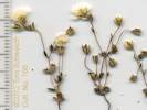

Linanthus pungens (Torr.) J. M. Porter & L. A. Johnson. (Syn: Leptodactylon pungens (Torr.) Nutt. ex Rydb. ) Granite Prickly Phlox. CalPhotos. Jepson eFlora. SEINet Taxon.
- Bodie Hills, in canyon ridge north of Mono Lake, along road to Bodie about 4.3 miles north of Hawthorne Road F. C. Vasek 3.1 17 Jun 1975. ( UCR17255† ) .
- Cowtrack Mountain, Large, sandy, flat area on Cowtrack Mountain, along the road to the summit, about 5.2 miles northeast of California Highway 120, and 1.5 miles southwest of the summit. Tom Schweich 460. 25 Jun 2007. ( CAS1131476‡ UC1980355‡ ) .
- Mono Basin, 514. 514. as Leptodactylon p. 653. 653. Winkler, David W., 1977 under Jeffrey pines Highway south, south of Mono Lake Annie M. Alexander and Louise Kellogg 1826. 3 Jul 1940. ( UC669145† ) .
- Mono Mills, Joseph and Hilda W. Grinnell 1060.1 16 Jun 1937. ( UC569576† ) .
- Sagehen Meadow,
South side of meadow.
Tom Schweich 633.
5 Jul 2010.
(
CAS1120833‡
UC1973711‡
)
.
.
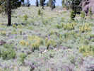
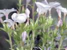

Navarretia breweri (A. Gray) Greene. Brewer's Navarretia. CalPhotos. Jepson eFlora. SEINet Taxon.
Annual, 6-12 cm., prickly when dry, minutely glandular; Stem branched along stem, ascending, minutely puberulent glandular; Leaves alternate except at base, deeply pinnately lobed, needle-like, lobed to near base, lobed portion 7 mm. + terminal lobe 9 mm., few straight white hairs; Infloresence dense, flowers in groups of 4-6, minutely glandular, slightly hairy (not wooly like Eriastrum); Outer bracts like leaves; Calyx, lobes unequal (3 long, 2 short), tapered, membrane narrow, not spout-like distally; Corolla lobes yellow, narrow tube, 5 mm.; Stamens, exserted. (Described from Coll. No. 791, 15 Dec 2011 and Coll. No. 963, 22 May 2013.)
- Bodie Hills, north slope tableland north of Mono Lake (location obscure, possibly Bodie Hills - Ed.) Frank W. Peirson 6155. 29 Jun 1925. ( UCR70854† ) .
- Bridgeport Canyon, Along Coyote Springs Road, about ⅓ mile southeast of the pass, at a watercourse crossing the road from southwest to northeast, 6˝ miles by road north of California Highway 167. Tom Schweich 963. 22 May 2013. ( CAS1161738‡ UC UCR250018‡ ) .
- Conway Summit,
In sagebrush.
Just N of summit between Bridgeport and Mono Lake (above Highway 395)
Milo S. Baker 9352.
9 Jun 1938.
(
UC629792†
)
.
.
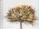
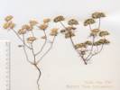
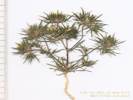
Phlox hoodii Richardson ssp. canescens (Torr. & A. Gray) Wherry. Carpet Phlox. CalPhotos. Jepson eFlora. SEINet Taxon.
Perennial, woody, dense, to 6 cm.; Leaves, opposite, 5 mm., lanceolate, entire, sharp-pointed, hairy and with separate sessile granular glands (which can be seen in profile on the abaxial surface of leaves), but the hairs are not glandular; Calyx, lobes equal, 6 mm., few glands on hairs in adaxial tips; Corolla, tube 13 mm + lobes 5 mm = 18 mm, throat slightly constricted; Stamens unequal. The combination of non-glandular hairs and sharp-tipped leaves causes this collection to key poorly by TJM2 or Taylor (2010), but per Welsh (Utah), P. hoodii appears to be the best compromise (Described from Coll. No. 399, keyed 4 Jan 2013).
- Deep Wells,
Assoc. plants -- Big sagebrush.
Mono County: Deep Well -- jeep trail (Adobe Hills east of Mono)
Jack L. Reveal 1121.
19 Jun 1965.
(
UCD118242†
)
.
.
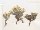
Phlox stansburyi (Torrey) A. A. Heller. Cold-Desert Phlox. CalPhotos. Jepson eFlora. SEINet Taxon.
- Conway Summit, Bridgeport road, Mono Lake to Conway Summit R. F. Hoover 5426. 5 Jul 1941. ( UC765564† ) .
- June Lake, Mrs. J. D. Wright 6 Jul 1929. ( SBBG58232† ) .
- Lee Vining, F. Howard 12 Jun 1962. ( SBBG58234† ) .
- Lee Vining Ranger Station, ridge near Leevining Canyon Ranger Station Alice M. Ottley 1082. 5 Jul 1920. ( JEPS70009† UC1554391† ) .
- Lower Horse Meadow, on top of a moraine ridge, Pinyon-Juniper southwest of Lee Vining above Lower Horse Meadow Jack L. Reveal 131. 10 Jun 1962. ( UC1338674† ) .
- Lundy, 8000-9000 ft vicinity of Lundy Miss Maud Minthorn 60. 30 Jun 1908. ( UC148720† ) .
- Sagehen Meadow,
North edge of meadow.
Tom Schweich 628.
2 Jul 2010.
(
CAS
UC1973712‡
)
.
.
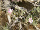
Polemonium occidentale Greene. CalPhotos. Jepson eFlora. SEINet Taxon.
- Bloody Canyon, Chesnut and Drew 20 Jul 1889. ( UC52666† ) .
- June Mountain Ski Lodge, Northeast side of the June Mountain Ski Area parking lot, about 1.1 mi by road southwest of the GNIS location of the town of June Lake. Tom Schweich 1196. 26 Jun 2015. ( UC2046095‡ UCR267676‡ ) Hwy. 158, June Mtn. ski lift, 1 mi. S of June Lake city limits. Wendell Wood 100. 11 Jul 1970. ( HSC12631† ) .
- Lee Vining Canyon, sun and semishade steep, boggy slopes about springs, with Salix, grasses, Pinus, Yellow Pine F Plany Commun 4.2 miles northwest of Lee Vining Meadows, Lee Vining Grade, State Hwy 120 P. C. Everett and E. K. Balls 22006. 10 Jul 1956. ( RSA113043† UC1075604† ) .
- Lundy Canyon, along creek road west of U. S. 395, along creek 1 mile below Lundy Lake Dam Ira L. Wiggins 14181. 27 Jun 1957. ( RSA126383† UC1190330† ) Inyo National Forest, banks of Mill Creek in Lundy Canyon, 1.2 mi. downstream from Lundy Lake Dam. PLSS: 02N25E15. Tim Messick 1774. 20 Jun 1982. ( HSC77216† ) .
- Lundy Lake, Doris (Hoover) Bowers 254. 6 Jul 1966. ( RSA764447† ) .
- Reversed Creek, Reverse Creek, Sierra Nevada. Frank W. Peirson 6142. 28 Jun 1925. ( RSA72031† ) Lodgepole Forest plant community. 2.5 miles beyond June Lake, on loop from U.S. Highway 395 (south entrance) Percy C. Everett, E. K. Balls 22003. 9 Jul 1956. ( RSA113041† ) . .
Polemonium pulcherrimum Hook. CalPhotos. Jepson eFlora. SEINet Taxon.
- Lundy, vicinity of Lundy, 8000-9000 ft Miss Maud Minthorn 214. 8 Sep 1908. ( UC1602164† ) .
Polygonaceae
Chorizanthe brevicornu Torr. var. spathulata (Rydb.) C. L. Hitchc. Great Basin Brittle Spineflower. CalPhotos. Jepson eFlora. SEINet Taxon.
Annual, Stem ocreae absent Leaf basal, petiole 8 mm., blade 19 mm. by 12 mm. wide, Pedicels subtended by 2 free linear bractlets (supposedly transparent but not in my collection), Flower cluster subtended by an involucre of fused bracts, 6-ribbed, tubular, teeth of equal length and without scarious margins, Perianth lobes entire, white, but unable to further dissect flower to complete determination (Described from Collection No. 396, 15 August 2012).
- Lee Vining Canyon, dry sandy ground foot of Lee Vining Canyon Carl W. Sharsmith 5615. 22 Jul 1948. ( SJSU13119† ) .
- Mono Basin, on old sandy beach soil, 1 miles north of Highway 31 (Pole Line Road) along Bridgeport Canyon Road Jack L. Reveal and James L. Reveal 105. 9 Jun 1962. ( UC1338568† ) near Mill Creek on plain at northwest corner R. F. Hoover 5418. 5 Jul 1941. ( UC766416† ) .
- Tioga Lodge,
Veg. Type:
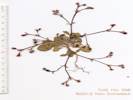
1. Annual
2. Involucres angled to strongly ribbed, sessile and strongly appressed or at tips of short bracted branchlets (or peduncled) Group 1.
3. Involucres at tips of slender branchlets, not appressed; peduncles present or 0; Flowers cream to ± red, 1–1.5 mm; inflorescence 5–10(15) cm wide; n SNE. . . . . . E. ampullaceum
3'. Involucres not at tips of slender branchlets, gen appressed; peduncles 0.
4. Lvs. tomentose both sides, flowers 1–2.5(3) mm, yellow or white to pink, rose, or red
5. Tepals glandular1 , flowers white to rose, > 1.5 mm. . . . . . . E. baileyi
5'. Tepals, glabrous, flowers white to yellow, = 1 mm. . . . . . . E. brachyanthum
4'. Lvs. Glabrous adaxially (top), maybe tomentose abaxially (bottom).
6. Infl sparsely tomentose, especially basally, or glabrous; lvs basal; fls white to rose or pale yellow — ne KR, CaR, n SNH, MP. . . . . . . E. vimineum
6'. Lvs basal; involucres 3–4 mm; flowers 1.5–2 mm; stem glabrous; SW, SNE, Dmoj. . . . . . . E. davidsonii
2'. Involucres smooth, not ribbed or angled, gen peduncled, if sessile then not appressed Group 2 (Subgroup Ganysma)
7. Leaves strictly basal, peduncles spreading to reflexed.
8. Leaves gen ± round, tomentose.
9. Base of tepals truncate, peduncles deflexed. . . . . . E. deflexum var. nevadense
9'. Outer tepals obtuse to rounded base, peduncles spreading to ascending. . . . . . E. cernuum
8'. Leaves gen ± round, glabrous or hairy, but not tomentose. . . . . . . E. esmeraldense var. esmeraldense
7'. Leaves cauline and basal, peduncles spreading to erect.
10. Leaves oblanceolate to ovate. . . . . . . E. maculatum
10'. Leaves linear with revolute margins. . . . . . . E. spergulinum var. reddingianum
1'. Perennial
11. Perennial; flower stipe present, sometimes weakly so, not winged; inflorescence bracts 2--13+. Group 3 + (subgroup Oligogonum)
12. Upright scrub, inflorescence an umbel. . . . . . . E. umbellatum var. nevadense
12'. Mat or low shrub.
13. Perianth yellow, hairy. . . . . . . E. caespitosum
13'. Perianth white to rose, glabrous. . . . . . . E. lobbii
11'. Per; fl stipe 0 or ± winged; inflorescence bracts gen 3 (mainly subgroup Eucycla) Group 4
14. Cushion plants, inner and outer tepals uniform in width.
15. Flowers in a ball-like head. . . . . . . E. rosense
15'. Flowers in an elongate raceme. . . . . . . E. wrightii
14'. Definite shrubs; woody branches.
16. Caudex perennial; inflorescence branches new each year.
17. Inflorescence racemose. . . . . . . E. nummulare
17'. Infl ball-like or cymose
18. Leaves large, 4-15(-25) × 1.5-6 cm . . . . . . . E. elatum var. elatum
18'. Leaves small, 1-6 × (0.3-)1-4 cm. . . . . . . E. nudum
19. Leaves ellliptic, <20 mm long, tomentose fo floccose above. . . . . . var. deductum
19'. Leaves narrowly oblong to oblong, 20-50 mm long, gen green and subglabrous above. . . . . . . var. nudum
16'. Shrubs with upright woody branches; leaves not fascicled; infl. Branches roughly equal (and something else). . . . . . . E. microthecum
20. Flower yellow. . . . . . . E. microthecum var. ambiguum
20'. Flower white to pink.
21. Low growing, alpine, revolute. . . . . . . E. microthecum var. alpinum
21'. Dry slopes, not particularly revolute. . . . . . . E. microthecum var. laxiflorum
Notes:
Eriogonum . Buckwheat. CalPhotos. Jepson eFlora. SEINet Taxon.
- Big Sand Flat, Collection discarded, either E. baileyi or E. brachyanthum, but not mature enough to determine. Collected on the ridge just northwest of Big Sand Flat in an area that had burned several years previously. Tom Schweich 469. 25 Jun 2007. .
- Mono Basin,
(79, 176)
656.
656.
Winkler, David W., 1977
.
.

Eriogonum ampullaceum J. T. Howell. (Syn: E. mohavense S. Watson ssp. ampullaceum (J. T. Howell) S. Stokes ) Mono Buckwheat. CalPhotos. Jepson eFlora. SEINet Taxon.
- Black Point, gravelly bank Mary DeDecker 4413. 22 Sep 1977. ( UC1442741† ) .
- Black Point (east base), seepage meadow border Shoreline at east base of Black Point. Dean Wm. Taylor 6089. 30 Jul 1976. ( UC1735960† ) .
- Dechambeau Ponds, black pumice bordering warm spring outflow, with a few Salix exigua thickets Dechambeau Ponds about 1.5 miles north of north shore of Mono Lake. Dean Wm. Taylor 16975. 23 Aug 1998. ( JEPS96598‡ ) .
- Kirkwood Spring, Margin of subalkaline meadow at Kirkwood Spring. Dean Wm. Taylor 7792. 15 Jul 1980. ( JEPS88659† UC1735961† ) .
- Maloney Place, dry gravelly soil Maloney Ranch north shore of Mono Lake. James L. Reveal 460. 5 Aug 1962. ( UC1338658† ) .
- Mono Basin, 399. 399. Jones & Stokes Associates, 1993 "Threatened" 654. 654. Winkler, David W., 1977 .
- Mono Lake, north shore (as a collection locality), Sandy soil above barren salt flats in scrub vegetation of Chysothamnus nauseosus, Artemisia tridentata, etc. Described as "Owens Valley," north shore of Mono Lake. G. R. Ballmer 2. 13 Aug 1994. ( UCR114945† ) .
- Mono Lake, northwest shore (as a col. locality), desert sand Northwest shore of Mono Lake Lewis S. Rose 57130. 30 Aug 1957. ( UC1111611† ) .
- Rush Creek, Mono Basin, meadow adjacent to Rush Creek 2 miles below Highway 395 Dean Wm. Taylor 7845. 5 Aug 1980. ( UC1735962† ) . .
Eriogonum baileyi S. Watson var. baileyi. Bailey's Buckwheat. CalPhotos. Jepson eFlora. SEINet Taxon.
Annual, to 30 cm; Stem glabrous; Leaves basal, ±round, tomentose, but withered at anthesis; Infloresence, elongate; Peduncles 0; Involucres subtended by bracts, sessile, appressed along branched and at tips of branchlets, 2 mm, (slightly) ribbed, 5-toothed, glabrous, ciliate at margins; Flowers glabrous, 1.5-2.0 mm, white to rose, small patches of color tending toward red rather than yellow, should be minutely glandular but not seen, even at 50x (Described from Coll. No. 696, 13 Nov 2011, and Coll. No. 892, 23 August 2012).
- Big Sand Flat, flats road to Benton, 12 miles southeast of Lee Vining Lewis S. Rose 68138. 17 Jul 1968. ( CAS585244† HSC17405† SBBG32418† SJSU5668† UCD99788† ) .
- Coyote Spring, Pinyon and sagebrush scrub on rocky ridgetop in sandy soil Coyote Spring, in canyon just south of Bodie G. R. Ballmer 26 Aug 1989. ( UCR58449† ) .
- Deadman Summit, North of Deadman's Summit Mrs. Ella D. Cantelow 21 Jul 1957. ( CAS559136† ) .
- Grant Lake, Nr. Rush Creek about 2 1/2 mi. n. e. of Silver Lake Ella Dales Cantelow 2248. 20 Oct 1938. ( CAS1181480† CAS268056† ) .
- Lee Vining, burned area in Artemisia tridentata scrub on granitic sand slopes west of Lee Vining, on highest Pleistocene lake terrace Dean Wm. Taylor 7511. 22 Jul 1979. ( UC1735954† ) Dry bank at roadside. N. C. Cooper 2426. 25 Aug 1944. ( RSA393095† ) Lee Vining: Roadside at Southern California Edison substation, Hwy 395, PLSS: 01N26E16. Scott D. White, with Edith Read, Gene Hawkins 5441. 4 Aug 1997. ( RSA653595† UCR117627† ) On slope facing east behind Gateway Motel in Lee Vining. Walter Knight, Irja Knight, Keith Wagnon, James Vale 4319. 13 Jul 1981. ( CAS649227† ) .
- Lee Vining Canyon, Calyx white, pink-tipped, midrib maroon, common on disturbed roadside. Great Basin Sagebrush Junction of Tioga Pass Road and U.S. Highway 395, Lee Vining Joseph M. Keefe 16351. 6 Oct 1974. ( RSA669977† RSA669978† ) .
- Lee Vining Ranger Station, dry gravels about 1.5 miles west of Lee Vining Ranger Station, Lee Vining Canyon Carl W. Sharsmith 7546. 28 Jul 1967. ( SJSU4198† ) .
- Mono Basin, south of Mono Lake, on highway 395 just past June Lake Loop David Gowen 500. 21 Jul 2005. ( JEPS108250† ) .
- Mono Craters, Open yellow pine forest. West slope of Mono Craters. Laura Lorraine 6 Aug 1938. ( DS285725† ) .
- Mono Lake, Mono Lake and vicinity, north of Lee Vining. 70 yds southeast of cemetery on the North shore of Mono Lake J. Burch, J. Robins, T. Wainwright 79. 1 Jul 1976. ( DS744471† ) [ Elevation above lake (6378 ft.): about 75 ft., Time since area was last covered by Mono Lake: more than 100 years, Soil pH: 6.8, Size of plant community: 200 m2. Species list: Gilia sp., Cryptantha circumscissa, Chrysothamnus nauseosus, Bromus tectorum, Cryptantha watsonii, Descurainia pinnata, Lygodesmia spinosa, Juncus effusus, Carex douglasii, Elymus cinereus, Oenothera dentata, Oryzopsis hymenoides, Chrysothamnus visicidiflora, Coldenia nuttallii, Artemisia tridentata, Distichlis spicata, Erodium cicutarium, Sitanion sp., Salsola pestifera. ] Tree coverage: 0, Shrub coverage: less than 1 dm., Herb coverage: 20, Av. height: 1 dm., Av. height: less than 1 dm. Mono Lake and vicinity, north of Lee Vining. J. Burch, J. Robins, T. Wainwright 176. 22 Jul 1976. ( DS744461† ) [ Horizontal distance above shore: 1458 ft., Elevation above lake (6378 ft.): 46 ft., Time since area was last covered by Mono Lake: 53 yrs., Water availability: 4, Soil color: gray, Soil pH: 8.1, Depth of water table: 34 ft., Size of plant community plot: 200 ft. Species list and percent of cover at collection site: Distichlis spicata 2, Juncus effusus 1, Artemisia tridentata +, Salsola pestifera +, Taraxacum officinale +, Bromus tectorum +, Eriogonum sp., Carex douglasii. ] desert slopes desert slopes Lewis S. Rose 37698. 29 Sep 1937. ( CAS253600† NY243347† RSA393096† UC849273† ) .
- Mono Lake, northwest shore (as a col. locality), desert sand northwest shore of Mono Lake Lewis S. Rose 57131. 30 Aug 1957. ( DS411332† UC1094012† ) .
- Mono Valley, In sand on a broad plain. Rabbit brush association. Mono Lake Bsin: just north of Mono Lake on the Hawthorne Highway Ernest C. Twisselmann 5756. 14 Sep 1959. ( CAS500728† CAS595540† ) Sandy sagebrush slope. Along County road between Mono Lake and Bodie, ca. 2 mi. from Mono Lake. Roxanna S. Ferris 13400. 18 Sep 1959. ( DS419792† NY243349† ) .
- Murphy Spring, drying edge of a wet meadow abundant on the driest edges of the meadow beside Bodie Road [CA Hwy 270], 3 miles southwest of Bodie State Historic Park George K. Helmkamp 42. 23 Sep 1995. ( UCR88207† ) .
- Negit Island, On slopes of volcanic sand and gravel. Negit Island, Mono Lake Edward Pittman 125. 3 Sep 1965. ( CAS595548† ) .
- Panum Crater, Pumice flat in an area that had been burned over. Panum Crater. S side Mono Lake. M. J. Williams 8678.2 26 Aug 1986. ( NY242968† RSA424431† ) .
- Parker Creek, on dry sandy soil junction of the Parker Lake and Aqueduct Road James L. Reveal and Jack L. Reveal 449. 29 Jul 1962. ( CAS585241† NY243322† RSA185097† UC1338606† ) .
- Pumice Valley, 3 mi. s. of Leevining [Lee Vining] Lewis S. Rose 50199. 26 Jul 1950. ( CAS367425† NY243331† ) open sandy site under dominant Purshia t. and Artemisia t. overstory Mono Basin, Pumice Valley, east of Highway 395 and just off (south) of Highway 120 Steve Matson 1490. 20 Aug 2005. ( JEPS111281† ) Pumice derived sand near north end of Mono Craters. This area burned in the Mono Fire of July 26-29, 2010. South side of California Highway 120, 3 miles east of US Highway 395. Tom Schweich 892. 23 Aug 2012. ( UC UCR248616‡ ) .
- Sagehen Meadow, Most common in disturbed areas, such as dirt piles left from construction. North of the meadow, near the house. Tom Schweich 696. 8 Aug 2010. ( CAS1131469‡ UC1980390‡ ) .
- Tioga Lodge,
Mrs. Ella D. Cantelow
25 Jul 1957.
(
CAS559131†
)
Mrs. Ella D. Cantelow
22 Jul 1957.
(
CAS559135†
)
.
.
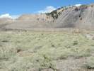
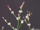
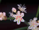
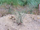
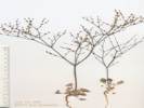
Eriogonum brachyanthum Coville. (Syn: E. baileyi S. Watson var. brachyanthum (Coville) Jeps. , E. vimineum Douglas ex Benth. var. brachyanthum (Coville) S. Stokes ) Shortflower Buckwheat. CalPhotos. Jepson eFlora. SEINet Taxon.
Annual; Stem glabrous above the basal rosette; Leaves basal, blade rounded, tomentose; Involucres 2 mm (long for E. brachyanthum), ribbed, not at tips of slender branchlets (at nodes along slender branches); Flowers (very) sparsely glandular (Described from Coll. No. 492.1, 10 Apr 2012). Collection 492.1 has larger involucres and flowers than my collections 509 and 519. Both of them were made on the west side of Pumice Valley, and away from Mono Lake. The involucres are 2 mm, slightly too large for E. brachyanthum, but still only 2/3 of the minimum size for E. davidsonii. Also, I don't see any of the reddish color I see in E. davidsonii.
- Bohler Canyon, Dry edge of wet meadow along the dirt road on the south side of Bohler Canyon, 1.8 mi (3.0 km) by air west of US Highway 395. Tom Schweich 509. 2 Aug 2007. ( CAS1120730‡ UC1973768‡ ) .
- Mono Basin, 3 miles north of Mono Lake Herbert L. Mason 11498. 1 Aug 1936. ( UC1081577† ) .
- Old Marina, Collection #492 was a mixed collection of Eriogonum brachyanthum with one individual of E. deflexum var. nevadense. On the western shore of Mono Lake. Tom Schweich 492.1 1 Aug 2007. ( CAS1157554‡ UC2015319‡ ) .
- Walker Creek (Lower),
Just below the aqueduct road on the north side of Walker Creek.
Tom Schweich 519.
2 Aug 2007.
(
CAS1120733‡
UC1973758‡
)
.
.
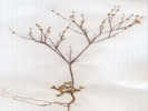
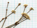
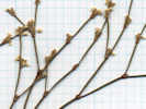
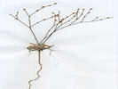
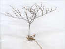
Eriogonum caespitosum Nutt. Matted Buckwheat. CalPhotos. Jepson eFlora. SEINet Taxon. Wind-swept barrens Rare: Uncommon Seen at pass in Bridgeport Canyon.
- Bridgeport Canyon, 495. 495. Low prostrate plant, somewhat rounded. Flowers yellow. Summit of Bridgeport Canyon. Jack L. Reveal 91. 2 Jun 1962. ( NY242888† ) Northern edge of the Mono Lake Basin, at the pass between Bridgeport Canyon and the Clearwater Creek drainage. Tom Schweich 486. 26 Jun 2007. ( UC1980429‡ ) Along Coyote Springs Road, about ⅓ mile southeast of the pass, at a watercourse crossing the road from southwest to northeast, 6˝ miles by road north of California Highway 167. Tom Schweich 967. 22 May 2013. ( CAS1161741‡ OBI82218‡ UC UCR250006‡ ) .
- Conway Summit, Conway Summit, microwave ridge. Paul A. Opler 30 May 2003. ( CS84923† ) .
- Mount Biedeman, N slope of Mt. Biedman, PLSS: 03N26E02. Tim Messick 525. 18 Jun 1979. ( HSC80189† ) .
- Murphy Spring,
2-3 miles southwest of Bodie on road to Murphy Spring
Charlotte N. Smith 1356.
13 Jun 1965.
(
JEPS48174†
)
.
.
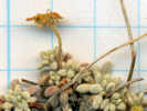

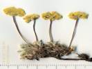
Eriogonum cernuum Nutt. (Syn: E. c. Nutt. var. viminale (S. Stokes) Reveal ) Nodding Buckwheat. CalPhotos. Jepson eFlora. SEINet Taxon.
- Mono Basin, 516. 516. Hwy 167, 0.2 mi W of Nevada state line. Inyo National Forest, NE of Mono Lake G. R. Ballmer 27 Aug 1989. ( UCR62656† ) . .
Eriogonum davidsonii Greene. Davidson's Buckwheat. CalPhotos. Jepson eFlora. SEINet Taxon. Possible mis-identification of E. vimineum.
Annual, tap-rooted, to 18 cm.; Leaves, basal only, petiole 7 mm., blade 13 mm. × 11 mm. wide, round-ovate; Involucre, sessile in axils, 2.5 mm., angled, margins hairy; Flowers, 2 mm., pink, glabrous, outer perianth lobes neither fan-shaped nor hastate (Described from Coll. No. 140, 22 Sep 1997).
- Lee Vining, Edge between riparian zone and Great Basin scrub. Eastern Sierra Nevada Mtns Lee Vining, electrical substation at the south end of town John F. Green, Nathan Moorhatch 19 Sep 2006. ( UCR183540† ) .
- Mono Mills, Growing in coarse pumice soil, growing with Phacelia fremontii & Pinus jeffreyi. Yellow Pine Forest/Sagebrush scrub. Vegetative. Mono Mills, south of Mono Lake. C. L. Bowen 497. 13 Jul 1982. ( CAS967677† ) .
- Rush Creek,
Roadside of US Highway 395 at Rush Creek, 5.4 miles by road south of Lee Vining.
Tom Schweich 140.
22 Sep 1997.
(
CAS1203760‡
UCR262129‡
)
.
.
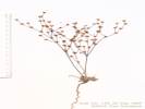
Eriogonum deflexum Torr. var. nevadense Reveal. Nevada Skeleton Weed. CalPhotos. Jepson eFlora. SEINet Taxon.
Annual; Stem glabrous, not inflated; Leaves ±basal, definitely not more than half-way up main stem; Blades tomentose; Involucre 1 mm, smooth (not ribbed), with reflexed peduncles 1-3 mm.; Infloresence not of many horizontal tiers, glabrous, (not widely) bell-shaped, Flowers white to pink; Perianth lobe outer lobe bases truncate, not cordate. Distinguished from var. deflexum because the perianth lobe bases are truncate rather than cordate. (Described from Coll. No. 492.2, 29 March 2012).
- Old Marina, Collection #492 was a mixed collection of Eriogonum brachyanthum with one individual of E. deflexum var. nevadense. On the western shore of Mono Lake. Tom Schweich 492.2 1 Aug 2007. ( UC2015318‡ ) . .
Eriogonum elatum Douglas ex Benth. var. elatum. Tall Woolly Buckwheat. CalPhotos. Jepson eFlora. SEINet Taxon.
Perennial erect herb from caudex, to 80 cm.; Stem to 50 cm., not jointed, slightly inflated, glabrous; Leaves, petioles 11-13 cm., ovate-elliptic, 8-9 cm. × 2.5-3.5 cm. wide, short-hairy adaxially, hairy to near-tomentose abaxially; Inflorescence branched, branches glabrous; Involucre, 2-3 per node, 15 mm. wide; Pedicels glabrous; Stipe 0; Flower hairy; Perianth lobes 5, all alike (Described from Coll. No. 1030, 24 Jul 2013).
- Coyote Spring, Canyon with loose gravelly slopes with vegetation of Pinyon Woodland. Coyote Springs, 2 mi N of Mono Lake near the road to Bodie G. R. Ballmer 22 Jul 1984. ( UCR34494† ) .
- Fern Creek, Sierra Nevada: Fern Creek, near Silver Lake, away from stream Mary DeDecker 1499. 22 Jul 1962. ( RSA196061† RSA618439† ) .
- Grant Lake, East facing slopes, near Grant Lake, along California Highway 158, about 0.4 miles south of the entrance to the Grant Lake Marina. Tom Schweich 1030. 24 Jul 2013. ( UC2045718‡ UCR262133‡ ) .
- Lee Vining, Common perennial, ca 1 m tall. Flowers dull white. Lee Vining: Roadside at Southern California Edison substation, Hwy 395. Scott D. White 5440. 4 Aug 1997. ( SD146186† UCR117626† ) .
- Lee Vining Creek, Dry slope. Leevining [Lee Vining] Creek, below Leevining [Lee Vining] side of Mono Lake. Malcolm Nobs 46. 14 Sep 1940. ( DS284390† ) .
- Lee Vining Canyon, dry upland site on terminal morainal debris in scrub; w/ marginal forests Coordinates by trs2LL from 01N26E19. Lee Vining Creek about 1.5 miles upstream from Ranger Station. Dean Wm. Taylor 15530. 15 Sep 1995. ( JEPS90503† ) Sierra Nevada, Yosemite National Park, Leevining Canyon Herbert L. Mason 11479. 1 Aug 1936. ( UC1081575† ) Leevining [Lee Vining] Canyon. John Thomas Howell 27418. 28 Jul 1950. ( CAS362544† ) .
- Mono Lake, Mono Lake, 4 miles north of Lee Vining Jerry Powell 507. 31 Aug 1965. ( UC1311869† ) .
- Mono Lake Cemetery, sandy soil In Mono Lake Cemetery grounds on the north shore of Mono Lake. James L. Reveal and Jack L. Reveal 409. 14 Jul 1962. ( CAS462323† NY280664† RSA185252† UC1338705† ) .
- Silver Lake,
Canyon west slope. Wild: native/naturalized.
“ North end of Silver Lake,” or “Canyon slope west of camp at north end of Silver Lake,” or “Silver Lake. 200 feet above lake.”
Frank W. Peirson 7571.
27 Jul 1927.
(
DS370499†
RSA65179†
RSA766440†
)
.
.
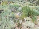
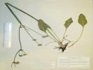
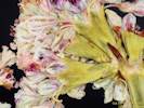
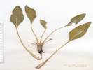
Eriogonum esmeraldense S. Watson. Esmeralda Buckwheat. CalPhotos. Jepson eFlora. SEINet Taxon.
- Deadman Summit, pumice slope summit between Crestview and Mono Lake John Thomas Howell 27459. 29 Aug 1950. ( UC1042553† ) .
- Mono Craters, soft pumice around craters Pumice Mine Rd, running NE from US Hwy 395, (N of the June Lake area); at S edge of Mono Craters George K. Helmkamp 2417. 12 Sep 1997. ( UCR102609† ) . .
Eriogonum esmeraldense S. Watson var. esmeraldense. Esmeralda Buckwheat. CalPhotos. Jepson eFlora. SEINet Taxon.
- Dry Creek, Eastern Sierra Nevada Dry Creek, west of Sagehen Meadow. 01S28E14 Jack L. Reveal and James L. Reveal 616. 10 Aug 1963. ( RSA176190 ) .
- Mono Craters, Chrysothamnus parryi dominated vegetation Mono Craters, pumice on summit ridge of Crater Mountain Dean Wm. Taylor 7526. 27 Aug 1979. ( JEPS91177† ) . .
Eriogonum lobbii Torr. & A. Gray. (Syn: E. l. Torr. & A. Gray var. lobbii ) Lobb's Buckwheat. CalPhotos. Jepson eFlora. SEINet Taxon.
- Lundy, 8000-9000 ft Miss Maud Minthorn 187. 19 Aug 1908. ( UC148792† ) .
- Mono Basin, 517. 517. . .
Eriogonum maculatum A. Heller. Spotted Buckwheat. CalPhotos. Jepson eFlora. SEINet Taxon.
- Black Point, 1.7 miles northeast of Black Point A. D. Gifford 901. 4 Sep 1937. ( UC578043† ) .
- Dechambeau Ranch, dry sandy volcanic gravels of sagebrush flat near Dechambeau's Ranch about 1.5 miles north of Black Point, Mono Lake Carl W. Sharsmith 8717. 5 Jul 1982. ( SJSU9738† ) .
- Mono Lake, northwest shore (as a col. locality),
sage brush scrub
0.5 miles northwest of Mono Lake, east of Sierra Nevada
A. Brenholt
3 Jul 1967.
(
UCR45805†
)
.
.
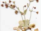
Eriogonum microthecum Nutt. CalPhotos. Jepson eFlora. SEINet Taxon.
- Mono Basin,
655.
655.
Winkler, David W., 1977
.
.

Eriogonum microthecum Nutt. var. alpinum Reveal. Alpine Slender Buckwheat. CalPhotos. Jepson eFlora. SEINet Taxon.
- Murphy Spring, Drying edge of a wet meadow. Uncommon, at edge of the meadow where sagebrush begins beside Bodie Road [CA Hwy 270], 3 miles southwest of Bodie State Historic Park George K. Helmkamp 43. 23 Sep 1995. ( UCR88211† ) . .
Eriogonum microthecum Nutt. var. ambiguum (M. E. Jones) Reveal. Slender Buckwheat. CalPhotos. Jepson eFlora. SEINet Taxon.
- East Craters Sand Flat, On Forest Road 1N24 at the northern end of East Craters Sand Flat. Tom Schweich 558. 13 Aug 2008. ( UC2015294‡ ) .
- Sagehen Peak,
20° S-facing slope of soft decomposed granite soil, with occasional granite outcrops. With Artemisia tridentata, Purshia tridentata, Chrysothamnus viscidiflorus, Phacelia bicolor, Grayia spinosa.
GLASS MOUNTAIN REGION Sagehen Peak; 150m S of peak along steep deeply rutted 4WD road.
Michael Honer 993.
21 Jun 2001.
(
NY802305
RSA680593
UC1787117
)
On a dry mesa about 1/3 mile north of Sagehen Peak, and east of Sagehen Meadows Road.
Tom Schweich 678.
22 Jul 2010.
(
CAS1119871‡
UC1980361‡
)
.
.

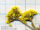
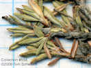
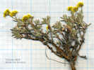
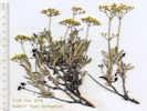
Eriogonum microthecum Nutt. var. laxiflorum Hook. Slender Buckwheat. CalPhotos. Jepson eFlora. SEINet Taxon.
Perennial erect shrub with woody branches; Leaves not fasciculate, slightly revolute; Infloresence of solitary involucres, branches equal in size; Perianth base not expanded into a small stipe and jointed with pedicel; Flowers white to pink (Described from Coll. No, 798, 30 Dec 2011).
- Copper Mountain, limestone scree Steep west (sic) face of Copper Mountain near Lundy Canyon mouth into Mono Basin Dean Wm. Taylor 6513. 23 Jun 1977. ( UC1735841† ) In a narrow limestone canyon on the east face of Copper Mountain. Tom Schweich, with Kim Kersh 798. 10 Sep 2011. ( CAS1131369‡ ) .
- Lee Vining,
Burned area in Artemisia tridentata scrub on granitic sand.
Mono Basin, slopes west of Lee Vining, on highest Pleistocene lake terrace
Dean Wm. Taylor 7513.
22 Jul 1979.
(
UC1735842†
)
.
.

Eriogonum nudum Douglas ex Benth. Naked Buckwheat. CalPhotos. Jepson eFlora. SEINet Taxon.
- Lundy Canyon, Bottom of canyon with sandy granitic soil Lundy Canyon, ca. 5 miles west on road to Lundy Lake from Hwy 395 Ian G. Gillespie 64. 28 Jul 2000. ( UCR132870† ) . .
Eriogonum nudum Douglas ex Benth. var. deductum (Greene) Jeps. Naked Buckwheat. CalPhotos. Jepson eFlora. SEINet Taxon.
- Big Sand Flat, Sand Flat near Mono Mills. Victor Duran 3344. 15 Jul 1932. ( CAS221440† DS228442† LA206898† NY762386† NY762387† POM214805† UC519674† UCD100600† UTC265830‡ ) . [ CAS coordinates by Geolocate (copied from GH427464) place this collection at Little Sand Flat, which is 4 1/1 miles south southwest of Mono Mills. NY and LA place this collection at the west end of Big Sand Flat, which seems more likely. UCD100600 is determined E. nudum Benth. var. nudum, James L. Reveal, 1970. ]
- June Lake, Mrs. J. D. Wright 6 Jul 1928. ( POM161215† SBBG64143† ) .
- Lee Vining Canyon, Mountain slopes Leevining Grade Lewis S. Rose 37708. 29 Sep 1937. ( CAS253612† ) .
- Mono Basin, under Jeffrey Pines Highway south of Mono Lake Annie M. Alexander and Louise Kellogg 1823. 3 Jul 1940. ( DS281509† UC669181† ) .
- Mono Craters,
Sand flat.
Just north of Mono Craters, 4 mi. S of Mono Lake.
David D. Keck, L. R. Abrams 2900.
30 Jun 1934.
(
DS242433†
DS690269†
)
Cinder surface from Mono Craters with occasional Pinus jeffreyi in a nearly barren area.
Along CA Hwy 120, 7.5 mi E of US Hwy 395
George K. Helmkamp 2407.
12 Sep 1997.
(
UCR103539†
)
on a bug pumice sand flat
northeast side of Mono Craters on a big sand flat along Highway 120, - Mono Mills,
Slope 3% N. Open pine stands on coarse pumice sand
Owens Valley/Eastern Sierra Nevada Mtns. | Inyo National Forest: Old Mono Mills Burn
E. C. Nord 69.
1 Aug 1957.
(
UCR22182†
)
.
- Pilot Spring,
7?° W-facing slope of soft pumice gravel. Uncommon in scrub and disturbed areas. Wild: native/naturalized Native.
Heavily disturbed area with recently felled small Pinus jeffryi all around. Open P. jeffryi woodland with understory of Artemisia tridentata, Purshia tridentata, Symphoricarpos rotundifolius, Ribes cereum, Stipa sp.
Along USFS logging road 1S45B, appx. 1mi W of Pilot Spring. "USFS Boundary Thinning Unit" sign posted nearby. PLSS: 01S28E28.
Michael Honer 1207.
21 Jul 2001.
(
NY802312†
RSA687548†
UC1786956†
)
.
- Reversed Creek,
June Lake (Rush Creek)
Willa Rutherford 2728.
31 Aug 1944.
(
RSA393398†
)
.
- Tioga Lodge,
Mrs. Ella D. Cantelow
25 Jul 1957.
(
CAS559132†
)
.
.
Eriogonum nudum Douglas ex Benth. var. nudum.
Naked Buckwheat.
CalPhotos.
Jepson eFlora.
SEINet Taxon.
Perennial herbaceous, erect;
Leaves basal, 22-32 mm, elliptic, subglabrous above (glabrous with a few cobwebby hairs);
Infloresence in cymose heads, glabrous;
Tepals glabrous;
Perianth base entire (not jointed)
(Described from Coll. No. 700, 13 Nov 2011). - Lee Vining Canyon,
On a bedrock ridge about 0.4 miles northwest of the Aspen Campground, north side of Poole Power Station Road.
Tom Schweich 700.
9 Aug 2010.
(
CAS1131413‡
UC1980387‡
)
.
.
Eriogonum nummulare M. E. Jones.
(Syn:
E. kearneyi Tidestr.
)
Money Buckwheat.
CalPhotos.
Jepson eFlora.
SEINet Taxon.
- Alameda Well,
In stabilized dune or beach strand.
In Mono Valley, 20 meters west of and above Dobie Meadows Road, 1.7 mi (2.7 km) northwest of Alameda Well
Tom Schweich 574.
7 Jul 2009.
.
[
See my image: 1959.
]
- McDonald Ranch,
flat, lakeshore
3/4 mile south of McDonalds Ranch
T. M. Hendrix 627.
18 Sep 1937.
(
UC1032152†
)
.
- Mono Basin,
"Rare," listed as Eriogonum kearneyi Tidestr.
730.
730.
Winkler, David W., 1977
1982Alluvial slopes with fine pumice sand. Sagebrush scrub/juniper woodland with Artemisia tridentata, Chrysothamnus nauseosus, C. viscidiflorus, Juniperus osteosperma, Tetradymia canescens, etc.
Great Basin, east side of Mono Lake ca. 2 mi from the shore at ca. 38 deg. N latitude
Andrew C. Sanders 7141.
11 Jul 1987.
(
UCR51880†
)
along roadside
Highway 167, 18 miles west of Highway 395
G. R. Ballmer
27 Aug 1989.
(
UCR58447†
)
in deep pumice sand
southeast of California 31 (Pole Line Road) on Deep Wells Road
Jack L. Reveal and James L. Reveal 838.
24 Aug 1963.
(
UC1305779†
)
on very dry sandy soil
4 mi w along Hiway 31 on the "Pole Line Road"
James L. Reveal and Caroline G. Reveal 465.
11 Sep 1962.
(
UC1338681†
)
.
- Sulphur Pond,
Sarcobatus scrub on subalkaline sand
MONO BASIN; Sulphur Pond, ca. 1.5 mi E of NE shore Mono Lake
Dean Wm. Taylor 16978.
23 Aug 1998.
(
JEPS96596†
)
.
.
Eriogonum rosense A. Nelson & P. B. Kenn. var. rosense.
(Syn:
E. r. A. Nelson & P. B. Kenn. var. beatleyae (Reveal) Reveal
)
Rosy Buckwheat.
CalPhotos.
Jepson eFlora.
SEINet Taxon.
- Mono Basin,
"Threatened," as Eriogonum beatleyae Reveal, which does not occur in California.
729.
729.
Winkler, David W., 1977
.
- Mono Valley,
Mono Valley, 0.65 road miles E of state line on Hwy 167 to Hawthorne, the 2.0 road miles S on E fork of a Pole Line rd. Eriogonum spergulinum A. Gray.
Spurry Buckwheat.
CalPhotos.
Jepson eFlora.
SEINet Taxon.
- Lundy Canyon,
bottom of canyon with sandy granitic soil
Lundy Canyon about 5 miles west on road to Lundy Lake from Highway 395
Ian G. Gillespie 62.
28 Jul 2000.
(
UCR132880†
)
.
- Mono Basin,
June Lake area, Highway 158 at June Lake Junction
Kathy Harper
25 Jul 1989.
(
UCR62185†
)
.
.
Eriogonum spergulinum A. Gray var. reddingianum (M. E. Jones) J. T. Howell.
Redding Buckwheat.
CalPhotos.
Jepson eFlora.
SEINet Taxon.
- Big Sand Flat,
Collected on the ridge just northwest of Big Sand Flat in an area that had burned several years previously.
Tom Schweich 468.
25 Jun 2007.
(
CAS1131481‡
UC1980445‡
)
.
- Dechambeau Ponds,
black pumice bordering warm spring outflow, with a few Salix exigua thickets
MONO BASIN; Dechambeau Ponds (ca. 1.5 mi N of N shore Mono Lake);
Dean Wm. Taylor 16976.
23 Aug 1998.
(
JEPS96597‡
)
.
- Dry Creek,
In small meadow in the middle reaches of upper Dry Creek, i.e., south of Big Sand Flat, and north of Crooked Meadows, 25 km by air southeast of Lee Vining, Mono County, California.
Tom Schweich 655.
12 Jul 2010.
(
CAS1121736‡
UC1980511‡
)
.
- East Craters Sand Flat,
Dry open pumice flat surrounded by Pinus jeffrfyi / P. contorta forest.
GLASS MOUNTAIN REGION | SE arm of East Craters Sand Flat, as it is crossed by FS Rd. 1S06.
Michael Honer 1506.
26 Aug 2001.
(
RSA688030†
)
on Forest Road 1S08, near small playa on southernmost East Craters Sand Flat,
Tom Schweich 554.
13 Aug 2008.
(
UC1953420‡
)
.
- Little Sand Flat,
Open pumice flat surrounded by Pinus jeffryi and P. contorta forest. Deep pumice ashfall from Mono Craters W.
GLASS MOUNTAIN REGION | Little Sand Flat; along 4WD road cutting across S tip of flat.
Michael Honer 1212.
21 Jul 2001.
(
RSA687569†
)
.
- Lundy,
vicinity of Lundy
Miss Maud Minthorn 6.
15 Jun 1908.
(
UC178442†
)
.
- Mono Basin,
under Jeffrey Pines
Highway south of Mono Lake
Annie M. Alexander and Louise Kellogg 1828.
3 Jul 1940.
(
UC669179†
)
on alluvial soil
1 1/2 miles north of Copper Mountain, on the high benchland at the head of and north of canyon cutting across Sec. 2
Jack L. Reveal and David Mason 499.
n.d..
(
UC1305772†
)
7ˇ W-facing slope of soft pumice gravel. Heavily disturbed area with recently felled small Pinus jeffryi all around. Open P. jeffryi woodland with understory of Artemisia tridentata, Purshia tridentata, Symphoricarpos rotundifolius, Ribes cereum, St …
GLASS MOUNTAIN REGION | Along USFS logging road 1S45B, appx. 1mi W of Pilot Spring. ''''USFS Boundary Thinning Unit'''' sign posted nearby.
Michael Honer 1206.
21 Jul 2001.
(
RSA687549†
)
Along roadside in pumice soil.
Mono Basin; 14.5 airline miles east southwest of Lee Vining, Pilot spring Rd., 2 miles south of Big Sand Flat.
Noel H. Holmgren and James L. Reveal 2927.
22 Jul 1966.
(
RSA197008†
)
.
- Mono Craters,
Sand flat with Hulsea, Eriogonum and Lupinus. Abundant; dominating the entire flat along with Lupinus duranii and Hulsea vestita.
Mono Craters. Pumice Mine Rd, 0.9 mi N of Devil's Punch Bowl.
George K. Helmkamp 4434.
13 Aug 1998.
(
UCR123462†
)
bare pumice and obsidian slope (se slope)
southeast slope of Mono Craters
Laura Lorraine
6 Aug 1938.
(
UC604905†
)
.
- Sagehen Meadow,
Sagebrush scrub with aspen stands and small moist meadows.
USGS quad: Dexter Canyon 7.5' Q.; Common in disturbed soil.;
Eastern Sierra/ Mono Basin 4.9 mi. SE of Calif. Hwy 120 on Sagehen Meadows Road
George K. Helmkamp and E. A. Helmkamp 2320.
10 Sep 1997.
(
UCR122325
)
North of the meadow in sagebrush.
Tom Schweich 660.
15 Jul 2010.
(
CAS1120831‡
UC1973689‡
)
.
.
Eriogonum spergulinum A. Gray var. spergulinum.
Spurry Buckwheat.
CalPhotos.
Jepson eFlora.
SEINet Taxon.
- June Lake,
R. Hoffman
11 Jul 1930.
(
SBBG65531†
)
.
- Lee Vining Creek,
mountain slope
Lee Vining Creek
R. Rockwell
Jun 1925.
(
SBBG65532†
)
.
.
Eriogonum umbellatum Torrey, Ann. Lyceum Nat. Hist. New York. 2: 241. 1827.
Sulphur-Flower Buckwheat.
CalPhotos.
Jepson eFlora.
SEINet Taxon.
- June Lake,
Mrs. J. D. Wright
5 Jul 1929.
(
SBBG64166†
)
.
- Lee Vining Canyon,
Common on dry, rocky mountainsides. Low shrub about 1 ft. high.
About 2.5 miles east of Warren Creek, a fork of Leevining Creek
Beecher Crampton 271.
10 Jul 1941.
(
UCD38111†
)
.
.
Eriogonum umbellatum Torr. var. nevadense Gand.
Sulphur-Flower Buckwheat.
CalPhotos.
Jepson eFlora.
SEINet Taxon.
Perennial shrub, erect;
Leaves alternate, entire;
Stipules 0;
Involucre subtended by 3-5 bracts, bracts fused at base, involucre 6 mm., lobes 4, 3 mm., reflexed, not awn-tipped;
Infloresence a simple umbel;
Perianth base with an attenuated, stipe-like base, 2 mm.;
Tepals yellow, glabrous.
(Described from Coll. No. 435, 31 Jul 2004, and Coll. No. 474, 26 Jun 2007). - Big Sand Flat,
Open, treeless shrubless area of loose sand & gravel.
Big Sand Flat along CA Hwy 120 at Pilot Spring Rd (SE of Mono Lake).
George K. Helmkamp 2411.
12 Sep 1997.
(
UCR102612†
)
.
- Bridgeport Canyon,
old sandy beach soil of lake
1 mile north of Highway 31 (Pole Line Road) along the Bridgeport Canyon Road
Jack L. Reveal and James L. Reveal 101.
9 Jun 1962.
(
UC1338610†
)
.
- East Craters Sand Flat,
Growing with Eriogonum microthecum var. ambiguum.
On Forest Road 1N24 at the north end of East Craters Sand Flat.
Tom Schweich 557.
13 Aug 2008.
.
- Grant Lake,
on sunny rocky e-facing slope above small stream; sagebrush-pinyon community
e-facing slope above small stream feeding Grant Lake
Robert F. Thorne 32807.
16 Jul 1963.
(
UC1349002†
)
South end of Grant Lake, east side of the lake, at the end of Forest Road 01S30 “Grant Lake Road.”
Tom Schweich 1191.
26 Jun 2015.
(
OBI83221‡
UCR267673‡
)
.
- June Lake,
Lewis S. Rose 40733.
2 Jul 1940.
(
UC912744†
)
.
- Lee Vining,
Burned area in Artemisia tridentata scrub on granitic sand.
Mono Basin, slopes west of Lee Vining, on highest Pleistocene lake terrace
Dean Wm. Taylor 7508.
22 Jul 1979.
(
UC1735866†
)
.
- Lee Vining Canyon,
about 3 miles from Mono Lake near foot of Lee Vining Grade (State Highway 120)
Ira L. Wiggins 14168.
26 Jun 1957.
(
UC1190343†
)
South-facing road cutbank in sagebrush and Purshia area, with scattered lodgepole pine.
Central High Sierra Nevada. Along road cut of old Tioga Road (now just a spur below the parking for the Warren Fork Trail) near Warren Fork
L. P. Janeway 7683.
21 Jul 2002.
(
CHSC83283†
)
.
- Mono Basin,
along highway
Sierra Nevada, U. S. Highway 306, 10 miles north of Mono Lake
Donald Myrick
27 Jun 1962.
(
SBBG11887†
)
.
- Mono Craters,
Sand flat with Hulsea, Eriogonum and Lupinus. Rare on the sand flat, but more common in the surrounding sagebrush.
Mono Craters. Pumice Mine Rd, 0.9 mi N of Devil's Punch Bowl.
George K. Helmkamp 4436.
13 Aug 1998.
(
UCR123393†
)
.
- Rattlesnake Gulch,
With Purshia tridentata in flat area with scant soil.
Small flat just east of Rattlesnake Gulch, on road to Bacon Gulch, about one-half mile northeast of US Highway 395, 10 miles north of Lee Vining.
Tom Schweich 474.
26 Jun 2007.
(
CAS1131486‡
UC1980452‡
)
.
- Sagehen Meadow,
North of the meadow in sagebrush.
Tom Schweich 661.
15 Jul 2010.
(
CAS1120825‡
UC1973690‡
)
.
- Sagehen Peak,
20° S-facing slope of soft decomposed granite soil, with occasional granite outcrops. Common in scrub.; With Artemisia tridentata, Purshia tridentata, Chrysothamnus viscidiflorus, Phacelia bicolor, Grayia spinosa.
GLASS MOUNTAIN REGION Sagehen Peak; 150m S of peak along steep deeply rutted 4WD road.
Michael Honer 995.
21 Jun 2001.
(
RSA680586
UC1787116
)
.
.
Eriogonum umbellatum Torr. var. umbellatum.
Sulphur-Flower Buckwheat.
CalPhotos.
Jepson eFlora.
SEINet Taxon.
Presence of Mono Basin is quite unusual, but determination confirmed by J. Reveal (1971).
Type collected “near the Rocky Mountains” by Edwin James, 1820. Described by Torrey in 1827. - Grant Lake,
Sierra Nevada: Grant Lake. Elev. 7000 Feet.
Mary DeDecker 911.
12 Jul 1958.
(
RSA617249†
)
.
.
Eriogonum vimineum Douglas ex Benth.
Willow Buckwheat.
CalPhotos.
Jepson eFlora.
SEINet Taxon.
- June Lake,
Mrs. J. D. Wright
5 Jul 1929.
(
SBBG64213†
)
.
- Mono Basin,
433.
433.
Jones & Stokes Associates, 1993
.
.
Eriogonum wrightii Torr. ex Benth. var. subscaposum S. Watson.
Bastardsage.
CalPhotos.
Jepson eFlora.
SEINet Taxon.
Perennial subshrub (as opposed to matted, suggesting var. wrightii), to 2 dm;
Stems white tomentose;
Leaf blade 8-10 mm, petiole bases not forming a ring around stem;
Infloresence raceme-like;
Involucres 1 per node, 2.5 mm
Bracts 3;
Tepals uniform in width;
Flower stipe 0
(Described from Coll. No. 701, 13 Nov 2011). - Lee Vining Canyon,
near head of Lee Vining Canyon, Tioga Road, Yosemite National Park
Carl W. Sharsmith 827.
8 Sep 1934.
(
UC1785043†
)
desert slopes
Leevining Grade
Lewis S. Rose 37705.
29 Sep 1937.
(
UC1029595†
)
A very loose "mat" suggestive of a subshrub and var. wrightii.
On a bedrock ridge about 0.4 miles northwest of the Aspen Campground, north side of Poole Power Station Road.
Tom Schweich 701.
9 Aug 2010.
(
UC1980399‡
)
.
- Lundy Canyon,
bottom of canyon with sandy granitic soil
floor of Lundy Canyon, about 5 miles west on road to Lundy Lake from Highway 395
Ian G. Gillespie 74.
1 Aug 2000.
(
UCR133034†
)
.
- Mono Basin,
sandy soil
near Mono Lake
Henry N. Bolander 6357.
1866.
(
UC6547†
)
.
- Silver Lake,
Sierra Nevada, near Silver Lake, June Lake Loop
Mary DeDecker 1293.
14 Aug 1960.
(
RSA624282†
)
.
.
Fallopia convolvulus (L.) A.Löve.
(Syn:
Polygonum convolvulus L.
)
Black Bindweed.
CalPhotos.
Jepson eFlora.
SEINet Taxon.
- Lee Vining,
garden weed in town
Dean Wm. Taylor 7518.
22 Jul 1979.
(
UC1735944†
)
.
- Mono Basin,
520.
520.
.
.
Goodmania luteola (Parry) Reveal & Ertter.
Yellow Spinecape.
CalPhotos.
Jepson eFlora.
SEINet Taxon.
- Alkali Lake,
Growing in saline areas near the lake; With Chrysothamnus.
Nevada, Mineral Co., Alkali Valley on the southwest side of the Wassuk Range, north side of Alkali Lake
Arnold Tiehm and Matt Lavin 8140.
12 Jul 1983.
(
ASU0123002‡
COLO01724038‡
KANU237976‡
NY404267‡
RENO26421‡
)
Northwest margin of Alkali Lake, in silty alkali flat with rabbitbrush,
Tom Schweich 623.
29 Jun 2010.
(
UC1973810‡
)
Northwest side of Alkali Lake, along the old road, in silty alkali soil.
Tom Schweich 624.
29 Jun 2010.
(
UC1973802‡
)
.
.
Oxyria digyna (L.) Hill.
Alpine Mountain Sorrel.
CalPhotos.
Jepson eFlora.
SEINet Taxon.
- Lundy,
vicinity of Lundy
Miss Maud Minthorn 175.
14 Aug 1908.
(
UC465840†
)
.
.
Oxytheca dendroidea Nutt.
CalPhotos.
Jepson eFlora.
SEINet Taxon.
- Mono Basin,
657.
657.
Winkler, David W., 1977
Alluvial slopes with fine pumice sand. Sagebrush scrub/juniper woodland with Artemisia tridentata, Chrysothamnus nauseosus, C. viscidiflorus, Juniperus osteosperma, Tetradymia canescens, etc.
east side of Mono Lake about 2 miles from the shore at about 38 degrees north latitude
Andrew C. Sanders 7142.
11 Jul 1987.
(
UCR51881†
)
south of Mono Lake, on Highway 395 just past June Lake Loop
David Gowen 499.
21 Jul 2005.
(
JEPS108249†
)
approximately 1.5 miles southeast of the turnoff to Mono Lake, along Highway 120
Rashmi Pant 1052.
1 Feb 1997.
(
SBBG118808†
UCR147531†
)
.
.
Oxytheca dendroidea Nutt. ssp. dendroidea.
CalPhotos.
Jepson eFlora.
SEINet Taxon.
- Mono Basin,
sand flat
about 3 miles south on flat toward Mono Craters on road to Mono Mills
David D. Keck and L. R. Abrams 2894.
30 Jun 1934.
(
UC532096†
)
sand flat
about 3 miles south on flat toward Mono Craters on road to Mono Mills
David D. Keck and L. R. Abrams 2895.
30 Jun 1934.
(
UC532095†
)
.
- Mono Lake Cemetery,
on sandy soil, cemetary grounds on north shore
north shore of Mono Lake in the Mono Lake Cemetary grounds
Jack L. Reveal and James L. Reveal 410.
14 Jul 1962.
(
UC1338624†
)
.
- Mono Mills,
loose sandy (tephra derived) soils in scrub
3 miles northeast of Mono Basin nyo National Forest, se side of Mono Lake, in vicinity of watertank shown on Cowtrack Mountain 15' USGS quadrangle
Dean Wm. Taylor 15229.
18 Jul 1995.
(
JEPS91070†
)
.
- Tioga Lodge,
3 miles north of Tioga Lake
Lewis S. Rose 50502.
26 Jun 1950.
(
UC942912†
)
.
.
Persicaria amphibia (L.) Delarbre.
(Syn:
Polygonum a. L. var. stipulaceum N. Coleman
)
Water Smartweed.
CalPhotos.
Jepson eFlora.
SEINet Taxon.
- Mono Basin,
freshwater pond near Mono Lake
Wm. H. Brewer 1830.
9 Jul 1863.
(
UC6638†
)
.
.
Persicaria lapathifolia (L.) A. Gray.
(Syn:
Polygonum l. L.
)
Pale Smartweed.
CalPhotos.
Jepson eFlora.
SEINet Taxon.
- Rush Creek delta,
ponds and marshes
Rush Creek Wildlife Area, southwest shore of lake
Malcolm A. Nobs and S. Galen Smith 1738.
1 Sep 1949.
(
UC1101150†
)
.
.
Persicaria maculosa Gray.
(Syn:
Polygonum persicaria L.
)
Lady's Thumb.
CalPhotos.
Jepson eFlora.
SEINet Taxon.
- Rush Creek delta,
ponds and marshes
Rush Creek Wildlife Area, southwest shore of lake
Malcolm A. Nobs and S. Galen Smith 1737.
1 Sep 1949.
(
UC1101115†
)
.
.
Polygonum aviculare L. ssp. buxiforme (Small) Costea & Tardif.
Prostrate Knotweed.
CalPhotos.
Jepson eFlora.
SEINet Taxon.
Treated as a waif, or garden escapee, not naturalized in California.
- Mono Vista Spring,
marshy area, sandy beach on shore of lake
marshy area at Mono Vista Springs on NW shore of Mono Lake
Malcolm A. Nobs and S. Galen Smith 1720.
1 Sep 1949.
(
UC1192340†
)
.
.
Polygonum aviculare L. ssp. depressum (Meisn.) Arcangeli.
(Syn:
P. arenastrum Boreau
)
Prostrate Knotweed.
Weed:
Inyo National Forest, priority: High, List: A.
CalPhotos.
Jepson eFlora.
SEINet Taxon.
- Lee Vining,
open Artemisia tridentata scrub in burned area on granitic sand
Mono Basin, slopes west of Lee Vining, on highest Pleistocene lake terrace
Dean Wm. Taylor 7495.
22 Jul 1979.
(
JEPS91175†
)
.
- Lower Horse Meadow,
meadow border on granitic substrate with Artemisia tridentata, Iris missouriensis, growing in a dirt roadbed
MONO BASIN: Lower Horse Meadow
Dean Wm. Taylor 16987.
24 Aug 1998.
(
JEPS96501†
)
.
- Mono Basin,
519.
519.
.
.
Rumex acetosella L.
(Syn:
Acetosella vulgaris (K. Koch) Fourr.
,
R. angiocarpus Murb.
)
Sheep Sorrel.
Weed:
CAL-IPC, List: Moderate.
CalPhotos.
Jepson eFlora.
SEINet Taxon.
Coll. No. 1841, 17 May 2018, characters observed:
Perennial herb from woody rootstock, to 30 cm.,
dioecious (all plants in this collection staminate);
Leaves,
basal and cauline similar,
ocrea, 7-10 mm.,
petiole 20 mm. +
blade 12-24 mm. × 6 mm. wide,
base hastate, lobes pointing outward,
tip acuminate;
Pedicels,
1-3 mm.;
Flowers,
bulbar-like base,
described as stipe-like,
but does not look stipe-like such as
that seen in Eriogonum umbellatum;
Pedicels,
1-3 mm.;
Tepals,
#6,
1.7 mm.,
reddish
(Described from Coll. No. 1841, 17 May 2018). - Lee Vining Ranger Station,
in dry soil areas around the station grounds
Jack L. Reveal and David Mason 537.
11 Jul 1963.
(
UC1338729†
)
.
- Mono Basin,
424.
424.
Jones & Stokes Associates, 1993
.
- Mono Lake,
Meadow, in deep alluvial soil, damp.
Northwest side of Mono Lake in Meadow below the old Mill Creek Powerhouse.
Jack L. Reveal and Arlene H. Reveal 380.
8 Jun 1963.
(
UC1338728†
)
.
.
Rumex californicus Rech. f.
(Syn:
R. salicifolius Weinm. var. denticulatus Torr.
)
CalPhotos.
Jepson eFlora.
SEINet Taxon.
- Cain Ranch,
in glacial alluvial soil
along Parker Lake Road, Cain Ranch, 4 miles south of Lee Vining
Jack L. Reveal and Arlene H. Reveal 406.
15 Jun 1963.
(
UC1338727†
)
.
.
Rumex crispus L.
Curley Dock.
Weed:
CAL-IPC, List: Limited.
CalPhotos.
Jepson eFlora.
SEINet Taxon.
- Maloney Place,
along stream on damp beach alluvial soil
On the north shore of Mono Lake at Maloney's Place.
Jack L. Reveal and Arlene H. Reveal 398.
15 Jun 1963.
(
UC1338730†
)
.
- Mono Basin,
376.
376.
Jones & Stokes Associates, 1993
658.
658.
Winkler, David W., 1977
.
- MBRG P-8,
Observation per MBRG voucher
746.
746.
.
- MBRG P-9,
Observation per MBRG voucher
757.
757.
.
- Mono Vista Spring,
in marshy area of lake shore
On the northwest shore of Mono Lake at Mono Vista Springs.
Malcolm A. Nobs and S. Galen Smith 1713.
1 Sep 1949.
(
UC1101225†
)
.
- Paoha Island,
Observation per MBRG voucher at Site 11 Plot 8 Station 10 on Paoha Island.
794.
794.
.
.
Rumex fueginus Phil.
Golden Dock.
CalPhotos.
Jepson eFlora.
SEINet Taxon.
[R. maritima L. misapplied]
- Mono Basin,
660.
660.
Winkler, David W., 1977
.
- Mono Lake County Park,
alkaline marsh near shore of lake near salt pinnacles
west end of County Park near Hwy 395 (Assumed to be Mono Lake County Park -- Ed.)
Robert F. Thorne and L. DeBuhr 47276.
23 Aug 1975.
(
UC1532814†
)
.
- MBRG P-9,
Observation per MBRG voucher.
758.
758.
.
.
Rumex lacustris Greene.
(Syn:
R. salicifolius Weinm. var. lacustris (Greene) J. C. Hickman
)
Lake Willow Dock.
CalPhotos.
Jepson eFlora.
SEINet Taxon.
- Dechambeau Ponds,
Scirpus marsh bordering warm spring outflow, with a few Salix exigua thickets.
Mono Basin; Dechambeau Ponds (ca. 1.5 mi N of N shore Mono Lake), PLSS: 02N26E.
Dean Wm. Taylor 16982.
23 Aug 1998.
(
JEPS96595‡
)
.
.
Rumex paucifolius S. Watson.
Alpine Sheep Sorrel.
CalPhotos.
Jepson eFlora.
SEINet Taxon.
- Bloody Canyon,
Chesnut and Drew
20 Jul 1889.
(
UC14074†
)
.
- Pilot Spring,
Under Jeffrey pines southeast of the spring.
Tom Schweich 647.
8 Jul 2010.
(
CAS1121624‡
UC1973747‡
)
.
- Sagehen Meadow,
Among sagebrush.
North side of the meadow.
Tom Schweich 595.
16 Jun 2010.
(
CAS1120310‡
UC1973722‡
)
South side of meadow.
Tom Schweich 634.
5 Jul 2010.
(
UC1973740‡
)
.
.
Rumex triangulivalvis (Danser) Rech. f.
(Syn:
R. salicifolius Weinm. var. triangulivalvis (Danser) J. C. Hickman
)
Triangular-Valved Dock.
CalPhotos.
Jepson eFlora.
SEINet Taxon.
Perennial, to 15 cm., growing beside distributary of Mill Creek;
Main stem, herbaceous (not clearly woody), decumbent;
Leaves, cauline,
lance-linear arcuate, 80 mm. × 10 mm. wide,
8 × longer than wide,
margins wavy,
adaxial surface sparsely short-hairy, esp. mid-rib,
abaxial sparsely cobwebby, esp. mid-rib,
petiole, 45 mm., not jointed;
Inflorescence, monoecious, axillary, dense, interrupted;
Flower,
inner perianth lobes 3, 3 mm. × 1.8 mm. wide,
triangular, notched bear base, tip acute,
tubercule (callosity) 1 × 3 inner lobes = 3,
± equal, width 0.3 mm., 1/6 lobe,
minute warty,
outer perianth lobes mostly deteriorated and easily overlooked;
Stamens, 6, yellow;
Styles, 3, fringed;
Seed, 3-angled, 1.4 mm × 0.7 mm. wide, brown
(Described from Coll. No. 1009, 22 July 2013). - Cottonwood Canyon,
a fork of the drainage along a stream in damp alluvial soil
Jack L. Reveal and Arlene H. Reveal 477.
29 Jun 1963.
(
UC1338732†
)
.
- Mono Basin,
524.
524.
659.
659.
Winkler, David W., 1977
.
- Mono Lake County Park,
seepage area with willows, shoreline marsh
Northwest shoreline of Mono Lake near Mono County Park
Dean Wm. Taylor 6065.
30 Jul 1976.
(
UC1735910†
)
.
- Mono Lake, northwest shore (as a col. locality),
Also collected at this location: Epilobium ciliatum ssp. ciliatum, Myosotis laxa, Polypogon monspeliensis, and Veronica anagallis-aquatica.
Seen at this location, but not collected, Salix exigua, Ranunculus cymbalaria, and Melilotus alba.
Beside a distributary in the delta of Mill Creek, on the northwest shore of Mono Lake.
Tom Schweich 1009.
22 Jul 2013.
(
OBI170195‡
UCR262151‡
)
.
- Mono Vista Spring,
marshy area
Mono Vista Springs, northwest shore of Mono Lake
Malcolm A. Nobs and S. Galen Smith 1715.
1 Sep 1949.
(
UC1191318†
UC1191319†
)
.
Portulacaceae
Calyptridium monospermum Greene.
One-seeded Pussypaws.
CalPhotos.
Jepson eFlora.
SEINet Taxon.
- Big Sand Flat,
open pumice sand
along Highway 120
Kathleen A. Teare 1417.
26 Jun 1981.
(
JEPS101166†
)
.
.
Calyptridium parryi A. Gray var. nevadense J. T. Howell.
CalPhotos.
Jepson eFlora.
SEINet Taxon.
- Lee Vining Canyon,
open sagebrush slopes
Lee Vining Canyon, near Aspen Campground
Dean Wm. Taylor 6507.
23 Jun 1977.
(
JEPS101042†
)
.
.
Calyptridium umbellatum (Torr.) Greene.
CalPhotos.
Jepson eFlora.
SEINet Taxon.
Perennial tap-rooted;
Infloresence (appearing) terminal;
Fruit round, 4 mm x 3 mm wide;
Seed 7 (+ 2 aborted), shiny black, reniform, dimpled
surface.
(Described from Coll. No. 463, 29 Nov 2011). - Big Sand Flat,
Very sparsely vegetated area.
Big Sand Flat along CA Hwy 120 at Pilot Spring Rd (SE of Mono Lake)
George K. Helmkamp 2331.
10 Sep 1997.
(
UCR102564†
)
Open, treeless shrubless area of loose sand & gravel.
Big Sand Flat along CA Hwy 120 at Pilot Spring Rd (SE of Mono Lake)
George K. Helmkamp 2412.
12 Sep 1997.
(
UCR102613†
)
on pumice sand
Big Sand Flat, along hwy 120
Jack L. Reveal and James L. Reveal 559.
14 Jul 1963.
(
RSA185227†
UC1338490†
)
sand flat
Benton-Mono Road, Sand Flat
Joseph and Hilda W. Grinnell 1055.1
16 Jun 1937.
(
UC56580†
)
Broad sand flat of coarse pumice soil, bordered by Pinus jeffryi forest on S, Atremesia tridentata scrub on N, with few shrubs on flat.
Big Sand Flat: along Hwy 120, E of Mono Mills.
Michael Honer 132.
14 May 2000.
(
RSA685432†
UC1786993†
)
Broad sand flat of coarse pumice soil, bordered by Pinus jeffryi forest on S, Atremesia tridentata scrub on N, with few shrubs on flat.
Big Sand Flat: along Hwy 120, E of Mono Mills.
Michael Honer 282.
14 Jun 2000.
(
RSA682475†
)
Also collected at this site: Abronia turbinata, Hulsea vestita, Lupinus duranii, and Mimulus nanus var. mephiticus.
Collected at the base of the slope on the northwest side of Big Sand Flat, the opposite side of the flat from California Highway 120, about 13 1/2 miles east of US Highway 395.
Tom Schweich 463.
25 Jun 2007.
(
UC1980448‡
)
West end of flat, on floor and adjacent slopes.
Tom Schweich 598.
17 Jun 2010.
(
CAS1121948‡
UC1973718‡
)
.
- Dry Creek,
Uppermost portion of Dry Creek, adjacent to Forest Road 1S56 and Crooked Meadows, sandy slopes, smaller plants here.
Tom Schweich 682.
23 Jul 2010.
(
UC1980357‡
)
.
- East Craters Sand Flat,
Sterile collection, insufficient for herbarium voucher.
on Forest Road 1N24 on east side of East Craters Sand Flat,
Tom Schweich 559.
13 Aug 2008.
[
Compare to Collection No. 583.
]
at the north end of East Craters Sand Flat along Forest Road 1S24, 2.9 mi (4.7 km) southwest of Mono Mills
Tom Schweich 583.
7 Jul 2009.
(
CAS1121441‡
UC1973704‡
)
.
[
Infloresence axillary, multiple infloresences per rosette.
,
Must have decided in February that the above wasn't true.
]
- Mono Craters,
pumice gravels & sands
North coulee of Mono Craters
Carl W. Sharsmith 8258.
10 Jul 1977.
(
SJSU7482†
)
on a little pumice, sandy flat
north end of the Mono Craters
Jack L. Reveal 133.
11 Jun 1962.
(
UC1338561†
)
.
- Mono Mills,
Cinder surface from Mono Craters with occasional Pinus jeffreyi in a nearly barren area.
Along CA Hwy 120, 7.5 mi E of US Hwy 395
George K. Helmkamp 2406.
12 Sep 1997.
(
UCR4m103540†
)
.
- Pumice Valley,
West base of Mono Craters at end of Inyo Forest Road 1S09, 4 air miles east of the south intersection of US Highway 395 and California Highway 120.
Tom Schweich 752.
15 Jun 2011.
(
UC1980493‡
)
.
- Punch Bowl,
On one of the more level sand flats among the explosion pits and domes 0.75 km northeast of the explosion pit commonly called the Punch Bowl.
Tom Schweich 756.
18 Jun 2011.
(
UC1980489‡
)
.
Primulaceae Dodecatheon alpinum (A. Gray) Greene.
Alpine Shootingstar.
CalPhotos.
Jepson eFlora.
SEINet Taxon.
- Reversed Creek,
along creek
about 15 miles south of Lee Vining along creek between June and Silver Lakes just below Fern Creek Lodge
H. J. Thompson 1546.
8 Aug 1952.
(
UC1001487†
)
.
.
Dodecatheon pulchellum (Raf.) Merr.
(=Primula pauciflora (Durand) A. R. Mast & Reveal var. pauciflora )
Beautiful Shootingstar.
CalPhotos.
Jepson eFlora.
SEINet Taxon.
- June Mountain Ski Lodge,
Meadow.
Hwy. 158, June Mtn. ski lift, 1 mi. S of June Lake city limits.
Wendell Wood 101.
11 Jul 1970.
(
HSC12448†
)
.
Ranunculaceae Aconitum columbianum Nutt.
Columbian Monkshood.
CalPhotos.
Jepson eFlora.
SEINet Taxon.
- Lee Vining Creek,
beside small branch of Lee Vining Creek near Power Co.
Mrs. Elizabeth C. Wright
Summer 1923.
(
CAS128295†
)
.
- Lundy Canyon,
On damp S-facing slope w/ Populus tremuloides, Pinus murrayana, Aquilegia formosa, Parnassia palustris, and Ledum gland.
Lower Lundy Canyon W of Hwy 395 N of Lee Vining.
W. Wisura, T. Hayduk, Q. Junzhan 4554.
24 Aug 1991.
(
RSA531301†
)
.
- Parker Creek,
Parker Creek intake above the Cain Ranch 5 mile south of Lee Vining
James L. Reveal 855.
1 Sep 1963.
(
UC1338487†
)
.
.
Aquilegia formosa DC.
(Syn:
A. f. Fisch. var. pauciflora (Greene) Payson
,
A. truncata Fisch. & C.A.Mey.
)
Western Columbine.
CalPhotos.
Jepson eFlora.
SEINet Taxon.
- June Lake,
Lewis S. Rose 49725.
2 Jul 1940.
(
UC853759†
)
.
- Lee Vining,
Sagebrush Scrub -- found near seep.
1 mile north of Lee Vining
Robert D. Briggs 1878.
2 Apr 1966.
(
CHSC3650†
)
.
- Lundy Canyon,
1 mile below Lundy Dam road west of US 395
Ira L. Wiggins 14179.
27 Jun 1957.
(
DS409426†
UC1190339†
)
.
- Mono Lake,
Mono Lake
Mrs. Elizabeth C. Wright 191707184.
18 Jul 1917.
(
CAS88424†
)
.
- Pilot Spring,
In the streambed at Pilot Spring.
Tom Schweich 658.
12 Jul 2010.
(
CAS1121269‡
UC1973715‡
)
.
- Walker Creek (Lower),
Growing in the banks of Walker Creek in Pumice Valley, just downstream from the crossing of old US Highway 395, about 4.5 miles by road south of Lee Vining.
Tom Schweich 1020.
24 Jul 2013.
(
OBI170556‡
UCR262140‡
)
.
.
Aquilegia pubescens Coville.
Sierra Columbine.
CalPhotos.
Jepson eFlora.
SEINet Taxon.
- Bloody Canyon,
Chesnut and Drew
20 Jul 1889.
(
UC13994†
)
.
- Lee Vining Creek,
Lee Vining Creek
Mrs. Elizabeth C. Wright
25 Jul 1917.
(
CAS88321†
)
.
- Lundy,
Vicinity of Lundy
Miss Maud Minthorn
6 Aug 1908.
(
DS44616†
)
8000-9000 ft
vicinity of Lundy
Miss Maud Minthorn
6 Aug 1908.
(
UC148737†
)
.
.
Delphinium andersonii A. Gray.
Anderson's Larkspur.
CalPhotos.
Jepson eFlora.
SEINet Taxon.
- Lee Vining Canyon,
Near foot of Lee Vining grade (State Highway 120 about 3 miles from Mono Lake
Ira L. Wiggins 14173.
26 Jun 1957.
(
DS508541†
)
.
- Lower Horse Meadow,
on top of a moraine ridge
on top of a moraine ridge above Lower Horse Meadow, southwest of Lee Vining. Sec. 20, T1N R26E
Jack L. Reveal and David Mason 132.
10 Jun 1962.
(
CAS892078†
UC1338670†
)
.
- Mono Basin,
limestone scree on steep east face of mountain
near mouth of Lundy Canyon, on east face of Copper Mountain
Dean Wm. Taylor 6514.
23 Jun 1977.
(
JEPS90899†
)
.
- Mono Lake,
Mono Lake
Mrs. Elizabeth C. Wright
2 Jul 1917.
(
CAS89044†
)
.
.
Delphinium glaucum S. Watson.
Sierra Larkspur.
CalPhotos.
Jepson eFlora.
SEINet Taxon.
- Bloody Canyon,
foot of Bloody Cyn
Chesnut and Drew
19 Jul 1889.
(
UC198983†
)
foot of Bloody Canyon
Chesnut and Drew
19 Jul 1889.
(
UC198983†
)
.
- Lundy,
Miss Maud Minthorn
8 Aug 1908.
(
UC467747†
)
.
- Lundy Canyon,
Aspen forest (Populus tremuloides) with Poa, Salix, Cornus, Juncus sp., Senecio.
Lundy Canyon, north side of Mill Creek just west of lowest beaver pond
Ian G. Gillespie 70.
29 Jul 2000.
(
UCR132868†
)
.
- Mono Lake,
Mono Lake
Mrs. Elizabeth C. Wright
18 Jul 1917.
(
CAS88985†
)
.
- Tioga Lodge,
Location reported as "Mono Lake Post Office."
John Porce (sp?)
28 Jul 1927.
(
DS195171†
)
.
.
Myosurus minimus L.
(Syn:
Myosurus minimus L. ssp. minimus
)
Tiny Mousetail.
CalPhotos.
Jepson eFlora.
SEINet Taxon.
- June Lake,
Vicinity of June Lake. Small ponds in Section 16, T1S, R26E, 8350 feet elevation. Moist mud on pond margin.
Dean Wm. Taylor 7881.
1 Jul 1981.
(
CAS908610†
)
.
.
Ranunculus aquatilis L. var. diffusus With.
(Syn:
Ranunculus aquatilis L. var. capillaceus (Thuill.) DC.
)
Threadleaf Crowfoot.
CalPhotos.
Jepson eFlora.
SEINet Taxon.
- Bloody Canyon,
shallow lake margin in fork of Bloody Canyon
Chesnut and Drew
19 Jul 1889.
(
UC13979†
)
.
- Mill Creek,
In slack water of gravel bar in Mill Creek, about 245 m upstream from the Cemetery Road crossing.
Tom Schweich 849.
21 Jun 2012.
(
CAS1157703‡
)
.
- Rush Creek,
Herbert L. Mason 13633.
4 Sep 1948.
(
UC1101369†
)
Rush Creek below the Grant Lake dam, where the Rush Creek return ditch joins the former course of Rush Creek.
Tom Schweich 523.
2 Aug 2007.
(
UC1973757‡
)
.
.
Ranunculus cymbalaria Pursh.
(=Halerpestes cymbalaria (Pursh) Greene)
Alkali Buttercup.
CalPhotos.
Jepson eFlora.
SEINet Taxon.
Perennial herb;
Leaves basal, simple (i.e., not compound);
Sepal spurs absent;
Flower radial;
Perianth in 2 whorls;
Petals 4+;
Anthers yellow;
Pistils many;
Ovules 1 per ovary;
Fruit body 7-9 mm
(Described from Coll. No. 409, 25 May 2004). - Cottonwood Canyon,
along stream in damp soil
Jack L. Reveal 475.
29 Jun 1963.
(
NY494379†
UC1338486†
)
In the spring between Cottonwood Canyon Road and the miner's shack, 6.3 miles by road northeast of Goat Ranch.
Tom Schweich 842.
20 Jun 2012.
(
UCR240671‡
)
Along a little creek.
Semidesert between Mono Lake and Bodie.
W. D. Pierce 1006.
9 Aug 1939.
(
RSA400242†
)
.
- Lee Vining Canyon,
granite soil, S facing slope. Canadian zone.
Leevining Canyon, Sierra Nevada Mtns, Mono Lake watershed.
Lyman Benson 3800.
1 Jul 1932.
(
POM269951†
)
.
- Mill Creek,
by flowing water of drainage-way of Mill Cr by W side Mono L
Carl W. Sharsmith 9220.
18 Aug 1991.
(
SJSU14688†
)
.
- Mono Basin,
661.
661.
Winkler, David W., 1977
bank of a creek [near] Mono Lake
Henry N. Bolander 6261.
186x.
(
UC9421†
)
.
- Mono Lake,
Lake Mono
Chesnut and Drew
18 Jul 1889.
(
UC13999†
)
Mono Lake
J. W. Congdon
19 Aug 1894.
(
DS43732†
)
.
- Mono Lake County Park,
Shallow water of streamlet thru alkaline marsh
With Veronica anagallis-aquatica, Zannichellia palustris, Rumex fueginus, Muhlenbergia asperifolia, etc.
Mono Lake: west end in County Park near Highway 395
Robert F. Thorne and L. DeBuhr 47282.
23 Aug 1975.
(
NY494387†
UC1532805†
)
.
- MBRG P-8,
Observation per MBRG voucher
742.
742.
.
- MBRG P-9,
Observation per MBRG voucher
752.
752.
.
- MBRG Q-1 "Mono Park",
Mono Lake and vicinity, north of Lee Vining. Altitude about 6400 ft.
J. Burch, J. Robins, & T. Wainwright 2.
19 Jun 1976.
(
DS744249†
)
Mono Lake and vicinity, north of Lee Vining. Altitude about 6400 ft.
J. Burch, J. Robins, & T. Wainwright 3.
19 Jun 1976.
(
DS?†
)
.
[
Need to verify presence of this voucher at CAS.
]
- Mono Lake, northwest shore (as a col. locality),
At freshwater seep, margin of Mono Lake, 2 miles north of Lee Vining.
Ira L. Wiggins 14175.
27 Jun 1957.
(
DS508395†
RSA176817†
)
Mono County: north end of Mono Lake, ca. 0.25 mile east of Highway 395
J. M. Tucker, W. R. Hildreth 3992.
11 Jul 1966.
(
UCD95810†
)
.
- Mono Lake, south shore (as a collection locality),
Shore of Mono Lake, Inyo County (sic) near Highway 120 and Mono Crater
D. E. Breedlove 43561.
28 May 1978.
(
CAS621072†
)
.
- Paoha Island,
Veg. Type: Md - Rush Creek,
Herbert L. Mason 13647.
4 Sep 1948.
(
UC1101379†
)
.
- Rush Creek delta,
On low-lying very wet strands in the Rush Creek delta.
Tom Schweich 905.
26 Aug 2012.
(
CAS1157695‡
UC
)
.
- Tioga Lodge,
Tioga Lodge, Mono Lake.
L. S. Rose 50177.
25 Jul 1950.
(
RSA70727†
)
Tioga Lodge, Mono County
Mrs. Ella D. Cantelow
23 Jul 1957.
(
CAS559144†
)
.
.
Ranunculus flammula L.
(Syn:
R. f. L. var. flammula
,
R. f. L. var. ovalis (Biegl.) L. Benson
)
Greater Creeping Spearwort.
CalPhotos.
Jepson eFlora.
SEINet Taxon.
- June Lake,
Mono County: vicinity of June Lake. Small ponds in Section 16, T1S, R26E, 8350 feet elevation. Moist mud on pond margin and in shallow water.
Dean Wm. Taylor 7880.
1 Jul 1981.
(
CAS894987†
CAS908856†
)
.
- Walker Lake,
at upper end of lake; shallow water (1.5 ft deep)
Sierra Nevada, at upper end of Walker Lake
Dean Wm. Taylor 13103.
8 Aug 1992.
(
UC1731658†
)
.
.
Thalictrum fendleri Engelm. ex A. Gray.
Fendler's Meadow Rue.
CalPhotos.
Jepson eFlora.
SEINet Taxon.
- June Lake,
Near a fresh water spring.
Lakeview Dr., June Lake
Wendell Wood 53.
20 Jun 1970.
(
HSC12491†
)
.
.
Thalictrum fendleri Engelm. ex A. Gray var. polycarpum Torr.
(Syn:
Thalictrum polycarpum (Torr.) S. Watson
)
Fendler's Meadow Rue.
CalPhotos.
Jepson eFlora.
SEINet Taxon.
- Lundy Canyon,
along creek 1 mile below Lundy Lake Dam, road west of US 395
Ira L. Wiggins 14184.
27 Jun 1957.
(
DS409430†
UC1190332†
)
.
.
Thalictrum sparsiflorum Turcz.
Fewflower Meadow-Rue.
CalPhotos.
Jepson eFlora.
SEINet Taxon.
- Dry Creek,
Shady areas adjacent to the creek in the middle reaches of upper Dry Creek, i.e., south of Big Sand Flat, yet north of Crooked Meadows.
Tom Schweich 656.
12 Jul 2010.
(
CAS1121268‡
UC1980369‡
)
.
- Lee Vining,
streamside, among shrubs
Leevining, Mono Co.
H. D. Ripley and R. C. Barneby 5827.
18 Jun 1943.
(
CAS311635†
)
.
- Lundy Canyon,
Along creek 1 mile below Lundy Lake Dam; road west of U. S. 395.
Ira L. Wiggins 14182.
27 Jun 1957.
(
DS409405†
)
.
- Parker Creek,
Just upstream from the informal campground on Parker Creek, 3.5 miles by air southwest of the intersection of US Highway 395, and California Highway 158.
Tom Schweich 867.
23 Jun 2012.
(
CAS1150680‡
UC2015304‡
)
.
Rhamnaceae Ceanothus cordulatus Kellogg.
Whitethorn Ceanothus.
CalPhotos.
Jepson eFlora.
SEINet Taxon.
- Lee Vining,
Burned area in Artemisia tridentata scrub on granitic sand.
Mono Basin, slopes west of Lee Vining, on highest Pleistocene lake terrace
Dean Wm. Taylor 7503.
22 Jul 1979.
(
UC1736296†
)
.
- Lee Vining Creek,
mountain side
"Levining Creek"
Alice M. Ottley 1089.
6 Jul 1920.
(
JEPS42282†
)
.
.
Ceanothus velutinus Dougl.
(Syn:
C. L.
,
C. velutinus Dougl. ssp. velutinus
)
Snowbush Ceanothus.
CalPhotos.
Jepson eFlora.
SEINet Taxon.
Perennial shrub;
Twigs not thorn-like;
Leaves alternate, ovate, 6-7 cm, 3-ribbed from base,
leathery, sticky glabrous adaxially, puberulent abaxially,
margin serrate, teeth gland-tipped;
Stipules scale-like;
Petioles 10-17 mm;
Flowers conspicuous, white;
Petals 5
(Described from Coll. No. 781, 24 Jan 2012). - Copper Mountain,
In a limestone canyon of Copper Mountain, just below the mine tunnel, 1.1 miles west of the intersection of US Highway 395 and Mill Creek Powerhouse Road.
Tom Schweich 781.
22 Jun 2011.
(
CAS1131359‡
UC1980466‡
)
.
- Fern Creek,
Sierra Nevada: Fern Creek, near Silver Lake
Mary DeDecker 1289.
13 Aug 1960.
(
RSA624278†
)
.
- Gull Lake,
D. Crofton-Atkins
Jun 1935.
(
SBBG4582†
)
.
- Lundy Canyon,
rocky e slope, in sun, e slope of Sierra Nevada; Transition Zone
1.2 mile northwest of Lundy
Carl B. Wolf 2537.
4 Nov 1931.
(
UC527439†
)
Bottom of canyon with sandy granitic soil
Lundy Canyon, ca. 5 miles west on road to Lundy Lake from Hwy 395
Ian G. Gillespie 61.
28 Jul 2000.
(
UCR132879†
)
.
.
Frangula rubra (Greene) Grubov.
(Syn:
Rhamnus rubra Greene
)
CalPhotos.
Jepson eFlora.
SEINet Taxon.
- Lundy Canyon,
Arid Transition Life Zone, sun, rocky e slope
0.5 miles northwest of Lundy
Carl B. Wolf
4 Nov 1931.
(
UC592939†
)
.
- Mono Lake, west of (as a collection locality),
Upper Sonoran Life Zone, sun, dec. granite
along slope above west shore of Mono Lake between Tioga Lodge and Lee Vining
Carl B. Wolf
16 Aug 1933.
(
UC592836†
)
.
Rosaceae Amelanchier utahensis Koehne.
Utah Service-Berry.
CalPhotos.
Jepson eFlora.
SEINet Taxon.
Woody shrub, 1-2 m.;
Stem, glabrous, thorns 0;
Leaves,
±evenly distributed on branches,
simple,
petiole 4 mm. + blade 17 mm. × 8-9 mm. wide,
not leathery,
margin entire to distally toothed,
abaxially glabrous in flower,
few hairs on petioles, adaxial leaf surface, and proximal margins,
deciduous unknown;
Petals, #5, obovate, 10 mm × 5 mm. wide;
Ovary inferior, top glabrous;
Styles 3;
Fruit, unknown (plant in flower).
(Described from Coll. No. 926, 25 May 2013.
Somewhat ambiguous, in that is has some characteristics of A. utahensis,
i.e., number of styles and narrow shape of leaf, but absence of hairs on ovary and
abaxial leaf suggest A. alnifolia var. pumila. ) - Big Sand Flat,
About 1.5 km north of Big Sand Flat, on the hill with a monument named "Sand."
Tom Schweich 606.
22 Jun 2010.
(
CAS1122614‡
UC1973730‡
)
.
- June Lake,
Hwy. 158 and Lakeview Dr., June Lake
Wendell Wood 88.
9 Jul 1970.
(
HSC12305†
)
.
- Lee Vining Canyon,
[Leevining] Lee Vining Canyon along creek. In gravel.
Jens Clausen 801.
23 Aug 1933.
(
DS237832†
)
Same as Coll. No. 926.
Along Forest Road 01N21 “Poole Power Plant,” 3.1 miles from its junction with California Highway 120.
Tom Schweich 925.
20 May 2013.
(
Alameda
CAS1161605‡
UCR250016‡
)
.
- Lundy,
8000-9000 ft
vicinity of Lundy
Miss Maud Minthorn
20 Jun 1908.
(
UC148741†
)
.
- Mono Basin,
dry slopes of disintegrated granite, with Artemisia tridentata
highway on grade north of Mono Lake
Philip A. Munz 11800.
16 May 1947.
(
DS333718†
NY850014†
RSA38638†
UCR139401†
)
.
[
NY850014 is determined as var. covillei, unresolved in California. The location of this collection is a little suspect.
]
- Mono Lake, west of (as a collection locality),
In pumice sand with ARTR and ORHY.
Along hiway 395, one-half mile north of Lee Vining
Syril N. Zufelt 104.
28 Jun 1971.
(
CAS710759†
)
.
- Tioga Lodge,
in pumice slope
west side of Mono Lake, 1 mile south of Mono Post Office on road to Lee Vining
William M. Hiesey 271.
12 Jun 1934.
(
UC646465†
)
.
.
Argentina anserina (L.) Rydb.
(Syn:
Potentilla anserina L.
)
Silver Weed Cinquefoil.
CalPhotos.
Jepson eFlora.
SEINet Taxon.
- June Lake,
June Lake Beach on the north shore of June Lake.
Tom Schweich 1033.
24 Jul 2013.
(
UCR262123‡
)
.
- Reversed Peak,
On the drying shore of natural ponds called "Snow Ponds" by local residents, south flank of Reversed Peak, about 1 mile northwest of Gull lake.
Tom Schweich 562.
14 Aug 2008.
(
UC1953416‡
)
.
.
Cercocarpus ledifolius Nutt.
Curl-leaf Mountain Mahogany.
CalPhotos.
Jepson eFlora.
SEINet Taxon.
- Lee Vining Ranger Station,
dry rocky slope
near Lee Vining Ranger Station, Lee Vining Canyon
G. Witherspoon 2079.
21 Jun 1940.
(
SJSU527†
)
.
- Mono Basin,
662.
662.
Winkler, David W., 1977
.
.
Cercocarpus ledifolius Nutt. var. intermontanus N. H. Holmgren.
Curl-leaf Mountain Mahogany.
CalPhotos.
Jepson eFlora.
SEINet Taxon.
- Lundy Canyon,
bottom of canyon with sandy granitic soil, assoc. with Populus tremuloides, Salix spp., Pinus jeffreyi
about 5 miles west on road to Lundy Lake from Hwy 395
Ian G. Gillespie 63.
28 Jul 2000.
(
UCR132871†
)
.
- Sagehen Meadow,
Near the top of the hill north of Sagehen Meadow.
Tom Schweich 667.
16 Jul 2010.
(
CAS1120822‡
UC1973696‡
)
.
- Sagehen Peak,
20° S-facing slope of soft decomposed granite soil, with occasional granite outcrops , With Artemisia tridentata, Purshia tridentata, Chrysothamnus viscidiflorus, Phacelia bicolor, Grayia spinosa
Glass Mountain Region: Sagehen Peak; 150m south of peak along steep deeply rutted 4WD road.
Michael Honer 994.
21 Jun 2001.
(
NY848745†
RSA680592†
)
.
.
Cercocarpus ledifolius Nutt. ssp. ledifolius.
Curl-leaf Mountain Mahogany.
CalPhotos.
Jepson eFlora.
SEINet Taxon.
- Bloody Canyon,
Chesnut and Drew
20 Jul 1889.
(
UC14127†
)
.
- Lundy Canyon,
shrub, rocky east slope in sun
1/2 mile northwest of Lundy
Carl B. Wolf
4 Nov 1931.
(
UC527156†
)
.
- Tioga Lodge,
in pumice slope
1 mile south of Mono Post Office on road to Lee Vining, west side of Mono Lake
William M. Hiesey 270.
12 Jun 1934.
(
UC646500†
)
.
.
Chamaebatiaria millefolium (Torr.) Maxim.
Desert Sweet.
CalPhotos.
Jepson eFlora.
SEINet Taxon.
- Punch Bowl,
Sterile collection. No buds forming yet.
On loose talus slopes in narrow defile between rhyolite plug domes, 0.6 km northeast of Punch Bowl.
Tom Schweich 758.
18 Jun 2011.
(
UC1980488‡
)
floor of crater
Tom Schweich 915.
6/19/2012.
on rim of inner crater
Tom Schweich 918.
6/19/2012.
.
.
Dasiphora fruticosa (L.) Rydb.
(Syn:
Potentilla fruticosa L.
)
Shrubby Cinquefoil, Golden Hardtack.
CalPhotos.
Jepson eFlora.
SEINet Taxon.
- Bloody Canyon,
R. A. Gibbs
1 Aug 1898.
(
UC69380†
)
.
- Lundy,
vicinity of Lundy, 8000-9000 ft
Miss Maud Minthorn
6 Aug 1908.
(
UC420591†
)
.
.
Drymocallis glandulosa (Lindl.) Rydb. var. reflexa (Greene) Ertter.
(Syn:
Potentilla glandulosa Lindl. ssp. reflexa (Greene) D. D. Keck
)
Mountain Sticky Cinquefoil.
CalPhotos.
Jepson eFlora.
SEINet Taxon.
Perennial herb, without stolons;
Leaves palmate;
Sepals 5, ~= petals;
Petals present, 3 mm, 2 mm wide, obovate;
Stamens 10-25 (obs: 23);
Styles widest in middle, not warty, jointed to fruit, attached below the middle, deciduous;
Achenes glabrous
(Described from Coll. No. 707, 15 Nov 2011). - Pilot Spring,
In and beside the streambed at the dam, growing with the columbines.
Tom Schweich 707.
26 Aug 2010.
(
CAS1131418‡
UC1980382‡
)
.
.
Geum macrophyllum Willd.
Large-leaf Avens.
CalPhotos.
Jepson eFlora.
SEINet Taxon.
My collection at Pilot Spring. Common on Glass Mountain.
Perennial herb, to 50 cm., plant drying green;
Leaves, upper stem leaves divided near to base;
Sepals 5;
Hypanthium bractlets (not visible);
Petals 5 (not visible);
Style continuous to fruit, 3 mm., hooked, not plumose, without bristles, non-glandular;
Fruit, many per flower, 2.5 mm
(Described from Coll. No. 438.1, 12 Nov 2012, var. perincisum considered indistinct). - Big Sand Flat,
Mouth of Dry Creek at northeast end of Big Sand Flat, close to California Highway 120.
Tom Schweich 685.
23 Jul 2010.
(
CAS1131433‡
UC1980402‡
)
.
- Dry Creek,
In the middle reaches of upper Dry Creek, i.e., above Big Sand Flat.
Tom Schweich 653.
12 Jul 2010.
(
UC1973749‡
)
.
- June Lake,
Wet meadow.
At head of June Lake
Freda Detmers 17858.
27 Aug 1933.
(
RSA498840†
)
.
- June Lake,
Freshwater spring.
Lakeview Dr., June Lake
Wendell Wood 54.
7 Jul 1970.
(
HSC12685†
)
.
- Pilot Spring,
In the creek bed under trees.
16.2 miles by air southeast of Lee Vining, 9.6 miles by air northwest of Glass Mountain.
Tom Schweich 560.
13 Aug 2008.
(
UC2015281‡
)
.
- Rattlesnake Gulch,
Spring-fed riparian zone in narrow canyon; Salix, Rosa woodsii ssp. ultramontana, Potentilla gracilis, Carex.
Eastern Sierra Nevada Mtns. Northern Mono Basin, Rattlesnake Gulch, c. 1 mile east of Conway Summit, PLSS: 03N26E30.
Ann M. Howald 2750.
23 Jul 2011.
(
UCR239560†
)
Along the watercourse at a cabin, about 300 m east of the GNIS location of Mono Diggings, 10.6 miles by road north of Lee Vining.
Tom Schweich 899.
24 Aug 2012.
(
UC
)
.
.
Holodiscus discolor (Pursh) Maxim. var. discolor.
Ocean Spray.
CalPhotos.
Jepson eFlora.
SEINet Taxon.
- Lundy Canyon,
Occasional in rocky soil in a shaded canyon bottom. Aspen association.
Ernest C. Twisselmann 5760.
13 Sep 1959.
(
CAS592176†
)
.
- Mono Craters,
North base of Mono Craters, south of Mono Lake, ca. 1 mi. W. of mono Mills
David D. Keck 2905.
30 Jun 1934.
(
DS242438†
DS687650†
)
Slope north of Mono Craters
James T. Vale
1973.
(
CAS866257†
)
.
- Rush Creek (in Horseshoe Canyon),
Nr. Rush Creek about 3 mi. n. e. of Silver Lake
Ella Dales Cantelow 2250.
20 Oct 1938.
(
CAS351317†
)
.
.
Holodiscus discolor (Pursh) Maxim. var. glabrescens (Greenm.) Jeps.
Ocean Spray.
CalPhotos.
Jepson eFlora.
SEINet Taxon.
Treated as H. microphyllus Rydb. var. glabrescens (Greenman) F. A. Ley by FNANM. - Conway Summit,
Hillside N of Hwy. 395 on Conway Summit grade, 0.5 mi. E of Mono Lake Vista, PLSS: 03N25E36.
Tim Messick 1377.
18 Aug 1980.
(
HSC80030†
)
.
.
Holodiscus discolor (Pursh) Maxim. var. microphyllus (Rydb.) Jeps.
(Syn:
H. microphyllus Rydb.
,
H. microphyllus Rydb. var. microphyllus
)
Ocean Spray.
CalPhotos.
Jepson eFlora.
SEINet Taxon.
Perennial shrub, to 2 m.;
Leaves,
alternate and alternate clusters,
12 mm. × 11 mm. wide,
base wedge-shaped,
widest at or below middle,
toothed distally, teeth entire,
veins pinnate,
glands 0;
Inflorescence, raceme;
Pedicels, 4.5 mm., bractlets, #2;
Petals, white;
Ovary, superior;
Pistils, #5, hairs dense bristle-like.
Described from Coll. No. 1189, 26 June 2015.
Treated as H. microphyllus Rydb. Var. microphyllus by FNANM. - Cottonwood Canyon,
On rocky canyon slope.
Cottonwood Canyon, S of Bodie
J. F. Emmel 188.
14 Jul 1969.
(
CAS497492†
)
.
- Grant Lake,
In sandy soil at base of cliffs.
South end of Grant Lake, east side of the lake, at the end of Forest Road 01S30 “Grant Lake Road.”
Tom Schweich 1189.
26 Jun 2015.
(
CS
OBI133277‡
RENO86894‡
UCR267671‡
)
.
- Lundy,
Dry rocky slope.
Vicinity of Lundy.
Miss Maud Minthorn
7 Jul 1908.
(
UC466734†
)
.
- Lundy Canyon,
On rocky soil. Assoc. with Alnus and Populus.
Mill Creek Canyon, 1/4 mile west of hiway 395 near the entrance to Lundy Canyon, PLSS: T2NR25E S13.
James L. Reveal 408.
14 Jul 1962.
(
CAS866684†
)
.
- Mono Craters,
on lava talus
Carl W. Sharsmith 5668.
27 Aug 1948.
(
SJSU13386†
)
.
- Sagehen Meadow,
Near top of hill north of Sagehen Meadow.
Tom Schweich 668.
16 Jul 2010.
(
CAS1120821‡
UC1973697‡
)
.
.
Horkelia fusca Lindl. var. parviflora (Nutt. ex Hook. & Arn.) Wawra.
(Syn:
H. f. Lindl. ssp. parviflora (Nutt. ex Hook. & Arn.) D. D. Keck
)
Smallflower Horkelia.
CalPhotos.
Jepson eFlora.
SEINet Taxon.
- Murphy Spring,
Drying edge of a wet meadow.
Fairly common.
beside Bodie Road [CA Hwy 270], 3 miles southwest of Bodie State Historic Park
George K. Helmkamp 401.
23 Sep 1995.
(
UCR88320†
)
In a wet meadow below California Highway 270 about 0.4 mi (0.6 km) southwest of Murphy Spring.
Tom Schweich 689.
25 Jul 2010.
(
CAS1131437‡
UC1980397‡
)
.
.
Horkeliella congdonis (Rydb.) Rydb.
Congdon's False Horkelia.
CalPhotos.
Jepson eFlora.
SEINet Taxon.
- Lower Horse Meadow,
meadow border on granitic substrate with Artemisia tridentata, Iris missouriensis
Dean Wm. Taylor 16986.
24 Aug 1998.
(
JEPS96937†
)
.
- Parker Creek,
on moraine hillside, on dry sandy soil associated with Artemisia
south of Parker Creek
James L. Reveal and Jack L. Reveal 448.
29 Jul 1962.
(
UC1338603†
)
.
- Pumice Valley,
open pumice flat with sparse turf of Carex douglasii and a few shrubs of Artemisia tridentata, Chrysothamnus nauseosus
Highway 120 about 0.3 miles east of Hwy 395
Dean Wm. Taylor 16173.
3 Aug 1997.
(
JEPS96956†
)
.
- Sagehen Meadow,
Occasional, flws white.; Gently E-sloping heavily grazed dry meadow of soft silty pumice alluvium over granitic bedrock. Uplands of Artemisia tridentata / Purshia tridentata scrub.
GLASS MOUNTAIN REGION Sagehen Meadow area; along 4WD road running S from Gaspipe Spring and Hwy 120 as it crosses dry springfed drainages. Appx. 1/2 mi. NE of Sagehen Spr. campground.
Michael Honer 975.
21 Jun 2001.
(
RSA682390
UC1786792
)
North edge of meadow.
Tom Schweich 694.
26 Jul 2010.
(
CAS1131467‡
UC1980393‡
)
.
.
Potentilla biennis Greene.
Biennial Cinquefoil.
CalPhotos.
Jepson eFlora.
SEINet Taxon.
Annual or biennial herb (not shrub), to 4 dm, without stolons;
Stem some hairs, weakly glandular;
Leaf ternately compound;
Leaflets 3, margins flat;
Inflorescence cyme;
Petals yellow, 1.5 mm;
Carpels numerous on a convex receptacle;
Stamens many;
Styles attached at tip of achene (carpel?), 0.6-0.7 mm long, widest at base, tapered, bumpy;
Achene 0.7 mm., glabrous
(Described from Coll. No. 410, keyed 12 Nov 2012, and Coll. No. 688, 7 Nov 2011). - Bloody Canyon,
Chesnut and Drew
20 Jul 1889.
(
UC14235†
)
.
- June Lake,
Lewis S. Rose 40730.
2 Jul 1940.
(
UC860525†
UCR11999†
)
.
- Larkin Lake,
light gray subalkaline mud in Iva axillaris-Mhulenbergia richardsonis meadow bordering large Eleocharis macrostachya lakebed
Dean Wm. Taylor 7786.
15 Jul 1980.
(
JEPS100238†
)
.
- Murphy Spring,
In a watercourse about 0.4 mi (0.6 km) southwest of Murphy Spring.
Tom Schweich 688.
25 Jul 2010.
(
CAS1131436‡
UC1980398‡
)
.
- Rush Creek,
Geographic coordinates estimated 29 Jul 2010.
In gravel on south side of Rush Creek just below Grant Lake dam.
Tom Schweich 524.
2 Aug 2007.
(
UC1973756‡
)
Disturbed areas near Rush Creek, near the confluence of the return ditch and the original course of the creek, 7 miles by road south of Lee Vining, CA.
Tom Schweich 835.
19 June 2012.
(
CAS1148723‡
UCR241439‡
)
.
.
Potentilla breweri S. Watson.
(Syn:
P. drummondii Lehm. ssp. breweri (S. Watson) Ertter
)
CalPhotos.
Jepson eFlora.
SEINet Taxon.
- Bloody Canyon,
head Bloody Canyon
Unknown
16 Aug 1894.
(
UC114329†
)
.
.
Potentilla gracilis Hook.
Slender Cinquefoil.
CalPhotos.
Jepson eFlora.
SEINet Taxon.
- Mono Lake,
upper Sonoran, granite soil, meadow
Lyman Benson 3808.
1 Jul 1932.
(
NY832790†
POM275125†
RSA457445†
UC511303†
)
.
.
Potentilla gracilis Hook. var. elmeri (Rydb.) Jeps.
Comb-Leaf Cinquefoil.
CalPhotos.
Jepson eFlora.
SEINet Taxon.
- Lundy,
8000-9000 ft
vicinity of Lundy
Miss Maud Minthorn
20 Jun 1908.
(
UC420588†
)
.
- Sagehen Meadow,
With sagebrush.
South side of meadow.
Tom Schweich 630.
5 Jul 2010.
(
CAS1120829‡
UC1973736‡
)
.
.
Potentilla gracilis Hook. var. fastigiata (Nutt.) S. Watson.
Slender Cinquefoil.
CalPhotos.
Jepson eFlora.
SEINet Taxon.
Also collected at Lily Lake, Lake County, Colorado.
Perennial, herbaceous, to 50 cm.;
Stolons 0;
Stem ascending, hairs one length, spreading, not shaggy or cottony;
Leaf palmately compound;
Leaflets 5-7, 12 to 21-toothed to base of leaflet, ± half or less to mid-veins, top and bottom surfaces similarly hairy, hairs straight spreading (not shaggy or cottony hairy),
Inflorescence in cymes, many-flowered;
Sepals 5;
Receptacle in fruit not enlarged;
Petals 5, yellow, equal to or slightly longer than sepals;
Hypanthium shallow;
Stamens many, 13-18;
Style jointed to achene at top, thickest at base, slightly tapered, neither warty nor hairy, 1.4-2.0 mm.;
Achenes glabrous, not fleshy;
(Described from Coll. No. 438.2 12 Nov 2012, Coll. No. 471 30 Nov 2011, and Coll. No. 852 21 Jun 2012). - Coyote Spring,
Along the water course above Coyote Spring and about 40 m west of Bridgeport Canyon Road.
Tom Schweich 852.
21 Jun 2012.
(
UC
UCR248629‡
)
.
- June Lake,
Wet meadow.
At the head of June Lake.
Freda Detmers
27 Aug 1933.
(
RSA498669†
)
Moist bank of stream
June Lake (Rush Creek)
N. C. Cooper 2731.
31 Aug 1944.
(
RSA451883†
)
.
- Rattlesnake Gulch,
Collected in a marshy area of Rattlesnake Gulch, about one-half mile northeast of US Highway 395, and 10 miles north of Lee Vining.
Tom Schweich 471.
26 Jun 2007.
(
CAS1131483‡
UC1980440‡
)
.
.
Potentilla millefolia Rydb.
Cutleaf Cinquefoil.
CalPhotos.
Jepson eFlora.
SEINet Taxon.
- Cottonwood Canyon,
This may be the southernmost collection of this taxon, and a range extension south into the Mono Lake watershed from the Walker River watershed.
In a small wet area on the east side of Cottonwood Canyon Road, in a section of the canyon where the landscape is more open, 4.6 miles by road northeast of Goat Ranch, Mono County, California.
Tom Schweich 844.
20 Jun 2012.
(
CAS1149118‡
UC2015316‡
UCR240674‡
)
.
.
Prunus andersonii A. Gray.
Desert Peach.
CalPhotos.
Jepson eFlora.
SEINet Taxon.
- Bohler Canyon,
Edge of wet meadow along the dirt road on the south side of Bohler Canyon, 1.8 mi (3.0 km) by air west of US Highway 395.
Tom Schweich 502.
2 Aug 2007.
(
CAS1117380‡
UC1973700‡
)
.
- Lee Vining,
Sagebrush Scrub Desert, sandy soils.
1 mile south of Lee Vining
Lyman Benson 12128.
27 Jul 1946.
(
UC1552000†
)
.
- Mill Creek,
on plain at lake
Near Mill Creek at northwest corner of Mono Lake.
R. F. Hoover 5423.
5 Jul 1941.
(
UC765501†
)
.
- Mono Basin,
378.
378.
Jones & Stokes Associates, 1993
663.
663.
Winkler, David W., 1977
.
- Mono Lake,
3 miles north of Mono Lake.
Herbert L. Mason 11501.
1 Aug 1936.
(
UC1083120†
)
.
- MBRG P-2,
Observation per MBRG voucher
847.
847.
.
- MBRG P-4,
Observation per MBRG voucher
811.
811.
.
- MBRG P-6,
Observation of Oryzopsis hymenoides per MBRG voucher
860.
860.
.
- Mono Lake, northwest shore (as a col. locality),
Sagebrush community on dry slopes and grass-sedge community near the lake margin
Northwestern shore of Mono Lake, 7 miles north of Lee Vining.
G. R. Ballmer
18 May 1986.
(
UCR42419†
)
.
- Mono Lake, south shore (as a collection locality),
shrub on slope at south end of lake
At the south end of Mono Lake.
Robert J. Weatherby 523.
30 May 1949.
(
UC1080583†
)
.
- Tioga Lodge,
in pumice slope
West side of Mono Lake about 1 mile south of Mono Post Office on the road to Lee Vining.
William M. Hiesey 268.
12 Jun 1934.
(
UC646467†
)
.
.
Prunus emarginata (Douglas) Eaton.
Bitter Cherry.
CalPhotos.
Jepson eFlora.
SEINet Taxon.
Perennial, woody, erect shrub;
Twigs with a terminal bud;
Leaves alternate, in clusters, simple, entire, obovate,
veins pinnate, gland-toothed;
Infloresence a short (20 mm) raceme (not an umbel);
Sepal entire (not gland-toothed);
Flowers 6-8;
Hypanthium urn-shaped, slightly narrowed at top;
Ovary superior, 2 mm, glabrous;
Style 1, 5 mm, linear (not tapered);
Pistil 1;
Stamens many (obs: 25);
and
Fruit glabrous
(Described from Coll. No. 744, 7 Jan 2012). - Aeolian Buttes,
Around rocks on northeast side of Aeolian Buttes, just above the Aqueduct Road.
Tom Schweich 744.
15 Jun 2011.
(
CAS1131406‡
UC1980501‡
)
.
- Lee Vining Canyon,
side of ridge
Alice M. Ottley 1081.
5 Jul 1920.
(
JEPS44369†
)
Lee Vining Canyon Road
G. Witherspoon 2069.
18 Jun 1940.
(
SJSU485†
)
granite soil, south slope, Canadian Zone
Lyman Benson 3772.
1 Jul 1932.
(
UC511294†
)
Along Forest Road 01N21 “Poole Power Plant,” 3.1 miles from its junction with California Highway 120.
Tom Schweich 926.
25 May 2013.
(
CAS1161606‡
OBI
OBI82286‡
UCR250333‡
)
.
- Mono Basin,
365.
365.
Jones & Stokes Associates, 1993
on rocky outcrop
2 miles east of Highway 395, south of old Mono Highway, Forest Service No. 1S09, PLSS location: 1S26E23.
James L. Reveal 340.
12 Jun 1962.
(
NY849288†
RSA185077†
UC1338581†
)
.
.
Purshia tridentata (Pursh) DC. var. tridentata.
Antelope Bitterbrush.
CalPhotos.
Jepson eFlora.
SEINet Taxon.
- Bloody Canyon,
foot of Bloody Canyon
Chesnut and Drew
19 Jul 1889.
(
UC14120†
)
.
- Lee Vining Canyon,
near foot of grade
about 3 miles from Mono Lake on State Highway 120 near foot of Lee Vining Grade
Ira L. Wiggins 14166.
26 Jul 1957.
(
UC1190374†
)
near foot of grade in Lee Vining Canyon
R. F. Hoover 5405.
5 Jul 1941.
(
UC765499†
)
.
- Mono Basin,
as Purshia tridentata
664.
664.
Winkler, David W., 1977
.
- Mono Lake,
slope 10%, soil loose pumice gravel, veg type pure bitterbrush (practically), distrib. Hillsides
(Latitude and longitude given is mid way between Panum Crater and South Tufa - Ed.)
E. C. Nord and W. R. Bentley 1427.1
18 Jun 1957.
(
UC1087462†
)
slope 10%, soil loose pumice gravel, veg type pure bitterbrush (practically), distrib. Hillsides
(Latitude and longitude given is mid way between Panum Crater and South Tufa - Ed.)
E. C. Nord and W. R. Bentley 1427.2
18 Jun 1957.
(
UC1087472†
)
3 miles north of Mono Lake
Herbert L. Mason 11499.
1 Aug 1936.
(
UC1083130†
)
.
- Mono Lake,
Lyman Benson 3776.
1 Jul 1932.
(
UC511290†
)
.
- MBRG P-2,
Observation as Purshia tridentata per MBRG voucher
846.
846.
.
- MBRG P-6,
Observation as Purshia tridentata per MBRG voucher
858.
858.
.
- Mono Lake, south shore (as a collection locality),
alkali sand soil
south side of Mono Lake
Edward L. Smith 222.
27 Jun 1957.
(
CHSC8057†
)
.
- Rattlesnake Gulch,
With Eriogonum umbellatum in flat area with scant soil.
Small flat just east of Rattlesnake Gulch, on road to Bacon Gulch.
Tom Schweich 475.
26 Jun 2007.
(
UC1980438‡
)
.
- Rush Creek,
Tom Schweich 138.
9/22/1997.
(
UC1953409‡
)
.
- Sagehen Meadow,
North edge of meadow.
Tom Schweich 627.
2 Jul 2010.
(
CAS1120826‡
UC1973719‡
)
.
.
Rosa woodsii Lindl. ssp. ultramontana (S. Watson) Roy L. Taylor & MacBryde.
Mountain Rose.
CalPhotos.
Jepson eFlora.
SEINet Taxon.
Shrubs large;
Leaves glandless;
Leaflet tip rounded (as opposed to truncate);
Prickles generally terete, slender, straight or slightly curved;
Sepals glandless, tips entire,
persistent in fruit (Note to self: remember the ovary is inferior, so the sepals are on top of the fruit.);
Petals 10-25 mm (measured 10-19 mm);
Pistils 10 (observed 26±). - Bloody Canyon,
Chesnut and Drew
20 Jul 1889.
(
UC14228†
)
.
- Cottonwood Canyon,
At small spring and miner's cabin 0.6 mi (1 km) south southwest of Sugarloaf.
Tom Schweich 691.
25 Jul 2010.
(
UC1980395‡
)
.
- Danburg Beach,
in thickets, in low moist area
Northwest side of Mono Lake, 0.1 miles from lake margin, vicinity of Mono Vista Springs (Danberg Beach)
Ferdinand W. Haasis 355.
29 Sep 1955.
(
UC1046624†
)
.
- Lee Vining Canyon,
south facing slope
Carl W. Sharsmith 443.
12 Jul 1942.
(
SJSU10430†
)
.
- Mono Basin,
observed as Rosa woodsii Lindl.
402.
402.
Jones & Stokes Associates, 1993
observed as Rosa woodsii Lindl.
665.
665.
Winkler, David W., 1977
.
- MBRG P-2,
Observation per MBRG voucher, as Rosa woodsii Lindl.
848.
848.
.
- Mono Vista Spring,
in with cottonwood trees
Vicinity of Mono Vista Springs, 0.1 miles from Mono Lake
Ferdinand W. Haasis 455.
29 Sep 1955.
(
UC1046623†
)
.
- Rattlesnake Gulch,
Collected in a marshy area of Rattlesnake Gulch, one-half mile northeast of US Highway 395, 10 miles north of Lee Vining, CA.
Tom Schweich 473.
26 Jun 2007.
(
CAS1131485‡
UC1980439‡
)
.
- Sagehen Peak,
In a flat area beside Sahegen Meadows Road approximately 1/2 mile north of Sagehen Peak,
Tom Schweich 672.
22 Jul 2010.
(
CAS1131429‡
UC1980367‡
)
.
- Tioga Lodge,
under cottonwoods
30 yards from Mono Lake, 2 miles north of Mono Lake Post Office
Joseph and Hilda W. Grinnell 1062.1
17 Jun 1937.
(
UC569575†
)
.
.
Spiraea splendens Baumann ex K. Koch.
(Syn:
Spiraea densiflora Torr. & A. Gray
)
Rose Meadowsweet.
CalPhotos.
Jepson eFlora.
SEINet Taxon.
- Lundy,
vicinity of Lundy, 8000-9000 ft
Miss Maud Minthorn
8 Sep 1908.
(
UC466725†
)
.
Rubiaceae Galium hypotrichium A. Gray.
Alpine Bedstraw.
CalPhotos.
Jepson eFlora.
SEINet Taxon.
- Mount Biedeman,
Near summit of Mt. Biedeman, PLSS: 03N26E01.
Tim Messick 511.
18 Jun 1979.
(
HSC77732†
)
.
.
Galium hypotrichium A. Gray ssp. hypotrichium.
Alpine Bedstraw.
CalPhotos.
Jepson eFlora.
SEINet Taxon.
- Cottonwood Canyon,
Steep rocky slope on east side of canyon with Pinus monophylla.
E side of Cottonwood Canyon, 0.5 mile from mouth of canyon.
Tim Messick 993.
20 Jun 1980.
(
CAS1000727†
HSC77716†
)
.
.
Galium multiflorum Kellogg.
Many-Flower Bedstraw.
CalPhotos.
Jepson eFlora.
SEINet Taxon.
Perennial herb or subshrub, woody base, to 25 cm.;
Stem, decumbent to ascending, glabrous;
Leaves, whorls of 4 in unequal pairs,
larger 7 mm. × 4.5 mm. wide,
smaller 5.5 mm. × 2.5 mm. wide,
containing elongate light-colored cells,
tip acuminate;
Inflorescence, many-flowered, terminal;
Flowers, at least some bisexual (??);
Corolla, 4-lobed;
Fruit, 5.5-8 mm. wide including hairs, hairs to 2 mm. long, straight
(Described from Coll. No. 411, 25 May 2004, and Coll. No. 797, 10 Sep 2011). - Black Point,
sandy scrub
near summit of Black Point
Dean Wm. Taylor 6087.
30 Jul 1976.
(
JEPS90065†
UC1732021†
)
Entangled in bushes at foot of black pumice hill or on top of same. Fruiting Native ;
N shore of Mono Lake. E of Sierra Nevada.
Frank W. Peirson 9202.
12 Aug 1930.
(
RSA67127†
)
slopes of the black pumice hill
Great Basin; East of Sierra Nevada region Low lake terrace near the black pumice hill, north shore Mono Lake
Frank W. Peirson 10764.
1 Aug 1933.
(
RSA67129†
)
.
- Copper Mountain,
In a narrow limestone canyon on the east face of Copper Mountain, 8.6 miles by road north of Lee Vining, California.
Tom Schweich, with Kim Kersh 797.
10 Sep 2011.
(
UC2045751‡
)
.
- Lee Vining,
Disturbed hillside on old lake-terrace. Burned area in Artemisia tridentata scrub on granitic sand.
Mono County: Above town of Lee Vining, Mono Basin
Dean Wm. Taylor 7509.
22 Jul 1979.
(
UCD121810†
)
.
- Lee Vining Canyon,
dry Pinus monophylla covered hillside, Pinyon-Juniper woodland
Lee Vining Creek 5 miles above Mono Lake
Peter Kamb 1263.
31 Jul 1948.
(
UCSC1311†
)
.
- Mono Basin,
666.
666.
Winkler, David W., 1977
.
- Mono Craters,
dioecious, infrequent, rock-crevices and open gravels
east slope of Mono Craters
Carl W. Sharsmith 5671.
27 Aug 1948.
(
SJSU13437†
)
from Jeffrey Pine Forest to Pumice veg.; pumice & dacite outcrops, 8000-9500 ft
Dean Wm. Taylor 7523.
27 Jul 1979.
(
JEPS90067†
)
among low chaparral
Frank W. Peirson
31 Jul 1933.
(
UC511802†
)
.
- Mono Lake, northwest shore (as a col. locality),
light pumice sand
on upper terrace of northwest shore of Mono Lake
Friedrich Ehrendorfer 5918.
7 May 1959.
(
JEPS27200†
)
.
- Punch Bowl,
Determination tentative, sterile and juvenile collection.
Growing around rocks in Jeffrey pine needles in a small valley between two plug domes, 0.6 km northeast of the Punch Bowl.
Tom Schweich 757.
18 Jun 2011.
.
.
Galium sparsiflorum W. Wight ssp. sparsiflorum.
Sequoia Bedstraw.
CalPhotos.
Jepson eFlora.
SEINet Taxon.
- Copper Mountain,
limestone scree
Steep west (sic) face of Copper Mountain near Lundy Canyon mouth into Mono Basin
Dean Wm. Taylor 6512.
23 Jun 1977.
(
UC1736227†
)
.
[
Collection locality contains Township and Range, not Section. Elevation of 2682 m would place in Upper Mono Basin, and nearly 400 m above published range. But is the limestone scree that high? Nearest collections are Tuolumne Grove and Crane Flat.
]
.
Galium trifidum L. var. columbianum (Rydb.) Hultén.
(Syn:
Galium trifidum L. var. pacificum Wiegand
)
Three-Petal Bedstraw.
CalPhotos.
Jepson eFlora.
SEINet Taxon.
Perennial, weak, sprawling, such as over a small stream, of climbing or
trailing, stems 25-70 cm.;
Stem glabrous (without prickles), or with sparse hooked prickles (described
by Munz, 1965, as “±retrorsely scabrous”);
Leaves in whorls of 4-6, distal-most opposite,
largest 10-17 mm. × 2-3 mm. wide,
±equal in size, ±sessile to short-petioled, elliptic to oblanceolate
to obovate, thin, entire, glabrous, tip obtuse;
Inflorescence, branchlets ±thread-like, not dense (3-4 flowers);
Pedicel, slender, spreading;
Flowers, terminal, bisexual, many much exserted from leaves;
Corolla, rotate, lobes 3-4(!), divided 1/2 to base, color white with dark
spots;
Fruit, 2, spheric nutlets, 1 mm. dia., in pairs, width pair < 4 mm.,
smooth, hairs 0 or hairiness like herbage (glabrous to few hairs), black when dry
(Described from Coll. Nos. 711, 876, and 1032). - Big Sand Flat,
East end, wet area where Dry Creek enters Big Sand Flat.
Tom Schweich 711.
26 Aug 2010.
(
UC
UCR248638‡
)
.
- Parker Creek,
Along Parker Creek Road (F. R. 01S25), where it crosses a small unnamed creek, 3.2 miles southwest of the intersection of California Highway 158 and US Highway 395.
Tom Schweich 876.
23 Jun 2012.
(
CAS1157335‡
)
.
- Silver Lake,
Growing in deep shade along the shore.
Southwest corner of Silver Lake, near a parking lot providing hiking and fishing access.
Tom Schweich 1032.
24 Jul 2013.
(
CAS1203765‡
OBI82089‡
RENO87135‡
UC2045721‡
UCR262139‡
)
.
.
Galium trifidum L ssp. subbiflorum (Wiegand) Puff.
(Syn:
Galium trifidum L. var. pusillum A. Gray
)
Three-Petal Bedstraw.
CalPhotos.
Jepson eFlora.
SEINet Taxon.
- Silver Lake,
In shallow water.
Shore of Silver Lake. Sierra Nevada.
Frank W. Peirson 6101.
26 Jun 1925.
(
RSA67165†
)
.
Salicaceae Populus balsamifera L.
Balsam Poplar.
CalPhotos.
Jepson eFlora.
SEINet Taxon.
JFP-8, accepted name for taxon not occurring in CA (erroneous reports, misapplication of names, misidentifications, other exclusions)
- Lee Vining,
Edge between riparian zone and Great Basin scrub
Lee Vining, electrical substation at the south end of town
John F. Green
19 Sep 2006.
(
UCR183538†
)
.
- Mill Creek,
riparian zone
Mill Creek near Mono City, NW of Mono Lake, c. 1 km W of Hwy 395
John F. Green
19 Sep 2006.
(
UCR182813†
)
.
.
Populus deltoides Marshall.
Eastern Cottonwood.
CalPhotos.
Jepson eFlora.
SEINet Taxon.
Not collected, but identified in Mono Lake EIS. Does not occur in California.
- Mono Basin,
408.
408.
Jones & Stokes Associates, 1993
.
.
Populus fremontii S. Watson.
Fremont Cottonwood.
CalPhotos.
Jepson eFlora.
SEINet Taxon.
- Mono Basin,
present
383.
383.
Jones & Stokes Associates, 1993
absent from Mono Basin, Long Valley, and Bridgeport Valley
920.
920.
Taylor, Dean Wm., 2010
.
.
Populus fremontii S. Watson ssp. fremontii.
Fremont Cottonwood.
CalPhotos.
Jepson eFlora.
SEINet Taxon.
Only one collection of this taxon from Mono County.
- Mono Lake, west of (as a collection locality),
Hwy. 395, 3 mi. N of Lee Vining
Wendell Wood 33.2
26 Jul 1970.
(
HSC12740†
)
.
.
Populus nigra L. var. italica Du Roi.
Lombardy Poplar.
CalPhotos.
Jepson eFlora.
SEINet Taxon.
Known from White Mountains, no collections in the Mono Lake basin.
- Mono Basin,
Listed as Populus lombardii, probably meaning the Lombardy Poplar.
392.
392.
Jones & Stokes Associates, 1993
.
.
Populus tremuloides Michx.
Quaking Aspen.
CalPhotos.
Jepson eFlora.
SEINet Taxon.
- Grant Lake,
Small tree ca. 5 m. Ca 6 in DBH. With Rosa californica, Salix caudata bryantiana, S. lingulifolia, S. hindsiana, etc. Vegetative Native ;
Along small stream feeding Grant Lake, Inyo National Forest.
R. F. Thorne 32811.
16 Jul 1963.
(
RSA171966†
)
.
- June Lake,
Moist bank of stream. Vegetative Native ;
N. C. Cooper
31 Aug 1944.
(
POM360791†
)
Hillside
Lakeview Dr., June Lake
Wendell Wood 60.
30 Jun 1970.
(
HSC12493†
)
.
- Lee Vining Creek,
Margin of stream. Vegetative Native ;
Leevining Creek.
E. Fitzgerald
Jul 1930.
(
POM360794†
)
moist area
G. Witherspoon 2067.
18 Jun 1940.
(
SJSU505†
)
.
- Lee Vining Canyon,
Bottom of Leevening Grade.
D. R. Harvey 425.
25 Jun 1929.
(
SDSU9410†
)
Near Aspen Campground, beside Forest Road 01N21 “Poole Power Plant Road,” 1.4 miles west of the junction with California Highway 120.
Tom Schweich 924.
20 May 2013.
(
Alameda
)
.
- Lundy Canyon,
Shrubby tree, 15 feet tall. Abundant.
along the bottom of Lundy Canyon
Ernest C. Twisselmann 5761.
14 Sep 1959.
(
CAS592092†
)
.
- Mill Creek,
riparian zone
Mill Creek near Mono City, NW of Mono Lake, c. 1 km W of Hwy 395
John F. Green
19 Sep 2006.
(
UCR182815†
)
.
- Mono Basin,
413.
413.
Jones & Stokes Associates, 1993
.
- Mono Diggins,
Montane meadow. Vegetative Native ;
1.5 miles S of Conway Summit on Hwy 395.
Wm. Martin 20077.
8 Sep 1971.
(
POM360792†
)
.
- Sagehen Meadow Campground,
Tom Schweich 944.
21 May 2013.
(
Alameda
)
.
- Walker Lake,
Willis Linn Jepson 4456.
18 Jul 1911.
(
JEPS64522†
)
.
.
Populus trichocarpa Torr. & A.Gray ex Hook.
(Syn:
P. balsamifera L. ssp. trichocarpa (Torr. & A. Gray ex Hook.) Brayshaw
)
Black Cottonwood.
CalPhotos.
Jepson eFlora.
SEINet Taxon.
Tree;
Leaf, petiole round 50 mm + blade ovate 80 mm. × 50 mm. wide,
margin finely scalloped, blade glabrous throughout;
Catkin, pistillate, pendant, perianth reduced to disk-shaped structure
(Described from Coll. No. 977, 22 May 2013). - June Lake,
Moist bank of stream. Vegetative Native
June Lake (Rush Creek).
N. C. Cooper 2732.
31 Aug 1944.
(
POM360813†
)
.
- Lee Vining Creek,
Terrace adjacent to Lee Vining Creek 1 mile below Highway 395
Dean Wm. Taylor 7731.
6 May 1980.
(
UC1738922†
)
.
- Lundy Canyon,
Assoc w/ Artemisia tridentata, Purshia
Inyo National Forest, W of Hwy 395, on Lundy Canyon Rd
C. R. Annable 2527.
8 Jul 1995.
(
NY195014†
)
.
- Mill Creek,
Along Mill Creek where it is crossed by Cemetery Road, 5.8 miles by road north and east of Lee Vining.
Tom Schweich 977.
22 May 2013.
(
Alameda
CAS1161604‡
CDA0050052‡
OBI82289‡
UCR250015‡
)
.
- Mono Basin,
453.
453.
Jones & Stokes Associates, 1993
667.
667.
Winkler, David W., 1977
.
- Mono Lake, west of (as a collection locality),
Mono Lake and vicinity, north of Lee Vining Site 2, Plot 8, Station 17 (see map). Horizontal distance above shore: 2470 ft., Elevation above lake: 68 ft.
J. Burch, J. Robins, T. Wainwright 142.
18 Jul 1967.
(
DS744231†
)
.
[
Water availability: 5, soil color: brown, soil pH: 7.1, depth of water table: 22 ft., size of plant community plot: 200 m2; Species list and percent of cover at collection site: Artemisia tridentata 1, Purshia tridentata 1, Prunus andersonii 2, Chrysothamnus nauseosus 1, Rosa woodsii +, Bromus tectorum +, Oryzopsis hymenoides +, Plagiobothrys kingii +, Descurainia sp. 1, Erodium circutarium +, Elymus cinereus +, Descurainia pinnata +, Cryptantha circumscissa +, Sitanion hystrix +, Salix hindsiana near plot, deadwood 2
]
- Rush Creek delta,
Stream bed.
SE side of Mono Lake near mouth of Lower Rush Creek
Wendell Wood 115.
14 Jul 1970.
(
HSC12394†
)
.
.
Salix .
Willow.
CalPhotos.
Jepson eFlora.
SEINet Taxon.
- Bohler Canyon,
Bohler Creek at Farrington Siphon.
Tom Schweich 929.
20 May 2013.
Bohler Creek at Farrington Siphon
Tom Schweich 930.
20 May 2013.
On Bohler Creek where crossed by Forest Road …
Tom Schweich 931.
20 May 2013.
A few meters away from creek
Tom Schweich 932.
20 May 2013.
along Bohler Creek
Tom Schweich 936.
20 May 2013.
along road
Tom Schweich 937.
20 May 2013.
.
- Coyote Spring,
Tom Schweich 973.
22 May 2013.
Tom Schweich 974.
22 May 2013.
.
- Dechambeau Ponds,
Tom Schweich 975.
22 May 2013.
.
- Dry Creek,
Along Dry Creek above Big Sand Flat, about 100 m upstream (southeast) of California Highway 120
Tom Schweich 951.
21 May 2013.
.
- Grant Lake,
This was an attempt to relocate R. F. Thorne's #32813 (7/16/1963) of Salix scouleriana Barratt ex Hook., Scouler's Willow.
Along California Highway 158 where a small stream comes down to Grant Lak.
Tom Schweich 1031.
24 Jul 2013.
(
Alameda
)
.
- Lee Vining Creek,
Lee Vining Creek, just above bridge and below Aspen Campground, bark yellow twigs flexible.
Tom Schweich 922.
20 May 2013.
Lee Vining Creek, just above bridge and below Aspen Campground
Tom Schweich 982.
19 Jun 2013.
(
Alameda
)
.
- Lee Vining Canyon,
Same plant at Coll. No. 981
Near Lee Vining Creek, at pedestrian bridge, below Aspen Campground.
Tom Schweich 923.
20 May 2013.
At upper end of turnout.
Tom Schweich 978.
23 May 2013.
Near Lee Vining Creek, at pedestrian bridge, below Aspen Campground.
Tom Schweich 981.
19 Jun 2013.
(
UC
)
.
- Parker Creek,
Tom Schweich 940.
20 May 2013.
Same plant as collection no. 873.
Tom Schweich 941.
20 May 2013.
Same plant as collection no. 872.
Tom Schweich 942.
20 May 2013.
.
- Sagehen Spring,
Tom Schweich 988.
20 Jun 2013.
(
Alameda
)
Same plant as my collections #943 and #988.
Tom Schweich 1045.
4 Oct 2013.
.
- Wilson Creek,
At Cemetary Road and DeChambeau Ranch diversion channel.
Tom Schweich 976.
22 May 2013.
.
.
Salix × rubens Schrank.
(=Salix × fragilis L.)
Hybrid Crack Willow.
CalPhotos.
Jepson eFlora.
SEINet Taxon.
- Mono Lake,
Visitor's Center on Hwy 395
George W. Argus 13808.
31 Jul 1998.
(
JEPS95772†
)
.
.
Salix boothii Dorn.
Booth's Willow.
CalPhotos.
Jepson eFlora.
SEINet Taxon.
Shrub erect; unclear as to clonal vs. non-clonal;
Bud scales clearly fused;
Petiole glandless;
Leaves entire, blade 40 mm by 12-15 mm wide,
glands on margins,
few hairs on both surfaces, variably more dense on top than on bottom;
Catkin bracts dark (obs: black).
(Described from Coll. No. 484, 27 Nov 2011). - Coyote Spring,
Growing in the meadow at Coyote Spring, Bridgeport Canyon, four miles north of California Highway 167.
Tom Schweich 484.
26 Jun 2007.
(
CAS1131492‡
UC1980431‡
)
.
- Mono Lake,
wet meadow near edge of saline lake, shrub 3 m tall
near Visitor's Center on Hwy 395
George W. Argus 13813.
31 Jul 1998.
(
JEPS95767†
NY281005†
)
.
.
Salix drummondiana Barratt ex Hook.
CalPhotos.
Jepson eFlora.
SEINet Taxon.
- Lee Vining Canyon,
in riparian setting, Carex lanuginosa meadows and forest of Populus trichocarpa, P. tremuloides, Pinus jeffreyi
Lee Vining Creek 0.4 miles upstream from DWP diversion intake
Dean Wm. Taylor 16174.
9 Aug 1997.
(
JEPS96582†
)
.
.
Salix exigua Nutt.
Coyote Willow, Narrow-Leaved Willow.
CalPhotos.
Jepson eFlora.
SEINet Taxon.
Perennial erect shrub, to 2 m.;
Leaves,
alternate,
21 mm. ×. 1.8 mm. wide,
11.7 ×long as wide,
abaxial villous,
adaxial mostly glabrous,
margins entire, slightly revolute;
Staminate catkins, 30 mm. × 6 mm. wide;
Pistillate catkins, 42 mm. × 4 mm. wide,
floral bract, 1.8 mm.,
capsule, 2.6 mm., glabrous
(Described from Coll. No. 1880, 24 May 2018). - Mono Lake, west of (as a collection locality),
alkaline seepages
west shore
Carl W. Sharsmith 5666.
26 Aug 1948.
(
SJSU13213†
)
.
.
Salix exigua Nutt. var. exigua.
Coyote Willow, Narrow-Leaved Willow.
CalPhotos.
Jepson eFlora.
SEINet Taxon.
Woody perennial Shrub, clone-forming, with upright branches;
Bud scale margins - Coyote Spring,
Growing in the meadow at Coyote Spring, Bridgeport Canyon, four miles north of California Highway 167.
Tom Schweich 483.
26 Jun 2007.
(
CAS1131491‡
UC1980432‡
)
.
- Dry Creek,
Along incised Dry Creek near the small meadow in the middle reaches of upper Dry Creek, i.e., above Big Sand Flat and below Crooked Meadows.
Tom Schweich 651.
12 Jul 2010.
(
CAS1119870†
UC1980371‡
)
.
- Lee Vining,
a few hundred feet from water's edge; in thickets along streamlets entering lake
West shore of Mono Lake, 1 mile north of Lee Vining
William M. Hiesey 258.
12 Jun 1934.
(
UC646494†
)
.
- Mono Basin,
374.
374.
Jones & Stokes Associates, 1993
.
- MBRG P-9,
Observation per MBRG voucher
866.
866.
.
- Parker Creek,
In a small wetland near the Parker Creek intake to the Los Angeles aqueduct, just below the aqueduct road, about 2 miles southwest of the intersection of California Highway 158 and US Highway 395.
Tom Schweich 865.
23 Jun 2012.
(
CAS1148731‡
UC2015306‡
UCR248624‡
)
.
.
Salix exigua Benth. var. hindsiana (Benth.) Dorn.
(Syn:
S. hindsiana Benth.
)
Sandbar Willow.
CalPhotos.
Jepson eFlora.
SEINet Taxon.
- Mono Basin,
Listed as a synonym: S. hindsiana Benth.
668.
668.
Winkler, David W., 1977
.
- MBRG P-12,
Observation per MBRG voucher as Salix hindsiana Benth.
818.
818.
.
- Rush Creek,
Chesnut and Drew
8 Jul 1889.
(
UC14801†
)
.
.
Salix geyeriana Andersson.
(Syn:
S. g. Andersson ssp. argentea (Bebb) C. K. Schneid.
)
Geyer Willow.
CalPhotos.
Jepson eFlora.
SEINet Taxon.
Woodyperennial spreading tree or shrub, to 1.0 m. to 2.5 m.;
Twigs glaucus (and feel waxy);
Bud scale margins fused;
Petiole 5 mm., glabrous, not glandular;
Leaves, alternate,
young leaves blade 12 mm. × 5 mm. wide, elliptic, entire,
adaxially hairy, but less so than abaxially, abaxially hairy, reddish or not, hairs decreasing as leaves mature;
mature leaves largest 4 cm x 1 cm wide, lanceolate to elliptic, margins generally flat, occasionally ±rolled basally, tip acute (some rounded), adaxially dull with
thinning hairs, abaxially glaucus;
Inflorescence, pistillate, with leaves on leafy shoots, 12 mm., slightly elongated rather than spheric;
Bracts, persistent (or deciduous?), tan, hairy;
Ovary stalk 1 mm. + body 2.2 mm. + style almost 0 mm. + stigma 0.3 mm., short silky hairy throughout when young, mature not hairy,
beak gradually tapered to style
(Described from Coll. No. 863, 23 June 2012, and Coll. No. 948, 21 May 2013). - Dry Creek,
Along Dry Creek above Big Sand Flat, about 0.9 km upstream (southeast) of California Highway 120
Tom Schweich 948.
21 May 2013.
(
Alameda
)
.
- Mono Basin,
384.
384.
Jones & Stokes Associates, 1993
.
- Parker Creek,
On the edge of a small wetland near the Parker Creek intake to the Los Angeles aqueduct, just below the aqueduct road, about 2 miles southwest of the intersection of California Highway 158 and US Highway 395.
Tom Schweich 863.
23 Jun 2012.
(
CAS1148729‡
UC2015308‡
UCR248625‡
)
This was the small willow at this location, which was re-collected with staminate and pistillate flowers as my collection number 942.
Along Parker Creek Road (F. R. 01S25), where it crosses a small unnamed creek, 3.2 miles southwest of the intersection of California Highway 158 and US Highway 395.
Tom Schweich 872.
23 Jun 2012.
(
?
CAS
UCR
)
Tom Schweich 939.
20 May 2013.
.
- Pilot Spring,
growing in water
Pilot Spring near Crooked Meadows in Mono Basin
Enid A. Larson
12 Sep 1975.
(
CAS823487†
)
.
- Sagehen Spring,
Same plants as Coll. Nos. 988 (20 Jun 2013) and 1045 (4 Oct 2013).
Tom Schweich 943.
21 May 2013.
(
CAS
UC
UCR
)
.
- Snow Ponds,
margins of small ponds on trail from Gull Lake area (Coordinates given are near Grant Lake - Ed.)
Dean Wm. Taylor 7862.1
23 Jun 1981.
(
UC1736134†
)
.
- Walker Lake,
Willis Linn Jepson 4453.
18 Jul 1911.
(
JEPS38468†
)
.
.
Salix laevigata Bebb.
Red Willow.
CalPhotos.
Jepson eFlora.
SEINet Taxon.
- Mono Basin,
417.
417.
Jones & Stokes Associates, 1993
.
- Tioga Lodge,
at Tioga Lodge, west shore of Mono Lake, about 2.5 miles north of Lee Vining
Dean Wm. Taylor 7971.
31 May 1982.
(
UC1736182†
)
.
.
Salix lasiandra Benth.
Pacific Willow.
CalPhotos.
Jepson eFlora.
SEINet Taxon.
- Mono Basin,
410.
410.
Jones & Stokes Associates, 1993
A review of collections available through the Consortium of California Herbaria (ucjeps.berkeley.edu/consortium/) found no collections of this species from Mono County.
Tom Schweich 468.
1/27/2007.
.
.
Salix lasiolepis Benth.
Arroyo Willow.
CalPhotos.
Jepson eFlora.
SEINet Taxon.
Also found in Warren Canyon, upper Mono Lake basin.
- Mono Basin,
451.
451.
Jones & Stokes Associates, 1993
.
- Mono Diggins,
Hillside N of Hwy. 395, .5 mi. E of Mono Lake Vista, PLSS: 03N25E36.
Tim Messick 1380.
18 Aug 1980.
(
HSC77445†
)
.
- Parker Creek,
This is the large willow at this location, which was collected again, with no flowers, as my collection number 941.
Along Parker Creek Road (F. R. 01S25), where it crosses a small unnamed creek, 3.2 miles southwest of the intersection of California Highway 158 and US Highway 395.
Tom Schweich 873.
23 Jun 2012.
.
.
Salix lutea Nutt.
Yellow Willow.
CalPhotos.
Jepson eFlora.
SEINet Taxon.
Woody perennial shrub to 2 mm.;
Leaf, margin gland-dotted;
Catkins, blooming with leaves on very short leafy shoots,
(width pressed 5.5 mm.);
Stamens, 2, mostly yellow with few purple tips;
Filaments, glabrous;
Quickly converges on Salix lutea or S. boothii in Argus
(2009), keys poorly in TJM2 and Taylor (2010);
(Described from Coll. No. 947, 21 May 2013) - Conway Summit,
in canyon on rd. from Mono Lake to Bridgeport (s. of rd. to Virginia Lake)
Emily Smith 8.2
23 Jul 1933.
(
UC525831†
)
.
- Dry Creek,
Along Dry Creek above Big Sand Flat, about 0.9 km upstream (southeast) of California Highway 120
Tom Schweich 947.
21 May 2013.
(
Alameda
)
.
- Grant Lake,
Shrub ca 3-4 m. With Populus tremuloides, Rosa californica, S. hindsiana, S. caudata bryantiana, etc. Fruiting Native ;
Along small stream feeding Grant Lake, Inyo National Forest.
R. F. Thorne 32810.
16 Jul 1963.
(
RSA171968†
)
.
- Lee Vining,
John Thomas Howell 41569.
20 June 1966.
(
CAS816900†
)
Just south of Lee Vining, Edge of large drain ditch.
John Thomas Howell, Gordon H. True 4422.
17 Jul 1968.
(
CAS820821†
)
.
- Lee Vining Canyon,
Canyon down to Mono Lake from Tuolumne Meadows
Winifred Paine
1905.
(
DS50949†
)
.
- Mono Basin,
437.
437.
Jones & Stokes Associates, 1993
669.
669.
Winkler, David W., 1977
.
- Mono Lake County Park,
Mono Lake and vicinity, north of Lee Vining; Mono Park; 1/2 mile east of Highway 395 near Dechambeau Creek
J. Burch, J. Robins, T. Wainwright 75.
28 Jun 1976.
(
DS744260†
)
.
- Mono Lake, south shore (as a collection locality),
South end of Mono Lake, along irrigating ditch, along streams.
Elmer I. Applegate 6851.
3 Nov 1931.
(
DS243953†
)
.
.
Salix orestera C. K. Schneid.
Sierra Willow.
CalPhotos.
Jepson eFlora.
SEINet Taxon.
- Lee Vining Creek,
wet seepage meadow in riparian setting
Lee Vining Creek about 1.5 miles upstream from the Ranger Station
Dean Wm. Taylor 15568.
21 Sep 1995.
(
JEPS105069†
)
.
.
Salix scouleriana Barratt ex Hook.
Scouler's Willow.
CalPhotos.
Jepson eFlora.
SEINet Taxon.
- Grant Lake,
Above small stream feeding Grant Lake. Inyo National Forest.
R. F. Thorne 32813.
16 Jul 1963.
(
RSA171971†
SBBG21988†
)
.
Santalaceae Arceuthobium americanum Nutt. ex Engelm.
American Dwarf Mistletoe.
CalPhotos.
Jepson eFlora.
SEINet Taxon.
- Mono Basin,
along creek
4.3 miles west of Hwy 120-395 junction, near Mono Lake
Job Kuijt 1390.
13 Jun 1957.
(
UC1078875†
)
.
.
Arceuthobium campylopodum Engelm.
(Syn:
Arceuthobium cyanocarpum J. M. Coult. & A. Nelson
)
Western Dwarf Mistletoe.
CalPhotos.
Jepson eFlora.
SEINet Taxon.
- Lee Vining Canyon,
north-facing slope
Carl W. Sharsmith 5681.
3 Sep 1948.
(
SJSU13070†
)
.
- Lundy Canyon,
2 miles east-southeast Lundry Lake
T. M. Hendrix 616.
1 Sep 1937.
(
UC577745†
)
.
.
Phoradendron juniperinum A. Gray.
Juniper Mistletoe.
CalPhotos.
Jepson eFlora.
SEINet Taxon.
- Lee Vining,
In pinyon-juniper/Great Basin scrub interface.
Lee Vining, NW edge of town, "first mile" site
John F. Green
19 Sep 2006.
(
UCR182808†
)
.
Sapindaceae Acer glabrum Torr. var. diffusum (Greene) Smiley.
Rocky Mountain Maple.
CalPhotos.
Jepson eFlora.
SEINet Taxon.
- Lee Vining Canyon,
seepage meadows on 40 degree slope; granitic substrate; steep glaciated canyon wall
Lee Vining Canyon, steep north facing slope directly above Poole Powerhouse
Dean Wm. Taylor 16179.
9 Aug 1997.
(
UC1736130†
)
.
.
Acer glabrum Torr. var. glabrum.
(Syn:
A. glabrum Torr. var. torreyi (Greene) Smiley
)
Torrey Maple.
CalPhotos.
Jepson eFlora.
SEINet Taxon.
- Lundy,
Vicinity of Lundy
Miss Maud Minthorn
Aug 1908.
(
POM126407†
)
[
It seems a little odd to me that this is the only Maud Minthorn collection found, so far, that isn't at UC or JEPS.
]
.
Sarcobataceae Sarcobatus vermiculatus (Hook.) Torr.
Greasewood.
CalPhotos.
Jepson eFlora.
SEINet Taxon.
- County Ponds,
Common around this pond.
On the northwest margin of the northwest of the County Ponds.
Tom Schweich 1048.
5 Oct 2013.
.
- Mono Basin,
356.
356.
Toft, Catherine, and Deborah Elliott-Fisk, 2002
630.
630.
Winkler, David W., 1977
.
- Mono Lake,
common shrub within about 200 feet of the lake
saline flat at the east end of Mono Lake
George K. Helmkamp 1238.
28 Sep 1996.
(
UCR95899†
)
.
[
(Latitude and longitude given are near South Tufa -- Ed.)
]
- Mono Lake,
in alkaline soil, border of lake,
border of Mono Lake
Henry N. Bolander 6392.
n.d..
(
UC7508†
)
island in Mono Lake
Herbert L. Mason 13676.
5 Sep 1948.
(
RSA312358†
UC1191401†
)
barren volcanic islands
Mono Lake Islands
Wm. H. Brewer 1844.
10 Jul 1863.
(
UC7514†
)
borders of lake; alkaline soil
borders of Mono Lake
Wm. H. Brewer 6392.
1866.
(
UC7513†
)
.
- MBRG P-10,
Site 10 Plot 3 Station 12, horisontal distance above shore 4085 ft., elevation above lake (6378 ft.) 46 ft.
J. Burch, J. Robins, & T. Wainwright 293.
16 Aug 1976.
(
DS744255†
)
.
- MBRG P-11,
Site 11 Plot 6 Station 8, horizontal distance above shore 729 ft., elevation above lake (6378 ft.) 36 ft., time since area was last covered by Mono Lake 28 years.
J. Burch, J. Robins, & T. Wainwright 305.
20 Aug 1976.
(
DS744254†
)
.
- MBRG P-6,
Site 6 Plot 14 Station 23, horizontal distance from shore 5330 ft., elevation above lake (6378 ft.) 63 ft.
J. Burch, J. Robins, & T. Wainwright 189.
1 Aug 1976.
(
DS744252†
)
.
- MBRG P-7,
Observation per MBRG voucher
783.
783.
.
- Mono Lake, north shore (as a collection locality),
sandy strip back of the broad beach
north shore of Mono Lake
Frank W. Peirson 10760.
31 Jul 1933.
(
RSA70030†
)
.
- Mono Valley,
Also collected nearby, Tetradymia glabrata.
Along Forest Road 02N47 “Waford Springs Cutoff,” near the intersection of California Highway 267 and Cottonwood Canyon Road, 8.4 km northeast of Lee Vining.
Tom Schweich 1167.
24 Jun 2015.
(
UC2046093‡
)
.
- Negit Island,
Comon on narrow flats in moist saline-volcanic sand.
Negit Island, Mono Lake, Mono County.
Edward Pittman 129.
5 Sep 1965.
(
CAS587585†
)
.
- Paoha Island,
sage vegetative type, south slope
A. D. Gifford 858.
20 Aug 1937.
(
RSA122809†
UC1136495†
)
East side of Paoha Island. This plant is dominant in this area. Growing near steam seeps.
J. Burch, J. Robins, & T. Wainwright 33.
27 Jun 1976.
(
DS744253†
)
Growing as the dominant plant in this area. 1/8 mile from eastern shore of the island.
Paoha Island
J. Burch, J. Robins, & T. Wainwright 44.
26 Jun 1976.
(
DS744250†
)
Growing within 50 yards of a freshwater spring. This plant dominant in the area.
Southeast corner of Paoha Island.
J. Burch, J. Robins, & T. Wainwright 48.
26 Jun 1976.
(
DS744251†
)
.
- South Tufa Area,
Depauperate low sink community, assoc. w/ Atriplex. Soil is high in calcium and very sandy. Highlands within a mile contain Yellow Pine Forest community and Pinyon Juniper Woodland.
Mono Lake, 1 mile north of junction of Highway 120 and Tufa Preserve Road
David Charlton 186.
17 May 1986.
(
UCR43264†
)
Tom Schweich 953.
21 May 2013.
.
Saxifragaceae Heuchera rubescens Torr.
Pink Alumroot.
CalPhotos.
Jepson eFlora.
SEINet Taxon.
- Grant Lake,
South end of Grant Lake, east side of the lake, at the end of Forest Road 01S30 “Grant Lake Road.”
Tom Schweich 1188.
26 Jun 2015.
(
UCR267669‡
)
.
- Lundy,
8000-9000 ft
vicinity of Lundy
Miss Maud Minthorn 148740.
7 Sep 1908.
(
UC148740†
)
.
Scrophulariaceae Limosella aquatica L.
Water Mudwort.
CalPhotos.
Jepson eFlora.
SEINet Taxon.
- Larkin Lake,
light gray subalkaline mud in Iva axillaris-Mhulenbergia richardsonis meadow bordering large Eleocharis macrostachya lakebed
Larkin Lake, Trench Canyon, eastern Mono Basin, on Nevada State Line
Dean Wm. Taylor 7784.
15 Jul 1980.
(
UC1736377†
)
.
.
Scrophularia desertorum (Munz) R. J. Shaw.
Desert Figwort.
CalPhotos.
Jepson eFlora.
SEINet Taxon.
Herbaceous shrub, to 1 m.;
Stem square, glandular;
Petiole 4.5 cm.;
Leaf 9 cm. x 6 cm. wide, triangular-deltate, base cordate below to oblique above, green (not yellow, not gray-green);
Inflorescence a panicle, glandular, 9+ flowers per branch;
Pedicels curved upward;
Corolla dark red, 5 (6-7) mm.
Leaf color and base point toward S. californica; pedicel and corolla characters point to S. desertorum
(Described from Coll. No. 828, 18 Jun 2012). - Tioga Lodge,
Granite outcrop surrounded by very sandy soil, likely a former shoreline or deltaic deposit from a high-stand of Mono Lake, above Tioga Lodge, along a powerline road, 2.8 miles north of Lee Vining.
Tom Schweich 828.
18 Jun 2012.
(
CAS1149309‡
UC2015272‡
UCR241437‡
)
.
.
Verbascum thapsus L.
Common Mullein.
Weed:
CAL-IPC, List: Limited.
Inyo National Forest, priority: Moderate,
CalPhotos.
Jepson eFlora.
SEINet Taxon.
- Bohler Canyon,
Drying areas near wet meadow along the creek in Bohler Canyon, about 2.0 mi (3.1 km) by air west of US Highway 395.
Tom Schweich 512.
2 Aug 2007.
(
CAS
UC1973766‡
)
.
- Lundy Lake,
Robert M. Perkins 328.
15 Aug 1936.
(
RSA427258†
)
.
- Mono Basin,
675.
675.
Winkler, David W., 1977
.
- Mono Lake,
Lower grassy borders of lake.
Freda Detmers 17863.
28 Aug 1933.
(
RSA427256†
)
Habitat: meadow.
G. R. Johnstone
6 Sep 1929.
(
RSA426395†
)
.
- MBRG P-12,
Observation per MBRG voucher
821.
821.
.
- Silver Lake,
Hwy. 158 near Silver Lake
Wendell Wood 112.
14 Jul 1970.
(
HSC12446†
)
.
- Tioga Lodge,
W. D. Pierce 1005.
9 Aug 1939.
(
RSA427259†
)
.
Solanaceae Chamaesaracha nana (A. Gray) A. Gray.
(Syn:
Leucophysalis nana (A. Gray) Averett
)
Dwarf Chamaesaracha.
CalPhotos.
Jepson eFlora.
SEINet Taxon.
- Lundy,
8000 - 9000 ft
vicinity of Lundy
Miss Maud Minthorn 101.
15 Jul 1908.
(
UC449977†
)
.
- Lundy Canyon,
Dry and sandy.
Lundy Canyon.
Robert M. Perkins 20407.
Jul 1938.
(
RSA421957†
)
.
.
Nicotiana attenuata Torr.
Coyote Tobacco.
CalPhotos.
Jepson eFlora.
SEINet Taxon.
Annual herb, not particularly sticky;
Leaves cauline, short-petioled;
Calyx 7-8 mm, lobes equal, dark green striped when fresh;
Corolla tubular, 20-25 mm;
Fruit capsule, smooth
(Described from Coll. No, 800, 30 Dec 2011). - Lee Vining,
N. C. Cooper 2438.
25 Aug 1944.
(
UCR133707†
)
.
- Mono Craters,
North end of Mono Craters, south side of CA Highway 120 about 3.2 miles east of US Highway 395 in an area that burned in 2010.
Tom Schweich, with Kim Kersh 800.
11 Sep 2011.
(
CAS1131370‡
UC1980460†
)
.
- Mono Mills,
3 miles northeast of Mono Mills in vicinity of water tank shown on Cowtrack Mountain 15' USGS quadrangle
Dean Wm. Taylor 15224.
18 Jul 1995.
(
JEPS91121†
)
.
- Rush Creek,
Rush Creek below the Grant Lake dam, where the Rush Creek return ditch joins the former course of Rush Creek.
Tom Schweich 522.
2 Aug 2007.
(
CAS
UC1973760‡
)
.
- Walker Creek (Lower),
Only one seen, nearly finished blooming.
Just below the aqueduct road on the north side of Walker Creek.
Tom Schweich 516.
2 Aug 2007.
(
UC1973762‡
)
.
.
Physalis philadelphica Lam.
Mexican Ground Cherry.
CalPhotos.
Jepson eFlora.
SEINet Taxon.
- Lee Vining,
Dean Wm. Taylor 8136.
9 Sep 1982.
(
JEPS101206†
)
.
.
Solanum umbelliferum Eschsch.
Bluewitch Nightshade.
CalPhotos.
Jepson eFlora.
SEINet Taxon.
- Lee Vining Canyon,
Lee Vining Grade, 3.5 miles above Lee Vining
Lincoln Constance and Rimo Bacigalupi 3447.
29 Jun 1952.
(
UC967185†
)
.
Tamaricaceae Tamarix ramosissima Ledeb.
Salt Cedar.
Weed:
CAL-IPC, List: High.
Inyo National Forest, priority: High, List: B.
CalPhotos.
Jepson eFlora.
SEINet Taxon.
- Mono Basin,
677.
677.
Winkler, David W., 1977
.
- Mono Lake, west of (as a collection locality),
Mono Lake shoreline, west shore along Highway 395
Dean Wm. Taylor 7932.
1 Sep 1981.
(
JEPS96864†
)
.
Urticaceae Urtica dioica L. ssp. holosericea (Nutt.) Thorne.
(Syn:
U. holosericea Nutt.
)
Stinging Nettle.
CalPhotos.
Jepson eFlora.
SEINet Taxon.
Perennial herb, to 50 cm., with stinging hairs;
Stem gray-green, stinging and non-stinging hairs, non-stinging hairs 0.2-0.4
mm.;
Leaves opposite to 70 mm., non-stinging hairs on abaxial veins erect;
Petioles to 23 mm.;
Inflorescence axillary, to 35 mm., structure indistinct;
Staminate flowers:
Sepals 4, fused at base, free otherwise;
Stamens 4, incurved in bud, surrounding a cup-like abortive ovary (?);
Pistillate flowers:
Sepals 4, fused at base, ±free otherwise, paired size differential
indistinct;
Stigmas 1, hairy, hairs tangled purple;
Fruit, 1.5 mm., ovate
(Described from Coll. No. 888, 23 Aug 2013). - Indian Spring,
Collected about a week after the Indian Fire of August 8-15,2012.
About 4.1 miles by air north of Sagehen Summit, collected near the water tank about 350 m downstream from the GNIS location of Indian Spring.
Tom Schweich 888.
23 Aug 2012.
(
CAS1157595‡
UC
)
.
- June Lake,
On damp hillside near edge of fl. bed. Erect. 5.6 dm. Sparsely pubescent beneath, not velvety. Corolla greenish white.
Lakeview Drive, June Lake
Wendell Wood 70.
9 Jul 1970.
(
CHSC19498†
)
.
- Mono Basin,
Listed as a synonym: U. holosericea Nutt.
681.
681.
Winkler, David W., 1977
.
Violaceae Viola nephrophylla Greene.
(Syn:
Viola sororia Willd. ssp. affinis (Le Conte) R. J. Little
)
Northern Bog Violet.
CalPhotos.
Jepson eFlora.
SEINet Taxon.
- June Lake,
meadow
northwest of June Lake, along Hwy on the "Loop"
Milo S. Baker 9157.
29 Jul 1938.
(
UC1762541†
)
.
.
Viola purpurea Kellogg ssp. aurea (Kellogg) J.C. Clausen.
(Syn:
V. aurea Kellogg
)
Goosefoot Violet.
CalPhotos.
Jepson eFlora.
SEINet Taxon.
Perennial to 8 cm;
Leaves entire and slightly toothed,
basal,
cauline, borne on short stems,
glabrous adaxially,
tomentose abaxially;
Flowers yellow
(Described from Coll. No. 776, 23 Jan 2012).
Keys give option of tomentose or not, irrespective of which side of the leaf, and the few photos of V. aurea show tomentum on both sides of leaf.
Perhaps the common name results from the shape of leaves resembling some leaves in Chenopodium. - Horseshoe Canyon Moraine,
Between lateral moraines on Inyo Forest Road 01S31, 1.5 miles south of the Rush Creek Return Ditch Gatehouse, and 2.6 miles north of Reversed Peak.
Tom Schweich 776.
20 Jun 2011.
(
UC1980471‡
)
.
- Lee Vining,
sandy soils
near Lee Vining
Dean Wm. Taylor 7735.
6 May 1980.
(
JEPS91081†
)
.
Alliaceae Allium bisceptrum S. Watson.
(Syn:
A. bisceptrum S. Watson var. bisceptrum
)
Twincrest Onion.
CalPhotos.
Jepson eFlora.
SEINet Taxon.
Geophyte, to 20 cm. from base of bulb to top of inflorescence, onion odor present, not rhizomatous,
Bulbs, 12 mm., ovoid, bulb coat reticulation indistinct with elongation perhaps in the vertical direction to square with wavy walls,
bulblets, few (FNANM) to many (TJM2), << bulb, not clustered on short rhizome;
Leaves, generally 3, to 16 cm. long, sheathing the scape 1/3 to 1/2 (This character leads to A. paniculatum which is not known from Nevada), to 7 mm. wide, flat, withering from tip during anthesis (leads to A. campanulatum) but not fully withered at flowering;
Scape to 15 cm., 1-2 mm. dia., fistulose (i.e., hollow; however, this character leads to giant onions, such as leeks), or partly pithy;
Inflorescence, many-flowered (obs: 27);
Pedicels, 11 mm., floriferous (i.e., not replaced by bulbils),
Perianth/Tepals 7 mm., parts free to fused near base, lanceolate, without a darker pink crescent adaxially, not or weakly keeled, outer and inner tepal margins entire, tip margins inrolled (Eeek!), tips acuminate, papery in fruit;
Stamens included,
Filaments unappendaged,
Ovary, 2 mm. x 2.5 mm wide, prominently crested;
Style, 4 mm. from top of ovary, simple, arising from base of ovary;
Seed 2 mm., dark
(Described from Collection No. 295, 14 August 2012, from Nevada using FNANM, and Coll. No. 856, 22 June 2012, from California using TJM2). - Danburg Ranch,
Herbert L. Mason 15208.
13 Jun 1963.
(
UC1275785†
)
.
- June Lake,
Mrs. J. D. Wright
5 Jul 1929.
(
SBBG44†
)
.
- Lundy Canyon,
along creek
road west of U. S. Hwy 395, along creek 1 mile below Lundy Dam
Ira L. Wiggins 14176.
27 Jun 1957.
(
UC1190342†
)
.
- Mono Lake,
moist places
(Date is likely a transcription error - Ed.)
Wm. H. Brewer
1820.
(
UC3195†
)
.
- Parker Creek,
meadow beside Parker Creek
Joseph and Hilda W. Grinnell 1071.1
18 Jun 1937.
(
UC569611†
)
.
- Walker Lake,
Willis Linn Jepson 4448.
18 Jul 1911.
(
JEPS33072†
)
.
.
Allium campanulatum S. Watson.
Dusky Onion.
CalPhotos.
Jepson eFlora.
SEINet Taxon.
- Bohler Canyon,
Opening or meadow near falling-down cabin, near Bohler Creek, and just outside the curve of Forest Road 01N106A where it turns from westerly to northerly and crosses Bohler Creek, 6.1 miles by road south of Lee Vining, CA
Tom Schweich 934.
20 May 2013.
(
UCR262148‡
)
.
- Upper Horse Meadow,
on rocky soil
1/4 mile east of Upper Horse Meadow, southwest of Lee Vining (Coordinates given would be Lower Horse Meadow - Ed.)
Jack L. Reveal 144.
26 Jun 1962.
(
UC1338672†
)
.
.
Allium validum S. Watson.
Pacific Onion.
CalPhotos.
Jepson eFlora.
SEINet Taxon.
- Lundy Canyon,
Damp S-facing slope w/ Populus tremuloides, Pinus murryana, Frasera speciosa, and Smilacina sp.
Lower Lundy Canyon W of Hwy 395 N of Lee Vining
W. Wisura, T. Hayduk, Q. Junzuhan, 4553.
24 Aug 1991.
(
RSA531302†
)
.
Araceae Lemna turionifera Landolt.
Turion Duckweed.
CalPhotos.
Jepson eFlora.
SEINet Taxon.
- Mono Lake,
ditch from freshwater spring by lake
by Mono Lake
Alice M. Ottley 1101.1
6 Jul 1920.
(
JEPS410†
)
.
Cyperaceae Amphiscirpus nevadensis (S. Watson) Oteng-Yeb.
(Syn:
Scirpus nevadensis S. Watson
)
Nevada Bulrush.
CalPhotos.
Jepson eFlora.
SEINet Taxon.
Herb terrestrial though growing on shore of Mono Lake;
Stem leafless, to 30-40 cm;
Leaves basal, veination parallel;
Ligule definitely not ciliate (possibly glabrous, which would lead one toward
Schoenoplectus);
Infloresence bract 2-3 cm;
Infloresence 1-6 spikelets;
Spikelets 10-20 mm, not flat;
Flowers spiraled (not 2-ranked);
Floral bract 1, 4-5 mm, shiny, 1 prominent vein (many obscure veins), tip acute (not notched);
Flowers bisexual;
Perianth,
bristles present (rudimentary perianth segments);
Perigynum 0;
Pistils 1 per flower; Stigma 2;
Stamens 3;
Fruit an achene, not enclosed in perigynum, 2 sided, papillate, not ribbed, face next to spikelet
axis
(Described from Coll. No. 491, 10 Apr 2012). - Black Point (east base),
seepage meadow
Mono Lake, shoreline at east base of Black Point
Dean Wm. Taylor 6084.
30 Jul 1976.
(
JEPS101853†
)
.
- Mono Basin,
as Scirpus nevadensis S. Watson.
459.
459.
Jones & Stokes Associates, 1993
as Scirpus nevadensis S. Watson.
692.
692.
Winkler, David W., 1977
.
- Mono Lake,
pumice sand of beach
south shore of Mono Lake about 0.5 miles west of inlet of Rush Creek.
Carl W. Sharsmith 5842.
6 Aug 1946.
(
SJSU12750†
)
marshy area
west shore of Mono Lake near outlet of Mill Creek
Carl W. Sharsmith 9190.
18 Jul 1991.
(
SJSU14700†
)
marshy ground
west shore in Mill Creek drainage
Carl W. Sharsmith 9224.
18 Aug 1991.
(
SJSU14704†
)
growing near lakeshore in wet alkali soil with Distichlis sp.
Southwest shore of Mono Lake at public access location.
Steve Matson 1413.
21 Jul 2005.
(
JEPS111270†
)
.
- Mono Lake,
Henry N. Bolander 6233.
1866.
(
UC2256†
)
Island in Mono Lake
Wm. H. Brewer 1846.
10 Jul 1863.
(
UC2165†
)
.
- MBRG P-3,
Observation of Scirpus nevadensis per MBRG voucher
792.
792.
.
- MBRG P-7,
Observation of Scirpus nevadensis per MBRG voucher
782.
782.
.
- MBRG P-9,
Observation per MBRG voucher, as Scirpus nevadensis
748.
748.
.
- Mono Lake, north shore (as a collection locality),
wet ground
north shore
Carl W. Sharsmith 9156.
27 Jul 1990.
(
SJSU14534†
)
.
- Mono Lake, south shore (as a collection locality),
alkaline alluvium
south shore of Mono Lake
Carl W. Sharsmith 83870.
23 Jun 1980.
(
SJSU8676†
)
.
- Mono Lake (southwest sector),
Moist alkaline seep dominated by Juncus nevadensis, J. americanus & Distichlis spicata.
Southwest side of Mono Lake, between the lake ans US Hwy 395
George K. Helmkamp
8 Sep 1988.
(
UCR59991†
)
.
- Old Marina,
On the western shore of Mono Lake.
Tom Schweich 491.
1 Aug 2007.
(
UC2015320‡
)
.
- Paoha Island,
southeast shore
A. D. Gifford 875.
20 Aug 1937.
(
UC578006†
)
.
- Rush Creek,
Herbert L. Mason 13662.
4 Sep 1948.
(
UC1100884†
)
Herbert L. Mason 13664.
4 Sep 1948.
(
UC1100883†
)
Herbert L. Mason 13667.
4 Sep 1948.
(
UC1100882†
)
.
- Rush Creek delta,
ponds and marshes
southwestern shore, ponds and marches at the Rush Creek Wildlife Area
Malcolm A. Nobs and S. Galen Smith 1734.
1 Sep 1949.
(
UC1100856†
)
.
- Warm Springs,
Beside a small stream of warm water, on an otherwise bare former shoreline of Mono Lake.
About 450 m south of the GNIS location of Warm Springs, accessed by way of Forest Road 01N54 “East Shore Road”, 20.4 km by air east northeast of Lee Vining, California.
Tom Schweich 1160.
24 Jun 2015.
(
CAS1204910‡
UCR265705‡
)
.
- Alkali Lake,
Plants growing with Chrysothamnus in saline areas near the lake.
Nevada, Mineral, Alkali Valley on the SW side of the Wassuk Range, north side of Alkali Lake.
Arnold Tiehm and Matt Lavin 8142.
12 Jul 1983.
(
BRY0082770‡
COLO01014885‡
KANU177172‡
NY3698975‡
)
.
.
Bolboschoenus maritimus (L.) Palla.
(Syn:
Scirpus maritimus L.
)
CalPhotos.
Jepson eFlora.
SEINet Taxon.
- Mono Basin,
as Scirpus robustus Pursh., which is probably a misidentification.
357.
357.
Jones & Stokes Associates, 1993
Determination as Scirpus robustus, is doubtful, as there are no Mono Basin collections of this taxon deposited in the California Consortium of Herbaria; probably a misidentification.
447.
447.
as Scirpus robustus Pursh., which is a probably misidentification.
693.
693.
Winkler, David W., 1977
.
- MBRG P-9,
Observation per MBRG voucher, as Scirpus robustus, which is probably a misidentification.
761.
761.
.
- Rush Creek,
Herbert L. Mason 13650.
4 Sep 1948.
(
UC1100913†
)
.
- Rush Creek delta,
on southwestern shore; ponds and marshes at the Rush Creek Wildlife Area | Mono Lake
Malcolm A. Nobs and S. Galen Smith 1735.
1 Sep 1949.
(
UC1100904†
)
.
.
Carex aquatilis Wahlenb. var. aquatilis.
(=Carex aquatilis Wahlenb.)
Water Sedge.
CalPhotos.
Jepson eFlora.
SEINet Taxon.
Perennial, herbaceous, to 20 cm. above ground, rhizomed;
Stem, bisexual, pistillate and staminate spikelets on same stem;
Leaf, differentiated into sheath and blade,
sheath, 6 cm., front fibrous (but ... how much fibrous is fibrous?), crosswalls irregular (though not a specified character for this taxon),
blade, 11cm.;
Inflorescence, 1 terminal staminate spikelet, and 3-4 lateral pistillate spikelets (puts us in Group 8);
Bract, > inflorescence, sheath 1.5 mm.;
Spikelets, erect;
Perigynum, 2.5-3.0 mm. x 1.0-1.3 mm. wide, not fleshy, ±flat, walls thin, (faint veins);
Stigmas, 2
(Described from Coll. No. 843, 20 June 2012). - Cottonwood Canyon,
In the spring between Cottonwood Canyon Road and the miner's shack, 6.3 miles by road northeast of Goat Ranch.
Tom Schweich 843.
20 Jun 2012.
(
CAS1148726‡
UC2015313‡
UCR240673‡
)
.
- Dry Creek,
In water at the mouth of Dry Creek, where it enters Big Sand Flat, just off California Highway 120,
Tom Schweich 640.
5 Jul 2010.
(
CAS1121412‡
UC1980375‡
)
2 miles south southeast of the outlet of Dry Creek onto Big Sand Flat at California Highway 120. Small marshy area in Dry Creek, just below the crossing of Dry Creek by the former (now closed) Forest Road 1S438.
Tom Schweich 890.
23 Aug 2012.
(
UC
)
.
- Pilot Spring,
Yellow pine forest with a small damp area from the spring.
Inyo National Forest at Pilot Spring, ca. 5 mi. SE of CA Hwy 120 (SE of Mono Lake & N of Mono Craters).
George K. Helmkamp 2336.
10 Sep 1997.
(
UCR103814†
)
.
.
Carex athrostachya Olney.
Slenderbeak Sedge.
CalPhotos.
Jepson eFlora.
SEINet Taxon.
Perennial to 5 dm;
Bracts lowest bract well-exceeding the infloresence;
Infloresence lateral spikelets sessile;
Spikelets > 2 per culm,
terminal spikelet has female flowers above male flowers (gynecandrous);
Perianth without petal-like parts,
subtended by a chaff-like bract;
Perigynia thin at maturity, flat except where distended by achene;
Anthers basifixed;
Ovary 1, completely enveloped in a closed sac-like bract;
Styles and Stigmas 2.
(Described from Coll. No. 472, 29 Nov 2011). - Rattlesnake Gulch,
Collected in a marshy area of Rattlesnake Gulch, about one-half mile northeast of US Highway 395, and 10 miles north of Lee Vining.
Tom Schweich 472.
26 Jun 2007.
(
CAS1131484‡
UC1980451‡
)
.
- Reversed Creek,
Reverse Creek, Silver Lake Region
Frank W. Peirson 6134.
28 Jun 1925.
(
SD87879†
)
.
.
Carex aurea Nutt.
Golden Sedge.
CalPhotos.
Jepson eFlora.
SEINet Taxon.
- June Lake,
wet meadow
at trhe head of June Lake
Freda Detmers
27 Aug 1933.
(
UCR19562†
)
.
- Mono Lake,
wet meadow (moisture from Mill Creek)
by northwest shore of Mono Lake
Carl W. Sharsmith 9709.
19 Jun 1982.
(
SJSU9730†
)
.
- Mono Lake,
near lake on shore, saline soil
Wm. H. Brewer 1839.
9 Jul 1863.
(
UC637†
UC651†
)
.
.
Carex congdonii L. H. Bailey.
Congdon's sedge.
CalPhotos.
Jepson eFlora.
SEINet Taxon.
- Lundy Canyon,
R. M. P.
29 Oct 1937.
(
RSA364786†
)
.
.
Carex cusickii Mack. ex Piper & Beattie.
Cusick's Sedge.
CalPhotos.
Jepson eFlora.
SEINet Taxon.
- Mono Lake County Park,
wet meadows and willow thickets
Mono Lake, northwest shoreline at Mono County Park
Dean Wm. Taylor 7663.1
3 Sep 1979.
(
JEPS100913†
)
.
.
Carex diandra Schrank.
Lesser-Panicled Sedge.
CalPhotos.
Jepson eFlora.
SEINet Taxon.
Sole collection in Mono Basin by MBRG, may be deposited at CAS.
- Mono Basin,
457.
457.
Jones & Stokes Associates, 1993
682.
682.
Winkler, David W., 1977
A review of collections available through the Consortium of California Herbaria (ucjeps.berkeley.edu/consortium/) found no collections of this species from Mono County.
Tom Schweich 471.
1/30/2007.
.
- MBRG P-9,
Observation per MBRG voucher
875.
875.
.
.
Carex douglasii Boott.
Douglas Sedge.
CalPhotos.
Jepson eFlora.
SEINet Taxon.
- Big Sand Flat,
Broad sand flat of coarse pumice soil, bordered by Pinus jeffryi forest on S, Atremesia tridentata scrub on N, with few shrubs on flat.
Big Sand Flat along Hwy 120 near turnoff to Crooked Meadows (FS Rd 1S17), 01S28E16
Michael Honer 1360.
25 Jul 2001.
(
RSA680800†
UC1786751†
)
.
- June Lake,
Lewis S. Rose 40727.
2 Jul 1940.
(
UC824742†
)
.
- Mono Basin,
380.
380.
Jones & Stokes Associates, 1993
683.
683.
Winkler, David W., 1977
.
- Mono Lake,
on wet ground and in running water
5 miles north of town of Mono Lake (?-Ed.) in wet seepage area along west side of Highway 395
Malcolm A. Nobs and S. Galen Smith 1700.
1 Sep 1949.
(
UC1100416†
)
.
- Mono Lake,
in sandy soil
Near Mono Lake
Wm. H. Brewer 1813.
7 Jul 1963.
(
UC198880†
UC8023†
UC808†
)
.
- MBRG P-2,
Observation per MBRG voucher
836.
836.
.
- Sagehen Meadow,
Found sparingly among sagebrush and forming a "turf" in open areas of granitic and volcanic sands.
North side of meadow.
Tom Schweich 596.
16 Jun 2010.
(
CAS1121437‡
UC1980424‡
)
.
.
Carex hoodii Boott.
Hood's Sedge.
CalPhotos.
Jepson eFlora.
SEINet Taxon.
- Pilot Spring,
Inyo National Forest at Pilot Spring about 5 miles southeast of highway CA-120 (southeast of Mono Lake and north of Mono Craters); yellow pine forest with a small damp area from the spring.
George K. Helmkamp 2339.
10 Sep 1997.
(
SD144145†
UCR103826†
)
.
.
Carex lasiocarpa Ehrh.
Woolly Sedge.
CalPhotos.
Jepson eFlora.
SEINet Taxon.
- Mono Basin,
435.
435.
Jones & Stokes Associates, 1993
A review of collections available through the Consortium of California Herbaria (ucjeps.berkeley.edu/consortium/) found no collections of this species from Mono County.
Tom Schweich 472.
1/31/2007.
.
.
Carex multicostata Mack.
Manyrib Sedge.
CalPhotos.
Jepson eFlora.
SEINet Taxon.
Perennial herb, aquatic, strongly emergent, glabrous,
Stem hollow;
Leaf veins parallel, differentiated into sheath and blade;
Sheath front with extensive white-translucent area;
Blade flattened, iris-like, oriented edge toward stem;
Inflorescence terminal, composed of many spikelets;
Spikelets 25-30 flowered, 12 mm wide;
Perianth scale-like;
Flowers, pistillate above staminate flowers;
Scales, pistillate with hyaline margin;
Perigynum, 4.7 mm., winged 0.3 mm. at mid-fruit, veins 4-6, 0 exceeding perigynum;
Stigmas 2
(Described from Coll. No. 868, 23 June 2012). - Parker Creek,
Shaded streamside.
Just upstream from the informal campground on Parker Creek, 3.5 miles by air southwest of the intersection of US Highway 395, and California Highway 158.
Tom Schweich 868.
23 Jun
Jun 2012.
(
CAS1152026‡
UC2015350‡
UCR248622‡
)
.
.
Carex nebrascensis Dewey.
Nebraska Sedge.
CalPhotos.
Jepson eFlora.
SEINet Taxon.
Coll. No. 1924, 3 June 2018, characters observed:
Perennial sedge,
sometimes growing in running water;
Habit,
rhizomatous;
Culms,
to 50 cm.,
lightly scabrous below the head;
Leaves,
4.3 mm. wide,
green,
sheaths,
white-hyaline,
ventrally smooth;
Inflorescence,
120 mm. × 15 mm. wide,
#3-5 spikes per culm,
separated;
Proximal bract,
leaf-like,
130 mm.,
nearly equaling the inflorescence;
Spikes,
differentiated,
terminal spike staminate,
lateral spikes androgynous to proximal spikes pistillate;
Pistillate spike,
30-40 mm. × 5-7.5 mm. wide,
ength 6× width,
peduncle 6 mm., stout, erect;
Pistillate scales,
5 mm., including awn 1.2 mm.,
>perigynia,
brown-black,
mid-vein green;
Perigynia,
many per spike,
body 1.8-3.0 mm. + beak 0.3-0.4 mm. =
2.1-3.4 mm. × 1.2-1.5 mm. wide,
wingless,
glabrous,
faces veined,
beak bidentate, ciliolate between teeth;
Achene,
1.4 mm. × 0.9 mm. wide,
biconvex;
Stigma,
#2.
(Described from Coll. No. 508, 2 Aug 2007, Mono County, CA, and
Coll. No. 1123, 1924, and 2489, Jefferson County, CO.) - Bohler Canyon,
Wet meadow along the dirt road on the south side of Bohler Canyon, 1.8 mi (3.0 km) by air west of US Highway 395.
Tom Schweich 508.
2 Aug 2007.
(
CAS1160888‡
UC
UCR250027‡
)
.
- Mono Basin,
403.
403.
Jones & Stokes Associates, 1993
684.
684.
Winkler, David W., 1977
.
- Mono Lake,
Terrace level just above and bordering east (sic) shore of Mono Lake about 2 miles north of Lee Vining Creek.
Carl W. Sharsmith 6290.
18 Jul 1955.
(
SJSU1682†
)
.
- Mono Lake County Park,
seepage areas with willows
in seepage areas Mono County Park on northwest shore of lake
Dean Wm. Taylor 6071.
30 Jul 1976.
(
JEPS90526†
)
seepage areas with willows
in seepage areas Mono County Park on northwest shore of lake
Dean Wm. Taylor 6072.
30 Jul 1976.
(
JEPS90528†
)
In moist meadow S of park headquarters with willows, sedges, rushes.
Mono County Park at Danburg Beach, western end of Mono Lake, 1/2 mile NE of Hwy 395, N of the community of Mono Lake. In moist meadow S of park headquarters
G. Douglas Barbe and T. C. Fuller 3924.
24 Aug 1982.
(
CHSC92515†
)
.
- MBRG P-9,
Observation per MBRG voucher
874.
874.
.
- Reversed Creek,
Silver Lake Region, Reverse Creek, abundant in wet meadow-like land
Frank W. Peirson 6132.
28 Jun 1925.
(
SD87793†
)
.
.
Carex pellita Muhl. ex Willd.
(Syn:
Carex lanuginosa Michx.
)
Wooly Sedge.
CalPhotos.
Jepson eFlora.
SEINet Taxon.
- Lee Vining Canyon,
Lee Vining Canyon, along Lee Vining Creek 1.5 miles above LADWP diversion
Dean Wm. Taylor 7938.
12 Sep 1981.
(
JEPS100911†
)
.
- Lower Horse Meadow,
Inyo National Forest; ca. 2 miles southwest of Lee Vining; wet places in Horse Meadow
Jack L. Reveal 2716.
13 Jul 1981.
(
SD109423†
)
.
- Mono Basin,
valley by Mono Lake
Wm. H. Brewer 1814.
7 Jul 1863.
(
UC8035†
)
.
- Rush Creek,
Rush Creek, Mono Lake
Herbert L. Mason 13699.1
4 Sep 1948.
(
UC1100509†
)
.
.
Carex praegracilis W. Boott.
Clustered Field-Sedge.
CalPhotos.
Jepson eFlora.
SEINet Taxon.
Perennial,
to 40-60 cm.,
from rhizomes;
Rhizomes and culm bases ±black;
Culm,
ridges scabrous;
Leaves,
mostly basal or near basal,
sheath, front hyaline without veins,
inner band not elongated,
ligule, 2 mm.,
blade, flat or revolute, 3 mm. wide,;
Inflorescence,
25-30 mm. × 5-9 mm. wide,
closely clustered;
Spikes,
6-11 per culm,
differentiated,
androgynous, or
nearly all staminate with a few pistillate flowers in some spikes;
Bract,
9 mm.,
margin chartaceous proximal ⅔,
proximal,
6.5 mm.,
leaf-like;
Pistillate Scales,
5.5 mm.,
>perigynia,
±clasping perigynia;
Perigynia,
#1(2) in some spikes,
more numerous in others,
2.5-3.5 mm. × 1.2 mm. wide,
adaxial veined or vein-less,
abaxial veined,
beak 1.5-1.7 mm.,
serrulate;
Achene,
1.7 mm, × 1.1 mm. wide,
(nearly) filling the body of the perigynia,
biconvex;
Stigma,
#2;
Anthers,
1.3 mm.,
apex bristly.
(Described from Coll. No. 1881, 24 May 2018 and
Coll. No. 1928, 8 June 2018). - Mono Basin,
371.
371.
Jones & Stokes Associates, 1993
685.
685.
Winkler, David W., 1977
There are no collections of this taxon from within the Mono Basin. However, there are collections from the Bodie Hills, Glass Mountain and Long Valley areas.
Tom Schweich 473.
2/2/2007.
.
.
Carex senta Boott.
Swamp Carex.
CalPhotos.
Jepson eFlora.
SEINet Taxon.
- Mono Basin,
Henry N. Bolander 6194.
1866.
(
UC7992†
)
.
.
Carex simulata Mack.
Analogue Sedge.
CalPhotos.
Jepson eFlora.
SEINet Taxon.
- Mono Lake County Park,
seepage area with willows, shoreline marsh
northwest shore of Mono Lake near Mono County Park
Dean Wm. Taylor 6069.
30 Jul 1976.
(
JEPS109551†
)
wet meadow
northwest edge of Mono Lake County Park, Mono Springs Vista
Juha Pykala, D. H. Norris, Heikki Toivonen 2793.
23 Jul 1987.
(
UC1586949†
)
.
.
Carex subfusca W. Boott.
Brown Sedge.
CalPhotos.
Jepson eFlora.
SEINet Taxon.
Sole collection in Mono Basin by MBRG, may be deposited at CAS.
- Mono Basin,
686.
686.
Winkler, David W., 1977
.
.
Carex utriculata Boott.
Beaked Sedge.
CalPhotos.
Jepson eFlora.
SEINet Taxon.
Perennial, sedge,
to 60 cm.,
rhizomatous;
Leaves,
with cross-walls,
not pubescent,
sheath, smooth;
Inflorescence,
200 mm. × 9 mm. wide,
5-6 spikes;
Spikes,
differentiated,
basal, absent,
terminal,
staminate,
26 mm. × 2.5 mm. wide,
lateral,
pistillate,
erect,
30 mm. × 8 mm. wide,
±cylindric;
Bracts,
proximal,
280 mm.,
>inflorescence;
Scales,
pistillate,
3-3.5 mm.,
<perigynia;
Perigynia,
3.5 mm.,
glabrous,
yellowish,
beak,
distinct;
Stigma,
#3;
Anthers,
2.3 mm.
(Described from Coll. No. 3314, 22 July 2024.) - Lundy,
stream bank
Frank W. Peirson 13605.
31 Jul 1937.
(
UC1026445†
)
.
- Mono Basin,
as Carex rostrata Stokes, which is misapplied.
452.
452.
Jones & Stokes Associates, 1993
.
- Snow Ponds,
Small ponds. Moist mud on pond margin and in shallow water.
Mono County: Vicinity of June Lake.
Dean Wm. Taylor 7883.
1 Jul 1981.
(
UCD140963†
)
.
- Walker Lake,
J. W. Congdon
14 Aug 1898.
(
UC1464†
)
J. W. Congdon
14 Aug 1898.
(
UC1464†
)
.
.
Cyperus squarrosus L.
(Syn:
Cyperus aristatus Rottb.
)
Bearded Flatsedge.
CalPhotos.
Jepson eFlora.
SEINet Taxon.
- Mono Basin,
in wet sand by road
CA Division of Fish & Game, Fed. Aid in Wildlife Restoration, Project #20-R
5 miles north of town of Mono Lake, along west side of Highway 395
Malcolm A. Nobs, andS. Galen Smith 1701.
1 Sep 1949.
(
UC1100555†
)
.
- Rush Creek,
On formerly flooded and now drying sandy banks of Rush Creek, 2.8 mi. downstream from US Highway 395, and 1.5 mi. upstream from Test Station Road.
Tom Schweich 727.
1 Sep 2010.
(
UC1980405‡
)
.
- Sawmill Canyon,
Mono Basin, wet meadow along Sawmill Canyon Road
Dean Wm. Taylor 7853.
18 Sep 1980.
(
JEPS101844†
)
.
.
Eleocharis R. Br.
Spikerush.
CalPhotos.
Jepson eFlora.
SEINet Taxon.
- MBRG P-9,
Observation per MBRG voucher, as Eleocharis sp.
762.
762.
.
.
Eleocharis bella (Piper) Svenson.
Beautiful Spikerush.
CalPhotos.
Jepson eFlora.
SEINet Taxon.
- Mono Basin,
Collected once at Dogtown, north of Mono Basin.
528.
528.
.
.
Eleocharis macrostachya Britton.
Common Spike-Rush.
CalPhotos.
Jepson eFlora.
SEINet Taxon.
- Larkin Lake,
standing water to 3 feet deep
Mono Basin, lake in Trench Canyon (Larkin Dry Lake)
Dean Wm. Taylor 7777.
15 Jul 1980.
(
UCD49754†
)
.
- Mono Basin,
372.
372.
Jones & Stokes Associates, 1993
687.
687.
Winkler, David W., 1977
.
- MBRG P-8,
Observation per MBRG voucher
738.
738.
.
- MBRG Q-1 "Mono Park",
Observation per MBRG voucher
736.
736.
.
- Mono Vista Spring,
open, sandy spot
"Mono Vista Springs," at northwest end of Mono Lake
S. Galen Smith and Malcolm Nobs 1718.
1 Sep 1949.
(
UC1100739†
)
.
- Rush Creek,
Herbert L. Mason 13659.
4 Sep 1948.
(
UC1100735†
UCD49749†
)
Herbert L. Mason 13660.
4 Sep 1948.
(
UC1100720†
)
Herbert L. Mason 13661.
4 Sep 1948.
(
UC1100734†
)
.
.
Eleocharis parishii Britton.
(Syn:
Eleocharis montevidensis Kunth
,
Eleocharis montevidensis Kunth var. disciformis (Parish) V. E. Grant
,
Eleocharis montevidensis Kunth var. parishii (Britton) V. E. Grant
)
Parish's Spike-Rush.
CalPhotos.
Jepson eFlora.
SEINet Taxon.
- Mono Basin,
411.
411.
Jones & Stokes Associates, 1993
as Eleocharis montevidensis.
688.
688.
Winkler, David W., 1977
A review of collections available through the Consortium of California Herbaria (ucjeps.berkeley.edu/consortium/) found no collections of this species from within the Mono Basin. However, there is one collection from Fales Hot Springs.
Tom Schweich 474.
2/2/2007.
.
- MBRG P-9,
Observation of Eleocharis montevidensis per MBRG voucher
870.
870.
.
.
Eleocharis rostellata (Torr.) Torr.
Beaked Spikerush.
CalPhotos.
Jepson eFlora.
SEINet Taxon.
- Mono Basin,
689.
689.
Winkler, David W., 1977
.
- Mono Vista Spring,
wet boggy marsh
Mono Vista Springs, Mono Lake, northwestern shore
Malcolm A. Nobs and S. Galen Smith 1719.
1 Sep 1949.
(
UC1100696†
UCD49735†
)
.
.
Schoenoplectus acutus (Muhl. ex Bigelow) Á. Löve & D. Löve var. occidentalis (S. Watson).
(Syn:
Scirpus acutus
,
Scirpus acutus var. occidentalis
)
Hardstem Bulrush.
CalPhotos.
Jepson eFlora.
SEINet Taxon.
- Mono Basin,
as Scirpus acutus.
690.
690.
Winkler, David W., 1977
Misspelled as Scirpus acutas for Scirpus acutus var. occidentalis
Tom Schweich 448.
12/27/2006.
Jones & Stokes Associates, 1993
.
- Mono Lake, west of (as a collection locality),
marshy seepage area on western lake shore
western shore of Mono Lake about 2.5 miles north of Lee Vining
Malcolm A. Nobs and S. Galen Smith 1729.
1 Sep 1949.
(
UC1100750†
)
.
- Rush Creek,
Herbert L. Mason 13648.
4 Sep 1948.
(
UC1100764†
)
.
.
Schoenoplectus americanus (Pers.) Volkart ex Schinz & R. Keller.
(Syn:
Scirpus americanus Pers.
)
Chairmaker's Bulrush.
CalPhotos.
Jepson eFlora.
SEINet Taxon.
- Mono Basin,
as Scirpus americanus Pers.
691.
691.
Winkler, David W., 1977
.
- MBRG P-3,
Observation of Scirpus americanus per MBRG voucher at Site 11 Plot 8 Station 10 on Paoha Island.
793.
793.
.
- MBRG P-7,
Observation of Scirpus americanus per MBRG voucher.
779.
779.
.
- MBRG P-8,
Observation per MBRG voucher, as the synonym Scirpus americanus
745.
745.
.
- MBRG P-9,
Observation per MBRG voucher, as Scirpus americanus
749.
749.
.
- MBRG Q-1 "Mono Park",
Observation per MBRG voucher, as Scirpus americanus Pers.
735.
735.
.
.
Schoenoplectus pungens (Vahl) Palla.
(Syn:
Scirpus pungens Vahl
)
Threesquare.
CalPhotos.
Jepson eFlora.
SEINet Taxon.
- Mono Basin,
as Scirpus pungens Vahl.
426.
426.
Jones & Stokes Associates, 1993
.
- Mono Lake, north of (as a collection locality),
in spring area along Highway 31 (Pole Line Road) (CA Hwy 267-Ed.) on north side of Mono Lake
Jack L. Reveal and David Mason 619.
11 Aug 1963.
(
UC1147109†
)
.
- Mono Vista Spring,
marshy area at Mono Visto springs on northwest shore of Mono Lake
Malcolm A. Nobs and S. Galen Smith 1722.
1 Sep 1949.
(
UC1100814†
)
marshy area at Mono Visto springs on northwest shore of Mono Lake
Malcolm A. Nobs and S. Galen Smith 1723.
1 Sep 1949.
(
UC1100813†
)
.
- Paoha Island,
west shore of Paoha Island in Mono Lake
A. D. Gifford 876.
20 Aug 1937.
(
UC577937†
)
.
- Rush Creek,
Herbert L. Mason 13663.
4 Sep 1948.
(
UC1100806†
)
Herbert L. Mason 13666.
4 Sep 1948.
(
UC1100804†
)
Herbert L. Mason 13668.
4 Sep 1948.
(
UC1100803†
)
.
- Sulphur Pond,
Inside the exclosure.
Tom Schweich 838.
20 Jun 2012.
(
UC2015299‡
)
.
- Tioga Lodge,
in sandy gravel
at Tioga Lodge along shores of Mono Lake
Jens Clausen 1845.
14 Sep 1940.
(
UC1154009†
)
.
- Warm Springs,
Growing in the waters of a small warm spring, one of many such springs in this location.
About 650 m south of the GNIS location of Warm Springs, accessed by way of Forest Road 01N54 “East Shore Road”, 20.4 km by air east northeast of Lee Vining, California.
Tom Schweich 1163.
24 Jun 2015.
(
CS
OBI155040‡
UCR265709‡
)
.
.
Schoenoplectus pungens (Vahl) Palla var. longispicatus (Britton) S. G. Sm.
(Syn:
Scirpus pungens Vahl var. longispicatus (Britton) Cronquist
)
Threesquare.
CalPhotos.
Jepson eFlora.
SEINet Taxon.
- Mono Lake County Park,
seepage area with willows, shoreline marsh
Northwest shoreline of Mono Lake near Mono County Park
Dean Wm. Taylor 6073.
30 Jul 1976.
(
JEPS101850†
)
.
- Mono Lake (southwest sector),
Moist alkaline dominated by Juncus nevadensis, J. americanus and Distichlis spicata.
Southwest side of Mono Lake, between the lake and US Hwy 395.
George K. Helmkamp
8 Sep 1988.
(
UCR59986†
)
.
- Mono Vista Spring,
apparently dwarfed
marshy area at Mono Vista Springs on the northwestern shore of Mono Lake, Mono County
S. Galen Smith 1722.
1 Sep 1949.
(
UCD49969†
)
.
.
Scirpus microcarpus J. Presl & C. Presl.
Panicled Rush.
CalPhotos.
Jepson eFlora.
SEINet Taxon.
Perennial terrestrial herb of wet places, to 50-60 cm, glabrous throughout;
Stem leafy, flowering stems with cauline leaves > 1;
Leaves, cauline present;
Inflorescence, terminal, of many spikelets on pedicels up to 3 cm;
Spikelets ±30 flowers, not flat, in head-like clusters;
Bracts, spiraled? (not 2-ranked);
Flowers many per spikelet, open, pistillate and staminate flowers in same
spikelet;
Perigynium absent;
Perianth bristles ≥fruit, slightly recurved, uniformly finely-toothed;
Pistils 1;
Stigmas 2;
Fruit, achene, 1-seeded, 2-angled
(Described from Coll. No. 521, 2 Aug 2007, and Coll. No. 900, 24 Aug 2012). - June Lake,
Moist stream bank.
June Lake (Rush Creek).
N. C. Cooper 2729.
31 Aug 1944.
(
RSA366023†
)
.
- Lee Vining,
marshy Seepage area on western shore of lake
about 2.5 miles north of Lee Vining on western shore of Mono Lake
Malcolm A. Nobs and S. Galen Smith 1730.
1 Sep 1949.
(
DS414183†
POM312851†
UC1100828†
)
.
- Lee Vining Creek,
Levining Creek near Mono Lake.
Elizabeth C. Wright
Summer 1923.
(
CAS128283†
)
.
- Parker Creek,
Lower Parker Creek, 0.3 mi (0.5 km) above the aqueduct and below the locked gate, in rose thicket alongside creek.
Tom Schweich 521.
2 Aug 2007.
(
UCR250029‡
)
.
- Rattlesnake Gulch,
Also collected here: Artemisia ludoviciana Nutt. ssp. ludoviciana, Castilleja miniata Hook. ssp. miniata, and Geum macrophyllum Willd.
Along the watercourse at a cabin, about 300 m east of the GNIS location of Mono Diggings, 10.6 miles by road north of Lee Vining.
Tom Schweich 900.
24 Aug 2012.
(
CAS1157590‡
UC
)
.
Hydrocharitaceae Elodea canadensis Michx.
Canadian Waterweed.
CalPhotos.
Jepson eFlora.
SEINet Taxon.
- Gull Lake,
shallow water (about 1.5 ft deep)
upper end of Gull Lake
Dean Wm. Taylor 13107.
8 Aug 1992.
(
JEPS90423†
)
.
Iridaceae Iris L.
Iris.
CalPhotos.
Jepson eFlora.
SEINet Taxon.
- Lee Vining Canyon,
Sierra Nevada Mountains Tioga Road, west of Lee Vining, at bottom of grade
F. C. Vasek 67062400.
24 Jun 1967.
(
UCR6313†
)
.
.
Iris missouriensis Nutt.
Western Blue Flag.
Weed:
Inyo National Forest, List: C.
CalPhotos.
Jepson eFlora.
SEINet Taxon.
- Coyote Spring,
Growing in the meadow at Coyote Spring, Bridgeport Canyon, 4 miles north of California Highway 167.
Tom Schweich 478.
26 Jun 2007.
(
CAS1131488‡
UC1980436‡
)
.
- June Lake,
Sierra Nevada: June Lake
Mrs. J. D. Wright
5 Jul 1929.
(
SBBG58784†
)
meadow
Sierra Nevada: June Lake
R. Hoffman
11 Jul 1930.
(
SBBG58783†
)
.
- Lee Vining Canyon,
bottom Leevining Grade
D. R. Harvey 414.
25 Jun 1929.
(
SDSU11766†
)
.
- Lee Vining Ranger Station,
low swampy area
Lee Vining Ranger Station at foot of Lee Vining Canyon
G. Witherspoon 2076.
21 Jun 1940.
(
SJSU515†
)
.
- Mono Basin,
400.
400.
Jones & Stokes Associates, 1993
694.
694.
Winkler, David W., 1977
.
- Mono Lake, north shore (as a collection locality),
1 mi ne Mono Inn (in Conway Road meadow, on the n shore of Mono Lake) - Mono Lake, PLSS: 2N26E19
Jack L. Reveal and James L. Reveal 111.
9 Jun 1962.
(
UC1338676†
)
.
- Sagehen Meadow,
South side of meadow, in drier areas mixed with Artemisia cana and Carex douglasii.
Tom Schweich 632.
5 Jul 2010.
(
CAS1120832‡
UC1973739‡
)
.
- Walker Lake,
Walker Lake in Bloody Canyon
Willis Linn Jepson 4446.
18 Jul 1911.
(
JEPS17305†
JEPS17346†
)
.
.
Sisyrinchium halophilum Greene.
(Syn:
S. leptocaulon E. P. Bicknell
)
Nevada Blue-Eyed Grass.
CalPhotos.
Jepson eFlora.
SEINet Taxon.
Both collections at Coyote Spring in Bridgeport Canyon.
Rhizome compact;
Stem unbranched;
Leaves ± basal;
Inner Bracts, just slightly shorter than outer,
translucent margin extends above the tip;
Perianth blue.
(Described from Coll. No. 485, 27 Nov 2011).
On some collections I have determined these as S. idahoense because of
uniform translucent margins on inner bract, per TJM1, TJDM, &
Taylor (2010). However, in TJM2 determined as S.
Halophilum because inner bract just slightly shorter than outer,
rather than << outer.
(Described from Coll. No. 485, 27 Nov 2011). - Coyote Spring,
in the meadow near the spring
Coyote Springs in the Bridgeport Canyon, PLSS: 3N26E14
Jack L. Reveal and Arlene H. Reveal
15 Jun 1963.
(
UC1338491†
)
Growing in the meadow at Coyote Spring, Bridgeport Canyon, 4 miles north of California Highway 167.
Tom Schweich 485.
26 Jun 2007.
(
CAS1131493‡
UC1980430‡
)
.
- Mono Basin,
404.
404.
Jones & Stokes Associates, 1993
695.
695.
Winkler, David W., 1977
.
- MBRG P-9,
Observation per MBRG voucher
871.
871.
.
.
Sisyrinchium idahoense E. P. Bicknell var. occidentale (Bicknell) Hend.
Idaho Blue-Eyed Grass.
CalPhotos.
Jepson eFlora.
SEINet Taxon.
Herbaceous perennial;
Rhizome, 19 mm. x 1.5 mm. dia., compact(?);
Stem unbranched, narrow (1.0-1.9 mm. wide), distal margin entire;
Leaves, basal;
Bracts
Outer 16-19 mm;
Inner 12-14(15) mm,
translucent margins ended at tip,
Perianth blue, outer parts (7)10-14 mm.
(Described from Coll. No. 784, 3 Dec 2011, and Coll. No. 866, 23 June 2013). - Lee Vining Canyon,
Lee Vining Creek about 1.5 miles upstream from the Ranger Station
Dean Wm. Taylor 15562.
21 Sep 1995.
(
JEPS105254†
)
.
- Parker Creek,
In a small wetland near the Parker Creek intake to the Los Angeles aqueduct, just below the aqueduct road, about 2 miles southwest of the intersection of California Highway 158 and US Highway 395.
Tom Schweich 866.
23 Jun 2012.
(
CAS1149120‡
UC2015305‡
UCR248623‡
)
.
- Silver Lake,
Grassy meadow just upstream of Silver Lake.
Tom Schweich 784.
9 Sep 2011.
(
CAS1131361‡
UC1980464‡
)
.
Juncaceae Juncus balticus Willd.
(=Juncus arcticus (Willd.) Trautv. var. balticus (Willdenow) Trautvetter)
Baltic Rush.
CalPhotos.
Jepson eFlora.
SEINet Taxon.
- Mono Basin,
361.
361.
Jones & Stokes Associates, 1993
.
- Mono Lake County Park,
wet meadows and willow thickets
Mono County Park on the northwest shore of Mono Lake
Dean Wm. Taylor 7655.
3 Sep 1979.
(
JEPS91295†
)
.
.
Juncus balticus Willd. ssp. ater (Rydb.) Snogerup.
(=Juncus arcticus (Willd.) Trautv. var. balticus (Willdenow) Trautvetter)
CalPhotos.
Jepson eFlora.
SEINet Taxon.
Perennial grass-like herb, to 60 cm.;
Rhizomes unknown;
Stem, smooth, cylindric;
Leaves,
sheath, 5 cm.,
blades, 0;
Inflorescence, appearing lateral, open,
bract, cylindric, resembling continuation of stem;
Perianth, 4.5 mm.;
Stamens, 6;
Stigmas, 3;
Fruit, 2.5 mm., beak prominent.
Described from Coll. No. 1165, 24 Jun 2015. - Warm Springs,
Growing among tufa-covered rocks around a small warm spring.
About 650 m south of the GNIS location of Warm Springs, accessed by way of Forest Road 01N54 “East Shore Road”, 20.4 km by air east northeast of Lee Vining, California.
Tom Schweich 1165.
24 Jun 2015.
(
CS
OBI181476‡
UCR265708‡
)
.
.
Juncus cooperi Engelm.
Cooper's Rush.
CalPhotos.
Jepson eFlora.
SEINet Taxon.
Presence in Mono Basin doubtful.
- Mono Basin,
373.
373.
Jones & Stokes Associates, 1993
There are no collections of this taxon that are deposited in the Consortium of California Herbaria.
Tom Schweich 476.
2/4/2007.
.
.
Juncus effusus L.
common rush.
CalPhotos.
Jepson eFlora.
SEINet Taxon.
Sole collection in Mono Basin by MBRG, may be deposited at CAS.
- Mono Basin,
697.
697.
Winkler, David W., 1977
.
- MBRG P-2,
Observation per MBRG voucher
835.
835.
.
- MBRG P-8,
Observation per MBRG voucher
807.
807.
.
- MBRG P-9,
Observation per MBRG voucher
873.
873.
.
.
Juncus longistylis Torr.
Long-Style Rush.
CalPhotos.
Jepson eFlora.
SEINet Taxon.
- Fern Creek,
Fern Creek near Silver Lake
Mary DeDecker 1501.
22 Jul 1962.
(
RSA626343†
)
.
- Mono Lake,
Type!
Henry N. Bolander 6029.
Sep 1866.
(
UC2569†
)
.
.
Juncus macrandrus Coville.
Long-Anther Rush.
CalPhotos.
Jepson eFlora.
SEINet Taxon.
Perennial, 35-65 cm.,
terrestrial plant of wet places;
Rhizomes, present;
Stems >1;
Leaves basal and cauline, ligule 0,
iris-like, flat, oriented with edge toward stem;
Infloresence spikes in head-like clusters, > 5,
appearing
terminal, not flat, bracts flat;
Spikelets spirally arranged (not clearly 2-ranked);
Spikelet has one bristle, two bractlets, four sepals;
Perianth bristles 3.5mm
Bracts 3-4 mm, not distinctly outcurved;
Stamens 6, filaments 0.8 mm. + anthers 1.8 mm. =
2.6 mm.;
Anthers, 2 mm., > > filaments;
Pistil, style 2 mm. + stigma 2.2 mm. = 4.2 mm.;
Fruit 2 mm x 1 mm wide, 3-sided, abruptly narrowed to beak, <
perianth;
Style 1 mm.;
Seeds 5-8(+?)
(Described from Coll. No. 497, 12 Apr 2012). - Bohler Canyon,
Along the dirt road on the south side of Bohler Canyon, 1.8 mi (3.0 km) by air west of US Highway 395.
Tom Schweich 497.
2 Aug 2007.
(
CAS1161749‡
UC
)
.
- Lee Vining Canyon,
in water fall along highway
Lee Vining Canyon, halfway down canyon, along highway about 7 miles from Lee Vining
Jens Clausen 792.
23 Aug 1933.
(
UC577242†
)
.
- Mill Creek,
marshy meadow area
west shore of Mono Lake near outlet of Mill Creek
Carl W. Sharsmith 9191.
18 Jul 1991.
(
SJSU14668†
)
On islands of Mill Creek, 240 m upstream of the Cemetery Road crossing.
Tom Schweich 845.
21 Jun 2012.
(
CAS1157899‡
CDA43053‡
UC
UCR248633‡
)
.
- Mono Basin,
696.
696.
Winkler, David W., 1977
.
- Mono Lake County Park,
moist seeps
Mono County Park at northwest end of lake
Dean Wm. Taylor 6070.
30 Jul 1976.
(
JEPS90428†
)
.
- MBRG P-9,
Observation per MBRG voucher
868.
868.
.
- Rush Creek delta,
Growing in waterlogged gravels creekside.
Beside the newly incised main channel of Rush Creek, 1 km north northeast of the intersection of Forest Roads 01N51 “South Tufa Road” and 01N50 “Rush Creek Road”, 5.8 km east of Lee Vining.
Tom Schweich 1173.
25 Jun 2015.
(
CS
OBI83184‡
UCR265703‡
)
.
- Tioga Lodge,
veg type Md, slope ne
1.3 miles northwest of Tioga Lodge
A. D. Gifford 893.
1 Sep 1937.
(
UC1133663†
)
.
- Walker Creek (Lower),
In Pumice Valley, near the banks of lower Walker Creek, where crossed by an old alignment of US Highway 395, 4.5 miles by road south of Lee Vining.
Tom Schweich 1017.
24 Jul 2013.
(
CAS1202600‡
OBI155700‡
UC2045742‡
UCR262135‡
)
.
.
Juncus mexicanus Willd.
(=Juncus arcticus (Willd.) Trautv. var. mexicanus (Willdenow ex Roemer & Schultes) Balslev)
Mexican Rush.
CalPhotos.
Jepson eFlora.
SEINet Taxon.
Taylor (2010) treats this as Juncus balticus Willd. Var. mexicanus (Willd.) Kuntz.
Perennial, from long robust creeping rhizomes, terrestrial plant
of wet places, to 50 cm.;
Stem and leaves not differentiated, upper stem twisted;
Inflorescence, bract, 7 cm., cylindric;
Perianth appearing to be a single whorl, scale-like,
5 mm.;
Flowers, bisexual;
Stamens 6, some sometimes smaller or abortive(?);
Pistil 1;
Stigmas 3;
Fruit, capsule, 3-angled;
Seeds, 40-50
(Described from Coll. No. 515, 2 Aug 2007). - Bohler Canyon,
Creekside in a wet meadow along the creek in Bohler Canyon, about 2.0 mi (3.1 km) by air west of US Highway 395.
Tom Schweich 515.
2 Aug 2007.
(
CAS1160887‡
UC
)
.
- Mono Lake,
On the sandy banks.
Henry N. Bolander 5.
1 Sep 1866.
(
UC311734†
)
Borders of Mono Lake.
Henry N. Bolander 6030.
9/1/1866.
(
UC1601798†
)
Henry N. Bolander 6030.
Sep 1866.
(
UC2491†
)
.
- Rush Creek,
Herbert L. Mason 13657.
4 Sep 1948.
(
UC1100952†
)
.
- Sagehen Meadow,
Abundant throughout meadow.; Gently E-sloping heavily grazed dry meadow of soft silty pumice alluvium over granitic bedrock. Uplands of Artemisia tridentata / Purshia tridentata scrub.
GLASS MOUNTAIN REGION Sagehen Meadow area; along 4WD road running S from Gaspipe Spring and Hwy 120 as it crosses dry springfed drainages. Appx. 1/2 mi. NE of Sagehen Spr. campground.
Michael Honer 982.
21 Jun 2001.
(
RSA680866
)
South side of meadow.
Tom Schweich 635.
5 Jul 2010.
(
CAS1121410‡
UC1980376‡
)
.
- Tioga Lodge,
along shore of lake, in sandy gravel
Jens Clausen 1844.
14 Sep 1940.
(
UC1154008†
)
.
.
Juncus nevadensis S. Watson var. nevadensis.
Nevada Rush.
CalPhotos.
Jepson eFlora.
SEINet Taxon.
Coll. No. 497, 12 Apr 2012, characters observed while keying:
Stems >1;
Leaves basal and cauline, ligule 0;
Infloresence spikes in head-like clusters, > 5, appearing terminal, not flat;
Spikelets spirally arranged (not clearly 2-ranked);
Spikelet has one bristle, two bractlets, four sepals;
Perianth bristles 3.5mm
Bracts 3-4 mm, not distinctly outcurved;
Perigynia 0;
Stamens 6;
Anthers > filaments;
Fruit 2 mm x 1 mm wide, 3-sided, abruptly narrowed to peak, < perianth;
Seeds 5-8(+?). - Lee Vining Ranger Station,
along the stream
Jack L. Reveal 611.
9 Aug 1963.
(
UC1147110†
)
.
- Mono Basin,
as Juncus nevadensis S. Watson.
407.
407.
Jones & Stokes Associates, 1993
.
- Mono Lake, west of (as a collection locality),
mud along the edge of the spring
Mono Sub-station Spring, west of Mono Lake
Jack L. Reveal and James L. Reveal 540.
12 Jul 1963.
(
UC1147064†
)
.
- Rush Creek,
Herbert L. Mason 13640.
4 Sep 1948.
(
UC1100993†
)
.
.
Juncus orthophyllus Coville.
Straight-Leaf Rush.
CalPhotos.
Jepson eFlora.
SEINet Taxon.
Perennial > 10 dm; Stem with pith;
Leaf mostly basal, blade flat, flexible, flat side oriented toward stem, sheaths open and not appendaged;
Flowers in head-like clusters, 5-6 per cluster;
Perianth 4-5 mm; parts = 1.5 mm wide;
Anthers basifixed;
Ovary not unilocular, ovules and seeds obviously many more than locules; Stigmas 3.
In TJM1 and Taylor (2010) the few number of flowers per cluster would lead one to J. covilleii, which has been collected once in Slate Creek Valley (J. Clausen, 1839, Sep 14 1940, UC1154006). In TJM2, size of perianth and fruit would separate them. TJDM does not include J. covilleii. - Dry Creek,
Along incised Dry Creek near the small meadow in the middle reaches of upper Dry Creek, i.e., above Big Sand Flat and below Crooked Meadows.
Tom Schweich 652.
12 Jul 2010.
(
UC1980370‡
)
Streambed in upper reaches of Dry Creek, above Big Sand Flat,
Tom Schweich 680.
23 Jul 2010.
(
CAS1131431‡
UC1980359‡
)
.
- Mono Lake,
On sandy banks of lake, near willow copses.
Henry N. Bolander 43.
Sep 1866.
(
UC311678†
)
.
Juncaginaceae Triglochin concinna Burtt Davy var. debilis (M. E. Jones) J. T. Howell.
Marsh Arrowgrass.
CalPhotos.
Jepson eFlora.
SEINet Taxon.
- Dechambeau Ponds,
seepage area with willows, shoreline marsh
Dean Wm. Taylor 6079.
30 Jul 1976.
(
JEPS101257‡
)
.
- Mono Basin,
395.
395.
Jones & Stokes Associates, 1993
699.
699.
Winkler, David W., 1977
.
.
Triglochin maritima L.
Seaside Arrowgrass.
CalPhotos.
Jepson eFlora.
SEINet Taxon.
Perennial, as collected 7-8 dm.;
Ligule tip entire, 2.5 mm.;
Leaf 4-5 mm wide, (but looks semi-circular near the ligule to me);
Carpels fertile > 3 (variously observed 4-6)
(Described from Collection No. 814, 8 May 2012). - Dechambeau Ponds,
Seepage meadow.
Mono Lake, near Dechambeau Ponds.
Dean Wm. Taylor 6082.
30 Jul 1976.
(
JEPS101253‡
)
.
- Mono Basin,
421.
421.
Jones & Stokes Associates, 1993
700.
700.
Winkler, David W., 1977
.
- Mono Vista Spring,
marshy area at Mono Vista Springs northwest shore of Mono Lake
Malcolm A. Nobs and S. Galen Smith 1707.
1 Sep 1949.
(
UC1099942†
)
.
- Rush Creek,
Herbert L. Mason 13638.
4 Sep 1948.
(
UC1099948†
)
.
- Warm Springs,
Beside a small stream of warm water, on an otherwise bare former shoreline of Mono Lake.
About 450 m south of the GNIS location of Warm Springs, accessed by way of Forest Road 01N54 “East Shore Road”, 20.4 km by air east northeast of Lee Vining, California.
Tom Schweich 1159.
24 Jun 2015.
(
CAS1204911‡
OBI
UC2046092‡
UCR265711‡
)
.
Liliaceae Calochortus bruneaunis A. Nelson & J. F. Macbr.
Bruneau Mariposa Lily.
CalPhotos.
Jepson eFlora.
SEINet Taxon.
- Jordan,
Alluvial fans at base of Copper Mountain, 0.5 mile north of Jordan, 0.7 mile west of the intersection of US Highway 395 and Mill Creek Powerhouse Road.
Tom Schweich 777.
22 Jun 2011.
(
UC1980470‡
)
.
- Lee Vining Canyon,
Mono Lake watershed, granite soil, S facing slope, Sierra Nevada Mtns.
Lyman Benson 3799.
1 Jul 1932.
(
POM290697†
)
.
- Mono Basin,
near Conway Summit, Tioga turnoff
F. Howard
12 Jun 1962.
(
SBBG57737†
)
.
- Sagehen Meadow,
On the hill slope north of the meadow. Only one seen, not collected.
Tom Schweich 896.
7/16/2010.
.
- Tioga Lodge,
On former shoreline above Tioga Lodge, growing in large sagebrush north of burned area.
Tom Schweich 919.
6/18/2012.
.
.
Calochortus leichtlinii Hook. f.
Smokey Mariposa.
CalPhotos.
Jepson eFlora.
SEINet Taxon.
- Bridgeport Canyon,
Thousands of Calochortus leichtlinii on an intra-canyon mesa, 2.75 miles north of Goat Ranch Cutoff Road, and 4.7 miles north of California Highway 167.
Tom Schweich 882.
6/20/2010.
.
- Coyote Spring,
Rocky slopes, south to southwest exposure.
Slopes to southeast of Coyote Spring, 2 miles north of Goat Ranch Cutoff Road, and 4 miles north of California Highway 167.
Tom Schweich 602.
20 Jun 2010.
(
UC1973726‡
)
.
- June Lake,
Mrs. J. D. Wright
5 Jul 1929.
(
SBBG57694†
)
.
- Lee Vining,
Anna E. Ehlers 828.
n.d..
(
UC494246†
)
.
- Lee Vining Ranger Station,
veg type sage, slope e
2 miles south and 1 mile east of Leevining Ranger Station
R. W. Lundh 328.
10 Jul 1934.
(
UC1134469†
)
.
- Lundy Canyon,
along creek
1 mile below Lundy Lake Dam, road west of U. S. 395
Ira L. Wiggins 14177.
27 Jun 1957.
(
UC1190341†
)
.
- Parker Creek,
on moraine hillsides, on dry sandy soil
south of Parker Creek
Jack L. Reveal and James L. Reveal 447.
29 Jul 1962.
(
UC1338604†
)
.
- Rancheria Gulch,
in the foothills, in alluvial fans
north side of Mono Lake along the Rancheria Gulch Road
Jack L. Reveal and James L. Reveal 437.
22 Jun 1963.
(
UC1338440†
)
.
- Tioga Lodge,
east-facing slope
2 miles north of Mono Lake Post Office
Joseph and Hilda W. Grinnell 1064.
17 Jun 1937.
(
UC569599†
UC569607†
)
.
.
Fritillaria atropurpurea Nutt.
Spotted Fritillary.
CalPhotos.
Jepson eFlora.
SEINet Taxon.
- Bodie Hills,
southwest of Bodie (Location possibly in Mono Basin -- Ed.)
Annie M. Alexander and Louise Kellogg 4321.
27 Jun 1945.
(
UC736159†
)
.
.
Lilium kelleyanum Lemmon.
Kelley's Lily.
CalPhotos.
Jepson eFlora.
SEINet Taxon.
- Fern Creek,
Sierra Nevada: Fern Creek, near Silver Lake.
Mary DeDecker 1503.
22 Jul 1962.
(
RSA626345†
)
.
.
Lilium parvum Kellogg.
Sierra Tiger Lily.
CalPhotos.
Jepson eFlora.
SEINet Taxon.
- Lundy,
8000-9000 ft
vicinity of Lundy
Miss Maud Minthorn
6 Aug 1908.
(
UC423446†
)
.
- Silver Lake,
Mrs. J. D. Wright
9 Jul 1929.
(
SBBG58700†
)
.
- Tioga Lodge,
creek near Tioga Lodge, Mono Lake
Albert Vollmer 26.
9 Jul 1949.
(
UC909525†
)
.
Melanthiaceae Veratrum californicum Durand var. californicum.
Helleborine, Corn Lily.
CalPhotos.
Jepson eFlora.
SEINet Taxon.
- Lundy,
vicinity of Lundy
Miss Maud Minthorn 172.
14 Aug 1908.
(
UC429306†
)
.
- Mono Basin,
as Veratrum californicum
385.
385.
Jones & Stokes Associates, 1993
.
.
Zigadenus paniculatus (Nutt.) S. Watson.
(=Toxicoscordion paniculatum (Nutt.) Rydb.)
Foothill Death Camas.
CalPhotos.
Jepson eFlora.
SEINet Taxon.
- Lundy,
8000-9000 ft
vicinity of Lundy
Miss Maud Minthorn
15 Jul 1908.
(
UC429213†
)
.
.
Zigadenus venenosus S. Watson var. venenosus.
(=Toxicoscordion venenosum (S. Watson) Rydb. var. venenosum )
Meadow Death Camas.
CalPhotos.
Jepson eFlora.
SEINet Taxon.
Ackerfield (2015) places Z. venenosus S. Watson in synonomy with Z. paniculatus (Nutt.) S. Watson for Colorado, whereas FNANM and others continue to segregate them. Still other lists are using Toxicoscordion.
- Mono Basin,
3 miles east of Highway 395, 0.25 miles north of the "Pole Line Road," Old Mono Lake
Jack L. Reveal and David Mason 76.
30 May 1962.
(
UC1338696†
)
.
Orchidaceae Epipactis gigantea Hook.
Stream Orchid.
CalPhotos.
Jepson eFlora.
SEINet Taxon.
- Andy Thompson Creek,
In willows at shoreline of lake.
981.
6/19/2013.
.
- Lee Vining,
marshy seepage area on shore of lake
seepage area on west shore of Mono Lake, about 2.5 miles north of Lee Vining
Malcolm A. Nobs and S. Galen Smith 1728.
1 Sep 1949.
(
UC1192310†
)
.
- Mono Basin,
724.
724.
Winkler, David W., 1977
Herbert L. Mason 11496.
1 Aug 1936.
(
UC1076549†
)
freshwater marsh at edge of Mono Lake
Joseph and Hilda W. Grinnell 1075.1
20 Jun 1937.
(
UC569623†
)
.
- Old Marina,
Growing behind a small beach bar, about a meter above current lake level.
West shore of Mono Lake, at the Old Marina, just north of the delta of Lee Vining Creek.
Tom Schweich 993.
20 Jun 2013.
(
CAS1202644‡
OBI151914‡
UCR262154‡
)
.
.
Platanthera dilatata (Pursh) Lindl. ex Beck var. leucostachys (Lindl.) Luer.
(Syn:
P. leucostachys Lindl.
)
Sierra Bog Orchid.
CalPhotos.
Jepson eFlora.
SEINet Taxon.
- Andy Thompson Creek,
In a boggy area of the delta of Andy Thompson Creek, on the western shore of Mono Lake, just below Tioga Lodge, 2.6 miles north of Lee Vining, CA.
Tom Schweich 985.
19 Jun 2013.
(
UC2045747‡
)
.
- Big Bend Campground,
Boggy area around spring.
Big Bend-Alder Grove Campground.
Doris Bowers 69.
18 Jul 1965.
(
RSA765050†
)
.
- Bloody Canyon,
Chesnut and Drew
20 Jul 1889.
(
UC13531†
)
.
- June Lake,
Freshwater spring.
June Lake, Lakeview Dr.
Wendell Wood 66.
3 Jul 1970.
(
HSC12299†
)
.
- Lee Vining,
marshy seepage area on west shore of lake
2.5 mile north of Lee Vining, on west shore of Mono Lake
Malcolm A. Nobs and S. Galen Smith 1727.
1 Sep 1949.
(
POM312932†
UC1192309†
UCD138992†
)
.
- Lee Vining Ranger Station,
Pinyon-Juniper Woodland, irrigation ditch,
near Ranger Station, 1 mile west of Lee Vining
Robert D. Briggs 1880.
2 Apr 1966.
(
CHSC3648†
)
.
- Lundy,
8000-9000 ft
Miss Maud Minthorn
15 Jul 1908.
(
UC429173†
)
.
- Lundy Canyon,
in boggy area along creek below dam
along creek 1 mile below Lundy Lake Dam, road west of U. S. Highway 395
Ira L. Wiggins 14180.
27 Jun 1957.
(
UC1190329†
)
.
- Mill Creek,
Streamside.
Mill Creek.
Fred J. Kindel
4 Jul 1955.
(
HSC16625†
)
.
- Mono Basin,
along the stream on the south side of mountain
south side of Copper Mountain 02N25E02 Coordinates Continue: T2N R25E center of S2.(lat/lon is on east side of Copper Mtn -- Ed.)
Jack L. Reveal and James L. Reveal 517.
7 Jul 1963.
(
UC1338492†
)
.
- Mono Lake,
Mono Lake, Sierra Nevada, Mono Lake Watershed.
Lyman Benson 3805.
1 Jul 1932.
(
RSA291067†
)
.
- Mono Lake, west of (as a collection locality),
wet shady thicket
thicket 100 feet above Mono Lake
Joseph and Hilda W. Grinnell 1073.1
20 Jun 1937.
(
JEPS15436†
)
.
- Mono Valley,
Sagebrush association. Around a hillside seep just above Hwy 395. Common around seep; uncommon in the region.
Slope W of Mono Lake, 5 miles N of Lee Vining.
Eben McMillan 761.
22 Jul 1962.
(
RSA563355†
)
.
.
Platanthera sparsiflora (S. Watson) Schltr.
(Syn:
Habenaria sparsiflora S. Watson
)
Sparse-Flowered Bog Orchid.
CalPhotos.
Jepson eFlora.
SEINet Taxon.
- Andy Thompson Creek,
In a boggy area of the delta of Andy Thompson Creek, on the western shore of Mono Lake, just below Tioga Lodge, 2.6 miles north of Lee Vining, CA.
Tom Schweich 984.
19 Jun 2013.
(
CAS1202645‡
UC2045748‡
)
.
- Mono Basin,
as Habenaria sparsiflora S. Watson.
725.
725.
Winkler, David W., 1977
.
- Mono Lake County Park,
seepage area with willows, shoreline marsh
northwest shoreline of Mono Lake near Mono County Park
Dean Wm. Taylor 6074.
30 Jul 1976.
(
UC1736439†
)
.
- MBRG P-9,
Observation of Habernaria sparsiflora per MBRG voucher
869.
869.
.
- Tioga Lodge,
Wet places.
Tioga Lodge, Mono Lake.
Lewis S. Rose 50185.
25 Jul 1950.
(
BRY24115‡
)
.
Poaceae Agropyron cristatum (L.) Gaertn.
Crested Wheat Grass.
CalPhotos.
Jepson eFlora.
SEINet Taxon.
- Deadman Summit,
Just north of Deadman Summit, Highway 395
G. D. Wallace 2034.
21 Aug 1982.
(
RSA701697†
)
.
- Gull Lake,
Common here, and in other near-by disturbed areas. Also collected on the beach at June Lake.
Disturbed land north of Gull Lake, on Leonard Drive, near Lauterbrunnen Strasse.
Tom Schweich 821.
30 May 2012.
(
CAS1150953‡
CDA39769‡
UC2015276‡
)
Disturbed roadside.
Tom Schweich 906.
9/9/2011.
.
- June Lake,
Growing among Purshia tridentata.
On the beach at the northeast shore of June Lake.
Tom Schweich 836.
19 Jun 2012.
(
CAS1149875‡
CDA39763‡
UC2015300‡
)
Tom Schweich 907.
9/9/2011.
.
.
Agrostis exarata Trin.
Spike Bentgrass.
CalPhotos.
Jepson eFlora.
SEINet Taxon.
- Pilot Spring,
Inyo National Forest at Pilot Spring, c. 5 mi. SE of Calif. Hwy 120, SE of Mono Lake & north of Mono Craters
G. K. Helmkamp, E. A. Helmkamp 2342.
10 Sep 1997.
(
UCR103828†
)
.
.
Agrostis gigantea Roth.
(Syn:
Agrostis alba L.
)
Redtop.
CalPhotos.
Jepson eFlora.
SEINet Taxon.
Perennial grass,
to 95 cm.,
rhizomatous;
Roots,
fibrous;
Stem,
herbaceous;
Leaves,
blade and sheath differentiated,
sheath,
80 mm.,
open,
glabrous,
ligule,
membranous,
4 mm.,
auricles, absent,
blade,
70 mm. × 2 mm. wide,
flat,
scabrous;
Inflorescence,
1 per culm,
>leaves,
panicle,
15 cm. × 4 cm. wide,
5-7 branches;
Rachis,
not extended,
sparsely scabrous;
Spikelets,
many,
2.3 mm. × 0.7 mm. wide,
similar,
borne singly,
pedicels, 0.7-2.0 mm.,
1-flowered;
Compression,
unremarkable;
Disarticulation,
above the glumes;
Glumes,
lower,
1.8 mm.,
veins, #1, sparsely scabrous,
upper,
1.8 mm.,
>lowest floret,
veins, #3, obscure, ±parallel;
Lemma,
1.7 mm.,
<glumes,
membranous,
veins, ≤3;
Palea,
1.0 mm.,
<lemma;
Anthers,
#3,
1.2 mm.
(Described from Coll. No. 1980, 13 July 2018.) - Mono Basin,
527.
527.
Listed as the synonym: Agrostis alba L.
702.
702.
Winkler, David W., 1977
.
- Rush Creek,
Herbert L. Mason 13653.
4 Sep 1948.
(
UC110011†
)
.
.
Agrostis scabra Willd.
Rough Bentgrass.
CalPhotos.
Jepson eFlora.
SEINet Taxon.
Perennial grass, 40 cm.,
rhizomes not seen;
Leaves,
sheath,
30 mm., open,
distally retrorsely scabrous,
ligule,
membranous,
2 mm.,
auricles, absent,
blade,
35 mm. × 0.8 mm. wide,
flat,
margins, scabrous;
Inflorescence,
1 per culm,
>leaves,
open panicle with ascending branches,
140 mm. × 80 mm. wide;
Rachis,
not extended;
Spikelets,
many,
2 mm. × 0.6 mm. wide,
similar,
borne singly,
pedicels 1.7-3.5 mm, scabrous;
Compression,
lateral;
Disarticulation,
above the glumes;
Glumes,
lower,
2.5 mm.,
keeled, scabrous on keel,
veins, #1,
upper,
2.4 mm.,
>lowest floret,
keeled, scabrous on keel,
veins, 1,
awns, 0;
Florets,
1 per spikelet,
fertile;
Lemma,
1.5 mm.,
<glumes,
rolled,
glabrous,
translucent,
veins, ?,
tip, obtuse,
awns, 0;
Palea,
0.3 mm.,
membranous,
colorless;
Anthers,
0.5 mm.;
Achene,
1 mm.,
green,
glabrous.
(Described from Coll. No. 2700.1, 17 Aug 2021). - Mono Craters,
Habitats visited ranging from Jeffrey Pine Forest to Pumice veg. with Chrysothamnus parryi vulcanicus. Pumice and dacite outcrops
Dean Wm. Taylor 7522.
27 Jul 1979.
(
UCD53391†
)
.
- Mono Lake,
island in Mono Lake
Herbert L. Mason 13678.
5 Sep 1948.
(
UC1100123†
)
.
- Paoha Island,
south end of Paoha Island
A. D. Gifford 869.
20 Aug 1937.
(
UC577787†
)
steam vents in Sarcobatus scrub
Pahoa Island, Mono Lake
Dean Wm. Taylor 7848.
17 Aug 1980.
(
JEPS100538†
)
.
- Rush Creek,
Herbert L. Mason 13641.
4 Sep 1948.
(
UC1100122†
)
.
- Sagehen Meadow,
Sagebrush scrub with aspen stands and small moist meadows.
USGS quad: Dexter Canyon 7.5' Q.; Common grass of the meadows and roadsides.;
Eastern Sierra/ Mono Basin 4.9 mi. SE of Calif. Hwy 120 on Sagehen Meadows Road
George K. Helmkamp and E. A. Helmkamp 2315.
10 Sep 1997.
(
UCR122321
)
.
.
Agrostis stolonifera L.
Creeping Bentgrass.
Weed:
CAL-IPC, List: Limited.
CalPhotos.
Jepson eFlora.
SEINet Taxon.
Perennial grass,
85-100 cm.,
decumbent at base or not,
weakly rhizomatous,
1 of 6 collections has a 2.5 cm. scaly rhizome;
Stem, nodes green;
Leaves,
sheath, open, glabrous at summit,
ligule,
membraneous, 4 mm., angled,
chartaceous tissue extending down sheath 20 mm.,
auricles, 0-1 mm. (double fold of proximal blade margin),
blade,
80-85 mm. × 3.2-3.8 mm. wide,
scabrous adaxially;
Inflorescence,
open panicle,
18 cm. × 14 cm. wide, deltate,
branches not bearing spikelets to base;
Spikelets,
1 per node,
on 1°-3° panicle branches,
axis not extended beside or above floret;
Glumes,
#2,
2.2-2.3 mm.,
±equal,
keeled, scabrous on keel,
veins 1,
awns 0,
purplish;
Disarticulation above the glumes;
Florets, 1 per spikelet, bisexual;
Lemma, 1.8 mm.,
thin, transparent,
except 3(5?) green veins,
awns, 0-0.3 mm.;
Palea, 1.3-1.5 mm.;
Anthers, #3, 1.4 mm.,
tan with purple abaxially.
Introduced.
(Described from
Coll. No. 1225, 16 Jul 2015, and
Coll. No. 1515, 24 July 2016.) - Bohler Canyon,
Drying areas near wet meadow along the creek in Bohler Canyon, about 2.0 mi (3.1 km) by air west of US Highway 395.
Tom Schweich 514.
2 Aug 2007.
(
UC
UCR250332‡
)
.
- Mono Lake County Park,
wet willows and willow thickets
Mono Lake County Park, northwest shore of Mono Lake
Dean Wm. Taylor 7657.
3 Sep 1979.
(
UCD53473†
)
.
- Paoha Island,
steam vents in Sarcobatus scrub
Pahoa Island, Mono Lake
Dean Wm. Taylor 7849.
17 Aug 1980.
(
JEPS100328†
)
.
- Simis Ranch,
disturbed moist ground in open field
Simis Ranch (Sylvester Ranch), Dechambeau Cr., near west shore of Mono Lake
Carl W. Sharsmith 7624.
29 Aug 1969.
(
SJSU4579†
)
.
.
Alopecurus aequalis Sobol.
Shortawn Foxtail.
CalPhotos.
Jepson eFlora.
SEINet Taxon.
- Big Sand Flat,
moist margins of pond
Big Sand Flat along Highway 120
Dean Wm. Taylor 6540.
28 Jun 1977.
(
JEPS101210†
)
.
- Cottonwood Canyon,
in wet soil along stream
Jack L. Reveal 474.
29 Jun 1963.
(
UC1147086†
)
.
- Lundy Canyon,
moist soil near stream of Mill Creek.
Frank W. Peirson 12993.
30 Jul 1937.
(
RSA90198†
SD87667†
)
.
- Tioga Lodge,
Shores of Mono Lake, Tioga Lodge.
L. R. Abrams 13605.
1 Jul 1934.
(
NY1143950†
)
.
- Walker Lake,
Willis Linn Jepson 4450.
18 Jul 1911.
(
JEPS68429†
)
.
.
Alopecurus carolinianus Walter.
Carolina Foxtail.
CalPhotos.
Jepson eFlora.
SEINet Taxon.
Annual,
clumped,
to 25 cm.;
Roots,
fibrous;
Stem,
herbaceous;
Internodes,
hollow,
glabrous;
Sheath,
30 mm.,
open;
Ligule,
membranous,
3.8 mm.,
auricles, 0;
Blade,
37 mm., × 2.5 mm. wide,
flat,
glabrous,
margins, glabrous;
Inflorescence,
1 per culm,
tightly contracted panicle, appearing to be a spike,
35 mm. × 6 mm. wide;
Rachis,
not extended,
glabrous;
Spikelets,
many,
similar,
borne singly,
1-flowered,
2.6 mm.;
Disarticulation,
below the glumes;
Glumes,
lower,
2.8 mm.,
veins (3),
upper,
2.8 mm.,
veins (3),
lateral veins pillose,
keeled,
keels ciliate,
awns 0;
Florets,
1 per spikelet;
Lemma,
2.6 mm.,
±=glumes,
ovate,
glabrous,
margins connate ½,
tip obtuse,
awns, #1, 4 mm., bent,
attached middle;
Palea, absent;
Anthers, 0.5 mm.
(Described from Coll. No. 1917, 3 June 2018.) - Grant Lake,
Mono County: Inyo National Forest, June Lake Loop Recreation area, Grant Lake
Beecher Crampton 8307.
21 Jun 1968.
(
UCD55889†
)
.
.
Beckmannia syzigachne (Steud.) Fernald.
American Sloughgrass.
CalPhotos.
Jepson eFlora.
SEINet Taxon.
- Rush Creek,
Herbert L. Mason 13669.2
4 Sep 1948.
(
UC1100214†
)
.
.
Bromus carinatus Hook. & Arn.
(Syn:
Ceratochloa carinata (Hook. & Arn.) Tutin
)
California Brome.
CalPhotos.
Jepson eFlora.
SEINet Taxon.
Perennial grass,
height 60-90 cm.,
clumped;
Leaves,
sheath and blade differentiated,
soft;
Sheath,
80 mm.,
closed,
generally glabrous,
except collar somewhat hairy;
Ligule,
membraneous,
2 mm.;
Auricles,
absent;
Blade,
140 mm. × 7 mm. wide,
flat,
scabrous,
mid-rib prominent;
Inflorescence,
1 per culm,
>leaves,
panicle,
180-200 mm. × 40-90 mm. wide;
Rachis,
not extended,
minutely scabrous on abaxial side;
Spikelets,
many (#22-26),
36 mm. × 11 mm. wide,
similar,
1 per node;
Compression,
lateral;
Disarticulation,
between the florets;
Glumes,
lower,
9.5 mm.,
veins,
#5,
distinct,
upper,
12 mm.,
<lowest floret,
veins,
#7,
distinct
keeled,
membraneous,
awns, 0,
margins short ciliate;
Florets,
6 per spikelet;
Rachilla,
exposed,
scabrous on abaxial side,
not extended;
Lemma,
13 mm.,
broad, 2.5 mm. midvein to margin,
>glumes,ovate,
keeled distally,
finely short hairy throughout,
veins, #9, glabrous,
margins, scarious,
tip, entire,
awns, #1, 8 mm., straight,
attached near tip;
Palea,
7 mm.,
<lemma,
keel, ciliate,
veins, green,
margin, glabrous,
tip, entire;
Anthers, 3.6 mm., yellow;
Ovary, hairy.
[Described from Coll. No. 2090, 26 June 2019, which I believe was a commercial
cultivar used in revegetation. Keys poorly in most Colorado floras, but quite nicely to B. carinatus var. carinatus in the Jepson Manual,
in good part by the length of the lemma awn.] - June Lake,
Sandy soil
Mono County: Rt. 395. Junction with road to June, Grant, and Silver Lakes. Mountain Meadow
Alan A. Beetle 3693.
27 Jun 1942.
(
UCD58290‡
)
.
.
Bromus carinatus Hook. & Arn. var. carinatus.
California Brome.
CalPhotos.
Jepson eFlora.
SEINet Taxon.
Perennial, to 40 cm.;
Roots fibrous;
Stem herbaceous;
Internodes hollow;
Leaf blade and sheath differentiated;
Sheath closed;
Ligule membraneous, 2 mm.;
Blade flat, to 4 mm wide, short hairy, margin sparse wavy hairy;
Inflorescence 3-many, 10-12 cm., panicle, branching evident, longest branch 25 mm., > leaves, spikelets many;
Compression lateral;
Spikelets similar, 1 / node, 1° and 2° branches, length 30-35 mm., 5-6 florets;
Florets 2+ bisexual;
Glumes lower 7 mm., upper 10 mm., margins thin translucent, upper glume has 3 prominent veins (keeled), awns 0;
Lemma, lower 12 mm., keeled, veins = 3 or 7, outer 2 appear doubled,
tip 2-forked,
awns 1, 13 mm, straight, attached to back at 9 mm.;
Palea, 8 mm, < lemma, keel hairy, margin ciliate;
Anthers 3, 0.7 mm., brown;
Ovary 5 mm., glabrous below, hairy near tip
(Described from Coll. No. 825, 30 May 2012). - Lee Vining,
"Leevining 3876"
G. L. Stebbins, Jr. 8201.
9 Jun 1950.
(
UC936030†
)
.
- Lee Vining Canyon,
in riparian setting, Carex lanuginosa meadows and forest of Populus trichocarpa, P. tremuloides, Pinus jeffreyi adjacent
Lee Vining Canyon, along Lee Vining Creek 0.4 mi upstream from DWP diversion intake
Dean Wm. Taylor 16890.
1 Aug 1998.
(
JEPS96659†
)
on a moraine hillside
Tioga Pass Road, above the 2nd switch back
Jack L. Reveal 473.
30 May 1963.
(
UC1147087†
)
near foot of grade
R. F. Hoover 5411.
5 Jul 1941.
(
UC766804†
)
.
.
Bromus carinatus Hook. & Arn. var. marginatus (Steud.) Barkworth & Anderton.
CalPhotos.
Jepson eFlora.
SEINet Taxon.
- Grant Lake,
Under aspen.
Mono County: Grant Lake, June Lake Loop Recreation area, Inyo National Forest
Beecher Crampton 8308.
21 Jun 1968.
(
UCD59100†
)
.
.
Bromus inermis Leyss.
(Syn:
B. inermis Leyss. ssp. inermis
)
Smooth Brome.
CalPhotos.
Jepson eFlora.
SEINet Taxon.
Perennial grass to 1 m.,
rhizomatous;
Leaves,
sheath, 8-11 cm., closed,
ligule, <1 mm., membraneous,
blade, 12-17 cm × 0.5 cm., flat, soft,
with a distinguishing fold,
usually described as an “M” or a “W”
that is difficult to see when dry;
Inflorescence, panicle,
15 cm. × 4 cm. wide,
multiple 1° branches per node,
mostly on one side of rachis;
Spikelets,
1 per node on 1° and 2° panicle branches,
15-24 mm. × 5 mm. wide,
laterally compressed,
2-6 florets per spikelet;
Glumes, 2,
keeled, glabrous,
lower, 7-8 mm., veins 1
upper, 8-10 mm., <lowest floret;
Rachilla,
sparsely hairy on abaxial side,
extended beyond uppermost floret or not;
Callus, small, glabrous;
Lemma, 11-12 mm.,
veins, 3, 5, 7, obvious,
tip bifid,
some awned;
Awn (when present), 1.0-1.6 mm.,
arising near tip of lemma;
Palea,
9 mm.,
veins ciliate.
(Described from Coll. No. 1113, 26 May 2014, and Coll. No. 1219, 16 Jul 2015). - Dechambeau Creek,
Seasonally wet pasture land
Deschambeau Cr near W shore of Mono Lake
Carl W. Sharsmith 8261.
10 Jul 1977.
(
SJSU7481†
)
.
- Mono Lake, west of (as a collection locality),
Damp Meadow.
w. shore Mono Lake
B. Lindner, E. Robinson 43.
9 Jun 1936.
(
RSA90148†
)
.
.
Bromus tectorum L.
(Syn:
B. tectorum L. var. glabratus Spenn.
)
Cheat Grass.
Weed:
CAL-IPC, List: High.
Inyo National Forest, priority: Locally high; generally low,
CalPhotos.
Jepson eFlora.
SEINet Taxon.
Annual grass, to 30 cm.;
Leaves,
Sheath, 50 mm., closed proximal ⅔, open distally,
Ligule, membraneous, 1 mm.;
Blade, 60 mm.;
Inflorescence, open panicle,
rachis and pedicels short hairy,
Spikelets, 1 per node, 15 mm., laterally compressed;
Glumes, 2,
sparsely hairy, margins scarious,
lower, 2.3 mm., veins indistinct,
upper, 4.5 mm.
Callus, glabrous, very short,
Florets, ±6,
Lemma,
6.5 mm.,
0.7 from mid-vein to margin,
back rounded,
sparsely hairy,
tip, forked, teeth 1 mm.,
awned from near tip,
awn, 5-7 mm.;
Anthers, 3, 0.4 mm.
Described from Coll. No. 1112, 26 May 2015. Dimensions are small for B. tectorum, perhaps because of the early date of collection. - Bohler Canyon,
South exposure In moraine soil
Foot of William's Bluff in Bohler Canyon
Jack L. Reveal 77.1
30 May 1962.
(
NY664626†
)
.
- Lee Vining Canyon,
grass growing in rocky granitic soil on a N-facing slope
collected along California Highway 120 into Lee Vining Canyon State Highway 120, and Lee Vining Canyon
Hugh Ranson 58.
29 May 1987.
(
UCSB54213†
)
.
- Mono Basin,
370.
370.
Jones & Stokes Associates, 1993
712.
712.
Winkler, David W., 1977
.
- MBRG P-1,
Observation per MBRG voucher
804.
804.
.
- MBRG P-12,
Observation per MBRG voucher
820.
820.
.
- MBRG P-2,
Observation per MBRG voucher
831.
831.
.
- MBRG Q-1 "Mono Park",
Observation per MBRG voucher
733.
733.
.
- Paoha Island,
Herbert L. Mason 15221.
4 Jul 1963.
(
UC1152954†
)
dense growth on volcanic slopes southeast corner of island
Mary DeDecker 3778.
24 Apr 1975.
(
RSA620826†
)
common on coarse volcanic gravel
Mary DeDecker 3779.
24 Apr 1975.
(
RSA620808†
)
.
- Pumice Valley,
Mono County: Rt. 395, 8 miles south of junct. with Rt. 120, on west side of Mono Lake
Alan A. Beetle 3694.
19 Jun 1942.
(
UCD59905‡
)
.
- Sagehen Meadow,
Previously disturbed soil around the house on the north side of Sagehen Meadow.
Tom Schweich 825.
31 May 2012.
(
CAS1157582‡
UC
UCR248639‡
)
.
.
Calamagrostis canadensis (Michx.) P. Beauv.
Bluejoint.
CalPhotos.
Jepson eFlora.
SEINet Taxon.
Perennial grass, to 90 cm., rhizomes unknown;
Leaves,
sheath,
90 mm., open,
ligule,
membranous,
3-5 mm.,
collar, minutely hairy,
blade,
150 mm. × 6.5 mm. wide,
scabrous;
Inflorescence,
1 per culm,
>leaves,
135 mm. × 25 mm. wide;
Spikelets,
many,
3 mm. × 1 mm. wide,
similar,
borne singly;
Compression,
±lateral;
Disarticulation,
above the glumes;
Glumes,
lower, 3.5 mm.,
veins, 1,
scabrous,
purple to brown,
upper,
3.0 mm.,
>lowest floret,
scabrous,
veins, 3,
rounded,
purple to brown;
Florets,
1 per spikelet;
Callus,
straight white hairs,
2.5 mm.;
Lemma,
2.5-3.0 mm.,
body < glumes,
tip, 2-forked,
awns, 1, 2.5 mm., straight, attached middle,
included;
Palea,
2 mm.,
<lemma,
membranous
(Described from Coll. No. 2700, 17 August 2021). - Pilot Spring,
Yellow pine forest with a small damp area from the spring.
Inyo National Forest at Pilot Spring, ca. 5 mi. SE of CA Hwy 120 (SE of Mono Lake & N of Mono Craters)
George K. Helmkamp 2334.
10 Sep 1997.
(
UCR103825†
)
.
.
Deschampsia cespitosa (L.) P. Beauv. ssp. cespitosa.
CalPhotos.
Jepson eFlora.
SEINet Taxon.
Sole collection in Mono Basin by MBRG, may be deposited at CAS.
- Mono Basin,
709.
709.
Winkler, David W., 1977
.
.
Distichlis spicata (L.) E. Greene.
(=Distichlis stricta (Torrey) Rydberg)
Saltgrass.
CalPhotos.
Jepson eFlora.
SEINet Taxon.
Perennial, herbaceous, to 20 cm. above ground;
Rhizomes, 3-5 mm. dia., scaly when young, buried 15-20 cm. below surface;
Stem, cylindric (and don't you forget it!), herbaceous, leafy, unisexual;
Leaf differentiated into sheath and blade, arranged in two (not three!) rows, blade 6-7 cm., glabrous, stiff;
Ligule soft hairy around exterior;
Inflorescence of many crowded spikelets, compressed laterally;
Flowers, staminate and pistillate on different stems;
Glumes 2,
Stigmas 2 per flower;
Fruit an achene
(Described from Coll. No. 839, 20 Jun 2012). - Bridgeport Canyon,
Sterile collection.
On Goat Ranch Road, 5.3 miles by road east north east of the intersection of US Highway 395 and California Highway 167 (Pole Line Road).
Tom Schweich 765.
19 Jun 2011.
.
- Hector Station,
Destroyed, Pistillate stems only.
Tom Schweich 896.
24 Aug 2012.
.
- Mono Basin,
418.
418.
Jones & Stokes Associates, 1993
714.
714.
Winkler, David W., 1977
Growing as the only plant species on mounds.
Mono Lake and vicinity, north of Lee Vining
J. Burch, J. Robins, T. Wainwright 21.
24 Jun 1976.
(
DS744465†
)
Mono Lake and vicinity, north of Lee Vining
J. Burch, J. Robins, T. Wainwright 96.
1 Jul 1976.
(
DS744473†
)
Low, stabilized dunes.
Mono Co.: Mono Dunes, northeasst shore of Mono Lake
Bruce M. Pavlik 58.
27 Jul 1979.
(
UCD64606†
)
Dunes.
Mono Co.: Mono Basin, 10 mi. E of Hwy. 167, junc. 395
C. A. Toft
26 Jul 1980.
(
UCD64586†
)
Mono Co.: Mono Basin, Sulfur Springs Rd., Dunes, 10 mi. E Hwy. 167 juct. 395
C. A. Toft
30 Jul 1980.
(
UCD64587†
)
In moist light saline sand.
East shoreline of Mono Lake
Edward Pittman 137.
5 Sep 1965.
(
CAS586792†
)
Species list and percent of cover at collection site: Veronica anagalis-aquatica, Ranunculus cymbalaria, Epilobium adenocaulon, Bromus tectorum, Distichlis spicata, Scirpus americanus, Eleocharis macrostachys, Sitanion sp.
Mono Lake and vicinity, north of Lee Vining
J. Burch, J. Robins, T. Wainwright 11.
19 Jun 1976.
(
DS744464†
)
.
- Mono Lake,
growing near lakeshore in wet alkali soil
along southwest shore of Mono Lake at public access location
Steve Matson 1414.
21 Jul 2005.
(
JEPS111268†
)
.
- MBRG P-9,
Tree coverage: 0, Shrub coverage: 0, Herb coverage: 85, Av. height: 5 dm.
Time since area was last covered by Mono Lake: 2 yrs. Water availability: 3, Soil color: white/brown, Soil pH: 9.4. Depth of water table: 0 ft. Size of plant community plot: 200 m2.
Site: 9, Plot 1, Station: 4 (see map). Horizontal distance above shore: 264 ft., Elevation above lake (6378 ft.): 3 ft.
J. Burch, J. Robins, T. Wainwright 240.
11 Aug 1976.
(
DS744445†
)
.
- Mono Lake, north of (as a collection locality),
Shadescale-Greasewood
Just N of Mono Lake.
J. P. Smith, J. O. Sawyer 5400.
10 Jun 1972.
(
HSC38249†
)
.
- Mono Lake, north shore (as a collection locality),
N shore of Mono Lake, 1/2 mi. E of Black Point.
Wendell Wood 253.
14 Aug 1970.
(
HSC97287†
)
.
- Mono Lake, west of (as a collection locality),
along west shores of Mono Lake
Jack L. Reveal and James L. Reveal 129.
9 Jun 1962.
(
UC1147055†
)
.
- Navy Beach,
Mono Lake Tufa State Natural Reserve. East Navy Beach at S end of lake.
R. C. Wenk, P. Hopkinson, M. Hammond, P. Brownsey 853.
17 Jun 2008.
(
CAS1097717†
)
.
- Paoha Island,
growing on drier ground than other species in meadow
meadow on west slope of Paoha Island
A. D. Gifford 879.
20 Aug 1937.
(
UC576300†
UCD64210†
)
west side of Paoha Island, Mono Lake
A. D. Gifford 880.
20 Aug 1937.
(
UC577975†
)
.
- Rush Creek,
Rush Creek, Mono Lake
Herbert L. Mason 13639.
4 Sep 1948.
(
DS414269†
)
.
- Sulphur Pond,
Common among dunes and rabbitbrush in dry areas around Sulphur Pond.
Tom Schweich 839.
20 Jun 2012.
(
CAS1148724‡
UC2015301‡
UCR241440‡
)
.
.
Elymus L.
Wildrye.
CalPhotos.
Jepson eFlora.
SEINet Taxon.
- MBRG Q-1 "Mono Park",
Observation per MBRG voucher as Sitanion
737.
737.
.
.
Elymus × aristatus.
CalPhotos.
Jepson eFlora.
SEINet Taxon.
- Lee Vining Canyon,
sandy soil, among Artemisia tridentata
along Tioga Road 3 miles west of Lee Vining
G. L. Stebbins, Jr. 3878.
5 Sep 1947.
(
UC774219†
)
.
.
Elymus cinereus Scribn. & Merr.
(Syn:
Leymus cinereus (Scribn. & Merr.) Á. Löve
)
Great Basin Wild Rye.
CalPhotos.
Jepson eFlora.
SEINet Taxon.
Perennial bunch grass to 13 dm.,
of high-altitude desert,
caespitose (non-rhizomatous);
Nodes region ±pubescent (definitely not glabrous);
Leaves, short hairy throughout,
sheath, 22 cm., open,
ligules, 3 mm., membraneous,
auricles, 0,
blade, 32 cm., flat;
Inflorescence spike-like, not branched,
2-ranked, 15 cm. × 15 mm. wide,
axes remaining together with age;
Spikelets,
many, all similar, sessile, 2(-7) per node,
20 mm.,
Compression, lateral;
Florets, bisexual to most (9/10) pistillate;
Glumes 2, awl-like, ±equal, lower 13 mm, upper 10-12 mm.,
narrow < 1 mm wide, sparse short hairy;
Lemma 10-12 mm, acute, awn 0-1 mm., sparse short hairy;
Palea 11 mm, sparse short hairy;
Anthers 6-7 mm, yellow.
(Described from Coll. No. 476, 28 Nov 2011, and Coll. No. 1169, 24 Jun 2015). - Lee Vining,
Associated with Artemisia tridentata and Distichlis.
west shore of Mono Lake, about 0.5 miles north of Lee Vining
Andrew C. Sanders 2230.
2 Aug 1981.
(
UCR27012†
)
.
- Lee Vining Canyon,
dry gravels
about 1.5 mi W of Leevining Canyon, E slope Sierra Nevada
Carl W. Sharsmith 7547.
28 Jul 1957.
(
SJSU4201†
)
sandy soil
along Tioga Pass rd 3 mi west of Lee Vining
G. L. Stebbins, Jr. 3879.
5 Sep 1947.
(
UC774218†
)
Leevining Canyon; near foot of grade
R. F. Hoover 5404.
5 Jul 1941.
(
UC768805†
)
.
- Lee Vining Ranger Station,
on dry gravelly moraine hillsides
hillsides [near] Lee Vining Ranger Station
Jack L. Reveal 157.
16 Jul 1962.
(
UC1147078†
)
.
- Mono Basin,
719.
719.
Winkler, David W., 1977
.
- MBRG P-2,
Observation of Elymus cinereus per MBRG voucher
837.
837.
.
- Mono Valley,
Volcanic cinder sand, some windblown, on a former shoreline terrace of Mono Lake.
At the current end of Forest Road 03N09 “No. Mono Gravel Pit,” 1 km south of the intersection of California Highway 167 and Cottonwood Canyon Road, and 15 km northwest of Lee Vining.
Tom Schweich 1169.
24 Jun 2015.
(
CS
OBI83160‡
RENO86890‡
UCR265706‡
)
.
- Pumice Valley,
Pumice Valley Pumice Valley, S of Mono Lake.
G. D. Barbe, Ed W. Hale 2301.
21 Jul 1977.
(
CDA18332†
)
.
- Rattlesnake Gulch,
On bare ground.
Small ridge just west of Rattlesnake Gulch.
Tom Schweich 476.
26 Jun 2007.
(
CAS1131487‡
UC1980437‡
)
.
.
Elymus elymoides (Raf.) Swezey.
(Syn:
E. longifolius (J. G. Sm.) Gould
,
Sitanion hystrix (Nutt.) J. G. Sm.
)
Squirreltail Grass.
CalPhotos.
Jepson eFlora.
SEINet Taxon.
Perennial grass to 50 cm., clumped;
Inflorescence,
bilateral spike;
Rachis,
internodes, 6.4 mm.,
breaking apart when mature;
Spikelets,
2 per node;
Glumes,
#2,
subulate,
62-65 mm.;
Florets,
#3,
lowest 2 fertile, upper sterile;
Lemma,
10 mm. + awn 50 mm.,
veins, #5, converging;
Palea,
9 mm.,
1 of 2 veins slightly extended as bristle.
Variety brevifolius if infraspecific names are to be applied.
Described from Coll. No. 1717, 28 July 2017. - Big Sand Flat,
Sand Flat between Adobe Valley and Mono Lake.
Roxana S. Ferris 11610.
26 Jul 1947.
(
DS322193†
)
.
- June Lake,
Meadow, head of Lake.
Freda Detmers 17853.
27 Aug 1933.
(
POM359927†
)
.
- Lee Vining,
Disturbed hillside on old lake-terrace. Burned area in Artemisia tridentata scrub on granitic sand.
Mono County: Above town of Lee Vining, Mono Basin
Dean W. Taylor 7507.
22 Jul 1979.
(
UCD61501†
)
.
- Mono Basin,
as Sitanion hystrix (Nutt.) J. G. Sm.
425.
425.
Jones & Stokes Associates, 1993
as Sitanion hystrix (Nutt.) J. G. Sm.
723.
723.
Winkler, David W., 1977
.
- MBRG P-2,
Observation of Sitanion hystrix per MBRG voucher
845.
845.
.
- Sagehen Meadow,
Sagebrush scrub with aspen stands and small moist meadows.
USGS quad: Dexter Canyon 7.5' Q.; Uncommon; in disturbed roadside soil.;
Eastern Sierra/ Mono Basin 4.9 mi. SE of Calif. Hwy 120 on Sagehen Meadows Road
George K. Helmkamp and E. A. Helmkamp 2326.
10 Sep 1997.
(
UCR102567
)
.
- Sagehen Peak,
In sagebrush.
Saddle between Sagehen Peak and Crooked Peak, north of Benton Hot Springs.
Elizabeth McClintock
6 Sep 1970.
(
CAS559050†
)
.
- Wilson Butte,
Sierra Nevada US Hwy 395 at Obsidian Dome, Wilson Butte.
G. D. Barbe, Ed W. Hale 2305.
21 Jul 1977.
(
CDA18334†
)
.
.
Elymus elymoides (Raf.) Swezey var. californicus (J. G. Sm.) J. P. sm.
Squirreltail Grass.
CalPhotos.
Jepson eFlora.
SEINet Taxon.
Perennial, to 30 cm., clumped, rhizomed;
Roots, fibrous;
Rhizomes, fibrous, appearing much like roots;
Stem, herbaceous;
Internodes, hollow;
Leaf blades and sheath differentiated, soft;
Inflorescence, spike (unbranched central axis), spikelets many;
Compression, unremarkable;
Disarticulation, infl. axis below glumes;
Spikelets, similar, 2-ranked, 2 per node, sessile;
Florets, 2+ per spikelet;
Glumes, 2, reduced to awns, 45 mm.,
upper and lower ±equal, entire;
Lemma, glabrous, awns 1, 40 mm., straight to bent in
maturity/dryness;
Palea, veins extended as short bristles
(Described from Coll. No. 989, 20 July 2013). - Big Sand Flat,
USA, California, Mono, 0.5 mi N of Big Sand Flat
J. L. Reveal
17 Jul 1963.
(
UTC111631‡
)
.
- Mono Mills,
Eastern Sierra Nevada Mtns. Glass Mountain along FS Rd. 1S12, c. 9 mi. east of US 395, east of Mono Craters, 2.3 mi. NE of junction with Bald Mtn Lookout Rd.
Jim André 20421.
11 Jul 2011.
(
UCR243871†
)
.
- Railroad Sand Flat,
Dense clumps growing in loose volcanic cinder sand.
Near the former Bodie & Benton Railway roadbed about 50 m north of Forest Road 01S91 “Old Stationhouse Road”, 3 miles by that road south of Mono Mills.
Tom Schweich 989.
20 Jun 2013.
(
CAS1202602‡
OBI157279‡
UC2045743‡
UCR262132‡
)
.
.
Elymus elymoides (Raf.) Swezey var. elymoides.
(Syn:
E. elymoides (Raf.) Swezey ssp. elymoides
)
Squirreltail Grass.
CalPhotos.
Jepson eFlora.
SEINet Taxon.
- Big Sand Flat,
1/2 mi n Big Sand Flat in Pinus jeffreyi in deep pumice sand.
Jack L. Reveal 562.
17 Jul 1963.
(
CAS521403†
RSA185238†
UC1147104†
UC1147105†
)
1/2 mi n Big Sand Flat in Pinus jeffreyi in deep pumice sand
Jack L. Reveal 563.
17 Jul 1963.
(
UC1147105†
)
.
- Lee Vining Ranger Station,
sage, east slope
2 miles south and 1 mile east of Lee Vining Ranger Station
R. W. Lundh 333.
10 Jul 1934.
(
UC1133014†
)
.
- Mono Basin,
dense clumps of grass growing in sandy soil
along US Highway 395 0.3 miles south of CA Hwy 120
G. Holmes and John Diehl 70.
19 May 1984.
(
UCSB50166†
UCSB56027†
)
associated species Artemisia tridentata, and Purshia andersonii.
collected 0.3 mi S, along the W-side of U S Highway 395 State Highway 120 - State Higwhay 120, and U S Highway 395
Jon Diehl 55.
19 May 1984.
(
UCSB56027†
)
.
- Mono Mills,
Rangeland.
Mono Mills, Highway 120 near Lee Vining.
L. Davis & E. Paddoc
19 Jul 1972.
(
CDA31712†
)
Also found at this location, Astragalus monoensis.
In a small unnamed sand flat, with a sheep watering trough, northeast of the intersection of Forest Roads 1S06 “120 Cutoff” and 1S13 “Old Rail Road.”
Tom Schweich 1154.
22 Jun 2015.
(
CAS1204909‡
OBI82188‡
UC2046091‡
UCR265713‡
)
.
- Upper Horse Meadow,
on rocky soil
1/4 mile east of Upper Horse Meadow, southwest of Lee Vining Elymus multisetus (J. G. Sm.) Burtt Davy.
(Syn:
Sitanion jubatum J. G. Sm.
)
Big Squirreltail.
CalPhotos.
Jepson eFlora.
SEINet Taxon.
Perennial;
Internodes hollow;
Leaf blade differentiated from sheath;
Sheath open;
Ligule membraneous;
Auricles small;
Inflorescence to 7 cm.;
Disarticulation along the inflorescence axis;
Spikelets 2 per node;
Florets 2-4 per spikelet;
Glumes divided near base into 3 awn-like segments, short hairy;
Lemma 3-veined, 1 awn;
Stamens 3
(Described from Coll. No. 423, 7 June 2012). - Mono Basin,
as Sitanion jubatum J. G. Sm.
722.
722.
Winkler, David W., 1977
.
- Pilot Spring,
Flat open Pinus jeffryi and P. contorta woodland on gravelly pumice soil, with scattered rhyolite and granite outcrops. Understory of Artemisia tridentata, Purshia tridentata, Symphoricarpos rotundifolius, Ribes cereum, Chrysothamnus viscidiflorus, …
Hilltop W of Pilot Spring; on 4WD road leading uphill E from FS Rd. 1S45B.
Michael Honer 1205.
21 Jul 2001.
(
RSA687550†
)
.
.
Elymus repens (L.) Gould.
(Syn:
Elytrigia repens (L.) Desv. ex B. D. Jacks.
)
Quack Grass.
CalPhotos.
Jepson eFlora.
SEINet Taxon.
- Dechambeau Ranch,
by barns of Dechambeaus Ranch, northwest shore of Mono Lake
Carl W. Sharsmith 7619.
29 Aug 1969.
(
SJSU4647†
)
.
.
Elymus trachycaulus (Link) Gould ex Shinners ssp. trachycaulus.
Slender Wheatgrass.
CalPhotos.
Jepson eFlora.
SEINet Taxon.
- Lee Vining,
Disturbed hillside on old lake-terrace. Burned area in Artesmisia tridentata scrub on granitic sand.
Mono County: Above town of Lee Vining. Mono Basin
Dean W. Taylor 7505.
22 Jul 1979.
(
UCD62640†
)
.
- Lee Vining Canyon,
roadside
new Tioga Road 3 miles east of Tioga Pass
Carl W. Sharsmith 4197.
16 Aug 1940.
(
SJSU12929†
)
.
- Sagehen Meadow,
Sagebrush scrub with aspen stands and small moist meadows.
USGS quad: Dexter Canyon 7.5' Q.; Uncommon grass; mainly at roadside.;
Eastern Sierra/ Mono Basin 4.9 mi. SE of Calif. Hwy 120 on Sagehen Meadows Road
George K. Helmkamp and E. A. Helmkamp 2318.
10 Sep 1997.
(
UCR122323
)
.
.
Elymus triticoides Buckley.
(=Leymus triticoides (Buckley) Pilger)
Beardless Wildrye.
CalPhotos.
Jepson eFlora.
SEINet Taxon.
Perennial, rhizomatous, to 70 cm.;
Internodes glabrous;
Leaf, blade and sheath differentiated, soft;
Sheath, open;
Ligule, 0.5 mm., membraneous;
Auricles, very small;
Blade, rolled, 6 mm. wide;
Inflorescence, single, 10 cm., spike-like, > leaves, spikelets many;
Axis, not extended beyond upper floret;
Compression, unremarkable;
Disarticulation, above the glumes, between florets;
Spikelets similar, 2-ranked, 3 per node, stalked, length 21 mm.;
Florets, 6 per spikelet;
Glumes, awl-shaped, upper > lower, awns 0, margins short hairy;
Lemma, > glumes, margins short hairy, awns 1, 1.5 mm., straight, attached near
tip
(Described from Coll. No. 1026, 24 July 2013). - Lee Vining Canyon,
dry gravels
about 1.5 mi west of Lee Vining Ranger Station, Leevining Canyon, east slope of Sierra Nevada
Carl W. Sharsmith 7545.
28 Jul 1967.
(
SJSU4203†
)
.
- Lower Horse Meadow,
on deep glacial alluvial
Jack L. Reveal and Arlene H. Reveal 527.
8 Jul 1963.
(
UC1147090†
)
.
- Mono Basin,
720.
720.
Winkler, David W., 1977
on sand dunes
200 ft s Highway 31 (Pole Line Road) (5.5 mi w of the California-Nevada state line)
James L. Reveal 482.
8 Jul 1963.
(
UC1147101†
)
.
- Mono Craters,
Jeffrey/lodgepole pine forest
south side of Mono Craters
Roxana S. Ferris 11615.
26 Jul 1947.
(
UC980033†
)
.
- Mono Mills,
in pumice soil
on relic island 2 miles south of Mono Mills
Jack L. Reveal 356.
1 Sep 1963.
(
UC1147059†
)
.
- Tioga Lodge,
in deep alluvial damp soil
Mono Substation Spring, west side of lake, 1 mile north of Tioga Lodge
Jack L. Reveal and Arlene H. Reveal 436.
22 Jun 1963.
(
UC1147084†
)
.
- Walker Creek (Lower),
Pumice Valley, in a low spot near the crossing of Walker Creek by an old alignment of US Highway 395.
Tom Schweich 1026.
24 Jul 2013.
(
CAS1238935‡
UC2045731‡
UCR262293‡
)
.
.
Eragrostis cilianensis (All.) Vignolo ex Janch.
Stinkgrass.
CalPhotos.
Jepson eFlora.
SEINet Taxon.
- Lee Vining,
weed in Lee Vining
Dean Wm. Taylor 7855.
19 Aug 1980.
(
UC1738910†
)
.
.
Eragrostis pilosa (L.) P. Beauv. var. pilosa.
CalPhotos.
Jepson eFlora.
SEINet Taxon.
- Dechambeau Ranch,
moist or wet ground
Dechambeaus Ranch near northwest shore of Mono Lake
Carl W. Sharsmith 7622.
29 Aug 1969.
(
SJSU4645†
)
.
.
Festuca idahoensis Elmer.
Idaho Fescue.
CalPhotos.
Jepson eFlora.
SEINet Taxon.
Perennial, to 50 cm, distinctly tufted or clumped;
Roots fibrous;
Stem herbaceous;
Internodes hollow;
Leaf blade and sheath differentiated, soft;
Sheath open;
Ligule membraneous, 0.5 mm.;
Blade narrow, rolled inward;
Inflorescence 1-2, 8-9 cm., > leaves, branching evident, panicle, spikelets many;
Spikelets similar, 1/node, 1° and 2° branches, many flowered, 10 mm.;
Florets, 4-6 per spikelet, bisexual (1-2 staminate, 3-4 staminate and pistillate, 5-6 staminate and ?pistillate);
Glumes lower 4.5 mm, upper 3.0 mm, lower < lowest floret, veins 3-9, awns 0;
Axis sparsely hairy, not extended beyond upper floret;
Lemma 5 mm., rolled, veins 5, outer faint, tip entire, awns 1, 2.0-2.5 mm, straight, attached at tip;
Palea < lemma, keel glabrous, margin glabrous,
Anthers 3, 2 mm.;
Ovary glabrous
(Described from Coll. No. 822, 30 May 2012. See also TAS #3343.). - Gull Lake,
Disturbed areas north of Gull Lake, off Leonard Drive near Highland Drive.
Tom Schweich 822.
30 May 2012.
(
CAS1157583‡
CDA39770‡
UC
UCR248641‡
)
.
- Lee Vining Canyon,
in riparian setting, Carex lanuginosa meadows and forest of Populus trichocarpa, P. tremuloides, Pinus jeffreyi adjacent
Lee Vining Canyon, along Lee Vining Creek 0.4 mi upstream from DWP diversion intake
Dean Wm. Taylor 16891.
1 Aug 1998.
(
JEPS96658†
)
.
.
Festuca rubra L.
Red Fescue.
CalPhotos.
Jepson eFlora.
SEINet Taxon.
- Lee Vining Canyon,
moist ground by springs
foot of Gibbs Canyon, Leevining Cr drainage
Carl W. Sharsmith 5678.
3 Sep 1948.
(
SJSU12971†
)
.
- Mill Creek,
Moist soil along ditch.
Bench along Mill Creek west of Mono Lake,
Jack Reveal 2714.
13 Jul 1981.
(
SD109425†
)
.
.
Glyceria elata (Rydb.) M. E. Jones.
Fowl Manna Grass.
CalPhotos.
Jepson eFlora.
SEINet Taxon.
Perennial grass, to 60-70 cm., of wetlands;
Leaf sheath and blade differentiated,
Sheath closed to near top;
Ligule membraneous;
Blade 25-30 cm. x 8 mm. wide, soft, thin, rows of dots parallel to veins;
Inflorescence well-developed, open;
Compression weak lateral;
Spikelets, many, similar, 1 per node on 1° and 2° branches, ovoid (not cylindric), many florets;
Glumes, reduced to small scales, glabrous, awns 0;
Lemma, glabrous, veins many, awns 0, tip boat-shaped;
Ovary (can't visualize, immature?)
(Described from Coll. No. 869, 23 Jun 2012). - Lee Vining Canyon,
Mono County: Leevining Canyon. East of Tioga Pass
H. L. Mason 11489.
1 Aug 1936.
(
UCD85128†
)
.
- Parker Creek,
Shaded streamside.
Just upstream from the informal campground on Parker Creek, 3.5 miles by air southwest of the intersection of US Highway 395, and California Highway 158.
Tom Schweich 869.
23 Jun 2012.
(
CAS1152027‡
UC2015349‡
UCR248621‡
)
.
.
Holcus lanatus L.
Common Velvet Grass.
CalPhotos.
Jepson eFlora.
SEINet Taxon.
- Mono Lake County Park,
Wet meadows and willow thickets.
Mono County: Mono Basin. Mono Lake County Park. NW shore of Mono Lake
Dean Wm. Taylor 7656.
3 Sep 1979.
(
UCD84970†
)
.
- Mono Lake, northwest shore (as a col. locality),
seepage area with willows, shoreline marsh
Northwest shoreline of Mono Lake near Mono County Park, 2N26E.
Dean Wm. Taylor 6064.
30 Jul 1976.
(
UC1738859†
)
.
.
Holcus mollis L.
creeping velvetgrass.
CalPhotos.
Jepson eFlora.
SEINet Taxon.
Sole collection in Mono Basin by MBRG, may be deposited at CAS. No other collections from Mono County.
- Mono Basin,
710.
710.
Winkler, David W., 1977
.
.
Hordeum brachyantherum Nevski.
Meadow Barley.
CalPhotos.
Jepson eFlora.
SEINet Taxon.
Perennial grass, to 60 cm.;
Leaves,
sheath, 8 cm., glabrous,
ligule, membraneous, 0.5 mm.,
auricles, unremarkable,
blade, 11 cm., flat;
Inflorescence, single spikes per culm,
9 cm., × 3 cm. wide,
2-ranked,
fully exserted at maturity;
Spikelets, 3 per node;
Disarticulation, at nodes of rachis;
Lateral spikelets,
pedicelled, reduced, sterile,
glumes,
18-20 mm.,
awn-like,
scabrous at base;
Central spikelet,
glumes, 21 mm.,
similar in shape to lateral glumes,
lemmas, 5 mm.,
awn, #1, 21 mm.
Described from Coll. No. 1214, 16 Jul 2015. - Grant Lake,
Sandy shore, under aspen.
Mono County: Grant Lake, June Lake Loop Recreation Area, Inyo National Forest
Beecher Crampton 8310.
21 Jun 1968.
(
UCD85373†
)
.
- Pumice Valley,
Mt. meadow.
Mono County: Rt. 395, 8 miles south of junct. with Rt. 120, on west side of Mono Lake
Alan A. Beetle 3695.
27 Jun 1942.
(
CAS273467‡
UCD85281‡
)
.
.
Hordeum brachyantherum Nevski ssp. brachyantherum.
Meadow Barley.
CalPhotos.
Jepson eFlora.
SEINet Taxon.
Perennial (?) to 45 cm.;
Internodes 2/3 hollow, typical (not woody, not swollen);
Leaf differentiated into sheath and blade;
Sheath open, glabrous;
Ligule membrane;
Auricles a very small appendage, < 1 mm.;
Blades generally soft, few hairs;
Infloresence well-developed, panicle, 2° branched, fully exserted;
Compression not remarkable;
Disarticulation along the infloresence axis;
Spikelets 3 per node, all similar, central spikelet sessile, lateral spikelets stalked;
Florets 1 per spikelet (but there is also some other accessory stucture);
Glumes 26 mm., generally straight with age, short hairy;
Lemma 10 mm + 25 mm awn, 5 veins;
Palea tip forked
(Described from Collection No. 807, 22 May 2012). - Lower Horse Meadow,
on deep glacial alluvial
Jack L. Reveal and Arlene H. Reveal 329.
8 Jul 1963.
(
UC1147062†
)
.
.
Hordeum jubatum L. ssp. jubatum.
Foxtail Barley.
CalPhotos.
Jepson eFlora.
SEINet Taxon.
- Dechambeau Ranch,
abundant ruderal
by the barns at Dechambeaus Ranch near north shore of Mono Lake
Carl W. Sharsmith 7621.
29 Aug 1969.
(
SJSU4644†
)
.
- Mono Basin,
382.
382.
Jones & Stokes Associates, 1993
721.
721.
Winkler, David W., 1977
.
- MBRG P-8,
Observation per MBRG voucher
739.
739.
.
- MBRG P-9,
Observation per MBRG voucher
759.
759.
.
- Mono Lake (southwest sector),
dry soil near shore line
SW shore of Mono Lake
Wendell Wood 252.
14 Aug 1970.
(
HSC12804†
)
.
- Paoha Island,
Herbert L. Mason 15217.
24 Jun 1963.
(
UC1152953†
)
.
- Rush Creek,
Herbert L. Mason 13649.
4 Sep 1948.
(
UC1100319†
)
.
- Sagehen Meadow,
North of the meadow among sagebrush.
Tom Schweich 664.
15
Jul 2010.
(
CAS1121396‡
UC1973693‡
)
.
.
Koeleria macrantha (Ledeb.) Schult.
Prairie Junegrass.
CalPhotos.
Jepson eFlora.
SEINet Taxon.
Perennial bunch grass, to 45-55 cm., non-rhizomatous;
Leaves,
mostly basal or lowest cauline,
cauline,
sheath, 90 mm., open,
ligule, <1-1.5 mm., membraneous,
auricles, 0,
blade, 40 mm., tip prow-shaped or merely constricted;
Inflorescence,
panicle,
60 mm. × 9 mm.,
shiny in anthesis due to exposure of translucent palae,
short branches,
branches short soft hairy;
Spikelets,
5 mm.,
1 per node on 1°-3° or indistinct panicle branches;
Glumes,
lower, 3 mm., veins 1,
upper, 4 mm., veins 3;
Florets, 3, #1 and #2 pistillate, #3 staminate,
or variously mixed bisexual and pistillate,
open, i.e., palea separated from lemma;
Disarticulation, between florets;
Rachilla hairy,
extends nearly 1 mm. above upper floret (or not);
extension undecorated;
Lemma, 4.5 mm.,
veins 5,
short hairy throughout,
awn, 0-0.5 mm., short, soft;
Palea, =lemma, translucent or colorless,
exposed, i.e., outside lemma.;
Stamens, 3, 1.8 mm.
Described from Coll. No. 1131, 9 June 2015,
and Coll. No. 1144, 15 Jun 2015. - Lundy Lake,
Among poplars in granitic sand.
Mono County: West side of Lundy Lake.
Alan A. Beetle 3702.
27 Jun 1942.
(
CAS271316‡
UCD85711‡
)
.
- Upper Horse Meadow,
on rocky soil; assoc with Artemisia
1.4 mile east of Upper Horse Meadow, southwest of Lee Vining
Jack L. Reveal 147.
26 Jun 1962.
(
UC1147074†
)
.
.
Melica californica Scribn.
California Melicgrass.
CalPhotos.
Jepson eFlora.
SEINet Taxon.
Perennial, sheath closed, ligule membraneous, extended, infloresence panicle, spikelets all the same, bracts broad and sometimes described as papery, lemma veins 7, awns 0, margins hyaline
Some typical features of Melica include packets of sterile florets at top of spikelet, broad bracts, lemma veins 7, awns 0, and hyaline margins. - Lundy Canyon,
among poplars in granite sand
west side of Lundy Lake
Alan A. Beetle 3697.
27 Jun 1942.
(
CAS271084‡
UC677572‡
UCD86424‡
US2437209‡
)
.
.
Melica stricta Bol.
Rock Melicgrass.
CalPhotos.
Jepson eFlora.
SEINet Taxon.
Perennial caespitose grass, to 35 cm.,
basal or subterranean nodes not swollen;
Leaf,
sheath and blade differentiated,
tips flat;
Inflorescence,
panicle,
1° and 2° branches, appressed,
pedicels sharply bent below spikelets,
Spikelets,
many,
1 per node,
all similar,
laterally compressed,
Glumes,
very short hairy, awns 0,
lower, 10 mm., veins 3, <lowest floret, broadly transparent,
upper, 11 mm., veins 5;
Axis, scabrous or shory hairy, segments not thickened;
Callus, glabrous;
Florets, (3)4(5) per spikelet,
lowest sterile,
next 2 bisexual,
uppermost vestigal;
Lemma, 11 mm., very short hairy, veins 5 faint, awns 0;
Palea, 6 mm., keels ciliate, margins.
Described from Coll. No. 1187, 26 June 2015. - Bridgeport Canyon,
at the base of the big lava boulder
Bridgeport Canyon road near Mono Lake
James L. Reveal 480.
6 Jul 1963.
(
NY1160444†
UC1147091†
)
.
- Grant Lake,
Sandy slopes below cliffs.
South end of Grant Lake, east side of the lake, at the end of Forest Road 01S30 “Grant Lake Road.”
Tom Schweich 1187.
26 Jun 2015.
(
CAS1204908‡
OBI83226‡
UC2046107‡
UCR267670‡
)
.
- Lee Vining Canyon,
on steep slope
2 miles west of Lee Vining Ranger Station, near foot of Lee Vining Grade
David D. Keck and Jens Clausen 3895.
20 Jul 1935.
(
UC579824†
)
near foot of grade
R. F. Hoover 5403.
5 Jul 1941.
(
UC767149†
)
.
- Pumice Valley,
Assoc w/ Artemisia tridentata, Pinyon, Jeffrey pine.
(Geographic coordinates given by NY are south of Lee Vining.) Deposited: NY 5/30/96; RSA - 2/26/98;
Inyo National Forest, W of Lee Vining.
C. R. Annable 2514.
6 Jul 1995.
(
NY43815†
)
.
- Rush Creek (in Horseshoe Canyon),
June Lake Junction. Inyo National Forest. Pinyon pine (Pinus monophylla) woodlands in sunny slopes between Silver Lake and Grant Lake.
D. Sanchez-Mata
26 Jul 1998.
(
UCD70387†
)
Mono County: June Lake Junction. Inyo National Forest. Between Silver Lake and Grant Lake
D. Sanchez-Mata
26 Jul 1998.
(
UCD88138†
)
.
.
Muhlenbergia andina (Nutt.) Hitchc.
Foxtail Muhly.
CalPhotos.
Jepson eFlora.
SEINet Taxon.
Perennial grass, to 70 cm.;
Rhizomes, robust, scaly;
Internodes glabrous,
except retrorsely hairy just below nodes to lowest part of sheath above;
Leaves,
sheath, open, 60 mm.,
ligules, 1 mm., membraneous,
auricles, absent,
blade, 100 mm. × 2.3 mm. wide, tapered to an acute tip,
margin and mid-rib slightly scabrous;
Inflorescence, 1 per culm,
dense interrupted panicle,
“appearing furry” per Wingate (1994);
Spikelets,
with 1 well developed floret;
Glumes,
lower, 3.5 mm.,
upper, 3.2 mm.,
veins, #1, but otherwise glumes very thin;
Callus, silky hairs to 2 mm.;
Lemma, 2.5 mm., very thin, except 3 green veins,
awn, #1, from entire apex, 7.5 mm, straight to wavy;
Palea, 1.7 mm.
(Described from Coll. No. 2392, 24 Jul 2020). - Mono Basin,
marshy seepage area on shore of lake
Date as "1 September, 1949". "Marsh Plant Survey of California"
west shore about 2.5 miles north of Lee Vining
Malcolm A. Nobs and S. Galen Smith 1732.
1 Sep 1949.
(
UC1101603†
UCD86497†
)
.
- Mono Lake,
H. N. Bolander 6094.
1866.
(
NY1144134†
NY1144135†
NY1144136†
UC60837†
)
.
- Thompson Ranch,
Granitic moraine.
Mono County: Mono Basin. Moist riparian site along Thompson Upper Ditch, diverted from Mill Creek (Lundy Canyon)
Dean Wm. Taylor 7939.2
22 Oct 1981.
(
UCD86500†
)
.
.
Muhlenbergia asperifolia (Nees & Meyen ex Trin.) Parodi.
Alkali Muhley.
CalPhotos.
Jepson eFlora.
SEINet Taxon.
- Dechambeau Ranch,
moist or wet ground, abundant locally
Dechambeau's Ranch near northwest shore of Mono Lake
Carl W. Sharsmith 7620.
29 Aug 1969.
(
SJSU4643†
)
.
- Maloney Place,
Mono Vista Spring, Maloney's Place, north side of lake
Jack L. Reveal and David Mason 594.
31 Jul 1963.
(
NY1144171†
UC1147089†
)
.
- Mill Creek,
moist alkaline seepages
west end of Mono Lake near outlet of Mill Creek
Carl W. Sharsmith 6463.
30 Aug 1957.
(
SJSU2013†
)
.
- Mono Basin,
359.
359.
Jones & Stokes Associates, 1993
703.
703.
Winkler, David W., 1977
.
- Mono Dunes,
Alkali trough.
Mono Co.: Mono Dunes, northeasst shore of Mono Lake
Bruce M. Pavlik 59.
27 Jul 1979.
(
UCD86554†
)
.
- Mono Lake,
Henry N. Bolander 6095.
Sep 1866.
(
UC36269†
)
Herbert L. Mason 11493.
1 Aug 1936.
(
UC1108813†
UCD86551†
)
.
- Mono Lake County Park,
freshwater seepage areas bordering saline lake margin
Mono County Park on the northwest shore
Dean Wm. Taylor 6061.
30 Jul 1976.
(
UC1738852†
)
Mono Lake County Park, vicinity of administration building on north side of the lake.
P. Rubtzoff 9659.
14 Jul 1981.
(
NY1144174†
)
.
- MBRG P-12,
Observation per MBRG voucher
825.
825.
.
- Old Marina,
On the western shore of Mono Lake.
Tom Schweich 490.
1 Aug 2007.
(
UC1980449‡
)
.
- Paoha Island,
West shore of Poaha Island near hot sulphur, 02N27E.
A. D. Gifford 881.
20 Aug 1937.
(
UC578659†
)
.
- Pumice Valley,
Pumice Valley Pumice Valley, S of Mono Lake.
G. D. Barbe, Ed W. Hale 2296.
21 Jul 1967.
(
CDA18327†
)
Mono County: Rt. 395 - 8 miles south of junct. With Rt. 120, mt. meadow on west side of Mono Lake
Alan A. Beetle 3696.
27 Jun 1942.
(
UCD86512 Error 14.6(b)-7a
)
.
- Rush Creek,
Herbert L. Mason 13654.
4 Sep 1948.
(
UC1101601†
)
.
- Tioga Lodge,
Lewis S. Rose 50174.
25 Jul 1950.
(
UC942843†
)
.
.
Muhlenbergia filiformis (Thurb. ex S. Watson) Rydb.
Pullup Muhly.
CalPhotos.
Jepson eFlora.
SEINet Taxon.
Collection by MBRG may be deposited at CAS.
- June Lake,
Wet meadow.
At the head of June Lake.
Freda Detmers 17897.
27 Aug 1933.
(
RSA403568†
)
.
- Mono Basin,
704.
704.
Winkler, David W., 1977
.
.
Muhlenbergia minutissima (Steud.) Swallen.
Annual Muhly.
CalPhotos.
Jepson eFlora.
SEINet Taxon.
- Mono Basin,
gravelly soil
Mono Lake
Geological Survey of California 6096.
n.d..
(
UC36429†
)
.
- Sawmill Canyon,
Moist, mineralized meadow with Juncus balticus and Sisyrinchium halophyllum.
Mono County: Sierra Nevada. Mono Basin. Along dirt road up Sawmill Canyon.
Dean Wm. Taylor 7852.
18 Sep 1980.
(
UCD86789†
)
.
.
Muhlenbergia richardsonis (Trin.) Rydb.
Mat Muhly.
CalPhotos.
Jepson eFlora.
SEINet Taxon.
Perennial, low, 12-15 cm, terrestrial;
Rhizomes creeping, subterranean internodes not swollen;
Leaf blade and sheath clearly differentiated, sheath open, margin membranaceous;
Ligule membranaceous, 1.5 mm;
Infloresence mature clearly > leaves, 5 mm wide, much branched, to at least 2°;
Spikelet similar throughout plant, many, 2.5 mm, one-flowered, cylindric, axis not extended beside floret, not subtended by bristles or hairs;
Glumes 2, unequal, < 2 mm, not swollen at base, not awned or long-pointed, glabrous, not ciliate-keeled, < lemma;
Lemma vein 3, glabrous, awn 0;
Palea 2-veined;
Stamens 3
(Described from Coll. No. 673, 6 Nov 2011). - Big Sand Flat,
Broad sand flat of course pumice soil, bordered by Pinus jeffreyi forest on south, Artemisia tridentata scrub on north, with few shrubs on flat, occasional rhizomed colonies across flat.
Glass Mountain Region. Big Sand Flat, east of Mono Mills on highway 120, within 150 m of south side of FS road 1S17 to Crooked Meadows.
Michael Honer 378.
20 Jul 2000.
(
NY1092142†
RSA682245†
)
.
- Dry Creek,
Uppermost Dry Creek, along Forest Road 01S56 “Dexter Canyon Cutoff,” ˝ mile north of Crooked Meadows, 1.4 miles south of Sagehen Peak, 17.2 air miles southeast of Lee Vining.
Tom Schweich 891.
23 Aug 2012.
(
UCR248617‡
)
.
- June Lake,
Lewis S. Rose 40731.
2 Jul 1940.
(
UC819163†
)
.
- Sagehen Peak,
In a flat area beside Sagehen Meadows Road about 1/2 mile north of Sagehen Peak,
Tom Schweich 673.
22 Jul 2010.
(
CAS1131475‡
UC1980366‡
)
.
.
Phleum alpinum L.
Alpine Timothy.
CalPhotos.
Jepson eFlora.
SEINet Taxon.
- Lundy Lake,
Among poplars in granitic sand.
Mono County: West side of Lundy Lake.
Alan A. Beetle 3700.
27 Jun 1942.
(
UCD89287‡
)
.
- Walker Lake,
Willis Linn Jepson 4444.
18 Jul 1911.
(
JEPS70609†
)
.
.
Phleum pratense L.
Timothy.
CalPhotos.
Jepson eFlora.
SEINet Taxon.
- Bohler Canyon,
In wet areas along the dirt road on the south side of Bohler Canyon, 1.8 mi (3.0 km) by air west of US Highway 395.
Tom Schweich 501.
2 Aug 2007.
(
CAS1120977‡
UC1973699‡
)
.
- Mono Basin,
at the foot of grade along highway on w side of the road in spring area; assoc w/Carex & Mimulus
w side of the road at the foot of Conway Grade along | highway 395
Jack L. Reveal 545.
13 Jul 1963.
(
UC1147102†
)
.
.
Poa annua L.
Annual Blue Grass.
CalPhotos.
Jepson eFlora.
SEINet Taxon.
Annual, 15-18 cm.;
Stem herbaceous;
Sheath open;
Inflorescence > leaves;
Spikelets similar, 1 per node;
Glumes lower 2 mm., upper 3 mm., awns 0, < lowest floret;
Axis hidden;
Florets 4 per spikelet, lowest 3.5 mm, > lowest glume, bisexual;
Callus glabrous;
Lemma veins 5, awns 0, short hairy;
Palea keels hairy;
Stamens, early deciduous;
Anthers 2, 0.8 mm.;
Ovary glabrous
(Described from Coll. No. 920, 12 Feb 2012). - Lundy Lake,
Among poplars in granitic sand.
Mono County: West side of Lundy Lake
Alan A. Beetle 3699.
27 Jun 1942.
(
UCD90288‡
)
.
.
Poa compressa L.
Canada Bluegrass.
CalPhotos.
Jepson eFlora.
SEINet Taxon.
Perennial, 35-80 cm.;
Root fibrous;
Rhizomes not seen to numerous;
Culms, compressed;
Nodes, compressed;
Leaf blade and sheath differentiated, soft;
Sheath 40-55 mm., open top ¾ to full length;
Blade, 40-55 mm., folded;
Ligule membraneous, 1-4 mm.;
Inflorescence 1 per culm, panicle,
contracted, > leaves,
45 mm. × 12 mm. wide,
spikelets many;
Compression,
lateral;
Disarticulation,
above the glumes,
between the florets;
Spikelets,
similar,
1 per node,
1°-3° branches,
4 mm. × 1.5 mm. wide, bisexual;
Florets per spikelet 3-5;
Glumes #2,
lower, 2(3) mm., veins #3,
upper, 2.2(3) mm., < lowest floret;
Callous glabrous;
Lemma,
2 mm.,
keeled, few hairs near base,
veins, 5 neither equally spaced nor prominent (much easier to see if you soften the lemmas with Pohl's solution!),
tip, obtuse,
awns 0;
Palea,
2 mm.,
veins, green, sparsely scabrous;
Anthers, #3, 1.6 mm.;
Ovary glabrous.
Described from Coll. No 861, 1231, and 1677. - Lee Vining Creek,
in active stream channel
Lee Vining Creek at town of Lee Vining, 0.6 mile above Mono Lake
Dean Wm. Taylor 7889.
4 Jul 1981.
(
UC1520571†
)
.
- Parker Creek,
Dry roadside on the edge of a small wetland near the Parker Creek intake to the Los Angeles aqueduct, just above the aqueduct road, about 2 miles southwest of the intersection of California Highway 158 and US Highway 395.
Tom Schweich 861.
23 Jun 2012.
(
CAS1152025‡
CDA39623‡
UC2015351‡
UCR248627‡
)
.
.
Poa pratensis L.
(Syn:
P. agassizensis B. Boivin & D. Löve
)
Kentucky Bluegrass.
Weed:
CAL-IPC, List: Limited.
CalPhotos.
Jepson eFlora.
SEINet Taxon.
Perennial grass,
to 40-75 cm.;
Roots fibrous;
Rhizomes slender, light-colored, 0.8-1.0 mm. dia., to 12 cm.;
Culm, not bulbous at base, not strongly flattened;
Nodes;
Leaf blades and sheath differentiated, soft,
Sheath, 85-130 mm., open at least ½;
Auricles 0;
Ligules membraneous, ≤1 to 1.8 mm.;
Blade,
lower involute or folded,
upper flat,
25-75 mm. × 3 mm. wide,
margin, scabrous,
tip ±prow-shaped (or not);
Inflorescence
1 per culm,
terminal,
panicle,
70-130 mm. × 33-65 mm. wide,
pyramidal,
branches scabrous;
Rachis,
not extended,
glabrous;
Spikelets,
4-5 mm. × 2.5 mm. wide,
similar throughout plant,
singly pedicelled on 2°-5° branches,
pedicels 0.5-2.0 mm.,
with both pistillate and staminate florets;
Compression lateral;
Disarticulation above the glumes;
Glumes,
keeled,
keels, glabrous, scabrous, or with small line of stiff hairs distally,
lower, 2.0-2.8 mm., <lowest lemma, veins 1 or 3,
upper, 2.5-3.0 mm., veins 3;
Florets,
#(2)3-4 per spikelet (eliminates Agrostis),
mostly bisexual;
Rachilla,
extends 1 mm. above upper floret,
not hairy;
Callus long cobwebby hairs (distinctive!), or with some cobwebby hairs, but cobwebby hairs also elsewhere;
Lemma
2.7-3.0 mm.,
>glumes,
glabrous,
veins 3-5,
likely 5 as the 2 outer veins that are visible are quite near margins,
short hairy on keel and margins cobwebby proximally,
margins scarious,
tip broadly acute,
Awns 0;
Palea 2.3-3 mm.,
≤lemma,
membraneous,
green, esp. on veins, keel scabrous,
intercostal regions narrow and glabrous;
Anthers
#3, 1-1.6 mm., purple (streaked);
Stigma feathery, white.
Described from Coll. Nos. 470 & 860, Mono County, CA,
and Coll. Nos. 1118, 1420 & 1889, 2057, Jefferson County, CO.
Subspecies of P. pratensis are not recognized in Colorado (Weber&Wittmann 2012, Ackerman 2015). - Parker Creek,
In a small wetland near the Parker Creek intake to the Los Angeles aqueduct, just above the aqueduct road, about 2 miles southwest of the intersection of California Highway 158 and US Highway 395.
Tom Schweich 860.
23 Jun 2012.
(
CAS1149876‡
CDA39622‡
UC2015317‡
)
.
- Rattlesnake Gulch,
Collected in a marshy area of Rattlesnake Gulch, about 1/2 mile northeast of US Highway 395, and 10 miles north of Lee Vining.
Tom Schweich 470.
26 Jun 2007.
(
CAS1131482‡
UC1980447‡
)
.
.
Poa pratensis L. ssp. pratensis.
(Syn:
P. pratensis L. ssp. agassizensis (B. Boivin & D. Löve) Roy L. Taylor & MacBryde
)
Kentucky Bluegrass.
CalPhotos.
Jepson eFlora.
SEINet Taxon.
Perennial to 40-60 cm, dioecious;
Roots fibrous;
Rhizomes slender, 0.8 mm. dia., to 12 cm.;
Culm, not bulbous at base, not strongly flattened;
Nodes;
Leaf blades and sheath differentiated, soft,
Sheath, 130 mm., open at least ½;
Auricles 0;
Ligules membraneous, ≤1 to 1.8 mm.;
Blade, lower involute or folded,
upper flat, 75 mm. × 3 mm. wide,
tip ±prow-shaped (or not);
Inflorescence terminal, 10-13 cm., panicle, shape at maturity unknown, >leaves, branches scabrous;
Spikelets 5 mm., similar throughout plant,
singly pedicelled on 2°-5° branches;
with both pistillate and staminate florets;
Compression lateral;
Disarticulation above the glumes;
Florets per spikelet (2) 3-4 (eliminates Agrostis), flowers mostly unisexual;
Glumes, keeled, glabrous or with small line of stiff hairs distally,
lower, 2.0-2.5 mm., <lowest lemma, veins 3,
upper, 2.5 mm.;
Callus long cobwebby hairs (distinctive!), or with some cobwebby hairs, but cobwebby hairs also elsewhere;
Lemma 2.7-3.0 mm., glabrous,
veins 3-5, may be conspicuous and ±evenly spaced (leads to Melica, which this is not),
short hairy or keel and margins cobwebby proximally,
margins scarious,
tip broadly acute,
Awns 0;
Palea 2.5 mm.,
green, esp. on veins, keel serrate;
Anthers 3, 1 mm., purple (streaked);
Stigma white.
Described from Coll. No. 470, 28 Nov 2011, and Coll. No. 860, 23 Jun 2012, Mono County, CA,
and Coll. No. 1118, 28 May 2015, Jefferson County, CO. - Lee Vining Ranger Station,
Meadow behind Lee Vining Ranger Station
Jack L. Reveal 610.
9 Aug 1963.
(
UC1147098†
)
.
- Maloney Place,
moist alluvial beach
Maloney's Meadow above Mono Vista Spring on north shore of Mono Lake
Jack L. Reveal and Arlene H. Reveal 394.
15 Jun 1963.
(
UC1147065†
)
.
- Mono Basin,
listed as "Poa pratensis"
390.
390.
Jones & Stokes Associates, 1993
listed as "P. palustris or P. pratensis"
715.
715.
Winkler, David W., 1977
.
.
Poa secunda J. Presl.
(Syn:
P. nevadensis Vasey ex Scribn.
)
Sandberg Bluegrass..
CalPhotos.
Jepson eFlora.
SEINet Taxon.
- Lee Vining Canyon,
sage brush- desert pine association
Sierra Nevada; Central Sierra Nevada region Ridge s. of Leevining Crk.
B. Lindner, E. Robinson 57.
6 Jun 1936.
(
RSA90087†
)
.
- Lundy Lake,
Among poplars in granitic sand.
Mono County: West side of Lundy Lake.
Alan A. Beetle 3703.
27 Jun 1942.
(
CAS244485‡
UCD90370‡
US2435343‡
)
.
- Mono Basin,
as Poa nevadensis Vasey ex Scribn.
405.
405.
Jones & Stokes Associates, 1993
.
.
Poa secunda J. Presl ssp. juncifolia (Scribn.) Soreng.
Sandberg Bluegrass..
CalPhotos.
Jepson eFlora.
SEINet Taxon.
Perennial grass, to 75 cm.,
basal or subterranean nodes not enlarged,
rhizomes 0;
Leaves,
sheath, open,
ligule, membraneous, 3 mm.,
blade, tips, prow-shaped;
Inflorescence,
well-developed panicle,
1°-4° branching evident,
exceeding upper leaves;
Spikelets,
many, all similar, 1 per node,
not subtended by bristles or long-silky hairs,
ovate in outline,
bisexual;
Compression, obvious, moderate lateral;
Glumes, #2, awns 0, < lowest floret,
lower, 2.4 mm., veins 1,
upper, 2.8 mm., veins 3;
Disarticulation, above the glumes,
Florets, #3+, fertile, 2+;
Callus, generally glabrous, but there is a small (0.3 mm.) tangle of hairs
atop the callus or at the base of the lemma that stays with the callus or caryopsis when
lemma is removed;
Lemma, 3.5 mm., slightly keeled distally, veins indistinct, awn 0;
Palea, 3.2 mm., veins hairy or scabrous;
Anthers, 1.8 mm.
Described from Coll. No. 1175, 25 Jun 2015. - Big Sand Flat,
big sand flat on pumice soil
Jack L. Reveal 493.
4 Jul 1963.
(
UC1147093†
)
Broad sand flat of coarse pumice soil, bordered by Pinus jeffryi forest on S, Atremesia tridentata scrub on N, with few shrubs on flat.
Along Hwy 120 near turnoff to Crooked Meadows (FS Rd 1S17).
Michael Honer 1356.
25 Jul 2001.
(
RSA700814†
UC1787162†
)
.
- Black Point,
near Black Point on Mono Lake
Dean Wm. Taylor 6088.
20 Jul 1976.
(
JEPS101867†
)
.
- Coyote Spring,
on alluvial from basalt hillsides
Upper Coyote Springs - Bridgeport Canyon.
Jack L. Reveal and James L. Reveal 543.
13 Jul 1963.
(
UC1147099†
)
.
- Lee Vining Canyon,
at foot of grade in Lee Vining Canyon
R. F. Hoover 5415.
5 Jul 1941.
(
UC962121†
)
.
- Mill Creek,
open marshy meadow
Mill Creek drainage by west side of Mono Lake
Carl W. Sharsmith 9223.
18 Aug 1991.
(
SJSU14690†
)
.
- Mono Lake,
borders of Mono Lake
Unknown
1866.
(
UC39631†
)
.
- Rush Creek delta,
Beside a former distributary channel of Rush Creek, now drying because of incision of the main channel, due to lowering lake level.
Rush Creek delta near the Mono Lake shoreline, 1 km north northeast of the intersection of Forest Roads 01N51 “South Tufa Road” and 01N50 “Rush Creek Road”, 5.8 km east of Lee Vining.
Tom Schweich 1175.
25 Jun 2015.
(
OBI83159‡
UC2046109‡
UCR265618‡
)
.
.
Poa secunda J. Presl ssp. secunda.
(Syn:
P. sandbergii (Thurb.) Benth. Ex Vasey
)
Sandberg Bluegrass..
CalPhotos.
Jepson eFlora.
SEINet Taxon.
Perennial, to 50 cm.,
not rhizomatous;
Internodes,
hollow,
glabrous;
Sheath,
60 mm.,
open;
Ligule,
membranous,
4 mm.,
auricles, 0.2-0.3 mm.;
Blade,
20-37 mm. × 2 mm. to 1 mm. wide,
flat,
tip folded and fused (prow-shaped),
mid-rib and margins sparsely scabrous;
Inflorescence,
1 per culm,
>leaves,
panicle,
80 mm. × 11 mm. wide,
1-5 branches, 3-7 mm.,
spikelets,
many;
Rachis,
sparsely scabrous,
nodes yellowish;
Spikelets,
many,
similar,
1 per node,
5-6.2 mm. × 1.5-2 mm. wide,
2-many flowered;
Compression,
unremarkable;
Glumes,
lower,
2.5 mm.,
veins, #3,
upper,
3.2 mm.,
veins, #3,
awns, #0;
Florets,
3 per spikelet,
fertile;
Axis,
sparsely hairy;
Lemma,
3.5 mm.,
±=glumes,
lanceolate,
membranous,
rounded proximal ½ to weakly keeled above,
wavy hairy (to 0.5 mm.) proximally, not cobwebby,
color, green,
veins, #5, ±parallel,
tip, entire, obtuse,
awns, #0;
Palea,
3.2 mm.,
±lemma,
membranous,
glabrous,
greenish at base and margins,
Anthers,
1.3 mm.
Described from Coll. No. 1855, 18 May 2018. - Bridgeport Canyon,
Along Coyote Springs Road, about 1/3 mile southeast of the pass, at a watercourse crossing the road from southwest to northeast, 6˝ miles by road north of California Highway 167.
Tom Schweich 969.
22 May 2013.
(
UC
)
.
- Lee Vining Creek,
terrace adjacent to Lee Vining Creek 1 mile below Hwy 395
Dean Wm. Taylor 7736.
6 May 1980.
(
JEPS101898†
)
.
- Mono Basin,
as Poa sandbergii (Thurb.) Benth. Ex Vasey.
716.
716.
Winkler, David W., 1977
.
- Rancheria Gulch,
on rocky alluvial
Sec. 33 T 3N R 26 E
Rancheria Canyon above Tor Paper Spring north of Mono Lake
Jack L. Reveal and Arlene H. Reveal 451.
22 Jun 1963.
(
UC1147085†
)
.
- Rush Creek,
CA Div. of Fish and Game, Fed. Aid in Wildlife Restoration, Project #20-R. "Marsh Plant Survey of California"
Herbert L. Mason 13652.
4 Sep 1948.
(
UC1100401†
)
.
- Upper Horse Meadow,
rocky metamorphic limestone
ridge top south of Upper Horse Meadow
Jack L. Reveal and Arlene H. Reveal 532.
8 Jul 1963.
(
UC1147060†
)
.
.
Poa wheeleri Vasey.
Wheeler's Bluegrass.
CalPhotos.
Jepson eFlora.
SEINet Taxon.
(Poa nervosa (Hook.) Vasey misapplied.)
- Silver Lake,
Roy C. Bogue
Sep 1918.
(
UCR2713†
)
.
.
Polypogon interruptus Kunth.
ditch rabbitsfoot grass.
CalPhotos.
Jepson eFlora.
SEINet Taxon.
Sole collection in Mono Basin by MBRG, may be deposited at CAS.
- Mono Basin,
706.
706.
Winkler, David W., 1977
.
.
Polypogon monspeliensis (L.) Desf.
Rabbit's-Foot Grass.
CalPhotos.
Jepson eFlora.
SEINet Taxon.
Annual, or short-lived perennial, to 35 cm.;
Nodes, green;
Leaf, blade and sheath differentiated;
Inflorescence, >> leaves, 3.5 cm., dense;
Spikelets, many, similar,
not subtended by bristles or hairs,
cylindric,
axis not extended beside or above floret,
attached to 2°-3° branches, stalk 0.3 mm.;
Florets, 1 per spikelet, bisexual;
Glumes, 2, 1.5 mm., equal,
not keeled or ciliate-keeled, short hairy, lobed,
awns 1 per glume, 4.5 mm.;
Lemmas, membranous, glabrous, short hair-like
“awn”;
Palea, membranous, glabrous;
Stamens, 3
(Described from Coll. No. 1007, 22 Jul 2013). - Andy Thompson Creek,
On a recently exposed beach bar in the delta of Andy Thompson Creek below Tioga Lodge, 2.6 miles north of Lee Vining, CA.
Tom Schweich 983.
19 Jun 2013.
(
CAS1202603‡
OBI169445‡
UC2045749‡
UCR262145‡
)
.
- Maloney Place,
along the stream on the north side of lake
along the stream on the north side of Maloney's Place, north side of Mono Lake
Jack L. Reveal 600.
4 Aug 1963.
(
UC1147072†
UTC103331‡
UTC111605‡
)
.
- Mono Basin,
416.
416.
Jones & Stokes Associates, 1993
707.
707.
Winkler, David W., 1977
.
- Mono Lake,
Coordinates copied from CAS131696.
Mono Lake.
B. D. Rogers
Jul 1964.
(
HSC10839†
)
Mono Lake and vicinity, N of Lee Vining Elev. given as: about 6400 feet.
J. Burch, J. Robins, T. Wainwright 8.
19 Jun 1976.
(
DS744218†
)
Coordinates copied from SD62096.
Mono Lake and vicinity, N of Lee Vining Elev. given as: about 6400 feet.
J. Burch, J. Robins, T. Wainwright 250.
11 Aug 1976.
(
DS744222†
)
Includes map and additional environmental data. Coordinates copied from SD62096.
Mono Lake and vicinity, N of Lee Vining Elev. given as: about 6400 feet.
J. Burch, J. Robins, T. Wainwright 251.
11 Aug 1976.
(
DS744220†
)
Coordinates copied from SD62096.
Mono Lake near Lee Vining.
John Thomas Howell 41001.
24 Oct 1964.
(
CAS64516†
UCD91323†
)
.
- Mono Lake, northwest shore (as a col. locality),
In the delta of Mill Creek, on the northwest shore of Mono Lake.
Tom Schweich 1007.
22 Jul 2013.
(
UCR262152‡
)
.
- Mono Lake Post Office,
Coordinates copied from DS741094.
Mono Lake Post Office, Mono Lake.
Peter H. Raven 3115.
30 Jun 1951.
(
CAS285199†
)
.
- Mono Lake, west of (as a collection locality),
Mono County: Lee Vining, shore of Mono Lake
Alan A. Beetle 12712.
13 Aug 1957.
(
UCD91245†
)
.
- Paoha Island,
flat slope
west shore of Paoha Island
A. D. Gifford 878.
20 Aug 1937.
(
UC1132913†
UCD91316†
)
west shore of Paoha Island
A. D. Gifford 882.
20 Aug 1937.
(
RSA129380†
UC579400†
)
.
- Rush Creek,
Herbert L. Mason 13644.
4 Sep 1948.
(
UC1100388†
UC1100389†
)
.
- Rush Creek delta,
In a former distributary channel of Rush Creek, now drying because of incision of the main channel, due to lowering lake level.
Rush Creek delta near the Mono Lake shoreline, 1 km north northeast of the intersection of Forest Roads 01N51 “South Tufa Road” and 01N50 “Rush Creek Road”, 5.8 km east of Lee Vining.
Tom Schweich 1177.
25 Jun 2015.
(
CS
RENO86891‡
UC2046094‡
)
.
- Tioga Lodge,
Mono Lake Substation, 1 mile north of Tioga Lodge, on northwest side of Mono Lake
Jack L. Reveal 827.
15 Aug 1963.
(
UC1147095†
UTC103573‡
)
.
.
Puccinellia distans (L.) Parl.
European Alkali Grass.
CalPhotos.
Jepson eFlora.
SEINet Taxon.
Perennial grass,
to 45 cm.,
clumped;
Leaves,
Sheath,
62 mm.,
open;
Ligule,
membranous,
1.7 mm.,
auricles, absent;
Blade,
41 mm.,
revolute,
scabrous on mid-vein and margin,
tip, prow-shaped;
Inflorescence,
1 per culm,
>leaves,
open panicle,
120 mm. × 90 mm. wide,
pyramidal,
some branches reflexed;
Rachis,
not extended,
scabrous;
Spikelets,
many,
2.5 mm. × 0.9 mm. wide,
similar,
borne singly,
pedicels, 1.0-3.5 mm.,
3-4 flowered;
Compression,
unremarkable;
Disarticulation,
above the glumes, between the florets,
florets falling separately;
Glumes,
lower,
0.9 mm.,
veins, #1,
upper,
1.5 mm.,
<lowest floret,
veins, 1 or more, obscure,
awns, #0;
Lemma,
1.9 mm.,
>glumes,
ovate,
membranous,
rolled,
glabrous,
purple to tan,
veins,
≥5, obscure,
tip, rounded, lacerate or erose,
Palea,
1.9 mm.,
±=lemma,
keels minutely scabrous,
tip, entire,
color purple to straw;
Anthers,
0.7 mm.;
Crypsela,
1.2 mm. × 0.6 mm. wide,
brown.
(Described from Coll. No. 1959.2, 21 June 2018.) - Mono Lake, south shore (as a collection locality),
Mono County: South side of Mono Lake
Harry George
25 Aug 1965.
(
UCD91534†
)
.
.
Puccinellia lemmonii (Vasey) Scribn.
Lemmon's alkaligrass.
CalPhotos.
Jepson eFlora.
SEINet Taxon.
- Mono Basin,
"Rare and Not Endandered, and Not Listed"
718.
718.
Winkler, David W., 1977
.
- MBRG P-8,
Observation per MBRG voucher
740.
740.
.
.
Puccinellia nuttalliana (Schult.) Hitchc.
(Syn:
Puccinellia airoides (Nutt.) S. Watson & J. M. Coult.
)
Nuttall's Alkali Grass.
CalPhotos.
Jepson eFlora.
SEINet Taxon.
Perennial grass, to 60 cm., not rhizomatous;
Leaves,
sheath, open,
ligule, membraneous,
blade, involute, 2 mm. wide when flat;
Inflorescence,
well-developed panicle, 21 cm., many similar spikelets;
Spikelets,
1 per node,
attached to 1°-3° branches,
6 mm. × 1.3 mm. wide,
Glumes, 2,
lower < lowest floret,
awns 0;
Pedicel, uniformly scabrous;
Florets, #3, androgynous;
Lemmas,
lowest, 2.7 mm.,
veins 5,
tip obtuse,
awns 0;
Anther, 0.9 mm.
Described from Coll. No. 1174, 25 Jun 2015. - Mill Creek,
moist alkaline open ground
west side of Mono Lake near outlet of Mill Creek
Carl W. Sharsmith 6462.
30 Aug 1957.
(
SJSU2012†
)
moist alkaline open ground
west side of Mono Lake near outlet of Mill Creek
Carl W. Sharsmith 9187.
18 Jul 1991.
(
SJSU14696†
)
.
- Mono Basin,
409.
409.
Jones & Stokes Associates, 1993
as Puccinellia airoides (Nutt.) S. Watson & J. M. Coult.
717.
717.
Winkler, David W., 1977
.
- Mono Lake,
associated with Artemisia tridentata and Distichlis
west shore of Mono Lake about 0.5 miles north of Lee Vining
Andrew C. Sanders 2227.
2 Aug 1981.
(
UCR26510†
)
.
- MBRG P-3,
Observation of Puccinella airoides per MBRG voucher
791.
791.
.
- MBRG P-5,
Observation of Puccinellia airoides per MBRG voucher
797.
797.
.
- MBRG P-9,
Observation per MBRG voucher, as P. airoides
750.
750.
.
- Mono Lake, south shore (as a collection locality),
alkaline alluvium
south shore of Mono Lake
Carl W. Sharsmith 8388.
23 Jun 1980.
(
SJSU8674†
)
.
- Mono Lake (southwest sector),
moist alkaline seep dominated by Juncus nevadensis, J. americanus & Distichlis spicata
southwest side of Mono Lake between the lake and US Hwy 395
George K. Helmkamp
8 Sep 1988.
(
UCR59980†
UCR60016†
)
.
- Rush Creek,
Mono County: Rush Creek, Mono Lake
Herbert L. Mason 13655.
4 Sep 1948.
(
UCD93432†
)
.
- Rush Creek delta,
In a former distributary channel of Rush Creek, now drying because of incision of the main channel, due to lowering lake level.
Rush Creek delta near the Mono Lake shoreline, 1 km north northeast of the intersection of Forest Roads 01N51 “South Tufa Road” and 01N50 “Rush Creek Road”, 5.8 km east of Lee Vining.
Tom Schweich 1174.
25 Jun 2015.
(
UC2046108‡
UCR265704‡
)
.
.
Spartina gracilis Trin.
Alkali Cordgrass.
CalPhotos.
Jepson eFlora.
SEINet Taxon.
- Alkali Lake,
Growing in saline areas near the lake.; Chrysothamnus.
Nevada, Mineral Co., Alkali Valley on the SW side of the Wassuk Range, north side of Alkali Lake. Verbatim Coordinates: 38 17 0.00 N 118 45 0.00 W.
Arnold Tiehm and Matt Lvain 8143.
12 Jul 1983.
(
ASU0121575‡
COLO01702067‡
NY243200‡
RENO1303‡
)
.
.
Stipa L.
(Syn:
Achnatherum Beauv.
,
Oryzopsis
)
CalPhotos.
Jepson eFlora.
SEINet Taxon.
- Mono Basin,
near Mill Creek on plain at northwest corner of Mono Lake
R. F. Hoover 5421.
5 Jul 1941.
(
UC769929†
)
.
.
Stipa x bloomeri Bol.
(=Achnatherum x bloomeri (Bol.) Barkworth)
CalPhotos.
Jepson eFlora.
SEINet Taxon.
- Lee Vining Canyon,
open ground in sandy soil
2 miles south of Lee Vining on floor of canyon
G. L. Stebbins, Jr., with P. Dansereau, C. McMillan, and K. Narayan 3995.
5 Aug 1949.
(
UC803927†
UCD51457†
)
.
.
Stipa comata Trin. & Rupr.
(=Hesperostipa comata (Trin. & Rupr.) Barkworth)
Needle and Thread.
CalPhotos.
Jepson eFlora.
SEINet Taxon.
See also Hesperostipa comata which is accepted in most non-California floras.
- Bloody Canyon,
foot of Bloody Canyon c. 0.5 mi above Walker L.
Carl W. Sharsmith 5538.
19 Jul 1947.
(
SJSU12951†
)
Chesnut and Drew
21 Jul 1889.
(
UC33883†
)
.
- Goat Ranch,
Veg. Type: P Atr
1 1/2 miles north of Goat Ranch
A. D. Gifford 903.
17 Sep 1937.
(
UC1133096†
)
.
- Grant Lake,
Dry slopes above lake, sagebrush - Purshia association.
Mono County, June Lake Loop, Grant Lake
Beeecher Crampton 8312.
21 Jun 1968.
(
UCD33457†
UCD85297†
)
.
- June Lake Junction,
Mountain Meadow. Sandy soil.
Mono County: Rt. 395, junction with road to June, Grant, and Silver Lakes.
Alan A. Beetle 3692.
27 Jun 1942.
(
UCD85254‡
)
.
- Lee Vining,
on flat bench on moraine sandy soil
at the junction of the Pumice Mill Road and Highway 395, 1/2 mile south of Lee Vining
Jack L. Reveal and James L. Reveal 117.
9 Jun 1962.
(
UC1147049†
)
.
- Lee Vining Canyon,
Erect cespitose perennial 4-6 dm tall. Sandy Artemisia tridentata flats, canyon floor; basin sagebrush scrub.
Mono County: Leevining Creek above Mono Lake.
Peter Kamb 1256.
31 Jul 1948.
(
UCD85304†
)
Smut.
Mono County: entrance to Tioga Road
R. Tofsrud
1 Jul 1951.
(
UCD85314†
)
.
- Mono Basin,
708.
708.
Winkler, David W., 1977
Alluvial slopes with fine pumice sand. Sagebrush scrub/juniper woodland with Artemisia tridentata, Chrysothamnus nauseosus, C. viscidiflorus, Juniperus osteosperma, Tetradymia canescens, etc.
Great Basin E side of Mono Lake c. 2 mi from the shore at c. 38 deg. N latitude
Andrew C. Sanders 7143.
11 Jul 1987.
(
UCR51885†
)
[
There is another Sanders and Lawlor collection #7143 that is determined as Stipa hymenoides.
]
Mono Lake
Henry N. Bolander
186x.
(
UC40045†
)
.
.
Stipa comata Trin. & Rupr. var. comata.
(=Hesperostipa comata (Trin. & Rupr.) Barkworth ssp. comata )
Needle and Thread.
CalPhotos.
Jepson eFlora.
SEINet Taxon.
Perennial, to 1 m.;
Ligule, membraneous, 4 mm.;
Spikelets, florets, 1;
Glumes, 2, 28–30 mm., ±equal; veins 5, glabrous;
Floret, callus 3 mm.;
Lemma, 10 mm., hardened at maturity,
margins overlapping and enclosing grain,
Awn 1, 146 mm., wavy in age,
proximally short (<1 mm.) straight hairy
(Described from Coll. No. 992, 20 June 2013). - Railroad Sand Flat,
Long straight awns catching the sun and waving in the breeze.
In openings of second-growth Jeffrey pine forest, near Railroad Sand Flat and the former Bodie & Benton Railway roadbed about 150 m southwest of Forest Road 01S91 “Old Stationhouse Road,” 2.8 miles by that road south of Mono Mills.
Tom Schweich 992.
20 Jun 2013.
(
OBI157271‡
UCR262147‡
)
.
- Sagehen Meadow,
North of the meadow among sagebrush.
Tom Schweich 663.
15 Jul 2010.
(
CAS1121397‡
UC1973692‡
)
.
.
Stipa comata Trin. & Rupr. var. intermedia Scribn. & Tweedy.
(=Hesperostipa comata (Trin. & Rupr.) Barkworth ssp. intermedia (Scribn. & Tweedy) Barkworth)
Needle and Thread.
CalPhotos.
Jepson eFlora.
SEINet Taxon.
- Lee Vining Canyon,
Lee Vining Canyon, near foot of grade
R. F. Hoover 5414.
5 Jul 1941.
(
UC769836†
)
.
.
Stipa elmeri Piper & Brodie.
(=Stipa occidentalis Thurb. ex S. Watson)
CalPhotos.
Jepson eFlora.
SEINet Taxon.
- June Lake Junction,
Associated with Oryzopsis hymenoides and many plants of the S. elmeri x O. hymenoides hybrid.
Near the southerly June Lake turnoff from Hwy 395, on the W side of the road to June Lake.
B. Lennart Johnson
9 Aug 1957.
(
UCR38158†
)
Mixed stand of S. occidentalis, Oryzopsis hymenoides and the hybrid of S. elmeri x O. hymenoides
Sierra Granite Co. Road turnoff from Hwy 395, south of the southerly June Lake turnoff.
B. Lennart Johnson
9 Aug 1957.
(
UCR38159†
)
.
- Mono Lake,
Collected in the field 9 July 1962; taken back to UCLA & grown in pots. Harvested 4 April 1963.;
B. Lennart Johnson 7.2
4 Apr 1963.
(
UCR62803†
)
.
.
Stipa hymenoides Roem. & Schult.
(=Eriocoma hymenoides (Roem. & Schult.) Rydb.)
Indian Rice Grass.
CalPhotos.
Jepson eFlora.
SEINet Taxon.
Perennial, mid-sized, to 40 cm.;
Internodes not swollen at base, filled with pith;
Leaf blade and sheath differentiated, base not woody;
Ligule membraneous;
Inflorescence well developed, exceeds leaves;
Spikelets not enclosed in bur-like involucre or subtended by bristles;
Florets not modified into bulblets, 1 per spikelet, 6-7 mm.;
Glume short hairy;
Lemma hairy, overlapping in part, hardened at maturity,
Awn 4 mm., decidiuous
(Described from Coll. No. 425, 8 June 2012). - Alameda Well,
in former stabilized dunes or beach strands about 20 meters west of and above the road
in Mono Valley, 20 meters west of and above Dobie Meadows Road, 1.7 mi (2.7 km) northwest of Alameda Well
Tom Schweich 575.
7 Jul 2009.
(
UC1973701‡
)
.
[
See my image 1959.
]
- Bloody Canyon,
Chesnut and Drew
21 Jul 1889.
(
UC33720†
)
.
- June Lake,
near the southerly June Lake turnoff from Hwy 395, on the west side of the road to June Lake
B. Lennart Johnson
9 Aug 1957.
(
UCR38190†
UCR38191†
UCR38192†
)
.
- Lee Vining Canyon,
open ground in sandy soil, floor of canyon
2 miles south of Lee Vining on floor of Lee Vining Canyon
G. L. Stebbins, Jr., with P. Dansereau, C. McMillan, and K. Narayan 3993.
5 Aug 1949.
(
UC803921†
)
Lee Vining Canyon near foot of grade
R. F. Hoover 5412.
5 Jul 1941.
(
UC769898†
)
.
- Mono Basin,
as Oryzopsis hymenoides (Roem. & Schult.) Ricker.
387.
387.
Jones & Stokes Associates, 1993
as Oryzopsis hymenoides (Roem. & Schult.) Ricker.
705.
705.
Winkler, David W., 1977
.
- Mono Craters,
bare pumice and obsidian slope
southeast slope of Mono Craters
Laura Lorraine
6 Aug 1938.
(
UC604904†
)
.
- Mono Lake,
A common clump-forming perennial between shrubs.
East side of Mono Lake about 2 miles from the shore
Andrew C. Sanders and E. J. Lawlor 7143.
11 Jul 1987.
(
UCD50330†
UCR51886†
)
.
- MBRG P-1,
Observation of Oryzopsis hymenoides per MBRG voucher
803.
803.
.
- MBRG P-2,
Observation of Oryzopsis hymenoides per MBRG voucher
839.
839.
.
- MBRG P-6,
Observation of Oryzopsis hymenoides per MBRG voucher
859.
859.
.
- Mono Mills,
USGS quad: Mono Mills 7.5' Q.;
Eastern Sierra, Mono Basin State Hwy 120 [c. 10 miles SE of Lee Vining] on the NE side of Mono Craters.
Frank C. Vasek
26 Jun 1957.
(
UCR4742†
)
.
- Rattlesnake Gulch,
On bare ground.
Small ridge just west of Rattlesnake Gulch.
Tom Schweich 477.
26 Jun 2007.
(
UC1980453‡
)
.
- Sagehen Meadow,
North side of meadow among sagebrush.
Tom Schweich 662.
15 Jul 2010.
(
CAS1119425‡
UC1973691‡
)
.
.
Stipa nelsonii Scribn. var. dorei (Barkworth & J. R. Maze) Dorn.
(=Achnatherum nelsonii (Scribn.) Barkworth ssp. dorei (Barkworth & J. R. Maze) Barkworth)
Mountain Needlegrass.
CalPhotos.
Jepson eFlora.
SEINet Taxon.
- Lee Vining Canyon,
in riparian setting, Carex lanuginosa meadows and forest of Populus trichocarpa, P. tremuloides, Pinus jeffreyi adjacent
Lee Vining Canyon, along Lee Vining Creek 0.4 mi upstream from DWP diversion intake
Dean Wm. Taylor 16892.
1 Aug 1998.
(
JEPS96657†
)
.
.
Stipa nevadensis B. L. Johnson.
(Error looking up Synonym =20Erinev).
Nevada Needlegrass.
CalPhotos.
Jepson eFlora.
SEINet Taxon.
- Grant Lake,
Dry slopes above lake - sage-Purshia assoc.
Mono County: Grant Lake, June Lake Loop Recreation Area, Inyo National Forest
Beecher Crampton 8311.
21 Jun 1968.
(
UCD50823†
)
.
- Lee Vining Canyon,
Erect cespitose perennial 3-5 dm tall. Sandy Artemisia tridentata flats, canyon floor; sagebrush scrub.
Leevining Creek 5 mi above Mono Lake, Mono County
Peter Kamb 1258.
31 Jul 1948.
(
UCD50846†
)
.
.
Stipa occidentalis Thurb. ex S. Watson.
(Syn:
Stipa elmeri Piper & Brodie
)
(=Eriocoma occidentalis (Thurb. ex S. Watson))
Western Needlegrass.
CalPhotos.
Jepson eFlora.
SEINet Taxon.
- Mono Basin,
Mono County, near the east end of Tioga Pass Road
R. Tofsrud
Jul 1951.
(
UCD50968†
)
.
.
Stipa occidentalis Thurb. ex S. Watson var. californica (Merr. & Davy) C. L. Hitchc.
(=Eriocoma occidentalis (Thurb. ex S. Watson) ssp. californica (Merr. & Burt Davy) Romasch.)
California Needlegrass.
CalPhotos.
Jepson eFlora.
SEINet Taxon.
- Big Sand Flat,
Broad sand flat of coarse pumice soil, bordered by Pinus jeffryi forest on S, Atremesia tridentata scrub on N, with few shrubs on flat.
Big Sand Flat: E of Mono Mills on Hwy. 120. Within 150m of S side of FS Rd. 1S17 to Crooked Meadows
Michael Honer 377.
20 Jul 2000.
(
RSA682227†
)
.
- Sagehen Meadow,
Sagebrush scrub with aspen stands and small moist meadows.
Eastern Sierra/ Mono Basin 4.9 mi. SE of Calif. Hwy 120 on Sagehen Meadows Road.
G. K. Helmkamp, E. A. Helmkamp 2316.
10 Sep 1997.
(
UCR122322†
)
.
.
Stipa occidentalis Thurb. ex S. Watson var. occidentalis.
(Error looking up Synonym =20Erioccocc).
Western Needlegrass.
CalPhotos.
Jepson eFlora.
SEINet Taxon.
Lemma hairy;
Palea << lemma;
Awn all segments hairy, lowest hairs < hairs on upper lemma
(Described from Coll. No. 671, 5 Nov 2011). - Lee Vining Canyon,
open ground in sand soil
Lee Vining Canyon, 2 miles south of Lee Vining
G. L. Stebbins, Jr., P. Dansereau, C. McMillan, and K. Narayan 3994.
5 Aug 1949.
(
UC803920†
)
.
- Paoha Island,
East part of Paoha Island, 02N27E.
A. D. Gifford 861.
20 Aug 1937.
(
UC577791†
)
.
- Sagehen Meadow,
Beside Sagehen Meadows Road approximately 1/4 mile south of Sagehen Meadow.
Tom Schweich 671.
22 Jul 2010.
(
CAS1133247‡
UC1980373‡
)
.
.
Stipa occidentalis Thurb. ex S. Watson var. pubescens (Vasey) J. R. Maze et al.
(=Eriocoma occidentalis (Thurb. ex S. Watson) ssp. pubescens (Vasey) Romasch.)
Common Western Needlegrass.
CalPhotos.
Jepson eFlora.
SEINet Taxon.
- Big Sand Flat,
In Pinus jeffreyi in deep pumice sand
1/2 mile north of Big Sand Flat
Jack L. Reveal and David Mason 565.
17 Jul 1963.
(
UC1147106†
)
.
- Lee Vining Canyon,
Erect, pubescent perennial 3-5 dm tall. Sandy Artemisia tridentata flats, canyon floor; basin sagebrush scrub.
Mono County: Leevining Creek, 5 mi. above Mono Lake
Peter Kamb 1257.
31 Jul 1948.
(
UCD51207†
)
.
- Mono Basin,
near southerly June Lake turnoff; w side of road to June Lake
B. L. Johnson
9 Aug 1957.
(
UC1515010†
)
on plain near lake
near Mill Creek on plain at northwest corner of Mono Lake
R. F. Hoover 5422.
5 Jul 1941.
(
UC769930†
)
.
- Mono Craters,
pumice flats with sparse cover of Chrysothamnus nauseosus
Mono Craters, Inyo National Forest, on summit ridge near top of Crater Mountain
Dean Wm. Taylor 7533.
27 Jul 1979.
(
UC1738911†
)
.
- Paoha Island,
Paoha Island, Mono Lake Paoha Island, Mono Lake: Occasional in Greaswood Scrub throughout the island.. Elev. 6450 Feet.
Mary DeDecker 3776.
24 Apr 1975.
(
RSA620841†
)
.
.
Stipa speciosa Trin. & Rupr.
(=Jarava speciosum (Trin. & Rupr.) Peńailillo)
Desert Needle Grass.
CalPhotos.
Jepson eFlora.
SEINet Taxon.
- Lee Vining Canyon,
S facing dry gravelly slope
above Leevining Canyon Rd (Highway 120) c. 0.75 mi W of Leevining Ranger Station, Leevining Canyon, E slope of Sierrra Nevada
Carl W. Sharsmith 7543.
28 Jul 1967.
(
SJSU4199†
)
.
- Mono Basin,
Veg Type: Sage Slope: e
2 miles south and I mile east of Lee Vining Ranger Station
R. W. Lundh 332.
10 Jul 1934.
(
UC1133237†
)
.
.
Stipa thurberiana Piper.
(=Eriocoma thurberiana (Piper) Romasch.)
CalPhotos.
Jepson eFlora.
SEINet Taxon.
- Big Sand Flat,
Broad sand flat of coarse pumice soil, bordered by Pinus jeffryi forest on S, Atremesia tridentata scrub on N, with few shrubs on flat.
Big Sand Flat: along Hwy 120, E of Mono Mills
Michael Honer 278.
14 Jun 2000.
(
RSA682479†
)
.
- Mono Basin,
on plain
near Mill Creek on plain at northwest corner of Mono Lake
R. F. Hoover 5419.
5 Jul 1941.
(
UC768770†
)
.
- Pumice Valley,
Sage-grass-bitterbrush
"Mono Lake Basin, west side of Mono Craters, ca. 2 miles north of Punchbowl."
Jack L. Reveal 998.
18 Jul 1964.
(
SD87937†
)
.
- Upper Horse Meadow,
ridge-top, on rocky metamorphic limestone
ridge-top south of Upper Horse Meadow
Jack L. Reveal and Arlene H. Reveal 531.
8 Jul 1963.
(
UC1147061†
)
on rocky soil
1/4 mile east of Upper Horse Meadow southwest of Lee Vining
Jack L. Reveal and David Mason 146.
26 Jun 1962.
(
UC1147052†
)
.
.
Trisetum cernuum Trin.
Tall Trisetum.
CalPhotos.
Jepson eFlora.
SEINet Taxon.
Sole collection in Mono Basin by MBRG, may be deposited at CAS.
- Mono Basin,
711.
711.
Winkler, David W., 1977
.
.
Trisetum spicatum (L.) K. Richt.
Spike Trisetum.
CalPhotos.
Jepson eFlora.
SEINet Taxon.
Also collected at Crooked Meadows. Common in Upper Mono Basin.
Perennial, 13cm;
Stem, herbaceous, soft hairy;
Leaf sheath and blade differentiated, sheath open, blade soft, soft hairy;
Ligule ciliate, 1 mm.;
Inflorescence spike-like panicle 4.5 cm., barely exceeding leaves, purple interior;
Compression lateral;
Spikelets similar, 2-8 per node on 1° and 2° branches,
Florets 4± per spikelet, bisexual;
Glumes, lanceolate, lower 3.5 mm < upper 4.5 mm.;
Lemma 4 mm., veins 3+, awns 1 attached to back
(Desccribed from Coll. No. 833, 18 Jun 2012). - Dry Creek,
In very sandy area on the edge of Dry Creek, where Dry Creek enters Big Sand Flat, about 90 meters southeast of California Highway 120, 13.7 air miles southeast of Lee Vining, California.
Tom Schweich 833.
18 Jun 2012.
(
UC2015298‡
)
.
- Lundy Lake,
Among poplars in granite sand.
(Collector reported altitude 7000 ft.)
West side of Lundy Lake
Alan A. Beetle 3701.
27 Jun 1942.
(
DS367676‡
UCD93647‡
US2436509‡
)
.
Potamogetonaceae Potamogeton foliosus Raf.
Leafy Pondweed.
CalPhotos.
Jepson eFlora.
SEINet Taxon.
- Rush Creek,
Herbert L. Mason 13634.
4 Sep 1948.
(
UC1099868†
)
Herbert L. Mason 13636.
4 Sep 1948.
(
UC1099902†
)
.
.
Potamogeton illinoensis Morong.
Illinois Pondweed.
CalPhotos.
Jepson eFlora.
SEINet Taxon.
- June Lake,
in deep water
2 miles west of US Highway 395 at the June Lake Marine near the boat docks
James L. Reveal and Caroline G. Reveal 2802.
26 Jul 1972.
(
UC1261177†
)
.
.
Potamogeton richardsonii (A. Benn.) Rydb.
Richardson's Pondweed.
CalPhotos.
Jepson eFlora.
SEINet Taxon.
- Snow Ponds,
small ponds; moist mud on pond margin and in shallow water
vicinity of June Lake Potamogeton robbinsii Oakes.
Robbin's Pondweed.
CalPhotos.
Jepson eFlora.
SEINet Taxon.
- Walker Lake,
shallow water, about 1.5 ft deep
upper end of Walker Lake
Dean Wm. Taylor 13105.
8 Aug 1992.
(
UC1755125†
)
.
.
Stuckenia filiformis (Pers.) Börner.
(Syn:
Potamogeton filiformis Pers.
)
Fineleaf Pondweed.
CalPhotos.
Jepson eFlora.
SEINet Taxon.
- Larkin Lake,
light gray subalkaline mud in Iva axillaris-Mhulenbergia richardsonis meadow bordering large Eleocharis macrostachya lakebed
Larkin Lake, Trench Canyon, eastern Mono Basin, on Nevada State Line
Dean Wm. Taylor 7780.
15 Jul 1980.
(
UC1738780†
)
.
.
Stuckenia pectinata (L.) Börner.
(Syn:
Potamogeton pectinatus L.
)
CalPhotos.
Jepson eFlora.
SEINet Taxon.
- Gull Lake,
freshwater marsh
Gull Lake, northwest of June Lake
Wayne P. Armstrong 1295.
19 Aug 1988.
(
SD129783†
)
.
- Larkin Lake,
light gray subalkaline mud in lake bed
Mono Basin, Larkin Lake, Trench Canyon
Dean Wm. Taylor 16773.
2 Jul 1998.
(
UC1731416†
)
.
- Mono Basin,
junction of Highway 178 and Highway 395 (Highway 178 is probably incorrect -- Ed.)
Herbert L. Mason 13672.
4 Sep 1948.
(
UC1099833†
)
.
Ruscaceae Maianthemum stellatum (L.) Link.
(Syn:
Smilacina stellata (L.) Desf.
)
Starry False Lily of the Valley.
CalPhotos.
Jepson eFlora.
SEINet Taxon.
- Bloody Canyon,
foot of Bloody Canyon, bank of stream
Chesnut and Drew
19 Jul 1889.
(
UC13804†
)
.
- Lee Vining Ranger Station,
under aspen
Jack L. Reveal 385.
12 May 1963.
(
UC1338493†
)
.
- Lundy,
8000-9000 ft
vicinity of Lundy
Miss Maud Minthorn 43.
29 Jun 1908.
(
UC148717†
)
.
- Mono Basin,
as Smilacina stellata (L.) Desf.
701.
701.
Winkler, David W., 1977
.
- Parker Creek,
Lower Parker Creek, above the aqueduct and below the locked gate, in rose thicket alongside creek.
Tom Schweich 520.
2 Aug 2007.
(
CAS1121738‡
UC1973759‡
)
.
Themidaceae Muilla transmontana Greene.
Inland Muilla.
CalPhotos.
Jepson eFlora.
SEINet Taxon.
Perennial geophyte to 45 cm.;
Leaves 4-5;
Bracts subtending inflorescence and individual pedicels;
Flowers in umbellate clusters;
Perianth free at base;
Filaments 4.5 mm., much wider at base;
Anthers 1 mm. yellow;
Ovary superior
(Described from Coll. No. 851, 21 June 2012). - Coyote Spring,
Along the water course above Coyote Spring and about 50 m northwest of Bridgeport Canyon Road.
Tom Schweich 851.
21 Jun 2012.
(
CAS1157545‡
)
.
- Sulphur Pond,
shore of lake
near Artesian Well, northeast shore of Mono Lake, Sulphur Springs
Herbert L. Mason 15228.
4 Jul 1963.
(
UC1275779†
)
.
Typhaceae Sparganium angustifolium Michx.
Narrowleaf Bur-Weed.
CalPhotos.
Jepson eFlora.
SEINet Taxon.
- Mill Creek,
west shore of Mono Lake near outlet of Mill Creek
Carl W. Sharsmith 9192.
18 Jul 1991.
(
SJSU14702†
)
.
.
Typha latifolia L.
Cattail.
CalPhotos.
Jepson eFlora.
SEINet Taxon.
- Mono Basin,
369.
369.
Jones & Stokes Associates, 1993
.
- Rush Creek delta,
on Rush Creek at west end of Mono Lake Duck Ponds at the Fish and Game Station
Malcolm A. Nobs and S. Galen Smith 1736.
1 Sep 1949.
(
UC241791†
)
.
Notes:
† -- Data provided by the participants of the Consortium of California Herbaria (ucjeps.berkeley.edu/consortium/).
Brokaw, Joshua M., and Larry Hufford. 2011.
A new species of Mentzelia (Loasaceae) from Mono County, California.
Madrońo.
58(1):57-63.
{TAS-pdf}
Jones & Stokes Associates. 1993.
. Environmental Impact Report for the Review of Mono Basin: Water Rights of the City of Los Angeles, Draft.
(JSA 90-171).
Sacramento, CA: Prepared for California State Water Resources Control Board,, May 1993.
Taylor, Dean Wm. 2010.
Flora of the Yosemite Sierra.
{TAS}
Toft, Catherine, and Deborah Elliott-Fisk. 2002.
Patterns of vegetation along a spatiotemporal gradient on shoreline strands of a desert basin lake.
Plant Ecology.
158(1):21-39.
{TAS-pdf}
Winkler, David W. 1977.
An Ecological Study of Mono Lake, California.
Institute of Ecology Publication No. 12.
Davis, California: University of California, June 1977.
{TAS}
If you have a question or a comment you may write to me at:
.
I sometimes post interesting questions in my FAQ, but I never disclose your full name or address. Date and time this article was prepared: 5/12/2025 3:07:43 PM.
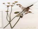
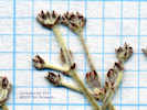
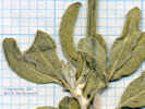
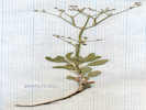
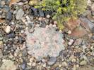

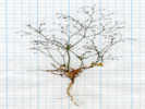
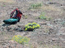
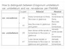
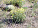
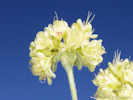
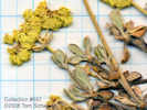
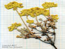
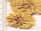
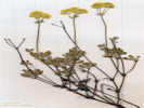


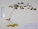
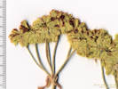
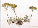
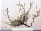
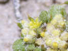
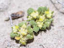
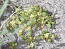
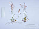
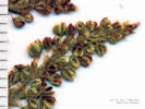
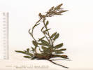
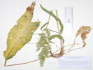
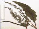
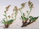
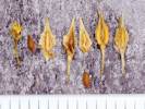
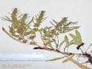
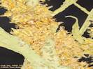

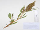

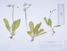

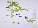
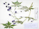
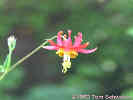


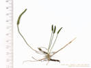

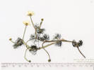


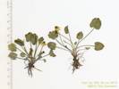
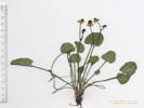
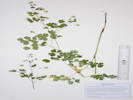
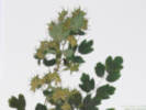
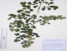
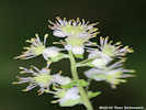
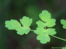
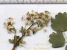
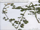
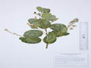


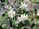
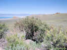
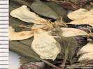
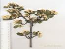


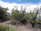
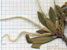
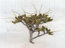
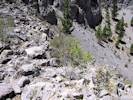

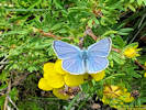
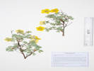

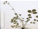
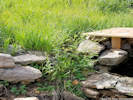
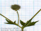
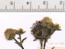
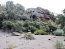
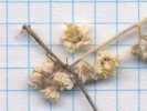
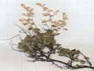
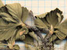


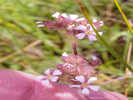
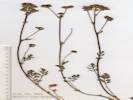
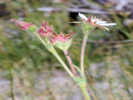
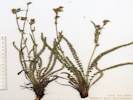
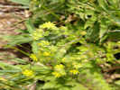

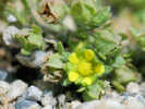
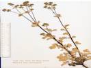
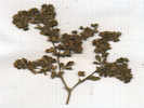
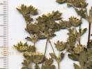
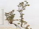
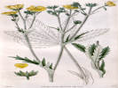
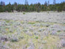

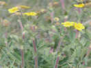
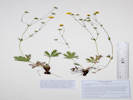
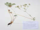
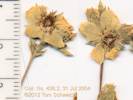

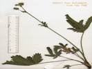
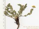
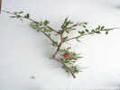
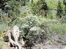
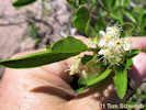

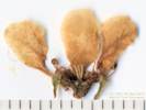
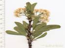
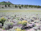
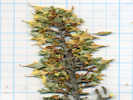

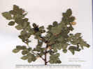
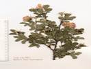
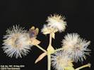
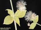
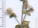
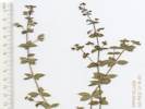

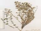
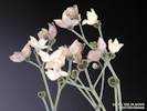
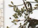
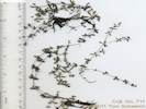
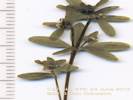

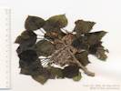
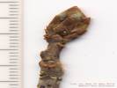

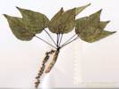
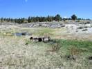
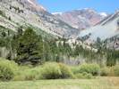

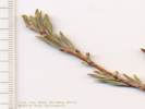
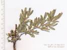

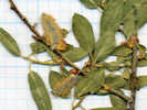

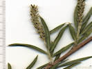
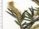
??? (free imbricate vs. fused);
Leaves linear, to 45 mm. long, < 7mm wide (obs: 3.5-5.0 mm), length 12-13 x width, margins entire, abaxial surface obscured by hair;
with hairs appressed and parallel to axis;
Stamens 2;
Style very short;
Stigmas lobed.
(Described from Coll. No. 483, 27 Nov 2011, and Coll. No. 865, 23 Jun 2012).
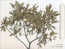
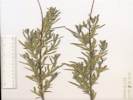
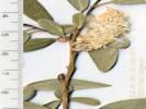
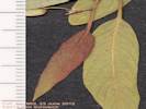
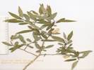

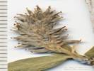
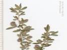

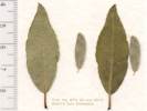
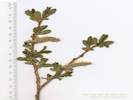

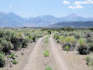


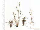


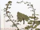

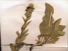
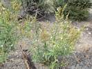
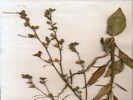
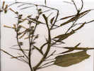

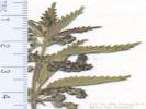

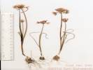
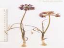
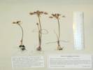

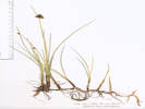

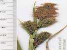
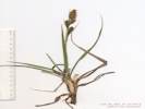
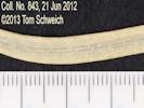

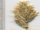
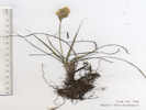
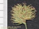
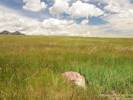

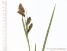


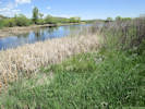
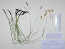
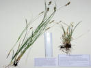


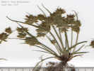
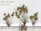

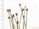
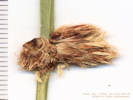

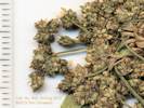
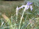
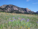
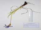
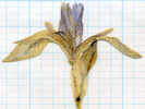
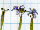


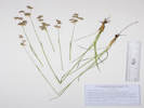
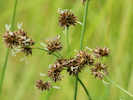
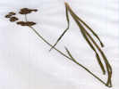
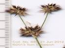
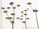

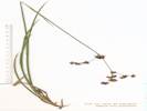

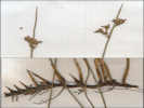
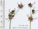

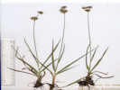
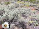
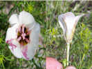
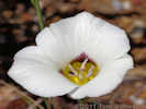


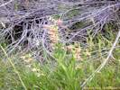
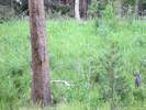
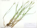
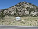
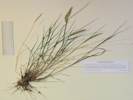
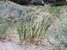
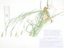
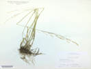
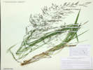
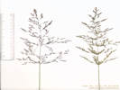
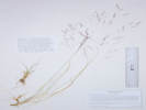
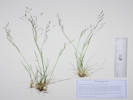
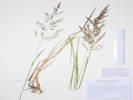
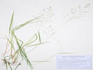
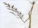
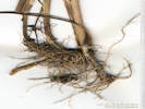
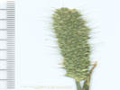
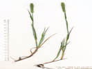

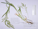
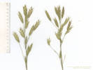
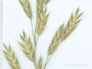
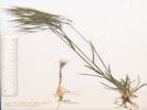
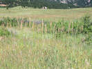
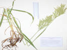
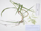
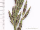
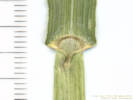
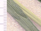
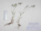
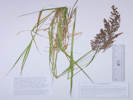

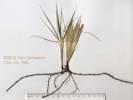
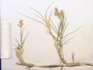
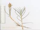
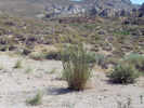
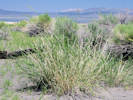
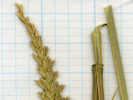
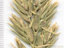
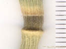
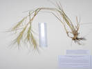
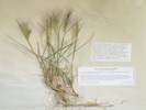
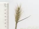
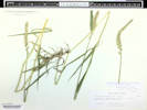
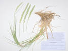
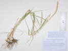
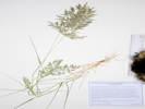
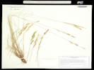
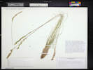
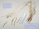
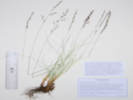
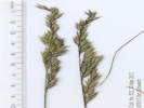
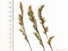
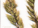
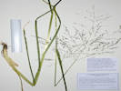
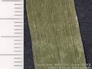
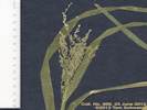
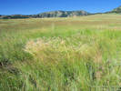
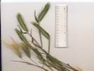
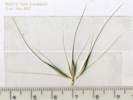
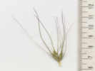
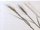
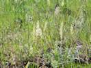
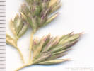
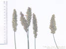
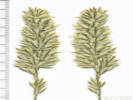
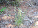
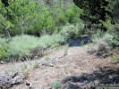
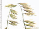
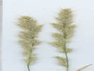
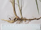
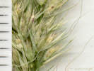
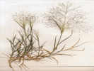
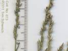
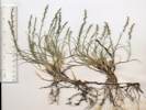
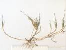
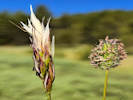
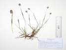
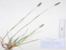
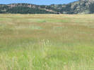
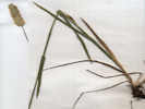
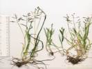
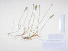
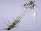
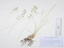
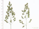
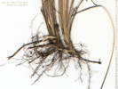
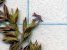
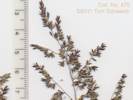
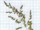

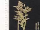
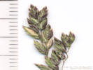
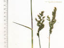
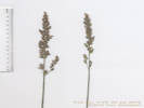
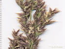
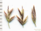
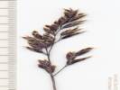
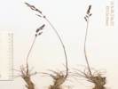

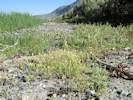

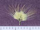
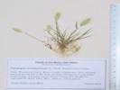
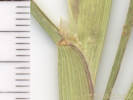

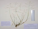
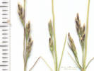
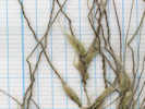
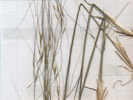
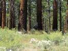
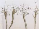
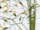
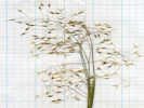
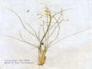
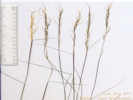
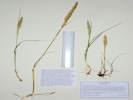
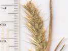
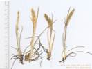
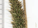
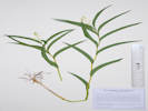

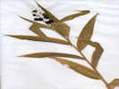

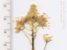
Total number of taxa: 778
Native Taxa:
(serif, italic, bold) 672 Exotic Taxa:
(sans-serif, italic)56 Nativity Undetermined:
(default font, italic) 50
Listed Weeds:
Identified as Weed 22
‡ -- Southwest Environmental Information Network, SEINet. 2009-2014. http//:swbiodiversity.org/seinet/index.php. Accessed from July 2009 to September 2014.
Locations Included in This Area
Bibliography