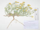
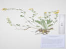
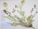
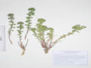
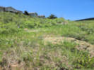
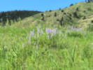
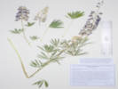
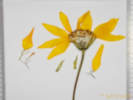
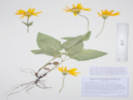
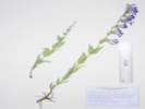
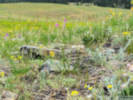
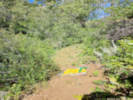
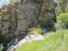
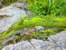
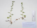
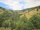
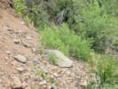
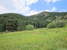
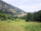
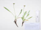
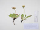
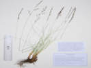
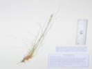
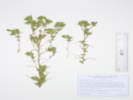
When I first read the field notes of Annie Alexander and Louise Kellogg, I was fascinated by the descriptions they wrote about the places they went and the plants and animals they found there. By publishing my field notes on the Internet I hope to follow a little bit in their tradition.
Plants of the Coal Creek Canyon Study Area Jefferson County Open Space, Colorado, USA
Ranunculaceae
Pulsatilla nuttalliana (DC.) Bercht. & J. Presl.
Pasque Flower.
Coal Creek Canyon Study Area, Lacey Parcel, Jefferson County, Colorado.
280 m. northwest of Coal Creek Canyon Fire Department Station 3, 14.2 km. north northwest of Golden.
39.87518°N, 105.27963°W.
WGS 1984
Elev. 2034 m.
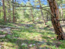
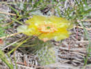
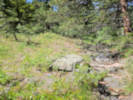
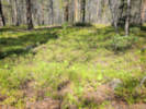
Open rocky field, recognizable here at this early date: Lomatium orientale, Echinocereus viridiflorus, Yucca glauca, and Carex inops ssp. heliophila.
Collected by permit: Jefferson County Open Space, 2024, issued: Mar 6, 2024, to: Tom Schweich.
Coal Creek Canyon Study Area, Lacey Parcel, Jefferson County, Colorado.
Isolated hill in the Idaho Springs-Ralston shear zone, 540 m. northwest of the Coal Creek Canyon Fire Department Station 3, 14.4 km. north northwest of Golden.
39.8765°N, 105.28229°W.
WGS 1984
Elev. 2053 m.
North side of hill in Ponderosa pine woodland.
Collected by permit: Jefferson County Open Space, 2024, issued: Mar 6, 2024, to: Tom Schweich.
Plants of the Coal Creek Canyon Study Area Jefferson County Open Space, Colorado, USA
Asteraceae
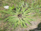
Cirsium vulgare (Savi) Ten.
Bull Thistle.
Coal Creek Canyon Study Area, Lacey Parcel, Jefferson County, Colorado.
In cobbles and gravel of the bank of Coal Creek, 850 m. northwest of the Coal Creek Canyon Fire Department Station 3, 14.6 km. north northwest of Golden.
39.87778°N, 105.28556°W.
WGS 1984
Elev. 2024 m.
Basal rosette.
iNaturalist Observation 209169508.
Collected by permit: Jefferson County Open Space, 2024, issued: Mar 6, 2024, to: Tom Schweich.
Native and Naturalized Flora of the Golden Area, Jefferson County, Colorado
Sapindaceae
Xanthoceras sorbifolium Bunge.
Yellowhorn.
Golden, Jefferson County, Colorado.
West end of alley parallel to 4th and 5th Streets, between Arapahoe and Cheyenne Streets, north side of alley, rooted between telephone pole and fence post, nearest street address 407 Cheyenne Street, 940 m. northwest of the GNIS location of Golden.
39.76091°N, 105.22961°W.
WGS 1984
Elev. 1759 m.
Woody shrub, about 2 m. tall, rooted at the base of a telephone pole, between that pole and a fence post.
Formerly grown in a private garden at 409 Cheyenne Street. Garden was destroyed by residential construction in 2018. However, this plant appeared in 2022 at the edge of the former garden some distance from the original location the plant was grown.
Collected by permit: City of Golden, 2024, issued: Mar 29, 2024, to: Tom Schweich.
Hildebrand Ranch Park, Jefferson County, Colorado.
East-facing slope below a flat. Unclear whether we are in Niobrara Fm. or on the Pierre Shale. 815 m. west of Hildebrand Ranch Park parking lot, 2.10 km. south southwest of West Metro Fire Rescue Station 14
39.55156°N, 105.11959°W.
WGS 1984
Elev. 1739 m.
Fine-grained calcareous sandstone with Musineon divaricatum, Helianthis pumilis, Delphinium sp., and Cercocarpus montanus.
These collections were made because of previous collections on nearby private land that are determined P. bellii (COLO201392, COLO201400).
Collected by permit: Jefferson County Open Space, 2024, issued: Mar 6, 2024, to: Tom Schweich.
The photograph was taken at roughly the same time as this collection was made, but I do not think this is actually one of the plants in the collection.
Hildebrand Ranch Park, Jefferson County, Colorado.
Top of an east-facing slope below flat. Unclear whether we are in Niobrara Fm. or on the Pierre Shale. 835 m. west of Hildebrand Ranch Park parking lot, 2.10 km. south southwest of West Metro Fire Rescue Station 14.
39.55153°N, 105.11978°W.
WGS 1984
Elev. 1746 m.
Fine-grained calcareous sandstone with Musineon divaricatum, Helianthis pumilis, Delphinium sp., and Cercocarpus montanus.
These collections were made because of previous collections on nearby private land that are determined P. bellii (COLO201392, COLO201400).
Collected by permit: Jefferson County Open Space, 2024, issued: Mar 6, 2024, to: Tom Schweich.
Hildebrand Ranch Park, Jefferson County, Colorado.
Just on the east slope of a small hogback mapped as Niobrara Fm., 965 m. west of Hildebrand Ranch Park parking lot, 2.15 km. south southwest of West Metro Fire Rescue Station 14.
39.55139°N, 105.12128°W.
WGS 1984
Elev. 1762 m.
Three of six plants growing under Cercocarpus montanus, with Eriogonum umbellatum and Opunita polyacantha.
These collections were made because of previous collections on nearby private land that are determined P. bellii (COLO201392, COLO201400).
Collected by permit: Jefferson County Open Space, 2024, issued: Mar 6, 2024, to: Tom Schweich.
Plants of Jefferson County Open Space Jefferson County, Colorado
Fabaceae
Oxytropis sericea Nutt. ex Torr. & A. Gray var. sericea.
White Locoweed.
Hildebrand Ranch Park, Jefferson County, Colorado.
Lower northeast slope of small hogback, near where the Two Brands Trail crossess through the hogback, 914 m. west southwest of parking lot, 24.5 km. south southeast of Golden.
39.549°N, 105.12029°W.
WGS 1984
Elev. 1760 m.
With Juniperus scopulorum, Musineon divaricatum, Cercocarpus montanus, Castilleja integra, Gutierrezia sarothrae, and Leucocrinum montanum.
Collected by permit: Jefferson County Open Space, 2024, issued: Mar 6, 2024, to: Tom Schweich.
Tom Schweich, with John Vickery
3242.
14-May-2024
Coll. No. 3242, 14 May 2024:
Perennial, to 35 cm., hairs soft, often wavy, not wart-like;
Leaves,
basal,
compound,
170 mm. × 36 mm. wide;
Leaflets,
#17±, 29 mm. × 7 mm. wide, hairy both sides;
Bracts,
11 mm., lanceolate;
Calyx,
tube 10 mm. + lobes 4 mm., hairs white, wavy;
Flowers,
ascending,
20-24 mm.,
banner, 19 mm., white with purple guides,
wings, 19 mm. (unable to see distinctive flexure of wings in dried specimens),
keel, 17 mm., purple distally, trip porrect;
Fruit,
last year's persistent,
20 mm. × 7 mm. wide,
ascending;
Hildebrand Ranch Park, Jefferson County, Colorado.
Lower northeast slope of small hogback, near where the Two Brands Trail crosses through the hogback, 914 m. west southwest of parking lot, 24.5 km. south southeast of Golden.
39.54897°N, 105.12019°W.
WGS 1984
Elev. 1755 m.
Also here: Euphorbia brachyceras, Cirsium undulatum, Bromus inermis, and Leucocrinum montanum.
Collected by permit: Jefferson County Open Space, 2024, issued: Mar 6, 2024, to: Tom Schweich.
Plants of Jefferson County Open Space Jefferson County, Colorado
Euphorbiaceae
Euphorbia brachycera Engelm.
Horned Spurge.
Hildebrand Ranch Park, Jefferson County, Colorado.
Lower northeast slope of small hogback, near where the Two Brands Trail crosses through the hogback, 914 m. west southwest of parking lot, 24.5 km. south southeast of Golden.
39.54898°N, 105.12019°W.
WGS 1984
Elev. 1755 m.
Also here: Ipomopsis spicata, Cirsium undulatum, Bromus inermis, and Leucocrinum montanum.
Collected by permit: Jefferson County Open Space, 2024, issued: Mar 6, 2024, to: Tom Schweich.
Plants of Jefferson County Open Space Jefferson County, Colorado
Asteraceae
Packera plattensis (Nuttall) W. A. Weber & Á. Löve.
Prairie Groundsel.
Hildebrand Ranch Park, Jefferson County, Colorado.
Lower northeast slope of small hogback, near where the Two Brands Trail crosses through the hogback, 875 m. west southwest of parking lot, 24.5 km. south southeast of Golden.
39.54936°N, 105.11992°W.
WGS 1984
Elev. 1751 m.
Small groups of 2-4 plants scattered across the lowest slope of the hogback.
Collected by permit: Jefferson County Open Space, 2024, issued: Mar 6, 2024, to: Tom Schweich.
Populus deltoides var. monilifera with pistillate catkins.
Native and Naturalized Flora of the Golden Area, Jefferson County, Colorado
Salicaceae
Populus deltoides Marshall ssp. monilifera (Aiton) Eckenw.
Plains Cottonwood.
Deadman Gulch, Jefferson County, Colorado.
East side of Highway 6, along the Illinois Street Trail, 2.21 km. south of the GNIS location of Golden.
39.73625°N, 105.21488°W.
WGS84
Elev. 1801 m.
Pistillate catkins with developing fruit.
Also collected here: Apocynum ×floribundum, Mirabilis nyctaginea, Rhamnus cathartica, and Schoenoplectus tabermontani.
Collected by permit: City of Golden, 2024, issued: Mar 29, 2024, to: Tom Schweich.
Tripp Ranch Meadow, Jefferson County, Colorado.
Very small (1.67 ac.) City of Golden-owned open space, adjacent to Jefferson County Open Space (Apex Park) and Stonebridge HOA common area, accessed by narrow passage from Crawford Street, 3.44 km. south of the GNIS location of Golden.
39.72481°N, 105.21653°W.
WGS 1984
Elev. 1861 m.
Flowers quite pink compared to others seen around Golden s.l.
On ridge near top of and entrance to parcel. Also here: Artemisia frigida, Artemisia ludoviciana, Grindelia squarrosa, Senecio integerrimus, Opuntia macrorhiza, O. polyacantha, Eriogonum umbellatum, Cercocarpus montanus, and Potentilla fissa
High mixed-grass prairie at base of Rocky Mountain Front Range.
Collected by permit: City of Golden, 2024, issued: Mar 29, 2024, to: Tom Schweich.
Coal Creek Canyon Study Area, Lacey Parcel, Jefferson County, Colorado.
Beside dry streambed composed mostly of cobbles, 180 m. west southwest of the Coal Creek Canyon Fire Station 3, 13.9 km. northwest of Golden.
39.87256°N, 105.27962°W.
WGS 1984
Elev. 2040 m.
Also here: Cynoglossum officinale, Silene latifolia, Lupinus argentea, and Prunus virginiana.
Collected by permit: Jefferson County Open Space, 2024, issued: Mar 6, 2024, to: Tom Schweich.
Coal Creek Canyon Study Area, Lacey Parcel, Jefferson County, Colorado.
South side of gulch that drains by Coal Creek Canyon Fire Station No. 3, 567 m. southwest of the fire station, 14.0 km. northwest of Golden.
39.87207°N, 105.28415°W.
WGS 1984
Elev. 2107 m.
Open Douglas fir forest, with Cynoglossum officinale, Mertensia lanceolata, Veronica biloba, Androsace occidentalis, and Rubus deliciosus.
Collected by permit: Jefferson County Open Space, 2024, issued: Mar 6, 2024, to: Tom Schweich.
Plants of Jefferson County Open Space Jefferson County, Colorado
Cyperaceae
Carex rossii Boott.
Ross Sedge.
Coal Creek Canyon Study Area, Lacey Parcel, Jefferson County, Colorado.
On a terrace, right bank of the second creek on the south side of Coal Creek Canyon, the first being that of Blue Mountain Estates, 565 m. west southwest of Coal Creek Canyon Fire Department Station 3.
39.87211°N, 105.28411°W.
WGS 1984
Elev. 2108 m.
Open Douglas fir forest with little understory, and that of Physocarpus monogynus, with a large patch of a Veronica, c.f. V. biloba.
Smut-infected(?).
Collected by permit: Jefferson County Open Space, 2024, issued: Mar 6, 2024, to: Tom Schweich.
Tom Schweich
3250.
10-Jun-2024
Coll. No. 3250, 10 June 2024, characters observed:
Perennial sedge, cespitose, to 30 cm.;
Leaves,
0.7 mm. wide,
green,
sheaths margins white-hyaline;
Inflorescence,
30 mm. × 5 mm. wide,
3-5 spikes;
Spikes,
basal present,
terminal staminate,
lateral, pistillate, 2-4;
Bracts,
proximal 20 mm.,
±= inflorescence,
leaf-like;
Pistillate scales,
3 mm.,
>perigynia,
green mid-vein, brown laterally, hyaline margin,
awn 0;
Perigynia,
2-4 per pistillate spike,
2.7 mm. × 1.7 mm. wide,
wingless,
pubescent,
beak 0.7-1.3 mm.,
bi-dentate;
Achene,
spherical,
1.5 mm. × 1.5 mm. wide,
black,
smut-infested?;
Stigma,
#3;
Anthers,
not seen.
Plants of the Coal Creek Canyon Study Area Jefferson County Open Space, Colorado, USA
Ruscaceae
Maianthemum racemosum (L.) Link ssp. amplexicaule (Nutt.) LaFrankie.
Feathery False Lily of the Valley.
Coal Creek Canyon Study Area, Lacey Parcel, Jefferson County, Colorado.
On a terrace, right bank of the second creek on the south side of Coal Creek Canyon, the first being that of Blue Mountain Estates, 725 m. west southwest of Coal Creek Canyon Fire Department Station 3, 14.0 km. northwest of Golden.
39.87174°N, 105.28588°W.
WGS 1984
Elev. 2135 m.
Open Douglas fir forest (little to no middlestory) with Physocarpus montanus and Prunus virginiana.
Collected by permit: Jefferson County Open Space, 2024, issued: Mar 6, 2024, to: Tom Schweich.
Plants of the Coal Creek Canyon Study Area Jefferson County Open Space, Colorado, USA
Asteraceae
Arnica cordifolia Hook.
Heart-Leaf Leopardbane.
Coal Creek Canyon Study Area, Lacey Parcel, Jefferson County, Colorado.
On a terrace, right bank of the second creek on the south side of Coal Creek Canyon, the first being that of Blue Mountain Estates, 787 m. west southwest of Coal Creek Canyon Fire Department Station 3, 14.0 km. northwest of Golden.
39.87137°N, 105.28656°W.
WGS 1984
Elev. 2155 m.
Open Douglas fir forest, with Acer glabrum.
Collected by permit: Jefferson County Open Space, 2024, issued: Mar 6, 2024, to: Tom Schweich.
Tom Schweich
3252.
10-Jun-2024
Coll. No. 3252, 10 June 2024, characters observed:
Perennial, to 40 cm.,
rhizomes long and thin;
Stem,
simple (of 4 plants one was branched at base),
arachnoid hairy;
Leaves,
opposite,
1-2 pairs,
64 mm. × 42 mm. wide,
cordate,
margin dentate (to almost serrate);
Inflorescence,
heads solitary;
Receptacle,
epaleate;
Phyllaries,
1st series, 21 mm. × 3 mm. wide, green, margin chartaceous, pilose,
2nd series, very thin chartaceous;
Ray flowers,
fertile,
#11,
yellow,
tube 6.5 mm. + blade 25 mm. × 9.5 mm. wide;
Disc flowers,
many, yellow,
tube 10 mm. + lobes 1 mm.;
Pappus,
many,
9 mm.,
white,
capillary;
Cypsela,
6 mm.,
dark gray,
strigose.
Plants of the Coal Creek Canyon Study Area Jefferson County Open Space, Colorado, USA
Apiaceae
Aletes acaulis (Torr.) J.M. Coult. & Rose.
Stemless Indian Parsley.
Coal Creek Canyon Study Area, Lacey Parcel, Jefferson County, Colorado.
On a terrace, right bank of the second creek on the south side of Coal Creek Canyon, the first being that of Blue Mountain Estates, 936 m. west southwest of Coal Creek Canyon Fire Department Station 3, 14.0 km. northwest of Golden.
39.8708°N, 105.28817°W.
WGS 1984
Elev. 2197 m.
Rocky forest floor, on lower part of an rock outcrop prominent in aerial imagery.
Collected by permit: Jefferson County Open Space, 2024, issued: Mar 6, 2024, to: Tom Schweich.
Coal Creek Canyon Study Area, Lacey Parcel, Jefferson County, Colorado.
Nose of ridge, 483 m. west southwest of Coal Creek Canyon Fire Station 33, 14.0 km. north northwest of Golden.
39.87187°N, 105.28302°W.
WGS 1984
Elev. 2129 m.
Petals 29 mm., orange, fruit ascending.
Open woodland with Pinus ponderosa, Cercocarpus montanus, and Potentilla fissa.
Collected by permit: Jefferson County Open Space, 2024, issued: Mar 6, 2024, to: Tom Schweich.
Centennial Cone Park, Jefferson County, Colorado.
In a small pass between Elk Creek and Guy Gulch, 870 m. southeast of the Ralph Schell Trailhead, 10.1 km. west northwest of Golden.
39.76798°N, 105.33786°W.
WGS 1984
Elev. 2322 m.
Montane grassland, with: Erigeron divergens, Echinocereus viridiflorus, and Oxytropis lambertii.
Collected by permit: Jefferson County Open Space, 2024, issued: Mar 6, 2024, to: Tom Schweich.
Centennial Cone Park, Jefferson County, Colorado.
In a small pass between Elk Creek and Guy Gulch, 870 m. southeast of the Ralph Schell Trailhead, 10.1 km. west northwest of Golden.
39.768°N, 105.33795°W.
WGS 1984
Elev. 2326 m.
Montane grassland, with: Artemisia frigida, Helianthus pumilis, and Heterotheca villosa.
Collected by permit: Jefferson County Open Space, 2024, issued: Mar 6, 2024, to: Tom Schweich.
Plants of Jefferson County Open Space Jefferson County, Colorado
Fabaceae
Oxytropis lambertii Pursh.
Purple Locoweed.
Centennial Cone Park, Jefferson County, Colorado.
In a small pass between Elk Creek and Guy Gulch, 870 m. southeast of the Ralph Schell Trailhead, 10.1 km. west northwest of Golden.
39.76797°N, 105.33787°W.
WGS 1984
Elev. 2322 m.
Montane grassland, with: Erigeron divergens, Echinocereus viridiflorus, and Koeleria macrantha.
Collected by permit: Jefferson County Open Space, 2024, issued: Mar 6, 2024, to: Tom Schweich.
Plants of Jefferson County Open Space Jefferson County, Colorado
Orobanchaceae
Castilleja integra A. Gray.
Wholeleaf Indian Paintbrush.
Centennial Cone Park, Jefferson County, Colorado.
In a small pass between Elk Creek and Guy Gulch, 860 m. southeast of the Ralph Schell Trailhead, 10.1 km. west northwest of Golden.
39.76811°N, 105.33795°W.
WGS 1984
Elev. 2324 m.
Montane grassland, also nearby: Harbouria trachypleura, Heterotheca villosa, Alyssum simplex, and Eriogonum arcuatum.
About 15 m. upslope from the other collections at this site.
Collected by permit: Jefferson County Open Space, 2024, issued: Mar 6, 2024, to: Tom Schweich.
Plants of Jefferson County Open Space Jefferson County, Colorado
Crassulaceae
Sedum lanceolatum Torr.
Spearleaf Stonecrop.
Centennial Cone Park, Jefferson County, Colorado.
Western slope of unnamed hill between Elk Creek and Guy Gulch, 880 m. southeast of Ralph Schell Trailhead, 10.6 km. west northwest of Golden.
39.76681°N, 105.33873°W.
WGS 1984
Elev. 2332 m.
Also seen here: Harbouria trachypleura, Pediocactus simpsonii, Astragalus laxmannii robustior, Eriogonum arcuatum, Cercocarpus montanus, and Potentilla fissa.
Collected by permit: Jefferson County Open Space, 2024, issued: Mar 6, 2024, to: Tom Schweich.
Plants of Jefferson County Open Space Jefferson County, Colorado
Polygonaceae
Eriogonum umbellatum Torr. var. umbellatum.
Sulphur-Flower Buckwheat.
Centennial Cone Park, Jefferson County, Colorado.
Slope above right bank of Elk Creek, near junction of Travois Trail and Evening Sun Loop, 760 m. southeast of the Ralph Schell Trailhead, 10.3 km. west northwest of Golden.
39.76752°N, 105.33977°W.
WGS 1984
Elev. 2303 m.
Grassy east-facing slope above creek, with: Artemisia dracunculus, Artemisia frigida, Helianthus pumilus, and Bromus inermis.
Collected by permit: Jefferson County Open Space, 2024, issued: Mar 6, 2024, to: Tom Schweich.
Plants of Jefferson County Open Space Jefferson County, Colorado
Fabaceae
Astragalus laxmannii Jacq. var. robustior (Hook.) Barneby & S. L. Welsh.
Prairie Milkvetch.
Centennial Cone Park, Jefferson County, Colorado.
South-facing slope above tributary of Elk Creek, between Elk Range Trail and Evening Sun Loop, 698 m. southeast of the Ralph Schell Trailhead, 10.3 km. west northwest of Golden.
39.76765°N, 105.34058°W.
WGS 1984
Elev. 2304 m.
Montane grassland, with: Rhus trilobata, Heterotheca villosa, Astragalus flexuosus, Eriogonum arcuatum, and Hesperostipa comata.
Collected by permit: Jefferson County Open Space, 2024, issued: Mar 6, 2024, to: Tom Schweich.
Plants of Jefferson County Open Space Jefferson County, Colorado
Orobanchaceae
Orobanche fasciculata Nutt.
Clustered Broomrape.
Centennial Cone Park, Jefferson County, Colorado.
South-facing slope above tributary of Elk Creek, between Elk Range Trail and Evening Sun Loop, 680 m. southeast of the Ralph Schell Trailhead, 10.3 km. west northwest of Golden.
39.76795°N, 105.34056°W.
WGS 1984
Elev. 2315 m.
Montane grassland, with: Artemisia frigida, Helianthus pumilus, Heterotheca villosa Eriogonum umbellatum, and Carex inops heliophila.
Numerous plants seen here, 15±.
Collected by permit: Jefferson County Open Space, 2024, issued: Mar 6, 2024, to: Tom Schweich.
Centennial Cone Park, Jefferson County, Colorado.
South-facing slope above tributary of Elk Creek, between Elk Range Trail and Evening Sun Loop, 658 m. southeast of the Ralph Schell Trailhead, 10.3 km. west northwest of Golden.
39.76817°N, 105.34066°W.
WGS 1984
Elev. 2318 m.
Montane grassland, with: Helianthus pumilis, Erysimum capitatum, Linum lewisii, and Erigonum alatum.
Collected by permit: Jefferson County Open Space, 2024, issued: Mar 6, 2024, to: Tom Schweich.
Centennial Cone Park, Jefferson County, Colorado.
South-facing slope above tributary of Elk Creek, between Elk Range Trail and Evening Sun Loop, 533 m. southeast of the Ralph Schell Trailhead, 10.5 km. west northwest of Golden.
39.76852°N, 105.34211°W.
WGS 1984
Elev. 2321 m.
Rocky ridge, soil covered with mosses.
Collected by permit: Jefferson County Open Space, 2024, issued: Mar 6, 2024, to: Tom Schweich.
Centennial Cone Park, Jefferson County, Colorado.
South-facing slope above tributary of Elk Creek, between Elk Range Trail and Evening Sun Loop, 403 m. southeast of the Ralph Schell Trailhead, 10.6 km. west northwest of Golden.
39.76968°N, 105.34293°W.
WGS 1984
Elev. 2338 m.
Montane grassland.
Collected by permit: Jefferson County Open Space, 2024, issued: Mar 6, 2024, to: Tom Schweich.
Plants of the Coal Creek Canyon Study Area Jefferson County Open Space, Colorado, USA
Rubiaceae
Galium boreale L.
Bedstraw.
Coal Creek Canyon Study Area, Lacey Parcel, Jefferson County, Colorado.
Edge of forest opening, 75 m. southwest of Coal Creek, 1.52 km. west northwest of Fire Station 3, 15.0 km. north northwest of Golden.
39.87821°N, 105.29416°W.
WGS 1984
Elev. 2065 m.
Open woodland with Pinus ponderosa, Pseudotsuga menziesii, Apocynum sp., Artemisia sp., Berberis repens, and Geranium cespitosum.
Collected by permit: Jefferson County Open Space, 2024, issued: Mar 6, 2024, to: Tom Schweich.
Plants of the Coal Creek Canyon Study Area Jefferson County Open Space, Colorado, USA
Berberidaceae
Berberis repens Lindl.
Creeping Barberry.
Coal Creek Canyon Study Area, Lacey Parcel, Jefferson County, Colorado.
Edge of forest opening, 75 m. southwest of Coal Creek, 1.52 km. west northwest of Fire Station 3, 15.0 km. north northwest of Golden.
39.87823°N, 105.29413°W.
WGS 1984
Elev. 2070 m.
In fruit, green when collected, fading to a dark brown.
Collected by permit: Jefferson County Open Space, 2024, issued: Mar 6, 2024, to: Tom Schweich.
Apocynum sp., initially determined A. androsaemifolium.
Plants of the Coal Creek Canyon Study Area Jefferson County Open Space, Colorado, USA
Apocynaceae
Apocynum ×floribundum Greene.
Dogbane.
Coal Creek Canyon Study Area, Lacey Parcel, Jefferson County, Colorado.
Edge of forest opening, 75 m. southwest of Coal Creek, 1.52 km. west northwest of Fire Station 3, 15.0 km. north northwest of Golden.
39.87817°N, 105.29412°W.
WGS 1984
Elev. 2067 m.
Leaves spreading to descending. Various ratios of calyx tube and lobes to corolla tube and lobes in 1.75 to 2.167 range. Corolla lobes spreading.
Collected by permit: Jefferson County Open Space, 2024, issued: Mar 6, 2024, to: Tom Schweich.
Tom Schweich
3268.
21-Jun-2024
Coll. No. 3268, 21 June 2024, characters observed:
Leaves, spreading to slightly descending;
Calyx, tube 1 mm. + lobes 2 mm. = 3 mm.;
Corolla, tube 3.5-4 mm. + lobes 2.5 mm. = 6.0-6.5 mm., lobes spreading;
Ratio: calyx 3 mm.:corolla 6.5 mm. = 2.167× is inconclusive per Ackerfield (2022), Weber&Wittmann (2012), and Welch, et al. (1993);
Ratio: corolla tube 3.5-4 mm.:calyx lobe 2 mm. = 1.75-2× suggests A. ×floribundum per FNA.
Coal Creek Canyon Study Area, Lacey Parcel, Jefferson County, Colorado.
Second primary drainage of Lacey parcel, about 110 m. southwest of Coal Creek, 1.54 km. west northwest of Coal Creek Canyon Fire Station #3, 15.0 km. northwest of Golden.
39.87804°N, 105.29453°W.
WGS 1984
Elev. 2073 m.
Sunny openings in ponderosa pine and Douglas fir forest. Also here: Acer glabrum, Prunus virginiana, Geranium caespitosum, and Amelanchier alnifolia.
Collected by permit: Jefferson County Open Space, 2024, issued: Mar 6, 2024, to: Tom Schweich.
Tom Schweich
3269.
21-Jun-2024
Perennial, 1 m., sunny mountain valley slope;
Leaves,
tripinnately compound;
Leaflets,
well-defined,
ultimate leaf division, 2-3 mm.;
Inflorescence,
compound umbel;
Involucral bractlets,
green, few;
Flowers,
white;
Ovary,
glabrous;
Stylopodium,
conic, frilled;
Fruit,
glabrous;
(Described from Coll. No. 3248, 10 June 2024, and Coll. No. 3269, 21 June 2024.)
Plants of the Coal Creek Canyon Study Area Jefferson County Open Space, Colorado, USA
Boraginaceae
Lithospermum multiflorum Torrey ex A. Gray.
Many Flowered Stoneseed.
Coal Creek Canyon Study Area, Lacey Parcel, Jefferson County, Colorado.
Second primary drainage of Lacey parcel, about 250 m. southwest of Coal Creek, 1.64 km. west northwest of Coal Creek Canyon Fire Station #3, 15.0 km. northwest of Golden.
39.87754°N, 105.29595°W.
WGS 1984
Elev. 2098 m.
Small opening in forest, with Pinus ponderosa, Acer glabrum, Amelanchier alnifolia, and Geranium caespitosum.
Collected by permit: Jefferson County Open Space, 2024, issued: Mar 6, 2024, to: Tom Schweich.
Plants of the Coal Creek Canyon Study Area Jefferson County Open Space, Colorado, USA
Cyperaceae
Carex occidentalis L. H. Bailey.
Western Sedge.
Coal Creek Canyon Study Area, Lacey Parcel, Jefferson County, Colorado.
Second primary drainage of Lacey parcel, about 240 m. southwest of Coal Creek, 1.62 km. west northwest of Coal Creek Canyon Fire Station #3, 15.0 km. northwest of Golden.
39.8775°N, 105.29574°W.
WGS 1984
Elev. 2098 m.
Under forest canopy, with Pseutotsuga menziesii, and Acer glabrum.
Collected by permit: Jefferson County Open Space, 2024, issued: Mar 6, 2024, to: Tom Schweich.
Coal Creek Canyon Study Area, Lacey Parcel, Jefferson County, Colorado.
Second primary drainage of Lacey parcel, about 280 m. southwest of Coal Creek, 1.67 km. west northwest of Coal Creek Canyon Fire Station #3, 15.0 km. northwest of Golden.
39.87722°N, 105.29641°W.
WGS 1984
Elev. 2106 m.
Douglas fir forest, also here: Physocarpus montanus, Viola canadensis, and Maianthemum racemosum ssp. amplexicaule.
Collected by permit: Jefferson County Open Space, 2024, issued: Mar 6, 2024, to: Tom Schweich.
Plants of the Coal Creek Canyon Study Area Jefferson County Open Space, Colorado, USA
Boraginaceae
Lithospermum occidentale (Mack.) Weakley, Witsell & D. Estes.
Western Marbleseed.
Coal Creek Canyon Study Area, Lacey Parcel, Jefferson County, Colorado.
Second primary drainage of Lacey parcel, about 220 m. southwest of Coal Creek, 1.65 km. west northwest of Coal Creek Canyon Fire Station #3, 15.0 km. northwest of Golden.
39.87787°N, 105.29605°W.
WGS 1984
Elev. 2099 m.
Sunny southeast-facing grassland, with Artemisia dracunculus, Heterotheca villosa, Opuntia polyacantha, Castilleja integra, and Rosa arkansana.
Collected by permit: Jefferson County Open Space, 2024, issued: Mar 6, 2024, to: Tom Schweich.
Plants of the Coal Creek Canyon Study Area Jefferson County Open Space, Colorado, USA
Saxifragaceae
Heuchera parvifolia Nutt. ex Torr. & A. Gray.
Littleleaf Alumroot.
Coal Creek Canyon Study Area, Lacey Parcel, Jefferson County, Colorado.
Second primary drainage of Lacey parcel, about 285 m. southwest of Coal Creek, 1.64 km. west northwest of Coal Creek Canyon Fire Station #3, 15.0 km. northwest of Golden.
39.87764°N, 105.29595°W.
WGS 1984
Elev. 2094 m.
Bank of creek, with Pinus ponderosa, Osmorhiza depauperata, Hydrophyllum fendleri, and Acer glabrum.
Collected by permit: Jefferson County Open Space, 2024, issued: Mar 6, 2024, to: Tom Schweich.
Plants of the Coal Creek Canyon Study Area Jefferson County Open Space, Colorado, USA
Phrymaceae
Erythranthe floribunda (Douglas ex Lindl.) G. L. Nesom.
Many Flowered Monkey Flower.
Coal Creek Canyon Study Area, Lacey Parcel, Jefferson County, Colorado.
Second primary drainage of Lacey parcel, about 160 m. southwest of Coal Creek, 1.60 km. west northwest of Coal Creek Canyon Fire Station #3, 15.0 km. northwest of Golden.
39.87788°N, 105.29533°W.
WGS 1984
Elev. 2084 m.
Growing with bryophytes in rocky streambed with a trickle of water.
Collected by permit: Jefferson County Open Space, 2024, issued: Mar 6, 2024, to: Tom Schweich.
Plants of the Coal Creek Canyon Study Area Jefferson County Open Space, Colorado, USA
Fabaceae
Lupinus argenteus Pursh var. rubricaulis (Greene) S.L. Welsh.
Silvery Lupine.
Coal Creek Canyon Study Area, Lacey Parcel, Jefferson County, Colorado.
Opening in forest on right bank of creek, 105 m. southwest of Coal Creek,1.55 km. west northwest of Coal Creek Fire Station #3, 15.0 km. north northwest of Golden.
39.878°N, 105.29458°W.
WGS 1984
Elev. 2076 m.
Tall, lacking basal leaves, petals mostly white, blue-tinged wings.
Collected by permit: Jefferson County Open Space, 2024, issued: Mar 6, 2024, to: Tom Schweich.
Plants of the Coal Creek Canyon Study Area Jefferson County Open Space, Colorado, USA
Boraginaceae
Hackelia floribunda (Lehm.) I. M. Johnst.
Many-Flowered Stickseed.
Coal Creek Canyon Study Area, Lacey Parcel, Jefferson County, Colorado.
Terrace about 80 m. south of Coal Creek, 1.49 km. west northwest of Coal Creek Fire Station #3, 15.0 km. north northwest of Golden.
39.878°N, 105.29397°W.
WGS 1984
Elev. 2071 m.
Openings in mixed Douglas fir and ponderosa pine forest with Apocynum sp., Rubus deliciosus, and Thalictrum fendleri.
Collected by permit: Jefferson County Open Space, 2024, issued: Mar 6, 2024, to: Tom Schweich.
Coal Creek Canyon Study Area, Lacey Parcel, Jefferson County, Colorado.
Forest glade on right bank of Coal Creek, 1.37 km. west northwest of Coal Creek Fire Station #3, 14.9 km. north northwest of Golden.
39.87786°N, 105.29247°W.
WGS 1984
Elev. 2057 m.
Forest glade in openings between Pinus ponderosa, with Eriogonum umbellatum, Clematis hirsuta, and Bromus inermis.
Collected by permit: Jefferson County Open Space, 2024, issued: Mar 6, 2024, to: Tom Schweich.
Tom Schweich
3278.
21-Jun-2024
It was suggested to me that “... the type of P. pulcherrima itself is subpalmate,
and possibly part of the hybrid swarm between P. hippiana and what should probably be called P. filipes” (BAE, personal communication January, 2023).
Plants of the Coal Creek Canyon Study Area Jefferson County Open Space, Colorado, USA
Fabaceae
Lupinus argenteus Pursh var. argenteus.
Loosely Flowered Silver Lupine.
Coal Creek Canyon Study Area, Lacey Parcel, Jefferson County, Colorado.
North side of Coal Creek, south-facing bank between Colorado State Highway 72 “Coal Creek Canyon Road” and the creek, 1.42 km. northwest of Coal Creek Fire Station #3, 1.50 km. north northwest of Golden.
39.87924°N, 105.29231°W.
WGS 1984
Elev. 2067 m.
Disturbed grassland in openings between Pinus ponderosa, with Eriogonum umbellatum, Clematis hirsuta, and Bromus inermis.
Collected by permit: Jefferson County Open Space, 2024, issued: Mar 6, 2024, to: Tom Schweich.
Plants of Jefferson County Open Space Jefferson County, Colorado
Phrymaceae
Erythranthe floribunda (Douglas ex Lindl.) G. L. Nesom.
Many Flowered Monkey Flower.
Magpie Gulch, Jefferson County, Colorado.
Southeast corner of Mount Galbraith Park, 2.17 km. west northwest of the GNIS location of Golden.
39.7588°N, 105.24606°W.
WGS 1984
Elev. 1910 m.
Calyx inflated in fruit, teeth nearly equal; Corolla yellow.
Small cascade over bedrock, with mosses, Dodecatheon pulchelllum, Potentilla norvrgica, Heuchera parvifolia, and Eleocharis sp.
Collected by permit: Jefferson County Open Space, 2024, issued: Mar 6, 2024, to: Tom Schweich.
Plants of Jefferson County Open Space Jefferson County, Colorado
Cyperaceae
Eleocharis quinqueflora (Hartmann) O. Schwarz.
Fewflower Spikerush.
Magpie Gulch, Jefferson County, Colorado.
Southeast corner of Mount Galbraith Park, 2.17 km. west northwest of the GNIS location of Golden.
39.75883°N, 105.24608°W.
WGS 1984
Elev. 1909 m.
Small cascade over bedrock, with mosses, Erythranthe floribunda, Dodecatheon pulchelllum, Potentilla norvegica, and Heuchera parvifolia.
Collected by permit: Jefferson County Open Space, 2024, issued: Mar 6, 2024, to: Tom Schweich.
Plants of Jefferson County Open Space Jefferson County, Colorado
Rosaceae
Potentilla norvegica L.
Norwegian Cinquefoil.
Magpie Gulch, Jefferson County, Colorado.
Southeast corner of Mount Galbraith Park, about 690 m. west of Canyon Point Circle, 2.17 km. west northwest of the GNIS location of Golden.
39.75886°N, 105.24608°W.
WGS 1984
Elev. 1909 m.
Near a small cascade over bedrock, drying mud and grasses away from creek, with Erythranthe floribunda, Dodecatheon pulchellum, Eleocharis sp., and Poa pratensis.
Collected by permit: Jefferson County Open Space, 2024, issued: Mar 6, 2024, to: Tom Schweich.
Plants of Jefferson County Open Space Jefferson County, Colorado
Juncaceae
Juncus bufonius L.
Toad Rush.
Magpie Gulch, Jefferson County, Colorado.
Southeast corner of Mount Galbraith Park, about 690 m. west of Canyon Point Circle, 2.17 km. west northwest of the GNIS location of Golden.
39.75886°N, 105.24608°W.
WGS 1984
Elev. 1909 m.
Near a small cascade over bedrock, drying mud and grasses away from creek, with Erythranthe floribunda, Dodecatheon pulchellum, Potentilla norvegica, Eleocharis sp., and Poa pratensis.
Collected by permit: Jefferson County Open Space, 2024, issued: Mar 6, 2024, to: Tom Schweich.
Plants of Jefferson County Open Space Jefferson County, Colorado
Rosaceae
Potentilla gracilis Hook. var. fastigiata (Nutt.) S. Watson.
Slender Cinquefoil.
Ranson/Edwards Homestead Open Space Park, Jefferson County, Colorado.
Open field off of Plainview Road, 1.2 miles west on CO State Highway 72 "Coal Creek Canyon Road" from CO State Highway 93, 0.9 miles generally north on Plainview Road, then 130 m. generally west into field.
39.88577°N, 105.2636°W.
WGS 1984
Elev. 1949 m.
Uncommon. Average leaflet incision <½.
Open grassy field that is a little wetter than most, also here: Helianthus pauciflorus ssp. subrhomboideus, Sonchus asper, Opuntia fragilis (in nearby gravel bar), and Sisyrinchium montanum.
Collected by permit: Jefferson County Open Space, 2024, issued: Mar 6, 2024, to: Tom Schweich.
Plants of Jefferson County Open Space Jefferson County, Colorado
Polygonaceae
Rumex triangulivalvis (Danser) Rech. f.
Triangular-Valved Dock.
Ranson/Edwards Homestead Open Space Park, Jefferson County, Colorado.
1.7 miles west on CO Highway 72 from CO Highway 93, then 0.9 miles generally north on Plainview Road, then about 215 m. west to south side of a small dam across creek.
39.8864°N, 105.26434°W.
WGS 1984
Elev. 1954 m.
Inner tepals with a tubercle, margins entire; leaf margins flat.
Also here: Gratiola neglecta, Persicaria pensylvanica, Alisma triviale, and Eleocharis palustris.
Collected by permit: Jefferson County Open Space, 2024, issued: Mar 6, 2024, to: Tom Schweich.
Plants of Jefferson County Open Space Jefferson County, Colorado
Apiaceae
Cicuta maculata L. var. angustifolia Hook.
Spotted Water Hemlock.
Ranson/Edwards Homestead Open Space Park, Jefferson County, Colorado.
1.7 miles west on CO Highway 72 from CO Highway 93, then 0.9 miles generally north on Plainview Road, then about 575 m. generally west along small creek. 15.1 km. north northwest of Golden.
39.88677°N, 105.2685°W.
WGS 1984
Elev. 1991 m.
Growing in creek, also nearby: Heliomeris multiflora, Mentha arvensis, Lysimachia ciliata, Ranunculus pensylvanicus, and Galium boreale.
Infraspecific names are not accepted by current Colorado florae.
Collected by permit: Jefferson County Open Space, 2024, issued: Mar 6, 2024, to: Tom Schweich.
Coal Creek Canyon Study Area, Lacey Parcel, Jefferson County, Colorado.
Left bank of Coal Creek, 1.31 km. west northwest of Coal Creek Canyon Fire Station #3, 14.9 km. north northwest of Golden.
39.87843°N, 105.29144°W.
WGS 1984
Elev. 2049 m.
Streamside, in a veritable rogues' gallery of weeds: Cynoglossum officinale, Hypericum perforatum, Potentilla recta, Verbascum thapsus, and Dactylis glomerata.
Colorado Noxious Weed List B.
Collected by permit: Jefferson County Open Space, 2024, issued: Mar 6, 2024, to: Tom Schweich.
Tom Schweich
3286.
3-Jul-2024
Coll. No. 3286, 3 July 2024, characters observed:
Annual herb, to 60 cm.;
Stem,
glabrous;
Leaves,
cauline,
petiole, 0 mm.,
blade, 50 mm. × 12 mm. wide, reduced distally,
divided, 2× pinnate, lobes filiform;
Inflorescence,
in heads, not overlopped by leaves;
Peduncles,
25-70 mm.;
Involucre,
4 mm. × 11 mm. wide,
glabrous,
Phyllaries,
in 3± equal series,
5.2 mm. × 1 mm. wide,
tongue-shaped,
strong central vein, mostly tan-brown,
glabrous;
Receptacle,
epaleate;
Flowers of 2 kinds;
Rays,
#20-24,
tube 2 mm. + blade 9 mm. × 2.8 mm. wide,
white,
fertile;
Disc flowers,
many,
tube 1.5 mm. +lobes 0.5 mm.;
yellow,
open;
Pappus,
scales, coroniform,
0.3 mm.,
±equal;
Cypsela,
1.2 mm.,
winged,
blown,
tuberculate(?).
Plants of the Coal Creek Canyon Study Area Jefferson County Open Space, Colorado, USA
Hypericaceae
Hypericum perforatum L.
Common St. John's Wort.
Coal Creek Canyon Study Area, Lacey Parcel, Jefferson County, Colorado.
Left bank of Coal Creek, 1.31 km. west northwest of Coal Creek Canyon Fire Station #3, 14.9 km. north northwest of Golden.
39.87843°N, 105.29143°W.
WGS 1984
Elev. 2049 m.
Streamside, in a veritable rogue's gallery of weeds: Tripleurospermum inodorum, Cynoglossum officinale, Potentilla recta, Verbascum thapsus, and Dactylis glomerata.
Colorado Noxious Weed list C.
Collected by permit: Jefferson County Open Space, 2024, issued: Mar 6, 2024, to: Tom Schweich.
Plants of the Coal Creek Canyon Study Area Jefferson County Open Space, Colorado, USA
Ranunculaceae
Ranunculus acris L.
Tall Buttercup.
Coal Creek Canyon Study Area, Lacey Parcel, Jefferson County, Colorado.
Right bank of Coal Creek, 1.31 km. west northwest of Coal Creek Canyon Fire Station #3, 14.9 km. north northwest of Golden.
39.8783°N, 105.29141°W.
WGS 1984
Elev. 2051 m.
Leaf segments broad, achene beak short.
Creekside with dense willows and Rocky Mountain maple.
Collected by permit: Jefferson County Open Space, 2024, issued: Mar 6, 2024, to: Tom Schweich.
Plants of the Coal Creek Canyon Study Area Jefferson County Open Space, Colorado, USA
Onagraceae
Epilobium ciliatum Raf.
Fringed Willowherb.
Coal Creek Canyon Study Area, Lacey Parcel, Jefferson County, Colorado.
Bottom of a small watercourse, about 25 m. south of the right bank of Coal Creek, 1.30 km. west northwest of Coal Creek Canyon Fire Station #3, 14.9 km. north northwest of Golden.
39.87811°N, 105.2914°W.
WGS 1984
Elev. 2052 m.
Broken shade in ponderosa pine and Douglas fir forest.
Collected by permit: Jefferson County Open Space, 2024, issued: Mar 6, 2024, to: Tom Schweich.
Plants of the Coal Creek Canyon Study Area Jefferson County Open Space, Colorado, USA
Asteraceae
Leucanthemum vulgare (Vaill.) Lam.
Ox-eye Daisy.
Coal Creek Canyon Study Area, Lacey Parcel, Jefferson County, Colorado.
Right bank of Coal Creek, 1.24 km. west northwest of Coal Creek Canyon Fire Station #3, 14.9 km. north northwest of Golden.
39.87829°N, 105.29057°W.
WGS 1984
Elev. 2050 m.
Streamside sand bank.
Colorado Noxious Weed List B.
Collected by permit: Jefferson County Open Space, 2024, issued: Mar 6, 2024, to: Tom Schweich.
Tom Schweich
3289.
3-Jul-2024
Coll. No. 3289 & 3290, 3 Jul 2024, characters observed:
Perennial herb, to 75 cm.,
creeping rootstock;
Stem,
glabrous,
proximally purple, distally green;
Leaves,
basal withered at anthesis,
cauline,
alternate,
sessile,
blade, 47-52 mm. × 15 mm. wide,
reduced distally,
spatulate,
irregularly toothed,
glabrous;
Involucre,
4 mm. × 11 mm. wide,
±flat;
Phyllaries,
in 3± series,
unequal,
lower < upper;
7 mm. × 2 mm. wide,
green with dark-brown scarious margins,
eglandular,
margins, flat;
Receptacle,
epaleate;
Flowers of 2 kinds;
Rays,
#30±,
tube 2 mm. + blade 12 mm. × 3.5 mm. wide,
white;
Disc flowers,
many,
tube 2 mm. + lobes 0.5 mm.,
yellow;
Pappus,
absent;
Cypsela,
1.5 mm.,
glabrous,
black with many (10?) tan ribs,
dehiscing readily.
Plants of the Coal Creek Canyon Study Area Jefferson County Open Space, Colorado, USA
Asteraceae
Leucanthemum vulgare (Vaill.) Lam.
Ox-eye Daisy.
Coal Creek Canyon Study Area, Lacey Parcel, Jefferson County, Colorado.
Right bank of Coal Creek, 1.20 km. west northwest of Coal Creek Canyon Fire Station #3, 14.9 km. north northwest of Golden.
39.87825°N, 105.29008°W.
WGS 1984
Elev. 2047 m.
Dry ephemeral sandy stream channel.
Colorado Noxious Weed List B.
Collected by permit: Jefferson County Open Space, 2024, issued: Mar 6, 2024, to: Tom Schweich.
Tom Schweich
3290.
3-Jul-2024
Coll. No. 3289 & 3290, 3 Jul 2024, characters observed:
Perennial herb, to 75 cm.,
creeping rootstock;
Stem,
glabrous,
proximally purple, distally green;
Leaves,
basal withered at anthesis,
cauline,
alternate,
sessile,
blade, 47-52 mm. × 15 mm. wide,
reduced distally,
spatulate,
irregularly toothed,
glabrous;
Involucre,
4 mm. × 11 mm. wide,
±flat;
Phyllaries,
in 3± series,
unequal,
lower < upper;
7 mm. × 2 mm. wide,
green with dark-brown scarious margins,
eglandular,
margins, flat;
Receptacle,
epaleate;
Flowers of 2 kinds;
Rays,
#30±,
tube 2 mm. + blade 12 mm. × 3.5 mm. wide,
white;
Disc flowers,
many,
tube 2 mm. + lobes 0.5 mm.,
yellow;
Pappus,
absent;
Cypsela,
1.5 mm.,
glabrous,
black with many (10?) tan ribs,
dehiscing readily.
Plants of the Coal Creek Canyon Study Area Jefferson County Open Space, Colorado, USA
Betulaceae
Corylus cornuta Marshall.
Beaked Hazelnut.
Coal Creek Canyon Study Area, Lacey Parcel, Jefferson County, Colorado.
Right bank of Coal Creek, 1.19 km. west northwest of Coal Creek Canyon Fire Station #3, 14.8 km. north northwest of Golden.
39.87821°N, 105.28998°W.
WGS 1984
Elev. 2046 m.
Dense vegetation of willows, ponderosa pine, and Douglas fir on the upper bank of Coal Creek.
Collected by permit: Jefferson County Open Space, 2024, issued: Mar 6, 2024, to: Tom Schweich.
Plants of the Coal Creek Canyon Study Area Jefferson County Open Space, Colorado, USA
Ranunculaceae
Thalictrum fendleri Engelm. ex A. Gray.
Fendler's Meadow Rue.
Coal Creek Canyon Study Area, Lacey Parcel, Jefferson County, Colorado.
Terrace above right bank of Coal Creek, about 15 m south of the creek, 1.24 km. west northwest of Coal Creek Canyon Fire Station #3, 14.9 km. north northwest of Golden.
39.87817°N, 105.29068°W.
WGS 1984
Elev. 2049 m.
Pistilate plants, in fruit.
Shaded edge of ponderosa pine woodland.
Collected by permit: Jefferson County Open Space, 2024, issued: Mar 6, 2024, to: Tom Schweich.
Plants of the Coal Creek Canyon Study Area Jefferson County Open Space, Colorado, USA
Cyperaceae
Carex stipata Muhl. ex Willd.
Saw Beaked Sedge.
Coal Creek Canyon Study Area, Lacey Parcel, Jefferson County, Colorado.
Terrace above right bank of Coal Creek, about 45 m south of the creek, 1.29 km. west northwest of Coal Creek Canyon Fire Station #3, 14.9 km. north northwest of Golden.
39.87796°N, 105.29142°W.
WGS 1984
Elev. 2052 m.
Stem sharply 3-angled.
Bank of very small creek, also here: Lysimachia ciliata, Glyceria striata.
Collected by permit: Jefferson County Open Space, 2024, issued: Mar 6, 2024, to: Tom Schweich.
Tom Schweich
3293.
3-Jul-2024
Coll. No. 3293, 3 July 2024, characters observed:
Perennial sedge,
robust,
65 cm.,
ridges scabrous below head;
Leaves,
6 mm. wide,
green,
sheaths,
white hyaline,
cross rugulose;
Inflorescence,
40 mm. × 10 mm. wide,
#15± spikes,
clustered;
Spikes,
identical appearing,
unable to determine whether androgynous or gynecandrous;
Bracts,
proximal,
10 mm.,
<inflorescence;
Pistillate scales,
<perigynia;
Perigynia,
many,
4 mm. × 1.5 mm. wide,
flat adaxially,
weakly winged,
beak, 2 mm., sloping to tip,
serrulate;
Achene,
1.2 mm. × 1.3 mm. wide,
biconvex,
obovate;
Stigmas, #2;
Plants of the Coal Creek Canyon Study Area Jefferson County Open Space, Colorado, USA
Poaceae
Glyceria striata (Lam.) Hitchc.
Striate Manna Grass.
Coal Creek Canyon Study Area, Lacey Parcel, Jefferson County, Colorado.
Terrace above right bank of Coal Creek, about 45 m south of the creek, 1.31 km. west northwest of Coal Creek Canyon Fire Station #3, 14.9 km. north northwest of Golden.
39.87796°N, 105.2916°W.
WGS 1984
Elev. 2053 m.
Late collection, shattered badly.
Shade of mixed Douglas fir and ponderosa pine forest, with Lysimachia ciliata, and Carex sp.
Collected by permit: Jefferson County Open Space, 2024, issued: Mar 6, 2024, to: Tom Schweich.
Plants of the Coal Creek Canyon Study Area Jefferson County Open Space, Colorado, USA
Primulaceae
Lysimachia ciliata L.
Fringed Loosestrife.
Coal Creek Canyon Study Area, Lacey Parcel, Jefferson County, Colorado.
Terrace above right bank of Coal Creek, about 30 m south of the creek, 1.31 km. west northwest of Coal Creek Canyon Fire Station #3, 14.9 km. north northwest of Golden.
39.8781°N, 105.29158°W.
WGS 1984
Elev. 2053 m.
Forest glade in openings of Douglas fir and ponderosa pine, with: Epilobium ciliatum, Carex sp., and Glyceria striata.
Collected by permit: Jefferson County Open Space, 2024, issued: Mar 6, 2024, to: Tom Schweich.
Plants of the Coal Creek Canyon Study Area Jefferson County Open Space, Colorado, USA
Asteraceae
Erigeron speciosus (Lindl.) DC.
Aspen Fleabane.
Coal Creek Canyon Study Area, Lacey Parcel, Jefferson County, Colorado.
Terrace just above right bank of Coal Creek, 1.36 km. west northwest of Coal Creek Canyon Fire Station #3, 14.9 km. north northwest of Golden.
39.87825°N, 105.29215°W.
WGS 1984
Elev. 2057 m.
Sunny spot among Pinus ponderosa, Prunus virginiana, and Populus angustifolia.
Collected by permit: Jefferson County Open Space, 2024, issued: Mar 6, 2024, to: Tom Schweich.
Orthilia secunda (L.) House.
Sidebells Wintergreen.
Morrison Creek, Jefferson County, Colorado.
Terrace above Morrison Creek, just south of the Little Scraggy Trail, 1.61 km. west of Kelsey Campground, 50.8 km. south of Golden.
39.30721°N, 105.28454°W.
WGS 1984
Elev. 2591 m.
Damp forest floor, with decaying wood and bryophytes, also collected here: Osmorhiza depauperata, Pyrola chlorantha, Rubus pubescens, and Oryzopsis asperifolia.
Tom Schweich, with Cathy Hansen-Stamp, Cynthia Hastings, Meg Van Ness
3297.
Plants of the Coal Creek Canyon Study Area Jefferson County Open Space, Colorado, USA
Lamiaceae
Nepeta cataria L.
Catnip.
Coal Creek Canyon Study Area, Lacey Parcel, Jefferson County, Colorado.
Terrace above and about 50 m. south of right bank of Coal Creek, 1.46 km. west northwest of Coal Creek Fire Station #3, 15.1 km. north northwest of Golden.
39.87835°N, 105.29335°W.
WGS 1984
Elev. 2057 m.
Broken shade with Symphyotrichum laeve, Symphoricarpos sp., Monarda fistulosa. Prunus virginiana, Rubus deliciosus. Populus angustifolia, Scrophularia lanceolata, and Acer glabrum.
Collected by permit: Jefferson County Open Space, 2024, issued: Mar 6, 2024, to: Tom Schweich.
Plants of the Coal Creek Canyon Study Area Jefferson County Open Space, Colorado, USA
Lamiaceae
Monarda fistulosa L.
Wild Bergamot.
Coal Creek Canyon Study Area, Lacey Parcel, Jefferson County, Colorado.
Terrace above and about 50 m. south of right bank of Coal Creek, 1.46 km. west northwest of Coal Creek Fire Station #3, 15.1 km. north northwest of Golden.
39.87835°N, 105.29339°W.
WGS 1984
Elev. 2058 m.
Broken shade with Symphyotrichum laeve, Symphoricarpos sp., Nepetia cataria. Prunus virginiana, Rubus deliciosus. Populus angustifolia, Scrophularia lanceolata, and Acer glabrum.
Collected by permit: Jefferson County Open Space, 2024, issued: Mar 6, 2024, to: Tom Schweich.
Plants of the Coal Creek Canyon Study Area Jefferson County Open Space, Colorado, USA
Asteraceae
Cichorium intybus L.
Common Chicory.
Coal Creek Canyon Study Area, Lacey Parcel, Jefferson County, Colorado.
In the scoured-out creek channel (possibly from the 2013 flood) about 25 m. south of the current channel of Coal Creek, 1.50 km. west northwest of Coal Creek Fire Station #3, 15.0 km. north northwest of Golden.
39.87846°N, 105.29378°W.
WGS 1984
Elev. 2056 m.
Large plants, >1 m. tall, petals fading to white from blue in hours.
Collected by permit: Jefferson County Open Space, 2024, issued: Mar 6, 2024, to: Tom Schweich.
Plants of the Coal Creek Canyon Study Area Jefferson County Open Space, Colorado, USA
Onagraceae
Oenothera villosa Thunb.
Hairy Evening Primrose.
Coal Creek Canyon Study Area, Lacey Parcel, Jefferson County, Colorado.
On a bank of a scoured-out creek channel (possibly from the 2013 flood) about 25 m. south of the current channel of Coal Creek, 1.50 km. west northwest of Coal Creek Fire Station #3, 15.0 km. north northwest of Golden.
39.87846°N, 105.29382°W.
WGS 1984
Elev. 2015 m.
Ponderosa pine on top of the creek bank, also here: Arctium minus, Cichorium intybus, and Pericome caudata.
Probably ssp. villosa if infaspecific names are to be applied.
Collected by permit: Jefferson County Open Space, 2024, issued: Mar 6, 2024, to: Tom Schweich.
Tom Schweich
3301.
19-Jul-2024
Originally determined O. elata, which species has a larger petal.
Plants of the Coal Creek Canyon Study Area Jefferson County Open Space, Colorado, USA
Asteraceae
Arctium minus Bernh.
Lesser Burdock.
Coal Creek Canyon Study Area, Lacey Parcel, Jefferson County, Colorado.
Scoured-out creek channel (possibly from the 2013 flood), in the mouth of tributary creek, about 25 m. south of the current channel of Coal Creek, 1.50 km. west northwest of Coal Creek Fire Station #3, 15.0 km. north northwest of Golden.
39.87848°N, 105.29389°W.
WGS 1984
Elev. 2056 m.
Ponderosa pine on top of the creek bank, also in the creek channel: Cichorium intybus, Pericome caudata, and Oenothera villosa.
Collected by permit: Jefferson County Open Space, 2024, issued: Mar 6, 2024, to: Tom Schweich.
Plants of the Coal Creek Canyon Study Area Jefferson County Open Space, Colorado, USA
Ranunculaceae
Actaea rubra (Aiton) Willd.
Red Baneberry.
Coal Creek Canyon Study Area, Lacey Parcel, Jefferson County, Colorado.
Terrace about 90 m. south of Coal Creek, 1.50 km. west northwest of Coal Creek Canyon Fire Station #3, 15.0 km. north northwest of Golden.
39.87793°N, 105.29407°W.
WGS 1984
Elev. 2065 m.
Shaded ponderosa pine and Douglas fir forest, with: Apocynum sp., Hackelia floribunda, Thalictrum fendleri, and Rubus deliciosus.
Collected by permit: Jefferson County Open Space, 2024, issued: Mar 6, 2024, to: Tom Schweich.
Plants of the Coal Creek Canyon Study Area Jefferson County Open Space, Colorado, USA
Asteraceae
Erigeron speciosus (Lindl.) DC.
Aspen Fleabane.
Coal Creek Canyon Study Area, Lacey Parcel, Jefferson County, Colorado.
Gentle slope above creek terrace, 125 m. south of Coal Creek, 1.50 km. west northwest of Coal Creek Canyon Fire Station #3, 15.0 km. north northwest of Golden.
39.87762°N, 105.29421°W.
WGS 1984
Elev. 2080 m.
Leaves glabrous, ciliate.
Openings in ponderosa pine and Douglas fir. Moist ground.
Collected by permit: Jefferson County Open Space, 2024, issued: Mar 6, 2024, to: Tom Schweich.
Castilleja sp., a little pink-ish, but still probably C. integra.
Plants of the Coal Creek Canyon Study Area Jefferson County Open Space, Colorado, USA
Orobanchaceae
Castilleja rhexifolia Rydb.
Splitleaf Indian Paintbrush.
Coal Creek Canyon Study Area, Lacey Parcel, Jefferson County, Colorado.
Lower end of a north-facing meadow, on southeast-facing slope, 175 m. south of Coal Creek, 1.53 km. west northwest of Coal Creek Canyon Fire Station #3, 14.9 km. north northwest of Golden.
39.87734°N, 105.2947°W.
WGS 1984
Elev. 2089 m.
Stem strigillose rather than canescent; flowers with a pinkish cast.
Open meadow with Achillea millefolia, Artemisia dracunculus, A. ludoviciana, Heterotheca villosa, Symphyotrichum laeve, Monarda fistulosa, Potentilla fissa, and Carex inops var. heliophila.
Collected by permit: Jefferson County Open Space, 2024, issued: Mar 6, 2024, to: Tom Schweich.
Tom Schweich
3305.
19-Jul-2024
Coll. No. 3305, 19 Jul 2024, characters observed:
Stem,
strigillose, not tomentose or canescent;
Bract,
17 mm.,
red with pink-ish cast,
lateral lobes distal ⅓,
tips acute;
Calyx,
16 mm.
adaxial (AKA above? back?) fused 9 mm.,
abaxial (AKA below? front?) fused 7 mm.,
∴ abaxial cleft > adaxial cleft;
Corolla,
tube 10 mm. + beak 10 mm. = 20 mm.
I came pretty close to determining this Castilleja miniata × rhexifolia.
Plants of the Coal Creek Canyon Study Area Jefferson County Open Space, Colorado, USA
Asteraceae
Achillea millefolium L.
Common Yarrow.
Coal Creek Canyon Study Area, Lacey Parcel, Jefferson County, Colorado.
Lower end of a northeast-facing meadow, on southeast-facing slope, 185 m. south of Coal Creek, 1.53 km. west northwest of Coal Creek Canyon Fire Station #3, 14.9 km. north northwest of Golden.
39.87728°N, 105.29465°W.
WGS 1984
Elev. 2090 m.
Open meadow with Achillea millefolia, Artemisia dracunculus, A. ludoviciana, Heterotheca villosa, Symphyotrichum laeve, Monarda fistulosa, Potentilla fissa, and Carex inops var. heliophila.
Collected by permit: Jefferson County Open Space, 2024, issued: Mar 6, 2024, to: Tom Schweich.
Castilleja sp., a little pink-ish, but still probably C. integra.
Plants of the Coal Creek Canyon Study Area Jefferson County Open Space, Colorado, USA
Orobanchaceae
Castilleja rhexifolia Rydb.
Splitleaf Indian Paintbrush.
Coal Creek Canyon Study Area, Lacey Parcel, Jefferson County, Colorado.
Lower end of a northeast-facing meadow, on southeast-facing slope, 225 m. south of Coal Creek, 1.53 km. west northwest of Coal Creek Canyon Fire Station #3, 14.9 km. north northwest of Golden.
39.87691°N, 105.29483°W.
WGS 1984
Elev. 2102 m.
Sunny meadow with occasional trees and shrubs, with: Ligusticum porteri, Heterotheca villosa, Symphoricarpos occidentalis, and Prunus virginiana.
Same as Coll. No. 3305.
Collected by permit: Jefferson County Open Space, 2024, issued: Mar 6, 2024, to: Tom Schweich.
Plants of the Coal Creek Canyon Study Area Jefferson County Open Space, Colorado, USA
Caprifoliaceae
Symphoricarpos occidentalis Hook.
Western Snowberry.
Coal Creek Canyon Study Area, Lacey Parcel, Jefferson County, Colorado.
Middle to upper end of a northeast-facing meadow, on southeast-facing slope, 235 m. south of Coal Creek, 1.54 km. west northwest of Coal Creek Canyon Fire Station #3, 14.9 km. north northwest of Golden.
39.87685°N, 105.29496°W.
WGS 1984
Elev. 2104 m.
Open meadow, with Ligusticum porteri, Monarda fistulosa, Prunus virginiana, and Acer glabrum.
Collected by permit: Jefferson County Open Space, 2024, issued: Mar 6, 2024, to: Tom Schweich.
Plants of the Coal Creek Canyon Study Area Jefferson County Open Space, Colorado, USA
Poaceae
Elymus trachycaulus (Link) Gould ex Shinners ssp. trachycaulus.
Slender Wheatgrass.
Coal Creek Canyon Study Area, Lacey Parcel, Jefferson County, Colorado.
Upper end of a northeast-facing meadow, on gentle southeast-facing slope, 345 m. south of Coal Creek, 1.52 km. west of Coal Creek Canyon Fire Station #3, 14.8 km. north northwest of Golden.
39.87577°N, 105.29513°W.
WGS 1984
Elev. 2130 m.
Somewhat glaucous, only a couple in bloom.
Top end of meadow below canyon slope, with: Geranium caespitosum, Prunus virginiana, Allium cernuum, and Nassella viridula.
Collected by permit: Jefferson County Open Space, 2024, issued: Mar 6, 2024, to: Tom Schweich.
Tom Schweich
3309.
19-Jul-2024
Coll. No. 3309, 19 July 2024, characters observed:
Perennial grass, to 80 cm.,
clumped, rhizomes not seen;
Leaves,
sheath,
82 mm., open,
ligule,
membranous,
0.7 mm.,
blade,
150 mm. × 6.5 mm. wide,
flat;
Inflorescence,
1 per culm,
>leaves,
two-sided spike,
110 mm. × 9 mm. wide;
Rachis,
not extended,
scabrous;
Spikelets,
many,
flat side to rachis,
16.5 mm. × 2.6 mm. wide,
similar,
borne singly,
sessile,
overlap 6 mm. = 36%;
Disarticulation,
above the glumes,
between florets;
Glumes,
lower (smaller),
10 mm. × 2 mm. wide,
veins, #5,
upper (larger),
11 mm. × 2.3 mm. wide,
<lowest floret,
veins, #5,
rounded,
tough,
awns, #1, 1.0-1.2 mm.,
margins, hyaline;
Florets,
6 per spikelet,
bisexual;
Lemma,
11 mm.,
>glumes,
rolled,
veins, #5, glabrous,
awns, #1, 2 mm., straight,
difficult to tease away from lemma and achene;
Palea,
8 mm.,
<lemma;
Achene,
5 mm.,
tan,
fused to lemma.
Salt Creek, Park County, Colorado.
Right bank of Salt Creek, just west of the place it is first crossed by FR 435 “Salt Creek Road,” 3.0 miles generally west of US Highway 285, 111 km. southwest of Golden.
38.95721°N, 106.00784°W.
WGS 1984
Elev. 2838 m.
Plant without prickles on new growth, (5)7 leaflets per leaf.
In aspen at edge of what appears to be a former beaver pond, with Pseudocymopterus montanus, Ribes inerme, Dasiphora fruticosa, and Carex sp.
Collected by permit: Pike San Isabel National Forest, 2024, issued: Jun 1, 2024, to: Tom Schweich.
Dasiphora fruticosa (L.) Rydb.
Shrubby Cinquefoil, Golden Hardtack.
Salt Creek, Park County, Colorado.
Right bank of Salt Creek, just west of the place it is first crossed by FR 435 “Salt Creek Road,” 3.0 miles generally west of US Highway 285, 111 km. southwest of Golden.
38.95739°N, 106.00793°W.
WGS 1984
Elev. 2836 m.
Edges of aspen grove, near what appears to be a former beaver pond, with Pseudocymopterus montanus, Ribes inerme, Rosa woodsii, and Carex sp.
Collected by permit: Pike San Isabel National Forest, 2024, issued: Jun 1, 2024, to: Tom Schweich.
Salt Creek, Park County, Colorado.
Right bank of Salt Creek, just west of the place it is first crossed by FR 435 “Salt Creek Road,” 3.0 miles generally west of US Highway 285, 111 km. southwest of Golden.
38.95726°N, 106.00792°W.
WGS 1984
Elev. 2837 m.
Edges of aspen grove, near what appears to be a former beaver pond, with Pseudocymopterus montanus, Dasiphora fruticosa, Rosa woodsii, and Carex sp.
Collected by permit: Pike San Isabel National Forest, 2024, issued: Jun 1, 2024, to: Tom Schweich.
Pseudocymopterus montanus (A. Gray) J. M. Coult. & Rose.
Alpine False Springparsley.
Salt Creek, Park County, Colorado.
Right bank of Salt Creek, just west of the place it is first crossed by FR 435 “Salt Creek Road,” 3.0 miles generally west of US Highway 285, 111 km. southwest of Golden.
38.95728°N, 106.00784°W.
WGS 1984
Elev. 2837 m.
Edges of aspen grove, near what appears to be a former beaver pond, with Ribes inerme, Dasiphora fruticosa, Rosa woodsii, and Carex sp.
Collected by permit: Pike San Isabel National Forest, 2024, issued: Jun 1, 2024, to: Tom Schweich.
Salt Creek, Park County, Colorado.
Right bank of Salt Creek, just west of the place it is first crossed by FR 435 “Salt Creek Road,” 3.0 miles generally west of US Highway 285, 111 km. southwest of Golden.
38.95721°N, 106.00805°W.
WGS 1984
Elev. 2835 m.
Channels in meadow that looks to be a former beaver pond, with Campanula parryi.
Collected by permit: Pike San Isabel National Forest, 2024, issued: Jun 1, 2024, to: Tom Schweich.
Tom Schweich
3314.
22-Jul-2024
Coll. No. 3314, 22 July 2024, characters observed:
Perennial, sedge,
to 60 cm.,
rhizomatous;
Leaves,
with cross-walls,
not pubescent,
sheath, smooth;
Inflorescence,
200 mm. × 9 mm. wide,
5-6 spikes;
Spikes,
differentiated,
basal, absent,
terminal,
staminate,
26 mm. × 2.5 mm. wide,
lateral,
pistillate,
erect,
30 mm. × 8 mm. wide,
±cylindric;
Bracts,
proximal,
280 mm.,
>inflorescence;
Scales,
pistillate,
3-3.5 mm.,
<perigynia;
Perigynia,
3.5 mm.,
glabrous,
yellowish,
beak,
distinct;
Stigma,
#3;
Anthers,
2.3 mm.
Salt Creek, Park County, Colorado.
Right bank of Salt Creek, just west of the place it is first crossed by FR 435 “Salt Creek Road,” 3.0 miles generally west of US Highway 285, 111 km. southwest of Golden.
38.95719°N, 106.00808°W.
WGS 1984
Elev. 2834 m.
Shaded edge of former beaver pond now a meadow, with: Carex utriculata.
Collected by permit: Pike San Isabel National Forest, 2024, issued: Jun 1, 2024, to: Tom Schweich.
Oxytropis deflexa (Pall.) DC. var. sericea Torr. & A. Gray.
Nodding Locoweed.
Salt Creek, Park County, Colorado.
Right bank of Salt Creek, just west of the place it is first crossed by FR 435 “Salt Creek Road,” 3.0 miles generally west of US Highway 285, 111 km. southwest of Golden.
38.95715°N, 106.00826°W.
WGS 1984
Elev. 2834 m.
Edge of aspen and spruce filling in meadow that appears to be a former beaver pond.
Collected by permit: Pike San Isabel National Forest, 2024, issued: Jun 1, 2024, to: Tom Schweich.
Salt Creek, Park County, Colorado.
Right bank of Salt Creek, just west of the place it is first crossed by FR 435 “Salt Creek Road,” 3.0 miles generally west of US Highway 285, 111 km. southwest of Golden.
38.95752°N, 106.00884°W.
WGS 1984
Elev. 2836 m.
Drier soil in the meadow with spruce, aspen, Cirsium arvense and Dasiphora fruticosa.
Collected by permit: Pike San Isabel National Forest, 2024, issued: Jun 1, 2024, to: Tom Schweich.
Primula pauciflora (Durand) A. R. Mast & Reveal var. pauciflora.
Darkthroat Shooting Star.
Salt Creek, Park County, Colorado.
Right bank of Salt Creek, just west of the place it is first crossed by FR 435 “Salt Creek Road,” 3.0 miles generally west of US Highway 285, 111 km. southwest of Golden.
38.9567°N, 106.00867°W.
WGS 1984
Elev. 2836 m.
Floor of aspen and lodgepole forest.
Coordinates estimated from other nearby collections.
Collected by permit: Pike San Isabel National Forest, 2024, issued: Jun 1, 2024, to: Tom Schweich.
Salt Creek, Park County, Colorado.
Along Pike-San Isabel Forest Road 435, 3.6 miles generally west of US highway 285, 112 km. southwest of Golden.
38.95605°N, 106.01868°W.
WGS 1984
Elev. 2862 m.
Short plants with large leaves and inflorescences.
Road cut in fractured shale, below lodgepole pines.
Collected by permit: Pike San Isabel National Forest, 2024, issued: Jun 1, 2024, to: Tom Schweich.
Brumley, Lake County, Colorado.
Near the site of the stagecoach stop of Brumley, about 11 miles generally west on CO State Highway 82 from the town of Twin Lakes, Lake County, 135 km. southwest of Golden.
39.09498°N, 106.54294°W.
WGS 1984
Elev. 3246 m.
Open spot among short (1 m.) willows, with Achillea millefolium, Taraxacum ceratophorum, and Phleum alpinum.
Collected by permit: Pike San Isabel National Forest, 2024, issued: Jun 1, 2024, to: Tom Schweich.
Brumley, Lake County, Colorado.
Near the site of the stagecoach stop of Brumley, about 11 miles generally west on CO State Highway 82 from the town of Twin Lakes, Lake County, 135 km. southwest of Golden.
39.09494°N, 106.54293°W.
WGS 1984
Elev. 3249 m.
Open spot among short (1 m.) willows, with Taraxacum ceratophorum, Geum triflorum, and Phleum alpinum.
Collected by permit: Pike San Isabel National Forest, 2024, issued: Jun 1, 2024, to: Tom Schweich.
Symphyotrichum foliaceum (DC.) G. L. Nesom var. apricum (A. Gray) G. L. Nesom.
Parry's Aster.
Brumley, Lake County, Colorado.
Near the site of the stagecoach stop of Brumley, about 11 miles generally west on CO State Highway 82 from the town of Twin Lakes, Lake County, 135 km. southwest of Golden.
39.09496°N, 106.54296°W.
WGS 1984
Elev. 3249 m.
Magenta flowers just opening. Phyllary margins and tips purple.
Open spot among short (1 m.) willows, with Achillea millefolium, Taraxacum ceratophorum, Geum triflorum, and Phleum alpinum.
Collected by permit: Pike San Isabel National Forest, 2024, issued: Jun 1, 2024, to: Tom Schweich.
Brumley, Lake County, Colorado.
Near the site of the stagecoach stop of Brumley, about 11 miles generally west on CO State Highway 82 from the town of Twin Lakes, Lake County, 135 km. southwest of Golden.
39.09507°N, 106.54298°W.
WGS 1984
Elev. 3252 m.
Nearly bare ground beside a clump of willows, with Achillea millefolium, Symphyotrichum foliaceum var. apricum, Taraxacum ceratophorum, and Geum triflorum.
Collected by permit: Pike San Isabel National Forest, 2024, issued: Jun 1, 2024, to: Tom Schweich.
Brumley, Lake County, Colorado.
Near the site of the stagecoach stop of Brumley, about 11 miles generally west on CO State Highway 82 from the town of Twin Lakes, Lake County, 135 km. southwest of Golden.
39.09516°N, 106.54292°W.
WGS 1984
Elev. 3252 m.
Nearly bare ground beside a clump of willows, with Achillea millefolium, Symphyotrichum foliaceum var. apricum, Taraxacum ceratophorum, Geum triflorum, and Phleum alpinum.
Collected by permit: Pike San Isabel National Forest, 2024, issued: Jun 1, 2024, to: Tom Schweich.
Cirsium sp., cf. C. parryi (A. Gray) Petr.
Parry's Thistle.
Brumley, Lake County, Colorado.
Near the site of the stagecoach stop of Brumley, about 11 miles generally west on CO State Highway 82 from the town of Twin Lakes, Lake County, 135 km. southwest of Golden.
39.09505°N, 106.54291°W.
WGS 1984
Elev. 3254 m.
Leaves adaxial glabrate, abaxial arachnoid, pre-anthesis.
Grassy areas between the highway and willows above North Fork of Lake Creek, with Achillea millefolium, Symphyotrichum foliaceum var. apricum, Taraxacum ceratophorum, Geum triflorum, and Phleum alpinum.
Collected by permit: Pike San Isabel National Forest, 2024, issued: Jun 1, 2024, to: Tom Schweich.
Tom Schweich
3325.
23-Jul-2024
See also Robert M. King, #11520, BRYV137683, MO1732166.
Brumley, Lake County, Colorado.
Near the site of the stagecoach stop of Brumley, about 11 miles generally west on CO State Highway 82 from the town of Twin Lakes, Lake County, 27.8 km. southwest of Leadville, 135 km. southwest of Golden.
39.09515°N, 106.54288°W.
WGS 1984
Elev. 3254 m.
Lvs palmate, lflts adaxial green, abaxial gray, toothed nearly full length, red-tipped glands in inflorescence.
Grassy areas between the highway and willows above North Fork of Lake Creek, with Achillea millefolium, Symphyotrichum foliaceum var. apricum, Taraxacum ceratophorum, Geum triflorum, and Phleum alpinum.
Collected by permit: Pike San Isabel National Forest, 2024, issued: Jun 1, 2024, to: Tom Schweich.
Brumley, Lake County, Colorado.
Near the site of the stagecoach stop of Brumley, about 11 miles generally west on CO State Highway 82 from the town of Twin Lakes, Lake County, 27.8 km. southwest of Leadville, 135 km. southwest of Golden.
39.09526°N, 106.54301°W.
WGS 1984
Elev. 3254 m.
Full sun just inside the willow thicket above North Fork of Lake Creek.
Collected by permit: Pike San Isabel National Forest, 2024, issued: Jun 1, 2024, to: Tom Schweich.
Brumley, Lake County, Colorado.
Near the site of the stagecoach stop of Brumley, about 11 miles generally west on CO State Highway 82 from the town of Twin Lakes, Lake County, 27.8 km. southwest of Leadville, 135 km. southwest of Golden.
39.09524°N, 106.54297°W.
WGS 1984
Elev. 3253 m.
Inflorescence nodding.
Grassy areas between the highway and willows above North Fork of Lake Creek, with Achillea millefolium, Symphyotrichum foliaceum var. apricum, Taraxacum ceratophorum, Geum triflorum, and Phleum alpinum.
Collected by permit: Pike San Isabel National Forest, 2024, issued: Jun 1, 2024, to: Tom Schweich.
Ligusticum tenuifolium S. Watson, Proc. Amer. Acad. Arts 14: 293 (1879), nom. illeg.
Slender Ligusticum.
Brumley, Lake County, Colorado.
Near the site of the stagecoach stop of Brumley, about 11 miles generally west on CO State Highway 82 from the town of Twin Lakes, Lake County, 27.8 km. southwest of Leadville, 135 km. southwest of Golden.
39.09547°N, 106.54329°W.
WGS 1984
Elev. 3250 m.
Water-saturated soil in willow thicket along former creek channels.
Collected by permit: Pike San Isabel National Forest, 2024, issued: Jun 1, 2024, to: Tom Schweich.
Ligusticum tenuifolium S. Watson, Proc. Amer. Acad. Arts 14: 293 (1879), nom. illeg.
Slender Ligusticum.
Det. by W. Applequist, 2007.
, (No location information available.), (No county information available.), (No state information available.)
Rocky Mountain Flora, Lat. 39°-41°.
Lectotype
E. Hall & J. P. Harbour
216.
1862
Explorations and Surveys West of the 100th Meridian Corps of Engineers, U. S. Army
Apiaceae
Ligusticum tenuifolium S. Watson, Proc. Amer. Acad. Arts 14: 293 (1879), nom. illeg.
Slender Ligusticum.
Det. by T. Zanoni, 2010.
Colorado Mts., (No county information available.), Colorado.
Syntype.
Lieut. G. M. Wheeler, Com'g.
Watson (1876,p. 140) in
Watson, Sereno. 1876
VI. Botanical Contributions (pp. 105-148),
3. Description of New Species of Plants, chiefly Californian,
with Revision of certain Genera (pp. 121-148).
Proceedings of the American Academy of Arts and Sciences.
New Series, Vol. III. Whole Series. Vol. XI.
https://www.biodiversitylibrary.org/item/35728#page/148/
LIGUSTICUM FILICINUM.
Rather slender, erect, a foot and a half
high : leaves broadly triangular in outline, ternate, the divisions
bipinnate, and the segments deeply pinnatifid with linear acute lobes : rays
10 to 15, an inch or two long; involucre none ; involucels of one or
few small linear bracts ; pedicels slender : fruit oblong, three lines
long, with dilated crenate disk but obscure stylophore, strongly ribbed
on the back, the lateral ribs narrow; vittte obscure: seed flattened,
concave on the face, obscurely ridged on the back.
—
L. apiifolium, Watson, Bot. King's Rep. 125.
L. scopulorum, Parry in Am. Naturalist, 9. 271.
In the Wahsatch and Uintah Mountains (n. 454 Watson ;
n. 82 Parry, S. Utah collection), and northward to Wyoming
(n. 121 Parry, N. W. Wyoming collection).
Both L. apiifolium, of Oregon and California,
and L. scopulorum, of Colorado, have much
less dissected foliage, and different fruit, which is shorter and more oval,
with conical stylophore, less flattened carpels, and a medial longitudinal
ridge upon the face of the seed. These two species are very similar,
but the latter has the more broadly winged ovate fruit, and the more
depressed seed. There are indications of one or two other species, but
fruit is needed for their confirmation.
Mathias & Constance (1941, p. 123) in
Mathias, Mildred E. and Lincoln Constance. 1941.
New Combinations and New Names in the Umbelliferae.
Bulletin of the Torrey Botanical Club. 68(2)
Ligusticum filicinum Wats, var. tenuifolium (Wats.) Mathias & Constance, comb. nov.
Ligusticum tenuifolium Wats. Proc. Amer. Acad. 14: 293. 1879.
Ligusticum oreganum Coult. & Rose, Contr. U. S. Nat. Herb. 7: 138. 1900
Goodrich (1986, p. 90) in
Goodrich, Sherel.
1986.
Utah Flora: Apiaceae (Umbelliferae)
The Great Basin Naturalist.
46.
https://www.biodiversitylibrary.org/page/7797254#page/79/
Ligusticum tenuifolium Wats. Small Ligusticum;
Slender-leaf Ligusticum. [L. filicinum
var. tenuifolium (Wats.) Mathias & Const. ].
Plants 11-64 cm tall, glabrous mildly aromatic
from a taproot, the crown more or less covered
by short shredded old leaf bases; leaves
basal and sometimes 1 or 2 cauline, ternate
and then 2—3 times pinnate with 5—7 pairs of
lateral primary leaflets; petioles 1.2-13.5 em
long; blades 3-19 cm long, completely dissected,
ovate in outline; lowest pair of primary
leaflets about 1/2 to 2/3 as long as the blade, on
petiolules (0.5) 1-4 cm long, the upper primary
leaflets progressively reduced, the ultimate
segments 2-9 mm long, 0.5-1.5 (2.5)
mm wide; scapes or peduncles 10—45 (61) em
long; involucre lacking; umbel solitary or the
terminal one sometimes subtended by a lateral
1 (very rarely 2) that usually arises from
the axil of a reduced leaf; rays 6—15, 0.5—3.6
cm long; involucels lacking or of 1—3 filiform-
linear bractlets to 3 mm long; pedicels 2—4
mm long; calyx obsolete; petals about 1 mm
long, white, sometimes tinged with light purple
in age; stylopodium evident, conic; styles
0.5—0.8 mm; fruit about 3-5 mm long.
Moist and wet meadows, along streams in lodgepole
pine and Engelmann spruce woods at 2,440 to
3,420 m, common across the Uinta Mountains,
in Daggett, Duchesne, Summit, Uintah,
and Wasatch counties; northeast Oregon
to western Montana south to Colorado and
Uinta Mountains of Utah; 37 (xviii).
Through a
series of features (none of which are exclusive),
plants of L. tenuifolium are readily distinguished
from those of L. filicinum. The
two taxa are sympatric in the western Uinta
Mountains, where somewhat intermediate
specimens occur, but the range of overlap is
small and few specimens seem intermediate.
Ackerfield (2015, p. 85; 2022, p. 98) is consistent,
2a. Plants generally 5-13 dm tall, relatively robust,
caulescent with 1 or more well-developed stem leaves;
fruit 5-8 mm. long. …L. filicinum
2b. Plants generally small and slender,
1-7 dm tall, scapose or subscapose with 1 stem leaf that is much reduced or lacking all together;
fruit 2-5 mm. long. … L. tenuifolium.
Brumley, Lake County, Colorado.
Near the site of the stagecoach stop of Brumley, about 11 miles generally west on CO State Highway 82 from the town of Twin Lakes, Lake County, 27.8 km. southwest of Leadville, 135 km. southwest of Golden.
39.09541°N, 106.5434°W.
WGS 1984
Elev. 3249 m.
Muddy side of former channel of North Fork of Lake Creek.
Collected by permit: Pike San Isabel National Forest, 2024, issued: Jun 1, 2024, to: Tom Schweich.
Cardamine cordifolia A. Gray.
Heartleaf Bittercress.
Brumley, Lake County, Colorado.
Near the site of the stagecoach stop of Brumley, about 11 miles generally west on CO State Highway 82 from the town of Twin Lakes, Lake County, 27.8 km. southwest of Leadville, 135 km. southwest of Golden.
39.09587°N, 106.54348°W.
WGS 1984
Elev. 3249 m.
Among creekside willows on bank of a former channel of North Fork of Lake Creek.
Collected by permit: Pike San Isabel National Forest, 2024, issued: Jun 1, 2024, to: Tom Schweich.
Senecio crassulus A. Gray, Proc. Amer. Acad. Arts. 19: 54. 1883.
Mountain Meadow Ragwort.
Brumley, Lake County, Colorado.
Near the site of the stagecoach stop of Brumley, about 11 miles generally west on CO State Highway 82 from the town of Twin Lakes, Lake County, 27.8 km. southwest of Leadville, 135 km. southwest of Golden.
39.09574°N, 106.54337°W.
WGS 1984
Elev. 3250 m.
Bank above North Fork of Lake Creek, full sun in a thicket of low-growing willows.
Collected by permit: Pike San Isabel National Forest, 2024, issued: Jun 1, 2024, to: Tom Schweich.
Tom Schweich
3332.
23-Jul-2024
Coll. No. 3332, 23 July 2024, characters observed:
Perennial herb,
37 cm.,
caudex button-like,
eglandular;
Stem,
glabrous;
Leaves,
alternate,
petiole 43 mm.,
blade 75 mm. × 22 mm. wide,
reduced distally,
oblanceolate,
mid-vein abaxially broad and margined,
margin subtly dentate, few enlarged cells with a central cell larger (glandular?);
Inflorescence,
heads,
3-4 per stem,
>leaves,
erect;
Peduncles,
4, 35, 50, 55 mm.;
Involucre,
8 mm. × 8 mm. wide,
cylindric;
Phyllaries,
1 series,
6 mm. × 1.2 mm. wide,
eglandular,
tips, acute, black;
Receptacle,
epaleate;
Flowers,
2 kinds
Ray flowers,
#13-15,
tube 3.3 mm. + blade 9 mm. × 4 mm. wide,
yellow,
fertile;
Disk flowers,
many,
tube 7 mm. + lobes 1 mm.,
yellow;
Pappus,
many
well-developed capillary bristles,
5.5 mm.,
±equal;
Style,
2-branched;
Cypsela,
2.0-2.6 mm. × 1 mm. wide,
light brown,
glabrous;
Gayophytum racemosum Torr. & A. Gray.
Blackfoot Groundsmoke.
Unnamed Gulch on Forest Road 189, Lake County, Colorado.
Along Pike-San Isabel National Forest Road 189, about 1 km. west of County Road 18 “East Tennessee Road,” 7.37 km. north northwest of the GNIS location of Leadville. Openings in aspen forest, mixed with patches of big sagebrush and willows.
39.29882°N, 106.31691°W.
WGS 1984
Elev. 3096 m.
Very small, annual.
Growing in an outlet ditch that was freshly bladed in 2023, with Collomia linearis and Polygonum polygaloides ssp. kelloggii.
Collected by permit: Pike San Isabel National Forest, 2024, issued: Jun 1, 2024, to: Tom Schweich.
Polygonum polygaloides Meisn. ssp. kelloggii (Greene) J. C. Hickman.
Kellogg's Knotweed.
Unnamed Gulch on Forest Road 189, Lake County, Colorado.
Along Forest Road 189, about 1 km. west of County Road 18 “East Tennessee Road,” 7.37 km. north northwest of the GNIS location of Leadville. Openings in aspen forest, mixed with patches of big sagebrush and willows.
39.29882°N, 106.31694°W.
WGS 1984
Elev. 3097 m.
Annual, very small, congested inflorescence; however, the tepals have a green center.
Growing in an outlet ditch that was freshly bladed in 2023, with Collomia linearis and Gayophytum racemosum.
Collected by permit: Pike San Isabel National Forest, 2024, issued: Jun 1, 2024, to: Tom Schweich.
Unnamed Gulch on Forest Road 189, Lake County, Colorado.
Along Pike-San Isabel National Forest Road 189, about 1 km. west of County Road 18 “East Tennessee Road,” 7.37 km. north northwest of the GNIS location of Leadville. Openings in aspen forest, mixed with patches of big sagebrush and willows.
39.29882°N, 106.31699°W.
WGS 1984
Elev. 3099 m.
1-2 dm. tall, dispersed inflorescence, mature flowers reflexed.
Growing in an outlet ditch that was freshly bladed in 2023, with Gayophytum racemosum, Collomia linearis, and Polygonum polygaloides ssp. kelloggii.
Collected by permit: Pike San Isabel National Forest, 2024, issued: Jun 1, 2024, to: Tom Schweich.
Androsace septentrionalis L.
Pygmyflower Rockjasmine.
Unnamed Gulch on Forest Road 189, Lake County, Colorado.
Along Forest Road 189, about 1 km. west of County Road 18 “East Tennessee Road,” 7.37 km. north northwest of the GNIS location of Leadville. Openings in aspen forest, mixed with patches of big sagebrush and willows.
39.29883°N, 106.31699°W.
WGS 1984
Elev. 3101 m.
In fruit, two plants, inflorescence interwoven, also seen elsewhere nearby.
Edge of aspen forest, also nearby: Vicia americana var. americana and Anticlea elegans
Collected by permit: Pike San Isabel National Forest, 2024, issued: Jun 1, 2024, to: Tom Schweich.
Unnamed Gulch on Forest Road 189, Lake County, Colorado.
Along Pike-San Isabel National Forest Road 189, about 1 km. east of County Road 18 “East Tennessee Road,” 7.37 km. north northwest of the GNIS location of Leadville. Openings in aspen forest, mixed with patches of big sagebrush and willows.
39.29882°N, 106.31695°W.
WGS 1984
Elev. 3097 m.
Growing in an outlet ditch that was freshly bladed in 2023, with Gayophytum racemosum, Polygonum douglasii, and P. polygaloides ssp. kelloggii.
Collected by permit: Pike San Isabel National Forest, 2024, issued: Jun 1, 2024, to: Tom Schweich.
Anticlea elegans (Pursh) Rydb.
Mountain Death Camas.
Unnamed Gulch on Forest Road 189, Lake County, Colorado.
Along Pike-San Isabel National Forest Road 189, about 1 km. east of County Road 18 “East Tennessee Road,” 7.37 km. north northwest of the GNIS location of Leadville. Openings in aspen forest, mixed with patches of big sagebrush and willows.
39.29888°N, 106.31704°W.
WGS 1984
Elev. 3100 m.
Meadow on edge of aspens, with Vicia americana var. americana.
Specimens with multiple bulbs were dug out as a unit.
Collected by permit: Pike San Isabel National Forest, 2024, issued: Jun 1, 2024, to: Tom Schweich.
Vicia americana Willd. var. americana.
American Vetch.
Unnamed Gulch on Forest Road 189, Lake County, Colorado.
Along Forest Road 189, about 1 km. west of County Road 18 “East Tennessee Road,” 7.37 km. north northwest of the GNIS location of Leadville. Openings in aspen forest, mixed with patches of big sagebrush and willows.
39.29889°N, 106.31706°W.
WGS 1984
Elev. 3100 m.
Twining on small willow stems and aspen branches, with Agoseris aurantica, Orthocarpus luteus, Pedicularis parryi, Androsace septentrionalis, and Anticlea elegans.
Infraspecific names are not accepted by current Colorado florae.
Collected by permit: Pike San Isabel National Forest, 2024, issued: Jun 1, 2024, to: Tom Schweich.
Unnamed Gulch on Forest Road 189, Lake County, Colorado.
Along Forest Road 189, about 1 km. west of County Road 18 “East Tennessee Road,” 7.37 km. north northwest of the GNIS location of Leadville. Openings in aspen forest, mixed with patches of big sagebrush and willows.
39.29878°N, 106.31708°W.
WGS 1984
Elev. 3100 m.
Also nearby in and around a small aspen grove: Agoseris aurantica, Vicia americana, Orthocarpus luteus, Pedicularis parryi, Androsace septentrionalis, and Anticlea elegans.
Collected by permit: Pike San Isabel National Forest, 2024, issued: Jun 1, 2024, to: Tom Schweich.
Agoseris aurantiaca (Hooker) Greene var. aurantica.
Orange-Flower Goat-Chicory.
Unnamed Gulch on Forest Road 189, Lake County, Colorado.
Along Forest Road 189, about 1 km. west of County Road 18 “East Tennessee Road,” 7.37 km. north northwest of the GNIS location of Leadville. Openings in aspen forest, mixed with patches of big sagebrush and willows.
39.29881°N, 106.31692°W.
WGS 1984
Elev. 3099 m.
Also nearby in and around a small aspen grove: Achillea millefolium, Vicia americana, Orthocarpus luteus, Pedicularis parryi, Androsace septentrionalis, and Anticlea elegans.
Collected by permit: Pike San Isabel National Forest, 2024, issued: Jun 1, 2024, to: Tom Schweich.
Unnamed Gulch on Forest Road 189, Lake County, Colorado.
About 45 m. southwest of Forest Road 189, about 1 km. west of County Road 18 “East Tennessee Road,” 7.37 km. north northwest of the GNIS location of Leadville. Openings in aspen forest, mixed with patches of big sagebrush and willows.
39.29862°N, 106.31734°W.
WGS 1984
Elev. 3097 m.
Openings in sagebrush.
Collected by permit: Pike San Isabel National Forest, 2024, issued: Jun 1, 2024, to: Tom Schweich.
Unnamed Gulch on Forest Road 189, Lake County, Colorado.
About 50 m. southwest of Forest Road 189, about 1 km. west of County Road 18 “East Tennessee Road,” 7.37 km. north northwest of the GNIS location of Leadville. Openings in aspen forest, mixed with patches of big sagebrush and willows.
39.29858°N, 106.31736°W.
WGS 1984
Elev. 3091 m.
Fine leaves, panicle infl.
Collected with Artemisia tridentata and Taraxacum ceratophorum.
Collected by permit: Pike San Isabel National Forest, 2024, issued: Jun 1, 2024, to: Tom Schweich.
Tom Schweich
3343.
24-Jul-2024
Coll. No. 3343, 24 July 2024, characters observed:
Perennial grass,
50-60 cm.,
clumped;
Stem,
upright at base,
glabrous below inflorescence;
Nodes,
black;
Leaves,
most leaves basal,
sheath,
150 mm.,
open,
ligule,
1 mm.,
blade,
80 mm. × 0.5 mm. wide,
conduplicate;
Inflorescence,
1 per culm,
>leaves,
panicle,
105 mm. × 20 mm wide,
1-2 branches;
Rachis,
not extended,
softly scabrous;
Spikelets,
many,
7-8 mm. × 1.7-2.0 mm. wide,
similar,
borne singly,
pedicels, 1-4 mm.;
Glumes,
lower,
3.5 mm. × 1 mm. wide,
center green, margins purple,
veins, 1,
[except for mid-veins on glumes and lemmas, most veins are ±obscure],
upper,
4.5 mm. × 1.3 mm. wide,
<lowest floret,
veins, 3(?),
awns, 0;
Florets,
5 per spikelet,
fertile;
Lemma,
5 mm.,
±= upper glume,
rolled,
veins, 3 or 5, ±obscure,
tip, acute,
awns, #1, 3 mm., straight,
attached, end,
tip, acute;
Palea,
5 mm.,
±= lemma,
tip, bifid;
Anthers,
2 mm., purple;
Ovary,
apex, glabrous;
Achene,
1 mm., brown;
Unnamed Gulch on Forest Road 189, Lake County, Colorado.
About 50 m. southwest of Forest Road 189, about 1 km. west of County Road 18 “East Tennessee Road,” 7.37 km. north northwest of the GNIS location of Leadville. Openings in aspen forest, mixed with patches of big sagebrush and willows.
39.29858°N, 106.31736°W.
WGS 1984
Elev. 3091 m.
fine leaves, panicle infl.
Collected with Artemisia tridentata, Taraxacum ceratophorum, and Festuca idahoensis.
Collected by permit: Pike San Isabel National Forest, 2024, issued: Jun 1, 2024, to: Tom Schweich.
Tom Schweich
3343.1
24-Jul-2024
Second collection of E. lettermanii at this location.
Coll. No. 3343.1, 24 July 2024, characters observed:
Perennial grass, 30 cm.;
Leaves,
sheath, open,
ligule, membranous,
blade, involute;
Inflorescence,
1 per culm,
<leaves,
contracted panicle;
Spikelets,
many,
7 mm. × 1 mm. wide,
similar,
borne singly;
Glumes,
lower,
6 mm.
veins, #3,
upper,
5.5 mm.
>lowest floret,
veins, #3,
awns, #1, 1 mm.;
Florets, 1 per spikelet;
Callus, straight white hairs;
Lemma,
4.5 mm.,
<glumes,
unevenly hairy, hairs, straight,
apical hears ≤1.5 mm.,
awns, #1, 15 mm, twisted;
Palea,
3.5 mm.
= 77% of lemma,
apical hairs > apex.
Anthers, 1.8 mm.,
yellow + black.
Artemisia tridentata Nutt. ssp. vaseyana (Rydb.) Beetle.
Mountain Big Sagebrush.
Unnamed Gulch on Forest Road 189, Lake County, Colorado.
About 50 m. southwest of Forest Road 189, about 1 km. west of County Road 18 “East Tennessee Road,” 7.37 km. north northwest of the GNIS location of Leadville. Openings in aspen forest, mixed with patches of big sagebrush and willows.
39.29858°N, 106.31735°W.
WGS 1984
Elev. 3095 m.
Leaf blades short relative to width, heads in narrow paniculiform arrays.
In patches among willows and aspen, with Taraxacum ceratophorum, Eriocoma lettermanii, Festuca idahoensis, and Festuca thurberi.
Collected by permit: Pike San Isabel National Forest, 2024, issued: Jun 1, 2024, to: Tom Schweich.
Unnamed Gulch on Forest Road 189, Lake County, Colorado.
About 55 m. southwest of Forest Road 189, about 1 km. west of County Road 18 “East Tennessee Road,” 7.37 km. north northwest of the GNIS location of Leadville. Openings in aspen forest, mixed with patches of big sagebrush and willows.
39.2985°N, 106.31733°W.
WGS 1984
Elev. 3092 m.
Tall cespitose grass in bloom.
Between patches of Artemisia tridentata, with Agoseris aurantiaca, Taraxacum ceratophorum, Geum triflorum, Eriocoma lettermanii, and Festuca idahoensis.
Collected by permit: Pike San Isabel National Forest, 2024, issued: Jun 1, 2024, to: Tom Schweich.
Tom Schweich
3345.
24-Jul-2024
Coll. No. 3345, 24 July 2024, characters observed:
Perennial grass, to 60 cm., cespitose;
Leaves,
sheath,
open,
ligule,
membranous,
5 mm.,
bifid,
auricles, 0,
blade,
25 cm. × 1 mm. wide,
involute,
glabrous, but white-spotted;
Inflorescence,
1 per culm,
<leaves,
panicle,
95 mm. × 65 mm. wide,
#3 branches;
Rachis,
not extended,
plumose hairy;
Spikelets,
many,
11 mm. × 2.6 mm. wide,
similar,
borne singly,
stalked,
pedicels 1.5-3.0 mm.;
Compression,
unremarkable;
Disarticulation,
between florets;
Glumes,
lower,
3.7 mm.,
veins, #1,
upper,
4 mm.,
veins, #3,
<lowest floret,
colors green to purple to scarious,
awns, 0;
Florets,
4 per spikelet,
Axis (within the spikelet),
extended beyond upper floret;
Lemma,
6.8 mm.
>glumes,
rolled,
glabrous,
veins, #5, glabrous,
tip, acute to 0.2 mm. awn;
Palea,
6.3 mm.,
<lemma;
Anthers,
4 mm.,
purple.
Agoseris aurantiaca (Hooker) Greene var. aurantica.
Orange-Flower Goat-Chicory.
Unnamed Gulch on Forest Road 189, Lake County, Colorado.
About 70 m. southwest of Forest Road 189, about 1 km. west of County Road 18 “East Tennessee Road,” 7.37 km. north northwest of the GNIS location of Leadville. Openings in aspen forest, mixed with patches of big sagebrush and willows.
39.29837°N, 106.3174°W.
WGS 1984
Elev. 3094 m.
Three scapes: two flowers, one fruit.
Openings in sagebrush with Taraxacum ceratophorum, and Geum triflorum.
Collected by permit: Pike San Isabel National Forest, 2024, issued: Jun 1, 2024, to: Tom Schweich.
Unnamed Gulch on Forest Road 189, Lake County, Colorado.
About 90 m. southwest of Forest Road 189, about 1 km. west of County Road 18 “East Tennessee Road,” 7.37 km. north northwest of the GNIS location of Leadville. Openings in aspen forest, mixed with patches of big sagebrush and willows.
39.29809°N, 106.31723°W.
WGS 1984
Elev. 3091 m.
Small slope, damp areas amongst willows.
Collected by permit: Pike San Isabel National Forest, 2024, issued: Jun 1, 2024, to: Tom Schweich.
Unnamed Gulch on Forest Road 189, Lake County, Colorado.
About 90 m. southwest of Forest Road 189, about 1 km. west of County Road 18 “East Tennessee Road,” 7.37 km. north northwest of the GNIS location of Leadville. Openings in aspen forest, mixed with patches of big sagebrush and willows.
39.29809°N, 106.31723°W.
WGS 1984
Elev. 3091 m.
Small slope, damp areas amongst willows, with Descurainia incisa.
Coll. Nos. 3347.1, 3349, & 3350, made within 30 m. of each other, are the same taxon.
Collected by permit: Pike San Isabel National Forest, 2024, issued: Jun 1, 2024, to: Tom Schweich.
Cardamine cordifolia A. Gray.
Heartleaf Bittercress.
Unnamed Gulch on Forest Road 189, Lake County, Colorado.
About 100 m. southwest of Forest Road 189, about 1 km. west of County Road 18 “East Tennessee Road,” 7.37 km. north northwest of the GNIS location of Leadville. Openings in aspen forest, mixed with patches of big sagebrush and willows.
39.29799°N, 106.31709°W.
WGS 1984
Elev. 3093 m.
Bank of small creek in willows.
Collected by permit: Pike San Isabel National Forest, 2024, issued: Jun 1, 2024, to: Tom Schweich.
Unnamed Gulch on Forest Road 189, Lake County, Colorado.
About 100 m. southwest of Forest Road 189, about 1 km. west of County Road 18 “East Tennessee Road,” 7.37 km. north northwest of the GNIS location of Leadville. Openings in aspen forest, mixed with patches of big sagebrush and willows.
39.29799°N, 106.3171°W.
WGS 1984
Elev. 3093 m.
Flowers white.
Bank of small creek in willows, also here: Bistorta vivipara.
Collected by permit: Pike San Isabel National Forest, 2024, issued: Jun 1, 2024, to: Tom Schweich.
Unnamed Gulch on Forest Road 189, Lake County, Colorado.
About 100 m. southwest of Forest Road 189, about 1 km. west of County Road 18 “East Tennessee Road,” 7.37 km. north northwest of the GNIS location of Leadville. Openings in aspen forest, mixed with patches of big sagebrush and willows.
39.298°N, 106.31709°W.
WGS 1984
Elev. 3093 m.
Bank of small creek in willows, also here: Oxypolis fendleri and Cardamine cordifolia.
Collected by permit: Pike San Isabel National Forest, 2024, issued: Jun 1, 2024, to: Tom Schweich.
Unnamed Gulch on Forest Road 189, Lake County, Colorado.
About 100 m. south of Forest Road 189, about 1 km. west of County Road 18 “East Tennessee Road,” 7.37 km. north northwest of the GNIS location of Leadville. Openings in aspen forest, mixed with patches of big sagebrush and willows.
39.29798°N, 106.31703°W.
WGS 1984
Elev. 3094 m.
Flowers white to light lavender.
Sunny opening in willow thicket.
Coll. Nos. 3347.1, 3349, & 3350, made within 30 m. of each other, are the same taxon.
Collected by permit: Pike San Isabel National Forest, 2024, issued: Jun 1, 2024, to: Tom Schweich.
Unnamed Gulch on Forest Road 189, Lake County, Colorado.
About 95 m. south of Forest Road 189, about 1 km. west of County Road 18 “East Tennessee Road,” 7.37 km. north northwest of the GNIS location of Leadville. Openings in aspen forest, mixed with patches of big sagebrush and willows.
39.29801°N, 106.31688°W.
WGS 1984
Elev. 3095 m.
Flowers white to light lavender.
Sunny opening in willow thicket.
Coll. Nos. 3347.1, 3349, & 3350, made within 30 m. of each other, are the same taxon.
Collected by permit: Pike San Isabel National Forest, 2024, issued: Jun 1, 2024, to: Tom Schweich.
North Fork West Tennessee Creek, Lake County, Colorado.
Hillslope between Lily Lake and North Fork West Tennessee Creek, about 550 m. east of Lily Lake, and 675 m. northwest of the crossing of FR 131 by the Colorado Trail.
39.3504°N, 106.36372°W.
WGS 1984
Elev. 3221 m.
Four sepals, small green berry.
Lodgepole pine forest, also collected nearby: Vaccinium scoparium.
Collected by permit: Pike San Isabel National Forest, 2024, issued: Jun 1, 2024, to: Tom Schweich.
North Fork West Tennessee Creek, Lake County, Colorado.
Hillslope between Lily Lake and North Fork West Tennessee Creek, about 425 m. east of Lily Lake, and 520 m. northwest of the crossing of FR 131 by the Colorado Trail, 12.2 km. north northwest of Leadville, 108 km. west southwest of Golden.
39.3504°N, 106.36382°W.
WGS 1984
Elev. 3221 m.
Perennial, rhizomatous.
Open lodgepole forest floor, with Vaccinium scoparium.
Collected by permit: Pike San Isabel National Forest, 2024, issued: Jun 1, 2024, to: Tom Schweich.
Tom Schweich
3352.
25-Jul-2024
Coll. No. 3352, 25 July 2024, characters observed:
Perennial of forest floor, to 10 cm.,
rhizomatous;
Leaves,
cauline,
opposite,
sessile,
31 mm. × 7 mm. wide,
adaxially glabrous, abaxially short curved hairs,
margin entire, ciliate, purple;
Flowers,
upper axils,
pedicel, 8 mm., glandular;
Calyx,
tube 5 mm. + lobes (#5) 1.7 mm.,
veins, #10,
glandular;
Hypanthium (??), disk-like (??)Carphophore, 1 mm.;
Petals,
9 mm. × 3 mm. wide, clawed?, notched,
white fading to light yellow,
united at base (??);
Anthers,
#10?, didymous?, white, inserted;
Ovary,
superior,
3 mm. × 1.8 mm.,
Styles, #3, exserted.
Vaccinium scoparium Leiberg ex Coville.
Grouse Whortleberry.
North Fork West Tennessee Creek, Lake County, Colorado.
Hill between Lily Lake and North Fork West Tennessee Creek, about 375 m. east of Lily Lake, and 560 m. northwest of the crossing of FR 131 by the Colorado Trail.
39.35038°N, 106.36431°W.
WGS 1984
Elev. 3229 m.
Gentle slope near top of hill with lodgepole forest.
Collected by permit: Pike San Isabel National Forest, 2024, issued: Jun 1, 2024, to: Tom Schweich.
Orthilia secunda (L.) House.
Sidebells Wintergreen.
Lily Lake, Lake County, Colorado.
About 15 m. into the lodgepole pine forest from the east shore of Lily Lake, at the end of Pike-San Isabel National Forest Road 131, 12.8 km. north northwest of Leadville, 108 km. west southwest of Golden.
39.35064°N, 106.36707°W.
WGS 1984
Elev. 3239 m.
Wet lodgepole pine forest floor with Pyrola asarifolia.
Collected by permit: Pike San Isabel National Forest, 2024, issued: Jun 1, 2024, to: Tom Schweich.
Lily Lake, Lake County, Colorado.
About 15 m. into the lodgepole pine forest from the east shore of Lily Lake, at the end of Pike-San Isabel National Forest Road 131, 12.8 km. north northwest of Leadville, 108 km. west southwest of Golden.
39.35065°N, 106.36707°W.
Elev. 3239 m.
Infl. bracts longer than subtended pedicels; calyx lobes longer than wide.
Wet lodgepole pine forest floor with Orthilia secunda.
Collected by permit: Pike San Isabel National Forest, 2024, issued: Jun 1, 2024, to: Tom Schweich.
Lily Lake, Lake County, Colorado.
Northeast shore of Lily Lake, accessed by way of National Forest Road 131, 12.9 km. northwest of Leadville, 108 km. southwest of Golden.
39.35121°N, 106.36755°W.
WGS 1984
Elev. 3235 m.
Collected by permit: Pike San Isabel National Forest, 2024, issued: Jun 1, 2024, to: Tom Schweich.
Plants of Jefferson County Open Space Jefferson County, Colorado
Lamiaceae
Mentha arvensis L.
Wild Mint.
Ranson/Edwards Homestead Open Space Park, Jefferson County, Colorado.
High plains above Rocky Flats, 1.7 miles west on Colorado Highway 72 from Colorado Highway 93, 0.8 miles north on Plainview Road, then 200 meters northwest to a small reservoir on an ephemeral stream.
39.88643°N, 105.26406°W.
WGS 1984
Elev. 1949 m.
Single plant with 6-7 stems. Very aromatic.
Small wetland below reservoir, with Persicaria pensylvanica.
Collected by permit: Jefferson County Open Space, 2024, issued: Mar 6, 2024, to: Tom Schweich.
Ranson/Edwards Homestead Open Space Park, Jefferson County, Colorado.
High plains above Rocky Flats, 1.7 miles west on Colorado Highway 72 from Colorado Highway 93, 0.8 miles north on Plainview Road, then 295 meters west along the southern border of Ranson/Edwards.
39.88449°N, 105.2659°W.
WGS 1984
Elev. 1983 m.
Ray flowers absent, greatly reduced, or, perhaps, the ligules were all eaten by insects before the collection was made.
Probably var. nana.
Collected by permit: Jefferson County Open Space, 2024, issued: Mar 6, 2024, to: Tom Schweich.
Tom Schweich, with Cynthia Hastings
3357.
26-Jul-2024
Coll. No. 3357, 26 July 2024, characters observed:
Perennial herb, 25 cm.,
caudex unknown;
Stem,
purple,
hirsute, short and long hairs;
Leaves,
basal, none seen,
cauline,
alternate,
sessile,
22 mm. × 5.5 mm. wide,
slightly reduced distally,
oblong,
entire,
single nerve (definitely not tri-nerved),
glandular,
tips, spine-tipped;
Inflorescence,
2-3 heads per stem,
not showy,
>leaves,
erect;
Involucre,
10 mm. × 13 mm. wide;
Phyllaries,
3± series,
7 mm. × 1 mm. wide,
lower < rest of involucre,
green,
tips purple;
Receptacle,
epaleate;
Ray flowers,
none seen,
probably eaten by insects before collection was made;
Disk flowers,
many,
tube 6 mm. + lobes 0.7 mm.,
yellow;
Pappus,
many, well-developed capillary bristles,
6 mm.,
±equal;
Cypsela,
2 mm. × __ mm. wide,
ascending long hairy.
DeLong Park (City of Golden), Jefferson County, Colorado.
In planted native grass beds, along 23rd Street, opposite Vernon Drive, 1.72 km. southeast of the GNIS location of Golden. Native to Colorado, but usually found in sandy habitats.
39.74895°N, 105.20801°W.
WGS 1984
Elev. 1765 m.
Unclear whether this grass was at DeLong Park before park construction, brought in with the soil amendment, or was a contaminant in the seed mix.
First seen in Golden's DeLong Park following construction of the new park in 2022; recently found in New Loveland Mine Park in 2024.
Collected by permit: City of Golden, 2024, issued: Mar 29, 2024, to: Tom Schweich.
Plants of Jefferson County Open Space Jefferson County, Colorado
Asteraceae
Helianthus pauciflorus Nutt. ssp. subrhomboideus (Rydb.) O. Spring & E. Schilling.
Stiff Sunflower.
Ranson/Edwards Homestead Open Space Park, Jefferson County, Colorado.
Near the southern edge of Ranson/Edwards, 1.7 mi. west on CO Hwy 72 from CO Hwy 93, then 0.9 mi generally north in Plainview Road, then 110 m. northwest into the field, 14.8 km. north of Golden
39.88512°N, 105.26335°W.
WGS 1984
Elev. 1951 m.
Open fields with Bromus inermis and Artemisia ludoviciana; also seen or collected nearby Solidago rigida var. humilis, Opuntia fragilis, and Sisyrinchium montanum.
Collected by permit: Jefferson County Open Space, 2024, issued: Mar 6, 2024, to: Tom Schweich.
Tom Schweich, with Sofia Albaladejo and Nico Albaladejo
3359.
Native and Naturalized Flora of the Golden Area, Jefferson County, Colorado
Poaceae
Andropogon gerardii Vitman.
Big Bluestem.
DeLong Park (City of Golden), Jefferson County, Colorado.
City park on 23rd Street at Vernon Drive, in hydroseeded “native ” area.
39.74871°N, 105.208°W.
WGS 1984
Elev. 1764 m.
Growing with Coll. No. 3384, Bothriochloa bladhii.
Collected by permit: City of Golden, 2024, issued: Mar 29, 2024, to: Tom Schweich.
Plants of Jefferson County Open Space Jefferson County, Colorado
Asteraceae
Pericome caudata A. Gray.
Mountain Tail-Leaf.
Clear Creek Canyon Park, Jefferson County, Colorado.
South side of Peaks to Plains Trail, just below the Canal Zone Climbing area, about 1/2 mile west of the Gateway Trailhead.
39.75033°N, 105.24852°W.
WGS 1984
GPS data inaccurate because of deep canyon, location placed 25 m. southwest of GPS reading per GoogleEarth.
Plants of Jefferson County Open Space Jefferson County, Colorado
Asteraceae
Solidago rigida L. var. humilis Porter.
Stiff Goldenrod.
Ranson/Edwards Homestead Open Space Park, Jefferson County, Colorado.
72 from Colorado Highway 93, 0.8 miles generally north on Plainview Road, then 170 meters west along the southern border of Ranson/Edwards.
39.88436°N, 105.2645°W.
WGS 1984
Elev. 1968 m.
In clumps, proximal cauline leaves withered.
With Heterotheca villosa, Symphyotrichum ericoides, Rosa arkansana, and Phleum pratense.
Collected by permit: Jefferson County Open Space, 2024, issued: Mar 6, 2024, to: Tom Schweich.
Plants of Jefferson County Open Space Jefferson County, Colorado
Asteraceae
Heterotheca villosa (Pursh) Shinners var. nana (A. Gray) Semple.
Hairy False Golden Aster.
Ranson/Edwards Homestead Open Space Park, Jefferson County, Colorado.
High plains above Rocky Flats, 1.7 miles west on Colorado Highway 72 from Colorado Highway 93, 0.8 miles generally north on Plainview Road, then 175 meters west along the southern border of Ranson/Edwards.
39.88436°N, 105.26454°W.
WGS 1984
Elev. 1961 m.
Many of the ray flower ligules have been eaten giving the inflorescence a discoid appearance.
With Solidago mollis, Symphyotrichum ericoides, Rosa arkansana, and Phleum pratense.
Collected by permit: Jefferson County Open Space, 2024, issued: Mar 6, 2024, to: Tom Schweich.
Tom Schweich, with Cynthia Hastings and Cathy Hansen-Stamp
3365.
Plants of Jefferson County Open Space Jefferson County, Colorado
Asteraceae
Madia glomerata Hook.
Mountain Tarweed.
Ranson/Edwards Homestead Open Space Park, Jefferson County, Colorado.
High plains above Rocky Flats, 1.7 miles west on Colorado Highway 72 from Colorado Highway 93, 0.9 miles generally north on Plainview Road, then 330 m west along a small stream.
39.88666°N, 105.26569°W.
WGS 1984
Elev. 1968 m.
More seen just east (downstream) of the small reservoir on this same stream.
Collected by permit: Jefferson County Open Space, 2024, issued: Mar 6, 2024, to: Tom Schweich.
Plants of Jefferson County Open Space Jefferson County, Colorado
Lamiaceae
Mentha arvensis L.
Wild Mint.
Ranson/Edwards Homestead Open Space Park, Jefferson County, Colorado.
High plains above Rocky Flats, 1.7 miles west on Colorado Highway 72 from Colorado Highway 93, 0.9 miles generally north on Plainview Road, then 330 m west along a small stream.
39.88666°N, 105.26569°W.
WGS 1984
Elev. 1968 m.
Growing with Madia glomerata.
Collected by permit: Jefferson County Open Space, 2024, issued: Mar 6, 2024, to: Tom Schweich.
Plants of Jefferson County Open Space Jefferson County, Colorado
Gentianaceae
Gentiana affinis Griseb.
Rocky Mountain Gentian.
Ranson/Edwards Homestead Open Space Park, Jefferson County, Colorado.
High plains above Rocky Flats, 1.7 miles west on Colorado Highway 72 from Colorado Highway 93, 2.0 miles generally north on Plainview Road, then 30 m southwest above the road.
39.89694°N, 105.26972°W.
WGS 1984
Elev. 1980 m.
In grasses under ponderosa pines.
Collected by permit: Jefferson County Open Space, 2024, issued: Mar 6, 2024, to: Tom Schweich.
Native and Naturalized Flora of the Golden Area, Jefferson County, Colorado
Solanaceae
Lycium barbarum L.
Matrimony Vine.
Kinney Run, Jefferson County, Colorado.
About 8 m. west of the Kinney Run Trail, close to its origin at the end of Tripp Drive, and adjacent to a small watercourse tributary to Kinney Run, 3.57 km. south of the GNIS location of Golden.
39.72389°N, 105.21389°W.
WGS 1984
Elev. 1838 m.
Flowers lavender, darker throat, fading brown, corolla lobes < tube, leaves petiolate.
With Cirsium canadensis, Ericameria nauseosa var. graveolens, and Bromus inermis.
iNaturalist Observation 239862182.
Collected by permit: City of Golden, 2024, issued: Mar 29, 2024, to: Tom Schweich.
South Table Mountain Park, Jefferson County, Colorado.
Lowest southwestern slope of South Table Mountain just above 17000 block of Rimrock Drive, within city limits of Golden.
39.74398°N, 105.20096°W.
WGS 1984
Elev. 1781 m.
Uncommon in Golden and vicinity.
Also here: Artemisia dracunculus, Ericameria nauseosa, both var. nauseosa and var. graveolens, Grindelia squarrosa, Ratibida columnifera, Opuntia macrorhiza, and Bromus tectorum; with Rhus trilobata on the slope above.
Collected by permit: Jefferson County Open Space, 2024, issued: Mar 6, 2024, to: Tom Schweich.
Plants of Jefferson County Open Space Jefferson County, Colorado
Asteraceae
Ericameria nauseosa (Pall. ex Pursh) G. L. Nesom & G. I. Baird var. nauseosa.
Rubber Rabbitbush.
South Table Mountain Park, Jefferson County, Colorado.
Middle of the southwestern slope of South Table Mountain just above 17000 block of Rimrock Drive, within city limits of Golden.
39.74524°N, 105.20074°W.
WGS 1984
Elev. 1824 m.
Scattered low shrubs, flowers just starting to open.
With Ericameria nauseosa var. graveolens, Grindelia squarrosa, Opuntia macrorhiza, and Agropyron cristatum.
Collected by permit: Jefferson County Open Space, 2024, issued: Mar 6, 2024, to: Tom Schweich.
Senecio spartioides Torr. & A. Gray.
Broomlike Ragwort.
Dispersed Camp Site, Jefferson County, Colorado.
Along Pike-San Isabel National Forest Road 211, about 3.6 miles generally southwest of its northern end at County Road 126 “Deckers Road,” 59 km. south of Golden.
39.22647°N, 105.30548°W.
WGS 1984
Elev. 2317 m.
Thin ponderosa pine forest with Erigeron divergens, Heterotheca villosa, Solidago missouriensis, Symphyotrichum porteri, Townsendia grandiflora, Castilleja integra, Eriocoma lettermanii, Bouteloua gracilis, and Bouteloua simplex.
This area burned in the Hayman Fire of 2002.
Collected by permit: Pike San Isabel National Forest, 2024, issued: Jun 1, 2024, to: Tom Schweich.
Dieteria bigelovii (A. Gray) D. R. Morgan & R. L. Hartman var. bigelovii.
Bigelow's Tansy Aster.
Dispersed Camp Site, Jefferson County, Colorado.
Along Pike-San Isabel National Forest Road 211, about 3.6 miles generally southwest of its northern end at County Road 126 “Deckers Road,” 59 km. south of Golden.
39.22647°N, 105.30549°W.
WGS 1984
Elev. 2317 m.
Thin ponderosa pine forest with Erigeron divergens, Heterotheca villosa, Solidago missouriensis, Symphyotrichum porteri, Townsendia grandiflora, Castilleja integra, Eriocoma lettermanii, Bouteloua gracilis, and Bouteloua simplex.
This area burned in the Hayman Fire of 2002.
Collected by permit: Pike San Isabel National Forest, 2024, issued: Jun 1, 2024, to: Tom Schweich.
Dispersed Camp Site, Jefferson County, Colorado.
Along Pike-San Isabel National Forest Road 211, about 3.6 miles generally southwest of its northern end at County Road 126 “Deckers Road,” 59 km. south of Golden.
39.22646°N, 105.30562°W.
WGS 1984
Elev. 2315 m.
Common in patches.
Thin ponderosa pine forest with Erigeron divergens, Heterotheca villosa, Solidago missouriensis, Symphyotrichum porteri, Townsendia grandiflora, Castilleja integra, Eriocoma lettermanii, Bouteloua gracilis, and Bouteloua simplex.
This area burned in the Hayman Fire of 2002.
Collected by permit: Pike San Isabel National Forest, 2024, issued: Jun 1, 2024, to: Tom Schweich.
Hymenothrix dissecta (A. Gray) B. G. Baldwin.
Ragleaf Bahia.
Dispersed Camp Site, Jefferson County, Colorado.
Along Pike-San Isabel National Forest Road 211, about 3.6 miles generally southwest of its northern end at County Road 126 “Deckers Road,” 59 km. south of Golden.
39.22614°N, 105.30567°W.
WGS 1984
Elev. 2325 m.
Cauline leaves ternately dissected.
Thin ponderosa pine forest with Erigeron divergens, Heterotheca villosa, Solidago missouriensis, Symphyotrichum porteri, Townsendia grandiflora, Castilleja integra, Eriocoma lettermanii, Bouteloua gracilis, and Bouteloua simplex.
This area burned in the Hayman Fire of 2002.
Collected by permit: Pike San Isabel National Forest, 2024, issued: Jun 1, 2024, to: Tom Schweich.
Dispersed Camp Site, Jefferson County, Colorado.
Along Pike-San Isabel National Forest Road 211, about 3.6 miles generally southwest of its northern end at County Road 126 “Deckers Road,” 59 km. south of Golden.
39.22646°N, 105.30605°W.
WGS 1984
Elev. 2324 m.
Thin ponderosa pine forest with Erigeron divergens, Heterotheca villosa, Hymenothrix dissecta, Symphyotrichum porteri, Townsendia grandiflora, Castilleja integra, Eriocoma lettermanii, Bouteloua gracilis, and Bouteloua simplex.
This area burned in the Hayman Fire of 2002.
Collected by permit: Pike San Isabel National Forest, 2024, issued: Jun 1, 2024, to: Tom Schweich.
Heterotheca villosa (Pursh) Shinners var. minor (Hook.) Semple.
Hairy False Goldenaster.
Dispersed Camp Site, Jefferson County, Colorado.
Along Pike-San Isabel National Forest Road 211, about 3.6 miles generally southwest of its northern end at County Road 126 “Deckers Road,” 59 km. south of Golden.
39.22628°N, 105.30553°W.
WGS 1984
Elev. 2323 m.
Stems, upper leaves, and phyllaries quite glandular.
Thin ponderosa pine forest with Erigeron divergens, Hymenothrix dissecta, Solidago missouriensis, Symphyotrichum porteri, Townsendia grandiflora, Castilleja integra, Eriocoma lettermanii, Bouteloua gracilis, and Bouteloua simplex.
This area burned in the Hayman Fire of 2002.
Collected by permit: Pike San Isabel National Forest, 2024, issued: Jun 1, 2024, to: Tom Schweich.
Bouteloua gracilis (Kunth) Lag. ex Griffiths.
Blue Grama.
Dispersed Camp Site, Jefferson County, Colorado.
Along Pike-San Isabel National Forest Road 211, about 3.6 miles generally southwest of its northern end at County Road 126 “Deckers Road,” 59 km. south of Golden.
39.22618°N, 105.30578°W.
WGS 1984
Elev. 2326 m.
Plants robust, though short.
Thin ponderosa pine forest with Erigeron divergens, Heterotheca villosa, Hymenothrix dissecta, Solidago missouriensis, Symphyotrichum porteri, Townsendia grandiflora, Castilleja integra, Eriocoma lettermanii and Bouteloua simplex.
This area burned in the Hayman Fire of 2002.
Collected by permit: Pike San Isabel National Forest, 2024, issued: Jun 1, 2024, to: Tom Schweich.
Castilleja integra A. Gray.
Wholeleaf Indian Paintbrush.
Dispersed Camp Site, Jefferson County, Colorado.
Along Pike-San Isabel National Forest Road 211, about 3.6 miles generally southwest of its northern end at County Road 126 “Deckers Road,” 59 km. south of Golden.
39.22621°N, 105.3055°W.
WGS 1984
Elev. 2324 m.
Small colony, short, stems tomentose, bracts entire, orange-red to deep red with occasional purplish cast.
Thin ponderosa pine forest with Erigeron divergens, Heterotheca villosa, Hymenothrix dissecta, Solidago missouriensis, Symphyotrichum porteri, Townsendia grandiflora, Eriocoma lettermanii and Bouteloua simplex.
This area burned in the Hayman Fire of 2002.
Collected by permit: Pike San Isabel National Forest, 2024, issued: Jun 1, 2024, to: Tom Schweich.
Dispersed Camp Site, Jefferson County, Colorado.
Along Pike-San Isabel National Forest Road 211, about 3.6 miles generally southwest of its northern end at County Road 126 “Deckers Road,” 59 km. south of Golden.
39.22638°N, 105.3059°W.
WGS 1984
Elev. 2324 m.
Non-rhizomatous bunch grass.
Thin ponderosa pine forest with Erigeron divergens, Heterotheca villosa, Hymenothrix dissecta, Solidago missouriensis, Symphyotrichum porteri, Townsendia grandiflora, Castilleja integra, and Bouteloua simplex.
Collected by permit: Pike San Isabel National Forest, 2024, issued: Jun 1, 2024, to: Tom Schweich.
Tom Schweich
3379.
12-Sep-2024
Coll. No. 3379, 12 September 2024, characters observed:
Leaves,
flag,
collar,
sparsely hairy;
Panicle contracted,
Glumes,
subequal;
Lemma,
5.5 mm.,
hairs at apex, 1.1-1.2 mm., longer than hairs on body,
Awn, 19 mm., 2×geniculate,
Palea,
4 mm., 72% of lemma,
+ hairs 0.2 mm. > apex.
Dispersed Camp Site, Jefferson County, Colorado.
Along Pike-San Isabel National Forest Road 211, about 3.6 miles generally southwest of its northern end at County Road 126 “Deckers Road,” 59 km. south of Golden.
39.22633°N, 105.30587°W.
WGS 1984
Elev. 2324 m.
Very small grass.
Thin ponderosa pine forest with Erigeron divergens, Heterotheca villosa, Hymenothrix dissecta, Solidago missouriensis, Symphyotrichum porteri, Townsendia grandiflora, Castilleja integra, and Eriocoma nelsonii.
Collected by permit: Pike San Isabel National Forest, 2024, issued: Jun 1, 2024, to: Tom Schweich.
Tom Schweich
3380.
12-Sep-2024
Coll. No. 3380, 12 September 2024, characters observed:
Annual grass,
to 2 cm., in little tufts;
Leaves,
sheath, 8 mm., open,
ligule, ciliate, 0.2 mm.,
blade, 12 mm. × 0.8 mm. wide,
involute,
glabrous;
Inflorescence,
1 per culm,
<leaves,
eyelash-like raceme of 14-15 spikelets,
12 mm. × 3.5 mm. wide;
Spikelets,
4 mm. × 1 mm. wide,
similar,
borne singly,
pedicels 0.3 mm.;
Disarticulation,
above the glumes.
Glumes,
lower,
1.6-1.7 mm.,
veins, 1,
upper,
3.0-3.2 mm.,
<lowest floret,
veins, 1,
awns, 0;
Florets,
2 per spikelet,
1 fertile + 1 sterile reduced;
Lemma,
4 mm.,
>glumes,
proximally 0.6 mm. straight white hairs mostly along mid-vein and margin,
veins, #3, parallel and extended like flattened awns;
Palea,
2.5 mm.;
Achene,
1.5 mm. × 0.6 mm. wide,
flattened,
greenish-brown.
Pretty sure it is an Erigeron, not sure about E. flagellaris.
Plants of Colorado
Asteraceae
Erigeron divergens Torr. & A. Gray.
Spreading Fleabane.
Dispersed Camp Site, Jefferson County, Colorado.
Along Pike-San Isabel National Forest Road 211, about 3.6 miles generally southwest of its northern end at County Road 126 “Deckers Road,” 59 km. south of Golden.
39.22634°N, 105.3064°W.
WGS 1984
Elev. 2323 m.
Thin ponderosa pine forest with Heterotheca villosa, Hymenothrix dissecta, Solidago missouriensis, Symphyotrichum porteri, Townsendia grandiflora, Castilleja integra, Eriocoma nelsonii, and Vulpia octoflora.
Collected by permit: Pike San Isabel National Forest, 2024, issued: Jun 1, 2024, to: Tom Schweich.
Tom Schweich
3381.
12-Sep-2024
Coll. No. 3381, 12 September 2024, characters observed:
Annual or short-lived perennial,
25 cm.,
caudex taprooted,
without leafy runners of rhizomes;
Stem,
pubescent-hispidulous (short rough hairs generally curved in all directions);
Leaves,
basal and proximal cauline withered,
alternate,
sessile,
blade 17 mm. × 1.6 mm. wide,
linear-oblong,
entire;
Involucre,
5 mm.;
Phyllaries,
2+ series,
3.5 mm. × 0.5 mm. wide,
±green, with purple tips;
Receptacle,
epaleate;
Flowers, 2 kinds;
Rays,
many,
tube 1 mm. + blade 6 mm. × 0.5 mm. wide,
spreading,
lavender,
fertile;
Disc flowers,
many,
tube 2 mm. + lobes 0.3 mm.,
yellow;
Pappus,
scales, #8±,
capillary bristles, #6-8, 1.5-1.8 mm.;
Cypsela,
0.8 mm. × 0.3 mm. wide,
4-angled,
tan-ish,
few appressed hairs.
Dispersed Camp Site, Jefferson County, Colorado.
Along Pike-San Isabel National Forest Road 211, about 3.6 miles generally southwest of its northern end at County Road 126 “Deckers Road,” 59 km. south of Golden.
39.22634°N, 105.30639°W.
WGS 1984
Elev. 2323 m.
Thin ponderosa pine forest with Heterotheca villosa, Hymenothrix dissecta, Solidago missouriensis, Symphyotrichum porteri, Castilleja integra, Eriocoma nelsonii, and Vulpia octoflora.
Collected by permit: Pike San Isabel National Forest, 2024, issued: Jun 1, 2024, to: Tom Schweich.
Symphyotrichum porteri (A. Gray) G.L. Nesom.
Smooth White Aster.
Dispersed Camp Site, Jefferson County, Colorado.
Along Pike-San Isabel National Forest Road 211, about 3.6 miles generally southwest of its northern end at County Road 126 “Deckers Road,” 59 km. south of Golden.
39.22646°N, 105.30549°W.
WGS 1984
Elev. 2317 m.
Thin ponderosa pine forest with Heterotheca villosa, Hymenothrix dissecta, Solidago missouriensis, Castilleja integra, Eriocoma nelsonii, and Vulpia octoflora.
Collected by permit: Pike San Isabel National Forest, 2024, issued: Jun 1, 2024, to: Tom Schweich.
Tom Schweich
3383.
12-Sep-2024
Coll. No. 3383, 12 September 2024, characters observed:
Perennial herb, to 30 cm.;
Leaves,
basal
cluster present at flowering,
entire,
glabrous,
margin ciliate,
tip spinulose;
Receptacle,
epaleate;
Phyllaries,
2+ series,
somewhat ciliate,
tip spinulose;
Flowers, 2 kinds;
Rays, white;
Disc flowers, yellow, fading brown;
Pappus, well-developed capillary bristles.
DeLong Park (City of Golden), Jefferson County, Colorado.
City park on 23rd Street at Vernon Drive, in hydroseeded “native ” area.
39.74881°N, 105.20798°W.
WGS 1984
Elev. 1762 m.
Growing with Coll. No. 3360, Andropogon gerardii. This or something similar also seen at New Loveland Mine Park.
Collected by permit: City of Golden, 2024, issued: Mar 29, 2024, to: Tom Schweich.
There was a small herd of wild horses in Big Sand Flat.
They were more or less bothered by people parking in the flat, and trying to walk amongst the herd.
When we were sitting at dinner last night, we began to wonder whether we needed a reservation to drive through Yosemite National Park
on our way to San Luis Obispo.
Checking our phones, it turned out that today was the last day that reservations were required for 2024.
The cashier at Nicely's said she had heard of people without reservations being alowed to drive through the park.
So we tried it.
Got a lecture from the ranger at the Tioga Pass gate, but they let us drive through the park.
Stopped at Olmstead Point and Wawona Tunnel for a view, but otherwise drove straight through the park.
Wikieup is in southeastern Mohave County in the valley of the Big Sandy River, between the Hualapai Mountains to the west and the Aquarius Mountains to the east. U.S. Route 93 passes through the community, leading northwest 54 miles (87 km) to Kingman, the Mohave county seat, and southeast 74 miles (119 km) to Wickenburg.
A tall perennial with several stems from the short caudex.
Stem 3-5 dm. high, slender, silky-hirsute, simple up to the inflorescence :
few-leaved: basal leaves mostly 7-foliolate, digitate,
with hirsute petioles, 5-15 cm. long ; leaflets obovate to oblanceolate,
obtuse, coarsely crenate, 2-6 cm. long, green and sparingly
strigose above, white-tomentose beneath ; stem-leaves similar, but
smaller, usually 5-foliolate, short-petioled: stipules ovate-lanceolate,
entire: cyme open: pedicels very slender, as well as the
hypanthium and calyx silky hirsute and more or less viscid:
bractlets linear-lanceolate, a little shorter than the lanceolate, acute
sepals: petals yellow or somewhat orange, broadly obcordate or
obovate and emarginate, 6-8 mm. long, exceeding the sepals :
stamens about 20.
This species is nearest related to P. pulcherrima Lehm., and I
had referred all the specimens cited below, except the type, to that
species.
It differs from P. pulcherrima in the very slender pedicels,
the total lack of tomentum on the hypanthium and the calyx and
the evident viscidity of these organs and the pedicels. It grows in
mountain meadows and on hillsides at an altitude of 2400-3200 m.
Colorado:
Wahatoya Cañon, Spanish Peaks, 1900, Rydberg & Vreeland, 6039 (type);
West Mancos Cañon, 1898, Baker, Earle & Tracy, 306;
La Plata Mountains, 182.
Montana:
Bridger Mountains, 1896, J. H. Flodman, 561.
… increasing free-roaming horse numbers
… affected vital rates for important life stages of sage-grouse … (Beck, et al., 2024)
Both the mtDNA and the microsatellite data suggest that the Bi-State Greater Sage-grouse are
genetically unique from Greater Sage-grouse elsewhere across the range.
As has been suggested previously (Oyler-McCance and others, 2005a), the Bi-State Greater
Sage-grouse are genetically unique and warrant special attention. Maintaining the genetic integrity of
this population could protect the evolutionary potential of this population of Greater Sage-grouse.
The amount of genetic differentiation between the Bi-State birds is similar to if not greater than
the amount of genetic difference between the Gunnison Sage-grouse and neighboring Greater Sage-
grouse in Colorado.
Unlike Gunnison Sage-grouse, however, Bi-State
Greater Sage-grouse have not developed the distinct differences in plumage, morphology, and behavior that have led to the reproductive isolation and
speciation in Gunnison Sage-grouse. (Oyler-McCandace & Casazza, 2011)
Other articles: • Social Trail (Parfet Estates Drive to Landing Zone):
on the slope;
If you have a question or a comment you may write to me at:
tomas@schweich.com
I sometimes post interesting questions in my FAQ, but I never disclose your full name or address.
 Eastern Mojave Vegetation