Eastern Mojave Vegetation
Tom Schweich
|
Eastern Mojave Vegetation
| US Interstate Highway 90 |
|
Tom Schweich |

|
(Null Preface) | |||||||||||||||||||||||||||||||||||||||||||||||||||||||||||||||||||||||||||||||||||||||||||||||||||||||||||||||||
|
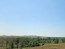
Indiana above
Illinois below | ||||||||||||||||||||||||||||||||||||||||||||||||||||||||||||||||||||||||||||||||||||||||||||||||||||||||||||||||||
|
Illinois above
Wisconsin below | ||||||||||||||||||||||||||||||||||||||||||||||||||||||||||||||||||||||||||||||||||||||||||||||||||||||||||||||||||
|
Wisconsin above
Minnesota below | ||||||||||||||||||||||||||||||||||||||||||||||||||||||||||||||||||||||||||||||||||||||||||||||||||||||||||||||||||
|
Minnesota above
South Dakota below | ||||||||||||||||||||||||||||||||||||||||||||||||||||||||||||||||||||||||||||||||||||||||||||||||||||||||||||||||||
|
Other articles:
|
Exit 212: US Highway 83, north to Pierre. Directions to the Big Bend of the Missouri: At Pierre take South Dakota Highway 34 east, then turn south on 319th Avenue, and continue on Westbend Road, to the West Bend State Recreation Area. | |||||||||||||||||||||||||||||||||||||||||||||||||||||||||||||||||||||||||||||||||||||||||||||||||||||||||||||||||
|
Other articles:
|
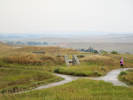
Exit 131: SD Hwy 240, south to the Badlands Loop. | |||||||||||||||||||||||||||||||||||||||||||||||||||||||||||||||||||||||||||||||||||||||||||||||||||||||||||||||||
|
Other articles:
|
Exit 110:
| |||||||||||||||||||||||||||||||||||||||||||||||||||||||||||||||||||||||||||||||||||||||||||||||||||||||||||||||||
|
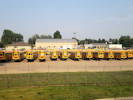
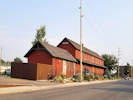
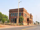
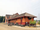
Locations: Wall. |
WallWall (Lakota: Mak?óica Aglágla Ot?u?wahe, "Town alongside the Badlands") is a town in Pennington County, South Dakota, United States. The population was 699 at the 2020 census. | |||||||||||||||||||||||||||||||||||||||||||||||||||||||||||||||||||||||||||||||||||||||||||||||||||||||||||||||||
Wasta Rest Stop | ||||||||||||||||||||||||||||||||||||||||||||||||||||||||||||||||||||||||||||||||||||||||||||||||||||||||||||||||||
|
Other articles:
Locations:
Cheyenne River.
|
Cross Cheyenne River.
| |||||||||||||||||||||||||||||||||||||||||||||||||||||||||||||||||||||||||||||||||||||||||||||||||||||||||||||||||
|
|
WastaExit 98: Wasta
Other articles:
Exit 17: US Highway 85, south.
Locations:
Spearfish.
Exit 12: East Jackson Blvd., for downtown Spearfish.
Other articles:
Exit 10: US Hwy 85, north.
Other articles:
Read up, to go east.
Exit 56: US Interstate 25, south to Denver. Read down, to go west
Other articles:
Locations:
Sheridan.
Other articles:
Locations:
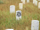
Little Bighorn Battlefield National Monument.
Locations:
Billings.
Other articles:
Locations:
Columbus.
Locations:
Bozeman.
Other articles:
Other articles:
Locations:
Butte.
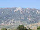
Our Lady of the Rockies.
Other articles:
Locations:
Warm Springs.
Other articles:
Locations:
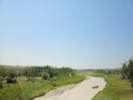
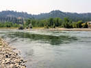
Clark Fork.
Source of the Clark Fork just to the east of the highway. The highway parallels the course of the Clark Fork through Missoula to Saint Regis.
Locations:
Missoula.
Other articles:
Locations:
Clark Fork.
The highway crosses Clark Fork.
Locations:
Saint Regis.
Other articles:
Locations:
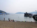
Couer D'Alene.
Other articles:
Other articles:
Locations:
Vantage.
Other articles:
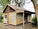
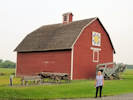
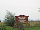
Locations:
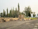
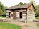
Olmstead Place State Park.
Not accessible from I-90. Access from Exit 109, Canyon Road to the west or, Exit 115, Main Street to the east.
Other articles:
Locations:
Cle Elum.
Locations:
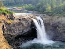
Snoqualmie Pass.
Other articles:
Locations:
Seattle.
Other articles:
Other articles:
Date and time this article was prepared:
5/12/2025 3:00:30 PM
|