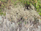
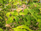
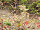
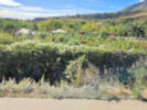
Eastern Mojave Vegetation
Tom Schweich
|
Eastern Mojave Vegetation
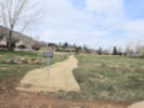
| Magpie Gulch Trail, Golden, Jefferson County, Colorado |
|
Tom Schweich |

|
From Magpie Gulch to Clear Creek. | |||
|
Other articles:
|
Junction: Iowa Street | |||
|
Other articles:
|
The section above is a short segment that connects Iowa Street to the bridge over CO Highway 93. The section below is a short segment that connects Canyon Point Circle to the beidge over CO Highway 93. | |||
|
Other articles:
|
Junction: Canyon Point Circle, turn right (south) to go around the circle to the Jefferson County Open Space Nightbird Gulch Trail. | |||
|
Other articles:
|
| |||
|
Other articles:
|
The segment above connects Canyon Point Circle to the bridge over CO Highway 93. | |||
|
Other articles:
|
Above here there are two branches of the trail, one that goes to Canyon Point Circle, and one that goes to Iowa Street. Junction: Trail Branches | |||
|
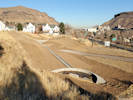
Bridge over CO Highway 93. | ||||
|
Other articles:
|
Intersection: Rubey Drive, trail turns south along Rubey Drive. | |||
|
Other articles:
|
Intersection:
| |||
|
Other articles:
Locations: Golden. New Loveland Mine Park. |
New Loveland Mine Park | |||
|
Other articles:
|
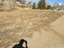
Social trail to High Point Drive
| |||
|
Literature Cited:
Other articles:
|
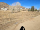
Shortcut social trail down | |||
|
Four cottonwood trees | ||||
|
Other articles:
|
| |||
|
Other articles:
|
Trail junction at southeast section of lawn.
| |||
|
Other articles:
|
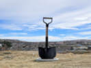
The Giant Shovel
| |||
|
Other articles:
|
Mountain bike trails to northwest and southeast.
| |||
|
Other articles:
|
Lower end of shortcut social trail.
| |||
|
Other articles:
|
Social trail to Cyn Vw Dr.
| |||
|
Other articles:
|
| |||
|
Stairs down to bridge | ||||
|
Other articles:
|
Junction: Social trail to Parkview Court | |||
|
Hairpin turn | ||||
|
Bottom of Stairs | ||||
|
Bridge over CO Highway 58 | ||||
|
Other articles:
|
Intersection: 8th Street | |||
|
Other articles:
|
Cross Church Ditch on 8th Street | |||
|
Other articles:
|
Junction: 8th Street, east to the Community Center and Washington Avenue | |||
|
Other articles:
|
Goathead, Puncture Vine (Tribulus terrestris)
| |||
|
Other articles:
|
Showy Milkweed (Asclepias speciosa)
| |||
|
Other articles:
|
Russian Olive (Elaeagnus angustifolia)
| |||
|
Other articles:
|
| |||
|
Other articles:
|
Humulus lupulus
| |||
|
Other articles:
|
Eriogonum effusum
| |||
|
Other articles:
|
Box Elder (Acer negundo)
| |||
|
Other articles:
|
Western Poison Ivy (Toxicodendron rydbergii)
| |||
|
Other articles:
|
| |||
|
Golden Community Garden | ||||
|
Other articles:
|
| |||
|
Other articles:
|
Acer glabrum var. glabrum “Rocky Mountain maple”
| |||
|
Locations: Magpie Gulch Trail at the Eddy. |
Bridge to the Eddy Hotel.I have noticed an unusually large diversity of plants along the banks of the Church Ditch, where it passes between the Eddy Hotel and the Golden Community Garden. One likely reason is water. The ditch carries water for approximately six weeks in late spring and early summer, providing a reliable source of moisture during an otherwise relatively dry period. Some of the plants, such as Betula occidentalis, commonly called “Water Birch,” are typically associated with wet places. In fact, the birch I observed is rooted in the lower bank of the ditch, where its roots would be quite wet when the ditch is flowing. Others, such as chokecherry (Prunus virginiana) and Siberian elm (Ulmus pumila), can grow near water but are also commonly found in drier settings. The ditch may therefore support a mixture of plants with different moisture requirements, from species closely associated with wet places to others that simply benefit from the additional water. Periodic clearing of the ditch banks may also contribute. The Church Ditch Company cleared the vegetation from the banks about four years ago (2022?), creating open ground that could be recolonized by plants from the surrounding area. The Magpie Gulch Trail, which parallels the ditch, may be another factor. It is a busy trail, and walkers and bicyclists may inadvertently transport seeds from other places. The combination of seasonal water, periodic disturbance, and possible seed dispersal may help explain why so many different plants occur along this short stretch of ditch. | |||
|
Other articles:
|
Mentzelia nuda (Pursh) Torrey & A. Gray “Bractless Blazing Star”
| |||
|
Conduit for Mapgie Gulch is under the Mapgie Gulch Trail. | ||||
|
Other articles:
|
Junction: Clear Creek Trail, Peaks to Plains Trail | |||
| If you have a question or a comment you may write to me at: tomas@schweich.com I sometimes post interesting questions in my FAQ, but I never disclose your full name or address. |
Date and time this article was prepared: 10/2/2026 12:40:20 PM |