Eastern Mojave Vegetation
Images -- Species - Apiaceae

By Tom Schweich


Home Page
Unclassified
Geography - Idaho
Geography - Park County, CO
Geography - Summit County, CO
Geography - Arizona
Geography - British Columbia
Geography - California
Geography - California's Colorado Desert
Alaska
Geography - Mono Lake Basin, California
Geography - Mono County, California
Geography - San Luis Obispo County, California
Geography - Marin County, California
Geography - Santa Clara County
Alameda
Garden
Geography - Central Mojave
Geography - New Mexico
Geography - Eastern Mojave
Geography - Northern Mojave
Geography - Colorado
Geography - Alamosa County, CO
Geography - Boulder County, CO
Geography - Clear Creek County, CO
Geography - Chaffee County, CO
Geography - Douglas County, CO
Geography - Gilpin County, CO
Geography - Golden, Colorado
Geography - Weld County, CO
Geography - Yuma County, CO
Geography - Hinsdale County, CO
Geography - Jefferson County, CO
Geography - North Table Mountain, Jefferson Cty, CO
Geography - Lake County, CO
Geography - Larimer County, CO
Geography - Nevada
Geography - Oregon
Geography - South Dakota
Geography - Utah
Geography - Nebraska
Geography - Virginia
Geography - Washington
Geography - Wyoming
Spain - Andalucia
Spain - Castilla y Leon
Spain - Castilla-La Mancha
Spain - Extremadura
Spain - Galicia
Spain - Madrid
Portugal
Geology
Economic Geology
Climatology
Botany
Salvia dorrii
Frasera albomarginata
Species
Species - Polygonaceae
Species - Brassicaceae
Species - Brassicaceae, Physaria vitulifera
Species - Rosaceae
Species - Fabaceae
Species - Cactaceae
Species - Apiaceae
Species - Onagraceae
Species - Polemoniaceae
Species - Boraginaceae
Species - Plantaginaceae
Species - Asteraceae
Species - Poaceae
Species - Cyperaceae
Zoology
Ecology
Archeology
Customer Satisfaction
General
Arizona
California
Kansas
Missouri
Nebraska
New York
Christmas 2002
Family Photos
Family Documents
Family Photos 2003
Art of Lydia Schweich
Portraits
Railroad
Geography - Germany

Images are organized by the topics listed at left. Click on a topic name to see images with that topic.

Would you like to use these photographs in your school term paper or report?

License is hereby granted for non-commercial use of the images contained herein provided that the images are reproduced with the copyright notice intact. This means that we give you our permission to use the photographs and information you find here in your school term papers and reports. You may resize the photograph to fit your needs, but you may not remove the copyright. Your term paper should note that the photographs are reproduced with permission and it should have a reference to this web site, such as:

"Photograph ©1999 Tom Schweich. Used by permission, http://www.schweich.com"

If you have a comment or a question about a photograph you may write to me at tomas@schweich.com I will answer you as soon as I can. I sometimes post interesting questions in my FAQ, but I will not disclose your full name or address.

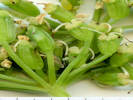
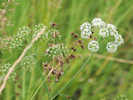
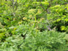
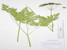
Aegopodium podagraria


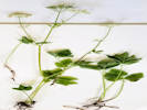
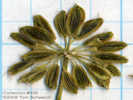
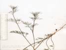
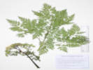
Basal leaves of Aegopodium podograria

Scanned 6 July 2019.

Article records that use this photograph:

        images/PDLf.jpg


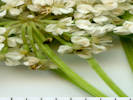
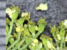
Flowers of Aegopodium podagraria

Scanned 6 July 2019.

Article records that use this photograph:

        images/PDfl.jpg


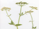
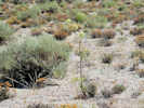
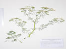
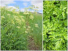
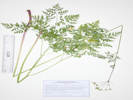
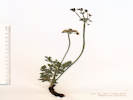
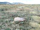
Overview of Aegopodium podograria

Photographed 6 July 2019.

Article records that use this photograph:

        images/PDOview.jpg


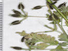
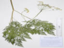
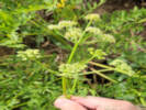
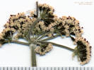
Inflorescence of Aegopodium podograria

Scanned 6 July 2019.

Article records that use this photograph:

        images/PDInfl.jpg


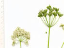
Compound umbels of Aegopodium podograria

Scanned 6 July 2019.

Article records that use this photograph:

        images/PDUmbel.jpg


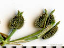
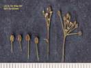
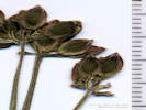
Fruit of Aegopodium podograria

Scanned 6 July 2019.

Article records that use this photograph:

        images/PGfr.jpg

Aletes acaulis


Coll. No. 1925, Aletes acaulis

Photographed 8 December 2018.

Article records that use this photograph:

        images/IMGQ4801sm.jpg


Coll. No. 1321, Aletes acaulis

Scanned 27 July 2016.

Article records that use this photograph:

        images/TAS013210Oview.jpg


Apiaceae Aletes acaulis

Photographed 4 May 2016.

Article records that use this photograph:

        images/IMGQ2554sm.jpg

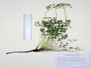
Aletes anisatus


Coll. No. 3491, Aletes anisatus.

Photographed 18 August 2025.

Article records that use this photograph:

        images/20250818_101625sm.jpg


Bowl of grus with Coll. No. 3491, Aletes anisatus.

Photographed 18 August 2025.

Also Coll. No. 3492, Muhlenbergia montana.

Article records that use this photograph:

        images/20250818_100703sm.jpg


Coll. No. 3491, Aletes anisatus.

Photographed 14 November 2025.

Plants of Colorado
East Slope of Tarryall Mountains, Jefferson County
Apiaceae

Aletes anisatus (A. Gray) W. L. Theob. & C. C. Tseng.  Anise Indian Parsley.

North Twin Creek, Jefferson County, Colorado. East slope of Tarryall Mountains, small ridge above Forest Road 211 and North Twin Creek, along a horse or cow trail, 11.3 km. (geodesic) southwest of Deckers. 39.21026°N, 105.34511°W. WGS 1984 Elev. 2478 m. Strong odor of anise when collected; in fruit, well past flowering in mid-August. In bowl of grus between outctops of Pikes Peak granite, with Juniperus communis, Pseudotsuga menziesii, Pseudognaphalium macounii, Paronychia jamesii, Ribes cereum, Jamesia americana, and Muhlenbergia montana. This area burned in the Hayman Fire of 2002.

Collected by permit: Pike San Isabel National Forest, 2025, issued: Mar 26, 2025, to: Tom Schweich.

Tom Schweich 3491. 18-Aug-2025

Article records that use this photograph:

        images/IMGQ6504sm.jpg


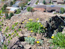
Obs. No. 4387, Aletes anisatus growing on a disintegrating outcrop of granite.

Photographed 18 August 2025.

Article records that use this photograph:

        images/20250818_113904sm.jpg


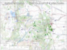
Distribution of Collections of Aletes anisatus.

Prepared 26 August 2025.

Article records that use this photograph:

        images/228Aleani_Distribution_Map.jpg

Angelica lineariloba


Collection No. 556
Collection No. 556

Photograph taken August 13, 2008.

Article records that use this photograph:

        images/IMG01280sm.jpg


Detail of Collection No. 556, Angelica lineariloba

Article records that use this photograph:

        images/TAS005560det.jpg


Overview of Collection No. 556, Angelica lineariloba

Article records that use this photograph:

        images/TAS005560oview.jpg

Anthriscus caucalis


Fruit of Coll. No. 2546, Anthriscus caucalis

Scanned 22 November 2021.

Plants of Jefferson County Open Space
Jefferson County, Colorado
Apiaceae

Anthriscus caucalis M. Bieb. var. caucalis.  Bur Chervil.

Lippincott Ranch, Jefferson County, Colorado. Southern "panhandle" part of the ranch, on a ridge in the north-central to northwest part, 22.0 km. north northwest of the GNIS location of Golden. 39.9023°N, 105.2711°W. WGS 1984 Elev. 1984 m. Fruit bristles hooked. In scattered ponderosa pines, with Phacelia heterophylla, Descurainia sophia, Opuntia fragilis, and Malva neglecta. Lippincott Ranch is jointly owned by City of Boulder Open Space and Mountain Parks and Jefferson County Open Space.

Collected by permit: Jefferson County Open Space, 2021, issued: Apr 1, 2021, to: Tom Schweich.

Tom Schweich, with John Vickery 2546. 29-Jun-2021

Coll. No. 2546, 29 June 2021, characters observed: Annual, to 25 cm., Stem, branched above, glabrous; Leaves, basal, withered, cauline, base sheathing stem, stipules, 0, compound, 3× pinnate, petiole, 13 mm., blade, triangular to lanceolate, 30 mm. × 27 mm. wide, leaflets petiolate, ultimate leaf segments, 9 mm., adaxial glabrous, petiole, abaxial surface, and leaflet margins, sparsely hispid; Inflorescence, umbels simple and compound, subtended by 5 bracts, 2.0-3.5 mm., entire, long ciliate. Pedicels 3 mm., Corolla, unknown; Fruit, schizocarp, central axis obvious, elongate body 2.3 mm. × 0.9 mm. wide + beak 0.5 mm. + stylopodium 0.2 mm., brown, pappillate, uniformly covered with short ±0.2 mm. hooked bristles, oil tubes and ridges ± obscure.

Article records that use this photograph:

        images/TAS025460Fr.jpg


Coll. No. 2546, Anthriscus caucalis

Photographed 23 November 2021.

Plants of Jefferson County Open Space
Jefferson County, Colorado
Apiaceae

Anthriscus caucalis M. Bieb. var. caucalis.  Bur Chervil.

Lippincott Ranch, Jefferson County, Colorado. Southern "panhandle" part of the ranch, on a ridge in the north-central to northwest part, 22.0 km. north northwest of the GNIS location of Golden. 39.9023°N, 105.2711°W. WGS 1984 Elev. 1984 m. Fruit bristles hooked. In scattered ponderosa pines, with Phacelia heterophylla, Descurainia sophia, Opuntia fragilis, and Malva neglecta. Lippincott Ranch is jointly owned by City of Boulder Open Space and Mountain Parks and Jefferson County Open Space.

Collected by permit: Jefferson County Open Space, 2021, issued: Apr 1, 2021, to: Tom Schweich.

Tom Schweich, with John Vickery 2546. 29-Jun-2021

Coll. No. 2546, 29 June 2021, characters observed: Annual, to 25 cm., Stem, branched above, glabrous; Leaves, basal, withered, cauline, base sheathing stem, stipules, 0, compound, 3× pinnate, petiole, 13 mm., blade, triangular to lanceolate, 30 mm. × 27 mm. wide, leaflets petiolate, ultimate leaf segments, 9 mm., adaxial glabrous, petiole, abaxial surface, and leaflet margins, sparsely hispid; Inflorescence, umbels simple and compound, subtended by 5 bracts, 2.0-3.5 mm., entire, long ciliate. Pedicels 3 mm., Corolla, unknown; Fruit, schizocarp, central axis obvious, elongate body 2.3 mm. × 0.9 mm. wide + beak 0.5 mm. + stylopodium 0.2 mm., brown, pappillate, uniformly covered with short ±0.2 mm. hooked bristles, oil tubes and ridges ± obscure.

Article records that use this photograph:

        images/IMGQ5497sm.jpg


Close-up of Coll. No. 2546, Anthriscus caucalis

Photographed 23 November 2021.

Plants of Jefferson County Open Space
Jefferson County, Colorado
Apiaceae

Anthriscus caucalis M. Bieb. var. caucalis.  Bur Chervil.

Lippincott Ranch, Jefferson County, Colorado. Southern "panhandle" part of the ranch, on a ridge in the north-central to northwest part, 22.0 km. north northwest of the GNIS location of Golden. 39.9023°N, 105.2711°W. WGS 1984 Elev. 1984 m. Fruit bristles hooked. In scattered ponderosa pines, with Phacelia heterophylla, Descurainia sophia, Opuntia fragilis, and Malva neglecta. Lippincott Ranch is jointly owned by City of Boulder Open Space and Mountain Parks and Jefferson County Open Space.

Collected by permit: Jefferson County Open Space, 2021, issued: Apr 1, 2021, to: Tom Schweich.

Tom Schweich, with John Vickery 2546. 29-Jun-2021

Coll. No. 2546, 29 June 2021, characters observed: Annual, to 25 cm., Stem, branched above, glabrous; Leaves, basal, withered, cauline, base sheathing stem, stipules, 0, compound, 3× pinnate, petiole, 13 mm., blade, triangular to lanceolate, 30 mm. × 27 mm. wide, leaflets petiolate, ultimate leaf segments, 9 mm., adaxial glabrous, petiole, abaxial surface, and leaflet margins, sparsely hispid; Inflorescence, umbels simple and compound, subtended by 5 bracts, 2.0-3.5 mm., entire, long ciliate. Pedicels 3 mm., Corolla, unknown; Fruit, schizocarp, central axis obvious, elongate body 2.3 mm. × 0.9 mm. wide + beak 0.5 mm. + stylopodium 0.2 mm., brown, pappillate, uniformly covered with short ±0.2 mm. hooked bristles, oil tubes and ridges ± obscure.

Article records that use this photograph:

        images/IMGQ5494sm.jpg

Berula erecta


Infloresence of Coll. No. 717.1, Berula erecta

Scanned 18 Oct 2011.

Perennial (?); Habitat wet place other than vernal pool; Rooting, tubers, and rhizomes unknown; Stem ascending, glabrous, hollow; Leaves with sheathing bases, once pinnate; Leaflets toothed or serrate; Infloresence in compound umbels; Bracts and bractlets conspicuous; Flowers white; Style short; Fruit lacking bristles, prickles or tubercles.

Article records that use this photograph:

        images/TAS007171Infl.jpg


Overview of Coll. No. 717.1, Berula erecta

Scanned 18 Oct 2011.

Perennial (?); Habitat wet place other than vernal pool; Rooting, tubers, and rhizomes unknown; Stem ascending, glabrous, hollow; Leaves with sheathing bases, once pinnate; Leaflets toothed or serrate; Infloresence in compound umbels; Bracts and bractlets conspicuous; Flowers white; Style short; Fruit lacking bristles, prickles or tubercles.

Article records that use this photograph:

        images/TAS007171Oview.jpg

Cicuta maculata angustifolia


Coll. No. 3285, Cicuta maculata var. angustifolia

Photographed 4 December 2024.

Plants of Jefferson County Open Space
Jefferson County, Colorado
Apiaceae

Cicuta maculata L. var. angustifolia Hook.  Spotted Water Hemlock.

Ranson/Edwards Homestead Open Space Park, Jefferson County, Colorado. 1.7 miles west on CO Highway 72 from CO Highway 93, then 0.9 miles generally north on Plainview Road, then about 575 m. generally west along small creek. 15.1 km. north northwest of Golden. 39.88677°N, 105.2685°W. WGS 1984 Elev. 1991 m. Growing in creek, also nearby: Heliomeris multiflora, Mentha arvensis, Lysimachia ciliata, Ranunculus pensylvanicus, and Galium boreale. Infraspecific names are not accepted by current Colorado florae.

Collected by permit: Jefferson County Open Space, 2024, issued: Mar 6, 2024, to: Tom Schweich.

Tom Schweich, with Cynthia Hastings 3285. 28-June-2024

Article records that use this photograph:

        images/IMGQ6287sm.jpg


Collection No. 499, Cicuta maculata var. angustifolia

Scanned 13 March 2011. Background grid is 10 x 10 to the inch.

Article records that use this photograph:

        images/TAS004990oview.jpg


Collection No. 499, Cicuta maculata var. angustifolia

Photograph taken August 2, 2007 beside Bohler Creek.

Article records that use this photograph:

        images/IMGP2715sm.jpg


Collection No. 499, Cicuta maculata var. angustifolia

Photograph taken August 2, 2007 beside Bohler Creek.

Article records that use this photograph:

        images/IMGP2713sm.jpg

Conium maculatum


Coll. No. 1436, Conium maculatum

Photographed 12 December 2016.

Article records that use this photograph:

        images/IMGQ3443sm.jpg

Cyclospermum leptophyllum


Coll. No. 134, Cyclospermum leptophyllum

Scanned 8 November 2013.

Article records that use this photograph:

        images/TAS001340Oview.jpg


Coll. No. 134, Cyclospermum leptophyllum

Scanned 8 November 2013.

Article records that use this photograph:

        images/TAS001340FlPts.jpg

Cymopterus anisatus


Cymopterus anisatus near Goose Creek.

Photographed 23 May 2021.

Location records that use this photograph:

Article records that use this photograph:

        images/20210523_112914sm.jpg

Cymopterus cinerarius


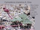
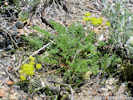
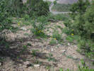
Habitat of Cymopterus cinerarius on the Mono Craters

Photograph taken 17 August 2010.

Article records that use this photograph:

        images/IMG_1302sm.jpg


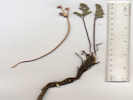
Collection No. 754, Cymopterus cinereus

Photograph taken 16 June 2011.

Article records that use this photograph:

        images/IMG11916sm.jpg


Collection No. 754, Cymopterus cinereus

Photograph taken 16 June 2011.

Article records that use this photograph:

        images/IMGP1997sm.jpg


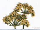
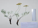
Coll. No. 703, Apiaceae Cymopterus cinerarius

Scanned 7 June 2011.

Article records that use this photograph:

        images/TAS007030Oview.jpg


Cymopterus cinerarius

Location records that use this photograph:

Article records that use this photograph:

        images/MLF_V1_Slide_38.jpg


Coll. No. 754, Cymopterus cinerarius

Scanned 17 Jan 2012.

Article records that use this photograph:

        images/TAS007540Oview.jpg

Cymopterus lemmonii


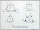
Coulter & Rose (1888) Figure 73.

#73 is P. montanus.

  • The open circles are the vittae (oil tubes), also called secretory ducts.
    • There are vallecular ducts on the outside (top) and commissural ducts on the inside (bottom).
  • The filled-in circles are fibrovascular bundles.
  • The hatched areas are probably marginal bundles.

    Article records that use this photograph:

            images/CoulterRose1888_fig73.jpg


Coll. No. 3313, Cymopterus lemmonii.

Photographed 17 December 2024.

Plants of Colorado
Apiaceae

Pseudocymopterus montanus (A. Gray) J. M. Coult. & Rose.  Alpine False Springparsley.

Salt Creek, Park County, Colorado. Right bank of Salt Creek, just west of the place it is first crossed by FR 435 “Salt Creek Road,” 3.0 miles generally west of US Highway 285, 111 km. southwest of Golden. 38.95728°N, 106.00784°W. WGS 1984 Elev. 2837 m. Edges of aspen grove, near what appears to be a former beaver pond, with Ribes inerme, Dasiphora fruticosa, Rosa woodsii, and Carex sp.

Collected by permit: Pike San Isabel National Forest, 2024, issued: Jun 1, 2024, to: Tom Schweich.

Tom Schweich 3313. 22-Jul-2024

Article records that use this photograph:

        images/IMGQ6301sm.jpg


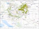
Distribution of Cymopterus lemmonii vouchers in CCH2 and SEINet.

Data downloaded from CCH2 and SEINet on 20 Feb 2024, total records: 5517, georeferenced records: 3394. Stars indicate the location of my collections.

Article records that use this photograph:

        images/228Cymlem_Distribution.jpg


Coll. No. 3023, Cymopterus lemmonii.

Photographed 16 December 2023.

Plants of the Douglas Mountain Study Area
Jefferson County Open Space, Colorado, USA
Apiaceae

Pseudocymopterus montanus (A. Gray) J. M. Coult. & Rose.  Alpine False Springparsley.

Guy Gulch, Jefferson County, Colorado. Edge of forest near the creek in Guy Gulch, southwest side of County Road 70, 1.14 km. northwest of Centennial Ranch house, 13.3 km. (geodesic) northwest of the GNIS location of Golden. 39.8007°N, 105.3649°W. WGS 1984 Elev. 2412 m. Grasses surrounded by Douglas fir forest, Mertensia lanceolata, Aquilegia coerulea, Fragaria vesca, and Viola canadensis.

Collected by permit: Jefferson County Open Space, 2023, issued: Apr 10, 2023, to: Tom Schweich.

Tom Schweich, with John Vickery 3023. 3-Jul-2023

Article records that use this photograph:

        images/IMGQ5985sm.jpg


Distribution of Colorado Cymopterus lemmonii vouchers in CCH2 and SEINet.

Data downloaded from CCH2 and SEINet on 20 Feb 2024, total records: 5517, georeferenced records: 3394. Stars indicate the location of my collections.

Article records that use this photograph:

        images/228CymlemDistributionCO.jpg


Coll. No. 1469, Cymopterus lemmonii

Scanned 31 December 2016.

Coll. No. 1469, 29 June 2016, characters observed: Perennial herb, to 15 cm., glabrous throughout, except very slightly scabrous at top of peduncle and on ribs of some rays; Pseudoscape, absent; Leaves, basal and cauline, 40 mm. × 25 mm. wide, obovate, compound, leaflets, #7, ultimate divisions narrowly lanceolate; Inflorescence, compound umbel; Involucre, bracts, 1.7 mm., linear (but not pinnafitid); Rays, ascending-spreading, ±equal; Involucel, bractlets green, inconspicuous, 1 mm.; Corolla, petals, #5, 1 mm. × 0.6 mm. wide, yellow; Stamens, #5; Filaments, recurved; Ovary, glabrous; Stylopodium, absent (?); Fruit, unknown.

Article records that use this photograph:

        images/TAS014690Oview.jpg


Umbel of Coll. No. 1469, Cymopterus lemmonii

Scanned 31 December 2016.

Coll. No. 1469, 29 June 2016, characters observed: Perennial herb, to 15 cm., glabrous throughout, except very slightly scabrous at top of peduncle and on ribs of some rays; Pseudoscape, absent; Leaves, basal and cauline, 40 mm. × 25 mm. wide, obovate, compound, leaflets, #7, ultimate divisions narrowly lanceolate; Inflorescence, compound umbel; Involucre, bracts, 1.7 mm., linear (but not pinnafitid); Rays, ascending-spreading, ±equal; Involucel, bractlets green, inconspicuous, 1 mm.; Corolla, petals, #5, 1 mm. × 0.6 mm. wide, yellow; Stamens, #5; Filaments, recurved; Ovary, glabrous; Stylopodium, absent (?); Fruit, unknown.

Article records that use this photograph:

        images/TAS014690Umb.jpg

Cymopterus terebinthinus


Collection No. 775, Apiaceae Cymopterus terebinthinus

Photograph taken 20 June 2011.

Article records that use this photograph:

        images/IMG_1982sm.jpg

Cymopterus terebinthinus californicus


Coll. No. 775, Cymopterus terebinthinus var. californicus

Scanned 23 Jan 2012.

Coll. No. 775, 23 Jan 2012, characters observed while keying: Perennial herb Leaves with sheathing bases, 4° pinnate compund; Infloresence umbellate; Bracts 0 Bractlets present, glabrous; Fruit not sufficiently developed to key.

Article records that use this photograph:

        images/TAS007750Oview.jpg

Daucus carota


Coll.No. 3485, Daucus carota.

Photographed 22 November 2025.

Plants of the Coal Creek Canyon Study Area
Jefferson County Open Space, Colorado, USA
Apiaceae

Daucus carota L.  Wild Carrot, Queen Ann's Lace.

Coal Creek Canyon Study Area, Lacey Parcel, Jefferson County, Colorado. Roadside ditch along Colorado Highway 72 “Coal Creek Canyon Road,” 2.15 km. northwest of Coal Creek Fire Station #3, 15.6 km. north northwest of Golden. 39.88224°N, 105.29985°W. WGS 1984 Elev. 2090 m.

Collected by permit: Jefferson County Open Space, 2025, issued: May 1, 2025, to: Tom Schweich.

Tom Schweich 3486. 28-Jul-2025

Article records that use this photograph:

        images/IMGQ6513sm.jpg

Harbouria trachypleura


Inflorescence of Coll. No. 1904, Harbouria trachypleura

Scanned 26 November 2018.

Article records that use this photograph:

        images/TAS019040Infl.jpg


Coll. No. 1904, Harbouria trachypleura

Photographed 26 November 2018.

Article records that use this photograph:

        images/IMGQ4794sm.jpg


Coll. No. 1357, Harbouria trachypleura

Photographed 21 May 2016.

Article records that use this photograph:

        images/IMGQ2601sm.jpg

Heracleum maximum


Coll. No. 3430, Heracleum maximum.

Photographed 26 December 2025.

Plants of Colorado
East Slope of Tarryall Mountains, Jefferson County
Apiaceae

Heracleum maximum Bartr.  Common Cow Parsnip.

North Twin Creek, Jefferson County, Colorado. Left bank of North Twin Creek, 185 m. northwest of the F. R. 211 crossing of North Twin Creek. 6.8 mi. west and south on F. R. 211 from its north end at County Road 126, 11.6 km. southwest of Deckers. 39.20888°N, 105.34703°W. WGS 1984 Elev. 2407 m. Leaves ternate, large lobes, flowers white. Streamside mature ponderosa pine and Douglas fir forest, also collected here: Monarda fistulosa, Rubis idaeus, and Verbascum thapsus. Within the perimeter of the Hayman Fire (2002), though this area mapped as low intensity.

Collected by permit: Pike San Isabel National Forest, 2025, issued: Mar 26, 2025, to: Tom Schweich.

Tom Schweich 3430. 2-Jul-2025

Article records that use this photograph:

        images/IMGQ6550sm.jpg


Coll. No. 3430, Heracleum maximum.

Photographed 2 July2025.

Article records that use this photograph:

        images/20250702_094259sm.jpg

Ligusticum porteri


Coll. No. 3428, Ligusticum porteri.

Photographed 26 October 2025.

Native and Naturalized Flora of the Golden Area, Jefferson County, Colorado
Apiaceae

Ligusticum porteri J.M. Coult. & Rose.  Porter's Licorice-Root.

North Table Mountain Open Space (City of Golden), Jefferson County, Colorado. Along a social trail in the northern part of the North Table Mountain Open Space, beside one of the larger watercourses coming down from the top of the mesa, 2.4 km. north of the GNIS location of Golden. 39.77721°N, 105.22487°W. WGS 1984 Elev. 1903 m. Basal leaves reddish at base. Seen or collected narby: Ericameria nauseosa var. graveolens, Campanula rotundifolia, Prunus americana, P. virginiana, Acer glabrum, and Bromus inermis.

Collected by permit: City of Golden, 2025, issued: Mar 14, 2025, to: Tom Schweich.

Tom Schweich 3428. 23-Jun-2025

Article records that use this photograph:

        images/IMGQ6486sme.jpg


Coll. No. 3428, Ligusticum porteri.

Photographed 23 June 2025.

Article records that use this photograph:

  • Checklist Flora of Native and Naturalized Vascular Plants of Golden and Vicinity, Jefferson County, Colorado: Ligusticum porteri.

        images/228Ligpor_osha.jpg


Coll. No. 3248, Ligusticum porteri.

Photographed 10 June 2024.

Article records that use this photograph:

        images/20240610_084551sm.jpg


Dried inflorescence of Coll. No. 3428, Ligusticum porteri.

Scanned 29 June 2025. The inflorescence had been sectioned before pressing.

Article records that use this photograph:

        images/2025-06-29_134210sm.jpg


Dried basal leaf of Coll. No. 3428, Ligusticum porteri.

Scanned 29 June 2025.

Article records that use this photograph:

        images/2025-06-29_133851sm.jpg


Coll. No. 3428, Ligusticum porteri.

Photographed 23 June 2025.

Article records that use this photograph:

        images/20250623_102329sm.jpg


Coll. No. 3248, Ligusticum porteri.

Photographed 9 November 2024.

Plants of the Coal Creek Canyon Study Area
Jefferson County Open Space, Colorado, USA
Apiaceae

Ligusticum porteri J.M. Coult. & Rose.  Porter's Licorice-Root.

Coal Creek Canyon Study Area, Lacey Parcel, Jefferson County, Colorado. Beside dry streambed composed mostly of cobbles, 180 m. west southwest of the Coal Creek Canyon Fire Station 3, 13.9 km. northwest of Golden. 39.87256°N, 105.27962°W. WGS 1984 Elev. 2040 m. Also here: Cynoglossum officinale, Silene latifolia, Lupinus argentea, and Prunus virginiana.

Collected by permit: Jefferson County Open Space, 2024, issued: Mar 6, 2024, to: Tom Schweich.

Tom Schweich 3248. 10-Jun-2024

Article records that use this photograph:

        images/IMGQ6270sm.jpg


Coll. No. 3248, Ligusticum porteri.

Photographed 10 June 2024.

Article records that use this photograph:

        images/20240610_084545sm.jpg


Coll. No. 3269, Ligusticum porteri.

Photographed 9 November 2024.

Plants of the Coal Creek Canyon Study Area
Jefferson County Open Space, Colorado, USA
Apiaceae

Ligusticum porteri J.M. Coult. & Rose.  Porter's Licorice-Root.

Coal Creek Canyon Study Area, Lacey Parcel, Jefferson County, Colorado. Second primary drainage of Lacey parcel, about 110 m. southwest of Coal Creek, 1.54 km. west northwest of Coal Creek Canyon Fire Station #3, 15.0 km. northwest of Golden. 39.87804°N, 105.29453°W. WGS 1984 Elev. 2073 m. Sunny openings in ponderosa pine and Douglas fir forest. Also here: Acer glabrum, Prunus virginiana, Geranium caespitosum, and Amelanchier alnifolia.

Collected by permit: Jefferson County Open Space, 2024, issued: Mar 6, 2024, to: Tom Schweich.

Tom Schweich 3269. 21-Jun-2024

Perennial, 1 m., sunny mountain valley slope; Leaves, tripinnately compound; Leaflets, well-defined, ultimate leaf division, 2-3 mm.; Inflorescence, compound umbel; Involucral bractlets, green, few; Flowers, white; Ovary, glabrous; Stylopodium, conic, frilled; Fruit, glabrous; (Described from Coll. No. 3248, 10 June 2024, and Coll. No. 3269, 21 June 2024.)

Article records that use this photograph:

        images/IMGQ6271sm.jpg


Coll. No. 2610, Ligusticum porteri

Photographed 13 January 2022.

Plants of Jefferson County Open Space
Jefferson County, Colorado
Apiaceae

Ligusticum porteri J.M. Coult. & Rose.  Porter's Licorice-Root.

Lippincott Ranch (North), Boulder County, Colorado. Northern part of ranch, north-facing slope overlooking Spring Brook. 2.2 km. north of the main gate, 23.8 km. north northwest of the GNIS location of Golden. 39.9139°N, 105.2783°W. WGS 1984 Elev. 2042 m. Deep grasses in openings of ponderosa pine woodland. Lippincott Ranch is jointly owned by City of Boulder Open Space and Mountain Parks and Jefferson County Open Space.

Collected by permit: Jefferson County Open Space, 2021, issued: Apr 1, 2021, to: Tom Schweich.

Tom Schweich, with John Vickery 2610. 20-Jul-2021

Article records that use this photograph:

        images/IMGQ5540sm.jpg


Coll. No. 3269, Ligusticum porteri, with frilled conic stylopodium.

Microphotograph 9 November 2024.

Article records that use this photograph:

        images/TAS032690_Stysm.jpg


Coll. No. 2833, Ligusticum porteri

Photographed 28 October 2022.

Plants of Lippincott Ranch
Boulder and Jefferson Counties, Colorado
Apiaceae

Ligusticum porteri J.M. Coult. & Rose.  Porter's Licorice-Root.

Lippincott Ranch (North), Boulder County, Colorado. Along the north fork of Spring Brook, 2.53 km. north northwest of the main gate, 2.42 km. south southwest of the GNIS location of Eldorado Springs. 39.916°N, 105.28°W. WGS 1984 Elev. 2037 m. Sunny spot, more plants in vegetative state in shade.

Collected by permit: Boulder OSMP, issued: May 27, 2022, to: Tom Schweich.

Tom Schweich, with John Vickery 2833. 2-Jul-2022

Article records that use this photograph:

        images/IMGQ5718sm.jpg


Typical form of compound umbel in Ligusticum porteri.

Photographed 9 July 2026.

… but otherwise a lousy, out-of-focus photo.

Location records that use this photograph:

Article records that use this photograph:

        images/20260709_075753sm.jpg

Ligusticum tenuifolium


Plants of the world page for Ligusticum filicinum var. tenuifolium.

Data retrieved: 31 December 2024.

Article records that use this photograph:

        images/POWO_228Ligten_20241231.jpg


Coll. No. 3329, Ligusticum filicinum var. tenuifolium.

Photographed 29 December 2024.

Plants of Colorado
Apiaceae

Ligusticum tenuifolium S. Watson, Proc. Amer. Acad. Arts 14: 293 (1879), nom. illeg.  Slender Ligusticum.

Brumley, Lake County, Colorado. Near the site of the stagecoach stop of Brumley, about 11 miles generally west on CO State Highway 82 from the town of Twin Lakes, Lake County, 27.8 km. southwest of Leadville, 135 km. southwest of Golden. 39.09547°N, 106.54329°W. WGS 1984 Elev. 3250 m. Water-saturated soil in willow thicket along former creek channels.

Collected by permit: Pike San Isabel National Forest, 2024, issued: Jun 1, 2024, to: Tom Schweich.

Tom Schweich 3329. 23-Jul-2024

Article records that use this photograph:

        images/IMGQ6322sm.jpg


Distribution of Ligusticum tenuifolium vouchers in SEINet

Data retrieved: 31 December 2024.

Article records that use this photograph:

        images/228Ligten_dist_SEINet_20241231.jpg

Lomatium foeniculaceum fimbriatum


Coll. No. 394, Lomatium foeniculaceum ssp. fimbriatum

Scanned 15 December 2012.

Article records that use this photograph:

        images/TAS003940Det.jpg


Coll. No. 394, Lomatium foeniculaceum ssp. fimbriatum

Scanned 15 December 2012.

Article records that use this photograph:

        images/TAS003940Oview.jpg

Lomatium nevadense nevadense


Coll. No. 960, Lomatium nevadense var. nevadense

Scanned on 7 Feb 2014.

Coll. No. 960, 22 May 2013, characters observed: Perennial, spreading, to 10 cm. above ground, from a stout (6 mm. dia.) tap root ≥ 9 cm., in dry soil at undisturbed places, not scented, plant nearly completely glabrous; Stem, ±0; Leaves, 2-3 pinnate, to 6 cm., basal sheaths purple, leaf segments, many, small, oblong, 1-2 mm. wide, sparse short straight white hairs; Inflorescence, compound umbel, involucel inconspicuous, umbels not head like; Pedicels, in fruit 3 mm.; Petals, white or cream; Ovary, glabrous, tip projection 0; Seed, 5 mm. × 2 mm. wide, elliptic, compressed front to back, not notched at base and tip, ribs ±equal, lateral ribs only slightly expanded as wings, glabrous.

Article records that use this photograph:

        images/TAS009600Oview.jpg

Lomatium orientale


Leaf of Coll. No. 2031, Lomatium orientale

Scanned 14 July 2019.

Article records that use this photograph:

        images/TAS020310Lf.jpg


Fruit of Coll. No. 2075, Lomatium orientale

Scanned 12 October 2019.

Article records that use this photograph:

        images/TAS020750Fr.jpg


Coll. No. 2031, Lomatium orientale

Scanned 14 July 2019.

Article records that use this photograph:

        images/TAS020310Oview.jpg


Inflorescence with fruit of Coll. No. 2075, Lomatium orientale

Scanned 12 October 2019.

Article records that use this photograph:

        images/TAS020750Infl.jpg


Fruit of Coll. No. 1837, Lomatium orientale

Scanned 2 November 2018.

Coll. No. 1837, 17 May 2018, characters observed: Perennial, to 20 cm., woody taproot; Leaves, compound, pinnate, 75 mm. × 26 mm. wide, ultimate divisions, ≤3 mm., ≤1 mm. wide, villous, tips, obtuse, (with a very small white “spine”); Inflorescence, compound umbel; Involucel Bracts, glabrous; Flowers, white; Anthers, red; Ovary, glabrous, stylopodium, absent; Fruit, 5 mm. × 3.5 mm. wide, ovate, glabrous, dorsally compressed, lateral ribs winged.

Article records that use this photograph:

        images/TAS018370Fruit.jpg


Coll. No. 1837, Lomatium orientale

Scanned 2 November 2018.

Coll. No. 1837, 17 May 2018, characters observed: Perennial, to 20 cm., woody taproot; Leaves, compound, pinnate, 75 mm. × 26 mm. wide, ultimate divisions, ≤3 mm., ≤1 mm. wide, villous, tips, obtuse, (with a very small white “spine”); Inflorescence, compound umbel; Involucel Bracts, glabrous; Flowers, white; Anthers, red; Ovary, glabrous, stylopodium, absent; Fruit, 5 mm. × 3.5 mm. wide, ovate, glabrous, dorsally compressed, lateral ribs winged.

Article records that use this photograph:

        images/TAS018370Oview.jpg


Inflorescence of Coll. No. 1837, Lomatium orientale

Scanned 2 November 2018.

Coll. No. 1837, 17 May 2018, characters observed: Perennial, to 20 cm., woody taproot; Leaves, compound, pinnate, 75 mm. × 26 mm. wide, ultimate divisions, ≤3 mm., ≤1 mm. wide, villous, tips, obtuse, (with a very small white “spine”); Inflorescence, compound umbel; Involucel Bracts, glabrous; Flowers, white; Anthers, red; Ovary, glabrous, stylopodium, absent; Fruit, 5 mm. × 3.5 mm. wide, ovate, glabrous, dorsally compressed, lateral ribs winged.

Article records that use this photograph:

        images/TAS018370Infl.jpg


Coll. No. 2929, Lomatium orientale.

Photographed 29 October 2023.

Plants of Jefferson County Open Space
Jefferson County, Colorado
Apiaceae

Lomatium orientale J.M. Coult. & Rose.  Salt-and-Pepper.

Magpie Gulch, Jefferson County, Colorado. In Mt. Galbraith Park, beside a bed rock cascade of the creek in Magpie Gulch, about 900 m. west of the gate to the parcel, 2.81 km. west northwest of the GNIS location of Golden. 39.7589°N, 105.2462°W. WGS 1984 Elev. 1893 m. Dry slope west and away from rock cascade.

Collected by permit: Jefferson County Open Space, 2023, issued: Apr 10, 2023, to: Tom Schweich.

Tom Schweich, with Cindy Trujillo 2929. 21-May-2023

Article records that use this photograph:

        images/IMGQ5925sm.jpg


Fruit of Coll. No. 2031, Lomatium orientale

Scanned 14 July 2019.

This is described as having 3-4 oil tubes between the ridges. Those oil tubes are certainly visible; then are the slightly darker linear stripes. I assume the “ridges” are at the very edge of the fruit. If so, what are the slightly lighter structures between the ridges called?

Article records that use this photograph:

        images/TAS020310Fr.jpg


Coll. No. 1077, Lomatium orientale

Photographed 23 March 2015.

Location records that use this photograph:

Article records that use this photograph:

        images/IMG40930sm.jpg


Coll. No. 1077, Lomatium orientale

Photographed 23 March 2015.

        images/IMGQ0323sm.jpg

Musineon divaricatum


Coll. No. 2023, Musineon divaricatum

Scanned 3 June 2019.

Article records that use this photograph:

        images/TAS020230Oview.jpg


Seed of Coll. No. 2042.1, Musineon divaricatum

Scanned 15 September 2019.

Article records that use this photograph:

        images/TAS020421Fr.jpg


Coll. No. 2918, Musineon divaricatum.

Photographed 24 October 2023.

Native and Naturalized Flora of the Golden Area, Jefferson County, Colorado
Apiaceae

Musineon divaricatum (Pursh) Raf.  Leafy Wildparsley.

Eagle Ridge, Jefferson County, Colorado. West-southwest-facing slope of Eagle Ridge, a locally named ridge of upturned Dakota Group between US Highway 6 and Eagleridge Drive, between Stonebridge entrance and Kinney Run, 3.75 km. south southeast of the GNIS location of Golden. 39.7301°N, 105.2139°W. WGS 1984 Elev. 1825 m. Also here: Lomatium orientale, Helianthus pumilis, Mertensia lanceolata, Astragalus drummondii, Scutellaria brittonii, and Cercocarpus montanus.

Collected by permit: City of Golden, 2023, issued: Mar 13, 2023, to: Tom Schweich.

Tom Schweich 2918. 9-May-2023

I think this image shows a pseudoscape of 4 cm. in length.

Article records that use this photograph:

        images/IMGQ5909sm.jpg


Coll. No. 2918, Musineon divaricatum.

Photographed 9 May 2023.

Article records that use this photograph:

        images/TAS029180Oview.jpg


Inflorescence of Coll. No. 2042.1, Musineon divaricatum

Scanned 15 September 2019.

Article records that use this photograph:

        images/TAS020421Infl.jpg


Coll. No. 2918, Musineon divaricatum.

Photographed 9 May 2023.

Location records that use this photograph:

Article records that use this photograph:

        images/20230509_101948sm.jpg


Coll. No. 2918, Musineon divaricatum.

Photographed 9 May 2023.

The scape and branches of the umbel are scabrous.

Article records that use this photograph:

        images/TAS029180Infl.jpg

Osmorhiza berteroi


Coll. No. 2619, Osmorhiza berteroi.

Photographed 19 January 2022.

Plants of Jefferson County Open Space
Jefferson County, Colorado
Apiaceae

Osmorhiza berteroi DC.  Sweet Cicely.

Spring Brook, Boulder County, Colorado. Northern part of ranch, north-facing slope overlooking Spring Brook. 2.3 km. north of the main gate, 23.9 km. north northwest of the GNIS location of Golden. 39.9147°N, 105.2782°W. WGS 1984 Elev. 2026 m. Fruit linear-oblong rather than clavate. Terrace above Spring Brook, edge of ponderosa pine woodland. Lippincott Ranch is jointly owned by City of Boulder Open Space and Mountain Parks and Jefferson County Open Space.

Collected by permit: Jefferson County Open Space, 2021, issued: Apr 1, 2021, to: Tom Schweich.

Tom Schweich, with John Vickery 2619. 20-Jul-2021

Article records that use this photograph:

        images/IMGQ5543sm.jpg

Osmorhiza depauperata


Coll. No. 2951, Osnorhiza depauperata.

Photographed 11 November 2023.

Plants of the Douglas Mountain Study Area
Jefferson County Open Space, Colorado, USA
Apiaceae

Osmorhiza depauperata Phil.  Blunt-Fruit Sweet-Cicely.

Guy Gulch, Jefferson County, Colorado. Along stream tributary to Guy Gulch, about 310 m. north of County Road 70, near the western boundary of the study area, 17.7 km. northwest of the GNIS location of Golden. 39.805°N, 105.3671°W. WGS 1984 Elev. 2464 m. Shaded floor of small gulch.

Collected by permit: Jefferson County Open Space, 2023, issued: Apr 10, 2023, to: Tom Schweich.

Tom Schweich, with John Vickery 2951. 6-Jun-2023

Article records that use this photograph:

        images/IMGQ5953sm.jpg


Coll. No. 3055, Osmorhiza depauperata.

Photographed 26 December 2023.

Plants of Colorado
Apiaceae

Osmorhiza depauperata Phil.  Blunt-Fruit Sweet-Cicely.

Morrison Creek, Jefferson County, Colorado. Small terrace above Morrison Creek, near crossing of Little Scraggy Trail, 1.16 km. southwest of Little Scraggy Peak, 50.0 km. south of Golden; accessed by way of Kelsey Campground and Jefferson County Road 126. 39.3073°N, 105.2847°W. WGS 1984 Elev. 2555 m. In fruit, no flowers seen. Forested, shaded, wet bank of creek; also collected nearby: Pyrola chlorantha, Rubus pubescens, Pedicularis canadensis, and Oryzopsis asperifolia.

Collected by permit: Pike San Isabel National Forest, 2023, issued: Jul 1, 2023, to: Tom Schweich.

Tom Schweich 3055. 10-Jul-2023

Article records that use this photograph:

        images/IMGQ6010sm.jpg


Coll. No. 2069.1, Osmorhiza, cf. O. depauperata

Scanned 8 October 2019.

Article records that use this photograph:

        images/TAS020691Inflsm.jpg

Oxypolis fendleri


Distribution of Oxypolis fendleri collections in Colorado.

Map prepared 18 February 2025, using data downloaded from CCH2 and SEINet. There were 1569 records, of which 1203 (77%) were georeferenced.

Article records that use this photograph:

        images/Oxypolis_fendleri_in_Colorado.jpg


Coll. No. 2713, Oxypolis fendleri

Photographed 13 February 2022.

Plants of Colorado
Apiaceae

Oxypolis fendleri (A. Gray) Heller.  Fendler's Cowbane.

Brumley, Lake County, Colorado. Along the bank of the North Fork of Lake Creek, opposite the Sno-Tel station, about 11 road miles generally west on Colorado Highway 82 from the town of Twin Lakes, 175 km. southwest of Golden. 39.0877°N, 106.5424°W. WGS 1984 Elev. 3244 m. Shaded bank of creek. Brumley was a stage stop on the route across Independence Pass.

Collected by permit: Pike - San Isabel National Forest, 2021, issued: Mar 29, 2021, to: Tom Schweich.

Tom Schweich 2713. 18-Aug-2021

Fruit strongly flattened dorsally, dorsal ribs filiform, lateral ribs thin-winged with a nerve at the inner margin on the dorsal side so that the mericarp appears to have 5 dorsal ribs (instead of 3) as well as the 2 marginal rings (Ackerfield, 2015, p. 88)”

Location records that use this photograph:

Article records that use this photograph:

        images/IMGQ5604sm.jpg


Fruit of Coll. No. 2713, Oxypolis fendleri

Microphotogrraphed 13 February 2022.

Plants of Colorado
Apiaceae

Oxypolis fendleri (A. Gray) Heller.  Fendler's Cowbane.

Brumley, Lake County, Colorado. Along the bank of the North Fork of Lake Creek, opposite the Sno-Tel station, about 11 road miles generally west on Colorado Highway 82 from the town of Twin Lakes, 175 km. southwest of Golden. 39.0877°N, 106.5424°W. WGS 1984 Elev. 3244 m. Shaded bank of creek. Brumley was a stage stop on the route across Independence Pass.

Collected by permit: Pike - San Isabel National Forest, 2021, issued: Mar 29, 2021, to: Tom Schweich.

Tom Schweich 2713. 18-Aug-2021

Fruit strongly flattened dorsally, dorsal ribs filiform, lateral ribs thin-winged with a nerve at the inner margin on the dorsal side so that the mericarp appears to have 5 dorsal ribs (instead of 3) as well as the 2 marginal rings (Ackerfield, 2015, p. 88)”

Article records that use this photograph:

        images/TAS027130Fr.jpg

Perideridia bolanderi bolanderi


Leaf of Coll. No. 961, Perideridia bolanderi ssp. bolanderi

Scanned on 7 Feb 2014.

Coll. No. 961, 22 May 2013, characters observed: Perennial, from elongated (7 cm.) tuber, to 50 cm., undisturbed places in dry rocky soil, glabrous, not scented; Leaves, 2°-pinnate and pinnate-ternate, leaf segments wider than thread-like, ultimate leaflet of mature leaf 3.5 mm. wide, not as dimorphic as Taylor (2010) describes; Inflorescence, compound umbel; Involucel, lobes 3.5 mm.; Pedicel, 2.5 mm.; Corolla, white; Ovary, 1.5 mm.; Styles, 1.5 mm.; Fruit, immature, no ribs expanded as wings at this stage (TJM2 Apiaceae 28-28').

Article records that use this photograph:

        images/TAS009610Oview.jpg


Coll. No. 961, Perideridia bolanderi ssp. bolanderi

Scanned on 7 Feb 2014.

Coll. No. 961, 22 May 2013, characters observed: Perennial, from elongated (7 cm.) tuber, to 50 cm., undisturbed places in dry rocky soil, glabrous, not scented; Leaves, 2°-pinnate and pinnate-ternate, leaf segments wider than thread-like, ultimate leaflet of mature leaf 3.5 mm. wide, not as dimorphic as Taylor (2010) describes; Inflorescence, compound umbel; Involucel, lobes 3.5 mm.; Pedicel, 2.5 mm.; Corolla, white; Ovary, 1.5 mm.; Styles, 1.5 mm.; Fruit, immature, no ribs expanded as wings at this stage (TJM2 Apiaceae 28-28').

Article records that use this photograph:

        images/TAS009610Infl.jpg

Perideridia parishii latifolia


Coll. No. 434, Perideridia parishii ssp. latifolia

Scanned 16 December 2012.

Article records that use this photograph:

        images/IMG_0898sm.jpg


[Home Page]

Date and time this article was prepared: 8/1/2026 3:18:47 PM