
Eastern Mojave Vegetation
By Tom Schweich
|
Eastern Mojave Vegetation | Images -- Geography - North Table Mountain, Jefferson Cty, CO |
|
By Tom Schweich |
|

Unclassified Geography - Idaho Geography - Park County, CO Geography - Summit County, CO Geography - Arizona Geography - British Columbia Geography - California Geography - California's Colorado Desert Alaska Geography - Mono Lake Basin, California Geography - Mono County, California Geography - San Luis Obispo County, California Geography - Marin County, California Geography - Santa Clara County Alameda Garden Geography - Central Mojave Geography - New Mexico Geography - Eastern Mojave Geography - Northern Mojave Geography - Colorado Geography - Alamosa County, CO Geography - Boulder County, CO Geography - Clear Creek County, CO Geography - Chaffee County, CO Geography - Douglas County, CO Geography - Gilpin County, CO Geography - Golden, Colorado Geography - Weld County, CO Geography - Hinsdale County, CO Geography - Jefferson County, CO Geography - North Table Mountain, Jefferson Cty, CO Geography - Lake County, CO Geography - Larimer County, CO Geography - Nevada Geography - Oregon Geography - South Dakota Geography - Utah Geography - Virginia Geography - Washington Geography - Wyoming Spain - Andalucia Spain - Castilla y Leon Spain - Castilla-La Mancha Spain - Extremadura Spain - Galicia Spain - Madrid Portugal Geology Economic Geology Climatology Botany Salvia dorrii Frasera albomarginata Species Species - Polygonaceae Species - Brassicaceae Species - Brassicaceae, Physaria vitulifera Species - Rosaceae Species - Fabaceae Species - Onagraceae Species - Polemoniaceae Species - Boraginaceae Species - Plantaginaceae Species - Asteraceae Species - Poaceae Zoology Ecology Archeology Customer Satisfaction General Arizona California Kansas Missouri Nebraska New York Christmas 2002 Family Photos Family Documents Family Photos 2003 Art of Lydia Schweich Portraits Railroad Geography - Germany |
Images are organized by the topics listed at left. Click on a topic name to see images with that topic. Would you like to use these photographs in your school term paper or report? License is hereby granted for non-commercial use of the images contained herein provided that the images are reproduced with the copyright notice intact. This means that we give you our permission to use the photographs and information you find here in your school term papers and reports. You may resize the photograph to fit your needs, but you may not remove the copyright. Your term paper should note that the photographs are reproduced with permission and it should have a reference to this web site, such as: "Photograph �1999 Tom Schweich. Used by permission, http://www.schweich.com" If you have a comment or a question about a photograph you may write to me at tomas@schweich.com I will answer you as soon as I can. I sometimes post interesting questions in my FAQ, but I will not disclose your full name or address.
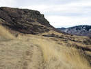
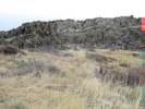
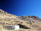
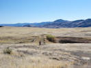
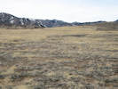
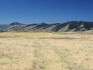
| Cottonwood Canyon Trail
| 
Location of Coll. No. 1806, Carex praegracilis | Photographed 7 May 2018.
Article records that use this photograph:
images/IMG50151sm.jpg
| Crappy Park Users
| 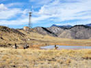
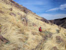
Horsepeople riding in the closed area at Vaca Lake. | Photographed 16 March 2019.
Location records that use this photograph:
Article records that use this photograph:
images/20200316_113343sm.jpg
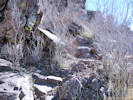
| Damage Repair
| 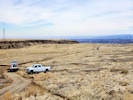
Open Space trail crew trying to repair damage by Xcel trucks. | Photographed 16 March 2019.
Article records that use this photograph:
images/20200316_115210sm.jpg
| 
Open Space trail crew trying to repair damage by Xcel trucks. | Photographed 16 March 2019.
Article records that use this photograph:
images/20200316_114530sm.jpg
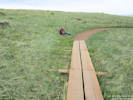
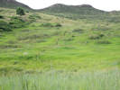
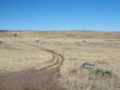
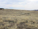
| Mesa Top Trail
| 
Mesa Top Trail where it was formerly washed out. | Photographed 7 May 2018.
Article records that use this photograph:
images/IMG50148sm.jpg
| 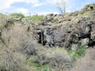
Waterfall beside Mesa Top Trail. | Photographed 7 May 2018.
Location records that use this photograph:
Article records that use this photograph:
images/IMGS0149sm.jpg
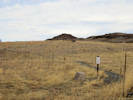
| 
Location of Coll. No. 1804, Juncus sp. | Photographed 7 May 2018.
Article records that use this photograph:
images/IMG50150sm.jpg
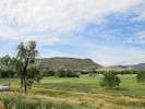
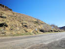
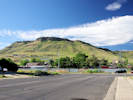
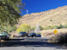
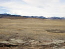
| North Golden
| 
Intersection of Iowa Drive with Colorado Highway 93 | Photographed 8 October 2014. Iowa Street would be found slightly east, towards the observer.
Article records that use this photograph:
images/IMG40570sm.jpg
| 
Intersection of Washington Avenue with Colorado Highway 93 | Photographed 8 October 2014.
Article records that use this photograph:
images/IMG40571sm.jpg
| 
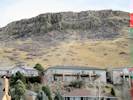
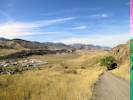
View down the southwest face of North Table Mountain | Photographed 8 October 2014.
Article records that use this photograph:
images/IMG40572sm.jpg
| North Table Loop
| 
Base of lava flow along North Table Loop. | Photographed 7 May 2018.
Location records that use this photograph:
Article records that use this photograph:
images/IMG50157sm.jpg
| 
Two of many bolts just below the North Table Loop. | Photographed 7 May 2018.
Location records that use this photograph:
Article records that use this photograph:
images/IMG50155sm.jpg
| 
Base of lava flow along North Table Loop. | Photographed 7 May 2018.
Location records that use this photograph:
Article records that use this photograph:
images/IMG50156sm.jpg
| North Table Mountain
| 
Hikers on the North Table Mountain Trail | Photographed 30 July 2015.
Location records that use this photograph:
Article records that use this photograph:
images/IMGQ1450sm.jpg
| 
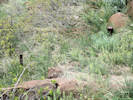
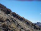
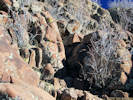
Deer above spring, southwest slopes of North Table Mountain. | Photographed March 16, 2017.
Article records that use this photograph:
images/IMGQ3606sm.jpg
| 
Lower end of North Table Mountain | Photographed 9 June 2015.
Location records that use this photograph:
Article records that use this photograph:
images/20150609_120953sm.jpg
| 
Ephemeral stream crosses trail | Photographed 10 March 2017. The stream crosses the trail at the location of the backpack. Note the cattails (Typha sp.) just above the trail.
Article records that use this photograph:
images/IMGQ3604sm.jpg
| 
Front Range Climbing Stewards trailer at top of Golden Cliffs Trail | Photographed 10 February 2017. I assume that Front Range Climbing Stewards is at least in part responsible for reconstructing the Golden Cliffs Trail where it passes through the rim of the mesa.
Location records that use this photograph:
Article records that use this photograph:
images/20170210_100902sm.jpg
| 
Switchback to rim of North Table Mountain | Photographed 8 October 2014.
Article records that use this photograph:
images/IMG40589sm.jpg
| 
Ephemeral stream crosses trail | Photographed 10 March 2017.
Article records that use this photograph:
images/IMGQ3603sm.jpg
| 
Social trail to Golden Cliffs Trailhead. | Photographed 18 February 2016.
Article records that use this photograph:
images/IMGQ1933sm.jpg
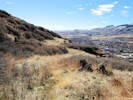
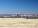
| 
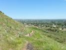
View of Golden to the south. | Photographed 18 February 2016.
Article records that use this photograph:
images/IMGQ1935sm.jpg
| 
The trail up from the switchback. | Photographed 18 February 2016.
Article records that use this photograph:
images/IMGQ1938sm.jpg
| 
Flat area on flank of North Table Mountain | Photographed 18 February 2016.
Article records that use this photograph:
images/IMGQ1942sm.jpg
| 
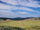
North Table Mountain to the southwest. | Photographed 13 August 2014.
Location records that use this photograph:
Article records that use this photograph:
images/IMG40354sm.jpg
| 
Start of social trail at Easley Road. | Photographed 27 February 2016. The “trail” climbs to the fourth highway bench along a route just right of center.
Article records that use this photograph:
images/IMGQ1988sm.jpg
| 
Old social trail. | Photographed 18 February 2016.
Article records that use this photograph:
images/IMGQ1985sm.jpg
| 
Peery Drive trailhead of North Table Mountain Trail. | Photographed 18 February 2016.
Article records that use this photograph:
images/IMGQ1928sm.jpg
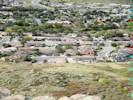
| 
The private pasture at left is a source of weeds bleeding into the adjacent open space. | Photographed 22 July 2016.
Location records that use this photograph:
Article records that use this photograph:
images/IMGQ2994sm.jpg
| 
North end of Social Trail. | Photographed 3 March 2016.
Article records that use this photograph:
images/IMGQ2034sm.jpg
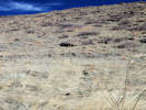
| 
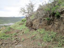
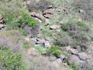
Landslide below North Table Mountain Trail | Photographed 3 March 2016.
Article records that use this photograph:
images/IMGQ2032sm.jpg
| 
Social trail at the base of the rim. | Photographed 18 February 2016.
Article records that use this photograph:
images/IMGQ1971sm.jpg
| 
Southern end of North Table Mountain Trail. | Photographed 18 February 2016.
Article records that use this photograph:
images/IMGQ1934sm.jpg
| 
Social trail to rim of mesa. | Photographed 18 February 2016.
Article records that use this photograph:
images/IMGQ1944sm.jpg
| 
Trace of tramway above Deer Springs Lane | Photographed on Winter Solstice, 21 December 2014.
Location records that use this photograph:
Article records that use this photograph:
images/IMG40750sm.jpg
| 
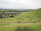
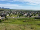
North Table Mountain from W. 58th Street | Photographed 22 July 2016, from Crestone Street near W. 58th Avenue.
Location records that use this photograph:
Article records that use this photograph:
images/IMGQ2972sm.jpg
| 
Trailhead of Mesa Spur Trail. | Photographed 22 July 2016, on W. 58th Avenue, near Crestone Street.
Location records that use this photograph:
Article records that use this photograph:
images/IMGQ2973sm.jpg
| 
Social trail below the rim. | Photographed 18 February 2016.
Article records that use this photograph:
images/IMGQ1966sm.jpg
| 
Mesa Spur Trail | Photographed 22 July 2016.
Location records that use this photograph:
Article records that use this photograph:
images/IMGQ2976sm.jpg
| 
Trace of tramway above Deer Springs Lane | Photographed on Winter Solstice, 21 December 2014. Bushes to the left of the trace are Rhus. I think the reddish tinge to the right of the trace is another willow. Should have been paying better attention.
Location records that use this photograph:
Article records that use this photograph:
images/IMG40746sm.jpg
| 
North Table Mountain Trail follows an old road. | Photographed 18 February 2016.
Article records that use this photograph:
images/IMGQ1964sm.jpg
| 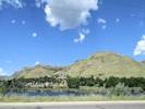
North Table Mountain from Table Mountain Parkway | Photographed 15 August 2014.
Location records that use this photograph:
Article records that use this photograph:
images/IMG40359sm.jpg
| 
Bird | Photographed 18 February 2016.
Article records that use this photograph:
images/IMGQ1953crop.jpg
| 
North Table Mountain from an unnamed hogback to the west. | Photographed 6 April 2017.
Article records that use this photograph:
images/IMGQ3680sm.jpg
| 
View from small hill near North Table Loop. | Photographed 22 July 2016.
Location records that use this photograph:
Article records that use this photograph:
images/IMGQ2988sm.jpg
| 
Spring improvements, plastic pipe south down the hill. | Photographed March 16, 2017.
Article records that use this photograph:
images/IMGQ3609sm.jpg
| 
View from small hill, south east to Denver. | Photographed 22 July 2016.
Location records that use this photograph:
Article records that use this photograph:
images/IMGQ2993sm.jpg
| 
Spring improvements (steel drum set in watercourse). | Photographed March 16, 2017.
Article records that use this photograph:
images/IMGQ3612sm.jpg
| 
Downhill view from the spring. | Photographed March 16, 2017. The water course runs from the lower right corner across to the left middleground, through the thicket, then back to the right, passing just to the right of the couple and their dog.
Article records that use this photograph:
images/IMGQ3614sm.jpg
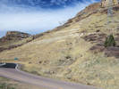
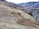
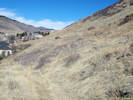
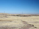
| North Table Mountain Park
| 
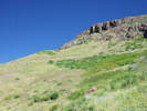
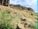
Golden Cliffs Trail on south face of North Table Mountain | Photographed 15 October 2014 from Castle Rock.
Location records that use this photograph:
Article records that use this photograph:
images/IMG40597sm.jpg
| 
Old Quarry Road, now part of North Table Loop. | Photographed 8 November 2015.
Article records that use this photograph:
images/IMGQ1869sm.jpg
| 
Trail access on Ridge Road. | Photographed 8 November 2015.
Location records that use this photograph:
Article records that use this photograph:
images/IMGQ1871sm.jpg
| 
Social trail into North Table Mountain Park | Photographed 13 July 2015.
Article records that use this photograph:
images/IMGQ1252sm.jpg
| 
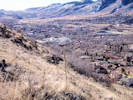
Denver from Tilting Mesa Trail | Photographed 8 November 2015.
Article records that use this photograph:
images/IMGQ1864sm.jpg
| 
Tilting Mesa Trail crosses dam of artificial pond | Photographed 8 November 2015.
Article records that use this photograph:
images/IMGQ1863sm.jpg
| 
Tilting Mesa Trail diverges to the northeast and Mesa Top Trail | Photographed 8 November 2015.
Article records that use this photograph:
images/IMGQ1858sm.jpg
| 
The North Table Loop heads south. | Photographed 3 March 2016.
Article records that use this photograph:
images/IMGQ2040sm.jpg
| 
Lichen Peak Trail | Photographed 3 March 2016.
Article records that use this photograph:
images/IMGQ2041sm.jpg
| 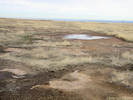
Small artificial ephemeral pool along south edge of scrapped area. | Photographed 3 March 2016.
Article records that use this photograph:
images/IMGQ2042sm.jpg
| 
Scrapped area, south side, looking west. | Photographed 3 March 2016.
Article records that use this photograph:
images/IMGQ2043sm.jpg
| 
Spoils piles, scrapped area in foreground. | Photographed 3 March 2016.
Article records that use this photograph:
images/IMGQ2044sm.jpg
| 
Artificial ephemeral pond; dam in right middleground. | Photographed 3 March 2016.
Article records that use this photograph:
images/IMGQ2045sm.jpg
| 
Ephemeral pool from south; artificial dam highlighted. | Photographed 3 March 2016.
Article records that use this photograph:
images/IMGQ2048sm.jpg
| 
Junipers where Cottonwood Canyon Trail reaches top of the mesa. | Photographed 8 November 2015.
Article records that use this photograph:
images/IMGQ1866sm.jpg
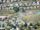
| 
Interface between North Table Mountain Park and Table Rock subdivision. |
Location records that use this photograph:
Article records that use this photograph:
images/IMGQ1259sm.jpg
| 
Pond near Mesa Top Trail. | Photographed 20 July 2015.
Location records that use this photograph:
Article records that use this photograph:
images/IMGQ1280sm.jpg
| 
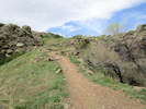
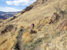
Easy part of rock scramble. | Photographed 18 February 2016.
Article records that use this photograph:
images/IMGQ1976sm.jpg
| 
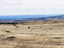
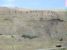
Much of North Table Mountain is closed due to sensitive resources. | Photographed 20 July 2015.
Location records that use this photograph:
Article records that use this photograph:
images/20150720_084217sm.jpg
| 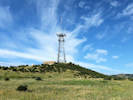
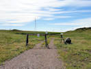
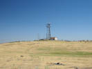
Radio tower on North Table Mountain | Photographed 20 July 2015.
Location records that use this photograph:
Article records that use this photograph:
images/20150720_084229sm.jpg
| 
Trail closed due to high water in pond. | Photographed 20 July 2015.
Location records that use this photograph:
Article records that use this photograph:
images/20150720_084314sm.jpg
| 
Social trail from Tablerock subdivision into North Table Mountain Park. | Photographed 20 July 2015.
Article records that use this photograph:
images/20150720_080457sm.jpg
| 
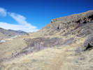
Small peaks in top of North Table Mountain | Photographed 20 July 2015.
Location records that use this photograph:
Article records that use this photograph:
images/IMGQ1276sm.jpg
| 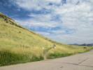
North Table Mountain trail at W. 53rd Drive | Photographed 13 August 2014.
Location records that use this photograph:
Article records that use this photograph:
images/IMG40356sm.jpg
| 
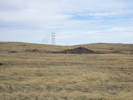
Old road and power line to radio tower. | Photographed 13 July 2016.
Article records that use this photograph:
images/IMGQ2960sm.jpg
| 
Two to three foot steps. | Photographed 18 February 2016.
Article records that use this photograph:
images/IMGQ1973sm.jpg
| 
Spray-painted graffiti on North Table Mountain. | Photographed 22 May 2017.
Location records that use this photograph:
Article records that use this photograph:
images/IMGQ3951sm.jpg
| 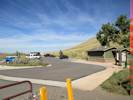
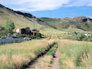
North Table Mountain Trailhead | Photographed 3 October 2014.
Location records that use this photograph:
Article records that use this photograph:
images/IMG40527sm.jpg
| 
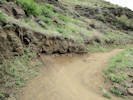
Looking down the North Table Loop trail | Photographed 3 October 2014.
Location records that use this photograph:
Article records that use this photograph:
images/IMG40528sm.jpg
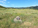
| 
US Bureau of Reclamation bench mark | Photographed 8 October 2014. This bench mark is badly vandalized. There are two reference marks nearby but I think this is the bench mark because it alone has a date stamped on it. 1 National Geodetic Survey, Retrieval Date = OCTOBER 10, 2014 KK1786 *********************************************************************** KK1786 DESIGNATION - NORTH TABLE KK1786 PID - KK1786 KK1786 STATE/COUNTY- CO/JEFFERSON KK1786 COUNTRY - US KK1786 USGS QUAD - GOLDEN (1994) KK1786 KK1786 *CURRENT SURVEY CONTROL KK1786 ______________________________________________________________________ KK1786* NAD 83(1992) POSITION- 39 46 09.22778(N) 105 13 09.52006(W) ADJUSTED KK1786* NAVD 88 ORTHO HEIGHT - 1984.0 (meters) 6509. (feet) VERTCON KK1786 ______________________________________________________________________ KK1786 GEOID HEIGHT - -15.63 (meters) GEOID12A KK1786 LAPLACE CORR - -18.65 (seconds) DEFLEC12A KK1786 HORZ ORDER - SECOND KK1786 KK1786.The horizontal coordinates were established by classical geodetic methods KK1786.and adjusted by the National Geodetic Survey in January 1993. KK1786. KK1786.The NAVD 88 height was computed by applying the VERTCON shift value to KK1786.the NGVD 29 height (displayed under SUPERSEDED SURVEY CONTROL.) KK1786 KK1786.The Laplace correction was computed from DEFLEC12A derived deflections. KK1786 KK1786. The following values were computed from the NAD 83(1992) position. KK1786 KK1786; North East Units Scale Factor Converg. KK1786;SPC CO C - 519,744.255 938,451.481 MT 1.00000386 +0 10 37.3 KK1786;SPC CO C - 1,705,194.28 3,078,902.90 sFT 1.00000386 +0 10 37.3 KK1786;UTM 13 - 4,402,167.506 481,216.794 MT 0.99960434 -0 08 25.1 KK1786 KK1786! - Elev Factor x Scale Factor = Combined Factor KK1786!SPC CO C - 0.99969130 x 1.00000386 = 0.99969515 KK1786!UTM 13 - 0.99969130 x 0.99960434 = 0.99929576 KK1786 KK1786: Primary Azimuth Mark Grid Az KK1786:SPC CO C - 42 AZ MK 285 54 43.0 KK1786:UTM 13 - 42 AZ MK 286 13 45.4 KK1786 KK1786|---------------------------------------------------------------------| KK1786| PID Reference Object Distance Geod. Az | KK1786| dddmmss.s | KK1786| CP7103 NORTH TABLE RM 1 4.980 METERS 19447 | KK1786| CP7102 42 AZ MK 2860520.3 | KK1786| CP7104 42 RM 2 10.740 METERS 29451 | KK1786|---------------------------------------------------------------------| KK1786 KK1786 SUPERSEDED SURVEY CONTROL KK1786 KK1786 NAD 83(1986)- 39 46 09.22434(N) 105 13 09.51795(W) AD( ) 2 KK1786 NAD 27 - 39 46 09.27088(N) 105 13 07.55917(W) AD( ) 2 KK1786 KK1786.Superseded values are not recommended for survey control. KK1786 KK1786.NGS no longer adjusts projects to the NAD 27 or NGVD 29 datums. KK1786.See file dsdata.txt to determine how the superseded data were derived. KK1786 KK1786_U.S. NATIONAL GRID SPATIAL ADDRESS: 13SDE8121602167(NAD 83) KK1786 KK1786_MARKER: DD = SURVEY DISK KK1786_SETTING: 66 = SET IN ROCK OUTCROP KK1786 KK1786 HISTORY - Date Condition Report By KK1786 HISTORY - 1977 MONUMENTED CO-059 KK1786 KK1786 STATION DESCRIPTION KK1786 KK1786'DESCRIBED BY JEFFERSON COUNTY COLORADO 1977 (LCH) KK1786'THE STATION IS A USBR MONUMENT, LOCATED 1.0 MILE SOUTH OF KK1786'GOLDEN, 3/4 MILE EAST OF STATE HIGHWAY 93 ON THE SOUTH RIM OF KK1786'NORTH TABLE MOUNTAIN NEAR THE SOUTHWEST CORNER OF SECTION 22, KK1786'T 3 S, R 70 W. KK1786' KK1786'TO REACH THE STATION FROM THE JEFFERSON COUNTY COURTHOUSE IN KK1786'GOLDEN, GO NORTH ON STATE HIGHWAY 93 FOR 4.2 MILES TO WEST KK1786'58TH AVENUE. TURN RIGHT AND GO EAST 0.3 MILE TO A LARGE KK1786'MASONARY AND IRON GATE ON THE RIGHT. GO THROUGH THIS GATE KK1786'AND TO THE OFFICE OF A LARGE ARENA WHERE YOU MUST SIGN A KK1786'RELEASE AND GET PERMISSION TO GO TO THE TOP OF NORTH TABLE KK1786'MOUNTAIN. DRIVE SOUTH ON A DIRT ROAD 0.3 MILE TO A FORK AT THE KK1786'BASE OF THE MOUNTAIN. BEAR RIGHT AND GO SOUTH AND WEST ON A KK1786'SHELF ROAD FOR 1.0 MILE TO AN INTERSECTION WITH A ROAD FROM KK1786'THE WEST WHERE THERE ARE ABANDONED FARM BUILDINGS KK1786'AND MACHINES. BEAR LEFT FOR KK1786'0.7 MILE UP A SHELF ROAD ON THE WEST SIDE OF THE KK1786'MOUNTAIN TO A 500 FEET DIAMETER DRY LAKE SEVERAL HUNDRED FEET KK1786'NORTHEAST OF A TELEPHONE MICROWAVE TOWER. BEAR RIGHT AND GO KK1786'SOUTH ON TRAIL TYPE ROAD FOR 1.2 MILES TO THE HIGHEST POINT KK1786'ON THE SOUTH RIM. KK1786' KK1786'TO REACH THE AZIMUTH MARK FROM THE COURTHOUSE IN GOLDEN, GO KK1786'NORTH ON STATE HIGHWAY 93 FOR 1.5 MILES TO THE CONCRETE BRIDGE KK1786'OVER TUCKER GULCH. THE AZIMUTH MARK IS LOCATED ON THE KK1786'SOUTHEAST CORNER AT CURB LEVEL. KK1786' KK1786'THE STATION MARK, STAMPED---NORTH TABLE---, IS A STANDARD KK1786'4-INCH BRONZE U.S. BUREAU OF RECLAMATION BENCH MARK KK1786'DISK CEMENTED IN A DRILL HOLE IN THE BEDROCK KK1786'OUTCROP 25 FEET NORTH OF THE EDGE AND 45 FEET WEST OF THE KK1786'TRAIL TO THE TOP. KK1786' KK1786'REFERENCE MARK 1, STAMPED---NORTH TABLE RM 1---, IS A STANDARD KK1786'4-INCH BRONZE U.S. BUREAU OF RECLAMATION BENCH MARK KK1786'DISK CEMENTED IN A DRILL HOLE IN THE BEDROCK KK1786'OUTCROP 15 FEET NORTH OF THE EDGE AND 46 FEET WEST OF THE KK1786'TRAIL TO THE TOP. KK1786' KK1786'REFERENCE MARK 2, STAMPED---042 JCMD RM 2 1977---, IS A KK1786'3-INCH BRONZE DISK CEMENTED IN A DRILL HOLE IN THE BEDROCK KK1786'OUTCROP 15 FEET NORTH OF THE EDGE AND 57 FEET WEST OF THE TRAIL KK1786'TO THE TOP. KK1786' KK1786'THE AZIMUTH MARK, STAMPED---42 JCMD AZM 1977---, IS A 3-INCH KK1786'BRONZE DISK CEMENTED IN A DRILL HOLE IN THE SOUTHEAST CORNER KK1786'OF THE BRIDGE OVER TUCKER GULCH AT TOP OF CURB LEVEL, 13 FEET KK1786'FROM THE CENTER OF STATE HIGHWAY 93 AND 31 FEET SOUTH OF THE KK1786'CENTER OF THE CREEK.
Location records that use this photograph:
Article records that use this photograph:
images/IMG40573sm.jpg
| 
Old road to radio tower. | Photographed 13 July 2016.
Article records that use this photograph:
images/IMGQ2959sm.jpg
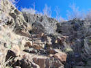
| 
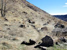
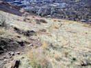
Debris pile of prospect. | Photographed 3 March 2016.
Article records that use this photograph:
images/IMGQ2052sm.jpg
| 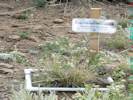
Project BudBurst Monitoring Plot | Photographed 8 October 2014.
Article records that use this photograph:
images/IMG40581sm.jpg
| | ||||||||