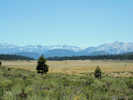
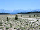
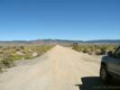
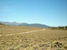
Eastern Mojave Vegetation
Images -- Geography - Mono County, California

By Tom Schweich


Home Page
Unclassified
Geography - Idaho
Geography - Park County, CO
Geography - Summit County, CO
Geography - Arizona
Geography - British Columbia
Geography - California
Geography - California's Colorado Desert
Alaska
Geography - Mono Lake Basin, California
Geography - Mono County, California
Geography - San Luis Obispo County, California
Geography - Marin County, California
Geography - Santa Clara County
Alameda
Garden
Geography - Central Mojave
Geography - New Mexico
Geography - Eastern Mojave
Geography - Northern Mojave
Geography - Colorado
Geography - Alamosa County, CO
Geography - Boulder County, CO
Geography - Clear Creek County, CO
Geography - Chaffee County, CO
Geography - Douglas County, CO
Geography - Gilpin County, CO
Geography - Golden, Colorado
Geography - Weld County, CO
Geography - Hinsdale County, CO
Geography - Jefferson County, CO
Geography - North Table Mountain, Jefferson Cty, CO
Geography - Lake County, CO
Geography - Larimer County, CO
Geography - Nevada
Geography - Oregon
Geography - Utah
Geography - Virginia
Geography - Washington
Geography - Wyoming
Spain - Andalucia
Spain - Castilla y Leon
Spain - Castilla-La Mancha
Spain - Extremadura
Spain - Galicia
Spain - Madrid
Portugal
Geology
Economic Geology
Climatology
Botany
Salvia dorrii
Frasera albomarginata
Species
Species - Polygonaceae
Species - Brassicaceae
Species - Brassicaceae, Physaria vitulifera
Species - Rosaceae
Species - Fabaceae
Species - Onagraceae
Species - Polemoniaceae
Species - Boraginaceae
Species - Plantaginaceae
Species - Asteraceae
Species - Poaceae
Zoology
Ecology
Archeology
Customer Satisfaction
General
Arizona
California
Kansas
Missouri
Nebraska
New York
Christmas 2002
Family Photos
Family Documents
Family Photos 2003
Art of Lydia Schweich
Portraits
Railroad
Geography - Germany

Images are organized by the topics listed at left. Click on a topic name to see images with that topic.

Would you like to use these photographs in your school term paper or report?

License is hereby granted for non-commercial use of the images contained herein provided that the images are reproduced with the copyright notice intact. This means that we give you our permission to use the photographs and information you find here in your school term papers and reports. You may resize the photograph to fit your needs, but you may not remove the copyright. Your term paper should note that the photographs are reproduced with permission and it should have a reference to this web site, such as:

"Photograph ©1999 Tom Schweich. Used by permission, http://www.schweich.com"

If you have a comment or a question about a photograph you may write to me at tas4@schweich.com I will answer you as soon as I can. I sometimes post interesting questions in my FAQ, but I will not disclose your full name or address.

Sketch map of Mono Basin Research Group sites.

Location records that use this photograph:

Article records that use this photograph:

        images/MBRGSketchMap.jpg

"Airfield Flat"

Airfield Flat, as seen from north to south.

Photograph taken 16 August 2010.

The airfield runs north and south on the west side of the flat, i.e., in the right side of the photo.

Location records that use this photograph:

Article records that use this photograph:

        images/IMG_1288sm.jpg

Airfield in unnamed flat near Deadman Summit.

Photograph taken 16 August 2010.

Location records that use this photograph:

Article records that use this photograph:

        images/IMG_1293sm.jpg

Adobe Hills

The southern end of Dobie Meadows Road.

Photograph taken 23-Sep-06.

Location records that use this photograph:

Article records that use this photograph:

        images/IMG_0764sm.jpg

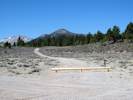
View to the northwest, along the route of 01N112.

Photograph taken 29 June 2010.

Location records that use this photograph:

Article records that use this photograph:

        images/IMG_0949sm.jpg

Adobe Hills Spillway

Adobe Hills Spillway from the south,

Photograph taken 23-Sep-06.

Water from Lake Russell (Mono Lake) would flow over the spillway toward to viewer.

Location records that use this photograph:

Article records that use this photograph:

        images/IMG_0770sm.jpg

Adobe Hills Spillway from Cowtrack Mountain

Photograph taken 25-Jun-07.

The Adobe Hills Spillway is circled in red.

The Mono Basin is to the left, or north of the spillway. The right, or south side, drains first to Adobe Valley, then the Chalfant Valley, and finally the Owens Valley.

Location records that use this photograph:

Article records that use this photograph:

        images/IMGP2684sm.jpg

Looking downstream from the spillway.

Photograph taken 23-Sep-06.

Water from Lake Russell (Mono Lake) would flow away from the viewer into Adobe Valley.

Location records that use this photograph:

Article records that use this photograph:

        images/IMG_0774sm.jpg

Adobe Valley

Earthscope GPS station near Sagehen Meadow.

Photograph taken 21 June 2010.

I think this is Station P641.

Article records that use this photograph:

        images/IMG_0914sm.jpg

Sagehen Meadow Campground

Photograph taken July 7, 2009.

Location records that use this photograph:

Article records that use this photograph:

        images/IMG01982sm.jpg

California Highway 120 begins climbing out of Adobe Valley.

Photograph taken 23-Sep-06 at the intersection with Dobie Meadows Road.

Article records that use this photograph:

        images/IMG_0765sm.jpg

Looking out of Mono Basin into Adobe Valley drainage.

Photograph taken 23 July 2010.

Article records that use this photograph:

        images/IMG_1083sm.jpg

View into Adobe Valley drainage from Sagehen Meadow Road.

Photograph taken 23 July 2010.

Article records that use this photograph:

        images/IMG_1077sm.jpg

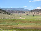
View of Johnny Meadow

Photograph taken 21 June 2010.

Location records that use this photograph:

Article records that use this photograph:

        images/IMG_0921sm.jpg

For Sale sign on House and Land in Dexter Canyon

Photograph taken 7 August 2010.

Article records that use this photograph:

        images/IMG_1239sm.jpg

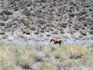
Wild horse in Adobe Valley.

Photograph taken July 7, 2009.

Article records that use this photograph:

        images/IMG01978sm.jpg

Glass Mountain from Adobe Valley

Photograph taken July 7, 2009.

Location records that use this photograph:

Article records that use this photograph:

        images/IMG01979sm.jpg

House for sale, 200 ac., 2 bdrm, 2 1/2 million.

Photograph taken 7 August 2010.

Article records that use this photograph:

        images/IMG_1241sm.jpg

Lower end of Taylor Canyon

Photograph taken 7 August 2010.

Article records that use this photograph:

        images/IMG_1238.jpg

California Highway 120 southeast towards the White Mountains.

Photograph taken 23-Sep-06 at the intersection with Dobie Meadows Road.

Location records that use this photograph:

Article records that use this photograph:

        images/IMG_0766sm.jpg

View north on Dobie Meadows Road.

Photograph taken 28 June 2010.

Article records that use this photograph:

        images/IMG_0945sm.jpg

Looking into Adobe Valley.

Photograph taken 23-Sep-06 from the entrance to the canyon on Dobie Meadows Road.

Article records that use this photograph:

  • Dobie Meadows Road, Mono County, California: 78010.
  • Field Notes: 23 Sep 06.

        images/IMG_0768sm.jpg

Airfield Flat

x-Forest Road 2S259 to the west

Photographed 30 May 2012.

Article records that use this photograph:

        images/IMG30209sm.jpg

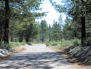
x-Forest Road 2S259 to the northeast

Photographed 30 May 2012.

Article records that use this photograph:

        images/IMG30211sm.jpg

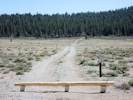
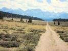
Looking south through Airfield Flat

Photographed 25 August 2012.

Location records that use this photograph:

Article records that use this photograph:

        images/IMG30659sm.jpg

Arborglyphs

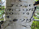
Arborglyph on Sagehen Meadows Road

Photograph taken June 22, 2010.

This one says, “Jose Irigoyen, Agosto 4, 1970.”

Article records that use this photograph:

        images/IMG_0916sm.jpg

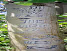
A particularly elaborate arborglyph.

Photograph taken 15 July 2010.

Article records that use this photograph:

        images/IMGP0480sm.jpg

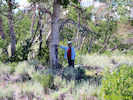
Cheryl by arborglyphs beside Sagehen Meadow Road.

Photograph taken 15 Jul 2010.

Article records that use this photograph:

        images/IMGP0482sm.jpg

Bald Mountain

View of Bald Mountain, southeast of Mono Craters.

Photograph taken 15 June 2011.

Location records that use this photograph:

Article records that use this photograph:

        images/IMG11901sm.jpg

Bennettville

Inside the adit of the Great Sierra Consolidated Silver Company at Bennettville

Photograph taken 24-Jun-07.

Location records that use this photograph:

Article records that use this photograph:

        images/IMG_1721sm.jpg

Mine Creek and Shell Lake

Photograph taken 24-Jun-07.

The lake is Shell Lake, and Mine Creek is coming toward the viewer on its way to join upper Lee Vining Creek at Junction Campground. The peak in the right distance is Mount Conness.

Location records that use this photograph:

Article records that use this photograph:

        images/IMG_1718sm.jpg

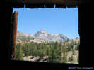
Mount Dana from Bennettville

Photograph taken 24-Jun-07.

Location records that use this photograph:

Article records that use this photograph:

        images/IMG_1709sm.jpg

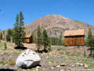
Two cabins at Bennettville

Photograph taken 24-Jun-07.

Location records that use this photograph:

Article records that use this photograph:

        images/IMG_1702sm.jpg

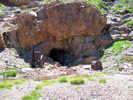
Adit of the Great Sierra Consolidated Silver Company at Bennettville

Photograph taken 24-Jun-07.

This adit was driven 1,800 feet without encountering ore of any particular value.

Location records that use this photograph:

Article records that use this photograph:

        images/IMG_1720sm.jpg

Bennettville and Tioga Peak

Photograph taken 24-Jun-07.

The two cabins are at the Bennettville site. Tioga Peak in the background.

Location records that use this photograph:

Article records that use this photograph:

        images/IMG_1715sm.jpg

Bennettville and Tioga Peak from the dump of the adit.

Photograph taken 24-Jun-07.

Location records that use this photograph:

Article records that use this photograph:

        images/IMG_1725sm.jpg

Benton and vicinity

View of the Benton Hot Springs Ranch meadow.

Photograph taken 26 June 2010.

Article records that use this photograph:

        images/IMG_0935sm.jpg

Benton Hot Springs.

Photograph taken July 17, 2005.

Location records that use this photograph:

Article records that use this photograph:

        images/IMGP1641asm.jpg

Looking toward Montgomery Pass through Benton Valley.

Photograph taken July 17, 2005.

US Highway 6 is in the valley, and the White Mountains are at right.

Location records that use this photograph:

Article records that use this photograph:

        images/IMGP1645sm.jpg

Looking south in the meadow near Benton Hot Springs

Photograph taken 26 June 2010.

Location records that use this photograph:

Article records that use this photograph:

        images/IMG_0932sm.jpg

Stage station in Benton Hot Springs

Photograph taken 27 June 2010.

Location records that use this photograph:

Article records that use this photograph:

        images/IMG_0936sm.jpg

Bed and breakfast at Benton Hot Springs

Photograph taken 27 June 2010.

Location records that use this photograph:

Article records that use this photograph:

        images/IMG_0937sm.jpg

Benton Valley

Surface expression of Queen Valley Thrust Fault.

Photographed 22 June 2015.

Location records that use this photograph:

Article records that use this photograph:

        images/IMGQ0972sm.jpg

Bodie

Bodie

Photograph taken 26-Jun-07.

Location records that use this photograph:

  • Bodie, Mono County, California

Article records that use this photograph:

        images/IMGP2701sm.jpg

Bodie from the South

Photograph taken 26-Jun-07.

Location records that use this photograph:

  • Bodie, Mono County, California

Article records that use this photograph:

        images/IMG_1822sm.jpg

Bodie & Benton Railroad

Crossing of the Bodie and Benton Railroad

Photograph taken 5-Jun-06.

Bodie and Benton R. R.

Surveyed in March, 1881, and completed in December 1881. With materials hauled from Hawthorne, Nevada, through Bodie to this road bed, at a cost of one million dollars. This narrow gauge railway carried timber supplies 31.74 miles from Mono Mills to Bodie station, rising in grade 2074 feet to an elevation of 8500 feet. Operations continued until 1918, when decreased mining activity caused the railroad to be dismantled.

Dedicated September 13, 1969
Bodie Chapter, E. Clampus Vitus
Mono County Board of Supervisors

Article records that use this photograph:

        images/IMG_0484sm.jpg

Bodie Hills

Looking west into Clearwater Creek (East Walker River) Drainage

Photograph taken 25 July 2010.

Article records that use this photograph:

        images/IMG_1094sm.jpg

Small exclosure in Bodie Hills.

Photograph taken 25 July 2010 in the Bodie Hills, northeast of Mt. Biedeman and south of California Highway 270.

Article records that use this photograph:

        images/IMG_1104sm.jpg

Small lightning set fires in the Bodie Hills.

Photograph taken 25 July 2010 from California Highway 270 north of Mt. Biedeman.

Article records that use this photograph:

        images/IMG01106sm.jpg

Outcrop near Coyote Springs Road.

Photographed 24 August 2012.

Location records that use this photograph:

Article records that use this photograph:

        images/IMG30634sm.jpg

Bridgeport

Independence Day parade in Bridgeport

Photograph taken 4 July 2010

Location records that use this photograph:

Article records that use this photograph:

        images/IMG_0972sm.jpg

Bridgeport Ranch Rodeo

Photograph taken 4 July 2010

Location records that use this photograph:

Article records that use this photograph:

        images/IMG_1017sm.jpg

Bridgeport Canyon

The road ahead: looking into the Walker River watershed.

Photograph taken 26-Jun-07.

This photo looks north into the Clearwater Creek drainage and therefore into the Walker River basin.

Location records that use this photograph:

Article records that use this photograph:

        images/IMG_1810sm.jpg

Horses in pass of Bridgeport Canyon

Photograph taken 26-Jun-07.

This photo looks west in the pass at the head of Bridgeport Canyon. The folks with the horses were living in a trailer.

Location records that use this photograph:

Article records that use this photograph:

        images/IMG_1809sm.jpg

Bridgeport Valley

Panorama of Bridgeport Valley

Photograph taken 4-Jun-06.

At the extreme right is the Bridgeport Remote Automated Weather Station (RAWS). Current data is available from: http://raws.wrh.noaa.gov/cgi-bin/roman/meso_base.cgi?stn=BPOC1.

Location records that use this photograph:

Article records that use this photograph:

        images/IMG_0454-8c.jpg

Bridgeport Valley, just west of Bridgeport

Photograph taken 4-Jun-06.

Location records that use this photograph:

Article records that use this photograph:

        images/IMG_0460sm.jpg

Californa, Mono County

Road Intersection

Photograph taken August 13, 2008.

Article records that use this photograph:

  • Forest Road 1S05, "Bald Mountain Road," Mono County, California: at FR 1S06, 1S08.
  • "120 Cutoff," Inyo Forest Road 1S06, Mono County, California: at 1S05.
  • Forest Road 1S08, Mono County, California: at 1S05.
  • Field Notes: 13-Aug-08.

        images/IMG01269sm.jpg

Sagehen Peak, California, from California Highway 120.

Photograph taken June 12, 2008.

Location records that use this photograph:

Article records that use this photograph:

        images/IMG01072sm.jpg

Glass Mountain from Adobe Valley, California.

Photograph taken June 12, 2008.

Location records that use this photograph:

Article records that use this photograph:

        images/IMG01071sm.jpg

US Highway 395 just south of Crestview and Deadman Summit

Photograph taken August 14, 2008.

Article records that use this photograph:

        images/IMG01350sm.jpg

Glass Mountain from California Highway 120 near Granite Mountain

Photograph taken June 12, 2008.

Location records that use this photograph:

Article records that use this photograph:

        images/IMG01073sm.jpg

Glass Mountain across Queen Valley

Photograph taken June 12, 2008.

Location records that use this photograph:

Article records that use this photograph:

        images/IMG01067sm.jpg

Dexter Canyon from Sagehen Peak

Photograph taken August 13, 2008.

Location records that use this photograph:

Article records that use this photograph:

        images/IMG01321sm.jpg

Glass Mountain from Sagehen Peak

Photograph taken August 13, 2008.

Location records that use this photograph:

Article records that use this photograph:

        images/IMG01320sm.jpg

Wild Horse Meadow from Sagehen Peak

Photograph taken August 13, 2008.

Location records that use this photograph:

Article records that use this photograph:

        images/IMG01319sm.jpg

Wild Horse Meadow

Photograph taken August 13, 2008.

Location records that use this photograph:

Article records that use this photograph:

        images/IMG01312sm.jpg

Crooked Meadows Campground

Photograph taken August 13, 2008.

Location records that use this photograph:

Article records that use this photograph:

        images/IMG01311sm.jpg

Crooked Meadows Spring

Photograph taken August 13, 2008.

Location records that use this photograph:

Article records that use this photograph:

        images/IMG01310sm.jpg

Crooked Meadows

Photograph taken August 13, 2008.

Location records that use this photograph:

Article records that use this photograph:

  • "Taylor Canyon Road," Inyo Forest Road 1S17, Mono County, California: 62000.
  • Field Notes: 13-Aug-08.

        images/IMG01308sm.jpg

McLaughlin Creek watershed

Photograph taken August 13, 2008.

Location records that use this photograph:

Article records that use this photograph:

  • "Taylor Canyon Road," Inyo Forest Road 1S17, Mono County, California: 59900.
  • Field Notes: 13-Aug-08.

        images/IMG01307sm.jpg

Bald Mountain from US Highway 395

Photograph taken August 14, 2008.

Location records that use this photograph:

Article records that use this photograph:

        images/IMG01352sm.jpg

Crooked Meadows from the north.

Photograph taken August 13, 2008.

Location records that use this photograph:

Article records that use this photograph:

        images/IMG01306sm.jpg

Black Lake alongside California Highway 120

Photograph taken June 12, 2008.

Location records that use this photograph:

Article records that use this photograph:

        images/IMG01069sm.jpg

Owens River from Bald Mountain

Photograph taken August 13, 2008.

Location records that use this photograph:

Article records that use this photograph:

        images/IMG01295sm.jpg

Owens River from Bald Mountain

Photograph taken August 13, 2008.

Location records that use this photograph:

Article records that use this photograph:

        images/IMG01294sm.jpg

Deadman Creek basin from Bald Mountain, California

Photograph taken August 13, 2008.

I don't think this basin has a name, but Deadman Creek runs through it in the direction toward the viewer. The mountains around the northwest corner of the basin look to me as though they may form the northwest wall of the Long Valley Caldera.

Location records that use this photograph:

Article records that use this photograph:

        images/IMG01285sm.jpg

Water gap in lower Adobe Valley

Photograph taken June 12, 2008.

Article records that use this photograph:

        images/IMG01068sm.jpg

Unnamed sand flat south of Bald Mountain Road.

Photograph taken August 13, 2008.

Location records that use this photograph:

Article records that use this photograph:

        images/IMG01284sm.jpg

Glass Mountain, northeast wall of Long Valley Caldera

Photograph taken August 14, 2008.

Location records that use this photograph:

Article records that use this photograph:

        images/IMG01349sm.jpg

Obsidian flow to west of US Highway 395

Photograph taken August 14, 2008.

Article records that use this photograph:

        images/IMG01351sm.jpg

Little Sand Flat from Bald Mountain, California

Photograph taken August 13, 2008.

Mono Craters in left middleground, and Mono Lake can just be seen in lower right.

Location records that use this photograph:

Article records that use this photograph:

        images/IMG01283sm.jpg

Cinnabar Canyon

Entrance to Cinnabar Canyon

Photograph taken 26-Jun-07 from the turnoff on California Highway 270.

Location records that use this photograph:

Article records that use this photograph:

        images/IMG_1837sm.jpg

View from quarry in Cinnabar Canyon

Photograph taken 26-Jun-07.

Location records that use this photograph:

Article records that use this photograph:

        images/IMG_1838sm.jpg

Coldwater Canyon

Coldwater Canyon from Chalfant Quarry

Photograph taken April 26, 2009.

The mouth of the canyon is left of center.

Location records that use this photograph:

Article records that use this photograph:

        images/IMG01610sm.jpg

Convict Creek

Convict Creek Moraines

Photograph taken April 26, 2009.

Article records that use this photograph:

        images/IMG01618sm.jpg

Convict Lake

Laurel Mountain across Convict Lake.

Photograph taken 18 June 2011.

Location records that use this photograph:

Article records that use this photograph:

        images/IMG11932sm.jpg

Plaque for Convict Lake

Photograph taken 18 June 2011.

Convict Lake
Convict Lake and Creek are so named as the result of an encounter here September 17, 1871, between Robert Morrison, Benton merchant and member of a posse of citizens, and three convicts who had escaped from the Carson City, Nevada, state penitentiary. Morrison encountered the convicts on present Convict Creek, then known as Monte Diable Creek. Morrison was killed and the convicts escaped. Other members of the possee captured the fugitives in Round Valley. They were taken to Bishop where two of the convicts were hanged. The third, a youth of 19, was returned to the Carson prison. The indians are said to have called Convict Lake wit-sa-nap.
Dedicated September 21, 1974
Bodie Chapter, E Clampus Vitus
Mono County Board of Supervisors

Location records that use this photograph:

Article records that use this photograph:

        images/IMG11944sm.jpg

Cowtrack Mountain

Post-burn vegetation patterns seen from Cowtrack Mountain

Photograph taken 25-Jun-07.

At least I assume that the vegetation patterns seen here, and quite visible in air photos result from a fire sometime in the past.

Location records that use this photograph:

Article records that use this photograph:

        images/IMGP2686sm.jpg

Crooked Meadows

Crooked Meadows in mid-June, no flowers yet.

Photograph taken 16 June 2011.

Location records that use this photograph:

Article records that use this photograph:

        images/IMG01914sm.jpg

Waiting for lunch at the Snow Bank Caf e

Photograph taken 16 June 2011 at Crooked Meadows Campground.

Location records that use this photograph:

Article records that use this photograph:

        images/IMG01915sm.jpg

Looking into Crooked Meadows from divide.

Photograph taken 8 July 2010 from near the intersection of Forest Road 1S17 and 1S56.

Location records that use this photograph:

Article records that use this photograph:

        images/IMG_1026sm.jpg

View east across Crooked Meadows

Photograph taken 1 September 2010, near the Gentianopsis simplex habitat.

Location records that use this photograph:

Article records that use this photograph:

        images/IMG01395sm.jpg

Shooting Stars in Crooked Meadows

Photograph taken 12 July 2010.

Location records that use this photograph:

Article records that use this photograph:

        images/IMG_1055sm.jpg

Deadman Creek

Experimental plot near Deadman Creek.

Photograph taken April 27, 2009.

Article records that use this photograph:

  • U. S. Highway 395: 46610.

        images/IMG01668sm.jpg

Snow fences at Deadman Creek Road

Photograph taken April 27, 2009.

Article records that use this photograph:

  • U. S. Highway 395: 46610.

        images/IMG01667sm.jpg

Devils Postpile

Rainbow Falls in Devils Postpile National Monument.

Photograph taken 29 June 2010.

Article records that use this photograph:

        images/IMG_0960sm.jpg

Dog Town

Dog Town Plaque

Photograph taken 26-Jun-07.

Dog Town

1857

Site of the first major gold rush to California's eastern slope of the Sierra Nevada. Dog Town derived its name from a popular miner's term for camps with huts or hovels. Ruins lying close to the cliff bordering Dog Town Creek are all that remain of the makeshift dwellings which here formed part of the "Diggins."

California Registered Historical Landmark No. 792

Plaque placed by the California State Park Comission in cooperation with the Mono County Department of Parks and Recreation and the Mono County Historical Society, September 11, 1966.

Location records that use this photograph:

Article records that use this photograph:

        images/IMG_1840sm.jpg

Scenic Highway plaque at Dog Town

Photograph taken 26-Jun-07.

Boom and Bust

"Here today, gone tomorrow" describes many early mining towns -- Dogtown was no exception. Miners rushed to the eastern Sierra when gold was discovered in the waters of Dog Creek in the 1850s. The largest nugget ever found in the eastern slope was said to have come from here. Despite the hopeful start, these gold deposits were not very extensive and with a couple of years "placer excitement" shofted to Monoville, a new strike just a few miles south of here.

Many hopeful parties have tried to make a go of the remaining placer deposits. In the late 1860s and early 1870s, Chinese families oppupied stone huts, planted gardens, and lived off what little gold they could find. As late as the early 1900s, an unproductive dredging operation was in place.

Though never very profitable, Dogtown was significant as the first placer settlement on the eastner slope of the Sierra, bringing attention to more profitable areas such as Bodie, Aurora, Masonic, and Virginia City. In some areas, mining continues today, adding to the wealth of gold and silver already found in these lonely hills.

Eastern Sierra Scenic Byway

Location records that use this photograph:

Article records that use this photograph:

        images/IMG_1841sm.jpg

Dog Town

Photograph taken 26-Jun-07.

Location records that use this photograph:

Article records that use this photograph:

        images/IMG_1842sm.jpg

Scenic Highway plaque at Dog Town

Photograph taken 26-Jun-07.

Edge of a Dream

Under favorable circumstances it snows at least once every single month of the year in the little town of Mono. So uncertain is the climate in summer that a lady that goes out visiting cannot hope to be prepared for all emergencies unless she takes her fan under one arm and her snowshoes under the other.
-- Mark Twain

Visions of "streets paved with gold" lured many fortune hunters to the Sierra Nevada durinf the mid to late 1800s. Thousands of gold seekers roamed the hills braving the elements. Life was challenging. Bitter winter winds dropped temperatures well below zero and snowfall was often several feet deep. "Homes" with little of no insulation neither kept the wind out, nor the warmth in. Shortages of provisions, difficult travel conditions, illness, and isolation were some of the many challenges faced by these hardy prospectors and pioneers. Most of the men and women were financially unsuccessful -- a lucky few actually realized their dreams.

Eastern Sierra Scenic Byway

Location records that use this photograph:

Article records that use this photograph:

        images/IMG_1839sm.jpg

View north on US Hwy 395 from Dog Town

Photograph taken 26-Jun-07.

Location records that use this photograph:

Article records that use this photograph:

        images/IMG_1843sm.jpg

Dunderberg Peak

View of Dunderberg Peak from Goat Ranch Cutoff

Photograph taken 19 June 2011.

Location records that use this photograph:

Article records that use this photograph:

        images/IMG_1952sm.jpg

Ellery Lake

Wildflower walk led by Cathy Rose

Photograph taken 27 July 2010.

Article records that use this photograph:

        images/IMG_1116sm.jpg

Ellery Lake in the morning.

This photograph was taken in the morning of 24-Sep-06 from the east side of the lake. The sun was lighting up the metamorphic rocks to the west. There is a USFS Campground along Lee Vining Creek on the opposite shore of the lake.

Location records that use this photograph:

Article records that use this photograph:

        images/IMG_0829sm.jpg

Gaspipe Spring

Gaspipe Spring

Photograph taken 25-Jun-07.

Location records that use this photograph:

Article records that use this photograph:

        images/IMG_1775sm.jpg

Gaspipe Spring

Photograph taken 25-Jun-07.

Location records that use this photograph:

Article records that use this photograph:

        images/IMG_1774sm.jpg

Glass Mountain

Glass Mountain from Casa Diablo Mine Road

Photograph taken April 27, 2009.

Location records that use this photograph:

Article records that use this photograph:

  • Casa Diablo Mine Road, Mono County, and Casa Diablo Road, Inyo County, California: along the road.

        images/IMG01652sm.jpg

Glass Mountain from Cowtrack Mountain Road

Photograph taken 25-Jun-07.

Location records that use this photograph:

Article records that use this photograph:

        images/IMG_1773sm.jpg

Glass Mountain from a little knoll near Crooked.

Photographed 23 August 2012.

Location records that use this photograph:

Article records that use this photograph:

        images/IMG30625sm.jpg

H. M. Hall RNA

Sign on the garden shed.

Photograph taken 14 August 2010.

Text is "Harvey Monroe Hall Natural Area, Research on Effects of Climate on Plants, Conducted by Carnegie Institute of Washington, Division of Plant Biology."

Location records that use this photograph:

Article records that use this photograph:

        images/IMG_1286sm.jpg

Harvey Monroe Hall Research Natural Area

Harvey Monroe Hall Research Natural Area

Photograph taken 27-Jun-07.

Location records that use this photograph:

Article records that use this photograph:

        images/IMG_1864sm.jpg

Slate Creek

Photograph taken 27-Jun-07.

Location records that use this photograph:

Article records that use this photograph:

        images/IMG_1865sm.jpg

Indian Spring

Indian Spring

Photographed 23 August 2012.

Location records that use this photograph:

Article records that use this photograph:

  • Spur Road to Indian Spring, Mono County, CA: 37000.
  • Field Notes: 23 Aug 2012.
  • A Checklist Flora of the Mono Lake Basin, Mono County, California and Mineral County, Nevada.: at Indian Spr.

        images/IMG30598sm.jpg

Indiana Summit

View west from Bald Mountain

Article records that use this photograph:

  • A Checklist Flora of the Mono Lake Basin, Mono County, California and Mineral County, Nevada.: south boundary.

        images/MLF_V1_Slide_30.jpg

Inyo Crater Lakes

Inyo Crater Lake

Photograph taken 8 Sep 2011.

Location records that use this photograph:

Article records that use this photograph:

  • Forest Road 03S30 "Inyo Craters Road," Mono County, California: 50000.
  • Field Notes: 8 Sep 2011.

        images/IMG12560sm.jpg

Inyo Crater Lake

Photograph taken 8 Sep 2011.

Location records that use this photograph:

Article records that use this photograph:

  • Forest Road 03S30 "Inyo Craters Road," Mono County, California: 50000.
  • Field Notes: 8 Sep 2011.

        images/IMG12562sm.jpg

Interpretive sign for Inyo Crater Lakes

Photograph taken 8 Sep 2011.

Location records that use this photograph:

Article records that use this photograph:

  • Forest Road 03S30 "Inyo Craters Road," Mono County, California: 50000.
  • Field Notes: 8 Sep 2011.

        images/IMG12564sm.jpg

Leavitt Falls

Leavitt Falls from Overlook.

Photograph taken 4-Jun-06.

Location records that use this photograph:

Article records that use this photograph:

        images/IMG_0451sm.jpg

Leavitt Meadow

Leavitt Meadow from Overlook.

Photograph taken 4-Jun-06.

Location records that use this photograph:

Article records that use this photograph:

        images/IMG_0450sm.jpg

Lee Vining Canyon

Water cascades down Lee Vining Canyon

Photograph taken 24-Jun-07.

Location records that use this photograph:

Article records that use this photograph:

        images/IMG_1731sm.jpg

Nunatak Nature Trail

Photograph taken August 1, 2007.

Article records that use this photograph:

        images/IMG_1908sm.jpg

Lee Vining Canyon from the Tioga Road.

Photograph taken 24-Jun-07.

Location records that use this photograph:

Article records that use this photograph:

        images/IMG_1730sm.jpg

Water cascades down upper Lee Vining Creek.

Photograph taken 23 June 2011.

Location records that use this photograph:

Article records that use this photograph:

        images/IMG_2036sm.jpg

Long Valley

Location of former hot spring

Photograph taken April 26, 2009.

Article records that use this photograph:

        images/IMG01627sm.jpg

View south-southwest across Long Valley

Photograph taken 21 June 2011.

The canyon in the center is the Convict Creek basin, and the mountain left of center is Laurel Mountain.

Location records that use this photograph:

Article records that use this photograph:

        images/IMG_1983sm.jpg

Big Alkali Lake, from a small dune on the east side.

Photograph taken April 27, 2009.

Location records that use this photograph:

Article records that use this photograph:

        images/IMG01657sm.jpg

Hot Creek Geological Site

Photograph taken April 26, 2009.

Location records that use this photograph:

Article records that use this photograph:

        images/IMG01619sm.jpg

View west across the resurgent dome.

Photograph taken 21 June 2011.

Location records that use this photograph:

Article records that use this photograph:

        images/IMG_1984sm.jpg

Locality of Leucocrinum montanum

Photograph taken 21 June 2011.

Article records that use this photograph:

        images/IMG_1985sm.jpg

View upstream at Leucocrinum montanum locality.

Photograph taken 21 June 2011.

Article records that use this photograph:

        images/IMG_1986sm.jpg

View downstream at Leucodrinum montanum locality.

Photograph taken 21 June 2011.

Article records that use this photograph:

        images/IMG_1987sm.jpg

Huntley Kaolinite Quarry

Photograph taken April 26, 2009.

Location records that use this photograph:

Article records that use this photograph:

        images/IMG01622sm.jpg

Plant fossils from former hot springs.

Photograph taken April 26, 2009.

Article records that use this photograph:

        images/IMG01780sm.jpg

South rim of Long Valley, as seen from US Highway 395

Photograph taken April 27, 2009.

The south rim of Long Valley, composed of Bishop Ash, stretches across the middleground of the photograph. The slopes of Wheeler Ridge are at left, and Casa Diablo Mountain at right, with Glass Mountain, on the north wall of the caldera seen in the right distance. The Owens River Gorge is just left of center.

Location records that use this photograph:

Article records that use this photograph:

        images/IMG01643sm.jpg

Long Valley from Benton Crossing Road.

Photograph taken April 27, 2009.

This photo looks west from Watterson Summit (elevation 7525 ft), which would nominally be the east margin of the Long Valley Caldera. Mammoth Mountain is the rounded mountain at left, and the Ritter Range is to the right.

Location records that use this photograph:

Article records that use this photograph:

        images/IMG01654sm.jpg

View of Long Valley from near Sentinel Meadow.

Photograph taken 15 July 2010.

Location records that use this photograph:

Article records that use this photograph:

        images/IMGP0463-4sm.jpg

Owens River at Benton Crossing Road.

Photograph taken April 27, 2009.

Location records that use this photograph:

Article records that use this photograph:

        images/IMG01656sm.jpg

Three horses watch the field trip stop.

Photograph taken April 26, 2009.

Article records that use this photograph:

        images/IMG1632sm.jpg

Huntley Kaolinite Quarry

Photograph taken April 26, 2009.

Location records that use this photograph:

Article records that use this photograph:

        images/IMG01623sm.jpg

View of Blue Chert Mine

Photograph taken April 26, 2009.

Location records that use this photograph:

Article records that use this photograph:

        images/IMG01626sm.jpg

Owens River and Long Valley from north wall of Long Valley caldera

Photograph taken 15 Jul 2010.

Location records that use this photograph:

Article records that use this photograph:

        images/IMGQ0466sm.jpg

Geothermal Well near Mammoth Lakes.

Photograph taken 8 Sep 2011.

Sign says: Well No. 44 16, Lease ?A-740, Operator: Mammoth Pacific, (760) 934-4893

5190047, 44-16, Magma 44 -16, Magma Power Company, Inyo Dome Fed Un, 37.6864, -119.0034, Elev: 2450, Drilled: 1799, Logged: 1451, 1, Date Logged: 27JUN05, Logged by Colin Williams & Frederick Grubb using USGS logging truck

Unocal’s deep well IDFU 44-16 penetrated the caldera fill, Tertiary volcanic rocks and metamorphic rocks to a depth of 2000m near the Inyo Craters (Figure 6). The well encountered temperatures of 218oC at 1100m, the highest yet measured in Long Valley, but proved unproductive because of a limited thickness of reservoir rocks and the incursion of cold water beneath the production zone (Suemnicht, G. A., 1987, "Results of Deep Drilling in the Western Moat of Long Valley, CA," EOS, Vol. 68, No. 40, pp. 785-998.). Quoted in: Gene A. Suemnicht [EGS Inc., Santa Rosa, CA 95403], LONG VALLEY CALDERA GEOTHERMAL AND MAGMATIC SYSTEMS, [Long Valley Caldera, Field Trip, May 27, 2011], California Geothermal Energy Collaborative, Long Valley, California

Article records that use this photograph:

        images/IMG_2565sm.jpg

Smokey Bear Flat

Photograph taken 8 Sep 2011.

Location records that use this photograph:

Article records that use this photograph:

        images/IMG_2566sm.jpg

Long Valley Caldera

View south into the Long Valley Caldera

Article records that use this photograph:

  • A Checklist Flora of the Mono Lake Basin, Mono County, California and Mineral County, Nevada.: south boundary.

        images/MLF_V1_Slide_29.jpg

Mammoth Lakes

Plaque for Mammoth Consolidated Mines

Photograph taken 8 Sep 2011.

The Mammoth Consolidated Gold Mine
Mammoth's famous gold mining boom began in 1877 and ended abruptly in 1881 when the Mammoth Mining Company's property was sold at a sheriff's sale. Miners have continued to prospect and mine Red Mountain on a small scale to this day. In 1927 the Mammoth Consolidated Mining Company began the last significant mining operations here. The Great Depression and bank failure contributed to its closing in 1933.
Arch Mahan, the principal partner in this venture, then changed careers from mining to recreation when he purchased the resort and pack station at Reds Meadow. He was prominent in the local tourist industry for the rest of his life. His career followed the trend that began in the early 1900's as Mammoth's scenic resources replaced mining as its major attraction and recreation became the base of the economy.
Plaque Dedicated July 1989
Bodie Chapter No. 64
E Clampus Vitus
U. S. Department of Agriculture
Forest Service
Mammoth Ranger District

Article records that use this photograph:

        images/IMG_2539sm.jpg

Mill City trailhead.

Photograph taken 8 Sep 2011.

Location records that use this photograph:

Article records that use this photograph:

        images/IMG_2534sm.jpg

Plaque for Mammoth City

Photograph taken 8 Sep 2011.

Mammoth City
On this site, opposite colorful Mineral Hill (now known as Red Mountain) where the Mammoth Mines are located, stood the town of Mammoth City. In this gulch during 1878-79 sprouted a mining camp of perhaps a thousand people. Mammoth City -- the center for the nearby, smaller camps of Pine City, Mill City, and Mineral Park -- is said to have has 22 saloons, 13 stores, 2 breweries, 2 livery stables, 5 restaurants, and 2 newspapers. Remember that a ten foot square tent or shack plus a barrel of whiskey were all that was needed to make a "saloon." The Mammoth Mining Company shut down permanently during the severe winter of 1878-80 causing a mass exodus of residents. A daily news report stated "twenty pairs of showshoes, each with a man on top, left this morning."
Plaque Dedicated September 8, 1984
Bodie Chapter No. 64
E Clampus Vitus

Article records that use this photograph:

        images/IMG_2535sm.jpg

Mammoth City

Photograph taken 8 Sep 2011.

Article records that use this photograph:

        images/IMG_2538sm.jpg

View of Town of Mammoth Lakes from Panorama Dome

Photograph taken 8 Sep 2011.

Location records that use this photograph:

Article records that use this photograph:

        images/IMG12547sm.jpg

The largest thing remaining at Mill City.

Photograph taken 8 Sep 2011.

Location records that use this photograph:

Article records that use this photograph:

        images/IMG_2531sm.jpg

Compressor at Mammoth Consolidated Mine

Photograph taken 8 Sep 2011.

Article records that use this photograph:

        images/IMG12541sm.jpg

Cabin at Mammoth Consolidated Mine

Photograph taken 8 Sep 2011.

Article records that use this photograph:

        images/IMG12540sm.jpg

Entrance of Valentine Reserve.

Photograph taken 8 Sep 2011.

Location records that use this photograph:

Article records that use this photograph:

        images/IMG_2528sm.jpg

Grave near Mill City.

Photograph taken 8 Sep 2011. "In memory of Mrs. J. E. Townsend, died March 14, 1882, aged 34 years."

Location records that use this photograph:

Article records that use this photograph:

        images/IMG_2532sm.jpg

Adit at the Mammoth Consolidated Mines

Photograph taken 8 Sep 2011.

Article records that use this photograph:

        images/IMG12543sm.jpg

Mammoth Rock from Panorama Dome.

Photograph taken 8 Sep 2011.

Location records that use this photograph:

Article records that use this photograph:

        images/IMG12549sm.jpg

Mammoth Mountain

Mammoth Mountain

Photograph taken 4 August 2010.

Location records that use this photograph:

Article records that use this photograph:

        images/IMG_1192sm.jpg

Cheryl and Tom on top of Mammoth Mountain.

Photograph taken 4 August 2010.

Location records that use this photograph:

Article records that use this photograph:

        images/IMG_1187sm.jpg

Mine Creek

Mine Creek between Shell Lake and Junction Campgorund

Photograph taken 24-Jun-07.

Location records that use this photograph:

Article records that use this photograph:

        images/IMG_1719sm.jpg

Monitor Pass

Map of road over Monitor Pass

From the Nevada Appeal, 10 February 2016:

Completion of 17 1/2 miles of new highway which connects by a more direct route the county seats of Bridgeport in Mono County and Markleeville in Alpine County will be celebrated by the boards of supervisors of the two counties with a dedication ceremony Sunday, when the new road will be opened formally to traffic.

The new highway, built over tortuous mountain terrain, extends from US 395 north of Coleville in Mono County to the Ebbetts Pass Highway south of Markleeville in Alpine. It has been designated a portion of State Route 89.

Hitherto, the only feasible route between Bridgeport and Markleeville was via Gardnerville, 27 miles longer than the new route.

The highway will provide more direct access from southern California to the recreational areas in the vicinity of Markleeville and Lake Tahoe, and to Carson City.

Location records that use this photograph:

Article records that use this photograph:

        images/CAHwy89_Monitor_Pass_1954.jpg

Mono Pass

View of Mono Lake from Mono Pass

Photo courtesy of jabert on Panoramio.

The first recorded discovery of Mono Lake was by US Army Lt. Tredwell Moore in 1852. Lt. Moore and members of his detachment became the first European Americans to discover the Mono Basin. The army was in pursuit of Chief Teneiya's Yosemite Miwok after a group of Indians attacked and killed three prospectors on the headwaters of the Merced River. The pursuit led them to Mono Pass for their first glimpse of Mono Lake.

Location records that use this photograph:

Article records that use this photograph:

        images/MLF_V1_Slide_9.jpg

Mormon Meadow

Upper end of Mormon Meadow

Photograph taken 26-Jun-07.

Location records that use this photograph:

Article records that use this photograph:

        images/IMG_1831sm.jpg

Upper end of Mormon Meadow

Photograph taken 26-Jun-07.

Location records that use this photograph:

Article records that use this photograph:

        images/IMG_1832sm.jpg

Mormon Meadow

Photograph taken 26-Jun-07.

Location records that use this photograph:

Article records that use this photograph:

        images/IMG_1833sm.jpg

Coyote Springs Road at CA Hwy 270 in Mormon Meadow

Photograph taken 26-Jun-07.

Location records that use this photograph:

Article records that use this photograph:

        images/IMG_1834sm.jpg

Mormon Meadow looking northeast from the lower end.

Photograph taken 26-Jun-07.

Location records that use this photograph:

Article records that use this photograph:

        images/IMG_1835sm.jpg

Owens River Gorge

Owens River Gorge

Photograph taken April 26, 2009.

Location records that use this photograph:

Article records that use this photograph:

        images/IMG01615sm.jpg

Steve Lipshie leads discussion about Bishop Ash in Owens River Gorge

Photograph taken April 26, 2009.

Location records that use this photograph:

        images/IMG01614sm.jpg

Pickel Meadow

USMC Mountain Warfare Training Center from Leavitt Meadow Overlook.

Photograph taken 4-Jun-06.

Location records that use this photograph:

Article records that use this photograph:

        images/IMG_0453sm.jpg

Pine Creek Canyon

Pine Creek Canyon as seen from Casa Diablo Mine Road

Photograph taken April 27, 2009.

Location records that use this photograph:

Article records that use this photograph:

  • Casa Diablo Mine Road, Mono County, and Casa Diablo Road, Inyo County, California: near summit.

        images/IMG01651sm.jpg

Rush Creek

Rush Creek on upstream side of Test Station Road.

Photograph taken August 1, 2007.

Location records that use this photograph:

Article records that use this photograph:

        images/IMG_1916sm.jpg

Sagehen Meadow

Early morning at Sagehen Meadow

Photograph taken 18 June 2010 at 8:12 AM.

Location records that use this photograph:

Article records that use this photograph:

        images/IMGP0151sm.jpg

Caught! Mouse in Havahart trap.

Photograph taken 16 June 2010.

Article records that use this photograph:

        images/IMGP9129sm.jpg

View of Sagehen Meadow and house from near Sagehen Peak.

Photograph taken 16 June 2011.

So I was a little upset when we had to clear the brush for 200 feet away from the house on private property. However, from this perspective, it really doesn't look so bad.

Location records that use this photograph:

Article records that use this photograph:

        images/IMG_1913sm.jpg

Anna, Sarah, and Glen from University of Lausanne

Photograph taken 27 June 2010.

Article records that use this photograph:

        images/IMG_0944sm.jpg

The swale that drains Sagehen Meadow.

Photograph taken 15 June 2010 at the eastern edge of Sagehen Meadow,

Location records that use this photograph:

Article records that use this photograph:

        images/IMGP9121sm.jpg

Sagehen Meadow from Sagehen Peak

Photograph taken August 13, 2008.

Location records that use this photograph:

Article records that use this photograph:

        images/IMG01326sm.jpg

Habitat of Mimulus nanus and Arabis holboellii

Photograph taken 15 June 2010

#1 is area with Mimulus nanus var. nanus and #2 are two individuals of Arabis holboellii var. pinetorum. This location was adjacent to the swale that drains Sagehen Meadow to the east.

Article records that use this photograph:

        images/IMGP9113sm.jpg

The happy botanist checks his determination of Phacelia bicolor.

Photograph taken 15 June 2010.

        images/IMG_0862sm.jpg

Sunset at Sagehen Meadow (8:00 PM)

Photograph taken 10 June 2010 at 8:00 PM.

Location records that use this photograph:

Article records that use this photograph:

        images/IMGP0086sm.jpg

Sunset at Sagehen Meadow (7:53 PM)

Photograph taken 10 June 2010 at 7:53 PM.

Location records that use this photograph:

Article records that use this photograph:

        images/IMGP0084sm.jpg

Early morning view of Sagehen Meadow

Photograph taken 12 June 2010 at 6:32 AM.

Location records that use this photograph:

Article records that use this photograph:

        images/IMGQ0090sm.jpg

Sagehen Meadow and Sagehen Peak after a thunderstorm.

Photograph taken 25 July 2010.

Location records that use this photograph:

Article records that use this photograph:

        images/IMG_1109sm.jpg

The Sagehen Meadow house

Photograph taken 16 June 2011.

Location records that use this photograph:

Article records that use this photograph:

        images/IMG11907sm.jpg

The house in Sagehen Meadow as seen from the location of my Collection No. 593.

Photograph taken 16 June 2010. Location of Collection No. 593 is just north of Sagehen Meadow.

Location records that use this photograph:

Article records that use this photograph:

        images/IMGP0133sm.jpg

House across the meadow

Photograph taken 12 June 2010.

Article records that use this photograph:

        images/IMG_0851sm.jpg

Mountain Bluebird in the early morning.

Photograph taken 13 June 2010 at 7:24 AM.

Location records that use this photograph:

Article records that use this photograph:

        images/IMGP0111sm.jpg

Robert L. Lane house in Sagehen Meadow

Photograph taken 16 June 2011.

Location records that use this photograph:

Article records that use this photograph:

        images/IMG_1909sm.jpg

Incoming Storm

Photograph taken 16 July 2010

Article records that use this photograph:

        images/IMGP0530sm.jpg

Evening at Sagehen Meadow

Photograph taken 5 July 2010

        images/IMG_1020sm.jpg

Early Morning.

Photographed 23 August 2012.

Location records that use this photograph:

Article records that use this photograph:

        images/IMG30594sm.jpg

Sagehen Meadow in a summer monsoon shower.

Photographed 22 August 2012.

Location records that use this photograph:

Article records that use this photograph:

        images/IMG30578sm.jpg

Sagehen Meadow in a summer monsoon shower.

Photographed 22 August 2012.

Location records that use this photograph:

Article records that use this photograph:

        images/IMG30580sm.jpg

Sunset

Photographed 22 August 2012.

Location records that use this photograph:

Article records that use this photograph:

        images/IMG30590sm.jpg

Sunset

Photographed 22 August 2012.

Location records that use this photograph:

Article records that use this photograph:

        images/IMG30592sm.jpg

Sagehen Peak

Another example of a "barren" sand slope.

Photograph taken 22 July 2010.

Location records that use this photograph:

Article records that use this photograph:

  • Forest Road 1N02 "Sagehen Meadows Road," Mono County, California: n. of Sagehen Pk.

        images/IMGP9546sm.jpg

Sagehen Peak from the GPS station

Photograph taken 16 June 2011.

Location records that use this photograph:

Article records that use this photograph:

        images/IMG11910sm.jpg

Sagehen Peak from the meadow

Photograph taken from the front "yard" of the house on 16 June 2011.

Note the snow still in the bare sand slopes.

Location records that use this photograph:

Article records that use this photograph:

        images/IMG11908sm.jpg

View of sand slope on north side of Sagehen Peak.

Photograph taken 22 July 2010.

I have keyed the Lupines out as L. argentea var. argentea.

Article records that use this photograph:

        images/IMG_1074sm.jpg

Distant view of sand slope on north side of Sagehen Peak.

Photograph taken 22 July 2010.

Location records that use this photograph:

Article records that use this photograph:

  • Forest Road 1N02 "Sagehen Meadows Road," Mono County, California: n. of Sagehen Pk.

        images/IMGP9545sm.jpg

End of the road.

Photograph taken 23 July 2010.

The Lupine collected here is at bottom, right of center.

Article records that use this photograph:

        images/IMG_1082sm.jpg

View southeast toward Sagehen Peak.

Photograph taken 21 June 2010.

The eastern end of Big Sand Flat is in the foreground. California Highway 120 crosses the lower third of the photo. Sagehen Peak is a peak at left.

Article records that use this photograph:

        images/IMG00911sm.jpg

Shady Rest

Shady Rest Campground

Photographed 29 May 2012.

Location records that use this photograph:

Article records that use this photograph:

        images/IMG30208sm.jpg

Slate Creek Valley

Cheryl crossing Lee Vining Creek on the way to Slate Creek Valley.

Photograph taken 14 August 2010.

Location records that use this photograph:

Article records that use this photograph:

        images/IMG_1273sm.jpg

Upper end of Slate Creek Valley.

Photograph taken 14 August 2010.

Location records that use this photograph:

Article records that use this photograph:

  • Slate Creek Valley Trail, Mono County, California: at hd of vy.

        images/IMG_1281sm.jpg

Pools in Slate Creek.

Photograph taken 14 August 2010.

Location records that use this photograph:

Article records that use this photograph:

        images/IMG11284sm.jpg

Tioga Pass

Yosemite entrance station June 23, 2011

Photograph taken 23 June 2011.

Article records that use this photograph:

        images/IMG_2037sm.jpg

Upper Lee Vining Canyon

Upper Lee Vining Creek

Photograph taken 27-Jun-07.

This location is between the Sawmill Campground and Saddlebag Lake.

Location records that use this photograph:

Article records that use this photograph:

        images/IMG_1858sm.jpg

Volcanic Tableland

Chalk Bluff from Five Bridges Road

Photograph taken April 27, 2009.

Wheeler Ridge is in the background.

Location records that use this photograph:

Article records that use this photograph:

        images/IMG01644sm.jpg

The road ahead.

Photograph taken April 27, 2009.

Location records that use this photograph:

Article records that use this photograph:

  • Casa Diablo Mine Road, Mono County, and Casa Diablo Road, Inyo County, California: on the road.

        images/IMG01648sm.jpg

Blackbrush on the Volcanic Tableland

Photograph taken April 27, 2009.

Location records that use this photograph:

Article records that use this photograph:

  • Casa Diablo Mine Road, Mono County, and Casa Diablo Road, Inyo County, California: on the road.
  • A Bibliography on Blackbrush (Coleogyne ramosissima): on Volcanic Tableland.

        images/IMG01650sm.jpg

View north on Casa Diablo Mine Road

Photograph taken April 27, 2009.

At least I assume the direction of the photograph is north. I don't recall a downhill section of road, but the mountain in the distance looks like Casa Diablo Mountain.

Location records that use this photograph:

Article records that use this photograph:

  • Casa Diablo Mine Road, Mono County, and Casa Diablo Road, Inyo County, California: somewhere.

        images/IMG01647sm.jpg

Walker

Jenny Dick, the artist who made the willow basket.

Photographed approximately June 1998.

Article records that use this photograph:

        images/19980603_Jenny_Dick.jpg

Info cards about the basket and the trading post.

Photographed approximately June 1998.

Article records that use this photograph:

        images/Basket_Info_Cards.jpg

2 Flags Trading Post

Photographed approximately June 1998.

Article records that use this photograph:

        images/19980603_3_Flags_Trading_Post.jpg

Willow basket made by Jenny Dick.

Photographed approximately June 1998.

Article records that use this photograph:

        images/20230218_171520.jpg

Warren Canyon

Meadow in mid-Warren Canyon

Photograph taken August 3, 2007.

This meadow is about 45 minutes' hike from California Highway 120.

Location records that use this photograph:

Article records that use this photograph:

        images/IMG_1963sm.jpg

Dry meadow in Warren Canyon

Photograph taken August 3, 2007.

Location records that use this photograph:

Article records that use this photograph:

        images/IMG_1962sm.jpg

View of Warren Canyon from Tioga Pass Road.

Photograph taken 24-Jun-07.

Location records that use this photograph:

Article records that use this photograph:

        images/IMG_1729sm.jpg

Fairy garden of bryophytes, rushes, willows and gentians.

Photograph taken August 3, 2007.

Article records that use this photograph:

        images/IMG_1969sm.jpg

Meadow in mid-Warren Canyon

Photograph taken August 3, 2007.

Location records that use this photograph:

Article records that use this photograph:

        images/IMG_1964sm.jpg

Wet Meadow

Wet Meadow, looking east.

Photograph taken 7 August 2010.

Location records that use this photograph:

Article records that use this photograph:

        images/IMG01227sm.jpg

Wet Meadow, looking west.

Photograph taken 7 August 2010.

Location records that use this photograph:

Article records that use this photograph:

        images/IMG01226sm.jpg


[Home Page]

Date and time this article was prepared: 4/27/2024 3:34:58 PM