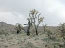
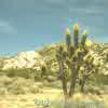
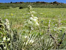
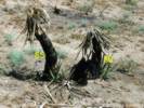
Eastern Mojave Vegetation
Images -- Species

By Tom Schweich


Home Page
Unclassified
Geography - Idaho
Geography - Park County, CO
Geography - Summit County, CO
Geography - Arizona
Geography - British Columbia
Geography - California
Geography - California's Colorado Desert
Alaska
Geography - Mono Lake Basin, California
Geography - Mono County, California
Geography - San Luis Obispo County, California
Geography - Marin County, California
Geography - Santa Clara County
Alameda
Garden
Geography - Central Mojave
Geography - New Mexico
Geography - Eastern Mojave
Geography - Northern Mojave
Geography - Colorado
Geography - Alamosa County, CO
Geography - Boulder County, CO
Geography - Clear Creek County, CO
Geography - Chaffee County, CO
Geography - Douglas County, CO
Geography - Gilpin County, CO
Geography - Golden, Colorado
Geography - Weld County, CO
Geography - Hinsdale County, CO
Geography - Jefferson County, CO
Geography - North Table Mountain, Jefferson Cty, CO
Geography - Lake County, CO
Geography - Larimer County, CO
Geography - Nevada
Geography - Oregon
Geography - South Dakota
Geography - Utah
Geography - Virginia
Geography - Washington
Geography - Wyoming
Spain - Andalucia
Spain - Castilla y Leon
Spain - Castilla-La Mancha
Spain - Extremadura
Spain - Galicia
Spain - Madrid
Portugal
Geology
Economic Geology
Climatology
Botany
Salvia dorrii
Frasera albomarginata
Species
Species - Polygonaceae
Species - Brassicaceae
Species - Brassicaceae, Physaria vitulifera
Species - Rosaceae
Species - Fabaceae
Species - Onagraceae
Species - Polemoniaceae
Species - Boraginaceae
Species - Plantaginaceae
Species - Asteraceae
Species - Poaceae
Zoology
Ecology
Archeology
Customer Satisfaction
General
Arizona
California
Kansas
Missouri
Nebraska
New York
Christmas 2002
Family Photos
Family Documents
Family Photos 2003
Art of Lydia Schweich
Portraits
Railroad
Geography - Germany

Images are organized by the topics listed at left. Click on a topic name to see images with that topic.

Would you like to use these photographs in your school term paper or report?

License is hereby granted for non-commercial use of the images contained herein provided that the images are reproduced with the copyright notice intact. This means that we give you our permission to use the photographs and information you find here in your school term papers and reports. You may resize the photograph to fit your needs, but you may not remove the copyright. Your term paper should note that the photographs are reproduced with permission and it should have a reference to this web site, such as:

"Photograph ©1999 Tom Schweich. Used by permission, http://www.schweich.com"

If you have a comment or a question about a photograph you may write to me at tomas@schweich.com I will answer you as soon as I can. I sometimes post interesting questions in my FAQ, but I will not disclose your full name or address.

Finished with 2023 collections.

Photographed 10 February 2024.

        images/20240210_124757smer.jpg

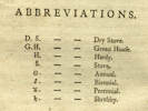
Abbreviations used by Aiton (1789)

Accessed 16 June 2020, URL: https://www.biodiversitylibrary.org/page/3650125#page/29/

Article records that use this photograph:

  • Checklist Flora of Native and Naturalized Vascular Plants of Golden and Vicinity, Jefferson County, Colorado: Rhus aromatica, Aiton, 1789.
  • Glossary: .

        images/Aiton1789_Abbreviations.jpg

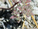
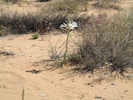
Flower seen near Big Sand Flat.

Photograph taken 25-Jun-07.

Article records that use this photograph:

        images/IMGP2695sm.jpg

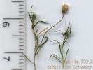
Coll. No. 792.2

Scanned 29 Dec 2011. This material was found within the materials of collection 792, Mimulus primuloides.

Article records that use this photograph:

        images/TAS007922Oview.jpg

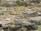
Agavaceae Agave desertii

Jim Lons holds up a stalk fo Agave desertii on top of Wild Horse Mesa.

Photographed in April 1982, scanned from a slide in 2023.

Location records that use this photograph:

Article records that use this photograph:

        images/1982-04-2-16-img292sm.jpg

Agave desertii on the rim of Wild Horse Mesa.

Northwestern rim of Wild Horse Mesa.

        images/agades.jpg

Century Plant (Agave desertii), western edge of Wild Horse Mesa.

This is about as far north as Agave desertii is found. There is a small colony here growing out of crevices in the rocks right on the edge of the mesa. In the right foreground is Buckhorn Cholla (Opuntia acanthocarpa). On the left is Blue Yucca (Yucca baccata).

Article records that use this photograph:

        images/wilhoraga.jpg

Agavaceae Agave utahensis

Utah Agave (Agave utahensis) near Clark Mountain

Photograph taken 6-Jun-06.

Article records that use this photograph:

        images/IMG_0548sm.jpg

Agavaceae Hesperocallis undulata

Desert Lily beside Kelbaker Road

Photograph taken April 22, 2008.

Article records that use this photograph:

        images/IMG10617sm.jpg

Hesperocallis undulata “Desert Ajo Lily”

Photographed 17 April 2017.

Article records that use this photograph:

        images/IMGQ3779sm.jpg

Hesperocallis undulata “Desert Ajo Lily”

Photographed 17 April 2017.

Article records that use this photograph:

        images/IMGQ3781sm.jpg

Agavaceae Nolina sp.

Nolina sp. along Excelsior Mine Road in the Kingston Range.

Article records that use this photograph:

        images/2907-50.jpg

Agavaceae Yucca baccata

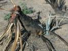
Very tall Yucca baccata in the woods Mountains.

Photographed in April 1985, scanned from a slide in 2023.

Location records that use this photograph:

Article records that use this photograph:

        images/1985-04-5-31-img286sm.jpg

Blue Yucca (Yucca baccata) in lower Wild Horse Canyon.

Article records that use this photograph:

        images/yucbac.jpg

Yucca baccata resprouting from the roots.

Photograph taken October 15, 2005.

Article records that use this photograph:

        images/IMGP1927sm.jpg

Agavaceae Yucca brevifolia

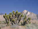
Joshua tree (Yucca brevifolia Engelm.) along Wild Horse Canyon Road.

Photographed in April 1995, scanned from a slide in 2023. Columbia Mountain in the right distance.

Article records that use this photograph:

        images/1995-04-img283sm.jpg

Joshua trees along CA Highway 178 near Onyx

Article records that use this photograph:

        images/1339_3153_1142_50sm.jpg

Yucca brevifolia resprouting 1 year after the Hackberry Complex fire.

Photograph taken 7-Jun-06.

Article records that use this photograph:

        images/IMGP2398sm.jpg

Very large Joshua Tree (Yucca brevifolia) in Joshua Tree National Monument.

A very special person with a large specimen of Joshua Tree (Yucca brevifolia) in Joshua Tree National Monument.

Article records that use this photograph:

        images/eileenjosh.jpg

Burned Joshua tree in Cedar Canyon

Photograph taken October 16, 2005.

Article records that use this photograph:

        images/IMGP2038sm.jpg

Joshua trees in Joshua Flats, Inyo County, California.

Photograph taken October 6, 2000.

Location records that use this photograph:

Article records that use this photograph:

        images/0091_3182_0174_40.jpg

Joshua trees(Yucca brevifolia) in bloom near Caruthers Canyon

Article records that use this photograph:

        images/yucbre_carcyn.jpg

Yucca brevifolia

Article records that use this photograph:

        images/yucbre.jpg

Joshua tree (Yucca brevifolia) in bloom along Kelbaker Road.

Matt, Kate and Roy with Joshua tree (Yucca brevifolia) in bloom along Kelbaker Road. A cinder cone in the Cima Volcanic Field is in the background.

Article records that use this photograph:

  • Kelbaker Road - Mojave National Preserve: 16000.

        images/kelbakyuc.jpg

Agavaceae Yucca glauca

Yucca glauca “Soapweed Yucca” on Dakota Ridge.

Photographed 14 June 2019.

Location records that use this photograph:

Article records that use this photograph:

  • Checklist Flora of Native and Naturalized Vascular Plants of Golden and Vicinity, Jefferson County, Colorado: Yucca glauca.
  • Recreational Trail (Pine Ridge Estates), Golden, Jefferson County, Colorado: near spur.
  • Field Notes: 14 Jun 2019.

        images/20190614_111320sm.jpg

Agavaceae Yucca schidigera

Yucca schidigera resprouting one year after Hackberry Complex Fire

Photograph taken 8-Jun-06.

Article records that use this photograph:

  • Effects of the Hackberry Complex Fire in Mojave National Preserve, June 22-25, 2005.: 340930.
  • Field Notes: 20060608030.

        images/IMGP2451sm.jpg

Yucca schidigera

Some unusually tall specimens in lower Wild Horse Canyon.

        images/1621-22.jpg

Yucca schidigera

Photograph taken near Hole-in-the-Wall.

        images/1621-21.jpg

Mohave Yucca (Yucca schidigera) in lower Wild Horse Canyon.

Article records that use this photograph:

  • Wild Horse Canyon Road - Mojave National Preserve: in lower cyn.
  • Frequently Asked Questions: HY325400.

        images/3182-44.jpg

Coll. No. 1575, Yucca schidigera

Photographed 18 April 2017.

Article records that use this photograph:

        images/IMGQ3810sm.jpg

Aizoaceae Sesuvium verrucosum

Reynolds Coll. No. 1053, Sesuvium verrucosum

Scanned 31 December 2013.

Location records that use this photograph:

Article records that use this photograph:

        images/RER001053Oview.jpg

Alismataceae Alisma trivale

Coll. No. 1727, Alisma trivale

Photographed 4 January 2018.

Article records that use this photograph:

        images/IMGQ4523sm.jpg

Alliaceae Allium

Allium seen at The Squeeze Rest Stop.

Photographed 12 April 2017.

Location records that use this photograph:

Article records that use this photograph:

        images/IMGQ3690sm.jpg

Coll. No. 296, Allium acuminatum

Scanned 14 August 2012.

Article records that use this photograph:

        images/TAS002960Oview.jpg

Alliaceae Allium × proliferum

Head of Coll. No. 2415, Allium × proliferum

Photographed 19 August 2020.

Article records that use this photograph:

        images/20200819_122344sm.jpg

Alliaceae Allium atrorubens cristatum

Scan of Coll. No. 388, Allium atrorubens var. cristatum

Scanned 9 August 2012.

Collection No. 388, 9 August 2012, characters observed while keying: Geophyte, bulblets present, Stem 5 cm., Leaves 1 per stem, Pedicels 11 mm. (> perianth), Perianth parts 9-10 mm., ± equal, entire, pink, darker veins, flat margins, Stamens included, Stigma lobes ± 0.

Article records that use this photograph:

        images/TAS003880Oview.jpg

Alliaceae Allium bisceptrum

Coll. No. 295, Allium bisceptrum

Scanned 14 August 2012.

I'm not really comfortable with this determination. There were a few characters observed that clearly led one astray in the keys. I used the FNANM key.

Article records that use this photograph:

        images/TAS002950_Oview_150.jpg

Coll. No. 856, Allium bisceptrum

Scanned 20 February 2013.

Location records that use this photograph:

Article records that use this photograph:

        images/TAS008560Oviewsm.jpg

Alliaceae Allium campanulatum

Coll. No. 934, Allium campanulatum

Photographed 3 March 2015.

Coll. No. 934, 20 May 2013, characters observed while “keying:” Perennial, 15 cm., from bulb; Bulb, 13 mm., ovoid; Leaves, 1–3, withered at flowering; Flowers 18; Perianth, 7-8 mm., keeled, tip margins in-rolled, no special coloration at adaxial base, papery in fruit. Between A. bisceptrum and A. campanulatum, I went with the latter on the strength of leaves withered in flower, perianth keeled and tip margins in-rolled, and ignored perianth papery in fruit, and absence of a basal adaxial purple crescent.

Location records that use this photograph:

Article records that use this photograph:

        images/IMG40891sm.jpg

Alliaceae Allium cernuum

Coll. No. 3189, Allium cernuum.

Photographed 28 January 2024.

Plants of the Douglas Mountain Study Area
Jefferson County Open Space, Colorado, USA
Alliaceae

Allium cernuum Roth.  Nodding Onion.

Guy Gulch, Jefferson County, Colorado. Southwest side of County Road 70 and the gulch, 660 m. northwest of Centennial Ranch, 12.8 km. northwest of the GNIS location of Golden. 39.79749°N, 105.36094°W. WGS 1984 Elev. 2423 m. Flowers just beginning to open. Sunny southeast-facing rocky slope, north ridge above small gulch tributary to Guy Gulch, also collected here: Artemisia ludoviciana, Symphyotrichum porteri, Muhlenbergia montana, and Thinopyrum intermedium.

Collected by permit: Jefferson County Open Space, 2023, issued: Apr 10, 2023, to: Tom Schweich.

Tom Schweich, with John Vickery 3189. 31-Jul-2023

Article records that use this photograph:

        images/IMGQ6081sm.jpg

Coll. No. 1240, Allium cernuum

Photographed 24 July 2015.

Location records that use this photograph:

Article records that use this photograph:

        images/IMGQ1309sm.jpg

Habitat of Coll. No. 1240, Allium cernuum

Photographed 24 July 2015.

Location records that use this photograph:

Article records that use this photograph:

        images/IMGQ1306sm.jpg

Alliaceae Allium geyeri

Habitat of Coll. No. 1417, Allium, perhaps A. geyeri

Photographed 10 June 2016.

Determination tentative.

Article records that use this photograph:

        images/IMGQ2716sm.jpg

Alliaceae allium geyeri

Coll. No. 1417, Allium geyeri

Scanned 6 December 2016.

Article records that use this photograph:

        images/TAS014170Oview.jpg

Alliaceae Allium sp.

Horticultural Allium escaped to Kinney Run.

Photographed 31 July 2020.

Article records that use this photograph:

        images/20200731_120805sm.jpg

Alliaceae Allium textile

Coll. No. 2302, Allium textile

Photographed 26 May 2020.

Article records that use this photograph:

        images/20200526_104436sm.jpg

Coll. No. 2933, Allium textile

Photographed 31 October 2023.

Plants of Jefferson County Open Space
Jefferson County, Colorado
Alliaceae

Allium textile A. Nelson & J.F. Macbr.  Textile Onion.

Magpie Gulch, Jefferson County, Colorado. Mount Galbraith Park, north side of Magpie gulch, about 490 m. west of the parcel gate, 2.55 km. west northwest of the GNIS location of Golden. 39.7608°N, 105.243°W. WGS 1984 Elev. 1917 m. Bulb coat fibrous, appearing woven; flowers white. Moderately steep east-facing grassy slope above patch of Cercocarpus montanus; also here: Phlox multiflora. Common.

Collected by permit: Jefferson County Open Space, 2023, issued: Apr 10, 2023, to: Tom Schweich.

Tom Schweich, with Cindy Trujillo 2933. 31-May-2023

Article records that use this photograph:

        images/IMGQ5931sm.jpg

Habitat of Coll. No. 1134, Alliaceae Allium textile

Photographed 9 June 2015.

Article records that use this photograph:

        images/IMGQ0793sm.jpg

Coll. No. 1134, Allium textile

Scanned 10 October 2015.

Article records that use this photograph:

        images/TAS011340Oview.jpg

Bulb coat of Coll. No. 1134, Allium textile

Scanned 10 October 2015.

Article records that use this photograph:

        images/TAS011340Bulb.jpg

Amaranthaceae Amaranthus albus

Coll. No. 3045, Amaranthus albus.

Photographed 23 December 2023.

Native and Naturalized Flora of the Golden Area, Jefferson County, Colorado
Amaranthaceae

Amaranthus albus L.  Tumble Pigweed.

Golden, Jefferson County, Colorado. Yard at 900 5th Street, cross street Arapahoe St., 0.83 km. northwest of the GNIS location of Golden. 39.7603°N, 105.2286°W. WGS 1984 Elev. 1755 m. One large plant that was broken apart to be dried. Common adventive garden weed.

Collected by permit: City of Golden, 2023, issued: Mar 13, 2023, to: Tom Schweich.

Tom Schweich 3045. 4-Jul-2023

Article records that use this photograph:

        images/IMGQ6003sm.jpg

Amaranthaceae Amaranthus torreyi

Coll. No. 141, Amaranthus torreyi

Scanned 22 May 2015.

Coll. No. 141, 3 Oct 1997, characters observed: Annual, tap-rooted, to 30 cm., monoecious; Nodes, without spines; Leaves, alternate, petiole 15 mm., blade 26 mm. × 9 mm. wide, lanceolate, base wedge-spaped, tip small mucronate; Inflorescence axillary; Flowers, pistillate, perianth parts #5, 2 mm., ±equal, oblong; Ovary, 1 mm.; Styles, #3, 0.8 mm.; Seed, 1.6 mm., dark red-brown.

Article records that use this photograph:

        images/TAS001410Oview.jpg

Amaranthaceae Froelichia gracilis

Coll No. 3206, Froelichia gracilis.

Photographed 30 August 2023.

Article records that use this photograph:

        images/20230830_094140sm.jpg

Coll No. 3206, Froelichia gracilis.

Photographed 30 August 2023.

Article records that use this photograph:

        images/20230830_094230sm.jpg

Coll No. 3206, Froelichia gracilis.

Photographed 29 August 2023.

Article records that use this photograph:

        images/20230829_100502sm.jpg

Amaranthaceae Kochia scoparia

Habit of Coll. No. 2577, Kochia scoparia

Photographed 19 Sep 2021.

Plants of Jefferson County Open Space
Jefferson County, Colorado
Chenopodiaceae

Kochia scoparia (L.) Schrad.  Common Red Sage.

Denver, Denver County, Colorado. W. Bates Avenue at South Utica Street, dirt strip on W. Bates Avenue, also observed at several houses within 2 blocks, some have been mowed, 13 km. southwest of the GNIS location of Denver, 24 km southeast of the GNIS location of Golden. 39.6627°N, 105.0459°W. WGS 1984 Elev. 1657 m. Several plants to 1 m. Also here: Chenopodium sp., various horticultural plants.

Tom Schweich 2755. 16-Sep-2021

Coll. No. 2755, 16 Sep 2021, characters observed: Annual, to 1 m., terrestrial, herbaceous, sap clear, not parasitic, not fern-like, without stinging hairs; Stem, with ascending multi-cellular hairs; Leaves, alternate, green, linear, 60 mm. × 6 mm. wide, veins #3 + reticulate, surface, adaxial pubescent, abaxial long silky appressed, margin ciliate, tip acute, no bristle; Inflorescence, bracteate, though some flowers borne singly on the rachis (i.e., not bracted), Bracts, 4 mm. × 1 mm. wide, lanceolate, green, mid-vein green, somewhat obscure, margin long ciliate; Rachis, densely long hairy; Perianth, sepaloid, single whorl, glabrous, not hooked, horizontally winged in fruit; Sepals, #5, fleshy; Stamens, #4; Ovary, enclosing seeds, carpels united; Stigmas, #2; Fruit, not a silicle.

Article records that use this photograph:

        images/20210916_130104sm.jpg

Coll. No. 2577, Kochia scoparia

Photographed 19 Sep 2021.

Plants of Jefferson County Open Space
Jefferson County, Colorado
Chenopodiaceae

Kochia scoparia (L.) Schrad.  Common Red Sage.

Denver, Denver County, Colorado. W. Bates Avenue at South Utica Street, dirt strip on W. Bates Avenue, also observed at several houses within 2 blocks, some have been mowed, 13 km. southwest of the GNIS location of Denver, 24 km southeast of the GNIS location of Golden. 39.6627°N, 105.0459°W. WGS 1984 Elev. 1657 m. Several plants to 1 m. Also here: Chenopodium sp., various horticultural plants.

Tom Schweich 2755. 16-Sep-2021

Coll. No. 2755, 16 Sep 2021, characters observed: Annual, to 1 m., terrestrial, herbaceous, sap clear, not parasitic, not fern-like, without stinging hairs; Stem, with ascending multi-cellular hairs; Leaves, alternate, green, linear, 60 mm. × 6 mm. wide, veins #3 + reticulate, surface, adaxial pubescent, abaxial long silky appressed, margin ciliate, tip acute, no bristle; Inflorescence, bracteate, though some flowers borne singly on the rachis (i.e., not bracted), Bracts, 4 mm. × 1 mm. wide, lanceolate, green, mid-vein green, somewhat obscure, margin long ciliate; Rachis, densely long hairy; Perianth, sepaloid, single whorl, glabrous, not hooked, horizontally winged in fruit; Sepals, #5, fleshy; Stamens, #4; Ovary, enclosing seeds, carpels united; Stigmas, #2; Fruit, not a silicle.

Article records that use this photograph:

        images/20210916_130803sm.jpg

Inflorescence of Coll. No. 2577, Kochia scoparia

Scanned 19 Sep 2021.

Plants of Jefferson County Open Space
Jefferson County, Colorado
Chenopodiaceae

Kochia scoparia (L.) Schrad.  Common Red Sage.

Denver, Denver County, Colorado. W. Bates Avenue at South Utica Street, dirt strip on W. Bates Avenue, also observed at several houses within 2 blocks, some have been mowed, 13 km. southwest of the GNIS location of Denver, 24 km southeast of the GNIS location of Golden. 39.6627°N, 105.0459°W. WGS 1984 Elev. 1657 m. Several plants to 1 m. Also here: Chenopodium sp., various horticultural plants.

Tom Schweich 2755. 16-Sep-2021

Coll. No. 2755, 16 Sep 2021, characters observed: Annual, to 1 m., terrestrial, herbaceous, sap clear, not parasitic, not fern-like, without stinging hairs; Stem, with ascending multi-cellular hairs; Leaves, alternate, green, linear, 60 mm. × 6 mm. wide, veins #3 + reticulate, surface, adaxial pubescent, abaxial long silky appressed, margin ciliate, tip acute, no bristle; Inflorescence, bracteate, though some flowers borne singly on the rachis (i.e., not bracted), Bracts, 4 mm. × 1 mm. wide, lanceolate, green, mid-vein green, somewhat obscure, margin long ciliate; Rachis, densely long hairy; Perianth, sepaloid, single whorl, glabrous, not hooked, horizontally winged in fruit; Sepals, #5, fleshy; Stamens, #4; Ovary, enclosing seeds, carpels united; Stigmas, #2; Fruit, not a silicle.

Article records that use this photograph:

        images/TAS027550Infl.jpg

Amaranthaceae Salsola tragus

Flowers of red-flowered variant of tumbleweed (Salsola tragus L.)

Photographed 26 September 2022 at the Oregon Trail Overlook of Hagerman Fossil Beds National Monument, Gooding County, Idaho.

Article records that use this photograph:

        images/IMGQ5699sm.jpg

Red-flowered variant of tumbleweed (Salsola tragus L.)

Photographed 26 September 2022 at the Oregon Trail Overlook of Hagerman Fossil Beds National Monument, Gooding County, Idaho.

Article records that use this photograph:

        images/IMGQ5697sm.jpg

Anacardiaceae Rhus aromatica

Aiton (1789) description of Rhus aromatica

Accessed 15 June 2020, URL: https://www.biodiversitylibrary.org/page/3650125#page/397/

Article records that use this photograph:

  • Checklist Flora of Native and Naturalized Vascular Plants of Golden and Vicinity, Jefferson County, Colorado: Rhus aromatica, Aiton, 1789.

        images/154Rhuaro_Aiton1789.jpg

Anacardiaceae Rhus glabra

Coll. No. 2556, Rhus glabra.

Photographed 26 November 2021.

Plants of Jefferson County Open Space
Jefferson County, Colorado
Anacardiaceae

Rhus glabra L.  Smooth Sumac.

Apex Park - Northern Parcel, Jefferson County, Colorado. Beside a stream in an unnamed gulch, near the center of the north parcel, 4.52 km. south southwest of the GNIS location of Golden. 39.7243°N, 105.2231°W. WGS 1984 Elev. 1947 m. Pistillate.

Collected by permit: Jefferson County Open Space, 2021, issued: Apr 1, 2021, to: Tom Schweich.

Tom Schweich 2556. 7-Jul-2021

Article records that use this photograph:

        images/IMGQ5501sm.jpg

Last year's fruit on Rhus glabra

Photographed 6 May 2021.

Location records that use this photograph:

Article records that use this photograph:

        images/20210506_114911sm.jpg

Anacardiaceae Rhus microphylla

Coll. No. 733, Rhus microphylla

Scanned 1 Jan 2012.

Article records that use this photograph:

        images/TAS007330Oview.jpg

Anacardiaceae Rhus trilobata

Rhus trilobata at the southern end of the Survey Field.

Phototographed 20 June 2020.

Article records that use this photograph:

        images/20200620_091452sm.jpg

Nuttall's description of Rhus trilobata in Torrey & Gray (1838).

Accessed 16 June 2020, URL: https://www.biodiversitylibrary.org/page/5290687#page/241/

Article records that use this photograph:

        images/TorreyJG1838_154Rhutri.jpg

Coll. No. 2139, Rhus trilobata.

Scanned 4 December 2019.

Plants of Jefferson County Open Space
Jefferson County, Colorado
Anacardiaceae

Rhus trilobata Torrey & A. Gray.  Squawbush.

North Table Mountain Park, Jefferson County, Colorado. Near the north boundary of the park, lower north slopes of North Table Mountain, in what appears to be the hummocky terrain of an ancient landslide, 6.06 km. north northeast of the GNIS location of Golden. 39.7965°N, 105.21°W. WGS 1984 Elev. 1822 m. Fruit, no flower. Near top of small mound, also collected here: Opuntia macrorhiza and Thelesperma megapotamicum.

Collected by permit: Jefferson County Open Space, 2019, issued: Mar 1, 2019, to: Tom Schweich.

Tom Schweich 2139. 11-Jul-2019

Article records that use this photograph:

        images/TAS021390Oview.jpg

Gray's description of Rhus aromatica var. trilobata in Watson (1871).

Scanned 16 June 2020. Book in my library.

Location records that use this photograph:

Article records that use this photograph:

        images/154Rhuarotri_Watson1871.jpg

Rhus trilobata at Ranson/Edwards.

Phototographed 23 June 2020.

Article records that use this photograph:

  • Checklist Flora of Native and Naturalized Vascular Plants of Golden and Vicinity, Jefferson County, Colorado: Rhus trilobata.
  • Field Notes: 23 Jun 2020.

        images/20200623_112158sm.jpg

Rhus trilobata

I think this photo was taken in Mojave National Preserve.

        images/rhutri.jpg

Anacardiaceae Rhus virens choriophylla

Coll. No. 734, Rhus virens var. choriophylla

Scanned 1 Jan 2012.

Article records that use this photograph:

        images/TAS007340Oview.jpg

Anacardiaceae Toxicodendron rydbergii

Western Poison Ivy on the backbone of Dakota Ridge.

Photographed 17 September 2020.

Article records that use this photograph:

        images/20200917_100056sm.jpg

Anacardiaceae Toxicodenfron rydbergii

Poison Ivy in the Survey Field.

Photographed 28 May 2018.

Location records that use this photograph:

Article records that use this photograph:

        images/IMG50249sm.jpg

Anthericeae Leucocrinum montanum

Habitat of Coll. No. 2254, Leucocrinum montanum

Photographed 4 May 2020.

Article records that use this photograph:

        images/20200504_101005sm.jpg

Leucocrinum montanum in Long Valley.

Photograph taken 21 June 2011.

Article records that use this photograph:

        images/IMG_1988sm.jpg

Coll. No. 1303, Leucocrinum montanum in the Survey Field.

Scanned 11 Jul 2016.

Article records that use this photograph:

        images/TAS013030Oview.jpg

Leucocrinum montanum sometimes called "sand lily" in some actual sandy habitat.

Photographed 27 April 2018.

Article records that use this photograph:

        images/IMG50104sm.jpg

Leucocrinum montanum on south-facing slope.

Photographed 27 March 2017.

Location records that use this photograph:

Article records that use this photograph:

        images/IMGQ3626sm.jpg

Star Lily (Leucocrinum montanum) as seen on Tin Cup Ridge.

Photographed 14 May 2015.

Location records that use this photograph:

Article records that use this photograph:

        images/IMGQ0511sm.jpg

Habitat of Coll. No. 1311, Leucocrinum montanum.

Photographed 12 April 2016.

Compare the rocky slope habitat here in Colorado, to the sagebrush streamside habitat in Long Valley, California.

Article records that use this photograph:

        images/IMGQ2321sm.jpg

Leucocrinum montanum on an old alluvial ridge in the Survey Field.

Photographed 9 April 2016.

Article records that use this photograph:

        images/IMGQ2312sm.jpg

Leucocrinum montanum on an old alluvial ridge in the Survey Field.

Photographed 9 April 2016.

Article records that use this photograph:

        images/IMGQ2309sm.jpg

Habitat of Leucocrinum montanum and Townsendia hookeri in the Survey Field.

Photographed 9 April 2016.

Very little ground cover at this early spring time.

Article records that use this photograph:

        images/IMGQ2305sm.jpg

Apiaceae

Cymopterus? Lomatium?

Photographed 24 April 2019.

Article records that use this photograph:

        images/IMG50687sm.jpg

Something in the Apiaceae on the edges of cliffs.

Photographed 22 April 2016.

Article records that use this photograph:

        images/IMGQ2407sm.jpg

Possibly Harbouria trachypleura

Photographed 23 September 2015.

Article records that use this photograph:

        images/20150923_102555sm.jpg

Apiaceae Aegopodium podagraria

Compound umbels of Aegopodium podograria

Scanned 6 July 2019.

Article records that use this photograph:

        images/PDUmbel.jpg

Fruit of Aegopodium podograria

Scanned 6 July 2019.

Article records that use this photograph:

        images/PGfr.jpg

Flowers of Aegopodium podagraria

Scanned 6 July 2019.

Article records that use this photograph:

        images/PDfl.jpg

Inflorescence of Aegopodium podograria

Scanned 6 July 2019.

Article records that use this photograph:

        images/PDInfl.jpg

Overview of Aegopodium podograria

Photographed 6 July 2019.

Article records that use this photograph:

        images/PDOview.jpg

Basal leaves of Aegopodium podograria

Scanned 6 July 2019.

Article records that use this photograph:

        images/PDLf.jpg

Apiaceae Aletes acaulis

Coll. No. 1925, Aletes acaulis

Photographed 8 December 2018.

Article records that use this photograph:

        images/IMGQ4801sm.jpg

Apiaceae Aletes acaulis

Photographed 4 May 2016.

Article records that use this photograph:

        images/IMGQ2554sm.jpg

Coll. No. 1321, Aletes acaulis

Scanned 27 July 2016.

Article records that use this photograph:

        images/TAS013210Oview.jpg

Apiaceae Angelica lineariloba

Detail of Collection No. 556, Angelica lineariloba

Article records that use this photograph:

        images/TAS005560det.jpg

Collection No. 556

Photograph taken August 13, 2008.

Article records that use this photograph:

        images/IMG01280sm.jpg

Overview of Collection No. 556, Angelica lineariloba

Article records that use this photograph:

        images/TAS005560oview.jpg

Apiaceae Anthriscus caucalis

Coll. No. 2546, Anthriscus caucalis

Photographed 23 November 2021.

Plants of Jefferson County Open Space
Jefferson County, Colorado
Apiaceae

Anthriscus caucalis M. Bieb. var. caucalis.  Bur Chervil.

Lippincott Ranch, Jefferson County, Colorado. Southern "panhandle" part of the ranch, on a ridge in the north-central to northwest part, 22.0 km. north northwest of the GNIS location of Golden. 39.9023°N, 105.2711°W. WGS 1984 Elev. 1984 m. Fruit bristles hooked. In scattered ponderosa pines, with Phacelia heterophylla, Descurainia sophia, Opuntia fragilis, and Malva neglecta. Lippincott Ranch is jointly owned by City of Boulder Open Space and Mountain Parks and Jefferson County Open Space.

Collected by permit: Jefferson County Open Space, 2021, issued: Apr 1, 2021, to: Tom Schweich.

Tom Schweich, with John Vickery 2546. 29-Jun-2021

Coll. No. 2546, 29 June 2021, characters observed: Annual, to 25 cm., Stem, branched above, glabrous; Leaves, basal, withered, cauline, base sheathing stem, stipules, 0, compound, 3× pinnate, petiole, 13 mm., blade, triangular to lanceolate, 30 mm. × 27 mm. wide, leaflets petiolate, ultimate leaf segments, 9 mm., adaxial glabrous, petiole, abaxial surface, and leaflet margins, sparsely hispid; Inflorescence, umbels simple and compound, subtended by 5 bracts, 2.0-3.5 mm., entire, long ciliate. Pedicels 3 mm., Corolla, unknown; Fruit, schizocarp, central axis obvious, elongate body 2.3 mm. × 0.9 mm. wide + beak 0.5 mm. + stylopodium 0.2 mm., brown, pappillate, uniformly covered with short ±0.2 mm. hooked bristles, oil tubes and ridges ± obscure.

Article records that use this photograph:

        images/IMGQ5497sm.jpg

Fruit of Coll. No. 2546, Anthriscus caucalis

Scanned 22 November 2021.

Plants of Jefferson County Open Space
Jefferson County, Colorado
Apiaceae

Anthriscus caucalis M. Bieb. var. caucalis.  Bur Chervil.

Lippincott Ranch, Jefferson County, Colorado. Southern "panhandle" part of the ranch, on a ridge in the north-central to northwest part, 22.0 km. north northwest of the GNIS location of Golden. 39.9023°N, 105.2711°W. WGS 1984 Elev. 1984 m. Fruit bristles hooked. In scattered ponderosa pines, with Phacelia heterophylla, Descurainia sophia, Opuntia fragilis, and Malva neglecta. Lippincott Ranch is jointly owned by City of Boulder Open Space and Mountain Parks and Jefferson County Open Space.

Collected by permit: Jefferson County Open Space, 2021, issued: Apr 1, 2021, to: Tom Schweich.

Tom Schweich, with John Vickery 2546. 29-Jun-2021

Coll. No. 2546, 29 June 2021, characters observed: Annual, to 25 cm., Stem, branched above, glabrous; Leaves, basal, withered, cauline, base sheathing stem, stipules, 0, compound, 3× pinnate, petiole, 13 mm., blade, triangular to lanceolate, 30 mm. × 27 mm. wide, leaflets petiolate, ultimate leaf segments, 9 mm., adaxial glabrous, petiole, abaxial surface, and leaflet margins, sparsely hispid; Inflorescence, umbels simple and compound, subtended by 5 bracts, 2.0-3.5 mm., entire, long ciliate. Pedicels 3 mm., Corolla, unknown; Fruit, schizocarp, central axis obvious, elongate body 2.3 mm. × 0.9 mm. wide + beak 0.5 mm. + stylopodium 0.2 mm., brown, pappillate, uniformly covered with short ±0.2 mm. hooked bristles, oil tubes and ridges ± obscure.

Article records that use this photograph:

        images/TAS025460Fr.jpg

Close-up of Coll. No. 2546, Anthriscus caucalis

Photographed 23 November 2021.

Plants of Jefferson County Open Space
Jefferson County, Colorado
Apiaceae

Anthriscus caucalis M. Bieb. var. caucalis.  Bur Chervil.

Lippincott Ranch, Jefferson County, Colorado. Southern "panhandle" part of the ranch, on a ridge in the north-central to northwest part, 22.0 km. north northwest of the GNIS location of Golden. 39.9023°N, 105.2711°W. WGS 1984 Elev. 1984 m. Fruit bristles hooked. In scattered ponderosa pines, with Phacelia heterophylla, Descurainia sophia, Opuntia fragilis, and Malva neglecta. Lippincott Ranch is jointly owned by City of Boulder Open Space and Mountain Parks and Jefferson County Open Space.

Collected by permit: Jefferson County Open Space, 2021, issued: Apr 1, 2021, to: Tom Schweich.

Tom Schweich, with John Vickery 2546. 29-Jun-2021

Coll. No. 2546, 29 June 2021, characters observed: Annual, to 25 cm., Stem, branched above, glabrous; Leaves, basal, withered, cauline, base sheathing stem, stipules, 0, compound, 3× pinnate, petiole, 13 mm., blade, triangular to lanceolate, 30 mm. × 27 mm. wide, leaflets petiolate, ultimate leaf segments, 9 mm., adaxial glabrous, petiole, abaxial surface, and leaflet margins, sparsely hispid; Inflorescence, umbels simple and compound, subtended by 5 bracts, 2.0-3.5 mm., entire, long ciliate. Pedicels 3 mm., Corolla, unknown; Fruit, schizocarp, central axis obvious, elongate body 2.3 mm. × 0.9 mm. wide + beak 0.5 mm. + stylopodium 0.2 mm., brown, pappillate, uniformly covered with short ±0.2 mm. hooked bristles, oil tubes and ridges ± obscure.

Article records that use this photograph:

        images/IMGQ5494sm.jpg

Apiaceae Berula erecta

Infloresence of Coll. No. 717.1, Berula erecta

Scanned 18 Oct 2011.

Perennial (?); Habitat wet place other than vernal pool; Rooting, tubers, and rhizomes unknown; Stem ascending, glabrous, hollow; Leaves with sheathing bases, once pinnate; Leaflets toothed or serrate; Infloresence in compound umbels; Bracts and bractlets conspicuous; Flowers white; Style short; Fruit lacking bristles, prickles or tubercles.

Article records that use this photograph:

        images/TAS007171Infl.jpg

Overview of Coll. No. 717.1, Berula erecta

Scanned 18 Oct 2011.

Perennial (?); Habitat wet place other than vernal pool; Rooting, tubers, and rhizomes unknown; Stem ascending, glabrous, hollow; Leaves with sheathing bases, once pinnate; Leaflets toothed or serrate; Infloresence in compound umbels; Bracts and bractlets conspicuous; Flowers white; Style short; Fruit lacking bristles, prickles or tubercles.

Article records that use this photograph:

        images/TAS007171Oview.jpg

Apiaceae Cicuta maculata angustifolia

Coll. No. 3285, Cicuta maculata var. angustifolia

Photographed 4 December 2024.

Plants of Jefferson County Open Space
Jefferson County, Colorado
Apiaceae

Cicuta maculata L. var. angustifolia Hook.  Spotted Water Hemlock.

Ranson/Edwards Homestead Open Space Park, Jefferson County, Colorado. 1.7 miles west on CO Highway 72 from CO Highway 93, then 0.9 miles generally north on Plainview Road, then about 575 m. generally west along small creek. 15.1 km. north northwest of Golden. 39.88677°N, 105.2685°W. WGS 1984 Elev. 1991 m. Growing in creek, also nearby: Heliomeris multiflora, Mentha arvensis, Lysimachia ciliata, Ranunculus pensylvanicus, and Galium boreale. Infraspecific names are not accepted by current Colorado florae.

Collected by permit: Jefferson County Open Space, 2024, issued: Mar 6, 2024, to: Tom Schweich.

Tom Schweich, with Cynthia Hastings 3285. 28-June-2024

Article records that use this photograph:

        images/IMGQ6287sm.jpg

Collection No. 499, Cicuta maculata var. angustifolia

Scanned 13 March 2011. Background grid is 10 x 10 to the inch.

Article records that use this photograph:

        images/TAS004990oview.jpg

Collection No. 499, Cicuta maculata var. angustifolia

Photograph taken August 2, 2007 beside Bohler Creek.

Article records that use this photograph:

        images/IMGP2715sm.jpg

Collection No. 499, Cicuta maculata var. angustifolia

Photograph taken August 2, 2007 beside Bohler Creek.

Article records that use this photograph:

        images/IMGP2713sm.jpg

Apiaceae Conium maculatum

Coll. No. 1436, Conium maculatum

Photographed 12 December 2016.

Article records that use this photograph:

        images/IMGQ3443sm.jpg

Apiaceae Cyclospermum leptophyllum

Coll. No. 134, Cyclospermum leptophyllum

Scanned 8 November 2013.

Article records that use this photograph:

        images/TAS001340Oview.jpg

Coll. No. 134, Cyclospermum leptophyllum

Scanned 8 November 2013.

Article records that use this photograph:

        images/TAS001340FlPts.jpg

Apiaceae Cymopterus anisatus

Cymopterus anisatus near Goose Creek.

Photographed 23 May 2021.

Location records that use this photograph:

Article records that use this photograph:

        images/20210523_112914sm.jpg

Apiaceae Cymopterus cinerarius

Collection No. 754, Cymopterus cinereus

Photograph taken 16 June 2011.

Article records that use this photograph:

        images/IMG11916sm.jpg

Collection No. 754, Cymopterus cinereus

Photograph taken 16 June 2011.

Article records that use this photograph:

        images/IMGP1997sm.jpg

Habitat of Cymopterus cinerarius on the Mono Craters

Photograph taken 17 August 2010.

Article records that use this photograph:

        images/IMG_1302sm.jpg

Coll. No. 703, Apiaceae Cymopterus cinerarius

Scanned 7 June 2011.

Article records that use this photograph:

        images/TAS007030Oview.jpg

Cymopterus cinerarius

Location records that use this photograph:

Article records that use this photograph:

        images/MLF_V1_Slide_38.jpg

Coll. No. 754, Cymopterus cinerarius

Scanned 17 Jan 2012.

Article records that use this photograph:

        images/TAS007540Oview.jpg

Apiaceae Cymopterus lemmonii

Umbel of Coll. No. 1469, Cymopterus lemmonii

Scanned 31 December 2016.

Coll. No. 1469, 29 June 2016, characters observed: Perennial herb, to 15 cm., glabrous throughout, except very slightly scabrous at top of peduncle and on ribs of some rays; Pseudoscape, absent; Leaves, basal and cauline, 40 mm. × 25 mm. wide, obovate, compound, leaflets, #7, ultimate divisions narrowly lanceolate; Inflorescence, compound umbel; Involucre, bracts, 1.7 mm., linear (but not pinnafitid); Rays, ascending-spreading, ±equal; Involucel, bractlets green, inconspicuous, 1 mm.; Corolla, petals, #5, 1 mm. × 0.6 mm. wide, yellow; Stamens, #5; Filaments, recurved; Ovary, glabrous; Stylopodium, absent (?); Fruit, unknown.

Article records that use this photograph:

        images/TAS014690Umb.jpg

Coll. No. 1469, Cymopterus lemmonii

Scanned 31 December 2016.

Coll. No. 1469, 29 June 2016, characters observed: Perennial herb, to 15 cm., glabrous throughout, except very slightly scabrous at top of peduncle and on ribs of some rays; Pseudoscape, absent; Leaves, basal and cauline, 40 mm. × 25 mm. wide, obovate, compound, leaflets, #7, ultimate divisions narrowly lanceolate; Inflorescence, compound umbel; Involucre, bracts, 1.7 mm., linear (but not pinnafitid); Rays, ascending-spreading, ±equal; Involucel, bractlets green, inconspicuous, 1 mm.; Corolla, petals, #5, 1 mm. × 0.6 mm. wide, yellow; Stamens, #5; Filaments, recurved; Ovary, glabrous; Stylopodium, absent (?); Fruit, unknown.

Article records that use this photograph:

        images/TAS014690Oview.jpg

Apiaceae Cymopterus terebinthinus

Collection No. 775, Apiaceae Cymopterus terebinthinus

Photograph taken 20 June 2011.

Article records that use this photograph:

        images/IMG_1982sm.jpg

Apiaceae Cymopterus terebinthinus californicus

Coll. No. 775, Cymopterus terebinthinus var. californicus

Scanned 23 Jan 2012.

Coll. No. 775, 23 Jan 2012, characters observed while keying: Perennial herb Leaves with sheathing bases, 4° pinnate compund; Infloresence umbellate; Bracts 0 Bractlets present, glabrous; Fruit not sufficiently developed to key.

Article records that use this photograph:

        images/TAS007750Oview.jpg

Apiaceae Harbouria trachypleura

Inflorescence of Coll. No. 1904, Harbouria trachypleura

Scanned 26 November 2018.

Article records that use this photograph:

        images/TAS019040Infl.jpg

Coll. No. 1904, Harbouria trachypleura

Photographed 26 November 2018.

Article records that use this photograph:

        images/IMGQ4794sm.jpg

Coll. No. 1357, Harbouria trachypleura

Photographed 21 May 2016.

Article records that use this photograph:

        images/IMGQ2601sm.jpg

Apiaceae Ligusticum filicinum tenuifolium

Coll. No. 3329, Ligusticum filicinum var. tenuifolium.

Photographed 29 December 2024.

Plants of Colorado
Apiaceae

Ligusticum filicinum S. Watson, Proc. Amer. Acad. Arts 11: 140 (1876) var. tenuifolium Mathias & Constance, Bull. Torrey Bot. Club 68: 123 (1941).  Slender Ligusticum.

Brumley, Lake County, Colorado. Near the site of the stagecoach stop of Brumley, about 11 miles generally west on CO State Highway 82 from the town of Twin Lakes, Lake County, 27.8 km. southwest of Leadville, 135 km. southwest of Golden. 39.09547°N, 106.54329°W. WGS 1984 Elev. 3250 m. Water-saturated soil in willow thicket along former creek channels.

Collected by permit: Pike San Isabel National Forest, 2024, issued: Jun 1, 2024, to: Tom Schweich.

Tom Schweich 3329. 23-Jul-2024

Article records that use this photograph:

        images/IMGQ6322sm.jpg

Apiaceae Ligusticum porteri

Coll. No. 3269, Ligusticum porteri.

Photographed 9 November 2024.

Plants of the Coal Creek Canyon Study Area
Jefferson County Open Space, Colorado, USA
Apiaceae

Ligusticum porteri J.M. Coult. & Rose.  Porter's Licorice-Root.

Coal Creek Canyon Study Area, Lacey Parcel, Jefferson County, Colorado. Second primary drainage of Lacey parcel, about 110 m. southwest of Coal Creek, 1.54 km. west northwest of Coal Creek Canyon Fire Station #3, 15.0 km. northwest of Golden. 39.87804°N, 105.29453°W. WGS 1984 Elev. 2073 m. Sunny openings in ponderosa pine and Douglas fir forest. Also here: Acer glabrum, Prunus virginiana, Geranium caespitosum, and Amelanchier alnifolia.

Collected by permit: Jefferson County Open Space, 2024, issued: Mar 6, 2024, to: Tom Schweich.

Tom Schweich 3269. 21-Jun-2024

Perennial, 1 m., sunny mountain valley slope; Leaves, tripinnately compound; Leaflets, well-defined, ultimate leaf division, 2-3 mm.; Inflorescence, compound umbel; Involucral bractlets, green, few; Flowers, white; Ovary, glabrous; Stylopodium, conic, frilled; Fruit, glabrous; (Described from Coll. No. 3248, 10 June 2024, and Coll. No. 3269, 21 June 2024.)

Article records that use this photograph:

        images/IMGQ6271sm.jpg

Coll. No. 3248, Ligusticum porteri.

Photographed 10 June 2024.

Article records that use this photograph:

        images/20240610_084551sm.jpg

Coll. No. 3248, Ligusticum porteri.

Photographed 10 June 2024.

Article records that use this photograph:

        images/20240610_084545sm.jpg

Coll. No. 3248, Ligusticum porteri.

Photographed 9 November 2024.

Plants of the Coal Creek Canyon Study Area
Jefferson County Open Space, Colorado, USA
Apiaceae

Ligusticum porteri J.M. Coult. & Rose.  Porter's Licorice-Root.

Coal Creek Canyon Study Area, Lacey Parcel, Jefferson County, Colorado. Beside dry streambed composed mostly of cobbles, 180 m. west southwest of the Coal Creek Canyon Fire Station 3, 13.9 km. northwest of Golden. 39.87256°N, 105.27962°W. WGS 1984 Elev. 2040 m. Also here: Cynoglossum officinale, Silene latifolia, Lupinus argentea, and Prunus virginiana.

Collected by permit: Jefferson County Open Space, 2024, issued: Mar 6, 2024, to: Tom Schweich.

Tom Schweich 3248. 10-Jun-2024

Article records that use this photograph:

        images/IMGQ6270sm.jpg

Coll. No. 3269, Ligusticum porteri, with frilled conic stylopodium.

Microphotograph 9 November 2024.

Article records that use this photograph:

        images/TAS032690_Stysm.jpg

Coll. No. 2833, Ligusticum porteri

Photographed 28 October 2022.

Plants of Lippincott Ranch
Boulder and Jefferson Counties, Colorado
Apiaceae

Ligusticum porteri J.M. Coult. & Rose.  Porter's Licorice-Root.

Lippincott Ranch (North), Boulder County, Colorado. Along the north fork of Spring Brook, 2.53 km. north northwest of the main gate, 2.42 km. south southwest of the GNIS location of Eldorado Springs. 39.916°N, 105.28°W. WGS 1984 Elev. 2037 m. Sunny spot, more plants in vegetative state in shade.

Collected by permit: Boulder OSMP, issued: May 27, 2022, to: Tom Schweich.

Tom Schweich, with John Vickery 2833. 2-Jul-2022

Article records that use this photograph:

        images/IMGQ5718sm.jpg

Coll. No. 2610, Ligusticum porteri

Photographed 13 January 2022.

Plants of Jefferson County Open Space
Jefferson County, Colorado
Apiaceae

Ligusticum porteri J.M. Coult. & Rose.  Porter's Licorice-Root.

Lippincott Ranch (North), Boulder County, Colorado. Northern part of ranch, north-facing slope overlooking Spring Brook. 2.2 km. north of the main gate, 23.8 km. north northwest of the GNIS location of Golden. 39.9139°N, 105.2783°W. WGS 1984 Elev. 2042 m. Deep grasses in openings of ponderosa pine woodland. Lippincott Ranch is jointly owned by City of Boulder Open Space and Mountain Parks and Jefferson County Open Space.

Collected by permit: Jefferson County Open Space, 2021, issued: Apr 1, 2021, to: Tom Schweich.

Tom Schweich, with John Vickery 2610. 20-Jul-2021

Article records that use this photograph:

        images/IMGQ5540sm.jpg

Apiaceae Ligusticum tenuifolium

Distribution of Ligusticum tenuifolium vouchers in SEINet

Data retrieved: 31 December 2024.

Article records that use this photograph:

        images/228Ligten_dist_SEINet_20241231.jpg

Plants of the world page for Ligusticum filicinum var. tenuifolium.

Data retrieved: 31 December 2024.

Article records that use this photograph:

        images/POWO_228Ligten_20241231.jpg

Apiaceae Lomatium foeniculaceum fimbriatum

Coll. No. 394, Lomatium foeniculaceum ssp. fimbriatum

Scanned 15 December 2012.

Article records that use this photograph:

        images/TAS003940Det.jpg

Coll. No. 394, Lomatium foeniculaceum ssp. fimbriatum

Scanned 15 December 2012.

Article records that use this photograph:

        images/TAS003940Oview.jpg

Apiaceae Lomatium nevadense nevadense

Coll. No. 960, Lomatium nevadense var. nevadense

Scanned on 7 Feb 2014.

Coll. No. 960, 22 May 2013, characters observed: Perennial, spreading, to 10 cm. above ground, from a stout (6 mm. dia.) tap root ≥ 9 cm., in dry soil at undisturbed places, not scented, plant nearly completely glabrous; Stem, ±0; Leaves, 2-3 pinnate, to 6 cm., basal sheaths purple, leaf segments, many, small, oblong, 1-2 mm. wide, sparse short straight white hairs; Inflorescence, compound umbel, involucel inconspicuous, umbels not head like; Pedicels, in fruit 3 mm.; Petals, white or cream; Ovary, glabrous, tip projection 0; Seed, 5 mm. × 2 mm. wide, elliptic, compressed front to back, not notched at base and tip, ribs ±equal, lateral ribs only slightly expanded as wings, glabrous.

Article records that use this photograph:

        images/TAS009600Oview.jpg

Apiaceae Lomatium orientale

Fruit of Coll. No. 2075, Lomatium orientale

Scanned 12 October 2019.

Article records that use this photograph:

        images/TAS020750Fr.jpg

Coll. No. 2929, Lomatium orientale.

Photographed 29 October 2023.

Plants of Jefferson County Open Space
Jefferson County, Colorado
Apiaceae

Lomatium orientale J.M. Coult. & Rose.  Salt-and-Pepper.

Magpie Gulch, Jefferson County, Colorado. In Mt. Galbraith Park, beside a bed rock cascade of the creek in Magpie Gulch, about 900 m. west of the gate to the parcel, 2.81 km. west northwest of the GNIS location of Golden. 39.7589°N, 105.2462°W. WGS 1984 Elev. 1893 m. Dry slope west and away from rock cascade.

Collected by permit: Jefferson County Open Space, 2023, issued: Apr 10, 2023, to: Tom Schweich.

Tom Schweich, with Cindy Trujillo 2929. 21-May-2023

Article records that use this photograph:

        images/IMGQ5925sm.jpg

Leaf of Coll. No. 2031, Lomatium orientale

Scanned 14 July 2019.

Article records that use this photograph:

        images/TAS020310Lf.jpg

Fruit of Coll. No. 2031, Lomatium orientale

Scanned 14 July 2019.

This is described as having 3-4 oil tubes between the ridges. Those oil tubes are certainly visible; then are the slightly darker linear stripes. I assume the “ridges” are at the very edge of the fruit. If so, what are the slightly lighter structures between the ridges called?

Article records that use this photograph:

        images/TAS020310Fr.jpg

Inflorescence with fruit of Coll. No. 2075, Lomatium orientale

Scanned 12 October 2019.

Article records that use this photograph:

        images/TAS020750Infl.jpg

Coll. No. 2031, Lomatium orientale

Scanned 14 July 2019.

Article records that use this photograph:

        images/TAS020310Oview.jpg

Inflorescence of Coll. No. 1837, Lomatium orientale

Scanned 2 November 2018.

Coll. No. 1837, 17 May 2018, characters observed: Perennial, to 20 cm., woody taproot; Leaves, compound, pinnate, 75 mm. × 26 mm. wide, ultimate divisions, ≤3 mm., ≤1 mm. wide, villous, tips, obtuse, (with a very small white “spine”); Inflorescence, compound umbel; Involucel Bracts, glabrous; Flowers, white; Anthers, red; Ovary, glabrous, stylopodium, absent; Fruit, 5 mm. × 3.5 mm. wide, ovate, glabrous, dorsally compressed, lateral ribs winged.

Article records that use this photograph:

        images/TAS018370Infl.jpg

Fruit of Coll. No. 1837, Lomatium orientale

Scanned 2 November 2018.

Coll. No. 1837, 17 May 2018, characters observed: Perennial, to 20 cm., woody taproot; Leaves, compound, pinnate, 75 mm. × 26 mm. wide, ultimate divisions, ≤3 mm., ≤1 mm. wide, villous, tips, obtuse, (with a very small white “spine”); Inflorescence, compound umbel; Involucel Bracts, glabrous; Flowers, white; Anthers, red; Ovary, glabrous, stylopodium, absent; Fruit, 5 mm. × 3.5 mm. wide, ovate, glabrous, dorsally compressed, lateral ribs winged.

Article records that use this photograph:

        images/TAS018370Fruit.jpg

Coll. No. 1077, Lomatium orientale

Photographed 23 March 2015.

        images/IMGQ0323sm.jpg

Coll. No. 1077, Lomatium orientale

Photographed 23 March 2015.

Location records that use this photograph:

Article records that use this photograph:

        images/IMG40930sm.jpg

Coll. No. 1837, Lomatium orientale

Scanned 2 November 2018.

Coll. No. 1837, 17 May 2018, characters observed: Perennial, to 20 cm., woody taproot; Leaves, compound, pinnate, 75 mm. × 26 mm. wide, ultimate divisions, ≤3 mm., ≤1 mm. wide, villous, tips, obtuse, (with a very small white “spine”); Inflorescence, compound umbel; Involucel Bracts, glabrous; Flowers, white; Anthers, red; Ovary, glabrous, stylopodium, absent; Fruit, 5 mm. × 3.5 mm. wide, ovate, glabrous, dorsally compressed, lateral ribs winged.

Article records that use this photograph:

        images/TAS018370Oview.jpg

Apiaceae Musineon divaricatum

Inflorescence of Coll. No. 2042.1, Musineon divaricatum

Scanned 15 September 2019.

Article records that use this photograph:

        images/TAS020421Infl.jpg

Coll. No. 2918, Musineon divaricatum.

Photographed 24 October 2023.

Native and Naturalized Flora of the Golden Area, Jefferson County, Colorado
Apiaceae

Musineon divaricatum (Pursh) Raf.  Leafy Wildparsley.

Eagle Ridge, Jefferson County, Colorado. West-southwest-facing slope of Eagle Ridge, a locally named ridge of upturned Dakota Group between US Highway 6 and Eagleridge Drive, between Stonebridge entrance and Kinney Run, 3.75 km. south southeast of the GNIS location of Golden. 39.7301°N, 105.2139°W. WGS 1984 Elev. 1825 m. Also here: Lomatium orientale, Helianthus pumilis, Mertensia lanceolata, Astragalus drummondii, Scutellaria brittonii, and Cercocarpus montanus.

Collected by permit: City of Golden, 2023, issued: Mar 13, 2023, to: Tom Schweich.

Tom Schweich 2918. 9-May-2023

Article records that use this photograph:

        images/IMGQ5909sm.jpg

Coll. No. 2023, Musineon divaricatum

Scanned 3 June 2019.

Article records that use this photograph:

        images/TAS020230Oview.jpg

Seed of Coll. No. 2042.1, Musineon divaricatum

Scanned 15 September 2019.

Article records that use this photograph:

        images/TAS020421Fr.jpg

Coll. No. 2918, Musineon divaricatum.

Photographed 9 May 2023.

Article records that use this photograph:

        images/TAS029180Oview.jpg

Coll. No. 2918, Musineon divaricatum.

Photographed 9 May 2023.

Location records that use this photograph:

Article records that use this photograph:

        images/20230509_101948sm.jpg

Coll. No. 2918, Musineon divaricatum.

Photographed 9 May 2023.

The scape and branches of the umbel are scabrous.

Article records that use this photograph:

        images/TAS029180Infl.jpg

Apiaceae Osmorhiza berteroi

Coll. No. 2619, Osmorhiza berteroi.

Photographed 19 January 2022.

Plants of Jefferson County Open Space
Jefferson County, Colorado
Apiaceae

Osmorhiza berteroi DC.  Sweet Cicely.

Spring Brook, Boulder County, Colorado. Northern part of ranch, north-facing slope overlooking Spring Brook. 2.3 km. north of the main gate, 23.9 km. north northwest of the GNIS location of Golden. 39.9147°N, 105.2782°W. WGS 1984 Elev. 2026 m. Fruit linear-oblong rather than clavate. Terrace above Spring Brook, edge of ponderosa pine woodland. Lippincott Ranch is jointly owned by City of Boulder Open Space and Mountain Parks and Jefferson County Open Space.

Collected by permit: Jefferson County Open Space, 2021, issued: Apr 1, 2021, to: Tom Schweich.

Tom Schweich, with John Vickery 2619. 20-Jul-2021

Article records that use this photograph:

        images/IMGQ5543sm.jpg

Apiaceae Osmorhiza depauperata

Coll. No. 3055, Osmorhiza depauperata.

Photographed 26 December 2023.

Plants of Colorado
Apiaceae

Osmorhiza depauperata Phil.  Blunt-Fruit Sweet-Cicely.

Morrison Creek, Jefferson County, Colorado. Small terrace above Morrison Creek, near crossing of Little Scraggy Trail, 1.16 km. southwest of Little Scraggy Peak, 50.0 km. south of Golden; accessed by way of Kelsey Campground and Jefferson County Road 126. 39.3073°N, 105.2847°W. WGS 1984 Elev. 2555 m. In fruit, no flowers seen. Forested, shaded, wet bank of creek; also collected nearby: Pyrola chlorantha, Rubus pubescens, Pedicularis canadensis, and Oryzopsis asperifolia.

Collected by permit: Pike San Isabel National Forest, 2023, issued: Jul 1, 2023, to: Tom Schweich.

Tom Schweich 3055. 10-Jul-2023

Article records that use this photograph:

        images/IMGQ6010sm.jpg

Coll. No. 2951, Osnorhiza depauperata.

Photographed 11 November 2023.

Plants of the Douglas Mountain Study Area
Jefferson County Open Space, Colorado, USA
Apiaceae

Osmorhiza depauperata Phil.  Blunt-Fruit Sweet-Cicely.

Guy Gulch, Jefferson County, Colorado. Along stream tributary to Guy Gulch, about 310 m. north of County Road 70, near the western boundary of the study area, 17.7 km. northwest of the GNIS location of Golden. 39.805°N, 105.3671°W. WGS 1984 Elev. 2464 m. Shaded floor of small gulch.

Collected by permit: Jefferson County Open Space, 2023, issued: Apr 10, 2023, to: Tom Schweich.

Tom Schweich, with John Vickery 2951. 6-Jun-2023

Article records that use this photograph:

        images/IMGQ5953sm.jpg

Coll. No. 2069.1, Osmorhiza, cf. O. depauperata

Scanned 8 October 2019.

Article records that use this photograph:

        images/TAS020691Inflsm.jpg

Apiaceae Oxypolis fendleri

Coll. No. 2713, Oxypolis fendleri

Photographed 13 February 2022.

Plants of Colorado
Apiaceae

Oxypolis fendleri (A. Gray) Heller.  Fendler's Cowbane.

Brumley, Lake County, Colorado. Along the bank of the North Fork of Lake Creek, opposite the Sno-Tel station, about 11 road miles generally west on Colorado Highway 82 from the town of Twin Lakes, 175 km. southwest of Golden. 39.0877°N, 106.5424°W. WGS 1984 Elev. 3244 m. Shaded bank of creek. Brumley was a stage stop on the route across Independence Pass.

Collected by permit: Pike - San Isabel National Forest, 2021, issued: Mar 29, 2021, to: Tom Schweich.

Tom Schweich 2713. 18-Aug-2021

Fruit strongly flattened dorsally, dorsal ribs filiform, lateral ribs thin-winged with a nerve at the inner margin on the dorsal side so that the mericarp appears to have 5 dorsal ribs (instead of 3) as well as the 2 marginal rings (Ackerfield, 2015, p. 88)”

Article records that use this photograph:

        images/IMGQ5604sm.jpg

Fruit of Coll. No. 2713, Oxypolis fendleri

Microphotogrraphed 13 February 2022.

Plants of Colorado
Apiaceae

Oxypolis fendleri (A. Gray) Heller.  Fendler's Cowbane.

Brumley, Lake County, Colorado. Along the bank of the North Fork of Lake Creek, opposite the Sno-Tel station, about 11 road miles generally west on Colorado Highway 82 from the town of Twin Lakes, 175 km. southwest of Golden. 39.0877°N, 106.5424°W. WGS 1984 Elev. 3244 m. Shaded bank of creek. Brumley was a stage stop on the route across Independence Pass.

Collected by permit: Pike - San Isabel National Forest, 2021, issued: Mar 29, 2021, to: Tom Schweich.

Tom Schweich 2713. 18-Aug-2021

Fruit strongly flattened dorsally, dorsal ribs filiform, lateral ribs thin-winged with a nerve at the inner margin on the dorsal side so that the mericarp appears to have 5 dorsal ribs (instead of 3) as well as the 2 marginal rings (Ackerfield, 2015, p. 88)”

Article records that use this photograph:

        images/TAS027130Fr.jpg

Apiaceae Perideridia bolanderi bolanderi

Leaf of Coll. No. 961, Perideridia bolanderi ssp. bolanderi

Scanned on 7 Feb 2014.

Coll. No. 961, 22 May 2013, characters observed: Perennial, from elongated (7 cm.) tuber, to 50 cm., undisturbed places in dry rocky soil, glabrous, not scented; Leaves, 2°-pinnate and pinnate-ternate, leaf segments wider than thread-like, ultimate leaflet of mature leaf 3.5 mm. wide, not as dimorphic as Taylor (2010) describes; Inflorescence, compound umbel; Involucel, lobes 3.5 mm.; Pedicel, 2.5 mm.; Corolla, white; Ovary, 1.5 mm.; Styles, 1.5 mm.; Fruit, immature, no ribs expanded as wings at this stage (TJM2 Apiaceae 28-28').

Article records that use this photograph:

        images/TAS009610Oview.jpg

Coll. No. 961, Perideridia bolanderi ssp. bolanderi

Scanned on 7 Feb 2014.

Coll. No. 961, 22 May 2013, characters observed: Perennial, from elongated (7 cm.) tuber, to 50 cm., undisturbed places in dry rocky soil, glabrous, not scented; Leaves, 2°-pinnate and pinnate-ternate, leaf segments wider than thread-like, ultimate leaflet of mature leaf 3.5 mm. wide, not as dimorphic as Taylor (2010) describes; Inflorescence, compound umbel; Involucel, lobes 3.5 mm.; Pedicel, 2.5 mm.; Corolla, white; Ovary, 1.5 mm.; Styles, 1.5 mm.; Fruit, immature, no ribs expanded as wings at this stage (TJM2 Apiaceae 28-28').

Article records that use this photograph:

        images/TAS009610Infl.jpg

Apiaceae Perideridia parishii latifolia

Coll. No. 434, Perideridia parishii ssp. latifolia

Scanned 16 December 2012.

Article records that use this photograph:

        images/IMG_0898sm.jpg

Apiaceae Pseudocymopterus montanus

Coll. No. 3313, Pseudocymopterus montanus.

Photographed 17 December 2024.

Plants of Colorado
Apiaceae

Pseudocymopterus montanus (A. Gray) J. M. Coult. & Rose.  Alpine False Springparsley.

Salt Creek, Park County, Colorado. Right bank of Salt Creek, just west of the place it is first crossed by FR 435 “Salt Creek Road,” 3.0 miles generally west of US Highway 285, 111 km. southwest of Golden. 38.95728°N, 106.00784°W. WGS 1984 Elev. 2837 m. Edges of aspen grove, near what appears to be a former beaver pond, with Ribes inerme, Dasiphora fruticosa, Rosa woodsii, and Carex sp.

Collected by permit: Pike San Isabel National Forest, 2024, issued: Jun 1, 2024, to: Tom Schweich.

Tom Schweich 3313. 22-Jul-2024

Article records that use this photograph:

        images/IMGQ6301sm.jpg

Coll. No. 3023, Pseudocymopterus montanus.

Photographed 16 December 2023.

Plants of the Douglas Mountain Study Area
Jefferson County Open Space, Colorado, USA
Apiaceae

Pseudocymopterus montanus (A. Gray) J. M. Coult. & Rose.  Alpine False Springparsley.

Guy Gulch, Jefferson County, Colorado. Edge of forest near the creek in Guy Gulch, southwest side of County Road 70, 1.14 km. northwest of Centennial Ranch house, 13.3 km. (geodesic) northwest of the GNIS location of Golden. 39.8007°N, 105.3649°W. WGS 1984 Elev. 2412 m. Grasses surrounded by Douglas fir forest, Mertensia lanceolata, Aquilegia coerulea, Fragaria vesca, and Viola canadensis.

Collected by permit: Jefferson County Open Space, 2023, issued: Apr 10, 2023, to: Tom Schweich.

Tom Schweich, with John Vickery 3023. 3-Jul-2023

Article records that use this photograph:

        images/IMGQ5985sm.jpg

Apocynaceae Amsonia tomentosa

Collection No. 237, Amsonia tomentosa, woolly bluestar.

Grid is 10x10 to the inch.

Article records that use this photograph:

        images/TAS002370oview.jpg

Collection No. 237, Amsonia tomentosa, woolly bluestar.

Grid is 10x10 to the inch.

Article records that use this photograph:

        images/TAS002370infl.jpg

Apocynaceae Apocynum ×floribundum

Inflorescence of Coll. No. 2180, Apocynum x-floribundum

Scanned 29 January 2020.

Plants of Colorado
Apocynaceae

Apocynum ×floribundum Greene.  Dogbane.

Little Scraggy Peak, Jefferson County, Colorado. Buffalo Creek Recreation Area, northeast slopes of Little Scraggy Peak, fairly close to Little Scraggy trailhead, about 4 mi. south of town of Buffalo Creek by Cty Rd 126, 60.3 km. south of the GNIS location of Golden. 39.3393°N, 105.2616°W. WGS 1984 Elev. 2438 m. Openings in ponderosa pine, also seen/collected here; Achillea millefolium, Sedum lanceolatum, Oxytropis lambertii, Verbascum thapsus, and Elymus elymoides. Area generally disturbed by minerals prospecting, fuels reduction, and mountain biking recreation.

Collected by permit: Pike-Isabel National Forest, 2019, issued: Mar 8, 2019, to: Tom Schweich.

Tom Schweich 2180. 23-Jul-2019

Coll. No. 2180, 23 Jul 2019: Nearby collections (15 km., SEINet, 29 Jan 2020) are of Apocynum cannabinum L. and A. androsaemifolium L. I applied the hybrid name (A. ×floribundum Greene) to this collection because the leaves are spreading to ascending, not drooping, and the corolla lobes are more spreading, not reflexed. Also of note, the corolla is more than twice the calyx.

Article records that use this photograph:

        images/TAS021800Infl.jpg

Coll. No. 2180, Apocynum x-floribundum

Scanned 29 January 2020.

Plants of Colorado
Apocynaceae

Apocynum ×floribundum Greene.  Dogbane.

Little Scraggy Peak, Jefferson County, Colorado. Buffalo Creek Recreation Area, northeast slopes of Little Scraggy Peak, fairly close to Little Scraggy trailhead, about 4 mi. south of town of Buffalo Creek by Cty Rd 126, 60.3 km. south of the GNIS location of Golden. 39.3393°N, 105.2616°W. WGS 1984 Elev. 2438 m. Openings in ponderosa pine, also seen/collected here; Achillea millefolium, Sedum lanceolatum, Oxytropis lambertii, Verbascum thapsus, and Elymus elymoides. Area generally disturbed by minerals prospecting, fuels reduction, and mountain biking recreation.

Collected by permit: Pike-Isabel National Forest, 2019, issued: Mar 8, 2019, to: Tom Schweich.

Tom Schweich 2180. 23-Jul-2019

Coll. No. 2180, 23 Jul 2019: Nearby collections (15 km., SEINet, 29 Jan 2020) are of Apocynum cannabinum L. and A. androsaemifolium L. I applied the hybrid name (A. ×floribundum Greene) to this collection because the leaves are spreading to ascending, not drooping, and the corolla lobes are more spreading, not reflexed. Also of note, the corolla is more than twice the calyx.

Article records that use this photograph:

        images/IMGQ5119sm.jpg

Coll. No. 1678, Apocynum x-floribundum

Photographed 18 December 2017.

Coll. No. 1678, 28 Jun 2017, characters observed: Perennial, 45-50 cm., in open prairie; Leaves, 40-57 mm. × 15-25 mm. wide, ovate, lanceolate, and oblong; Calyx, lobes, 1.4-1.6 mm.; Corolla, lobes, 2.5-3.0 mm., erect to spreading in distal ⅓, faded to thin pink veins and various blotches of pinkish color; Corolla lobes 1.56-2.14 times as long as the calyx lobes.

Article records that use this photograph:

        images/IMGQ4495sm.jpg

Coll. No. 1442, Apocynum x-floribundum

Photographed 14 December 2016.

Coll. No. 1442, 22 June 2016, characters observed: Perennial herb, to 35 cm.; Leaves, cauline, opposite, spreading horizontal, petiole 2 mm. + blade 50 mm. × 24 mm. wide, ovate, margin revolute; Sepals, 2.5 mm.; Flowers, bell-shaped, 6 mm. × 5 mm. wide, >2× calyx; Petals, fused at base, tube  mm. + lobes 2 mm., pink, drying purple, lobes erect to spreading, none reflexed; Stamens, 5. Filaments, distinct; More like A. androsaemifolium than A. cannabinum, but it seems to best fit the description of the hybrid A. ×floribundum.

Article records that use this photograph:

        images/IMGQ3462sm.jpg

Araceae Arisarum simorhinum

Arisarum simorhinum Durieu “Friar's Cowl”

Photographed 8 January 2022.

Location records that use this photograph:

Article records that use this photograph:

        images/20220108_124546sm.jpg

Araceae Lemna minor

Coll. No. 2275, Lemna minor

Scanned 28 October 2020.

Article records that use this photograph:

        images/TAS022750Oview.jpg

Aristolochiaceae Aristolochia californica

California Pipevine (Aristolochia californica)

In my garden in Alameda, California.

        images/3252-60.jpg

Pipevine Swallowtail (Battus philenor) in my Alameda, California garden.

In the summer of 1999, I noticed two butterfly larvae on the California Pipevine (Aristolochia californica) in my backyard. They each were black with yellow spots. I suspected that they could be larvae of the Pipevine Swallowtail, but they were gone before I could confirm my identification. Then on May 25, 2000, my wife found this butterfly on the Pipevine. It appears to have just hatched out. After several hours it flew away.

Several days later we watched as a Pipevine Butterfly (the same one?) layed seven eggs in two spots on our Pipevine.

        images/DSCN0089.jpg

Asclepiaceae Asclepias hallii

Coll. No. 3319, Asclepias hallii.

Photographed 18 December 2024.

Plants of Colorado
Asclepiadaceae

Asclepias hallii A. Gray.  Hall's Milkweed.

Salt Creek, Park County, Colorado. Along Pike-San Isabel Forest Road 435, 3.6 miles generally west of US highway 285, 112 km. southwest of Golden. 38.95605°N, 106.01868°W. WGS 1984 Elev. 2862 m. Short plants with large leaves and inflorescences. Road cut in fractured shale, below lodgepole pines.

Collected by permit: Pike San Isabel National Forest, 2024, issued: Jun 1, 2024, to: Tom Schweich.

Tom Schweich 3319. 22-Jul-2024

Article records that use this photograph:

        images/IMGQ6304sm.jpg

Asclepiadaceae Asclepias erosa

Composite photograph of a bee and a butterfly on Milk Weed in Wild Horse Canyon.

Composite photograph of a bee and a butterfly on the flowers of a Milk Weed (Asclepias erosa) in Wild Horse Canyon wash. My collection #255.

Article records that use this photograph:

        images/0072_3301_0700_12.jpg

Collection No. 152, Asclepias erosa

Article records that use this photograph:

        images/TAS001520oview.jpg

Milk Weed in Wild Horse Canyon Wash

A colony of Milk Weed (Asclepias erosa) in Wild Horse Canyon wash. My collection #255.

Article records that use this photograph:

        images/0072_3301_0700_10.jpg

Asclepiadaceae Asclepias hallii

Coll. No. 3319, Asclepias, maybe A. hallii.

Photographed 22 July 2024.

Article records that use this photograph:

        images/20240722_133856sm.jpg

Asclepiadaceae Asclepias incarnata

Asclepias incarnata in my garden.

Photographed 29 July 2023.

Article records that use this photograph:

  • Checklist Flora of Native and Naturalized Vascular Plants of Golden and Vicinity, Jefferson County, Colorado: Asclepias incarnata.

        images/20230729_151942sm.jpg

Asclepias incarnata in my garden.

Photographed 29 July 2023.

Article records that use this photograph:

  • Checklist Flora of Native and Naturalized Vascular Plants of Golden and Vicinity, Jefferson County, Colorado: Asclepias incarnata.

        images/20230729_152047sm.jpg

Asclepiadaceae Asclepias pumila

Asclepias pumila growing in my parkway.

Photographed 27 July 2019.

Article records that use this photograph:

        images/IMGQ5031sm.jpg

Asclepias pumila growing in my parkway.

Photographed 27 July 2019.

Article records that use this photograph:

        images/IMGQ5027sm.jpg

Asclepiadaceae Asclepias speciosa

Seed pod of Asclepias speciosa

Photographed 17 October 2014.

Article records that use this photograph:

  • Checklist Flora of Native and Naturalized Vascular Plants of Golden and Vicinity, Jefferson County, Colorado: Asclepias speciosa.
  • Field Notes: 17 Oct 2014.

        images/IMG40616sm.jpg

Seed of Asclepias speciosa

Photographed 11 November 2014.

Article records that use this photograph:

  • Checklist Flora of Native and Naturalized Vascular Plants of Golden and Vicinity, Jefferson County, Colorado: Asclepias speciosa.
  • Field Notes: 17 Oct 2014.

        images/IMGQ0102sm.jpg

Asclepiadaceae Asclepias stenophylla

Habitat of Obs. No. 3736, Asclepias stenophylla.

Photographed 28 June 2024.

Location records that use this photograph:

Article records that use this photograph:

        images/20240628_120255sm.jpg

Habitat of Obs. No. 3737, Asclepias stenophylla.

Photographed 28 June 2024.

Location records that use this photograph:

Article records that use this photograph:

        images/20240628_122155sm.jpg

Asclepias stenophylla fruiting.

Photographed 23 August 2024.

Article records that use this photograph:

        images/20240823_090759sm.jpg

Coll. No. 2379, Asclepias stenophylla

Photographed 12 July 2020.

Article records that use this photograph:

        images/20200712_090543sm.jpg

Coll. No. 2379, Asclepias stenophylla

Photographed 12 July 2020.

Article records that use this photograph:

        images/20200712_090438sm.jpg

Another habitat shot of Coll. No. 2379, Asclepias stenophylla

Photographed 12 July 2020.

Article records that use this photograph:

        images/20200712_093728sm.jpg

Umbel of Obs. No. 3737, Asclepias stenophylla.

Photographed 28 June 2024.

Article records that use this photograph:

        images/20240628_122459sm.jpg

Coll. No. 2739, Asclepias stenophylla

Photographed 19 December 2020.

Plants of Jefferson County Open Space
Jefferson County, Colorado
Asclepiadaceae

Asclepias stenophylla A. Gray.  Narrow-leaved Milkweed.

Ranson/Edwards Homestead Open Space Park, Jefferson County, Colorado. High plains above Rocky Flats, 1.7 mi. west on CO Hwy 72 from CO Hwy 93, 0.9 mi. generally north on Plainview Road, then 550-600 m. west to the southwest corner of the parcel, 19.4 km. north northwest of the GNIS location of Golden 39.8848°N, 105.2677°W. WGS 1984 Elev. 2003 m. First recognized at Ranson/Edwards by Irene Weber. CNHP rare plant rank S2, global rank G4G5.

Collected by permit: Jefferson County Open Space, 2020, issued: Apr 13, 2020, to: Tom Schweich.

Tom Schweich 2379. 12-Jul-2020

Article records that use this photograph:

        images/IMGQ5266sm.jpg

Asclepias stenophylla fruiting.

Photographed 23 August 2024.

Article records that use this photograph:

        images/20240823_090630sm.jpg

Asclepias stenophylla collected at Ranson/Edwards Homestead Open Space.

Photographed 16 December 2020.

Plants of Jefferson County Open Space
Jefferson County, Colorado
Asclepiadaceae

Asclepias stenophylla A. Gray.  Narrow-leaved Milkweed.

Ranson/Edwards Homestead Open Space Park, Jefferson County, Colorado. High plains above Rocky Flats, southwestern corner of the park, west of Plainview Road, along the southern fence line, and continuing to the north to an ephemeral steam. 39.8843°N, 105.2663°W. WGS 1984 Foothills grassland.

Irene Weber, with Anthony Massaro and Tanner Marshall 8-Jul-2020

Article records that use this photograph:

        images/IMGQ5261sm.jpg

Asclepiadaceae Asclepias viridiflora

Obs. No. 3721, Asclepias viridiflora in Magpie Gulch.

Photographed 26 June 2024.

Article records that use this photograph:

        images/20240626_095757sm.jpg

Obs. No. 1933, Asclepias viridiflora

Photographed 10 Jun 2020.

Article records that use this photograph:

  • Checklist Flora of Native and Naturalized Vascular Plants of Golden and Vicinity, Jefferson County, Colorado: Asclepias viridiflora.
  • Field Notes: 10 Jun 2020.

        images/20200610_110046sm.jpg

Obs. No. 3721, Asclepias viridiflora in Magpie Gulch.

Photographed 26 June 2024.

Article records that use this photograph:

        images/20240626_095805sm.jpg

Asclepias definitely, maybe A. viridiflora

Photographed 29 July 2016. My observation #1481.

Article records that use this photograph:

        images/IMGQ3042sm.jpg

Leaf of Asclepias definitely, maybe A. viridiflora

Photographed 29 July 2016. My observation #1481.

Article records that use this photograph:

        images/IMGQ3049sm.jpg

Fruit of Asclepias definitely, maybe A. viridiflora

Photographed 29 July 2016. My observation #1481.

Article records that use this photograph:

        images/IMGQ3046sm.jpg

Asparagaceae Asparagus officinalis

Coll. No. 1510, Asparagus officinalis

Photographed 10 January 2017.

North Table Mountain Park, Jefferson County, Colorado. Lower north slopes of North Table Mountain, 0.76 km southeast of the Mesa Spur Trailhead in 58th Avenue, 4.58 km. north northeast of the GNIS location of Golden. 39.7955°N, 105.2086°W. WGS 1984 Elev. 1843 m. Sterile.

Article records that use this photograph:

        images/IMGQ3523sm.jpg

Asparagaceae Puschkinia scilloides

Unknown horticultural Liliaceae at Golden History Park

Photographed 25 April 2023.

Location records that use this photograph:

Article records that use this photograph:

        images/20230425_105123sm.jpg

Aspleniaceae Asplenium septentrionale

Coll. No. 2671.1, Asplenium septentrionale

Photographed 1 February 2022.

Plants of Jefferson County Open Space
Jefferson County, Colorado
Aspleniaceae

Asplenium septentrionale (L.) Hoffm.  Forked Spleenwort.

Bull Gulch, Jefferson County, Colorado. Lippincott Ranch, crossed west to east by Bull Gulch, north side of gulch, 473 m. west from the eastern boundary, 1.53 km. north northwest of the main gate, and 23.1 km. north northwest of the GNIS location of Golden. 39.9083°N, 105.2805°W. WGS 1984 Elev. 2007 m. Rock outcrop on north side of gulch. Lippincott Ranch is jointly owned by City of Boulder Open Space and Mountain Parks and Jefferson County Open Space.

Collected by permit: Jefferson County Open Space, 2021, issued: Apr 1, 2021, to: Tom Schweich.

John Vickery, with Tom Schweich 2671.1 7-Aug-2021

Article records that use this photograph:

        images/IMGQ5579sm.jpg

Obs. No. 3757, Asplenium septentrionale.

Photographed 12 July 2024.

Article records that use this photograph:

        images/20240712_122818sm.jpg

Beetles

Beetle seen in the Survey Field

Photographed 23 April 2018.

Article records that use this photograph:

        images/IMG50089sm.jpg

Berberidaceae Berberis haematocarpa

Coll. No. 735, Berberis harmatocarpa

Scanned 5 Jan 2012.

Article records that use this photograph:

        images/TAS007350Oview.jpg

Berberidaceae Berberis repens

Lindley's (1828) figure of Berberis repens

Downloaded from Biodoversity Heritage Library, 4 August 2021.

Article records that use this photograph:

        images/Lindley1828_94Berrep.jpg

Coll. No. 1309, Berberis repens

Photographed 12 April 2016.

Article records that use this photograph:

        images/IMGQ2316sm.jpg

Coll. No. 1309, Berberis repens

Scanned 18 July 2016.

Article records that use this photograph:

  • Checklist Flora of Native and Naturalized Vascular Plants of Golden and Vicinity, Jefferson County, Colorado: Berberis repens.
  • Neighborhood Access Trail, Golden, Jefferson County, Colorado: near trailhead.
  • Field Notes: Coll. No. 1309.

        images/TAS013090Oview.jpg

Betulaceae Betula occidentalis

Water Birch (Betula occidentalis) along Clear Creek.

Photographed 8 April 2021.

Article records that use this photograph:

  • Clear Creek Trail, Golden, Jefferson County, Colorado: at 1st ck access.
  • Checklist Flora of Native and Naturalized Vascular Plants of Golden and Vicinity, Jefferson County, Colorado: Betula occidentalis.
  • Field Notes: 20210408.

        images/20210408_094629sm.jpg

Coll. No. 2644, Betula occidentalis.

Scanned 25 January 2022.

Plants of Colorado
Betulaceae

Betula occidentalis Hook.  Water Birch.

Morrison Creek, Jefferson County, Colorado. Buffalo Creek Recreation Area, along Morrison Creek and former National Forest Road 547, 2.55 km. south of National Forest Road 550, 63.2 km. south of the GNIS location of Golden. 39.3206°N, 105.2839°W. WGS 1984 Elev. 2442 m. Collected away from the creek, though there are others on banks of the creek; habitat is a opening in the forest, or “meadow” with many down trees; also collected here: Solidago missouriensis.

Collected by permit: Pike - San Isabel National Forest, 2021, issued: Mar 29, 2021, to: Tom Schweich.

Tom Schweich 2644. 5-Aug-2021

Article records that use this photograph:

        images/TAS026440Oview.jpg

Betulaceae Betula pendula

Coll. No. 2497, Betula pendula

Photographed 24 October 2021.

Plants of Jefferson County Open Space
Jefferson County, Colorado
Betulaceae

Betula pendula Roth.  European White Birch.

Lippincott Ranch, Jefferson County, Colorado. Southwest corner of the ranch, bottom of a small gulch, below the railroad embankment, 22.4 km. north northwest of the GNIS location of Golden. 39.9026°N, 105.2821°W. WGS 1984 Elev. 2053 m. Jointly owned by City of Boulder Open Space and Mountain Parks and Jefferson County Open Space.

Collected by permit: Jefferson County Open Space, 2021, issued: Apr 1, 2021, to: Tom Schweich.

Tom Schweich, with John Vickery 2497. 4-Jun-2021

Article records that use this photograph:

        images/IMGQ5438sm.jpg

Betulaceae Corylus cornuta

Coll. No. 2628, Corylus cornuta

Photographed 20 January 2022.

Plants of Jefferson County Open Space
Jefferson County, Colorado
Betulaceae

Corylus cornuta Marshall.  Beaked Hazelnut.

Spring Brook, Boulder County, Colorado. North part of Lippincott Ranch in Boulder County, on the banks of Spring Brook, 2.38 km. north northwest of the main gate, 24.0 km. north northwest of the GNIS location of Golden. 39.9149°N, 105.2802°W. WGS 1984 Elev. 2065 m. Fruit. In deep shade of Spring Brook. Lippincott Ranch is jointly owned by City of Boulder Open Space and Mountain Parks and Jefferson County Open Space.

Collected by permit: Jefferson County Open Space, 2021, issued: Apr 1, 2021, to: Tom Schweich.

Tom Schweich, with John Vickery 2628. 20-Jul-2021

Article records that use this photograph:

        images/IMGQ5549sm.jpg

Coll. No. 3291, Corylus cornuta.

Photographed 6 December 2024.

Plants of the Coal Creek Canyon Study Area
Jefferson County Open Space, Colorado, USA
Betulaceae

Corylus cornuta Marshall.  Beaked Hazelnut.

Coal Creek Canyon Study Area, Lacey Parcel, Jefferson County, Colorado. Right bank of Coal Creek, 1.19 km. west northwest of Coal Creek Canyon Fire Station #3, 14.8 km. north northwest of Golden. 39.87821°N, 105.28998°W. WGS 1984 Elev. 2046 m. Dense vegetation of willows, ponderosa pine, and Douglas fir on the upper bank of Coal Creek.

Collected by permit: Jefferson County Open Space, 2024, issued: Mar 6, 2024, to: Tom Schweich.

Tom Schweich 3291. 3-Jul-2024

Article records that use this photograph:

        images/IMGQ6292sm.jpg

Bignoniaceae Chilopsis linearis

Chilopsis linearis "Desert Willow"

Photograph taken on Basin Road, near US Interstate 15.

Article records that use this photograph:

        images/3526-66.jpg

Chilopsis linearis "Desert Willow"

Photograph taken on Basin Road, near US Interstate 15.

Article records that use this photograph:

        images/3526-65.jpg

Bryophyte

Coll. No. 2014, Bryophyte

Scanned 25 April 2019.

Article records that use this photograph:

        images/TAS020140Oview.jpg

Cactaceae Cylindropuntia ramosissima

Nasty Lookin' Stuff

Photographed 22 January 2015.

Article records that use this photograph:

        images/IMG40812sm.jpg

Opuntia ramosissima along Kelbaker Road.

Photographed 22 January 2015.

Article records that use this photograph:

        images/IMG40811sm.jpg

Cactaceae Echinocereus engelmannii

Bug in Echinocereus engelmannii

Photograph taken 12-May-07.

Article records that use this photograph:

        images/IMG_1518sm.jpg

Echinocereus engelmannii in Wild Horse Canyon.

Photograph of Echinocereus engelmannii "Hedgehog Cactus" taken near the Silver Buddy mine, between Wild Horse Canyon and Macedonia Canyon.

        images/3526-93.jpg

Echinocereus engelmannii in Wild Horse Canyon.

Photograph of Echinocereus engelmannii "Hedgehog Cactus" taken near the Silver Buddy mine, between Wild Horse Canyon and Macedonia Canyon.

        images/ala3526-92.jpg

Echinocereus engelmannii

Photograph taken 12-May-07.

Article records that use this photograph:

        images/IMG_1516sm.jpg

Echinocereus engelmannii in Wild Horse Canyon.

Photograph of Echinocereus engelmannii "Hedgehog Cactus" taken near the Silver Buddy mine, between Wild Horse Canyon and Macedonia Canyon.

        images/3526-92.jpg

Cactaceae Echinocereus triglochidiatus

Hedgehog cactus (Echinocereus triglochidiatus Engelm.) on Columbia Mountain.

Photographed April 1986.

Location records that use this photograph:

Article records that use this photograph:

        images/1986-04-1-4-img213sm.jpg

Fire-singed Claret Cup Cactus (Echinocereus triglochidiatus) making a comeback after the Hackberry Complex fire.

Photograph taken October 15, 2005.

Article records that use this photograph:

        images/IMGP1974sm.jpg

Mound Cactus (Echinocereus triglochidiatus).

Sometimes also called Claret Cup Cactus, grows in the rocks in the canyons along Wild Horse Canyon Road. My impression is that the species is more common on the Precambrian schist and gneiss, but I have no data to support that conclusion. Occasionally the species can be found on alluvial soils.

Article records that use this photograph:

        images/echitrig.jpg

Cactaceae Echinocereus viridiflorus

Echinocereus viridiflorus in a place just cleared of Alyssum simplex.

Photographed 21 May 2023.

Article records that use this photograph:

        images/20230521_095828sm.jpg

A large specimen of Echinocereus viridiflorus.

Photographed 22 May 2023.

Location records that use this photograph:

Article records that use this photograph:

        images/20230522_114256sm.jpg

Echinocereus viridiflorus on a terrace of Coal Creek.

Photographed 15 June 2022.

Article records that use this photograph:

        images/20220615_102156sm.jpg

Obs. No. 1471, Echinocereus viridiflorus

Photographed 29 May 2016.

Article records that use this photograph:

        images/IMGQ2646sm.jpg

High density of Echinocereus viridiflorus

Photographed 15 May 2017.

Location records that use this photograph:

Article records that use this photograph:

  • Social Trail across Schweich Hill, Golden, Jefferson County, Colorado: near top.
  • Field Notes: 15 May 2017.

        images/IMGQ3943sm.jpg

Obs. No. 1096, Echinocereus viridiflorus

Photographed 3 May 2015.

Location records that use this photograph:

Article records that use this photograph:

        images/IMGQ0403sm.jpg

Cactaceae Escobaria missouriensis

Escobaria missouriensis in bloom on Schweich Hill.

Photographed 16 May 2023.

Article records that use this photograph:

        images/20230516_103450sm.jpg

Three Missouri Foxtail Cactus together.

Photographed 16 April 2019.

Article records that use this photograph:

        images/IMGQ4928sm.jpg

First fully open flower in Schweich Hill.

Photographed 8 May 2023.

Location records that use this photograph:

Article records that use this photograph:

        images/20230508_120606sm.jpg

Escobaria missouriensis in bloom on Schweich Hill.

Photographed 16 May 2023.

Article records that use this photograph:

        images/20230516_104239sm.jpg

Missouri Foxtail Cactus beside the trail.

Photographed March 11, 2018.

Location records that use this photograph:

Article records that use this photograph:

  • Social Trail across Schweich Hill, Golden, Jefferson County, Colorado: at path.
  • Field Notes: 20180311010.

        images/IMGQ4565sm.jpg

Escobaria missouriensis

Photographed 18 May 2018.

Location records that use this photograph:

Article records that use this photograph:

        images/IMGQ4665sm.jpg

Escobaria missouriensis, Green Mountain, Jefferson County, Collorado

Photographed 17 May 2015.

Article records that use this photograph:

        images/IMGQ0520sm.jpg

Obs. No. 1603, Escobaria missouriensis

Photographed 28 April 2018.

Article records that use this photograph:

        images/20180428_210Cormissm.jpg

Missouri Foxtail Cactus sits low in the soil.

Photographed March 11, 2018.

Location records that use this photograph:

Article records that use this photograph:

  • Social Trail across Schweich Hill, Golden, Jefferson County, Colorado: at path.
  • Field Notes: 20180311010.

        images/IMGQ4556sm.jpg

Escobaria missouriensis at Tin Cup Ridge.

Photographed 23 May 2018.

Location records that use this photograph:

Article records that use this photograph:

        images/IMG50229sm.jpg

Escobaria missouriensis in a crack between three rocks.

Photographed 14 March 2018.

The old roots showing through the soil suggest that this cactus has been here for a long time.

Article records that use this photograph:

        images/IMGQ4574sm.jpg

Small Missouri Foxtail Cactus

Photographed 18 April 2018.

Article records that use this photograph:

        images/20180418_133701sm.jpg

Cactaceae Escobaria vivipara

Definitely a Escobaria, likely E. vivipara

Photographed 17 September 2020.

Article records that use this photograph:

        images/20200917_095721sm.jpg

Small Escobaria vivipara in bloom beside Utah Highway 21

Photograph taken June 9, 2008.

Article records that use this photograph:

        images/IMG00964sm.jpg

Escobaria vivipara

        images/1621-28.jpg

Escobaria vivipara near Lobo Point.

        images/3071-85.jpg

Escobaria vivipara with fruit.

Photographed 27 March 2017.

Location records that use this photograph:

Article records that use this photograph:

  • Social Trail across Schweich Hill, Golden, Jefferson County, Colorado: at path.
  • Field Notes: 27 Mar 2017.

        images/IMGQ3640GPR.jpg

Escobaria vivipara in the North Washington Open Space.

Photographed 15 June 2018.

Article records that use this photograph:

        images/IMG50276sm.jpg

Coll. No. 1070, Escobaria vivipara

Photographed 12 March 2015. Determination tentative. Not collected, solitary cactus.

Location records that use this photograph:

Article records that use this photograph:

        images/IMGQ0278sm.jpg

Escobaria vivipara along the road to Lobo Point.

Photographed May 1993. Scanned 17 March 2018.

Article records that use this photograph:

        images/9353-8-332.jpg

Obs. No. 1553, Escobaria vivipara

Photographed 8 May 2017.

Article records that use this photograph:

        images/IMGQ3929sm.jpg

Cactaceae Ferocactus cylindraceus

Barrel Cactus (Ferocactus cylindracus) at the base of the south side of Pinto Mountain.

Article records that use this photograph:

  • Cedar Canyon Road - Mojave National Preserve: 32000.

        images/3221-65.jpg

Barrel Cactus (Ferocactus cyindraceus).

This is me pretending to drape my arm across a Barrel Cactus (Ferocactus cyindraceus) at the rock shelter on Wild Horse Mesa. Photograph taken in 1979. I don't look dorky like this anymore.

Article records that use this photograph:

        images/tas.jpg

Cactaceae Ferocactus polycephalus

Ferocactus polycephalus along Racetrack Valley Road.

Article records that use this photograph:

  • Racetrack Valley Road, Inyon County, California: 16000.

        images/2907-79.jpg

Cactaceae Lobivia wrightiana

Lobivia wrightiana in my garden.

        images/0700-65.jpg

Cactaceae Mammilaria tetrancistra

Foxtail cactus (Mammilaria tetrancistra) on limestone outcrop in Mesquite Mountains.

Photograph taken April 20, 2004.

Article records that use this photograph:

        images/IMGP0381sm.jpg

Cactaceae Mammillaria sp.

Mammillaria cactus in my garden.

        images/3526-35.jpg

Cactaceae Opuntia basilaris

Beavertail Cactus (Opuntia basilaris) near Winters Pass in the Mesquite Mountains.

Photograph taken 20 April 2005, in the Mesquite Mountains, about 1000 meters northeast of Winters Pass. This is my collection number 449.

Article records that use this photograph:

        images/IMGP1047sm.jpg

Collection No. 449 from the Mesquite Mountains.

Scanned 22-Jan-06.

Article records that use this photograph:

        images/TAS004490.jpg

Beavertail cactus (Opuntia basilaris) near the northern boundary of Fort Irwin.

Article records that use this photograph:

  • Irwin Road - Central Mojave Desert: 14000.

        images/opubasftirwin.jpg

Opuntia basilaris

Photograph taken in early April on the north side of Old Dad Mountain.

        images/opubas.jpg

Beavertail (Opunita basilaris) sprouting after a fire.

Photograph taken October 15, 2005 near Lobo Point, Mojave National Preserve.

Article records that use this photograph:

        images/IMGP1947sm.jpg

Cactaceae Opuntia bigelovii

Teddy Bear Cholla

Photograph taken April 22, 2008.

Article records that use this photograph:

  • Pinto Basin Road, Joshua Tree National Park, Riverside County, California: 45000.
  • Field Notes: 22-Apr-08.

        images/IMG10604sm.jpg

Teddy Bear Cholla

Photograph taken April 22, 2008.

Article records that use this photograph:

  • Pinto Basin Road, Joshua Tree National Park, Riverside County, California: 45000.
  • Field Notes: 22-Apr-08.

        images/IMG10606sm.jpg

Teddy-Bear Cholla (Opuntia bigelovii) near Boundary Cone

Photograph taken May 29, 2008.

Article records that use this photograph:

        images/IMG_0678sm.jpg

Cactaceae Opuntia chlorotica

Pancake Cactus (Opuntia chlorotica) resprouting after the Hackberry Complex Fire.

Photograph taken October 15, 2005.

This is one of the few cacti that were resprouting. Many others were not. Perhaps it has to do with the amount of damage to the base of the plant from the heat.

Article records that use this photograph:

        images/IMGP2006sm.jpg

Cactaceae Opuntia echinocarpa

Silver cholla (Opuntia echinocarpa) in lower Wild Horse Canyon.

Silver cholla appears to be limited by elevation and isn't found at higher elevations.

Article records that use this photograph:

  • Wild Horse Canyon Road - Mojave National Preserve: in lower cyn.

        images/opuech.jpg

Cactaceae Opuntia erinacea

Mojave Prickly Pear (Opuntia erinacea) on the slopes of the Winters Pass Hills

Photograph taken April 20, 2004

Article records that use this photograph:

        images/IMGP0371sm.jpg

Cactaceae Opuntia fragilis

Coll. No. 2543, Opuntia fragilis

Photographed 22 November 2021.

Plants of Jefferson County Open Space
Jefferson County, Colorado
Cactaceae

Opuntia fragilis (Nuttall) Haw.  Brittle Pricklypear.

Lippincott Ranch, Jefferson County, Colorado. Southwest quadrant of the "panhandle" southern part of the ranch, on a bench between two ephemeral streams, 21.7 km. north northwest of the GNIS location of Golden. 39.9007°N, 105.2704°W. WGS 1984 Elev. 1958 m. Rooted in soil beside, and then growing on top of, a large boulder. Mostly open prairie, with just a few ponderosa pines. This cactus was also observed among rocks and ponderosa pines along the crest of the ridge to the north. Lippincott Ranch is jointly owned by City of Boulder Open Space and Mountain Parks and Jefferson County Open Space.

Collected by permit: Jefferson County Open Space, 2021, issued: Apr 1, 2021, to: Tom Schweich.

Tom Schweich, with John Vickery 2543. 29-Jun-2021

Article records that use this photograph:

        images/IMGQ5480sm.jpg

Opuntia fragilis on flat below highway.

Photographed 12 April 2024

Location records that use this photograph:

Article records that use this photograph:

        images/20240412_130808sm.jpg

Habitat of Obs. No. 3279, Opuntia fragilis.

Photographed 28 June 2024.

Article records that use this photograph:

        images/20240628_083547sm.jpg

Coll. No. 2543, Opuntia fragilis

Photographed 29 June 2021.

Article records that use this photograph:

        images/20210629_121953sm.jpg

Habitat of Coll. No. 2543, Opuntia fragilis

Photographed 29 June 2021. The cactus was rooted in soil beside the boulder and growing on top of the boulder.

Article records that use this photograph:

        images/20210629_123445sm.jpg

Obs. No. 3279, Opuntia fragilis.

Photographed 28 June 2024.

Article records that use this photograph:

        images/20240628_083527sm.jpg

Cactaceae Opuntia macrorhiza

Opuntia macrorhiza on Schweich Hill.

Photographed 10 April 2024.

Location records that use this photograph:

Article records that use this photograph:

        images/20240410_103234sm.jpg

Coll. No. 1948, Opuntia macrorhiza

Photographed 22 December 2018.

Coll. No. 1948, 15 June 2018, characters observed: Perennial cactus, not distinctly mat-forming; Stem, segments, 90 mm. × 60 mm. wide, flattened, bluish-green, areoles, #5-6 per diagonal row, spaced 8-14 mm., proximal, glochids only, distal, glochids and spines, spines, #2, #1, 28 mm., erect, brown to tan at tip, #1, 12 mm., recumbent, nearly white; Flowers, petals, 36 mm. × 22 mm. wide, wedge-shaped, color yellow; Stamens, many, 18 mm., yellow; Style, 20-24 mm., stout; Stigma, lobes, #6-8, 3 mm.; Fruit, 38 mm. × 17 mm. wide, narrow at base, fleshy, green, areoles, mix of glochids and short spines.

Location records that use this photograph:

Article records that use this photograph:

        images/IMGQ4814sm.jpg

Opuntia macrorhiza on Schweich Hill.

Photographed 10 April 2024.

Location records that use this photograph:

Article records that use this photograph:

        images/20240410_103302sm.jpg

Coll. No. 2371, Opuntia macrorhiza

Phototographed 20 June 2020.

Article records that use this photograph:

        images/20200620_113343sm.jpg

Opuntia macrorhiza

Photographed 29 May 2020.

Article records that use this photograph:

        images/20200529_105906sm.jpg

Opuntia macrorhiza on Schweich Hill.

Photographed 20 June 2024.

Location records that use this photograph:

Article records that use this photograph:

        images/20240620_094640sm.jpg

Obs. No. 1540, Opuntia macrorhiza

Photographed 2 May 2017.

Location records that use this photograph:

Article records that use this photograph:

        images/IMGQ3909sm.jpg

Cactaceae Opuntia polyacantha

Coll. No. 2445, Opuntia polyacantha

Photographed 6 Nov 2020.

Article records that use this photograph:

        images/IMGQ5220sm.jpg

Observation No. 3697, Opuntia polyacantha.

Photographed 21 June 2024.

Article records that use this photograph:

        images/20240621_111315sm.jpg

Opuntia polyacantha on Dakota Ridge.

Photographed 17 September 2020.

Article records that use this photograph:

        images/20200917_102154sm.jpg

Coll. No. 2790, Opuntia polyacantha, 10 Jun 2022

Photographed 10 June 2022.

Article records that use this photograph:

        images/20220610_095255sm.jpg

Flower and fruit of Coll. No. 1428, Opuntia polyacantha

Scanned 11 December 2016.

Article records that use this photograph:

        images/TAS014280Fl.jpg

Obs. No. 1427, Opuntia polyacantha

Photographed 9 June 2015.

Article records that use this photograph:

        images/IMGQ0761sm.jpg

Cactaceae Opuntia sp.

Opuntia along Racetrack Valley Road.

Article records that use this photograph:

  • Racetrack Valley Road, Inyon County, California: 16000.

        images/2907-80.jpg

Cactaceae Pediocactus simpsonii

Pediocactus simpsonii on the dry flat below CO Highway 72.

Photographed 12 April 2024. Many in bloom here.

Location records that use this photograph:

Article records that use this photograph:

        images/20240412_130652sm.jpg

Pediocactus simpsonii (Nutt.) Haw.

Photographed 25 April 2015.

Location records that use this photograph:

Article records that use this photograph:

        images/IMGQ0331sm.jpg

Pediocactus simpsonii on North Table Mountain

Photographed 27 February 2016.

Article records that use this photograph:

        images/IMGQ2016sm.jpg

Obs. No. 1428, Pediocactus simpsonii

Photographed 9 June 2015.

Article records that use this photograph:

        images/IMGQ0797sm.jpg

Concentration of Pediocactus simpsonii

Photographed 16 April 2018.

Article records that use this photograph:

        images/20180416_105751sm.jpg

Concentration of Pediocactus simpsonii

Photographed 16 April 2018.

Article records that use this photograph:

        images/IMGQ4632sm.jpg

Habitat of Obs. No. 1428, Pediocactus simpsonii

Photographed 9 June 2015.

Article records that use this photograph:

        images/IMGQ0802sm.jpg

Habitat of Pediocactus simpsonii (Nutt.) Haw.

Photographed 25 April 2015.

Location records that use this photograph:

Article records that use this photograph:

        images/IMGQ0339sm.jpg

Habitat of Pediocactus simpsonii on North Table Mountain

Photographed 27 February 2016.

Article records that use this photograph:

        images/IMGQ2019sm.jpg

Pediocactus simpsonii in bloom at Ranson Edwards Homestead OSP.

Photographed 14 April 2016.

Article records that use this photograph:

        images/IMGQ2372sm.jpg

Cactaceae Sclerocactus polyancistrus

Mojave Fish-Hook Cactus (Sclerocactus polyancistrus)

        images/1339_3153_1142_24sm.jpg

Mojave Fish-Hook Cactus (Sclerocactus polyancistrus)

        images/1339_3153_1142_22sm.jpg

Sclerocactus polyancistrus near Furnace Creek, White Mountains, California

Photograph taken 11-May-07.

Article records that use this photograph:

  • Furnace Creek Road, Mono County California: 28200.

        images/IMG_1496sm.jpg

Mojave Fish-Hook Cactus (Sclerocactus polyancistrus)

        images/1339_3153_1142_23sm.jpg

Campanulaceae Campanula glomerata

Leaves of Campanula glomerata “Dane's Blood”

Photographed 16 April 2019.

Article records that use this photograph:

        images/20190416_114215sm.jpg

Coll. No. 1982, Campanula glomerata

Photographed 15 July 2018.

Article records that use this photograph:

        images/20180715_093516sm.jpg

Coll. No. 1982, Campanula glomerata

Photographed 15 July 2018.

Article records that use this photograph:

        images/IMG50437sm.jpg

Landscape that includes Campanula glomerata

Photographed 15 July 2018.

Article records that use this photograph:

        images/IMG50436sm.jpg

Campanulaceae Campanula parryi

Coll. No. 2598, Campanula parryi

Photographed 15 December 2021.

Plants of Colorado
Campanulaceae

Campanula parryi A. Gray.  Parry's Bellflower.

Unnamed meadow on Forest Road 109, Lake County, Colorado. Southern part of the ridge that includes Mount Zion and Buckeye Peak, about 2.7 road miles north of Leadville, access to Forest Road 109 from US Highway 24, 140 km. southwest of Golden. 39.2791°N, 106.3128°W. WGS 1984 Elev. 3091 m.

Collected by permit: Pike - San Isabel National Forest, 2021, issued: Mar 29, 2021, to: Tom Schweich.

Tom Schweich 2598. 15-Jul-2021

Article records that use this photograph:

        images/IMGQ5535sm.jpg

Coll. No. 2867, Campanula parryi.

Photographed 24 November 2022.

Plants of Colorado
Campanulaceae

Campanula parryi A. Gray.  Parry's Bellflower.

Salt Creek, Park County, Colorado. Along the recently closed Forest Road 435A, about 180 m. east of it's junction with Forest Road 435 “Salt Creek Road,” 6.72 km. northwest of Antero Junction, 21.8 km. northeast of Buena Vista. 38.9583°N, 106.0055°W. WGS 1984 Elev. 2826 m. On the floor of an aspen glade just north of Salt Creek.

Collected by permit: Pike - San Isabel National Forest, 2022, issued: Mar 29, 2022, to: Tom Schweich.

Tom Schweich 2867. 19-Jul-2022

Article records that use this photograph:

        images/IMGQ5747sm.jpg

Campanulaceae Campanula rapunculoides

Roots of Campanula rapunculoides

Photographed 15 July 2020.

The roots were dug out of the yard at 900 5th Street.

Article records that use this photograph:

  • Checklist Flora of Native and Naturalized Vascular Plants of Golden and Vicinity, Jefferson County, Colorado: Campanula rapunculoides.

        images/20200715_091825sm.jpg

Coll. No. 3214, Campanula rapunculoides.

Photographed 2 February 2024.

Plants of the Douglas Mountain Study Area
Jefferson County Open Space, Colorado, USA
Campanulaceae

Campanula rapunculoides L.  Rampion Bellflower.

Guy Gulch, Jefferson County, Colorado. In the gulch about 55 m. behind and northeast of the Centennial Ranch house, 12.2 km. (geodesic) northwest of the GNIS location of Golden. 39.79517°N, 105.35368°W. WGS 1984 Elev. 2369 m. Nearly all vegetative, beside stream, rooted in moss. EDDMapS Record ID 11942190.

Collected by permit: Jefferson County Open Space, 2023, issued: Apr 10, 2023, to: Tom Schweich.

Tom Schweich, with John Vickery 3214. 8-Sep-2023

Article records that use this photograph:

        images/IMGQ6103sm.jpg

Campanulaceae Campanula rotundifolia

Coll. No. 2151, Campanula rotundifolia

Photographed 6 December 2019.

Plants of Jefferson County Open Space
Jefferson County, Colorado
Campanulaceae

Campanula rotundifolia L.  Harebell.

Lippincott Property, Jefferson County, Colorado. Northernmost Jefferson County, parcel jointly owned by Jefferson County Open Space and City of Boulder OSMP, southwest corner near the railroad tracks, 22.3 km. north northwest of the GNIS location of Golden. 39.9025°N, 105.2802°W. WGS 1984 Elev. 2079 m. More sprawling than erect, deep forest duff in ponderosa pine woodland, with Collomia linearis, Eriogonum umbellatum, Lappula occidentalis, and Sedum lanceolatum.

Collected by permit: Jefferson County Open Space, 2019, issued: Mar 1, 2019, to: Tom Schweich.

Tom Schweich 2151. 13-Jul-2019

Article records that use this photograph:

        images/IMGQ5112sm.jpg

Coll. No. 1246, Campanula rotundifolia

Scanned 21 December 2015.

Coll. No. 1246, 24 July 2015, characters observed: Perennial herb, to 40 cm.; Leaves, basal, ?, cauline, alternate, ±lance-linear, 52 mm. × 2.5 mm. wide; Inflorescence, solitary and loose racemes; Pedicel, 9 mm.; Calyx, tube 2.5 mm. + 5 lobes 2.5 mm. = 5.0 mm.; Corolla, 13 mm, blue-purple; Capsule, nodding, 5.5 mm. × 4.5 mm. wide, opening by pores near the base.

Article records that use this photograph:

        images/TAS012460Oview.jpg

Canidae Canis latrans

Coyote at Ranson/Edwards.

Photographed 24 July 2016.

The coyote wanted to take a nap under the trees at left, but my presence was disturbing, so it moved on.

Location records that use this photograph:

Article records that use this photograph:

        images/IMGQ3041sm.jpg

Canis latrans

Coyote begs for food along Badwater Road.

Photograph taken April 24, 2011.

Article records that use this photograph:

        images/IMG_1658ec.jpg

Cannabaceae Celtis reticulata

Small Celtis reticulata (?) in Magpie Gulch.

Photographed 22 May 2023.

Location records that use this photograph:

Article records that use this photograph:

        images/20230522_101616sm.jpg

Coll. No. 1798, Celtis reticulata

Scanned 9 July 2018.

Article records that use this photograph:

        images/TAS017980Oview.jpg

Coll. No. 1799, Celtis reticulata

Scanned 9 July 2018.

Article records that use this photograph:

        images/TAS017990Oview.jpg

Coll. No. 1798, Celtis reticulata

Scanned 9 July 2018.

Article records that use this photograph:

        images/TAS017980Det.jpg

Coll. No, 1799, Celtis reticulata

Photographed 7 May 2018.

Article records that use this photograph:

        images/IMG50141sm.jpg

Coll. No, 1799, Celtis reticulata

Photographed 7 May 2018.

Article records that use this photograph:

        images/IMG50138sm.jpg

Coll. No. 1799, Celtis reticulata

Scanned 9 July 2018.

Article records that use this photograph:

        images/TAS017990Det.jpg

Cannabaceae Humulus lupulus

Small vine of Humulus lupulus

Photographed 21 June 2022.

Article records that use this photograph:

        images/20220621_093128sm.jpg

Coll. No. 2419, Humulus lupulus

Photographed 17 August 2020.

Article records that use this photograph:

        images/20200817_112538sm.jpg

Wild hops growing on Chokecherry, with Hairy Willow herb below.

Photographed 23 August 2020.

Location records that use this photograph:

Article records that use this photograph:

  • Checklist Flora of Native and Naturalized Vascular Plants of Golden and Vicinity, Jefferson County, Colorado: Humulus lupulus.
  • Field Notes: 23 Aug 2020.

        images/20200823_092225sm.jpg

Coll. No. 3204, Humulus lupulus.

Photographed 31 January 2024.

Native and Naturalized Flora of the Golden Area, Jefferson County, Colorado
Cannabaceae

Humulus lupulus L.  Common Hops.

Golden History Park, Jefferson County, Colorado. Escaping the cultivated demonstration garden at the Golden History Park, adjacent to 11th Street, about 290 m. west of the GNIS location of Golden. 39.75507°N, 105.22446°W. WGS 1984 Elev. 1733 m.

Collected by permit: City of Golden, 2023, issued: Mar 13, 2023, to: Tom Schweich.

Tom Schweich 3204. 29-Aug-2023

Article records that use this photograph:

        images/IMGQ6093sm.jpg

Coll. No. 3209, Humulus lupulus.

Photographed 31 January 2024.

Plants of the Douglas Mountain Study Area
Jefferson County Open Space, Colorado, USA
Cannabaceae

Humulus lupulus L.  Common Hops.

Guy Gulch, Jefferson County, Colorado. In a culvert with flowing water on the northeast side of County Road 70, 35 m. south of the Centennial Ranch house, 12.2 km. (geodesic) west northwest of the GNIS location of Golden. 39.79445°N, 105.35403°W. WGS 1984 Elev. 2351 m.

Collected by permit: Jefferson County Open Space, 2023, issued: Apr 10, 2023, to: Tom Schweich.

Tom Schweich, with John Vickery 3209. 8-Sep-2023

Article records that use this photograph:

        images/IMGQ6094sm.jpg

Cannabaceae Humulus neomexicanus

Coll. No. 3199, Humulus neomexicanus on the Welch Ditch.

Photographed 30 August 2023.

This location is at the gate just west of the stairs to the climbing area.

Article records that use this photograph:

        images/20230829_094557sm.jpg

Coll. No. 3200, Humulus neomexicanus

Photographed 29 August 2023.

Article records that use this photograph:

        images/20230829_101726sm.jpg

Coll. No. 3200, Humulus neomexicanus

Photographed 29 August 2023.

Article records that use this photograph:

        images/20230829_103735sm.jpg

Coll. No. 3205, Humulus neomexicanus

Photographed 30 August 2023.

Article records that use this photograph:

        images/20230830_092951sm.jpg

Names applied to Colorado collections Humulus sp.

Prepared from a data extract from SEINet on 2 September 2023.

Article records that use this photograph:

        images/NamesCOHumulus.jpg

Coll. No. 3200, Humulus neomexicanus.

Photographed 31 January 2024.

Plants of Jefferson County Open Space
Jefferson County, Colorado
Cannabaceae

Humulus neomexicanus (A. Nelson & Cockerell) Rydb.  New Mexican Hops.

Welch Ditch, Jefferson County, Colorado. Mouth of Clear Creek Canyon, beside the flume of the Welch Ditch, 2.53 km. (geodesic) west southwest of the GNIS location of Golden. 39.74679°N, 105.24832°W. WGS 1984 Elev. 1717 m. Sunny southwest-facing site, upper side of the flume, in a small steep gulch, with Holodiscus dumosus, and Cercocarpus montanus.

Collected by permit: Jefferson County Open Space, 2023, issued: Apr 10, 2023, to: Tom Schweich.

Tom Schweich 3200. 29-Aug-2023

Article records that use this photograph:

        images/IMGQ6091sm.jpg

Coll. No. 2733, Humulus neomexicanus.

Photographed 15 February 2022.

Plants of Jefferson County Open Space
Jefferson County, Colorado
Cannabaceae

Humulus lupulus L.  Wild Hops.

Apex Gulch, Jefferson County, Colorado. Along the Apex Gulch Trail, 1.60 km. generally west of the Apex Trail trailhead, 6.42 km. south of the GNIS location of Golden. 39.7112°N, 105.2227°W. WGS 1984 Elev. 1989 m. Pistillate plants.

Collected by permit: Jefferson County Open Space, 2021, issued: Apr 1, 2021, to: Tom Schweich.

Tom Schweich, with Cindy Trujillo 2733. 25-Aug-2021

Article records that use this photograph:

        images/IMGQ5615sm.jpg

Wild Hops — Humulus neomexicanus ? in Kinney Run

Photographed 4 September 2024.

Location records that use this photograph:

Article records that use this photograph:

        images/20240904_101849sm.jpg

Wild Hops — Humulus neomexicanus ? in Kinney Run

Photographed 4 September 2024.

Location records that use this photograph:

Article records that use this photograph:

        images/20240904_101931sm.jpg

Wild New Mexican Hops (Humulus neomexicanus) beside the Peaks to Plains Trail.

Photographed 3 June 2024.

Article records that use this photograph:

        images/20240603_112941sm.jpg

Hops vines and cones on a Douglas fir.

Photographed 29 March 2024.

Article records that use this photograph:

        images/20240329_102855sm.jpg

Wild Hops (Humulus sp.) collections and observations in Golden s.l.

Drawn 6 June 2024.

Article records that use this photograph:

  • Checklist Flora of Native and Naturalized Vascular Plants of Golden and Vicinity, Jefferson County, Colorado: Humulus neomexicana.

        images/Golden_Hops.jpg

Coll. No. 3201, Humulus neomexicanus.

Photographed 31 January 2024.

Plants of Jefferson County Open Space
Jefferson County, Colorado
Cannabaceae

Humulus neomexicanus (A. Nelson & Cockerell) Rydb.  New Mexican Hops.

Welch Ditch, Jefferson County, Colorado. Mouth of Clear Creek Canyon, along the Welch Ditch in a small steep gulch, 2.55 km. (geodesic) west southwest of the GNIS location of Golden. 39.74466°N, 105.2486°W. WGS 1984 Elev. 1725 m. Upper side of flume, wetter site, edge of Douglas fir and water birch. GPS coordinates inaccurate due to cliffs in the canyon; actual location about 80 meters to the northeast. One of three collections of hops made along the ditch this day.

Collected by permit: Jefferson County Open Space, 2023, issued: Apr 10, 2023, to: Tom Schweich.

Tom Schweich 3201. 29-Aug-2023

Article records that use this photograph:

        images/IMGQ6092sm.jpg

Coll. No. 3199, Humulus neomexicanus.

Photographed 31 January 2024.

Plants of Jefferson County Open Space
Jefferson County, Colorado
Cannabaceae

Humulus neomexicanus (A. Nelson & Cockerell) Rydb.  New Mexican Hops.

Welch Ditch, Jefferson County, Colorado. Mouth of Clear Creek Canyon, hill side of Welch Ditch, near junction of climbing access trail and at a gate formerly used to close access to the trail, 3.39 km. (geodesic) west of the GNIS location of Golden. 39.74937°N, 105.25052°W. WGS 1984 Elev. 1717 m. Nearly all above the flume, small amount below, with Clematis ligusticifolia, Ribes cereum, Holodiscus dumosus, and Brickellia californica. GPS coordinates place collection on the Peaks to Plains Trail about 25 m. southwest of actual location, perhaps because of the steepness of the cliffs here. One of three collections made along the Welch Ditch on this date.

Collected by permit: Jefferson County Open Space, 2023, issued: Apr 10, 2023, to: Tom Schweich.

Tom Schweich 3199. 29-Aug-2023

Article records that use this photograph:

        images/IMGQ6090sm.jpg

Wild hops (Humulus neomexicanus) in Kinney Run.

Photographed 30 March 2023.

Location records that use this photograph:

Article records that use this photograph:

        images/20230330_101009sm.jpg

Coll. No. 2516, Humulus neomexicanus

Photographed 9 November 2021.

Plants of Jefferson County Open Space
Jefferson County, Colorado
Cannabaceae

Humulus lupulus L.  Wild Hops.

North Table Mountain Park, Jefferson County, Colorado. In a flat area (headscarp of ancient landslide?) on the steep southwest slope of North Table Mountain, 1.91 km. north of the GNIS location of Golden. 39.7687°N, 105.2199°W. WGS 1984 Elev. 1910 m. Growing on boulders and Prunus virginiana in a sea of Toxicodendron rydbergii. This flat area is probably a catchment for the spring located just below. Location is in a small wedge of Jefferson County Open Space land between two parcels of City of Golden land.

Collected by permit: Jefferson County Open Space, 2021, issued: Apr 1, 2021, to: Tom Schweich.

Tom Schweich, with Cindy Trujillo 2516. 18-Jun-2021

Article records that use this photograph:

        images/IMGQ5459sm.jpg

Caprifoliaceae Knautia macedonica

Coll. No. 2810, Knautia macedonica

Photographed 2 September 2022.

Native and Naturalized Flora of the Golden Area, Jefferson County, Colorado
Caprifoliaceae

Knautia macedonica Griesb.  Macedonian scabious.

Delong Park, Jefferson County, Colorado. In the unreconstructed portion of the park, below the houses on Lookout View Court, 1.81 km. southeast of the GNIS location of Golden. 39.7481°N, 105.2081°W. WGS 1984 Elev. 1764 m. Flowers deep red. Probably a garden escapee, now naturalized.

Collected by permit: City of Golden, 2022, issued: Mar 17, 2022, to: Tom Schweich.

Tom Schweich 2810. 20-Jun-2022

Article records that use this photograph:

        images/IMGQ5670sm.jpg

Caprifoliaceae Linnaea borealis

Coll. No. 3113, Linnaea borealis.

Photographed 18 July 2023.

Location records that use this photograph:

Article records that use this photograph:

        images/20230718_115654sm.jpg

Coll. No. 3113, Linnaea borealis.

Photographed 10 January 2024.

Plants of Colorado
Caprifoliaceae

Linnaea borealis L.  Twinflower.

Lily Lake, Lake County, Colorado. Western shore of Lily Lake, sprawling over forest floor at base of trees, 12.9 km. northwest of the GNIS location of Leadville. 39.3509°N, 106.3694°W. WGS 1984 Elev. 3239 m.

Collected by permit: Pike San Isabel National Forest, 2023, issued: Jul 1, 2023, to: Tom Schweich.

Tom Schweich 3113. 18-Jul-2023

Location records that use this photograph:

Article records that use this photograph:

        images/IMGQ6044sm.jpg

Caprifoliaceae Lonicera involucrata

Coll. No. 3121, Lonicera involucrata.

Photographed 13 January 2024.

Plants of Colorado
Caprifoliaceae

Lonicera involucrata (Richardson) Banks ex Spreng.  Twinberry Honeysuckle.

Unnamed Gulch, Lake County, Colorado. Along Forest Road 189, about 1 km. east of County Road 18 “East Tennessee Road,” 5.69 km. (geodesic) north northwest of the GNIS location of Leadville. 39.29794°N, 106.31707°W. WGS 1984 Elev. 3094 m. South of the road in willow thicket, streamside.

Collected by permit: Pike San Isabel National Forest, 2023, issued: Jul 1, 2023, to: Tom Schweich.

Tom Schweich 3121. 19-Jul-2023

Article records that use this photograph:

        images/IMGQ6059sm.jpg

Caprifoliaceae Lonicera tatarica

Coll. No. 2501, Lonicera tatarica

Photographed 26 October 2021.

Plants of Jefferson County Open Space
Jefferson County, Colorado
Caprifoliaceae

Lonicera tatarica L.  Tatarian Honeysuckle.

Lippincott Ranch, Jefferson County, Colorado. Southwest corner of the ranch, along an unnamed intermittent stream tributary to Bull Gulch, in the stream bed, 22.6 km. north northwest of the GNIS location of Golden. 39.9055°N, 105.2789°W. WGS 1984 Elev. 1990 m. Also collected or seen here: Corylus cornuta, Clematis hirsutissima, Frasera speciosa, Ranunculus sceleratus, Besseya plantaginea, Persicaria hydropiper, and Urtica dioica. Jointly owned by City of Boulder Open Space and Mountain Parks and Jefferson County Open Space.

Collected by permit: Jefferson County Open Space, 2021, issued: Apr 1, 2021, to: Tom Schweich.

Tom Schweich, with John Vickery 2501. 4-Jun-2021

Article records that use this photograph:

        images/IMGQ5441sm.jpg

Coll. No. 3017, Lonicera tatarica.

Photographed 13 December 2023.

Native and Naturalized Flora of the Golden Area, Jefferson County, Colorado
Caprifoliaceae

Lonicera tatarica L.  Tatarian Honeysuckle.

DeLong Park (City of Golden), Jefferson County, Colorado. New city park (construction in 2021 and 2022), southeastern "natural" area of park, 1.39 km. southeast of the GNIS location of Golden. 39.7483°N, 105.208°W. WGS 1984 Elev. 1765 m. Fruit is twin berries growing on last years' twigs With Prunus virginiana. Widely distributed in Colorado; likely naturalized and no longer just a garden escapee. EDDMapS Record ID ________.

Collected by permit: City of Golden, 2023, issued: Mar 13, 2023, to: Tom Schweich.

Tom Schweich 3017. 29-Jun-2023

Article records that use this photograph:

        images/IMGQ5977sm.jpg

Coll. No. 1705, Lonicera tatarica

Scanned 26 November 2017.

Same plant as my Coll. No. 1591.

Article records that use this photograph:

        images/TAS017050Twig.jpg

Coll. No. 1591, Lonicera tatarica

Photographed 2 May 2017.

Coll. No. 1591, 2 May 2017, characters observed: Shrub to small tree, 2 m.; Leaves, opposite, 24 mm. × 17 mm. wide, simple, entire, petiole, 1.5 mm.; Peduncle, 10-13 mm.; Flowers, in pairs, subtended by bracts, bisexual; Bracts, small, at base of calyx; Calyx, tube 2.0 mm. + lobes 0.5-1.0 mm.; Corolla, tube 12.5 mm. + lobes 12 mm., pink, hairy inside; Ovary, inferior; Stamens, #5, exserted, versatile; Style, #1, exserted, hairy; Stigma, capitate. Disturbed places, native to Siberia, sporadic escapee from cultivation, berries possibly toxic.

Location records that use this photograph:

Article records that use this photograph:

        images/IMGQ3906sm.jpg

Coll. No. 1591, Lonicera tatarica

Scanned 26 November 2017.

Coll. No. 1591, 2 May 2017, characters observed: Shrub to small tree, 2 m.; Leaves, opposite, 24 mm. × 17 mm. wide, simple, entire, petiole, 1.5 mm.; Peduncle, 10-13 mm.; Flowers, in pairs, subtended by bracts, bisexual; Bracts, small, at base of calyx; Calyx, tube 2.0 mm. + lobes 0.5-1.0 mm.; Corolla, tube 12.5 mm. + lobes 12 mm., pink, hairy inside; Ovary, inferior; Stamens, #5, exserted, versatile; Style, #1, exserted, hairy; Stigma, capitate. Disturbed places, native to Siberia, sporadic escapee from cultivation, berries possibly toxic.

Location records that use this photograph:

Article records that use this photograph:

        images/TAS015910Fl.jpg

Caprifoliaceae Symphoricarpos longiflorus

Fragrant Snowberry (Symphoricarpos longiflorus) resprouting from its roots.

Photograph taken October 15, 2005.

Article records that use this photograph:

        images/IMGP1937sm.jpg

Collection No. 179, Symphoricarpos longiflorus, fragrant snowberry.

Grid is 10x10 to the inch.

Article records that use this photograph:

        images/TAS001790oview.jpg

Former thicket of Fragrant Snowberry burned by the Hackberry Complex Fire.

Photograph taken October 15, 2005.

Article records that use this photograph:

        images/IMGP1935sm.jpg

Symphoricarpus longiflorus at Lobo Point.

Photograph taken May 22, 2004.

Article records that use this photograph:

        images/IMGP0461sm.jpg

Fragrant Snowberry at Lobo Point.

These photographs, taken May 25, 2001, show the habitat of Fragrant Snowberry (Symphoricarpos longiflorus) at Lobo Point. The plant is the meter-high shrub growing around the Pinyon Pine in the approximate center of the photograph. To date, this is the only location at which I have found this species.

A search of University and Jepson Herbaria at UC Berkeley showed specimens collected by Mary Beal in Fountain Canyon, Providence Mountains, Annie Alexander and Louise Kellogg in Caruthers Canyon, and Carl Wolf in Keystone Canyon.

Article records that use this photograph:

        images/0022_3291_2725_28.jpg

Caprifoliaceae Symphoricarpos occidentalis

Flower of Symphoricarpos occidentalis as found on Green Mountain.

Scanned 3 August 2014.

Woody perennial to 50 cm., forming dense colonies in moist open swales, [spreading by long sparsely-branched rhizomes,] Twigs without lenticels, minutely hairy when young; Leaves opposite, ovate, to 7 cm. × 5 cm. wide, reduced above, thick, approaching leathery, pinnately veined, upper surface glabrous, lower few short white hairs, margin slightly wavy, slightly rolled under, sparsely curved hairy; Petioles to 7 mm.; Inflorescence axillary (and terminal?); Floral bracts triangular, 3 mm.; Flowers in dense axillary clusters, bisexual, ±radial, possibly slightly bilateral, 2 or more whorls; Corolla fused at base, tube 2 mm., throat with recurved hairs, lobes 5, 2-3 mm, slightly longer than tube, white with magenta mottling; Stamens 5, alternate, exserted; Anthers versatile; Ovary inferior; Pistil 1; Style exserted; Stigma entire; Fruit a berry, green when young, mature color and size unknown (Described from specimen seen on Green Mountain, 2 August 2014).

Article records that use this photograph:

        images/271Symocc_fl.jpg

Symphoricarpos occidentalis as found on Green Mountain.

Scanned 3 August 2014.

Woody perennial to 50 cm., forming dense colonies in moist open swales, [spreading by long sparsely-branched rhizomes,] Twigs without lenticels, minutely hairy when young; Leaves opposite, ovate, to 7 cm. × 5 cm. wide, reduced above, thick, approaching leathery, pinnately veined, upper surface glabrous, lower few short white hairs, margin slightly wavy, slightly rolled under, sparsely curved hairy; Petioles to 7 mm.; Inflorescence axillary (and terminal?); Floral bracts triangular, 3 mm.; Flowers in dense axillary clusters, bisexual, ±radial, possibly slightly bilateral, 2 or more whorls; Corolla fused at base, tube 2 mm., throat with recurved hairs, lobes 5, 2-3 mm, slightly longer than tube, white with magenta mottling; Stamens 5, alternate, exserted; Anthers versatile; Ovary inferior; Pistil 1; Style exserted; Stigma entire; Fruit a berry, green when young, mature color and size unknown (Described from specimen seen on Green Mountain, 2 August 2014).

Article records that use this photograph:

        images/271Symocc_oview.jpg

Coll. No. 1285, Symphoricarpos occidentalis

Scanned 16 January 2016.

Coll. No. 1285, 28 Aug 2015, characters observed: Woody perennial, to 1 m.; Leaves, cauline, opposite, 45 mm. × 28 mm. wide, ovate, margin, entire, revolute, becoming toothed with age; Flowers, ±8 in dense axillary clusters; Corolla, tube 3 mm. + lobes 3 mm. = 6 mm., hairy at level of insertion of filaments; Stamens, exserted; Style, exserted; Fruit, 5 mm.

Article records that use this photograph:

        images/TAS012850Fr.jpg

Coll. No. 1285, Symphoricarpos occidentalis

Scanned 16 January 2016.

Coll. No. 1285, 28 Aug 2015, characters observed: Woody perennial, to 1 m.; Leaves, cauline, opposite, 45 mm. × 28 mm. wide, ovate, margin, entire, revolute, becoming toothed with age; Flowers, ±8 in dense axillary clusters; Corolla, tube 3 mm. + lobes 3 mm. = 6 mm., hairy at level of insertion of filaments; Stamens, exserted; Style, exserted; Fruit, 5 mm.

Article records that use this photograph:

        images/TAS012850Fl.jpg

Caprifoliaceae Symphoricarpos rotundifolius

Detail of Collection No. 665, Symphoricarpos rotundifolius var. rotundifolius

Scanned 17 May 2011.

Location records that use this photograph:

Article records that use this photograph:

        images/TAS006650Det.jpg

Symphoricarpos rotundifolius near Sagehen Meadow

Photograph taken 16 July 2010.

Article records that use this photograph:

        images/IMGP0508sm.jpg

Habitat of Symphoricarpos rotundifolius near Sagehen Meadow

Photograph taken 16 July 2010.

Location records that use this photograph:

Article records that use this photograph:

        images/IMG_1072sm.jpg

Symphoricarpos rotundifolius near Sagehen Meadow

Photograph taken 16 July 2010.

Article records that use this photograph:

        images/IMGP9517sm.jpg

Overview of Collection No. 665, Symphoricarpos rotundifolius var. rotundifolius

Scanned 17 May 2011.

Location records that use this photograph:

Article records that use this photograph:

        images/TAS006650Oview.jpg

Round-Leaved Snowberry Symphoricarpos rotundifolius in the burned area along the road.

Photograph taken 15 Jul 2010.

Article records that use this photograph:

        images/IMGQ0461sm.jpg

Coll. No. 1654, Symphoricarpos rotundifolius

Photographed 1 June 2017.

Article records that use this photograph:

        images/IMGQ3979sm.jpg

Caprifoliaceae Valeriana acutiloba

Coll. No. 2593, Valeriana acutiloba

Photographed 13 December 2021.

Plants of Colorado
Caprifoliaceae

Valeriana acutiloba Rydb.  Sharpleaf Valerian.

North Fork West Tennessee Creek, Lake County, Colorado. About 300 m. east of Lily Lake, along Pike-San Isabel Forest Road 131, 2.6 road miles west of US Highway 24, and 10.9 road miles north northwest of Leadville, 140 km. southwest of the GNIS location of Golden. 39.3522°N, 106.3656°W. WGS 1984 Elev. 3228 m. Partial shade around the edges of dense lodgepole pine forest.

Collected by permit: Pike - San Isabel National Forest, 2021, issued: Mar 29, 2021, to: Tom Schweich.

Tom Schweich 2593. 13-Jul-2021

Article records that use this photograph:

        images/IMGQ5528sm.jpg

Caprifoliaceae Valeriana edulis edulis

Coll. No. 1474, Valeriana edulis var. edulis

Photographed 28 December 2016.

Coll. No. 1474, 29 Jun 2016, characters observed: Perennial herb, to 60 cm.; Stem, glabrous; Leaves, basal, petiole 11 cm. + blade 15 cm. × 2.6 cm. wide, narrowly obovate, cauline, in 2 pairs, pinnafitid, segments narrow; Inflorescence, panicle (definitely not a corymb); Flowers, perfect; Corolla, tube 2 mm. + lobes 1.2 mm., white, somewhat hairy proximal outside; Stamens, ±exserted; Fruit, unknown.

Article records that use this photograph:

        images/IMGQ3509sm.jpg

Caprifoliaceae Valeriana occidentalis

Inflorescence of Coll. No. 1955, Valeriana occidentalis

Scanned 26 December 2018.

Coll. No. 1955, 20 June 2018, characters observed: Perennial herb, to 50 cm.; Stem, 1 or 2 from caudex with fibrous roots; Leaves, basal, withered, cauline, opposite, petiole, 25 mm., blade, 60 mm. × 20 mm. wide, pinnatifid, terminal leaflet, 32 mm. × 20 mm. wide, glabrous except at the axils; Inflorescence, corymb, 35 mm. wide; Calyx, segments, 5-7 mm.; Corolla, tube 1.4-2.4 mm. + lobes 1.0-1.3 mm. × 2.3-3.0 mm. wide, white drying yellow, glabrous; Stamens, well exserted.

Article records that use this photograph:

        images/TAS019550Infl.jpg

Coll. No. 1955, Valeriana occidentalis

Photographed 26 December 2018.

Coll. No. 1955, 20 June 2018, characters observed: Perennial herb, to 50 cm.; Stem, 1 or 2 from caudex with fibrous roots; Leaves, basal, withered, cauline, opposite, petiole, 25 mm., blade, 60 mm. × 20 mm. wide, pinnatifid, terminal leaflet, 32 mm. × 20 mm. wide, glabrous except at the axils; Inflorescence, corymb, 35 mm. wide; Calyx, segments, 5-7 mm.; Corolla, tube 1.4-2.4 mm. + lobes 1.0-1.3 mm. × 2.3-3.0 mm. wide, white drying yellow, glabrous; Stamens, well exserted.

Article records that use this photograph:

        images/IMGQ4819sm.jpg

Carex aquatilis aquatilis

Location of Coll. No. 890, Carex aquatilis var. aquatilis.

Photographed 23 August 2012.

Article records that use this photograph:

        images/IMG30622sm.jpg

Caryophyllaceae

Habitat of Coll. No. 3352, Caryophyllaceae?

Photographed 25 July 2024.

Article records that use this photograph:

        images/20240725_100022sm.jpg

Caryophyllaceae Arenaria lanuginosa saxosa

Coll. No. 2877.1, Arenaria lanuginosa var. saxosa.

Scanned 30 November 2022.

Plants of Colorado
Caryophyllaceae

Arenaria lanuginosa (Michx.) Rohrb. var. saxosa (A. Gray) Zarucchi, R. L. Hartman & Rabeler.  Spreading Sandwort.

West Tennessee Creek, Lake County, Colorado. Along an old, closed forest road on the north side of West Tennessee Creek, 740 m. southeast of Lily Lake, 16.0 km. north northwest of Leadville. 39.3473°N, 106.3638°W. WGS 1984 Elev. 3176 m. Very few in shade. Bare soil with a few trees on bench above the flood plain of the creek. Distances measured from GNIS point features.

Collected by permit: Pike - San Isabel National Forest, 2022, issued: Mar 29, 2022, to: Tom Schweich.

Tom Schweich 2877.1 19-Jul-2022

Article records that use this photograph:

        images/TAS028771Oview.jpg

Coll. No. 2853, Arenaria lanuginosa var. saxosa.

Photographed 18 November 2022.

Plants of Colorado
Caryophyllaceae

Arenaria lanuginosa (Michx.) Rohrb. var. saxosa (A. Gray) Zarucchi, R. L. Hartman & Rabeler.  Spreading Sandwort.

Morrison Creek, Jefferson County, Colorado. Beside horse trail (former road?), on forest floor above Morrison Creek. 2.10 km. northwest of Kelsey Campground, 5.38 km. southwest of the Little Scraggy Trailhead. 39.3126°N, 105.2829°W. WGS 1984 Elev. 2524 m. Perennial, stems and pedicels with small downward-pointing hairs, petals, 5, white, Forest-shaded open, east-facing slope; also seen or collected here: Sedum lanceolatum and Anticlea elegans.

Collected by permit: Pike - San Isabel National Forest, 2022, issued: Mar 29, 2022, to: Tom Schweich.

Tom Schweich 2853. 12-Jul-2022

Coll. No. 2853, 12 July 2022, characters observed: Perennial, to 20 cm., herbaceous, rhizomatous; Stems, small downward-pointing hairs; Leaves, opposite, stipules (papery or not) absent, connate, 14 mm. × 3 mm. wide, narrowly elliptic; Inflorescence, open cyme; Pedicels, small downward-pointing hairs; Sepals, distinct; Petals, 3 mm. × 1.5 mm. wide, not clawed, entire, white; Stamens, ≥#8; Style, #3; Seeds, unknown.

Article records that use this photograph:

        images/IMGQ5738sm.jpg

Caryophyllaceae Cerastium arvense strictum

Field Chickweed (Cerastium arvense var. strictum) on Schweich Hill.

Photographed 30 April 2024.

Location records that use this photograph:

Article records that use this photograph:

        images/20240430_094506sm.jpg

Coll. No. 1078, Cerastium arvense ssp. strictum

Scanned 11 June 2015.

Location records that use this photograph:

Article records that use this photograph:

        images/TAS010780Oview.jpg

Coll. No. 1479, Cerastium arvense ssp. strictum

Scanned 26 December 2016.

Article records that use this photograph:

        images/TAS014790Oview.jpg

Caryophyllaceae Cerastium brachypodum

Coll. No. 2118.1, Cerastium brachypodum

Photographed 9 November 2019.

Article records that use this photograph:

        images/IMGQ5089sm.jpg

Flower/Fruit of Coll. No. 2118.1, Cerastium brachypodum

Scanned 9 November 2019.

Article records that use this photograph:

        images/TAS021181Fl.jpg

Caryophyllaceae Cerastium fontanum vulgare

Coll. No. 2507.2, Cerastium fontanum ssp. vulgare

Photographed 1 November 2021.

Plants of Jefferson County Open Space
Jefferson County, Colorado
Caryophyllaceae

Cerastium fontanum Baumgarten ssp. vulgare (Hartman) Greuter & Burdet.  Common Mouse-Ear.

Bull Gulch, Jefferson County, Colorado. In Lippincott Ranch, in stream channel adjacent to sand/gravel/cobble bar, just upstream of the ranch road crossing of Bull Gulch, 23.0 km. north northwest of the GNIS location of Golden 39.9081°N, 105.2771°W. WGS 1984 Elev. 1964 m. Many collections here, such as: Juncus ensifolius, Populus deltoides, Melilotus albus, Trifolium fragiferum, Ribes inerme, Chamerion angustifolium, Epilobium brachycarpum, and Anaphalis margaritacea. Jointly owned by City of Boulder Open Space and Mountain Parks and Jefferson County Open Space.

Collected by permit: Jefferson County Open Space, 2021, issued: Apr 1, 2021, to: Tom Schweich.

Tom Schweich, with John Vickery 2507.2 4-Jun-2021

Article records that use this photograph:

        images/IMGQ5449sm.jpg

Coll. No. 2072, Cerastium fontanum ssp. vulgare

Scanned 11 October 2019

Article records that use this photograph:

        images/TAS020720Oview.jpg

Caryophyllaceae Dianthus armeria

Habitat of Obs. No. 1453, Dianthus armeria

Photographed 20 August 2015.

The Dianthus is the small pink flower just above left center. There are also numerous dried, brown infloresences with capsules, e.g., above right center.

Article records that use this photograph:

        images/IMGQ1535sm.jpg

Obs. No. 1453, Dianthus armeria

Photographed 20 August 2015.

Article records that use this photograph:

        images/IMGQ1525sm.jpg

Caryophyllaceae Eremogene fendleri

Coll. No. 1270, Eremogene fendleri

Scanned 8 January 2015.

Coll. No. 1270, 29 Jul 2015, characters observed: Perennial herb, tufted, to 30 cm.; Stem, proximal glabrous, distal short glandular hairy “peg-like hairs”; Leaves, cauline, 50 mm. × 0.5 mm. wide, linear to needle-like, erect to appressed, tip small spinulose, stipules absent; Inflorescence, open cyme; Pedicels, 3-8 mm.; Sepals, distinct, 4.5 mm., glandular hairy; Petals, entire; Anthers, purple.

Article records that use this photograph:

        images/TAS012700Oview.jpg

Caryophyllaceae Eremogone congesta

Coll. No. 2594, Eremogone congesta

Photographed 14 December 2021.

Plants of Colorado
Caryophyllaceae

Eremogone congesta (Nutt.) Ikonn.  Ball-Head Matted Sandwort.

North Fork West Tennessee Creek, Lake County, Colorado. About 300 m. east of Lily Lake, along Pike-San Isabel Forest Road 131, 2.6 road miles west of US Highway 24, and 10.9 road miles north northwest of Leadville, 140 km. southwest of the GNIS location of Golden. 39.3521°N, 106.3655°W. WGS 1984 Elev. 3228 m. Dry rocky opening in lodgepole pine forest. Also collected nearby: Eriogonum umbellatum var. majus, Androsace septentrionalis, Collomia linearis, Antennaria rosea, and Solidago multiradiata. Variety congesta if infraspecific names are to be applied.

Collected by permit: Pike - San Isabel National Forest, 2021, issued: Mar 29, 2021, to: Tom Schweich.

Tom Schweich 2594. 13-Jul-2021

Article records that use this photograph:

        images/IMGQ5529sm.jpg

Caryophyllaceae Eremogone fendleri

Habitat of Coll. No. 3264, Eremogone fendleri

Photographed 10 June 2024.

Location records that use this photograph:

Article records that use this photograph:

        images/20240614_113623sm.jpg

Caryophyllaceae Eremogone kingii glabrescens

Coll. No. 965, Eremogone kingii var. glabrescens

Scanned on 8 Feb 2014.

Coll. No. 965, 22 May 2013, characters observed: Perennial, tufted or mat-forming, from woody underground rootstocks, to 8 cm.; Stipules 0; Leaves, congested at base of flower stems, opposite, needle-like, 5.5-6.5 mm. × 0.7 mm.; Inflorescence, not umbel-like; Sepals, ±free, 4 mm. × 1.5 mm., acute (not obtuse or rounded), spine-tipped; Petals, #5, 5 mm., white, entire; Styles, #3; Fruit, a capsule, otherwise immature.

Article records that use this photograph:

        images/TAS009650Oview.jpg

Coll. No. 433, Eremogone kingii var. glabrescens

Scanned 23 October 2012.

Article records that use this photograph:

        images/TAS004330Oview.jpg

Caryophyllaceae Eremogone macradenia macradenia

Eremogone macradenia var. macradenia on Wild Horse Mesa.

Photograph taken May 22. 2004.

Article records that use this photograph:

        images/IMGP0457sm.jpg

Coll. No. 1582, Eremogone macradenia var. macradenia

Scanned 3 November 2017.

Coll. No. 1582, 18 April 2017, characters observed: Perennial herb, to 22 cm.; Leaves, opposite, ascending, 12 mm. × 1 mm. wide, widest at base, tapered throughout length, tip sharp-pointed; Inflorescence, open cyme; Sepals, acute (barely acuminate), 6 mm. × 2 mm. wide. Stem and leaves short relative to typical descriptions, but not likely to be E. kingii var. glabrescens.

Article records that use this photograph:

        images/TAS015820Oview.jpg

Coll. No. 189, Eremogone macradenia var. macradenia

Scanned 22 May 2015.

Coll. No. 189, 29 May 1999, characters observed; Perennial, from woody rootstock, to 30 cm.; Stem, 16-27 cm.; Leaves, opposite, 18 mm. proximally to 6 mm. distally, needle-like, congested bear base, stipules 0; Inflorescence, open cyme; Sepals, free, 4.2-7.8 mm. × 2.5 mm wide, tip acute, folded tightly but not a spine; Petals, entire, claw 0; Styles, 3; Fruit, capsule, sutures 6.

Article records that use this photograph:

        images/TAS001890Oview.jpg

Caryophyllaceae Gypsophila paniculata

Coll. No. 1710, Gypsophila paniculata

Photographed 30 December 2017.

Article records that use this photograph:

        images/IMGQ4515sm.jpg

Caryophyllaceae Holosteum umbellatum

Coll. No. 2246, Holosteum umbellatum

Scanned 2 May 2020.

Plants of Jefferson County Open Space
Jefferson County, Colorado
Caryophyllaceae

Holosteum umbellatum L.  Jagged Chickweed.

Apex Park - Restricted Area, Jefferson County, Colorado. Approximate center of area, mid slope, northeast-facing nose of ridge, 4.7 km. south of the GNIS location of Golden. 39.7233°N, 105.2233°W. WGS 1984 Tiny annual, white petals with jagged ends. Also here: Collinsia parviflora.

Collected by permit: Jefferson County Open Space, 2020, issued: Apr 13, 2020, to: Tom Schweich.

Tom Schweich 2246. 21-Apr-2020

Coll. No. 2246, 21 April 2020: Annual, to 5 cm.; Stem, single, glandular distally; Stipules, absent; Leaves, cauline, opposite, 6 mm. × 1.7 mm. wide, oval, margins, entire, glandular; Inflorescence, umbellate; Pedicels, 2.5-9.0 mm., reflexed in flower; Sepals, #5, all distinct, 2.7-3.0 mm. × 1.2 mm. wide, ovate, green, margin scarious; Petals, #5, 2.5 mm. × 1.2 mm. wide, deltoid, tip erose; Stamens, #5; Styles, #2(3?), 1 entire, 1 forked (with 2 stigmas).

Article records that use this photograph:

        images/TAS022460Oview.jpg

Inflorescence of Coll. No. 2246, Holosteum umbellatum

Scanned 2 May 2020.

In the middle flower, then erose ends of the petals can be seen.

Plants of Jefferson County Open Space
Jefferson County, Colorado
Caryophyllaceae

Holosteum umbellatum L.  Jagged Chickweed.

Apex Park - Restricted Area, Jefferson County, Colorado. Approximate center of area, mid slope, northeast-facing nose of ridge, 4.7 km. south of the GNIS location of Golden. 39.7233°N, 105.2233°W. WGS 1984 Tiny annual, white petals with jagged ends. Also here: Collinsia parviflora.

Collected by permit: Jefferson County Open Space, 2020, issued: Apr 13, 2020, to: Tom Schweich.

Tom Schweich 2246. 21-Apr-2020

Coll. No. 2246, 21 April 2020: Annual, to 5 cm.; Stem, single, glandular distally; Stipules, absent; Leaves, cauline, opposite, 6 mm. × 1.7 mm. wide, oval, margins, entire, glandular; Inflorescence, umbellate; Pedicels, 2.5-9.0 mm., reflexed in flower; Sepals, #5, all distinct, 2.7-3.0 mm. × 1.2 mm. wide, ovate, green, margin scarious; Petals, #5, 2.5 mm. × 1.2 mm. wide, deltoid, tip erose; Stamens, #5; Styles, #2(3?), 1 entire, 1 forked (with 2 stigmas).

Article records that use this photograph:

        images/TAS02246Infl.jpg

Caryophyllaceae Minuartia obtusiloba

Minuartia obtusiloba ??

Photographed 28 June 2018.

Location records that use this photograph:

Article records that use this photograph:

        images/IMGQ4706sm.jpg

Caryophyllaceae Paronychia jamesii

Coll. No. 1263, Paronychia jamesii

Scanned 30 December 2015.

Coll. No. 1263, 29 July 2015, characters observed: Perennial erect subshrub, to 15 cm.; Leaves, cauline, opposite, 10 mm., linear, pointed, stipules, 4-5 mm., papery; Inflorescence, many-flowered cyme; Sepals, #5, 2.3 mm., greenish, awn-tipped; Petals, absent.

Article records that use this photograph:

        images/TAS012630Oview.jpg

Inflorescence of Coll. No. 1263, Paronychia jamesii

Scanned 30 December 2015.

Coll. No. 1263, 29 July 2015, characters observed: Perennial erect subshrub, to 15 cm.; Leaves, cauline, opposite, 10 mm., linear, pointed, stipules, 4-5 mm., papery; Inflorescence, many-flowered cyme; Sepals, #5, 2.3 mm., greenish, awn-tipped; Petals, absent.

Article records that use this photograph:

        images/TAS012630Infl.jpg

Paronychia jamesii as seen on top of North Table Mountain

Photographed 8 October 2014.

Determination tentative.

Article records that use this photograph:

  • Checklist Flora of Native and Naturalized Vascular Plants of Golden and Vicinity, Jefferson County, Colorado: Paronychia jamesii.
  • Golden Cliffs Trail, Golden, Jefferson County, Colorado: near rim.
  • Field Notes: 8 Oct 2014.

        images/IMG40580sm.jpg

Caryophyllaceae Pseudostellaria jamesiana

Coll. No. 2787, Pseudostellaria jamesiana

Photographed 6 June 2022.

Plants of Jefferson County Open Space
Jefferson County, Colorado
Caryophyllaceae

Pseudostellaria jamesiana (Torr.) W. A. Weber & R. L. Hartm.  Tuber Starwort.

Windy Saddle Park, Jefferson County, Colorado. Unnamed gulch above the Colorado School of Mines Survey Field, 875 m. northeast of, and downslope from, the Buffalo Bill Museum, and 2.97 km. southwest of the GNIS location of Golden. 39.7368°N, 105.2318°W. WGS 1984 Elev. 1950 m. Growing in rock outcrops on northwest side of a ridge, among Juniperus scopulorum and Cercocarpus montanus.

Collected by permit: Jefferson County Open Space, 2022, issued: Apr 5, 2022, to: Tom Schweich.

Tom Schweich, with Cindy Trujillo 2787. 17-May-2022

Article records that use this photograph:

        images/IMGQ5637sm.jpg

Coll. No. 2069.2, Pseudostellaria jamesiana

Photographed 9 October 2019

Article records that use this photograph:

        images/IMGQ5050sm.jpg

Caryophyllaceae Saponaria officinalis

Saponaria officinalis

Photographed 2 July 2018 by elaphrornis, at Mill Basin, Brooklyn, NY 11234, USA. Description: Bouncing Bet or Common Soapwort (Saponaria officinalis). Brooklyn, NY. Sidewalk edge by fence, Flatbush Ave south of Kings Plaza Marina. Also in pavement spaces for street trees. Image found on SEINet. Usage Rights: CC BY-NC (Attribution-Non-Commercial)

Article records that use this photograph:

        images/88Sapoff_elaphrornis.jpg

Caryophyllaceae Silene

Coll. No. 1465, Silene sp.

Scanned 21 December 2016.

Article records that use this photograph:

        images/TAS014650Fl.jpg

Caryophyllaceae Silene csereii

Coll. No. 1922, Silene csereii

Photographed 6 December 2018.

Coll. No. 1922, 3 June 2018, characters observed: Perennial herb, erect, to 50 cm.; Stem, simple, branched only in the inflorescence, without dark or sticky band; Inflorescence, glabrous; Calyx, tube 9 mm. × 8 mm. across + lobes 2 mm., indented at base around peduncle, glabrous, veins obscure, reticulations faint; Corolla, white to cream; Stamens, #10, exserted 10 mm.; Filaments, white to purple-tinged distally; Seeds, unknown.

Article records that use this photograph:

        images/IMGQ4799sm.jpg

Caryophyllaceae Silene latifolia

Coll. No. 2127, Silene latifolia

Photographed 17 November 2019.

Calyx with long multicellular hairs and short glandular hairs; flowers imperfect, pistillate flowers with 5 styles.

Article records that use this photograph:

        images/IMGQ5100sm.jpg

Flower of Coll. No. 2127, Silene latifolia

Scanned 17 November 2019.

Calyx with long multicellular hairs and short glandular hairs; flowers imperfect, pistillate flowers with 5 styles.

Article records that use this photograph:

        images/TAS021270Fl.jpg

Caryophyllaceae Silene scabriflora

Coll. No. 324, Silene scabriflora

Scanned 13 December 2012.

Article records that use this photograph:

        images/TAS003240Det.jpg

Coll. No. 324, Silene scabriflora

Scanned 13 December 2012.

Article records that use this photograph:

        images/TAS003240Oview.jpg

Caryophyllaceae Silene vulgaris

Coll. No. 1463, Silene vulgaris

Photographed 27 June 2016.

The field determination was Silene antirrhina, but now is changed to S. vulgaris.

Coll. No. 1463, 27 June 2016, characters observed: Perennial herb, erect, to 55 cm., generally glabrous throughout; Stem, lacking dark sticky band, most, i.e., 7/8 stems, simple unbranched; Stipules, 0; Leaves, basal, unknown, cauline, opposite, 44 mm. × 6-7 mm. wide, sessile, bases connate; Calyx, tube 8 mm. × 5.5 mm. wide + lobes 2 mm. somewhat inflated, many green veins, not particularly prominent; indented around peduncle (when pressed and dry); Corolla, 13 mm., limb 6 mm., white; Stamens, #10, exserted; Filaments, white (definitely not purple); Seeds, 1 mm., brown, papillate.

Article records that use this photograph:

        images/IMGQ2795sm.jpg

Habitat of Coll. No. 1463, Silene vulgaris

Photographed 27 June 2016.

The field determination was Silene antirrhina, but now is changed to S. vulgaris.

Coll. No. 1463, 27 June 2016, characters observed: Perennial herb, erect, to 55 cm., generally glabrous throughout; Stem, lacking dark sticky band, most, i.e., 7/8 stems, simple unbranched; Stipules, 0; Leaves, basal, unknown, cauline, opposite, 44 mm. × 6-7 mm. wide, sessile, bases connate; Calyx, tube 8 mm. × 5.5 mm. wide + lobes 2 mm. somewhat inflated, many green veins, not particularly prominent; indented around peduncle (when pressed and dry); Corolla, 13 mm., limb 6 mm., white; Stamens, #10, exserted; Filaments, white (definitely not purple); Seeds, 1 mm., brown, papillate.

Article records that use this photograph:

        images/IMGQ2791sm.jpg

Caryophyllaceae Spergularia marina

Coll. No. 306, Spergularia marina

Scanned 7 November 2013.

Coll. No. 306, 22 Sep 2002, characters observed while keying: Perennial (short-lived) subshrub, saline environments, green and photosynthetic; Leaves, opposite, simple, fused at base, linear, entire, petiole 0; Stipules, 3 mm., scarious; Inflorescence, 1-3 in involucre, glandular hairy; Flowers, open, radial, bisexual, parts in 5s, both sepals and petals; Sepals, 5, free; Petals, 5, free at base, claw 0; Ovary superior; Pistil 1; Stigma 2; Stamens, #±5, alternate; Fruit, capsule; Seed, 0.6 mm., light brown.

Article records that use this photograph:

        images/TAS003060Oview.jpg

Caryophyllaceae Spergularia rubra

Coll. No. 2590.5, Spergularia rubra.

Scanned 11 December 2021.

Plants of Colorado
Caryophyllaceae

Spergularia rubra (L.) J. Presl & C. Presl.  Red Sand Spurry.

North Fork West Tennessee Creek, Lake County, Colorado. About 300 m. east of Lily Lake, along Pike-San Isabel Forest Road 131, 2.6 road miles west of US Highway 24, 140 km. southwest of the GNIS location of Golden. 39.3521°N, 106.3655°W. WGS 1984 Elev. 3225 m. Dry rocky opening in lodgepole pine forest. Also collected here: Androsace septentrionalis. One of six little annuals collected here. Appears to be first Lake County collection.

Collected by permit: Pike - San Isabel National Forest, 2021, issued: Mar 29, 2021, to: Tom Schweich.

Tom Schweich 2590.5 13-Jul-2021

Article records that use this photograph:

        images/TAS025905Oview.jpg

Caryophyllaceae Stellaria longifolia

Habitat of Coll. No. 1411, Stellaria longifolia

Photographed 10 June 2016.

Article records that use this photograph:

        images/IMGQ2709sm.jpg

Caryophyllaceae Stellaria longipes

Habitat of Stellaria longipes in Sagehen Meadow.

Photograph taken 5 July 2010, in the swale draining the meadow, southeast portion of meadow, rocks are part of an attempt to reduce erosion in the swale.

Location records that use this photograph:

Article records that use this photograph:

        images/IMGP0313sm.jpg

Habitat of Stellaria longipes near Dry Creek.

Photograph taken 22 June 2010.

The stellaria can be seen left of center. Later in the season, the grass had grown much taller, and the Stellaria was much harder to find.

Article records that use this photograph:

        images/IMGP0152sm.jpg

MBRG Collection of Stellaria longipes.

This voucher is DS 744268.

Article records that use this photograph:

        images/DS744268.jpg

Stellaria longipes at Dry Creek.

Photograph taken 22 June 2010.

Article records that use this photograph:

        images/IMGP0153sm.jpg

Caryophyllaceae Stellaria longipes longipes

Coll. No. 2524, Stellaria longipes ssp. longipes

Photographed 14 November 2021.

Plants of Colorado
Caryophyllaceae

Stellaria longipes Goldie ssp. longipes.  Longstalk Starwort.

Morrison Creek, Jefferson County, Colorado. Lower part of a small gulch tributary to Morrison Creek, 1.25 km. south of NF Road 550, 61.8 km. south of the GNIS location of Golden. 39.3302°N, 105.2839°W. WGS 1984 Elev. 2387 m. Damp forest floor, also collected here: Lonicera involucrata, Pedicularis canadensis, Dodecatheon pulchellum, Schizachne purpurescens, and Oryzopsis asperifolia.

Collected by permit: Pike - San Isabel National Forest, 2021, issued: Mar 29, 2021, to: Tom Schweich.

Tom Schweich 2524. 23-Jun-2021

Coll. No. 2524, 23 June 2021, characters observed: Perennial, to 15 cm., spreading by delicate rhizomes; Stems, glabrous, not scabrid or warty; Leaves, opposite, lance-linear, 22 mm. × 2 mm. wide, glabrous, not scabrid, mid-rib prominent, lacking tufts of leaves in axils; Flowers, solitary, Sepals, distinct, free, 4.3 mm., green except thin scarious margins, glabrous, 3 veins without ridges; Petals, white, 5 mm., deeply parted; Styles, 3.

Article records that use this photograph:

        images/IMGQ5465sm.jpg

Coll. No. 862, Stellaria longipes ssp. longipes

Scanned 24 February 2013.

Article records that use this photograph:

        images/TAS008620Oview.jpg

Coll. No. 862, Stellaria longipes ssp. longipes

Scanned 24 February 2013.

Article records that use this photograph:

        images/TAS008620Det.jpg

Caryophyllaceae Stellaria media

Coll. No. 804, Stellaria media

Scanned 24 January 2013.

Article records that use this photograph:

        images/TAS008040Oview.jpg

Celastraceae Mortonia scabrella

Coll. No. 732, Mortonia scabrella

Scanned 1 Jan 2012.

Article records that use this photograph:

        images/TAS007320Oview.jpg

Celastraceae Mortonia utahensis

Flowers of Mortonia utahensis.

Photograph taken April 23, 2004.

Article records that use this photograph:

        images/IMGP0441sm.jpg

Typical appearance of leaves on Mortonia utahensis

Photograph taken April 23, 2004.

Article records that use this photograph:

        images/IMGP0440sm.jpg

Growth habit of Mortonia utahensis.

Photograph taken April 23, 2004.

Article records that use this photograph:

        images/IMGP0438sm.jpg

Cervidae Odocoileus hemionus

Fawn waiting for its mother.

Photograph taken 20 June 2011.

This little fawn didn't move a muscle, didn't even blink, except for breathing.

Article records that use this photograph:

        images/IMG11959sm.jpg

Chenopodiaceae Allenrolfea occidentalis

Reynolds Coll. No. 1050, Allenrolfea occidentalis

Scanned 31 December 2013.

Location records that use this photograph:

Article records that use this photograph:

        images/RER001050Oview.jpg

Chenopodiaceae Atriplex canescens

Overview of Coll. No. 721, Atriplex canescens var. canescens

Scanned 19 Oct 2011.

Shrub 1 m; Twigs 30 cm, 2 mm wide at base to 1 mm wide at tip; Leaves (mature primary) 28-35 mm, 5-7 mm wide, (smallest) 12-15 mm, 2 mm wide; Bracts 8-9 mm, 5 mm wide, entire to dentate (not deeply sharp-dentate).

Location records that use this photograph:

Article records that use this photograph:

  • Checklist Flora of Native and Naturalized Vascular Plants of Golden and Vicinity, Jefferson County, Colorado: Atriplex canescens.
  • Field Notes: Col. #721.

        images/TAS007210Oview.jpg

Detail of Coll. No. 721, Atriplex canescens var. canescens

Scanned 19 Oct 2011.

Shrub 1 m; Twigs 30 cm, 2 mm wide at base to 1 mm wide at tip; Leaves (mature primary) 28-35 mm, 5-7 mm wide, (smallest) 12-15 mm, 2 mm wide; Bracts 8-9 mm, 5 mm wide, entire to dentate (not deeply sharp-dentate).

Article records that use this photograph:

  • Checklist Flora of Native and Naturalized Vascular Plants of Golden and Vicinity, Jefferson County, Colorado: Atriplex canescens.
  • Field Notes: Col. #721.

        images/TAS007210Infl.jpg

Chenopodiaceae Atriplex confertifolia

Coll. No. 232, Atriplex confertifolia

Scanned 23 May 2015.

Coll. No. 232, 30 Apr 2000, characters observed; Perennial, woody shrub, to 1 m.; Stem, some branch tips spiny, smooth not striate; Leaves, petiole 4-5 mm., blade 16-18 mm. × 9.0-9.5 mm. wide, length 1.7-2.0  × width, margins entire; Inflorescence, dioecious or monoecious (staminate or pistillate flowers are borne separately, but when the collection was made, I did not note separate branches or separate plants); Bracts, fruiting, to 5 mm. × 4 mm. wide, ±leaf-like (small, per description in TJM2, but all different sizes and likely still growing).

Article records that use this photograph:

        images/TAS002320Oview.jpg

Coll. No. 232, Atriplex confertifolia

Scanned 23 May 2015.

Coll. No. 232, 30 Apr 2000, characters observed; Perennial, woody shrub, to 1 m.; Stem, some branch tips spiny, smooth not striate; Leaves, petiole 4-5 mm., blade 16-18 mm. × 9.0-9.5 mm. wide, length 1.7-2.0  × width, margins entire; Inflorescence, dioecious or monoecious (staminate or pistillate flowers are borne separately, but when the collection was made, I did not note separate branches or separate plants); Bracts, fruiting, to 5 mm. × 4 mm. wide, ±leaf-like (small, per description in TJM2, but all different sizes and likely still growing).

Some of the fruiting bracts are circles in red.

Location records that use this photograph:

Article records that use this photograph:

        images/TAS002320Det.jpg

Chenopodiaceae Atriplex polycarpa

Reynolds Coll. No. 1051, Atriplex polycarpa

Scanned 31 December 2013.

Location records that use this photograph:

Article records that use this photograph:

        images/RER010510Oview.jpg

Chenopodiaceae Bassia hyssopifolia

Collection No. 493, Bassia hyssopifolia

Scanned 3 March 2011. Background grid is 10 x 10 to the inch.

Coll. No. 493, 12 Apr 2012, characters observed: Annual, to 25 cm., hairs simple; Stem single erect, or branched at base 90° and ascending, not jointed or fleshy, nodes without spines, hairy; Leaves alternate, well-developed, without stipules, well-developed, 7 mm., lanceolate, entire, weakly fleshy, veins obscure, hairs appressed, proximal narrowed at base, distal not clasping, hairs appressed; Inflorescence in axillary clusters; Flowers with calyx, bisexual, no tubercules, hooks, or appendages visible; Calyx, lobes 5, hairy1, not bristly or spine-tipped, little red things among hairs that could be developing tuberucles or hooks1; Petals 0; Styles, 2; Stamens 5; Fruit, unknown, not developed; Seed, unknown, not developed;

Article records that use this photograph:

        images/TAS004930oview.jpg

Coll. No. 493, Bassia hyssopifolia

Scanned 3 March 2011. Background grid is 10 x 10 to the inch.

Coll. No. 493, 12 Apr 2012, characters observed: Annual, to 25 cm., hairs simple; Stem single erect, or branched at base 90° and ascending, not jointed or fleshy, nodes without spines, hairy; Leaves alternate, well-developed, without stipules, well-developed, 7 mm., lanceolate, entire, weakly fleshy, veins obscure, hairs appressed, proximal narrowed at base, distal not clasping, hairs appressed; Inflorescence in axillary clusters; Flowers with calyx, bisexual, no tubercules, hooks, or appendages visible; Calyx, lobes 5, hairy1, not bristly or spine-tipped, little red things among hairs that could be developing tuberucles or hooks1; Petals 0; Styles, 2; Stamens 5; Fruit, unknown, not developed; Seed, unknown, not developed;

Article records that use this photograph:

        images/TAS00493infl.jpg

Chenopodiaceae Blitum nuttallianum

Inflorescence of Coll. No. 2953, Blitum nuttallianum.

Photographed 3 November 2023.

Native and Naturalized Flora of the Golden Area, Jefferson County, Colorado
Chenopodiaceae

Blitum nuttallianum Schult.  Nuttall's Povertyweed.

Golden, Jefferson County, Colorado. Southwest parkway at 900 5th Street, Golden. 39.7609°N, 105.2286°W. WGS 1984 Elev. 1755 m. Adventive “weed” in an area planted with purchased seed of Colorado native plants.

Collected by permit: City of Golden, 2023, issued: Mar 13, 2023, to: Tom Schweich.

Tom Schweich 2953. 7-Jun-2023

Article records that use this photograph:

        images/IMGQ5946sm.jpg

Coll. No. 2953, Blitum nuttallianum.

Photographed 3 November 2023.

Native and Naturalized Flora of the Golden Area, Jefferson County, Colorado
Chenopodiaceae

Blitum nuttallianum Schult.  Nuttall's Povertyweed.

Golden, Jefferson County, Colorado. Southwest parkway at 900 5th Street, Golden. 39.7609°N, 105.2286°W. WGS 1984 Elev. 1755 m. Adventive “weed” in an area planted with purchased seed of Colorado native plants.

Collected by permit: City of Golden, 2023, issued: Mar 13, 2023, to: Tom Schweich.

Tom Schweich 2953. 7-Jun-2023

Article records that use this photograph:

        images/IMGQ5940sm.jpg

Chenopodiaceae Chenopodium

Coll. No. 623.2

Scanned 11 June 2011.

Article records that use this photograph:

        images/TAS006232Oview.jpg

Habitat of Collection No. 722 Chenopodium

Photograph taken 1 September 2010.

This looks like the dry floor of a former pond to me.

Article records that use this photograph:

        images/IMG_1390sm.jpg

Chenopodiaceae Chenopodium album

Coll. No. 3203, Chenopodium album.

Photographed 31 January 2024.

Native and Naturalized Flora of the Golden Area, Jefferson County, Colorado
Chenopodiaceae

Chenopodium album L.  Lambsquarters.

Golden History Park, Jefferson County, Colorado. West end of Golden History Park, at the western entrance gate, 395 m. west of the GNIS location of Golden. 39.75466°N, 105.22554°W. WGS 1984 Elev. 1733 m. Apparently naturalized, found in an area of native and non-native vegetation.

Collected by permit: City of Golden, 2023, issued: Mar 13, 2023, to: Tom Schweich.

Tom Schweich 3203. 29-Aug-2023

Article records that use this photograph:

        images/IMGQ6096sm.jpg

Coll. No. 1750, Chenopodium album

Photographed 8 January 2018.

Article records that use this photograph:

        images/IMGQ4536sm.jpg

Coll. No. 1750, Chenopodium album

Scanned 8 January 2018.

Article records that use this photograph:

        images/TAS017500Infl.jpg

Chenopodiaceae Chenopodium glaucum

Coll. No. 1046, Chenopodium glaucum

Photographed 26 April 2015.

Coll. No. 1046, 5 Oct 2013, characters observed while flopping around in the keys: Annual herb, to 12 cm., growing in flowing water on the shore of Mono Lake; Stem, not succulent; Leaves alternate, wedge-shaped, 10 mm. × 4 mm. wide, 1-veined, margin toothed, powdery (“farinose”) abaxially; Inflorescence, upper axillary, 3 mm. dia., Calyx lobes 5 when seeds horizontal, ±3 when seeds vertical, thin and membraneous; Flowers unknown; Stamens unknown; Stigmas 2, fused at base; Seed, 1 mm., brown.

Article records that use this photograph:

        images/IMGQ0344sm.jpg

Chenopodiaceae Chenopodium incanum occidentale

Coll. No. 200, Chenopodium incanum var. occidentale

Scanned 23 October 2012.

Article records that use this photograph:

        images/TAS002000Oview.jpg

Chenopodiaceae Chenopodium leptophyllum

Detail of Coll. No. 722, Chenopodium leptophyllum

Scanned 19 Oct 2011.

Leaves lower blades < 3.5 mm (actual 2 mm), one-veined from base; Calyx lobes 5, weakly lobed; Seed horizontal.

Article records that use this photograph:

        images/TAS007220Det.jpg

Overview of Coll. No. 722, Chenopodium leptophyllum

Scanned 19 Oct 2011.

Leaves lower blades < 3.5 mm (actual 2 mm), one-veined from base; Calyx lobes 5, weakly lobed; Seed horizontal.

Article records that use this photograph:

        images/TAS007220Oview.jpg

Overview of Coll. No. 674, Chenopodium leptophyllum

Scanned 27 Oct 2011.

27 Oct 2011: Characters observed while keying: Annual, Leaves dull green to grayish; Lower Blades, one-veined from base, < 3.5 mm wide (measured 2 mm wide); Seed horizontal.

Article records that use this photograph:

        images/TAS006740Oview.jpg

Chenopodiaceae Chenopodium leptophylum

Coll. No. 1012, Chenopodium leptophylum

Photographed 20 February 2015.

Coll. No. 1012, 22 July 2013, characters observed while keying: Annual, to 80 cm., scaly or powdery throughout; Stem, not jointed, striated; Leaves, weakly fleshy, flattened, primary, 31 mm. × 3.5 mm., lance-linear, 1-veined from base, top acute to rounded, not spine-tipped, short-petioled to sessile, distal not clasping; Flowers, bisexual, calyx lobes 5, appendages 0, condition in fruit unknown; Stamens 5; Ovary superior; Stigma branches 2; Seeds not available, assumed to be horizontal.

Article records that use this photograph:

        images/IMGQ0187sm2.jpg

Coll. No. 1012, Chenopodium leptophylum

Photographed 20 February 2015.

Coll. No. 1012, 22 July 2013, characters observed while keying: Annual, to 80 cm., scaly or powdery throughout; Stem, not jointed, striated; Leaves, weakly fleshy, flattened, primary, 31 mm. × 3.5 mm., lance-linear, 1-veined from base, top acute to rounded, not spine-tipped, short-petioled to sessile, distal not clasping; Flowers, bisexual, calyx lobes 5, appendages 0, condition in fruit unknown; Stamens 5; Ovary superior; Stigma branches 2; Seeds not available, assumed to be horizontal.

Location records that use this photograph:

Article records that use this photograph:

        images/IMGQ0190sm.jpg

Chenopodiaceae Chenopodium simplex

Coll. No. 2630.1, Chenopodium simplex.

Photographed 21 January 2022.

Plants of Jefferson County Open Space
Jefferson County, Colorado
Chenopodiaceae

Chenopodium simplex (Torr.) Raf.  Maple Leaf Pigweed.

Bull Gulch, Jefferson County, Colorado. Lippincott Ranch, crossed by Bull Gulch from west to east, 1.37 km. north northwest of the main gate, 23.0 km. north northwest of the GNIS location of Golden. 39.9082°N, 105.2779°W. WGS 1984 Elev. 1949 m. Leaves, margins scalloped. On the steep eroded south bank of Bull Gulch. Lippincott Ranch is jointly owned by City of Boulder Open Space and Mountain Parks and Jefferson County Open Space.

Collected by permit: Jefferson County Open Space, 2021, issued: Apr 1, 2021, to: Tom Schweich.

Tom Schweich, with John Vickery 2630.1 20-Jul-2021

Article records that use this photograph:

        images/IMGQ5551sm.jpg

Chenopodiaceae Cycloloma atriplicifolium

Coll. No. 2915, Cycloloma atriplicifolium.

Photographed 23 December 2022.

Native and Naturalized Flora of the Golden Area, Jefferson County, Colorado
Chenopodiaceae

Cycloloma atriplicifolium (Spreng.) J. M. Coult.  Winged-Pigweed.

DeLong Park (City of Golden), Jefferson County, Colorado. Hydroseeded “native” area, north corner of park on 23rd Street opposite Table Drive, 1.74 km. southeast of the GNIS location of Golden. 39.7489°N, 105.2081°W. WGS 1984 Elev. 1762 m. Immature, stems and fruit still green, and wings just beginning to develop. For a mature specimen see, Coll. No. 2914. Not previously collected in Golden; unclear whether this plant was previously here, brought in with the soil amendment, or was a contaminant in the seed mix. DeLong Park was a private residence that was left fallow for a number of years, then converted to a city park in 2021-2022.

Collected by permit: City of Golden, 2022, issued: Mar 17, 2022, to: Tom Schweich.

Tom Schweich, with Laurel Starr 2915. 15-Sep-2022

Article records that use this photograph:

        images/IMGQ5785sm.jpg

Coll. No. 3142, Cycloloma atriplicifolium.

Photographed 12 January 2024.

Native and Naturalized Flora of the Golden Area, Jefferson County, Colorado
Chenopodiaceae

Cycloloma atriplicifolium (Spreng.) J. M. Coult.  Winged-Pigweed.

DeLong Park (City of Golden), Jefferson County, Colorado. On the edge of a mowed area, in the hydroseeded “native” area, north corner of park on 23rd Street opposite Table Drive, 1.74 km. southeast of the GNIS location of Golden 39.74902°N, 105.20804°W. WGS 1984 Elev. 1765 m. DeLong Park was a private residence that was left fallow for a number of years, then converted to a city park in 2021-2022. This 2023 collection was made, therefore, in the second growing season after park construction. Not previously collected in Golden; unclear whether this plant was previously here, brought in with the soil amendment, or was a contaminant in the seed mix.

Collected by permit: City of Golden, 2023, issued: Mar 13, 2023, to: Tom Schweich.

Tom Schweich 3142. 22-Jul-2023

Article records that use this photograph:

        images/IMGQ6049sm.jpg

Coll. No. 2914, Cycloloma atriplicifolium.

Photographed 23 December 2022.

Native and Naturalized Flora of the Golden Area, Jefferson County, Colorado
Chenopodiaceae

Cycloloma atriplicifolium (Spreng.) J. M. Coult.  Winged-Pigweed.

DeLong Park (City of Golden), Jefferson County, Colorado. Hydroseeded “native” area, north corner of park on 23rd Street opposite Table Drive, 1.74 km. southeast of the GNIS location of Golden. 39.7489°N, 105.2081°W. WGS 1984 Elev. 1762 m. Mature, i.e., stems and inflorescence red and fruit wings well-developed, whereas Coll. No. 2915 is immature. Not previously collected in Golden; unclear whether this plant was previously here, brought in with the soil amendment, or was a contaminant in the seed mix. DeLong Park was a private residence that was left fallow for a number of years, then converted to a city park in 2021-2022.

Collected by permit: City of Golden, 2022, issued: Mar 17, 2022, to: Tom Schweich.

Tom Schweich, with Laurel Starr 2914. 15-Sep-2022

Article records that use this photograph:

        images/IMGQ5786sm.jpg

Chenopodiaceae Dysphania botrys

Coll. No. 2669, Dysphania botrys

Scanned 31 January 2022.

Plants of Jefferson County Open Space
Jefferson County, Colorado
Chenopodiaceae

Dysphania botrys (L.) Mosyakin & Clemants.  Jerusalem Oak Goosefoot.

Bull Gulch, Jefferson County, Colorado. Lippincott Ranch, crossed west to east by Bull Gulch, north side of gulch, 346 m. west from the eastern boundary, 1.49 km. north northwest of the main gate, and 23.1 km. north northwest of the GNIS location of Golden. 39.9086°N, 105.2793°W. WGS 1984 Elev. 1987 m. In sand and gravel in currently dry north channel. Lippincott Ranch is jointly owned by City of Boulder Open Space and Mountain Parks and Jefferson County Open Space.

Collected by permit: Jefferson County Open Space, 2021, issued: Apr 1, 2021, to: Tom Schweich.

Tom Schweich, with John Vickery 2669. 7-Aug-2021

Article records that use this photograph:

        images/TAS026690Oview.jpg

Coll. No. 3047, Dysphania botrys.

Photographed 7 July 2023.

Article records that use this photograph:

        images/20230707_105033sm.jpg

Chenopodiaceae Froelichia gracilis

Coll. No. 3206, Froelichia gracilis.

Photographed 31 January 2024.

Plants of Jefferson County Open Space
Jefferson County, Colorado
Amaranthaceae

Froelichia gracilis (Hook.) Moq.  Slender Snakecotton.

Welch Ditch, Jefferson County, Colorado. Mouth of Clear Creek Canyon, in loose gravel and rocks between cliff and the flume of Welch Ditch, 2.60 km. (geodesic) west southwest of the GNIS location of Golden. 39.74753°N, 105.24967°W. WGS 1984 Elev. 1784 m. Upper side of flume only, not seen below. Only plant growing here.

Collected by permit: Jefferson County Open Space, 2023, issued: Apr 10, 2023, to: Tom Schweich.

Tom Schweich 3206. 30-Aug-2023

Article records that use this photograph:

        images/IMGQ6097sm.jpg

Chenopodiaceae Grayia spinosa

Coll. No. 670, Grayia spinosa

Scanned 7 June 2011.

Article records that use this photograph:

        images/TAS00670Oview.jpg

Male and female flowers of Grayia spinosa as collected at “Sand.”

Photograph taken 22 June 2010.

Article records that use this photograph:

        images/IMGP0165-6sm.jpg

Chenopodiaceae Kochia scoparia

Coll. No. 2754, Kochia scoparia

Photographed 2 December 2021.

Native and Naturalized Flora of the Golden Area, Jefferson County, Colorado
Chenopodiaceae

Kochia scoparia (L.) Schrad.  Common Red Sage.

Golden, Jefferson County, Colorado. On the edge of the Church Ditch, near its crossing under 8th Street, 1.33 km. west of the GNIS location of Golden. 39.7553°N, 105.233°W. WGS 1984 Elev. 1744 m. Rarely collected in Golden, though nearly ubiquitous. This particular patch has been mowed, giving the plants an uncommon shape.

Collected by permit: City of Golden, 2021, issued: Jan 27, 2021, to: Tom Schweich.

Tom Schweich 2754. 16-Sep-2021

Article records that use this photograph:

        images/IMGQ5510sm.jpg

Chenopodiaceae Krascheninnikovia lanata

Obs. No. 3898, Krascheninnikovia lanata.

Photographed 5 December 2024.

Article records that use this photograph:

  • Social Trail (Parfet Estates Drive to Landing Zone), Golden, Jefferson County, Colorado: on the slope.
  • Field Notes: 5 Dec 2024.

        images/20241205_132040e2.jpg

Obs. No. 3898, Krascheninnikovia lanata.

Photographed 5 December 2024.

Location records that use this photograph:

Article records that use this photograph:

  • Social Trail (Parfet Estates Drive to Landing Zone), Golden, Jefferson County, Colorado: on the slope.
  • Field Notes: 5 Dec 2024.

        images/20241205_132014sm.jpg

Chenopodiaceae Micromonolepis pusilla

Coll. No. 617.2, Micromonolepis pusilla.

Scanned 29 Sep 2011. Grid is 10 x 10 to the inch.

Article records that use this photograph:

        images/TAS006172Oview.jpg

Chenopodiaceae Suaeda nigra

Reynolds Coll. No. 1052, Suaeda nigra

Scanned 31 December 2013.

Location records that use this photograph:

Article records that use this photograph:

        images/RER001052Oview.jpg

Chenopodiaceae Suckleya suckleyana

Illustration of Suckleya suckleyana.

Plate IV from Gray, Asa (1860).

Location records that use this photograph:

Article records that use this photograph:

        images/GrayA1860_Plate4_Obione_suckleyana.jpg

Chenopodiaeae Salsola tragus

Coll. No. 3197, Salsola tragus.

Photographed 30 January 2024.

Native and Naturalized Flora of the Golden Area, Jefferson County, Colorado
Chenopodiaceae

Salsola tragus L.  Tumbleweed.

Colorado School of Mines Survey Field, Jefferson County, Colorado. Small divide between two unnamed streams, southeast quadrant of Survey Field, 2.23 km. (geodesic) south of the GNIS location of Golden. 39.73542°N, 105.22058°W. WGS 1984 Elev. 1813 m. Highest Great Plains at Rocky Mountain Front Range scarp, disturbed area of limestone mining, also collected here: Liatris punctata, Cleomella serrulata and Eriocoma hymenoides.

Collected by permit: Colorado School of Mines, 2023, issued: May 9, 2023, to: Tom Schweich.

Tom Schweich 3197. 27-Aug-2023

Article records that use this photograph:

        images/IMGQ6087sm.jpg

Class Aves

Sandpiper and two chicks

Photograph taken 22 June 2011.

The water was flowing down one tread of the road.

Article records that use this photograph:

        images/IMG_2027sm.jpg

Cleomaceae Cleomella parviflora

Coll. No. 617.1, Cleomella parviflora

Scanned 29 Sep 2011. Grid is 10 x 10 to the inch.

Article records that use this photograph:

        images/TAS006171Oview.jpg

Coll. No. 1016, Cleomella parviflora

Photographed 22 February 2015.

Location records that use this photograph:

Article records that use this photograph:

        images/IMGQ0214sm.jpg

Cleomaceae Cleomella serrulata

Coll. No. 3196, Cleomella serrulata.

Photographed 30 January 2024.

Native and Naturalized Flora of the Golden Area, Jefferson County, Colorado
Cleomaceae

Cleomella serrulata (Pursh) Roalson & J. C. Hall.  Rocky Mountain Bee Plant.

Colorado School of Mines Survey Field, Jefferson County, Colorado. Small divide between two unnamed streams, southeast quadrant of Survey Field, 2.23 km. (geodesic) south of the GNIS location of Golden. 39.73543°N, 105.22054°W. WGS 1984 Elev. 1812 m. Highest Great Plains at Rocky Mountain Front Range scarp, edge of disturbed area, where some quarrying has occurred, also collected here: Liatris punctata, Salsola tragus and Eriocoma hymenoides.

Collected by permit: Colorado School of Mines, 2023, issued: May 9, 2023, to: Tom Schweich.

Tom Schweich 3196. 27-Aug-2023

Article records that use this photograph:

        images/IMGQ6086sm.jpg

Cleomaceae Peritoma lutea

Coll. No. 408, Peritoma lutea

Scanned 10 November 2012.

Article records that use this photograph:

        images/TAS004080Oview.jpg

Cleomaceae Peritoma serrulata

Peritoma serrulata beside Tucker Gulch

Photographed 10 August 2014.

Article records that use this photograph:

        images/IMG40348sm.jpg

Collections Distributed

2020 Collections Ready to Distribute

Photographed 6 January 2021.

Article records that use this photograph:

        images/20210106_104924sm.jpg

Commelinaceae Tradescantia occidentalis

A Tradescantia occidentalis “Prairie Spiderwort” with intense color.

Photographed 26 May 2020.

Article records that use this photograph:

        images/20200526_110954sm.jpg

Habitat of Coll. No. 1142, Tradescantia occidentalis

Photographed 15 June 2015.

Article records that use this photograph:

        images/IMGQ0829sm.jpg

Color variation in Tradescantia occidentalis.

Photographed 22 May 2017.

Photographs taken within 2 meters of each other on the east side of North Table Mountain.

Article records that use this photograph:

        images/IMGQ3945-6sm.jpg

Convolvulaceae Convolvulus arvensis

Habitat of Coll. No. 1220, Convolvulus arvensis

Photographed 17 July 2015.

Article records that use this photograph:

        images/IMGQ1271sm.jpg

Coll. No. 1220, Convolvulus arvensis

Scanned 12 December 2015.

Article records that use this photograph:

        images/TAS012200Oview.jpg

Convolvulaceae Cuscuta pacifica pacifica

Coll. No. 305, Cuscuta pacifica var. pacifica

Scanned 2 January 2013.

Article records that use this photograph:

        images/TAS003050Oview.jpg

Coll. No. 1039, Cuscuta pacifica var. pacifica

Scanned 29 Dec 2014.

Coll. No. 1039, 13 September 2013, keyed 29 December 2014, characters observed while keying: Plants non-green, parasitic, growing on Salicornia in tidal flat; Leaves absent; Flowers separate from host inflorescence; Pedicel 0.5+ mm.; Calyx, 2.5-3.0 mm., tube 1.3 mm., ±=lobes, net-veined not papillate, tip acute, not appendaged; Corolla, bell-shaped, tube 2.0 mm. + lobes 1.5-2.0 mm. = 3.5-4.0 mm., scale absent present (and quite difficult to see in recently rehydrated material), fringed, corolla tips straight, acute, ±like calyx tips; Stamens alternate; Filaments 0.5 mm., flattened; Anthers 0.4 mm.; Styles 0.5 mm.; Stigma spheric;

Article records that use this photograph:

        images/TAS010390Oview.jpg

Convolvulaceae Evolvulus nuttallianus

Pursh desription of Evolvulus argenteus

Accessed 7 June 2020, URL: https://www.biodiversitylibrary.org/page/396605#page/228/

Article records that use this photograph:

        images/1814Pursh187230.jpg

Nuttall (1834) description of E. pilosus

Access 9 June 2020, URL: https://www.biodiversitylibrary.org/page/35957900#page/217/

Article records that use this photograph:

        images/9330510249Evonut1834Nuttall.jpg

Evolvulus nuttallianus seen along the Welch Ditch

Photographed 29 May 2022.

Article records that use this photograph:

        images/20220529_142445sm.jpg

Flower of Coll. No. 2319, Evolvulus nuttallianus

Scanned 9 June 2020.

Native and Naturalized Flora of the Golden Area, Jefferson County, Colorado
Convolvulaceae

Evolvulus nuttallianus Roem. & Schult.  Shaggy Dwarf Morning Glory.

North Washington Open Space, Jefferson County, Colorado. Top of hill, north side of social trail. 39.7686°N, 105.2332°W. WGS 1984 Elev. 1819 m. Two plants, twelve stems total; two stems collected. Flowers blue, fading darker.

Collected by permit: City of Golden, 2020, issued: Apr 9, 2020, to: Tom Schweich.

Tom Schweich, with Margaret Henderson and Nancy von Burske 2319. 6-Jun-2020

Location records that use this photograph:

Article records that use this photograph:

        images/TAS023190Fl.jpg

Nuttall (1818) description of Evolvulus nuttallianus.

Accessed 9 June 2020, URL: https://www.biodiversitylibrary.org/page/722374#page/181/

Article records that use this photograph:

        images/9330510249Evonut1818Nuttall.jpg

Roemer & Schultes description of Evolvulus nuttallianus

Accessed 7 June 2020, URL: https://www.biodiversitylibrary.org/page/731955#page/277/

Article records that use this photograph:

        images/1820RoemSchult19818.jpg

Coll. No. 2319, Evolvulus nuttallianus

Scanned 9 June 2020.

Native and Naturalized Flora of the Golden Area, Jefferson County, Colorado
Convolvulaceae

Evolvulus nuttallianus Roem. & Schult.  Shaggy Dwarf Morning Glory.

North Washington Open Space, Jefferson County, Colorado. Top of hill, north side of social trail. 39.7686°N, 105.2332°W. WGS 1984 Elev. 1819 m. Two plants, twelve stems total; two stems collected. Flowers blue, fading darker.

Collected by permit: City of Golden, 2020, issued: Apr 9, 2020, to: Tom Schweich.

Tom Schweich, with Margaret Henderson and Nancy von Burske 2319. 6-Jun-2020

Location records that use this photograph:

Article records that use this photograph:

        images/TAS023190Oview.jpg

Cornaceae Cornus sericea sericea

Coll. No. 698, Cornus sericea ssp. sericea

Scanned 13 Nov 2011.

Article records that use this photograph:

        images/TAS006980Oview.jpg

Crassulaceae Crassula aquatica

Coll. No. 1689, Crassula aquatica

Scanned 28 June 2017.

Coll. No. 1689, 28 June 2017, characters observed: Annual, to 22 mm.; Stem, rooting, ascending; Leaves, cauline, opposite, bases conjoined, 4 mm. × 0.5 mm. wide; Flowers, borne singly in axils; Petals, #4, 1 mm. × 1.2 mm. wide; Seeds, #12, 0.4 mm., oblong, lines longitudinal.

Article records that use this photograph:

        images/TAS016890sm.jpg

Crassulaceae Crassula connata

Coll. No. 806, Crassula connata

Photographed 8 April 2012.

Location records that use this photograph:

Article records that use this photograph:

        images/IMGP1134sm.jpg

Coll. No. 806, Crassula connata

Scanned 24 January 2013.

Location records that use this photograph:

Article records that use this photograph:

        images/TAS008060Oview.jpg

Crassulaceae Crassula tillaea

Coll. No. 802, Crassula tillaea

Scanned 24 January 2013.

Article records that use this photograph:

        images/TAS008020Oview.jpg

Crassulaceae Dudleya saxosa aloides

Desert Dudleya in my garden.

        images/0022_3291_2725_24.jpg

Dudleya saxosa ssp. aloides at Bonanza King Canyon.

        images/9352-29.jpg

Desert Dudleya in a ravine in the Kelso Mountains.

Article records that use this photograph:

        images/0022_3291_2725_44.jpg

Coll. No. 15, Dudleya saxosa ssp. aloides

Photographed May 1993. Scanned 17 March 2018.

Article records that use this photograph:

        images/9352-29-320.jpg

Crassulaceae Rhodiola rhodantha

Inflorescence of Coll. No. 2004, Rhodiola rhodantha

Scanned 26 January 2019.

Article records that use this photograph:

        images/TAS020040Infl.jpg

Coll. No. 2004, Rhodiola rhodantha

Photographed 26 January 2019.

Article records that use this photograph:

        images/IMGQ4857sm.jpg

Crassulaceae Sedum lanceolatum

Habitat of Observation No. 3706, Sedum lanceolatum.

Photographed 21 June 2024.

Article records that use this photograph:

        images/20240621_113152sm.jpg

Small population of Sedum lanceolatum beside the Travois Trail.

Photographed 10 June 2024.

Article records that use this photograph:

        images/20240614_100628sm.jpg

Flowers of Sedum lanceolatum just beginning to open.

Photographed 28 May 2015.

Article records that use this photograph:

        images/IMGQ0594sm.jpg

Cupressaceae Juniperus communis depressa

Coll. No. 1361, Juniperus communis var. depressa

Scanned 21 November 2016.

Article records that use this photograph:

        images/TAS013610Oview.jpg

Glaucous stomatal band on leaf of Coll. No. 1361, Juniperus communis var. depressa

Microphotographed 21 November 2016.

Article records that use this photograph:

        images/TAS013610Lf.jpg

Cupressaceae Juniperus grandis

Coll. No. 901, Juniperus grandis

Scanned 29 August 2013.

Article records that use this photograph:

        images/TAS009010Oview.jpg

Cupressaceae Juniperus osteosperma

Collection #572

Scanned May 6, 2010, grid is 10x10 to the inch.

Article records that use this photograph:

        images/TAS005720Oview.jpg

Dead or dying Junipers on north face of Wild Horse Mesa

This photo was taken on May 26, 2003. It shows that many of the junipers on the north face of Wild Horse Mesa are brown and presumably dead or dying.

Article records that use this photograph:

        images/TS3038-R1-24.jpg

Collection #572

Scanned May 6, 2010, grid is 10x10 to the inch.

Article records that use this photograph:

        images/TAS005720Det.jpg

Juniperus osteosperma Utah Juniper.

Photograph taken at Lobo Point.

        images/junost.jpg

Juniper with dead outer branches beginning to sprout inside.

Photograph taken May 29, 2005.

I thought this Juniper was interesting. The outer branches were all dead from previous years of drought. However, in the 1 1/2 years of normal, or above normal, precipitation, the inside of the Juniper is beginning to sprout and grow new branches.

Article records that use this photograph:

        images/IMGP1314sm.jpg

Juniper along Lobo Point Road.

Photograph taken October 15, 2005.

This Juniper is pretty badly singed along the bottom, but still green in the top.

Article records that use this photograph:

        images/IMGP1924sm.jpg

Very large Utah Juniper, Collection No. 571

Photograph taken July 7, 2009.

"There is a remarkable stand of Utah juniper east of Mono Lake near the Nevada border. The stand has very little single leaf pinyon, and the Utah juniper trees are very large and have the appearance of very old trees. The stand is growing on wind-eroded volcanic tephra sand with little understory herbaceous vegetation, which may contribute to making the location a fire safe site (Barbour, et al., 2007)."

Article records that use this photograph:

        images/IMG01955sm.jpg

Very large Utah Juniper, Collection No. 572

Photograph taken July 7, 2009.

"There is a remarkable stand of Utah juniper east of Mono Lake near the Nevada border. The stand has very little single leaf pinyon, and the Utah juniper trees are very large and have the appearance of very old trees. The stand is growing on wind-eroded volcanic tephra sand with little understory herbaceous vegetation, which may contribute to making the location a fire safe site (Barbour, et al., 2007)."

Article records that use this photograph:

        images/IMG01956sm.jpg

Cupressaceae Juniperus scopulorum

Rocky Mountain juniper on the rim of North Table Mountain.

Photographed 26 September 2023.

Article records that use this photograph:

        images/20230926_095311sm.jpg

Juniperus scopulorum Sarg. (Rocky Mountain Juniper) in Chimney Gulch

Photographed 30 October 2014.

Chimney Gulch trail passing by just below.

Location records that use this photograph:

Article records that use this photograph:

  • Chimney Gulch Trail, Jefferson County, Colorado: along trail.
  • Checklist Flora of Native and Naturalized Vascular Plants of Golden and Vicinity, Jefferson County, Colorado: Juniperus scopulorum.
  • Field Notes: 30 Oct 2014.

        images/IMG40648sm.jpg

Cupressaceae Juniperus virginiana

Coll. No. 1775, Juniperus virginiana

Photographed 15 Jun 2018.

Location records that use this photograph:

Article records that use this photograph:

        images/IMGQ4688sm.jpg

Curcurbitaceae Curcurbita palmata

Curcurbita palmata along Cedar Canyon Road.

Photograph taken in Setember, 1998.

        images/3201-35.jpg

Curcurbita palmata along Cedar Canyon Road.

Photograph taken in September, 1998.

Article records that use this photograph:

        images/3201-34.jpg

Cyperaceae Amphiscirpus nevadensis

Coll. No. 1160, Amphiscirpus nevadensis

Scanned 30 October 2015.

Article records that use this photograph:

        images/TAS011600Oview.jpg

Inflorescence of Coll. No. 1160, Amphiscirpus nevadensis

Scanned 30 October 2015.

Article records that use this photograph:

        images/TAS011600Infl.jpg

Cyperaceae Carex

Coll. No. 3250, Carex sp., cf. C. rossii.

Photographed 10 June 2024.

        images/20240610_101709crc.jpg

Coll. No. 3250, Carex sp., cf. C. rossii.

Photographed 10 June 2024.

        images/20240610_101650sm.jpg

Coll. No. 3250, Carex sp., cf. C. rossii.

Photographed 10 June 2024.

        images/20240610_101709cra.jpg

Coll. No. 3250, Carex sp., cf. C. rossii.

Photographed 10 June 2024.

        images/20240610_101709crb.jpg

Coll. No. 1088, Carex sp.

Scanned 30 October 2015.

Coll. No. 1088, 25 April 2015, characters observed: Perennial grass-like herb to 22 cm.; Rhizomes unknown; Inflorescence, mostly staminate, or all pistillate; Bract, subtending lowest spike, 7 mm., does not form a sheath entirely around stem; Spikes, >1 per stem, neither androgynous nor gynecandrous; Scales, pistillate, 4 mm.; Perigynium, 3 mm. × 0.8 mm., surface glabrous, green, margin, not winged, beak, serrulate, brown; Stigmas, 2.

Location records that use this photograph:

Article records that use this photograph:

        images/TAS010880Oview.jpg

Coll. No. 1088, Carex sp.

Scanned 30 October 2015.

Coll. No. 1088, 25 April 2015, characters observed: Perennial grass-like herb to 22 cm.; Rhizomes unknown; Inflorescence, mostly staminate, or all pistillate; Bract, subtending lowest spike, 7 mm., does not form a sheath entirely around stem; Spikes, >1 per stem, neither androgynous nor gynecandrous; Scales, pistillate, 4 mm.; Perigynium, 3 mm. × 0.8 mm., surface glabrous, green, margin, not winged, beak, serrulate, brown; Stigmas, 2.

Location records that use this photograph:

Article records that use this photograph:

        images/TAS010880Infl.jpg

Cyperaceae Carex aquatilis aquatilis

Coll. No. 640, Carex aquatilis var. aquatilis

Photograph taken 5 July 2010 in Big Sand Flat.

Article records that use this photograph:

        images/IMGP9341sm.jpg

Coll. No. 640

Scanned 7 June 2011.

Article records that use this photograph:

        images/TAS006400Oview.jpg

Coll. No. 640

Scanned 7 June 2011.

Article records that use this photograph:

        images/TAS006400FemInfl.jpg

Coll. No. 843, Carex aquatilis var. aquatilis

Scanned 19 February 2013.

Location records that use this photograph:

Article records that use this photograph:

        images/TAS008430Oview.jpg

Coll. No. 843, Carex aquatilis var. aquatilis

Scanned 19 February 2013.

Location records that use this photograph:

Article records that use this photograph:

        images/TAS008430Sheath.jpg

Coll. No. 843, Carex aquatilis var. aquatilis

Scanned 19 February 2013.

Location records that use this photograph:

Article records that use this photograph:

        images/TAS008430Infl.jpg

Cyperaceae Carex athrostachya

Coll. No. 472, Carex athrostachya

The grid spacing is 1/4 inch.

Coll. No. 472, 29 Nov 2011, characters observed while keying: Perennial to 5 dm; Bracts lowest bract well-exceeding the infloresence; Infloresence lateral spikelets sessile; Spikelets > 2 per culm, terminal spikelet has female flowers above male flowers (gynecandrous); Perianth without petal-like parts, subtended by a chaff-like bract; Perigynia thin at maturity, flat except where distended by achene; Anthers basifixed; Ovary 1, completely enveloped in a closed sac-like bract; Styles and Stigmas 2.

Article records that use this photograph:

        images/TAS004720oview.jpg

Cyperaceae Carex aurea

Coll. No. 3215, Carex aurea.

Photographed 3 February 2024.

Plants of the Douglas Mountain Study Area
Jefferson County Open Space, Colorado, USA
Cyperaceae

Carex aurea Nutt.  Golden Sedge.

Guy Gulch, Jefferson County, Colorado. In the gulch about 75 m. behind and northeast of the Centennial Ranch house, 12.2 km. (geodesic) northwest of the GNIS location of Golden. 39.79538°N, 105.35361°W. WGS 1984 Elev. 2373 m. In ponderosa pine duff beside creek.

Collected by permit: Jefferson County Open Space, 2023, issued: Apr 10, 2023, to: Tom Schweich.

Tom Schweich, with John Vickery 3215. 8-Sep-2023

Article records that use this photograph:

        images/IMGQ6104sm.jpg

Cyperaceae Carex brevior

Coll. No. 1939, Carex brevior

Photographed 17 December 2018.

Coll. No. 1939, 14 June 2018, characters observed: Perennial sedge; Habit: rhizomatous; Culms: to 60 cm., base, brown; Leaves: 2.0-2.5 mm. wide, green, margins, slightly scarious, sheaths, ventrally, tan + brown-dotted, smooth; Inflorescence: 17 mm. × 13 mm. wide, #4 spikes, loosely clustered; Spikes: identical appearing, sessile, 8 mm. × 6 mm. wide, gynecandrous; Bracts: 6.5 mm., short, proximal, 8 mm., setaceous; Pistillate scales: 4 mm. × 2 mm. wide, <perigynia, green mid-vein, brown laterally; Perigynia: many per spike, 4.3 mm. × 3 mm. wide, winged, veined both sides, glabrous; Beak: 1.5 mm., ±sloping to tip, serrulate; Achene: 1.7 mm. × 1.4 mm. wide, biconvex, oblong; Stigma: #2.

Article records that use this photograph:

        images/IMGQ4810sm.jpg

Coll. No. 1450, Carex brevior

Scanned 16 December 2016.

Article records that use this photograph:

        images/TAS014500Oview.jpg

Inflorescence of Coll. No. 1145, Carex brevior

Scanned 21 October 2015.

Coll. No. 1145, 15 June 2015, characters observed: Grass-like perennial, to 75 cm.; Leaves, basal and lower cauline; Inflorescence, terminal, multiple individually distinct spikelets; Bracts, 9 mm., <inflorescence and spikelets, lacking sheath, strong central vein, Spikelets, 4-6 per stem, 10 mm. × 5 mm. wide, gynecandrous (staminate below, pistillate above); Scales, thin, <perigynia; Perigynia, 4.5 mm. × 3 mm. wide, 1.5 × long as wide, glabrous, margin, ±winged, entire below, serrulate above, beak, 1.4 mm., flat, serrulate to tip; Stigmas, 2; Achene, 2 mm. × 1.5 mm. wide, lenticular.

        images/TAS011450Infl.jpg

Cyperaceae Carex conoidea

Overview of Carex conoidea.

Scanned 16 December 2020.

Plants of Jefferson County Open Space
Jefferson County, Colorado
Cyperaceae

Carex conoidea Willd.  Open Field Sedge.

Meyer Ranch Park, Jefferson County, Colorado. Wetland immediately south of the parking lot. 39.5458°N, 105.272°W. WGS 1984 Elev. 2401 m.

Anthony Massaro, with Irene Weber and Tanner Marshall 18-Jul-2019

Article records that use this photograph:

        images/AXM20190718Oview.jpg

Inflorescence of Carex conoidea.

Scanned 16 December 2020.

Plants of Jefferson County Open Space
Jefferson County, Colorado
Cyperaceae

Carex conoidea Willd.  Open Field Sedge.

Meyer Ranch Park, Jefferson County, Colorado. Wetland immediately south of the parking lot. 39.5458°N, 105.272°W. WGS 1984 Elev. 2401 m.

Anthony Massaro, with Irene Weber and Tanner Marshall 18-Jul-2019

Article records that use this photograph:

        images/AXM20190718Infl.jpg

Spikelets of Carex conoidea.

Scanned 16 December 2020.

Plants of Jefferson County Open Space
Jefferson County, Colorado
Cyperaceae

Carex conoidea Willd.  Open Field Sedge.

Meyer Ranch Park, Jefferson County, Colorado. Wetland immediately south of the parking lot. 39.5458°N, 105.272°W. WGS 1984 Elev. 2401 m.

Anthony Massaro, with Irene Weber and Tanner Marshall 18-Jul-2019

Article records that use this photograph:

        images/AXM20190718Spkltssm.jpg

Staminate Spikelet of Carex conoidea.

Scanned 16 December 2020.

Plants of Jefferson County Open Space
Jefferson County, Colorado
Cyperaceae

Carex conoidea Willd.  Open Field Sedge.

Meyer Ranch Park, Jefferson County, Colorado. Wetland immediately south of the parking lot. 39.5458°N, 105.272°W. WGS 1984 Elev. 2401 m.

Anthony Massaro, with Irene Weber and Tanner Marshall 18-Jul-2019

Article records that use this photograph:

        images/AXM20190718SpkltStam.jpg

Pistillate Spikelet of Carex conoidea.

Scanned 16 December 2020.

Plants of Jefferson County Open Space
Jefferson County, Colorado
Cyperaceae

Carex conoidea Willd.  Open Field Sedge.

Meyer Ranch Park, Jefferson County, Colorado. Wetland immediately south of the parking lot. 39.5458°N, 105.272°W. WGS 1984 Elev. 2401 m.

Anthony Massaro, with Irene Weber and Tanner Marshall 18-Jul-2019

Article records that use this photograph:

        images/AXM20190718SpkltPis.jpg

Cyperaceae Carex douglasii

Coll. No. 596, Carex douglasii

Scanned 4 Oct 2011. Scale marks in millimeters.

Article records that use this photograph:

        images/TAS005960Infl.jpg

Coll. No. 596, Carex douglasii

Scanned 4 Oct 2011. Scale in centimeters.

Article records that use this photograph:

        images/TAS005960Oview.jpg

Cyperaceae Carex geophila

Coll. No. 1910.1, Carex geophila

Scanned 29 November 2018.

Coll. No. 1910.1, 31 May 2018, characters observed: Perennial sedge, caespitose, to 17 cm.; Inflorescence, <leaves, differentiated spikes, basal spikes present; Spikes, terminal spike, staminate, 10 mm. × 1.3 mm. wide; lateral spikes, pistillate, #2, 3-4 flowered; Pistillate scales, ovate, ±=perigynia; Perigynia, suborbicular, 4 mm., pubescent, beak, 1.5 mm.

Article records that use this photograph:

        images/TAS019101Oview.jpg

Cyperaceae Carex inops heliophila

Sun-loving Sedge beside the Tertiary Trail.

Photographed 9 April 2019.

Article records that use this photograph:

        images/IMGQ4896sm.jpg

Coll. No. 1079, Carex inops ssp. heliophila

Scanned 12 June 2015.

Coll. No. 1079, 23 April 2015, characters observed: Perennial herb, to 16 cm., prior year leaves to 23 cm.; Rhizome, unknown (none found); Culm, 11.5 cm. × 0.6 mm., ±triangular, but obscured by white striations at least when dry; Leaves, 12 cm. × 1.5 mm., ±flat, some folded ≤30°.; Inflorescence, multiple spikes, all approximate (I think this means all pretty close together), 1-2 pistillate spike(s) below, 1 staminate spike above; Bracts, lowest, blade 8 mm., sheath 4.5 mm., papery; Pistillate spike, peduncled 1.0-1.3 mm., 9 mm., brown (not black); Staminate spike, terminal, 16 mm., ovoid (not cylindric), brown (not black); Scales, >perigynum body; Perigynum, pubescent on faces, margin ciliate; Achenes, unknown.

Location records that use this photograph:

Article records that use this photograph:

        images/TAS010790Infl.jpg

Finished vouchers of Coll. No. 1568, Carex inops ssp. heliophila

Photographed 23 December 2017.

Article records that use this photograph:

        images/IMGQ4500sm.jpg

Inflorescence of Coll. No. 1816, Carex inops var. heliophila

Photographed 10 August 2018.

Article records that use this photograph:

        images/TAS018160Infl.jpg

Coll. No. 1784, Carex inops var. heliophila

Photographed 16 April 2018.

Article records that use this photograph:

        images/IMGQ4619sm.jpg

Crown of Coll. No. 1568, Carex inops ssp. heliophila sewed to voucher.

Photographed 23 December 2017.

Article records that use this photograph:

        images/IMGQ4505sm.jpg

Coll. No. 1079, Carex inops ssp. heliophila

Scanned 12 June 2015.

Coll. No. 1079, 23 April 2015, characters observed: Perennial herb, to 16 cm., prior year leaves to 23 cm.; Rhizome, unknown (none found); Culm, 11.5 cm. × 0.6 mm., ±triangular, but obscured by white striations at least when dry; Leaves, 12 cm. × 1.5 mm., ±flat, some folded ≤30°.; Inflorescence, multiple spikes, all approximate (I think this means all pretty close together), 1-2 pistillate spike(s) below, 1 staminate spike above; Bracts, lowest, blade 8 mm., sheath 4.5 mm., papery; Pistillate spike, peduncled 1.0-1.3 mm., 9 mm., brown (not black); Staminate spike, terminal, 16 mm., ovoid (not cylindric), brown (not black); Scales, >perigynum body; Perigynum, pubescent on faces, margin ciliate; Achenes, unknown.

Location records that use this photograph:

Article records that use this photograph:

        images/TAS010790Oview.jpg

Habitat of Coll. No. 1568, Carex inops var. heliophila

Photographed 3 April 2017.

Article records that use this photograph:

        images/IMGQ3655sm.jpg

Coll. No. 1816, Carex inops var. heliophila

Photographed 10 August 2018.

Article records that use this photograph:

        images/IMGQ4731sm.jpg

Carex inops var. heliophila along the trail.

Photographed 14 March 2018.

Article records that use this photograph:

  • Checklist Flora of Native and Naturalized Vascular Plants of Golden and Vicinity, Jefferson County, Colorado: Carex inops heliophila.
  • Social Trail, North Table Mountain, Jefferson County, Colorado: at corner.
  • Field Notes: 14 Mar 2018.

        images/IMGQ4579-82.jpg

Coll. No. 1568, Carex inops var. heliophylla

Scanned 28 September 2017

Article records that use this photograph:

        images/TAS015680.jpg

Coll. No. 1568, Carex inops var. heliophila

Photographed 3 April 2017.

Article records that use this photograph:

        images/IMGQ3657sm.jpg

Cyperaceae Carex multicostata

Coll. No. 868, Carex multicostata

Scanned 7 Mar 2013.

Article records that use this photograph:

        images/TAS008680Infl.jpg

Cyperaceae Carex nebrascensis

Inflorescence of Coll. No. 2070, Carex nebrascensis

Scanned 9 October 2019.

Article records that use this photograph:

        images/TAS020700Infl.jpg

Collection No. 508, Carex nebrascensis

Scanned 16 March 2011. Background grid is 10 x 10 to the inch.

Coll. No. 508, 2 Aug 2007, characters observed: Perennial, herbaceous, to 50 cm., glabrous throughout; Inflorescence, ≥2 spikelets, lowest bract sheathless (Sect. Phacocystis per Taylor, 2010), pistillate and staminate flowers on same stem, terminal spikelet staminate (Group 8 per TJM2); Spikelets, 2 or more on each culm, lateral spikelets pedunculate, 30 mm. × 5 mm. wide, length 6× width; Perigynum, body 1.8 mm. + beak 0.3 mm. = 2.1 mm., walls tough, faces veined, but beak not as clearly notched as illustrated in TJM2, teeth minutely hairy; Stigmas 2.

Article records that use this photograph:

        images/TAS005080oview.jpg

Coll. No. 1123, Carex nebrascensis

Scanned 28 September 2015.

Coll. No. 1123, 28 May 2015, characters observed: Perennial herb, to 50 cm., growing in running water; Inflorescence, 3-5 spikelets, 18-31 mm., cylindrical, lowest pistillate, peduncle 6 mm., stout, erect, intermediate pistillate below and staminate above, upper staminate; Bracts, lowest without sheath; Scales, pistillate, 3.5 mm. × 1.4 mm. wide, generally black except prominent midrib and chartaceous margin; Perigynia, 3.0 mm. × 1.2 mm. wide, some 3-5 veined, but not all, beak, 0.4 mm, bifid; Stigmas, 2.

Article records that use this photograph:

        images/TAS011230Oview.jpg

Coll. No. 1123, Carex nebrascensis.

Photographed 28 May 2015. Determination tentative, I haven't keyed this collection yet! 9 October 2019: Yup, that's what it is!

Article records that use this photograph:

        images/IMGQ0638sm.jpg

Coll. No. 1123, Carex nebrascensis

Scanned 28 September 2015.

Coll. No. 1123, 28 May 2015, characters observed: Perennial herb, to 50 cm., growing in running water; Inflorescence, 3-5 spikelets, 18-31 mm., cylindrical, lowest pistillate, peduncle 6 mm., stout, erect, intermediate pistillate below and staminate above, upper staminate; Bracts, lowest without sheath; Scales, pistillate, 3.5 mm. × 1.4 mm. wide, generally black except prominent midrib and chartaceous margin; Perigynia, 3.0 mm. × 1.2 mm. wide, some 3-5 veined, but not all, beak, 0.4 mm, bifid; Stigmas, 2.

Article records that use this photograph:

        images/TAS011230PisSpike.jpg

Cyperaceae Carex occidentalis

Coll. No. 1913, Carex occidentalis

Scanned 2 December 2018.

Coll. No. 1913, 31 May 2018, characters observed:

Perennial sedge,

Habit, densely caespitose;

Culms, to 60 cm., lightly scabrous below head;

Leaves, 2.2 mm. wide, green, Sheaths, white-hyaline, ventrally smooth;

Inflorescence, 22-26 mm. × 8-9 mm. wide, 8-9 spikes, closely clustered;

Spikes, identical (appearing), brown (but not reddish), 7-9 mm. × 5-6 mm. wide, gynecandrous(?);

There are no anthers. However, there are filaments. In the upper spikes, the flowers are mixed staminate and pistillate with neither appearing to be particularly superior to the other.

Proximal bract, short (7.5 mm.) and setaceous (bristle-like);

Pistillate scales, 3.5 mm., <perigynia, green center, brawn laterally, hyaline margin;

Perigynia, #10 per spike, 3 mm. × 1.4 mm. wide, some weakly winged, papillate, beak flattish, ± sloping to tip, serrulate, achene to beak tip, 1.3 mm.;

Achene, 1.7 mm. × 1.4 mm. wide, biconvex;

Stigma, #2.

Article records that use this photograph:

        images/TAS019130Infl.jpg

Coll. No. 2508, Carex occidentalis

Photographed 1 November 2021.

Plants of Jefferson County Open Space
Jefferson County, Colorado
Cyperaceae

Carex occidentalis L. H. Bailey.  Western Sedge.

Bull Gulch, Jefferson County, Colorado. In Lippincott Ranch, on the south bank of Bull Gulch, wet area above the active stream channel, just upstream of the ranch road crossing of Bull Gulch, 23.0 km. north northwest of the GNIS location of Golden. 39.908°N, 105.2772°W. WGS 1984 Elev. 1955 m. Many collections here, such as: Carex nebrascensis, Cerastium fontanum ssp. vulgare, Sisyrinchium montanum, and Juncus bufonius. Jointly owned by City of Boulder Open Space and Mountain Parks and Jefferson County Open Space.

Collected by permit: Jefferson County Open Space, 2021, issued: Apr 1, 2021, to: Tom Schweich.

Tom Schweich, with John Vickery 2508. 4-Jun-2021

Article records that use this photograph:

        images/IMGQ5454sm.jpg

Inflorescence of Coll. No. 2255, Carex occidentalis

Scanned 5 July 2020.

Plants of Jefferson County Open Space
Jefferson County, Colorado
Cyperaceae

Carex occidentalis L. H. Bailey.  Western Sedge.

Windy Saddle Park, Jefferson County, Colorado. Steep, narrow section of unnamed gulch in southeast corner of park, beside flowing water of ephemeral stream, 3.0 km. southwest of the GNIS location of Golden. 39.7367°N, 105.2329°W. WGS 1984 Elev. 1966 m.

Collected by permit: Jefferson County Open Space, 2020, issued: Apr 13, 2020, to: Tom Schweich.

Tom Schweich 2255. 4-May-2020

Coll. No. 2255, 4 May 2020, characters observed: Perennial sedge, few thin dark rhizomes (?); Culms, to 32 cm., ridges slightly scabrous below head; Leaves, 2.7 mm. wide, green, sheaths, white hyaline, smooth; Inflorescence, 24 mm. × 6 mm. wide, #6± spikes, loosely clustered; Spikes, identical appearing, androgynous, clearly bisexual, 7 mm. × 2.5 mm. wide; Bracts, 5 mm, proximal, 13.5 mm., <inflorescence; Pistillate scales, 4.2 mm., ≥perigynia, green mid-vein, brown laterally, hyaline margin, one margin sometimes folded over perigynia, awn, 0; Perigynia, #6± per spike, 3 mm. × 1.5 mm. wide, wingless, veins, 0 or vey obscure, glabrous, beak, <1 mm., ± sloping to tip, achene to beak tip, 1.3 mm.; Achene, 1.7 mm. × 1 mm. wide, ?biconvex–immature, obovate; Stigma, #2; Anthers, #2, 3.4 mm.

Article records that use this photograph:

        images/TAS022550Infl.jpg

Inflorescence of Coll. No. 1913, Carex occidentalis.

Scanned 4 July 2019.

Article records that use this photograph:

        images/TAS019130Inflsm.jpg

Coll. No. 1913, Carexoccidentalis

Photographed 31 May 2018.

Article records that use this photograph:

        images/IMG50252sm.jpg

Cyperaceae Carex praegracilis

Coll. No. 1806, Carex praegracilis

Photographed 14 January 2019.

Coll. No. 1806, 8 May 2018. characters observed: Perennial sedge, Habit: rhizomatous; Culms: to 45 mm., scabrous below head; Leaves: 2.2 mm. wide, green, sheaths, white-hyaline, smooth; Inflorescence: 27 mm. × 8 mm. wide, #8-10 spikes, loosely clustered; Spikes: identical appearing, terminal androgynous, lateral androgynous, proximal pistillate, 8 mm. × 5 mm. wide; Bracts: proximal, 24 mm., <inflorescence, setaceous (bristle-like); Pistillate scales: 4 mm. × 2 mm. wide, green mid-vein, brown laterally, hyaline margin, one scale margin just barely folded over edge of perigynum; Perigynia: #15-16 per spike, 3.8 mm. × 1.6 mm. wide, wingless, obscurely veined, glabrous, beak, 0.8 mm., flattish, ±sloping to tip, serrulate, achene to beak tip 1.6 mm.; Achene: 2.1 mm. × 1.3 mm. wide, pretty flat, obovate; Stigma: #2.

Article records that use this photograph:

        images/IMGQ4828sm.jpg

Coll. No. 1928, Carex praegracilis

Photographed 9 December 2018.

Coll. No. 1928, 8 June 2018, characters observed: Perennial sedge, to 60 cm., rhizomes blackish-brown; Culms, lightly scabrous; Leaves, 3 mm. wide, revolute, sheaths, inner band not elongated; Inflorescence, 25-30 mm. × 5-9 mm. wide, closely clustered; Spikes, 6-7 mm. × 2-4 mm., identical appearing, nearly all staminate with a few pistillate flowers in some spikes; Bracts, proximal, 6.5 mm., leaf-like; Pistillate scales, 5.5 mm., >perigynia; Perigynia, 1(2) in some spikes, 3.5 mm. × 1.2 mm. wide, adaxial vein-less, abaxial veined, minutely papillate, beak, 1.5 mm., serrulate; achene to beak tip 1.3 mm.; Achene, 1.7 mm, × 1.1 mm. wide, (nearly) filling the body of the perigynia, biconvex; Stigma, #2; Anthers, 1.3 mm., apex bristly.

Article records that use this photograph:

        images/IMGQ4803sm.jpg

Habitat of Coll. No. 1881, Carex praegracilis

Photographed 24 May 2018.

Article records that use this photograph:

        images/IMG50242sm.jpg

Cyperaceae Carex rossii

Inflorescence of Coll. No. 3250, Carex rossii.

Scanned 17 June 2024.

Plants of Jefferson County Open Space
Jefferson County, Colorado
Cyperaceae

Carex rossii Boott.  Ross Sedge.

Coal Creek Canyon Study Area, Lacey Parcel, Jefferson County, Colorado. On a terrace, right bank of the second creek on the south side of Coal Creek Canyon, the first being that of Blue Mountain Estates, 565 m. west southwest of Coal Creek Canyon Fire Department Station 3. 39.87211°N, 105.28411°W. WGS 1984 Elev. 2108 m. Open Douglas fir forest with little understory, and that of Physocarpus monogynus, with a large patch of a Veronica, c.f. V. biloba. Smut-infected(?).

Collected by permit: Jefferson County Open Space, 2024, issued: Mar 6, 2024, to: Tom Schweich.

Tom Schweich 3250. 10-Jun-2024

Coll. No. 3250, 10 June 2024, characters observed: Perennial sedge, cespitose, to 30 cm.; Leaves, 0.7 mm. wide, green, sheaths margins white-hyaline; Inflorescence, 30 mm. × 5 mm. wide, 3-5 spikes; Spikes, basal present, terminal staminate, lateral, pistillate, 2-4; Bracts, proximal 20 mm., ±= inflorescence, leaf-like; Pistillate scales, 3 mm., >perigynia, green mid-vein, brown laterally, hyaline margin, awn 0; Perigynia, 2-4 per pistillate spike, 2.7 mm. × 1.7 mm. wide, wingless, pubescent, beak 0.7-1.3 mm., bi-dentate; Achene, spherical, 1.5 mm. × 1.5 mm. wide, black, smut-infested?; Stigma, #3; Anthers, not seen.

Article records that use this photograph:

        images/TAS035200Inflsm.jpg

Coll. No. 3250, Carex rossii.

Photographed 18 June 2024.

Plants of Jefferson County Open Space
Jefferson County, Colorado
Cyperaceae

Carex rossii Boott.  Ross Sedge.

Coal Creek Canyon Study Area, Lacey Parcel, Jefferson County, Colorado. On a terrace, right bank of the second creek on the south side of Coal Creek Canyon, the first being that of Blue Mountain Estates, 565 m. west southwest of Coal Creek Canyon Fire Department Station 3. 39.87211°N, 105.28411°W. WGS 1984 Elev. 2108 m. Open Douglas fir forest with little understory, and that of Physocarpus monogynus, with a large patch of a Veronica, c.f. V. biloba. Smut-infected(?).

Collected by permit: Jefferson County Open Space, 2024, issued: Mar 6, 2024, to: Tom Schweich.

Tom Schweich 3250. 10-Jun-2024

Coll. No. 3250, 10 June 2024, characters observed: Perennial sedge, cespitose, to 30 cm.; Leaves, 0.7 mm. wide, green, sheaths margins white-hyaline; Inflorescence, 30 mm. × 5 mm. wide, 3-5 spikes; Spikes, basal present, terminal staminate, lateral, pistillate, 2-4; Bracts, proximal 20 mm., ±= inflorescence, leaf-like; Pistillate scales, 3 mm., >perigynia, green mid-vein, brown laterally, hyaline margin, awn 0; Perigynia, 2-4 per pistillate spike, 2.7 mm. × 1.7 mm. wide, wingless, pubescent, beak 0.7-1.3 mm., bi-dentate; Achene, spherical, 1.5 mm. × 1.5 mm. wide, black, smut-infested?; Stigma, #3; Anthers, not seen.

Article records that use this photograph:

        images/IMGQ6135sm.jpg

Cyperaceae Carex scoparia

Coll. No. 2163, Carex scoparia.

Photographed 16 December 2019.

Plants of Jefferson County Open Space
Jefferson County, Colorado
Cyperaceae

Carex scoparia Schkuhr ex Willd.  Pointed Broom Sedge.

Ranson/Edwards Homestead Open Space Park, Jefferson County, Colorado. Northwest corner of park, 1.7 mi. west on CO highway 72 from CO Highway 93, 2.0 mi. generally north on Plainview Road to private road, then 550 m west northwest, near northern fence line, 21.6 km. north northeast of the GNIS location of Golden, 39.8991°N, 105.2743°W. WGS 1984 Elev. 2002 m.

Collected by permit: Jefferson County Open Space, 2019, issued: Mar 1, 2019, to: Tom Schweich.

Tom Schweich 2163. 16-Jul-2019

Coll. No. 2163, 16 July 2019, characters observed: Perennial sedge, caespitose, to 60 cm., lightly scabrous below head; Leaves, 2 mm. wide, green sheaths, white-hyaline, centrally smooth; Inflorescence, 22 mm. × 15 mm. wide, spikes, #6, closely clustered; Spikes, identical appearing, gynecandrous, 10 mm. × 5 mm. wide, terminal spike clavate; Bracts, 9 mm. long, proximal, 20 mm., =inflorescence, bristle-like; Pistillate scales, <perigynia, mid-vein, green, margin, hyaline, awn, absent; Perigynia, many per spike, 5 mm. × 2 mm. wide, winged, faces, veined, adaxial veins, #7-9, glabrous, beak, 1.5 mm., ±sloping to tip, achene to beak tip, 2.5-2.8 mm.; Achene, 1.3 mm. × 0.7 mm. wide, oval, biconvex; Stigma, #2.

Article records that use this photograph:

        images/IMGQ5114sm.jpg

Inflorescence of Coll. No. 2163, Carex scoparia.

Scanned 16 December 2019.

Plants of Jefferson County Open Space
Jefferson County, Colorado
Cyperaceae

Carex scoparia Schkuhr ex Willd.  Pointed Broom Sedge.

Ranson/Edwards Homestead Open Space Park, Jefferson County, Colorado. Northwest corner of park, 1.7 mi. west on CO highway 72 from CO Highway 93, 2.0 mi. generally north on Plainview Road to private road, then 550 m west northwest, near northern fence line, 21.6 km. north northeast of the GNIS location of Golden, 39.8991°N, 105.2743°W. WGS 1984 Elev. 2002 m.

Collected by permit: Jefferson County Open Space, 2019, issued: Mar 1, 2019, to: Tom Schweich.

Tom Schweich 2163. 16-Jul-2019

Coll. No. 2163, 16 July 2019, characters observed: Perennial sedge, caespitose, to 60 cm., lightly scabrous below head; Leaves, 2 mm. wide, green sheaths, white-hyaline, centrally smooth; Inflorescence, 22 mm. × 15 mm. wide, spikes, #6, closely clustered; Spikes, identical appearing, gynecandrous, 10 mm. × 5 mm. wide, terminal spike clavate; Bracts, 9 mm. long, proximal, 20 mm., =inflorescence, bristle-like; Pistillate scales, <perigynia, mid-vein, green, margin, hyaline, awn, absent; Perigynia, many per spike, 5 mm. × 2 mm. wide, winged, faces, veined, adaxial veins, #7-9, glabrous, beak, 1.5 mm., ±sloping to tip, achene to beak tip, 2.5-2.8 mm.; Achene, 1.3 mm. × 0.7 mm. wide, oval, biconvex; Stigma, #2.

Article records that use this photograph:

        images/TAS021630Infl.jpg

Cyperaceae Carex sp

Inforescence of Coll. No. 3293, Carex sp.

Scanned 9 December 2024.

Article records that use this photograph:

        images/TAS032930Infl.jpg

Cyperaceae Carex stipata

Coll. No. 3293, Carex stipata.

Photographed 31 December 2024.

Plants of the Coal Creek Canyon Study Area
Jefferson County Open Space, Colorado, USA
Cyperaceae

Carex stipata Muhl. ex Willd.  Saw Beaked Sedge.

Coal Creek Canyon Study Area, Lacey Parcel, Jefferson County, Colorado. Terrace above right bank of Coal Creek, about 45 m south of the creek, 1.29 km. west northwest of Coal Creek Canyon Fire Station #3, 14.9 km. north northwest of Golden. 39.87796°N, 105.29142°W. WGS 1984 Elev. 2052 m. Stem sharply 3-angled. Bank of very small creek, also here: Lysimachia ciliata, Glyceria striata.

Collected by permit: Jefferson County Open Space, 2024, issued: Mar 6, 2024, to: Tom Schweich.

Tom Schweich 3293. 3-Jul-2024

Coll. No. 3293, 3 July 2024, characters observed: Perennial sedge, robust, 65 cm., ridges scabrous below head; Leaves, 6 mm. wide, green, sheaths, white hyaline, cross rugulose; Inflorescence, 40 mm. × 10 mm. wide, #15± spikes, clustered; Spikes, identical appearing, unable to determine whether androgynous or gynecandrous; Bracts, proximal, 10 mm., <inflorescence; Pistillate scales, <perigynia; Perigynia, many, 4 mm. × 1.5 mm. wide, flat adaxially, weakly winged, beak, 2 mm., sloping to tip, serrulate; Achene, 1.2 mm. × 1.3 mm. wide, biconvex, obovate; Stigmas, #2;

Article records that use this photograph:

        images/IMGQ6325sm.jpg

Cyperaceae Carex utriculata

Coll. No. 3314, Carex utriculata.

Photographed 17 December 2024.

Plants of Colorado
Cyperaceae

Carex utriculata Boott.  Beaked Sedge.

Salt Creek, Park County, Colorado. Right bank of Salt Creek, just west of the place it is first crossed by FR 435 “Salt Creek Road,” 3.0 miles generally west of US Highway 285, 111 km. southwest of Golden. 38.95721°N, 106.00805°W. WGS 1984 Elev. 2835 m. Channels in meadow that looks to be a former beaver pond, with Campanula parryi.

Collected by permit: Pike San Isabel National Forest, 2024, issued: Jun 1, 2024, to: Tom Schweich.

Tom Schweich 3314. 22-Jul-2024

Coll. No. 3314, 22 July 2024, characters observed: Perennial, sedge, to 60 cm., rhizomatous; Leaves, with cross-walls, not pubescent, sheath, smooth; Inflorescence, 200 mm. × 9 mm. wide, 5-6 spikes; Spikes, differentiated, basal, absent, terminal, staminate, 26 mm. × 2.5 mm. wide, lateral, pistillate, erect, 30 mm. × 8 mm. wide, ±cylindric; Bracts, proximal, 280 mm., >inflorescence; Scales, pistillate, 3-3.5 mm., <perigynia; Perigynia, 3.5 mm., glabrous, yellowish, beak, distinct; Stigma, #3; Anthers, 2.3 mm.

Article records that use this photograph:

        images/IMGQ6302sm.jpg

Cyperaceae Cyperus squarrosus

Collection No. 727, Cyperus squarrosus L. Bearded Flatsedge.

Photograph taken 1 September.

At first, I thought a Carex. However, it certainly looks like an annual. So it could be Cyperus.

24 Oct 2011: Characters observed while keying this collection: Monocot; Perianth without petal-like parts, bristles absent; Flowers borne concealed within axils of stramineous (chaff-like or husk-like) bracts; Floral bracts 2-ranked, 5-11-veined (observed: 7), tip recurved; Perigynia absent; Ovary unilocular; Styles 3; Seed widest near top.

Article records that use this photograph:

        images/IMGP0920sm.jpg

Coll. No. 727, Cyperus squarrosus

Scanned 24 Oct 2011.

Characters observed while keying this collection: Monocot; Perianth without petal-like parts, bristles absent; Flowers borne concealed within axils of stramineous (chaff-like or husk-like) bracts; Floral bracts 2-ranked, 5-11-veined (observed: 7), tip recurved; Perigynia absent; Ovary unilocular; Styles 3; Seed widest near top.

Article records that use this photograph:

        images/TAS007270Det.jpg

Coll. No. 727, Cyperus squarrosus

Scanned 24 Oct 2011.

Characters observed while keying this collection: Monocot; Perianth without petal-like parts, bristles absent; Flowers borne concealed within axils of stramineous (chaff-like or husk-like) bracts; Floral bracts 2-ranked, 5-11-veined (observed: 7), tip recurved; Perigynia absent; Ovary unilocular; Styles 3; Seed widest near top.

Article records that use this photograph:

        images/TAS007270Oview.jpg

Cyperaceae Eleocharis acicularis

Habitat of Coll. No. 1832, Eleocharis cf. acicularis

Photographed 17 May 2018.

Article records that use this photograph:

        images/IMG50192sm.jpg

Coll. No. 1832, Eleocharis cf. acicularis

Scanned 30 October 2018.

Determination tentative.

Article records that use this photograph:

        images/TAS018320Oview.jpg

Coll. No. 1832, Eleocharis cf. acicularis

Scanned 17 May 2018.

Article records that use this photograph:

        images/TAS018320sm.jpg

Cyperaceae Eleocharis compressa

Coll. No. 2532, Eleocharis compressa

Photographed 17 November 2021.

Plants of Jefferson County Open Space
Jefferson County, Colorado
Cyperaceae

Eleocharis compressa Sull.  Flatstem Spikerush.

Lippincott Ranch, Jefferson County, Colorado. Central "wasp waist" of ranch, just below the ranch road, 22.0 km. north northwest of the GNIS location of Golden. 39.9014°N, 105.274°W. WGS 1984 Elev. 1989 m. Culms flattened, scales bifid, achenes 3-sided, apical cap distinct. Wet grassland with a few ponderosa pines. Lippincott Ranch is jointly owned by City of Boulder Open Space and Mountain Parks and Jefferson County Open Space.

Collected by permit: Jefferson County Open Space, 2021, issued: Apr 1, 2021, to: Tom Schweich.

Tom Schweich, with John Vickery 2532. 29-Jun-2021

Article records that use this photograph:

        images/IMGQ5475sm.jpg

Cyperaceae Eleocharis obtusa

Scale and achenes of Coll. No. 2204, Eleocharis, c.f. E. obtusa

Microphotographed 6 February 2019.

Article records that use this photograph:

        images/TAS022040Ac.jpg

Cyperaceae Eleocharis palustris

Coll. No. 1728, Eleocharis palustris

Scanned 5 January 2018.

I think the little thing coming off the crown to the left is a rhizome.

Article records that use this photograph:

        images/TAS017280Oview.jpg

Coll. No. 1215, Eleocharis sp., probably E. palustris

Scanned 11 December 2015.

Article records that use this photograph:

        images/TAS012150Oview.jpg

Coll. No. 1275, Eleocharis sp., probably E. palustris

Scanned 11 January 2016.

Article records that use this photograph:

        images/TAS012750Oview.jpg

Cyperaceae Schoenoplectus californicus

Schoenoplectus, perhaps S. californicus in the estuary of the Gualala River

Photographed 16 October 2017.

Location records that use this photograph:

  • Gualala, Mendocino County, California

Article records that use this photograph:

        images/20171016_180726sm.jpg

Cyperaceae Schoenoplectus pungens

Inflorescence of Coll. No. 1163, Schoenoplectus pungens

Scanned 30 October 2015.

The thing to see here are the long awns on the scales.

Article records that use this photograph:

        images/TAS011630Oview.jpg

Cyperaceae Schoenoplectus tabernaemontani

Coll. No. 1962, Schoenoplectus tabernaemontani

Photographed 9 January 2019.

Article records that use this photograph:

        images/IMGQ4824sm.jpg

Cyperaceae Scirpus microcarpus

Coll. No. 521, Scirpus microcarpus

Scanned 20 March 2011. Background grid is 10 x 10 to the inch.

Coll. No. 521, 2 Aug 2007, characters observed: Perennial, to 60 cm.; Leaves, cauline present; Inflorescence, terminal; Spikelets, ±30 flowers, not flat, in head-like clusters; Bracts, spiraled? (not 2-ranked); Flower, bisexual, not enclosed in a sac-like structure; Perianth bristles curved around fruit.

Article records that use this photograph:

  • Forest Road 01S24, Inyo National Forest, Mono County, California: at pkg.
  • Field Notes: 2-Aug-07.

        images/TAS005210oview.jpg

Coll. No. 900, Scirpus microcarpus

Photographed 29 August 2013.

Coll. No. 900, 24 Aug 2012, characters observed while keying: Perennial terrestrial herb of wet places, to 50 cm, glabrous throughout; Stem leafy, flowering stems with cauline leaves > 1; Inflorescence of many spikelets on pedicels up to 3 cm; Spikelets not flat; Flowers many per spikelet, open, pistillate and staminate flowers in same spikelet; Perigynium absent; Perianth bristles ≥fruit, slightly recurved, uniformly finely-toothed; Pistils 1; Stigmas 2; Fruit, achene, 1-seeded, 2-angled.

Article records that use this photograph:

        images/IMG_1631sm.jpg

Coll. No. 900, Scirpus microcarpus

Scanned 29 August 2013.

Coll. No. 900, 24 Aug 2012, characters observed while keying: Perennial terrestrial herb of wet places, to 50 cm, glabrous throughout; Stem leafy, flowering stems with cauline leaves > 1; Inflorescence of many spikelets on pedicels up to 3 cm; Spikelets not flat; Flowers many per spikelet, open, pistillate and staminate flowers in same spikelet; Perigynium absent; Perianth bristles ≥fruit, slightly recurved, uniformly finely-toothed; Pistils 1; Stigmas 2; Fruit, achene, 1-seeded, 2-angled.

Article records that use this photograph:

        images/TAS009000Infl.jpg

Cyperaceae Scirpus pallidus

Coll. No. 1488, Scirpus pallidus

Scanned 2 January 2017.

Article records that use this photograph:

        images/TAS014880Infl.jpg

Dipsacaceae Dipsacus fullonum

“Fuller's Teasel” at Tin Cup Ridge, Coll. No. 2677.

Photographed 10 August 2021.

Article records that use this photograph:

        images/20210810_093035sm.jpg

Coll. No. 2677, Dipsacus fullonum

Photographed 3 February 2022.

Plants of Jefferson County Open Space
Jefferson County, Colorado
Dipsacaceae

Dipsacus fullonum L.  Fuller's Teasel.

Tin Cup Ridge, Jefferson County, Colorado. Lower east slope of the hogback locally called Tin Cup Ridge, the northward extension of Dinosaur Ridge into Golden, 6.58 km. south southeast of the GNIS location of Golden. 39.7121°N, 105.2035°W. WGS 1984 Elev. 1904 m. Flowers purple, leaves entire.

Collected by permit: Jefferson County Open Space, 2021, issued: Apr 1, 2021, to: Tom Schweich.

Tom Schweich, with Cindy Trujillo 2677. 10-Aug-2021

Article records that use this photograph:

        images/IMGQ5586sm.jpg

Dipsacaceae Dipsacus laciniatus

Coll. No. 2412, Dipsacus laciniatus, imaged by COLO.

Native and Naturalized Flora of the Golden Area, Jefferson County, Colorado
Dipsacaceae

Dipsacus laciniatus L.  Cutleaf Teasel.

Kinney Run, Jefferson County, Colorado. West side of Kinney Run between the creek and the houses of Stonebridge HOA, between Deadman Gulch and Tripp Ranch, 2.45 km. south of the GNIS location of Golden. 39.7287°N, 105.2153°W. WGS 1984 Elev. 1821 m. In a thicket of Rhus trilobata; also seen or collected nearby: Elaeagnus angustifolia, and Acer negundo. Colorado Noxious Weed List B.

Collected by permit: City of Golden, 2020, issued: Apr 9, 2020, to: Tom Schweich.

Tom Schweich 2412. 31-Jul-2020

Article records that use this photograph:

        images/COLO02433928.jpg

Dipsacaceae Knautia macedonica

Cultivated Knautia macedonica beside driveway.

Photographed 22 June 2022.

Article records that use this photograph:

        images/20220622_102956sm.jpg

Dryopteridaceae Cystopteris fragilis

Coll. No. 2890, Cystopteris fragilis

Photographed 10 December 2022.

Plants of Colorado
Dryopteridaceae

Cystopteris fragilis (L.) Bernh.  Brittle Bladderfern.

Brumley, Lake County, Colorado. About ½ mile north of Brumley on the east side of the highway, about 12 road miles on Colorado Highway 82 generally west from Twin Lakes, Lake County, Colorado; 175 km. southwest of Golden. 39.0954°N, 106.541°W. WGS 1984 Elev. 3279 m. About 140 m. above the highway in a rock pile of hummocky terrain (avalanche chute?) with a few small willows.

Collected by permit: Pike - San Isabel National Forest, 2022, issued: Mar 29, 2022, to: Tom Schweich.

Tom Schweich 2890. 20-Jul-2022

Coll. No. 2890, 20 July 2022, characters observed: Plants, terrestrial, to 35 cm.; Fronds, petiole scales very sparse, widest at middle, bipinnately compound + lobed, abaxial surface glabrous, margins flat; Sori, between midrib and leaflet margin, round, indusium hood-like at base then divided into filiform segments.

Location records that use this photograph:

Article records that use this photograph:

        images/IMGQ5757sm.jpg

Coll. No. 1447.1, Fern, perhaps Cystopteris fragilis

Scanned 16 December 2016.

Article records that use this photograph:

        images/TAS014471.jpg

Dryopteridaceae Dryopteris filix-mas

Coll. No. 2826.1, Dryopteris filix-mas.

Photographed 24 October 2022.

Plants of Lippincott Ranch
Boulder and Jefferson Counties, Colorado
Dryopteridaceae

Dryopteris filix-mas (L.) Schott.  Male Fern.

Lippincott Ranch (North), Boulder County, Colorado. Northern portion of the ranch in Boulder County, very close to the western parcel boundary, base of boulders above south fork of Spring Creek, 2.33 km. north northwest of the main gate, 2.67 km. south southwest of the GNIS location of Eldorado Springs. 39.9144°N, 105.2811°W. WGS 1984 Elev. 2060 m. Ponderosa pine forest, also collected here: Jamesia americana, Heuchera bracteata, Urtica dioica, and Elymus glaucus.

Collected by permit: Boulder OSMP, issued: May 27, 2022, to: Tom Schweich.

Tom Schweich, with John Vickery 2826.1 2-Jul-2022

Article records that use this photograph:

        images/IMGQ5714sm.jpg

Coll. No. 2507.1, Dryopteris filix-mas

Photographed 31 October 2021.

Plants of Jefferson County Open Space
Jefferson County, Colorado
Dryopteridaceae

Dryopteris filix-mas (L.) Schott.  Male Fern.

Bull Gulch, Jefferson County, Colorado. In Lippincott Ranch, in stream channel adjacent to sand/gravel/cobble bar, just upstream of the ranch road crossing of Bull Gulch, 23.0 km. north northwest of the GNIS location of Golden 39.9081°N, 105.277°W. WGS 1984 Elev. 1964 m. Many collections here, such as: Juncus ensifolius, Populus deltoides, Melilotus albus, Trifolium fragiferum, Ribes inerme, Chamerion angustifolium, Epilobium brachycarpum, and Anaphalis margaritacea. Jointly owned by City of Boulder Open Space and Mountain Parks and Jefferson County Open Space.

Collected by permit: Jefferson County Open Space, 2021, issued: Apr 1, 2021, to: Tom Schweich.

Tom Schweich, with John Vickery 2507.1 4-Jun-2021

Article records that use this photograph:

        images/IMGQ5448sm.jpg

Coll. No. 2671, Dryopteris filix-mas.

Photographed 1 February 2022.

Plants of Jefferson County Open Space
Jefferson County, Colorado
Dryopteridaceae

Dryopteris filix-mas (L.) Schott.  Male Fern.

Bull Gulch, Jefferson County, Colorado. Lippincott Ranch, crossed west to east by Bull Gulch, north side of gulch, 434 m. west from the eastern boundary, 1.49 km. north northwest of the main gate, and 23.1 km. north northwest of the GNIS location of Golden. 39.9082°N, 105.2802°W. WGS 1984 Elev. 2002 m. At the base of a boulder, high on the south bank of the gulch. Lippincott Ranch is jointly owned by City of Boulder Open Space and Mountain Parks and Jefferson County Open Space.

Collected by permit: Jefferson County Open Space, 2021, issued: Apr 1, 2021, to: Tom Schweich.

Tom Schweich, with John Vickery 2671. 7-Aug-2021

Article records that use this photograph:

        images/IMGQ5578sm.jpg

Fruiting bodies of Coll. No. 2826.1, Dryopteris filix-mas.

Scanned 24 October 2022.

Plants of Lippincott Ranch
Boulder and Jefferson Counties, Colorado
Dryopteridaceae

Dryopteris filix-mas (L.) Schott.  Male Fern.

Lippincott Ranch (North), Boulder County, Colorado. Northern portion of the ranch in Boulder County, very close to the western parcel boundary, base of boulders above south fork of Spring Creek, 2.33 km. north northwest of the main gate, 2.67 km. south southwest of the GNIS location of Eldorado Springs. 39.9144°N, 105.2811°W. WGS 1984 Elev. 2060 m. Ponderosa pine forest, also collected here: Jamesia americana, Heuchera bracteata, Urtica dioica, and Elymus glaucus.

Collected by permit: Boulder OSMP, issued: May 27, 2022, to: Tom Schweich.

Tom Schweich, with John Vickery 2826.1 2-Jul-2022

Article records that use this photograph:

        images/TAS028261Fr.jpg

Dryopteridaceae Woodsia

Coll No. 2019, Woodsia ?

Photographed 18 April 2019.

Article records that use this photograph:

        images/IMG50648sm.jpg

Coll No. 2019, Woodsia ?

Photographed 18 April 2019.

Article records that use this photograph:

        images/IMG50649sm.jpg

Dryopteridaceae Woodsia neomexicana

Woodsia neomexicana(?) from Alderfer/Three Sisters Park.

Scanned 22 March 2021. The specimen was distributed to Denver Botanic Garden for confirmation.

Article records that use this photograph:

        images/AXM20200805_1200pxsm.jpg

Dryopteridaceae Woodsia oregana cathcartiana

Coll. No. 2555, Woodsia oregana ssp. cathcartiana

Photographed 30 November 2021.

Plants of Jefferson County Open Space
Jefferson County, Colorado
Dryopteridaceae

Woodsia oregana D.C. Eaton ssp. cathcartiana (B.L. Rob.) Windham.  Rocky Mountain Woodsia.

Apex Park - Northern Parcel, Jefferson County, Colorado. In an unnamed gulch with an ephemeral stream, roughly equal in size and catchment area with Deadman Gulch the next gulch to the north, about ⅓ of the way up the initial Front Range scarp, 4.51 km. south of the GNIS location of Golden. 39.7244°N, 105.2226°W. WGS 1984 Elev. 1957 m. Steep, damp north-facing slope, in rocks under Ribes cereum, Prunus virginiana, and Amelanchier alnifolia.

Collected by permit: Jefferson County Open Space, 2021, issued: Apr 1, 2021, to: Tom Schweich.

Tom Schweich 2555. 7-Jul-2021

Article records that use this photograph:

        images/IMGQ5504sm.jpg

Coll. No. 1343, Woodsia oregana subsp. cathcartiana

Scanned 9 November 2016.

Of the three characters that distinguish subsp. cathcartiana from subsp. oregana, two, spore size and adaxial epidermal cell size, require measuring in units of µm, something outside the usual abilities of the field botanist. The third character, regarding the cells on pinnule margins being irregular in shape making the margins appear ragged, can be seen with a good microscope.

Article records that use this photograph:

        images/TAS013430Oview.jpg

Coll. No. 1734, Woodsia oregana ssp. cathcartiana

Scanned 7 January 2018.

Article records that use this photograph:

        images/TAS017340Leaf.jpg

Woodsia in a crevice on west side of North Table Mountain.

Photographed 8 June 2017

Article records that use this photograph:

        images/IMGQ4005sm.jpg

Elaeagnaceae Elaeagnus angustifolia

Coll. No. 1645, Elaeagnus angustifolia

Photographed 30 May 2017.

Mature tree on right, young tree on left.

Article records that use this photograph:

        images/IMGQ3965-6sm.jpg

Coll. No. 1437, Elaeagnus angustifolia

Scanned 12 December 2016.

Article records that use this photograph:

        images/TAS014370Twig.jpg

Elaeagnaceae Shepherdia argentea

Repeatedly browsed Buffalo Berry (Shepherdia argentea) in a meadow near Rush Creek.

Photograph taken 1 September 2010.

Article records that use this photograph:

        images/IMG01391sm.jpg

Habitat of Buffalo Berry (Shepherdia argentea) along Rush Creek.

Photograph taken 1 September 2010.

Location records that use this photograph:

Article records that use this photograph:

        images/IMG01393sm.jpg

Buffalo Berry (Shepherdia argentea) growing out of the willows along Rush Creek.

Photograph taken 1 September 2010.

Article records that use this photograph:

        images/IMG01392sm.jpg

Detail of Coll. No. 723, Shepherdia argentea

Scanned 19 Oct 2011.

Article records that use this photograph:

        images/TAS007230Oview.jpg

Elaeagnaceae Shepherdia canadensis

Coll. No. 2878, Shepherdia canadensis.

Scanned 30 November 2022.

Plants of Colorado
Elaeagnaceae

Shepherdia canadensis (L.) Nutt.  Russet Buffalo-Berry.

West Tennessee Creek, Lake County, Colorado. Along an old, closed forest road on the north side of West Tennessee Creek, 740 m. southeast of Lily Lake, 15.9 km. north northwest of Leadville. 39.3465°N, 106.3651°W. WGS 1984 Elev. 3179 m. In bud, flowers not open yet. Low shrub under trees of open forest. Distances measured from GNIS point features.

Collected by permit: Pike - San Isabel National Forest, 2022, issued: Mar 29, 2022, to: Tom Schweich.

Tom Schweich 2878. 19-Jul-2022

Article records that use this photograph:

        images/IMGQ5752sm.jpg

Coll. No. 2878, Shepherdia canadensis.

Scanned 30 November 2022.

Plants of Colorado
Elaeagnaceae

Shepherdia canadensis (L.) Nutt.  Russet Buffalo-Berry.

West Tennessee Creek, Lake County, Colorado. Along an old, closed forest road on the north side of West Tennessee Creek, 740 m. southeast of Lily Lake, 15.9 km. north northwest of Leadville. 39.3465°N, 106.3651°W. WGS 1984 Elev. 3179 m. In bud, flowers not open yet. Low shrub under trees of open forest. Distances measured from GNIS point features.

Collected by permit: Pike - San Isabel National Forest, 2022, issued: Mar 29, 2022, to: Tom Schweich.

Tom Schweich 2878. 19-Jul-2022

Article records that use this photograph:

        images/TAS028780Det.jpg

Coll. No. 3351, Shepherdia canadensis.

Photographed 25 July 2024.

Article records that use this photograph:

        images/20240725_094718sm.jpg

Ephedraceae Ephedra nevadensis

Collection No. 88, Ephedra nevadensis

Article records that use this photograph:

        images/TAS000880oview.jpg

Male Ephedra nevadensis in bloom near Lobo Point.

Article records that use this photograph:

        images/1440-14.jpg

Collection No. 88, Ephedra nevadensis

Article records that use this photograph:

        images/TAS000880det.jpg

Coll. No. 1573, Ephedra nevadensis

Photographed 2 October 2017.

Article records that use this photograph:

        images/TAS015730Oview.jpg

Ephedraceae Ephedra viridis

Habitat of Ephedra viridis in the Mono Dunes

Photograph taken on a rainy Sunday afternoon 30 August 2010.

This location is on California Highway 167, 4.2 miles east of US Highway 395, in a stabilized dune field on the north shore of Pleistocene Lake Mono.

Article records that use this photograph:

        images/IMG_1369sm.jpg

Habitat of Ephedra viridis in Bohler Canyon

Photograph taken 19 June 2010.

Location records that use this photograph:

Article records that use this photograph:

        images/IMG_0873sm.jpg

Photograph of a male Green Ephedra (Ephedra viridis) along the ridge line of the Mid Hills.

Photograph taken in May, 1997.

        images/ephvir.jpg

Coll. No. 401, Ephedra viridis

Scanned 7 June 2012. Shows how green ephedra looks after drying for 8 years.

Article records that use this photograph:

        images/TAS004010Oview.jpg

Ephedra viridis in Wild Horse Canyon.

This specimen is approximately 1 meter tall, and 2 meters across. Ephedra viridis is easy to recognize because its stems stick straight up and are bright green.

        images/2907-30.jpg

Ephedra viridis resprouting one year after the fire.

Photograph taken 7-Jun-06.

Article records that use this photograph:

        images/IMGP2421sm.jpg

Coll. No. 954, Ephedra viridis

Photographed 21 May 2013.

Article records that use this photograph:

        images/IMG31452sm.jpg

Equisetaceae Equisetum arvense

Coll. No. 870.1, Equisetum arvense

Scanned 11 Mar 2013.

Article records that use this photograph:

        images/TAS008701Oview.jpg

Ericaceae Arctostaphylos patula

Coll. No. 1043, Arctostaphylos patula

Photographed 3 October 2013.

Article records that use this photograph:

        images/IMG_1687sm.jpg

Coll. No. 1043, Arctostaphylos patula

Scanned 26 April 2015.

Coll. No. 1043, 3 Oct 2013, characters observed while keying: Perennial shrub, >1 m. tall, burl unknown, sprouting after fire unknown; Stems, bark reddish, smooth; Twigs, pubescent with gold-tipped hairs; Leaves, alternate, green, ±shiny, surfaces generally same color, lightly covered with small gold-tipped hairs, ovate to elliptic, 35 mm. × 23 mm. wide, base truncate to rounded, margin entire, tip obtuse, petiole 6 mm., covered with gold-tipped hairs; Inflorescence, nascent infl. pendent; Flowers unknown; Fruit unknown.

Plant typically of high Sierra Nevada (SNH) in this region, collected frequently in Mammoth Lakes area. This is possibly the first collection from the Mono Lake basin.

Article records that use this photograph:

        images/TAS010430Oview.jpg

Ericaceae Arctostaphylos uva-ursi

Coll. No. 2238, Arctostaphylos uva-ursi

Scanned 17 February 2020.

Plants of Colorado
Ericaceae

Arctostaphylos uva-ursi (L.) Sprengel.  Bearberry.

Little Scraggy Peak, Jefferson County, Colorado. Buffalo Creek Recreation Area, northeast slopes of Little Scraggy Peak, northwest base of large granite outcrop, 1.83 km. southwest of the Little Scraggy trailhead, 60.9 km. south of the GNIS location of Golden. 39.3343°N, 105.2684°W. WGS 1984 Elev. 2493 m. In fruit. This patch has more fruit than typically seen nearby. Also collected nearby: Senecio spartioides, Solidago nana, Jamesia americana, and Polygonum douglasii. Area generally disturbed by minerals prospecting, fuels reduction, and mountain biking recreation.

Collected by permit: Pike-Isabel National Forest, 2019, issued: Mar 8, 2019, to: Tom Schweich.

Tom Schweich 2238. 16-Sep-2019

Article records that use this photograph:

        images/TAS022380Oview.jpg

Coll. No. 2469, Arctostaphylos uva-ursi

Scanned 13 October 2021.

Plants of Colorado
Ericaceae

Arctostaphylos uva-ursi (L.) Sprengel.  Bearberry.

Goose Creek, Jefferson County, Colorado. Slopes above Hankins Gulch near its mouth on Goose Creek, area burned by Hayman fire of 2002, 86 km. south-southwest of Golden. 39.1786°N, 105.3874°W. WGS 1984 Elev. 2513 m. Downed ponderosa pines, with Antennaria parvifolia, Erigeron compositus, Erigeron vetensis, Clematis columbiana, and Cymopterus anisatus.

Collected by permit: Pike - San Isabel National Forest, 2021, issued: Mar 29, 2021, to: Tom Schweich.

Tom Schweich, with Bob Legier & Matt Schweich 2469. 23-May-2021

Article records that use this photograph:

        images/TAS024690Oview.jpg

Arctostaphylos uva-ursi along the spine of Tin Cup Ridge

Photographed 23 September 2015.

Article records that use this photograph:

        images/IMGQ1650sm.jpg

Coll. No. 1355, Arctostaphylos uva-ursi

Photographed 21 May 2016.

Article records that use this photograph:

        images/IMGQ2595sm.jpg

Ponderosa pine and Arctostaphylos uva-ursi on Tin Cup Ridge

Photographed 23 September 2015.

Article records that use this photograph:

        images/IMGQ1653sm.jpg

Coll. No. 1355, Arctostaphylos uva-ursi

Scanned 20 November 2016.

Article records that use this photograph:

        images/TAS013550Oview.jpg

Ericaceae Orthilia secunda

Coll. No. 3297, Orthilia secunda.

Plants of Colorado
Ericaceae

Orthilia secunda (L.) House.  Sidebells Wintergreen.

Morrison Creek, Jefferson County, Colorado. Terrace above Morrison Creek, just south of the Little Scraggy Trail, 1.61 km. west of Kelsey Campground, 50.8 km. south of Golden. 39.30721°N, 105.28454°W. WGS 1984 Elev. 2591 m. Damp forest floor, with decaying wood and bryophytes, also collected here: Osmorhiza depauperata, Pyrola chlorantha, Rubus pubescens, and Oryzopsis asperifolia.

Tom Schweich, with Cathy Hansen-Stamp, Cynthia Hastings, Meg Van Ness 3297. 12-Jul-2024

Location records that use this photograph:

Article records that use this photograph:

        images/IMGQ6243sm.jpg

Coll. No. 3297, Orthilia secunda.

Photographed 12 July 2024.

Location records that use this photograph:

Article records that use this photograph:

        images/20240712_115101sm.jpg

Ericaceae Pterospora andromedea

Woodland Pinedrops seen in the northern parcel.

Photographed 26 May 2019.

Location records that use this photograph:

Article records that use this photograph:

        images/20190526_094629sm.jpg

Ericaceae Pyrola asarifolia

Coll. No. 3084, Pyrola asarifolia.

Scanned 29 July 2023.

Article records that use this photograph:

        images/TAS030840Oviewsm.jpg

Coll. No. 3084, Pyrola asarifolia.

Photographed 12 July 2023.

Article records that use this photograph:

        images/20230712_112911sm.jpg

Coll. No. 3084, Pyrola asarifolia.

Photographed 1 January 2024.

Plants of the Douglas Mountain Study Area
Jefferson County Open Space, Colorado, USA
Ericaceae

Pyrola asarifolia Michx.  Liverleaf Wintergreen.

Guy Gulch, Jefferson County, Colorado. Small forested gulch tributary to Guy Gulch, 227 m. southwest across County Road 70 from the Centennial Ranch house, 2.56 km. south of Mount Tom, 12.3 km. west northwest of the GNIS location of Golden. 39.7937°N, 105.3563°W. WGS 1984 Elev. 2375 m. Many rosettes, 1 plant in bud, 1 plant in bloom. On the floor of the gulch, also collected here: Circaea alpina, Ranunculus abortivus, Prosartes trachycarpa, and Piptatherum micranthum.

Collected by permit: Jefferson County Open Space, 2023, issued: Apr 10, 2023, to: Tom Schweich.

Tom Schweich, with Cindy Trujillo and John Vickery 3084. 12-Jul-2023

Article records that use this photograph:

        images/IMGQ6025sm.jpg

Ericaceae Pyrola chlorantha

Coll. No. 2882, Pyrola chlorantha.

Photographed 2 December 2022.

Plants of Colorado
Ericaceae

Pyrola chlorantha Sw.  Green-Flowered Wintergreen.

North Fork West Tennessee Creek, Lake County, Colorado. Between West Tennessee Creek and its North Fork, near the intersection of a closed forest road and the Colorado Trail, 1.12 km. southeast of Lily Lake, 15.7 km. north northwest of Leadville. 39.3465°N, 106.3603°W. WGS 1984 Elev. 3206 m. Shaded forest with little to no understory. Distances measured from GNIS point features.

Collected by permit: Pike - San Isabel National Forest, 2022, issued: Mar 29, 2022, to: Tom Schweich.

Tom Schweich 2882. 19-Jul-2022

Article records that use this photograph:

        images/IMGQ5755sm.jpg

Coll. No. 3054, Pyrola chlorantha.

Photographed 26 December 2023.

Plants of Colorado
Ericaceae

Pyrola chlorantha Sw.  Green-Flowered Wintergreen.

Morrison Creek, Jefferson County, Colorado. Small terrace above Morrison Creek, near crossing of Little Scraggy Trail, 1.16 km. southwest of Little Scraggy Peak, 50.0 km. south of Golden; accessed by way of Kelsey Campground and Jefferson County Road 126. 39.3072°N, 105.2847°W. WGS 1984 Elev. 2550 m. Many plants here, 2 in bloom, 1 in bud. Forested, shaded, wet bank of creek; also collected nearby: Osmorhiza depauperata, Rubus pubescens, Pedicularia canadensis, and Oryzopsis asperifolia.

Collected by permit: Pike San Isabel National Forest, 2023, issued: Jul 1, 2023, to: Tom Schweich.

Tom Schweich 3054. 10-Jul-2023

Article records that use this photograph:

        images/IMGQ6009sm.jpg

Ericaceae Vaccinium

Coll. No. 3021, Vaccinium sp.

Photographed 15 December 2023.

Plants of the Douglas Mountain Study Area
Jefferson County Open Space, Colorado, USA
Ericaceae

Vaccinium L.  Blueberry.

Guy Gulch, Jefferson County, Colorado. Abandoned stream channel of the creek in Guy Gulch, southwest side of County Road 70, 1.13 km. northwest of Centennial Ranch house, 13.3 km. (geodesic) northwest of the GNIS location of Golden. 39.8009°N, 105.3646°W. WGS 1984 Elev. 2409 m. In a thicket under Betula occidentalis, Ribes cereum, and Rubus deliciosus. Compare to Coll. No. 3112 and 3139, Vaccinium sp. from Lake County.

Collected by permit: Jefferson County Open Space, 2023, issued: Apr 10, 2023, to: Tom Schweich.

Tom Schweich, with John Vickery 3021. 3-Jul-2023

Coll. No. 3021, 3 July 2023, characters observed: Perennial, low-growing; Twigs of current season, terete, reddish-brown, glabrous; Leaves, oblanceolate to oblong, 34 mm. × 14 mm. wide, smaller leaves broadest above middle, margins serrulate entire length.

Harrington (1964 2nd ed.): Vaccinium caespitosum. Weber & Wittmann (2012): V. myrtillus. Ackerfield (2022): V. membranaceum.

Article records that use this photograph:

        images/IMGQ5982sm.jpg

Ericaceae Vaccinium cespitosum

Coll. No, 3139, Vaccinium cespitosum.

Photographed 16 December 2023.

Plants of Colorado
Ericaceae

Vaccinium cespitosum Michx.  Dwarf Blueberry.

Evans Gulch, Lake County, Colorado. South-facing slope in full sun, above Evans Gulch, at the end of County Road 3, 6.33 km.(geodesic) east northeast of the GNIS location of Leadville. 39.2607°N, 106.2203°W. WGS 1984 Elev. 3450 m.

Collected by permit: Pike San Isabel National Forest, 2023, issued: Jul 1, 2023, to: Tom Schweich.

Tom Schweich 3139. 20-Jul-2023

Coll. No. 3139, 20 July 2023, characters observed: Perennial, low-growing; Stems, of current year, terete, yellow-green, finely puberulent in patches (not in lines); Leaves, alternate, oblanceolate, 20 mm. × 5.5 mm. wide, margin serrulate; No flowers or fruit.

Article records that use this photograph:

        images/IMGQ5984sm.jpg

Ericaceae Vaccinium scoparium

Coll. No. 3353, Vaccinium scoparium.

Photographed 25 July 2024.

Article records that use this photograph:

        images/20240725_101110sm.jpg

Habitat of Coll. No. 3112, Vaccinium scoparium.

Photographed 18 July 2023.

Plants of Colorado
Ericaceae

Vaccinium scoparium Leiberg ex Coville.  Grouse Whortleberry.

Lily Lake, Lake County, Colorado. Ridge south of Lily Lake on Lily Lake Loop trail, 230 m. south of Lily Lake, 12.7 km (geodesic) northwest of Leadville. 39.3488°N, 106.3692°W. WGS 1984 Elev. 3254 m. Rocky top of hill between West Tennessee Creek and Lily Lake. Primary ground cover here in lodgepole pine forest with no middlestory.

Collected by permit: Pike San Isabel National Forest, 2023, issued: Jul 1, 2023, to: Tom Schweich.

Tom Schweich 3112. 18-Jul-2023

Coll. No. 3112, 18 July 2023, characters observed: Perennial, low-growing; Stems, numerous narrow ridged branches “broom-like,” of current year, green, sharply angled; Leaves, alternate, lanceolate, 14 mm. × 6 mm. wide, margins serrulate, slightly revolute; Petals, united, pink;

Article records that use this photograph:

        images/20230718_113605sm.jpg

Coll. No. 3112, Vaccinium scoparium.

Photographed 15 December 2023.

Plants of Colorado
Ericaceae

Vaccinium scoparium Leiberg ex Coville.  Grouse Whortleberry.

Lily Lake, Lake County, Colorado. Ridge south of Lily Lake on Lily Lake Loop trail, 230 m. south of Lily Lake, 12.7 km (geodesic) northwest of Leadville. 39.3488°N, 106.3692°W. WGS 1984 Elev. 3254 m. Rocky top of hill between West Tennessee Creek and Lily Lake. Primary ground cover here in lodgepole pine forest with no middlestory.

Collected by permit: Pike San Isabel National Forest, 2023, issued: Jul 1, 2023, to: Tom Schweich.

Tom Schweich 3112. 18-Jul-2023

Coll. No. 3112, 18 July 2023, characters observed: Perennial, low-growing; Stems, numerous narrow ridged branches “broom-like,” of current year, green, sharply angled; Leaves, alternate, lanceolate, 14 mm. × 6 mm. wide, margins serrulate, slightly revolute; Petals, united, pink;

Article records that use this photograph:

        images/IMGQ5983sm.jpg

Habitat of Coll. No. 3353, Vaccinium scoparium.

Photographed 25 July 2024.

Article records that use this photograph:

        images/20240725_101237sm.jpg

Euphorbia brachycera

Young cyathium of Coll. No. 3093, Euphorbia brachycera.

Photographed 4 January 2024.

Plants of Colorado
Euphorbiaceae

Euphorbia brachycera Engelm.  Horned Spurge.

Salt Creek, Park County, Colorado. Along the fence line, about 630 m. east of the crossing of Salt Creek by Forest Road 435 “Salt Creek Road,” 3.0 mi. by road west of US Highway 285, 111 km. southwest of Golden. 38.96°N, 106.0012°W. WGS 1984 Elev. 2821 m. Uncommon. Open mud-cracked flat, with Dasiphora fruticosa, Koeleria macrantha, Antennaria sp., and Gutierrezia sarothrae.

Collected by permit: Pike San Isabel National Forest, 2023, issued: Jul 1, 2023, to: Tom Schweich.

Tom Schweich 3093. 17-Jul-2023

Article records that use this photograph:

        images/TAS030930YngSm.jpg

Mature cyathium of Coll. No. 3093, Euphorbia brachycera.

Photographed 4 January 2024.

Plants of Colorado
Euphorbiaceae

Euphorbia brachycera Engelm.  Horned Spurge.

Salt Creek, Park County, Colorado. Along the fence line, about 630 m. east of the crossing of Salt Creek by Forest Road 435 “Salt Creek Road,” 3.0 mi. by road west of US Highway 285, 111 km. southwest of Golden. 38.96°N, 106.0012°W. WGS 1984 Elev. 2821 m. Uncommon. Open mud-cracked flat, with Dasiphora fruticosa, Koeleria macrantha, Antennaria sp., and Gutierrezia sarothrae.

Collected by permit: Pike San Isabel National Forest, 2023, issued: Jul 1, 2023, to: Tom Schweich.

Tom Schweich 3093. 17-Jul-2023

Article records that use this photograph:

        images/TAS030930MatSm.jpg

Coll. No. 3093, Euphorbia brachycera.

Photographed 4 January 2024.

Plants of Colorado
Euphorbiaceae

Euphorbia brachycera Engelm.  Horned Spurge.

Salt Creek, Park County, Colorado. Along the fence line, about 630 m. east of the crossing of Salt Creek by Forest Road 435 “Salt Creek Road,” 3.0 mi. by road west of US Highway 285, 111 km. southwest of Golden. 38.96°N, 106.0012°W. WGS 1984 Elev. 2821 m. Uncommon. Open mud-cracked flat, with Dasiphora fruticosa, Koeleria macrantha, Antennaria sp., and Gutierrezia sarothrae.

Collected by permit: Pike San Isabel National Forest, 2023, issued: Jul 1, 2023, to: Tom Schweich.

Tom Schweich 3093. 17-Jul-2023

Article records that use this photograph:

        images/IMGQ6030sm.jpg

Euphorbiaceae Chamaesyce albomarginata

Rattlesnake Weed (Chamaesyce albomarginata) in the Mesquite Mountains.

Photograph taken 21 April 2005, while returning to Winters Pass from a summit of the Mesquite Mountains.

        images/IMGP1108sm.jpg

Coll. No. 220, Chamaesyce albomarginata on the north slope of Wild Horse Mesa.

Coll. No. 220, 27 Apr 2000, characters observed:

Article records that use this photograph:

        images/1440-15.jpg

Coll. No. 220, Chamaesyce albomarginata

Scanned 16 May 2015.

Coll. No. 220, 27 Apr 2000, characters observed:

Article records that use this photograph:

        images/TAS002200Oview.jpg

Euphorbiaceae Chamaesyce glyptosperma

KHD63968 voucher of Coll. No. 1550.5, Chamaesyce glyptosperma.

Plants of Jefferson County Open Space
Jefferson County, Colorado
Euphorbiaceae

Chamaesyce glyptosperma (Engelm.) Small.  Ribseed Sand Mat.

North Table Mountain Park, Jefferson County, Colorado. Top of North Table Mountain, near southern edge, 330 m. east of the USBR monument designated “North Table,” 1.64 km. north northeast of the GNIS location of Golden. 39.7696°N, 105.2153°W. WGS 1984 Elev. 1954 m.

Collected by permit: Jefferson County Open Space, 2016, issued: Mar 1, 2016, to: Tom Schweich.

Tom Schweich 1550.5 1-Sep-2016

Article records that use this photograph:

  • Checklist Flora of Native and Naturalized Vascular Plants of Golden and Vicinity, Jefferson County, Colorado: Chamaesyce glyptosperma.

        images/TAS015505_KHD63968.jpg

Euphorbiaceae Euphorbia

Coll. No. 3093, Euphorbia sp.

Photographed 17 July 2023.

Article records that use this photograph:

        images/20230717_114453sm.jpg

Euphorbiaceae Euphorbia brachycera

Coll. No. 3243.1, Euphorbia brachycera.

Photographed 6 November 2024.

Plants of Jefferson County Open Space
Jefferson County, Colorado
Euphorbiaceae

Euphorbia brachycera Engelm.  Horned Spurge.

Hildebrand Ranch Park, Jefferson County, Colorado. Lower northeast slope of small hogback, near where the Two Brands Trail crosses through the hogback, 914 m. west southwest of parking lot, 24.5 km. south southeast of Golden. 39.54898°N, 105.12019°W. WGS 1984 Elev. 1755 m. Also here: Ipomopsis spicata, Cirsium undulatum, Bromus inermis, and Leucocrinum montanum.

Collected by permit: Jefferson County Open Space, 2024, issued: Mar 6, 2024, to: Tom Schweich.

Tom Schweich, with John Vickery 3243.1 14-May-2024

Article records that use this photograph:

        images/IMGQ6250sm.jpg

Cyathium of Coll. No. 2044.2, Euphorbia brachycera

Scanned 17 September 2019.

Native and Naturalized Flora of the Golden Area, Jefferson County, Colorado
Euphorbiaceae

Euphorbia brachycera Engelm.  Horned Spurge.

Deadman Gulch, Jefferson County, Colorado. Above the watercourse locally named “Kinney Run,” between US Highway 6 and Eagle Ridge Drive, 110 m. northwest of Kinney Run Trail, 3.17 km. south of the GNIS location of Golden. 39.7339°N, 105.2169°W. WGS 1984 Elev. 1817 m. Northeast-facing slope, more open stoney ground, on what appears to be a southeast to northwest trend approximating the trend of Eagle Ridge to the southeast.

Collected by permit: City of Golden, 2019, issued: Jan 29, 2019, to: Tom Schweich.

Tom Schweich 2044.2 2-Jun-2019

Article records that use this photograph:

        images/TAS020442Fl.jpg

Inflorescence of Coll. No. 2044.2, Euphorbia brachycera

Scanned 17 September 2019.

Native and Naturalized Flora of the Golden Area, Jefferson County, Colorado
Euphorbiaceae

Euphorbia brachycera Engelm.  Horned Spurge.

Deadman Gulch, Jefferson County, Colorado. Above the watercourse locally named “Kinney Run,” between US Highway 6 and Eagle Ridge Drive, 110 m. northwest of Kinney Run Trail, 3.17 km. south of the GNIS location of Golden. 39.7339°N, 105.2169°W. WGS 1984 Elev. 1817 m. Northeast-facing slope, more open stoney ground, on what appears to be a southeast to northwest trend approximating the trend of Eagle Ridge to the southeast.

Collected by permit: City of Golden, 2019, issued: Jan 29, 2019, to: Tom Schweich.

Tom Schweich 2044.2 2-Jun-2019

Article records that use this photograph:

        images/TAS020442Infl.jpg

Coll. No. 2044.2, Euphorbia brachycera

Scanned 17 September 2019.

Native and Naturalized Flora of the Golden Area, Jefferson County, Colorado
Euphorbiaceae

Euphorbia brachycera Engelm.  Horned Spurge.

Deadman Gulch, Jefferson County, Colorado. Above the watercourse locally named “Kinney Run,” between US Highway 6 and Eagle Ridge Drive, 110 m. northwest of Kinney Run Trail, 3.17 km. south of the GNIS location of Golden. 39.7339°N, 105.2169°W. WGS 1984 Elev. 1817 m. Northeast-facing slope, more open stoney ground, on what appears to be a southeast to northwest trend approximating the trend of Eagle Ridge to the southeast.

Collected by permit: City of Golden, 2019, issued: Jan 29, 2019, to: Tom Schweich.

Tom Schweich 2044.2 2-Jun-2019

Article records that use this photograph:

        images/TAS020442Oview.jpg

Coll. No. 2485, Euphorbia brachycera

Photographed 19 October 2021.

Plants of Jefferson County Open Space
Jefferson County, Colorado
Euphorbiaceae

Euphorbia brachycera Engelm.  Horned Spurge.

North Table Mountain Park, Jefferson County, Colorado. Beside informal horse trail along the northern boundary of the park, 6.28 km. north northeast of the GNIS location of Golden. 39.798°N, 105.2098°W. WGS 1984 Elev. 1805 m. In mixed grasses and forbs. Also seen next to North Table Loop trail.

Collected by permit: Jefferson County Open Space, 2021, issued: Apr 1, 2021, to: Tom Schweich.

Tom Schweich, with Cindy Trujillo 2485. 2-Jun-2021

Coll. No. 2485, 2 June 2021, characters observed: Perennial, to 25-30 cm., glabrous throughout; Stem, erect, herbaceous; Leaves, alternate, sessile, lanceolate, 16 mm. × 8 mm. wide, margin entire, tip acute, green throughout; Flowers, arranged in a cyathium, glands entire with “horns” on either side.

Article records that use this photograph:

        images/IMGQ5433sm.jpg

Euphorbiaceae Euphorbia dentata

Coll. No. 2680, Euphorbia dentata.

Photographed 3 February 2022.

Plants of Jefferson County Open Space
Jefferson County, Colorado
Euphorbiaceae

Euphorbia dentata Michx.  Toothed Spurge.

North Table Mountain Park, Jefferson County, Colorado. East side of North Table Mountain, along the Mesa Top Trail, nearly up to the rim of the mesa, 4.95 km. northeast of the GNIS location of Golden. 39.7847°N, 105.1978°W. WGS 1984 Elev. 1886 m. Mostly grasses with a few shrubs on this southeast-facing slope. Also previously collected along this part of the trail: Phacelia heterophylla and Medicago lupulina.

Collected by permit: Jefferson County Open Space, 2021, issued: Apr 1, 2021, to: Tom Schweich.

Tom Schweich, with Cindy Trujillo 2680. 13-Aug-2021

Article records that use this photograph:

        images/IMGQ5587sm.jpg

Euphorbiaceae Euphorbia esula

Coll. No. 2473.1, Euphorbia esula

Photographed 14 October 2021.

Native and Naturalized Flora of the Golden Area, Jefferson County, Colorado
Euphorbiaceae

Euphorbia esula L.  Leafy Spurge.

Cressmans Gulch (lower), Jefferson County, Colorado. Northwest corner of Golden, strath above Cressmans Gulch, 115 m. downstream from Pine Ridge Road, 4.46 km. northwest of the GNIS location of Golden. 39.783°N, 105.2394°W. WGS 1984 Elev. 1872 m. Weedy place above the channel of Cressman Gulch, with non-natives Medicago sativa, Lithospermum arvense, Verbascum thapsus, Bromus inermis, and natives Linum lewisii, Lupinus argenteus, and Pediomelum tenuiflorum. Plants are growing in plastic mesh suggesting this area was subjected to revegetation in the past. Colorado Noxious Weed List B.

Collected by permit: City of Golden, 2021, issued: Jan 27, 2021, to: Tom Schweich.

Tom Schweich 2473.1 25-May-2021

Article records that use this photograph:

        images/IMGQ5428sm.jpg

Coll. No. 1657, Euphorbia esula

Photographed 11 December 2017.

Article records that use this photograph:

        images/IMGQ4485sm.jpg

Habitat of Coll. No. 1795, Euphorbia esula

Photographed 27 April 2018.

Article records that use this photograph:

        images/IMG50105sm.jpg

Coll. No. 1733, Euphorbia esula

Photographed 7 Jnauary 2018.

Article records that use this photograph:

        images/IMGQ4526sm.jpg

Euphorbiaceae Euphorbia myrsinites

Infestation of Myrtle Spurge between Gregory Drive and Goldco Circle.

Photographed 10 March 2019.

Article records that use this photograph:

  • Checklist Flora of Native and Naturalized Vascular Plants of Golden and Vicinity, Jefferson County, Colorado: Euphorbia myrsinites.
  • Gregory Drive, Golden, Jefferson County, Colorado: 30290.
  • Field Notes: 10 Mar 2019.

        images/20190310_141124sm.jpg

A big patch of Myrtle Spurge beside the ditch.

Photographed 3 June 2020.

Location records that use this photograph:

Article records that use this photograph:

        images/20200603_084834sm.jpg

Myrtle Spurge as a treasured landscaping element.

Photographed 6 October 2014.

Article records that use this photograph:

        images/IMG40539sm.jpg

Myrtle spurge in the alley.

Photographed 22 March 2016.

Article records that use this photograph:

        images/20170322_113626sm.jpg

Myrtle Spurge on Arapahoe Street.

Photographed 22 March 2016.

Article records that use this photograph:

        images/20170322_111102sm.jpg

Euphorbiaceae myrsinites “Myrtle Spurge”

Photographed 3 April 2017.

Article records that use this photograph:

  • Social Trail (Parfet Estates Drive to Landing Zone), Golden, Jefferson County, Colorado: 80000.
  • Field Notes: Monday, 3 Apr 2017.

        images/IMGQ3653sm.jpg

Location of patch of Euphorbia myrsinites on lower slopes of Lookout Mountain.

Photographed 6 July 2016.

Article records that use this photograph:

        images/IMGQ2937sm.jpg

Euphorbiaceae Euphorbia myrsinites

Photographed 4 May 2016.

Article records that use this photograph:

        images/IMGQ2555sm.jpg

Habitat of Coll. No. 1779, Euphorbia myrsinites in Kinney Run.

Photographed 12 April 2018.

Location records that use this photograph:

Article records that use this photograph:

        images/IMGQ4594sm.jpg

Coll. No. 1779, Euphorbia myrsinites in Kinney Run.

Photographed 12 April 2018.

Location records that use this photograph:

Article records that use this photograph:

        images/IMGQ4593sm.jpg

Two Colorado noxious weeds growing together at Windy Saddle

Photographed 30 October 2014.

Location records that use this photograph:

Article records that use this photograph:

        images/IMG40659sm.jpg

Euphorbiaceae Euphorbia peplus

Coll. No. 2931.1, Euphorbia peplus.

Photographed 30 October 2023.

Plants of Jefferson County Open Space
Jefferson County, Colorado
Euphorbiaceae

Euphorbia peplus L.  Petty Spurge.

Magpie Gulch, Jefferson County, Colorado. Mount Galbraith Park, north side of Magpie gulch, about 850 m. west of the parcel gate, 2.87 km. west northwest of the GNIS location of Golden. 39.7596°N, 105.2463°W. WGS 1984 Elev. 1925 m. Annual, erect; leaves alternate, oblanceolate, entire. Steep, sunny, grassy slope about 100 m. above creek. Also collected here: Mentzelia albicaulis.

Collected by permit: Jefferson County Open Space, 2023, issued: Apr 10, 2023, to: Tom Schweich.

Tom Schweich, with Cindy Trujillo 2931.1 31-May-2023

Article records that use this photograph:

        images/IMGQ5928sm.jpg

Euphorbiaceae Euphorbia schizoloba

Coll. No. 84, Euphorbia schizoloba

Scanned 7 December 2012.

Article records that use this photograph:

        images/TAS000840Oview.jpg

Euphorbiaceae Euphorbia spathulata

Coll. No. 1388, Euphorbia spathulata

Scanned 29 November 2016.

Coll. No. 1388, 1 June 2016, characters observed: Annual, tap-rooted, to 25 cm., glabrous throughout; Leaves, cauline alternate, 26 mm. × 9 mm. wide, spatulate, toothed; Inflorescence, umbellate, flower a cyathium; Capsules, 2.5 mm. × 2.8 mm. wide, warty-tuberculate.

Article records that use this photograph:

        images/TAS013880.jpg

Inflorescence of Coll. No. 1388, Euphorbia spathulata

Microphotograph 29 November 2016.

Coll. No. 1388, 1 June 2016, characters observed: Annual, tap-rooted, to 25 cm., glabrous throughout; Leaves, cauline alternate, 26 mm. × 9 mm. wide, spatulate, toothed; Inflorescence, umbellate, flower a cyathium; Capsules, 2.5 mm. × 2.8 mm. wide, warty-tuberculate.

Article records that use this photograph:

        images/TAS013870Cy.jpg

Euphorbiaeae Euphorbia marginata

Euphorbia marginata seen on edge of social trail.

Photographed 28 July 2023.

Location records that use this photograph:

Article records that use this photograph:

        images/20230728_105805sm.jpg

Fagaceae Chrysolepis sempervirens

Coll. No. 697, Chrysolepis sempervirens

Scanned 13 Nov 2011.

Article records that use this photograph:

        images/TAS006970Oview.jpg

Fagaceae Quercus

Coll. No. 743, Quercus

Scanned 7 Jan 2012.

Coll. No. 742, 7 Jan 2012, characters observed: Leaves elliptic, margins wavy, toothed, reddish on top, grayish on bottom, sunken veins on top, stellate hairs top and bottom.

Article records that use this photograph:

        images/TAS007430Oview.jpg

Coll. No. 743, Quercus

Scanned 7 Jan 2012.

Coll. No. 742, 7 Jan 2012, characters observed: Leaves elliptic, margins wavy, toothed, reddish on top, grayish on bottom, sunken veins on top, stellate hairs top and bottom.

Article records that use this photograph:

        images/TAS007430Det.jpg

Fagaceae Quercus agrifolia agrifolia

Coll. No. 1037, Quercus agrifolia

Photographed 14 January 2015.

Article records that use this photograph:

        images/IMG40779sm.jpg

Coast Live Oak with acacia and blackberries.

Photographed 17 July 2013.

Location records that use this photograph:

Article records that use this photograph:

        images/IMG31557sm.jpg

Coll. No. 914, Quercus agrifolia var. agrifolia

Photographed 19 December 2012.

Article records that use this photograph:

        images/IMG30900sm.jpg

Coll. No. 914, Quercus agrifolia var. agrifolia

Scanned 19 December 2012.

Article records that use this photograph:

        images/TAS009140Oview.jpg

Habit of Coll. No. 999, Quercus agrifolia var. agrifolia

Photographed 17 July 2013.

Article records that use this photograph:

        images/IMG_1546sm.jpg

Coll. No. 914, Quercus agrifolia var. agrifolia

Scanned 19 December 2012. Note hair tufts in axil of veins.

Article records that use this photograph:

        images/TAS009140Det.jpg

Leaves and Acorns of Coll. No. 999, Quercus agrifolia var. agrifolia

Photographed 17 July 2013.

Article records that use this photograph:

        images/IMG_1548sm.jpg

Three Coast Live Oaks among acacias, blackberries, and Pampas grass

Photographed 17 July 2013.

Location records that use this photograph:

Article records that use this photograph:

        images/IMG31556sm.jpg

Fagaceae Quercus chrysolepis

Canyon Live Oak (Quercus chrysolepis Liebm.) 1 year after the Hackberry Complex Fire.

Photograph taken 7-Jun-06.

Article records that use this photograph:

        images/IMGP2403sm.jpg

Canyon Live Oak (Quercus chrysolepis Liebm.) resprouting after the Hackberry Complex Fire.

Photograph taken 7-Jun-06.

Article records that use this photograph:

  • Effects of the Hackberry Complex Fire in Mojave National Preserve, June 22-25, 2005.: 330350.
  • Field Notes: 20060607220.

        images/IMGP2404sm.jpg

Canyon Live Oak on north face of Wild Horse Mesa.

Photographed May 1993. Scanned 17 March 2018.

Article records that use this photograph:

        images/9353-11-332.jpg

Fagaceae Quercus gambelii

Coll. No. 2391, Quercus gambelii

Photographed 21 December 2020.

Plants of Jefferson County Open Space
Jefferson County, Colorado
Fagaceae

Quercus gambelii Nutt.  Gambel's oak.

Apex Park, Jefferson County, Colorado. East-central Apex Park, part-way up the initial Rocky Mountain Front Range scarp, along a social trail in a small canyon, 5.21 km. south of the GNIS location of Golden. 39.7195°N, 105.2196°W. WGS 1984 Elev. 1956 m.

Collected by permit: Jefferson County Open Space, 2020, issued: Apr 13, 2020, to: Tom Schweich.

Tom Schweich 2391. 17-Jul-2020

Article records that use this photograph:

        images/IMGQ5282sm.jpg

Coll. No. 2738, Quercus gambelii

Photographed 1 Sep 2021.

Article records that use this photograph:

        images/20210901_110453sm.jpg

Coll. No. 2288, Quercus gambelii

Scanned 1 November 2020.

Article records that use this photograph:

        images/TAS022880Oview.jpg

Fagaceae Quercus turbinella

Coll. No. 740, Quercus turbinella

Scanned 7 Jan 2012.

Article records that use this photograph:

        images/TAS007400Oview.jpg

Fern

Coll. No. 2019, Fern.

Scanned 2 June 2019.

Article records that use this photograph:

        images/TAS020190Oview.jpg

Flamingo

Added this flamingo to my life list at the Mono Lake Picnic.

Photograph taken 19 June 2011.

Article records that use this photograph:

        images/IMG11956sm.jpg

Fouquieriaceae Fouquieria splendens

Ocotillo in the Pinto Basin

Photograph taken April 22, 2008.

Article records that use this photograph:

  • Pinto Basin Road, Joshua Tree National Park, Riverside County, California: 55000.
  • Field Notes: 22-Apr-08.

        images/IMG10598sm.jpg

Ocotillo in the Pinto Basin

Photograph taken April 22, 2008.

Article records that use this photograph:

  • Pinto Basin Road, Joshua Tree National Park, Riverside County, California: 55000.
  • Field Notes: 22-Apr-08.

        images/IMG10599sm.jpg

Fumariaceae Corydalis aurea

Coll No. 3096, Corydalis aurea.

Photographed 17 July 2023.

Article records that use this photograph:

        images/20230717_122101sm.jpg

Coll. No. 2932, Corydalis aurea.

Photographed 30 October 2023.

Plants of Jefferson County Open Space
Jefferson County, Colorado
Fumariaceae

Corydalis aurea Willd.  Scrambled Eggs.

Magpie Gulch, Jefferson County, Colorado. Mount Galbraith Park, north side of Magpie gulch, about 730 m. west of the parcel gate, 2.87 km. west northwest of the GNIS location of Golden. 39.7596°N, 105.2453°W. WGS 1984 Elev. 1912 m. Steep, sunny, grassy slope about 85 m. above creek.

Collected by permit: Jefferson County Open Space, 2023, issued: Apr 10, 2023, to: Tom Schweich.

Tom Schweich, with Cindy Trujillo 2932. 31-May-2023

Article records that use this photograph:

        images/IMGQ5930sm.jpg

Habitat of Coll. No. 2026, Corydalis aurea.

Photographed 25 April 2019

Article records that use this photograph:

        images/IMG50691sm.jpg

Coll. No. 2026, Corydalis aurea with fruit.

Scanned 3 June 2019.

Article records that use this photograph:

        images/TAS020260Infl.jpg

Habitat of Corydalis aurea at base of rocks to right of daypack.

Photographed 12 April 2016.

Article records that use this photograph:

        images/IMGQ2347sm.jpg

Habitat of Coll. No. 1318, Corydalis aurea

Photographed 22 April 2016.

Pretty small plants, mostly in and around the rocks.

Article records that use this photograph:

        images/IMGQ2395sm.jpg

Coll. No. 1318, Corydalis aurea

Scanned 22 July 2016.

Article records that use this photograph:

        images/TAS013180Oview.jpg

Corydalis aurea along the North Table Loop.

Photographed 12 April 2016.

Article records that use this photograph:

  • Checklist Flora of Native and Naturalized Vascular Plants of Golden and Vicinity, Jefferson County, Colorado: Corydalis aurea.
  • North Table Loop, Jefferson County, Colorado: along trail.
  • Field Notes: along trail.

        images/IMGQ2339sm.jpg

Fumariaceae Fumaria vaillantii

Earthsmoke (Fumaria vaillantii beside Clear Creek Trail.

Photographed 27 May 2021.

Location records that use this photograph:

Article records that use this photograph:

        images/20210527_115452sm.jpg

Fungi

Unknown fungi on telephone road in Cedar Canyon.

Found near the west end of Pinto Mountain.

Article records that use this photograph:

  • Cedar Canyon Road - Mojave National Preserve: 18000.

        images/3201-33.jpg

Garryaceae Garrya wrightii

Coll. No. 738, Garrya wrightii

Scanned 5 Jan 2012.

Article records that use this photograph:

        images/TAS007380Oview.jpg

Gentianaceae Frasera paniculata

Frasera paniculata growing on the road berm.

Photograph taken June 8, 2008.

Article records that use this photograph:

        images/IMG00930sm.jpg

Frasera paniculata growing on the road berm.

Photograph taken June 8, 2008.

Article records that use this photograph:

        images/IMG00932sm.jpg

Frasera paniculata growing on the road berm.

Photograph taken June 8, 2008.

Article records that use this photograph:

        images/IMG00931sm.jpg

Gentianaceae Frasera puberulenta

Frasera puberulenta in the Punch Bowl.

Photographed 19 June 2012.

Article records that use this photograph:

        images/IMG30276sm.jpg

Habit of Frasera puberulenta in the Mono Craters

Photograph taken 1 August 2010.

Article records that use this photograph:

        images/IMGP0722sm.jpg

Flower of Frasera puberulenta in the Mono Craters

Photograph taken 1 August 2010.

Article records that use this photograph:

        images/IMGP0728sm.jpg

Coll. No. 695, Frasera puberulenta

Scanned 13 Nov 2011.

Coll. No. 695, 13 Nov 2011, characters observed while keying; Plant short-lived perennial, chlorophyll, without milky sap, dying after flowering, caulescent; Leaves, simple, opposite, linear, sessile, lower clasping, narrow white margin, puberulent, 10 mm wide; Inflorescence open, distal in small cyme; Corolla regular, rotate, lobed to near base, base of sinus between corolla lobes unappendaged; Petals 4, fused at base, 1 prominent nectary pit; Stamens 4, alternate with corolla lobes; Anthers opening longitudinally; Ovary superior, chamber 1; Style 1; Stigma 2-cleft.

Article records that use this photograph:

        images/TAS006950Oview.jpg

Coll. No. 695, Frasera puberulenta

Scanned 13 Nov 2011.

Coll. No. 695, 13 Nov 2011, characters observed while keying; Plant short-lived perennial, chlorophyll, without milky sap, dying after flowering, caulescent; Leaves, simple, opposite, linear, sessile, lower clasping, narrow white margin, puberulent, 10 mm wide; Inflorescence open, distal in small cyme; Corolla regular, rotate, lobed to near base, base of sinus between corolla lobes unappendaged; Petals 4, fused at base, 1 prominent nectary pit; Stamens 4, alternate with corolla lobes; Anthers opening longitudinally; Ovary superior, chamber 1; Style 1; Stigma 2-cleft.

Article records that use this photograph:

        images/TAS006950Det.jpg

Gentianaceae Frasera speciosa

Frasera speciosa beginning to bloom in my parkway (4/28/2023)

Photographed 28 April 2023.

Article records that use this photograph:

        images/20230428_095731sm.jpg

Domestic honey bee on Frasera speciosa.

Photographed 17 May 2023.

Article records that use this photograph:

        images/20230517_094813sm.jpg

The larger of several Frasera speciosa blooming in my parkway.

Photographed 17 May 2023.

Article records that use this photograph:

  • Checklist Flora of Native and Naturalized Vascular Plants of Golden and Vicinity, Jefferson County, Colorado: Frasera speciosa.
  • Field Notes: 17 May 2023.

        images/20230517_094834sm.jpg

Hooker's illustration of Frasera speciosa.

Article records that use this photograph:

        images/HookerWJ1840_246Fraspe_TabCLIII.jpg

Two flowers open.

Photographed 5 May 2023.

Article records that use this photograph:

        images/20230505_135619sm.jpg

Obs. No. 3350, Bumble bee on Frasera speciosa in the middle of a small valley near Salt Creek, Park County, Colorado.

Photographed 17 July 2023.

Article records that use this photograph:

        images/20230717_124716sm.jpg

Obs. No. 3350, Frasera speciosa in the middle of a small valley near Salt Creek, Park County, Colorado.

Photographed 17 July 2023.

Article records that use this photograph:

        images/20230717_124218sm.jpg

Frasera speciosa at Soda Springs, Tuolumne Meadows.

Photograph taken 31 July 2010.

Location records that use this photograph:

Article records that use this photograph:

        images/IMG01155sm.jpg

Frasera speciosa along Laramie River Road.

Photographed 19 June 2018.

The striking character of the specimen is the long pedicels of the flowers.

Location records that use this photograph:

Article records that use this photograph:

        images/IMG50326sm.jpg

Coll. No. 1840, Frasera speciosa

Photographed 17 May 2018.

Article records that use this photograph:

        images/IMG50202sm.jpg

Long peduncles and pedicels on Frasera speciosa/

Photographed 19 June 2018.

The striking character of the specimen is the long pedicels of the flowers.

Location records that use this photograph:

Article records that use this photograph:

        images/IMG50328sm.jpg

Frasera speciosa beginning to bloom.

Photographed 14 April 2016 at Ranson Edwards Homestead Open Space Park.

Article records that use this photograph:

        images/IMGQ2362sm.jpg

Coll. No. 1122, Frasera speciosa

Scanned 26 September 2015.

Article records that use this photograph:

        images/TAS011220Fls.jpg

Seed of Frasera speciosa

Microphotograph made 8 August 2016. Marks across top of image are 1 millimeter.

Article records that use this photograph:

        images/246Fraspe_seed_20160808sm.jpg

Habitat of Frasera speciosa in Mt Falcon Park.

Photographed 1 June 2015.

Article records that use this photograph:

        images/IMGQ0720sm.jpg

Coll. No. 1122, Frasera speciosa

Photographed 28 May 2015.

When I made the collection, I did not collect the whole plant. Instead I carefully snipped off two leaves, and four open flowers.

Location records that use this photograph:

Article records that use this photograph:

        images/IMGQ0632sm.jpg

Gentianaceae Gentiana affinis

Gentiana affinis in white.

Photographed 9 September 2015.

There were many other G. affinis here, all blue.

Article records that use this photograph:

        images/IMGQ1634sm.jpg

Gentianaceae Gentiana calycosa

Gentiana calycosa at Silver Lake.

Image of Gentiana calycosa Copyright 2003 Christopher L. Christie.

Article records that use this photograph:

        images/MLF_V1_246Gencal.jpg

Gentianaceae Gentiana newberryi

Habitat of Gentiana newberryi as seen at the edge of Lower Gaylor Lake.

Photograph taken 24 August 2010.

Article records that use this photograph:

        images/IMGP0833sm.jpg

Gentiana newberryi as seen at the edge of Lower Gaylor Lake.

Photograph taken 24 August 2010.

Article records that use this photograph:

        images/IMGP0840sm.jpg

Gentianaceae Gentiana parryi

Coll. No, 2722, Gentiana parryi.

Photographed 14 February 2022.

Plants of Colorado
Gentianaceae

Gentiana parryi Engelm.  Parry's Gentian.

Brumley, Lake County, Colorado. Banks of the North Fork of Lake Creek, opposite the Sno-Tel station road turnoff from the highway, about 11 road miles generally west on Colorado Highway 82 from the town of Twin Lakes, 175 km. southwest of Golden. 39.0891°N, 106.5421°W. WGS 1984 Elev. 3242 m. Openings between willows, mostly sunny. Brumley was a stage stop on the route across Independence Pass.

Collected by permit: Pike - San Isabel National Forest, 2021, issued: Mar 29, 2021, to: Tom Schweich.

Tom Schweich 2722. 18-Aug-2021

Article records that use this photograph:

        images/IMGQ5609sm.jpg

Coll. No. 323, Gentiana parryi

Scanned 1 January 2013.

Article records that use this photograph:

        images/TAS003230Det.jpg

Coll. No. 323, Gentiana parryi

Scanned 1 January 2013.

Article records that use this photograph:

        images/TAS003230Oview.jpg

Gentianaceae Gentianella amarella acuta

Coll. No. 2857, Gentianella amarella ssp. acuta.

Photographed 19 November 2022.

Plants of Colorado
Gentianaceae

Gentianella amarella (L.) Börner ssp. acuta (Michx.) J. M. Gillett.  Autumn Dwarf Gentian.

Morrison Creek, Jefferson County, Colorado. Just north of a saddle, barely in the Morrison Creek watershed, at an old metal gate on the horse trail (possibly an old road), 1.75 km. west northwest of the Kelsey Campground, 5.91 km. southwest of the Little Scraggy Trailhead. 39.308°N, 105.2821°W. WGS 1984 Elev. 2865 m. Flowers magenta, fading to blue. Shaded open forest, i.e., little to no middlestory; also collected nearby: Erigeron eximius.

Collected by permit: Pike - San Isabel National Forest, 2022, issued: Mar 29, 2022, to: Tom Schweich.

Tom Schweich 2857. 12-Jul-2022

Article records that use this photograph:

        images/IMGQ5741sm.jpg

Gentianaceae Gentianopsis holopetala

Typical appearance of Gentianopsis holopetala, the Sierra Fringed Gentian.

Photograph taken 24 August 2010.

Article records that use this photograph:

        images/IMGP0826sm.jpg

Habit of Gentianopsis holopetala between Lower and Upper Gaylor Lakes.

Photograph taken 24 August 2010.

Article records that use this photograph:

        images/IMGP0828sm.jpg

Collection No. 529, Gentianopsis holopetala

Scanned 20 March 2011. Background grid is 10 x 10 to the inch.

Article records that use this photograph:

        images/TAS005290oview.jpg

Collection No. 529, Gentianopsis holopetala

Scanned 20 March 2011. Background grid is 10 x 10 to the inch.

Article records that use this photograph:

        images/TAS005290det.jpg

Collection No. 530, Gentianopsis holopetala

Scanned 20 March 2011. Background grid is 10 x 10 to the inch.

Article records that use this photograph:

        images/TAS005300oview.jpg

Coll. No. 529, Gentianopsis holopetala

Photograph taken August 3, 2007.

Article records that use this photograph:

        images/IMG_1965sm.jpg

Coll. No. 785, Gentianopsis holopetala

Scanned 5 Dec 2011.

Coll. No. 785, 5 Dec 2011, characters observed while keying: Annual herb; Stems 2-4, to 2 cm, branched; Peduncle to 12 cm; Calyx appressed to floral tube; Corolla funnel shaped, to 35 mm, blue, lobes ±= tube, entire, base of sinus between lobes unappendaged.

Article records that use this photograph:

        images/TAS007850Oview.jpg

Coll. No. 785, Gentianopsis holopetala

Scanned 5 Dec 2011.

Coll. No. 785, 5 Dec 2011, characters observed while keying: Annual herb; Stems 2-4, to 2 cm, branched; Peduncle to 12 cm; Calyx appressed to floral tube; Corolla funnel shaped, to 35 mm, blue, lobes ±= tube, entire, base of sinus between lobes unappendaged.

Article records that use this photograph:

        images/TAS007850Infl.jpg

Gentianaceae Gentianopsis simplex

Habitat of Gentianopsis simplex in Crooked Meadows

Photograph taken 2 September 2010.

The habitat is in the more green ans shorter grass stripe in the center of the photo.

Location records that use this photograph:

Article records that use this photograph:

        images/IMG_1394sm.jpg

Collection No. 728, Gentianopsis simplex in Crooked Meadows.

Photograph taken 2 September 2010.

Location records that use this photograph:

Article records that use this photograph:

        images/IMGP0933sm.jpg

Collection of Gentianopsis simplex

Photograph taken 2 September 2010.

        images/IMG_1400sm.jpg

Coll. No. 712, Gentianopsis simplex

Scanned 18 Nov 2011.

Coll. No. 712, 18 Nov 2011, characters observed while keying: Annual photosynthetic herb, to 8 cm; Stems simple, to 4 cm; Internode 11 mm (compare to peduncle); Leaves cauline, opposite, sessile, simple, elliptic, 12 mm; Peduncle 19 mm (> internode); Infloresence not coiled, single-flowered; Perianth in 2 whorls (sepals and petals present); Flowers single, bisexual; Sepals 4; Corolla 2 cm, distinct tube, not bell shaped; Petals 4, connate (congenitally fused at least at base), 17 mm, blue sinuses between petals not appendaged, lobes serrate; Stamens 4, alternate, filaments fused at base, free upper half; Ovary 1, superior; Pistil 1; Stigma 2-cleft.

Article records that use this photograph:

        images/TAS007120Det.jpg

Coll. No. 712, Gentianopsis simplex

Scanned 18 Nov 2011.

Coll. No. 712, 18 Nov 2011, characters observed while keying: Annual photosynthetic herb, to 8 cm; Stems simple, to 4 cm; Internode 11 mm (compare to peduncle); Leaves cauline, opposite, sessile, simple, elliptic, 12 mm; Peduncle 19 mm (> internode); Infloresence not coiled, single-flowered; Perianth in 2 whorls (sepals and petals present); Flowers single, bisexual; Sepals 4; Corolla 2 cm, distinct tube, not bell shaped; Petals 4, connate (congenitally fused at least at base), 17 mm, blue sinuses between petals not appendaged, lobes serrate; Stamens 4, alternate, filaments fused at base, free upper half; Ovary 1, superior; Pistil 1; Stigma 2-cleft.

Article records that use this photograph:

  • Inyo National Forest Road 01S04A, Mono County, California: 10300.
  • Field Notes: Col. #712.

        images/TAS007120Oview.jpg

Gentianaceae Gentianopsis thermalis

Coll. No. 2723, Gentianopsis thermalis.

Photographed 14 February 2022.

Plants of Colorado
Gentianaceae

Gentianopsis thermalis (Kuntze) Iltis.  Rocky Mountain Fringed Gentian.

Brumley, Lake County, Colorado. Sandy abandoned oxbow of the North Fork of Lake Creek, about 130 m. north of the Sno-Tel station road turnoff from the highway, about 11 road miles generally west on Colorado Highway 82 from the town of Twin Lakes, 175 km. southwest of Golden. 39.0902°N, 106.5419°W. WGS 1984 Elev. 3236 m. Partially revegetated sandy bar. Brumley was a stage stop on the route across Independence Pass.

Collected by permit: Pike - San Isabel National Forest, 2021, issued: Mar 29, 2021, to: Tom Schweich.

Tom Schweich 2723. 18-Aug-2021

Article records that use this photograph:

        images/IMGQ5610sm.jpg

Gentianaceae Swertia perennis

Coll. No. 2000.1, Swertia perennis

Scanned 25 January 2019.

Article records that use this photograph:

        images/TAS020001Fl.jpg

Coll. No. 2000.1, Swertia perennis

Scanned 25 January 2019.

Article records that use this photograph:

        images/IMGQ4847sm.jpg

Swertia perennis at Guanella Pass

Photograph taken 8 Aug 2011.

Location records that use this photograph:

Article records that use this photograph:

        images/IMG_2331sm.jpg

Geraniaceae Erodium cicutarium

Coll. No. 2063.3, Erodium cicutarium

Scanned 5 October 2019.

Article records that use this photograph:

        images/TAS020633Oview.jpg

Coll. No. 2063.3, Erodium cicutarium

Scanned 5 October 2019.

Article records that use this photograph:

        images/TAS020633Det.jpg

Coll. No. 2063.3, Erodium cicutarium

Scanned 5 October 2019.

Article records that use this photograph:

        images/TAS020633Fl.jpg

Coll. No. 349, Erodium cicutarium

Scanned 7 December 2012.

Article records that use this photograph:

        images/TAS003490Oview.jpg

Coll. No. 1790, Erodium cicutarium

Scanned 5 July 2018.

Article records that use this photograph:

        images/TAS017900Oview.jpg

Geraniaceae Geranium caespitosum

Coll. No. 3004, Geranium caespitosum.

Photographed 10 December 2023.

Plants of the Douglas Mountain Study Area
Jefferson County Open Space, Colorado, USA
Geraniaceae

Geranium caespitosum James.  Pineywoods Geranium.

Guy Gulch, Jefferson County, Colorado. North of Guy Gulch, accessed by a ranch road off of Pyrenees Lane, in a pile of rocks 25 m. southwest of the line shack, 1.14 km. west southwest of Mt. Tom, 13.8 km. (geodesic) northwest of the GNIS location of Golden. 39.8127°N, 105.3638°W. WGS 1984 Elev. 2605 m. Perhaps an artificial pile of rocks, possibly containing a spring, with Ribes cereum.

Collected by permit: Jefferson County Open Space, 2023, issued: Apr 10, 2023, to: Tom Schweich.

Tom Schweich, with John Vickery 3004. 23-Jun-2023

Article records that use this photograph:

        images/IMGQ5972sm.jpg

Flower of Coll. No. 1149, Geranium caespitosum

Scanned 23 October 2015.

Article records that use this photograph:

        images/TAS011490Fl.jpg

Habitat of Coll. No. 1149, Geranium caespitosum

Photographed 15 June 2015.

Location records that use this photograph:

Article records that use this photograph:

        images/IMGQ0847sm.jpg

Coll. No. 1149, Geranium caespitosum

Scanned 23 October 2015.

Article records that use this photograph:

        images/TAS011490Oview.jpg

Geraniaceae Geranium richardsonii

Coll. No. 2850, Geranium richardsonii.

Photographed 17 November 2022.

Plants of Colorado
Geraniaceae

Geranium richardsonii Fisch. & Trautv.  Richardson's Geranium.

Morrison Creek, Jefferson County, Colorado. Buffalo Creek Recreation Area, in a glade beside Morrison Creek where crossed by the horse trail (possibly an old road), 1.93 km. west northwest of Kelsey Campground, 5.73 km. southwest of the Little Scraggy Trailhead. 39.3098°N, 105.2829°W. WGS 1984 Elev. 2545 m. Edges of forest along creek; also collected here: Erigeron eximius, Aconitum columbianum, and Hackelia floribunda.

Collected by permit: Pike - San Isabel National Forest, 2022, issued: Mar 29, 2022, to: Tom Schweich.

Tom Schweich 2850. 12-Jul-2022

Article records that use this photograph:

        images/IMGQ5737sm.jpg

Coll. No. 1014, Geranium richardsonii

Photographed 22 February 2015.

Coll. No. 1014, 22 July 2013, characters observed while keyed: Perennial, herbaceous, green & photosynthetic, to 60 cm.; Leaves, simple, palmately lobed, into 5-7 lobes, largest 44–57 mm. × 87–96 mm. wide, petioles 17–19 mm.; Inflorescence (cymules!) 2-flowered; Pedicels, 9–15 mm., hairs topped with purple glands (per Taylor, 2010); Flowers, open, radial, bisexual, in 5×n parts; Perianth, 2 whorls; Petals, 5, free, hairy ≤½ adaxial surface, 15 mm. × 7 mm. wide, white; tips rounded; Nectaries, not wooly or lanate (per TJM2 & Aedo, 2012), but few small straight hairs, without tuft of hairs on top; Stamens, 10, 2×petals; Ovary superior; Pistil 1; Stigmas, (in fruit) 3–4 mm.; Mericarp with basal callus.

Location records that use this photograph:

Article records that use this photograph:

        images/IMGQ0196sm.jpg

Coll. No. 1014, Geranium richardsonii

Photographed 22 February 2015.

Coll. No. 1014, 22 July 2013, characters observed while keyed: Perennial, herbaceous, green & photosynthetic, to 60 cm.; Leaves, simple, palmately lobed, into 5-7 lobes, largest 44–57 mm. × 87–96 mm. wide, petioles 17–19 mm.; Inflorescence (cymules!) 2-flowered; Pedicels, 9–15 mm., hairs topped with purple glands (per Taylor, 2010); Flowers, open, radial, bisexual, in 5×n parts; Perianth, 2 whorls; Petals, 5, free, hairy ≤½ adaxial surface, 15 mm. × 7 mm. wide, white; tips rounded; Nectaries, not wooly or lanate (per TJM2 & Aedo, 2012), but few small straight hairs, without tuft of hairs on top; Stamens, 10, 2×petals; Ovary superior; Pistil 1; Stigmas, (in fruit) 3–4 mm.; Mericarp with basal callus.

Location records that use this photograph:

Article records that use this photograph:

        images/IMG40885sm.jpg

Glossulariaceae Ribes inerme inerme

Coll. No. 870, Ribes inerme var. inerme

Scanned 8 Mar 2013.

Article records that use this photograph:

        images/TAS008700Oview.jpg

Grossulariaceae Ribes aureum

Habitat of Coll. No. 1834, Ribes aureum.

Photographed 17 May 2018.

Location records that use this photograph:

Article records that use this photograph:

        images/IMG50194sm.jpg

Twigs of Ribes aureum in winter.

Photographed 10 February 2017. This is the same plant from which my Coll. No. 1319 was made.

Article records that use this photograph:

        images/IMGQ3541sm.jpg

Ribes aureum in winter.

Photographed 10 February 2017. This is the same plant from which my Coll. No. 1319 was made.

Article records that use this photograph:

        images/IMGQ3540sm.jpg

Grossulariaceae Ribes aureum

Photographed 4 May 2016.

Article records that use this photograph:

        images/IMGQ2546sm.jpg

Coll. No. 1834, Ribes aureum.

Scanned 1 November 2018.

Article records that use this photograph:

        images/TAS018340Oview.jpg

Grossulariaceae Ribes aureum

Photographed 4 May 2016.

Article records that use this photograph:

        images/IMGQ2543sm.jpg

Grossulariaceae Ribes cereum

Developing fruit on Ribes cereum.

Phototographed 20 June 2020.

Article records that use this photograph:

        images/20200620_093104sm.jpg

Coll. No. 1092, Ribes cereum

Photographed 30 April 2015.

Article records that use this photograph:

        images/IMGQ0364sm.jpg

Grossulariaceae Ribes cereum cereum

Ribes cereum var. cereum, Collection No. 593

Photograph taken 16 June 2010. Location of Collection No. 593 is just north of Sagehen Meadow.

Article records that use this photograph:

        images/IMGP0132sm.jpg

Ribes cereum var. cereum, Collection No. 592

Photograph taken 15 June 2010 at the eastern edge of Sagehen Meadow.

Article records that use this photograph:

        images/IMGP9125sm.jpg

Habitat of Ribes cereum var. cereum near Sagehen Meadow.

Photograph taken 16 June 2010. Location of Collection No. 593 is just north of Sagehen Meadow.

Article records that use this photograph:

        images/IMG10857sm.jpg

Ribes cereum var. cereum, Collection No. 592

Photograph taken 15 June 2010 at the eastern edge of Sagehen Meadow.

Article records that use this photograph:

        images/IMGP9124sm.jpg

Coll. No. 745, Ribes cereum var. cereum

Scanned 7 Jan 2012.

Coll. No. 745, 7 Jan 2012, characters observed while keying: Perennial, woody, erect shrub; Nodal spines 0; Bract tip truncate; Sepals white-greem, 6 mm; Hypanthium tube-shaped, clearly exceeding the ovary, > 2 X longer than wide; Style glabrous (expected to be hairy); and Anther tip rounded with a cup-like depression.

Article records that use this photograph:

        images/TAS007450Oview.jpg

Coll. No. 950, Ribes cereum var. cereum

Scanned 30 Jan 2014.

Coll. No. 950, 21 May 2013, characters observed: Woody perennial shrub, to 1.5 m., not tendril bearing; Nodal spines 0; Leaf, simple, 10 mm., ovate, palmately 5-lobed; Bract, tip truncate, 3-4 prominent teeth; Flowers, open, bisexual; Perianth, parts 5; Hypanthium, 4 mm. × 2 mm. wide, clearly exceeding the ovary; Sepals, 1 mm., pink, reflexed; Petals, 5, 0.5 mm., white; Stamens, 5, alternate petals, inserted below level of petals; Anther, tip with cup-like depression; Ovary inferior; Pistil, 1 per flower; Style, appears to be 1 (2 fused to tip), glabrous (generally hairy); Ovules, many per chamber.

Article records that use this photograph:

  • Inyo National Forest Road 01S04A, Mono County, California: 11400.
  • Field Notes: Coll. No. 950.

        images/TAS009500Oview.jpg

Grossulariaceae Ribes inerme

Coll. No. 3312, Ribes inerme.

Photographed 22 July 2024.

Article records that use this photograph:

        images/20240722_110842sm.jpg

Coll. No. 3071, Ribes inerme.

Photographed 29 December 2023.

Plants of the Douglas Mountain Study Area
Jefferson County Open Space, Colorado, USA
Grossulariaceae

Ribes inerme Rydb.  White Stem Gooseberry.

Guy Gulch, Jefferson County, Colorado. Around the base of a willow in a former meander of the creek, 135 m. west across County Road 70 from the Centennial Ranch house, 2.43 km. south of Mount Tom, 12.3 km. west northwest of the GNIS location of Golden. 39.7947°N, 105.3554°W. WGS 1984 Elev. 2348 m. At the base of a willow in an abandoned meander of the creek, with Hackellia floribunda, Geum macrophyllum, and Scrophularia lanceolata.

Collected by permit: Jefferson County Open Space, 2023, issued: Apr 10, 2023, to: Tom Schweich.

Tom Schweich, with John Vickery 3071. 12-Jul-2023

Article records that use this photograph:

        images/IMGQ6018sm.jpg

Grossulariaceae Ribes inerme inerme

Coll. No. 2504, Ribes inerme

Photographed 29 October 2021.

Plants of Jefferson County Open Space
Jefferson County, Colorado
Grossulariaceae

Ribes inerme Rydb.  White Stem Gooseberry.

Bull Gulch, Jefferson County, Colorado. At the base of several boulders on the south side of Bull Gulch, near the location of the ranch road crossing of the gulch, 22.9 km. north northwest of the GNIS location of Golden. 39.9077°N, 105.2767°W. WGS 1984 Elev. 1964 m. Developing fruit. Variety inerme if infraspecific names are to be applied. In Lippincott Ranch, jointly owned by City of Boulder Open Space and Mountain Parks and Jefferson County Open Space.

Collected by permit: Jefferson County Open Space, 2021, issued: Apr 1, 2021, to: Tom Schweich.

Tom Schweich, with John Vickery 2504. 4-Jun-2021

Article records that use this photograph:

        images/IMGQ5445sm.jpg

Coll. No. 949, Ribes inerme var. inerme

Scanned 31 Jan 2014.

Coll. No. 949, 21 May 2013, characters observed: Woody perennial shrub, to 1.5 m.; Nodal spines present, internodal bristles present; Leaves, petiole 12 mm. + blade 12 mm. × 17 mm. wide, ovate, palmately lobed; Inflorescence ±2-flowered; Calyx, green; Pedicel, 3 mm., not jointed at ovary; Hypanthium, cup-shaped, 2.5 mm. × 3 mm. diameter; Sepals, 5, 2.5-3.0 mm., reflexed, green, margins purple- tinged; Petals, 5, 1.5 mm. × 1.5 mm. wide, wedge- shaped, white; Anthers, slightly longer than wide, exceeding petals; Filaments exceeding petals by 1 mm.; Styles, fused proximal ⅔, hairy middle ⅓, separated distal ⅓, exceeding anthers. (TJM2 key requires styles hairy at least at base, description is silent about style hairs.)

Article records that use this photograph:

  • Inyo National Forest Road 01S04A, Mono County, California: 11400.
  • Field Notes: Coll. No. 949.

        images/TAS009490Oview.jpg

Style hairs of Coll. No. 949, Ribes inerme var. inerme

Scanned 31 Jan 2014.

The TJM2 key to Ribes, at item 25, requires the styles to be hairy at least at base. The description of Ribes inerme is silent about style hair. Following item 25' style glabrous at base, will lead to confusion at items 32 and 32', i.e., Ribes lobbii or R. sericeum.

Coll. No. 949, 21 May 2013, characters observed: Woody perennial shrub, to 1.5 m.; Nodal spines present, internodal bristles present; Leaves, petiole 12 mm. + blade 12 mm. × 17 mm. wide, ovate, palmately lobed; Inflorescence ±2-flowered; Calyx, green; Pedicel, 3 mm., not jointed at ovary; Hypanthium, cup-shaped, 2.5 mm. × 3 mm. diameter; Sepals, 5, 2.5-3.0 mm., reflexed, green, margins purple- tinged; Petals, 5, 1.5 mm. × 1.5 mm. wide, wedge- shaped, white; Anthers, slightly longer than wide, exceeding petals; Filaments exceeding petals by 1 mm.; Styles, fused proximal ⅔, hairy middle ⅓, separated distal ⅓, exceeding anthers.

Article records that use this photograph:

  • Inyo National Forest Road 01S04A, Mono County, California: 11400.
  • Field Notes: Coll. No. 949.

        images/TAS009490Style.jpg

Coll. No. 949, Ribes inerme var. inerme

Scanned 31 Jan 2014.

Coll. No. 949, 21 May 2013, characters observed: Woody perennial shrub, to 1.5 m.; Nodal spines present, internodal bristles present; Leaves, petiole 12 mm. + blade 12 mm. × 17 mm. wide, ovate, palmately lobed; Inflorescence ±2-flowered; Calyx, green; Pedicel, 3 mm., not jointed at ovary; Hypanthium, cup-shaped, 2.5 mm. × 3 mm. diameter; Sepals, 5, 2.5-3.0 mm., reflexed, green, margins purple- tinged; Petals, 5, 1.5 mm. × 1.5 mm. wide, wedge- shaped, white; Anthers, slightly longer than wide, exceeding petals; Filaments exceeding petals by 1 mm.; Styles, fused proximal ⅔, hairy middle ⅓, separated distal ⅓, exceeding anthers. (TJM2 key requires styles hairy at least at base, description is silent about style hairs.)

Article records that use this photograph:

  • Inyo National Forest Road 01S04A, Mono County, California: 11400.
  • Field Notes: Coll. No. 949.

        images/TAS009490Det.jpg

Grossulariaceae Ribes speciosum

Fuschia Flowering Goosebeery in my backyard.

        images/118RibspeAlameda.jpg

Grossulariaceae Ribes velutinum

Photograph of Ribes velutinum along the Mid Hills ridge.

Photograph taken in May, 1998.

        images/ribvel.jpg

Coll. No. 413, Ribes velutinum

Scanned 11 November 2012.

Article records that use this photograph:

        images/TAS004130Oview.jpg

Hornworts?

Hornwort on cliff at Welch Ditch

Photographed 8 April 2021.

Article records that use this photograph:

        images/20210408_101505sm.jpg

Hydrangeaceae Jamesia americana

Distribution of herbarium vouchers of Jamesia americana.

Drawn 26 May 2024.

This map replaces Holmgren & Holmgren (1989) Fig. 1.

Article records that use this photograph:

        images/118aJamame_distribution.jpg

Hooker, J. D., 1875 illustration of Jamesia americana.

Downloaded from Biodiversity Heritage Library, 25 May 2024.

Article records that use this photograph:

        images/HookerJD1875_118aJamame_3.jpg

Jamesia americana on the Peaks to Plains Trail.

Photographed 25 May 2024.

Location records that use this photograph:

Article records that use this photograph:

  • Checklist Flora of Native and Naturalized Vascular Plants of Golden and Vicinity, Jefferson County, Colorado: Jamesia americana.
  • Peaks to Plains Trail, Clear Creek and Jefferson Counties, Colorado: at s. bank.
  • Field Notes: 24 May 2024.

        images/20240524_110736combsm.jpg

Jamesia americana on the cliff by the Tough Cuss Bridge.

Photographed 29 March 2024.

Article records that use this photograph:

        images/20240329_100823sm.jpg

Coll. No. 2236, Jamesia americana.

Scanned 17 February 2020.

Plants of Colorado
Hydrangeaceae

Jamesia americana Torr. & A. Gray.  Fivepetal Cliffbush.

Little Scraggy Peak, Jefferson County, Colorado. Buffalo Creek Recreation Area, northeast slopes of Little Scraggy Peak, 1.70 km. southwest of the Little Scraggy trailhead, 60.1 km. south of the GNIS location of Golden. 39.3352°N, 105.2679°W. WGS 1984 Elev. 2458 m. Fruit only. Also collected nearby: Senecio spartioides, Solidago nana, and Arctostaphylos uva-ursi. Area generally disturbed by minerals prospecting, fuels reduction, and mountain biking recreation.

Collected by permit: Pike-Isabel National Forest, 2019, issued: Mar 8, 2019, to: Tom Schweich.

Tom Schweich 2236. 16-Sep-2019

Article records that use this photograph:

        images/TAS022360Oview.jpg

Jamesia americana “Five-Petal Cliffbush” on the flanks of Little Scraggy Peak.

Photographed 31 May 2018.

Location records that use this photograph:

Article records that use this photograph:

        images/IMG50250sm.jpg

Hydrophyllaceae Eriodictyon angustifolium

Yerba santa in Caruthers Canyon.

My Collection No. 256

Article records that use this photograph:

        images/0072_3301_0700_30.jpg

Hydrophyllaceae Nama sp.

Purple Mat (Nama sp.) in Macedonia Canyon.

Photograph taken April 24, 2001, in the main wash of Macedonia Canyon just below the narrows.

Article records that use this photograph:

        images/0022_3291_2725_21.jpg

Hypericaceae Hypericum perforatum

Coll. No. 1228, Hypericum perforatum

Photographed 20 July 2015.

This photograph was made on top of North Table Mountain, near the radio tower.

Article records that use this photograph:

        images/IMGQ1289sm.jpg

Coll. No. 1229, Hypericum perforatum

Scanned 15 December 2015.

Article records that use this photograph:

        images/IMGQ1891sm.jpg

Hypericaceae Hypericum scouleri

Coll. No. 1011, Hypericum scouleri

Photographed 22 July 2013.

Location records that use this photograph:

Article records that use this photograph:

        images/IMG_20130722_1324sm.jpg

Iridaceae Iris missouriensis

Coll. No. 2039, Iris missouriensis

Photographed 25 August 2019.

Article records that use this photograph:

        images/IMGQ5039sm.jpg

Habitat of Iris missouriensis in Sagehen Meadow.

Photograph taken 5 July 2010.

Location records that use this photograph:

Article records that use this photograph:

        images/IMGP0295sm.jpg

Coll. No. 478, Iris missourensis

The grid spacing is 1/4 inch.

Article records that use this photograph:

        images/TAS004780oview.jpg

Iris missouriensis in Sagehen Meadow.

Photograph taken 5 July 2010.

Article records that use this photograph:

        images/IMGP0300sm.jpg

Coll. No. 1370, Iris missouriensis

Photographed 29 May 2016.

Article records that use this photograph:

        images/IMGQ2632sm.jpg

Iridaceae Sisyrinchium bellum

Blue-Eyed Grass Sisyrinchium bellum

Growing in my garden.

        images/sisbel.jpg

Blue-Eyed Grass in my garden.

Photograph taken March 24, 2001.

        images/dscn0178.jpg

Iridaceae Sisyrinchium idahoense occidentale

Coll. No. 485, Sisyrinchium idahoense var. occidentale

The grid spacing is 1/4 inch.

Article records that use this photograph:

        images/TAS004850infl.jpg

Coll. No. 784, Sisyrinchium idahoense var. occidentale

Scanned 3 Dec 2011.

Coll. No. 784, 3 Dec 2011, characters observed while keying: Rhizome compact; Stem unbranched, narrow (1 mm); Bracts Inner 12-14 mm, translucent margins ended at tip, Outer 16-19 mm; Perianth blue, outer parts 10-14 mm.

Article records that use this photograph:

        images/TAS007840Oview.jpg

Coll. No. 866, Sisyrinchium idahoense var. occidentale

Scanned 2 March 2013. Note the rhizome at bottom left.

Article records that use this photograph:

        images/TAS008660Oview.jpg

Coll. No. 784, Sisyrinchium idahoense var. occidentale

Scanned 3 Dec 2011.

Coll. No. 784, 3 Dec 2011, characters observed while keying: Rhizome compact; Stem unbranched, narrow (1 mm); Bracts Inner 12-14 mm, translucent margins ended at tip, Outer 16-19 mm; Perianth blue, outer parts 10-14 mm.

Article records that use this photograph:

        images/TAS007840Infl.jpg

Iridaceae Sisyrinchium montanum

Inflorescence of Coll. No. 2071, Sisyrinchium montanum

Scanned 11 October 2019

Article records that use this photograph:

        images/TAS020710Infl_Anno.jpg

Juncaceae Juncus

Coll. No. 1274, Juncus

Photographed 30 July 2015.

Article records that use this photograph:

        images/IMGQ1445sm.jpg

Juncaceae Juncus arcticus balticus

Coll. No. 3018, Juncus arcticus var. balticus.

Photographed 14 December 2023.

Plants of the Douglas Mountain Study Area
Jefferson County Open Space, Colorado, USA
Juncaceae

Juncus arcticus (Willd.) Trautv. var. balticus (Willdenow) Trautvetter.  Arctic Rush.

Guy Gulch, Jefferson County, Colorado. Abandoned stream terrace, southwest side of County Road 70, 1.13 km. northwest of Centennial Ranch house, 13.3 km. (geodesic) northwest of the GNIS location of Golden. 39.801°N, 105.3646°W. WGS 1984 Elev. 2407 m.

Collected by permit: Jefferson County Open Space, 2023, issued: Apr 10, 2023, to: Tom Schweich.

Tom Schweich, with John Vickery 3018. 3-Jul-2023

Article records that use this photograph:

        images/IMGQ5978sm.jpg

Coll. No. 1269, Juncus arcticus var. balticus

Scanned 8 January 2015.

Coll. No. 1269, 29 Jul 2015, characters observed: Perennial, to 1 m.; Leaves, basal sheaths only; Inflorescence, appears lateral; Bract, appearing to be extension of stem, 14-18 cm., >stem; Flowers, many per stem, (obs. 20); Stamens, 5.

Article records that use this photograph:

        images/TAS012690Infl.jpg

Juncaceae Juncus articulatus

Inflorescence of Coll. No. 2426, Juncus articulatus.

Photographed 29 December 2020.

Native and Naturalized Flora of the Golden Area, Jefferson County, Colorado
Juncaceae

Juncus articulatus L.  Joint-Leaf Rush.

Deadman Gulch, Jefferson County, Colorado. Along Deadman Gulch (Kinney Run), between US Highway 6 and Eagle Ridge Drive, on a bank of the creek, just upstream of a retention pond, 3.24 km. south of the GNIS location of Golden. 39.7336°N, 105.2156°W. WGS 1984 Elev. 1791 m. Also collected here: Arctium minus, Cyclachaena xanthiifolia, and a horticultural Salvia.

Collected by permit: City of Golden, 2020, issued: Apr 9, 2020, to: Tom Schweich.

Tom Schweich 2426. 17-Aug-2020

Coll. No. 2426, 17 Aug 2020, characters observed: Perennial, to 30 cm., rooting at lower nodes; Leaves, sheath, 35 mm., not terminating in a bristle tip, auricles, 1.4-1.7 mm., blade, 95 mm., terete above the sheath, septate; Inflorescence, appears terminal, subtending bract 26 mm., <inflorescence, not appearing to be a continuation of stem, paniculate, many heads, flowers not subtended by a pair of scarious bracteoles, bracts subtending each flower brown; Tepals, 2.3 mm., brown, margins scarious; Stamens, #6; Capsule, 3 mm., ellipsoid, exserted 1 mm. beyond tepals. Generally thought to be circumboreal, although listed as alien by Weber & Wittmann (2012).

Article records that use this photograph:

        images/IMGQ5294sm.jpg

Coll. No. 2426, Juncus articulatus.

Photographed 29 December 2020.

Native and Naturalized Flora of the Golden Area, Jefferson County, Colorado
Juncaceae

Juncus articulatus L.  Joint-Leaf Rush.

Deadman Gulch, Jefferson County, Colorado. Along Deadman Gulch (Kinney Run), between US Highway 6 and Eagle Ridge Drive, on a bank of the creek, just upstream of a retention pond, 3.24 km. south of the GNIS location of Golden. 39.7336°N, 105.2156°W. WGS 1984 Elev. 1791 m. Also collected here: Arctium minus, Cyclachaena xanthiifolia, and a horticultural Salvia.

Collected by permit: City of Golden, 2020, issued: Apr 9, 2020, to: Tom Schweich.

Tom Schweich 2426. 17-Aug-2020

Coll. No. 2426, 17 Aug 2020, characters observed: Perennial, to 30 cm., rooting at lower nodes; Leaves, sheath, 35 mm., not terminating in a bristle tip, auricles, 1.4-1.7 mm., blade, 95 mm., terete above the sheath, septate; Inflorescence, appears terminal, subtending bract 26 mm., <inflorescence, not appearing to be a continuation of stem, paniculate, many heads, flowers not subtended by a pair of scarious bracteoles, bracts subtending each flower brown; Tepals, 2.3 mm., brown, margins scarious; Stamens, #6; Capsule, 3 mm., ellipsoid, exserted 1 mm. beyond tepals. Generally thought to be circumboreal, although listed as alien by Weber & Wittmann (2012).

Article records that use this photograph:

        images/IMGQ5292sm.jpg

Juncaceae Juncus balticus ater

Inflorescence of Coll. No. 1165, Juncus balticus ssp. ater

Scanned 30 October 2015.

Coll. No. 1165, 24 Jun 2015, characters observed: Perennial grass-like herb, to 60 cm.; Rhizomes unknown; Stem, smooth, cylindric; Leaves, sheath, 5 cm., blades, 0; Inflorescence, appearing lateral, open, bract, cylindric, resembling continuation of stem; Perianth, 4.5 mm.; Stamens, 6; Stigmas, 3; Fruit, 2.5 mm., beak prominent.

Article records that use this photograph:

        images/TAS011650Infl.jpg

Juncaceae Juncus bufonius

Coll. No. 2142, Juncus bufonius

Scanned 4 December 2019.

Plants of Jefferson County Open Space
Jefferson County, Colorado
Juncaceae

Juncus bufonius L.  Toad Rush.

Lippincott Property, Jefferson County, Colorado. Northernmost Jefferson County, parcel jointly owned by Jefferson County Open Space and City of Boulder OSMP, in flowing water diverted through former clay pit, 22.0 km. north northwest of the GNIS location of Golden. 39.9028°N, 105.2749°W. WGS 1984 Elev. 2005 m. Also collected here: Aloperucus carolinianus, Prunella vulgaris, and Trifolium repens.

Collected by permit: Jefferson County Open Space, 2019, issued: Mar 1, 2019, to: Tom Schweich.

Tom Schweich 2142. 13-Jul-2019

Article records that use this photograph:

        images/TAS021420Oview.jpg

Coll. No. 1689.4, Juncus bufonius and Coll. No. 1689.6, Limosella aquatica.

Scanned 28 June 2017.

Article records that use this photograph:

        images/TAS016894Oview.jpg

Coll. No. 1203, Juncus bufonius

Scanned 3 December 2015.

Coll. No. 1203, 12 Jul 2015, characters observed: Annual, to 15 cm., of wet places; Leaves, basal and cauline, sheath 19-20 mm., not bristle-tipped, auricles 0, blade, 45 mm., rolled, not equitant (leaves of two ranks each folded in half); Inflorescence, >½ total height of plant, appears terminal, bract erect, ±=inflorescence, but does not appear be a continuation of stem, 12-15 heads per inflorescence; Perianth, 3-5-4.0 mm.; Capsule, 3 mm. × 1.5 mm. wide, oblong; Seeds, 0.3 mm., brown, not tailed.

Article records that use this photograph:

        images/TAS012030Oview.jpg

Juncaceae Juncus bufonius bufonius

Coll. No. 83, Juncus bufonius var. bufonius

Scanned 9 June 2012. This is a common early weed in my garden.

Article records that use this photograph:

        images/TAS000830Oview.jpg

Juncaceae Juncus ensifolius

Coll. No. 2655, Juncus ensifolius

Photographed 29 January 2022.

Plants of Jefferson County Open Space
Jefferson County, Colorado
Juncaceae

Juncus ensifolius Wikstr.  Sword-Leaf Rush.

Bull Gulch, Jefferson County, Colorado. Lippincott Ranch, crossed west to east by Bull Gulch, 68 m. west from the eastern boundary, 1.35 km. north northwest of the main gate, and 23.0 km. north northwest of the GNIS location of Golden. 39.9081°N, 105.2769°W. WGS 1984 Elev. 1964 m. Leaves ensiform. One specimen has an odd growth (a gall?) in the inflorescence. Growing in the stream channel that was scoured out by the floods of September 2013. Lippincott Ranch is jointly owned by City of Boulder Open Space and Mountain Parks and Jefferson County Open Space.

Collected by permit: Jefferson County Open Space, 2021, issued: Apr 1, 2021, to: Tom Schweich.

Tom Schweich, with John Vickery 2655. 7-Aug-2021

Article records that use this photograph:

        images/IMGQ5564sm.jpg

Gall(?) on Coll. No. 2655, Juncus ensifolius

Photographed 29 January 2022.

Plants of Jefferson County Open Space
Jefferson County, Colorado
Juncaceae

Juncus ensifolius Wikstr.  Sword-Leaf Rush.

Bull Gulch, Jefferson County, Colorado. Lippincott Ranch, crossed west to east by Bull Gulch, 68 m. west from the eastern boundary, 1.35 km. north northwest of the main gate, and 23.0 km. north northwest of the GNIS location of Golden. 39.9081°N, 105.2769°W. WGS 1984 Elev. 1964 m. Leaves ensiform. One specimen has an odd growth (a gall?) in the inflorescence. Growing in the stream channel that was scoured out by the floods of September 2013. Lippincott Ranch is jointly owned by City of Boulder Open Space and Mountain Parks and Jefferson County Open Space.

Collected by permit: Jefferson County Open Space, 2021, issued: Apr 1, 2021, to: Tom Schweich.

Tom Schweich, with John Vickery 2655. 7-Aug-2021

Article records that use this photograph:

        images/IMGQ5569sm.jpg

Juncaceae Juncus interior

Inflorescence of Coll. No. 2513, Juncus interior

Scanned 8 November 2021.

Native and Naturalized Flora of the Golden Area, Jefferson County, Colorado
Juncaceae

Juncus interior Wiegand.  Inland Rush.

North Table Mountain, Jefferson County, Colorado. Southwest slope of North Table Mountain, where a spring-fed stream crosses the City of Golden North Table Mountain Trail, forming a very small wetland, 1.66 km. north of the GNIS location of Golden. 39.767°N, 105.2201°W. WGS 1984 Elev. 1822 m. Previously collected here: Rumex crispus, Poa palustris, Elymus trachycaulus, and Thlaspi arvense.

Collected by permit: City of Golden, 2021, issued: Jan 27, 2021, to: Tom Schweich.

Tom Schweich, with Cindy Trujillo 2513. 18-Jun-2021

Article records that use this photograph:

        images/TAS025130Infl.jpg

Inflorescence of Coll. No. 2109, Juncus interior

Scanned 3 November 2019.

Article records that use this photograph:

        images/TAS021090Infl.jpg

Coll. No. 2513, Juncus interior

Photographed 8 November 2021.

Native and Naturalized Flora of the Golden Area, Jefferson County, Colorado
Juncaceae

Juncus interior Wiegand.  Inland Rush.

North Table Mountain, Jefferson County, Colorado. Southwest slope of North Table Mountain, where a spring-fed stream crosses the City of Golden North Table Mountain Trail, forming a very small wetland, 1.66 km. north of the GNIS location of Golden. 39.767°N, 105.2201°W. WGS 1984 Elev. 1822 m. Previously collected here: Rumex crispus, Poa palustris, Elymus trachycaulus, and Thlaspi arvense.

Collected by permit: City of Golden, 2021, issued: Jan 27, 2021, to: Tom Schweich.

Tom Schweich, with Cindy Trujillo 2513. 18-Jun-2021

Article records that use this photograph:

        images/IMGQ5458sm.jpg

Inflorescence of Coll. No. 1527, Juncus interior

Scanned 16 January 2017.

North Table Mountain, Jefferson County, Colorado. Lower south slopes of North Table Mountain, above Peery Parkway, 250 m. south of the USBR monument “North Table,”1.25 km. north of the GNIS location of Golden. 39.767°N, 105.2201°W. WGS 1984 Elev. 1831 m. Small wetland where the North Table Mountain Trail crosses a watercourse below a near-perennial spring that is higher on the south slope of the mesa.

Coll. No. 1527, 5 August 2014, characters observed: Perennial graminoid, to 45 cm., Culm, 40 cm, round, 1 mm. dia.; Leaves, basal, outer, 7 mm., sheath-like, inner, sheath, 80 mm., open, ligule, 0.5 mm., membraneous, blade, 225 mm., rolled; Bracts, #2, 85 mm., 46 mm.; Pedicel, 3 mm., bract, 2 mm.; Flowers, #17, closely subtended by a pair of scarious bracteoles; Tepals, 3.2 mm. lanceolate, tip acuminate, green center, then light brown strips, then scarious margin; Capsule, 3.5 mm., rounded at summit, placenta extends nearly to tip; Seeds, 0.5 mm., oblong, not tailed, annular grooves;

Article records that use this photograph:

        images/TAS015270Infl.jpg

Juncaceae Juncus longistylis

Coll. No. 2535

Photographed 18 November 2021.

Plants of Jefferson County Open Space
Jefferson County, Colorado
Juncaceae

Juncus longistylis Torr.  Long-Style Rush.

Lippincott Ranch, Jefferson County, Colorado. Southeastern "panhandle" portion of ranch, near the north boundary of Ranson/Edwards Homestead Open Space, nearly under the power line, 21.8 km. north northeast of the GNIS location of Golden. 39.9004°N, 105.2732°W. WGS 1984 Elev. 1990 m. Terminal head, scarious margins. Seasonally wet slope with a few ponderosa pines. Lippincott Ranch is jointly owned by City of Boulder Open Space and Mountain Parks and Jefferson County Open Space.

Collected by permit: Jefferson County Open Space, 2021, issued: Apr 1, 2021, to: Tom Schweich.

Tom Schweich, with John Vickery 2535. 29-Jun-2021

Article records that use this photograph:

        images/IMGQ5477sm.jpg

Juncaceae Juncus macrandrus

Collection No. 497, Juncus macrandrus

Scanned 13 March 2011. Background grid is 10 x 10 to the inch.

Coll. No. 497, 12 Apr 2012, characters observed: Perennial, to 65 cm., terrestrial plant of wet places; Stems >1; Leaves basal and cauline, ligule 0, iris-like, flat, oriented with edge toward stem; Infloresence spikes in head-like clusters, > 5, appearing terminal, not flat, bracts flat; Spikelets spirally arranged (not clearly 2-ranked); Spikelet has one bristle, two bractlets, four sepals; Perianth bristles 3.5mm Bracts 3-4 mm, not distinctly outcurved; Stamens 6, filaments 0.8 mm. + anthers 1.8 mm. = 2.6 mm.; Anthers > filaments; Fruit 2 mm x 1 mm wide, 3-sided, abruptly narrowed to beak, < perianth; Style 1 mm.; Seeds 5-8(+?).

Article records that use this photograph:

        images/TAS004970oview.jpg

Coll. No. 497, Juncus macrandrus beside Bohler Creek

Photograph taken August 2, 2007 beside Bohler Creek.

Article records that use this photograph:

        images/IMGP2717sm.jpg

Coll. No. 1017, Juncus macrandrus

Scanned 5 January 2015.

Determination tentative, fruit insufficient.

Article records that use this photograph:

        images/TAS010170Oview.jpg

Iris-like leaves of Coll. No. 1173, Juncus macrandrus

Scanned 3 November 2015.

Coll. No. 1173, 25 Jun 2015, characters observed: Grass-like perennial herb, to 30 cm.; Rhizomes present; Leaf, blade, flat, iris-like, oriented with edge toward stem; Inflorescence, appearing terminal, bract, not resembling continuation of stem; Anthers, 2 mm., >> filaments; Pistil, style 2 mm. + stigma 2.2 mm. = 4.2 mm; Fruit, abruptly tapered to beak.

Article records that use this photograph:

        images/TAS011730Leaf.jpg

Coll. No. 1017, Juncus macrandrus

Scanned 5 January 2015.

Determination tentative, fruit insufficient.

Article records that use this photograph:

        images/TAS010170Hd.jpg

Coll. No. 845, Juncus macrandrus

Scanned 18 Jun 2013.

Coll. No. 845, 21 Jun 2013, characters observed while keying: Herbaceous perennial, aquatic but not submersed; Leaves, true leaves, not scale- or needle-like, sheath open, veination parallel, multiple veins, blade flattened, iris-like, oriented edge toward stem, glabrous; Inflorescence 4-14 clusters of flowers; Bract exceeding only lowest flower cluster, not cylindric; Clusters <= 10 mm.; Flowers present, bisexual; Perianth in 2 whorls of 3, sepals and petals, very similar, all brown; Anther 1.2 mm., > filament; Ovary superior; Pistil 1; Style 1, 1.0 mm.; Stigmas 3; Fruit [ gradually | abruptly ] tapered toward beak.

Location records that use this photograph:

Article records that use this photograph:

        images/TAS008450Fls.jpg

Coll. No. 845, Juncus macrandrus

Scanned 18 Jun 2013.

Coll. No. 845, 21 Jun 2013, characters observed while keying: Herbaceous perennial, aquatic but not submersed; Leaves, true leaves, not scale- or needle-like, sheath open, veination parallel, multiple veins, blade flattened, iris-like, oriented edge toward stem, glabrous; Inflorescence 4-14 clusters of flowers; Bract exceeding only lowest flower cluster, not cylindric; Clusters <= 10 mm.; Flowers present, bisexual; Perianth in 2 whorls of 3, sepals and petals, very similar, all brown; Anther 1.2 mm., > filament; Ovary superior; Pistil 1; Style 1, 1.0 mm.; Stigmas 3; Fruit [ gradually | abruptly ] tapered toward beak.

Location records that use this photograph:

Article records that use this photograph:

        images/TAS008450Infl.jpg

Juncaceae Juncus mertensianus

Coll. No. 2720, Juncus mertensianus

Photographed 14 February 2022.

Plants of Colorado
Juncaceae

Juncus mertensianus Bong.  Merten's Rush.

Brumley, Lake County, Colorado. Sandy shore of the North Fork of Lake Creek, near the Sno-Tel station, about 11 road miles generally west on Colorado Highway 82 from the town of Twin Lakes, 175 km. southwest of Golden. 39.088°N, 106.5426°W. WGS 1984 Elev. 3236 m. In sand and gravel at creek level, sunny location with willows on shore. Brumley was a stage stop on the route across Independence Pass.

Collected by permit: Pike - San Isabel National Forest, 2021, issued: Mar 29, 2021, to: Tom Schweich.

Tom Schweich 2720. 18-Aug-2021

Article records that use this photograph:

        images/IMGQ5608sm.jpg

Juncaceae Juncus mexicanus

Coll. No. 515, Juncus mexicanus

Scanned 17 March 2011. Background grid is 10 x 10 to the inch.

Coll. No. 515, 2 Aug 2007, characters observed: Perennial, from long robust creeping rhizomes, terrestrial plant of wet places, to 50 cm.; Stem and leaves not differentiated, upper stem twisted; Inflorescence, bract, 7 cm., cylindric; Perianth appearing to be a single whorl, scale-like, 5 mm.; Flowers, bisexual; Stamens 6, some sometimes smaller or abortive(?); Pistil 1; Stigmas 3; Fruit, capsule, 3-angled; Seeds, 40-50.

Article records that use this photograph:

        images/TAS005150oview.jpg

Juncaceae Juncus orthophyllus

Coll. No. 680, Juncus orthophyllus

Scanned 5 Nov 2011.

Perennial > 10 dm; Stem with pith; Leaf mostly basal, blade flat, flexible, flat side oriented toward stem, sheaths open and not appendaged; Flowers in head-like clusters, 5-6 per cluster; Perianth 4-5 mm; parts <= 1.5 mm wide; Anthers basifixed; Ovary not unilocular, ovules and seeds obviously many more than locules; Stigmas 3.

In TJM1 and Taylor (2010) the few number of flowers per cluster would lead one to J. covilleii, which has been collected once in Slate Creek Valley (J. Clausen, 1839, Sep 14 1940, UC1154006). In TJM2, size of perianth and fruit would separate them. TJDM does not include J. covilleii.

Article records that use this photograph:

        images/TAS006800Oview.jpg

Coll. No. 652, Juncus orthophyllus

Scanned 11 Oct 2011.

Article records that use this photograph:

        images/TAS006520Infl.jpg

Coll. No. 652, Juncus orthophyllus

Scanned 11 Oct 2011.

Article records that use this photograph:

        images/TAS006520Oview.jpg

Juncaceae Luzula parviflora

Coll. No. 2707.1, Luzula parviflora

Photographed 11 February 2022.

Plants of Colorado
Juncaceae

Luzula parviflora (EHRH.) Desv.  Small-Flower Wood-Rush.

North Fork West Tennessee Creek, Lake County, Colorado. About 250 m. northeast of Lily Lake, near the current end of Pike-San Isabel Forest Road 131, 2.6 road miles west of US Highway 24, 140 km. southwest of the GNIS location of Golden. 39.3525°N, 106.3662°W. WGS 1984 Elev. 3244 m. Subalpine forest beside the creek, deep shade.

Collected by permit: Pike - San Isabel National Forest, 2021, issued: Mar 29, 2021, to: Tom Schweich.

Tom Schweich 2707.1 17-Aug-2021

        images/IMGQ5603sm.jpg

Krameriaceae Krameria erecta

Close-up of Krameria erecta flower.

Photograph of my collection No. 177 taken in May 1999, at Lobo Point, San Bernardino County, California.

Article records that use this photograph:

        images/3526-83.jpg

Krameria erecta

        images/kraere.jpg

Krameria erecta near Lobo Point.

The Krameria erecta is the gray-green bush with purple flowers in the center of the photograph. The boulders are Wild Horse Mesa Tuff, a welded tuff, with desert varnish and bright yellow-green lichens. Also visible in the photograph are Ephedra nevadensis, Pinus monophylla, and Yucca baccata. This photograph is of my collection No. 177.

Article records that use this photograph:

        images/3526-81.jpg

Lamiaceae Clerodendrum splendens

Coll. No. 1049, Clerodendrum splendens

Scanned 12 December 2013.

Coll. No. 1049, 30 Nov 2013, characters observed: Perennial shrub, to 2 mm, climbing but not a vine; Leaves opposite, 10-12 cm., cordate, entire; Calyx, lobes 5, 14 mm., lanceolate, fused ⅓; Flowers bisexual; Corolla, lobes 5, tube 22 mm. + lobes 7 mm., deep red, bilateral,upper lobes reflexed; Stamens 4, all fertile, arising in pairs, exserted, curled up when flower is young, curled down when flower is mature; Anthers, 2 mm., versatile; Ovary superior; Pistil 1, 47 mm., exserted, rising as flower matures; Stigma forked, 2 lobes.

Location records that use this photograph:

Article records that use this photograph:

        images/TAS010490Infl.jpg

Coll. No. 1049, Clerodendrum splendens

Scanned 12 December 2013.

Coll. No. 1049, 30 Nov 2013, characters observed: Perennial shrub, to 2 mm, climbing but not a vine; Leaves opposite, 10-12 cm., cordate, entire; Calyx, lobes 5, 14 mm., lanceolate, fused ⅓; Flowers bisexual; Corolla, lobes 5, tube 22 mm. + lobes 7 mm., deep red, bilateral,upper lobes reflexed; Stamens 4, all fertile, arising in pairs, exserted, curled up when flower is young, curled down when flower is mature; Anthers, 2 mm., versatile; Ovary superior; Pistil 1, 47 mm., exserted, rising as flower matures; Stigma forked, 2 lobes.

Location records that use this photograph:

Article records that use this photograph:

        images/IMG_0142sm.jpg

Lamiaceae Dracocephalum parviflorum

Coll. No. 3049, Dracocephalum parviflorum.

Photographed 24 December 2023.

Plants of Colorado
Lamiaceae

Dracocephalum parviflorum Nutt.  American Dragonhead.

Morrison Creek, Jefferson County, Colorado. Small swale tributary to Morrison Creek, near crossing of Little Scraggy Trail, 1.08 km. southwest of Little Scraggy Peak, 50.3 km. south of Golden. 39.3078°N, 105.2841°W. WGS 1984 Elev. 2365 m. annual Lodgepole pine, Douglas fir, and aspen with Aquilegia coerulea and Acer glabrum.

Collected by permit: Pike San Isabel National Forest, 2023, issued: Jul 1, 2023, to: Tom Schweich.

Tom Schweich 3049. 10-Jul-2023

Article records that use this photograph:

        images/IMGQ6007sm.jpg

Coll. No. 3049, Dracocephalum parviflorum.

Photographed 10 July 2023.

Article records that use this photograph:

        images/20230710_092424sm.jpg

Coll. No. 3066, Dracocephalum parviflorum.

Photographed 12 July 2023.

Article records that use this photograph:

        images/20230712_080922sm.jpg

Lamiaceae Hedeoma nana californica

Coll. No. 455, Hedeoma nana ssp. californica near top of Mesquite Mountains.

Photograph taken 21 April 2005. This is the same species as I saw at Aztec Tank.

Article records that use this photograph:

        images/IMGP1100sm.jpg

Coll. No. 455, Hedeoma nana ssp. californica, from the Mesquite Mountains

Scanned 21-Jan-06. Also saw this plant at Aztec Tank, Clark County, Nevada.

Article records that use this photograph:

        images/TAS004550.jpg

Coll. No. 455, Hedeoma nana ssp. californica

Scanned 17 Sep 2013.

Coll. No. 455, 21 April 2013, characters observed while keying: Perennial herb, woody at base, to 13 cm., (subshrub); Stem 4-angled, recurved short hairy throughout; Leaves opposite, petiole 1 mm. + blade 4.5 mm. × 2.5 mm. wide, ovate, short hairy, margin entire, abaxially glandular; Inflorescence axillary; Bract, 1 mm., hairy (not spiny); Pedicels 2 mm.; Calyx 4.5 mm., tubular, 3 lobes > other 2, in fruit, lobes variously curved but not converging, throat ±open; Corolla, 2-lipped, 7 mm.; (Style, should be unequally 2-lobed, but unable to see); Stamens 2, staminodes 0; Anthers, fertile sacs 2.

Article records that use this photograph:

        images/TAS004550Fl.jpg

Coll. No. 455, Hedeoma nana ssp. californica

Scanned 16 Sep 2013.

Article records that use this photograph:

        images/TAS004550Det.jpg

Lamiaceae Hyptis emoryi

Desert Lavender in Pinto Basin.

Photograph taken April 22, 2008.

Article records that use this photograph:

  • Pinto Basin Road, Joshua Tree National Park, Riverside County, California: 50000.
  • Field Notes: 22-Apr-08.

        images/IMG10602sm.jpg

Lamiaceae Lamium amplexicaule

Coll. No. 1776, Lamium amplexicaule

Scanned 3 July 2018.

Location records that use this photograph:

Article records that use this photograph:

        images/TAS017760Oview.jpg

Lamiaceae Lycopus americanus

Barton (1815) publication of Lycopus americanus

Article records that use this photograph:

        images/BartonWPC1815_254Lycopus.jpg

Muhlenberg (1813) listing of Lycopus americanus.

I think this is considered nom. inval. because there is no description to distinguish between the three species of Lycopus that Muhlenberg lists.

Article records that use this photograph:

        images/Muhlenberg1813_254Lycame.jpg

Coll. No. 1287, Lycopus americanus

Photographed 17 January 2016.

Article records that use this photograph:

        images/IMGQ1904sm.jpg

Lamiaceae Mentha arvensis

Coll. No. 718, Mentha arvensis

Scanned 20 Nov 2011.

Coll. No. 718, 20 Nov 2011, characters observed while keying: Perennial herb; Stem erect; Internodes visible; Leaves ±equal in size upward; Infloresence axillary clusters distributed along stem; Calyx 5-lobed, radially symmetrical, lobes and tips equally hairy; Flowers radial, 3 mm; Stamens exserted, fertile 4; Style exserted.

Article records that use this photograph:

        images/TAS007180Oview.jpg

Lamiaceae Mentha canadensis

Coll. No. 1032.1, Mentha canadensis

Scanned 14 February 2015.

Coll. No. 1032.1, 24 Jul 2013, characters observed while keying: Perennial herb, to 30 cm., spreading by rhizomes; Stem, erect, 4-angles, hairy; Leaves, opposite, ±equal in size, ovate, 37 mm. × 15 mm. wide, margins serrate, surfaces nearly hairless; Petiole 4.5 mm.; Inflorescence axillary, bract margin hairy; Calyx, lobes 5, short hairy outside; Corolla 5 mm.; Stamens 4, exserted.

Some characters, such as ovate and near-glabrous leaves, suggest M. arvensis, whereas a short-hairy calyx and 5 mm. corolla suggest M. canadensis.

Article records that use this photograph:

        images/TAS010321Oview.jpg

Coll. No. 1032.1, Mentha canadensis

Photographed 14 February 2015.

Coll. No. 1032.1, 24 Jul 2013, characters observed while keying: Perennial herb, to 30 cm., spreading by rhizomes; Stem, erect, 4-angles, hairy; Leaves, opposite, ±equal in size, ovate, 37 mm. × 15 mm. wide, margins serrate, surfaces nearly hairless; Petiole 4.5 mm.; Inflorescence axillary, bract margin hairy; Calyx, lobes 5, short hairy outside; Corolla 5 mm.; Stamens 4, exserted.

Some characters, such as ovate and near-glabrous leaves, suggest M. arvensis, whereas a short-hairy calyx and 5 mm. corolla suggest M. canadensis.

While the TJM2 description says, “bracts minute or 0,” the bracts shown here are 3 mm.

Article records that use this photograph:

        images/IMGQ0139sm.jpg

Lamiaceae Monarda fistulosa

Sea of Monarda fistulosa

Photographed 21 July 2019.

Article records that use this photograph:

        images/20190721_094447sm.jpg

Coll. No. 1201, Monarda fistulosa

Photographed 12 July 2015.

Article records that use this photograph:

        images/IMGQ1248sm.jpg

Coll. No. 1697, Monarda fistulosa

Scanned 28 December 2017.

Article records that use this photograph:

        images/TAS016970Infl.jpg

Coll. No. 1697, Monarda fistulosa

Scanned 28 December 2017.

Article records that use this photograph:

        images/IMGQ4508sm.jpg

Coll. No. 1245, Monarda fistulosa growing in a patch of poison ivy.

Photographed 24 July 2015.

Article records that use this photograph:

        images/20150724_103907sm.jpg

Lamiaceae Monarda pectinata

Coll. No. 2349, Monarda pectinata

Photographed 10 Jun 2020, in Apex Open Space Park.

Location records that use this photograph:

Article records that use this photograph:

        images/20200610_111657sm.jpg

Coll. No. 2349, Monarda pectinata

Photographed 10 Jun 2020, in Apex Open Space Park.

Location records that use this photograph:

Article records that use this photograph:

        images/20200610_111712sm.jpg

Habitat of Coll. No. 1236, Monarda pectinata

Photographed 20 July 2015.

Article records that use this photograph:

        images/IMGQ1297sm.jpg

Coll. No. 1236, Monarda pectinata

Scanned 17 December 2015.

Coll. No. 1236, 20 Jul 2015, characters observed: Annual, to 25 cm., erect; Stem, hairs retrorse; Leaves, cauline, opposite, petiole 7 mm. + blade 35 mm. × 8 mm. wide, ovate-lanceolate, pinnate veined, margin serrate, gland-dotted; Inflorescence, axillary clusters; Corolla, 14 mm., upper lip prominent, color cream.

Article records that use this photograph:

        images/TAS012360Oview.jpg

Lamiaceae Monardella odoratissima glauca

Coll. No. 436, Monardella odoratissima ssp. glauca

Scanned 12 Sep 2013.

Coll. No. 436, 31 July 2013, characters observed while keying: Annual/perennial unknown, but assumed to be a herbaceous perennial or subshrub, to 50 cm.; Stem, hairs short, sparse; Leaves, opposite, ovate, 35 mm. × 18 wide mid-cauline, abaxial veins short- hairy, margins serrate and short-hairy; Calyx, radial, sepals fused 5 mm + lobes 3 mm = 8 mm., tips acute; Stamens 2, staminodes 2; Anthers, sacs fertile 2, attached to filament side by side.

Article records that use this photograph:

        images/TAS004360Oview.jpg

Lamiaceae Prunella vulgaris

“Axillary” Inflorescence of Coll. No. 1294, Prunella vulgaris

Scanned 20 January 2016.

The inflorescence is actually considered to be terminal.

Article records that use this photograph:

        images/TAS012940Axil.jpg

Terminal Inflorescence of Coll. No. 1294, Prunella vulgaris

Scanned 20 January 2016.

Article records that use this photograph:

        images/TAS012940Spike.jpg

Coll. No. 1294, Prunella vulgaris

Scanned 20 January 2016.

Article records that use this photograph:

        images/IMGQ1907sm.jpg

Lamiaceae Salazaria mexicana

Collection No. 359, Salazaria mexicana, Mexican Bladder Sage

Grid is 10x10 to the inch.

Article records that use this photograph:

        images/TAS003590infl.jpg

Collection No. 359, Salazaria mexicana, Mexican Bladder Sage

Grid is 10x10 to the inch.

Article records that use this photograph:

        images/TAS003590oview.jpg

Mexican Bladder Sage (Salazaria mexicana) resprouting from the roots.

Photograph taken October 15, 2005 near Lobo Point, Mojave National Preserve.

Article records that use this photograph:

        images/IMGP1940sm.jpg

Salazaria mexicana flower.

Photograph of S. mexicana flower taken in lower Wild Horse Canyon in May, 1996.

        images/salmex.jpg

Coll. No. 1585, Salazaria mexicana

Scanned 4 November 2017.

Article records that use this photograph:

        images/TAS015850Oview.jpg

Mexican Bladder Sage Salazaria mexicana

Photographed 28 May 2012.

Article records that use this photograph:

        images/IMG30182sm.jpg

Lamiaceae Salvia columbariae

Label on UC25696

This collection of Salvia columbariae may have been made by William M. Maule. However, whoever wrote the label badly misspelled his name.

Article records that use this photograph:

  • William M. Maule: n.d..

        images/UC25696_Label_IMG_0211.jpg

Lamiaceae Salvia dorrii

Salvia dorrii flowers.

Photographed May 1993. Scanned 17 March 2018.

Article records that use this photograph:

        images/9351-21-400.jpg

Wasp nest(?) made of grains of sand.

Photographed May 1993. Scanned 17 March 2018.

Article records that use this photograph:

        images/9351-20-400.jpg

Wasp nest(?) made of grains of sand.

Photographed May 1993. Scanned 17 March 2018.

Article records that use this photograph:

        Images/9351-19-400.jpg

Lamiaceae Salvia lanceolata

Lamarck's (1791) description of Salvia lanceolata Lam.

(Source: http://www.biodiversitylibrary.org/item/6086#page/91/mode/1up, retrieved 2 October 2016.)

        images/254Sallan_Lamarck1791.jpg

Bentham's (1833) description of Salvia lanceolata

94. S. lanceolata (Willd. Enum. Hort. Berol. 1. 37), caule herbaceo adscendente ramoso glabro, foliis petiolatis lanceolato-linearibus obtusiusculis vel acuminatis basi angustatus pubescentibus, junioribus incanis, floralibus lanceolato-subulatis calyce brevioribus, racemis simlicibus, verticillastris subifloris omnibus remotis, calycibus tubulosis striatus glabris, labio superiore integro dentibusque labii inferioris lanceolatis acutis, corollis calycem breviter superante, tubo incluso ventricoso, labio superiore recto, inferiore longiore lobis rotundatis, connectivis postice deflexis lineari-dilatatis longitudinaliter connatis, stylo breviter bifariam barbato.

S. reflexa. Horn. Enum. Hort. Hafn. 1. 34.
S. lanceaefolia. Poir. Dict. Suppl. 5. 49.
S. lanceolata. Jacq. Fil. Ecl. 1. 13. t. 13.
S. aspidophylla. Roem. et Schult. Syst. Mant. 1. 206.
S. trichostemmoides. Pursh! Fl. Am. Sept. 1. 19.
Hab. in America septentrionali: in Mexico Mocino et Sesse! in convalli Guanaxuatense Novae Hispaniae Humboldt et Bonpland, ad Missouri flumen Lewis et Clark! (h. s. c. et v. s. sp.)
Caules circiter pedales, glabri vel ad extremitatem ramorum tenuiter canopubescentes, ramis saepe racemos excedentibus. Folia 1½-2-pollicaria, saepius oblongolinearia, nunc apice longe angustata, medio obscure et obtuse serrata, basi saepius longe angustata, in var. ß angustiora et glabriora. Verticillastri fere pollicem remoti, biflori vel rarius 2-4 flori. Calyces breviter pedicellati, striati, fructiferi valde aucti, basi inflati. Corolla coerulea, (cum calyce) vix 4-linearis.

Article records that use this photograph:

        images/254Sallan_Bentham1833.jpg

Lamiaceae Salvia mohavensis

Mohave Sage (Salvia mohavensis) near Lobo Point

On an outcrop of rhyolite.

Article records that use this photograph:

        images/0072_3301_0700_72.jpg

Salvia mohavensis

Photograph taken in May, 1999, on the ridge between the Silver Buddy Mine and Macedonia Canyon.

        images/2907-04.jpg

Collection No. 87, Salvia mohavensis

Article records that use this photograph:

        images/TAS000870oview.jpg

Collection No. 87, Salvia mohavensis

Article records that use this photograph:

        images/TAS000870det.jpg

Salvia mohavensis at Lobo Point.

It is relatively rare to find Salvia mohavensis in bloom. May 1993, when this photograph was taken, is the only time I've seen the species in bloom at Lobo Point.

Article records that use this photograph:

        images/9352-30.jpg

Mohave Sage (Salvia mohavensis) near Lobo Point

On an outcrop of rhyolite.

Article records that use this photograph:

        images/0072_3301_0700_73.jpg

Lamiaceae Salvia nivea

Bentham's (1833) description of Salvia nivea

25. S. nivea (Thunb. Prodr. Fl. Cap. 96).
S. lanceolata. Lam. Ill. 1. 72. sec. Vahl.
Hab. ad Caput Bonæ Spei Thunberg.
“S. foliis lanceolatis integerrimis albo-tomentosis, ramis divaricatis.” — Thunb. l. c.
“Caulis erectus, 3-pedalis. Rami et ramuli decussati, tetragoni, sulcati, inferne glabri, superne tomentosi. Folia opposita, petiolata, acuta, parum rugosa, convoluta, nivea, patula, internodiis breviora, pollicaria. Flores oppositi vel subpaniculati in apicibus ramulorum. Calyces hirti. Corollæ purpureæ, calyce duplo longiores. Similis S. aureæ et chamæeleagneæ, sed distinguitur facile foliis lanceolatis niveis.” — Thunb. Fl. Cap. MSS. ex Rœm. et Schult. Syst. Mant. 1.

Article records that use this photograph:

        images/254Salniv_Bentham1833.jpg

Lamiaceae Salvia pratensis

Coll. No. 2424, Salvia cf. pratensis.

Scanned 28 December 2020.

Native and Naturalized Flora of the Golden Area, Jefferson County, Colorado
Lamiaceae

Salvia cf. pratensis L.  Meadow Clary.

Deadman Gulch, Jefferson County, Colorado. Along Deadman Gulch (Kinney Run), between US Highway 6 and Eagle Ridge Drive, on a bank of the creek, 3.24 km. south of the GNIS location of Golden. 39.7336°N, 105.2157°W. WGS 1984 Elev. 1792 m. Likely garden escapee.

Collected by permit: City of Golden, 2020, issued: Apr 9, 2020, to: Tom Schweich.

Tom Schweich 2424. 17-Aug-2020

Article records that use this photograph:

        images/IMGQ5288sm.jpg

Lamiaceae Salvia reflexa

Rydberg's (1906) use of the name Salvia lanceolata

2. Salvia lanceolata Willd. On prairies, plains and hillsides from S. D. and Mont. to Tex. and Ariz.; also in Mex. — Alt. 4000–8500 ft. — Colorado Springs; hills about Box Cañon west of Ouray; Cucharas Valley, near La Veta; foot-hills west of Ft. Collins; Ft. Collins; Boulder.

Article records that use this photograph:

        images/254Sallan_Rydberg1906.jpg

Rydberg's (1922) use of the name Salvia lanceolata

2. S. lanceolata Willd. Perennial; stem puberulent, erect, branched, 1-4 dm. high; leaf-blades oblong-lanceolate to oblong or linear, 2-8 cm. long, puberulent; upper lip abruptly pointed; corolla purplish; upper lip minutely puberulent. Prairies, plains, and hillsides: S.D. — Tex. — N.M. — Mont.; Mex. Plain — Submont. My – S.

Article records that use this photograph:

        images/254Sallan_Rydberg1922.jpg

Pursh's (1814) description of Salvia trichostemmoides.

3. S. foliis lanceolatis serratis, floribus in racemis terminalibus oppositis, corollis calyce trifido subæquantibus, caule brachiato-ramosissimo. trichostem-
moides
In open plains of the Missouri river. M. Lewis. ☉. v. s. in Herb. Lewis. Flowers small, sky-blue.
Caulis erectus ramosissimus: ramuli tetragoni 4-sulcati. Folia opposita, brevi-petiolata. Flores oppositi, in racemis foliosis. Bracteæ vel folia floralia lineares, longitudine pedicellorum. Cal. tubuloso-campanulatus, striatus, hispidus. Lab. superius subrotundum, integrum: inferius 2-fidum: laciniis oblongis, acutis. Corollæ labium superius subrotundum, concavum: inferius 3-lobum, laciniis lateralibus brevissimis: intermedia major, dilatata, undulatim-crenata. Stylus corollæ duplo longior. Sem. 3-gona, glabra, venosa. Habitus Trichostemmæ dichotomæ.

Article records that use this photograph:

  • Names in Salvia reflexa and S. lanceolata.: Pursh, 1814.

        images/254Saltri_Pursh1814.jpg

Willdenow's description of Salvia lanceolata

* 18. SALVIA lanceolata.
S. foliis lanceolatis obtusis remote serratis subtus pubescentibus petiolatis, spica racemosa alari, verticillis bifloris, bracteis lanceolatis pedunculum subaequantibus.
Salvia lanceolata Broussonet.
S. (reflexa) incana, foliis lanceolatis obtusis crenatis, recemis elongatis ex dichotomia ramonum. Hornem. Enum pl. hort. Haf. 34.
Habitat . . . . . . . . ☉. D.
Caulis pedalis et altior erectus ramosus tatragonus pubescens. Folia pollicaria et ultra, angusto-linearia obtusa, basi in petiolum angustata, remote obtuse werrata, supra glabra, subtus pubescentia. Spica racemosa quadri-vel quinquepollicaris alaris, id est e dichotomia caulis orta. Flores oppositi pedunculati, ita ut verticilli tantum biflori remotissimi. Pedunculi calyce parum breviores. Bracteae angusto-lanceolatae longitudine pedunculi vel parum longiores. Calyces campanulati bilabiati, labium superius ovatum acutum, inferius bifidum. Corolla praecedentis, sed labium superius emarginatum. Accedit habitu ad praecedentem, sed characteribus indicatis abunde diversa.

Article records that use this photograph:

        images/254Salvia_lanceolata_Willd.jpg

Schultes (1822) description of Salvia aspidophylla.

n. 108b. S. aspidophylla; foliis longe lanceolatis, angustis, laxe serratis, subglabris, spicâ laxâ; verticillis subfloris; ramis subhirsutis. S. lanceaefolia Poiret Enc. meth. Suppl. V. p. 49. n. 151. S. lanceolata Desfont. Cat. H. paris. 68.
Nomen mutandum erat ob S. lanceolatum Willd. antiquiorem, et fatendum ingenue, nos, nisi Poiret l. c. n. 143 adduxisset S. lanceolatum Willd. s. reflexam Hornem., hanc suam lanceolatam pro eadem omnio habuisse speciem. Descriptio sequens: Caules herbacei, ramis numerosissimis flaccidis patentibus cinereis subscabris basi effusis in ambitum; folia mollia, petiolata, albo-virida, obtusa, 3 poll., 6 lin. lata, attenuata, basi acuta, laevia, vix nervosa; spicae gracillimae; verticilli distantes; bracteae minimae, petiolatae, ovate, acuminatae; calyces glabri, tubulosi, labiis 2 brevibus, obtusis; corolla vix calyce longior. An Peruvia patria?. ☉

Article records that use this photograph:

        images/254Salasp_Schultes1822.jpg

Reveal, Moulton and Schuyler (1999) on Salvia reflexa.

173. Salvia reflexa Hornem.

Salvia reflexa Hornem., Enum. Pl. Hort. Hafn., rev. ed.: 34. 1807.
Salvia trichostemmoides Pursh, Fl. Amer. Sept.: 19. Dec (sero) 1813. - LECTOTYPE: PH-LC 199 (Moulton 156b), designated here! DUPLICATE OF THE LECTOTYPE: PH-LC 198 (Moulton 156a).
Pursh provides a full description of his new species. Meehan (1898: 39) lists only PH-LC 198, apparently unaware of PH-LC 199 from Lambert. He refers the specimen to Salvia lanceolata Willd. (Enum. Pl.: 37. 1809), a later name for S. reflexa. The Lewis type was collected at the Big Bend of the Missouri River in Lyman Co., South Dakota, on 21 Sep 1804 (Moulton, 1987a: 96-99). Epling (in Repert. Spec. Nov. Regni Veg. 60: 103. 1939) did not differentiate among the syntypes when he indicated the type was at PH.

Article records that use this photograph:

        images/254Salref_RevealJLMS1999.jpg

Lamiaceae Salvia uliginosa

Bentham's (1833) description of Salvia uliginosa

101. S. uliginosa (Benth. in Mus. Reg. Berol. MSS.), caule herbaceo erecto glabro vel villoso, foliis periolatis oblongo-lanceolatis acutis serratis basi angustatis glabris vel pubescentibus, floralibus membranaceis lato-ovatis acuminatis deciduis, racemis densis longe pedunculatis subramosis, verticillastris multifloris, calycibus campanulatis, labio superior subintegro dentibusque labii inferioris acuminatis, corollis calyce duplo longioribus, tubo subincluso ventricoso, labio superior extus pubescente recto, inferiore duplo longiore lobis rotundatis, connectivis postice deflexis lato-linearibus longitudunaliter connatis, stylo supra supra breviter barbato.
ß rufescens, caule foliorumque pagina inferiore rufo-pubescente,
Hab. in Brasilia: ad rivulos San Jose, Toropassa, &c. provinciae Rio Grande et in ulignosis prope Estancia do Salto Missionum Uruguaiensium A. de St. Hillaire! in uliginosis Brasilias meridionalis Sello! ad Buenos Ayres Parker! ß in sylvia caeguis ad viam a Minas ad Rio de Janiero A. de St. Hillaire! (h. s. sp. e Mus. Reg. Berol. et v. s. sp. in herb. St. Hil. et Parker, ß in herb. St. Hil.)
Caules 2-6-pedales, virgati, ramosi, obtuse tetragoni, sulcati, glandulosi, glabriusculi vel pilis articulatis villosi. Petiole breves. Folia 2-4-pollicaria, forma variabilia, nunc vix 3-4 lin. lata basi longe angustata, nunc fere pollicem lata basi cineata vel rarius rotundata, saepius profunde serrata, viridia, membranacea, subtus nervosa, glaberrima vel utrinque pubescentia, subtus uti calyces glandulis nigris crebris punctata, floralia membranacea, flavescentia, longe acuminata, ante anthesin saepius comosa, rarius fere abortiva, per anthesin decidua. Racemi 1-4 spicaeformes, pedunculati, a foliis caulinis longe distantes. Calyces subsessiles, glabri vel cano-pubescentes, striati vel laeves, incani, colorati vel virides, dentibus lato-ovatis vel ovato-lanceolatis, superiore integro 1-3-mucronato, inferiore plus minusve cuspidato, Corolla coerulea vel alba, magnitudine corollae S. polystachydis. Connectiva sub insertione calloso-dentata. Stylus subexsertus, lobis subulatis, superiore duplo longiore.
Species more plantarum uliginosarum valde variabilis, sed vix dividenda.

Article records that use this photograph:

        images/254Saluli_Bentham1833.jpg

Lamiaceae Scutellaria brittonii

Scutellaria brittonii “Britton's Skullcap”

Photographed 20 May 2020.

Several groups like this on a very exposed steep slope.

Location records that use this photograph:

Article records that use this photograph:

  • Checklist Flora of Native and Naturalized Vascular Plants of Golden and Vicinity, Jefferson County, Colorado: Scutellaria brittonii.
  • Field Notes: 20 May 2020.

        images/20200520_113744sm.jpg

Location of Coll. No. 1631, Scutellaria brittonii

Photographed 25 May 2017.

Just a little bit of blue color on the broken slope on the side of a borrow pit. , maybe 20 plants here.

Article records that use this photograph:

        images/IMGQ3960sm.jpg

Scutellaria, probably S. brittonii

Photographed 28 May 2015.

Article records that use this photograph:

        images/IMGQ0608sm.jpg

Coll. No. 1352, Scutellaria brittonii

Scanned 19 November 2016.

Article records that use this photograph:

        images/TAS013520Oview.jpg

Coll. No. 1631, Scutellaria brittonii

Scanned 4 December 2017.

Article records that use this photograph:

        images/TAS016310Oview.jpg

Lauraceae Umbellularia californica

California Bay tree in my backyard.

Photograph taken March 24, 2001. This tree forms the western corner of the garden, eventhough it is rooted in my neighbor's yard. On hot summer afternoons, it shades the backyard, and year-around it provides a place to live for many birds.

        images/dscn0176.jpg

Liliaceae Allium

Native Onion at Aspen Campground, California

Photograph taken June 12, 2008.

Article records that use this photograph:

        images/IMG01077sm.jpg

Liliaceae Calochortus

Calochortus in Swallow Canyon, Nevada

Photograph taken June 10, 2008.

Article records that use this photograph:

        images/IMG00987sm.jpg

Calochortus beside Cowtrack Mountain Road

Photograph taken 25-Jun-07.

Technically this plant is outside the Mono Basin, in the Adobe Valley.

Article records that use this photograph:

        images/IMG_1766sm.jpg

Calochortus seen on the rim of the Long Valley caldera

Photograph taken 15 Jul 2010.

Article records that use this photograph:

        images/IMGP0454sm.jpg

Liliaceae Calochortus bruneaunis

Collection No. 777, Calochortus bruneaunis

Photograph taken 22 June 2011.

This photograph shows how the nectary appears depressed on the back side of the petal.

Article records that use this photograph:

        images/IMGP1022sm.jpg

Collection No. 777, Calochortus bruneaunis

Photograph taken 22 June 2011.

Article records that use this photograph:

        images/IMGP1021sm.jpg

Bruneau Mariposa Lily (Calochortus bruneaunis) as seen north of Sagehen Meadow

Photograph taken 16 July 2010.

Determination tentative.

Article records that use this photograph:

        images/IMGP0531-2sm.jpg

Calochortus bruneaunis growing in sagebrush above Tioga Lodge.

Photographed 18 June 2012.

Article records that use this photograph:

        images/IMG30237-9sm.jpg

Coll. No. 777, Calochortus bruneaunis

Scanned 23 Jan 2012.

Article records that use this photograph:

        images/TAS007770Det.jpg

Coll. No. 777, Calochortus bruneaunis

Scanned 23 Jan 2012.

Article records that use this photograph:

        images/TAS007770Oview.jpg

Liliaceae Calochortus excavatus

Inyo Star-Tulip (Calochortus excavatus)

Article records that use this photograph:

        images/IMGP0181sm.jpg

Inyo Star-Tulip (Calochortus excavatus)

Article records that use this photograph:

        images/IMGP0185sm.jpg

Liliaceae Calochortus flexuosus

Calochortus flexuosus growing in Blackbrush (Coleogyne ramosissima)

Calochortus flexuosus growing in Blackbrush (Coleogyne ramosissima) along Excelsior Mine Road.

Article records that use this photograph:

        images/calfle.jpg

Calochortus flexuosus in the Mesquite Mountains

Photograph taken April 23, 2004.

On the south side of the road, climbing up to some dip-slope limestone outcrops, I saw 4-5 Calochortus flexuosus.

Article records that use this photograph:

        images/IMGP0432sm.jpg

Calochortus flexuosus at House Rock

Photographed 19 April 2017.

Article records that use this photograph:

        images/IMGQ3821sm.jpg

Liliaceae Calochortus gunnisonii

Petal of Coll. No. 2901, Calochortus gunnisonii.

Scanned 19 December 2022.

Plants of Colorado
Liliaceae

Calochortus gunnisonii S. Watson.  Gunnison's Mariposa Lily.

Unnamed Gulch, Lake County, Colorado. Along Forest Road 189, about 1 km. west of County Road 18 “East Tennessee Road,” 7.37 km. north northwest of the GNIS location of Leadville. 39.2987°N, 106.3161°W. WGS 1984 Elev. 3107 m. Petals white to light lavender to lavender, fading blue-purplish. Openings in aspen forest, mixed with patches of big sagebrush and willows.

Collected by permit: Pike - San Isabel National Forest, 2022, issued: Mar 29, 2022, to: Tom Schweich.

Tom Schweich 2901. 21-Jul-2022

Article records that use this photograph:

        images/TAS029010Petal.jpg

Coll. No. 2901, Calochortus gunnisonii

Photographed 21 Jul 2022.

Article records that use this photograph:

        images/20220721_101306sm.jpg

Flower interior of Coll. No. 2108, Calochortus gunnisonii

Scanned 3 November 2019.

Article records that use this photograph:

        images/TAS021080Petals.jpg

Flower interior of Coll. No. 2108, Calochortus gunnisonii being scanned.

Photographed 3 November 2019

Article records that use this photograph:

        images/TAS021080Scan.jpg

Coll. No. 2108, Calochortus gunnisonii.

Photographed 3 November 2019

Article records that use this photograph:

        images/IMGQ5088sm.jpg

Coll. No. 2988, Calochortus gunnisonii.

Photographed 30 November2023.

Native and Naturalized Flora of the Golden Area, Jefferson County, Colorado
Liliaceae

Calochortus gunnisonii S. Watson.  Gunnison's Mariposa Lily.

Colorado School of Mines Survey Field, Jefferson County, Colorado. Eastern, or lower, parcel of the survey field, within Golden city limits, 247 m. northwest of the Kinney Run Trail, 2.26 km. south of the GNIS location of Golden. 39.7353°N, 105.2182°W. WGS 1984 Elev. 1813 m. First flowers open. Two-thirds of way up the north-facing slope, with Astragalus drummondii, Sphaeralcea coccinea, Hesperostipa comata, and Nassella viridula. Mixed grass prairie, highest Great Plains at base of Rocky Mountain Front Range.

Collected by permit: City of Golden, 2023, issued: Mar 13, 2023, to: Tom Schweich.

Tom Schweich 2988. 19-Jun-2023

Article records that use this photograph:

        images/IMGQ5966sm.jpg

Petal of Coll. No. 2108, Calochortus gunnisonii

Scanned 3 November 2019.

Article records that use this photograph:

        images/TAS021080Petal.jpg

Calochortus gunnisonii on South Table Mountain.

Photographed 19 June 2014.

Location records that use this photograph:

Article records that use this photograph:

  • Checklist Flora of Native and Naturalized Vascular Plants of Golden and Vicinity, Jefferson County, Colorado: Calochortus gunnisonii.
  • Field Notes: 20140619.

        images/IMG40270sm.jpg

Calochortus gunnisonii with semi-circular segments cut from petals.

Photographed 6 July 2016.

A leaf-cutter bee was observed nearby cutting similar shaped segments from the petals of Argemone polyanthemos.

Article records that use this photograph:

        images/IMGQ2907sm.jpg

Liliaceae Calochortus kennedyi

Calochortus kennedyi on north face of Wild Horse Mesa

Photograph taken May 29, 2008.

Article records that use this photograph:

        images/IMG_0669sm.jpg

Collection No. 308, Calochortus kennedyi

Article records that use this photograph:

        images/TAS003080det.jpg

Calochortus kennedyi on the north face of Wild Horse Mesa.

Photograph taken May 22, 2004.

There were many in bloom on the north face of Wild Horse Mesa.

Article records that use this photograph:

        images/IMGP0456sm.jpg

Collection No. 308, Calochortus kennedyi

Article records that use this photograph:

        images/TAS003080oview.jpg

Liliaceae Calochortus kennedyi kennedyi

Coll. No. 318, Calochortus kennedyi var. kennedyi

Scanned 10 June 2012, about 8 years after collection.

Article records that use this photograph:

        images/TAS003180Oview.jpg

Liliaceae Calochortus leichtlinii

Habitat of Calochortus leichtlinii in Bridgeport Canyon.

Photograph taken 20 June 2010.

Article records that use this photograph:

        images/IMG_0896sm.jpg

Liliaceae Calochortus longebarbatus

Calochortus longibarbatus

Growing in my garden in Alameda, California.

        images/3221A-1.jpg

Calochortus longebarbatus

Growing in my garden.

        images/3182-12.jpg

Liliaceae Calochortus luteus

Calochortus luteus

Growing in my garden in Alameda.

        images/3526-37.jpg

Calochortus luteus in my garden.

        images/3526-64.jpg

Liliaceae Calochortus superbus

Calochortus superbus

Growing in my garden in Alameda.

        images/3526-34.jpg

Liliaceae Calochortus tolmiei

Hairy Star Tulip (Calochortus tolmiei) and Blue-Eyed Grass at Point Reyes

Photograph taken 15 April 2012.

Article records that use this photograph:

  • Chimney Rock Road, Marin County, California: at trl hd.

        images/IMG30091sm.jpg

Liliaceae Camassia quamash

Camas lily in my backyard

Photograph taken April 1, 2001. I took several with my digital camera, and none of them turned out very well.

        images/dscn0185.jpg

Liliaceae Lilium pardalinum

Leopard Lily (Lilium pardalinum) in my garden.

        images/2907-14.jpg

Liliaceae Muscari botryoides

Coll. No. 1310, Muscari botryoides

Scanned 19 July 2016.

Article records that use this photograph:

        images/TAS013100Oview.jpg

Coll. No. 1786, Muscari botryoides

Scanned 4 July 2018.

Article records that use this photograph:

        images/TAS017860Oview.jpg

Liliaceae Nolina

Beargrass (Nolina) along Old Highway 66

Photograph taken May 29, 2008.

Article records that use this photograph:

        images/IMG_0692sm.jpg

Liliaceae Prosartes trachycarpa

Prosartes trachycarpa S. Watson

Photographed 2 July 2022.

Article records that use this photograph:

  • Checklist Flora of Native and Naturalized Vascular Plants of Golden and Vicinity, Jefferson County, Colorado: Prosartes trachycarpa.
  • Field Notes: 2 Jul 2022.

        images/20220702_112703sm.jpg

Coll. No. 3083, Prosartes trachycarpa.

Photographed 1 January 2024.

Plants of the Douglas Mountain Study Area
Jefferson County Open Space, Colorado, USA
Liliaceae

Prosartes trachycarpa S. Watson.  Roughfruit Fairybells.

Guy Gulch, Jefferson County, Colorado. Small forested gulch tributary to Guy Gulch, 192 m. southwest across County Road 70 from the Centennial Ranch house, 2.56 km. south of Mount Tom, 12.3 km. west northwest of the GNIS location of Golden. 39.7935°N, 105.3559°W. WGS 1984 Elev. 2368 m. Immature fruit. On the bank of the gulch, also collected here: Circaea alpina, Ranunculus abortivus, and Piptatherum micranthum.

Collected by permit: Jefferson County Open Space, 2023, issued: Apr 10, 2023, to: Tom Schweich.

Tom Schweich, with John Vickery and Cindy Trujillo 3083. 12-Jul-2023

Article records that use this photograph:

        images/IMGQ6024sm.jpg

Linaceae Linum lewisii

Inflorescence of Coll. No. 1951, Linum lewisii

Scanned 24 December 2018.

Article records that use this photograph:

        images/TAS019510Infl.jpg

Linaceae Linum perenne

Coll. No. 3119, Linum perenne.

Photographed 20 July 2023.

Plants of Colorado
Linaceae

Linum perenne L.  Blue Flax.

Unnamed Gulch, Lake County, Colorado. Along Forest Road 189, about 1 km. east of County Road 18 “East Tennessee Road,” 5.69 km. (geodesic) north northwest of the GNIS location of Leadville. 39.29799°N, 106.31703°W. WGS 1984 Elev. 3093 m. Many stems, not particularly vasiform; a few short-styled flowers among almost all long-styled. Openings in willow thicket near creek.

Collected by permit: Pike San Isabel National Forest, 2023, issued: Jul 1, 2023, to: Tom Schweich.

Tom Schweich 3119. 19-Jul-2023

Article records that use this photograph:

        images/20230719_094031sm.jpg

Coll. No. 1383, Linum perenne

Photographed 1 June 2016.

Definitely Linum, maybe L. perenne because the styles are consistently longer than the stamens, which, in Weber & Wittmann (2012), would put us in L. perenne rather than L. lewisii. The key in Ackerfield (2015) does not discriminate between the two taxa based upon characters that can be observed with this collection.

Location records that use this photograph:

Article records that use this photograph:

        images/IMGQ2657sm.jpg

Linaceae Linum pratense

Coll. No. 2982, Linum pratense.

Photographed 29 November 2023.

Native and Naturalized Flora of the Golden Area, Jefferson County, Colorado
Linaceae

Linum pratense (Norton) Small.  Meadow Flax.

Colorado School of Mines Survey Field, Jefferson County, Colorado. Eastern, or lower, parcel of the survey field, within Golden city limits, 175 m. northwest of the Kinney Run Trail, 2.31 km. south of the GNIS location of Golden. 39.7349°N, 105.2175°W. WGS 1984 Elev. 1809 M. Annual, small blue flowers, short styles. Shoulder of ridge, southeast aspect. Also collected here, Astragalus drummondii and Delphinium carolinium ssp. virescens.

Collected by permit: City of Golden, 2023, issued: Mar 13, 2023, to: Tom Schweich.

Tom Schweich 2982. 19-Jun-2023

Article records that use this photograph:

        images/IMGQ5965sm.jpg

Linaceae Linum puberulum

Hairy Flax at Pinto Mountain

        images/3201-73.jpg

Hairy Flax at Pinto Mountain

        images/3201-74.jpg

Linnaceae Linum lewisii

Coll. No. 823, Linum lewisii

Photographed 26 January 2013.

Article records that use this photograph:

        images/IMG31005sm.jpg

Liverwort

Liverwort in Bull Gulch.

Photographed 21 July 2019.

Article records that use this photograph:

        images/20190721_113901sm.jpg

Loasaceae Eucnide urens

"Rock Nettle" (Eucnide urens) in the Cave Mountain (Baxter) Limestone Quarry

Article records that use this photograph:

        images/1440-10.jpg

Loasaceae Mentzelia albicaulis

Coll. No. 2931, Mentzelia albicaulis.

Photographed 29 October 2023.

Plants of Jefferson County Open Space
Jefferson County, Colorado
Loasaceae

Mentzelia albicaulis (Douglas ex Hook.) Douglas ex Torr. & A. Gray.  White-Stem Blazing Star.

Magpie Gulch, Jefferson County, Colorado. Mount Galbriath Park, north side of Magpie gulch, 2.87 km. west northwest of the GNIS location of Golden. 39.7596°N, 105.2463°W. WGS 1984 Elev. 1925 m. Leaves deeply pinnatifid; petals short, yellow. Steep, sunny, grassy slope about 100 m. above creek. Also collected here: Euphorbia brachycera.

Collected by permit: Jefferson County Open Space, 2023, issued: Apr 10, 2023, to: Tom Schweich.

Tom Schweich, with Cindy Trujillo 2931. 21-May-2023

Article records that use this photograph:

        images/IMGQ5927sm.jpg

Coll. No. 933, Mentzelia albicaulis

Photographed 4 March 2015.

Flower partially dissected to expose the style (3 mm.) and the filaments (not lobed).

Coll. No. 933, 20 May 2013, characters observed while keying: Annual, young, 13 cm.; Leaves, 60 mm. × 6 mm. wide, deeply lobed; Floral bracts, entire, green throughout; Sepals, 2.2 mm. × 1.2 mm., bases separate; Petals, 5 mm. × 2.5 mm. wide, obovate; Stamens, 3 mm.; Style, 3 mm.; Fruit, 7 mm. × 2 mm., obconic, curved slightly. Determined M. albicaulis mostly because the floral bracts are entire and green throughout.

Location records that use this photograph:

Article records that use this photograph:

        images/IMGQ0252sm.jpg

Coll. No. 933, Mentzelia albicaulis

Photographed 4 March 2015.

Coll. No. 933, 20 May 2013, characters observed while keying: Annual, young, 13 cm.; Leaves, 60 mm. × 6 mm. wide, deeply lobed; Floral bracts, entire, green throughout; Sepals, 2.2 mm. × 1.2 mm., bases separate; Petals, 5 mm. × 2.5 mm. wide, obovate; Stamens, 3 mm.; Style, 3 mm.; Fruit, 7 mm. × 2 mm., obconic, curved slightly. Determined M. albicaulis mostly because the floral bracts are entire and green throughout.

Location records that use this photograph:

Article records that use this photograph:

        images/IMGQ0250sm.jpg

Coll. No. 958, Mentzelia albicaulis

Scanned on 5 Feb 2014.

Coll. No. 958, 22 May 2013, characters observed: Annual, to 20 cm.; Floral bracts 3-lobed, not conspicuous, not concealing fruits; Corolla, with orange base and yellow tip; Style, 2.8 mm.; Fruit, mature 16-17 mm., barely curved; Seeds, in more than 1 row above mid-fruit.

Article records that use this photograph:

        images/TAS009580Infl.jpg

Coll. No. 427, Mentzelia albicaulis

Scanned 13 January 2013.

Article records that use this photograph:

        images/TAS004270Oview.jpg

Coll. No. 958, Mentzelia albicaulis

Scanned on 5 Feb 2014.

Coll. No. 958, 22 May 2013, characters observed: Annual, to 20 cm.; Floral bracts 3-lobed, not conspicuous, not concealing fruits; Corolla, with orange base and yellow tip; Style, 2.8 mm.; Fruit, mature 16-17 mm., barely curved; Seeds, in more than 1 row above mid-fruit.

Article records that use this photograph:

        images/TAS009580Oview.jpg

Coll. No. 933, Mentzelia albicaulis

Photographed 4 March 2015.

Coll. No. 933, 20 May 2013, characters observed while keying: Annual, young, 13 cm.; Leaves, 60 mm. × 6 mm. wide, deeply lobed; Floral bracts, entire, green throughout; Sepals, 2.2 mm. × 1.2 mm., bases separate; Petals, 5 mm. × 2.5 mm. wide, obovate; Stamens, 3 mm.; Style, 3 mm.; Fruit, 7 mm. × 2 mm., obconic, curved slightly. Determined M. albicaulis mostly because the floral bracts are entire and green throughout.

Location records that use this photograph:

Article records that use this photograph:

        images/IMGQ0257sm.jpg

Loasaceae Mentzelia congesta

Coll. No. 467, Mentzelia congesta

Article records that use this photograph:

        images/TAS004670lf.jpg

Coll. No. 467, Mentzelia congesta

Article records that use this photograph:

        images/TAS004670oview.jpg

Coll. No. 467, Mentzelia congesta

Article records that use this photograph:

        images/TAS004670infl.jpg

Coll. No. 832, Mentzelia congesta

Scanned 16 February 2013.

Article records that use this photograph:

        images/TAS008320Oviewsm.jpg

Coll. No. 467, Mentzelia congesta

Scanned 1 Dec 2011.

Coll. No. 467, 1 Dec 2011, characters observed while keying: Floral bracts conspicuous, though not completely concealing the fruit as per the key, white to above the middle with green margin, toothed; Seeds in more than one row above the middle, rounded.

Article records that use this photograph:

        images/TAS0046703Indv.jpg

Coll. No. 467, Mentzelia congesta

Scanned 1 Dec 2011.

Coll. No. 467, 1 Dec 2011, characters observed while keying: Floral bracts conspicuous, though not completely concealing the fruit as per the key, white to above the middle with green margin, toothed; Seeds in more than one row above the middle, rounded.

        images/TAS004670Bract.jpg

Loasaceae Mentzelia laevicaulis

Collection No. 527, Mentzelia laevicaulis

Scanned 20 March 2011. Background grid is 10 x 10 to the inch.

Article records that use this photograph:

        images/TAS005270oview.jpg

Mentzelia laevicaulis at the Old Marina

Photograph taken August 3, 2007.

Article records that use this photograph:

        images/IMG_1961sm.jpg

Loasaceae Mentzelia monoensis

Coll. No. 987, Mentzelia monoensis

Photographed 25 February 2015.

Coll. No. 987, 20 June 2012, characters observed while keying: Annual, to 40 cm., branched near base; Stem, white-tan, with few barbed hairs; Leaves, cauline, alternate, simple, lanceolate, 30–40 mm. × 11 mm. wide, pinnately lobed, barbed hairs abaxially, less dense adaxially; Floral bracts, 5 mm., not concealing fruit, entire, base white, margin green, barbed hairy; Perianth, 2 or more whorls, 5×n parts; Flowers, open; Petals, free, 4 mm. × 3 mm. wide, obovate, yellow distally, darker proximally; Stamens, many, inserted on hypanthium (not petals); Ovary inferior; Pistil 1; Style, 1, 2.5 mm.; Fruit, 9 mm. × 2 mm., cylindric; Seeds, > 1 row above mid-fruit, coat cells domed (not pointed).

In the TJM2 key to Mentzelia, this collection gets lost at 33-33' because the bracts are entire, but the white base is conspicuous, while the fruit is small. In the key supplied in Brokaw & Hufford (2011), this collection keys fairly easily into 8' M. monoensis.

Article records that use this photograph:

        images/IMGQ0228sm2.jpg

Mentzelia monoensis

Article records that use this photograph:

  • A Checklist Flora of the Mono Lake Basin, Mono County, California and Mineral County, Nevada.: near Mono Mills.

        images/MLF_V1_Slide_27.jpg

Coll. No. 987, Mentzelia monoensis

Photographed 25 February 2015.

Coll. No. 987, 20 June 2012, characters observed while keying: Annual, to 40 cm., branched near base; Stem, white-tan, with few barbed hairs; Leaves, cauline, alternate, simple, lanceolate, 30–40 mm. × 11 mm. wide, pinnately lobed, barbed hairs abaxially, less dense adaxially; Floral bracts, 5 mm., not concealing fruit, entire, base white, margin green, barbed hairy; Perianth, 2 or more whorls, 5×n parts; Flowers, open; Petals, free, 4 mm. × 3 mm. wide, obovate, yellow distally, darker proximally; Stamens, many, inserted on hypanthium (not petals); Ovary inferior; Pistil 1; Style, 1, 2.5 mm.; Fruit, 9 mm. × 2 mm., cylindric; Seeds, > 1 row above mid-fruit, coat cells domed (not pointed).

In the TJM2 key to Mentzelia, this collection gets lost at 33-33' because the bracts are entire, but the white base is conspicuous, while the fruit is small. In the key supplied in Brokaw & Hufford (2011), this collection keys fairly easily into 8' M. monoensis.

Article records that use this photograph:

        images/IMGQ0230sm3.jpg

Loasaceae Mentzelia montana

Collection No. 749, Mentzelia montana

Photograph taken 15 June 2011.

Coll. No. 749, 16 Jan 2012, characters observed while keying: Annual to 15 cm; Stem light-colored (dark when dry); Leaves to 10 cm, linear, pinnately lobed; Floral bracts 3 to 5-toothed, white base, green margin, not concealing fruit; Petals yellow, orange at base; Style 2 mm; Fruit 8 mm x 2-3 mm wide, not curved; Seeds in more than one row above the mid-fruit; Elevation 2100 m.

Article records that use this photograph:

        images/IMGP0985sm.jpg

Coll. No. 749, Mentzelia montana

Scanned 16 Jan 2012.

Coll. No. 749, 16 Jan 2012, characters observed while keying: Annual to 15 cm; Stem light-colored (dark when dry); Leaves to 10 cm, linear, pinnately lobed; Floral bracts 3 to 5-toothed, white base, green margin, not concealing fruit; Petals yellow, orange at base; Style 2 mm; Fruit 8 mm x 2-3 mm wide, not curved; Seeds in more than one row above the mid-fruit; Elevation 2100 m.

Article records that use this photograph:

        images/TAS007490Oview.jpg

Loasaceae Mentzelia nuda

Bractless Blazing Star (Mentzelia nuda) with last year's fruit.

Photographed March 11, 2018.

Location records that use this photograph:

Article records that use this photograph:

  • Social Trail across Schweich Hill, Golden, Jefferson County, Colorado: at top.
  • Field Notes: 20180311010.

        images/IMGQ4568sm.jpg

Loasaceae Mentzelia nuda (?)

Coll. No. 1059, Mentzelia

Photographed 28 August 2014.

        images/IMG40415sm.jpg

Loasaceae Mentzelia obscura

Coll. No. 588, Mentzelia obscura

Scanned 5 Oct 2011. Scale in centimeters.

Article records that use this photograph:

        images/TAS005880Oview.jpg

Coll. No. 588, Mentzelia obscura

Scanned 5 Oct 2011. Scale marks in millimeters. The ovary at right was dissected to reveal seeds in multiple rows in the upper portion of the ovary. Unfortunately, they all fell out when the specimen was placed on the scanner.

Article records that use this photograph:

        images/TAS005880Det.jpg

Loasaceae Mentzelia speciosa

Coll. No. 2866, Mentzelia speciosa.

Photographed 24 November 2022.

Plants of Colorado
Loasaceae

Mentzelia speciosa Osterh.  Plains Blazing Star.

Salt Creek, Park County, Colorado. Small valley north of Salt Creek, formerly accessed by recently closed Forest Road 435A, 6.64 km. northwest of Antero Junction, 22.2 km. northeast of Buena Vista. 38.9594°N, 106.002°W. WGS 1984 Elev. 2821 m. Petals yellow. Junction of two small washes, with various sagebrushes, Thermopsis rhombifolia, Allium cernuum, and Oenothera suffrutescens sp.

Collected by permit: Pike - San Isabel National Forest, 2022, issued: Mar 29, 2022, to: Tom Schweich.

Tom Schweich 2866. 19-Jul-2022

Article records that use this photograph:

        images/IMGQ5746sm.jpg

Loasaceae Mentzelia torreyi

Torrey's Blazing-Star (Mentzelia torreyi) at South Tufa.

Photograph taken 14 July 2010.

Location records that use this photograph:

Article records that use this photograph:

        images/IMG_1071sm.jpg

Collection No. 587, Mentzelia torreyi

Photograph taken July 8, 2009.

Article records that use this photograph:

        images/IMGP2830sm.jpg

Collection No. 587, Mentzelia torreyi

Grid is 10 x 10 to the inch, scanned 11 April 2010.

Article records that use this photograph:

        images/TAS005870oview.jpg

Collection No. 587, Mentzelia torreyi

Grid is 10 x 10 to the inch, scanned 11 April 2010.

Article records that use this photograph:

        images/TAS005870det.jpg

Coll. No. 1162, Mentzelia torreyi

Scanned 30 October 2015.

Article records that use this photograph:

        images/TAS011620Oview.jpg

Lythraceae Lythrum salicaria

Paul Rothrock photo of Lythrum salicaria

Photographer: Paul Rothrock Locality: Steuben County, Indiana. Images are made available under the Creative Commons Attribution-ShareAlike (CC BY-SA URL: http://swbiodiversity.org/imglib/seinet/midwest/Lythraceae/202004/Lythrum_salicaria_hab_Rothrock_1586459097.jpg. Accessed 10 April 2020.

Article records that use this photograph:

  • Checklist Flora of Native and Naturalized Vascular Plants of Golden and Vicinity, Jefferson County, Colorado: Lythrum salicaria.

        images/216Lytsal_Rothrock.jpg

Malvaceae Malva sylvestris

Malva sylvestris in Villafranca de los Barros

Photographed 27 December 2021.

Location records that use this photograph:

Article records that use this photograph:

        images/20211227_141207sm.jpg

Malva sylvestris in Villafranca de los Barros

Photographed 27 December 2021.

Location records that use this photograph:

Article records that use this photograph:

        images/20211227_141141sm.jpg

Malvaceae Sidalcea asperella

Coll. No. 432 Sidalcea asperella

Scanned 9 December 2012.

Article records that use this photograph:

        images/TAS004320Oview.jpg

Malvaceae Sidalcea oregana spicata

Coll. No. 437, Sidalcea oregana ssp. spicata

Scanned 10 December 2012.

Article records that use this photograph:

        images/TAS004370Oview.jpg

Coll. No. 1015, Sidalcea oregana ssp. spicata

Photographed 22 February 2015.

Coll. No. 1015, 22 July 2013, characters observed while keying: Perennial herb, to 65 cm.; Leaves, mostly on lower stem, appearing rosette-like; Inflorescence, dense, not interrupted; Flowers, many in near-terminal spike, to 15 mm. wide; Petals, 5, 15 mm. × 5 mm., notched, pink-purple; Anthers, near top of filament tube, in 2 concentric series; Stigmas, 6, linear; Fruit, not available.

Location records that use this photograph:

Article records that use this photograph:

        images/IMGQ0210sm.jpg

Malvaceae Sphaeralcea ambigua

Coll. No. 424, Sphaeralcea ambigua

Scanned 8 December 2012.

Article records that use this photograph:

        images/TAS004240Oview.jpg

Coll. No. 1578, Sphaeralcea ambigua

Photographed 4 October 2017.

Coll. No. 1578, 18 April 2017, characters observed: Perennial herb, to 50 cm.; Hairs, stellate; Bractlets, #2-3; Calyx, 10 mm., fused at base; Flower, 17 mm. × 28 mm wide, showy, orange, fading pink; Anthers, near top of filament tube, not organized in concentric series, i.e., not Sidalcea Stigmas, head-like; Fruit, separate segments; Seeds, seeds per segment unknown. Fruit needed to key to genus from family, not available in this collection.

Article records that use this photograph:

        images/TAS015780Oview.jpg

Malvaceae Sphaeralcea coccinea

Coll. No. 1423, Sphaeralcea coccinea

Scanned 10 December 2016.

Article records that use this photograph:

        images/TAS014240Oview.jpg

Sphaeralcea coccinea (Nutt.) Rydb. On the lowest slopes of North Table Mountain.

Photographed 24 May 2018.

Article records that use this photograph:

  • Checklist Flora of Native and Naturalized Vascular Plants of Golden and Vicinity, Jefferson County, Colorado: Sphaeralcea coccinea.
  • Field Notes: 24 May 2018.

        images/IMG50245sm.jpg

Malvaceae Sphaeralcea munroana

Coll. No. 300, Sphaeralcea munroana

Scanned 9 December 2012.

Article records that use this photograph:

        images/TAS003000Oview.jpg

Melanthiaceae Anticlea elegans

Coll. No. 3338, Anticlea elegans.

Photographed 2 January 2025.

Plants of Colorado
Melanthiaceae

Anticlea elegans (Pursh) Rydb.  Mountain Death Camas.

Unnamed Gulch on Forest Road 189, Lake County, Colorado. Along Pike-San Isabel National Forest Road 189, about 1 km. east of County Road 18 “East Tennessee Road,” 7.37 km. north northwest of the GNIS location of Leadville. Openings in aspen forest, mixed with patches of big sagebrush and willows. 39.29888°N, 106.31704°W. WGS 1984 Elev. 3100 m. Meadow on edge of aspens, with Vicia americana var. americana. Specimens with multiple bulbs were dug out as a unit.

Collected by permit: Pike San Isabel National Forest, 2024, issued: Jun 1, 2024, to: Tom Schweich.

Tom Schweich 3338. 24-Jul-2024

Article records that use this photograph:

        images/IMGQ6327sm.jpg

Melanthiaceae Toxicoscordion fremontii

Coll. No. 203, Death Camas (Toxicoscordian fremontii) along Coalinga Road.

Article records that use this photograph:

        images/1440-43.jpg

Coll. No. 203, Toxicoscordion fremontii

Scanned 23 May 2015.

Article records that use this photograph:

        images/TAS002030Oview.jpg

Melanthiaceae Toxicoscordion paniculatum

Flower of Coll. No. 2032, Toxicoscordion paniculatum.

Scanned 19 July 2019.

Originally determined Zigadenus paniculatus var. gramineus

Lippincott Property, Jefferson County, Colorado. Jointly owned by City of Boulder OSMP and Jefferson County Open Space, near the northern edge of the property and the Boulder County boundary.

Article records that use this photograph:

        images/TAS020320Fl.jpg

Panicle at base of inflorescence of Coll. No. 2055, Toxicoscordion paniculatum.

Scanned 29 September 2019.

Oriignally determined Zigadenus paniculatus var. gramineus

North Table Mountain Park, Jefferson County, Colorado. Small grassy areas on the upper southwest slope of North Table Mountain, hummocky terrain, probably in the head of one or more landslides.

Article records that use this photograph:

        images/TAS020550Pan.jpg

Likely Toxicoscordion paniculatum whose leaf tips were scorched by the Hogback Fire (2023).

Photographed 13 April 2023.

Article records that use this photograph:

        images/20230413_092849sm.jpg

Inflorescence of Coll. No. 2055, Toxicoscordion paniculatum

Scanned 29 September 2019.

Oriignally determined Zigadenus paniculatus var. gramineus

North Table Mountain Park, Jefferson County, Colorado. Small grassy areas on the upper southwest slope of North Table Mountain, hummocky terrain, probably in the head of one or more landslides.

Article records that use this photograph:

        images/TAS020550Infl.jpg

Grassy habitat of Coll. No. 1627, Toxicoscordion paniculatum

Photographed 22 May 2017.

East side of North Table Mountain, near the Easley Road trailhead, on an old abandoned road above North Table Loop.

Article records that use this photograph:

        images/IMGQ3950sm.jpg

Melanthiaceae Toxicoscordion venenosum

Coll. No. 789, Toxicoscordion venenosum

Scanned 14 Dec 2011.

Coll. No. 789, 14 Dec 2011, characters observed while keying: Leaves linear; Infloresence fruit branches 45° from main axis; Fruit 2 cm; Seeds 9 mm, not winged (eliminates Veratrum), brown (eliminates Camassia).

Article records that use this photograph:

        images/TAS007890Det.jpg

Coll. No. 789, Toxicoscordion venenosum (S. Watson) Rydb.

Scanned 14 Dec 2011.

Coll. No. 789, 14 Dec 2011, characters observed while keying: Leaves linear; Infloresence fruit branches 45° from main axis; Fruit 2 cm; Seeds 9 mm, not winged (eliminates Veratrum), brown (eliminates Camassia).

Article records that use this photograph:

        images/TAS007890Oview.jpg

Melanthiaceae Veratrum californicum

Habitat of Coll. No. 3108, Veratrum californicum.

Photographed 18 July 2023.

Also collected here: Senecio triangularis.

Article records that use this photograph:

        images/20230718_110332sm.jpg

Coll. No. 3108, Veratrum californicum.

Photographed 10 January 2024.

Plants of Colorado
Melanthiaceae

Veratrum californicum Durand.  Helleborine, Corn Lily.

West Tennessee Creek, Lake County, Colorado. Meadow in a small valley between West Tennessee Creek and Lily Lake, 400 m. southwest of Lily Lake, 12.8 km. northwest of the GNIS location of Leadville. 39.3481°N, 106.3713°W. WGS 1984 Elev. 3235 m. Filling the floor of this little valley, also collected here: Senecio triangularis, Pedicularis racemosa, and Viola sp.

Collected by permit: Pike San Isabel National Forest, 2023, issued: Jul 1, 2023, to: Tom Schweich.

Tom Schweich 3108. 18-Jul-2023

Article records that use this photograph:

        images/IMGQ6041sm.jpg

Melanthiaceae Zigadenus elegans

Coll. No. 2001, Zigadenus elegans

Photographed 25 January 2019.

Article records that use this photograph:

        images/IMGQ4848sm.jpg

Montiaceae Calyptridium

One-seeded Pussypaws (Calyptridium monospermum) at East Craters Sand Flat

Photograph taken July 7, 2009.

Article records that use this photograph:

        images/IMG01989sm.jpg

Little plant in the pumice sand flats

Photograph taken August 13, 2008.

Article records that use this photograph:

        images/IMG01266sm.jpg

Montiaceae Calyptridium roseum

Coll. No. 927, Calyptridium roseum

Scanned on 24 Feb 2014.

Coll. No. 927, 20 May 2013, characters observed: Annual, spreading, to 2.5 cm.; Leaves, cauline, alternate; Inflorescence, not 1-sided; Pedicel, ≤ 1 mm., slender? or stout? (wider than thread-like); Sepals, 2.5 mm. × 1.5-3.0 mm. wide Petals, #2, 1.5 mm., found at top of ovary when plant in fruit; Stamens, #1, yellow; Stigma, sessile; Fruit, 2-valved, dehiscing from top; Seed, #many (>10), 0.4 mm., margin papillate.

Article records that use this photograph:

        images/TAS009270Oview.jpg

Montiaceae Claytonia lanceolata

Bract(s) at base of inflorescence of Coll. No. 1307, Claytonia rosea

Scanned 16 July 2016.

Article records that use this photograph:

        images/TAS013070Bract.jpg

Montiaceae Claytonia rosea

Flower of Coll. No. 2020, Claytonia rosea

Scanned 2 June 2019.

The things to see here are 2 sepals, 5 stamens, and 3 stigmas (and therefore 3 carpels in the fruit).

Article records that use this photograph:

        images/TAS020200Fl.jpg

Coll. No. 1076, Claytonia rosea

Scanned 11 June 2015.

Location records that use this photograph:

Article records that use this photograph:

        images/TAS010760Oview.jpg

Habitat of Coll. No. 1312, Claytonia rosea above the North Table Loop.

Photographed 12 April 2016.

Article records that use this photograph:

        images/IMGQ2351sm.jpg

Coll. No. 1307, Claytonia rosea

Scanned 16 July 2016.

Article records that use this photograph:

        images/TAS013070Oview.jpg

Montiaceae Claytonia rubra

Coll. No. 2291.1, Claytonia rubra

Scanned 9 November 2020.

Plants of Jefferson County Open Space
Jefferson County, Colorado
Montiaceae

Claytonia rubra (T. J. Howell) Tidestrom.  Red-Stem Springbeauty.

South Valley Park, Jefferson County, Colorado. Between the Coyote Song Trail and the sandstone cliffs on the east side of the park, 4.81 km. west northwest of Chatfield Farms, Denver Botanic Garden. 39.5584°N, 105.1415°W. WGS 1984 Elev. 1826 m. Openings in Gambel oaks. Also collected here: Quercus gambelii, Mertensia lanceolata, Scutellaria brittonii, Collinsia parviflora, and Toxicoscordion paniculatum.

Collected by permit: Jefferson County Open Space, 2020, issued: Apr 13, 2020, to: Tom Schweich.

Tom Schweich 2291.1 20-May-2020

Coll. No. 2291.1, 20 May 2020, characters observed: Annuals to 7 cm., glabrous; Leaves, reddish in maturity, basal, petiole to 18 mm., blade trullate to rhomboid, 9 mm. × 9 mm. wide, cauline, a single pair, connate on one side; Flowers, 4 mm., pink; Seeds, 1.5 mm. × 1 mm. wide, shiny black, dimpled. Per FNANM likely subsp. depressa if infraspecific names are to be applied.

Article records that use this photograph:

        images/TAS022911Oview.jpg

Coll. No. 2291.1, Claytonia rubra

Scanned 9 November 2020.

Plants of Jefferson County Open Space
Jefferson County, Colorado
Montiaceae

Claytonia rubra (T. J. Howell) Tidestrom.  Red-Stem Springbeauty.

South Valley Park, Jefferson County, Colorado. Between the Coyote Song Trail and the sandstone cliffs on the east side of the park, 4.81 km. west northwest of Chatfield Farms, Denver Botanic Garden. 39.5584°N, 105.1415°W. WGS 1984 Elev. 1826 m. Openings in Gambel oaks. Also collected here: Quercus gambelii, Mertensia lanceolata, Scutellaria brittonii, Collinsia parviflora, and Toxicoscordion paniculatum.

Collected by permit: Jefferson County Open Space, 2020, issued: Apr 13, 2020, to: Tom Schweich.

Tom Schweich 2291.1 20-May-2020

Coll. No. 2291.1, 20 May 2020, characters observed: Annuals to 7 cm., glabrous; Leaves, reddish in maturity, basal, petiole to 18 mm., blade trullate to rhomboid, 9 mm. × 9 mm. wide, cauline, a single pair, connate on one side; Flowers, 4 mm., pink; Seeds, 1.5 mm. × 1 mm. wide, shiny black, dimpled. Per FNANM likely subsp. depressa if infraspecific names are to be applied.

Article records that use this photograph:

        images/TAS022911Det.jpg

Montiaceae Lewisia rediviva

Coll. No. 959, Lewisia rediviva

Photographed 22 May 2013.

Article records that use this photograph:

        images/IMG_1463sm.jpg

Montiaceae Montia chamissoi

Coll. No. 3073, Montia chamissoi.

Photographed 12 July 2023.

Article records that use this photograph:

        images/20230712_090655sm.jpg

Montiaceae Phemeranthus parviflorus

Small plant seen on top of North Table Mountain

Photographed 1 Sep 2016.

It turns out (June 10, 2017) that this little plant is Phemeranthus parviflorus

Article records that use this photograph:

        images/IMGQ3221sm.jpg

Coll. No. 1689.1, Phemeranthus parviflorus

Scanned 28 June 2017.

Article records that use this photograph:

        images/TAS016891Oview.jpg

Phemeranthus parviflorus on top of North Table Mountain.

Photographed 10 June 2017.

Location records that use this photograph:

Article records that use this photograph:

        images/20170610_105859sm.jpg

Myrsinaceae Lysimachia ciliata

Coll. No. 1723, Lysimachia ciliata

Photographed 3 January 2018.

Coll. No. 1723, 28 Jul 2018, characters observed: Perennial herb, to 40 cm.; Leaves, cauline, opposite, petiole, 12 mm., sparsely long ciliate, blade, 72 mm. × 26 mm. wide, lanceolate, glabrous, margin minutely ciliate; Inflorescence, axillary, flowers borne singly on long pedicels; Pedicel, 30 mm.; Sepals, #5, 4 mm.; Petals, #5, 7 mm. × 6 mm. wide, free ≥½length, yellow; Stamens, #5, alternate; Filaments, 2 mm., attached near base; Anthers, 2 mm.; Ovary, superior; Style, #1, 3 mm., lengthening to 4 mm. at maturity; Fruit, 3 mm. × 3 mm. dia., globose, bluish.

Article records that use this photograph:

        images/IMGQ4521sm.jpg

Nyctaginaceae Abronia fragrans

A portion of the Marcus E. Jones collection of Abronia fragrans

Article records that use this photograph:

        images/MEJ81Abrfrasm.jpg

Nyctaginaceae Abronia turbinata

A portion of the Chesnut and Drew collection of Abronia turbinata

Article records that use this photograph:

        images/ChD81Abrtursm.jpg

Collection No. 462

Specimen Collected 25-Jun-07.

Big Sand Flat, Mono County, California. Collected at the base of the slope on the northwest side of Big Sand Flat, the opposite side of the flat from California Highway 120, about 13 1/2 miles east of US Highway 395. 37.8745°N, 118.9019°E. UTM: 11S 4193402N 332827E. Also collected at this site: Hulsea vestita, Lupinus duranii, Calyptridium umbellatum, and Mimulus nanus var. mephiticus.

Article records that use this photograph:

        images/TAS004620Image2.jpg

Unable to form link string for "images/IMGP0388sma.JPG" because of file extension. Habitat of Abronia turbinata near Sagehen Meadow Campground

Photograph taken 12 Jul 2010.

Location records that use this photograph:

Article records that use this photograph:

        images/IMGP0388sma.JPG

Verbena flowers opening

Photograph taken 25-Jun-07 in an open sandy area on the edge of Big Sand Flat.

Article records that use this photograph:

        images/IMGP2687sm.jpg

This little bug was trying to get inside the Abronia turbinata flowers.

Photograph taken 25-Jun-07.

Article records that use this photograph:

        images/IMGP2691sm.jpg

Habitat of Abronia turbinata near Mono Craters.

Photograph taken 15 June 2011.

Article records that use this photograph:

        images/IMG_1897sm.jpg

Collection No. 462

Specimen Collected 25-Jun-07.

Big Sand Flat, Mono County, California. Collected at the base of the slope on the northwest side of Big Sand Flat, the opposite side of the flat from California Highway 120, about 13 1/2 miles east of US Highway 395. 37.8745°N, 118.9019°E. UTM: 11S 4193402N 332827E. Also collected at this site: Hulsea vestita, Lupinus duranii, Calyptridium umbellatum, and Mimulus nanus var. mephiticus.

Article records that use this photograph:

        images/TAS004620Image1.jpg

Coll. No. 462, Abronia turbinata

Scanned 27 Nov 2011.

Article records that use this photograph:

        images/TAS004620Oview.jpg

Nyctaginaceae Allionia incarnata

Whole Scan of Collection No. 361, Allionia incarnata L.

Scanned at 300 dpi. Area shown is about 67.5 mm wide by 40 mm high.

Article records that use this photograph:

        images/TAS003610.jpg

Detail of flower of Collection No. 361 Allionia incarnata L.

Scanned at 1200 dpi. Area shown is about 17 mm wide by 13 mm high.

Article records that use this photograph:

        images/TAS003610FL.jpg

Nyctaginaceae Mirabilis bigelovii

Mirabilis bigelovii in my Salvia dorrii plot.

Photograph taken October 15, 2005.

There is one Mirabilis multiflora that I have been following for a few years. This plant survived, as it is a perennial growing every year from the roots. I noticed, though, that all of the M. multiflora in this area were very much chewed upon. This is unusual. I’m thinking that perhaps the rabbits, or other small mammals, must be very hungry and are forced to eat this plant, even though it may not be very palatable to them.

Article records that use this photograph:

        images/IMGP1979sm.jpg

Nyctaginaceae Mirabilis laevis villosa

Collection No. 363, Mirabilis laevis var. villosa

Grid is 10x10 to the inch.

Article records that use this photograph:

        images/TAS003630oview.jpg

Collection No. 363, Mirabilis laevis var. villosa

Grid is 10x10 to the inch.

Article records that use this photograph:

        images/TAS003630infl.jpg

Nyctaginaceae Mirabilis linearis

Coll. No. 1525, Mirabilis linearis

Photographed 14 January 2017.

North Table Mountain, Jefferson County, Colorado. South side of North Table Mountain, below Climbing Access Trail near the top of the slope; 260 m. southeast of the USBR monument designated “North Table,” 1.38 km. north northeast of the GNIS location of Golden. 39.7675°N, 105.217°W. WGS 1984 Elev. 1890 m. Widely scattered; collected with Andropogon gerardii.

Article records that use this photograph:

        images/IMGQ3528sm.jpg

Coll. No. 1273, Mirabilis linearis

Photographed 30 July 2015.

Coll. No. 1273, 30 Jul 2015, characters observed: Perennial herb, to 1 m.; Stem, ascending through brush, glabrous below; Leaves, cauline, alternate, sessile, 90 mm. × 5 mm. wide, linear; Involucre, 15 mm., hairs with pale crosswalls; Flowers, 3 per involucre; Fruit, 4 mm. × 2.2 mm., obovate, ribs 4, hairy.

Article records that use this photograph:

        images/IMGQ1439sm.jpg

Nyctaginaceae Mirabilis multiflora

Collection No. 142, Mirabilis multiflora ssp. pubescens

Article records that use this photograph:

        images/TAS001420oview.jpg

Mirabilis multiflora

        images/3102-30.jpg

Caterpiller munches on Mirabilis multiflora

Photograph taken 1 June 2010.

Article records that use this photograph:

        images/IMG_0824sm.jpg

Nymphaceae Nuphar polysepala

Coll. No. 3355, Nuphar polysepala.

Photographed 31 December 2024.

Plants of Colorado
Nymphaceae

Nuphar polysepala Engelm.  Rocky Mountain Pond-Lily.

Lily Lake, Lake County, Colorado. Northeast shore of Lily Lake, accessed by way of National Forest Road 131, 12.9 km. northwest of Leadville, 108 km. southwest of Golden. 39.35121°N, 106.36755°W. WGS 1984 Elev. 3235 m.

Collected by permit: Pike San Isabel National Forest, 2024, issued: Jun 1, 2024, to: Tom Schweich.

Tom Schweich 3355. 25-Jul-2024

Article records that use this photograph:

        images/IMGQ6324sm.jpg

Coll. No. 3355, Nuphar polysepala.

Photographed 25 July 2024.

Location records that use this photograph:

Article records that use this photograph:

        images/89Nuppol_combined.jpg

Nymphaeaceae Nuphar polysepala

Obs. No. 3359, Nuphar polysepala

Photographed 18 July 2023.

Location records that use this photograph:

Article records that use this photograph:

        images/20230718_121821sm.jpg

Oleaceae Fraxinus anomala

Single-Leaf Ash (Fraxinus anomala Wats) resprouting from roots after Hackberry Complex Fire.

Photograph taken October 15, 2005.

This is the only Single-Leaf Ash I've found on the north face of Wild Horse Mesa.

Article records that use this photograph:

        images/IMGP1984sm.jpg

Single-Leaf Ash (Fraxinus anomala) on the north face of Wild Horse Mesa.

Photograph taken May 29, 2005.

Article records that use this photograph:

        images/IMGP1315sm.jpg

Single-Leaf Ash (Fraxinus anomala) on the north face of Wild Horse Mesa.

Photograph taken May 29, 2005.

Article records that use this photograph:

        images/IMGP1316sm.jpg

Close up of leaf of Fraxinus anomala.

Article records that use this photograph:

        images/3201-23.jpg

Single-Leaved Ash (Fraxinus anomala).

Overall view of Fraxinus anomala on the north slope of Wild Horse Mesa.

Article records that use this photograph:

        images/3201-22.jpg

Oleaceae Fraxinus pennsylvanica

Coll. No. 3015, Fraxinus pennsylvanica.

Photographed 13 December 2023.

Native and Naturalized Flora of the Golden Area, Jefferson County, Colorado
Oleaceae

Fraxinus pennsylvanica Marshall.  Green Ash.

DeLong Park (City of Golden), Jefferson County, Colorado. New city park (construction in 2021 and 2022), rooted in the bank of the Welch Ditch along the southwest boundary. 1.35 km. southeast of the GNIS location of Golden. 39.7483°N, 105.2084°W. WGS 1984 Elev. 1763 m. Medium-sized trees; probably pre-date the park. Various Colorado authors disagree about nativity of this tree to Colorado. Earliest collection in 1891 at State Agricultural College, Ft. Collins.

Collected by permit: City of Golden, 2023, issued: Mar 13, 2023, to: Tom Schweich.

Tom Schweich 3015. 29-Jun-2023

Article records that use this photograph:

        images/IMGQ5976sm.jpg

Oleaceae Jasminum

Coll. No. 68, Jasminum

Scanned 1 January 2013.

Article records that use this photograph:

        images/TAS000680Oview.jpg

Oleaceae Ligustrum vulgare

Coll. No. 2135, Ligustrum vulgare

Photographed 22 November 2019.

Article records that use this photograph:

        images/IMGQ5102sm.jpg

Coll. No. 2135, Ligustrum vulgare

Photographed 8 July 2019.

Article records that use this photograph:

        images/20190708_110539sm.jpg

Coll. No. 2135, Ligustrum vulgare

Photographed 8 July 2019.

Article records that use this photograph:

        images/20190708_110527sm.jpg

Oleaceae Menodora spinescens

Spiny Menodora (Menodora spinescens) near Stump Spring

My Collection No. 235.

Article records that use this photograph:

  • Old Spanish Trail Road - Eastern Mojave Desert: 52000.

        images/1440-56.jpg

Spiny Desert Olive (Menodora spinescens) in the Mesquite Mountains.

Photograph taken 20 April 2005, in the Mesquite Mountains, about 200 meters northeast of Winters Pass. This is my collection number 441.

Article records that use this photograph:

        images/IMGP1039comb.jpg

Spiny Desert Olive (Menodora spinescens) in bloom.

Photograph taken April 21, 2001 in the Mescal Range. This is one of the few times that I have found this species in bloom. My collection number 268.

Article records that use this photograph:

        images/0022_3291_4597_24.jpg

Collection No. 441 from the Mesquite Mountains.

Scanned 22-Jan-06.

Article records that use this photograph:

        images/TAS004410.jpg

Orchidaceae Corallorhiza maculata

Observation No. 3687, Orchidaceae Corallorhiza maculata.

Photographed 21 June 2024.

Article records that use this photograph:

        images/20240621_103521sm.jpg

Habitat of Corallorhiza maculata

Photographed 2 July 2022.

Article records that use this photograph:

        images/20220702_093901sm.jpg

Orchidaceae Epipactis gigantea

Habitat of Coll. No. 993, Epipactis gigantea, the Sierra stream orchid.

Photographed 20 Jun 2013.

The orchid is the non-grass plant seen in the foreground.

Location records that use this photograph:

Article records that use this photograph:

        images/IMG_1521sm.jpg

Orchidaceae Epipactus gigantea

Stream Orchid (Epipactus gigantea) in the delta of Andy Thompson Creek.

Photographed 22 July 2013. Platanthera sparsiflora behind it and to the right.

Location records that use this photograph:

Article records that use this photograph:

        images/IMG_20130722_1828sm.jpg

Orchidaceae Platanthera aquilonis

Flower of Coll. No. 2892, Platanthera aquilonis, pollinia indicated by arrow.

Scanned 15 December 2022.

Plants of Colorado
Orchidaceae

Platanthera aquilonis Sheviak.  Northern Green Orchid.

Brumley, Lake County, Colorado. Edge of slough beside the North Fork of Lake Creek, near the access road to the Sno-Tel station, about 11 road miles generally west on Colorado Highway 82 from the town of Twin Lakes, 175 km. southwest of Golden. 39.0895°N, 106.5421°W. WGS 1984 Elev. 3235 m. Common on edge of slough (former channel of the creek). Brumley was a stage stop on the route across Independence Pass.

Collected by permit: Pike - San Isabel National Forest, 2022, issued: Mar 29, 2022, to: Tom Schweich.

Tom Schweich 2892. 20-Jul-2022

I went with P. aquilonis because the lip petal is not rounded-dilated at the base and the polonia are loose and free of the anther sacs.

Article records that use this photograph:

        images/TAS028920Flarrow.jpg

Flower of Coll. No. 2892, Platanthera aquilonis.

Scanned 15 December 2022.

Plants of Colorado
Orchidaceae

Platanthera aquilonis Sheviak.  Northern Green Orchid.

Brumley, Lake County, Colorado. Edge of slough beside the North Fork of Lake Creek, near the access road to the Sno-Tel station, about 11 road miles generally west on Colorado Highway 82 from the town of Twin Lakes, 175 km. southwest of Golden. 39.0895°N, 106.5421°W. WGS 1984 Elev. 3235 m. Common on edge of slough (former channel of the creek). Brumley was a stage stop on the route across Independence Pass.

Collected by permit: Pike - San Isabel National Forest, 2022, issued: Mar 29, 2022, to: Tom Schweich.

Tom Schweich 2892. 20-Jul-2022

I went with P. aquilonis because the lip petal is not rounded-dilated at the base and the polonia are loose and free of the anther sacs.

Article records that use this photograph:

        images/TAS028920Fl.jpg

Coll. No. 2892, Platanthera aquilonis.

Photographed 15 December 2022.

Plants of Colorado
Orchidaceae

Platanthera aquilonis Sheviak.  Northern Green Orchid.

Brumley, Lake County, Colorado. Edge of slough beside the North Fork of Lake Creek, near the access road to the Sno-Tel station, about 11 road miles generally west on Colorado Highway 82 from the town of Twin Lakes, 175 km. southwest of Golden. 39.0895°N, 106.5421°W. WGS 1984 Elev. 3235 m. Common on edge of slough (former channel of the creek). Brumley was a stage stop on the route across Independence Pass.

Collected by permit: Pike - San Isabel National Forest, 2022, issued: Mar 29, 2022, to: Tom Schweich.

Tom Schweich 2892. 20-Jul-2022

I went with P. aquilonis because the lip petal is not rounded-dilated at the base and the polonia are loose and free of the anther sacs.

Location records that use this photograph:

Article records that use this photograph:

        images/IMGQ5758sm.jpg

Orchidaceae Platanthera dilatata albiflora

Coll. No. 2597, Platanthera dilatata var. albiflora

Photographed 15 December 2021.

Plants of Colorado
Orchidaceae

Platanthera dilatata (Pursh) Lindl. ex Beck var. albiflora (Cham.) Ledeb.  Bog Orchid.

Tennessee Pass, Lake County, Colorado. Drainage ditch along D&RGW right of way, about 250 m. south of the south portal of the tunnel, access by way of County Road 21A from US Highway 24, 9.5 road miles north of Leadville, 134 km. southwest of Golden. 39.3575°N, 106.3127°W. WGS 1984 Elev. 3125 m.

Collected by permit: Pike - San Isabel National Forest, 2021, issued: Mar 29, 2021, to: Tom Schweich.

Tom Schweich 2597. 13-Jul-2021

Article records that use this photograph:

        images/IMGQ5533sm.jpg

Orchidaceae Platanthera dilatata leucostachys

Lots of Sierra Bog Orchid across Mill Creek

Photographed 22 July 2013.

Article records that use this photograph:

        images/IMG_1589sm.jpg

Orchidaceae Platanthera huronensis

Coll. No. 2863, Platanthera huronensis (Nutt.)Lindl.

Photographed 18 Jul 2022.

Plants of Colorado
Orchidaceae

Platanthera huronensis (Nutt.) Lindl.  Huron Green Orchid.

Salt Creek, Park County, Colorado. Small valley north of Salt Creek, formerly accessed by recently closed Forest Road 435A, 6.86 km. northwest of Antero Junction, 22.3 km. northeast of Buena Vista. 38.9606°N, 106.0014°W. WGS 1984 Elev. 2820 m. Bank of small spring-fed creek, at least 8 plants here, widely spaced along creek.

Collected by permit: Pike - San Isabel National Forest, 2022, issued: Mar 29, 2022, to: Tom Schweich.

Tom Schweich 2863. 18-Jul-2022

Article records that use this photograph:

        images/20220718_123415sm.jpg

Orchidaceae Spiranthes diluvialis

Spiranthes diluvialis

Photographed 17 August 2014, Salt Lake County, Utah, approximately 4300 ft. elevation, dense growth, open meadowm a total of 7 plants in flower. Image reproduced by Creative Commons Attribution-ShareAlike (CC BY-SA), original URL: http://swbiodiversity.org/seinet/imagelib/imgdetails.php?imgid=611358, accessed 5 April 2020.

Article records that use this photograph:

  • Checklist Flora of Native and Naturalized Vascular Plants of Golden and Vicinity, Jefferson County, Colorado: Spiranthes diluvualis.

        images/51Spidil_Tony_Frates.jpg

Orobanchaceae Castilleja

Paintbrush in the Mid Hills Campground

Photograph taken April 21, 2004.

Article records that use this photograph:

        images/IMGP0398sm.jpg

Coll. No. 1143, Castilleja

Photographed 15 June 2015.

Article records that use this photograph:

        images/IMGQ0836sm.jpg

Orobanchaceae Castilleja applegatei pinetorum

Castilleja applegatei var. pinetorum near Sagehen Meadow.

Photograph taken 16 July 2010.

Article records that use this photograph:

        images/IMGP0515sm.jpg

Habitat of Castilleja applegatei var. pinetorum near Sagehen Meadow.

Photograph taken 16 July 2010.

Location records that use this photograph:

Article records that use this photograph:

        images/IMGP9503sm.jpg

Castilleja applegatei var. pinetorum near Sagehen Meadow.

Photograph taken 16 July 2010.

Article records that use this photograph:

        images/IMGP0516sm.jpg

Overview of Collection No. 666, Castilleja applegatei var. pinetorum

Scanned 17 May 2011. Grid is 10x10 to the inch.

Location records that use this photograph:

Article records that use this photograph:

        images/TAS006660Oview.jpg

Orobanchaceae Castilleja chromosa

Habitat of Castilleja chromosa south of Sagehen Meadow.

Photograph taken 5 July 2010.

Shrubs in background are Big Sagebrush (Artemisia tridentata) and Wax Currant (Ribes cereum var. cereum).

Article records that use this photograph:

        images/IMGP0332sm.jpg

Coll. No. 639, Castilleja chromosa

Scanned 8 June 2011.

Originally determined as C. angustifolia.

Article records that use this photograph:

        images/TAS006390Oview.jpg

Coll. No. 955, Castilleja chromosa

Photographed 21 May 2013.

Article records that use this photograph:

        images/IMG_1455sm.jpg

Coll. No. 217, Castilleja chromosa

Scanned 10 Jan 2014.

Coll. No. 217, 27 April 2000, characters observed: Perennial subshrub, to 25 cm., green, hairs simple, not glandular anywhere especially proximal to inflorescence, pinyon-juniper woodland; Leaves alternate (sometimes nearly appearing opposite), sessile, 50 mm. × 5 mm. wide, lanceolate to 5-lobed distally, not fleshy; Calyx, 18 mm., cleft ab- and ad-axially 5 mm. (28%), lobes not curved upward; Corolla, tube 11 mm. + beak 13 mm. = 24 mm., straight, not curved through abaxial side of side of calyx sinus, upper lobes tip open, projected forward, lower lip small; Stamens, 4, fused in pairs; Anther, sacs per stamen obscured by twinning, looks like at least 3 sacs per pair of stamens; Stigma, lobes obscured by pollen.

Article records that use this photograph:

        images/TAS002170Oview.jpg

Coll. No. 422, Castilleja chromosa, at Coyote Summit

Scanned 20 Sep 2013.

Coll. No. 422, 26 May 2004, characters observed while keying: Perennial subshrub, growing out of Artemisia tridentata, to 27 cm.; Hairs simple throughout; Leaves alternate, sessile, 30 mm., 3- to 5-lobed, not fleshy, short simple hairy; Inflorescence reddish, not glandular; Bract, 17 mm., 3-lobed; Calyx, 17 mm., divided equally 4 mm. (24%); Corolla, tube 10 mm. + beak 10 mm. = 20 mm., lower lip small teeth, beak greenish yellow above and reddish below.

Article records that use this photograph:

        images/TAS004220Oview.jpg

Orobanchaceae Castilleja foliolosa

Coll. No. 205, Castilleja foliolosa

Scanned 12 Jan 2014.

Coll. No. 205, 2 April 2000, characters observed: Perennial subshrub, to 30 cm.; Stems, decumbent to ascending; Herbage gray-green; Hairs, much branched; Leaves, alternate, sessile, 14 mm. oblong, to few 3- lobed distally; Calyx, 14 mm., cleft equally 4 mm., entire on sides; Corolla, tube 8 mm. + beak 13 mm. = 21 mm., lower lip small.

Article records that use this photograph:

        images/TAS002050Oview.jpg

Orobanchaceae Castilleja integra

Coll. No. 3307, Castilleja integra.

Photographed 19 July 2024.

This one seems a little more pink-ish rather than orange-y.

Article records that use this photograph:

        images/20240719_101455sm.jpg

Coll. No. 1865, Castilleja integra

Photographed 11 November 2018.

Article records that use this photograph:

        images/IMGQ4764sm.jpg

Coll. No. 1143, Castilleja integra

Scanned 20 October 2015.

Coll. No. 1143, 15 Jun 2015, characters observed: Perennial herb, to 30 cm.; Stem, tomentose throughout; Leaves, cauline, sessile, 90 mm. × 5 mm., narrowly lanceolate, entire; Bracts, 36 mm. × 11 mm., elliptic to oblanceolate, entire, green at base to red-orange; Calyx, tube 25 mm. + cleft below 10 mm. = 35 mm., cleft above 8 mm., light green to tips red-orange; Corolla, 36 mm.

Article records that use this photograph:

        images/TAS011430Oview.jpg

Inflorescence of Coll. No. 1379, Castilleja integra

Scanned 27 November 2016.

Article records that use this photograph:

        images/TAS013790Infl.jpg

Habitat of Coll. No. 1143, Castilleja integra

Photographed 15 June 2015.

Location records that use this photograph:

Article records that use this photograph:

        images/IMGQ0832sm.jpg

Coll. No. 1614, Castilleja integra, along the top of the North Washington Open Space.

Photographed 15 May 2017.

Location records that use this photograph:

Article records that use this photograph:

        images/IMGQ3942sm.jpg

Coll. No. 1379, Castilleja integra

Photographed 29 May 2016.

Article records that use this photograph:

        images/IMGQ2655sm.jpg

Orobanchaceae Castilleja linariifolia

Coll. No. 3043, Castilleja linariifolia.

Photographed 22 December 2023.

Plants of the Douglas Mountain Study Area
Jefferson County Open Space, Colorado, USA
Orobanchaceae

Castilleja linariifolia Benth.  Wyoming Indian Paintbrush.

Guy Gulch, Jefferson County, Colorado. Top of very steep slope above creek, 90 m. southwest of County Road 70, 1.09 km. (geodesic) northwest of Centennial Ranch house, 13.3 km. (geodesic) northwest of the GNIS location of Golden. 39.8001°N, 105.3644°W. WGS 1984 Elev. 2429 m. Very narrow leaves.

Collected by permit: Jefferson County Open Space, 2023, issued: Apr 10, 2023, to: Tom Schweich.

Tom Schweich, with John Vickery 3043. 3-Jul-2023

Article records that use this photograph:

        images/IMGQ6001sm.jpg

Coll. No. 439, Castilleja linariifolia

Photographed 20 Sep 2013.

Coll. No. 439, 31 Jul 2004, characters observed while keying: Annual/perennial unknown, to 50 cm., plants of dry places, growing out of Artemisia; Stem and leaf glabrous; Leaf, linear, proximal 60 mm. × 2 mm. wide, margins curled up, length reduced distally to 15 mm, occasionally 3- or 5-lobed; Inflorescence, simple hairy; Bracts, 3-lobed, <calyx; Calyx, 26 mm., divided 14/26 (54%) abaxially and undivided adaxially, lobes curved upward; Corolla curved out through abaxial calyx sinus, beak described as sparsely puberulent, but unable to see in this collection.

Article records that use this photograph:

        images/TAS004390Oview.jpg

Orobanchaceae Castilleja miniata

Coll. No. 3037, Castilleja miniata.

Photographed 20 December 2023.

Plants of the Douglas Mountain Study Area
Jefferson County Open Space, Colorado, USA
Orobanchaceae

Castilleja miniata Hook.  Giant Red Indian Paintbrush.

Guy Gulch, Jefferson County, Colorado. Small ridge between two smaller gulches, deep shade of a gulch tributary to Guy Gulch, 260 m. southwest of County Road 70, 1.60 km. northwest of Centennial Ranch house, 13.4 km. (geodesic) northwest of the GNIS location of Golden. 39.8003°N, 105.3665°W. WGS 1984 Elev. 2461 m. Stems pilose, not tomentose, lanceolate leaves and bracts with no lobes.

Collected by permit: Jefferson County Open Space, 2023, issued: Apr 10, 2023, to: Tom Schweich.

Tom Schweich, with John Vickery 3037. 3-Jul-2023

Article records that use this photograph:

        images/IMGQ5995sm.jpg

Collection No. 500, Castilleja miniata

Photograph taken August 2, 2007 beside Bohler Creek.

Article records that use this photograph:

        images/IMGP2714sm.jpg

Collection No. 500, Castilleja miniata

Scanned 13 March 2011. Background grid is 10 x 10 to the inch.

Article records that use this photograph:

        images/TAS005000oview.jpg

Coll. No. 1467, Castilleja miniata

Scanned 1 January 2017.

Coll. No. 1467, 29 June 2016, characters observed: Perennial herb, to 30 cm., glandular hairy, sometimes tangled, more dense distally; Leaves, cauline, alternate, sessile, 35 mm. × 4.7 mm. wide, some entire, some with pair of lateral lobes; Bract, subtending flower, 26 mm. × 11 mm. wide, ovate, entire, or 1 pair lateral lobes, green becoming reddish-orange distally; Calyx, 22 mm. × 6.5 mm. wide, tube 12 mm. + lobes 10 mm., upper and lower lobes ±equal, color unremarkable, except reddish at tip; Corolla, 30 mm. upper lip(s) 9 mm., lower lip, 3 short teeth, 3 mm.

Does not fit easily into any Castilleja recognized in Colorado. Most like C. miniata or perhaps C. miniata × rhexifolia.

Article records that use this photograph:

        images/TAS014670Oview.jpg

Inflorescence parts of Coll. No. 1467, Castilleja miniata

Scanned 1 January 2017.

Coll. No. 1467, 29 June 2016, characters observed: Perennial herb, to 30 cm., glandular hairy, sometimes tangled, more dense distally; Leaves, cauline, alternate, sessile, 35 mm. × 4.7 mm. wide, some entire, some with pair of lateral lobes; Bract, subtending flower, 26 mm. × 11 mm. wide, ovate, entire, or 1 pair lateral lobes, green becoming reddish-orange distally; Calyx, 22 mm. × 6.5 mm. wide, tube 12 mm. + lobes 10 mm., upper and lower lobes ±equal, color unremarkable, except reddish at tip; Corolla, 30 mm. upper lip(s) 9 mm., lower lip, 3 short teeth, 3 mm.

Does not fit easily into any Castilleja recognized in Colorado. Most like C. miniata or perhaps C. miniata × rhexifolia.

Article records that use this photograph:

        images/TAS014670Fl.jpg

Orobanchaceae Castilleja miniata miniata

Flower parts of Coll. No. 1182, Castilleja miniata ssp. miniata

Scanned 9 November 2015.

Coll. No. 1182, 25 June 2015, characters observed: Perennial herb, to 45 cm., very sparsely glandular hairy proximally; Leaves, opposite below, alternate above, 70 mm. × 3 mm. wide, lance-linear, reduced above; Inflorescence, glandular-hairy; Bract, not like leaves, 27 mm., lobes 3; Calyx, 26 mm., cleft ±equally top and bottom; Corolla, 40 mm.

Article records that use this photograph:

        images/TAS011820Fl.jpg

Orobanchaceae Castilleja minor minor

Collection No. 494, Castilleja minor minor

Scanned 3 March 2011. Background grid is 10 x 10 to the inch.

Article records that use this photograph:

        images/TAS004940oview.jpg

Collection No. 494, Castilleja minor minor

Scanned 3 March 2011. Background grid is 10 x 10 to the inch.

Article records that use this photograph:

        images/TAS004940infl.jpg

Orobanchaceae Castilleja pilosa

Castilleja pilosa in Sagehen Meadow

Photograph taken 26 July 2010 in Sagehen Meadow.

Article records that use this photograph:

        images/IMGP0680sm.jpg

Coll. No. 693, Castilleja pilosa

Scanned 10 Nov 2011.

Article records that use this photograph:

        images/TAS006930Oview.jpg

Orobanchaceae Castilleja rhexifolia

Coll. No. 2614, Castilleja rhexifolia

Photographed 14 January 2022.

Plants of Jefferson County Open Space
Jefferson County, Colorado
Orobanchaceae

Castilleja rhexifolia Rydb.  Splitleaf Indian Paintbrush.

Lippincott Ranch (North), Boulder County, Colorado. Northern part of ranch, north-facing slope overlooking Spring Brook. 2.2 km. north of the main gate, 23.8 km. north northwest of the GNIS location of Golden. 39.914°N, 105.2783°W. WGS 1984 Elev. 2039 m. Grassy opening among ponderosa pines. Lippincott Ranch is jointly owned by City of Boulder Open Space and Mountain Parks and Jefferson County Open Space.

Collected by permit: Jefferson County Open Space, 2021, issued: Apr 1, 2021, to: Tom Schweich.

Tom Schweich, with John Vickery 2614. 20-Jul-2021

Article records that use this photograph:

        images/IMGQ5542sm.jpg

Coll. No. 3305, Castilleja rhexifolia

Photographed 13 December 2024.

I came pretty close to determining this as Castilleja miniata × rhexifolia.

Plants of the Coal Creek Canyon Study Area
Jefferson County Open Space, Colorado, USA
Orobanchaceae

Castilleja rhexifolia Rydb.  Splitleaf Indian Paintbrush.

Coal Creek Canyon Study Area, Lacey Parcel, Jefferson County, Colorado. Lower end of a north-facing meadow, on southeast-facing slope, 175 m. south of Coal Creek, 1.53 km. west northwest of Coal Creek Canyon Fire Station #3, 14.9 km. north northwest of Golden. 39.87734°N, 105.2947°W. WGS 1984 Elev. 2089 m. Stem strigillose rather than canescent; flowers with a pinkish cast. Open meadow with Achillea millefolia, Artemisia dracunculus, A. ludoviciana, Heterotheca villosa, Symphyotrichum laeve, Monarda fistulosa, Potentilla fissa, and Carex inops var. heliophila.

Collected by permit: Jefferson County Open Space, 2024, issued: Mar 6, 2024, to: Tom Schweich.

Tom Schweich 3305. 19-Jul-2024

Coll. No. 3305, 19 Jul 2024, characters observed: Stem, strigillose, not tomentose or canescent; Bract, 17 mm., red with pink-ish cast, lateral lobes distal ⅓, tips acute; Calyx, 16 mm. adaxial (AKA above? back?) fused 9 mm., abaxial (AKA below? front?) fused 7 mm., ∴ abaxial cleft > adaxial cleft; Corolla, tube 10 mm. + beak 10 mm. = 20 mm.

Article records that use this photograph:

        images/IMGQ6298sm.jpg

Coll. No. 3307, Castilleja rhexifolia

Photographed 13 December 2024.

Plants of the Coal Creek Canyon Study Area
Jefferson County Open Space, Colorado, USA
Orobanchaceae

Castilleja rhexifolia Rydb.  Splitleaf Indian Paintbrush.

Coal Creek Canyon Study Area, Lacey Parcel, Jefferson County, Colorado. Lower end of a northeast-facing meadow, on southeast-facing slope, 225 m. south of Coal Creek, 1.53 km. west northwest of Coal Creek Canyon Fire Station #3, 14.9 km. north northwest of Golden. 39.87691°N, 105.29483°W. WGS 1984 Elev. 2102 m. Sunny meadow with occasional trees and shrubs, with: Ligusticum porteri, Heterotheca villosa, Symphoricarpos occidentalis, and Prunus virginiana. Same as Coll. No. 3305.

Collected by permit: Jefferson County Open Space, 2024, issued: Mar 6, 2024, to: Tom Schweich.

Tom Schweich 3307. 19-Jul-2024

        images/IMGQ6299sm.jpg

Castilleja rhexifolia seen at Pass Lake.

Photographed 28 June 2018.

        images/IMGQ4701sm.jpg

Orobanchaceae Castilleja sessiliflora

Coll. No. 1089, Castilleja sessiliflora

Photographed 28 May 2015.

Location records that use this photograph:

Article records that use this photograph:

        images/IMGQ0588sm.jpg

Coll. No. 1089, Castilleja sessiliflora

Scanned 18 June 2015.

Article records that use this photograph:

        images/TAS010890Oview.jpg

Habitat of Coll. No. 1089, Castilleja sessiliflora

Photographed 28 May 2015.

Location records that use this photograph:

Article records that use this photograph:

        images/IMGQ0584sm.jpg

Orobanchaceae Castilleja sulphurea

Coll. No. 2000, Castilleja sulphurea

Photographed 25 January 2019.

Article records that use this photograph:

        images/IMGQ4846sm.jpg

Coll. No. 2595, Castilleja sulphurea

Photographed 14 December 2021.

Plants of Colorado
Orobanchaceae

Castilleja sulphurea Rydb.  Sulphur Indian Paintbrush.

North Fork West Tennessee Creek, Lake County, Colorado. About 300 m. east of Lily Lake, along Pike-San Isabel Forest Road 131, 2.6 road miles west of US Highway 24, and 10.9 road miles north northwest of Leadville, 140 km. southwest of the GNIS location of Golden. 39.3522°N, 106.3652°W. WGS 1984 Elev. 3227 m. Partially shaded low place in lodgepole pine forest. Also collected nearby: Eriogonum umbellatum var. majus, Eremogone congesta, Androsace septentrionalis, Collomia linearis, Antennaria rosea, and Solidago multiradiata.

Collected by permit: Pike - San Isabel National Forest, 2021, issued: Mar 29, 2021, to: Tom Schweich.

Tom Schweich 2595. 13-Jul-2021

Article records that use this photograph:

        images/IMGQ5530sm.jpg

Orobanchaceae Cordylanthus mollis

Cordylanthus mollis at Port Edith salt marsh.

Photograph taken 7-Aug-03 on a CNPS field trip. The out-of-focus white object is a ruler that is approximately 1 inch wide.

Article records that use this photograph:

        images/TS7038-R1-13.jpg

Cordylanthus mollis at Port Edith salt marsh.

Photograph taken 7-Aug-03 on a CNPS field trip.

Article records that use this photograph:

        images/TS7038-R1-10.jpg

Orobanchaceae Cordylanthus parviflorus

Collection No. 155, Cordylanthus parviflorus

Article records that use this photograph:

        images/TAS0015500view.jpg

Purple Bird's-Beak (Cordylanthus paarviflorus)

This photograph is of my Collection No. 292.

Article records that use this photograph:

        images/1339_3153_1142_72sm.jpg

Purple Bird's-Beak (Cordylanthus parviflorus)

This photograph is of my Collection No. 292.

Article records that use this photograph:

        images/1339_3153_1142_70sm.jpg

Orobanchaceae Orobanche cooperi

Collection No. 456, Orobanche cooperi, from the Mesquite Mountains.

Scanned 21-Jan-06.

Article records that use this photograph:

        images/TAS004560.jpg

Orobanche cooperi in the Mesquite Mountains, my Coll. No. 456.

Photograph taken 21 April 2005.

Article records that use this photograph:

        images/IMGP1101sm.jpg

Coll. No. 456, Orobanche cooperi, collected near the top of the Mesquite Mountains.

Scanned 21 Sep 2013.

Coll. No. 456, 21 April 2005, characters observed while keying: Non-photosynthetic parasitic herb to 12 cm.; Root attachment unknown; Inflorescence dense, 2.0-3.5 cm. wide; Pedicel 5 mm.; Bractlets, 2, 8 mm., narrow; Calyx, fused 5 mm. + free 6 mm. = 11 mm., divided ±equally; Corolla, 20 mm., constricted at middle, lacking a ring of hairs at base of filaments; Anthers, sparsely hairy; Stigma lobes 2, thin, recurved.

Article records that use this photograph:

        images/TAS004560Oview.jpg

Orobanchaceae Orobanche corymbosa

Orobanche corymbosa, Collection No. 577

Photograph taken July 7, 2009.

The Orobanche was growing in the openings between bushes. It wasn't clear to me which of the shrub species were being parasitized.

Article records that use this photograph:

        images/IMG01961sm.jpg

Collection #577 Orobanche corymbosa

Scanned May 6, 2010, grid is 10x10 to the inch.

Article records that use this photograph:

        images/TAS005770R.jpg

Collection #577 Orobanche corymbosa

Scanned May 6, 2010, grid is 10x10 to the inch.

Specimen was split longitudinally before pressing.

Article records that use this photograph:

        images/TAS005770L.jpg

Coll. No. 1180, Orobanche corymbosa

Scanned 6 November 2015.

Coll. No. 1180, 25 Jun 2015, characters observed: Parasitic perennial plant, 15 cm., dark-red or purple; Inflorescence branched; Pedicels with bractlets; Calyx lobes 18 mm.; Flowers 15-22; Corolla 24 mm., lower lip 6 mm.; Anthers hairy all over.

Article records that use this photograph:

        images/TAS011800Ab.jpg

Coll. No. 1180, Orobanche corymbosa

Photographed 25 June 2015.

Article records that use this photograph:

        images/IMGQ1179sm.jpg

Coll. No. 1180, Orobanche corymbosa

Scanned 6 November 2015.

Coll. No. 1180, 25 Jun 2015, characters observed: Parasitic perennial plant, 15 cm., dark-red or purple; Inflorescence branched; Pedicels with bractlets; Calyx lobes 18 mm.; Flowers 15-22; Corolla 24 mm., lower lip 6 mm.; Anthers hairy all over.

Article records that use this photograph:

        images/TAS011800Ad.jpg

Orobanchaceae Orobanche fasciculata

Coll. No. 3184, Orobanche fasciculata.

Photographed 27 January 2024.

Plants of the Douglas Mountain Study Area
Jefferson County Open Space, Colorado, USA
Orobanchaceae

Orobanche fasciculata Nutt.  Clustered Broomrape.

Guy Gulch, Jefferson County, Colorado. Southwest side of County Road 70 and the gulch, 635 m. northwest of Centennial Ranch, 12.8 km. northwest of the GNIS location of Golden. 39.79771°N, 105.36041°W. WGS 1984 Elev. 2394 m. Several plants between two Cercocarpus montanus, with a few Eriogonum umbellatum, no Artemisia sp. nearby.

Collected by permit: Jefferson County Open Space, 2023, issued: Apr 10, 2023, to: Tom Schweich.

Tom Schweich, with John Vickery 3184. 31-Jul-2023

Article records that use this photograph:

        images/IMGQ6080sm.jpg

Oribanche fasciculata in Artemisia frigida.

Photographed 10 June 2024.

This particular plant was not collected.

Location records that use this photograph:

Article records that use this photograph:

        images/20240614_110026sm.jpg

Calyx and corolla of Coll. No. 2043, Orobanche fasciculata

Scanned 15 September 2019.

Article records that use this photograph:

        images/TAS020430Fl.jpg

Coll. No. 2043, Orobanche fasciculata

Scanned 15 September 2019.

Article records that use this photograph:

        images/TAS020430Oview.jpg

Orobanche fasciculata growing in a small clump of Artemisia frigida

Photographed 12 Jun 2020, near the top of Dakota Ridge.

Location records that use this photograph:

Article records that use this photograph:

        images/20200612_103848sm.jpg

Obs. No. 1567, Orobanche fasciculata

Photographed 5 June 2017.

Article records that use this photograph:

        images/IMGQ3996sm.jpg

Orobanche fasciculata seen in North Washington Open Space.

Photographed 15 June 2018.

Article records that use this photograph:

        images/IMG50274sm.jpg

Orobanche fasciculata on top of Panorama Dome

Photograph taken 8 Sep 2011. Determination tentative, not collected.

Location records that use this photograph:

Article records that use this photograph:

        images/IMG12552sm.jpg

Coll. No. 1386, Orobanche fasciculata

Scanned 28 November 2016.

Article records that use this photograph:

        images/TAS013860Oview.jpg

Orobanche fasciculatum in Nightbird Gulch

Photographed 3 May 2015.

Article records that use this photograph:

        images/IMGQ0385sm.jpg

Orobanchaceae Orobanche uniflora

Coll. No. 1372, Orobanche uniflora

Scanned 26 November 2016.

Article records that use this photograph:

        images/TAS013720Oview.jpg

Coll. No. 1372, Orobanche uniflora

Photographed 29 May 2016.

Article records that use this photograph:

        images/IMGQ2637sm.jpg

Orobanchaceae Orthocarpus luteus

Coll. No. 2904, Orthocarpus luteus.

Photographed 20 December 2022.

Plants of Colorado
Orobanchaceae

Orthocarpus luteus Nutt.  Yellow Owls Clover.

Unnamed Gulch, Lake County, Colorado. Along Forest Road 189, about 1 km. west of County Road 18 “East Tennessee Road,” 7.37 km. north northwest of the GNIS location of Leadville. 39.2987°N, 106.3169°W. WGS 1984 Elev. 3102 m. Openings in aspen forest, mixed with patches of big sagebrush and willows.

Collected by permit: Pike - San Isabel National Forest, 2022, issued: Mar 29, 2022, to: Tom Schweich.

Tom Schweich 2904. 21-Jul-2022

Article records that use this photograph:

        images/IMGQ5764sm.jpg

Orobanchaceae Pedicularis canadensis

Coll. No. 2520, Pedicularis canadensis

Photographed 11 November 2021.

Plants of Colorado
Orobanchaceae

Pedicularis canadensis L.  Canadian Lousewort.

Morrison Creek, Jefferson County, Colorado. Lower part of a small gulch tributary to Morrison Creek, 1.25 km. south of NF Road 550 61.8 km. south of the GNIS location of Golden. 39.3299°N, 105.2837°W. WGS 1984 Elev. 2381 m. Flowers yellow. Damp forest floor, also collected here: Lonicera involucrata, Dodecatheon pulchellum, Bromus porteri, and Oryzopsis asperifolia. Var. fluviatilis if infraspecific names are to be applied, but not accepted by POWO (Kew, 2021).

Collected by permit: Pike - San Isabel National Forest, 2021, issued: Mar 29, 2021, to: Tom Schweich.

Tom Schweich 2520. 23-Jun-2021

Article records that use this photograph:

        images/IMGQ5460sm.jpg

Coll. No. 2520, Pedicularis canadensis

Photographed 23 June 2021.

Article records that use this photograph:

        images/20210623_104554sm.jpg

Orobanchaceae Pedicularis groenlandica

Coll. No. 1996, Pedicularis groenlandica

Photographed 22 January 2019.

Article records that use this photograph:

        images/IMGQ4842sm.jpg

Coll. No. 2891, Pedicularis groenlandica

Photographed 20 Jul 2022.

Article records that use this photograph:

        images/20220720_123038sm.jpg

Orobanchaceae Pedicularis parryi

Coll. No. 2905, Pedicularis parryi.

Photographed 20 December 2022.

Plants of Colorado
Orobanchaceae

Pedicularis parryi A. Gray.  Parry's Lousewort.

Unnamed Gulch, Lake County, Colorado. Along Forest Road 189, about 1 km. west of County Road 18 “East Tennessee Road,” 7.37 km. north northwest of the GNIS location of Leadville. 39.2988°N, 106.317°W. WGS 1984 Elev. 3101 m. Corolla pale yellow. Openings in aspen forest, mixed with patches of big sagebrush and willows.

Collected by permit: Pike - San Isabel National Forest, 2022, issued: Mar 29, 2022, to: Tom Schweich.

Tom Schweich 2905. 21-Jul-2022

Article records that use this photograph:

        images/IMGQ5767sm.jpg

Orobanchaceae Pedicularis racemosa alba

Coll. No. 3110, Pedicularis racemosa var. alba.

Photographed 10 January 2024.

Plants of Colorado
Orobanchaceae

Pedicularis racemosa Douglas ex Benth. ssp. alba Pennell.  Sickletop Lousewort.

West Tennessee Creek, Lake County, Colorado. Edge of lodgepole pine forest beside a meadow between West Tennessee Creek and Lily Lake, 400 m. southwest of Lily Lake, 12.8 km. northwest of the GNIS location of Leadville. 39.3479°N, 106.3713°W. WGS 1984 Elev. 3243 m. Leaves simple, serrate; flowers, white. With Veratrum californicum, Senecio triangularis in the meadow, and Viola sp. in the forest.

Collected by permit: Pike San Isabel National Forest, 2023, issued: Jul 1, 2023, to: Tom Schweich.

Tom Schweich 3110. 18-Jul-2023

Article records that use this photograph:

        images/IMGQ6042sm.jpg

Oxalidaceae Oxalis stricta

Coll. No. 1676, Oxalis stricta

Scanned 26 December 2017.

Article records that use this photograph:

        images/TAS016760Oview.jpg

Inflorescence of Coll. No. 1676, Oxalis stricta

Scanned 26 December 2017.

Article records that use this photograph:

        images/TAS016760Infl.jpg

Papaveraceae Arctomecon merriamii

Bear Poppy Arctomecon merriamii near Red Pass.

Photographed May 1993. Scanned 17 March 2018.

Article records that use this photograph:

        images/9354-3-332.jpg

Papaveraceae Argemone munita rotundata

Coll. No. 428, Argemone munita ssp. rotundata

Scanned 12 October 2012.

Collection No. 428, 12 Oct 2012, characters observed while keying: Annual or biennial; Stem purplish, closely prickly, longest prickles 5 mm; Leaves generally cauline, distal blades not clasping, dissected, prickly on veins, and somewhat between veins; Flower radial; Petals white; Capsule prickles simple, < 5 mm. (Keyed to subspecies per Flora of North America.)

Article records that use this photograph:

        images/TAS004280Oview.jpg

Papaveraceae Argemone polyanthemos

Argemone polyanthemos Fedde) G.B. Ownbey) “Crested Prickly Poppy” with a Leafcutting Bee (Megachile spp.).

Photographed 11 June 2024

Article records that use this photograph:

  • Checklist Flora of Native and Naturalized Vascular Plants of Golden and Vicinity, Jefferson County, Colorado: Argemone polyanthemos.

        images/20240611_155926edit.jpg

Flower of Coll. No. 1484, Argemone polyanthemos

Photographed 6 July 2016.

Article records that use this photograph:

        images/IMGQ2889sm.jpg

Leaf-cutting bee cutting semi-circular segments from petals of Argemone polyanthemos.

Photographed 6 July 2016.

Article records that use this photograph:

        images/IMGQ2903sm.jpg

Habitat of Coll. No. 1484, Argemone polyanthemos

Photographed 6 July 2016.

Article records that use this photograph:

        images/IMGQ2882sm.jpg

Seed of Coll. No. 1522, Argemone polyanthemos

Microphotograph made 8 August 2016. Marks across bottom of image are 1 millimeter.

Article records that use this photograph:

        images/105Argpol_seed_20160808sm.jpg

Papaveraceae Eschscholtzia sp.

Undetermined Poppy near Lobo Point

Article records that use this photograph:

        images/1440-13.jpg

Papaveraceae Eschscholzia californica

California Poppy in my garden.

Photograph taken March 24, 2001.

This photo appears on the front cover of Weland, Gerald. 1993. A Guide to Locating California Wildflowers. Phoenix, Arizona, American Traveler Press, 1993. 2004 Printing.

        images/dscn0179.jpg

Papaveraceae Eschscholzia minutiflora

Coll. No. 269, Eschscholzia minutiflora

Scanned 20 May 2015.

Coll. No. 269, 22 April 2001, characters observed: Annual, to 20 cm.; Leaves, basal and cauline, basal, 70-80 mm., some leaf segments widen to tip, tip obtuse, not notched, petiole, small glands, not hairs; Peduncle, 60-70 mm., < basal leaves; Flower bud, glabrous, ±nodding; Receptacle, 3.2 mm. × 1.7 mm. wide, tapered at base, parallel sides distally (leads away from E. minutiflora in TJM2 key); Petals, 6 mm. × 5 mm. wide, near round, yellow; Seed, 1 mm., oblong, dark brown, net-ridged.

Article records that use this photograph:

        images/TAS002690Oview.jpg

Coll. No. 269, Eschscholzia minutiflora

Scanned 20 May 2015.

Coll. No. 269, 22 April 2001, characters observed: Annual, to 20 cm.; Leaves, basal and cauline, basal, 70-80 mm., some leaf segments widen to tip, tip obtuse, not notched, petiole, small glands, not hairs; Peduncle, 60-70 mm., < basal leaves; Flower bud, glabrous, ±nodding; Receptacle, 3.2 mm. × 1.7 mm. wide, tapered at base, parallel sides distally (leads away from E. minutiflora in TJM2 key); Petals, 6 mm. × 5 mm. wide, near round, yellow; Seed, 1 mm., oblong, dark brown, net-ridged.

The thing to see in this photo is that the sides of the distal receptacle are parallel; not a typical E. minutiflora character.

Article records that use this photograph:

        images/TAS002690Det.jpg

Papaveraceae Papaver orientale

Coll. No. 2813, Papaver orientale

Photographed 4 September 2022.

Plants of Jefferson County Open Space
Jefferson County, Colorado
Papaveraceae

Papaver orientale L.  Oriental Poppy.

Ranson/Edwards Homestead Open Space Park, Jefferson County, Colorado. Bar of abandoned channel of Coal Creek, approximately 1.6 mi. west on CO Highway 72 from CO Highway 93 to Plainview Road, 0.8 mi. generally north on Plainview Road to a high pressure gas line service road, then about 500 m. east northeast. 39.8851°N, 105.2579°W. WGS 1984 Elev. 1923 m. Approx. 30 flowering stems, petals bright red with purple spot, stamens dark purple. Also collected in the lower channel: Apocynum ×floribundum, Amorpha fruticosa, Populus angustifolia, and Vitis riparia.

Collected by permit: Jefferson County Open Space, 2022, issued: Apr 5, 2022, to: Tom Schweich.

Tom Schweich 2813. 21-Jun-2022

        images/IMGQ5672sm.jpg

Coll. No. 2813, Papaver orientale.

Photographed 21 June 2022.

Article records that use this photograph:

        images/20220621_100539sm.jpg

Coll. No. 2813, Papaver orientale.

Photographed 21 June 2022.

Article records that use this photograph:

        images/20220621_095502sm.jpg

Capsules of Coll. No. 2813, Papaver orientale.

Photographed 21 June 2022.

Article records that use this photograph:

        images/20220621_100747sm.jpg

Coll. No. 2831, Papaver orientale.

Photographed 27 October 2022.

Plants of Lippincott Ranch
Boulder and Jefferson Counties, Colorado
Papaveraceae

Papaver orientale L.  Oriental Poppy.

Lippincott Ranch (North), Boulder County, Colorado. In deep shade beside north fork of Spring Brook, 2.49 km. north northwest of the main gate, 2.49 km. south southwest of the GNIS location of Eldorado Springs. 39.9156°N, 105.2805°W. WGS 1984 Elev. 2042 m. Sterile.

Collected by permit: Boulder OSMP, issued: May 27, 2022, to: Tom Schweich.

Tom Schweich, with John Vickery 2831. 2-Jul-2022

Article records that use this photograph:

        images/IMGQ5716sm.jpg

Phrymaceae Diplacus bigelovii bigelovii

Coll. no. 319, Diplacus bigelovii var. bigelovii

Scanned 20 Sep 2013.

Article records that use this photograph:

        images/TAS003190Oview.jpg

Phrymaceae Diplacus bigelovii cuspidatus

Coll. No. 730, Diplacus bigelovii var. cuspidatus

Scanned 1 Jan 2012.

Article records that use this photograph:

        images/TAS007300Oview.jpg

Phrymaceae Diplacus mephiticus

Skunky Monkeyflower in Little Sand Flat

Photograph taken August 13, 2008.

Location records that use this photograph:

Article records that use this photograph:

        images/IMG01298sm.jpg

Collection Number 465

Article records that use this photograph:

        images/TAS004650oview.jpg

Flower of Diplacus mephiticus

Photograph taken 26 July 2010 in Sagehen Meadow.

Article records that use this photograph:

        images/IMGP0664sm.jpg

Leaf of Diplacus mephiticus

Photograph taken 26 July 2010 in Sagehen Meadow.

Article records that use this photograph:

        images/IMGP0662sm.jpg

Coll. No. 392, Diplacus mephiticus

Scanned 17 Sep 2013.

Article records that use this photograph:

        images/TAS003920One.jpg

Coll. No. 392, Diplacus mephiticus

Scanned 17 Sep 2013.

Article records that use this photograph:

        images/TAS003920Oview.jpg

Phrymaceae Diplacus nanus

Diplacus nanus, Collection No. 599

Photograph taken 16 June 2010, on the north slopes above Big Sand Flat.

Article records that use this photograph:

        images/IMGP0145sm.jpg

Diplacus nanus, Collection No. 590

Photograph taken 15 June 2010 at the edge of Sagehen Meadow,

Article records that use this photograph:

        images/IMGP9116sm.jpg

Habitat of Diplacus nanus near Big Sand Flat.

Photograph taken 16 June 2010, on the north slopes above Big Sand Flat.

Article records that use this photograph:

        images/IMGP0149sm.jpg

Coll. No. 750, Diplacus nanus

Scanned 16 Jan 2012.

Coll. No. 750, 16 Jan 2012, characters observed while keying: Annual 4-5 cm; Flower nodes with 2 flowers; Leaves puberulent, tip rounded, gland tipped hairs 0.1-0.2 mm mostly along margins; Pedicel 2-3 mm; Calyx 7 mm., gland tipped hairs 0.1-0.2 mm; Corolla bilateral, tube throat 12-15 mm., externally glabrous; Anthers ciliate; Stigma at end of corolla tube throat, > stamens, edges ciliate; Fruit fragile (definitely not hard).

Most collections at this locality are determined as var. mephiticus, but short lengths of hairs on leaves and calyces are strongly suggestive of var. nanus.

Article records that use this photograph:

        images/TAS007500Det.jpg

Coll. No. 750, Diplacus nanus

Scanned 16 Jan 2012.

Coll. No. 750, 16 Jan 2012, characters observed while keying: Annual 4-5 cm; Flower nodes with 2 flowers; Leaves puberulent, tip rounded, gland tipped hairs 0.1-0.2 mm mostly along margins; Pedicel 2-3 mm; Calyx 7 mm., gland tipped hairs 0.1-0.2 mm; Corolla bilateral, tube throat 12-15 mm., externally glabrous; Anthers ciliate; Stigma at end of corolla tube throat, > stamens, edges ciliate; Fruit fragile (definitely not hard).

Most collections at this locality are determined as var. mephiticus, but short lengths of hairs on leaves and calyces are strongly suggestive of var. nanus.

Article records that use this photograph:

        images/TAS007500Oview.jpg

Phrymaceae Erythranthe

Collection No. 505

Photograph taken August 2, 2007 beside Bohler Creek.

Article records that use this photograph:

        images/IMGP2719sm.jpg

Phrymaceae Erythranthe floribunda

Stem and inflated calyx of Obs. No. 2454, Erythranthe floribunda

Photographed 1 Sep 2021

Article records that use this photograph:

        images/20210901_090837sm.jpg

Location of Coll. No. 2560, Erythranthe floribunda

Photographed 7 July 2021.

Article records that use this photograph:

        images/20210707_120044sm.jpg

Ciliate calyx lobes of Coll. No. 2561.2, Erythranthe floribunda

Microphotographed 28 November 2021.

Plants of Jefferson County Open Space
Jefferson County, Colorado
Phrymaceae

Erythranthe floribunda (Douglas ex Lindl.) G. L. Nesom.  Many Flowered Monkey Flower.

Apex Park - Northern Parcel, Jefferson County, Colorado. On the bedrock of an unnamed gulch, near the center of the north parcel, 4.55 km. south southwest of the GNIS location of Golden. 39.7241°N, 105.2237°W. WGS 1984 Elev. 1972 m. Corolla yellow with spots, stipitate-glandular, calyx lobes ciliate. Growing on islands of moss amid flowing water, also collected here, Erythranthe floribunda, Epilobium ciliatum, and Juncus bufonius. I think these are just very small E. floribunda.

Collected by permit: Jefferson County Open Space, 2021, issued: Apr 1, 2021, to: Tom Schweich.

Tom Schweich 2561.2 7-Jul-2021

Coll. No. 2561.1, 7 July 2021, characters observed: Diminuitive annual monkey-flower, 30-45 mm., rooted in islands of moss amid flowing water with E. floribunda, stipitate-glandular except for corolla; Leaves, opposite, lanceolate, petiole 1.0-1.5 mm. + blade 3.0-3.5 mm. × 1.7 mm. wide, veination indistinct; Pedicel, 8.5-11.0 mm., >calyx; Calyx, 3.5 mm., lobes, equal, <<tube, ciliate with white hairs, symmetrically inflated and closing in fruit; Corolla, 8 mm., exserted 5.5 mm., throat, 4-5 mm., limb, 4 mm., yellow with red spots.

Article records that use this photograph:

        images/TAS026511_Calyxteeth.jpg

Coll. No. 2561.2, Erythranthe floribunda

Scanned 28 November 2021.

Plants of Jefferson County Open Space
Jefferson County, Colorado
Phrymaceae

Erythranthe floribunda (Douglas ex Lindl.) G. L. Nesom.  Many Flowered Monkey Flower.

Apex Park - Northern Parcel, Jefferson County, Colorado. On the bedrock of an unnamed gulch, near the center of the north parcel, 4.55 km. south southwest of the GNIS location of Golden. 39.7241°N, 105.2237°W. WGS 1984 Elev. 1972 m. Corolla yellow with spots, stipitate-glandular, calyx lobes ciliate. Growing on islands of moss amid flowing water, also collected here, Erythranthe floribunda, Epilobium ciliatum, and Juncus bufonius. I think these are just very small E. floribunda.

Collected by permit: Jefferson County Open Space, 2021, issued: Apr 1, 2021, to: Tom Schweich.

Tom Schweich 2561.2 7-Jul-2021

Coll. No. 2561.1, 7 July 2021, characters observed: Diminuitive annual monkey-flower, 30-45 mm., rooted in islands of moss amid flowing water with E. floribunda, stipitate-glandular except for corolla; Leaves, opposite, lanceolate, petiole 1.0-1.5 mm. + blade 3.0-3.5 mm. × 1.7 mm. wide, veination indistinct; Pedicel, 8.5-11.0 mm., >calyx; Calyx, 3.5 mm., lobes, equal, <<tube, ciliate with white hairs, symmetrically inflated and closing in fruit; Corolla, 8 mm., exserted 5.5 mm., throat, 4-5 mm., limb, 4 mm., yellow with red spots.

Article records that use this photograph:

        images/TAS025611_Image2.jpg

Phrymaceae Erythranthe guttata

Collection No. 504, Erythranthe guttata

Scanned 15 March 2011. Background grid is 10 x 10 to the inch.

Article records that use this photograph:

        images/TAS005040oview.jpg

Coll. No. 788, Erythranthe guttata

Scanned 15 Dec 2011.

Coll. No. 788, 15 Dec 2011, characters observed while keying: Herb terrestrial, in wet places, to 5 dm tall. Leaves cauline, opposite, to 40 mm, round, not lobed or dissected, toothed to 2 mm, fused at base around stem; Infloresence 15-20 fls; Pedicel (5-13 mm) > calyx (9-15 mm); Calyx not spurred at base, angled in cross-section, cleft < 1/2 length (?), asymmetrically inflated in fruit; Corolla tubular (not rotate), yellow, not red-spotted, 25 mm, deciduous, upper lobes not united, lower lobes not pouched upwards, reflexed downward; Stamens fertile 4, unequal length, staminode absent; Stigma maybe weakly 2-lobed (not capitate); Fruit 6 mm.

Article records that use this photograph:

        images/TAS007880Fl.jpg

Phrymaceae Erythranthe suksdorfii

Collection No. 747, Erythranthe suksdorfii

Photograph taken 15 June 2011.

I included this photo to show that the calyx swells slightly in fruit, but definitely does so symmetrically. It does not swell assymetrically.

Article records that use this photograph:

        images/IMGP0991sm.jpg

Collection No. 747, Erythranthe suksdorfii

Photograph taken 15 June 2011.

Article records that use this photograph:

        images/IMGP2986sm.jpg

Typical habitat of Erythranthe suksdorfii near Reversed Peak.

Photograph taken 20 June 2011.

Article records that use this photograph:

        images/IMG_1972sm.jpg

Collection No. 747, Erythranthe suksdorfii

Photograph taken 15 June 2011.

Article records that use this photograph:

        images/IMGP1988sm.jpg

Erythranthe suksdorfii, Calyptridium roseum, and Phacelia bicolor just west of Mono Craters.

Photograph taken 16 June 2011.

Article records that use this photograph:

        images/IMG_1921sm.jpg

Coll. No. 747, Erythranthe suksdorfii

Scanned 15 Jan 2012.

Coll. No. 747, 15 Jan 2012, characters observed while keying: Annual; Pedicels 4-7 mm (4.0, 5.0, 5.0, 6.0, 7.0), > calyx; Calyx 2.5-3.5 mm (2.5, 3.0, 3.0, 3.5, 3.5), puberulent, slightly inflated in fruit, lobes equal, < tube, rounded, glabrous; Corolla 2-3 mm, limb 2 mm, single color, yellow, one or more red spots.

Article records that use this photograph:

        images/TAS007470Oview.jpg

Coll. No. 772, Erythranthe suksdorfii

Scanned 22 Jan 2012.

Article records that use this photograph:

        images/TAS007720Oview.jpg

Coll. No. 799, Erythranthe suksdorfii

Scanned 30 Dec 2011. This material to be combined with Coll. No. 747.

Article records that use this photograph:

        images/TAS007990Oview.jpg

Coll. No. 747, Erythranthe suksdorfii

Scanned 15 Jan 2012.

Coll. No. 747, 15 Jan 2012, characters observed while keying: Annual; Pedicels 4-7 mm (4.0, 5.0, 5.0, 6.0, 7.0), > calyx; Calyx 2.5-3.5 mm (2.5, 3.0, 3.0, 3.5, 3.5), puberulent, slightly inflated in fruit, lobes equal, < tube, rounded, glabrous; Corolla 2-3 mm, limb 2 mm, single color, yellow, one or more red spots.

Article records that use this photograph:

        images/TAS007470Det.jpg

Coll. No. 772, Erythranthe suksdorfii, near Grant Lake Overlook.

Scanned 22 Jan 2012.

Article records that use this photograph:

        images/TAS007720Det.jpg

Phrymaceae Erythranthe utahensis

Coll. No. 847, Erythranthe utahensis

Scanned 26 Jun 2013.

Coll. No. 847, 21 June 2012, characters observed while keying: Herbaceous annual or perennial, green photosynthetic, suberect to erect, 25-30 cm.; Rhizomes numerous, 0.5-0.8 mm. dia., i.e., larger than filiform; Leaves cauline opposite, glabrous-puberulent; Flowers 12-16; Pedicels at anthesis 13 mm., in fruit 24-25 mm.; Calyx five-angled, cleft < 1/2 length, at anthesis 11 mm., in fruit moderately inflated, upper 13 mm., lower lobes turned upagainst upper lobe; Corolla yellow, upper lobe 20-25 mm., lobes entire, dehiscent soon after anthesis, upper lobes not united, spur absent; Stamens 4, staminode absent; Stigmas 2-lobed.

Location records that use this photograph:

Article records that use this photograph:

        images/TAS008470Oview.jpg

Phrymaceae Mimetanthe pilosus

Coll. No. 719, Mimetanthe pilosus

Scanned 20 Nov 2011.

Article records that use this photograph:

        images/TAS007190Oview.jpg

Phrymaceae Mimulus floribundus

Coll. No. 1448, Mimulus floribundus

Scanned 16 December 2016.

Coll. No. 1448, 22 June 2016, characters observed: Annual, of wet places, 10-30 cm.; Leaves, opposite, cauline, lower, petiole 8 mm. + blade 9 mm. × 8 mm. wide, orbicular-ovate; upper, nearly sessile; Calyx, upper lobe 4.7-8.0 mm., lower lobe 3.7-6.4 mm.; Corolla, 10 mm., yellow; Fruit, pedicel, 8 mm.

Article records that use this photograph:

        images/TAS014480Oview.jpg

Phyrmaceae Erythranthe

Coll. No. 1688, Erythranthe sp.

Scanned 28 June 2017.

Article records that use this photograph:

        images/TAS016880Oviewsm.jpg

Phyrmaceae Erythranthe floribunda

Coll. No. 1688, Erythranthe floribunda

Scanned 23 December 2017.

Article records that use this photograph:

        images/TAS016880Oview.jpg

Phyrmaceae Erythranthe geyeri

Coll. No. 3280, 26 June 2024.

Photographed 26 June 2024.

Article records that use this photograph:

        images/20240626_101236sm.jpg

Phyrmaceae Erythranthe guttata

Coll. No. 1176, Erythranthe guttata

Scanned 5 November 2015.

Coll. No. 1176, 25 Jun 2015, characters observed, Annual herb, erect, largest 20 cm.; Leaves, toothed, not lobed or dissected; Pedicel, 10-25 mm.; Flowers, (2)5-6(13) per stem; Calyx, (in flower) 7-8 mm.; Corolla, yellow, throat pouched up, closed.

Article records that use this photograph:

        images/TAS011760Oview.jpg

Phyrmaceae Erythranthe primuloides

Erythranthe primuloides in Sagehen Meadow.

Photograph taken 5 July 2010.

Article records that use this photograph:

        images/IMGP0322sm.jpg

Collection No. 528, Erythranthe primuloides

Scanned 20 March 2011. Background grid is 10 x 10 to the inch.

Article records that use this photograph:

        images/TAS005280oview.jpg

Habitat of Erythranthe primuloides in Sagehen Meadow.

Photograph taken 5 July 2010.

Location records that use this photograph:

Article records that use this photograph:

        images/IMGP0327sm.jpg

Coll. No. 786, Erythranthe primuloides

Scanned 5 Dec 2011.

Article records that use this photograph:

        images/TAS007860Oview.jpg

Phyrmaceae Erythranthe tilingii

Coll. No. 1995, Erythranthe tilingii

Scanned 22 January 2019.

Article records that use this photograph:

        images/TAS019950Oview.jpg

Phyrmaceae Mimulus

Participants in the 2011 Mimulus workshop

Photograph taken 22 May 2011.

Article records that use this photograph:

        images/2011MimulusGroupsm.jpg

Phyrmaceae Mimulus bigelovii

Mimulus bigevovii on limestone scree, Mesquite Mountains.

Photograph taken 21 April 2005.

Article records that use this photograph:

        images/IMGP1069sm.jpg

Pinaceae Abies bifolia

Immature pistillate cone on Rocky Mountain Subalpine Fir

Photographed 19 June 2018.

Location records that use this photograph:

Article records that use this photograph:

        images/IMG50321sm.jpg

Pinaceae Picea pungens

Obs. No. 3812, Picea pungens.

Photographed 22 July 2024.

Determination tentative.

Article records that use this photograph:

        images/20240722_121849sm.jpg

Pinaceae Pinus cembroides

Coll. No. 739, Pinus cembroides

Scanned 7 Jan 2012.

Article records that use this photograph:

        images/TAS007390Oview.jpg

Pinaceae Pinus contorta murrayana

Coll. No. 946, Pinus contorta ssp. murrayana

Scanned 1 Feb 2014.

Article records that use this photograph:

        images/TAS009460Oview.jpg

Pinaceae Pinus longaeva

Western Bristlecone Pine (Pinus longaeva) on the trail above Lee Canyon.

Elevation about 9,000 feet.

Article records that use this photograph:

  • Nevada State Route 156: 34000.

        images/3201-53.jpg

Pinaceae Pinus ponderosa

Coll. No. 1316, Pinus ponderosa in Ranson Edwards Homestead Open Space Park.

Photographed 14 April 2016.

These were in the southern part of the park, just below the railroad tracks.

Article records that use this photograph:

        images/IMGQ2375sm.jpg

Ponderosa pine on top of North Table Mountain.

Photographed 13 July 2016.

Article records that use this photograph:

  • Checklist Flora of Native and Naturalized Vascular Plants of Golden and Vicinity, Jefferson County, Colorado: Pinus ponderosa.
  • Tilting Mesa Trail, North Table Mountain Park, Jefferson County, Colorado: along trail.
  • Field Notes: Wednesday, 13 Jul 2016.

        images/IMGQ2957sm.jpg

Pinaceae Pinus ponderosa(?)

Coll. No. 908, Pinus ponderosa?

Photographed 26 August 2012.

Article records that use this photograph:

        images/IMG30681sm.jpg

Coll. No. 908, Pinus ponderosa?

Photographed 26 August 2012.

Article records that use this photograph:

        images/IMG30680sm.jpg

Pinaceae Pseudotsuga menziesii

Coll. No. 1502, Pseudotsuga menziesii “Douglas Fir”

Photographed 13 July 2016.

Article records that use this photograph:

        images/IMGQ2964sm.jpg

Douglas Fir above the Mesa Top Trail

Photographed 1 June 2016.

Location records that use this photograph:

Article records that use this photograph:

        images/IMGQ2671sm.jpg

Pinaceae Pseudotsuga menziesii glauca

Coll. No. 1502, Pseudotsuga menziesii var. glauca

Photographed 7 January 2017.

Article records that use this photograph:

        images/IMGQ3519sm.jpg

Plantaginaceae Linaria dalmatica

Linaria dalmatica sprouting.

Photographed 4 April 2024.

Article records that use this photograph:

        images/20240404_111157sm.jpg

Plantaginaceae Penstemon secundiflorus

Coll. No. 3526, Penstemon secundiflorus.

Photographed 11 November 2024.

Plants of Jefferson County Open Space
Jefferson County, Colorado
Plantaginaceae

Penstemon secundiflorus Benth.  Sidebells Penstemon.

Centennial Cone Park, Jefferson County, Colorado. In a small pass between Elk Creek and Guy Gulch, 870 m. southeast of the Ralph Schell Trailhead, 10.1 km. west northwest of Golden. 39.768°N, 105.33795°W. WGS 1984 Elev. 2326 m. Montane grassland, with: Artemisia frigida, Helianthus pumilis, and Heterotheca villosa.

Collected by permit: Jefferson County Open Space, 2024, issued: Mar 6, 2024, to: Tom Schweich.

Tom Schweich 3256. 14-Jun-2024

Article records that use this photograph:

        images/IMGQ6274sm.jpg

Plantaginaceae Penstemon teucrioides

Coll. No. 2859, Penstemon teucrioides.

Photographed 18 Jul 2022.

Article records that use this photograph:

        images/20220718_112123sm.jpg

Plantaginaceae Penstemon whippleanus

Coll. No. 2883, Penstemon whippleanus at Brumley.

Photographed 20 Jul 2022.

Location records that use this photograph:

Article records that use this photograph:

        images/20220720_092839sm.jpg

Polemoniaceae Polemonium foliosissimum

Coll. No. 3034, Polemonium foliosissimum.

Photographed 18 December 2023.

Plants of the Douglas Mountain Study Area
Jefferson County Open Space, Colorado, USA
Polemoniaceae

Polemonium foliosissimum A. Gray.  Towering Jacob's Ladder.

Guy Gulch, Jefferson County, Colorado. Deep shade of a small gulch tributary to Guy Gulch, 150 m. southwest of County Road 70, 1.21 km. northwest of Centennial Ranch house, 13.4 km. (geodesic) northwest of the GNIS location of Golden. 39.8005°N, 105.366°W. WGS 1984 Elev. 2439 m. Limited material for collection.

Collected by permit: Jefferson County Open Space, 2023, issued: Apr 10, 2023, to: Tom Schweich.

Tom Schweich, with John Vickery 3034. 3-Jul-2023

Article records that use this photograph:

        images/IMGQ5992sm.jpg

Portulacaceae Calyptridium monospermum

Collection No. 583

Scanned 2 May 2010, grid is 10 x 10 to the inch.

Article records that use this photograph:

        images/TAS005830Oview.jpg

Portulacaceae Calyptridium roseum

Collection No. 746, Calyptridium roseum

Photograph taken 15 June 2011.

Article records that use this photograph:

        images/IMGP2984sm.jpg

Coll. No. 746, Calyptridium roseum

Scanned 8 Jan 2012.

Coll. No. 746, 8 Jan 2012, characters observed while keying: Annual; Leaves fleshy; Flowers on pedicels, 1-3 mm; Sepals2; Petals 2, white; Stamen 1; Anther yellow (TJM keys will say rose to pink, but they look yellow to me); Style absent; Stigma sessile; Capsule oblong.

Article records that use this photograph:

        images/TAS007460Oview.jpg

Portulacaceae Calyptridium umbellatum

Coll. No. 682, Calyptridium umbellatum

Scanned 3 Nov 2011. This specimen was partially dissected to show whether the infloresence was terminal (C. umbellatum) or axillary (C. monospermum). I can't really see that, but it is clear that there are multiple rosettes (C. umbellatum) rather than a single rosette (C. monospermum).

        images/TAS006820Det.jpg

Overview of Collection No. 559

Article records that use this photograph:

        images/TAS005590oview.jpg

Detail of Collection No. 559

Article records that use this photograph:

        images/TAS005590det.jpg

Collection Number 463, Calyptridium umbellatum

Article records that use this photograph:

        images/TAS004630oview.jpg

Coll. No. 682, Calyptridium umbellatum

Scanned 3 Nov 2011. Specimen on left was partially dissected to show whether the infloresence was terminal (C. umbellatum) or axillary (C. monospermum). I can't really see that, but it is clear that there are multiple rosettes (C. umbellatum) rather than a single rosette (C. monospermum).

Article records that use this photograph:

        images/TAS006820Oview.jpg

Portulacaceae Claytonia rosea

Coll. No. 1072, Claytonia rosea

Photographed 12 March 2015. Determination tentative. Not collected, very few plants in bloom.

        images/IMGQ0286sm.jpg

Portulacaceae Lewisia cotyledon

Lewisia cotyledon in my garden in Alameda.

Yes, they are growing in the strawberry pot on the left, as well as the glazed pots in the center of the photograph.

Article records that use this photograph:

        images/3526-32.jpg

Lewisia cotyledon in my garden in Alameda.

        images/3526-31.jpg

Cliff Maids (Lewisia cotyledon) happily inhabiting a Strawberry pot.

This used to be one plant, but it caught some kind of rot. So I cut it up in little pieces, but then I didn't know what to do with 16 little pieces of Lewisia. A Strawberry pot was close at hand and pressed into service. These Lewisias seem to really like it. This photograph was taken at the end of August, 2000, when the plants were launching their second major bloom of the Summer.

Article records that use this photograph:

        images/DSCN0103.jpg

Portulacaceae Montia chamissoi

Habit of Montia chamissoi in Sagehen Meadow.

Photograph taken 5 July 2010.

Article records that use this photograph:

        images/IMGP0328sm.jpg

Coll. No. 795, Montia chamissoi

Scanned 29 Dec 2011.

Article records that use this photograph:

        images/TAS007950Oview.jpg

Primulaceae Androsace occidentalis

Coll. No. 1080, Androsace occidentalis

Scanned 13 June 2015.

Coll. No. 1080, 23 April 2015, characters observed: Annual, to 5 cm., inconspicuous, seen only while lying in grass to collect a sedge, non-glandular hairs branched, glands few; Leaves, basal, 8 mm. × 1.8 mm. wide, elliptic, slightly narrowed at base but not clearly petioled; Peduncle (scape?), 40 mm.; Bracts, 3.7 mm., elliptic; Pedicel, 6 mm.; Sepals, 4 mm., prominently 1-veined, but keel not apparent in dry specimen, papery where united (could be described as a calyx with lobes ±= tube); Corolla, <calyx, white.

Location records that use this photograph:

Article records that use this photograph:

        images/TAS010800Oview.jpg

Primulaceae Androsace septentrionalis

Details of the umbel of Coll. No. 1907, Androsace septentrionalis

Scanned 28 November 2018.

One thing to see is that the bracts subtending the umbel are lanceolate rather than ovate.

Article records that use this photograph:

        images/TAS019070Umbel.jpg

Coll. No. 1468, Androsace septentrionalis

Scanned 31 December 2016.

Article records that use this photograph:

        images/TAS014680Oview.jpg

Primulaceae Dodecatheon pulchellum

Coll. No. 2459, Dodecatheon pulchellum

Photographed 6 October 2021.

Native and Naturalized Flora of the Golden Area, Jefferson County, Colorado
Primulaceae

Dodecatheon pulchellum (Raf.) Merr.  Beautiful Shootingstar.

Clear Creek Canyon Park, Jefferson County, Colorado. About 50 m. south of the Welch Ditch, up one of the larger gulches on the south side of Clear Creek, 2.4 km. west of the GNIS location of Golden. 39.7518°N, 105.2421°W. WGS 1984 Elev. 1789 m. Beside ephemeral stream, 80± plants, flowers just starting to open.

Collected by permit: Jefferson County Open Space, 2021, issued: Apr 1, 2021, to: Tom Schweich.

Tom Schweich 2459. 19-May-2021

Article records that use this photograph:

        images/IMGQ5421sm.jpg

Coll. No. 2927, Dodecatheon pulchellum in Magpie Gulch.

Photographed 31 May 2023.

Article records that use this photograph:

        images/20230531_091215sm.jpg

Coll. No. 2287, Docecatheon pulchellum

Photographed 18 May 2020.

Article records that use this photograph:

        images/20200518_115033sm.jpg

Coll. No. 2927, Dodecatheon pulchellum

Photographed 29 October 2023.

Plants of Jefferson County Open Space
Jefferson County, Colorado
Primulaceae

Dodecatheon pulchellum (Raf.) Merr.  Beautiful Shootingstar.
      [=Primula pauciflora (Durand) A. L. Mast & Reveal]

Magpie Gulch, Jefferson County, Colorado. In Mt. Galbraith Park, beside a bed rock cascade of the creek in Magpie Gulch, about 900 m. west of the gate to the parcel, 2.81 km. west northwest of the GNIS location of Golden. 39.7588°N, 105.246°W. WGS 1984 Elev. 1902 m. Mesic habitat formed by rock outcrops, with Populus × acuminata, Acer glabrum, Physocarpus monogynus, Rubus deliciosus, Ribes cereum, and Prunus virginiana.

Collected by permit: Jefferson County Open Space, 2023, issued: Apr 10, 2023, to: Tom Schweich.

Tom Schweich, with Cindy Trujillo 2927. 31-May-2023

Article records that use this photograph:

        images/IMGQ5923sm.jpg

Pronghorn

Pronghorn in the field.

Photographed 27 April 2016.

Article records that use this photograph:

        images/IMGQ2486sm.jpg

Pteridaceae Pellaea bridgesii

Coll. No. 699, Pellaea bridgesii

Scanned 13 Nov 2011.

Coll. No. 699, 13 Nov 2011, characters observed while keying; Perennial terrestrial fern, to 15 cm; Fronds many, mono-morphic, once pinnate, underside glabrous; Pinnae flat (not recurved to cover sori), basal unlobed; Sori on margin of frond.

Article records that use this photograph:

        images/TAS006990Oview.jpg

Puzzles

A little puzzle found in a very difficult habitat.

Photographed 24 August 2012.

Rosettes of leaves, quite hairy, with acuminate tips.

Location records that use this photograph:

Article records that use this photograph:

        images/IMG30636sm.jpg

Pyrola chlorantha

Coll. No. 3054, Pyrola chlorantha

Photographed 10 July 2023.

Location records that use this photograph:

Article records that use this photograph:

        images/20230710_102555sm.jpg

Ranunculaceae Aconitum columbianum

Coll. No. 2885, Aconitum columbianum.

Photographed 3 December 2022.

Plants of Colorado
Ranunculaceae

Aconitum columbianum Nutt.  Columbian Monkshood.

Brumley, Lake County, Colorado. On the bank of Lake Creek, beside the access road to the Sno-Tel station, about 11 road miles generally west on Colorado Highway 82 from the town of Twin Lakes, 175 km. southwest of Golden. 39.0892°N, 106.5421°W. WGS 1984 Elev. 3234 m. On the bank of the creek, also collected here: Gentiana parryi, Chamerion angustifolium, and Mertensia ciliata.

Collected by permit: Pike - San Isabel National Forest, 2022, issued: Mar 29, 2022, to: Tom Schweich.

Tom Schweich 2885. 20-Jul-2022

Location records that use this photograph:

Article records that use this photograph:

        images/IMGQ5756sm.jpg

Coll. No. 2639, Aconitum columbianum

Photographed 23 January 2022.

Plants of Colorado
Ranunculaceae

Aconitum columbianum Nutt.  Columbian Monkshood.

Morrison Creek, Jefferson County, Colorado. Buffalo Creek Recreation Area, along Morrison Creek and former National Forest Road 547, 2.70 km. south of National Forest Road 550, 63.3 km. south of the GNIS location of Golden. 39.3198°N, 105.2835°W. WGS 1984 Elev. 2449 m. Deep shade on banks of creek. Forest is generally more open here, and there is a meadow nearby. Also collected here: Equisetum arvense.

Collected by permit: Pike - San Isabel National Forest, 2021, issued: Mar 29, 2021, to: Tom Schweich.

Tom Schweich 2639. 5-Aug-2021

Article records that use this photograph:

        images/IMGQ5556sm.jpg

Ranunculaceae Actaea rubra

Coll. No. 2502.1, Actaea rubra

Photographed 29 October 2021.

Plants of Jefferson County Open Space
Jefferson County, Colorado
Ranunculaceae

Actaea rubra (Aiton) Willd.  Red Baneberry.

Lippincott Ranch, Jefferson County, Colorado. Southwest corner of the ranch, on the bank of an unnamed intermittent stream tributary to Bull Gulch, 22.7 km. north northwest of the GNIS location of Golden. 39.9058°N, 105.2787°W. WGS 1984 Elev. 1988 m. Immature, flowers only. Also collected here: Barbarea vularis, and Gratiola neglecta. Jointly owned by City of Boulder Open Space and Mountain Parks and Jefferson County Open Space.

Collected by permit: Jefferson County Open Space, 2021, issued: Apr 1, 2021, to: Tom Schweich.

Tom Schweich, with John Vickery 2502.1 4-Jun-2021

Article records that use this photograph:

        images/IMGQ5443sm.jpg

Coll. No. 3303, Actaea rubra.

Photographed 12 December 2024.

Plants of the Coal Creek Canyon Study Area
Jefferson County Open Space, Colorado, USA
Ranunculaceae

Actaea rubra (Aiton) Willd.  Red Baneberry.

Coal Creek Canyon Study Area, Lacey Parcel, Jefferson County, Colorado. Terrace about 90 m. south of Coal Creek, 1.50 km. west northwest of Coal Creek Canyon Fire Station #3, 15.0 km. north northwest of Golden. 39.87793°N, 105.29407°W. WGS 1984 Elev. 2065 m. Shaded ponderosa pine and Douglas fir forest, with: Apocynum sp., Hackelia floribunda, Thalictrum fendleri, and Rubus deliciosus.

Collected by permit: Jefferson County Open Space, 2024, issued: Mar 6, 2024, to: Tom Schweich.

Tom Schweich 3303. 19-Jul-2024

Article records that use this photograph:

        images/IMGQ6296sm.jpg

Ranunculaceae Anemone multifida

Coll. No. 3028.1, Anemone multifida.

Photographed 16 December 2023.

Plants of the Douglas Mountain Study Area
Jefferson County Open Space, Colorado, USA
Ranunculaceae

Anemone multifida Poir.  Pacific Anemone.

Guy Gulch, Jefferson County, Colorado. Small delta at mouth of gulch tributary to Guy Gulch, southwest side of County Road 70, 1.20 km. northwest of Centennial Ranch house, 13.4 km. (geodesic) northwest of the GNIS location of Golden. 39.8011°N, 105.3654°W. WGS 1984 Elev. 2416 m. Flowers reddish-purple. Open edge of Douglas fir forest.

Collected by permit: Jefferson County Open Space, 2023, issued: Apr 10, 2023, to: Tom Schweich.

Tom Schweich, with John Vickery 3028.1 3-Jul-2023

Article records that use this photograph:

        images/IMGQ5989sm.jpg

Ranunculaceae Anemone multifida multifida

Coll. No. 1475, Anemone multifida var. multifida

Photographed 28 December 2016.

Article records that use this photograph:

        images/IMGQ3507sm.jpg

Ranunculaceae Anemone narcissaflora zephyra

Coll. No. 1478, Anemone narcissaflora var. zephyra

Photographed 28 June 2016.

Coll. No. 1478, 29 Jun 2016, characters observed: Perennial herb, to 35 cm.; Stem, thick, 4 mm.; Leaves, basal, petiole, 150 mm. × 3 mm. wide + blade 60 mm. × 75 mm. wide, (ternately?) divided, margins incised, involucre, single series of stem leaves whorled around inflorescence, sessile; Flowers, actinomorphic, 1-4 per stem; Sepals, petaloid, 12-17 mm., not spurred, white, drying light yellow; Fruit, unknown.

Location records that use this photograph:

Article records that use this photograph:

        images/IMGQ2863sm.jpg

Coll. No. 1478, Anemone narcissiflora var. zephyra

Photographed 26 December 2016.

Coll. No. 1478, 29 Jun 2016, characters observed: Perennial herb, to 35 cm.; Stem, thick, 4 mm.; Leaves, basal, petiole, 150 mm. × 3 mm. wide + blade 60 mm. × 75 mm. wide, (ternately?) divided, margins incised, involucre, single series of stem leaves whorled around inflorescence, sessile; Flowers, actinomorphic, 1-4 per stem; Sepals, petaloid, 12-17 mm., not spurred, white, drying light yellow; Fruit, unknown.

Location records that use this photograph:

Article records that use this photograph:

        images/IMGQ3497sm.jpg

Coll. No. 1478, Anemone narcissiflora var. zephyra

Scanned 26 December 2016.

Coll. No. 1478, 29 Jun 2016, characters observed: Perennial herb, to 35 cm.; Stem, thick, 4 mm.; Leaves, basal, petiole, 150 mm. × 3 mm. wide + blade 60 mm. × 75 mm. wide, (ternately?) divided, margins incised, involucre, single series of stem leaves whorled around inflorescence, sessile; Flowers, actinomorphic, 1-4 per stem; Sepals, petaloid, 12-17 mm., not spurred, white, drying light yellow; Fruit, unknown.

Article records that use this photograph:

        images/TAS014780Infl.jpg

Ranunculaceae Aquilegia

Ray's (1686) description of Aquilegia.

Found on Biodiversity Heritage Library on 24 May 2020.

Article records that use this photograph:

  • Checklist Flora of Native and Naturalized Vascular Plants of Golden and Vicinity, Jefferson County, Colorado: Aquilegia, Ray, 1686.

        images/RayJ1686_92Aqu.jpg

Ranunculaceae Aquilegia coerulea

Coll. No. 2526, Aquilegia coerulea

Photographed 15 November 2021.

Plants of Colorado
Ranunculaceae

Aquilegia coerulea E. James.  Colorado Blue Columbine.

Morrison Creek, Jefferson County, Colorado. Lower part of a small gulch tributary to Morrison Creek, 1.18 km. south of NF Road 550, 61.8 km. south of the GNIS location of Golden. 39.3303°N, 105.2842°W. WGS 1984 Elev. 2383 m. On a bench above the damp forest floor, also collected nearby: Lonicera involucrata, Stellaria longipes, Pedicularis canadensis, Dodecatheon pulchellum, Schizachne purpurescens, and Oryzopsis asperifolia.

Collected by permit: Pike - San Isabel National Forest, 2021, issued: Mar 29, 2021, to: Tom Schweich.

Tom Schweich 2526. 23-Jun-2021

Article records that use this photograph:

        images/IMGQ5466sm.jpg

Coll. No. 2855, Aquilegia coerulea

Photographed 18 November 2022.

Plants of Colorado
Ranunculaceae

Aquilegia coerulea E. James.  Colorado Blue Columbine.

Morrison Creek, Jefferson County, Colorado. In shaded forest beside Morrison Creek, 2.21 km. northwest of the Kelsey Campground, 5.22 km. southwest of the Little Scraggy Trailhead. 39.314°N, 105.2829°W. WGS 1984 Elev. 2500 m.

Collected by permit: Pike - San Isabel National Forest, 2022, issued: Mar 29, 2022, to: Tom Schweich.

Tom Schweich 2855. 12-Jul-2022

Article records that use this photograph:

        images/IMGQ5739sm.jpg

Edwin James, MD. Collection of Aquilegia coerulea.

From my presentation 0920_Schweich_History of Botanizing in the Pikes Peak Region.pptx

Article records that use this photograph:

  • Checklist Flora of Native and Naturalized Vascular Plants of Golden and Vicinity, Jefferson County, Colorado: 1823.

        images/0920_31018230000Long.jpg

Columbine along CR 41

Photographed 19 June 2018.

Article records that use this photograph:

        images/IMG50305sm.jpg

Ranunculaceae Aquilegia formosa

Western columbine (Aquilegia formosa) growing in my garden.

Article records that use this photograph:

        images/3526-44.jpg

Ranunculaceae Caltha chionophila

Coll. No. 2894, Caltha chionophila.

Photographed 15 December 2022.

Plants of Colorado
Ranunculaceae

Caltha chionophila Greene.  Marsh Marigold.

Brumley, Lake County, Colorado. On bank of North Fork of Lake Creek, near the access road to the Sno-Tel station, about 11 road miles generally west on Colorado Highway 82 from the town of Twin Lakes, 175 km. southwest of Golden. 39.0895°N, 106.5422°W. WGS 1984 Elev. 3236 m. Uncommon. Brumley was a stage stop on the route across Independence Pass.

Collected by permit: Pike - San Isabel National Forest, 2022, issued: Mar 29, 2022, to: Tom Schweich.

Tom Schweich 2894. 20-Jul-2022

Article records that use this photograph:

        images/IMGQ5760sm.jpg

Ranunculaceae Clematis comumbiana

Coll. No. 2780, Clematis columbiana

Photographed 5 June 2022.

Plants of Jefferson County Open Space
Jefferson County, Colorado
Ranunculaceae

Clematis columbiana (Nutt.) Torr. & A. Gray.  Rock Clematis.

Windy Saddle Park, Jefferson County, Colorado. Southeast corner of Windy Saddle Park, about 100 m.northeast of, and downslope from, the Buffalo Bill Museum, and 3.6 km. southwest of the GNIS location of Golden. 39.7338°N, 105.2377°W. WGS 1984 Elev. 2202 m. Petals light-lavender. Near top of initial Front Range slope in Douglas Fir forest with Acer glabrum “Rocky Mountain Maple,” Berberis repens, and Mertensia lanceolata. Variety columbiana if infraspecific names are to be applied.

Collected by permit: Jefferson County Open Space, 2021, issued: Apr 1, 2021, to: Tom Schweich.

Tom Schweich, with Cindy Trujillo 2780. 17-May-2022

Article records that use this photograph:

        images/IMGQ5633sm.jpg

Ranunculaceae Clematis grosseserrata

Coll. No. 3024, Clematis grosseserrata.

Photographed 16 December2023.

Plants of the Douglas Mountain Study Area
Jefferson County Open Space, Colorado, USA
Ranunculaceae

Clematis grosseserrata (Rydb.) Ackerfield.  Western Blue Virgin's-Bower.

Guy Gulch, Jefferson County, Colorado. Edge of Douglas fir forest near the creek in Guy Gulch, southwest side of County Road 70, 1.15 km. northwest of Centennial Ranch house, 13.3 km. (geodesic) northwest of the GNIS location of Golden. 39.8009°N, 105.3649°W. WGS 1984 Elev. 2417 m. In fruit.

Collected by permit: Jefferson County Open Space, 2023, issued: Apr 10, 2023, to: Tom Schweich.

Tom Schweich, with John Vickery 3024. 3-Jul-2023

Article records that use this photograph:

        images/IMGQ5986sm.jpg

Coll. No. 2968.1, Clematis grosseserrata.

Photographed 14 June 2023.

Article records that use this photograph:

        images/20230614_104321sm.jpg

Coll. No. 2968.1, Clematis grosseserrata.

Photographed 27 November 2023.

Plants of the Douglas Mountain Study Area
Jefferson County Open Space, Colorado, USA
Ranunculaceae

Clematis grosseserrata (Rydb.) Ackerfield.  Western Blue Virgin's-Bower.

Guy Gulch, Jefferson County, Colorado. Mouth of a small gulch tributary to Guy Gulch, southwest side of the creek and County Road 70, 530 m. south southeast of the ranch house, 15.5 km. northwest of the GNIS location of Golden. 39.7915°N, 105.352°W. WGS 1984 Elev. 2333 m. Shaded floor of the drainage, with Micranthes rhomboidea.

Collected by permit: Jefferson County Open Space, 2023, issued: Apr 10, 2023, to: Tom Schweich.

Tom Schweich, with John Vickery 2968.1 14-Jun-2023

Article records that use this photograph:

        images/IMGQ5957sm.jpg

Coll. No. 2968.1, Clematis grosseserrata.

Photographed 14 June 2023.

Article records that use this photograph:

        images/20230614_104305sm.jpg

Ranunculaceae Clematis hirsutissima

Coll. No. 2823, Clematis, c.f. C. hirsutissima.

Photographed 20 October 2022.

Plants of Jefferson County Open Space
Jefferson County, Colorado
Ranunculaceae

Clematis c.f. C. hirsutissima Pursh.  Hairy Clematis, Sugar Bowls.

Lippincott Ranch, Jefferson County, Colorado. Northern part of the ranch in Boulder County, 2.3 km. north northwest of the main gate, 23.9 km. north northwest of the GNIS location of Golden. 39.9141°N, 105.2803°W. WS 1984 Elev. 2061 m. Finely divided leaf, 2-3 times pinnately compound. Moderate northeast slope in ponderosa pine woodland, also seen nearby Corallorhiza maculata and Jamesia americana.

Collected by permit: Boulder OSMP, issued: May 27, 2022, to: Tom Schweich.

Tom Schweich, with John Vickery 2823. 2-Jul-2022

Article records that use this photograph:

        images/IMGQ5710sm.jpg

Coll. No. 2500, Clematis hirsutissima.

Photographed 26 October 2021.

Plants of Jefferson County Open Space
Jefferson County, Colorado
Ranunculaceae

Clematis hirsutissima Pursh.  Hairy Clematis, Sugar Bowls.

Lippincott Ranch, Jefferson County, Colorado. Southwest corner of the ranch, along an unnamed intermittent stream tributary to Bull Gulch, 22.6 km. north northwest of the GNIS location of Golden. 39.9052°N, 105.2792°W. WGS 1984 Elev. 2014 m. Also collected or seen here: Corylus cornuta, Frasera speciosa, Lonicera tatarica, Ranunculus sceleratus, Besseya plantaginea, and Urtica dioica. Jointly owned by City of Boulder Open Space and Mountain Parks and Jefferson County Open Space.

Collected by permit: Jefferson County Open Space, 2021, issued: Apr 1, 2021, to: Tom Schweich.

Tom Schweich 2500. 4-Jun-2021

Article records that use this photograph:

        images/IMGQ5440sm.jpg

Ranunculaceae Clematis ligustifolia

Coll. No. 1970, Clematis ligustifolia

Photographed 10 January 2019.

Article records that use this photograph:

        images/IMGQ4825sm.jpg

Ranunculaceae Clematis orientalis

Loraine Yeatts Coll. No. 1073, Clematis orientalis

Collected 18 September 1984, on South Table Mountain, Jefferson County, Colorado. Usage Rights: CC0 1.0 (Public-domain). Image by Denver Botanic Garden, Kathryn Kalmbach Herbarium. URL: https://serv.biokic.asu.edu/imglib/h_seinet/seinet/KHD/KHD00039/KHD00039951_lg.jpg Accessed 9 April 2020.

Article records that use this photograph:

  • Checklist Flora of Native and Naturalized Vascular Plants of Golden and Vicinity, Jefferson County, Colorado: Clematis orientalis.

        images/92Cleori_Yeatts.jpg

Coll. No. 2437, Clematis orientalis

Photographed 28 August 2020.

Article records that use this photograph:

        images/20200828_095622sm.jpg

Clematis orientalis in a tree beside Clear Creek.

Photographed 29 August 2020.

Article records that use this photograph:

        images/20200829_110646sm.jpg

Clematis orientalis, a List B noxious weed on the fence beside the Clear Creek Trail.

Photographed 29 August 2020.

Article records that use this photograph:

        images/20200829_105542sm.jpg

Ranunculaceae Delphinium andersonii

Coll. No. 297 Delphinium andersonii

Scanned 24 October 2012.

Article records that use this photograph:

        images/TAS002970Oview.jpg

Ranunculaceae Delphinium carolinianum virescens

Coll. No. 2359, Delphinium carolinianum subsp. virescens

Photographed 12 Jun 2020 about mid-slope on the west side of Dakota Ridge.

Article records that use this photograph:

        images/20200612_104756sm.jpg

Coll. No. 1661, Delphinium carolinianum subsp. virescens

Photographed 12 December 2017.

Article records that use this photograph:

        images/IMGQ4488sm.jpg

Coll. No. 1440, Delphinium carolinianum subsp. virescens

Photographed 13 December 2016.

Article records that use this photograph:

        images/IMGQ3447sm.jpg

Ranunculaceae Delphinium nuttallianum

Coll. No. 1787.1, Delphinium nuttallianum

Scanned 5 July 2018.

Article records that use this photograph:

        images/TAS017871Fl.jpg

Coll. No. 1362, Delphinium nuttallianum

Scanned 21 November 2016.

Article records that use this photograph:

        images/TAS013620Oview.jpg

Coll. No. 1628, Delphinium nuttallianum

Scanned 4 December 2017.

Stems blue-purple, leaves few, follicles flaring outward from base.

Article records that use this photograph:

        images/TAS016280Oview.jpg

Coll. No. 1363, Delphinium, maybe D. nutallianum

Photographed 21 May 2016.

Article records that use this photograph:

        images/IMGQ2613sm.jpg

Habitat of Coll. No. 1813, Delphinium nuttallianum.

Photographed 10 May 2018.

Article records that use this photograph:

        images/IMG50167sm.jpg

Ranunculaceae Delphinium nuttallii

Coll. No. 1792, Delphinium, probably D. nuttallii

Photographed 23 April 2018.

Article records that use this photograph:

        images/IMG50086sm.jpg

Ranunculaceae Delphinium parishii

Parish's Larkspur (Delphinium parishii) on the slopes of the Winters Pass Hills.

Photograph taken April 20, 2004

Article records that use this photograph:

        images/IMGP0373sm.jpg

Collection No. 360, Delphinium parishii var. parishii, Parish's larkspur.

Grid is 10x10 to the inch.

Article records that use this photograph:

        images/TAS003600oview.jpg

Ranunculaceae Myosurus minimus

Tiny Mousetails (Myosurus minimus) on top of North Table Mountain.

Photographed 2 June 2016.

Location records that use this photograph:

Article records that use this photograph:

        images/IMGQ2684sm.jpg

Coll. No. 1452.1, Myosurus minimus

Scanned 17 December 2016.

Article records that use this photograph:

        images/TAS014521Oview.jpg

Ranunculaceae Pulsatilla nuttalliana

Pulsatilla nuttalliana under Ponderosa pines.

Photographed 24 April 2024.

Location records that use this photograph:

Article records that use this photograph:

        images/20240424_102833sm.jpg

Brechtold & Presl (1823) publication of Pulsatilla nuttalliana.

Article records that use this photograph:

        images/BrechtPresl1823_92Pulnut.jpg

Coll. No. 1075, Pulsatilla nuttalliana

Photographed 23 March 2015.

Location records that use this photograph:

Article records that use this photograph:

        images/IMGQ0320sm.jpg

Coll. No. 1793, Pulsatilla nuttalliana

Scanned 8 July 2018.

Article records that use this photograph:

        images/TAS017930Oview.jpg

Ranunculaceae Ranunculus abortivus

Coll. No. 3082, Ranunculus abortivus.

Photographed 1 January 2024.

Plants of the Douglas Mountain Study Area
Jefferson County Open Space, Colorado, USA
Ranunculaceae

Ranunculus abortivus L.  Littleleaf Buttercup.

Guy Gulch, Jefferson County, Colorado. Small forested gulch tributary to Guy Gulch, 192 m. southwest across County Road 70 from the Centennial Ranch house, 2.56 km. south of Mount Tom, 12.3 km. west northwest of the GNIS location of Golden. 39.7935°N, 105.3559°W. WGS 1984 Elev. 2364 m. Floor of gulch, also collected here: Circaea alpina, Prosartes trachycarpa, and Piptatherum micranthum.

Collected by permit: Jefferson County Open Space, 2023, issued: Apr 10, 2023, to: Tom Schweich.

Tom Schweich, with John Vickery and Cindy Trujillo 3082. 12-Jul-2023

Coll. No. 3082, 12 July 2023, characters observed: Annual or perennial herb, semi-aquatic, 30 cm., not creeping or rooting at nodes; Leaves, dimorphic, basal, simple, margin, crenate, cauline, compound or very deeply lobed; Sepals, glabrous; Petals, yellow, claw 0.5 mm. + blade 1.5 mm. = 2.0 mm.; Achenes, 1.3 mm. beak very small, curved, globose, glabrous.

Article records that use this photograph:

        images/IMGQ6023sm.jpg

Ranunculaceae Ranunculus acris

Coll. No. 2274, Ranunculus acris

Coll. No. 2274, Ranunculus acris.

Native and Naturalized Flora of the Golden Area, Jefferson County, Colorado
Ranunculaceae

Ranunculus acris L.  Tall Buttercup.

Tucker Gulch (lower), Jefferson County, Colorado. Creekside just below the First Street Bridge, 1.69 km. north northwest of the GNIS location of Golden 39.7665°N, 105.2265°W. WGS 1984 Elev. 1761 m. Rooted in the lowest bank of the creek. Also collected nearby: Chorispora tenella, Euphorbia esula, and Poa bulbosa.

Collected by permit: City of Golden, 2020, issued: Apr 9, 2020, to: Tom Schweich.

Tom Schweich 2274. 12-May-2020

Coll. No. 2274, 12 May 2020, characters observed: Perennial herb, to 30 cm., aquatic; Leaves, mostly basal with few cauline, compound, deeply parted, margins toothed; Petioles, spreading hairs; Flowers, actinomorphic, sepals, present, 9 mm. × 2.5 mm. wide, ovate, hairy, white/translucent, petals, yellow, 17 mm. × 12.5 mm. wide, obovate, notched, not spurred; Pistil, many; Achenes, immature, small, glabrous, abruptly curved short beak.

Article records that use this photograph:

        images/IMGQ5209sm.jpg

Coll. No. 2274, Ranunculus sp.

Photographed 12 May 2020.

Coll. No. 2274.1, Alopecurus arundinaceus is also in this photo, but very difficult to see.

Article records that use this photograph:

        images/20200512_114347sm.jpg

Flower of Coll. No. 2274, Ranunculus acris

Coll. No. 2274, Ranunculus acris.

Native and Naturalized Flora of the Golden Area, Jefferson County, Colorado
Ranunculaceae

Ranunculus acris L.  Tall Buttercup.

Tucker Gulch (lower), Jefferson County, Colorado. Creekside just below the First Street Bridge, 1.69 km. north northwest of the GNIS location of Golden 39.7665°N, 105.2265°W. WGS 1984 Elev. 1761 m. Rooted in the lowest bank of the creek. Also collected nearby: Chorispora tenella, Euphorbia esula, and Poa bulbosa.

Collected by permit: City of Golden, 2020, issued: Apr 9, 2020, to: Tom Schweich.

Tom Schweich 2274. 12-May-2020

Coll. No. 2274, 12 May 2020, characters observed: Perennial herb, to 30 cm., aquatic; Leaves, mostly basal with few cauline, compound, deeply parted, margins toothed; Petioles, spreading hairs; Flowers, actinomorphic, sepals, present, 9 mm. × 2.5 mm. wide, ovate, hairy, white/translucent, petals, yellow, 17 mm. × 12.5 mm. wide, obovate, notched, not spurred; Pistil, many; Achenes, immature, small, glabrous, abruptly curved short beak.

Article records that use this photograph:

        images/TAS022740Flsm.jpg

Coll. No. 3287, Ranunculus acris.

Photographed 4 December 2024.

Plants of the Coal Creek Canyon Study Area
Jefferson County Open Space, Colorado, USA
Ranunculaceae

Ranunculus acris L.  Tall Buttercup.

Coal Creek Canyon Study Area, Lacey Parcel, Jefferson County, Colorado. Right bank of Coal Creek, 1.31 km. west northwest of Coal Creek Canyon Fire Station #3, 14.9 km. north northwest of Golden. 39.8783°N, 105.29141°W. WGS 1984 Elev. 2051 m. Leaf segments broad, achene beak short. Creekside with dense willows and Rocky Mountain maple.

Collected by permit: Jefferson County Open Space, 2024, issued: Mar 6, 2024, to: Tom Schweich.

Tom Schweich 3287. 3-Jul-2024

Article records that use this photograph:

        images/IMGQ6289sm.jpg

More Ranunculus sp. Nearby.

Photographed 12 May 2020.

Article records that use this photograph:

        images/20200512_121620sm.jpg

Ranunculaceae Ranunculus aquatilis diffusus

Collection No. 523, Ranunculus aquatilis var. diffusus

Scanned 20 March 2011. Background grid is 10 x 10 to the inch.

Article records that use this photograph:

        images/TAS005230oview.jpg

Coll. No. 849, Ranunculus aquatilis var. diffusus

Scanned 27 Jun 2013.

Location records that use this photograph:

Article records that use this photograph:

        images/TAS008490Fl.jpg

Coll. No. 1497, Ranunculus aquitilis var. diffusus

Scanned 5 January 2017.

Top of North Table Mountain, south edge of pond at base of north-facing rocky slope (fault scarp?), 3.3 km. north northeast of the GNIS location of Golden. 39.785°N, 105.2136°W. WGS 1984 Elev. 1975 m.

Article records that use this photograph:

        images/TAS014970Oview.jpg

Ranunculaceae Ranunculus californicus californic

Coll. No. 204, Ranunculus californicus var. californicus

Scanned 20 May 2015.

Coll. No. 204, 2 Apr 2000, characters observed: Herbaceous perennial, to 25 cm.; Stem, not floating, not rooting at nodes, erect, hairy; Leaves, basal and cauline, cauline, alternate, deeply lobed; Flower, radial; Perianth, parts in 2 whorls, sepals and petals different; Sepals, 5 mm. × 2.5 mm. wide, spurs 0, yellow, hairy abaxially, reflexed; Petals, #11, 7 mm. × 2.8 mm. wide, clawed, yellow, round nectary near base of blade; Stamens, yellow; Ovule, 1 per ovary; Pistils, many; Style, present; Fruit, follicle (not a berry), 3.2 mm. × 3 mm. wide × 1 mm. thick, width 3 × depth, not inflated, wall tough, not papery, faces smoooth, beak, 0.6 mm., curved.

Article records that use this photograph:

        images/TAS002040Oview.jpg

Ranunculaceae Ranunculus cardiophyllus

Coll. No. 2605, Ranunculus cardiophyllus

Photographed 16 December 2021.

Plants of Colorado
Ranunculaceae

Ranunculus cardiophyllus Hook.  Heartleaf Buttercup.

Unnamed meadow on Forest Road 109, Lake County, Colorado. Southern part of the ridge that includes Mount Zion and Buckeye Peak, about 2.7 road miles north of Leadville, access to Forest Road 109 from US Highway 24, 140 km. southwest of Golden. 39.2788°N, 106.3121°W. WGS 1984 Elev. 3105 m. East end of meadow, shaded edges of the forest, also collected here: Astragalus alpinus, Vicia americana, Leptosiphon nuttallii, nearby: Campanula parryi, and Collomia linearis.

Collected by permit: Pike - San Isabel National Forest, 2021, issued: Mar 29, 2021, to: Tom Schweich.

Tom Schweich 2605. 15-Jul-2021

Article records that use this photograph:

        images/IMGQ5537sm.jpg

Ranunculaceae Ranunculus cymbalaria

Coll. No. 1498, Ranunculus cymbalaria

Scanned 5 January 2017.

North Table Mountain Park, Jefferson County, Colorado. Top of North Table Mountain, on the west side of an ephemeral pond in the northern part of the mesa, near the radio tower, 3.4 km. north of the GNIS location of Golden. 39.7853°N, 105.2142°W. WGS 1984 Elev. 1976 m. In very wet soil at the edge of the pond.

Article records that use this photograph:

        images/TAS014980Oview.jpg

Coll. No. 409, Ranunculus cymbalaria

Scanned 22 October 2012.

Article records that use this photograph:

        images/TAS004090Oview.jpg

Coll. No. 842, Ranunculus cymbalaria

Scanned 19 February 2013.

Location records that use this photograph:

Article records that use this photograph:

        images/TAS008420Oview.jpg

Ranunculaceae Ranunculus glaberrimus

Habitat of Coll. No. 2248, Ranunculus glaberrimus

Photographed 25 April 2020.

Article records that use this photograph:

        images/20200425_102443sm.jpg

Ranunculaceae Ranunculus glaberrimus ellipticus

Coll. No. 2248, Ranunculus glaberrimus var. ellipticus

Scanned 2 July 2020.

Plants of Jefferson County Open Space
Jefferson County, Colorado
Ranunculaceae

Ranunculus glaberrimus Hook. var. ellipticus (Greene) Greene.  Sagebrush Buttercup.

Apex Park - Northern Parcel, Jefferson County, Colorado. Rocky Mountain Front Range, approximate mid-slope, very close to the southern boundary of the north parcel, 5.0 km. south of the GNIS location of Golden 39.721°N, 105.2211°W. WGS 1984 Elev. 2080 m. Northeast-facing rocky slope, but the plants are growing in deep humus between the rocks.

Collected by permit: Jefferson County Open Space, 2020, issued: Apr 13, 2020, to: Tom Schweich.

Tom Schweich 2248. 25-Apr-2020

Coll. No. 2248 25 Apr 2020, characters observed: Perennial herb, to 11 cm., terrestrial; Stem, glabrous; Leaves, basal, petiole, 40 mm., blade, simple, 25 mm. × 13 mm. wide, elliptic to rhomboid, cauline, alternate, ternate, 24 mm. × 24 mm. wide; Flowers, actinomorphic; Sepals, 4.5 mm., lower surface few long soft white hairs; Petals, #5, 6 mm. × 4.5 mm. wide, bright yellow, not spurred; Achenes, in a globose cluster 5 mm. × 8 mm. wide, many in number, 1.5 mm. × 1.3 mm. wide, slightly hairy.

Article records that use this photograph:

        images/TAS022480Oview.jpg

Ranunculaceae Ranunculus macounii

Coll. No. 2830, Ranunculus macounii.

Photographed 27 October 2022.

Plants of Lippincott Ranch
Boulder and Jefferson Counties, Colorado
Ranunculaceae

Ranunculus macounii Britton.  Macoun's Buttercup.

Lippincott Ranch (North), Boulder County, Colorado. Rooted in water of the south fork of Spring Brook, 2.41 km. north northwest of the main gate, 2.55 km. south southwest of the GNIS location of Eldorado Springs. 39.9151°N, 105.2802°W. WGS 1984 Elev. 2050 m. Shade streambed under ponderosa pines, previously collected nearby: Corylus cornuta, Circaea alpina, Parietaria pensylvanica, and Glyceria elata. Prosartes trachycarpa also observed nearby.

Collected by permit: Boulder OSMP, issued: May 27, 2022, to: Tom Schweich.

Tom Schweich, with John Vickery 2830. 2-Jul-2022

Article records that use this photograph:

        images/IMGQ5715sm.jpg

Ranunculaceae Ranunculus pensylcanicus

Coll. No. 1724, Ranunculus pensylcanicus

Photographed 3 January 2018.

Coll. No. 1724, 28 Jul 2017, characters observed: Perennial herb, to 50 cm.; Stem, at least hirsute if not hispid; Leaves, basal unknown, cauline, alternate, petiole to 85 mm., compound, blade 50 mm. × 100 mm. wide, leaflets, #3, cleft ½±; Sepals, 2.8-3.0 mm.; Petals, 2 mm. × 1.3 mm. wide, yellow; Heads, largest 12 mm. × 8 mm. wide; Achenes, 2.3 mm. × 1.7 mm. wide, beak, 0.8 mm., deltate.

        images/IMGQ4522sm.jpg

Ranunculaceae Ranunculus ranunculinus

Ranunculus ranunculinus in a small seep.

Photographed 10 May 2022.

Also seen in Clear Creek Canyon in a small seep just above the Welch Ditch flume.

Location records that use this photograph:

Article records that use this photograph:

        images/20220510_105209sm.jpg

Ranunculaceae Ranunculus repens

Coll. No. 2957, Ranunculus repens.

Photographed 22 November 2023.

Plants of the Douglas Mountain Study Area
Jefferson County Open Space, Colorado, USA
Ranunculaceae

Ranunculus repens L.  Creeping Buttercup.

Guy Gulch, Jefferson County, Colorado. Wet area from small creek entering Guy Gulch from the northeast, southwest side of County Road 70, 107 m. southwest of the ranch house, 15.8 km. northwest of the GNIS location of Golden. 39.7942°N, 105.3546°W. WGS 1984 Elev. 2336 m. Semi-aquatic; rooting at nodes, basal leaves compound; petals 11-12 mm. × 9 mm. wide, yellow.

Collected by permit: Jefferson County Open Space, 2023, issued: Apr 10, 2023, to: Tom Schweich.

Tom Schweich, with John Vickery 2957. 14-Jun-2023

Article records that use this photograph:

        images/IMGQ5955sm.jpg

Basal leaf of Coll. No. 1333, Ranunculus repens

Scanned 6 November 2016.

Coll. No. 1333, 11 May 2016, characters observed: Perennial herb, terrestrial of wet habitat, not alpine, appressed to spreading hairy throughout; Leaves, basal, petiole to 26 cm., 8 cm. × 10 cm. wide, ternately compound, divided once again, then lobed, cauline, distributed along stem, alternate, compound; Flowers, radially symmetric, Sepals, spreading (not reflexed), 9 mm., long straight hairy; Petals, #5, 16 mm. × 12 mm. wide, yellow, not spurred, nectary scale free ≥½ length; Pistils many; Style absent; Achenes, (immature) 1.5 mm., beak straight to slightly curved.

Article records that use this photograph:

        images/TAS013330Lf.jpg

Coll. No. 1333, Ranunculus repens

Scanned 6 November 2016.

Coll. No. 1333, 11 May 2016, characters observed: Perennial herb, terrestrial of wet habitat, not alpine, appressed to spreading hairy throughout; Leaves, basal, petiole to 26 cm., 8 cm. × 10 cm. wide, ternately compound, divided once again, then lobed, cauline, distributed along stem, alternate, compound; Flowers, radially symmetric, Sepals, spreading (not reflexed), 9 mm., long straight hairy; Petals, #5, 16 mm. × 12 mm. wide, yellow, not spurred, nectary scale free ≥½ length; Pistils many; Style absent; Achenes, (immature) 1.5 mm., beak straight to slightly curved.

Article records that use this photograph:

        images/TAS013330Fl.jpg

Ranunculaceae Ranunculus sceleratus

Coll. No. 1960, Ranunculus sceleratus

Scanned 9 January 2019.

Coll. No. 1960, 21 June 2018, characters observed: Perennial, terrestrial herb of wet places, to 20 mm.; Leaves, basal, petiole 45 mm. + blade 20 mm. × 32 mm. wide, deeply lobed into 3 segments, lobes rounded, mostly withered, cauline, alternate, petiole 20 mm. + blade 20 mm. × 24 mm. wide, twice ternately lobed, lobes rounded, few long thin hairs; Flowers, actinomorphic; Sepals, 2.2 mm. × 1.2 mm. wide, thin, ovate, thin white hairs; Petals, 2 mm. × 1.3 mm. wide, yellow, elliptic, not spurred; Achenes, 1.3 mm. × 1.0 mm. wide, green-tan, subglobose, small beak, glabrous.

Article records that use this photograph:

        images/TAS019600Oview.jpg

Ranunculaceae Ranunculus testiculatus

Coll. No. 2446, Ranunculus testiculatus

Scanned 11 Sep 2021.

Native and Naturalized Flora of the Golden Area, Jefferson County, Colorado
Ranunculaceae

Ranunculus testiculatus Crantz.  Bur Buttercup.

Clear Creek, Jefferson County, Colorado. Along the City of Golden Clear Creek Trail, in the gravel between the concrete trail and the Clear Creek RV Park, 1.4 km. west of the GNIS location of Golden. 39.7532°N, 105.233°W. WGS 1984 Elev. 1739 m.

Collected by permit: City of Golden, 2021, issued: Jan 27, 2021, to: Tom Schweich.

Tom Schweich 2446. 8-Apr-2021

Article records that use this photograph:

        images/TAS024460sm.jpg

Ranunculaceae Thalictrum fendleri

Coll. No. 3292, Thalictrum fendleri.

Photographed 6 December 2024.

Plants of the Coal Creek Canyon Study Area
Jefferson County Open Space, Colorado, USA
Ranunculaceae

Thalictrum fendleri Engelm. ex A. Gray.  Fendler's Meadow Rue.

Coal Creek Canyon Study Area, Lacey Parcel, Jefferson County, Colorado. Terrace above right bank of Coal Creek, about 15 m south of the creek, 1.24 km. west northwest of Coal Creek Canyon Fire Station #3, 14.9 km. north northwest of Golden. 39.87817°N, 105.29068°W. WGS 1984 Elev. 2049 m. Pistilate plants, in fruit. Shaded edge of ponderosa pine woodland.

Collected by permit: Jefferson County Open Space, 2024, issued: Mar 6, 2024, to: Tom Schweich.

Tom Schweich 3292. 3-Jul-2024

Article records that use this photograph:

        images/IMGQ6294sm.jpg

Coll. No. 2528, Thalictrum fendleri

Photographed 15 November 2021.

Plants of Colorado
Ranunculaceae

Thalictrum fendleri Engelm. ex A. Gray.  Fendler's Meadow Rue.

Morrison Creek, Jefferson County, Colorado. Moist forest floor across an old road from Morrison Creek, just north of the Colorado Trail, 0.92 km. south of NF Road 550, 61.5 km. south of the GNIS location of Golden. 39.3321°N, 105.2853°W. WGS 1984 Elev. 2375 m. Also collected nearby: Lupinus argenteus var. fulvomaculatus, and Rudbeckia laciniata.

Collected by permit: Pike - San Isabel National Forest, 2021, issued: Mar 29, 2021, to: Tom Schweich.

Tom Schweich 2528. 23-Jun-2021

Article records that use this photograph:

        images/IMGQ5469sm.jpg

Coll. No. 3292, Thalictrum fendleri in fruit.

Photographed 6 December 2024.

Plants of the Coal Creek Canyon Study Area
Jefferson County Open Space, Colorado, USA
Ranunculaceae

Thalictrum fendleri Engelm. ex A. Gray.  Fendler's Meadow Rue.

Coal Creek Canyon Study Area, Lacey Parcel, Jefferson County, Colorado. Terrace above right bank of Coal Creek, about 15 m south of the creek, 1.24 km. west northwest of Coal Creek Canyon Fire Station #3, 14.9 km. north northwest of Golden. 39.87817°N, 105.29068°W. WGS 1984 Elev. 2049 m. Pistilate plants, in fruit. Shaded edge of ponderosa pine woodland.

Collected by permit: Jefferson County Open Space, 2024, issued: Mar 6, 2024, to: Tom Schweich.

Tom Schweich 3292. 3-Jul-2024

Article records that use this photograph:

        images/IMGQ6294det.jpg

Ranunculaceae Thalictrum sparsiflorum

Leaf of Thalictrum sparsiflorum along Dry Creek.

Photograph taken 12 Jul 2010.

Article records that use this photograph:

        images/IMGP9399sm.jpg

Flowers of Ranunculaceae Thalictrum sparsiflorum, collection #656

Photograph taken 12 Jul 2010.

Article records that use this photograph:

        images/IMGP9398sm.jpg

Coll. No. 656, Thalictrum sparsiflorum

Scanned 9 Oct 2011.

Article records that use this photograph:

        images/TAS006560Oview.jpg

Coll. No. 656, Thalictrum sparsiflorum

Scanned 9 Oct 2011.

Article records that use this photograph:

        images/TAS006560Det.jpg

Rhamnaceae Ceanothus fendleri

Fruit of Coll. No. 2183, Ceanothus fendleri

Scanned 30 January 2020.

Plants of Colorado
Rhamnaceae

Ceanothus fendleri A. Gray.  Fendler's Ceanothus.

Little Scraggy Peak, Jefferson County, Colorado. Buffalo Creek Recreation Area, northeast slopes of Little Scraggy Peak, fairly close to Little Scraggy trailhead, about 4 mi. south of town of Buffalo Creek by Cty Rd 126, 60.4 km. south of the GNIS location of Golden. 39.3385°N, 105.2612°W. WGS 1984 Elev. 2426 m. Also collected here: Cercocarpus montanus and Potentilla fissa. Among rock outcrops in an area generally disturbed by minerals prospecting, fuels reduction, and mountain biking recreation.

Collected by permit: Pike-Isabel National Forest, 2019, issued: Mar 8, 2019, to: Tom Schweich.

Tom Schweich 2183. 23-Jul-2019

Article records that use this photograph:

        images/TAS021830Fr.jpg

Coll. No. 1700, Ceanothus fendleri

Scanned 29 December 2017.

Article records that use this photograph:

        images/TAS017000Oview.jpg

Rhamnaceae Ceanothus herbaceus

Ceanothus herbaceus at Lippincott Ranch.

Photographed 4 June 2021.

Location records that use this photograph:

Article records that use this photograph:

  • Checklist Flora of Native and Naturalized Vascular Plants of Golden and Vicinity, Jefferson County, Colorado: Ceanothus herbaceus.
  • Field Notes: 4 Jun 2021.

        images/20210604_100312sm.jpg

Rhamnaceae Ceanothus velutinus

Coll. No. 2661, Ceanothus velutinus.

Photographed 30 January 2022.

Plants of Jefferson County Open Space
Jefferson County, Colorado
Rhamnaceae

Ceanothus velutinus Dougl.  Snowbush Ceanothus.

Bull Gulch, Jefferson County, Colorado. Lippincott Ranch, crossed west to east by Bull Gulch, 177 m. west from the eastern boundary, south bank of the gulch, 1.36 km. north northwest of the main gate, and 23.0 km. north northwest of the GNIS location of Golden. 39.9082°N, 105.2779°W. WGS 1984 Elev. 1975 m. Lippincott Ranch is jointly owned by City of Boulder Open Space and Mountain Parks and Jefferson County Open Space.

Collected by permit: Jefferson County Open Space, 2021, issued: Apr 1, 2021, to: Tom Schweich.

Tom Schweich, with John Vickery 2661. 7-Aug-2021

Article records that use this photograph:

        images/IMGQ5573sm.jpg

Coll. No. 781, Ceanothus velutinus

Scanned 24 Jan 2012.

Coll. No. 781, 24 Jan 2012, characters observed while keying: Perennial shrub; Twigs not thorn-like; Leaves alternate, ovate, 6-7 cm, 3-ribbed from base, leathery, sticky glabrous adaxially, puberulent abaxially, margin serrate, teeth gland-tipped; Stipules scale-like; Petioles 10-17 mm; Flowers conspicuous, white; Petals 5.

Article records that use this photograph:

        images/TAS007810Oview.jpg

Rhamnaceae Rhamnus cathartica

Coll. No. 2925, Rhamnus cathartica.

Photographed 28 October 2023.

Native and Naturalized Flora of the Golden Area, Jefferson County, Colorado
Rhamnaceae

Rhamnus cathartica L.  European Buckthorn.

Deadman Gulch, Jefferson County, Colorado. Also locally called “Kinney Run,” in a triangular city parcel along the projection of Illinois Street below US Highway 6. 39.7373°N, 105.2151°W. WGS 1984 Elev. 1782 m. One plant with 22 stems, rooted in bank of creek. With Salix exigua and Prunus virginiana.

Collected by permit: City of Golden, 2023, issued: Mar 13, 2023, to: Tom Schweich.

Tom Schweich 2925. 28-May-2023

Location records that use this photograph:

Article records that use this photograph:

        images/IMGQ5919sm.jpg

Coll. No. 2925, Rhamnus cathartica on the bank of Deadman Gulch.

Photographed 28 May 2023.

Location records that use this photograph:

Article records that use this photograph:

        images/20230528_103646sm.jpg

Coll. No. 2788, Rhamnus cathartica

Photographed 17 June 2022.

Plants of Jefferson County Open Space
Jefferson County, Colorado
Rhamnaceae

Rhamnus cathartica L.  European Buckthorn.

Apex Park - Northern Parcel, Jefferson County, Colorado. Just insude the northeast corner of Apex Park - North, about 61 m. from the northeast property corner, 4.43 km. south of the GNIS location of Golden 39.7251°N, 105.2171°W. WGS 1984 Elev. 1842 m. Lf. margin crenate, teeth with dark gland, style 4-parted. Beside intermittent stream, edge of Prunus americana thicket, with Arctium minus and Cynoglossum officinale. At least three plants here. Introduced to Colorado; escaping from cultivation into canyons and along streams.

Collected by permit: Jefferson County Open Space, 2022, issued: Apr 5, 2022, to: Tom Schweich.

Tom Schweich 2788. 10-Jun-2022

Article records that use this photograph:

        images/IMGQ5645sm.jpg

Flower of Coll. No. 2788, Rhamnus cathartica

Microphotograph 17 June 2022.

Plants of Jefferson County Open Space
Jefferson County, Colorado
Rhamnaceae

Rhamnus cathartica L.  European Buckthorn.

Apex Park - Northern Parcel, Jefferson County, Colorado. Just insude the northeast corner of Apex Park - North, about 61 m. from the northeast property corner, 4.43 km. south of the GNIS location of Golden 39.7251°N, 105.2171°W. WGS 1984 Elev. 1842 m. Lf. margin crenate, teeth with dark gland, style 4-parted. Beside intermittent stream, edge of Prunus americana thicket, with Arctium minus and Cynoglossum officinale. At least three plants here. Introduced to Colorado; escaping from cultivation into canyons and along streams.

Collected by permit: Jefferson County Open Space, 2022, issued: Apr 5, 2022, to: Tom Schweich.

Tom Schweich 2788. 10-Jun-2022

Article records that use this photograph:

        images/TAS027880_Fl.jpg

Buds on Obs. No. 2453, Rhamnus cathartica

Photographed 1 Sep 2021

Article records that use this photograph:

        images/20210901_085835sm.jpg

Fruit of Obs. No. 2453, Rhamnus cathartica

Photographed 1 Sep 2021

Article records that use this photograph:

        images/20210901_085809sm.jpg

Fruit of Obs. No. 2453, Rhamnus cathartica

Photographed 1 Sep 2021

Article records that use this photograph:

        images/20210901_085851sm.jpg

Rhamnaceae Rhamnus ilicifolia

Rhamnus ilicifolia on the north face of Wild Horse Mesa.

Plants of the Mid Hills, Mojave National Preserve
San Bernardino County, California, USA
Rhamnaceae

Rhamnus ilicifolia Kellogg.  Hollyleaf Redberry.

Wild Horse Mesa, San Bernardino County, California. North slope of Wild Horse Mesa. 5 km west-northwest of Hole-in-the-Wall. 35.0472°N, 115.4587°W. WGS 1984. Elev. 1550 m.
   Collected under Permit#: MOJA-2001-SCI-0015, Vegetation of Lobo Point and North Wild Horse Mesa.

Tom Schweich 165. 20-Sep-1998

Article records that use this photograph:

        images/3201-59.jpg

Holly-Leaved Redberry (Rhamnus ilicifolia) on the north face of Wild Horse Mesa.

Plants of the Mid Hills, Mojave National Preserve
San Bernardino County, California, USA
Rhamnaceae

Rhamnus ilicifolia Kellogg.  Hollyleaf Redberry.

Wild Horse Mesa, San Bernardino County, California. North slope of Wild Horse Mesa. 5 km west-northwest of Hole-in-the-Wall. 35.0472°N, 115.4587°W. WGS 1984. Elev. 1550 m.
   Collected under Permit#: MOJA-2001-SCI-0015, Vegetation of Lobo Point and North Wild Horse Mesa.

Tom Schweich 165. 20-Sep-1998

Article records that use this photograph:

        images/3201-60.jpg

Rubiaceae Galium aparine

Coll. No. 1395 Galium aparine

Scanned 1 December 2016.

Coll. No. 1395, 8 June 2016, characters observed: Annual/perennial unknown, weak-stemmed and scrambling through shrubs and grass; Stem, retrorsely scabrous on angles (but not densely so); Leaves, whorls of 6-8 (more leaves above, fewer below), 46 mm. × 4 mm. wide, oblanceolate, margins retrorsely scabrous, tips with a short spine; Flowers, corolla, greenish-white, lobes 1 mm.; Fruit, 1.3 mm., covered with hooked hairs.

Article records that use this photograph:

        images/TAS013950Oview.jpg

Rubiaceae Galium boreale

Inflorescence of Coll. No. 2194, Galium boreale

Scanned 2 February 2020.

Plants of Colorado
Rubiaceae

Galium boreale S. Watson.  Bedstraw.

Trout Creek Pass, Chaffee County, Colorado. Along Chaffee County Road 311, about 0.8 mi. west of its intersection with US Highway 285 at Trout Creek Pass, 149 km. southwest of the GNIS location of Golden. 38.9082°N, 105.989°W. WGS 1984 Elev. 2890 m. Collected with Hymenoxys richardsonii var. floribunda, Tetradymia canescens, Geranium caespitosum, Penstemon barbatus, and Achnatherum Eriocoma hymenoides.

Collected by permit: Pike-Isabel National Forest, 2019, issued: Mar 8, 2019, to: Tom Schweich.

Tom Schweich 2194. 5-Aug-2019

Article records that use this photograph:

        images/TAS021940Inflsm.jpg

Coll. No. 2194, Galium boreale

Photographed 2 February 2020.

Plants of Colorado
Rubiaceae

Galium boreale S. Watson.  Bedstraw.

Trout Creek Pass, Chaffee County, Colorado. Along Chaffee County Road 311, about 0.8 mi. west of its intersection with US Highway 285 at Trout Creek Pass, 149 km. southwest of the GNIS location of Golden. 38.9082°N, 105.989°W. WGS 1984 Elev. 2890 m. Collected with Hymenoxys richardsonii var. floribunda, Tetradymia canescens, Geranium caespitosum, Penstemon barbatus, and Achnatherum Eriocoma hymenoides.

Collected by permit: Pike-Isabel National Forest, 2019, issued: Mar 8, 2019, to: Tom Schweich.

Tom Schweich 2194. 5-Aug-2019

Article records that use this photograph:

        images/IMGQ5126sm.jpg

Habitat of Coll. No. 3266, Galium boreale in Coal Creek Canyon.

Photographed 21 June 2024.

Article records that use this photograph:

        images/20240621_092327sm.jpg

Coll. No 1721.1, Galium boreale

Photographed 3 January 2018.

Article records that use this photograph:

        images/IMGQ4520sm.jpg

Mature Inflorescence of Coll. No 1721.1, Galium boreale

Photographed 3 January 2018.

Article records that use this photograph:

        images/TAS017211Infl.jpg

Rubiaceae Galium multiflorum

Coll. No. 757, Galium multiflorum

Scanned 23 Sep 2013.

Determination is tentative because this specimen does juvenile. However, the plant is woody at the base, leaves are in whorls of 4, and the leaves contain elongated light-colored cells as seen in G. multiflorum.

Location records that use this photograph:

Article records that use this photograph:

        images/TAS007570Det.jpg

Coll. No. 411, Galium multiflorum

Scanned 22 Sep 2013.

Coll. No. 411, 25 May 2004, characters observed while keying: Perennial herb or subshrub, woody base, to 25 cm.; Stem, decumbent to ascending, glabrous; Leaves, in whorls of 4, 7-8 mm. × 4.5 mm. wide, ±equal (??), elliptic, margin entire, tip acuminate; Inflorescence, many-flowered, terminal; Flowers, at least some bisexual (??); Corolla, 4-lobed; Fruit, 5.5 mm. wide including hairs, hairs to 2 mm. long, straight.

Article records that use this photograph:

        images/TAS004110Oview.jpg

Coll. No. 411, Galium multiflorum

Scanned 22 Sep 2013.

Coll. No. 411, 25 May 2004, characters observed while keying: Perennial herb or subshrub, woody base, to 25 cm.; Stem, decumbent to ascending, glabrous; Leaves, in whorls of 4, 7-8 mm. × 4.5 mm. wide, ±equal (??), elliptic, margin entire, tip acuminate; Inflorescence, many-flowered, terminal; Flowers, at least some bisexual (??); Corolla, 4-lobed; Fruit, 5.5 mm. wide including hairs, hairs to 2 mm. long, straight.

Article records that use this photograph:

        images/TAS004110Det.jpg

Coll. No. 797, Galium multiflorum

Photographed 5 March 2015.

The things to see in this photograph are: there are 4 lobes on the corolla at upper tight, and the hairs on the fruit are straight.

Coll. No. 797, 10 Sep 2011, characters observed while keying: Perennial, to 25 cm., woody at base; Stem glabrous; Leaves, whorls of 4 in unequal pairs, larger 7 mm. × 4.5 mm. wide, smaller 5.5 mm. × 2.5 mm. wide, containing elongate light-colored cells, tip acuminate; Corolla, lobes 4; Fruit, 8 mm. wide, including hairs, hairs straight.

Article records that use this photograph:

        images/IMGQ0259sm.jpg

Coll. No. 797, Galium multiflorum

Scanned 30 Dec 2011.

Article records that use this photograph:

        images/TAS007970Det.jpg

Coll. No. 797, Galium multiflorum

Scanned 30 Dec 2011.

Article records that use this photograph:

        images/TAS007970Oview.jpg

Coll. No. 797, Galium multiflorum

Photographed 5 March 2015.

The things to see in this photograph are: leaves are in whorls of 4, with unequal pairs.

Coll. No. 797, 10 Sep 2011, characters observed while keying: Perennial, to 25 cm., woody at base; Stem glabrous; Leaves, whorls of 4 in unequal pairs, larger 7 mm. × 4.5 mm. wide, smaller 5.5 mm. × 2.5 mm. wide, containing elongate light-colored cells, tip acuminate; Corolla, lobes 4; Fruit, 8 mm. wide, including hairs, hairs straight.

Article records that use this photograph:

        images/IMGQ0260sm.jpg

Rubiaceae Galium stellatum

Collection No. 454, Galium stellatum from the Mesquite Mountains

Scanned 21-Jan-06.

Article records that use this photograph:

        images/TAS004540.jpg

Coll. No. 454, Galium stellatum

Scanned 22 Sep 2013.

Coll. No. 454, 21 April 2005, characters observed while keying: Perennial, to 30 cm.; Stem, woody, 10 cm. or more; Leaves, whorls of 4, widest below middle, sharp at tip; Inflorescence, crowded; Corolla, 4-lobed; Fruit, 3.0-4.0 mm., incl. hairs, hairs dense, straight, white.

Article records that use this photograph:

        images/TAS004540Oview.jpg

Coll. No. 454, Galium stellatum

Scanned 22 Sep 2013.

Coll. No. 454, 21 April 2005, characters observed while keying: Perennial, to 30 cm.; Stem, woody, 10 cm. or more; Leaves, whorls of 4, widest below middle, sharp at tip; Inflorescence, crowded; Corolla, 4-lobed; Fruit, 3.0-4.0 mm., incl. hairs, hairs dense, straight, white.

Article records that use this photograph:

        images/TAS004540Det.jpg

Rubiaceae Galium trifidum columbianum

Habitat of Coll. No. 876, Galium trifidum var. columbianum

Photographed 23 June 2012.

The other plant with larger green stems and leaves is Cardamine breweri.

Article records that use this photograph:

        images/IMG30393sm.jpg

Coll. No. 1032, Galium trifidum var. columbianum

Photographed 24 July 2013.

Coll. No. 1032, 24 Jul 2013, characters observed while keying: Annual or Perennial unknown, Weak, sprawling herb, climbing or trailing, with slender branches, green in color; Stem, to 70 cm., not woody, sparse hooked prickles (described by Munz, 1965, as “±retrorsely scabrous”); Leaves ±sessile, ±equal, in whorls or 5 or 6, distal-most opposite, obovate to oblanceolate, 10-17 mm. × 2-3 mm. wide, entire, thin and flat in cross-section, ±glabrous, to slightly puberulent on adaxial surface; Inflorescence branchlets thread-like; Pedicel, slender, spreading; Flowers terminal, bisexual, many, much exserted from leaves; Corolla rotate, lobes 4, divided 1/2 to base, color white with dark spots; Fruit, 2, spheric, width pair < 4 mm., hairless.

Article records that use this photograph:

        images/IMG_1623sm.jpg

Coll. No. 711, Galium trifidum var. columbianum

Scanned 18 Nov 2011.

Coll. No. 711, 18 Nov 2011, characters observed while keying: Perennial herb, weak, sprawling; Stem glabrous (without prickles); Leaves 4 in a whorl, short-petioled, elliptic to obovate, thin, glabrous; Infloresence not dense (3-4 flowers); Corolla 3-lobed, yellow (?); Fruit 2 nutlets, smooth, hairiness like herbage (glabrous to few hairs).

Article records that use this photograph:

  • Inyo National Forest Road 01S04A, Mono County, California: 10300.
  • Field Notes: Col. #711.

        images/TAS007110Oview.jpg

Coll. No. 1032, Galium trifidum var. columbianum

Photographed 12 February 2015.

Coll. No. 1032, 24 Jul 2013, characters observed while keying: Annual or Perennial unknown, Weak, sprawling herb, climbing or trailing, with slender branches, green in color; Stem, to 70 cm., not woody, sparse hooked prickles (described by Munz, 1965, as “±retrorsely scabrous”); Leaves ±sessile, ±equal, in whorls or 5 or 6, distal-most opposite, obovate to oblanceolate, 10-17 mm. × 2-3 mm. wide, entire, thin and flat in cross-section, ±glabrous, to slightly puberulent on adaxial surface; Inflorescence branchlets thread-like; Pedicel, slender, spreading; Flowers terminal, bisexual, many, much exserted from leaves; Corolla rotate, lobes 4, divided 1/2 to base, color white with dark spots; Fruit, 2, spheric, width pair < 4 mm., hairless.

Article records that use this photograph:

        images/IMGQ0118sm.jpg

Coll. No. 876, Galium trifidum var. columbianum

Scanned 7 July 2013.

Coll. No. 876, 23 June 2013, characters observed while keying: Perennial, sprawling over a small stream, stems to 25 cm.; Leaves in whorls of 4, ±equal in size; Inflorescence, branchlets > thread-like; Flowers bisexual; Corolla lobes 3; Fruit, 1 mm. dia., in pairs, hairs 0, black when dry.

Article records that use this photograph:

        images/TAS008760Oview.jpg

Coll. No. 876, Galium trifidum var. columbianum

Scanned 7 July 2013.

Coll. No. 876, 23 June 2013, characters observed while keying: Perennial, sprawling over a small stream, stems to 25 cm.; Leaves in whorls of 4, ±equal in size; Inflorescence, branchlets > thread-like; Flowers bisexual; Corolla lobes 3; Fruit, 1 mm. dia., in pairs, hairs 0, black when dry.

Article records that use this photograph:

        images/TAS008760Infl.jpg

Coll. No. 711, Galium trifidum var. columbianum

Scanned 18 Nov 2011.

Coll. No. 711, 18 Nov 2011, characters observed while keying: Perennial herb, weak, sprawling; Stem glabrous (without prickles); Leaves 4 in a whorl, short-petioled, elliptic to obovate, thin, glabrous; Infloresence not dense (3-4 flowers); Corolla 3-lobed, yellow (?); Fruit 2 nutlets, smooth, hairiness like herbage (glabrous to few hairs)

Article records that use this photograph:

  • Inyo National Forest Road 01S04A, Mono County, California: 10300.
  • Field Notes: Col. #711.

        images/TAS007110Det.jpg

Rubiaceae Galium triflorum

Coll. No. 3085, Galium triflorum.

Photographed 1 January 2024.

Plants of the Douglas Mountain Study Area
Jefferson County Open Space, Colorado, USA
Rubiaceae

Galium triflorum Michx.  Fragrant Bedstraw.

Guy Gulch, Jefferson County, Colorado. Small forested gulch tributary to Guy Gulch, 260 m. southwest across County Road 70 from the Centennial Ranch house, 2.56 km. south of Mount Tom, 12.4 km. west northwest of the GNIS location of Golden. 39.7937°N, 105.3568°W. WGS 1984 Elev. 2376 m. Very deep forest duff on a small shaded divide between two drainages.

Collected by permit: Jefferson County Open Space, 2023, issued: Apr 10, 2023, to: Tom Schweich.

Tom Schweich, with Cindy Trujillo and John Vickery 3085. 12-Jul-2023

Article records that use this photograph:

        images/IMGQ6026sm.jpg

Ruscaceae Maianthemum racemosum amplexicaule

Coll. No. 2495, Maianthemum racemosum ssp. amplexicaule

Photographed 24 October 2021.

Plants of Jefferson County Open Space
Jefferson County, Colorado
Ruscaceae

Maianthemum racemosum (L.) Link ssp. amplexicaule (Nutt.) LaFrankie.  Feathery False Lily of the Valley.

Lippincott Ranch, Jefferson County, Colorado. Southwestern corner of the ranch, just below the railroad, on wooded northwest slope with ponderosa pine and Juniperus communis, 22.3 km. north northwest of the GNIS location of Golden. 39.9019°N, 105.2817°W. WGS 1984 Elev. 2099 m. Also seen or collected nearby: Arnica cordifolia, Pseudognaphalium macounii, and Pterospora andromedea.

Collected by permit: Jefferson County Open Space, 2021, issued: Apr 1, 2021, to: Tom Schweich.

Tom Schweich, with John Vickery 2495. 4-Jun-2021

Article records that use this photograph:

        images/IMGQ5437sm.jpg

Coll. No. 2942, Maianthemum racemosum ssp. amplexicaule.

Photographed 7 November 2023.

Plants of the Douglas Mountain Study Area
Jefferson County Open Space, Colorado, USA
Ruscaceae

Maianthemum racemosum (L.) Link ssp. amplexicaule (Nutt.) LaFrankie.  Feathery False Lily of the Valley.

Guy Gulch, Jefferson County, Colorado. Douglas Mountain Study Area, area along Guy Gulch, about 75 m. above the road, north side of Jefferson County Road 70 and near western boundary, 17.8 km. northwest of the GNIS location of Golden. 39.8036°N, 105.3679°W. WGS 1984 Elev. 2467 m. Nose of small southeast plunging ridge, in deep soil under Juniperus scopulorum, with Ribes cereum.

Collected by permit: Jefferson County Open Space, 2023, issued: Apr 10, 2023, to: Tom Schweich.

Tom Schweich, with John Vickery 2942. 6-Jun-2023

Article records that use this photograph:

        images/IMGQ5947sm.jpg

Ruscaceae Maianthemum stellatum

Coll. No. 2785, Maianthemum stellatum

Photographed 6 June 2022.

Plants of Jefferson County Open Space
Jefferson County, Colorado
Ruscaceae

Maianthemum stellatum (L.) Link.  Starry False Lily of the Valley.

Windy Saddle Park, Jefferson County, Colorado. Around an unnamed spring in the southeast corner of Windy Saddle Park, about 610 m. northeast of, and downslope from, the Buffalo Bill Museum, and 3.17 km. southwest of the GNIS location of Golden. 39.736°N, 105.234°W. WGS 1984 Elev. 2018 m. Also here: Juniperus scopulorum, Noccaea fendleri, Prunus americana, Rubus idaeus var. strigosus, and Frasera speciosa.

Collected by permit: Jefferson County Open Space, 2022, issued: Apr 5, 2022, to: Tom Schweich.

Tom Schweich 2785. 17-May-2022

Article records that use this photograph:

        images/IMGQ5634sm.jpg

Coll. No. 3000, Maianthemum stellatum.

Photographed 2 December 2023.

Plants of the Douglas Mountain Study Area
Jefferson County Open Space, Colorado, USA
Ruscaceae

Maianthemum stellatum (L.) Link.  Starry False Lily of the Valley.

Guy Gulch, Jefferson County, Colorado. North of Guy Gulch, accessed by a ranch road off of Pyrenees Lane, on the southwest-facing slope 80 m. south of the line shack, 1.16 km. west southwest of Mt. Tom, 13.8 km. (geodesic) northwest of the GNIS location of Golden. 39.8121°N, 105.3637°W. WGS 1984 Elev. 2595 m. Under Douglas fir on upper bank of creek with Mertensia lanceolata.

Collected by permit: Jefferson County Open Space, 2023, issued: Apr 10, 2023, to: Tom Schweich.

Tom Schweich, with John Vickery 3000. 23-Jun-2023

Article records that use this photograph:

        images/IMGQ5968sm.jpg

Collection No. 520, Ruscaceae Maianthemum stellatum

Scanned 19 March 2011. Background grid is 10 x 10 to the inch.

Article records that use this photograph:

        images/TAS005200oview.jpg

Rutaceae Thamnosma montana

Close up of Thamnosma montana.

The little green globes are fruits. If you use a litte bit of imagination, they look like tiny grapefruit. T. montana is in the Rutaceae, the Citrus family, and thus related to Grapefuit, Oranges, and Lemons.

        images/thamon.jpg

Salicaceae Populus angustifolia

Coll. No. 2812, Populus angustifolia.

Photographed 3 September 2022.

Plants of Jefferson County Open Space
Jefferson County, Colorado
Salicaceae

Populus angustifolia E. James.  Narrowleaf Cottonwood.

Ranson/Edwards Homestead Open Space Park, Jefferson County, Colorado. Bar of abandoned channel of Coal Creek, approximately 1.6 mi. west on CO Highway 72 from CO Highway 93 to Plainview Road, 0.8 mi. generally north on Plainview Road to a high pressure gas line service road, then about 520 m. east. 39.8845°N, 105.2583°W. WGS 1984 Elev. 1922 m. With Amorpha fruticosa and Crataegus succulenta

Collected by permit: Jefferson County Open Space, 2022, issued: Apr 5, 2022, to: Tom Schweich.

Tom Schweich 2812. 21-Jun-2022

Article records that use this photograph:

        images/IMGQ5671sm.jpg

Bud scales of Coll. No. 2812, Populus angustifolia.

Scanned 3 September 2022.

Plants of Jefferson County Open Space
Jefferson County, Colorado
Salicaceae

Populus angustifolia E. James.  Narrowleaf Cottonwood.

Ranson/Edwards Homestead Open Space Park, Jefferson County, Colorado. Bar of abandoned channel of Coal Creek, approximately 1.6 mi. west on CO Highway 72 from CO Highway 93 to Plainview Road, 0.8 mi. generally north on Plainview Road to a high pressure gas line service road, then about 520 m. east. 39.8845°N, 105.2583°W. WGS 1984 Elev. 1922 m. With Amorpha fruticosa and Crataegus succulenta

Collected by permit: Jefferson County Open Space, 2022, issued: Apr 5, 2022, to: Tom Schweich.

Tom Schweich 2812. 21-Jun-2022

Article records that use this photograph:

        images/TAS028120Bud.jpg

Salicaceae Populus deltoides

Pistillate catkins on Coll. No. 3235, Populus deltoides.

Photographed 16 April 2024.

Article records that use this photograph:

        images/20240416_135718sm.jpg

Staminate catkins on Coll. No. 3233, Populus deltoides.

Photographed 15 April 2024.

Article records that use this photograph:

        images/20240415_134840sm.jpg

Salicaceae Populus deltoides monilifera

Fragmenting collection of staminate catkins, Coll. No. 3233, Populus deltoides monilifera.

Photographed 20 June 2024.

Article records that use this photograph:

        images/20240620_161039sm.jpg

Coll. No. 3245, Populus deltoides var. monilifera.

Photographed 6 November 2024.

Native and Naturalized Flora of the Golden Area, Jefferson County, Colorado
Salicaceae

Populus deltoides Marshall ssp. monilifera (Aiton) Eckenw.  Plains Cottonwood.

Deadman Gulch, Jefferson County, Colorado. East side of Highway 6, along the Illinois Street Trail, 2.21 km. south of the GNIS location of Golden. 39.73625°N, 105.21488°W. WGS84 Elev. 1801 m. Pistillate catkins with developing fruit. Also collected here: Apocynum ×floribundum, Mirabilis nyctaginea, Rhamnus cathartica, and Schoenoplectus tabermontani.

Collected by permit: City of Golden, 2024, issued: Mar 29, 2024, to: Tom Schweich.

Tom Schweich, with Cynthia Hastings 3245. 31-May-2024

Article records that use this photograph:

        images/IMGQ6252sm.jpg

Salicaceae Populus tremuloides

Coll. No. 924, Populus tremuloides

Scanned 28 Feb 2014.

Article records that use this photograph:

        images/TAS009240Oview.jpg

Bud of Coll. No. 944, Populus tremuloides

Scanned on Groundhog's Day, 2 Feb 2014.

Article records that use this photograph:

        images/TAS009440Bud.jpg

Male catkin of Coll. No. 944, Populus tremuloides

Scanned on Groundhog's Day, 2 Feb 2014.

Article records that use this photograph:

        images/TAS009440CatkinMale.jpg

Salicaceae Populus trichocarpa

Coll. No. 977, Populus trichocarpa

Scanned 2 Mar 2014.

Article records that use this photograph:

        images/TAS009770Oview.jpg

Salicaceae Salix

Salix sp., probably S. fragilis in Tucker Gulch.

Photographed 13 December 2018.

This willow has also been identified as S. alba and S. lutea.

Article records that use this photograph:

        images/20181213_133804sm.jpg

Coll. No. 923, Salix

Photographed 20 May 2013.

Article records that use this photograph:

        images/IMG31400sm.jpg

Coll. No. 951, Salix

Scanned 30 Jan 2014.

Article records that use this photograph:

  • Inyo National Forest Road 01S04A, Mono County, California: 10300.
  • Field Notes: Coll. No. 951.

        images/TAS009510Oview.jpg

Coll. No. 929, Salix

Photographed 20 May 2013.

Article records that use this photograph:

        images/IMG_1421sm.jpg

Coll. No. 1074, Salix sp.

Photographed 16 March 2015.

Location records that use this photograph:

Article records that use this photograph:

        images/IMGQ0306sm.jpg

Coll. No. 951, Salix at right.

Photographed 21 May 2013.

Location records that use this photograph:

Article records that use this photograph:

        images/IMG_1443sm.jpg

Coll. No. 979 and 980, Salix sp.

Photographed 19 Jun 2013.

Article records that use this photograph:

        images/IMG31496sm.jpg

Coll. No. 1074, Salix sp.

Photographed 16 March 2015.

Location records that use this photograph:

Article records that use this photograph:

        images/IMGQ0311sm.jpg

Coll. No. 923, Salix

Scanned 2 Mar 2014.

Article records that use this photograph:

        images/TAS009230Oview.jpg

Coll. No. 922, Salix

Scanned 2 Mar 2014.

Article records that use this photograph:

        images/TAS009220StamOview.jpg

Coll. No. 922, Salix

Scanned 2 Mar 2014.

Article records that use this photograph:

        images/TAS009220PistOview.jpg

Coll. No. 942, Salix

Photographed 20 May 2013.

Article records that use this photograph:

        images/IMG_1430sm.jpg

Salicaceae Salix × fragilis

Coll. No. 2955, Salix × fragilis.

Photographed 12 November 2023.

Plants of the Douglas Mountain Study Area
Jefferson County Open Space, Colorado, USA
Salicaceae

Salix × fragilis L.  Crack Willow.

Guy Gulch, Jefferson County, Colorado. Along the creek in Guy Gulch, 115 m. southwest of the ranch house, 15.9 km. northwest of the GNIS location of Golden. 39.7943°N, 105.3549°W. WGS 1984 Elev. 2337 m. Trees, huge trunks, branches break easily, ♀ catkins.

Collected by permit: Jefferson County Open Space, 2023, issued: Apr 10, 2023, to: Tom Schweich.

Tom Schweich, with John Vickery 2955. 14-Jun-2023

Article records that use this photograph:

        images/IMGQ5954sm.jpg

Salicaceae Salix alba

Salix alba along Tucker Gulch.

Photographed 6 February 2016.

Article records that use this photograph:

        images/IMGQ1913sm.jpg

Coll. No. 1073, Salix alba

Photographed 16 March 2015.

Coll. No. 1103, 11 May 2015, characters observed: Perennial upright shrub to 4 m., growing into multiple-trunked tree to 10 m.; Twigs, yellow-brown, glabrous (not pruinose), current-year growth not available; Bud, scale margins connate; Leaves, alternate, 39 mm. × 9.5 mm. wide, = 4.1×long vs. wide, mid-vein slightly long hairy, margins hairy, otherwise leaves glabrous, youngest leaves with margins glandular-toothed, petiole, 3 mm., eglandular, deeply grooved adaxially; Plants, staminate, no pistillate material found. Catkins, 50 mm., not branched, arising from subterminal buds; Stamens 2, Filaments, 3 mm., not connate; Anthers, 0.7 mm.; Capsules, unknown.

Location records that use this photograph:

Article records that use this photograph:

        images/IMGQ0300sm.jpg

Coll. No. 1073, Salix alba

Photographed 16 March 2015.

Coll. No. 1103, 11 May 2015, characters observed: Perennial upright shrub to 4 m., growing into multiple-trunked tree to 10 m.; Twigs, yellow-brown, glabrous (not pruinose), current-year growth not available; Bud, scale margins connate; Leaves, alternate, 39 mm. × 9.5 mm. wide, = 4.1×long vs. wide, mid-vein slightly long hairy, margins hairy, otherwise leaves glabrous, youngest leaves with margins glandular-toothed, petiole, 3 mm., eglandular, deeply grooved adaxially; Plants, staminate, no pistillate material found. Catkins, 50 mm., not branched, arising from subterminal buds; Stamens 2, Filaments, 3 mm., not connate; Anthers, 0.7 mm.; Capsules, unknown.

Location records that use this photograph:

Article records that use this photograph:

        images/IMGQ0297sm.jpg

Salix alba in Tucker Gulch

Photographed on Winter Solstice, 21 December 2014.

Given the winter color of these willows, I would guess S. lutea, but we'll have to see when they bloom, and leaf out.

Location records that use this photograph:

Article records that use this photograph:

        images/IMG40744sm.jpg

Salix alba in Tucker Gulch

Photographed on Winter Solstice, 21 December 2014.

Given the winter color of these willows, I would guess S. lutea, but we'll have to see when they bloom, and leaf out.

Location records that use this photograph:

Article records that use this photograph:

        images/IMG40745sm.jpg

Salix alba trunks along Tucker Gulch.

Photographed 6 February 2016.

Article records that use this photograph:

        images/IMGQ1919sm.jpg

Salix alba removed from the creek in 2016.

Photographed 6 February 2016.

Article records that use this photograph:

        images/IMGQ1914sm.jpg

Salicaceae Salix amygdaloides

Coll. No. 1886, Salix amygdaloides

Photographed 18 November 2018.

Coll. No. 1886, 28 May 2018, characters observed: Perennial tree, Twigs, young, dark brown; Leaves, alternate, petiole, 10-12 mm., tuft of hairs adaxially, glands absent at base of leaf, blade, 80 mm. × 26 mm. wide, 3.08 × long as wide, young leaves have slightly tangled white hairs both sides, mature leaves, green adaxially, glaucus abaxially, margin, serrate, tip, acuminate; Staminate catkins (aments), peduncle, 12 mm., spike, 47 mm. × 9 mm. wide, stamens, #4-5, 4.5 mm.; Pistillate catkins, absent.

Article records that use this photograph:

        images/IMGQ4771sm.jpg

Salix amygdaloides (Coll. No. 1886) with Cottonwood in southern Survey Fields.

Photographed 8 May 2021.

The willow is the yellowish tree at the base of the cottonwoods.

Location records that use this photograph:

Article records that use this photograph:

        images/20210508_085947sm.jpg

Salicaceae Salix bebbiana

Hairy capsule of Coll. No. 2507, Salix bebbiana

Photographed 31 October 2021.

Plants of Jefferson County Open Space
Jefferson County, Colorado
Salicaceae

Salix bebbiana Sarg.  Bebb Willow.
   Det. by Tom Schweich, 10/31/2021.

Bull Gulch, Jefferson County, Colorado. In Lippincott Ranch, in stream channel adjacent to sand/gravel/cobble bar, just upstream of the ranch road crossing of Bull Gulch, 23.0 km. north northwest of the GNIS location of Golden 39.9081°N, 105.277°W. WGS 1984 Elev. 1964 m. Many collections here, such as: Juncus ensifolius, Populus deltoides, Melilotus albus, Trifolium fragiferum, Ribes inerme, Chamerion angustifolium, Epilobium brachycarpum, and Anaphalis margaritacea. Jointly owned by City of Boulder Open Space and Mountain Parks and Jefferson County Open Space.

Collected by permit: Jefferson County Open Space, 2021, issued: Apr 1, 2021, to: Tom Schweich.

Tom Schweich, with John Vickery 2507. 4-Jun-2021

Coll. No. 2507, 4 June 2021, characters observed: Shrub; Twigs, hairy, not pruinose; Leaves, 38 mm. × 14 mm. wide, ratio 2.7:1, somewhat oblanceolate, tip acute to rounded, lighter below, not glaucus; Catkins, pistillate, fruiting, on leafy branches; Floral bracts, tawny; Pedicels, 2.8 mm.; Capsules, 5-6 mm. × 1.3 mm., hairy; Styles, 0.5 mm.

Article records that use this photograph:

        images/TAS025070Cap.jpg

Coll. No. 2507, Salix bebbiana

Photographed 31 October 2021.

Plants of Jefferson County Open Space
Jefferson County, Colorado
Salicaceae

Salix bebbiana Sarg.  Bebb Willow.
   Det. by Tom Schweich, 10/31/2021.

Bull Gulch, Jefferson County, Colorado. In Lippincott Ranch, in stream channel adjacent to sand/gravel/cobble bar, just upstream of the ranch road crossing of Bull Gulch, 23.0 km. north northwest of the GNIS location of Golden 39.9081°N, 105.277°W. WGS 1984 Elev. 1964 m. Many collections here, such as: Juncus ensifolius, Populus deltoides, Melilotus albus, Trifolium fragiferum, Ribes inerme, Chamerion angustifolium, Epilobium brachycarpum, and Anaphalis margaritacea. Jointly owned by City of Boulder Open Space and Mountain Parks and Jefferson County Open Space.

Collected by permit: Jefferson County Open Space, 2021, issued: Apr 1, 2021, to: Tom Schweich.

Tom Schweich, with John Vickery 2507. 4-Jun-2021

Coll. No. 2507, 4 June 2021, characters observed: Shrub; Twigs, hairy, not pruinose; Leaves, 38 mm. × 14 mm. wide, ratio 2.7:1, somewhat oblanceolate, tip acute to rounded, lighter below, not glaucus; Catkins, pistillate, fruiting, on leafy branches; Floral bracts, tawny; Pedicels, 2.8 mm.; Capsules, 5-6 mm. × 1.3 mm., hairy; Styles, 0.5 mm.

Article records that use this photograph:

        images/IMGQ5447sm.jpg

Coll. No. 2959, Salix bebbiana.

Photographed 7 December 2023.

Plants of the Douglas Mountain Study Area
Jefferson County Open Space, Colorado, USA
Salicaceae

Salix bebbiana Sarg.  Bebb Willow.

Guy Gulch, Jefferson County, Colorado. Beside the creek of Guy Gulch, southwest side of County Road 70, 96 m. southwest of the ranch house, 2.48 km. south of Mt. Tom, 12.2 km. (geodesic) northwest of the GNIS location of Golden. 39.7941°N, 105.3548°W. WGS 1984 Elev. 2342 m. Pistillate catkins, young stems reddish. Bank of creek.

Collected by permit: Jefferson County Open Space, 2023, issued: Apr 10, 2023, to: Tom Schweich.

Tom Schweich, with John Vickery 2959. 14-Jun-2023

Coll. No. 2959, 14 Jun 2023, characters observed: Shrub, multi-stem, > 1 m.; Stems, not pruinose, current year reddish brown; Leaves, alternate, elliptic, 20 mm. × 9 mm. wide, petiole 2-3 mm., pubescent both sides; Catkins, pistillate, 35 mm., open, loosely flowered, floral bracts, tan, stipe, 3 mm.; Capsules, 6 mm., pubescent.

Article records that use this photograph:

        images/IMGQ5969sm.jpg

Catkin of Coll. No. 2959, Salix bebbiana.

Photographed 7 December 2023.

Plants of the Douglas Mountain Study Area
Jefferson County Open Space, Colorado, USA
Salicaceae

Salix bebbiana Sarg.  Bebb Willow.

Guy Gulch, Jefferson County, Colorado. Beside the creek of Guy Gulch, southwest side of County Road 70, 96 m. southwest of the ranch house, 2.48 km. south of Mt. Tom, 12.2 km. (geodesic) northwest of the GNIS location of Golden. 39.7941°N, 105.3548°W. WGS 1984 Elev. 2342 m. Pistillate catkins, young stems reddish. Bank of creek.

Collected by permit: Jefferson County Open Space, 2023, issued: Apr 10, 2023, to: Tom Schweich.

Tom Schweich, with John Vickery 2959. 14-Jun-2023

Coll. No. 2959, 14 Jun 2023, characters observed: Shrub, multi-stem, > 1 m.; Stems, not pruinose, current year reddish brown; Leaves, alternate, elliptic, 20 mm. × 9 mm. wide, petiole 2-3 mm., pubescent both sides; Catkins, pistillate, 35 mm., open, loosely flowered, floral bracts, tan, stipe, 3 mm.; Capsules, 6 mm., pubescent.

Article records that use this photograph:

        images/TAS029590_Catkin.jpg

Salicaceae Salix boothii

Catkin of Coll. No. 2962, Salix boothii.

Photographed 7 December 2023.

Plants of the Douglas Mountain Study Area
Jefferson County Open Space, Colorado, USA
Salicaceae

Salix boothii Dorn.  Booth's Willow.

Guy Gulch, Jefferson County, Colorado. On the bank of the creek in Guy Gulch, 155 m. south of the Centennial Ranch house, 2.56 km. south of Mt. Tom, 12.1 km. (geodesic) northwest of the GNIS location of Golden. 39.7934°N, 105.3538°W. WGS 1984 Elev. 2335 m. Multi-stem, catkin bracts dark brown.

Collected by permit: Jefferson County Open Space, 2023, issued: Apr 10, 2023, to: Tom Schweich.

Tom Schweich, with John Vickery 2962. 14-Jun-2023

Coll. No. 2962, 14 June 2023, characters observed: Shrub, tall, multi-stem; Height, > 1 m.; Stems, not pruinose, current year's near black, prior year's grayish to yellowish; Leaves, alternate, petiole, 4-5 mm., without glands, blade, 42 mm. × 19 mm. wide, oblong to ovate, surfaces glabrate (hairs velutinous (short, soft, curvy)), margin serrulate; Catkins, pistillate, leafy pedunculate, 28 mm. × 10 mm. wide, elongate, densely flowered; Floral bracts, 1.5 mm., black, villous; Stipe, 0.5 mm.; Capsules, 4.5-6.5 mm., slender, pubescent on proximal margins; Style, 1.7-1.8 mm.

Article records that use this photograph:

        images/TAS029620_Catkin.jpg

Coll. No. 2962, Salix boothii.

Photographed 7 December 2023.

Plants of the Douglas Mountain Study Area
Jefferson County Open Space, Colorado, USA
Salicaceae

Salix boothii Dorn.  Booth's Willow.

Guy Gulch, Jefferson County, Colorado. On the bank of the creek in Guy Gulch, 155 m. south of the Centennial Ranch house, 2.56 km. south of Mt. Tom, 12.1 km. (geodesic) northwest of the GNIS location of Golden. 39.7934°N, 105.3538°W. WGS 1984 Elev. 2335 m. Multi-stem, catkin bracts dark brown.

Collected by permit: Jefferson County Open Space, 2023, issued: Apr 10, 2023, to: Tom Schweich.

Tom Schweich, with John Vickery 2962. 14-Jun-2023

Coll. No. 2962, 14 June 2023, characters observed: Shrub, tall, multi-stem; Height, > 1 m.; Stems, not pruinose, current year's near black, prior year's grayish to yellowish; Leaves, alternate, petiole, 4-5 mm., without glands, blade, 42 mm. × 19 mm. wide, oblong to ovate, surfaces glabrate (hairs velutinous (short, soft, curvy)), margin serrulate; Catkins, pistillate, leafy pedunculate, 28 mm. × 10 mm. wide, elongate, densely flowered; Floral bracts, 1.5 mm., black, villous; Stipe, 0.5 mm.; Capsules, 4.5-6.5 mm., slender, pubescent on proximal margins; Style, 1.7-1.8 mm.

Article records that use this photograph:

        images/IMGQ5970sm.jpg

Coll. No. 484, Salix boothii

The grid spacing is 1/4 inch.

Coll. No. 484, 27 Nov 2011, characters observed while keying; Shrub erect; unclear as to clonal vs. non-clonal; Bud scales clearly fused; Petiole glandless; Leaves entire, blade 40 mm by 12-15 mm wide, glands on margins, few hairs on both surfaces, variably more dense on top than on bottom; Catkin bracts dark (obs: black).

Article records that use this photograph:

        images/TAS004840oview.jpg

Salicaceae Salix exigua

Staminate catkin of Coll. No. 1880, Salix exigua

Scanned 16 November 2018.

Coll. No. 1880, 24 May 2018, characters observed: Perennial erect shrub, to 2 m.; Leaves, alternate, 21 mm. ×. 1.8 mm. wide, 11.7 ×long as wide, abaxial villous, adaxial mostly glabrous, margins entire, slightly revolute; Staminate catkins, 30 mm. × 6 mm. wide; Pistillate catkins, 42 mm. × 4 mm. wide, floral bract, 1.8 mm., capsule, 2.6 mm., glabrous.

Article records that use this photograph:

        images/TAS018800_St_sm.jpg

Pistillate catkin of Coll. No. 1880, Salix exigua

Scanned 16 November 2018.

Coll. No. 1880, 24 May 2018, characters observed: Perennial erect shrub, to 2 m.; Leaves, alternate, 21 mm. ×. 1.8 mm. wide, 11.7 ×long as wide, abaxial villous, adaxial mostly glabrous, margins entire, slightly revolute; Staminate catkins, 30 mm. × 6 mm. wide; Pistillate catkins, 42 mm. × 4 mm. wide, floral bract, 1.8 mm., capsule, 2.6 mm., glabrous.

Article records that use this photograph:

        images/TAS018800_Pi_sm.jpg

Coll. No. 483, Salix exigua Nutt.

The grid spacing is 1/4 inch.

Article records that use this photograph:

        images/TAS004830det.jpg

Coll. No. 483, Salix exigua Nutt.

The grid spacing is 1/4 inch.

Article records that use this photograph:

        images/TAS004830oview.jpg

Salicaceae Salix exigua exigua

Coll. No. 651, Salix exigua var. exigua

Scanned 11 Oct 2011.

Article records that use this photograph:

        images/TAS006510Oview.jpg

Coll. No. 865, Salix exigua var. exigua

Scanned 1 March 2013.

Article records that use this photograph:

        images/TAS008650Oview.jpg

Salicaceae Salix geyeriana

Coll. No. 948, Salix geyeriana

Scanned 31 Jan 2014.

Coll. No. 948, 21 May 2013, characters observed: Woody perennial shrub, to 1 m.; Stem, glaucus; Leaf, blade 12 mm. × 5 mm. wide, elliptic, entire, adaxially hairy, but less so than abaxially, abaxially hairy, densely silky; Inflorescence, pistillate, with leaves on leafy shoots, 12 mm., slightly elongated rather than spheric; Bracts, persistent, tan, hairy; Ovary, stalk 1 mm. + body 2.2 mm. + style almost 0 mm. + stigma 0.3 mm., short silky hairy throughout.

Article records that use this photograph:

  • Inyo National Forest Road 01S04A, Mono County, California: 11400.
  • Field Notes: Coll. No. 948.

        images/TAS009480Infl.jpg

Coll. No. 863, Salix geyeriana

Photographed 23 June 2012.

Collected in a small wetland near the Parker Creek intake to the Los Angeles aqueduct.

Article records that use this photograph:

        images/IMG30385sm.jpg

Coll. No. 863, Salix geyeriana

Scanned 25 February 2013.

The primary purpose of this image is to show that the bud scale margins are fused.

Article records that use this photograph:

        images/TAS008630Det.jpg

Coll. No. 863, Salix geyeriana

Scanned 25 February 2013.

One of the things to see here are that the twigs are glaucus.

Article records that use this photograph:

        images/TAS008630Oview.jpg

Coll. No. 948, Salix geyeriana

Scanned 31 Jan 2014.

Coll. No. 948, 21 May 2013, characters observed: Woody perennial shrub, to 1 m.; Stem, glaucus; Leaf, blade 12 mm. × 5 mm. wide, elliptic, entire, adaxially hairy, but less so than abaxially, abaxially hairy, densely silky; Inflorescence, pistillate, with leaves on leafy shoots, 12 mm., slightly elongated rather than spheric; Bracts, persistent, tan, hairy; Ovary, stalk 1 mm. + body 2.2 mm. + style almost 0 mm. + stigma 0.3 mm., short silky hairy throughout.

Article records that use this photograph:

  • Inyo National Forest Road 01S04A, Mono County, California: 11400.
  • Field Notes: Coll. No. 948.

        images/TAS009480Oview.jpg

Coll. No. 872, Salix geyeriana

Scanned 5 July 2013.

Article records that use this photograph:

        images/TAS008740.jpg

Coll. No. 863, Salix geyeriana

Scanned 25 February 2013.

One purpose of this image is to show that the adaxial leaf surface is hairy. This is an important character in keying S. geyeriana. However, in this particular specimen, the hairs quickly fall off, and only the youngest leaves could be described as hairy.

Article records that use this photograph:

        images/TAS008630Leaf.jpg

Salicaceae Salix glauca

Coll. No. 3103, Salix glauca.

Photographed 8 January 2024.

Plants of Colorado
Salicaceae

Salix glauca L.  Gray Willow.

West Tennessee Creek, Lake County, Colorado. Former meander of West Tennessee Creek, 578 m. (geodesic) southeast of Lily Lake, 12.3 km. (geodesic) north northwest of Leadville. 39.3469°N, 106.3636°W. WGS 1984 Elev. 3164 m. Low shrub on floor of meander, also collected here: Pseudocymopterus montanus, Potentilla gracilis var. fastigiata, Danthonia intermedia, and Phleum alpinum. Variety villosa Andersson, if infraspecific names are to be applied.

Collected by permit: Pike San Isabel National Forest, 2023, issued: Jul 1, 2023, to: Tom Schweich.

Tom Schweich 3103. 18-Jul-2023

Article records that use this photograph:

        images/IMGQ6036sm.jpg

Salicaceae Salix irrorata

Coll. No. 2490, Salix irrorata.

Photographed 21 October 2021.

Plants of Jefferson County Open Space
Jefferson County, Colorado
Salicaceae

Salix irrorata Andersson.  Dewystem Willow.

Lippincott Ranch, Jefferson County, Colorado. Central part of ranch near the former clay mine headquarters, beside a former stream channel now abandoned to the new route through the clay pit, 22.1 km north northwest of Golden. 39.9025°N, 105.2749°W. WGS 1984 Elev. 2001 m. Shrub to 2 m., stems yellow brown, prior year's pruinose. Also collected nearby: Erigeron flagellaris, Astragalus agrestis, Trifolium repens, Prunella vulgaris, Carex nebrascensis, Juncus bufonius, and Alopecurus carolinianus. Jointly owned by City of Boulder Open Space and Mountain Parks and Jefferson County Open Space.

Collected by permit: Jefferson County Open Space, 2021, issued: Apr 1, 2021, to: Tom Schweich.

Tom Schweich, with John Vickery 2490. 4-Jun-2021

Article records that use this photograph:

        images/IMGQ5435sm.jpg

Salicaceae Salix lasiandra caudata

Coll. No. 2956, Salix lasiandra var. caudata.

Photographed 8 December 2023.

Plants of the Douglas Mountain Study Area
Jefferson County Open Space, Colorado, USA
Salicaceae

Salix lasiandra Benth. Var. caudata (Nutt.) Sudw.  Greenleaf Willow.

Guy Gulch, Jefferson County, Colorado. Along the creek in Guy Gulch, 95 m. southwest of the Centennial Ranch house, 2.48 km. south of Mt. Tom, 12.2 km. (geodesic) northwest of the GNIS location of Golden. 39.7942°N, 105.3549°W. WGS 1984 Elev. 2340 m. Staminate catkins, small multi-trunk.

Collected by permit: Jefferson County Open Space, 2023, issued: Apr 10, 2023, to: Tom Schweich.

Tom Schweich, with John Vickery 2956. 14-Jun-2023

Coll. No. 2956, 14 Jun 2023, characters observed: Shrub, tall, multistem, > 1 m.; Stems, current year's yellow-brown, shiny (like shellacked), prior year's medium brown; Leaves, petiole, 2-3 mm., without glands, blade, elliptic, 52 mm. × 18 mm. wide, margin, serrulate, tip, acute to acuminate, glabrous; Catkins, staminate, peduncles, 9-14 mm., leafy, catkin, 40 mm., elongate; Floral bracts, yellowish-tan, tips, eglandular, rounded to erose?, proximally velutinous (short wavy); Stamens, 5-6; Filaments, not hairy.

Article records that use this photograph:

        images/IMGQ5971sm.jpg

Catkin of Coll. No. 2956, Salix lasiandra var. caudata.

Scanned 8 December 2023.

Plants of the Douglas Mountain Study Area
Jefferson County Open Space, Colorado, USA
Salicaceae

Salix lasiandra Benth. var. caudata (Nutt.) Sudw.  Greenleaf Willow.

Guy Gulch, Jefferson County, Colorado. Along the creek in Guy Gulch, 95 m. southwest of the Centennial Ranch house, 2.48 km. south of Mt. Tom, 12.2 km. (geodesic) northwest of the GNIS location of Golden. 39.7942°N, 105.3549°W. WGS 1984 Elev. 2340 m. Staminate catkins, small multi-trunk.

Collected by permit: Jefferson County Open Space, 2023, issued: Apr 10, 2023, to: Tom Schweich.

Tom Schweich, with John Vickery 2956. 14-Jun-2023

Coll. No. 2956, 14 Jun 2023, characters observed: Shrub, tall, multistem, > 1 m.; Stems, current year's yellow-brown, shiny (like shellacked), prior year's medium brown; Leaves, petiole, 2-3 mm., without glands, blade, elliptic, 52 mm. × 18 mm. wide, margin, serrulate, tip, acute to acuminate, glabrous; Catkins, staminate, peduncles, 9-14 mm., leafy, catkin, 40 mm., elongate; Floral bracts, yellowish-tan, tips, eglandular, rounded to erose?, proximally velutinous (short wavy); Stamens, 5-6; Filaments, not hairy.

Article records that use this photograph:

        images/TAS029560_catkin.jpg

Salicaceae Salix lasiandra var. caudata

Coll. No. 2373, Salix lasiandra var. caudata

Scanned 16 December 2020.

Plants of Jefferson County Open Space
Jefferson County, Colorado
Salicaceae

Salix lasiandra Benth. var. caudata (Nutt.) Sudw.  Greenleaf Willow.

Ranson/Edwards Homestead Open Space Park, Jefferson County, Colorado. High plains above Rocky Flats, 1.6 mi. west on CO Hwy 72 from CO Hwy 93, 1.6 mi. generally north on Plainview Road, then 325 m. east along a terrace on the south side of an ephemeral stream, 19.9 km. north northwest of the GNIS location of Golden. 39.8896°N, 105.2588°W. WGS 1984 Elev. 1932 m. Beside ephemeral stream; in fruit. Also collected here or nearby: Galium boreale, Crataegus succulenta, Rosa arkansana, Toxicodendron rydbergii, and Gaillardia aristata.

Collected by permit: Jefferson County Open Space, 2020, issued: Apr 13, 2020, to: Tom Schweich.

Tom Schweich 2373. 23-Jun-2020

Article records that use this photograph:

        images/TAS023730Oview.jpg

Salicaceae Salix lasiolepis

Coll. No. 873, Salix lasiolepis

Scanned 6 July 2013.

Coll. No. 873, 23 June 2012, characters observed while keying: Twigs green, aging brown, to mottled black and green; Bud scales (those forming ? appear fused); Stipules leaf-like, deciduous; Petiole 5 mm., glandless; Leaf 40-42 mm. x 11-12 mm. wide, length to width ratio 3.5-3.7:1, base acute to rounded; young leaves with white soft straight hairs on both surfaces; mature leaves dull above, glaucus below, with few hairs remaining around mid-vein; margins rolled slightly, not revolute, gland-dotted giving a slight crenulate appearance.

Article records that use this photograph:

        images/TAS008730Oview.jpg

Coll. No. 873, Salix lasiolepis

Scanned 6 July 2013.

Coll. No. 873, 23 June 2012, characters observed while keying: Twigs green, aging brown, to mottled black and green; Bud scales (those forming ? appear fused); Stipules leaf-like, deciduous; Petiole 5 mm., glandless; Leaf 40-42 mm. x 11-12 mm. wide, length to width ratio 3.5-3.7:1, base acute to rounded; young leaves with white soft straight hairs on both surfaces; mature leaves dull above, glaucus below, with few hairs remaining around mid-vein; margins rolled slightly, not revolute, gland-dotted giving a slight crenulate appearance.

Article records that use this photograph:

        images/TAS08730Leaf.jpg

Salicaceae Salix lutea

Coll. No. 947, Salix lutea

Scanned 1 Feb 2014.

Coll. No. 947, 21 May 2014, characters observed: Woody perennial shrub to 2 mm.; Leaf, margin gland-dotted; Catkins, blooming with leaves on very short leafy shoots, (width pressed 5.5 mm.); Stamens, 2, mostly yellow with few purple tips; Filaments, glabrous; Quickly converges on Salix lutea or S. boothii in Argus (2009), keys poorly in TJM2 and Taylor (2010).

Article records that use this photograph:

  • Inyo National Forest Road 01S04A, Mono County, California: 11400.
  • Field Notes: Coll. No. 947.

        images/TAS009470Oview.jpg

Salicaceae Salix monticola

Coll. No. 2507.3

Photographed 1 November 2021.

Plants of Jefferson County Open Space
Jefferson County, Colorado
Salicaceae

Salix monticola Bebb.  Park Willow.

Bull Gulch, Jefferson County, Colorado. In Lippincott Ranch, in stream channel adjacent to sand/gravel/cobble bar, just upstream of the ranch road crossing of Bull Gulch, 23.0 km. north northwest of the GNIS location of Golden. 39.9081°N, 105.2771°W. WGS 1984 Elev. 1964 m. Many collections here, such as: Juncus ensifolius, Populus deltoides, Melilotus albus, Trifolium fragiferum, Ribes inerme, Chamerion angustifolium, Epilobium brachycarpum, Salix bebbiana and Anaphalis margaritacea. Jointly owned by City of Boulder Open Space and Mountain Parks and Jefferson County Open Space.

Collected by permit: Jefferson County Open Space, 2021, issued: Apr 1, 2021, to: Tom Schweich.

Tom Schweich, with John Vickery 2507.3 4-Jun-2021

Article records that use this photograph:

        images/IMGQ5450sm.jpg

Salicaceae Salix scouleriana

Coll. No. 2948, Salix scouleriana.

Photographed 9, November 2023.

Plants of the Douglas Mountain Study Area
Jefferson County Open Space, Colorado, USA
Salicaceae

Salix scouleriana Barratt ex Hook.  Scouler's Willow.

Guy Gulch, Jefferson County, Colorado. Douglas Mountain Study Area, area along Guy Gulch, about 315 m. above the county road, north side of Jefferson County Road 70 and near western boundary, 17.8 km. northwest of the GNIS location of Golden. 39.8054°N, 105.3676°W. WGS 1984 Elev. 2494 m. Floral bracts black; young stamens red. Openings in forest, east-facing slope below top of ridge, bottom of rock outcrop, well above stream, with Ribes cereum, Jamesia americana, and Acer glabrum.

Collected by permit: Jefferson County Open Space, 2023, issued: Apr 10, 2023, to: Tom Schweich.

Tom Schweich, with John Vickery 2948. 6-Jun-2023

Article records that use this photograph:

        images/IMGQ5952sm.jpg

Santalaceae Comandra umbellata pallida

Pale Bastard Toadflax (Comandra umbellata ssp. pallida) in the natural area at DeLong Park.

Photographed 11 May 2024.

Location records that use this photograph:

        images/20240511_100948sm.jpg

Comparison of root cortex color.

Photographed 4 April 2024, assembled 7 April 2024.

Article records that use this photograph:

  • Checklist Flora of Native and Naturalized Vascular Plants of Golden and Vicinity, Jefferson County, Colorado: Linaria dalmatica.
  • Field Notes: 4 Apr 2024.

        images/20240404_111211Combo.jpg

Bastard Toadflax in my parkway.

Photographed 8 May 2022.

Article records that use this photograph:

        images/20220509_110642sm.jpg

Coll. No. 1373, Comandra umbellata subsp. pallida

Scanned 26 November 2016.

Article records that use this photograph:

        images/TAS013730Oview.jpg

Coll. No. 1373, Comandra umbellata subsp. pallida

Scanned 26 November 2016.

Article records that use this photograph:

        images/TAS013730Det.jpg

Sapinadaceae Acer saccharinum

A branch fell out of our huge Silver Maple.

Photographed 8 September 2022.

Article records that use this photograph:

        images/20220908_162158sm.jpg

Sapindaceae Acer glabrum

Emerging leaves and inflorescence of Coll. No. 2452, Acer glabrum

Scanned 30 Sep 2021.

Plants of Jefferson County Open Space
Jefferson County, Colorado
Sapindaceae

Acer glabrum Torr.  Rocky Mountain Maple.

Clear Creek Canyon Park, Jefferson County, Colorado. Mouth of Clear Creek Canyon, south side of the canyon, i.e., north-facing slopes, along the Welch Ditch, on bank of ditch, 2.2 km. west of the GNIS location of Golden. 39.7519°N, 105.2402°W. WGS 1984 Elev. 1774 m. Flowering. Retaining some fruit from last year. Collection location is in both Golden s.l. and Clear Creek Canyon Park of Jefferson County Open Space.

Collected by permit: Jefferson County Open Space, 2021, issued: Apr 1, 2021, to: Tom Schweich.

Tom Schweich 2452. 5-May-2021

Article records that use this photograph:

        images/TAS024520Infl.jpg

Coll. No. 2939, Acer glabrum im bloom.

Photographed 3 November 2023

Plants of Jefferson County Open Space
Jefferson County, Colorado
Sapindaceae

Acer glabrum Torr.  Rocky Mountain Maple.

Guy Gulch, Jefferson County, Colorado. Douglas Mountain Study Area, area along Guy Gulch, about 100 m. above the road, north side of Jefferson County Road 70 and near western boundary, 17.7 km. northwest of the GNIS location of Golden. 39.8036°N, 105.3674°W. WGS 1984 Elev. 2461 m. Off the east side of a small ridge, also here, Collinsia parviflora on sunny ground around the maple.

Collected by permit: Jefferson County Open Space, 2023, issued: Apr 10, 2023, to: Tom Schweich.

Tom Schweich, with John Vickery 2939. 6-Jun-2023

Article records that use this photograph:

        images/IMGQ5939sm.jpg

Coll. No. 2496, very large Acer glabrum.

Photographed 4 June 2021.

DBH 10".

Article records that use this photograph:

        images/20210604_112048sm.jpg

Coll. No. 2452, Acer glabrum

Scanned 30 Sep 2021.

Plants of Jefferson County Open Space
Jefferson County, Colorado
Sapindaceae

Acer glabrum Torr.  Rocky Mountain Maple.

Clear Creek Canyon Park, Jefferson County, Colorado. Mouth of Clear Creek Canyon, south side of the canyon, i.e., north-facing slopes, along the Welch Ditch, on bank of ditch, 2.2 km. west of the GNIS location of Golden. 39.7519°N, 105.2402°W. WGS 1984 Elev. 1774 m. Flowering. Retaining some fruit from last year. Collection location is in both Golden s.l. and Clear Creek Canyon Park of Jefferson County Open Space.

Collected by permit: Jefferson County Open Space, 2021, issued: Apr 1, 2021, to: Tom Schweich.

Tom Schweich 2452. 5-May-2021

Article records that use this photograph:

        images/TAS024520Oview.jpg

Flower of Coll. No. 2452, Acer glabrum

Scanned 30 Sep 2021.

Plants of Jefferson County Open Space
Jefferson County, Colorado
Sapindaceae

Acer glabrum Torr.  Rocky Mountain Maple.

Clear Creek Canyon Park, Jefferson County, Colorado. Mouth of Clear Creek Canyon, south side of the canyon, i.e., north-facing slopes, along the Welch Ditch, on bank of ditch, 2.2 km. west of the GNIS location of Golden. 39.7519°N, 105.2402°W. WGS 1984 Elev. 1774 m. Flowering. Retaining some fruit from last year. Collection location is in both Golden s.l. and Clear Creek Canyon Park of Jefferson County Open Space.

Collected by permit: Jefferson County Open Space, 2021, issued: Apr 1, 2021, to: Tom Schweich.

Tom Schweich 2452. 5-May-2021

Article records that use this photograph:

        images/TAS024520Fl.jpg

Coll. No. 1738, Acer glabrum

Photographed 7 January 2018.

Article records that use this photograph:

        images/IMGQ4531sm.jpg

Sapindaceae Acer negundo

Coll. No. 2457, Acer negundo.

Photographed 8 May 2021.

This tree was determined to be pistillate.

Article records that use this photograph:

        images/20210508_094600sm.jpg

Coll. No. 2451, Acer negundo

Scanned 30 Sep 2021.

Plants of Jefferson County Open Space
Jefferson County, Colorado
Sapindaceae

Acer negundo L.  Box Elder Maple.

Clear Creek, Jefferson County, Colorado. Mouth of Clear Creek Canyon, south side of the canyon, i.e., north-facing slopes, along the Welch Ditch, on berm of ditch, 2.2 km. west of the GNIS location of Golden. 39.7519°N, 105.2403°W. WGS 1984 Elev. 1777 m. Staminate flowers. Collection location is in both Golden s.l. and Clear Creek Canyon Park of Jefferson County Open Space. Variety interius if infraspecific names are to be applied.

Collected by permit: Jefferson County Open Space, 2021, issued: Apr 1, 2021, to: Tom Schweich.

Tom Schweich 2451. 5-May-2021

Article records that use this photograph:

        images/TAS024510Infl.jpg

Coll. No. 1102, 11 May 2015

Scanned 19 Jul 2015.

Article records that use this photograph:

        images/TAS011020Oview.jpg

Sapindaceae Xanthoceras sorbifolium

Coll. No. 3238, Xanthoceras sorbifolium.

Photographed 5 July 2024.

Native and Naturalized Flora of the Golden Area, Jefferson County, Colorado
Sapindaceae

Xanthoceras sorbifolium Bunge.  Yellowhorn.

Golden, Jefferson County, Colorado. West end of alley parallel to 4th and 5th Streets, between Arapahoe and Cheyenne Streets, north side of alley, rooted between telephone pole and fence post, nearest street address 407 Cheyenne Street, 940 m. northwest of the GNIS location of Golden. 39.76091°N, 105.22961°W. WGS 1984 Elev. 1759 m. Woody shrub, about 2 m. tall, rooted at the base of a telephone pole, between that pole and a fence post. Formerly grown in a private garden at 409 Cheyenne Street. Garden was destroyed by residential construction in 2018. However, this plant appeared in 2022 at the edge of the former garden some distance from the original location the plant was grown.

Collected by permit: City of Golden, 2024, issued: Mar 29, 2024, to: Tom Schweich.

Tom Schweich 3238. 8-May-2024

Article records that use this photograph:

        images/IMGQ6141sm.jpg

Fruit of Xanthoceras sorbifolium

Photographed 15 September 2023.

Article records that use this photograph:

        images/20230915_161858sm.jpg

Coll. No. 2919, Xanthoceras sorbifolium

Photographed 24 October 2023.

Native and Naturalized Flora of the Golden Area, Jefferson County, Colorado
Sapindaceae

Xanthoceras sorbifolium Bunge.  Yellowhorn.

Golden, Jefferson County, Colorado. Near the Cheyenne Street end of the alley between 4th and 5th Streets, 1.22 km. northwest of the GNIS location of Golden. 39.7609°N, 105.2296°W. WGS 1984 Elev. 1764 m. North side of alley, rooted between telephone pole and fence post, also here Ericameria nauseosa var. graveolens, and various annual weeds. Planted in the former garden at 409 Cheyenne Street (K. Boland, pers. Comm, 2023), though in a different location than where this collection was found. The original location was destroyed by housing construction.

Collected by permit: City of Golden, 2023, issued: Mar 13, 2023, to: Tom Schweich.

Tom Schweich 2919. 13-May-2023

Article records that use this photograph:

        images/IMGQ5912sm.jpg

Coll. No. 2919, Xanthoceras sorbifolium in the alley.

Photographed 13 May 2023.

Coll. No. 2919, 13 May 2023, characters observed: Perennial woody shrub or small tree, to 2 m.; Stem, unarmed; Leaves, alternate, ovate, 95 mm. × 45 mm. wide, compound, pinnate, leaflets #11, 24 mm. × 8 mm. wide, lanceolate, sharply serrate distally, adaxial surface minutely hairy on veins, abaxial surface puberulent; Inflorescence, clusters on previous year's stems; Flowers borne singly; Petioles, 18 mm.; Sepals, #5, 8 mm. × 5 mm. wide, ovate, rounded; Petals, #5, free to base, 20 mm. × 7 mm., oblanceolate, margin crisped(?), greenish-yellow to white distally, ciliate at base; Nectary(???) 5-lobed, orange, club-shaped; Stamens, #8, included, different lengths; Anthers, 1 mm., versatile, yellow; Stigmas, #1, bifid.

Article records that use this photograph:

        images/20230513_152129sm.jpg

Leaf and flower of Coll. No. 2919, Xanthoceras sorbifolium in the alley.

Photographed 13 May 2023.

Coll. No. 2919, 13 May 2023, characters observed: Perennial woody shrub or small tree, to 2 m.; Stem, unarmed; Leaves, alternate, ovate, 95 mm. × 45 mm. wide, compound, pinnate, leaflets #11, 24 mm. × 8 mm. wide, lanceolate, sharply serrate distally, adaxial surface minutely hairy on veins, abaxial surface puberulent; Inflorescence, clusters on previous year's stems; Flowers borne singly; Petioles, 18 mm.; Sepals, #5, 8 mm. × 5 mm. wide, ovate, rounded; Petals, #5, free to base, 20 mm. × 7 mm., oblanceolate, margin crisped(?), greenish-yellow to white distally, ciliate at base; Nectary(???) 5-lobed, orange, club-shaped; Stamens, #8, included, different lengths; Anthers, 1 mm., versatile, yellow; Stigmas, #1, bifid.

Article records that use this photograph:

        images/20230513_150200sm.jpg

Details of Coll. No. 2919, Xanthoceras sorbifolium in the alley.

Photographed 13 May 2023.

Coll. No. 2919, 13 May 2023, characters observed: Perennial woody shrub or small tree, to 2 m.; Stem, unarmed; Leaves, alternate, ovate, 95 mm. × 45 mm. wide, compound, pinnate, leaflets #11, 24 mm. × 8 mm. wide, lanceolate, sharply serrate distally, adaxial surface minutely hairy on veins, abaxial surface puberulent; Inflorescence, clusters on previous year's stems; Flowers borne singly; Petioles, 18 mm.; Sepals, #5, 8 mm. × 5 mm. wide, ovate, rounded; Petals, #5, free to base, 20 mm. × 7 mm., oblanceolate, margin crisped(?), greenish-yellow to white distally, ciliate at base; Nectary(???) 5-lobed, orange, club-shaped; Stamens, #8, included, different lengths; Anthers, 1 mm., versatile, yellow; Stigmas, #1, bifid.

Article records that use this photograph:

        images/20230513_151140sm.jpg

Sarcobataceae Sarcobatus baileyi

Bailey's Greasewood (Sarcobatus baileyi) in northern Fish Lake Valley.

Photograph taken 11-May-07.

Article records that use this photograph:

        images/IMGP2563sm.jpg

Sarcobataceae Sarcobatus vermiculatus

Coll. No. 1167, Sarcobatus vermiculatus

Scanned 1 November 2015.

Article records that use this photograph:

        images/TAS011670Oview.jpg

General habitat of Coll. No. 1167, Sarcobatus vermiculatus

Photographed 24 June 2015.

Article records that use this photograph:

        images/IMGQ1103sm.jpg

Saururaceae Anemopsis californica

Anemopsis californica “Yerba Mansa” beside Zzyzx Road.

Photographed 17 April 2017.

Location records that use this photograph:

  • Soda Lake, San Bernardino County, California

Article records that use this photograph:

        images/IMGQ3773sm.jpg

Saxifragaceae Heuchera

Heuchera on cliffs.

Photographed 13 October 2015.

Article records that use this photograph:

        images/IMGQ1792sm.jpg

Saxifragaceae Heuchera bracteata

Coll. No. 2826, Heuchera bracteata.

Photographed 24 October 2022.

Plants of Lippincott Ranch
Boulder and Jefferson Counties, Colorado
Saxifragaceae

Heuchera bracteata (Torr.) Ser.  Bracted Alumroot.

Lippincott Ranch (North), Boulder County, Colorado. Northern portion of the ranch in Boulder County, base of boulders above south fork of Spring Creek, 2.33 km. north northwest of the main gate, 2.67 km. south southwest of Eldorado Springs. 39.9144°N, 105.2811°W. WGS 1984 Elev. 2060 m. Ponderosa pine forest, also collected here: Dryopteris filix-mas, Jamesia americana, Urtica dioica, and Elymus glaucus.

Collected by permit: Boulder OSMP, issued: May 27, 2022, to: Tom Schweich.

Tom Schweich, with John Vickery 2826. 2-Jul-2022

Article records that use this photograph:

        images/IMGQ5713sm.jpg

Habitat of Coll. No. 2826, Heuchera bracteata.

Photographed 2 July 2022.

Article records that use this photograph:

        images/20220702_101418sm.jpg

Saxifragaceae Heuchera hallii

Heuchera hallii observed beside the Little Scraggy Trail.

Photographed 10 July 2023.

Article records that use this photograph:

        images/20230710_122705sm.jpg

Obs. No. 3756, Heuchera hallii.

Photographed 12 July 2024.

Article records that use this photograph:

        images/20240712_103145sm.jpg

Saxifragaceae Heuchera parvifolia

Coll. No. 2928, Heuchera parvifolia.

Photographed 29 October 2023.

Plants of Jefferson County Open Space
Jefferson County, Colorado
Saxifragaceae

Heuchera parvifolia Nutt. ex Torr. & A. Gray.  Littleleaf Alumroot.

Magpie Gulch, Jefferson County, Colorado. In Mt. Galbraith Park, beside a bed rock cascade of the creek in Magpie Gulch, about 900 m. west of the gate to the parcel, 2.81 km. west northwest of the GNIS location of Golden. 39.7588°N, 105.2461°W. WGS 1984 Elev. 1897 m. Mesic habitat formed by rock outcrops, with Populus × acuminata, Acer glabrum, Physocarpus monogynus, Rubus deliciosus, Ribes cereum, and Prunus virginiana.

Collected by permit: Jefferson County Open Space, 2023, issued: Apr 10, 2023, to: Tom Schweich.

Tom Schweich, with Cindy Trujillo 2928. 31-May-2023

Article records that use this photograph:

        images/IMGQ5924sm.jpg

Coll. No. 3274, Heuchera parvifolia.

Photographed 22 November 2024.

Plants of the Coal Creek Canyon Study Area
Jefferson County Open Space, Colorado, USA
Saxifragaceae

Heuchera parvifolia Nutt. ex Torr. & A. Gray.  Littleleaf Alumroot.

Coal Creek Canyon Study Area, Lacey Parcel, Jefferson County, Colorado. Second primary drainage of Lacey parcel, about 285 m. southwest of Coal Creek, 1.64 km. west northwest of Coal Creek Canyon Fire Station #3, 15.0 km. northwest of Golden. 39.87764°N, 105.29595°W. WGS 1984 Elev. 2094 m. Bank of creek, with Pinus ponderosa, Osmorhiza depauperata, Hydrophyllum fendleri, and Acer glabrum.

Collected by permit: Jefferson County Open Space, 2024, issued: Mar 6, 2024, to: Tom Schweich.

Tom Schweich 3274. 21-Jun-2024

Article records that use this photograph:

        images/IMGQ6277sm.jpg

Coll. No. 1655, Heuchera parvifolia

Photographed 11 December 2017.

Article records that use this photograph:

        images/IMGQ4484sm.jpg

Saxifragaceae Heuchera rubescens

Coll. No. 1188, Heuchera rubescens

Photographed 26 June 2015.

Article records that use this photograph:

        images/IMGQ1218sm.jpg

Saxifragaceae Micranthes odontoloma

Coll. No. 3115, Micranthes odontoloma.

Photographed 11 January 2024.

Plants of Colorado
Saxifragaceae

Micranthes odontoloma (Piper) A. Heller.  Brook Saxifrage.

North Fork West Tennessee Creek, Lake County, Colorado. Right bank of North Fork of West Tennessee Creek, 530 m. east northeast of Lily Lake, 12.7 km. north northwest of the GNIS location of Leadville. 39.352°N, 106.3623°W. WGS 1984 Elev. 3203 m. In a damp ephemeral stream channel, collected with Cardamine cordifolia.

Collected by permit: Pike San Isabel National Forest, 2023, issued: Jul 1, 2023, to: Tom Schweich.

Tom Schweich 3115. 18-Jul-2023

Article records that use this photograph:

        images/IMGQ6046sm.jpg

Saxifragaceae Micranthes rhomboidea

Coll. No. 2262, Micranthes rhomboidea

Photographed 25 October 2020.

Article records that use this photograph:

        images/IMGQ5208sm.jpg

Coll. No. 2247, Micranthes rhomboidea

Scanned 5 June 2020.

Plants of Jefferson County Open Space
Jefferson County, Colorado
Saxifragaceae

Micranthes rhomboidea (Greene) Small.  Diamondleaf Saxifrage.

Apex Park - Northern Parcel, Jefferson County, Colorado. Approximate mid-slope, second gulch north of area boundary, northeast-facing slope near ephemeral stream, 4.9 km. south of the GNIS location of Golden. 39.722°N, 105.2216°W. WGS 1984 Elev. 1984 m. Wet, springy area, no running water.

Collected by permit: Jefferson County Open Space, 2020, issued: Apr 13, 2020, to: Tom Schweich.

Tom Schweich 2247. 21-Apr-2020

Article records that use this photograph:

        images/TAS022470Oview.jpg

Coll. No. 2262, Micranthes rhomboidea

Scanned 25 October 2020.

Article records that use this photograph:

        images/TAS022620Oview.jpg

Saxifragaceae Saxifraga californica

Photographs

Article records that use this photograph:

        images/fn19950715050.gif

Saxifragaceae Tellima grandiflora

Fringe Cups in my garden.

        images/dscn0192.jpg

Fringe Cups in my garden

        images/dscn0190.jpg

Tellima grandiflora in my garden in Alameda.

        images/3252-66.jpg

Scrophulariaceae Limosella aquatica

Coll. No. 1696, Limosella aquatica

Scanned 28 December 2017.

Article records that use this photograph:

        images/TAS016960Oview.jpg

Scrophulariaceae Myoporum laetum

Coll No. 917, Myoporum laetum

Scanned 10 February 2013.

Article records that use this photograph:

        images/TAS009170.jpg

Scrophulariaceae Scrophularia desertorum

Habitat of Scrophularia desertorum

Photographed 18 June 2012.

Actually I took this photo as much for the inclusions in the granite as the habitat of the plant.

Article records that use this photograph:

        images/IMG30240sm.jpg

Coll. No. 828, Scrophularia desertorum

Scanned 26 January 2013.

Article records that use this photograph:

        images/TAS008280Oview.jpg

Scrophulariaceae Verbascum blattaria

Verbascum blattaria, common at Buffalo Point.

Photographed 25 September 2022.

Location records that use this photograph:

Article records that use this photograph:

        images/IMGQ5681sm.jpg

Coll. No. 1206, Verbascum blattaria

Photographed 24 July 2015.

Coll. No. 1206, 12 Jul 2015, characters observed: Annual or biennial herb, to 1.5 m.; Stem, round; Leaves, basal and cauline, cauline leaves alternate, sessile; Inflorescence, raceme; Flowers, 1 per axil; Calyx radial, lobes 5, stalked glandular, glands clear; Corolla, ±rotate, early deciduous, falling with stamens as a unit; Petals, 5, united at base, yellow-orange, all slightly folded, none wide open; Stamens 5; Filaments, all hairy glandular; Ovary, superior; Style 1, persistent Stigma, entire; Fruit, spheric, to 1 cm.

Article records that use this photograph:

        images/IMGQ135369sm.jpg

Coll. No. 1206, Verbascum blattaria

Photographed 12 July 2015.

Coll. No. 1206, 12 Jul 2015, characters observed: Annual or biennial herb, to 1.5 m.; Stem, round; Leaves, basal and cauline, cauline leaves alternate, sessile; Inflorescence, raceme; Flowers, 1 per axil; Calyx radial, lobes 5, stalked glandular, glands clear; Corolla, ±rotate, early deciduous, falling with stamens as a unit; Petals, 5, united at base, yellow-orange, all slightly folded, none wide open; Stamens 5; Filaments, all hairy glandular; Ovary, superior; Style 1, persistent Stigma, entire; Fruit, spheric, to 1 cm.

Article records that use this photograph:

        images/IMGQ1251sm.jpg

Scrophulariaceae Verbascum thapsus

Collection No. 512, Verbascum thapsus

Scanned 17 March 2011. Background grid is 10 x 10 to the inch.

Article records that use this photograph:

  • Checklist Flora of Native and Naturalized Vascular Plants of Golden and Vicinity, Jefferson County, Colorado: Verbascum thapsus.
  • Field Notes: 2-Aug-07.

        images/TAS005120oview.jpg

Dense colonies of Common Mullein (Verbascum thapsus) in Cottonwood Canyon

Photographed 8 November 2015.

Article records that use this photograph:

        images/IMGQ1826sm.jpg

Simaroubaceae Castela emoryi

General view of location that Crucifixion Thorn (Castela emoryi) is found.

Photograph taken 19 April 2005.

Article records that use this photograph:

        images/IMGP1025sm.jpg

Crucifixion Thorn (Castela emoryi) in the central Mojave Desert.

Photograph taken 19 April 2005.

Article records that use this photograph:

        images/IMGP1019sm.jpg

Crucifixion Thorn (Castela emoryi) in the central Mojave Desert.

Photograph taken 19 April 2005.

Article records that use this photograph:

        images/IMGP1024sm.jpg

Smilacaceae Smilax lasioneuron

John Vickery in a patch of Smilax lasioneuron

Photographed 2 July 2022.

Article records that use this photograph:

  • Checklist Flora of Native and Naturalized Vascular Plants of Golden and Vicinity, Jefferson County, Colorado: Smilax lasioneuron.
  • Field Notes: 2 Jul 2022.

        images/20220702_125621sm.jpg

Snakes

Gopher snake on Bay Farm bicycle train

Photographed 6 June 2012, about 9:30 AM.

Article records that use this photograph:

        images/Droid2_20120606093117med.jpg

Solanaceae Lycium andersonii

Lycium andersonii 1 year after being burned.

Photograph taken 7-Jun-06.

Article records that use this photograph:

  • Effects of the Hackberry Complex Fire in Mojave National Preserve, June 22-25, 2005.: 340149.
  • Field Notes: 20060607170.

        images/IMGP2394sm.jpg

Coll. No. 356, Lycium andersonii

Scanned 13 Sep 2013.

Coll. No. 356, 20 Apr 2004, characters observed while keying: Woody perennial shrub, ±glabrous; Stem, branches straight; Leaf, ± linear to slightly obovate, petiole 1.5 mm + blade 5 mm × 1.5 mm wide; Calyx, cup-shaped, in fruit, ≤2 mm; Corolla lobes unknown; Seeds many.

Article records that use this photograph:

        images/TAS003560Oview.jpg

Solanaceae Lycium chinense

Flower of Coll. No. 2486, Lycium chinense

Scanned 11 November 2022.

Native and Naturalized Flora of the Golden Area, Jefferson County, Colorado
Solanaceae

Lycium chinense Mill.  Chinese Desert-Thorn.
    (Determination tentative.)

Tucker Gulch (lower), Jefferson County, Colorado. North boundary of City of Golden parcel, sprawling down slope with yard waste from adjacent privately-owned parcel, about 140 m. west northwest of North Ford Street. 2.64 km. northwest of the GNIS location of Golden. 39.7716°N, 105.2324°W. WGS 1984 Elev. 1804 m. One thorn seen on stem, leaves alternate, entire, petals 5 fused at base, floral tube < lobes, ovary position uncertain, stamens 5, stigma entire. Weedy slope with Bromus inermis, Euphorbia esula, Ulmus pumila, etm.

Collected by permit: City of Golden, 2022, issued: Mar 17, 2022, to: Tom Schweich.

Tom Schweich 2846. 6-Jul-2022

Article records that use this photograph:

        images/TAS028460_img163.jpg

Flower of Coll. No. 2486, Lycium chinense

Scanned 11 November 2022.

Native and Naturalized Flora of the Golden Area, Jefferson County, Colorado
Solanaceae

Lycium chinense Mill.  Chinese Desert-Thorn.
    (Determination tentative.)

Tucker Gulch (lower), Jefferson County, Colorado. North boundary of City of Golden parcel, sprawling down slope with yard waste from adjacent privately-owned parcel, about 140 m. west northwest of North Ford Street. 2.64 km. northwest of the GNIS location of Golden. 39.7716°N, 105.2324°W. WGS 1984 Elev. 1804 m. One thorn seen on stem, leaves alternate, entire, petals 5 fused at base, floral tube < lobes, ovary position uncertain, stamens 5, stigma entire. Weedy slope with Bromus inermis, Euphorbia esula, Ulmus pumila, etm.

Collected by permit: City of Golden, 2022, issued: Mar 17, 2022, to: Tom Schweich.

Tom Schweich 2846. 6-Jul-2022

Article records that use this photograph:

        images/TAS028460_img162.jpg

Coll. No. 2486, Lycium chinense

Photographed 11 November 2022.

Native and Naturalized Flora of the Golden Area, Jefferson County, Colorado
Solanaceae

Lycium chinense Mill.  Chinese Desert-Thorn.
    (Determination tentative.)

Tucker Gulch (lower), Jefferson County, Colorado. North boundary of City of Golden parcel, sprawling down slope with yard waste from adjacent privately-owned parcel, about 140 m. west northwest of North Ford Street. 2.64 km. northwest of the GNIS location of Golden. 39.7716°N, 105.2324°W. WGS 1984 Elev. 1804 m. One thorn seen on stem, leaves alternate, entire, petals 5 fused at base, floral tube < lobes, ovary position uncertain, stamens 5, stigma entire. Weedy slope with Bromus inermis, Euphorbia esula, Ulmus pumila, etm.

Collected by permit: City of Golden, 2022, issued: Mar 17, 2022, to: Tom Schweich.

Tom Schweich 2846. 6-Jul-2022

Article records that use this photograph:

        images/IMGQ5730sm.jpg

Scan of Coll. No. 2486, Lycium chinense

Scanned 11 November 2022.

Native and Naturalized Flora of the Golden Area, Jefferson County, Colorado
Solanaceae

Lycium chinense Mill.  Chinese Desert-Thorn.
    (Determination tentative.)

Tucker Gulch (lower), Jefferson County, Colorado. North boundary of City of Golden parcel, sprawling down slope with yard waste from adjacent privately-owned parcel, about 140 m. west northwest of North Ford Street. 2.64 km. northwest of the GNIS location of Golden. 39.7716°N, 105.2324°W. WGS 1984 Elev. 1804 m. One thorn seen on stem, leaves alternate, entire, petals 5 fused at base, floral tube < lobes, ovary position uncertain, stamens 5, stigma entire. Weedy slope with Bromus inermis, Euphorbia esula, Ulmus pumila, etm.

Collected by permit: City of Golden, 2022, issued: Mar 17, 2022, to: Tom Schweich.

Tom Schweich 2846. 6-Jul-2022

Article records that use this photograph:

        images/TAS028460_img164.jpg

Solanaceae Lycium cooperi

Lycium cooperi approximately 1 year after a fire.

Photograph taken 7-Jun-06.

The leaves on this plant are very large, compared to the usual size of leaves on L. cooperi. However, I'm fairly certain about the species.

Article records that use this photograph:

        images/IMGP2392sm.jpg

Coll. No, 335, Lycium cooperi

Scanned 12 Sep 2013.

Coll. No. 335, 20 April 2004, characters observed while keying: Woody perennial to 1 m; Stem, branches straight, lateral becoming spines, thorns to 5 mm; Leaves, in alternate clusters, petiole 2 mm + blade 10 mm × 4.3 mm wide, obovate, flat in cross-section; Inflorescence, single flowers with leaf clusters; Pedicel 4 mm, short glandular hairy; Calyx, 7 mm, bell-shaped, lobes 5, short glandular hairy; Sepals, fused, 4.0 mm + lobes 3.0 mm = 7  mm, glandular hairy; Corolla tube 14 mm + lobes 3 mm = 17 mm, lobes reflexed; Fruit 4 mm.

Article records that use this photograph:

        images/TAS003350Oview.jpg

Solanaceae Lycium sp.

Berries of a Lycium, either L. barbarum or L. chinense, in Kinney Run.

Photographed 2 January 2025.

Location records that use this photograph:

Article records that use this photograph:

        images/20250102_140842sm.jpg

Solanaceae Nicotiana attenuata

Collection No. 522, Nicotiana attenuata

Scanned 20 March 2011. Background grid is 10 x 10 to the inch.

Article records that use this photograph:

        images/TAS005220oview.jpg

Collection No. 516, Nicotiana attenuata

Scanned 19 March 2011. Background grid is 10 x 10 to the inch.

Article records that use this photograph:

        images/TAS005160oview.jpg

Habitat of Nicotiana attenuata along side CA Highway 120.

Photographed 11 Sep 2011.

Note the caterpilars.

Article records that use this photograph:

        images/IMG_2630sm.jpg

Coll. No. 800, Nicotiana attenuata

Scanned 30 Dec 2011.

Article records that use this photograph:

        images/TAS008000Oview.jpg

Habitat of Nicotiana attenuata along side CA Highway 120

Photographed 11 Sep 2011.

Article records that use this photograph:

        images/IMG_2629sm.jpg

Solanaceae Nicotiana obtusifolia

Detail of Coll. No. 453, Nicotiana obtusifolia from the Mesquite Mountains.

Scanned 21-Jan-06.

Coll. No. 453, 21 Apr 2013, characters observed while keying: Perennial herb to 50 cm; Leaves, ±clasping (on the verge of sessile), definitely none petioled; Calyx, bell-shaped, sepals fused 8 mm + 5 lobes 6 mm × 8 mm dia., lobes equal; Corolla, 18-20 mm, limb 12 mm, open during day.

Article records that use this photograph:

        images/TAS004530det.jpg

Coll. No. 453, Nicotiana obtusifolia, from the Mesquite Mountains.

Scanned 21-Jan-06.

Coll. No. 453, 21 Apr 2013, characters observed while keying: Perennial herb to 50 cm; Leaves, ±clasping (on the verge of sessile), definitely none petioled; Calyx, bell-shaped, sepals fused 8 mm + 5 lobes 6 mm × 8 mm dia., lobes equal; Corolla, 18-20 mm, limb 12 mm, open during day.

Article records that use this photograph:

        images/TAS004530.jpg

Solanaceae Physalis

Ground Cherry (Physalis sp.) along the North Table Loop.

Photographed 8 November 2015.

Article records that use this photograph:

        images/IMGQ1830sm.jpg

Solanaceae Physalis crassifolia

Coll. No. 4.3, Physalis crassifolia

Scanned 15 Sep 2013.

Coll. No. 4.3, 16 April 1993, characters observed while keying: Annual/perennial unknown, subshrub; Hairs, dense, short, unbranched, glandular; Stem ridged; Leaf, petiole 8-10 mm, blade 11 mm, ovate, margin wavy; Pedicel 7 mm; Calyx, in flower 4 mm, in fruit unknown; Corolla, 7 mm, yellow Fruit unknown.

Article records that use this photograph:

        images/TAS000043Oview.jpg

Coll. No. 212, Physalis crassifolia

Scanned 10 Jan 2014.

Coll. No. 212, 26 April 2000, characters observed: Annual/Perennial, subshrub, to 20 cm., root/rhizome unknown, sparsely hairy; Leaf, alternate, ovate, petiole 15 mm. + blade 12 mm. × 8 mm. wide, margin entire to wavy; Pedicel, 10-13 mm. in flower and fruit; Calyx, in fruit bladder like; Corolla, rotate, 9-10 mm., limb 10 mm., pale yellow, not spotted adaxially, tube not hairy (s/b hairy); Filaments, sparsely hairy near bases; Anthers, 2 mm., < filaments, opening from tip to near base, not twisted after opening; Fruit, a berry, 10 mm.

Article records that use this photograph:

        images/TAS002120Oview.jpg

Solanaceae Physalis hederifolia

Ivy-Leaved Ground Cherry (Physalis hederifolia) on limestone outcrop, east side of Mesquite Mountains.

Photograph taken April 20, 2004. Only one seen.

Article records that use this photograph:

        images/IMGP0388sm.jpg

Solanaceae Physalis hederifolia comata

Coll. No. 1511, Physalis hederifolia var. comata

Scanned 10 January 2017.

North Table Mountain Park, Jefferson County, Colorado. Lower north slopes of North Table Mountain,500 m. south southeast of the Mesa Spur Trailhead on 58th Avenue, 4.74 km. north northeast of the GNIS location of Golden. 39.7976°N, 105.2115°W. WGS 1984 Elev. 1797 m. Trailside, in grasses.

Coll. No. 1511, 22 July 2016, characters observed: Perennial herb, to 30 cm., glandular hairy throughout, without long multicellular hairs; Leaves, cauline, alternate, petiole 20 mm. + blade 36-45 mm. × 24 mm. wide, sinuate toothed; Calyx, 7-10 mm., becoming inflated enclosing fruit, 30 mm.; Corolla, yellow, 12-15 mm. dia.; Fruit, berry, 8-10 mm. dia.

Article records that use this photograph:

        images/TAS015110Oview.jpg

Solanaceae Physalis hispida

Coll. No. 2662, Physalis hispida.

Microphotographed 1 February 2022.

Plants of Jefferson County Open Space
Jefferson County, Colorado
Solanaceae

Physalis hispida (Waterf.) Cronquist.  Prairie Ground Cherry.

Bull Gulch, Jefferson County, Colorado. Lippincott Ranch, crossed west to east by Bull Gulch, 222 m. west from the eastern boundary, north bank of the gulch, 1.36 km. north northwest of the main gate, and 23.0 km. north northwest of the GNIS location of Golden. 39.9084°N, 105.2782°W. WGS 1984 Elev. 1994 m. Lower stem hairs spreading, upper stem hairs retrorse; in fruit. Several rattlesnakes here. Lippincott Ranch is jointly owned by City of Boulder Open Space and Mountain Parks and Jefferson County Open Space.

Collected by permit: Jefferson County Open Space, 2021, issued: Apr 1, 2021, to: Tom Schweich.

Tom Schweich, with John Vickery 2662. 7-Aug-2021

Article records that use this photograph:

        images/TAS026620_hairs.jpg

Solanaceae Physalis virginiana

Coll. No. 2662, Physalis virginiana.

Photographed 30 January 2022.

Plants of Jefferson County Open Space
Jefferson County, Colorado
Solanaceae

Physalis virginiana Mill.  Virginia Ground Cherry.

Bull Gulch, Jefferson County, Colorado. Lippincott Ranch, crossed west to east by Bull Gulch, 222 m. west from the eastern boundary, north bank of the gulch, 1.36 km. north northwest of the main gate, and 23.0 km. north northwest of the GNIS location of Golden. 39.9084°N, 105.2782°W. WGS 1984 Elev. 1994 m. Stem hairs retrorse, in fruit. Several rattlesnakes here. Lippincott Ranch is jointly owned by City of Boulder Open Space and Mountain Parks and Jefferson County Open Space.

Collected by permit: Jefferson County Open Space, 2021, issued: Apr 1, 2021, to: Tom Schweich.

Tom Schweich, with John Vickery 2662. 7-Aug-2021

Article records that use this photograph:

        images/IMGQ5574sm.jpg

Solanaceae Solanum dulcamara

Coll. No. 1961, Solanum dulcamara

Photographed 9 January 2019.

Article records that use this photograph:

        images/IMGQ4823sm.jpg

Coll. No. 1961, Solanum dulcamara

Photographed 7 July 2018.

Article records that use this photograph:

        images/IMG50420sm.jpg

Solanaceae Solanum elaeagnifolium

Obs. No. 3817, Solanum elaeagnifolium at DeLong Park.

Photographed 30 July 2024.

Location records that use this photograph:

Article records that use this photograph:

        images/20240730_085738sm.jpg

Solanum elaeagnifolium found at DeLong Park.

Photographed 20 August 2024.

Location records that use this photograph:

Article records that use this photograph:

        images/20240820_080315sm.jpg

Solanum elaeagnifolium found at DeLong Park.

Photographed 20 August 2024.

Location records that use this photograph:

Article records that use this photograph:

        images/20240820_080343sm.jpg

Solanaceae Solanum physalifolium

Coll. No. 1533, Solanum physalifolium

Photographed 18 January 2017.

Golden, Jefferson County, Colorado. Landscaped parkway near the intersection of 5th Street and Arapahoe Street, Golden, CO, 0.9 km. northwest of the GNIS location of Golden. 39.7613°N, 105.2286°W. WGS 1984 Elev. 1755 m. Adventive weed. Introduced.

Coll. No. 1533, 16 August 2016, characters observed: Annual, to 25 cm., hairy throughout, hairs gland-tipped, some multicellular, without spines or prickles; Leaves, alternate, simple, 35 mm. × 19 mm. wide, ovate, margins entire to wavy; Inflorescence, racemes, 2-5 flowers, between nodes or sometimes at nodes opposite leaves; Calyx, tube 1.5 mm. + lobes 1.0 mm., without downward pointing lobes; Corolla, rotate, white, limb, 8 mm.; Stamens, upright around the style, touching it without being fused (connivent); Fruit, unknown. Introduced.

Article records that use this photograph:

        images/IMGQ3531sm.jpg

Solanaceae Solanum rostratum

Coll. No. 1534, Solanum rostratum

Photographed 18 January 2017.

Golden, Jefferson County, Colorado. Landscaped parkway near the intersection of 5th Street and Arapahoe Street, Golden, CO, 0.9 km. northwest of the GNIS location of Golden. 39.7613°N, 105.2286°W. WGS 1984 Elev. 1755 m. Adventive weed.

Article records that use this photograph:

        images/IMGQ3532sm.jpg

Sterculiaceae Fremontodendron californicum

Fremontia (Fremontodendron californicum) in South Fork Valley.

Article records that use this photograph:

        images/1339_3153_1142_47sm.jpg

Themidaceae Dichelostemma capitatum

Coll. No. 209, Dichelostemma capitatum ssp. capitatum

Scanned 24 May 2015.

Coll. No. 209, 2 Apr 2000, characters observed: Perennial geophyte, to 35 cm.; Scape, curved; Bracts, 12.5 mm.; Pedicel, 5 mm.; Perianth, tube 6 mm. + lobes 9.5 mm. = 15.5  mm., blue-purple, inner crown, 1.5 mm. > anthers, color unknown, straw color when dry; Stamens, #6; Anthers, unequal, #3 @ 2.7 mm., #3 @ 4.2 mm.

Article records that use this photograph:

        images/TAS002090Fl.jpg

Themidaceae Muilla transmontana

Coll. No. 851, Muilla transmontana

Photographed 29 June 2013.

Location records that use this photograph:

Article records that use this photograph:

        images/IMG_1524sm.jpg

Coll. No. 851, Muilla transmontana

Scanned 29 June 2013.

One thing to notice in this scan is that each pedicel has a bract.

Location records that use this photograph:

Article records that use this photograph:

        images/TAS008510Infl.jpg

Ulmaceae Ulmus americana

Ulmus americana beside North Table Loop.

Photographed 1 June 2017.

Article records that use this photograph:

        images/IMGQ3973sm.jpg

Leaf of Coll. No. 1648, Ulmus americana (?).

Photographed 1 June 2017.

Elliptical, 8 cm. × 4 cm., base oblique, margin serrate, doubly so below, tip acuminate, glabrous.

Article records that use this photograph:

        images/IMGQ3971sm.jpg

Coll. No. 1802, Corylus cornuta Ulmus americana

Scanned 9 July 2018.

Article records that use this photograph:

        images/TAS018020Bud.jpg

Coll. No. 1802, Corylus cornuta Ulmus americana

Scanned 9 July 2018.

Article records that use this photograph:

        images/TAS018020Node.jpg

Coll. No. 1520, Corylus cornuta Ulmus americana

Determination tentative.

Photographed 13 January 2017.

North Table Mountain Park, Jefferson County, Colorado. Lower east slopes of North Table Mountain, along the North Table Loop north of the Mesa Top Trail, 1.57 km. northwest of the Easley Road trailhead; 4.56 km. northeast of the GNIS location of Golden. 39.7923°N, 105.1973°W. WGS 1984 Elev. 1830 m. Sterile collection, no reproductive parts found. Determination tentative.

Coll. No. 1520, 29 July 2016, characters observed: Tree, Twigs, brown, sparsely (hairy to arachnose); Leaves, alternate, petiole, 6 mm., blade, 130 mm. × 75 mm. wide, base, oblique, tip, acuminate, margin, doubly-serrate, prominently pinnately veined, glabrous.

Article records that use this photograph:

        images/IMGQ3527sm.jpg

Undetermined

Coll. No. 2037.2

Scanned 29 July 2019.

Article records that use this photograph:

        images/TAS020361Oview.jpg

Tuber (?) of Coll. No. 2037.2

Scanned 29 July 2019.

Article records that use this photograph:

        images/TAS020361Tuber.jpg

Leaves of Coll. No. 2037.2

Scanned 29 July 2019.

Article records that use this photograph:

        images/TAS020361Lv.jpg

Rehydrated Leaves of Coll. No. 2037.2

Scanned 29 July 2019.

Article records that use this photograph:

        images/TAS020372LvPR.jpg

Mystery plant emerging at Coal Creek Canyon.

Photographed 12 April 2024

Article records that use this photograph:

        images/20240412_094030sm.jpg

Undetermined species found in limestone outcrop on east side of Mesquite Mountains.

Photograph taken April 20, 2004.

Article records that use this photograph:

        images/IMGP0386sm.jpg

Undetermined species found in limestone outcrop on east side of Mesquite Mountains.

Photograph taken April 20, 2004.

Possibly Phacelia perityloides var. jaegeri, compare to my collection No. 452.

Article records that use this photograph:

        images/IMGP0385sm.jpg

Collection No. 459.

Scanned 15-Jan-06.

Article records that use this photograph:

        images/TAS004590-2.jpg

Collection No. 459.

Scanned 15-Jan-06.

Article records that use this photograph:

        images/TAS004590-1.jpg

Coll. No. 1248, Undetermined

Scanned 22 December 2015.

Coll. No. 1248, 24 Jul 2015, characters observed: Annual/Perennial unknown, to 50 cm.; Leaves, cauline, 10 mm. & times; 4 mm. wide, elliptical, toothed; Inflorescence, raceme, flower parts in 5s; Calyx, tube 1 mm. + 5 lobes 1 mm. = 2 mm.; Ovary, superior; Style, persistent; Fruit, capsule, 2.5 mm. × 1.8 mm., ovoid; Seeds, #1, 1.2 mm. × 0.8 mm., ovoid, light brown, smooth.

Article records that use this photograph:

        images/TAS012480Oview.jpg

Accidental Coll. No. 1240.1, Undetermined

Scanned 19 December 2015.

Article records that use this photograph:

        images/TAS012401Oview.jpg

Undetermined #2

Obs. No. 1564, Undetermined

Photographed 1 June 2017

Article records that use this photograph:

        images/Obs1564_Leaf.jpg

Obs. No. 1564, Undetermined

Photographed 1 June 2017

Article records that use this photograph:

        images/IMGQ3985sm.jpg

Obs. No. 1564, Undetermined

Photographed 1 June 2017

Article records that use this photograph:

        images/IMGQ3984sm.jpg

Unknown

The Mystery Plant

Photographed 23 May 2021.

Location records that use this photograph:

Article records that use this photograph:

        images/20210523_114945sm.jpg

What the heck is this? It looks like a poison ivy tree!

Photographed 3 June 2020.

Article records that use this photograph:

        images/20200603_114716sm.jpg

Coll. No. 2674, Unknown.

Scanned 1 February 2022.

Plants of Jefferson County Open Space
Jefferson County, Colorado
Rhamnaceae

Ceanothus L.  Ceanothus.

Bull Gulch, Jefferson County, Colorado. Lippincott Ranch, crossed west to east by Bull Gulch, south side of gulch, 526 m. west from the eastern boundary, 1.52 km. northwest of the main gate, and 23.1 km. north northwest of the GNIS location of Golden. 39.908°N, 105.2811°W. WGS 1984 Elev. 2014 m. Lvs. pilose, margins with dark glands. Open Douglas fir forest on the south side of the gulch. Lippincott Ranch is jointly owned by City of Boulder Open Space and Mountain Parks and Jefferson County Open Space.

Collected by permit: Jefferson County Open Space, 2021, issued: Apr 1, 2021, to: Tom Schweich.

Tom Schweich, with John Vickery 2674. 7-Aug-2021

Article records that use this photograph:

        images/TAS026740Oview.jpg

Unknown species, Phacelia? On the top of the Mesquite Mountains.

Photograph taken 21 April 2005.

Article records that use this photograph:

        images/IMGP1094sm.jpg

Urticaceae Parietaria judaica

Habitat of Parietaria judaica

Photograph taken 21 October 2012.

Article records that use this photograph:

        images/IMGP1299sm.jpg

Coll. No. 913, Parietaria judaica

Scanned 6 November 2012.

Article records that use this photograph:

        images/IMGQ1314sm.jpg

Habitat of Parietaria judaica

Photograph taken 21 October 2012.

Article records that use this photograph:

        images/IMG30747sm.jpg

Coll. No. 913, Parietaria judaica

Photograph taken 6 November 2012 at 2512 Blanding Avenue.

Article records that use this photograph:

        images/IMG_0775sm.jpg

Habitat of Parietaria judaica

Photograph taken 6 November 2012 at 1926 Everett Street.

Article records that use this photograph:

        images/IMG30776sm.jpg

Coll. No. 910, Parietaria judaica

Photographed 4 October, 2012.

Collection No. 910, 4 Oct 2012, characters observed while keying: Perennial terrestrial herb, Stem hairs simple, Leaves alternate, stipules 0, pinnate-veined, hairs simple, Flowers in axillary clustered involucres, Involucral bracts 4, Male and female flowers in same involucre, Male flowers stalked, developing first, petals white, Female flowers sessile, petals fused, petals white, Ovary superior, 4-lobes(?) but lobes concave, Stigma not obviously lobed.

Article records that use this photograph:

        images/IMGQ1294sm.jpg

Coll. No. 910, Parietaria judaica

Photographed 4 October, 2012.

Collection No. 910, 4 Oct 2012, characters observed while keying: Perennial terrestrial herb, Stem hairs simple, Leaves alternate, stipules 0, pinnate-veined, hairs simple, Flowers in axillary clustered involucres, Involucral bracts 4, Male and female flowers in same involucre, Male flowers stalked, developing first, petals white, Female flowers sessile, petals fused, petals white, Ovary superior, 4-lobes(?) but lobes concave, Stigma not obviously lobed.

Article records that use this photograph:

        images/IMGQ1295sm.jpg

Urticaceae Parietaria pensylvanica

Coll. No. 3046, Parietaria pensylvanica on a wet slope under Symphoricarpos occidentalis.

Photographed 7 July 2023.

Article records that use this photograph:

        images/20230707_093328sm.jpg

Coll. No. 2628.1, Parietaria pensylvanica.

Scanned 20 January 2022.

Plants of Jefferson County Open Space
Jefferson County, Colorado
Urticaceae

Parietaria pensylvanica Willd.  Pennsylvania Pellitory.

Spring Brook, Boulder County, Colorado. North part of Lippincott Ranch in Boulder County, on the south bank of Spring Brook, 2.38 km. north northwest of the main gate, 24.0 km. north northwest of the GNIS location of Golden. 39.9149°N, 105.2802°W. WGS 1984 Elev. 2065 m. In deep shade of Spring Brook. Lippincott Ranch is jointly owned by City of Boulder Open Space and Mountain Parks and Jefferson County Open Space.

Collected by permit: Jefferson County Open Space, 2021, issued: Apr 1, 2021, to: Tom Schweich.

Tom Schweich, with John Vickery 2628.2 20-Jul-2021

Article records that use this photograph:

        images/TAS026283Oview.jpg

Coll. No. 3046, Parietaria pensylvanica.

Photographed 23 December 2023.

Native and Naturalized Flora of the Golden Area, Jefferson County, Colorado
Urticaceae

Parietaria pensylvanica Willd.  Pennsylvania Pellitory.

South Table Mountain, Jefferson County, Colorado. Along the re-routed Lubahn Trail, below the basalt rim of South Table Mountain, 1.15 km. east southeast of the GNIS location of Golden. 39.7538°N, 105.2079°W. WGS 1984 Elev. 1861 m. Wet slope above Lubahn Trail under Rhus trilobata, Symphoricarpos sp., and Cercocarpus montanus. Spring 2023 was recognized as “wetter than average.”

Collected by permit: City of Golden, 2023, issued: Mar 13, 2023, to: Tom Schweich.

Tom Schweich 3046. 7-Jul-2023

Article records that use this photograph:

        images/IMGQ6004sm.jpg

Coll. No. 2923, Parietaria pensylvanica.

Photographed 27 October 2023.

Plants of Jefferson County Open Space
Jefferson County, Colorado
Urticaceae

Parietaria pensylvanica Willd.  Pennsylvania Pellitory.

Magpie Gulch, Jefferson County, Colorado. Small branch of Magpie Gulch, southeast-facing slope, 450 m. west of entrance gate, 2.48 km. west northwest of the GNIS location of Golden. 39.7598°N, 105.2427°W. With grasses around the base of a small boulder in a moist spot in full sun.

Collected by permit: Jefferson County Open Space, 2023, issued: Apr 10, 2023, to: Tom Schweich.

Tom Schweich, with Cindy Trujillo 2923. 22-May-2023

Article records that use this photograph:

        images/IMGQ5917sm.jpg

Parietaria pensylvanica on a wet slope under Rhus trilobata

Photographed 7 July 2023.

Article records that use this photograph:

        images/20230707_092201sm.jpg

Urticaceae Urtica dioica holosericea

Coll. No. 888, Urtica dioica ssp. holosericea, pistillate flowers

Scanned 16 August 2013.

Coll. No. 888, 23 Aug 2013, characters observed whilst keying: Perennial herb, to 50 cm., with stinging hairs; Stem gray-green, stinging and non-stinging hairs, non-stinging hairs 0.2-0.4 mm.; Leaves opposite to 70 mm., non-stinging hairs on abaxial veins erect; Petioles to 23 mm.; Inflorescence axillary, to 35 mm., structure indistinct; Staminate flowers: Sepals 4, fused at base, free otherwise; Stamens 4, incurved in bud, surrounding a cup-like abortive ovary (?); Pistillate flowers: Sepals 4, fused at base, ±free otherwise, paired size differential indistinct; Stigmas 1, hairy, hairs tangled purple; Fruit, 1.5 mm., ovate.

Article records that use this photograph:

        images/TAS008880Oview.jpg

Urticaceae Urtica dioica pubescens

Urtica dioica ssp. pubescens does not sting.

Photographed 9 August 2023.

Article records that use this photograph:

        images/20230809_151746sm.jpg

Verbenaceae Verbena bracteata

Coll. No. 1500.2, Verbena bracteata

Scanned 6 January 2017.

Top of North Table Mountain, on the west side of an ephemeral pond in the northern part of the mesa, beside Mesa Top Trail, near the radio tower, 3.4 km. north of the GNIS location of Golden. 39.7855°N, 105.2142°W. WGS 1984 Elev. 1968 m. Erect, perennial, damp soil near pond.

Coll. No. 1500.2, 13 July 2016, characters observed: Perennial herb, to 15 cm., erect; Leaves, cauline, opposite, petiole 5 mm. + blade 20 mm. × 10 mm. wide, pinnafitid, toothed; Bract, 11 mm. × 2.2 mm. wide, entire; Calyx, 4 mm. × 1.5 mm. wide; Corolla, lobes, #5 tube 4 mm. + throat 1 mm. + lobes 2 mm., limb, 2.5 mm., color blue; Introduced.

Usually seen as a prostrate trailside herb. However, this one was growing in grasses and herbs, and forced to adopt an erect habit.

Article records that use this photograph:

        images/TAS015002Oview.jpg

Verbenaceae Verbena gooddingii

Collection No. 164, Verbena gooddingii, southwestern mock vervain.

Grid is 10x10 to the inch.

Article records that use this photograph:

        images/TAS001640seed.jpg

Verbena growing again after fire.

Photograph taken October 15, 2005.

Article records that use this photograph:

        images/IMGP1925sm.jpg

Collection No. 164, Verbena gooddingii, southwestern mock vervain.

Grid is 10x10 to the inch.

Article records that use this photograph:

        images/TAS001640oview.jpg

Verbena gooddingii near Lobo Point

        images/1440-16.jpg

Verbena gooddingi 1 year after the fire.

Photograph taken 7-Jun-06.

Article records that use this photograph:

        images/IMGP2396sm.jpg

Coll. No. 199, Verbena gooddingii

Scanned 23 October 2012.

Article records that use this photograph:

        images/TAS001990Oview.jpg

Coll. No. 3.1, Verbena gooddingii

Scanned 9 Sep 2013.

Coll. No. 3.1, 16 Apr 1993, characters observed while keying: Annual/perennial unknown, perennial assumed, subshrub, soft-hairy; Leaves, opposite, petiole 12 mm., blade 33 mm., lobed at base, toothed; Calyx, 8 mm., cylindric, 5-toothed, hairs spreading; Corolla, petals fused, radial, 12 mm., throat hairy, 5-lobed, limb 7 mm., blue; Ovary, 4-chambered.

Article records that use this photograph:

        images/TAS000031Oview.jpg

Coll. No. 199, Verbena gooddingii

Scanned 23 October 2012.

Article records that use this photograph:

        images/TAS001990Leaf.jpg

Violaceae Hybanthus verticillatus

“Baby Slippers” Hybanthus verticillatus found in a yard in Golden.

Photographed 2 June 2023.

Article records that use this photograph:

        images/IMGQ5856sm.jpg

Coll. No. 2517, Hybanthus verticillatus.

Photographed 18 June 2021.

Article records that use this photograph:

        images/20210618_131705sm.jpg

Violaceae Viola adunca

Coll. No. 3111, Viola adunca.

Photographed 10 January 2024.

Plants of Colorado
Violaceae

Viola adunca Sm.  Hooked Spur Violet.

West Tennessee Creek, Lake County, Colorado. Edge of lodgepole pine forest beside a meadow between West Tennessee Creek and Lily Lake, 400 m. southwest of Lily Lake, 12.8 km. northwest of the GNIS location of Leadville. 39.348°N, 106.3712°W. WGS 1984 Elev. 3244 m. Purple flowers, long spurs. With Veratrum californicum, Senecio triangularis in the meadow, and Pedicularis racemosa in the forest.

Collected by permit: Pike San Isabel National Forest, 2023, issued: Jul 1, 2023, to: Tom Schweich.

Tom Schweich 3111. 18-Jul-2023

Article records that use this photograph:

        images/IMGQ6043sm.jpg

Viola adunca along Goose Creek.

Photographed 23 May 2021.

Location records that use this photograph:

Article records that use this photograph:

        images/20210523_135922sm.jpg

Violaceae Viola canadensis

Viola canadensis out in an open sunny spot.

Photographed 24 April 2024.

Location records that use this photograph:

Article records that use this photograph:

        images/20240424_130426sm.jpg

Coll. No. 2037, Viola canadensis

Scanned 28 July 2019.

Article records that use this photograph:

        images/TAS020370Oview.jpg

Viola canadensis beside the Welch Ditch.

Photographed 14 May 2023.

Location records that use this photograph:

Article records that use this photograph:

        images/20230514_144156sm.jpg

Coll. No. 2259, Viola canadensis

Scanned 9 September 2020.

Article records that use this photograph:

        images/TAS022590Det.jpg

Violaceae Viola nuttallii

“Nuttall's Violet” on Schweich Hill.

Photographed 4 May 2023.

Article records that use this photograph:

        images/20230504_093915sm.jpg

Early Spring habitat of Viola nuttallii and Alyssum simplex

Photographed 9 April 2016.

Article records that use this photograph:

        images/IMGQ2301sm.jpg

Habitat of Coll. No. 1313, Viola nuttallii in Ranson Edwards Homestead Open Space Park.

Photographed 14 April 2016.

Also collected here: Taraxacum officinale.

Article records that use this photograph:

        images/IMGQ2352sm.jpg

Coll. No. 1301, Viola nuttallii

Scanned 11 Jul 2016.

Article records that use this photograph:

        images/TAS013010Oview.jpg

Habitat of Coll. No. 1593, Viola nuttallii

Photographed 2 May 2017.

Location records that use this photograph:

Article records that use this photograph:

        images/IMGQ3910sm.jpg

Habitat of Coll. No. 1094, Viola nuttallii

Photographed 30 April 2015.

Article records that use this photograph:

        images/IMGQ0374sm.jpg

Coll. No. 1094, Viola nuttallii

Photographed 30 April 2015.

Article records that use this photograph:

        images/IMGQ0378sm.jpg

Coll. No. 1780, Viola nuttallii

Photographed 12 April 2018.

Location records that use this photograph:

Article records that use this photograph:

        images/IMGQ4598sm.jpg

Violaceae Viola purpurea aurea

Coll. No. 776, Viola purpurea var. aurea

Scanned 23 Jan 2012.

Article records that use this photograph:

        images/TAS007760Oview.jpg

Viscaceae Arceuthobium vaginatum var. cryptopodium

Coll. No. 2625, Viscaceae Arceuthobium vaginatum var. cryptopodium

Photographed 22 Jul 2021.

Article records that use this photograph:

        images/IMGQ5389sm.jpg

Vitaceae Parthenocissus vitacea

Location of Coll. No. 2435, Parthenocissus vitacea

Photographed 23 August 2020.

Location records that use this photograph:

Article records that use this photograph:

        images/20200823_100151sm.jpg

Coll. No. 1706, Parthenocissus vitacea

Photographed 30 December 2017.

Article records that use this photograph:

        images/IMGQ4512sm.jpg

Vitaceae Vitis riparia

Coll. No. 2807, Vitis riparia

Photographed 16 August 2022.

Plants of Jefferson County Open Space
Jefferson County, Colorado
Vitaceae

Vitis riparia Michx.  Riverbank Grape.

Ranson/Edwards Homestead Open Space Park, Jefferson County, Colorado. On a terrace of Coal Creek, approximately 1.6 mi. west on CO Highway 72 from CO Highway 93 to Plainview Road, 0.8 mi. generally north on Plainview Road, then 440 m. east on an high pressure gas line service road to Coal Creek. 39.8833°N, 105.2597°W. WGS 1984 Elev. 1930 m. In flower. Sprawling on the ground and growing on Rhus trilobata under Populus angustifolia.

Collected by permit: Jefferson County Open Space, 2022, issued: Apr 5, 2022, to: Tom Schweich.

Tom Schweich 2807. 15-Jun-2022

Article records that use this photograph:

        images/IMGQ5667sm.jpg

Coll. No. 2807, Vitis riparia

Photographed 16 August 2022.

Plants of Jefferson County Open Space
Jefferson County, Colorado
Vitaceae

Vitis riparia Michx.  Riverbank Grape.

Ranson/Edwards Homestead Open Space Park, Jefferson County, Colorado. On a terrace of Coal Creek, approximately 1.6 mi. west on CO Highway 72 from CO Highway 93 to Plainview Road, 0.8 mi. generally north on Plainview Road, then 440 m. east on an high pressure gas line service road to Coal Creek. 39.8833°N, 105.2597°W. WGS 1984 Elev. 1930 m. In flower. Sprawling on the ground and growing on Rhus trilobata under Populus angustifolia.

Collected by permit: Jefferson County Open Space, 2022, issued: Apr 5, 2022, to: Tom Schweich.

Tom Schweich 2807. 15-Jun-2022

Article records that use this photograph:

        images/IMGQ5666sm.jpg

Zygophyllaceae Fagonia laevis

Fagonia laevis in Fish Creek.

Photograph taken April 21, 2008.

Article records that use this photograph:

        images/IMG10566sm.jpg

Zygophyllaceae Larrea tridentata

Larrea tridentata "Creosote Bush"

Photograph taken on Basin Road, near US Interstate 15.

Article records that use this photograph:

        images/3526-69.jpg

The rare, and perhaps only, Creosote Bush in the White Mountains.

Photograph taken 12-May-07.

Article records that use this photograph:

        images/IMG_1523sm.jpg

Larrea tridentata "Creosote Bush"

Photograph taken on Basin Road, near US Interstate 15.

Article records that use this photograph:

        images/3526-71.jpg

Zygophyllaceae Tribulus terrestris

Tribulus terrestris growing in a crack between sidewalk and wall.

Photographed 22 June 2022.

Article records that use this photograph:

        images/20220622_101955sm.jpg

Coll. No. 994, Tribulus terrestris

Photographed 13 July 2013.

Article records that use this photograph:

  • Checklist Flora of Native and Naturalized Vascular Plants of Golden and Vicinity, Jefferson County, Colorado: Tribulus terrestris.
  • Field Notes: Coll. No. 994.

        images/IMG_1536sm.jpg


[Home Page]

Date and time this article was prepared: 1/5/2025 2:39:28 PM