Eastern Mojave Vegetation
Tom Schweich
|
Eastern Mojave Vegetation
| Field Notes (Continued) |
|
Tom Schweich |

Topics in this Article: 1800s 1900s 1910s 1920s 1930s 1940s 1950s 1960s 1970s 1980s 1990 1991 1992 1993 1995 1996 1997 1998 1999 2000 2001 2002 2003 2004 2005 2006 2007 2008 2008 Tour de Swertia albomarginata Mono Lake, August 2008 2009 2010 2011 2012 2013 2014 2015 2016 2017 2018 2019 2020 2021 2022 2023 2024 Contents Literature Cited |
When I first read the field notes of Annie Alexander and Louise Kellogg, I was fascinated by the descriptions they wrote about the places they went and the plants and animals they found there. By publishing my field notes on the Internet I hope to follow a little bit in their tradition. | ||||||||
|
|
2007 | ||||||||
|
|
Weursday 28/29 March 2007 | ||||||||
| I call this Weursday, because when traveling east the days seem to merge into each other, in this case our Wednesday merged into Thursday. | |||||||||
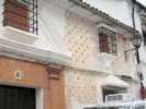
| This morning we left San Francisco on a Lufthansa flight to Frankfurt. The flight left a few minutes late but arrived in Frankfurt on time. In frankfurt we transferred to a Madrid flight. Again it left a few minutes late but arrived on time. In Madrid, one of Cheryl's suitcases was missing, so we filed a report with Lufthansa, and then walked out to the taxi stand. The taxi took us directly to our hotel, Hotel Mora. | |||||||||
| However, the driver took us on a very long circumvaluation around the city center. The freeways were all moving where we went, and I saw that the freeway normally taken was completely stopped up, but it was also good deal for the taxi driver to rack up miles and charge us more. | |||||||||
| Finally, at Hotel Mora, we checked in, cleaned up a bit, and then took a short nap, setting the alarm so that we did not sleep too long. After our nap, we went out for a walk, with the purpose of staying awake until a reasonable bed time. | |||||||||
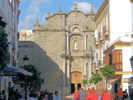
| At Atocha railroad station, we stopped to obtain our tickets. I had purchased the tickets on the Internet, but RENFE wanted to see our credit card first hand before issuing the tickets. Also, RENFE would only issue one set of tickets on one new credit card. Well, the Altaria was full from Madrid to Sevilla, but the AVE still had room in Preferente class. So, I had to buy two sets of tickets. I used my name, passport number, and credit card for Madrid to Sevilla, and Cheryl's name, passport number and credit card number for the Sevilla to Puerto Santa Maria leg. | |||||||||
| At Atocha, the ticket counters were mobbed, probably because people were trying to get out of town for Semana Santa. You can start at a special counter to get a number. They were working on numbers in the high 300's while giving out numbers in the low 500's. However, because we were picking up tickets purchased on the Internet, we got a special "quick number," 740 that came up on the ticket counter almost immediately. We were able to pick up our tickets for both legs, Madrid to Sevilla on the AVE, and the Altaria from Sevilla to Puerto Santa Maria, at the same time. This would save us a lot of time on Friday morning. | |||||||||
| From the Atocha ticket counter, we walked both underground and above trying to find the memorial to the victims of the 3/11 train bombing. Eventually we found it outside, in the middle of the traffic circle. You have to find your way to it from inside, and then you can see the crystal and the names of the victims. | |||||||||
| From Atocha, we walked up Paseo de Prado, stopping at VIPS (news stand) to look for a map of Andalucia. Didn't find one. | |||||||||
| We had a light dinner at Cafe Museo on Calle de los Huertos just off Paseo de Prado. We ordered tostada con tomate, the house special salad with rice, and the potatoes, broken eggs, and pumpkin dish. It was all very good, and just the right amount for two. | |||||||||
| From Cafe Museo, we walked back to Hotel Mora and went to bed. | |||||||||
|
|
Friday, 30 March 2007 | ||||||||
| Today we traveled to El Puerto de Santa Maria from Madrid. In Madrid we had breakfast of orange juice, coffee, and tostada (toast) con tomate. This reminds us that there are many different interpretations of just what "tostada con tomate" might be. This rendition had a few tomato seeds and a little tomato squeezed onto some toast. Last night's "tostada con tomate" was an ample spread of pureed tomato on toast. Today's rendition was a little disappointing. Back in our hotel room, we finished packing, and walked to Puerto Atocha. | |||||||||
|
Other articles:
Locations:
Madrid.
|
| ||||||||
 View of the waiting area of Estacion Santa Justa View of the waiting area of Estacion Santa Justa
 The Altaria arrives in Estacion Santa Justa, Sevilla The Altaria arrives in Estacion Santa Justa, Sevilla
|
We continued on to Atocha, went through Security, waited a few minutes, and then boarded the AVE. At Sevilla, we got off the AVE, waited a few minutes in the Station Santa Justa, and then went down to the platform to wait for the Altaria. | ||||||||
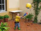
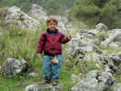
 Ian plays on the monkey bars Ian plays on the monkey bars
|
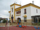
Rachel and Ian picked us up at Puerto Santa Maria. Rachel went to work and Ian, Nacho, Cheryl and I went to the park. | ||||||||
|
|
Saturday, 31 March 07 | ||||||||
 Playing baseball in the front patio. Playing baseball in the front patio.
|
This morning it was threatening rain. Rachel and Cheryl went shopping to buy a few clothes so that Cheryl will have some until her suitcase arrives. Nacho, Ian and I went for a walk and got a coffee. However, it started to rain a little bit, so we started for home. There, we played baseball in the front yard until the rain became too hard, then we colored and made stickers until Rachel and Cheryl came home. Cheryl and Rachel made Merluza (Hake) and green beans for dinner. Nacho and I worked on the router for a while. We're having trouble successfully signing on with PPPoE, but should be able to do so successfully. We (all) went for another walk through the neighborhood. When we returned, the delivery van with Cheryls suitcase arrived. It was a bit of good luck, as he could not have left the suitcase without a signature. | ||||||||
|
|
Sunday, 1 April 2007 | ||||||||
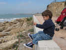 Fishing from the beach promenade Fishing from the beach promenade
|
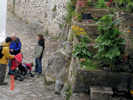
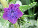
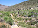
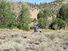
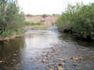
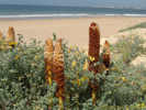
Today our plan was to go to Cadiz and watch a few pasos for Semana Santa. In the morning, we went to get churros, a fried pastry, at the local churro stand, then Rachel went back to the house to work a little bit, while the rest of us went down to the beach. There is a promenade nearby that we visited. I looked at the local weeds. I think the big cane is Arondo. There is a yellow lupine that looks like a lotus from a distance, and a large red vetch. There is also an orobanche that is quite large, and has many flowers arranged around a central spike. | ||||||||
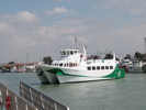 The ferry approaching El Puerto de Santa Maria terminal. The ferry approaching El Puerto de Santa Maria terminal.
|
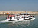
We took the 2:00 PM ferry from the El Puerto terminal on Rio Guadalete. The cost for adults is 1.80, or about $2.40. This ferry is a fast catamaran. The web sites refer to a little ferry called El Vaporcita. We did not see the little ferry this day, but did see it on Sunday two weeks later. | ||||||||
|
Locations:
Cadiz.
|
The ride is slow at first through the El Puerto harbor, and then quite fast across the Bay of Cadiz. The ride was a little bit rough, as the Bay is open to the Atlantic Ocean and the wind was blowing swells directly into the bay. Twenty minutes later we docked in the harbor at Cadiz. The ferry terminal is centrally located, just a few short blocks from the cathedral. | ||||||||
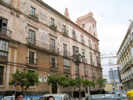 Older building with tower. Older building with tower.
|
Many of the older buildings in Cadiz had small towers on top so that ships could be seen entering the harbor. When ships were arriving in the harbor, the first merchant to see them could also be the first merchant at shipside to sell their wares. | ||||||||
| Getting off the ferry, we set off in search of a restaurant for lunch. Unfortunately, everyone in Cadiz was also eating lunch in a restaurant. So we had to wait a while, and then had a lunch of salad, chicken, and two kinds of fish. | |||||||||
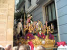 The Cristo at rest at the entrance to Plaza San Agustin The Cristo at rest at the entrance to Plaza San Agustin
|
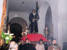
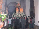
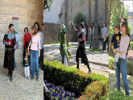
From lunch we walked parallel to a paso until we could get ahead of it, stopping at the Plaza de San Agustin. This was the paso of Borriquito (Little Burro), from the Iglesia de Carmen, and it depicts Jesus entering the city of Jerusalem on a little burro. It is the first paso of Semana Santa in Cadiz. They left at 4:00 PM and after passing through the Cathedral would return at Midnite. After waiting only an hour, the paso began to come by. This was not a large paso consisting of only a few hundred Nazarrenos, the two floats, one for Jesus and one for Mary, and band for each. | ||||||||
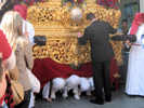 The "costaleros" under the Cristo. The "costaleros" under the Cristo.
|
The Cristo stopped just at it entered the Plaza de San Agustin. The costaleros set it down and then take a break. Sometimes, they change out the costaleros and those relieved from the service race ahead to carry the paso up ahead. | ||||||||
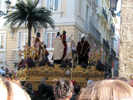 The Cristo from the Iglesia de Carmen at the Iglesia de San Agustin The Cristo from the Iglesia de Carmen at the Iglesia de San Agustin
|
Adjacent to the Plaza de San Agustin was the Iglesia de San Agustin. When the Jesus float and Mary float went by the church doors, they stopped, and turned to face into the church. The Mary float, in particular, would sway in place, and then lunge forward toward the door. | ||||||||
| After watching the paso, we had a coffee at a nearby hotel, then went out again to see the salida (exit) of another nearby paso. | |||||||||
| This paso from the Iglesia de San Agustin goes by the name Humilidad, and depicts Jesus sitting on a boulder thinking about his crucifixion. It was coming out at 7:30 PM. The doors opened promptly at 7:30, and in a few minutes the Jesus float came out. I was able to take a video of the costaleros lifting the float, and begin to turn to go down the street. They had just gotten it turned to head down the street when it was time to leave for the ferry. | |||||||||
| The ferry is a little smaller than the ferries on San Francisco bay. The ride back to El Puerto was a little smoother, mostly because we were going in the same general direction as the ocean swells. | |||||||||
|
|
Monday, 2 April 2007 | ||||||||
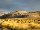
 The Rota Navy Base from El Puerto The Rota Navy Base from El Puerto
 Playing on the beach Playing on the beach
|
This morning after breakfast, meaning about 11:00 oclock, Cheryl and I took Ian out so that Rachel could work. We walked to the overlook of the bay, and then down to the beach. There, Ian and I made mountains and tunnels in the sand on the beach. After returning to the house, I went for a run through the neighborhood. In the afternoon, after lunch, I took a siesta. | ||||||||
 Coloring Easter Eggs. Coloring Easter Eggs.
|
Then we helped Ian color Easter Eggs. This is not a tradition in Spain, so Cheryl brought a Dora-themed easter egg coloring set. | ||||||||
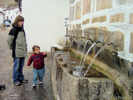
| Cheryl and I went to get bread so that Rachel could make Salmorejo, a kind of tomato soup. At the Panaderia (bread shop) the clerk tried to help me by using some Spanglish asking for Uno and twenty. When I gave her 1.20, she wanted 20 cents more. So I think, maybe, she meant to say Uno and forty. | |||||||||
|
|
Tuesday, 3 April 2007 | ||||||||
| In the morning I worked on Rachel and Nachos Internet connection. I could not get the connection to work. Over the course of the morning I made a few discoveries; one of the being that a Cross-Over Cable was being used between the ADSL modem/router and the laptop. Several others related to how the ADSL modem/router was configured. I think Im getting close to configuring the Linksys router to work with the ZyTel. | |||||||||
| In the afternoon, Rachel, Ian, Cheryl and I went to a park in Rota. | |||||||||
| Nearby was a visitor center for some sort of natural reserve or environmental organization. While, we did not visit this center, it is quite close of Los Corrales de Rota which appear to have been places to keep or raise fish along the coast. | |||||||||
|
|
Wednesday, 4 April 2007 | ||||||||
| In the morning I played with Ian a bit. Then I went for a run. I went north to the edge of the navy base, and then down the steps to the beach. Ran down the beach about 10 minutes and then turned back. I did pretty good, but I had to walk up the steepest hill. Cleaned up and packed for our trip. | |||||||||
 Rachel prepares the Dorado for lunch. Rachel prepares the Dorado for lunch.
|
Rachel made an early lunch, baking Dorado, a medium sized fish, with potatoes, tomatoes, onion, and olive oil for about an hour in a hot oven. | ||||||||
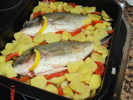 Dorado with potatoes, tomatoes, onions and oil Dorado with potatoes, tomatoes, onions and oil
|
|||||||||
| Leaving El Puerto de Santa Maria, Nacho and Rachel navigated their way through the industrial polygon to the main highway, which we took past Cadiz, Chiclana, and Vejer de la Frontera. | |||||||||
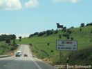 Osborne bull in the countryside of the Province of Cadiz. Osborne bull in the countryside of the Province of Cadiz.
|
Between Vejer de la Frontera and Tarifa we saw more and more windmills. We also saw a couple of bulls. Originially, these were advertising for Osborne Sherry. When roadside advertising was banned, and the bulls began to be removed, there was a popular demand to retain the bull without the name. So a compromise was struck to allow just that. Generally, the bulls remain, and there are a few Tio Pepe around for that kind of sherry also. | ||||||||
|
Locations:
Baelo Claudio.
|
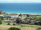
We turned off to go to the Playa de Bolonia and to a roman archeological site called Baelo Claudio. | ||||||||
|
Locations:
Baelo Claudio.
|
|||||||||
|
Locations:
Baelo Claudio.
|
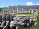
The market place at Baelo Claudio. | ||||||||
|
Locations:
Baelo Claudio.
|
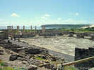
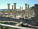
Baelo Claudio was at its peak from AD 41 until AD 54 when it began to decline after an earthquake (in the Gulf of Cadiz, likely). | ||||||||
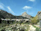
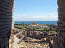 View of Baelo Claudio from Theater. View of Baelo Claudio from Theater.
|
|||||||||
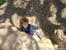 Ian in tree at Baelo Claudio Ian in tree at Baelo Claudio
|
|||||||||
 View of Baelo Claudio from above. View of Baelo Claudio from above.
|
|||||||||
|
Locations:
Baelo Claudio.
|
Had a coffee at Playa de Bolonia and then got back on the road to Tarifa. | ||||||||
 Ian in front of our room at Hostal El Levante. Ian in front of our room at Hostal El Levante.
|
|||||||||
 We look across the Straits of Gibraltar to Morocco We look across the Straits of Gibraltar to Morocco
|
We walked up to the vista point. | ||||||||
| It was very clear and we could see mountains, towns, bridges, and windmills in Morocco. | |||||||||
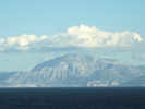 View of the Moroccan Coast from Tarifa View of the Moroccan Coast from Tarifa
|
|||||||||
 Cathedral in Tarifa Cathedral in Tarifa
|
Had a dinner of different things. Ian had a grilled ham and cheese sandwich, Nacho had a tapa of stuffed squid and lasagna, Rachel had desayuno (breakfast) of fried ham, eggs and toast, Cheryl had Tortilla Espanola, and I had a Bocatilla Pepito de Ternera (a grilled steak sandwich). | ||||||||
| coffee and ice cream | |||||||||
| Then we came back to Hostal El Levante for the night. | |||||||||
|
|
Thursday, 5 April 2007 | ||||||||
|
In the morning, we had a light breakfast at Hostal Le Levante. They do Tostada con tomate well, as we only had to ask for a little more pureed tomato for the four of us. After breakfast, we checked out of the hotel, and got in the car, driving past Tarifa.
It was cloudy this morning and we could not see anything of Africa, even from the high viewpoint along the highway. The next town was Algeciras. From the highway, Algeciras appears to be a large, bustling, and rapidly growing port city, being situated within the Straits of Gibraltar. | |||||||||
|
Locations:
Gibraltar.
La Linea de la Concepcion.
|
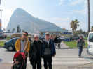
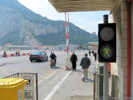
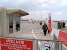
We decided that Cheryl and I would take the 1 ½ hour Cross-It-Off-Your-List walking tour of Gibraltar. This consisted of walking across the runway (the only way into Gibraltar), going to the main shopping square, buying a trinket, collecting a rock to take back into Spain (that way all of Gibraltar will eventually be back in Spain), and then walking back across the runway into Spain. | ||||||||
| Driving away from La Linea, we backtracked part-way back to Algeciras to the highway north and then proceeded up the valley to Jimena de la Frontera. This is not Jimena de Librar that we have visited previously, and it took some doing to get us all on that same page. | |||||||||
| Somewhat by accident, we happened on a nice restaurant for lunch in middle (by elevation) Jimena de la Fra. I had the green salad and the grilled piece of pork. Cheryl had the mixed salad that included tuna, egg, corn, artichoke hearts, etc., and the lentil soup that she remembers as being quite good. Rachel had the swordfish, and I dont remember what Nacho had. | |||||||||
 Ian has an ice cream Ian has an ice cream
|
After lunch, we drove a little higher in the town, looking for helado (ice cream) as a treat for Ian, as he had eaten quite a lunch. We found a place in a small square and watch enviously as Ian polished off the entire cup of chocolate ice cream while we had a coffee. | ||||||||
|
Locations:
Jimena de la Frontera.
|
Having four or five coffees a day here is not like four or five coffees at Starbucks. The amount of coffee is much less, and three café con leche would equal a tall latte at Starbucks. Also, I dont think the coffee here has quite a much caffeine. I think Rachel and Nacho might disagree with me, but its just my opinion. | ||||||||
|
Locations:
Jimena de la Frontera.
|
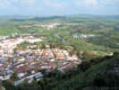
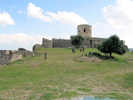
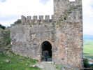
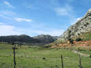
Following the ice cream soirée in upper-middle Jimena de la Frontera, we decided to go all the way to the top, and take in the castle. This one is in a state of arrested decay. There is some ongoing work to expose and preserve some Roman murals over to one side of the hill. Mainly the castle affords a fine view of the river valley below. | ||||||||
|
Locations:
Jimena de la Frontera.
|
There is also a cemetery on the top of this hill, but we did not visit it. | ||||||||
| There is no direct way to get to Grazalema from Jimena de la Frontera. I might have opted for the longer but possibly faster route up the ridge between the Rio _______ and the Rio ______ to Ronda and then turn west to Grazalema. | |||||||||
| However, we made plans to take a more direct but mountainous route through Cortes and Ubrique | |||||||||
|
|
Friday, April 6, 2007 | ||||||||
| Today was a day to stay in Grazalema and not drive. | |||||||||
| We began with breakfast at a café in the main plaza, Plaza de España. There Cheryl and I asked for toast with tomato. This should come with olive oil. Instead we got toast with strawberry jelly and the waiter brought a large tub of margarine. Later, when Rachel and Nacho came, they specifically ordered toast with oil and tomato, and got what they wanted. As pointed out before, every place is different in its rendition of toast with tomato. I guess some places also make their own their assessment of whether you should get it. | |||||||||
| After breakfast, Rachel and I bought some cheese (mixed goat and sheep milk) and some sausage at the meat store and some bread at the grocery store, | |||||||||
 Grazalema street under construction. Grazalema street under construction.
|
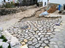
We hiked up to the top of Grazalema. Near the top of the city, the street was being replaced. I thought the construction was interesting. Over the ground, they put a layer of wire. Then stones with rought mortar. Then I expect they will come back and place a finish coat of mortar. | ||||||||
 Trailhead for Llanos de Endrinal Trailhead for Llanos de Endrinal
|
|||||||||
 Hiking above Grazalema Hiking above Grazalema
|
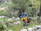
then began our trail to Llanos de Endridal. | ||||||||
 Ian on the trail. Ian on the trail.
|
Ian did very well for the first half hour, and then needed help thereafter. | ||||||||
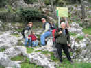
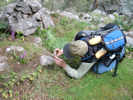 Tom photographs an orchid on the trail. Tom photographs an orchid on the trail.
|
There were two different orchids on the trail, this purple one, and a white one. | ||||||||
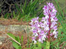 Common orchid in Sierra de Grazalema. Common orchid in Sierra de Grazalema.
|
This was the most common of two orchids we observed on the trail. | ||||||||
| When we got up, the sky was clear. But by the time we were on our trail, the sky clouded over, it rained a few drops, which then turned to freezing rain. Maybe there were a few snow flakes. It stopped and we stopped to have a little lunch, perhaps a little early, then started the freezing rain again before we returned to the top of Grazalema. | |||||||||
|
Literature Cited:
|
We all took a siesta and then started out again. Post-siesta, early afternoon being about 6:00 PM. We took part of a published walking tour of Grazalema, | ||||||||
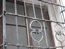 Older grillwork on a residence in Grazalema. Older grillwork on a residence in Grazalema.
|
noting some older style grillwork, | ||||||||
 Older style of house painting in Grazalema Older style of house painting in Grazalema
|
some painted exterior walls that have been exposed by removing the now-standard white plaster, and a old column of unknown age that has been used as a door step. | ||||||||
|
Literature Cited:
Locations:
Grazalema.
|
After passing through a tunnel under the main road into Grazalema, we also saw another column of unknown vintage. | ||||||||
|
Literature Cited:
Locations:
Grazalema.
|
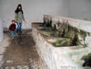
A little further down is the Roman fountain, | ||||||||
|
Literature Cited:
|
and the public laundry (no longer in use). | ||||||||
| Now we began our re-ascent into Grazalema, pushing the stroller up ramp and steep street, until we reached the gazebo that overlooks the main part of town. It was raining a little, so there was not much opportunity for photography. | |||||||||
| For dinner we went to Hostal Casa de las Piedras. Nacho had the Sopa de Grazalema (egg, chorizo, and bread in broth) again, and the trout. The trout was large-sized, seeming a little larger than trout we get. They had a special dish of spinach, lentils, and garbanzos that Cheryl ate, plus a revuelta with some unidentified vegetables. Rachel had the Sopa de Grazalema, and another revuelta with mushrooms and asparagus. It tasted pretty good if one could overlook the asparagus. I had the Sopa de Picadillos (soup of little things: egg, ham and croutons). However, I did not encounter any ham in my bowl. And, I had the grilled chicken breast. Here, grilled chicken breast is not a single breast, but more like two that have been pounded flat. So, it is a lot of food. Same with the grilled pork that I had on Thursday in Jimena de la Frontera. | |||||||||
| This being Good Friday, it was the night for the Semana Santa pasos in Grazalema. The "salida" was scheduled for 10:00 PM, and a light rain was threatening. Therefore, a decision was made not to come out of the church. | |||||||||
|
Locations:
Grazalema.
|
The Cristo was carried by the men. There was only one band, inside the church, possibly a combination of the Cristo band with the Virgin band. Inside the church, the music was very loud and quite dramatic. | ||||||||
|
Locations:
Grazalema.
|
The Virgin was carried by the women of the church. Until now, we have seen the virgin carried only by the men. So we think this might be something unique to Grazalema, or maybe to the smaller towns. | ||||||||
| The effect of candlelight in the church was also very dramatic. I have a short video of the Virgin across the church that can be downloaded here (http://www.schweich.com/images/MVI_1243.AVI). | |||||||||
|
|
Saturday, 7 April 2007 | ||||||||
|
Locations:
Olvera.
|
Today we are going to walk on the Via Verde. This is a former railroad roadbed that goes 30 km between Olvera and Puerto Serrano. The railroad was originally planned to run from Jerez to Almargin, and was under construction by private interests in 1926. However, an economic downturn stopped construction and the railway was never finished. | ||||||||
|
Locations:
Olvera.
|
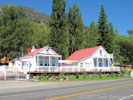
After an initial stop at an intermediate point we went to the Olvera railway station between Olvera and Pruna. The former, and never used, railroad station has been restored and is a hostel and restaurant. Of the four stations between Olvera and Puerto Serrano, three have been restored, but one is still in ruins. | ||||||||
|
Locations:
Olvera.
|
We walked on the Via Verde a little over 4 km. Along the way I saw an Aristolochia and a Scrophularia, Cerinthe major, and a little brown and yellow orchid on otherwise barren slope. One of the plants I;ve been trying to key out has a purple corolla, a scorpoid cyme, five stamens, arranged with one short, two long and two exserted, and the style obscurely forked. This is really common and should be easily identifiable. | ||||||||
|
Locations:
Olvera.
|
| ||||||||
| We had a little lunch, of bread, cheese, and salami, and then started back. Rachel accidently stepped off the pavement, and banged her knee badly. So Cheryl and I stayed with her, while Nacho took Ian to get the car. We slowly made our way to the intermediate point mentioned above, where Nacho met us with the car. | |||||||||
| Because the people at the Olvera station had given Nacho some first aid supplies, we went back there. After returning the supplies, we had the usual coffee, and Ian had a ColaCao. | |||||||||
| From there we drove back to Grazalema instead of Setenil, so that Rachel could avoid aggravating her knee. | |||||||||
|
Locations:
Grazalema.
|
After a little snack, Cheryl and I walked around the town and looked in shops, while Rachel and Nacho rested. | ||||||||
|
Locations:
Grazalema.
|
|||||||||
|
Locations:
Grazalema.
|
|||||||||
|
|
Sunday, 8 April 2007 | ||||||||
|
Locations:
Grazalema.
|
Today (Sunday), we got up, packed, had a little breakfast in Rachel and Nachos hotel apartment, and then left Grazalema, stopping to look back at the view of the town in the morning sun. | ||||||||
|
Locations:
Sierra del Caillo.
|
| ||||||||
|
Locations:
Ubrique.
|
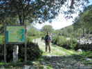
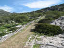
In Ubrique, were looking for the Calzada Romana (Roman Road). We stayed on the north side of town, passing the Fuente de los Nueve Canos (Fountain of Nine Some-Things), | ||||||||
|
Locations:
Ubrique.
|
when we saw a sign pointing to the Sendero (trailhead). I checked it out from below and the road looked pretty good. Unfortunately, just around to corner, the road turned to a poor dirt road. We continued up to road a short way, and then parked, leaving Rachel, Cheryl, and sleeping Ian, while Nacho and I walked the remainder of the road up to the sendero (trailhead). | ||||||||
|
Locations:
Ubrique.
|
Nacho and walked a short portion of the Calzada Romana (Roman Road). | ||||||||
|
Locations:
Jedula.
|
We stopped for lunch in Jedula, though not at this particular bar. Here the women and children were out front and in the plaza, while the men were watching footbal (soccer) in television inside the bar. | ||||||||
| Now we are back in El Puerto. I think Ian is happy to be home. | |||||||||
| This evening Cheryl and I took Ian to the beach. There were many people out on the beach, and the little café was open. Ian and I made a mountain, and a hole. A little boy, about Ians age stopped by to play for a little while, and then went back to his family. | |||||||||
|
|
Monday, 9 April 2007 | ||||||||
| Today, I did not do much because I have a cold. Cheryl went to coffee with Rachels friends, we did some laundry, and this afternoon Ian, Nacho, and Cheryl have gone to the park, while I feed clothes to washer and dryer. | |||||||||
|
|
Tuesday, 10 April 2007 | ||||||||
| Didnt do much today either. Really felt lousy. | |||||||||
|
|
Wednesday, 11 April 2007 | ||||||||
| Today I walked up to the Farmacia to get some saline solution for my nose. Armed with a cheat sheet that said solucion salina para nariz and Rhinomer #3, I was able to remember this short speech, and get what I wanted. Other than that I didnt do much today. | |||||||||
|
|
Thursday, 12 April 2007 | ||||||||
| Today I set off in search of a haircut. Just on the other side of the Farmacia, there is a Peluquerido Drago & Ortega. I asked Rachel (she gets her hair cut there) and they do men. When I got there, I tried to open the door, but it would not open. Apparently, you have to knock, and they open the door from the inside. I asked, in my best Spanish, if they were a haircut for men and they said yes and motioned for me to sit. A young man came and got me and we negotiated about the length of my hair. I started at dos milimetros and he went to numero dos. As he got started, it was apparent that numero dos was a little long for me, and we needed mas cortada, so we went to numero uno. That turned out to be a little short, but it will be OK. | |||||||||
| The cost of the haircut was 6.50, and I gave him a 1 tip; probably too much again, but Im a foreigner who doesnt know any better here. | |||||||||
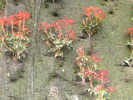
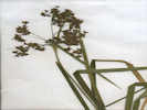
 Orobanche near the beach at El Puerto Orobanche near the beach at El Puerto
|
|||||||||
| Late in the afternoon, e.g., 7:30 PM, we decided to get a coffee. Ian went on his tricycle. Nacho and I held him back on the way down the hill, and then puched him back up the hill, while helping steer. | |||||||||
| For dinner, we went to the local Mexican Cantina and Mini-Golf. We started with Jalapeño Poppers that were quite mild. Then Cheryl and I had chicken tacos, Rachel had a taco with black beans, and Nacho had a burrito. | |||||||||
| The food was pretty good, and fairly close to what we know as Mexican food. There are a lot of Americans living in Rota and El Puerto that provide clientele for this restaurant. | |||||||||
|
|
Friday, 13 April 2007 | ||||||||
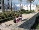
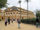
| This morning we went to the Royal School of Equestrian Arts in Jerez de la Frontera. There was no performance today, only practice and access to the school grounds. We made several attempts to obtain tickets on the Internet, but in the end gave up, as they were always sold out or not available. | |||||||||
| On arrival in Jerez, we were lucky to find a street parking spot about a block from the school. We stood in a short line to buy tickets for 9 each. Ian was free. | |||||||||
| Another gate gave us access and we went in. A large group of tourists seemed to be from Holland-America Line. I would guess their boat docked in Cadiz, and they were bussed to Jerez. | |||||||||
 Arena Arena
|
Like most people, we went straight to the arena to watch the horses practice. Photography is prohibited. The practice was mostly individual horses and riders working on specific skills. Occasionally, a tour guide would call out that a tour was forming in Spanish, English, or German. | ||||||||
| When Ian tired of the horse practice, we went outside. Generally, only small areas of the grounds are available for unescorted touring. | |||||||||
| However, we noticed a large group of the Holland-America tourists were just leaving with an escort, and we attached ourselves to them. We toured the stables, actually just one hall in the stables. We saw a few horses come back in from practice, and two go out for practice. | |||||||||
| The tour was going somewhere else on the grounds, but we decided we had had enough. We worked out way back to the gate, and then to the car for the ride back to El Puerto. | |||||||||
| Back in El Puerto, we stopped at an appliance store to look at vacuum cleaners, but found none of the models that Cheryl and Rachel had seen at El Corte Ingles. | |||||||||
| At the house, we had lunch and a siesta. Neither Cheryl nor I feel particularly well due to our colds. | |||||||||
|
|
Saturday, 14 April 2007 | ||||||||
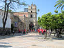
| Saturday morning, we returned to Jerez. Access to the center of the city from the south is quite easy, with a broad street leading up past the Alcazar (fort) to a parking garage under the main plaza. | |||||||||
|
Locations:
Jerez de la Frontera.
|
A local bicycle group was leaving for a tour of the city (#1) just as we arrived at the Alcazar. | ||||||||
|
Locations:
Jerez de la Frontera.
|
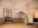
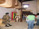
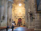
In the Alcazar, the mosque (mezquita) has been preserved, though it has been converted to a Christian church, and then partially restored as a mosque. | ||||||||
|
Locations:
Jerez de la Frontera.
|
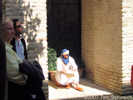
There were actors interpreting the history of Jerez from the Moors of the 11th century until the 19th century. | ||||||||
|
Locations:
Jerez de la Frontera.
|
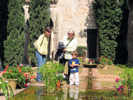
The brochure notes that the Alcazar has experienced several periods of decay and restoration. At one time there was a partially constructed hotel in the Alcazar grounds. The gardens restored to be quite pretty (#2) with small fountains, little brick-lined streams and pools with goldfish. | ||||||||
|
Locations:
Jerez de la Frontera.
|
The actors staged a sword-fight to represent the time that Spain reconquested Jerez from the Moors. Ian liked the Spanish soldier, and watched the sword fight intensely, and then wanted to say Hola! to him (#3). | ||||||||
|
Locations:
Jerez de la Frontera.
|
|||||||||
|
Locations:
Jerez de la Frontera.
|
|||||||||
|
Locations:
Jerez de la Frontera.
|
|||||||||
|
Locations:
Jerez de la Frontera.
|
We had a small lunch in the Plaza de Peones (#4) after which Ian acquired some small candies similar to Starburst. | ||||||||
| In the next plaza, Plaza del Progreso, there was a playground with lots of little children playing. After playing a while Ian shared some of his candy with a little girl (#5). | |||||||||
| In the afternoon, Nacho took Ian down to the beach, while I went for a run. Again I went north to the edge of the navy base, down the stairs, then turned south on the beach. I ended my run with Nacho and Ian. Some acquaintances from Ians school came by with their little boy, Jose. We talked for a while and the boys played in the sand. Of course, the talking was in my very limited Spanish, and their very limited English, with a lot of fumbling for vocabulary. | |||||||||
|
|
Sunday, 15 April 2007 | ||||||||
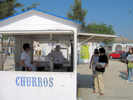 Getting Churros in El Puerto Getting Churros in El Puerto
|
Sunday morning started with getting Churros and the paper (#6). | ||||||||
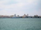
| Then we went to Cadiz on the Ferry to meet Nachos brother, Julio, who is the commander of the Corvette Infanta Christina (#7). They are in Cadiz for a joint exercise with Algeria, Morocco, Greece, Turkey, and France to train for inspecting merchant ships in the Straits of Gibraltar. | |||||||||
 Little ferry boat en route to Cadiz. Little ferry boat en route to Cadiz.
|
|||||||||
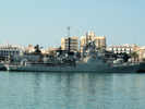 P77 Infanta Cristina in Cadiz P77 Infanta Cristina in Cadiz
|
Julio gave us a tour of the ship, meeting his officers, and letting Ian sit in the Captains Chair (#8). | ||||||||
| We had lunch of tapas on the sidewalk of a nearby restaurant, and then came home on the ferry. | |||||||||
| Maria Jesus and Julio were visiting in town, so we went do meet them at Puerto Sherry for a coffee. | |||||||||
|
|
Monday, 16 April 2007 | ||||||||
| Today we went to El Corte Ingles in Jerez de la Frontera. The primary purpose was to buy a vacuum cleaner but we also bought a few other things. In Hipercor, we got CDs to record and exchange photos from this trip and a few food items. | |||||||||
| After buying the vacuum cleaner, and depositing it in the car, we went back to the cafeteria in El Corte Ingles for some Tostada con Tomate. I think I should develop a rating scale for this. You have to separately rate the quality of the toast, the quality of the oil, and the quantity and quality of the pureed tomato. | |||||||||
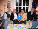 Ian's grandparents. Ian's grandparents.
|
In the evening Maria Jesus and Julio came over for dinner and to play with Ian. | ||||||||
|
|
Tuesday, 17 April 2007 | ||||||||
| This morning Cheryl and Rachel have gone to the current-day equivalent of a Tupperware Party, a gathering of mostly English and American women from the Navy base and surrounding areas that includes to opportunity to buy kitchen ware and other things. | |||||||||
| I opted to stay home and do my e-mail. Then I looked at some imagery that was available on the Internet. About 1100 I changed to my running clothes, and set off for the beach. I generally run north along the upper streets to the promenade just at the edge of the navy base. The I go down the steps, about 30, to the beach and turn south. It takes about 6 minutes to get onto the beach. Then I run (Run, in the broad sense of the word.) south along the beach for 9 minutes, and turn around. At some point, I have to climb from the beach to the streets. Today, I climbed the stairs again. That seems to work better than to try and run up one of the streets. | |||||||||
| This afternoon Ive done a little e-mailing and a little GIS work. | |||||||||
|
|
Wednesday, 18 April 2007 | ||||||||
| This morning a general strike was called around the Bay of Cadiz to support the workers of the Delphi plant in Puerto Real that is being closed. Rachel and Nacho thought our planned trip on the Cercanias to Sevilla from Puerto Santa Maria was likely threatened. If we called RENFE they would say that the trains were running. But, it was also possible that the trains just might not show up, or even that it might show up, but go no further. Therefore, it was decided that Rachel would drive us to Sevilla from where we planned to take the AVE to Madrid. | |||||||||
|
|
Thursday, 19 April 2007 | ||||||||
| Flew Madrid to Frankfurt to San Francisco. | |||||||||
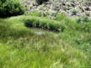
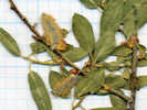
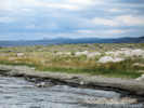
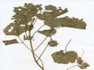
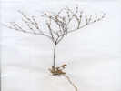
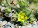
 Loeseliastrum on Furnace Creek Wash Loeseliastrum on Furnace Creek Wash
|
I found this little Loeselastrum on a bench beside the wash., | ||||||||
|
Other articles:
|
4 June 2007 | ||||||||
|
|
Sunday, June 24, 2007 | ||||||||
|
Other articles:
Locations:
Tuolumne Meadows.
|
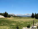
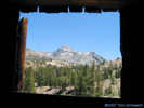
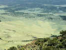
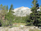
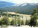
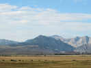
I left Alameda Sunday morning, stopped at Tuolomne Meadows for the obligatory photograph, and reached Tioga Pass in about 3 1/2 hours | ||||||||
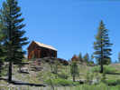
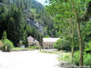
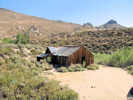
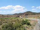
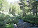
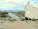
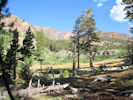
| Stopped at the Inyo National Forest Junction campground. I tried to find trail to Bennetville that is shown on the Tioga Pass USGS quadrangle map. This map shows the trail, an old road going up the south side of the creek. I could not find the trail, but eventually found good trail up the north side of the creek. The map labels the trail as Loc Ap which I later realize must mean location approximate. The trial leaves the campground near the campground host site, and goes straight to the cabins at Bennettville, then continues on to Shell Lake. | |||||||||
|
Locations:
Bennettville.
Tioga Peak.
|
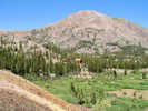
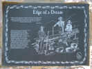
There are two cabins at Bennettville, that are being preserved in a state of arrested decay. The main cabin is two stories high, and the smaller is a single story. | ||||||||
| The insides of both cabins are plain, so its not possible to tell how they were used, whether a store, a hotel, etc. | |||||||||
|
Locations:
Bennettville.
Mount Dana.
|
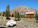
The upper window in the main cabin has a great view of Mount Dana. | ||||||||
|
Locations:
Shell Lake.
|
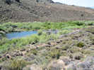
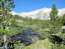
Continuing up the trail, I went as far as Shell Lake, | ||||||||
|
Locations:
Mine Creek.
|
then crossed Mine Creek | ||||||||
| and headed for the adit. | |||||||||
| There is a log bridge across Mine Creek that is about 1/4 mile below Shell Lake. | |||||||||
|
Locations:
Bennettville.
|
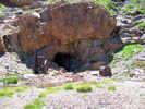
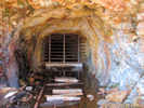
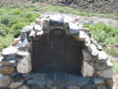
At the mine I looked around. There is a significant water flow from the mine that does not look particularly polluted.
Inside the mine entrance there is a gate. And there are a few old pieces of equipment, both compressors, lying about at the entrance to the mine. | ||||||||
|
Locations:
Bennettville.
Tioga Peak.
|
I returned to log bridge, and then followed the trail back to campground. | ||||||||
| I stopped at Ellery Lake to look at the campground. Its fairly nice, but many of the campsites are exposed. | |||||||||
|
Other articles:
Locations:
Warren Canyon.
|
| ||||||||
|
Other articles:
Locations:
Lee Vining Canyon.
|
I turned off Highway 120 on Poole Power Station Road and drove to end of road at the power station. | ||||||||
| Big Bend Campground is the highest campground in Lee Vining Canyon. It had some nice spots still available at 300 PM on a Sunday. This is a location that several collections reference. | |||||||||
|
Other articles:
|
Back on California Highway 120, I continued down hill towards Mono Lake. To the right, or south side of the highway, I saw the Los Angeles aqueduct diversion dam. It was not fenced or posted for No Trespassing, so I drove in to look at it. | ||||||||
| The reason to stop here, besides interest in water politics in the Mono Lake basin, are the several collections that were made in this area. For example, Dean Taylor made several collections just upstream from this dam. | |||||||||
| There is a small pond with two gates at the dam. One gate appeared to enter the aqueduct, and the other released water into Lee Vining Creek. It appears that the Lee Vining Creek might be automated to maintain a constant flow. If not automated, it was well-instrumented to measure the actual flow. | |||||||||
| The next place down the highway was the Lee Vining Ranger Station. This is an administrative center and redidential area. The public information office is down by the lake. Again, the reason to note this place is the collections that were made referencing this location. Among others, Jack Reveal and Carl Wolf made collections in this area. | |||||||||
| Just below the ranger station is a water fountain for drinking water. Here I refilled my water bottles. | |||||||||
| At Highway 395 I turned north and went through town | |||||||||
|
Other articles:
|
grave marker for Adeline Carson Stilts near the Mono Inn
| ||||||||
| to Mono Lake County Park. | |||||||||
|
Locations:
Lee Vining.
Mono Lake County Park.
|
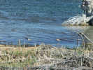
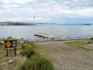
Walked on boardwalk down to the lake. There were lots of gulls and a few blackbirds, in addition to two American Avocets in breeding plumage. | ||||||||
|
Other articles:
Locations:
Thompson Ranch.
|
Above the county park are some large trees in a meadow. The area is signed as private property of Los Angeles Department of Water and Power. I had thought that this was Mono Vista Spring. However, tomorrow at the Mono Historical Museum, I would learn that this was the location of the Thompson Ranch house. Regardless, this was only a pleasant partially shaded meadow. | ||||||||
|
Other articles:
|
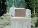
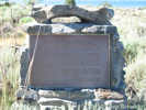
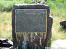
On the way back to town, I stopped at the Picnic Grounds Beach. This is not much of a picnic grounds, but there is one table that has a bit of shade, and there is access to the lake. This is one place to photograph brine flies. This is also the location of the memorial plaque for Sheriff James P. Dolan.
| ||||||||
|
Locations:
Negit Island.
|
For dinner I went to the Whoa Nelli Deli at the Mobil Gas station. This being Sunday afternoon, the gas station and restaurant was complete with a wine tasting. For dinner I had the Chicken Caesar Wrap. It was tasty, but only chicken, lettuce and a flour tortilla. | ||||||||
| At the motel, I talked a few minutes with my neighbor. He has just retired also. He is doing some drawing in his new found time. He had also ridden a new mototcycle up to Lee Vining today and was riding back to Los Angeles tomorrow. | |||||||||
|
|
Monday June 25 2007 | ||||||||
| This morning I walked around town a little bit waiting until 9:00 AM so I could meet some people at the Mono Lake Committee. | |||||||||
| Among other things, we talked about some of the localities in the Mono Lake basin, and they suggested I stop at the Mono Basin Historical Society at the Museum. | |||||||||
|
Other articles:
Locations:
Mono Lake Post Office.
|
Before the museum opened, I drove to the Tioga Lodge and asked if they knew any history, especially about the Mono Lake Post Office being there. This was confirmed, and I copied some anonymous pages that had been written about the Lodge. They confirm that the Mono Lake Post Office was here, but do not give dates. | ||||||||
|
Locations:
Lee Vining.
|
At the Mono Lake Historical Museum, I met Norm Dechambeau. He was able to give me the location of the Simis (Sylvester) Ranch. He knew the name Sylvester Ranch, but not Simis Ranch, recalling it as Simons Ranch. Carl W. Sharsmith made six collections at Simis Ranch, probably all on August 29, 1969, and Jack L. Reveal made one collection there in July 13, 1980. Its possible that Sharsmith mistook Simis for Simons Ranch in his notes or in transcribing his notes to labels. | ||||||||
| I also asked Mr. Dechambeau about the Maloney Place. Only Jack L. Reveal and family collected at this location. Mr. Dechambeau had no knowledge of this name. | |||||||||
|
Other articles:
Locations:
Williams Butte.
|
Farringtons was easier. It is at the base of Williams Butte, across Walker Creek from the former Cain Ranch. Marked at this time by trees and a corral, the trailers just above the corral are not part of Farringtons. | ||||||||
|
Other articles:
|
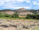
From the museum, I went out Hwy 120 past Gas Pipe Spring to the road to Cowtrack Mountain. | ||||||||
|
Other articles:
|
The road to Cowtrack Mountain is a little sandy. In fact it is sandy almost to the very top of Cowtrack Mountain, getting rocky in only the last 100 feet. The drive was about 7 1/2 miles and took a little more than a half hour. | ||||||||
|
Locations:
Adobe Hills Spillway.
Cowtrack Mountain.
Mono Lake.
|
| ||||||||
|
Other articles:
|
On one of the large flats just below the summit at 11S 0339795 4203270, I collected a Phlox that seemed to have an unusually long floral tube | ||||||||
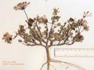
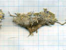
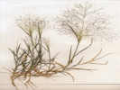
 Granite Prickly Phlox (Leptodactylon pungens), Collection No. 460 Granite Prickly Phlox (Leptodactylon pungens), Collection No. 460
 Granite Prickly Phlox (Linanthus pungens), Collection No. 460. Granite Prickly Phlox (Linanthus pungens), Collection No. 460.
|
460 |
Linanthus pungens (Torr.) J. M. Porter & L. A. Johnson. (Syn: Leptodactylon pungens (Torr.) Nutt. ex Rydb. ) Granite Prickly Phlox.
Cowtrack Mountain, Mono County, California. Large, sandy, flat area on Cowtrack Mountain, along the road to the summit, about 5.2 miles northeast of California Highway 120, and 1.5 miles southwest of the summit. 37.9615°N, 118.824596°W. UTM: 11S 4203270N 339795E. | |||||||
|
Other articles:
|
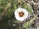
Also on the descent, I saw a Calochortus. There were only two, so I did not collect. | ||||||||
|
Other articles:
Locations:
Gaspipe Spring.
|
H. M. Hall collected Chamaebatiaria millefolium here in August 1922. Unless my Collection No. 482 is confirmed to be Chamaebatiaria millefolium, this collection will be the closest collection of the taxon to Mono Lake basin. | ||||||||
|
Locations:
Parker Peak.
|
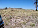
Had lunch in the shade on the road up to Sagehen Peak. | ||||||||
 Odd structure near Big Sand Flat Odd structure near Big Sand Flat
|
|||||||||
|
Other articles:
Locations:
Big Sand Flat.
|
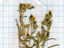
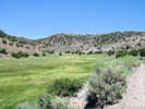
Crossed Big Sand Flat and stopped on the south-facing slope to collect. Location: 11N 0332827 4193402, Latitude: 37.874525, Longitude: -118.90188. | ||||||||
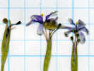
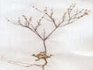
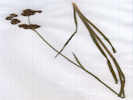
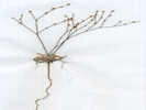
 Coll. No. 461, Lupinus duranii Coll. No. 461, Lupinus duranii
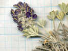 Coll. No. 461, Lupinus duranii Coll. No. 461, Lupinus duranii
 Coll. No. 461, Lupinus duranii Coll. No. 461, Lupinus duranii
|
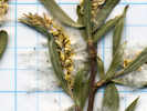
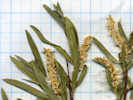
461 | Lupinus duranii Eastw. | |||||||
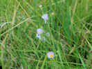
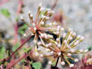 Verbena flowers opening Verbena flowers opening
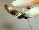 This little bug was trying to get inside the Abronia turbinata flowers. This little bug was trying to get inside the Abronia turbinata flowers.
 Collection No. 462 Collection No. 462
|
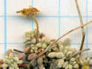
462 |
| |||||||
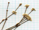
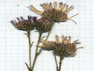
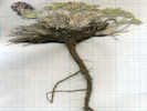
 Collection Number 463, Calyptridium umbellatum Collection Number 463, Calyptridium umbellatum
|
463 |
Calyptridium umbellatum (Torr.) Greene. Coll. No. 463, 29 Nov 2011, characters observed while keying: Perennial tap-rooted; Infloresence (appearing) terminal; Fruit round, 4 mm x 3 mm wide; Seed 7 (+ 2 aborted), shiny black, reniform, dimpled surface. | |||||||
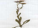
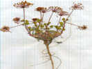
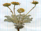 Coll. No. 464, Hulsea vestita var. vestita Coll. No. 464, Hulsea vestita var. vestita
|
464 | Hulsea vestita var. vestita | |||||||
 Collection Number 465 Collection Number 465
|
465 | Mimulus nanus Hook. & Arn. var. mephiticus (Greene) D. M. Thomps. | |||||||
|
Other articles:
|
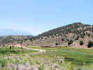
Moved on up onto the ridge north of Big Sand Flat. Came to place that had burned, 11S 0333197 4194993 | ||||||||
 Collection Number 466 Collection Number 466
|
466 | 466 Phacelia, possibly P. bicolor. | |||||||
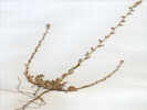
 Coll. No. 467, Mentzelia congesta Coll. No. 467, Mentzelia congesta
 Coll. No. 467, Mentzelia congesta Coll. No. 467, Mentzelia congesta
 Coll. No. 467, Mentzelia congesta Coll. No. 467, Mentzelia congesta
|
467 |
| |||||||
 Coll. No. 468, Eriogonum spergulinum var. reddingianum Coll. No. 468, Eriogonum spergulinum var. reddingianum
 Coll. No. 468, Eriogonum spergulinum var. reddingianum Coll. No. 468, Eriogonum spergulinum var. reddingianum
|
468 | Eriogonum spergulinum A. Gray var. reddingianum (M. E. Jones) J. T. Howell. Redding Buckwheat. | |||||||
 Collection Number 469 Collection Number 469
|
469 | Eriogonum, not in bloom. Collection discarded, either E. baileyi or E. brachyanthum, but not mature enough to determine. | |||||||
 Flower seen near Big Sand Flat. Flower seen near Big Sand Flat.
|
Not sure I collected this one. | ||||||||
|
|
Tuesday, June 26, 2007 | ||||||||
| Today I started by looking for Simis (Sylvester) Ranch. | |||||||||
| I got off of US Hwy 395 at a turnout for the old highway, and followed it north for a way. Reached a place where it seemed necessary to turn into a driveway. Decided against it, because I dont like to drive into someones front yard, and continued on to my next stop. | |||||||||
|
Other articles:
|
This was the Mill Creek Power House. This is the point at which Mill Creek water is diverted into Wilson Ditch and Wilson Creek to water the meadows at Conway Ranch. | ||||||||
|
Other articles:
|
|||||||||
| I found the diversion into Wilson Creek, but it doesn't look like water is flowing into the highest ditch. | |||||||||
| The maps show that Goat Ranch Cutoff Road does not cross the bed of Wilson Creek. However, there is an informal trail that looks quite passable. However, this is clearly just to vehicle tracks, not a maintained road. | |||||||||
| I did a drive-by of Conway Ranch. The windows of the main building have been boarded up, and there is a small trailer out back. No one was at the ranch at the time. | |||||||||
|
Other articles:
Locations:
Conway Ranch.
|
| ||||||||
| Turned off of US Hwy 395 onto a dirt road and followed this road into Rattlesnake Gulch. | |||||||||
| Stopped at the first spring. There was a young buck (male deer) hiding from me behind the willows. | |||||||||
|
Other articles:
Locations:
Rattlesnake Gulch.
|
Rattlesnake Gulch 11S 0310913 4217523 | ||||||||
|
Other articles:
|
470 |
| |||||||
| 471 | Potentilla gracilis Hook. var. fastigiata (Nutt.) S. Watson. Slender Cinquefoil. Coll. No. 471, 30 Nov 2011, characters observed while keying: Perennial herbaceous; Stem ascending, hairs one length; Leaves palmately compound; Leaflets 7, 12-toothed ± half or less to mid-veins, hairs straight spreading (not shaggy or cottony hairy), top and bottom surfaces similarly hairy; Flowers in cymes; Sepals 5; Petals 5, yellow, equal to or slightly longer than sepals; Receptacle not enlarged; Stamens many (13 counted); Style jointed to fruit, 2 mm, slightly tapered; Achenes not fleshy. | ||||||||
|
Other articles:
|
472 |
Carex athrostachya Olney. Slenderbeak Sedge.
Coll. No. 472, 29 Nov 2011, characters observed while keying: Perennial to 5 dm; Bracts lowest bract well-exceeding the infloresence; Infloresence lateral spikelets sessile; Spikelets > 2 per culm, terminal spikelet has female flowers above male flowers (gynecandrous); Perianth without petal-like parts, subtended by a chaff-like bract; Perigynia thin at maturity, flat except where distended by achene; Anthers basifixed; Ovary 1, completely enveloped in a closed sac-like bract; Styles and Stigmas 2. | |||||||
 Coll. No. 473, Rosa woodsii var.ultramontana Coll. No. 473, Rosa woodsii var.ultramontana
|
473 | 473 Rosa | |||||||
| From Rattlesnake Gulch, I was thinking I wanted to continue east across to Bacon Gulch, and ultimately Sinnamon Cut. | |||||||||
| Turned left, across the creek (wet muddy area) and climbed the hill out of Rattlesnake Gulch. After crossing a couple of little gullies, I decided not to continue in this direction, as an old guy, alone, in a single vehicle, and so began to return to Rattlesnake Gulch. | |||||||||
|
Other articles:
Locations:
Rattlesnake Gulch.
|
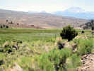
On the ridge between Rattlesnake Gulch and Bacon Gulch (11S 0311228 4217669, elev. 2306 m), there were many Eriogonum in bloom. | ||||||||
 Coll. No. 474, Eriogonum umbellatum var. nevadense Coll. No. 474, Eriogonum umbellatum var. nevadense
 Coll. No. 474, Eriogonum umbellatum var. nevadense Coll. No. 474, Eriogonum umbellatum var. nevadense
|
474 |
Eriogonum umbellatum Torr. var. nevadense Gand. Sulphur-Flower Buckwheat. Coll. No. 474, 29 Nov 2011, characters observed while keying: Perennial shrub, erect; Leaves alternate, entire; Stipules 0; Involucre subtended by 3 bracts, bracts fused at base, lobes reflexed, not awn-tipped; Infloresence a simple umbel; Perianth base with an attenuated, stipe-like base; Tepals yellow, glabrous. | |||||||
 Coll. No. 475 Coll. No. 475
|
475 | 475 Purshia tridentata (Pursh) DC. var. tridentata | |||||||
|
Other articles:
Locations:
Rattlesnake Gulch.
|
From this location, I noticed there was a cabin in Rattlesnake Gulch, just a little above the location where I had already collected. | ||||||||
| Crossed the wet muddy area again, and turned north to the cabin. | |||||||||
|
Other articles:
Locations:
Rattlesnake Gulch.
|
The main cabin had two rooms, and the little cabin out back had only one room. | ||||||||
| Deciding to leave the area and head for my next stop, I began retracing my steps to Hwy 395, when I saw a very large bunch grass. | |||||||||
| Near Rattlesnake Gulch, between the gulch and US Hwy 395 11S 0310842 4217437 2268m | |||||||||
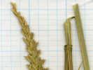
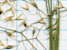
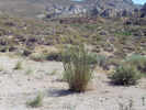 Collection No. 476, Great Basin Wild Rye Collection No. 476, Great Basin Wild Rye
 Coll. No. 476, Elymus cinereus Coll. No. 476, Elymus cinereus
|
476 |
Elymus cinereus Scribn. & Merr. Great Basin Wild Rye.
Coll. No. 476, 28 Nov 2011, characters observed while keying: Perennial to 13 dm; Nodes region ±pubescent (definitely not glabrous), Auricles 0; Ligules membraneous; Inflorescence spike-like, axes remaining together with age; Spikelets 2-7 per node; Florets most (9/10) female; Glumes 2, awl-like, lower 13 mm, upper 10 mm, narrow < 1 mm wide, sparse short hairy; Lemma 12 mm, acute, awn 0, sparse short hairy; Palea 11 mm, sparse short hairy; Anthers 6-7 mm, yellow. | |||||||
 Coll. No. 477, Coll. No. 477, 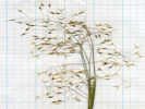 Coll. No. 477, Coll. No. 477, |
477 | 477 Oryzopsis | |||||||
| Back on Hwy 395, I turned south, then east again on Conway Ranch Road. | |||||||||
| At the crossing of Rattlesnake Gulch, I noticed a very good road heading up Bacon Gulch in the direction of Sinnamon Gulch. | |||||||||
| I followed this road to its end at a cattle pond. From the cattle pond, there were several extensions, one continuing up Bacon Gulch and the other climbing toward Sinnamon Cut. | |||||||||
| I followed the Sinnamon Cut road for a short distance, and then parked just the the western end of Sinnamon Cut. | |||||||||
|
Locations:
Sinnamon Cut.
|
Walked up the road for a view of Sinnamon Cut. | ||||||||
|
Other articles:
Locations:
Conway Ranch.
|
Returned to the car, drove back down to Conway Ranch Road and turned left (east). | ||||||||
| Joined Goat Ranch Cutoff Road. I stayed on Goat Ranch Cutoff Road to Bridgeport Canyon. | |||||||||
|
Other articles:
|
While on Goat Ranch Cutoff Road, I remembered there was a station on this portion of the road, called Hector Station. I didnt see anything, but neither did I have a map showing where to look. | ||||||||
|
Other articles:
|
Turned up Bridgeport Canyon. This was formerly the main road into Mono Lake basin from Bridgeport. | ||||||||
|
Other articles:
|
Nice outcrop of volcanic mudflow breccia. | ||||||||
|
Other articles:
Locations:
Coyote Spring.
|
| ||||||||
|
Other articles:
|
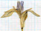
478 | 478 Iris missourensis | |||||||
|
Literature Cited:
Other articles:
|
479 |
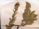
Coll. No. 479, 30 Nov 2011, characters observed while keying: Plant glabrous; Stems terete; Leaves mid-cauline sessile and auriculate, 4-5 cm x 15 mm wide pinnately lobed, 5 to 9 lobes; Petals yellow, obovate, 5 mm, 2+ mm wide; Stamens 6, all appearing equal in length, included; Style 0.5 mm; Fruit silique, linear, 14-24 mm x 1.5 mm wide, not stipitate, appressed to ascending, strongly flattened, compressed parallel to the replum (which appears mostly as a thin membrane), dehiscent by valves, valves 1-veined (some 2nd and 3nd anastomosing veins); Seeds many, brown scaly (?). In TJM2 this keys straight to Barbarea and then most likely to B. orthoceras. In Taylor, it gets lost between Brassica and Hirschfeldia because of the yellow flowers. Hirschfeldia might be a good guess because the fruit is appressed to the stem, but the distal end of the fruit is much simpler than the usual photos of Hirschfeldia. If I allow the flowers to be white, then I can get into Cardamine in which C. breweri might be a good guess. However, looking at those three species at the herbarium, it's none of them. It could be Sisymbrium officinale, but I need to verify that in the herbarium. This would be the first collection from Mono County. | |||||||
|
Other articles:
|
480 |
Lappula redowskii (Hornem.) Greene var. redowskii
Coll. No. 480, 27 Nov 2011, characters observed while keying; Annual, without milky juice; Petals blue; Nutlets not spreading (eliminates Pectocarya), margin a rim of barbed prickles, not fused at base and not al all crown-like. | |||||||
|
Other articles:
|
481 |
Eriastrum signatum D. Gowen. David's Spotted Wooly Star.
Coll. No. 481, 27 Nov 2011, characters observed while keying in TJM2: Annual, not glandular; Corolla lobes blue, throat 4 mm, lobes 1 mm; Stamens attached at corolla sinus, equal (differentiates from E. wilcoxi), exserted < 1/2 corolla lobes; Anthers exserted. | |||||||
|
Other articles:
|
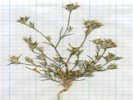
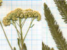
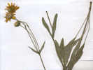
482 | 482 Achillea millefolium, also collected by others in Lee Vining Canyon, Simis Ranch, and South Fork of Mill Creek. Coll. No. 482, 30 Nov 2011, characters observed while keying: Perennial herbaceous; Leaves alternate, finely dissected, aromatic when fresh; Heads in flat-topped clusters; Phyllaries in 2+ series; Receptacle chaff scales among disk flowers; Chaff scales flat: Petals fused; Disk corollas white; Ovary inferior. | |||||||
 Coll. No. 483, Salix exigua Nutt. Coll. No. 483, Salix exigua Nutt.
 Coll. No. 483, Salix exigua Nutt. Coll. No. 483, Salix exigua Nutt.
|
483 |
Salix exigua Nutt., sometimes called Narrow-Leaved Willow, Sandbar Willow, or Coyote Willow.
Coll. No. 483, 27 Nov 2011, characters observed while keying: Shrub, clone-forming, with upright branches; Bud scale margins ??? (free imbricate vs. fused); Leaves < 7mm wide (obs: 5 mm), margins entire, pubescent below, with hairs appressed and parallel to axis; Style very short; Stigmas lobed. | |||||||
|
Other articles:
|
484 |
Salix boothii Dorn. Booth's Willow
Coll. No. 484, 27 Nov 2011, characters observed while keying; Shrub erect; unclear as to clonal vs. non-clonal; Bud scales clearly fused; Petiole glandless; Leaves entire, blade 40 mm by 12-15 mm wide, glands on margins, few hairs on both surfaces, variably more dense on top than on bottom; Catkin bracts dark (obs: black). | |||||||
|
Other articles:
|
485 |
Sisyrinchium halophilum Greene. Nevada Blue-Eyed Grass.
27 Nov 2011: It looks to me as though the translucent margins of the inner bracts are pretty uniform in width. Coll. No. 485, 27 Nov 2011, characters observed while keying: Rhizome compact; Stem unbranched; Leaves ± basal; Inner Bracts, just slightly shorter than outer, translucent margin extends above the tip; Perianth blue. Originally determined as S. idahoense because of uniform translucent margins on inner bract, per TJM1, TJDM, & Taylor (2010). However, in TJM2 determined as S. Halophilum because inner bract just slightly shorter than outer, rather than << outer. | |||||||
|
Other articles:
|
Continued up the canyon, and stopped at another major spring that does not appear to have a name. | ||||||||
|
Other articles:
|
Then came to the pass between Bridgeport Canyon and Mormon Meadow, 11S 0314163 4223450 elev. 2337 m. Here there was a little mat-forming Eriogonum. | ||||||||
| There were some folks camping in the pass with their horses. | |||||||||
 Coll No. 486 Eriogonum caespitosum Coll No. 486 Eriogonum caespitosum
 Coll. No. 486, Eriogonum caespitosum Coll. No. 486, Eriogonum caespitosum
 Coll. No. 486, Eriogonum caespitosum Coll. No. 486, Eriogonum caespitosum
|
486 | 486 Eriogonum, probably E. caespitosum. | |||||||
|
Other articles:
|
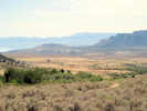
The view southeast across Mono Lake basin was a little difficult due to haze and the mid-morning angle of the sun. | ||||||||
|
Other articles:
|
Returned back down Bridgeport Canyon into Mono Lake basin. | ||||||||
|
Other articles:
Locations:
Goat Ranch.
|
| ||||||||
|
Other articles:
Locations:
Cottonwood Canyon.
|
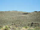
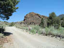
Started up Cottonwood Canyon, in the direction of Bodie. There are no Cottonwoods in this portion of the canyon. | ||||||||
|
Other articles:
Locations:
Cottonwood Canyon.
|
|||||||||
|
Other articles:
Locations:
Cottonwood Canyon.
|
|||||||||
|
Other articles:
|
The pass separates Mono Lake basin from the Rough Creek and therefore East Walker basin. | ||||||||
|
Other articles:
Locations:
Bodie.
|
|||||||||
|
Other articles:
|
Did not go into Bodie, and instead turned west again over a low pass, re-entering the Mono Lake basin. | ||||||||
|
Other articles:
|
Saw some cottonwoods in the upper portion of Cottonwood Canyon. | ||||||||
|
Other articles:
Locations:
Murphy Spring.
|
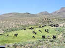
Murphy Spring was full of cows. Not much botanizing to do here. | ||||||||
|
Locations:
Bodie Hills.
Mount Biedeman.
|
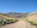
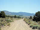
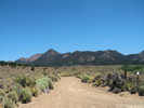
Turned off Highway 270 into a small valley north of Mount Biedeman. | ||||||||
|
Other articles:
|
487 |
The mat-forming lupines are L. breweri, L. lepidus, and L. padre-crowleyi. Only L. ledpidus var. lobbii and var. utahensis have the infl < lvs. Determined 25 July 2010, see also my collection no. 686. | |||||||
| Returned to the highway and turned west. The highway leaves the Mono Lake basin and enters the East Walker River watershed by way of Clearwater Creek. | |||||||||
|
Other articles:
|
Mormon Meadow, upper end. | ||||||||
|
Literature Cited:
Other articles:
Locations: Mormon Meadow. |
Mormon Meadow
| ||||||||
|
Other articles:
|
Mormon Meadow, lower end. | ||||||||
|
Other articles:
Locations:
Bridgeport Canyon.
|
| ||||||||
| Returned to California Highway 270, and continued west and downhill. | |||||||||
|
Other articles:
Locations:
Cinnabar Canyon.
|
Drove up Cinnabar Canyon, but did not try the 4WD road to Big Alkali. | ||||||||
 View from quarry in Cinnabar Canyon View from quarry in Cinnabar Canyon
|
Stopped at the pit. Seemed to be an ash quarry, or perhaps a diatomaceous earth quarry. | ||||||||
| Drove to US Hwy 395 at the end of CA Hwy 270, and turned south. | |||||||||
|
Other articles:
|
|||||||||
|
Other articles:
Locations:
Dog Town.
|
| ||||||||
|
Other articles:
|
| ||||||||
|
Other articles:
|
| ||||||||
|
Other articles:
|
Drove up Lundy Canyon to Lundy, stopping to take a photo of the Lundy Lake Dam, and Lundy Lake. | ||||||||
|
Other articles:
Locations:
Lundy.
|
|||||||||
|
Other articles:
|
There is a plaque for Lundy which indicates most of the town burned in 1896, ten years before Miss Maud Minthorn collected there.
| ||||||||
| Stopped for a little while in Lundy Canyon to review some notes and have a snack. | |||||||||
| Started to return to Lee Vining, but decided instead to pass through town, and check out Test Station Road south of town. | |||||||||
| Crossed over Rush Creek. | |||||||||
| Found a little 4WD track that went along the southeast side of Rush Creek. | |||||||||
|
Other articles:
Locations:
Cowtrack Mountain.
Rush Creek delta.
|
| ||||||||
| Returned to town, washed face, and then went to dinner at the Mobil Gas Station. Today I ordered the BBQ Chicken Sandwich and potato salad. This also was enough food for two people. Ate a little more than half while talking to people at the next table. | |||||||||
|
|
Wednesday, June 27, 2007 | ||||||||
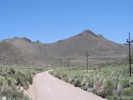
| Up this morning at the crack of dawn. | |||||||||
|
Other articles:
|
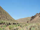
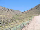
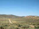
Drove up Lee Vining Canyon in the strong early morning light of another pretty day. | ||||||||
|
Locations:
Harvey Monroe Hall Natural Area.
|
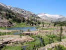
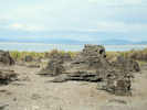
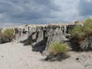
From the Sawmill Campground trailhead, I walked into the Harvey Monroe Hall Research Natural Area. On the edge of this RNA was Timberline Station of the Carnegie Institution. | ||||||||
|
Locations:
Lee Vining Canyon (Upper).
|
The crossing of the old road and Lee Vining Creek must be fairly near the locality used by Scott D. White in August 1997. | ||||||||
| The boundary of the RNA is signed, and no camping is permitted inside. I presume this is also the area known as Slate Creek Basin or Slate Creek Valley. | |||||||||
| The cabin and work shed still stands at the research station still stands. It doesnt look like anyone is currently doing research here. | |||||||||
| The former garden can be found. | |||||||||
|
Locations:
Slate Creek.
|
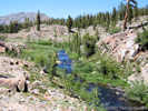
Presumably, this is Slate Creek. | ||||||||
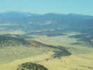
| From a little farther up the Saddlebag Lake Road, there was a good view of the Slate Creek Basin. | |||||||||
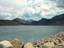
| Saddlebag Lake seemed to be very low, compared to how it has looked in previous years. | |||||||||
|
|
Wednesday, August 1, 2007 | ||||||||
| Pothole Dome | |||||||||
|
Other articles:
Locations:
Pothole Dome.
|
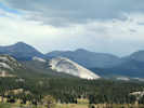
I climbed up on Pothole Dome. My primary purpose in doing this was to see what was up there, and to cross it off my list. There were nice views of Tuolumne Meadows, but I didn't find a pothole that I though was worthy of the name Pothole Dome. | ||||||||
|
Other articles:
Locations:
Lembert Dome.
|
There was a dramatic view to the east of Lembert Dome in the sun, with a cloudy, rainy Mount Dana in the background. | ||||||||
|
Other articles:
Locations:
Tuolumne Meadows.
|
|||||||||
|
Other articles:
|
Nunatak Nature Trail A nunatak is an isolated knob or peak of bedrock that projects prominently above the surface of a glacier and is surrounded by glacier ice. The word is derived from the Eskimo for "lonely peak." | ||||||||
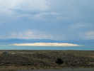 Paoha Island on a rainy Summer afternoon. Paoha Island on a rainy Summer afternoon.
|
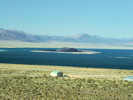
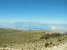
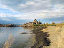
At the Vista Point I was treated to a nice view of Paoha Island and the Mono Craters with the sun shining through the rain clouds. | ||||||||
|
Other articles:
Locations:
Old Marina.
|
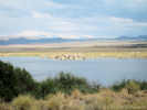
Drove to the Old Marina, latitude: 37.0980593°, longitude: -119.108357°, UTM: 11S 314889 4205525 1950 m. This location is annotated as "boat ramp" on some editions of the Lee Vining USGS 7.5" quadrangle. | ||||||||
|
Locations:
Old Marina.
|
This is the appearance of the shoreline at the Old Marina, phot taken from the boat dock. | ||||||||
 Dried collection of Alkali Muhley, my collection no. 490. Dried collection of Alkali Muhley, my collection no. 490.
|
490 | Muhlenbergia asperifolia, on the shore of Mono Lake. | |||||||
| 491 |
Amphiscirpus nevadensis (S. Watson) Oteng-Yeb. Nevada Bulrush. Coll. No. 491, 10 Apr 2012, characters observed while keying: Herb terrestrial though growing on shore of Mono Lake; Stem leafless, to 30-40 cm; Leaves basal, veination parallel; Ligule definitely not ciliate (possibly glabrous, which would lead one toward Schoenoplectus); Infloresence bract 2-3 cm; Infloresence 1-6 spikelets; Spikelets 10-20 mm, not flat; Flowers spiraled (not 2-ranked); Floral bract 1, 4-5 mm, shiny, 1 prominent vein (many obscure veins), tip acute (not notched); Flowers bisexual; Perianth 0; Perigynum 0; Pistils 1 per flower; Stigma 2; Stamens 3; Fruit an achene, not enclosed in perigynum, 2 sided, papillate, not ribbed, face next to spikelet axis. | ||||||||
| Collection 492 turned out to be a mixed collection of Eriogonum brachyanthum, with one individual of E. deflexum var. nevadense. | |||||||||
|
Other articles:
|
492.1 |
Eriogonum brachyanthum Coville. Short-Flower Buckwheat.
Coll. No. 492.1, 10 Apr 2012, characters observed while keying: Annual; Stem glabrous above the basal rosette; Leaves basal, blade rounded, tomentose; Involucres 2 mm (long for E. brachyanthum), ribbed, not at tips of slender branchlets (at nodes along slender branches); Flowers (very) sparsely glandular. This collection has larger involucres and flowers than my collections 509 and 519. Both of them were made on the west side of Pumice Valley, and away from Mono Lake. The involucres are 2 mm, slightly too large for E. brachyanthum, but still only 2/3 of the minimum size for E. davidsonii. Also, I don't see any of the reddish color I see in E. davidsonii. | |||||||
 Collection No. 492.2, Eriogonum deflexum var. nevadense Collection No. 492.2, Eriogonum deflexum var. nevadense
 Collection No. 492.2, Eriogonum deflexum var. nevadense Collection No. 492.2, Eriogonum deflexum var. nevadense
|
492.2 |
Eriogonum deflexum var. nevadense
Coll. No. 492.2, 29 March 2012, characters observed while keying: Annual; Stem glabrous, not inflated; Leaves ±basal, definitely not more than half-way up main stem; Blades tomentose; Involucre 1 mm, smooth (not ribbed), with reflexed peduncles 1-3 mm.; Infloresence not of many horizontal tiers, glabrous, (not widely) bell-shaped, Flowers white to pink; Perianth lobe outer lobe bases truncate (not cordate). Distinguished from var. deflexum because the perianth lobe bases are truncate rather than cordate. | |||||||
|
Other articles:
|
493 |
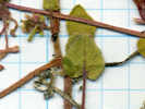
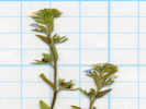
Bassia hyssopifolia (Pall.) Kuntze. Bassia. Old Marina, Mono County, California. On the western shore of Mono Lake, 2 km northeast of the U. S. Forest Service Visitor Center. 37.9806°N, 119.1084°W. WGS 1984. Elev. 1950 m. Coll. No. 493, 12 Apr 2012, characters observed: Annual, to 25 cm., hairs simple; Stem single erect, or branched at base 90° and ascending, not jointed or fleshy, nodes without spines, hairy; Leaves alternate, well-developed, without stipules, well-developed, 7 mm., lanceolate, entire, weakly fleshy, veins obscure, hairs appressed, proximal narrowed at base, distal not clasping, hairs appressed; Inflorescence in axillary clusters; Flowers with calyx, bisexual, no tubercules, hooks, or appendages visible; Calyx, lobes 5, hairy1, not bristly or spine-tipped, little red things among hairs that could be developing tuberucles or hooks1; Petals 0; Styles, 2; Stamens 5; Fruit, unknown, not developed; Seed, unknown, not developed; | |||||||
 Collection No. 494, Castilleja minor minor Collection No. 494, Castilleja minor minor
 Collection No. 494, Castilleja minor minor Collection No. 494, Castilleja minor minor
|
494 | Castilleja minor ssp. minor | |||||||
 Collection No. 495, Solidago spectabilis Collection No. 495, Solidago spectabilis
|
495 | Solidago spectabilis | |||||||
| Notes show Sarcobatus was seen here. | |||||||||
| Drove south across Lee Vining Creek to South Tufa | |||||||||
|
Other articles:
Locations:
Rush Creek.
|
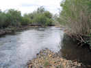
The arroyo of Rush Creek above Test Station Road is fairly narrow. | ||||||||
|
Other articles:
Locations:
Rush Creek.
|
The arroyo width downstream is a little more wide. | ||||||||
| Took the tour, | |||||||||
|
Locations:
South Tufa Area.
|
Tufa demonstration | ||||||||
|
Other articles:
Locations:
South Tufa Area.
|
Tufa in afternoon sunlight | ||||||||
|
Locations:
Mono Craters.
|
Mono Craters in afternoon sunlight | ||||||||
|
Other articles:
Locations:
Navy Beach.
|
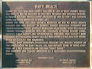
Stopped by the historical plaque for Navy Beach. | ||||||||
|
|
Thursday, August 2, 2007 | ||||||||
| Drove south, | |||||||||
|
Other articles:
Locations:
Farrington Ranch.
|
Farrington Ranch | ||||||||
|
Other articles:
Locations:
Reversed Peak.
|
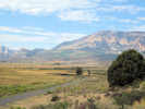
This location also afforded a view of Reversed Peak and San Joaquin Mountain in the distance. | ||||||||
|
Locations: Bohler Canyon. |
Drove up Bohler Canyon | ||||||||
|
Other articles:
|
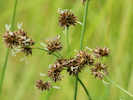
Stopped beside small creek: 11S 0312946 4196747 2197 m (37.900933, -119.127283) | ||||||||
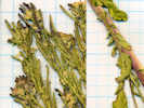
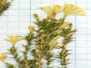
 Stephanomeria exigua ssp. exigua, Coll. No. 496 Stephanomeria exigua ssp. exigua, Coll. No. 496
 Collection No. 496, Stephanomeria exigua ssp. exigua Collection No. 496, Stephanomeria exigua ssp. exigua
 Collection No. 496, Stephanomeria exigua ssp. exigua Collection No. 496, Stephanomeria exigua ssp. exigua
|
496 | Stephanomeria exigua ssp. exigua in open places with sand and gravel with Artemisia tridentata. | |||||||
|
Other articles:
|
497 |
Juncus macrandrus Coville. Long-Anther Rush.
Bohler Canyon, Mono County, California. Along the dirt road on the south side of Bohler Canyon, 1.8 mi (3.0 km) by air west of US Highway 395. 37.9011°N, 119.1274°W. WGS 1984. Coll. No. 497, 12 Apr 2012, characters observed: Perennial, to 65 cm., terrestrial plant of wet places; Stems >1; Leaves basal and cauline, ligule 0, iris-like, flat, oriented with edge toward stem; Inflorescence spikes in head-like clusters, > 5, appearing terminal, not flat, bracts flat; Spikelets spirally arranged (not clearly 2-ranked); Spikelet has one bristle, two bractlets, four sepals; Perianth bristles 3.5mm Bracts 3-4 mm, not distinctly outcurved; Stamens 6, filaments 0.8 mm. + anthers 1.8 mm. = 2.6 mm.; Anthers > filaments; Fruit 2 mm x 1 mm wide, 3-sided, abruptly narrowed to beak, < perianth; Style 1 mm.; Seeds 5-8(+?). | |||||||
|
Other articles:
|
498 |
Bohler Canyon, Mono County, California. Along the dirt road on the south side of Bohler Canyon, 1.8 mi (3.0 km) by air west of US Highway 395. 37.9011°N, 119.1274°W. WGS 1984. Coll. No. 498, 2 Aug 2007, characters observed: Perennial herb, to 40 cm.; Stem, becoming hairy distally, but never strigose; Leaves, basal and cauline, alternate, reduced above, lower leaf petiole 80 mm. + blade 70 mm. × 6 mm. wide, length 11.5 × width, lanceolate, glabrous, margins minutely dentate; Inflorescence, 3-13 heads (3,4,8,13 observed); Heads, flowers of two kinds; Peduncles, hairy, eglandular; Phyllaries in 2+ series, slightly overlapping, unequal, inner > outer, outer tip obtuse, ±herbaceous, margins scarious; Receptacles epaleate; Pappus of bristles, single series, #25-30, cylindric, short plumose; Rays, conspicuous, 13 mm., much exceeding disc flowers, lavender; Disc flower, style present. | |||||||
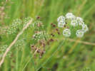 Collection No. 499, Cicuta maculata var. angustifolia Collection No. 499, Cicuta maculata var. angustifolia
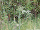 Collection No. 499, Cicuta maculata var. angustifolia Collection No. 499, Cicuta maculata var. angustifolia
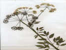 Collection No. 499, Cicuta maculata var. angustifolia Collection No. 499, Cicuta maculata var. angustifolia
|
499 | Cicuta maculata L. var. angustifolia Hook. Spotted Water Hemlock. | |||||||
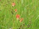 Collection No. 500, Castilleja miniata Collection No. 500, Castilleja miniata
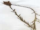 Collection No. 500, Castilleja miniata Collection No. 500, Castilleja miniata
|
500 | Castilleja miniata Hook. Giant Red Indian Paintbrush. | |||||||
 Collection No. 501 Collection No. 501
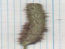 So, are there short awns? And what's with the truncate(?) glumes? So, are there short awns? And what's with the truncate(?) glumes?
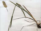 Collection No. 501, Phleum pratense L. Timothy. Collection No. 501, Phleum pratense L. Timothy.
|
501 |
Well, this is embarassing. When I collected it, I was sure this was Alopecurus aequalis Sobol. Short-Awn Foxtail. However it has no awns. So now (September 2011), I think it is:
Phleum pratense L. Cultivated Timothy. Native to Eurasia and widely cultivated for forage, hay, etc. It would seem to me that the truncate glumes would be a weird enough character to use in a key. | |||||||
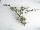 Coll. No. 502, Prunus andersonii Coll. No. 502, Prunus andersonii
|
502 | Prunus andersonii with fruit. | |||||||
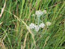 Achillea millefolium, Collection No. 503 Achillea millefolium, Collection No. 503
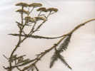 Collection No. 503, Achillea millefolium Collection No. 503, Achillea millefolium
|
503 | Achillea millifolia | |||||||
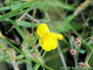 Collection No. 505 Collection No. 505
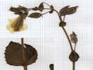 Collection No. 504, Erythranthe guttata Collection No. 504, Erythranthe guttata
|
504 | Mimulus guttatus | |||||||
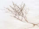 Collection No. 505, Gaytophytum diffusum var. parviflorum Collection No. 505, Gaytophytum diffusum var. parviflorum
|
505 | Gayophytum diffusum var. parviflorum | |||||||
|
Other articles:
|
506 |
Cardamine breweri S. Watson. Brewer's Bittercress.
Bohler Canyon, Mono County, California. Wet meadow along the dirt road on the south side of Bohler Canyon, 1.8 mi (3.0 km) by air west of US Highway 395. 37.9011°N, 119.1275°W. WGS 1984. Sterile collection. Same as my collection #875. | |||||||
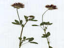 Collection No. 507, Trifolium wormskioldii Collection No. 507, Trifolium wormskioldii
|
507 |
Trifolium wormskioldii Lehm. Cows Clover.
Bohler Canyon, Mono County, California. Wet meadow along the dirt road on the south side of Bohler Canyon, 1.8 mi (3.0 km) by air west of US Highway 395. 37.9011°N, 119.1275°W. WGS 1984. Coll. No. 507, 2 Aug 2007, characters observed: Herbaceous perennial, to 40 cm.; Roots and rhizomes unknown; Stem ascending; Leaves, petiole to 40 mm., palmately compound; Leaflets 3, not gland dotted, toothed-serrate as extensions of veins, tip acute; Involucre, conspicuous, when pressed hiding only bases of flowers, fused 2 mm. + free 3.5 mm., tip acute, Calyx not inflated in fruit; Sepals fused ≥½, tube = lobes, glabrous; Flower bilateral, 12 mm.; Corolla not inflated in fruit. | |||||||
|
Other articles:
|
508 |
Carex nebrascensis Dewey. Nebraska Sedge.
Bohler Canyon, Mono County, California. Wet meadow along the dirt road on the south side of Bohler Canyon, 1.8 mi (3.0 km) by air west of US Highway 395. 37.9011°N, 119.1274°W. WGS 1984. Elev. 2197 m. Coll. No. 508, 2 Aug 2007, characters observed: Perennial, herbaceous, to 50 cm., glabrous throughout; Inflorescence, ≥2 spikelets, lowest bract sheathless (Sect. Phacocystis per Taylor, 2010), pistillate and staminate flowers on same stem, terminal spikelet staminate (Group 8 per TJM2); Spikelets, 2 or more on each culm, lateral spikelets pedunculate, 30 mm. × 5 mm. wide, length 6× width; Perigynum, body 1.8 mm. + beak 0.3 mm. = 2.1 mm., walls tough, faces veined, but beak not as clearly notched as illustrated in TJM2, teeth minutely hairy; Stigmas 2. | |||||||
|
Other articles:
|
509 | Eriogonum brachyanthum, annual with very small sessile involucres, glabrous stems and tepals. | |||||||
|
Other articles:
Locations:
Bohler Canyon.
|
A little further up the creek, still no paddle. 11S 0312836 4196767 2201 m, 37.900939,-119.129777 | ||||||||
|
Other articles:
|
|||||||||
|
Other articles:
|
510 | Asteraceae, in grasses and sedges at creek side. | |||||||
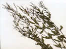 Collection No. 511, Epilobium ciliatum var. ciliatum Collection No. 511, Epilobium ciliatum var. ciliatum
|
511 | Epilobium ciliatum var. ciliatum | |||||||
|
Other articles:
|
512 | Verbascum thapsus | |||||||
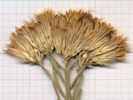 Collection No. 513, Ericameria nauseosa var. hololeuca Collection No. 513, Ericameria nauseosa var. hololeuca
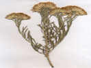 Collection No. 513, Ericameria nauseosa var. hololeuca Collection No. 513, Ericameria nauseosa var. hololeuca
|
513 | Ericameria nauseosa var. hololeuca | |||||||
|
Other articles:
Letters:
Thursday, April 10, 2014.
|
514 | Agrostis stolonifera L. -- ? | |||||||
|
Other articles:
|
515 |
Juncus mexicanus Willd. Mexican Rush.
Bohler Canyon, Mono County, California. Creekside in a wet meadow along the creek in Bohler Canyon, about 2.0 mi (3.1 km) by air west of US Highway 395. 37.9009°N, 119.1298°W. WGS 1984. Elev. 2201 m. Coll. No. 515, 2 Aug 2007, characters observed: Perennial, from long robust creeping rhizomes, terrestrial plant of wet places, to 50 cm.; Stem and leaves not differentiated, upper stem twisted; Inflorescence, bract, 7 cm., cylindric; Perianth appearing to be a single whorl, scale-like, 5 mm.; Flowers, bisexual; Stamens 6, some sometimes smaller or abortive(?); Pistil 1; Stigmas 3; Fruit, capsule, 3-angled; Seeds, 40-50. | |||||||
|
Other articles:
Locations:
Walker Creek (Lower).
|
The sign down by the creek says:
| ||||||||
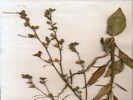 Collection No. 516, Nicotiana attenuata Collection No. 516, Nicotiana attenuata
|
516 | Nicotiana attenuata, only one seen, nearly finished blooming. | |||||||
| 517 | Oenothera elata ssp. hirsutissima, large, mostly finished blooming. | ||||||||
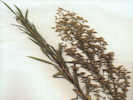 Collection No. 518, Erigeron canadensis Collection No. 518, Erigeron canadensis
|
518 |
Erigeron canadensis (L.) Cronquist. Canadian Horseweed.
Walker Creek (Lower), Mono County, California. Lower Walker Creek at the transition from Bloody Canyon to Pumice Valley, just below the aqueduct and Forest Road 01N17 Farrington Siphon, on the north side of Walker Creek. 37.895°N, 119.1226°W. WGS 1984. Elev. 2173 m. Also collected here: Eriogonum brachyanthum, and Nicotiana attenuata. Coll. No. 518, 2 Aug 2007, characters observed while keying: Annual, to 70 cm.; Leaves, alternate, lanceolate, to 60 mm. × 6 mm.; Inflorescence, panicle-like; Heads, many, inconspicuously radiate (i.e., two kinds of flowers, some flowers strap-shaped, but not obvious unless examined closely); Phyllaries, weakly graduated, with 1 central vein turning red-brown when dry; Receptacle epaleate; Flowers, rays: 0.7 mm. (measured from opening of tube to tip of lobe[s]), pistillate, white, disc: yellow, 4-lobed; Pappus, well-developed bristles. | |||||||
|
Other articles:
|
519 | Eriogonum brachyanthum | |||||||
|
Other articles:
Locations:
Walker Lake.
|
|||||||||
| Lower Parker Creek in shaded rose thicket alongside creek: 11S 0313240 4193657 2198 m, above aqueduct and below locked gate. | |||||||||
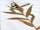 Collection No. 520, Ruscaceae Maianthemum stellatum Collection No. 520, Ruscaceae Maianthemum stellatum
|
520 | Maianthemum stellatum (L.) Link. (Syn: Smilacina stellata (L.) Desf. ) Starry False Lily of the Valley. | |||||||
|
Other articles:
|
521 |
Scirpus microcarpus J. Presl & C. Presl. Panicled Rush.
Parker Creek, Mono County, California. Lower Parker Creek, 0.3 mi (0.5 km) above the aqueduct and below the locked gate, in rose thicket alongside creek. 37.8728°N, 119.1242°W. WGS 1984. Elev. 2198 m. Coll. No. 521, 2 Aug 2007, characters observed: Perennial, to 60 cm.; Leaves, cauline present; Inflorescence, terminal; Spikelets, ±30 flowers, not flat, in head-like clusters; Bracts, spiraled? (not 2-ranked); Flower, bisexual, not enclosed in a sac-like structure; Perianth bristles curved around fruit. | |||||||
|
Other articles:
|
Pumice Valley from the Parker Lake trailhead. | ||||||||
|
Other articles:
|
The valley in the foreground is the Parker Creek drainage. The long low ridge in the right middleground is the glacial moraine on the south side of Bloody Canyon, and the mountain in the background is Mount Gibbs. | ||||||||
|
Other articles:
Locations:
Parker Creek.
|
Photograph looks across Parker Creek (in the trees) to Williams Butte. The dead vegetation in the foreground lines an irrigation ditch, which appears to be unused. Negit Island can be seen in Mono Lake at right distance, about to receive a rain shower. | ||||||||
|
Locations:
Rush Creek.
|
Rush Creek below Grant Lake Dam: 11S 0314852 4193243 2157 m | ||||||||
|
Locations:
Rush Creek.
|
|||||||||
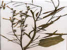 Collection No. 522, Nicotiana attenuata Collection No. 522, Nicotiana attenuata
|
522 | Nicotiana attenuata | |||||||
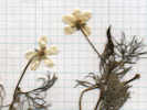 Collection No. 523, Ranunculus aquatilis var. diffusus Collection No. 523, Ranunculus aquatilis var. diffusus
|
523 |
Ranunculus aquatilis L. var. diffusus With. Threadleaf Crowfoot. Rush Creek, Mono County, California. Rush Creek below the Grant Lake dam, where the Rush Creek return ditch joins the former course of Rush Creek. 37.8698°N, 119.1056°W. WGS 1984. Elev. 2157 m. | |||||||
|
Other articles:
|
524 |
Potentilla biennis Greene. Biennial Cinquefoil. Very distinctive flowers, reduced petals in a cup. Not recognized until I collected this same plant near Murphy Spring in the Bodie Hills. | |||||||
|
Locations:
Grant Lake.
|
Discovered that a road crosses the Grant Lake dam on the way to the Rush Creek return ditch. | ||||||||
|
Other articles:
Locations:
Rush Creek.
|
|||||||||
|
Locations:
Rush Creek.
|
Saw this sign along the Rush Creek return ditch:
| ||||||||
|
Locations:
Rush Creek.
|
The Rush Creek returns water to Rush Creek from the aqueduct. | ||||||||
|
Other articles:
|
I stopped at the Grave of the Unknown Prospector to document this location.
It seems to me, though, that before Caltrans rebuilt the intersection of US Highway 395 and California Highway 120, the memorial at this site was the Grave of the Unknown Fisherman.
| ||||||||
|
Locations:
Navy Beach.
|
|||||||||
|
Other articles:
Locations:
Navy Beach.
|
| ||||||||
|
Other articles:
|
Beach north of Panum Crater: 11S 0320770 4201496 1956 m | ||||||||
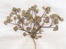 Collection No. 525, Psathyrotes annua Collection No. 525, Psathyrotes annua
|
525 | Psathyrotes annua (Nutt.) A. Gray. Annual Psathyrotes, in sand on shore of Mono Lake. | |||||||
|
Other articles:
Locations:
Rush Creek.
|
| ||||||||
|
Other articles:
|
Road crossing of Rush Creek: 11S 0318724 4200941 | ||||||||
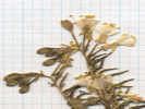 Collection No. 526, Camissonia boothii ssp. boothii Collection No. 526, Camissonia boothii ssp. boothii
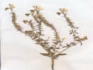 Collection No. 526, Camissonia boothii ssp. boothii Collection No. 526, Camissonia boothii ssp. boothii
|
526 |
Camissonia boothii ssp. boothii. Ambiguous as to subspecies, rosette present at fruit, hairs not strigose, maybe spreading (or tomentose), bracts leaf-like, conspicuous, petals white, open in daytime, fruit <1mm at base, perhaps slightly enlarged, but definitely tapering to the tip. Eremothera b. ssp. b in Taylor (2010). | |||||||
|
|
Friday, August 3, 2007 | ||||||||
|
Other articles:
Locations:
Old Marina.
Tioga Lodge.
|
At the Mono Lake Marina | ||||||||
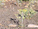 Mentzelia laevicaulis at the Old Marina Mentzelia laevicaulis at the Old Marina
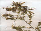 Collection No. 527, Mentzelia laevicaulis Collection No. 527, Mentzelia laevicaulis
|
527 | Mentzelia laevicaulis | |||||||
| Waited for coffee | |||||||||
| Warren Canyon | |||||||||
|
Other articles:
Locations:
Warren Canyon.
|
|||||||||
| Walked up the canyon | |||||||||
|
Other articles:
Locations:
Warren Canyon.
|
View of the meadow | ||||||||
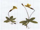 Collection No. 528, Erythranthe primuloides Collection No. 528, Erythranthe primuloides
|
528 | Mimulus primuloides, little monkey flower. | |||||||
|
Other articles:
|
|||||||||
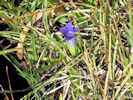 Coll. No. 529, Gentianopsis holopetala Coll. No. 529, Gentianopsis holopetala
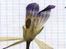 Collection No. 529, Gentianopsis holopetala Collection No. 529, Gentianopsis holopetala
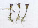 Collection No. 529, Gentianopsis holopetala Collection No. 529, Gentianopsis holopetala
|
529 | Gentianopsis holopetala | |||||||
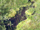 Fairy garden of bryophytes, rushes, willows and gentians. Fairy garden of bryophytes, rushes, willows and gentians.
|
|||||||||
| returned to lower meadow | |||||||||
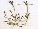 Collection No. 530, Gentianopsis holopetala Collection No. 530, Gentianopsis holopetala
|
530 | Gentianopsis holopetala | |||||||
| Drove home | |||||||||
|
Literature Cited:
|
Palmer's Arizona CollectionsReviewed McVaugh's article on the whereabouts of Edward Palmer in 1869, 1877, and 1878. The article has only one oblique reference to Palmer's whereabouts in 1870, in the following footnote, " and there is some confusion with Palmer's trip of the following year, 1870, when he was again on the Colorado River and at Yuma in August " | ||||||||
|
Literature Cited:
Locations: Littlefield. Mokiak Pass. Mount Trumbull. Saint George. |
As to Palmer's travels in 1877, McVaugh's acticle lists the following:
From January until late in June, Palmer made his headquarters at Saint George, Utah, during this time traveling out to point of interest in nearby Utah, Arizona, and Nevada. April ?13-25. Trip from St. George to St. Thomas, Nevada, and return, passing through the corner of Arizona both coming and going. Collections were made at Beaver Dam (now Littlefield), on the Virgin River. According to Safford, Palmer also made collections at a place called Mesquite Flat, 12 miles from Beaver Dam. April 27-May 4. Trip from St. George to Mokiak Pass and the Juniper Mountains (or Cedar Ridges), Arizona. None of these places appears on any map at my disposal, but in a letter to Engelmann (May 5, 1877) Palmer says he has just returned from "the broaken mountains 75 miles E. of S. from St. George and not far from the Colorado River." Professor Walter P. Cottam of the University of Utah kindly informs me that Mokiak Pass lies on the road to Wolf Hole, about 40 miles south of St. George, and that the term "Juniper Mountains: in this case probably refers to the wooded ridges along Mokiak Canyon. May ?29-June 4. Second trip to Mokiak Pass and the Juniper Mountains. June ?7-15. Trip from St. George to Mt. Trumbull, Arizona, and return. Palmer's route to Mt. Trumbull is unknown, but doubtless lay along the old Mormon wagon road down the Hurricane ledge, the so called Temple Road (Barnes, Will C., Arizona Place Names, p. 440). Leaving St. George on June 22nd, Palmer went by easy stages to Salt Lake City, collecting plants and archeological material at Red Creek (Paragonah) and Beaver City (Beaver) and from the surrounding mountains. The Arizona collection of 1877, according to Gray's list, comprised 124 numbers, of which 71 were from Mokiak Pass, 27 from Mount Trumbull, and 26 from Beaver Dam. The bulk of the 1877 collection, which comprised a total of 502 numbers (not including duplicate and supplementary numbers) originated in Utah. | ||||||||
|
Locations: Mokiak Pass. Quail Hill. |
At the Earth Sciences Library, I checked the Wolf Hole Mountain East, Arizona 7.5' quadrangle (1979). Wolf Hole (site) is at the bottom of this map in Wolf Hole Valley and near Wolf Hole Lake. Mount Trumbull is about 28 miles south by road from Wolf Hole.
Saint George would be about 28 miles north of Wolf Hole by road. Quail Hill is the only pass between Saint George on the north, and Wolf Hole Valley on the south. It would therefore seem likely that the location now known as Quail Hill is the location formerly known as Mokiak Pass. | ||||||||
|
[Previous Page]
[Next Page]
Go to page: [1800s] [1900s] [1910s] [1920s] [1930s] [1940s] [1950s] [1960s] [1970s] [1980s] [1990] [1991] [1992] [1993] [1994] [1995] [1996] [1997] [1998] [1999] [2000] [2001] [2002] [2003] [2004] [2005] [2006] [2007] [2008] [2009] [2010] [2011] [2012] [2013] [2014] [2015] [2016] [2017] [2018] [2019] [2020] [2021] [2022] [2023] [2024] [A] | |||||||||
| If you have a question or a comment you may write to me at: tas4@schweich.com I sometimes post interesting questions in my FAQ, but I never disclose your full name or address. |
Date and time this article was prepared: 4/27/2024 3:24:16 PM |
||||||||