Eastern Mojave Vegetation
Tom Schweich
|
Eastern Mojave Vegetation
| Field Notes (Continued) |
|
Tom Schweich |

Topics in this Article: 1800s 1900s 1910s 1920s 1930s 1940s 1950s 1960s 1970s 1980s 1990 1991 1992 1993 1995 1996 1997 1998 1999 2000 2001 2002 2003 2004 2005 2006 2007 2008 2008 Tour de Swertia albomarginata Mono Lake, August 2008 2009 2010 2011 2012 2013 2014 2015 2016 2017 2018 2019 2020 2021 2022 2023 2024 Contents Literature Cited |
When I first read the field notes of Annie Alexander and Louise Kellogg, I was fascinated by the descriptions they wrote about the places they went and the plants and animals they found there. By publishing my field notes on the Internet I hope to follow a little bit in their tradition. | ||||||||||||||||||||
|
|
1980s1980 | ||||||||||||||||||||
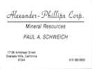 Alexander-Philips Corp. Alexander-Philips Corp.
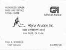 Paul Schweich, Alpha Aviation Paul Schweich, Alpha Aviation
 Paul Schweich, CFI Paul Schweich, CFI
|
| ||||||||||||||||||||
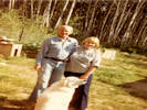 "Paul, Martha & TJ in Martha's yard," in Lydia's handwriting. "Paul, Martha & TJ in Martha's yard," in Lydia's handwriting.
|
Visit to Ester, Alaska | ||||||||||||||||||||
|
|
1980 Desert Studies Field Trip | ||||||||||||||||||||
|
Locations:
Kelso Dunes.
Wild Horse Canyon.
|
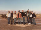
Day 0If I remember correctly, we were supposed to leave for the eastern Mojave on Saturday, and camp at the Barstow Syncline. However, the weather was bad, and we delayed our departure until very early Sunday morning. Henry was in charge of our van and he is in this photo (the tall person left of center). He must have had us stop at the Kelso Dunes on our way into Lobo Point, as this was one of my first photographs of the trip. | ||||||||||||||||||||
|
Other articles:
Locations:
Barber Mountain.
Hole-in-the-Wall.
Lobo Point.
Table Top.
|
Day 1 -- Barber Mountain
| ||||||||||||||||||||
|
Locations:
Wild Horse Mesa.
|
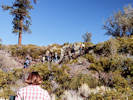
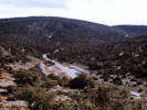
Day 2 -- Wild Horse MesaHike to Wild Horse Mesa. Our route was from Lobo Point camp west across Wild Horse Canyon, up the north face of the mesa, southwards to a rock shelter, then south and east to descend into Saddle Horse Canyon. After a stop at the Ceremonial Site, then we crossed northeast and up the wash back into camp.
| ||||||||||||||||||||
|
Other articles:
Locations:
Mitchell Caverns.
|
Day 3 -- Mitchell Caverns
| ||||||||||||||||||||
|
Literature Cited:
Other articles:
Locations: Hart. |
Day 4 -- Hart and Vontrigger Hills
| ||||||||||||||||||||
|
Other articles:
Locations:
Vontrigger Hills.
Wild Horse Canyon.
|
| ||||||||||||||||||||
|
Other articles:
Locations:
Barber Mountain.
Lobo Point.
Table Top.
|
Day 5 -- Lobo Point
| ||||||||||||||||||||
|
Locations:
Wild Horse Mesa.
|
Day 6 -- Going Home | ||||||||||||||||||||
|
Other articles:
Locations:
Redwood National Park.
|
Backpacking at Redwood National Park. | ||||||||||||||||||||
|
Other articles:
Locations:
Bumpass Hell.
Chaos Crags.
Lassen National Park.
Lassen Peak.
|
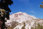
1980 Lassen Field Trip
| ||||||||||||||||||||
|
Other articles:
Locations:
Butte Lake Campground.
Cinder Cone.
|
Hike to top of Cinder Cone.
| ||||||||||||||||||||
|
Other articles:
Locations:
Subway Cave Lava Tubes.
|
Field trip stop at Subway Cave, near Old Station.
| ||||||||||||||||||||
|
Other articles:
Locations:
Badwater.
Dante's View.
Death Valley Dunes.
Devils Golf Course.
Emigrant Canyon.
Salt Creek.
Trail Canyon.
Wildrose Canyon.
Wildrose Charcoal Kilns.
Zabriskie Point.
|
Thanksgiving, 1980Merritt College field trip to Death Valley. Also known as the “Barf-Mobile” trip.
| ||||||||||||||||||||
|
Other articles:
Locations:
Kehoe Beach.
|
Point ReyesI'm pretty sure this was Kehoe Beach.
| ||||||||||||||||||||
|
|
1981 | ||||||||||||||||||||
|
|
January, 1981 | ||||||||||||||||||||
|
|
April, 1981 | ||||||||||||||||||||
|
Other articles:
Locations:
Golden Quail Claims.
|
1981 Desert Studies Field Trip | ||||||||||||||||||||
|
Locations:
Desert Tortoise Natural Area.
|
Stop at the Desert Tortoise Natural Area. | ||||||||||||||||||||
|
Other articles:
Locations:
Caruthers Canyon.
Giant Ledge Mine.
Rock Spring.
Watson Wash.
|
Rock Springs and Caruthers Canyon
| ||||||||||||||||||||
|
Other articles:
Locations:
Barber Mountain.
Gold Valley Mine.
Granite Well.
Lobo Point.
|
Barber Mountain: At some point in the week, maybe the first day, we climbed to the top of Barber Mountain. This might also be the day I visited the Gold Valley Mine.
| ||||||||||||||||||||
|
Other articles:
Locations:
Kelso Dunes.
|
Field trip stop at Kelso Dunes.
| ||||||||||||||||||||
|
Locations:
Burro Canyon.
Woods Mountains Guzzler.
|
Woods Mountains: field trip.
| ||||||||||||||||||||
|
|
August 1981 | ||||||||||||||||||||
|
Other articles:
Locations:
Big Obsidian Flow Trailhead.
Paulina Lake.
|
| ||||||||||||||||||||
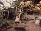 Rachel with giant sunflower. Rachel with giant sunflower.
|
|||||||||||||||||||||
|
Other articles:
|
1981 Death Valley Field TripOne of my many rainy trips to Death Valley.I think this was one on Roland Gangloff's trips. The first night was at Rhyolite, where we pitched camp in the oncoming rain, and went into Beatty for dinner. At the time, there was only the Exchange Club, that was casino, restaurant, bar, and Greyhound bus stop. There were packages piled up around the front door that had just come in on the bus. I remember having Thanksgiving dinner here, but not whether it was Wednesday or Thursday night. We took this station wagon through Titus Canyon, ripping a hole in the muffler at one point. Then camped in the rain at Mesquite Spring Campground. That day or the next day we visited Ubehebe Crater and Scotty's Castle. We also had a flat tire and discovered that we only had one of those new little donuts with a 35 mph speed restriction. The garage at Furnace Creek was open on Sunday, but we had to wait quite a while while they struggled to inflate some giant 4WD tires for the person ahead of us. With out tire fixed, we exited through Death Valley Junction and Baker for the drive home. | ||||||||||||||||||||
|
|
1982 | ||||||||||||||||||||
|
|
January | ||||||||||||||||||||
|
Other articles:
Locations:
Cima Volcanic Field.
Lobo Point.
|
1982 Desert Studies
| ||||||||||||||||||||
|
Other articles:
Locations:
Hackberry Mountain.
|
Trip to the fossil beds of Hackberry Mountain. These were on the north size of Hackberry Mountain in, what I now assume were, beds of the Winkler Formation.
| ||||||||||||||||||||
|
Other articles:
Locations:
Hole-in-the-Wall.
Lobo Point.
|
The camp at Lobo Point.
| ||||||||||||||||||||
|
Other articles:
Locations:
Keystone Canyon.
|
New York Mountains, Keystone Canyon.
| ||||||||||||||||||||
|
Other articles:
Locations:
Beecher Canyon.
Wild Horse Mesa.
|
Wild Horse Mesa:
| ||||||||||||||||||||
|
Locations:
Gold Valley Spring.
|
Hike to Gold Valley Spring. | ||||||||||||||||||||
|
|
July 1982Paul & Lydia visit Martha & Richard in Alaska. | ||||||||||||||||||||
|
|
August 14thRachel learning to ride a 2-wheel bike. Oakland. 8/14/1982. | ||||||||||||||||||||
|
|
December 23rd | ||||||||||||||||||||
|
|
December 24thChristmas Eve, 1982 | ||||||||||||||||||||
|
|
December 25thChristmas, 1982 | ||||||||||||||||||||
|
|
1983 | ||||||||||||||||||||
|
|
1983 Desert Studies Field Trip | ||||||||||||||||||||
|
Other articles:
Locations:
Globe Canyon (Upper).
Winklers Cabin.
|
| ||||||||||||||||||||
|
|
May 30, 1983Visit to Granada Hills. | ||||||||||||||||||||
|
|
1984 | ||||||||||||||||||||
|
Other articles:
Locations:
Lobo Point.
|
1984 Desert Studies Field Trip
| ||||||||||||||||||||
|
Other articles:
Locations:
Globe Canyon (Upper).
Providence Mine.
Summit Spring.
|
Globe Canyon / Summit Spring
| ||||||||||||||||||||
|
Other articles:
Locations:
Bonanza King Canyon.
|
Bonanza King
| ||||||||||||||||||||
|
Locations:
Fort Piute.
Piute Spring.
|
Piute Cyn / Fort Piute
| ||||||||||||||||||||
|
Locations:
Woods Mountains.
|
Woods Mountains
| ||||||||||||||||||||
|
|
May 1984Photo of Lydia and Paul taken for church directory. | ||||||||||||||||||||
|
|
May 1984Paul & Lydia camping at Chimney Peak Campground. There does not seem to be a campground by this name in 2020. There is a Chimney Creek campground in Tulare County at the head of Nine Mile Canyon. | ||||||||||||||||||||
|
|
June 3, 1984Some sort of event at the Laguna Hills Baptist Church. Uncle Ivan Bell was pastor there for a time, perhaps this was his retirement party. | ||||||||||||||||||||
|
|
JulyVisit to Oakland. | ||||||||||||||||||||
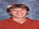 Matt Schweich, November 1984 Matt Schweich, November 1984
|
|||||||||||||||||||||
|
Other articles:
Locations:
Chris Wicht Camp.
Nelson Range.
Panamint Valley.
Stovepipe Wells.
Surprise Canyon.
Towne Pass.
|
1984 Saline Valley Field Trip
We planned to make one stop in Bakersfield at a grocery store, just because people might need to stock up. This was a good plan because person did not bring any food at all. Let's call him Ron. I think his explanation was that he had asked his roommate to get him some food, but his roommate did not go to the market, or something like that. Olancha would have been our place to turn off of US Highway 395 in the direction of Saline Valley. As we approached Olancha, it was starting to snow. We had dinner in Olancha, at the Ranch House Cafe. It continued to snow heavily while we ate dinner. We decided we would not try to drive into Saline Valley that night. There were a couple of motels in Olancha, but they were both totally dark, either full or not operating. We could not tell. We drove on to Lone Pine, where we stayed in the Lone Pine hotel. I think the women got the hotel rooms with a bath. Ron and I roomed together with a shower and bath down the hall. Thursday (Thanksgiving) morning we left for Saline Valley. The road good through Lee Flat, with the snow either melted or packed down. However, as the road got steeper, we started losing control of the van when the snow was about 6 inches deep. Of course, because it was a rental van, we did not have chain. We did not make it to the pass above Grapevine Canyon. As a group, we thought maybe we could go into Death Valley. So we drove back down to Highway 190. Ron was driving, and a little crazed because he needed credit from the class to ... ... do something ... maybe, graduate. He was going way too fast down Darwin Grade, So I had to tell him to slow down. He didn't take it well, and decided to drive 20 mph; kind of like an ass. So we went into and across Panamint Valley. It was cloudy but no rain. We drove past the past the Road Closed sign. It was starting to rain at Towne Pass. We started down the grade and it was raining really hard by the time we got to Emigrant Wash. I don't think there was any running water in Emigrant Wash. But then the road turns east across numerous washes. The first a little water, then the next wash a little more water, then a wash lot of water. Looking at the map now, we must have been really close to Stovepipe Wells. But we didn't know that then, and decided to turn back. There was a 5th wheel behind us who could not turn around at that spot. I have no idea what they ultimately did. Now what to do? Somehow, we decided to get gas and supplies and camp in Panamint Valley. So we drove to Trona. It was breezy, but otherwise sunny and bright. We bought gas and water and then headed back for Panamint Valley. We found a place to camp in Panamint Valley on Indian Ranch Road near Warm Sulphur Spring. This is where we spent Thursday night. Friday morning, it was still cloudy, especially to the north and east. So, we decided to stay here. I don't remember the process, but it seems that we made the decision as a group. Ron was desperate to go into Saline Valley, I think because he needed class credits. We had a discussion about keeping a journal and turning it in to get credit. We Walked up Surprise Canyon fan and saw there was a road from the south end of the fan. Then past Chris Wicht Camp, we hiked a mile or so up the canyon, past the narrow place where the road was washed out. Saturday, decided to try Death Valley. We packed up and got in the van. I'm not sure how we got there, because it was afternoon when we arrived at Stovepipe Wells. Perhaps we went up Wildrose Canyon to the charcoal ovens. Regardless, there were a lot of vacant campsites in the campground at Stovepipe Wells. The two black women and I decided we would go to the restaurant for dinner. I wish I could remember their names. They were both delightful company. One of them had just picked up the phrase "no problem." She was a City of Oakland social worker. But I learned it from her, and from then on, pretty much everything was no problem. An old guy was playing pedal steel guitar and singing really old time western songs, with two young guys for backup. He took quite an interest in us, as I expect we might have been an interesting sight. We talked about our trip, failure to get into Saline Valley, and what we did instead. His pedal steel playing and singing was really good, and he made repeated snide comments about his backups having no clue. A couple of us had the idea to sleep out in the sand dunes. It must be a popular thing for people to try, because there was a ranger waiting for us, who sent us back into the campground. Sunday morning, we went back to the restaurant for breakfast. After packing up, we drove home. I assume we went out of the south end of the valley, through Baker to Bakersfield and then up the San Joaquin Valley. As we neared Oakland, several passengers were asking to be dropped off at their house on the way into town. But we didn't do that. We went to my house first. Then we cleaned the van. People who left their car at my house were able to go home. Then I drove around Oakland taking people home. That way, I didn't get stuck cleaning out a dirty van on Monday morning. | ||||||||||||||||||||
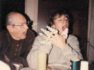 "Matt puts the icecream cones Rachel & Lydia decorated on his fingers & pretends he is going to eat them. Paul, also. December 25, 1984" "Matt puts the icecream cones Rachel & Lydia decorated on his fingers & pretends he is going to eat them. Paul, also. December 25, 1984"
|
Christmas, 1984 | ||||||||||||||||||||
|
|
1985 | ||||||||||||||||||||
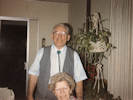 Bob and Vera Shaw Bob and Vera Shaw
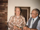 Paul and Bob. Paul and Bob.
|
“Vera & Bob Shaw when they visited us in January, 1985. Bob is 75 and Vera is 77 years of age” – Lydia Schweich “Paul & Bob Shaw. I read a book on photography which said it is better in a photo to have people doing something, rather than having them lined up as a firing squad. So that is why these are looking at the book. Granada Hills, CA. January, 1985.” &ndash Lydia Schweich | ||||||||||||||||||||
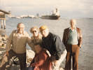 Post-lunch photo. Post-lunch photo.
|
“Ivan, Lois and Henry Keene, and Paul standing, and Olga sitting on the rocks, near Reuben's Restaurant, on Harbor Island, San Diego. Coronado Bridge in the background. February 1985” – Lydia Schweich | ||||||||||||||||||||
|
Other articles:
Locations:
Lobo Point.
|
1985 Desert Studies Field Trip
| ||||||||||||||||||||
|
(Barber Mtn) | |||||||||||||||||||||
|
Locations:
Rustler Canyon.
Woods Mountains.
|
Woods Mountains
| ||||||||||||||||||||
|
Locations:
Table Top.
|
Table Mountain
| ||||||||||||||||||||
|
Other articles:
Locations:
Caruthers Canyon.
|
Rock Spr? New York Mtns?
| ||||||||||||||||||||
|
Locations:
Winklers Cabin.
|
Winklers Cabin / Wild Horse Mesa | ||||||||||||||||||||
|
Other articles:
Locations:
Bonanza King Canyon.
|
Bonanza King Canyon
| ||||||||||||||||||||
|
Other articles:
Locations:
Lobo Point.
|
Group photo before leaving.
| ||||||||||||||||||||
|
Other articles:
Locations:
Mid Hills Campground.
Winklers Cabin.
|
May 24, 1985Lydia and Paul visit to the eastern Mojave.
| ||||||||||||||||||||
|
Other articles:
Locations:
Rock Spring.
|
Rock Springs. | ||||||||||||||||||||
|
|
Christmas 1985 | ||||||||||||||||||||
|
|
14-Feb-1986 | ||||||||||||||||||||
|
Other articles:
Locations:
Lobo Point.
Old Dad Mountain.
|
1986 Desert Studies Field Trip
| ||||||||||||||||||||
|
Locations:
Hole-in-the-Wall.
|
Barber ? | ||||||||||||||||||||
|
Other articles:
Locations:
Winklers Cabin.
|
Winklers
| ||||||||||||||||||||
|
Locations:
Woods Mountains.
|
South Woods Mountains
| ||||||||||||||||||||
|
Locations:
Woods Mountains.
|
Northeast Woods Mountains
| ||||||||||||||||||||
|
Locations:
Columbia Mountain.
|
Columbia Mountain | ||||||||||||||||||||
|
Locations:
Piute Spring.
|
Piute Canyon | ||||||||||||||||||||
|
Locations:
Mount Diablo.
|
Mother's Day, May 11, 1986We went for a nice walk on the handicapped accessible trail near the top of Mount Diablo. | ||||||||||||||||||||
|
Locations: Winklers Cabin. Letters:
Wednesday, June 12, 1985.
|
|||||||||||||||||||||
|
|
August, 1986 | ||||||||||||||||||||
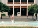 Rachel in front of the Flint Center Rachel in front of the Flint Center
|
I have a whole series of these photos dated August 1986, taken at the Flint Center of De Anza College. Perhaps Rachel and I were waiting to pick Jacob up from his camp at Camp Costanoan. | ||||||||||||||||||||
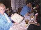 Lydia's birthday, 1986 Lydia's birthday, 1986
|
Lydia's Birthday at Lyon Avenue House in Oakland. | ||||||||||||||||||||
|
Other articles:
Locations:
Barber Mountain.
Lobo Point.
Wild Horse Canyon.
|
15 November 1986Visit to Lobo Point
| ||||||||||||||||||||
|
|
1987 | ||||||||||||||||||||
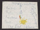 Rachel Run Rainbow Sun Rachel Run Rainbow Sun
|
|||||||||||||||||||||
|
|
1987 Desert Studies Field Trip | ||||||||||||||||||||
|
Literature Cited:
Other articles:
Locations: Barber Mountain. Bonanza King Canyon. Caruthers Canyon. Golden Quail Claims. Hole-in-the-Wall. Lobo Point. Wild Horse Mesa. Woods Mountains. |
| ||||||||||||||||||||
|
Other articles:
Locations:
Grand Canyon.
|
April, 1987, Grand Canyon
| ||||||||||||||||||||
|
Other articles:
Locations:
Wupatki National Monument.
|
A stop at the Wupatki National Monument Pueblo ruin | ||||||||||||||||||||
|
Locations:
Sunol Valley Regional Park.
|
May, 1987, Girl Scout Trip to Sunol Park
| ||||||||||||||||||||
|
|
October, 1987 | ||||||||||||||||||||
|
Other articles:
Locations:
Government Holes.
Olympus Mine.
Rock Spring.
Wild Horse Canyon.
|
Field trip to the eastern Mojave with my dad.
| ||||||||||||||||||||
|
Other articles:
Locations:
Afton Canyon.
|
Drove up Afton Canyon with my dad.
| ||||||||||||||||||||
|
|
1988 | ||||||||||||||||||||
|
|
1988 Desert Studies Field Trip | ||||||||||||||||||||
|
Other articles:
Locations:
Kelso Dunes.
|
Stopped at the Kelso Dunes on our way in. | ||||||||||||||||||||
|
Other articles:
Locations:
Hole-in-the-Wall.
Lobo Point.
|
| ||||||||||||||||||||
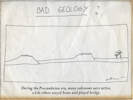 A cartoon that has occupied a prominent place on my bookshelves … A cartoon that has occupied a prominent place on my bookshelves …
 An oath I took after replacing the kitchen faucet. That of course knocked a lot of scale loose and I had to replace pipes to the washing machine. An oath I took after replacing the kitchen faucet. That of course knocked a lot of scale loose and I had to replace pipes to the washing machine.
|
An oath I took after doing some plumbing. | ||||||||||||||||||||
|
Locations:
Lobo Point.
|
October 24, 1988Camping at Lobo Point camp. | ||||||||||||||||||||
|
[Previous Page]
[Next Page]
Go to page: [1800s] [1900s] [1910s] [1920s] [1930s] [1940s] [1950s] [1960s] [1970s] [1980s] [1990] [1991] [1992] [1993] [1994] [1995] [1996] [1997] [1998] [1999] [2000] [2001] [2002] [2003] [2004] [2005] [2006] [2007] [2008] [2009] [2010] [2011] [2012] [2013] [2014] [2015] [2016] [2017] [2018] [2019] [2020] [2021] [2022] [2023] [2024] [A] | |||||||||||||||||||||
| If you have a question or a comment you may write to me at: tomas@schweich.com I sometimes post interesting questions in my FAQ, but I never disclose your full name or address. |
Date and time this article was prepared: 12/9/2024 7:28:58 PM |
||||||||||||||||||||