 Eastern Mojave Vegetation
Tom Schweich
 Eastern Mojave Vegetation
| Field Notes (Continued) |
|
Tom Schweich |

Topics in this Article: 1800s 1900s 1910s 1920s 1930s 1940s 1950s 1960s 1970s 1980s 1990 1991 1992 1993 1995 1996 1997 1998 1999 2000 2001 2002 2003 2004 2005 2006 2007 2008 2008 Tour de Swertia albomarginata Mono Lake, August 2008 2009 2010 2011 2012 2013 2014 2015 2016 2017 2018 2019 2020 2021 2022 2023 2024 Contents Literature Cited |
When I first read the field notes of Annie Alexander and Louise Kellogg, I was fascinated by the descriptions they wrote about the places they went and the plants and animals they found there. By publishing my field notes on the Internet I hope to follow a little bit in their tradition. | ||||||||||||||||||||||||||||||||||||||||||||||||||||||||||||||||||||||||||||||||||||||||||||||||||||||||||||||||||||||||||||||||||||||||||||||||||||||||||||||||||||||||||||||||||||||||||||||||||||||||||||||||||||||||||||||||||||||||||||||||||||||||||||||||||||||||||||||||||||||||||||||||||||||||||||||||||||||||||||||||||||||||||||||||||||||||||||||||||||||||||||||||||||||||||||||||||||||||||||||||||||||||||||||||||||||||||||||||||||||||||||||||||||||||||||||||||||||||||||||||||||||||||||||||||||||||||||||||||||||||||||||||||||||||||||||||||||||||||||||||||||||||||||||||||||||||||||||||||||||||||||||||||||||||||||||||||||||||||||||||||||||||||||||||||||||||||||||||||||||||||||||||||||||||||||||||||||||||||||||||||||||||||||||||||||||||||||||||||||||||||||||||||||||||||||||||||||||||||||||||||||||||||||||||||||||||||||||||||||||||||||||||||||||||||||||||||||||||||||||||||||||||||||||||||||||||||||||||||||||||||||||||||||||||||||||||||||||||||||||||||||||||||||||||||||||||||||
|
|
2010 | ||||||||||||||||||||||||||||||||||||||||||||||||||||||||||||||||||||||||||||||||||||||||||||||||||||||||||||||||||||||||||||||||||||||||||||||||||||||||||||||||||||||||||||||||||||||||||||||||||||||||||||||||||||||||||||||||||||||||||||||||||||||||||||||||||||||||||||||||||||||||||||||||||||||||||||||||||||||||||||||||||||||||||||||||||||||||||||||||||||||||||||||||||||||||||||||||||||||||||||||||||||||||||||||||||||||||||||||||||||||||||||||||||||||||||||||||||||||||||||||||||||||||||||||||||||||||||||||||||||||||||||||||||||||||||||||||||||||||||||||||||||||||||||||||||||||||||||||||||||||||||||||||||||||||||||||||||||||||||||||||||||||||||||||||||||||||||||||||||||||||||||||||||||||||||||||||||||||||||||||||||||||||||||||||||||||||||||||||||||||||||||||||||||||||||||||||||||||||||||||||||||||||||||||||||||||||||||||||||||||||||||||||||||||||||||||||||||||||||||||||||||||||||||||||||||||||||||||||||||||||||||||||||||||||||||||||||||||||||||||||||||||||||||||||||||||||||||
|
|
Thursday, April 21, 2010 | ||||||||||||||||||||||||||||||||||||||||||||||||||||||||||||||||||||||||||||||||||||||||||||||||||||||||||||||||||||||||||||||||||||||||||||||||||||||||||||||||||||||||||||||||||||||||||||||||||||||||||||||||||||||||||||||||||||||||||||||||||||||||||||||||||||||||||||||||||||||||||||||||||||||||||||||||||||||||||||||||||||||||||||||||||||||||||||||||||||||||||||||||||||||||||||||||||||||||||||||||||||||||||||||||||||||||||||||||||||||||||||||||||||||||||||||||||||||||||||||||||||||||||||||||||||||||||||||||||||||||||||||||||||||||||||||||||||||||||||||||||||||||||||||||||||||||||||||||||||||||||||||||||||||||||||||||||||||||||||||||||||||||||||||||||||||||||||||||||||||||||||||||||||||||||||||||||||||||||||||||||||||||||||||||||||||||||||||||||||||||||||||||||||||||||||||||||||||||||||||||||||||||||||||||||||||||||||||||||||||||||||||||||||||||||||||||||||||||||||||||||||||||||||||||||||||||||||||||||||||||||||||||||||||||||||||||||||||||||||||||||||||||||||||||||||||||||||
|
Other articles:
Locations:
Tehachapi.
|
|||||||||||||||||||||||||||||||||||||||||||||||||||||||||||||||||||||||||||||||||||||||||||||||||||||||||||||||||||||||||||||||||||||||||||||||||||||||||||||||||||||||||||||||||||||||||||||||||||||||||||||||||||||||||||||||||||||||||||||||||||||||||||||||||||||||||||||||||||||||||||||||||||||||||||||||||||||||||||||||||||||||||||||||||||||||||||||||||||||||||||||||||||||||||||||||||||||||||||||||||||||||||||||||||||||||||||||||||||||||||||||||||||||||||||||||||||||||||||||||||||||||||||||||||||||||||||||||||||||||||||||||||||||||||||||||||||||||||||||||||||||||||||||||||||||||||||||||||||||||||||||||||||||||||||||||||||||||||||||||||||||||||||||||||||||||||||||||||||||||||||||||||||||||||||||||||||||||||||||||||||||||||||||||||||||||||||||||||||||||||||||||||||||||||||||||||||||||||||||||||||||||||||||||||||||||||||||||||||||||||||||||||||||||||||||||||||||||||||||||||||||||||||||||||||||||||||||||||||||||||||||||||||||||||||||||||||||||||||||||||||||||||||||||||||||||||||||
|
Other articles:
|
Turn off from National Trails Highway "Old US Highway 66" to an unknown road. | ||||||||||||||||||||||||||||||||||||||||||||||||||||||||||||||||||||||||||||||||||||||||||||||||||||||||||||||||||||||||||||||||||||||||||||||||||||||||||||||||||||||||||||||||||||||||||||||||||||||||||||||||||||||||||||||||||||||||||||||||||||||||||||||||||||||||||||||||||||||||||||||||||||||||||||||||||||||||||||||||||||||||||||||||||||||||||||||||||||||||||||||||||||||||||||||||||||||||||||||||||||||||||||||||||||||||||||||||||||||||||||||||||||||||||||||||||||||||||||||||||||||||||||||||||||||||||||||||||||||||||||||||||||||||||||||||||||||||||||||||||||||||||||||||||||||||||||||||||||||||||||||||||||||||||||||||||||||||||||||||||||||||||||||||||||||||||||||||||||||||||||||||||||||||||||||||||||||||||||||||||||||||||||||||||||||||||||||||||||||||||||||||||||||||||||||||||||||||||||||||||||||||||||||||||||||||||||||||||||||||||||||||||||||||||||||||||||||||||||||||||||||||||||||||||||||||||||||||||||||||||||||||||||||||||||||||||||||||||||||||||||||||||||||||||||||||||||
|
Other articles:
|
|||||||||||||||||||||||||||||||||||||||||||||||||||||||||||||||||||||||||||||||||||||||||||||||||||||||||||||||||||||||||||||||||||||||||||||||||||||||||||||||||||||||||||||||||||||||||||||||||||||||||||||||||||||||||||||||||||||||||||||||||||||||||||||||||||||||||||||||||||||||||||||||||||||||||||||||||||||||||||||||||||||||||||||||||||||||||||||||||||||||||||||||||||||||||||||||||||||||||||||||||||||||||||||||||||||||||||||||||||||||||||||||||||||||||||||||||||||||||||||||||||||||||||||||||||||||||||||||||||||||||||||||||||||||||||||||||||||||||||||||||||||||||||||||||||||||||||||||||||||||||||||||||||||||||||||||||||||||||||||||||||||||||||||||||||||||||||||||||||||||||||||||||||||||||||||||||||||||||||||||||||||||||||||||||||||||||||||||||||||||||||||||||||||||||||||||||||||||||||||||||||||||||||||||||||||||||||||||||||||||||||||||||||||||||||||||||||||||||||||||||||||||||||||||||||||||||||||||||||||||||||||||||||||||||||||||||||||||||||||||||||||||||||||||||||||||||||||
|
Other articles:
|
|||||||||||||||||||||||||||||||||||||||||||||||||||||||||||||||||||||||||||||||||||||||||||||||||||||||||||||||||||||||||||||||||||||||||||||||||||||||||||||||||||||||||||||||||||||||||||||||||||||||||||||||||||||||||||||||||||||||||||||||||||||||||||||||||||||||||||||||||||||||||||||||||||||||||||||||||||||||||||||||||||||||||||||||||||||||||||||||||||||||||||||||||||||||||||||||||||||||||||||||||||||||||||||||||||||||||||||||||||||||||||||||||||||||||||||||||||||||||||||||||||||||||||||||||||||||||||||||||||||||||||||||||||||||||||||||||||||||||||||||||||||||||||||||||||||||||||||||||||||||||||||||||||||||||||||||||||||||||||||||||||||||||||||||||||||||||||||||||||||||||||||||||||||||||||||||||||||||||||||||||||||||||||||||||||||||||||||||||||||||||||||||||||||||||||||||||||||||||||||||||||||||||||||||||||||||||||||||||||||||||||||||||||||||||||||||||||||||||||||||||||||||||||||||||||||||||||||||||||||||||||||||||||||||||||||||||||||||||||||||||||||||||||||||||||||||||||||
|
Literature Cited:
Other articles:
|
The route through these little hills, as described in Reynolds & Miller (2010) is from north to south. I did it from south to north, so I went down this little canyon, If you're following the field trip guide, you'll come up the little canyon. | ||||||||||||||||||||||||||||||||||||||||||||||||||||||||||||||||||||||||||||||||||||||||||||||||||||||||||||||||||||||||||||||||||||||||||||||||||||||||||||||||||||||||||||||||||||||||||||||||||||||||||||||||||||||||||||||||||||||||||||||||||||||||||||||||||||||||||||||||||||||||||||||||||||||||||||||||||||||||||||||||||||||||||||||||||||||||||||||||||||||||||||||||||||||||||||||||||||||||||||||||||||||||||||||||||||||||||||||||||||||||||||||||||||||||||||||||||||||||||||||||||||||||||||||||||||||||||||||||||||||||||||||||||||||||||||||||||||||||||||||||||||||||||||||||||||||||||||||||||||||||||||||||||||||||||||||||||||||||||||||||||||||||||||||||||||||||||||||||||||||||||||||||||||||||||||||||||||||||||||||||||||||||||||||||||||||||||||||||||||||||||||||||||||||||||||||||||||||||||||||||||||||||||||||||||||||||||||||||||||||||||||||||||||||||||||||||||||||||||||||||||||||||||||||||||||||||||||||||||||||||||||||||||||||||||||||||||||||||||||||||||||||||||||||||||||||||||||
|
Other articles:
|
|||||||||||||||||||||||||||||||||||||||||||||||||||||||||||||||||||||||||||||||||||||||||||||||||||||||||||||||||||||||||||||||||||||||||||||||||||||||||||||||||||||||||||||||||||||||||||||||||||||||||||||||||||||||||||||||||||||||||||||||||||||||||||||||||||||||||||||||||||||||||||||||||||||||||||||||||||||||||||||||||||||||||||||||||||||||||||||||||||||||||||||||||||||||||||||||||||||||||||||||||||||||||||||||||||||||||||||||||||||||||||||||||||||||||||||||||||||||||||||||||||||||||||||||||||||||||||||||||||||||||||||||||||||||||||||||||||||||||||||||||||||||||||||||||||||||||||||||||||||||||||||||||||||||||||||||||||||||||||||||||||||||||||||||||||||||||||||||||||||||||||||||||||||||||||||||||||||||||||||||||||||||||||||||||||||||||||||||||||||||||||||||||||||||||||||||||||||||||||||||||||||||||||||||||||||||||||||||||||||||||||||||||||||||||||||||||||||||||||||||||||||||||||||||||||||||||||||||||||||||||||||||||||||||||||||||||||||||||||||||||||||||||||||||||||||||||||||
|
Other articles:
Locations:
Mojave River.
|
|||||||||||||||||||||||||||||||||||||||||||||||||||||||||||||||||||||||||||||||||||||||||||||||||||||||||||||||||||||||||||||||||||||||||||||||||||||||||||||||||||||||||||||||||||||||||||||||||||||||||||||||||||||||||||||||||||||||||||||||||||||||||||||||||||||||||||||||||||||||||||||||||||||||||||||||||||||||||||||||||||||||||||||||||||||||||||||||||||||||||||||||||||||||||||||||||||||||||||||||||||||||||||||||||||||||||||||||||||||||||||||||||||||||||||||||||||||||||||||||||||||||||||||||||||||||||||||||||||||||||||||||||||||||||||||||||||||||||||||||||||||||||||||||||||||||||||||||||||||||||||||||||||||||||||||||||||||||||||||||||||||||||||||||||||||||||||||||||||||||||||||||||||||||||||||||||||||||||||||||||||||||||||||||||||||||||||||||||||||||||||||||||||||||||||||||||||||||||||||||||||||||||||||||||||||||||||||||||||||||||||||||||||||||||||||||||||||||||||||||||||||||||||||||||||||||||||||||||||||||||||||||||||||||||||||||||||||||||||||||||||||||||||||||||||||||||||||
|
Other articles:
|
Road along UP tracks gives access to Stop P-3. | ||||||||||||||||||||||||||||||||||||||||||||||||||||||||||||||||||||||||||||||||||||||||||||||||||||||||||||||||||||||||||||||||||||||||||||||||||||||||||||||||||||||||||||||||||||||||||||||||||||||||||||||||||||||||||||||||||||||||||||||||||||||||||||||||||||||||||||||||||||||||||||||||||||||||||||||||||||||||||||||||||||||||||||||||||||||||||||||||||||||||||||||||||||||||||||||||||||||||||||||||||||||||||||||||||||||||||||||||||||||||||||||||||||||||||||||||||||||||||||||||||||||||||||||||||||||||||||||||||||||||||||||||||||||||||||||||||||||||||||||||||||||||||||||||||||||||||||||||||||||||||||||||||||||||||||||||||||||||||||||||||||||||||||||||||||||||||||||||||||||||||||||||||||||||||||||||||||||||||||||||||||||||||||||||||||||||||||||||||||||||||||||||||||||||||||||||||||||||||||||||||||||||||||||||||||||||||||||||||||||||||||||||||||||||||||||||||||||||||||||||||||||||||||||||||||||||||||||||||||||||||||||||||||||||||||||||||||||||||||||||||||||||||||||||||||||||||||
|
Other articles:
|
|||||||||||||||||||||||||||||||||||||||||||||||||||||||||||||||||||||||||||||||||||||||||||||||||||||||||||||||||||||||||||||||||||||||||||||||||||||||||||||||||||||||||||||||||||||||||||||||||||||||||||||||||||||||||||||||||||||||||||||||||||||||||||||||||||||||||||||||||||||||||||||||||||||||||||||||||||||||||||||||||||||||||||||||||||||||||||||||||||||||||||||||||||||||||||||||||||||||||||||||||||||||||||||||||||||||||||||||||||||||||||||||||||||||||||||||||||||||||||||||||||||||||||||||||||||||||||||||||||||||||||||||||||||||||||||||||||||||||||||||||||||||||||||||||||||||||||||||||||||||||||||||||||||||||||||||||||||||||||||||||||||||||||||||||||||||||||||||||||||||||||||||||||||||||||||||||||||||||||||||||||||||||||||||||||||||||||||||||||||||||||||||||||||||||||||||||||||||||||||||||||||||||||||||||||||||||||||||||||||||||||||||||||||||||||||||||||||||||||||||||||||||||||||||||||||||||||||||||||||||||||||||||||||||||||||||||||||||||||||||||||||||||||||||||||||||||||||
|
Other articles:
|
If you're following the route in reverse order, i.e., from south to north, it can be hard to find the route down off the bluff. There are three routes north. The westernmost dead ends at a fine viewpoint. The easternmost goes into the housing development. Take the middle route shown here. | ||||||||||||||||||||||||||||||||||||||||||||||||||||||||||||||||||||||||||||||||||||||||||||||||||||||||||||||||||||||||||||||||||||||||||||||||||||||||||||||||||||||||||||||||||||||||||||||||||||||||||||||||||||||||||||||||||||||||||||||||||||||||||||||||||||||||||||||||||||||||||||||||||||||||||||||||||||||||||||||||||||||||||||||||||||||||||||||||||||||||||||||||||||||||||||||||||||||||||||||||||||||||||||||||||||||||||||||||||||||||||||||||||||||||||||||||||||||||||||||||||||||||||||||||||||||||||||||||||||||||||||||||||||||||||||||||||||||||||||||||||||||||||||||||||||||||||||||||||||||||||||||||||||||||||||||||||||||||||||||||||||||||||||||||||||||||||||||||||||||||||||||||||||||||||||||||||||||||||||||||||||||||||||||||||||||||||||||||||||||||||||||||||||||||||||||||||||||||||||||||||||||||||||||||||||||||||||||||||||||||||||||||||||||||||||||||||||||||||||||||||||||||||||||||||||||||||||||||||||||||||||||||||||||||||||||||||||||||||||||||||||||||||||||||||||||||||||
|
Other articles:
Locations:
Mojave River.
|
|||||||||||||||||||||||||||||||||||||||||||||||||||||||||||||||||||||||||||||||||||||||||||||||||||||||||||||||||||||||||||||||||||||||||||||||||||||||||||||||||||||||||||||||||||||||||||||||||||||||||||||||||||||||||||||||||||||||||||||||||||||||||||||||||||||||||||||||||||||||||||||||||||||||||||||||||||||||||||||||||||||||||||||||||||||||||||||||||||||||||||||||||||||||||||||||||||||||||||||||||||||||||||||||||||||||||||||||||||||||||||||||||||||||||||||||||||||||||||||||||||||||||||||||||||||||||||||||||||||||||||||||||||||||||||||||||||||||||||||||||||||||||||||||||||||||||||||||||||||||||||||||||||||||||||||||||||||||||||||||||||||||||||||||||||||||||||||||||||||||||||||||||||||||||||||||||||||||||||||||||||||||||||||||||||||||||||||||||||||||||||||||||||||||||||||||||||||||||||||||||||||||||||||||||||||||||||||||||||||||||||||||||||||||||||||||||||||||||||||||||||||||||||||||||||||||||||||||||||||||||||||||||||||||||||||||||||||||||||||||||||||||||||||||||||||||||||||
|
Other articles:
|
|||||||||||||||||||||||||||||||||||||||||||||||||||||||||||||||||||||||||||||||||||||||||||||||||||||||||||||||||||||||||||||||||||||||||||||||||||||||||||||||||||||||||||||||||||||||||||||||||||||||||||||||||||||||||||||||||||||||||||||||||||||||||||||||||||||||||||||||||||||||||||||||||||||||||||||||||||||||||||||||||||||||||||||||||||||||||||||||||||||||||||||||||||||||||||||||||||||||||||||||||||||||||||||||||||||||||||||||||||||||||||||||||||||||||||||||||||||||||||||||||||||||||||||||||||||||||||||||||||||||||||||||||||||||||||||||||||||||||||||||||||||||||||||||||||||||||||||||||||||||||||||||||||||||||||||||||||||||||||||||||||||||||||||||||||||||||||||||||||||||||||||||||||||||||||||||||||||||||||||||||||||||||||||||||||||||||||||||||||||||||||||||||||||||||||||||||||||||||||||||||||||||||||||||||||||||||||||||||||||||||||||||||||||||||||||||||||||||||||||||||||||||||||||||||||||||||||||||||||||||||||||||||||||||||||||||||||||||||||||||||||||||||||||||||||||||||||||
|
|
Friday, April 22, 2010 | ||||||||||||||||||||||||||||||||||||||||||||||||||||||||||||||||||||||||||||||||||||||||||||||||||||||||||||||||||||||||||||||||||||||||||||||||||||||||||||||||||||||||||||||||||||||||||||||||||||||||||||||||||||||||||||||||||||||||||||||||||||||||||||||||||||||||||||||||||||||||||||||||||||||||||||||||||||||||||||||||||||||||||||||||||||||||||||||||||||||||||||||||||||||||||||||||||||||||||||||||||||||||||||||||||||||||||||||||||||||||||||||||||||||||||||||||||||||||||||||||||||||||||||||||||||||||||||||||||||||||||||||||||||||||||||||||||||||||||||||||||||||||||||||||||||||||||||||||||||||||||||||||||||||||||||||||||||||||||||||||||||||||||||||||||||||||||||||||||||||||||||||||||||||||||||||||||||||||||||||||||||||||||||||||||||||||||||||||||||||||||||||||||||||||||||||||||||||||||||||||||||||||||||||||||||||||||||||||||||||||||||||||||||||||||||||||||||||||||||||||||||||||||||||||||||||||||||||||||||||||||||||||||||||||||||||||||||||||||||||||||||||||||||||||||||||||||||
|
Locations:
Zzyzx.
|
|||||||||||||||||||||||||||||||||||||||||||||||||||||||||||||||||||||||||||||||||||||||||||||||||||||||||||||||||||||||||||||||||||||||||||||||||||||||||||||||||||||||||||||||||||||||||||||||||||||||||||||||||||||||||||||||||||||||||||||||||||||||||||||||||||||||||||||||||||||||||||||||||||||||||||||||||||||||||||||||||||||||||||||||||||||||||||||||||||||||||||||||||||||||||||||||||||||||||||||||||||||||||||||||||||||||||||||||||||||||||||||||||||||||||||||||||||||||||||||||||||||||||||||||||||||||||||||||||||||||||||||||||||||||||||||||||||||||||||||||||||||||||||||||||||||||||||||||||||||||||||||||||||||||||||||||||||||||||||||||||||||||||||||||||||||||||||||||||||||||||||||||||||||||||||||||||||||||||||||||||||||||||||||||||||||||||||||||||||||||||||||||||||||||||||||||||||||||||||||||||||||||||||||||||||||||||||||||||||||||||||||||||||||||||||||||||||||||||||||||||||||||||||||||||||||||||||||||||||||||||||||||||||||||||||||||||||||||||||||||||||||||||||||||||||||||||||||
 Presentation by Steve Rowland of UNLV Presentation by Steve Rowland of UNLV
|
|||||||||||||||||||||||||||||||||||||||||||||||||||||||||||||||||||||||||||||||||||||||||||||||||||||||||||||||||||||||||||||||||||||||||||||||||||||||||||||||||||||||||||||||||||||||||||||||||||||||||||||||||||||||||||||||||||||||||||||||||||||||||||||||||||||||||||||||||||||||||||||||||||||||||||||||||||||||||||||||||||||||||||||||||||||||||||||||||||||||||||||||||||||||||||||||||||||||||||||||||||||||||||||||||||||||||||||||||||||||||||||||||||||||||||||||||||||||||||||||||||||||||||||||||||||||||||||||||||||||||||||||||||||||||||||||||||||||||||||||||||||||||||||||||||||||||||||||||||||||||||||||||||||||||||||||||||||||||||||||||||||||||||||||||||||||||||||||||||||||||||||||||||||||||||||||||||||||||||||||||||||||||||||||||||||||||||||||||||||||||||||||||||||||||||||||||||||||||||||||||||||||||||||||||||||||||||||||||||||||||||||||||||||||||||||||||||||||||||||||||||||||||||||||||||||||||||||||||||||||||||||||||||||||||||||||||||||||||||||||||||||||||||||||||||||||||||||
|
|
Saturday, April 23, 2010 | ||||||||||||||||||||||||||||||||||||||||||||||||||||||||||||||||||||||||||||||||||||||||||||||||||||||||||||||||||||||||||||||||||||||||||||||||||||||||||||||||||||||||||||||||||||||||||||||||||||||||||||||||||||||||||||||||||||||||||||||||||||||||||||||||||||||||||||||||||||||||||||||||||||||||||||||||||||||||||||||||||||||||||||||||||||||||||||||||||||||||||||||||||||||||||||||||||||||||||||||||||||||||||||||||||||||||||||||||||||||||||||||||||||||||||||||||||||||||||||||||||||||||||||||||||||||||||||||||||||||||||||||||||||||||||||||||||||||||||||||||||||||||||||||||||||||||||||||||||||||||||||||||||||||||||||||||||||||||||||||||||||||||||||||||||||||||||||||||||||||||||||||||||||||||||||||||||||||||||||||||||||||||||||||||||||||||||||||||||||||||||||||||||||||||||||||||||||||||||||||||||||||||||||||||||||||||||||||||||||||||||||||||||||||||||||||||||||||||||||||||||||||||||||||||||||||||||||||||||||||||||||||||||||||||||||||||||||||||||||||||||||||||||||||||||||||||||||
|
Other articles:
|
|||||||||||||||||||||||||||||||||||||||||||||||||||||||||||||||||||||||||||||||||||||||||||||||||||||||||||||||||||||||||||||||||||||||||||||||||||||||||||||||||||||||||||||||||||||||||||||||||||||||||||||||||||||||||||||||||||||||||||||||||||||||||||||||||||||||||||||||||||||||||||||||||||||||||||||||||||||||||||||||||||||||||||||||||||||||||||||||||||||||||||||||||||||||||||||||||||||||||||||||||||||||||||||||||||||||||||||||||||||||||||||||||||||||||||||||||||||||||||||||||||||||||||||||||||||||||||||||||||||||||||||||||||||||||||||||||||||||||||||||||||||||||||||||||||||||||||||||||||||||||||||||||||||||||||||||||||||||||||||||||||||||||||||||||||||||||||||||||||||||||||||||||||||||||||||||||||||||||||||||||||||||||||||||||||||||||||||||||||||||||||||||||||||||||||||||||||||||||||||||||||||||||||||||||||||||||||||||||||||||||||||||||||||||||||||||||||||||||||||||||||||||||||||||||||||||||||||||||||||||||||||||||||||||||||||||||||||||||||||||||||||||||||||||||||||||||||||
|
Other articles:
Locations:
Buwalda Ridge.
|
|||||||||||||||||||||||||||||||||||||||||||||||||||||||||||||||||||||||||||||||||||||||||||||||||||||||||||||||||||||||||||||||||||||||||||||||||||||||||||||||||||||||||||||||||||||||||||||||||||||||||||||||||||||||||||||||||||||||||||||||||||||||||||||||||||||||||||||||||||||||||||||||||||||||||||||||||||||||||||||||||||||||||||||||||||||||||||||||||||||||||||||||||||||||||||||||||||||||||||||||||||||||||||||||||||||||||||||||||||||||||||||||||||||||||||||||||||||||||||||||||||||||||||||||||||||||||||||||||||||||||||||||||||||||||||||||||||||||||||||||||||||||||||||||||||||||||||||||||||||||||||||||||||||||||||||||||||||||||||||||||||||||||||||||||||||||||||||||||||||||||||||||||||||||||||||||||||||||||||||||||||||||||||||||||||||||||||||||||||||||||||||||||||||||||||||||||||||||||||||||||||||||||||||||||||||||||||||||||||||||||||||||||||||||||||||||||||||||||||||||||||||||||||||||||||||||||||||||||||||||||||||||||||||||||||||||||||||||||||||||||||||||||||||||||||||||||||||
|
Other articles:
|
588 |
Mentzelia obscura H. J. Thomps. & J. E. Roberts. Pacific Blazingstar.
Dunn, San Bernardino County, California. On the edge of a quarry, off powerline road, at the end of Arrowhead Trail, 1.7 miles by road from Afton Road exit (Exit 221) of US Interstate 15, 1.2 miles by air northeast of Dunn, California. 35.0628°N, 116.4336°W. WGS 1984. Elev. 526 m. Flowers seem small. Very similar to M. albicaulis except for seeds, which are rounded and rounded-papillate. Characters observed: Flower bract entire, light-colored, texture puberulent with long hairs; Petals 5 (not 8), < 8 mm (measured 5-6 mm); Fruit 15 mm long by 2 mm dia.; Seeds in multiple rows above the ovary; Seed angles rounded, surface rounded-papillate. | |||||||||||||||||||||||||||||||||||||||||||||||||||||||||||||||||||||||||||||||||||||||||||||||||||||||||||||||||||||||||||||||||||||||||||||||||||||||||||||||||||||||||||||||||||||||||||||||||||||||||||||||||||||||||||||||||||||||||||||||||||||||||||||||||||||||||||||||||||||||||||||||||||||||||||||||||||||||||||||||||||||||||||||||||||||||||||||||||||||||||||||||||||||||||||||||||||||||||||||||||||||||||||||||||||||||||||||||||||||||||||||||||||||||||||||||||||||||||||||||||||||||||||||||||||||||||||||||||||||||||||||||||||||||||||||||||||||||||||||||||||||||||||||||||||||||||||||||||||||||||||||||||||||||||||||||||||||||||||||||||||||||||||||||||||||||||||||||||||||||||||||||||||||||||||||||||||||||||||||||||||||||||||||||||||||||||||||||||||||||||||||||||||||||||||||||||||||||||||||||||||||||||||||||||||||||||||||||||||||||||||||||||||||||||||||||||||||||||||||||||||||||||||||||||||||||||||||||||||||||||||||||||||||||||||||||||||||||||||||||||||||||||||||||||||||||||||
|
Other articles:
|
|||||||||||||||||||||||||||||||||||||||||||||||||||||||||||||||||||||||||||||||||||||||||||||||||||||||||||||||||||||||||||||||||||||||||||||||||||||||||||||||||||||||||||||||||||||||||||||||||||||||||||||||||||||||||||||||||||||||||||||||||||||||||||||||||||||||||||||||||||||||||||||||||||||||||||||||||||||||||||||||||||||||||||||||||||||||||||||||||||||||||||||||||||||||||||||||||||||||||||||||||||||||||||||||||||||||||||||||||||||||||||||||||||||||||||||||||||||||||||||||||||||||||||||||||||||||||||||||||||||||||||||||||||||||||||||||||||||||||||||||||||||||||||||||||||||||||||||||||||||||||||||||||||||||||||||||||||||||||||||||||||||||||||||||||||||||||||||||||||||||||||||||||||||||||||||||||||||||||||||||||||||||||||||||||||||||||||||||||||||||||||||||||||||||||||||||||||||||||||||||||||||||||||||||||||||||||||||||||||||||||||||||||||||||||||||||||||||||||||||||||||||||||||||||||||||||||||||||||||||||||||||||||||||||||||||||||||||||||||||||||||||||||||||||||||||||||||||
|
Other articles:
|
|||||||||||||||||||||||||||||||||||||||||||||||||||||||||||||||||||||||||||||||||||||||||||||||||||||||||||||||||||||||||||||||||||||||||||||||||||||||||||||||||||||||||||||||||||||||||||||||||||||||||||||||||||||||||||||||||||||||||||||||||||||||||||||||||||||||||||||||||||||||||||||||||||||||||||||||||||||||||||||||||||||||||||||||||||||||||||||||||||||||||||||||||||||||||||||||||||||||||||||||||||||||||||||||||||||||||||||||||||||||||||||||||||||||||||||||||||||||||||||||||||||||||||||||||||||||||||||||||||||||||||||||||||||||||||||||||||||||||||||||||||||||||||||||||||||||||||||||||||||||||||||||||||||||||||||||||||||||||||||||||||||||||||||||||||||||||||||||||||||||||||||||||||||||||||||||||||||||||||||||||||||||||||||||||||||||||||||||||||||||||||||||||||||||||||||||||||||||||||||||||||||||||||||||||||||||||||||||||||||||||||||||||||||||||||||||||||||||||||||||||||||||||||||||||||||||||||||||||||||||||||||||||||||||||||||||||||||||||||||||||||||||||||||||||||||||||||||
|
Other articles:
Locations:
New Dunn.
|
|||||||||||||||||||||||||||||||||||||||||||||||||||||||||||||||||||||||||||||||||||||||||||||||||||||||||||||||||||||||||||||||||||||||||||||||||||||||||||||||||||||||||||||||||||||||||||||||||||||||||||||||||||||||||||||||||||||||||||||||||||||||||||||||||||||||||||||||||||||||||||||||||||||||||||||||||||||||||||||||||||||||||||||||||||||||||||||||||||||||||||||||||||||||||||||||||||||||||||||||||||||||||||||||||||||||||||||||||||||||||||||||||||||||||||||||||||||||||||||||||||||||||||||||||||||||||||||||||||||||||||||||||||||||||||||||||||||||||||||||||||||||||||||||||||||||||||||||||||||||||||||||||||||||||||||||||||||||||||||||||||||||||||||||||||||||||||||||||||||||||||||||||||||||||||||||||||||||||||||||||||||||||||||||||||||||||||||||||||||||||||||||||||||||||||||||||||||||||||||||||||||||||||||||||||||||||||||||||||||||||||||||||||||||||||||||||||||||||||||||||||||||||||||||||||||||||||||||||||||||||||||||||||||||||||||||||||||||||||||||||||||||||||||||||||||||||||||
|
Other articles:
|
|||||||||||||||||||||||||||||||||||||||||||||||||||||||||||||||||||||||||||||||||||||||||||||||||||||||||||||||||||||||||||||||||||||||||||||||||||||||||||||||||||||||||||||||||||||||||||||||||||||||||||||||||||||||||||||||||||||||||||||||||||||||||||||||||||||||||||||||||||||||||||||||||||||||||||||||||||||||||||||||||||||||||||||||||||||||||||||||||||||||||||||||||||||||||||||||||||||||||||||||||||||||||||||||||||||||||||||||||||||||||||||||||||||||||||||||||||||||||||||||||||||||||||||||||||||||||||||||||||||||||||||||||||||||||||||||||||||||||||||||||||||||||||||||||||||||||||||||||||||||||||||||||||||||||||||||||||||||||||||||||||||||||||||||||||||||||||||||||||||||||||||||||||||||||||||||||||||||||||||||||||||||||||||||||||||||||||||||||||||||||||||||||||||||||||||||||||||||||||||||||||||||||||||||||||||||||||||||||||||||||||||||||||||||||||||||||||||||||||||||||||||||||||||||||||||||||||||||||||||||||||||||||||||||||||||||||||||||||||||||||||||||||||||||||||||||||||||
|
Other articles:
Locations:
Harvard Hill.
|
|||||||||||||||||||||||||||||||||||||||||||||||||||||||||||||||||||||||||||||||||||||||||||||||||||||||||||||||||||||||||||||||||||||||||||||||||||||||||||||||||||||||||||||||||||||||||||||||||||||||||||||||||||||||||||||||||||||||||||||||||||||||||||||||||||||||||||||||||||||||||||||||||||||||||||||||||||||||||||||||||||||||||||||||||||||||||||||||||||||||||||||||||||||||||||||||||||||||||||||||||||||||||||||||||||||||||||||||||||||||||||||||||||||||||||||||||||||||||||||||||||||||||||||||||||||||||||||||||||||||||||||||||||||||||||||||||||||||||||||||||||||||||||||||||||||||||||||||||||||||||||||||||||||||||||||||||||||||||||||||||||||||||||||||||||||||||||||||||||||||||||||||||||||||||||||||||||||||||||||||||||||||||||||||||||||||||||||||||||||||||||||||||||||||||||||||||||||||||||||||||||||||||||||||||||||||||||||||||||||||||||||||||||||||||||||||||||||||||||||||||||||||||||||||||||||||||||||||||||||||||||||||||||||||||||||||||||||||||||||||||||||||||||||||||||||||||||||
|
Other articles:
|
|||||||||||||||||||||||||||||||||||||||||||||||||||||||||||||||||||||||||||||||||||||||||||||||||||||||||||||||||||||||||||||||||||||||||||||||||||||||||||||||||||||||||||||||||||||||||||||||||||||||||||||||||||||||||||||||||||||||||||||||||||||||||||||||||||||||||||||||||||||||||||||||||||||||||||||||||||||||||||||||||||||||||||||||||||||||||||||||||||||||||||||||||||||||||||||||||||||||||||||||||||||||||||||||||||||||||||||||||||||||||||||||||||||||||||||||||||||||||||||||||||||||||||||||||||||||||||||||||||||||||||||||||||||||||||||||||||||||||||||||||||||||||||||||||||||||||||||||||||||||||||||||||||||||||||||||||||||||||||||||||||||||||||||||||||||||||||||||||||||||||||||||||||||||||||||||||||||||||||||||||||||||||||||||||||||||||||||||||||||||||||||||||||||||||||||||||||||||||||||||||||||||||||||||||||||||||||||||||||||||||||||||||||||||||||||||||||||||||||||||||||||||||||||||||||||||||||||||||||||||||||||||||||||||||||||||||||||||||||||||||||||||||||||||||||||||||||||
|
|
Sunday, April 24, 2010 | ||||||||||||||||||||||||||||||||||||||||||||||||||||||||||||||||||||||||||||||||||||||||||||||||||||||||||||||||||||||||||||||||||||||||||||||||||||||||||||||||||||||||||||||||||||||||||||||||||||||||||||||||||||||||||||||||||||||||||||||||||||||||||||||||||||||||||||||||||||||||||||||||||||||||||||||||||||||||||||||||||||||||||||||||||||||||||||||||||||||||||||||||||||||||||||||||||||||||||||||||||||||||||||||||||||||||||||||||||||||||||||||||||||||||||||||||||||||||||||||||||||||||||||||||||||||||||||||||||||||||||||||||||||||||||||||||||||||||||||||||||||||||||||||||||||||||||||||||||||||||||||||||||||||||||||||||||||||||||||||||||||||||||||||||||||||||||||||||||||||||||||||||||||||||||||||||||||||||||||||||||||||||||||||||||||||||||||||||||||||||||||||||||||||||||||||||||||||||||||||||||||||||||||||||||||||||||||||||||||||||||||||||||||||||||||||||||||||||||||||||||||||||||||||||||||||||||||||||||||||||||||||||||||||||||||||||||||||||||||||||||||||||||||||||||||||||||||
|
Other articles:
|
|||||||||||||||||||||||||||||||||||||||||||||||||||||||||||||||||||||||||||||||||||||||||||||||||||||||||||||||||||||||||||||||||||||||||||||||||||||||||||||||||||||||||||||||||||||||||||||||||||||||||||||||||||||||||||||||||||||||||||||||||||||||||||||||||||||||||||||||||||||||||||||||||||||||||||||||||||||||||||||||||||||||||||||||||||||||||||||||||||||||||||||||||||||||||||||||||||||||||||||||||||||||||||||||||||||||||||||||||||||||||||||||||||||||||||||||||||||||||||||||||||||||||||||||||||||||||||||||||||||||||||||||||||||||||||||||||||||||||||||||||||||||||||||||||||||||||||||||||||||||||||||||||||||||||||||||||||||||||||||||||||||||||||||||||||||||||||||||||||||||||||||||||||||||||||||||||||||||||||||||||||||||||||||||||||||||||||||||||||||||||||||||||||||||||||||||||||||||||||||||||||||||||||||||||||||||||||||||||||||||||||||||||||||||||||||||||||||||||||||||||||||||||||||||||||||||||||||||||||||||||||||||||||||||||||||||||||||||||||||||||||||||||||||||||||||||||||||
|
Other articles:
|
The Emerald bed of the Barstow Formation. The mineral making the green color is Celadonite, a greenish mineral of hydrated iron, magnesium, potassium silicate containing small amounts of aluminum, calcium, sodium, and numerous trace elements. | ||||||||||||||||||||||||||||||||||||||||||||||||||||||||||||||||||||||||||||||||||||||||||||||||||||||||||||||||||||||||||||||||||||||||||||||||||||||||||||||||||||||||||||||||||||||||||||||||||||||||||||||||||||||||||||||||||||||||||||||||||||||||||||||||||||||||||||||||||||||||||||||||||||||||||||||||||||||||||||||||||||||||||||||||||||||||||||||||||||||||||||||||||||||||||||||||||||||||||||||||||||||||||||||||||||||||||||||||||||||||||||||||||||||||||||||||||||||||||||||||||||||||||||||||||||||||||||||||||||||||||||||||||||||||||||||||||||||||||||||||||||||||||||||||||||||||||||||||||||||||||||||||||||||||||||||||||||||||||||||||||||||||||||||||||||||||||||||||||||||||||||||||||||||||||||||||||||||||||||||||||||||||||||||||||||||||||||||||||||||||||||||||||||||||||||||||||||||||||||||||||||||||||||||||||||||||||||||||||||||||||||||||||||||||||||||||||||||||||||||||||||||||||||||||||||||||||||||||||||||||||||||||||||||||||||||||||||||||||||||||||||||||||||||||||||||||||||
|
Other articles:
|
|||||||||||||||||||||||||||||||||||||||||||||||||||||||||||||||||||||||||||||||||||||||||||||||||||||||||||||||||||||||||||||||||||||||||||||||||||||||||||||||||||||||||||||||||||||||||||||||||||||||||||||||||||||||||||||||||||||||||||||||||||||||||||||||||||||||||||||||||||||||||||||||||||||||||||||||||||||||||||||||||||||||||||||||||||||||||||||||||||||||||||||||||||||||||||||||||||||||||||||||||||||||||||||||||||||||||||||||||||||||||||||||||||||||||||||||||||||||||||||||||||||||||||||||||||||||||||||||||||||||||||||||||||||||||||||||||||||||||||||||||||||||||||||||||||||||||||||||||||||||||||||||||||||||||||||||||||||||||||||||||||||||||||||||||||||||||||||||||||||||||||||||||||||||||||||||||||||||||||||||||||||||||||||||||||||||||||||||||||||||||||||||||||||||||||||||||||||||||||||||||||||||||||||||||||||||||||||||||||||||||||||||||||||||||||||||||||||||||||||||||||||||||||||||||||||||||||||||||||||||||||||||||||||||||||||||||||||||||||||||||||||||||||||||||||||||||||||
|
Other articles:
|
|||||||||||||||||||||||||||||||||||||||||||||||||||||||||||||||||||||||||||||||||||||||||||||||||||||||||||||||||||||||||||||||||||||||||||||||||||||||||||||||||||||||||||||||||||||||||||||||||||||||||||||||||||||||||||||||||||||||||||||||||||||||||||||||||||||||||||||||||||||||||||||||||||||||||||||||||||||||||||||||||||||||||||||||||||||||||||||||||||||||||||||||||||||||||||||||||||||||||||||||||||||||||||||||||||||||||||||||||||||||||||||||||||||||||||||||||||||||||||||||||||||||||||||||||||||||||||||||||||||||||||||||||||||||||||||||||||||||||||||||||||||||||||||||||||||||||||||||||||||||||||||||||||||||||||||||||||||||||||||||||||||||||||||||||||||||||||||||||||||||||||||||||||||||||||||||||||||||||||||||||||||||||||||||||||||||||||||||||||||||||||||||||||||||||||||||||||||||||||||||||||||||||||||||||||||||||||||||||||||||||||||||||||||||||||||||||||||||||||||||||||||||||||||||||||||||||||||||||||||||||||||||||||||||||||||||||||||||||||||||||||||||||||||||||||||||||||||
|
Other articles:
Locations:
Owl Canyon Campground.
|
|||||||||||||||||||||||||||||||||||||||||||||||||||||||||||||||||||||||||||||||||||||||||||||||||||||||||||||||||||||||||||||||||||||||||||||||||||||||||||||||||||||||||||||||||||||||||||||||||||||||||||||||||||||||||||||||||||||||||||||||||||||||||||||||||||||||||||||||||||||||||||||||||||||||||||||||||||||||||||||||||||||||||||||||||||||||||||||||||||||||||||||||||||||||||||||||||||||||||||||||||||||||||||||||||||||||||||||||||||||||||||||||||||||||||||||||||||||||||||||||||||||||||||||||||||||||||||||||||||||||||||||||||||||||||||||||||||||||||||||||||||||||||||||||||||||||||||||||||||||||||||||||||||||||||||||||||||||||||||||||||||||||||||||||||||||||||||||||||||||||||||||||||||||||||||||||||||||||||||||||||||||||||||||||||||||||||||||||||||||||||||||||||||||||||||||||||||||||||||||||||||||||||||||||||||||||||||||||||||||||||||||||||||||||||||||||||||||||||||||||||||||||||||||||||||||||||||||||||||||||||||||||||||||||||||||||||||||||||||||||||||||||||||||||||||||||||||||
|
Other articles:
|
|||||||||||||||||||||||||||||||||||||||||||||||||||||||||||||||||||||||||||||||||||||||||||||||||||||||||||||||||||||||||||||||||||||||||||||||||||||||||||||||||||||||||||||||||||||||||||||||||||||||||||||||||||||||||||||||||||||||||||||||||||||||||||||||||||||||||||||||||||||||||||||||||||||||||||||||||||||||||||||||||||||||||||||||||||||||||||||||||||||||||||||||||||||||||||||||||||||||||||||||||||||||||||||||||||||||||||||||||||||||||||||||||||||||||||||||||||||||||||||||||||||||||||||||||||||||||||||||||||||||||||||||||||||||||||||||||||||||||||||||||||||||||||||||||||||||||||||||||||||||||||||||||||||||||||||||||||||||||||||||||||||||||||||||||||||||||||||||||||||||||||||||||||||||||||||||||||||||||||||||||||||||||||||||||||||||||||||||||||||||||||||||||||||||||||||||||||||||||||||||||||||||||||||||||||||||||||||||||||||||||||||||||||||||||||||||||||||||||||||||||||||||||||||||||||||||||||||||||||||||||||||||||||||||||||||||||||||||||||||||||||||||||||||||||||||||||||||
|
|
Tuesday, June 1, 2010 | ||||||||||||||||||||||||||||||||||||||||||||||||||||||||||||||||||||||||||||||||||||||||||||||||||||||||||||||||||||||||||||||||||||||||||||||||||||||||||||||||||||||||||||||||||||||||||||||||||||||||||||||||||||||||||||||||||||||||||||||||||||||||||||||||||||||||||||||||||||||||||||||||||||||||||||||||||||||||||||||||||||||||||||||||||||||||||||||||||||||||||||||||||||||||||||||||||||||||||||||||||||||||||||||||||||||||||||||||||||||||||||||||||||||||||||||||||||||||||||||||||||||||||||||||||||||||||||||||||||||||||||||||||||||||||||||||||||||||||||||||||||||||||||||||||||||||||||||||||||||||||||||||||||||||||||||||||||||||||||||||||||||||||||||||||||||||||||||||||||||||||||||||||||||||||||||||||||||||||||||||||||||||||||||||||||||||||||||||||||||||||||||||||||||||||||||||||||||||||||||||||||||||||||||||||||||||||||||||||||||||||||||||||||||||||||||||||||||||||||||||||||||||||||||||||||||||||||||||||||||||||||||||||||||||||||||||||||||||||||||||||||||||||||||||||||||||||||
|
Other articles:
|
Looking west on the road to Winkler's Cabin. | ||||||||||||||||||||||||||||||||||||||||||||||||||||||||||||||||||||||||||||||||||||||||||||||||||||||||||||||||||||||||||||||||||||||||||||||||||||||||||||||||||||||||||||||||||||||||||||||||||||||||||||||||||||||||||||||||||||||||||||||||||||||||||||||||||||||||||||||||||||||||||||||||||||||||||||||||||||||||||||||||||||||||||||||||||||||||||||||||||||||||||||||||||||||||||||||||||||||||||||||||||||||||||||||||||||||||||||||||||||||||||||||||||||||||||||||||||||||||||||||||||||||||||||||||||||||||||||||||||||||||||||||||||||||||||||||||||||||||||||||||||||||||||||||||||||||||||||||||||||||||||||||||||||||||||||||||||||||||||||||||||||||||||||||||||||||||||||||||||||||||||||||||||||||||||||||||||||||||||||||||||||||||||||||||||||||||||||||||||||||||||||||||||||||||||||||||||||||||||||||||||||||||||||||||||||||||||||||||||||||||||||||||||||||||||||||||||||||||||||||||||||||||||||||||||||||||||||||||||||||||||||||||||||||||||||||||||||||||||||||||||||||||||||||||||||||||||||
|
Other articles:
|
Looking east on the road to Winkler's Cabin. | ||||||||||||||||||||||||||||||||||||||||||||||||||||||||||||||||||||||||||||||||||||||||||||||||||||||||||||||||||||||||||||||||||||||||||||||||||||||||||||||||||||||||||||||||||||||||||||||||||||||||||||||||||||||||||||||||||||||||||||||||||||||||||||||||||||||||||||||||||||||||||||||||||||||||||||||||||||||||||||||||||||||||||||||||||||||||||||||||||||||||||||||||||||||||||||||||||||||||||||||||||||||||||||||||||||||||||||||||||||||||||||||||||||||||||||||||||||||||||||||||||||||||||||||||||||||||||||||||||||||||||||||||||||||||||||||||||||||||||||||||||||||||||||||||||||||||||||||||||||||||||||||||||||||||||||||||||||||||||||||||||||||||||||||||||||||||||||||||||||||||||||||||||||||||||||||||||||||||||||||||||||||||||||||||||||||||||||||||||||||||||||||||||||||||||||||||||||||||||||||||||||||||||||||||||||||||||||||||||||||||||||||||||||||||||||||||||||||||||||||||||||||||||||||||||||||||||||||||||||||||||||||||||||||||||||||||||||||||||||||||||||||||||||||||||||||||||||
|
Other articles:
|
Lunch stop at Lobo Point, where the Merritt College Desert Studies class used to camp. Note the new No Camping sign. | ||||||||||||||||||||||||||||||||||||||||||||||||||||||||||||||||||||||||||||||||||||||||||||||||||||||||||||||||||||||||||||||||||||||||||||||||||||||||||||||||||||||||||||||||||||||||||||||||||||||||||||||||||||||||||||||||||||||||||||||||||||||||||||||||||||||||||||||||||||||||||||||||||||||||||||||||||||||||||||||||||||||||||||||||||||||||||||||||||||||||||||||||||||||||||||||||||||||||||||||||||||||||||||||||||||||||||||||||||||||||||||||||||||||||||||||||||||||||||||||||||||||||||||||||||||||||||||||||||||||||||||||||||||||||||||||||||||||||||||||||||||||||||||||||||||||||||||||||||||||||||||||||||||||||||||||||||||||||||||||||||||||||||||||||||||||||||||||||||||||||||||||||||||||||||||||||||||||||||||||||||||||||||||||||||||||||||||||||||||||||||||||||||||||||||||||||||||||||||||||||||||||||||||||||||||||||||||||||||||||||||||||||||||||||||||||||||||||||||||||||||||||||||||||||||||||||||||||||||||||||||||||||||||||||||||||||||||||||||||||||||||||||||||||||||||||||||||
|
Other articles:
|
View of Lobo Point in 2010. | ||||||||||||||||||||||||||||||||||||||||||||||||||||||||||||||||||||||||||||||||||||||||||||||||||||||||||||||||||||||||||||||||||||||||||||||||||||||||||||||||||||||||||||||||||||||||||||||||||||||||||||||||||||||||||||||||||||||||||||||||||||||||||||||||||||||||||||||||||||||||||||||||||||||||||||||||||||||||||||||||||||||||||||||||||||||||||||||||||||||||||||||||||||||||||||||||||||||||||||||||||||||||||||||||||||||||||||||||||||||||||||||||||||||||||||||||||||||||||||||||||||||||||||||||||||||||||||||||||||||||||||||||||||||||||||||||||||||||||||||||||||||||||||||||||||||||||||||||||||||||||||||||||||||||||||||||||||||||||||||||||||||||||||||||||||||||||||||||||||||||||||||||||||||||||||||||||||||||||||||||||||||||||||||||||||||||||||||||||||||||||||||||||||||||||||||||||||||||||||||||||||||||||||||||||||||||||||||||||||||||||||||||||||||||||||||||||||||||||||||||||||||||||||||||||||||||||||||||||||||||||||||||||||||||||||||||||||||||||||||||||||||||||||||||||||||||||||
 Caterpiller munches on Mirabilis multiflora Caterpiller munches on Mirabilis multiflora
|
Caterpiller munches on Mirabilis multiflora | ||||||||||||||||||||||||||||||||||||||||||||||||||||||||||||||||||||||||||||||||||||||||||||||||||||||||||||||||||||||||||||||||||||||||||||||||||||||||||||||||||||||||||||||||||||||||||||||||||||||||||||||||||||||||||||||||||||||||||||||||||||||||||||||||||||||||||||||||||||||||||||||||||||||||||||||||||||||||||||||||||||||||||||||||||||||||||||||||||||||||||||||||||||||||||||||||||||||||||||||||||||||||||||||||||||||||||||||||||||||||||||||||||||||||||||||||||||||||||||||||||||||||||||||||||||||||||||||||||||||||||||||||||||||||||||||||||||||||||||||||||||||||||||||||||||||||||||||||||||||||||||||||||||||||||||||||||||||||||||||||||||||||||||||||||||||||||||||||||||||||||||||||||||||||||||||||||||||||||||||||||||||||||||||||||||||||||||||||||||||||||||||||||||||||||||||||||||||||||||||||||||||||||||||||||||||||||||||||||||||||||||||||||||||||||||||||||||||||||||||||||||||||||||||||||||||||||||||||||||||||||||||||||||||||||||||||||||||||||||||||||||||||||||||||||||||||||||
|
Locations:
Lee Vining.
Sagehen Meadow.
|
10 June 2010We drove to Sagehen Meadow Thursday, June 10th. My truck was packed to the roof, but Cheryl’s car still had some room for more stuff.Stopped in Lee Vining to claim our Post Office Box, it’s PO Box 428, as there is no mail delivery out here. Then on to the Whoa Nelli Deli (Mobil Gas Station) for an early dinner. And then … out the 23 miles from Lee Vining to Sagehen Meadow. Thursday night, we pretty much just emptied the cars, and then collapsed. Both of feel the altitude a little, getting short of breath while carrying stuff up the stairs. The only unpacking we did was the refrigerator food, and then went to bed. I set one of the Havahart traps in the downstairs bedroom, baiting it with peanut butter. These traps don’t kill the animal. Before I went to sleep I heard the trap close. I caught a little mouse. I tried to go back to sleep, but the little mouse started making a racket in the trap, so I staggered out of bed, opened the front door, and shooed the mouse out of the trap. | ||||||||||||||||||||||||||||||||||||||||||||||||||||||||||||||||||||||||||||||||||||||||||||||||||||||||||||||||||||||||||||||||||||||||||||||||||||||||||||||||||||||||||||||||||||||||||||||||||||||||||||||||||||||||||||||||||||||||||||||||||||||||||||||||||||||||||||||||||||||||||||||||||||||||||||||||||||||||||||||||||||||||||||||||||||||||||||||||||||||||||||||||||||||||||||||||||||||||||||||||||||||||||||||||||||||||||||||||||||||||||||||||||||||||||||||||||||||||||||||||||||||||||||||||||||||||||||||||||||||||||||||||||||||||||||||||||||||||||||||||||||||||||||||||||||||||||||||||||||||||||||||||||||||||||||||||||||||||||||||||||||||||||||||||||||||||||||||||||||||||||||||||||||||||||||||||||||||||||||||||||||||||||||||||||||||||||||||||||||||||||||||||||||||||||||||||||||||||||||||||||||||||||||||||||||||||||||||||||||||||||||||||||||||||||||||||||||||||||||||||||||||||||||||||||||||||||||||||||||||||||||||||||||||||||||||||||||||||||||||||||||||||||||||||||||||||||||
|
|
Friday June 11thFriday morning, the low temperature was 31, with light snow showers. We got busy and were putting things away, cleaning up, etc.. We set the heating to 63, and it slowly warmed the house up to 63 from maybe 53. I started working on the picture window blinds, because they were sticking, and would not close all the way. As soon as I touched them, they fell down around my head. Inspection revealed they were installed with the wrong size brackets, and that most of the screws were loose. In the original packaging for the blinds I found the right size brackets, and then found some bigger screws in the garage. I got the trackway installed, and was just starting to install the slats when …The electricity went out. Here, no electricity means no water, in addition to no refrigerator, no lights, etc. Actually the downstairs bathroom gets a little water by gravity feed. So we at least had a toilet that would flush, and a little trickle of water from the bathroom faucet. I read the electrical system manuals. Then went out to the battery house where the inverter is, but couldn’t get the electricity back up. The inverter was on but not sending AC power to the house. We placed a couple of calls, including one to the electrician, but no one responded. For telephone access we have to drive out 2 miles to California Highway 120 at Sagehen Summit. There we can get 2 to 4 bars, and pretty good voice quality. I’m thinking the service must come from a tower near June Lake, as we can see the hills around June Lake, though not the hills around Lee Vining. We spent last night in the house, with no electricity. We built a fire in the fireplace which kept the house a toasty 56 degrees. Then I heated some chili beans over the propane tailgate barbeque we brought, and we had Frito pie (Fritos, Chili Beans, and Cheese) for dinner. As it was cold and dark, we went to bed. Set two traps this night, one downstairs and one upstairs in the kitchen. I think I fell asleep around 900, and when I woke up at 1000, there was a mouse in the trap. It, too, was making quite a racket, so I put it out in the hallway to wait for morning. Cheryl heard the trap in the kitchen shut about 1100. In the morning we said, “Good Morning,” to the mice, and I took then out into the sagebrush to let them go. | ||||||||||||||||||||||||||||||||||||||||||||||||||||||||||||||||||||||||||||||||||||||||||||||||||||||||||||||||||||||||||||||||||||||||||||||||||||||||||||||||||||||||||||||||||||||||||||||||||||||||||||||||||||||||||||||||||||||||||||||||||||||||||||||||||||||||||||||||||||||||||||||||||||||||||||||||||||||||||||||||||||||||||||||||||||||||||||||||||||||||||||||||||||||||||||||||||||||||||||||||||||||||||||||||||||||||||||||||||||||||||||||||||||||||||||||||||||||||||||||||||||||||||||||||||||||||||||||||||||||||||||||||||||||||||||||||||||||||||||||||||||||||||||||||||||||||||||||||||||||||||||||||||||||||||||||||||||||||||||||||||||||||||||||||||||||||||||||||||||||||||||||||||||||||||||||||||||||||||||||||||||||||||||||||||||||||||||||||||||||||||||||||||||||||||||||||||||||||||||||||||||||||||||||||||||||||||||||||||||||||||||||||||||||||||||||||||||||||||||||||||||||||||||||||||||||||||||||||||||||||||||||||||||||||||||||||||||||||||||||||||||||||||||||||||||||||||||
|
|
Saturday, June 12, 2010 | ||||||||||||||||||||||||||||||||||||||||||||||||||||||||||||||||||||||||||||||||||||||||||||||||||||||||||||||||||||||||||||||||||||||||||||||||||||||||||||||||||||||||||||||||||||||||||||||||||||||||||||||||||||||||||||||||||||||||||||||||||||||||||||||||||||||||||||||||||||||||||||||||||||||||||||||||||||||||||||||||||||||||||||||||||||||||||||||||||||||||||||||||||||||||||||||||||||||||||||||||||||||||||||||||||||||||||||||||||||||||||||||||||||||||||||||||||||||||||||||||||||||||||||||||||||||||||||||||||||||||||||||||||||||||||||||||||||||||||||||||||||||||||||||||||||||||||||||||||||||||||||||||||||||||||||||||||||||||||||||||||||||||||||||||||||||||||||||||||||||||||||||||||||||||||||||||||||||||||||||||||||||||||||||||||||||||||||||||||||||||||||||||||||||||||||||||||||||||||||||||||||||||||||||||||||||||||||||||||||||||||||||||||||||||||||||||||||||||||||||||||||||||||||||||||||||||||||||||||||||||||||||||||||||||||||||||||||||||||||||||||||||||||||||||||||||||||||
|
Locations:
Mammoth Lakes.
Sagehen Meadow.
|
Drove out to the highway to check for messages, hearing none, I returned to the house for breakfast. For coffee, we heated water on the propane stove in the truck.
A good hot shower is beginning to sound really good about this time. Also our gel ice packs in the refrigerator are beginning to soften, so before long the food will start to spoil. So we’re thinking maybe take the really perishable food in the cooler, get ice, try some phone calls, and maybe crash in a motel for a shower and some Internet. While arriving in Mammoth Lakes we finally heard from the electrician. He told me about a secret circuit breaker *inside* the inverter panel. He said it was a white button. So we turned around and went back to the house. While taking the panel off the inverter, I noticed a white button on *top* of the inverter. So I pushed it, and then restarted the inverter and it worked! The electricity came back on! Flowing water, flushing toilets, all the conveniences of modern living. | ||||||||||||||||||||||||||||||||||||||||||||||||||||||||||||||||||||||||||||||||||||||||||||||||||||||||||||||||||||||||||||||||||||||||||||||||||||||||||||||||||||||||||||||||||||||||||||||||||||||||||||||||||||||||||||||||||||||||||||||||||||||||||||||||||||||||||||||||||||||||||||||||||||||||||||||||||||||||||||||||||||||||||||||||||||||||||||||||||||||||||||||||||||||||||||||||||||||||||||||||||||||||||||||||||||||||||||||||||||||||||||||||||||||||||||||||||||||||||||||||||||||||||||||||||||||||||||||||||||||||||||||||||||||||||||||||||||||||||||||||||||||||||||||||||||||||||||||||||||||||||||||||||||||||||||||||||||||||||||||||||||||||||||||||||||||||||||||||||||||||||||||||||||||||||||||||||||||||||||||||||||||||||||||||||||||||||||||||||||||||||||||||||||||||||||||||||||||||||||||||||||||||||||||||||||||||||||||||||||||||||||||||||||||||||||||||||||||||||||||||||||||||||||||||||||||||||||||||||||||||||||||||||||||||||||||||||||||||||||||||||||||||||||||||||||||||||||
|
Other articles:
|
I started a fire at about 500PM, when the house was 61 inside, and now, about an hour later the house temperature is up to 64, so the fireplace is pretty effective. I’m just going to have to get busy and start splitting wood, as we are burning through the available wood pretty fast.
So we are staying at the house tonight. The Internet is working. Tomorrow the electrician may still come out, as I have a few remaining questions. One thing we’ve learned is to check everything, and not assume that anything is working. For example, we’ve been getting water from the tank, and assuming that the solar panel operated pump down in the meadow is working. But maybe not, so I got up on the tank this afternoon and checked the tank to make sure it was full. It was! | ||||||||||||||||||||||||||||||||||||||||||||||||||||||||||||||||||||||||||||||||||||||||||||||||||||||||||||||||||||||||||||||||||||||||||||||||||||||||||||||||||||||||||||||||||||||||||||||||||||||||||||||||||||||||||||||||||||||||||||||||||||||||||||||||||||||||||||||||||||||||||||||||||||||||||||||||||||||||||||||||||||||||||||||||||||||||||||||||||||||||||||||||||||||||||||||||||||||||||||||||||||||||||||||||||||||||||||||||||||||||||||||||||||||||||||||||||||||||||||||||||||||||||||||||||||||||||||||||||||||||||||||||||||||||||||||||||||||||||||||||||||||||||||||||||||||||||||||||||||||||||||||||||||||||||||||||||||||||||||||||||||||||||||||||||||||||||||||||||||||||||||||||||||||||||||||||||||||||||||||||||||||||||||||||||||||||||||||||||||||||||||||||||||||||||||||||||||||||||||||||||||||||||||||||||||||||||||||||||||||||||||||||||||||||||||||||||||||||||||||||||||||||||||||||||||||||||||||||||||||||||||||||||||||||||||||||||||||||||||||||||||||||||||||||||||||||||||
|
|
Sunday, June 13, 2010 | ||||||||||||||||||||||||||||||||||||||||||||||||||||||||||||||||||||||||||||||||||||||||||||||||||||||||||||||||||||||||||||||||||||||||||||||||||||||||||||||||||||||||||||||||||||||||||||||||||||||||||||||||||||||||||||||||||||||||||||||||||||||||||||||||||||||||||||||||||||||||||||||||||||||||||||||||||||||||||||||||||||||||||||||||||||||||||||||||||||||||||||||||||||||||||||||||||||||||||||||||||||||||||||||||||||||||||||||||||||||||||||||||||||||||||||||||||||||||||||||||||||||||||||||||||||||||||||||||||||||||||||||||||||||||||||||||||||||||||||||||||||||||||||||||||||||||||||||||||||||||||||||||||||||||||||||||||||||||||||||||||||||||||||||||||||||||||||||||||||||||||||||||||||||||||||||||||||||||||||||||||||||||||||||||||||||||||||||||||||||||||||||||||||||||||||||||||||||||||||||||||||||||||||||||||||||||||||||||||||||||||||||||||||||||||||||||||||||||||||||||||||||||||||||||||||||||||||||||||||||||||||||||||||||||||||||||||||||||||||||||||||||||||||||||||||||||||||
|
Locations:
Sagehen Meadow.
|
Our focus for Sunday was to finish moving in. Cheryl has been cleaning the kitchen. Even though the family was here and cleaned a lot, there was more to do. I took it upon myself to clean out the firewood storage niche next to the fireplace and then refill it with clean split wood from the garage. In the process I cleaned the garage a little also.
In between, I putzed with Skype. I can place calls, and I can hear the person whom I called with great clarity. They on the other hand could only make out about 1/5 of my words. Not near good enough to rely on for day-to-day communications. As a kind of compromise, someone could call our Skype number and leave a voice mail message. I will get notified that there is a message, and can retrieve the message. Then, I suppose, if it’s urgent I can drive the 2½ miles down to Sagehen Summit, and place a cellular call from there. As my sister says, life was a lot simpler in the sod house and covered wagon days. If speed is not of the essence, then E-mail or Facebook is probably the best way to communicate for now because we can check our computers frequently.
The snow flurries have stopped and today is in the 70’s and sunny. The electricity has been reliable but, then again, we haven’t been running the heat pump. The electrician did not come today, which was OK because we don’t have any burning issues. I continue to read the manuals for the equipment. I found no manual for two pieces of equipment, so I downloaded them from the Internet. There are a few issues that need to be resolved. For example, the battery meter has not worked since the electricity went out, and I can’t get it restarted. The next step will be to go out to the battery house and check the fuses on the battery meter circuitry. And the pump controller down in the meadow shows a Fault condition, although it’s pumping water because the tank stays full. Because it’s been sunny the solar collector for hot water has been working. This afternoon we took real showers in 80 degree water. 90 would have been better. Tomorrow will be sunny also, and maybe tomorrow we’ll have hot water. We’ve been a little bit inventive, by heating water in the tea kettle to make a pail of hot water for hair washing, and then mostly rinsing in the tepid water from the hot water tank. This afternoon, we walked the perimeter of the property. Since the property is 40 acres square, it’s ¼ mile south from the house to the corner with the well and pump, ¼ mile to the east , ¼ mile north, and finally ¼ mile west back to the house. Found a little water in the swale. Saw a few things in bloom; enough to get me thinking it’s time to start collecting. I’ll only mention three. There is a little Phacelia, probably Phacelia bicolor, that is blooming in the warmer environment against the house. There is an Arabis growing in the heavy gravel of the road. It’s very distinctive because the flower stem bends way down when the fruit begins to develop. The term for that would be “reflexed.” I’m thinking it’s Arabis holboellii var. retrofracta, but I need to take my Jepson manual down there and sit in the dirt and check it again carefully. Cheryl saw me lying in the dirt, but didn’t see my camera, so thought something had happened to me. And then, there is a tiny Mimulus (Monkey flower) that is blooming on south-facing sandy slopes. It’s probably Mimulus nanus, but I need to go back and be sure. Along the roads at lower elevations the Mimulus nanus var. mephiticus (Skunky Monkey Flower) is starting to bloom, making a kind of purple carpet beside the road. Tonight I will set the traps again. Last night we caught two mice, one in each trap. This morning I took them 100 yards out into the sagebrush and let them go. I’m hoping they’ll stay out there, and not make their way back to the house. We use peanut butter to bait the traps. Also today, I chased an animal out of the garage. It was larger than a mouse, but I didn’t get a good look at it. Following it’s path, I found a small hole that gives animals access to the garage. So I need to plug that one tomorrow. Finally, we have a family of Mountain Bluebirds nesting under the eaves of the house. Tonight, while we were eating dinner, the proud father, and hard worker I might add, posed for us on the railing of the deck. I have attached a link to a recording of the song of the Mountain Bluebird: http://www.all-birds.com/Sound/mountainbluebird.wav | ||||||||||||||||||||||||||||||||||||||||||||||||||||||||||||||||||||||||||||||||||||||||||||||||||||||||||||||||||||||||||||||||||||||||||||||||||||||||||||||||||||||||||||||||||||||||||||||||||||||||||||||||||||||||||||||||||||||||||||||||||||||||||||||||||||||||||||||||||||||||||||||||||||||||||||||||||||||||||||||||||||||||||||||||||||||||||||||||||||||||||||||||||||||||||||||||||||||||||||||||||||||||||||||||||||||||||||||||||||||||||||||||||||||||||||||||||||||||||||||||||||||||||||||||||||||||||||||||||||||||||||||||||||||||||||||||||||||||||||||||||||||||||||||||||||||||||||||||||||||||||||||||||||||||||||||||||||||||||||||||||||||||||||||||||||||||||||||||||||||||||||||||||||||||||||||||||||||||||||||||||||||||||||||||||||||||||||||||||||||||||||||||||||||||||||||||||||||||||||||||||||||||||||||||||||||||||||||||||||||||||||||||||||||||||||||||||||||||||||||||||||||||||||||||||||||||||||||||||||||||||||||||||||||||||||||||||||||||||||||||||||||||||||||||||||||||||||
|
|
Monday, June 14thMonday was our big shopping day in Mammoth Lakes. We hit Rite-Aid, the Do-It Center, Sierra Sundance Whole Foods, and the Vons. We also went to the Great Outdoor Clothing Store in the outlet mall to buy me a couple of shirts. I had very carefully grouped the shirts to bring in my closet, and then left them there in their very neat little group. So I bought two more shirts. In the future we can dispense with Rite-Aid and Sierra Sundance Whole Foods, and get most everything we need at the Do-It Center and Vons. We had a very nice lunch at the Good Life Café, open for breakfast and lunch. I had the crispy chicken sandwich with the side salad, and Cheryl had the vegetarian quiche with the potato leek soup. All very fresh and delicious. We were, however, exhausted after shopping five stores capped by a 1 1/4-hour shopping experience at the Vons. And then … we had to follow all those 50 mph slowpoke rubberneckin’ tourists out highway 120 to our turnoff at Sagehen Summit.Well, that better be all for now. It starts getting light at 4:15 AM, sun up at 5:30 am, so if you want 8 hours of sleep, you gotta get to bed when it gets dark. | ||||||||||||||||||||||||||||||||||||||||||||||||||||||||||||||||||||||||||||||||||||||||||||||||||||||||||||||||||||||||||||||||||||||||||||||||||||||||||||||||||||||||||||||||||||||||||||||||||||||||||||||||||||||||||||||||||||||||||||||||||||||||||||||||||||||||||||||||||||||||||||||||||||||||||||||||||||||||||||||||||||||||||||||||||||||||||||||||||||||||||||||||||||||||||||||||||||||||||||||||||||||||||||||||||||||||||||||||||||||||||||||||||||||||||||||||||||||||||||||||||||||||||||||||||||||||||||||||||||||||||||||||||||||||||||||||||||||||||||||||||||||||||||||||||||||||||||||||||||||||||||||||||||||||||||||||||||||||||||||||||||||||||||||||||||||||||||||||||||||||||||||||||||||||||||||||||||||||||||||||||||||||||||||||||||||||||||||||||||||||||||||||||||||||||||||||||||||||||||||||||||||||||||||||||||||||||||||||||||||||||||||||||||||||||||||||||||||||||||||||||||||||||||||||||||||||||||||||||||||||||||||||||||||||||||||||||||||||||||||||||||||||||||||||||||||||||||
|
|
Tuesday, 15 June 2010Botanizing Your Front Yard.It’s pretty amazing to be able to walk your front door and do some serious botanizing in your front yard. This afternoon I walked though the meadow, and down the swale, looking for the little monkey flower we saw Sunday. I found it easily on the south-facing slopes among the sagebrush. It’s called Mimulus nanus var. nanus, or Dwarf Purple Monkey Flower. It’s about 1 1/2 inches tall. Most plants have only one flower, but some have two. One of the ways you identify this little plant is by the two gold stripes in the throat of the flower that are surrounded by deeper magenta. This is one of the few collections of this variety in the Mono Lake basin. Most of the collections are of Mimulus nanus var. mephiticus or the Skunky Monkey Flower, that can seen lining the roads and coloring the sand flats magenta. Today, I also collected the Arabis holboellii var. pinetorum that I mentioned in a previous post, and a Ribes cereum var. cereum or Wax Currant. Another name for this plant might be a Gooseberry. This morning I also buried a pipe in the ground to support one of those umbrella clotheslines, as it is getting to be time to wash clothes. Cheryl did a couple of loads of clothes, but hung them on a short line that is behind the battery house, as today’s wind was stirring up some dust around the umbrella clothesline. Since I disturbed the soil putting in the pipe, the fine dust is exposed to the wind. I imagine after a few days, the dust will be blown away, and we can use the umbrella clothesline. Last night we only caught one mouse. I took it a different way out into the sagebrush, spinning the trap to make the mouse dizzy as suggested by Steve. Maybe it will be totally confused and go the other direction away from the house. If that doesn’t work, I’m gonna try doing the Hokey-Pokey before letting the mice out of the traps. The second trap was sprung, but it had no mouse. Perhaps, I didn’t set it right and the mouse got away. Or maybe it just closed of its own volition. They have quite a hair trigger on them. There are still other mice in the house. Today we found mouse poop on the counter top where Cheryl had cleaned yesterday. We also pulled the refrigerator out and cleaned up the poop back there. I was thinking we might run into a nest somewhere, like behind the refrigerator, but so far we haven’t found one. We’re also following Hanta virus precautions, of not sweeping mouse poop, but wetting it with a mild Clorox solution, and then wiping it up with a paper towel. Is it really necessary to take such precautions? I don’t know. | ||||||||||||||||||||||||||||||||||||||||||||||||||||||||||||||||||||||||||||||||||||||||||||||||||||||||||||||||||||||||||||||||||||||||||||||||||||||||||||||||||||||||||||||||||||||||||||||||||||||||||||||||||||||||||||||||||||||||||||||||||||||||||||||||||||||||||||||||||||||||||||||||||||||||||||||||||||||||||||||||||||||||||||||||||||||||||||||||||||||||||||||||||||||||||||||||||||||||||||||||||||||||||||||||||||||||||||||||||||||||||||||||||||||||||||||||||||||||||||||||||||||||||||||||||||||||||||||||||||||||||||||||||||||||||||||||||||||||||||||||||||||||||||||||||||||||||||||||||||||||||||||||||||||||||||||||||||||||||||||||||||||||||||||||||||||||||||||||||||||||||||||||||||||||||||||||||||||||||||||||||||||||||||||||||||||||||||||||||||||||||||||||||||||||||||||||||||||||||||||||||||||||||||||||||||||||||||||||||||||||||||||||||||||||||||||||||||||||||||||||||||||||||||||||||||||||||||||||||||||||||||||||||||||||||||||||||||||||||||||||||||||||||||||||||||||||||||
|
Other articles:
|
589 |
Arabis holboellii Hornem. var. pinetorium(Tidestr.) Rollins. (=Boechera pinetorum (Tidestr.) Windham & Al-Shehbaz. ) Holboell's Rockcress.
Sagehen Meadow, Mono County, California. In the heavy gravel of the access road to the Robert Lane house, adjacent to sagebrush above the meadow. 37.8727°N, 118.8583°W. WGS 1984. Basal leaves obovate; pedicels smoothly arched in fruit, not reflexed; fruit curved, not straight. Basal leaves obovate; pedicels smoothly arched in fruit, not reflexed; fruit curved, not straight. In the heavy gravel of the access road to the Robert Lane house, adjacent to sagebrush above Sagehen Meadow. | |||||||||||||||||||||||||||||||||||||||||||||||||||||||||||||||||||||||||||||||||||||||||||||||||||||||||||||||||||||||||||||||||||||||||||||||||||||||||||||||||||||||||||||||||||||||||||||||||||||||||||||||||||||||||||||||||||||||||||||||||||||||||||||||||||||||||||||||||||||||||||||||||||||||||||||||||||||||||||||||||||||||||||||||||||||||||||||||||||||||||||||||||||||||||||||||||||||||||||||||||||||||||||||||||||||||||||||||||||||||||||||||||||||||||||||||||||||||||||||||||||||||||||||||||||||||||||||||||||||||||||||||||||||||||||||||||||||||||||||||||||||||||||||||||||||||||||||||||||||||||||||||||||||||||||||||||||||||||||||||||||||||||||||||||||||||||||||||||||||||||||||||||||||||||||||||||||||||||||||||||||||||||||||||||||||||||||||||||||||||||||||||||||||||||||||||||||||||||||||||||||||||||||||||||||||||||||||||||||||||||||||||||||||||||||||||||||||||||||||||||||||||||||||||||||||||||||||||||||||||||||||||||||||||||||||||||||||||||||||||||||||||||||||||||||||||||||
 Habitat of Mimulus nanus and Arabis holboellii Habitat of Mimulus nanus and Arabis holboellii
|
This photo shows the habitat of Mimulus nanus var. nanus and Arabis hoboellii var. pinetorum. | ||||||||||||||||||||||||||||||||||||||||||||||||||||||||||||||||||||||||||||||||||||||||||||||||||||||||||||||||||||||||||||||||||||||||||||||||||||||||||||||||||||||||||||||||||||||||||||||||||||||||||||||||||||||||||||||||||||||||||||||||||||||||||||||||||||||||||||||||||||||||||||||||||||||||||||||||||||||||||||||||||||||||||||||||||||||||||||||||||||||||||||||||||||||||||||||||||||||||||||||||||||||||||||||||||||||||||||||||||||||||||||||||||||||||||||||||||||||||||||||||||||||||||||||||||||||||||||||||||||||||||||||||||||||||||||||||||||||||||||||||||||||||||||||||||||||||||||||||||||||||||||||||||||||||||||||||||||||||||||||||||||||||||||||||||||||||||||||||||||||||||||||||||||||||||||||||||||||||||||||||||||||||||||||||||||||||||||||||||||||||||||||||||||||||||||||||||||||||||||||||||||||||||||||||||||||||||||||||||||||||||||||||||||||||||||||||||||||||||||||||||||||||||||||||||||||||||||||||||||||||||||||||||||||||||||||||||||||||||||||||||||||||||||||||||||||||||||
|
Other articles:
|
590 |
Mimulus nanus Hook. & Arn. var. mephiticus (Greene) D. M. Thomps. (=Diplacus mephiticus (Greene) G.L. Nesom.) Skunky Monkey Flower.
Sagehen Meadow, Mono County, California. 37.8708°N, 118.8548°W. WGS 1984 Elev. 2535 m. Possibly puberulent, but definitely not hairy; throat floor generally with 2 gold stripes surrounded by deeper magenta. On south-facing slopes in granitic soil, among sagebrush, above the swale. Somewhat ambiguous as to var. mephiticus vs. var. nanus. Possibly puberulent, but definitely not hairy; throat floor generally with 2 gold stripes surrounded by deeper magenta. | |||||||||||||||||||||||||||||||||||||||||||||||||||||||||||||||||||||||||||||||||||||||||||||||||||||||||||||||||||||||||||||||||||||||||||||||||||||||||||||||||||||||||||||||||||||||||||||||||||||||||||||||||||||||||||||||||||||||||||||||||||||||||||||||||||||||||||||||||||||||||||||||||||||||||||||||||||||||||||||||||||||||||||||||||||||||||||||||||||||||||||||||||||||||||||||||||||||||||||||||||||||||||||||||||||||||||||||||||||||||||||||||||||||||||||||||||||||||||||||||||||||||||||||||||||||||||||||||||||||||||||||||||||||||||||||||||||||||||||||||||||||||||||||||||||||||||||||||||||||||||||||||||||||||||||||||||||||||||||||||||||||||||||||||||||||||||||||||||||||||||||||||||||||||||||||||||||||||||||||||||||||||||||||||||||||||||||||||||||||||||||||||||||||||||||||||||||||||||||||||||||||||||||||||||||||||||||||||||||||||||||||||||||||||||||||||||||||||||||||||||||||||||||||||||||||||||||||||||||||||||||||||||||||||||||||||||||||||||||||||||||||||||||||||||||||||||||
| 591 |
Arabis holboellii Hornem. var. pinetorium (Tidestr.) Rollins. (=Boechera pinetorum (Tidestr.) Windham & Al-Shehbaz.) Holboell's Rockcress.
Sagehen Meadow, Mono County, California. Lower part of the meadow, above swale. 37.8708°N, 118.8548°W. WGS 1984. Elev. 2535 m. Among sagebrush. Lower part of the meadow, above swale. | ||||||||||||||||||||||||||||||||||||||||||||||||||||||||||||||||||||||||||||||||||||||||||||||||||||||||||||||||||||||||||||||||||||||||||||||||||||||||||||||||||||||||||||||||||||||||||||||||||||||||||||||||||||||||||||||||||||||||||||||||||||||||||||||||||||||||||||||||||||||||||||||||||||||||||||||||||||||||||||||||||||||||||||||||||||||||||||||||||||||||||||||||||||||||||||||||||||||||||||||||||||||||||||||||||||||||||||||||||||||||||||||||||||||||||||||||||||||||||||||||||||||||||||||||||||||||||||||||||||||||||||||||||||||||||||||||||||||||||||||||||||||||||||||||||||||||||||||||||||||||||||||||||||||||||||||||||||||||||||||||||||||||||||||||||||||||||||||||||||||||||||||||||||||||||||||||||||||||||||||||||||||||||||||||||||||||||||||||||||||||||||||||||||||||||||||||||||||||||||||||||||||||||||||||||||||||||||||||||||||||||||||||||||||||||||||||||||||||||||||||||||||||||||||||||||||||||||||||||||||||||||||||||||||||||||||||||||||||||||||||||||||||||||||||||||||||||||
|
Locations:
Sagehen Meadow.
|
Looking upstream at the swale that drains Sagehen Meadow. Note the water in the lower left. | ||||||||||||||||||||||||||||||||||||||||||||||||||||||||||||||||||||||||||||||||||||||||||||||||||||||||||||||||||||||||||||||||||||||||||||||||||||||||||||||||||||||||||||||||||||||||||||||||||||||||||||||||||||||||||||||||||||||||||||||||||||||||||||||||||||||||||||||||||||||||||||||||||||||||||||||||||||||||||||||||||||||||||||||||||||||||||||||||||||||||||||||||||||||||||||||||||||||||||||||||||||||||||||||||||||||||||||||||||||||||||||||||||||||||||||||||||||||||||||||||||||||||||||||||||||||||||||||||||||||||||||||||||||||||||||||||||||||||||||||||||||||||||||||||||||||||||||||||||||||||||||||||||||||||||||||||||||||||||||||||||||||||||||||||||||||||||||||||||||||||||||||||||||||||||||||||||||||||||||||||||||||||||||||||||||||||||||||||||||||||||||||||||||||||||||||||||||||||||||||||||||||||||||||||||||||||||||||||||||||||||||||||||||||||||||||||||||||||||||||||||||||||||||||||||||||||||||||||||||||||||||||||||||||||||||||||||||||||||||||||||||||||||||||||||||||||||||
|
Other articles:
|
592 |
Ribes cereum Douglas var. cereum. Wax Currant.
Sagehen Meadow, Mono County, California. Between the sagebrush and the swale draining the meadow in the lower, eastern part. 37.8708°N, 118.8554°W. WGS 1984. Elev. 2535 m. Bract tip wide with teeth, style hairy. | |||||||||||||||||||||||||||||||||||||||||||||||||||||||||||||||||||||||||||||||||||||||||||||||||||||||||||||||||||||||||||||||||||||||||||||||||||||||||||||||||||||||||||||||||||||||||||||||||||||||||||||||||||||||||||||||||||||||||||||||||||||||||||||||||||||||||||||||||||||||||||||||||||||||||||||||||||||||||||||||||||||||||||||||||||||||||||||||||||||||||||||||||||||||||||||||||||||||||||||||||||||||||||||||||||||||||||||||||||||||||||||||||||||||||||||||||||||||||||||||||||||||||||||||||||||||||||||||||||||||||||||||||||||||||||||||||||||||||||||||||||||||||||||||||||||||||||||||||||||||||||||||||||||||||||||||||||||||||||||||||||||||||||||||||||||||||||||||||||||||||||||||||||||||||||||||||||||||||||||||||||||||||||||||||||||||||||||||||||||||||||||||||||||||||||||||||||||||||||||||||||||||||||||||||||||||||||||||||||||||||||||||||||||||||||||||||||||||||||||||||||||||||||||||||||||||||||||||||||||||||||||||||||||||||||||||||||||||||||||||||||||||||||||||||||||||||||
|
|
Wednesday, June 16, 2010So Wednesday, at a fine Matt & Becci lunch of Ritz crackers, Laughing Cow garlic and herb cheese, a little deli ham, carrots, humus, and Pelegrino Limonata soda, I spy a large green bush out the picture window. Nestled in among the Jeffrey pines, the sun brought it out of the background as a very bright green. So I says to Cheryl …I says, “Wife, I reckon I’ll mosey over there and botanize yonder bright green bush.” I did so, and determined that it was a large version of the Gooseberry or Wax Current (Ribes cereum var. cereum) that I had previously found in smaller versions around the meadow. While there I took this photo looking back at the house. Coming back I also got down on my belly and photographed this little guy. It’s a small version of Phacelia bicolor, and it is found in the warmer areas on the south side of the house. The largest plants are right up against the battery house. Note the bug down below the photo. We’re making some progress in reducing the mouse population in the house. Last night we caught no mice. The trap in the kitchen was closed, but had no mouse. So I don’t know if I set it incorrectly and a mouse escaped, or if just vibration in the house caused the trap to close. Regardless the trap downstairs was not sprung. So maybe we’re making progress in reducing the mouse population in the house. We’re almost finished in moving in and cleaning the house. Upstairs and downstairs are cleaned more. The downstairs bed is now on the frame and off the wooden blocks. So we’re almost ready for company and to show the house to prospective buyers. I have also been working a little in the garage. I moved a bookcase slated for the Salvation Army against the garage wall and have been organizing the tools, screws, nails, etc., in the old bookcase. There is also a pile of waste wood in front of the house. About a third of that has been cleared of nails, and then sawn in fireplace-size pieces. We really don’t have hot water for bathing, though. It gets warm, maybe 80°. So we heat some water in the tea kettle, and use it to make a dish pan of hot water for most of the washing. I can rinse off in the house’s hot water, but I wouldn’t want to take complete shower in it. We used the stove to cook pancakes, and I found myself missing KPFA. Usually I make pancakes on Sunday mornings while listening to Mary Berg’s Sleepers Awake! show on KPFA. This show always ends with the duet from Bach’s Cantata No. 78, which has become known as the “Pancake Song” in our house. For dinner tonight, Cheryl is baking a meat loaf and potatoes in the oven. We haven’t been using the heat pump to heat the house, actually haven’t needed it, so we have plenty of electricity to operate the electric stove. | ||||||||||||||||||||||||||||||||||||||||||||||||||||||||||||||||||||||||||||||||||||||||||||||||||||||||||||||||||||||||||||||||||||||||||||||||||||||||||||||||||||||||||||||||||||||||||||||||||||||||||||||||||||||||||||||||||||||||||||||||||||||||||||||||||||||||||||||||||||||||||||||||||||||||||||||||||||||||||||||||||||||||||||||||||||||||||||||||||||||||||||||||||||||||||||||||||||||||||||||||||||||||||||||||||||||||||||||||||||||||||||||||||||||||||||||||||||||||||||||||||||||||||||||||||||||||||||||||||||||||||||||||||||||||||||||||||||||||||||||||||||||||||||||||||||||||||||||||||||||||||||||||||||||||||||||||||||||||||||||||||||||||||||||||||||||||||||||||||||||||||||||||||||||||||||||||||||||||||||||||||||||||||||||||||||||||||||||||||||||||||||||||||||||||||||||||||||||||||||||||||||||||||||||||||||||||||||||||||||||||||||||||||||||||||||||||||||||||||||||||||||||||||||||||||||||||||||||||||||||||||||||||||||||||||||||||||||||||||||||||||||||||||||||||||||||||||||
 Caught! Mouse in Havahart trap. Caught! Mouse in Havahart trap.
|
Little mouse in a Havahart trap downstairs. | ||||||||||||||||||||||||||||||||||||||||||||||||||||||||||||||||||||||||||||||||||||||||||||||||||||||||||||||||||||||||||||||||||||||||||||||||||||||||||||||||||||||||||||||||||||||||||||||||||||||||||||||||||||||||||||||||||||||||||||||||||||||||||||||||||||||||||||||||||||||||||||||||||||||||||||||||||||||||||||||||||||||||||||||||||||||||||||||||||||||||||||||||||||||||||||||||||||||||||||||||||||||||||||||||||||||||||||||||||||||||||||||||||||||||||||||||||||||||||||||||||||||||||||||||||||||||||||||||||||||||||||||||||||||||||||||||||||||||||||||||||||||||||||||||||||||||||||||||||||||||||||||||||||||||||||||||||||||||||||||||||||||||||||||||||||||||||||||||||||||||||||||||||||||||||||||||||||||||||||||||||||||||||||||||||||||||||||||||||||||||||||||||||||||||||||||||||||||||||||||||||||||||||||||||||||||||||||||||||||||||||||||||||||||||||||||||||||||||||||||||||||||||||||||||||||||||||||||||||||||||||||||||||||||||||||||||||||||||||||||||||||||||||||||||||||||||||||
|
Other articles:
Locations:
Sagehen Meadow.
|
593 |
Sagehen Meadow, Mono County, California. Northwest side of the meadow. 37.8713°N, 118.86°W. WGS 1984. Elev. 2540 m. Large plant, lf hairs few, glandular, style hairs present. In mixed sagebrush and Jeffrey pine. Large plant, lf hairs few, glandular, style hairs present. Northwest side of the Sagehen Meadow. In mixed sagebrush and Jeffrey pine. At first I thought this might be a different species than collection no. 592. However the leaf hairs are few, and style hairs are present, so it is the same species. | |||||||||||||||||||||||||||||||||||||||||||||||||||||||||||||||||||||||||||||||||||||||||||||||||||||||||||||||||||||||||||||||||||||||||||||||||||||||||||||||||||||||||||||||||||||||||||||||||||||||||||||||||||||||||||||||||||||||||||||||||||||||||||||||||||||||||||||||||||||||||||||||||||||||||||||||||||||||||||||||||||||||||||||||||||||||||||||||||||||||||||||||||||||||||||||||||||||||||||||||||||||||||||||||||||||||||||||||||||||||||||||||||||||||||||||||||||||||||||||||||||||||||||||||||||||||||||||||||||||||||||||||||||||||||||||||||||||||||||||||||||||||||||||||||||||||||||||||||||||||||||||||||||||||||||||||||||||||||||||||||||||||||||||||||||||||||||||||||||||||||||||||||||||||||||||||||||||||||||||||||||||||||||||||||||||||||||||||||||||||||||||||||||||||||||||||||||||||||||||||||||||||||||||||||||||||||||||||||||||||||||||||||||||||||||||||||||||||||||||||||||||||||||||||||||||||||||||||||||||||||||||||||||||||||||||||||||||||||||||||||||||||||||||||||||||||||||
|
Other articles:
|
594 |
Phacelia bicolor Torr. ex S. Watson var. bicolor.
Sagehen Meadow, Mono County, California. Northwest side of the meadow. 37.8713°N, 118.86°W. WGS 1984. Elev. 2540 m. Large plant, lf hairs few, glandular, style hairs present. In mixed sagebrush and Jeffrey pine. Growing in disturbed area, plants of many different sizes. | |||||||||||||||||||||||||||||||||||||||||||||||||||||||||||||||||||||||||||||||||||||||||||||||||||||||||||||||||||||||||||||||||||||||||||||||||||||||||||||||||||||||||||||||||||||||||||||||||||||||||||||||||||||||||||||||||||||||||||||||||||||||||||||||||||||||||||||||||||||||||||||||||||||||||||||||||||||||||||||||||||||||||||||||||||||||||||||||||||||||||||||||||||||||||||||||||||||||||||||||||||||||||||||||||||||||||||||||||||||||||||||||||||||||||||||||||||||||||||||||||||||||||||||||||||||||||||||||||||||||||||||||||||||||||||||||||||||||||||||||||||||||||||||||||||||||||||||||||||||||||||||||||||||||||||||||||||||||||||||||||||||||||||||||||||||||||||||||||||||||||||||||||||||||||||||||||||||||||||||||||||||||||||||||||||||||||||||||||||||||||||||||||||||||||||||||||||||||||||||||||||||||||||||||||||||||||||||||||||||||||||||||||||||||||||||||||||||||||||||||||||||||||||||||||||||||||||||||||||||||||||||||||||||||||||||||||||||||||||||||||||||||||||||||||||||||||||
|
Other articles:
|
595 |
Rumex paucifolius S. Watson. Alpine Sheep Sorrel.
Sagehen Meadow, Mono County, California. North side of the meadow. 37.8725°N, 118.8587°W. WGS 1984 Elev. 2542 m. Among sagebrush. North side of the meadow. | |||||||||||||||||||||||||||||||||||||||||||||||||||||||||||||||||||||||||||||||||||||||||||||||||||||||||||||||||||||||||||||||||||||||||||||||||||||||||||||||||||||||||||||||||||||||||||||||||||||||||||||||||||||||||||||||||||||||||||||||||||||||||||||||||||||||||||||||||||||||||||||||||||||||||||||||||||||||||||||||||||||||||||||||||||||||||||||||||||||||||||||||||||||||||||||||||||||||||||||||||||||||||||||||||||||||||||||||||||||||||||||||||||||||||||||||||||||||||||||||||||||||||||||||||||||||||||||||||||||||||||||||||||||||||||||||||||||||||||||||||||||||||||||||||||||||||||||||||||||||||||||||||||||||||||||||||||||||||||||||||||||||||||||||||||||||||||||||||||||||||||||||||||||||||||||||||||||||||||||||||||||||||||||||||||||||||||||||||||||||||||||||||||||||||||||||||||||||||||||||||||||||||||||||||||||||||||||||||||||||||||||||||||||||||||||||||||||||||||||||||||||||||||||||||||||||||||||||||||||||||||||||||||||||||||||||||||||||||||||||||||||||||||||||||||||||||||
|
Other articles:
|
596 |
Carex douglasii Boott. Douglas Sedge.
Sagehen Meadow, Mono County, California. North side of meadow. 37.8728°N, 118.8579°W. WGS 1984. Elev. 2536 m. Found sparingly among sagebrush and forming a "turf" in open areas of granitic and volcanic sands. 5 October 2011: Of seven plants collected, five plants have only staminate florets. The other two plants have staminate and pistillate florets in lower spikelets of the infloresence. Upon dissection, the perigynia was not well developed, so I could not tell whether it would be beaked. In retrospect, these collections were probably made too early in the plants phenology. Here are some characters I arrived at: Plant long-rhizomed, rhizomes 1.5 mm dia., bisexual or pistillate; Leaf blade inrolled; Infloresence generally 2.5 cm, 1.3 cm wide; Spikelets > 1 per infl, lowest spikelet sheath < 4 mm (measured 2 mm), 1 per node, generally < 1.5 cm (measured 0.7-0.9 cm); Perigynia without veins, faces glabrous, not filled with pithy tissue, appressed to ascending; Style 3 mm; Stigmas 2, 4 mm, wavy. | |||||||||||||||||||||||||||||||||||||||||||||||||||||||||||||||||||||||||||||||||||||||||||||||||||||||||||||||||||||||||||||||||||||||||||||||||||||||||||||||||||||||||||||||||||||||||||||||||||||||||||||||||||||||||||||||||||||||||||||||||||||||||||||||||||||||||||||||||||||||||||||||||||||||||||||||||||||||||||||||||||||||||||||||||||||||||||||||||||||||||||||||||||||||||||||||||||||||||||||||||||||||||||||||||||||||||||||||||||||||||||||||||||||||||||||||||||||||||||||||||||||||||||||||||||||||||||||||||||||||||||||||||||||||||||||||||||||||||||||||||||||||||||||||||||||||||||||||||||||||||||||||||||||||||||||||||||||||||||||||||||||||||||||||||||||||||||||||||||||||||||||||||||||||||||||||||||||||||||||||||||||||||||||||||||||||||||||||||||||||||||||||||||||||||||||||||||||||||||||||||||||||||||||||||||||||||||||||||||||||||||||||||||||||||||||||||||||||||||||||||||||||||||||||||||||||||||||||||||||||||||||||||||||||||||||||||||||||||||||||||||||||||||||||||||||||||||
|
|
Thursday, June 17thFinally, today I took a little botanizing trip over the hill to Big Sand Flat. I was looking for the little Monkeyflower (Mimulus nanus var. nanus) that I wrote about last time. It seems there are no collections of it from the Mono Lake basin, even though I found it a half mile away. Stopping in the west end of Big Sand Flat, I hiked north looking for it. Hiked north because so far I have only found it on south-facing slopes. There it was, on upper slopes above the sand flat, in open places among the sage brush. Returned to about the mid point of the flat, and took a similar walk. Just as I got to the top of the slope on the north side of the sand flat, I found the species again, among the Jeffrey pines, but on bare soil in open places. All three places I’ve found the plant have been at the tops of slopes, where the shape of the slope is convex. I’ve not found the plant at the bottom of a slope where the shape of the slope is concave. I think maybe I’m finding this variety, though, because I’m looking for it. It’s very small, often only an inch high, and it blooms early in the season. It’s also probably overshadowed by a cousin of sorts, the Skunky Monkey Flower (Mimulus nanus var. mephiticus). That variety puts on great shows of magenta along the roadsides and in the sand flats. And so maybe it overshadows it’s diminuitive cousin who is found only on convex slopes. | ||||||||||||||||||||||||||||||||||||||||||||||||||||||||||||||||||||||||||||||||||||||||||||||||||||||||||||||||||||||||||||||||||||||||||||||||||||||||||||||||||||||||||||||||||||||||||||||||||||||||||||||||||||||||||||||||||||||||||||||||||||||||||||||||||||||||||||||||||||||||||||||||||||||||||||||||||||||||||||||||||||||||||||||||||||||||||||||||||||||||||||||||||||||||||||||||||||||||||||||||||||||||||||||||||||||||||||||||||||||||||||||||||||||||||||||||||||||||||||||||||||||||||||||||||||||||||||||||||||||||||||||||||||||||||||||||||||||||||||||||||||||||||||||||||||||||||||||||||||||||||||||||||||||||||||||||||||||||||||||||||||||||||||||||||||||||||||||||||||||||||||||||||||||||||||||||||||||||||||||||||||||||||||||||||||||||||||||||||||||||||||||||||||||||||||||||||||||||||||||||||||||||||||||||||||||||||||||||||||||||||||||||||||||||||||||||||||||||||||||||||||||||||||||||||||||||||||||||||||||||||||||||||||||||||||||||||||||||||||||||||||||||||||||||||||||||||||
|
Other articles:
|
598 |
Calyptridium umbellatum (Torr.) Greene.
Big Sand Flat, Mono County, California. West end of flat, on floor and adjacent slopes. 37.8667°N, 118.9052°W. WGS 1984. Elev. 2385 m. Infloresence terminal, not axial. | |||||||||||||||||||||||||||||||||||||||||||||||||||||||||||||||||||||||||||||||||||||||||||||||||||||||||||||||||||||||||||||||||||||||||||||||||||||||||||||||||||||||||||||||||||||||||||||||||||||||||||||||||||||||||||||||||||||||||||||||||||||||||||||||||||||||||||||||||||||||||||||||||||||||||||||||||||||||||||||||||||||||||||||||||||||||||||||||||||||||||||||||||||||||||||||||||||||||||||||||||||||||||||||||||||||||||||||||||||||||||||||||||||||||||||||||||||||||||||||||||||||||||||||||||||||||||||||||||||||||||||||||||||||||||||||||||||||||||||||||||||||||||||||||||||||||||||||||||||||||||||||||||||||||||||||||||||||||||||||||||||||||||||||||||||||||||||||||||||||||||||||||||||||||||||||||||||||||||||||||||||||||||||||||||||||||||||||||||||||||||||||||||||||||||||||||||||||||||||||||||||||||||||||||||||||||||||||||||||||||||||||||||||||||||||||||||||||||||||||||||||||||||||||||||||||||||||||||||||||||||||||||||||||||||||||||||||||||||||||||||||||||||||||||||||||||||||
|
Other articles:
|
599 |
Diplacus mephiticus (Greene) G.L. Nesom. Skunky Monkey Flower. Big Sand Flat, Mono County, California. Open slopes above the west end of flat. 37.8672°N, 118.906°W. WGS 1984 Elev. 2401 m. Small specimens, growing among sagebrush. Somewhat ambiguous as to var. mephiticus vs. var. nanus. | |||||||||||||||||||||||||||||||||||||||||||||||||||||||||||||||||||||||||||||||||||||||||||||||||||||||||||||||||||||||||||||||||||||||||||||||||||||||||||||||||||||||||||||||||||||||||||||||||||||||||||||||||||||||||||||||||||||||||||||||||||||||||||||||||||||||||||||||||||||||||||||||||||||||||||||||||||||||||||||||||||||||||||||||||||||||||||||||||||||||||||||||||||||||||||||||||||||||||||||||||||||||||||||||||||||||||||||||||||||||||||||||||||||||||||||||||||||||||||||||||||||||||||||||||||||||||||||||||||||||||||||||||||||||||||||||||||||||||||||||||||||||||||||||||||||||||||||||||||||||||||||||||||||||||||||||||||||||||||||||||||||||||||||||||||||||||||||||||||||||||||||||||||||||||||||||||||||||||||||||||||||||||||||||||||||||||||||||||||||||||||||||||||||||||||||||||||||||||||||||||||||||||||||||||||||||||||||||||||||||||||||||||||||||||||||||||||||||||||||||||||||||||||||||||||||||||||||||||||||||||||||||||||||||||||||||||||||||||||||||||||||||||||||||||||||||||||
|
Other articles:
|
600 |
Diplacus mephiticus (Greene) G.L. Nesom. Skunky Monkey Flower. Big Sand Flat, Mono County, California. Above the flat on the north side, bare soil in open areas with Jeffrey pine and sagebrush. 37.8769°N, 118.9021°W. WGS 1984. Elev. 2415 m. Somewhat ambiguous as to var. mephiticus vs. var. nanus. | |||||||||||||||||||||||||||||||||||||||||||||||||||||||||||||||||||||||||||||||||||||||||||||||||||||||||||||||||||||||||||||||||||||||||||||||||||||||||||||||||||||||||||||||||||||||||||||||||||||||||||||||||||||||||||||||||||||||||||||||||||||||||||||||||||||||||||||||||||||||||||||||||||||||||||||||||||||||||||||||||||||||||||||||||||||||||||||||||||||||||||||||||||||||||||||||||||||||||||||||||||||||||||||||||||||||||||||||||||||||||||||||||||||||||||||||||||||||||||||||||||||||||||||||||||||||||||||||||||||||||||||||||||||||||||||||||||||||||||||||||||||||||||||||||||||||||||||||||||||||||||||||||||||||||||||||||||||||||||||||||||||||||||||||||||||||||||||||||||||||||||||||||||||||||||||||||||||||||||||||||||||||||||||||||||||||||||||||||||||||||||||||||||||||||||||||||||||||||||||||||||||||||||||||||||||||||||||||||||||||||||||||||||||||||||||||||||||||||||||||||||||||||||||||||||||||||||||||||||||||||||||||||||||||||||||||||||||||||||||||||||||||||||||||||||||||||||
|
Other articles:
|
Sand dunes on the edge of Big Sand Flat. | ||||||||||||||||||||||||||||||||||||||||||||||||||||||||||||||||||||||||||||||||||||||||||||||||||||||||||||||||||||||||||||||||||||||||||||||||||||||||||||||||||||||||||||||||||||||||||||||||||||||||||||||||||||||||||||||||||||||||||||||||||||||||||||||||||||||||||||||||||||||||||||||||||||||||||||||||||||||||||||||||||||||||||||||||||||||||||||||||||||||||||||||||||||||||||||||||||||||||||||||||||||||||||||||||||||||||||||||||||||||||||||||||||||||||||||||||||||||||||||||||||||||||||||||||||||||||||||||||||||||||||||||||||||||||||||||||||||||||||||||||||||||||||||||||||||||||||||||||||||||||||||||||||||||||||||||||||||||||||||||||||||||||||||||||||||||||||||||||||||||||||||||||||||||||||||||||||||||||||||||||||||||||||||||||||||||||||||||||||||||||||||||||||||||||||||||||||||||||||||||||||||||||||||||||||||||||||||||||||||||||||||||||||||||||||||||||||||||||||||||||||||||||||||||||||||||||||||||||||||||||||||||||||||||||||||||||||||||||||||||||||||||||||||||||||||||||||||
|
|
Friday, June 18, 2010 | ||||||||||||||||||||||||||||||||||||||||||||||||||||||||||||||||||||||||||||||||||||||||||||||||||||||||||||||||||||||||||||||||||||||||||||||||||||||||||||||||||||||||||||||||||||||||||||||||||||||||||||||||||||||||||||||||||||||||||||||||||||||||||||||||||||||||||||||||||||||||||||||||||||||||||||||||||||||||||||||||||||||||||||||||||||||||||||||||||||||||||||||||||||||||||||||||||||||||||||||||||||||||||||||||||||||||||||||||||||||||||||||||||||||||||||||||||||||||||||||||||||||||||||||||||||||||||||||||||||||||||||||||||||||||||||||||||||||||||||||||||||||||||||||||||||||||||||||||||||||||||||||||||||||||||||||||||||||||||||||||||||||||||||||||||||||||||||||||||||||||||||||||||||||||||||||||||||||||||||||||||||||||||||||||||||||||||||||||||||||||||||||||||||||||||||||||||||||||||||||||||||||||||||||||||||||||||||||||||||||||||||||||||||||||||||||||||||||||||||||||||||||||||||||||||||||||||||||||||||||||||||||||||||||||||||||||||||||||||||||||||||||||||||||||||||||||||||
|
Locations:
Sagehen Meadow.
|
We were poised to make our Mono Lake social debut at the Mono Basin Bird Chautauqua.
I had no idea what a Chautauqua was. Turns out a Chautauqua is an adult education movement in the United States, highly popular in the late 19th and early 20th centuries. Chautauqua assemblies expanded and spread throughout rural America until the mid-1920s. The Chautauqua brought entertainment and culture for the whole community, with speakers, teachers, musicians, entertainers, preachers and specialists of the day. Former U.S. President Theodore Roosevelt was quoted as saying that Chautauqua is "the most American thing in America." Thank you, Wikipedia. The Mono Basin Bird Chautauqua started for us with the dinner Friday night at the Lee Vining Community Center. Three entries, a beef, a stuffed chicken breast, and some special polenta for the vegetarians. We sat along common tables and chatted with our table-mates about the sessions we were attending. | ||||||||||||||||||||||||||||||||||||||||||||||||||||||||||||||||||||||||||||||||||||||||||||||||||||||||||||||||||||||||||||||||||||||||||||||||||||||||||||||||||||||||||||||||||||||||||||||||||||||||||||||||||||||||||||||||||||||||||||||||||||||||||||||||||||||||||||||||||||||||||||||||||||||||||||||||||||||||||||||||||||||||||||||||||||||||||||||||||||||||||||||||||||||||||||||||||||||||||||||||||||||||||||||||||||||||||||||||||||||||||||||||||||||||||||||||||||||||||||||||||||||||||||||||||||||||||||||||||||||||||||||||||||||||||||||||||||||||||||||||||||||||||||||||||||||||||||||||||||||||||||||||||||||||||||||||||||||||||||||||||||||||||||||||||||||||||||||||||||||||||||||||||||||||||||||||||||||||||||||||||||||||||||||||||||||||||||||||||||||||||||||||||||||||||||||||||||||||||||||||||||||||||||||||||||||||||||||||||||||||||||||||||||||||||||||||||||||||||||||||||||||||||||||||||||||||||||||||||||||||||||||||||||||||||||||||||||||||||||||||||||||||||||||||||||||||||||
|
|
Saturday, June 19, 2010 | ||||||||||||||||||||||||||||||||||||||||||||||||||||||||||||||||||||||||||||||||||||||||||||||||||||||||||||||||||||||||||||||||||||||||||||||||||||||||||||||||||||||||||||||||||||||||||||||||||||||||||||||||||||||||||||||||||||||||||||||||||||||||||||||||||||||||||||||||||||||||||||||||||||||||||||||||||||||||||||||||||||||||||||||||||||||||||||||||||||||||||||||||||||||||||||||||||||||||||||||||||||||||||||||||||||||||||||||||||||||||||||||||||||||||||||||||||||||||||||||||||||||||||||||||||||||||||||||||||||||||||||||||||||||||||||||||||||||||||||||||||||||||||||||||||||||||||||||||||||||||||||||||||||||||||||||||||||||||||||||||||||||||||||||||||||||||||||||||||||||||||||||||||||||||||||||||||||||||||||||||||||||||||||||||||||||||||||||||||||||||||||||||||||||||||||||||||||||||||||||||||||||||||||||||||||||||||||||||||||||||||||||||||||||||||||||||||||||||||||||||||||||||||||||||||||||||||||||||||||||||||||||||||||||||||||||||||||||||||||||||||||||||||||||||||||||||||||
|
Other articles:
Locations:
Bohler Canyon.
|
Saturday morning we went on a field trip up Bohler Canyon just south of Lee Vining. This was billed as a potpourri. Lots of birding. Of course I’m doing pretty good just to get Class = Aves, much less the crested free-range bugcatcher. We did find this example of an arborglyph, something that at one time would have been grafitti on trees, and is now the subject of anthropological investigation. See, for example, the June 7th issue of the High Country News. | ||||||||||||||||||||||||||||||||||||||||||||||||||||||||||||||||||||||||||||||||||||||||||||||||||||||||||||||||||||||||||||||||||||||||||||||||||||||||||||||||||||||||||||||||||||||||||||||||||||||||||||||||||||||||||||||||||||||||||||||||||||||||||||||||||||||||||||||||||||||||||||||||||||||||||||||||||||||||||||||||||||||||||||||||||||||||||||||||||||||||||||||||||||||||||||||||||||||||||||||||||||||||||||||||||||||||||||||||||||||||||||||||||||||||||||||||||||||||||||||||||||||||||||||||||||||||||||||||||||||||||||||||||||||||||||||||||||||||||||||||||||||||||||||||||||||||||||||||||||||||||||||||||||||||||||||||||||||||||||||||||||||||||||||||||||||||||||||||||||||||||||||||||||||||||||||||||||||||||||||||||||||||||||||||||||||||||||||||||||||||||||||||||||||||||||||||||||||||||||||||||||||||||||||||||||||||||||||||||||||||||||||||||||||||||||||||||||||||||||||||||||||||||||||||||||||||||||||||||||||||||||||||||||||||||||||||||||||||||||||||||||||||||||||||||||||||||||
|
Locations:
Bohler Canyon.
|
View from Bohler Canyon. | ||||||||||||||||||||||||||||||||||||||||||||||||||||||||||||||||||||||||||||||||||||||||||||||||||||||||||||||||||||||||||||||||||||||||||||||||||||||||||||||||||||||||||||||||||||||||||||||||||||||||||||||||||||||||||||||||||||||||||||||||||||||||||||||||||||||||||||||||||||||||||||||||||||||||||||||||||||||||||||||||||||||||||||||||||||||||||||||||||||||||||||||||||||||||||||||||||||||||||||||||||||||||||||||||||||||||||||||||||||||||||||||||||||||||||||||||||||||||||||||||||||||||||||||||||||||||||||||||||||||||||||||||||||||||||||||||||||||||||||||||||||||||||||||||||||||||||||||||||||||||||||||||||||||||||||||||||||||||||||||||||||||||||||||||||||||||||||||||||||||||||||||||||||||||||||||||||||||||||||||||||||||||||||||||||||||||||||||||||||||||||||||||||||||||||||||||||||||||||||||||||||||||||||||||||||||||||||||||||||||||||||||||||||||||||||||||||||||||||||||||||||||||||||||||||||||||||||||||||||||||||||||||||||||||||||||||||||||||||||||||||||||||||||||||||||||||||||
|
Other articles:
Locations:
Bohler Canyon.
|
Habitat of Ephedra viridis in Bohler Canyon. | ||||||||||||||||||||||||||||||||||||||||||||||||||||||||||||||||||||||||||||||||||||||||||||||||||||||||||||||||||||||||||||||||||||||||||||||||||||||||||||||||||||||||||||||||||||||||||||||||||||||||||||||||||||||||||||||||||||||||||||||||||||||||||||||||||||||||||||||||||||||||||||||||||||||||||||||||||||||||||||||||||||||||||||||||||||||||||||||||||||||||||||||||||||||||||||||||||||||||||||||||||||||||||||||||||||||||||||||||||||||||||||||||||||||||||||||||||||||||||||||||||||||||||||||||||||||||||||||||||||||||||||||||||||||||||||||||||||||||||||||||||||||||||||||||||||||||||||||||||||||||||||||||||||||||||||||||||||||||||||||||||||||||||||||||||||||||||||||||||||||||||||||||||||||||||||||||||||||||||||||||||||||||||||||||||||||||||||||||||||||||||||||||||||||||||||||||||||||||||||||||||||||||||||||||||||||||||||||||||||||||||||||||||||||||||||||||||||||||||||||||||||||||||||||||||||||||||||||||||||||||||||||||||||||||||||||||||||||||||||||||||||||||||||||||||||||||||||
|
Other articles:
|
In the afternoon we took a Field Notebook and Illustration workshop. Had a delightful time sitting in a meadow in Lee Vining Canyon, trying to follow our leaders’ instructions on how to do “deep description” or trace our hands doing blind tracing, i.e., tracing without looking at the paper. | ||||||||||||||||||||||||||||||||||||||||||||||||||||||||||||||||||||||||||||||||||||||||||||||||||||||||||||||||||||||||||||||||||||||||||||||||||||||||||||||||||||||||||||||||||||||||||||||||||||||||||||||||||||||||||||||||||||||||||||||||||||||||||||||||||||||||||||||||||||||||||||||||||||||||||||||||||||||||||||||||||||||||||||||||||||||||||||||||||||||||||||||||||||||||||||||||||||||||||||||||||||||||||||||||||||||||||||||||||||||||||||||||||||||||||||||||||||||||||||||||||||||||||||||||||||||||||||||||||||||||||||||||||||||||||||||||||||||||||||||||||||||||||||||||||||||||||||||||||||||||||||||||||||||||||||||||||||||||||||||||||||||||||||||||||||||||||||||||||||||||||||||||||||||||||||||||||||||||||||||||||||||||||||||||||||||||||||||||||||||||||||||||||||||||||||||||||||||||||||||||||||||||||||||||||||||||||||||||||||||||||||||||||||||||||||||||||||||||||||||||||||||||||||||||||||||||||||||||||||||||||||||||||||||||||||||||||||||||||||||||||||||||||||||||||||||||||||
| We hurried home and went to bed early, because our Sunday morning field trip started at 700 AM. | |||||||||||||||||||||||||||||||||||||||||||||||||||||||||||||||||||||||||||||||||||||||||||||||||||||||||||||||||||||||||||||||||||||||||||||||||||||||||||||||||||||||||||||||||||||||||||||||||||||||||||||||||||||||||||||||||||||||||||||||||||||||||||||||||||||||||||||||||||||||||||||||||||||||||||||||||||||||||||||||||||||||||||||||||||||||||||||||||||||||||||||||||||||||||||||||||||||||||||||||||||||||||||||||||||||||||||||||||||||||||||||||||||||||||||||||||||||||||||||||||||||||||||||||||||||||||||||||||||||||||||||||||||||||||||||||||||||||||||||||||||||||||||||||||||||||||||||||||||||||||||||||||||||||||||||||||||||||||||||||||||||||||||||||||||||||||||||||||||||||||||||||||||||||||||||||||||||||||||||||||||||||||||||||||||||||||||||||||||||||||||||||||||||||||||||||||||||||||||||||||||||||||||||||||||||||||||||||||||||||||||||||||||||||||||||||||||||||||||||||||||||||||||||||||||||||||||||||||||||||||||||||||||||||||||||||||||||||||||||||||||||||||||||||||||||||||||||
|
Locations:
Mono Dunes.
|
Sunday, June 20, 2010This trip, aptly named the Mono Dunes Critter Caper, amounted to seeing what was caught in the traps set out the night before by our leader.The leader was John Harris, from Mills College, who did some undergraduate work in the Mono Dunes, and knew the area and animals well. We caught mostly deer mice, a pinyon mouse or two, several kangaroo mice, and one least chipmunk. No kangaroo rats. The kangaroo mice were really interesting, they have huge heads because of the auditory bulbs on their skulls. Apparently these large bulbs enable them to hear very low frequency sounds, such as those made by the wings of owls. | ||||||||||||||||||||||||||||||||||||||||||||||||||||||||||||||||||||||||||||||||||||||||||||||||||||||||||||||||||||||||||||||||||||||||||||||||||||||||||||||||||||||||||||||||||||||||||||||||||||||||||||||||||||||||||||||||||||||||||||||||||||||||||||||||||||||||||||||||||||||||||||||||||||||||||||||||||||||||||||||||||||||||||||||||||||||||||||||||||||||||||||||||||||||||||||||||||||||||||||||||||||||||||||||||||||||||||||||||||||||||||||||||||||||||||||||||||||||||||||||||||||||||||||||||||||||||||||||||||||||||||||||||||||||||||||||||||||||||||||||||||||||||||||||||||||||||||||||||||||||||||||||||||||||||||||||||||||||||||||||||||||||||||||||||||||||||||||||||||||||||||||||||||||||||||||||||||||||||||||||||||||||||||||||||||||||||||||||||||||||||||||||||||||||||||||||||||||||||||||||||||||||||||||||||||||||||||||||||||||||||||||||||||||||||||||||||||||||||||||||||||||||||||||||||||||||||||||||||||||||||||||||||||||||||||||||||||||||||||||||||||||||||||||||||||||||||||||
| We had some time between the field trip and the picnic, so drove up Bridgeport Canyon, where I hoped to relocate a collection by Jack and Jim Reveal (Mimulus nanus var. nanus, UC1338583). This is apparently the only collection of that variety from the Mono Lake basin. Typically, collections of Mimulus nanus in the Mono Lake basin are the variety mephiticus, of Skunky Monkey Flower, especially those collections made in Big Sand Flat, close to where we are living. But here on the south side of the basin, and on the margins of Big Sand Flat, I have been collecting something that looks very much more like the variety nanus that mephiticus. They are very tiny and not hairy at all, whereas variety mephiticus is 2-3 inches tall and hairy. There were also thousands of Calochortus leichtlinii in bloom on a small intra-canyon mesa. Anyway, I was able to find something like I was looking for on an open, sandy convex slope among the pinions above Coyote Springs. | |||||||||||||||||||||||||||||||||||||||||||||||||||||||||||||||||||||||||||||||||||||||||||||||||||||||||||||||||||||||||||||||||||||||||||||||||||||||||||||||||||||||||||||||||||||||||||||||||||||||||||||||||||||||||||||||||||||||||||||||||||||||||||||||||||||||||||||||||||||||||||||||||||||||||||||||||||||||||||||||||||||||||||||||||||||||||||||||||||||||||||||||||||||||||||||||||||||||||||||||||||||||||||||||||||||||||||||||||||||||||||||||||||||||||||||||||||||||||||||||||||||||||||||||||||||||||||||||||||||||||||||||||||||||||||||||||||||||||||||||||||||||||||||||||||||||||||||||||||||||||||||||||||||||||||||||||||||||||||||||||||||||||||||||||||||||||||||||||||||||||||||||||||||||||||||||||||||||||||||||||||||||||||||||||||||||||||||||||||||||||||||||||||||||||||||||||||||||||||||||||||||||||||||||||||||||||||||||||||||||||||||||||||||||||||||||||||||||||||||||||||||||||||||||||||||||||||||||||||||||||||||||||||||||||||||||||||||||||||||||||||||||||||||||||||||||||||||
|
Literature Cited:
Other articles:
|
601 |
Mimulus nanus Hook. & Arn. var. nanus. Dwarf Purple Monkey Flower.
Bridgeport Canyon, Mono County, California. Approximately 50 meters west of the stated geographic coordinates and Bridgeport Canyon Road, 0.75 miles north of Goat Ranch Cutoff Road, and 2.70 miles north from California Highway 167. 38.1095°N, 119.0645°W. WGS 1984. Elev. 2065 m. On upper convex slopes, sandy soil, openings among pinyons. This collection was an attempt to relocate Jack L. Reveal and James L. Reveal #104, 6/9/1962 (UC1338583). Reading Thompson's key in TJM2, 65. Lvs and calyces hairy, hairs >= 0.7 mm, corolla tube gen puberulent externally, corolla magenta, dark red-purple, or yellow ….. var. mephiticus If it's yellow, then mephiticus, never seen that in the Mono Lake basin. If the leaves and calyces are hairy, then it's mephiticus If it's magenta and not hairy, maybe puberulent, then it's nanus. I have the impression that a lot of what has been collected as var. mephiticus in the Mono Lake basin, would be redetermined as var. nanus when following the key in TJM2.
|
Other articles:
602
|
Calochortus leichtlinii Hook. f. Smokey Mariposa.
| Coyote Spring, Mono County, California. Slopes to southeast of Coyote Spring, 2 miles north of Goat Ranch Cutoff Road, and 4 miles north of California Highway 167. 38.12°N, 119.0851°W. WGS 1984. Elev. 2174 m. Rocky slopes, south to southwest exposure.
|
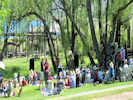 Concert in Mono Lake County Park at conclusion of the 2010 Chautauqua. Concert in Mono Lake County Park at conclusion of the 2010 Chautauqua.
|
But we were talking about the Chautauqua …
We went to the picnic, paid our $20 and got two plates full of BBQ pork sandwich, homemade potato salad, coleslaw, a few potato chips, and a Hansen’s drink. They also had a traditional hamburger and a Portobello-burger. This went to support Lee Vining High School in whatever they do. The picnic also included live music by husband & wife (Kris Delmhorst & Jeffrey Foucault) who claimed never to have played in the daytime, in a park, so I think it was a more amazing experience for them than for us. Between sets was the official Mono Lake Bird Calling Contest, with a few real bird calls, and lots of hilarious hijinks and tomfoolery.
| This was a great experience, something that we’d plan to do again, and certainly recommend to others.
|
|
| Monday, June 21, 2010Monday, we hung out here in Sagehen Meadow, washed clothes. We use the washing machine, but then hang clothes out on the umbrella clothes line that we brought from home.
|
|
Also this day we determined to try our escape route. There have been fires on or near Sagehen Meadows Road. If, for some reason, we can't leave by that route, we wanted to know how to leave (with our vehicles). One route would have us follow Sagehen Meadows Road to Dexter Canyon road, which after some 40 miles of driving would leave us at CA Highway 120 in Adobe Valley. Alternatively it looks like there is a little road we could take that would leave us on CA Highway 120 at Gaspipe Spring. To get there, we would have to go across the meadow on Sagehen Meadows Road, then turn east on Forest Road 1S196. This little track follows the swale downhill until to comes to Forest Road 1S191.
|
|
Literature Cited:
Other articles:
|
Forest Road 1S191 crosses the swale and then climbs the hill.
| At the top of the hill is an Earthscope GPS station. I think this was Station P641. Then the road descends easily to Gaspipe Spring.
|
|
| Tuesday, June 22, 2010Tuesday June 22 Tuesday, I did some computer work, and then botanized for a few hours in Big Sand Flat.
Hmmmm.
Continued on the road a little more and a little more, until it dead-ended on a small hilltop. This hill had a fine view of Mono Lake to the northwest, and Sagehen Peak to the south. Here I collected Gayophytum diffusum var. parvifolium, Mentzelia albicaulis, Phacelia bicolor, and two Cryptantha.
|
|
Stopped at the spring where Dry Creek enters Big Sand Flat.
|
|
Other articles:
603
|
Stellaria longipes Goldie ssp. longipes Longstalk Starwort.
| Big Sand Flat, Mono County, California. In a damp area beside Dry Creek where it enters Big Sand Flat. 37.8819°N, 118.8852°W. WGS 1984 Elev. 2390 m. Also collected at Sagehen Meadow. See also Collection # 636 in Sagehen Meadow.
|
|
Returned to CA Hwy 120, drove down to the exclosure, then turned northeast on a little Forest Road 1S19B (1S181). Here I saw two small Penstemons beside the road.
|
|
Other articles:
604
|
Penstemon cinicola D. D. Keck. Ash Penstemon.
| Big Sand Flat, Mono County, California. On the northwest margin of Big Sand Flat, on forest road 01S19B, about 1 km north of forest road 01S19, two plants here, one more seen near the end of forest road 01S19B, also collected at Sagehen Meadow. 37.8766°N, 118.9006°W. WGS 1984. Elev. 2396 m. This small dark blue penstemon keyed out directly to P. humilis when using the Jepson Desert Manual. That would be an interesting find and a southerly range extension since the nearest collection of P. humilis is near Bodie. However, there were a few collections of P. cinicola from Crooked Meadows. This taxon is not listed in the Jepson Desert Manual. Later, I would also collect P. cinicola at Sagehen Meadow.
|
Other articles:
|
|
|
Other articles:
605
|
Grayia spinosa (Hook.) Moq. Spiny Hop Sage.
| Big Sand Flat, Mono County, California. About 1.5 km north of Big Sand Flat, on the hill with a monument named "Sand." 37.8969°N, 118.8914°W. WGS 1984. Elev. 2480 m. Collected both male and female plants.
|
Other articles:
606
|
Amelanchier utahensis Koehne. Utah Service-Berry.
| Big Sand Flat, Mono County, California. About 1.5 km north of Big Sand Flat, on the hill with a monument named "Sand." 37.8971°N, 118.8916°W. WGS 1984. Elev. 2488 m.
|
Other articles:
607
|
| Aliciella leptomeria (A. Gray) J.M. Porter. Sand Gilia. Big Sand Flat, Mono County, California. About 1.5 km north of Big Sand Flat, on the hill with a monument named "Sand." 37.8969°N, 118.8914°W. WGS 1984. Elev. 2488 m.
|
Other articles:
608
|
Gayophytum diffusum Torr. & A. Gray var. parviflorum H. Lewis & Szweyk. Spreading Groundsmoke.
| Big Sand Flat, Mono County, California. About 1.5 km north of Big Sand Flat, on the hill with a monument named "Sand." 37.8969°N, 118.8914°W. WGS 1984. Elev. 2490 m.
|
Other articles:
609
|
Phacelia bicolor Torr. Ex S. Watson ver. bicolor. Two-Color Phacelia.
| Big Sand Flat, Mono County, California. About 1.5 km north of Big Sand Flat, on the hill with a monument named "Sand." 37.8968°N, 118.8914°W. WGS 1984. Elev. 2488 m.
|
Other articles:
610
|
Mentzelia albicaulis Hook. White-Stem Blazing Star.
| Big Sand Flat, Mono County, California. About 1.5 km north of Big Sand Flat, on the hill with a monument named "Sand." 37.8969°N, 118.8913°W. WGS 1984. Elev. 2486 m.
|
Literature Cited:
Other articles:
611
|
| Plagiobothrys kingii (S. Watson) A. Gray var. harknessii (Greene) Jepson. Harkness' Popcornflower. Big Sand Flat, Mono County, California. About 1.5 km north of Big Sand Flat, on the hill with a monument named "Sand." 37.8968°N, 118.8914°W. WGS 1984. Elev. 2486 m. Coll. No. 611, 22 Jun 2010, characters observed while keying: Annual, cotyledons persistent, to 7 cm., tap-rooted, branched at base; Stems, ±equally tall; Leaves, basal rosette 0, cauline alternate; Corolla, white, limb 5 mm., appendages yellow, prominent; Nutlets, #4, light tan, ovoid, 2.6 mm. × 1.5 mm. wide, adaxially keeled above scar, scar, lateral, sessile, raised, flat without thick rim, margin prickles 0, cross-ribs irregular.
|
 Coll No. 612, Cryptantha Coll No. 612, Cryptantha
 Coll No. 612, Cryptantha Coll No. 612, Cryptantha
|
Cryptantha
|
|
Other articles:
613
|
Mimulus nanus Hook. & Arn. var. nanus (Greene) D. M. Thomps. Skunky Monkey Flower.
| Big Sand Flat, Mono County, California. On top of the north rim of Big Sand Flat. Forest Road 01S19D, about 1/2 mile northeast of Forest Road 01S19 “M&R Tank Road.” 37.8799°N, 118.9019°W. WGS 1984. Elev. 2444 m. Open areas among Jeffrey pine, sandy soil. Somewhat ambiguous as to var. mephiticus vs. var. nanus.
|
Other articles:
|
In the afternoon we decided to explore to the end of Sagehen Meadows Road, the road we live on. We got as far as Johnny Meadow Road, where I got distracted. So we checked out Johnny Meadow. It wasn't bad, but unfortunately the road was blocked by a down tree, so we were unable to go all the way to the end.
|
|
Other articles:
|
Along the way we saw more arborglyphs, something never noticed before, but now found in nearly every aspen grove. This one says, “Jose Irigoyen, Agosto 4, 1970.” We also found a turnout near the top that gives an excellent view of the house, Mono Lake, and the Sierra Nevada.
|
|
|
Our plan for the next morning was to drive up there with our coffee, and enjoy the view. But we didn’t make it. Maybe another morning.
|
|
|
| Wednesday June 23Today, I worked on identifying some of what I collected yesterday, then did some of the brush-clearing that I am responsible for here. Some sources say brush should be cleared for 50 feet around the house, others say 100 feet. Mostly I am working on the southwest side of the house, since fires seem to run southwest to northeast here. Some of what I’m clearing is year-old sagebrush. Those are easy, just using a weed puller. Others though, are plants that have sprouted from older roots. My technique is to dig the roots out, then cut up and bury the plant in the hole made while digging the roots. The alternative is to bag it all and take to the dump, but I would rather not do that. I’m OK with digging out sagebrush, but I’m having trouble doing that to the few bitterbrush or the lupines that are just now sprouting from their roots.Tonight, as I was washing the dishes, the moon was rising over Glass Mountain, while the early evening sun illuminated Sagehen Peak. It was beautiful just like every morning and evening here. I don’t think I would ever tire of the view.
|
|
| Thursday June 24Unlike the lumberjacks who go shopping on Wednesday, we went shopping on Thursday in that suburb of Los Angeles known as Mammoth Lakes. We’ve made it 10 days, mostly due to Cheryl’s planning, but we’re out of Cheez-Its, beer, coffee, and other essentials of life.
|
|
| Saturday, June 26, 2010
|
Other articles:
|
This morning we attended a field trip sponsored by the Eastern Sierra Land Trust to the alkali meadows of the Benton Hot Spring Ranch. This location is about 40 minutes east of Sagehen Meadow, near the town of Benton. Benton is north of US Highway 6 from Bishop to Tonopah, and at the foot of the highest part of the White Mountains. The Eastern Sierra Land Trust has a conservation easement on the meadow, to provide the owner compensation for promising never to develop the meadow, or split it up and sell it off in little pieces.
|
|
|
We crossed the barbed wire fence and walked across the meadow. Even though it rained yesterday, the meadow wasn’t muddy, and the salts were crunchy under our shoes.
|
|
Other articles:
Locations:
Blind Springs Valley.
|
|
|
|
Also in the meadow we saw the Potentilla gracilis or slender cinquefoil, again not in the middle of the meadow, but sort of on the edges that were still wet. Lots of other plants, an Orobanche, probably O. corymbosa, a rare alkali hawksbeard, and of course several different kinds of willows.
|
|
|
There is a pond at the lower end of the meadow. The Eastern Sierra Land Trust is working on a project to restore the Benton Speckled Dace to the stream draining the pond. Unfortunately, the pond is populated by the Sacramento Perch, also an endangered species in its own habitat near, you guessed it, Sacramento. Apparently it also likes to eat most anything, but is especially fond of Benton Speckled Dace. It looks like the project will be approved, to drain the pond and get rid of the Sacramento Perch, then restore it somewhat, to make good habitat for the Benton Speckled Dace, and then introduce them. According to some geological reports I’ve read, the Benton Speckled Dace could be descended from fish that migrated from the Lahontan Basin (Carson Sink) to the Owens River drainage by way of Pleistocene Lake Mono, when it spilled first northward by way of the Mount Hicks spillway, then southward by way of the Adobe Hills spillway.
|
|
|
This afternoon, I straightened up the battery house, sweeping the floor, and stacking the fiberglas insulation left over from construction neatly against the wall. I also worked a little more on removing the brush around the house that has started to regrow after being plowed several years ago. I’m pretty good at pulling out the sagebrush and the rabbitbrush, but having trouble deciding I want or need to dig out the bitterbrush (Purshia tridentata, in the Rose family) and the lupines. There are only a few bitterbrush, and the lupines are very soft so, so far, it hasn’t made much difference. Appealing to my Berkeley-ish ecocitizen sensibilities, I have been cutting up and burying the cleared sagebrush, rather than loading it into plastic bags and hauling it to the dump. I’m sure the real locals would think I was nuts.
| Also this afternoon, Karl was here. He nailed back some of the siding that has become loose in the wind, and began making preparations to install a small electric water heater. We’re happy to be having real hot water. However, it comes at a price. It’s one more thing that could drain the batteries. Probably we’ll turn it off at night, so that we don’t run the batteries down keeping the water hot all night. Then turn it back on in the morning, when the sun is shining on the solar panels. We have stopped using the dryer, opting for the clothes line, and have stopped using the heat pump, because of their heavy electricity use. The contractor’s also going to replace the back door the sheriff broke open when they were looking for the former owner of the house. I’m continuing to learn about the house. We lost our power a week or so ago, because we were using too much, and tripped a circuit breaker in the inverter. At that time, the battery meter also stopped working. Resetting the inverter brought back the power, but not the battery meter. After several puzzling days, the electrician and contractor remembered over beers shared at the bluegrass concert at the Mobil Gas Station that the battery meter was powered by an auxiliary power circuit on the battery charge controller. So they called me, suggesting I figure out how to turn that circuit on. I read the battery charge controller manual, and highlighted the configuration menus in yellow. While attempting to apply my new knowledge in the battery house, I learned that the menus in the charge controller were similar to, but not exactly the same as, the menus as described in the manual. Regardless, I managed to turn the auxiliary circuit back on, and the meter came to life. It’s an important little meter because it tells us how much charge is in the batteries, how many amps of current we’re taking out of the batteries versus how much the solar panels are putting in, and how many amp-hours we’re drawn out of the batteries. To organize all this knowledge I’ve started a Visio drawing of the mechanical systems of the house, showing how everything starts with the solar panels, and all the different ways we use that energy. It’s pretty complicated. There are four pumps: the well, the house water pressure, the solar collector pump, and the geothermal water pump. Three information panels: the battery charge controller, the inverter, and the battery meter in the house office. In other news, I had my first Sagehen Meadows haircut. I was explaining to Dick at the Razor’s Edge that we would spending the summer here and that I would probably have to drive to Mammoth Lakes for a haircut. Dick loaned me an old pair of clippers, and sent me to the Shaver Shop on Telegraph Avenue, to buy a set of Size 1½ cutters. That’s how I get my hair cut, a 1½ all over. Cheryl and I set up out on the deck, and she cut my hair. It looks pretty even. Of course, not as perfect as Dick, hisself, might have done, but still pretty good.
|
|
While writing up the day's events, I was, by the way, nursing a bottle of Mammoth Brewing Company’s Paranoids Pale Ale. This is a local brew, which I thought I should buy as we continue to “go native” or maybe it’s “go local.” They have a number of other brews, including the Real McCoy Amber Ale, which I pronounce as “eminently drinkable.” Mendocino Brewing Company products, such as Eye of Hawk ale seem to be popular here, or at least loaded to the rafters in the cooler. And, of course, the New Belgium products, such as Fat Tire ale are also available.
| Well, that’s probably enough for tonight. I’m going to send this as a .PDF, and also e-mail it directly to two people who are having trouble reading the PDF version. If that includes you, please let me know.
|
|
| Sunday, June 27, 2010
|
|
Sunday (June 27th) I met three botanists from the University of Lausanne, Switzerland, at the intersection of California Highway 120 and Benton Crossing Road. They are Anna, Sarah, and Glen, left to right. Anna is a PhD student working in Polygonaceae (Buckwheats), Sarah is a Masters student, and Glen is a PhD student. We had agreed to a 900 AM meeting time. I was a little unsure about our route and driving miles, so I left a little early and drove to Benton to get gas. I wasn’t sure the gas station would be open at 800 AM on a Sunday. It’s a generic gas station with no brand name showing. The pumps are credit card operated, and the sign says they’re open 700 AM to 900 PM. The gas station is affiliated with a restaurant and a “market” and there were a couple of good ol’ boys inside shoveling down eggs, bacon, hash browns, and whatever else was on the menu.
|
|
|
With a tank full of gas, I returned through the Blind Spring Valley where Cheryl and I attended a field trip on the day before. Stopped for a photo or two of the valley, and then again in Old Benton, or Benton Hot Springs. Took a photo of the old general store and gas station. Across the street is the old house, and down the road is the Benton Hot Springs Bed and Breakfast that has been recommended to us several times. From there I drove back west on Hwy 120 to Benton Crossing Road. Anna, Sarah, and Glen were there, waiting for me. Our first stop was just a few miles north in Adobe Valley, where they collected buckwheats, whereas I got distracted by an Astragalus (Loco Weed).
|
|
Other articles:
614
|
|
Adobe Valley, Mono County, California. 0.3 miles northwest on a 4WD road that was entered from California Highway 120 0.8 miles north of Benton Crossing Road, 37.8039°N, 118.5795°W. WGS 1984 Elev. 1990 m. Keyed from Taylor (2010) 9' Stipules not connate into a sheath
|
Other articles:
Locations:
Wildrose Canyon.
615
|
|
Wildrose Canyon, Mono County, California. Near Benton Crossing Road, about 5.4 miles south of California Highway 120. 37.7216°N, 118.6029°W. WGS 1984. Elev. 2271 m. Characters: Annual. Stem erect. Leaves, cauline compound, segments toothed. Calyx lobes entire, ±alike, generally short to long hairy. Corolla uniformly colored blue, 13 mm, 12 mm wide, generally deciduous. Some stamens exserted. Fruit ovoid to elliptic 4-5 mm. Pedicels 1.5 mm in fruit. Calyx lobes in fruit 8 mm, not dimorphic, ±straight, ±enclosing fruit, 3 mm > fruit. Seeds 2, one seed has ridge, but not grooved. In Taylor (2010), this keys pretty much straight to P. vallis-mortae. In TJM2 and TJDM, it gets lost in the keys around P. distans and P. tanacetifolia.
|
Other articles:
Locations:
Wildrose Canyon.
616
|
Eriastrum wilcoxii (A. Nelson) H. Mason. Wilcox's Woollystar.
| Wildrose Canyon, Mono County, California. Near Benton Crossing Road, about 5.4 miles south of California Highway 120. 37.7216°N, 118.6029°W. WGS 1984. Elev. 2271 m. Coll. No. 616, 27 June 2010, characters observed: Annual, to 10 cm.; Leaves, alternate, pinnately-lobed, lobes 5; Calyx, membrane not spout-like; Corolla, tube 6 mm. + throat 1 mm. + lobes 4 mm. × 1.8 mm. wide, lobes lavender, lobe tips > stamens; Stamens attached well below corolla sinus, unequal, exserted < ½ length of corolla lobes; Anthers exserted.
|
|
Back on Benton Crossing Road, which zig-zags around before finally coming out at US Hwy 395 near Mammoth Lakes, we stopped at Wildrose Canyon. I was a little surprised to find Desert Mallow (Sphaeralcea ambigua) here. It is very common in the eastern Mojave Desert, at Lobo Point, and Wild Horse Mesa. Sometimes called apricot mallow, the stems reach 2 feet tall and are covered by orange or apricot-colored flowers. The desert mallow is one of the first perennial plants to fill in after a fire. When we were in the eastern Mojave in early June, I took this photo of Round Valley from Pinto Mountain. It shows a partially burned area from the Hackberry complex fire of 2005, with the sagebrush and junipers in grays and greens on the left, and how the Desert Mallow has filled the burned area in orange on the right.
| From Wildrose Canyon we proceeded south over Wildrose Summit and into a little valley then drains through Chidago Canyon to Chidago Flat. On the left (east) side of the road, at a place called Banner Springs, was a large vegetable garden, fully fenced, maybe an acre in size. I seemed like an odd place for such a large garden. We made one botanical stop in this little valley, along a wooden pole line, where we were looking for Eriogonum esmeraldense, or the Esmeralda Buckwheat. Esmeralda is the name of a Nevada county. It was originally a huge county stretching from Goldfield in the southeast and past Aurora in the northwest. Later it was split into two counties, with the Goldfield area retaining the county seat of Esmeralda County, and the mining town of Aurora becoming the county seat of Mineral county. After Aurora declined, the county seat was moved to Hawthorne, Nevada. The first collection of the Esmeralda Buckwheat was made in 1853 in the mining town of Candelaria which was then in Esmeralda County, but now is in Mineral County. For lunch we stopped at Watterson Summit, on the eastern edge of the Long Valley caldera and ate in the shade of the Jeffrey pines among boulders of Bishop Ash. The rim of the caldera is pretty low on the south and southeast and the topography subdued. But to the north, the wall rises to 11,000 feet at Glass Mountain, nearly 5,000 feet above the floor. For the last botanical stop we went to Benton Crossing, where the road crosses over the Owens River. I think my niece Heidi has been fishing here. We were looking for a little plant called Goodmania luteola. It has a couple of common names, Yellow Spinecape or Golden Goodmania. It’s one of those little tiny plants that you have to lay down in the alkali dust to see or photograph. I don’t have any photos. Was planning to take some, but then a young fisherman came over and asked for help starting his car. Got distracted doing that, using my jumper cables, and then forgot that I wanted to get my camera out. However, here’s a photo that I particularly like (http://calphotos.berkeley.edu/cgi/img_query?enlarge=0000+0000+0607+1303) taken by Steve Matson. He’s a really good plant photographer, and I’ve met him on a couple of field trips and at the herbarium.
|
Other articles:
617
|
Goodmania luteola, in alkali flats adjacent to Forest Road 3S47, just north of Benton Crossing Road.
| Also found at numerous locations on wet alkali flats or meadows in Long Valley. There is one other collection from Mono County at River Spring in Adobe Valley. Inyo County locations include Fish Slough and Klondike Lake. The type is a collection made by C. C. Parry in 1881 with a given location of "Mojave."
|
Other articles:
617.1
|
Cleomella parviflora A. Gray. Slender Cleomella.
| In alkali flats adjacent to Forest Road 3S47, just north of Benton Crossing Road. (37.6987,-118.7615,WGS 1984.) 6/27/2010 Benton Crossing, Mono County, California.
|
Other articles:
617.2
|
Micromonolepis pusilla (Torr. ex S. Watson) Ulbr. Small Povertyweed.
| Benton Crossing, Mono County, California. In alkali flats adjacent to Forest Road 3S47, just north of Benton Crossing Road. 37.6987°N, 118.7615°W. WGS 1984. Elev. 2083 m.
|
 Anna, Sarah, and Glen from University of Lausanne Anna, Sarah, and Glen from University of Lausanne
|
Anna, Sara, and Glen, three botanists from University of Lausanne, who stayed with us for two nights.
|
|
Other articles:
|
Stopped for a few photos in Benton Hot Springs.
|
|
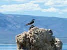 Osprey with nest on tufa. Osprey with nest on tufa.
|
The stop at Benton Crossing completed our stops for the day, so we did a little bit of Mono Lake basin touring, stopping mainly at the South Tufa of Mono Lake. After being gently admonished for stepping on some tufa, we caught some brine shrimp and looked at those, and then looked for the freshwater springs entering Mono Lake. It is the fresh water with just a tiny bit of calcium carbonate precipitating when entering the alkaline water of Mono Lake that creates the tufa towers in the water. The towers are sticking up out of the water now, because the lake level has declined, as the streams entering Mono Lake were diverted to provide water for Los Angeles.
We also watched a pair of Ospreys, who had built a nest atop one of the tufa towers. The docents said that they have been in residence since April but, so far, have failed to rear any chicks. Since there are no fish in Mono Lake, they fly ten miles to the June Lakes basin to fish. If they have chicks they have to carry the fish ten miles (downhill, at least) to their nest at Mono Lake.
| Finally, back at the house, we had a nice dinner that Cheryl prepared. We also had hot water for showers, Karl had installed a small electric water heater in the mechanical closet. Of course, that’s one more way we use electricity, so we have to be careful to use only what we need.
|
|
| Monday, June 28thMonday was a laundry day, a yard work day, and a deal with what you collected yesterday kind of day. Our guests collected in Yosemite during the day (with permits!) and then returned in the evening to spend a second night with us.
|
|
| Tuesday, June 29, 2010
|
Other articles:
|
Tuesday morning, Cheryl made blueberry scones for breakfast, which were very good. After our guests packed up and headed out to collect near Lee Vining and points north, we assembled a little lunch, and set out for the day ourselves. I wanted to do a little botanizing at the Adobe Hills Spillway, and in Alkali Valley. On the way we passed through Adobe Valley, the location where I saw and then video-ed the wild horses (http://www.youtube.com/watch?v=5cHiuznIsi8) last year. We saw lots of horse poop on the road, but no horses this year. We even poked up a little road into the back country with no good luck.
|
|
|
We stopped at the Adobe Hills Spillway, where Mono Lake spilled over into the Owens River during the Pleistocene Ice Ages. I showed Cheryl the snail shells in the sediments at the high-water level, and then I tried again to examine and identify a little plant that has had me mystified for a couple of years. With divided leaves, cobwebby hairs, congested flowers, stamens opposite petals, etc., it ought to be easy to figure out. However, every time I try, I seem to get lost in the keys. I’m using the Jepson Desert Manual, and it’s possible the species is not in there. It’s also possible that my Homer Simpson diagnostic skills are a little weak. Anyway, this time I took some photos, and collected it again, and maybe some day, it’ll come to me. I also collected an Astragalus, a composite, and the obligatory Cryptantha or two, at the spillway, and then we moved on.
|
|
Other articles:
618
|
Ipomopsis congesta (Hook.) V. E. Grant subsp. congesta Ballhead Ipomopsis.
| Adobe Hills Spillway, Mono County, California. At the spillway of Pleistocene Lake Mono, east side of road, most common in borrow pit, occasional elsewhere nearby. 38.0585°N, 118.774°W. WGS 1984. Stems reddish, leaves pinnately lobed, infloresence head-like, flowers white, stamens exserted. Growing in fresh water sandstone, with fossil snail shells. , stems reddish, leaves pinnately lobed, infloresence head-like, flowers white, stamens exserted, on fresh water sandstone,
|
Other articles:
Locations:
Adobe Hills Spillway.
619
|
|
Adobe Hills Spillway, Mono County, California. Growing in the fresh water sandstone at the spillway, 16.6 miles east of US Highway 395 on California Highway 167, then 8.0 miles southeast on Dobie Meadows Road. 38.0585°N, 118.774°W. WGS 1984. Elev. 2181 m. Coll. No. 619, 29 Jun 2013, characters observed: Perennial subshrub of Great Basin sagebrush desert (Mono Lake basin is in nSNE); Hairs basifixed, simple; Root crown, at ground surface; Leaves, 1-pinnate, odd-pinnate, main axis extending as a leaflet; Leaflets >> 7, typically 23, mid leaflets 5 mm. × 2.2 mm. wide, spaced 2 mm., tip rounded, sparsely hairy, green (not ashy-gray or silvery), both surfaces ±equal in appearance; Stipules, 3 mm., not connate, sheaths 0; Calyx conspicuous, base ±symmetric; Sepals, fused 3.5 mm. + free 2 mm.; Flowers, bilateral, 18-20 in a spike, not head-like; Corolla conspicuous; Petals ochroleucus (not pink-purple); Banner 8 mm. when dry; Wings 8 mm.; Keel 6 mm.; Stamens, 9 fused, 1 free; Style tip and stigma glabrous; Fruit, 12 mm. long, stipe 0, glabrous, 2-chambered; Seeds, several.
|
Other articles:
Locations:
Adobe Hills Spillway.
620
|
|
Adobe Hills Spillway, Mono County, California. Growing in the fresh water sandstone at the spillway, 16.6 miles east of US Highway 395 on California Highway 167, then 8.0 miles southeast on Dobie Meadows Road. 38.0585°N, 118.774°W. WGS 1984. Elev. 2175 m.
|
 Collection No. 621, Cryptantha Collection No. 621, Cryptantha
|
Cryptantha sp.
|
|
Other articles:
|
Our next stop was Alkali Lake in Alkali Valley in Alkali County … … Oh! … No, that would be Mineral County. I don’t know how the state of Nevada could have missed the opportunity to have an Alkali County, though. There are certainly plenty of places it could describe.
| We found a little road that would take us down to the alkali flats. There was a spring with a three ducks. Haven’t a clue what kind of ducks. They were small, dark colored, with maybe a white stripe. Maybe someone else can recognize them. The plants found in the zone between the sagebrush and the alkali flats were pretty interesting. We found quite a few different plants, although it was still a little early spring here are 7000 feet elevation. The little Goodmania might be here, but the plants were very small and I found only one or two open flowers.
|
Other articles:
622
|
Thelypodium crispum Payson. Crisped Thelypody.
| Alkali Lake, Mineral County, Nevada. Northwest side of Alkali Lake, in alkaline soils with rabbitbrush. 38.2817°N, 118.7633°W. WGS 1984. Northwest side of Alkali Lake, in alkaline soils with rabbitbrush.
|
Other articles:
623
|
Goodmania luteola (Parry) Reveal & Ertter. Yellow Spinecape.
| Alkali Lake, Mineral County, Nevada. Northwest margin of Alkali Lake, in silty alkali flat with rabbitbrush, 38.2817°N, 118.7632°W. WGS 1984.
|
Literature Cited:
Other articles:
623.1
|
|
|
 Coll. No. 623.2 Coll. No. 623.2
623.2
|
Chenopodium. Goosefoot.
| Alkali Valley, Mineral County, Nevada. Northwest margin of Alkali Lake, in silty alkali flat with rabbitbrush. 38.2817°N, 118.7632°W. WGS 1984. Flowers, but no seed. Coll. No. 623.2, 29 Jun 2010, characters observed: Annual, scaly or powdery, hairs 0; Stems, upper, not jointed or fleshy; Leaves, alternate, not clasping, petioled, blades 15 mm. × 4.5-5.0 mm. wide, flattened (not fleshy), 1-veined, not spine- or bristle-tipped; Flowers, pistillate, with calyx; Calyx, not winged or tubercled, appendages 0; Stamens 5; Seed, orientation unknown.
|
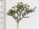 Coll. No. 623.3 Coll. No. 623.3
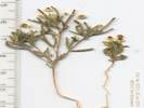 Coll. No. 623.3 Coll. No. 623.3
623.3
|
Cleomella parviflora A. Gray. Slender Cleomella.
| Alkali Valley, Mineral County, Nevada. Northwest margin of Alkali Lake, in silty alkali flat with rabbitbrush. 38.2817°N, 118.7632°W. WGS 1984. Elev. 2148 m. Coll. No. 623.3, 29 June 2010, characters observed while keying: Annual, or appearing so, herbaceous, tap- rooted, not scapose; Hairs, very few, in axils only, simple, tapered; Leaves, cauline, alternate, not lobed or clasping at base, compound, 8-12 mm.; Flowers bisexual, radial (actinomorphic); Perianth in 2 whorls; Flower parts 4(6); Sepals fused at base; Petals 4, free at base, entire, yellow; Ovary superior; Pistils 1 per flower; Style very short; Stamens 6; Filaments wingless; Fruit a silicle, ±spheric, ±3 mm., indehiscent; Seeds, ±8.
|
Other articles:
624
|
Goodmania luteola (Parry) Reveal & Ertter
|
|
|
I also found a Hesperochiron californicus, or California monkey-fiddle (who comes up with these common names?) on the drying and cracking alkali mud. This was a new plant to me, and I would not have expected to find it here.
|
|
Other articles:
625
|
Hesperochiron californicus (Benth.) S. Watson. California Monkey-Fiddle.
| Alkali Lake, Mineral County, Nevada. On the south side of Alkali Lake, where the old road breaks out of the sagebrush. 38.2659°N, 118.7503°W. WGS 1984. Elev. 2149 m. Open, drying, alkaline mud flats.
|
|
After a little lunch, we started back for home. Out here, of course, one does not go straight home. Straight home would have been about 30 miles across the east side of the Mono Lake basin. But, there is the post office, the market, and the gas station that (should) all lie on the route home, and they are all in Lee Vining on the west side of the basin. At the post office, we got our mail, and picked up a daypack for Cheryl, and some Sherman (live) mouse traps for me. At the Mono Market, we got a few supplies, and lastly filled the truck with gas at the Tioga Gas Mart.
|
|
|
| Wednesday, June 30thWednesday morning we packed up again and left for Devils Postpile National Park. Of course, first we stopped at the dump to drop off garbage and recycling. The dump is open on Monday, Wednesday, Friday, and Saturday, and sometimes we find ourselves planning outings around the dump schedule.Cheryl and I visited Rainbow Falls in a September years ago, and we wanted to see it with a lot of water and, hopefully, a rainbow, so it was on our priority list for an early tourist trip. You have to stop and the Mammoth Ski Lodge and then take a shuttle bus from there. The fare was $7.00 with no discount for being old and decrepit. There is also a summer time gondola ride to the top of Mammoth Mountain. The regular fare is $21.00 with a senior fare of $11.00. Maybe, they just drop seniors off about half-way, I don’t know. Anyway, we took the shuttle to the Rainbow Falls trailhead, and walked the mile and a half to the falls. There was a good flow from the melting snow in the high country, and a good visible rainbow. After lunch, we walked back to the trailhead at Red’s Meadow Resort, and took the bus back to the Mammoth Ski Lodge. While driving through Mammoth Lakes, we noticed a Farmer’s Market. It’s on Wednesdays from 400 PM until 700 PM, and they were just setting up when we arrived. There were maybe five or six stands, but only two were fruits and vegetables. Another had coffee, one fresh roasted peanuts, and another was the Friends of the Inyo, an environmental group. At the vegetable stand we got some very nice organic broccoli and lettuce. Talking with the growers, we learned that their garden is at Banner Springs, mentioned above, and that they grow all that they sell. Next time we pass by that way, we’ll have to stop in and say hello. They also knew about the house in Sagehen Meadow, and its story. The fruit stand had very nice peaches, apricots, and cherries from Bishop. We just bought peaches and apricots, and some good-looking garlic. So that’s probably it for today. Today (Thursday) and Friday, we’ll stay here at the house. I have plant collections to document and work over. And, it’s time to botanize in the meadow again, to see what’s started to bloom since I was last out there a week ago. Spring continues to evolve here, the days at a little warmer, maybe a very pleasant 75 in the daytime, and in the low 50’s at night, with different tiny flowers in bloom. Saturday, we’re signed up for a canoe trip on Mono Lake, and Sunday we’re planning to do Independence Day in Bridgeport, with a morning parade, a noon barbecue, and an afternoon rodeo. Apparently the Bridgeport rodeo is just skills the cowboys actually use on the ranches, and not the professional stuff. We’ll see. Tom
|
Other articles:
|
Rainbow Falls.
|
|
|
| July 2010
|
|
| Friday, July 2, 2010
|
Other articles:
626
|
| Diplacus mephiticus (Greene) G.L. Nesom. Skunky Monkey Flower. Pumice Valley, Mono County, California. Along Dross Road to the Mono County Transfer Station. 37.9048°N, 119.0622°W. WGS 1984. Elev. 6823 ft. Plants not hairy when first collected here on 16 June 2010, see smaller specimen, then hairy when collected 30 Jun 2010, see larger specimen.
|
Other articles:
627
|
Purshia tridentata (Pursh) DC. var. tridentata. Antelope Bitterbrush.
| Sagehen Meadow, Mono County, California. North edge of meadow. 37.8719°N, 118.8577°W. WGS 1984. Elev. 2500 m.
|
Other articles:
628
|
Phlox stansburyi (Torrey) A. A. Heller. Cold-Desert Phlox.
| Sagehen Meadow, Mono County, California. North edge of meadow. 37.8716°N, 118.8577°W. WGS 1984 Elev. 2538 m. Plants erect, branches open, not matted.
|
Other articles:
629
|
|
Sagehen Meadow, Mono County, California. South side of meadow, locally common at edge of meadow. 37.8702°N, 118.857°W. WGS 1984. Elev. 8342 ft. Spreads by rhizomes, infloresence crowded at nodes, glabrous, corolla 7 mm, blue-purple, glabrous except hairy floor, valves spreading, staminode yellow hairy.
|
|
|
|
|
| Saturday July 3rdEarly last Saturday morning we took the Mono Lake Committee’s canoe tour of Mono Lake. I didn’t take my camera, because I did not want it to get wet. So I don’t have any photographs from the tour.The tour leaves from Navy Beach, on the south side of the lake. We left the house at 700 AM for our 800 AM tour. They want us tourists on-site a half hour before the tour, so that we can sign the liability waiver, get fitted for a life vest, and take the safety lecture. Depending upon the number of people who attend, there may or may not be a guide in each boat. Since there were only six people signed up for our tour, each canoe had a guide. The 930 AM tour had 22 people, so I’m guessing some canoes did not have guides. In our canoe, I sat in the front (I guess I should say “bow”), Cheryl sat in the middle, and our guide Sarah sat in the stern. The tour route is from Navy Beach west to South Tufa, and return. Even though it was early in the morning, the lake had swells from the north about 9 inches high. Though Mono Lake appears blue from a distance, that must be just a reflection of the sky, for the water close up is a green from the algae growing in it. The water is clear enough though to see the bottom through 5 to 6 feet of water. I was also surprised to see so many brine shrimp. When I visited South Tufa with the Swiss botanists on Sunday, we saw a few along the shore. The same was true last summer when we Nacho took Ian out into the lake at the Picnic Grounds on the west side of the lake. However, out in the canoe you can see how many brine shrimp there are; our guide said trillions. We caught a few and saw plain brine shrimp, green brine shrimp, brine shrimp with egg cases, and mating brine shrimp. Sarah, our guide said that sometimes red brine shrimp are found and that the color is the result of the oxidation state of the iron in their hemoglobin. The eggs just sink to the bottom of the lake, and wait until next year to hatch. Along the way, we saw several swallows nesting in holes in the tufa towers. The osprey nest we saw on the previous Sunday was vacant and we saw no osprey at all this morning. The tour also took us by a newly forming tufa tower. It was about 35 feet from shore and about 18 inches high, topping out just above the water line. It was a good size spring, with a hole about 2 inches in diameter, and water flowing about what you’d expect from a large garden hose. And the water was warm! Maybe about 85°F. When we were back on shore, though, I could not locate it out in the lake. Back at the house, I did some things for our landlord, including measuring how far the brush had been cleared away from the house. I also discovered the wood pile outback was too close to the house, so I restacked the portion that was too close, so that none is the wood is closer than 30 feet to the house. I also blocked a little hole that allowed small animals to get into the garage.
|
|
| Sunday, July 4, 2010
|
Other articles:
|
Sunday was the Fourth of July, and we went to Bridgeport to partake in their festivities. Bridgeport is about an hour from the house. It’s 20 minutes from the house to US Hwy 395, 10 minutes to and through Lee Vining, and then 20 more minutes up and over Conway Summit and down the other side. We parked at the east end of Bridgeport and carried our chairs across the bridge over the West Walker River. Found a good spot at pretty much the east end of town, and plunked down our chairs for a front row seat. This was about 5 minutes before the parade was scheduled to start. In Alameda, you’ve got to get there a couple of hours before the parade to get a front row seat. The parade came down Main Street, which is also US Highway 395. I was a little surprised that such a major highway would be closed for a parade, but I guess it’s just a matter of priorities. Of course, Main Street is pretty short, it’s maybe 6 blocks from one end of town to the other. So we’re thinking it’s going to be a pretty short parade. Actually it was a fairly good-sized parade for a small town (and county), with maybe 40 entries. The best part was, once the parade reached the end of town, they simply turned around and marched the other way. So everyone got to see the parade twice! Once coming, and once going.
| Set up around the County Courthouse were maybe 4-5 of the “jumpy things” for kids, and a stage for various announcements and entertainment. Behind the court house, were the usual cheesy art booths with a few specialty booths. All the public land agencies were there: BLM, Forest Service, etc. The Friends of the Bodie Railway & Timber Company were there, and I learned that they paid for and built the very nice interpretive display at Mono Mills, where timber was milled before riding the railroad to Bodie. For lunch we paid our $15 and had the barbecue lunch in the park just behind the court house. They said they were sponsored by the Bridgeport Chapter of PETA. Of course, as we learned, in Bridgeport PETA stands for “People Eating Tasty Animals,” so we had very tasty barbecued steak. Also behind the park is the Bridgeport Museum. There they called our attention to the latest issue of their newsletter, which featured the schools and school teachers of Mono County in the early part of the 20th century. I asked them about Miss Maud Minthorn. She was the schoolmistress in Lundy in 1908. I’m aware of her because she also collected plants and sent them to the herbarium at Cal. I’ve seen 76 plant collections by Miss Minthorn at Cal which would make her the fourth most prolific collector in the Mono Lake basin. Apparently, she only lasted one year in Lundy, because her 1909 collections are from Pioche, Nevada, including one of Swertia albomarginata, the little plant I study. From Pioche, she went back to Cal, earned a Masters in mathematics, and then taught high school math in Fresno for any years. Well, anyway, after some correspondence with the director of the museum, this was new information to them. Some day, I need to go to a Fresno museum or historical society, because perhaps looking at old high school yearbooks, I can find a photo of Miss Minthorn. We hung around the park for a while, enjoyed the karaoke, which was mixed in with Frank and his significant other, Ellie or Evie, something like that, performing separately and together. Frank did an excellent Conway Twitty. They must have been in their eighties, and were still performing in Minden and Gardnerville. Now it was time for the rodeo, so we walked from the courthouse at the middle of town to the west end of town, two blocks, to the rodeo grounds. There was a woman standing by the rail, setting up her tripods, cameras, etc., so I struck up a conversation with her about the rodeo, where to sit, etc. She gave us a great orientation, and we sat right at the railing, directly opposite the announcer’s booth and the bucking bronco chutes. This was a ranch rodeo, not the professional stuff we see on television. So the events featured skills that the cattle ranchers used. The most interesting was the cattle loading event. For this event they brought a pickup truck and a trailer into the arena. Four cowboys (and cowgirls) … I dunno could you say “cowpersons?” … would load their horses into the trailer and then get into the truck. At “Go,” they would jump out of the truck, get the horses out of the trailer, set up a temporary fence, go round up three cows, get them into the trailer, take down the temporary fence, close the door, and gather their horses together. I think the fastest time was 1:34 minutes. And all kinds of thing could go wrong. If your horse wandered away while the fence was being taken apart, that counted against you. Sometimes the cows would stay together, and sometimes they would scatter. I got a good video of this event, http://www.youtube.com/watch?v=oAHwxI3kdLs it’s uploading right now, but our upload speed is pretty slow, so it may not be done before I send this out. There were lots of other events at the rodeo, and it went on for about four hours. Two hours was great; three hours would have been enough; but at the four hour mark I was beginning to feel like a roast lobster, even with our hats and sunscreen. It was fun, though, and I’m glad we went.
|
|
| Monday, July 5, 2010Yesterday, we stayed around here, and I botanized. Won’t bore you with too many details, but I did find several Sierran wet meadow plants down in the swale that drains Sagehen Meadow. Here’s a short list: Longstalk Starwort (Stellaria longipes), Primrose Monkeyflower (Mimulus primuloides) in the photo at right, and Water Minerslettuce (Montia chamissoi). Looking at what’s been collected in this area, the plants at Sagehen Meadow seem a little more similar to the wetter meadows on the flanks of Glass Mountain, than to the nearby sand flats just a mile or so away. I also collected the Prickly Phlox (Linanthus pungens) and Western Blue Flag (Iris missouriensis) that are now blooming all over the meadow.Just above the wet part of the meadow, I found a Cinquefoil (Potentilla) that keyed out straight to Comb-Leaf Cinquefoil (P. gracilis var. elmeri). I’m always a little nervous when something keys out easily, as in “could I have gone wrong in the key somewhere?” But finding this plant here, and having keyed it out, I’m now wondering about a Potentilla we saw at the Benton Hot Springs Ranch. It was on their list as Potentilla gracilis var. gracilis. In an exchange with Barbara I learned var. gracilis was a coastal variety, and that the likely variety out here was var. elmeri. That’s what I found here at Sagehen Meadow. So should I call this to the attention of the Eastern Sierra Land Trust? Suggest they re-examine their Potentilla in the field? Let it be? I don’t know.
|
Other articles:
Locations:
Sagehen Meadow.
630
|
|
Sagehen Meadow, Mono County, California. South side of meadow. 37.8697°N, 118.8565°W. WGS 1984. Elev. 2502 m. With sagebrush.
|
Other articles:
631
|
|
Sagehen Meadow, Mono County, California. South side of meadow. 37.8698°N, 118.8564°W. WGS 1984. Elev. 2529.
|
Other articles:
Locations:
Sagehen Meadow.
632
|
|
Sagehen Meadow, Mono County, California. South side of meadow, in drier areas mixed with Artemisia cana and Carex douglasii. 37.8703°N, 118.8556°W. WGS 1984.
|
Other articles:
Locations:
Sagehen Meadow.
633
|
|
Sagehen Meadow, Mono County, California. South side of meadow. 37.8701°N, 118.8552°W. WGS 1984. Elev. 2536 m.
|
634
|
Rumex paucifolius S. Watson. Alpine Sheep Sorrel.
| Sagehen Meadow, Mono County, California. South side of meadow. 37.8704°N, 118.8552°W. WGS 1984. Elev. 2532 m.
|
635
|
Juncus mexicanus Willd. (Syn: Juncus balticus Willd. var. mexicanus (Willd.) Kuntz ) Mexican Rush.
| Sagehen Meadow, Mono County, California. South side of meadow. 37.8704°N, 118.8552°W. WGS 1984. Elev. 2532 m. 12 June 2011:
|
Other articles:
Locations:
Sagehen Meadow.
636
|
Stellaria longipes Goldie ssp. longipes. Longstalk Starwort.
| Sagehen Meadow, Mono County, California. In the swale draining the meadow, southeast corner. 37.8707°N, 118.8552°W. WGS 1984 Elev. 2532 m.
|
Other articles:
Locations:
Sagehen Meadow.
637
|
|
Erythranthe primuloides (Benth.) G.L. Nesom & N.S. Fraga. Primrose Monkey Flower. Sagehen Meadow, Mono County, California. In the swale draining the meadow, at a log dam intended to reduce erosion. 37.8707°N, 118.8552°W. WGS 1984. Elev. 2533 m.
|
Other articles:
638
|
Montia chamissoi (Spreng.) Greene. Toad Lily.
| Sagehen Meadow, Mono County, California. In the swale draining the meadow, southeast side. 37.8707°N, 118.8552°W. WGS 1984. Elev. 2533 m.
|
|
I found Abronia turbinata and Penstemon spectabilis on the slopes immediately southeast of the Sagehen Meadow Campground. Neither of them are developed well enough to collect. I should go back there again in a week.
|
|
Other articles:
639
|
Castilleja angustifolia (Nutt.) G. Don. Desert Indian Paintbrush.
| Sagehen Meadow Campground, Mono County, California. about 1 mile south of Sagehen Meadow Campground on Forest Road 01S160, 37.854°N, 118.8585°W. WGS 1984. Elev. 2630 m. parasitizing Linanthus pungens among bitterbrush and Jeffrey pines. Taylor (2010) uses C. chromosa Nelson, but C. angustifolia (Nutt.) G. Don is the earliest epithet in the widespread C. chromosa Nelson complex. More study needed. 8 June 2011:
|
 Coll. No. 640, Carex aquatilis var. aquatilis Coll. No. 640, Carex aquatilis var. aquatilis
 Coll. No. 640 Coll. No. 640
 Coll. No. 640 Coll. No. 640
640
|
Carex aquatilis Wahlenb. var. aquatilis in water at the mouth of Dry Creek, where it enters Big Sand Flat, just off California Highway 120.
| 8 June 2011:
… at least I think it's Carex aquatilis … there is a Helmkamp collection from Pilot Spring, while Taylor (2010) does not list it for the Mono Lake basin.
|
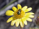 Hulsea vestita with bee as seen in Big Sand Flat. Hulsea vestita with bee as seen in Big Sand Flat.
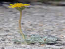 Hulsea vestita in Big Sand Flat. Hulsea vestita in Big Sand Flat.
 Habit of Hulsea vestita in Big Sand Flat. Habit of Hulsea vestita in Big Sand Flat.
641
|
|
|
Literature Cited:
Other articles:
Locations: Big Sand Flat.
642
|
|
Fairly easy to recognize due to, "Crown below soil surface, lower stipules especially underground stipules fused around stem into sheath (Baldwin, et al., 2002)."
|
 First photo taken of Collinsia parviflora, before I knew what it was. First photo taken of Collinsia parviflora, before I knew what it was.
|
There was also this little thing in the swale that I need to key out. I thought needed a day or two to mature.
|
|
|
| Thursday, July 8, 2010.Jan and Kees visited for an afternoon and dinner. Kees and I walked in the meadow where I showed him the little plant that I had discovered that morning. I took a few more photographs, and then learned it was Collinsia parviflora. The closest previous collection to Mono Lake basin was by Mary DeDecker in 1984 at “Sky Meadow,” near Kelty Meadows, about 14 miles southeast of Sagehen Meadow. I can’t really claim to have found this little plant in the Mono Lake basin, but I’m getting close. It’s also interesting to me (and maybe other botanists) that Michael Honer did not collect this species while working on his flora of Glass Mountain. Perhaps it shows the variability of plants from year to year.
|
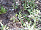 Habit of Collinsia parviflora in Sagehen Meadow Habit of Collinsia parviflora in Sagehen Meadow
 Collinsia parviflora in Sagehen Meadow. Collinsia parviflora in Sagehen Meadow.
643
|
Collinsia parviflora Lindl. In the swale draining the meadow.
|
|
644
|
Mimulus nanus Hook. & Arn. var. mephiticus (Greene) D. M. Thomps. In open areas southeast of the spring. Somewhat ambiguous as to var. mephiticus vs. var. nanus.
|
|
645
|
Phacelia bicolor Torr. ex S. Watson var. bicolor. In open areas southeast of the spring.
|
|
646
|
Arabis hoboellii Hornem. var. pinetorum (Tidestr.) Rollins. In open areas southeast of the spring.
|
|
647
|
Rumex paucifolius S. Watson. Under Jeffrey pines southeast of the spring.
|
|
 Habitat of Penstemon cinicola on upper Dry Creek. Habitat of Penstemon cinicola on upper Dry Creek.
648
|
Penstemon cinicola D. D. Keck. In upper Dry Creek, where it is crossed by Forest Road 1S56, just north of Crooked Meadows.
|
|
|
View upstream (northeast) of Dry Creek.
|
|
Other articles:
Locations:
Dry Creek.
|
|
|
|
View into Dry Creek drainage from divide.
|
|
|
| Friday, July 9, 2010
|
Other articles:
Locations:
South Tufa Area.
|
|
|
Locations:
South Tufa Area.
|
Mimi and her family came the next day after an arduous journey filled with wrong turns. On Friday, we went to the Mono Lake tourist spots, of Panum Crater, the Visitor Center, lunch at the county park, and then South Tufa. We brought our flip-flops and waded in the lake, catching brine shrimp and alkali flies. Then Saturday, we took the shuttle bus into Devils Postpile National Monument. Getting off at the Ranger Station this time, we saw the postpile from bottom and top, and then hiked up to Minaret Falls.
|
|
|
| Saturday, July 10, 2010
|
 Soda Springs on the San Joaquin River. Soda Springs on the San Joaquin River.
|
on the San Joaquin River.
|
|
|
| Monday, July 12, 2010On Monday, Cheryl and I drove to some botanical spots locally, and I made a few collections inside the Mono Lake basin.
|
Locations:
Sagehen Meadow Campground.
649
|
Abronia turbinata S. Watson. On loose sand slope just south of the Sagehen Meadow Campground.
|
|
Locations:
Sagehen Meadow Campground.
650
|
Penstemon speciousus Lindl. on wooded slopes west of the Sagehen Meadow Campground. | Leaves, upper glabrous; Infloresence, axis and pedicels glabrous; Calyx 7-9 mm; Corolla, color blue, 30 mm, throat 11 mm wide; Anthers glabrous (definitely not wooly), sacs not dehiscing full length, spreading not quite 90°.
|
Other articles:
|
|
|
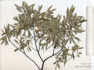 Coll. No. 651, Salix exigua var. exigua Coll. No. 651, Salix exigua var. exigua
651
|
Salix exigua var. exigua. Coyote Willow.
| Tall shrub, forms thickets (maybe clone-forming); Leaves entire, linear, 5-7 (8) mm wide, not glandular at base of blade on petiole, pubescent below, pubesence appressed and parallel to axis.
|
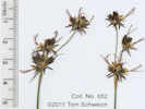 Coll. No. 652, Juncus orthophyllus Coll. No. 652, Juncus orthophyllus
 Coll. No. 652, Juncus orthophyllus Coll. No. 652, Juncus orthophyllus
652
|
Juncus orthophyllus Coville. Straight-Leaf Rush.
| Perennial; Stem with pith; Leaf blade flat, flat side oriented toward stem, sheaths open and not appendaged; Flowers in head-like clusters, 5-6 per cluster; Perianth 5 mm; Anthers basifixed; Ovary not unilocular, ovules and seeds obviously many more than locules; Stigmas 3. In Taylor (2010) this would key out as J. covilleii because of the few flowers per cluster. In TJM2, size of perianth and fruit would distinguish them.
|
653
|
Geum macrophyllum
|
|
654
|
Stellaria longipes var. longipes
|
|
655
|
Gilia sp.
|
|
|
There was a good strong culvert where the road crossed the creek in a tree shaded glen. Along Dry Creek (with running water), I found what I believe to be Thalictrum sparsiflorum, with a common name of Few-Flowered Meadow Rue. For botanist eyes only: it definitely has bisexual flowers, so I’m pretty sure about the determination. This would be the first collection of this plant in the Mono Lake basin away from the Sierra Nevada.
|
|
Other articles:
656
|
|
|
|
Across the creek, the road starts to climb out of the little canyon of Dry Creek. While I collected some interesting things along the road, we eventually came upon a fallen tree across the road. Just beyond the fallen tree was also a gate. But like the gate at the beginning of the road, the gate at the end was open. Regardless, the tree was much too big for me to move, so we had to back down the road, maybe a quarter mile, until I could find a (safe) place to turn around.
|
|
 Coll. No. 657, Ipomopsis aggregata ssp. formosissima Coll. No. 657, Ipomopsis aggregata ssp. formosissima
 Coll. No. 657, Ipomopsis aggregata ssp. formosissima Coll. No. 657, Ipomopsis aggregata ssp. formosissima
657
|
Ipomopsis aggregata (Pursh) V. E. Grant ssp. formosissima (Greene) Wherry. Scarlet Gilia.
| Perennial, infl clusters not on one side of axis (they appear to alternate to me); calyx lobes long-ish (?) but acuminate, not hairy; corolla 23-26 mm, color red; pollen yellow.
|
|
Thinking about lunch, we drove to an overlook of Long Valley that Karl, the contractor, told me about. While the view was pretty, the wind was strong, and the clouds a little thundery, so we decided not to stay at that exposed location, and drove to Pilot Spring for lunch.
| I was a Pilot Spring about a week before. While there, I noticed some Western Columbine (Aquilegia formosa) that were about to bloom. Today, they were in bloom. I made a check up and down the stream bed until I found enough that I thought it OK to collect, about a dozen plants, and then made a small collection. The odd thing about Pilot Spring is that quite a few plants have been collected there once, but not more that that. G. K. Helmkamp collected only Sierra Sanicle (Sanicula graveolens) ever found in Mono County at Pilot Springs in 1997, but I’ve not found it there since. I collected Large-Leaf Avens (Geum macrophyllum) there in 2008 and haven’t seen it at the spring since. And, now, even though this is the fourth year I’ve checked Pilot Spring, I’ve found Western Columbine for the first time. Don’t know if this means anything. Barbara suggested maybe the species are brought there in the wool of sheep, or perhaps on or in other sheep parts.
|
Other articles:
Locations:
Pilot Spring.
658
|
Aquilegia formosa Fisch. ex DC. Western Columbine.
|
|
|
|
|
Other articles:
|
Shooting Stars in Crooked Meadows.
|
|
|
|
|
|
| Tuesday, July 13, 2010When Steve visited, we walked down in the meadow, and I showed him the Ash Penstemon (Penstemon cinicola). Typically, Penstemons looking like this one are determined P. rydbergii var. oreocharis or P. procerus subsp. formosus. However, Dean Taylor’s collection from Crooked Meadows was annotated P. cinicola by Margriet Wetherwax, and a Michael Honer collection from the same location were annotated P. cinicola by Noel Holmgren. I’ve been finding this plant in Sagehen Meadow, and upper reaches of Dry Creek, and I’ve found a few in Big Sand Flat. So I think I have extended the Mono County range of P. cinicola from just Crooked Meadows, to Sagehen Meadow and Big Sand Flat.
|
Other articles:
Locations:
Sagehen Meadow.
659
|
|
17 May 2011: Looked at this again. If I could see the spur being 1-3 mm, then it could be L. a. var. heteranthus, a much more common variety, though mostly in the western portion of the Mono Lake Basin. However, a length of 1 mm is really stretching it. So I don't think it's var. heteranthus. Another alternative is var. palmeri, which Mary DeDecker collected nearby, but I don't see the stem hairs spreading, and the leaves have some green instead of gray to silver. So, I'm staying with var. argenteus.
|
|
| Wednesday, July 14, 2010
|
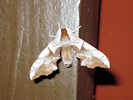 Moth seen at Mono Lake County Park Moth seen at Mono Lake County Park
|
For Katherine’s visit, we did the Mono Lake spots on Wednesday, and then took an abbreviated trip on Thursday to the Long Valley Overlook. On the way we stopped at Crooked Meadows to look at the Shooting Stars, and also found a lot of the Ash Penstemon. On the way back we stopped along Sagehen Meadows Road to view the “arborglyphs.”
| As this was our third time stopping along the road, we’re beginning to understand that Jose Irigoyen was a prolific arborglyphist. . I thought the glyph in the photo at right showed a lot of creativity with the stylized carving of the letters. Hopefully, Jose was just as creative in his sheep herding. I’m not sure how much time he spent guarding the sheep. And perhaps a few were carried off by the coyotes, as he may have documented that as well. One of the arborglyphs is the epithet “Estuos putas coyotes.” Many of these glyphs carry dates of 1967 and 1970. We’ve been seeing a few signs that sheep are still grazed in the area. Tuesday, we noticed a loading chute between Mono Mills and Big Sand Flat. And, later, while climbing Panum Crater with Katherine, we noticed a double-decker stock truck and trailer. Friday, we saw a water truck going up Sagehen Meadow Road. Supposedly, the sheep herders will come and ask if they can graze the private property in the meadow. We’re pledged to ask them not to do so. We really want to keep the meadow nice and attractive because it’s for sale. (And, actually, truth be told, I’d be really sad if the Forest Service lets the sheep graze the meadows. As dry and sandy as they are, they would look horrible if grazed and torn up by the sheep.) I just hope they don’t come while we’re gone. Or, if they do come while we’re gone, they’ll assume that not having permission means they shouldn’t graze the meadow.
|
Locations:
South Tufa Area.
|
I saw this Torrey's Blazing-Star (Mentzelia torreyi) along the trail at South Tufa. There are no collections of this taxon at this location. All collections in the Mono Lake basin are around Black Point.
|
|
|
| Thursday, July 15, 2010
|
660
|
Eriogonum spergulinum var. reddingianum
|
|
Locations:
Sagehen Meadow.
661
|
|
|
662
|
Achnatherum hymenoides
|
|
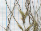 Coll No. 663, Stipa comata Coll No. 663, Stipa comata
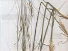 Coll No. 663, Stipa comata Coll No. 663, Stipa comata
663
|
Stipa comata Trin. & Rupr. Var. comata Needle and Thread. Distal awn curled in age.
|
|
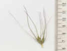 Coll. No. 664, Hordeum jubatum Coll. No. 664, Hordeum jubatum
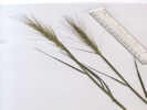 Coll. No. 664, Hordeum jubatum Coll. No. 664, Hordeum jubatum
664
|
Hordeum jubatum L. ssp. jubatum Foxtail Barley. North of the meadow among sagebrush.
| 7 June 2011:
|
Other articles:
|
|
|
Other articles:
|
View south of the Owens River and Long Valley.
|
|
Other articles:
|
Near the summit on Sagehen Meadows Road is an excellent view point.
|
|
Other articles:
|
Beside the road are numerous arborglyphs.
|
|
|
| Friday, July 16, 2010
|
Locations:
Sagehen Meadow.
665
|
|
|
Locations:
Sagehen Meadow.
666
|
|
|
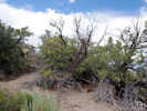 Mountain Mahogany on hills near Sagehen Meadow Mountain Mahogany on hills near Sagehen Meadow
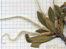 Detail of Collection No. 667. Detail of Collection No. 667.
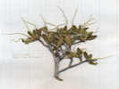 Overview of Collection No. 667. Overview of Collection No. 667.
667
|
Cercocarpus ledifolius Nutt. var. intermontanus N. H. Holmgren. Curl-leaf Mountain Mahogany.
|
|
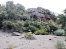 Ocean Spray (Holodiscus discolor var. microphyllus) on hill above Sagehen Meadow Ocean Spray (Holodiscus discolor var. microphyllus) on hill above Sagehen Meadow
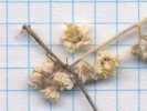 Flowers of Collection No. 668, Holodiscus discolor var. microphyllus Flowers of Collection No. 668, Holodiscus discolor var. microphyllus
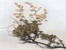 Overview of Collection No. 668, Holodiscus discolor var. microphyllus Overview of Collection No. 668, Holodiscus discolor var. microphyllus
668
|
|
|
 Coll. No. 669, Phacelia ramosissima Coll. No. 669, Phacelia ramosissima
 Coll. No. 669, Phacelia ramosissima Coll. No. 669, Phacelia ramosissima
669
|
Phacelia ramosissima Douglas ex Lehm. Var. ramosissima
|
|
 Coll. No. 670, Grayia spinosa Coll. No. 670, Grayia spinosa
670
|
Grayia spinosa (Hook.) Moq. Spiny Hop Sage.
|
|
 Incoming Storm Incoming Storm
|
Incoming storm.
|
|
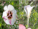 Bruneau Mariposa Lily (Calochortus bruneaunis) as seen north of Sagehen Meadow Bruneau Mariposa Lily (Calochortus bruneaunis) as seen north of Sagehen Meadow
|
Possible Calochortus bruneaunis seen on the hill slope north of Sagehen Meadow. Only one seen, not collected.
|
|
|
| July 17 to July 19thAs you might have gathered, Cheryl and I are visiting our parents for a few days. Here, near sea level, the air has a soupy, humid feel to it. I think we’ll be glad to return to the dry, thin air of Sagehen Meadow. Clothes dry on the line in about a half-hour. Shirts never feel sticky or wet. And exposing a sweaty back by taking off a back pack, leaves one shivering from the cold. We’re also acclimatized to having few people around. The direct route from Sagehen Meadow to Atascadero is by way of Yosemite Valley. The traffic jams and crush of people at Bridalveil Fall,and the Wawona tunnel viewpoint were a little overwhelming. Not to mention the highway construction on California Highway 41 between the valley floor and Wawona. For the return trip, we’re hoping to miss some of this by using CA Highway 140 to the valley. There is just no reasonable way to avoid Tioga Pass and Tuolumne Meadows. The other passes all take much more time.
|
|
| Thursday, July 22, 2010
|
Other articles:
|
One of the landforms we have out here are barren sand slopes scattered here and there. You may have seen them in my other photos of Sagehen Peak. The photo at right is a closeup and the sand slope is just below center. When we first arrived in early June, the slopes looked quite barren.
| As the summer has past, though, the slopes have taken on a silvery green aspect. On Friday of last week, I made an expedition to one of these slopes. On close inspection, it turns out these slopes are very loose and soft cinders. There is almost a monoculture of lupine on them, the same species I identified near the house in Sagehen Meadow: Lupinus argenteus var. argenteus. I’m the only guy around here who thinks the variety argenteus can be found here. Michael Honer who did the Glass Mountain flora lists variety palmeri, but then again, none of his collections indicate that he ever collected specifically on these “barren” sand slopes. So maybe it’s another small issue that will have to be resolved back in the herbarium. Around the edges of the sand slopes are buckwheats and penstemons, but besides the lupines, the only other plant growing in the sand slopes is an odd little thing called Shield Plant (Streptanthus tortuosus). This is another high Sierra plant that I am finding out here in the high, dry meadows. I guess the lesson is that staying in one smallish area, and looking again and again, you’ll find something no one else has found.
|
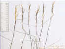 Coll. No. 671, Stipa occidentalis var. occidentalis Coll. No. 671, Stipa occidentalis var. occidentalis
671
|
Stipa occidentalis Thurb. ex S. Watson var. occidentalis. Beside Sagehen Meadows Road approximately 1/2 mile north of Sagehen Peak.
| Coll. No. 671, 5 Nov 2011, Characters observed while keying: Lemma hairy; Palea << lemma; Awn all segments hairy, lowest hairs < hairs on upper lemma.
|
Other articles:
672
|
Rosa woodsii Lindl. var. ultramontana (S. Watson) Jeps. In a flat area beside Sahegen Meadows Road approximately 1/2 mile north of Sagehen Peak, 7/22/2010 Sagehen Peak, Mono County, California. (Sagehen).
| 30 Oct 2011: Characters observed while keying: Shrubs large; Leaves glandless; Leaflet tip rounded (as opposed to truncate); Prickles generally terete, slender, straight or slightly curved; Sepals glandless, tips entire, persistent in fruit (Note to self: remember the ovary is inferior, so the sepals are on top of the fruit.); Petals 10-25 mm (measured 10-19 mm); Pistils >10 (observed 26±).
|
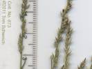 Coll. No. 673, Muhlenbergia richardsonis Coll. No. 673, Muhlenbergia richardsonis
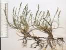 Coll. No. 673, Muhlenbergia richardsonis Coll. No. 673, Muhlenbergia richardsonis
673
|
Grass, looks somewhat like a saltgrass.
|
|
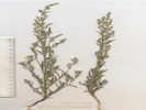 Overview of Coll. No. 674, Chenopodium leptophyllum Overview of Coll. No. 674, Chenopodium leptophyllum
674
|
Chenopodium leptophyllum (Moq.) Nutt. ex S. Watson. In a flat area beside Sagehen Medows Road about 1/2 mile north of Sagehen Peak.
| 27 Oct 2011: Characters observed while keying: Annual, Leaves dull green to grayish; Lower Blades, one-veined from base, < 3.5 mm wide (measured 2 mm wide); Seed horizontal.
|
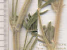 Detail of Coll. No. 675, Lupinus argenteus var. argenteus Detail of Coll. No. 675, Lupinus argenteus var. argenteus
675
|
Lupinus argenteus Pursh var. argenteus.
| Characters observed while keying: Perennial > 1 dm, stem hairs appressed, leaves cauline, petioles 4-4.5mm, calyx spurred <= 1 mm, banner back hairy, keel upper margin ciliate distal half.
|
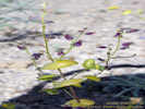 Coll. No. 676, Streptanthus tortuosus Coll. No. 676, Streptanthus tortuosus
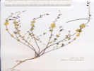 Coll. No. 676, Streptanthus tortuosus Coll. No. 676, Streptanthus tortuosus
676
|
Streptanthus tortuosus Kellogg. Glabrous throughout, cauline leaves clasping. On a barren sand slope about 1/3 mile north northwest of Sagehen Peak, and east of Sagehen Meadow Road, 7/22/2010 Sagehen Peak, Mono County, California. (Sagehen).
|
|
677
|
Penstemon speciosus Lindl. On a barren sand slope about 1/3 mile north northwest of Sagehen Peak, and east of Sagehen Meadow Road, Common at this location, nearly finished flowering. 7/22/2010 Sagehen Peak, Mono County, California. (Sagehen).
|
|
 Habitat of Eriogonum microthecum var. ambiguum Habitat of Eriogonum microthecum var. ambiguum
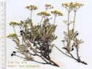 Overview of Coll. No. 678, Eriogonum microthecum var. ambiguum Overview of Coll. No. 678, Eriogonum microthecum var. ambiguum
678
|
Eriogonum microthecum Nutt. var. ambiguum (M. E. Jones) Reveal. On a dry mesa about 1/3 mile north of Sagehen Peak, and east of Sagehen Meadow Road, 7/22/2010 Sagehen Peak, Mono County, California. (Sagehen).
| 27 Oct 2011: Characters observed while keying: Subshrub ± erect (not cushion-like or matted); Stems upright, not jointed; Leaves not in fascicles, 10-20 mm, slightly rolled under; Bracts scale-like (as opposed to leaf-like); Infloresence branches short, evenly branched; Involucres solitary, terminal; Perianth base not jointed with a pedicel, glabrous, yellow.
|
|
| Friday, July 23, 2010
|
Other articles:
679
|
Lupinus argenteus Pursh var. meionanthus (A. Gray) Barneby. Leaves cauline, flower white, banner glabrous, keel ciliate entire length. Among Jeffrey pines at the northwest base of the peak with the "Crooked" benchmark, at the end of Forest Road 1S161.
| Coll. No. 679, 5 Nov 2011, Characters observed while keying: Perennial, herb, >= 3 dm tall (obs: 4.5-5 dm); Leaves cauline, spread along stem; Leaflets 22-38 mm, upper surface appressed hairy, not wooly; Infloresence open; Pedicels slender, 4-5 mm; Calyx spur mere bulge; Bracts persistent; Flower white, 10-11 mm; Banner base lightly hairy, back glabrous; Keel upper margin ciliate claw to tip not uniform, cilia density increases claw to tip. Keys to Lupinus holmgrenanus in TJM1, L. gracilentus in TJM2, L. argenteus var. meionanthus in TJDM, and L. pratensis var. eriostachyus in Taylor (2010). The larger flower size of 10-11 mm is usually what gets one off track while keying. Also, the persistence of the bracts can be a problem.
|
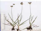 Coll. No. 680, Juncus orthophyllus Coll. No. 680, Juncus orthophyllus
680
|
Juncus orthophyllus Coville. Streambed in upper reaches of Dry Creek, above Big Sand Flat.
| Perennial > 10 dm; Stem with pith; Leaf mostly basal, blade flat, flexible, flat side oriented toward stem, sheaths open and not appendaged; Flowers in head-like clusters, 5-6 per cluster; Perianth 4-5 mm; parts <= 1.5 mm wide; Anthers basifixed; Ovary not unilocular, ovules and seeds obviously many more than locules; Stigmas 3. In TJM1 and Taylor (2010) the few number of flowers per cluster would lead one to J. covilleii, which has been collected once in Slate Creek Valley (J. Clausen, 1839, Sep 14 1940, UC1154006). In TJM2, size of perianth and fruit would separate them. TJDM does not include J. covilleii.
|
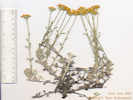 Coll. No. 681, Eriophyllum lanatum var. integrifolium Coll. No. 681, Eriophyllum lanatum var. integrifolium
681
|
Eriophyllum lanatum (Pursh) J. Forbes var. integrifolium (Hook.) Smiley. Sandy soils among Jeffrey pines near the top of Dry Creek.
| Coll. No. 681, 3 Nov 2011: Characters observed while keying: Perennial subshrub, not thistle-like; Leaves entire to 3-(5-)lobed (not compound), margins flat; Headsradiate, > 15 mm wide including ligules (obs: 17-18 mm wide); Phyllaries 5-10 or < 15 (1 obs = 8), keeled; Receptacle naked; Flowers not all ligulate, color yellow; Ray flowers present ±8 (1 obs = 7); Achenes with a small crown-like pappus of scales.
|
 Coll. No. 682, Calyptridium umbellatum Coll. No. 682, Calyptridium umbellatum
682
|
Calyptridium umbellatum (Torr.) Greene. Mt. Hood Pussypaws.
(Syn: Calyptridium umbellatum var. caudiciferum (A. Gray) Jeps.; Cistanthe umbellata (Torr.) Hershk.)
3 Nov 2011: The smaller of these two specimens were partially dissected to show whether the infloresence was terminal (C. umbellatum) or axillary (C. monospermum). I could not really see that, but it is clear that there are multiple rosettes (C. umbellatum) rather than a single rosette (C. monospermum).
|
|
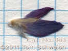 Coll. No. 683, Lupinus lepidus var. confertus Coll. No. 683, Lupinus lepidus var. confertus
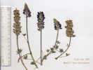 Coll. No. 683, Lupinus lepidus var. confertus Coll. No. 683, Lupinus lepidus var. confertus
683
|
Lupinus lepidus Douglas ex Lindl. var. confertus (Kellogg) C.P. Sm. Leaves basal and cauline, banner glabrous, keel white to dark red-purple, ciliated distal half. Uppermost portion of Dry Creek, sandy soil of volcanic cinders. 7/23/2010 Dry Creek, Mono County, California.
| 30 Oct 2011: Characters observed while keying: Perennial herb; Leaves mostly cauline, spread along stems, upper and lower surfaces hairy; Leaflets largest < 40 mm (obs: 10-12 mm); Infloresence > leaves, dense, whorls > 7 (obs: 8-10); Calyx spur 0-1 mm; Banner back glabrous, spot yellow; Keel ciliate on distal half, color white to dark red-purple.
|
 Coll. No. 684, Phacelia hastata var. compacta Coll. No. 684, Phacelia hastata var. compacta
684
|
Phacelia hastata var. compacta Hairs more spreading than appressed, calyx glandular below hairs.
|
|
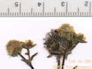 Detail of Coll. No. 685, Geum macrophyllum Detail of Coll. No. 685, Geum macrophyllum
685
|
Geum macrophyllum Willd. Mouth of Dry Creek at Big Sand Flat, close to California Highway 120.
|
30 Oct 2011: Characters observed while keying: Perennial herb, drying green; Flowers 3-10 (observed: 8, 10), erect; Epicalyx should be present per Taylor (2010) but unable to see; Sepals 4, green; Hypanthium shape ? (unable to observe in dried specimens), bractlets unclear (but see small appendages circled in red on detail photo); Petals present, yellow; Styles persistent, 2-9 mm (obs: 4-5 mm), tapered, hooked, bristles at base (see detail photo, conflicts with species description), not plumose.
|
Other articles:
|
View into Mono Lake basin from Sagehen Meadows Road.
|
|
Other articles:
|
|
|
Other articles:
|
Forest Road 1S160 (1S437) crosses a dry tributary of Dry Creek. This may be a good place to access the main course of Dry Creek.
|
|
Other articles:
|
Divide between Adobe Valley and Mono Lake basin.
|
|
Other articles:
|
|
|
Other articles:
|
|
|
Other articles:
|
|
|
Other articles:
|
East end of Forest Road 1S12.
|
|
Other articles:
|
View of the Mono Craters from Little Sand Flat.
|
|
|
| Saturday, July 24, 2010
|
|
View of sand slope on north side of Sagehen Peak.
|
|
|
| Sunday, July 25, 2010On Sunday, we took a little trip to the Bodie Hills. There is a little lupine that stumped me last time I visited in 2007. This time, I sat in the dirt with the plant and the book and worked through the key, until I arrived at Lupinus lepidus var. lobbii., sometimes called the Donner Lake Lupine. It grows in mats with some of the flowers above the leaves, and some below. This little lupine is actually quite common in the upper Mono Lake basin, at such places as Saddlebag Lake, Dana Plateau, and Tioga Pass. So it’s a little unusual to find it in the Bodie Hills away from the Sierra Nevada. And there is another similar lupine that others have collected in the Bodie Hills, called Lupinus breweri, or Brewer’s Lupine. Brewer, by the way, was the botanist on the California Geological Survey in 1860-1864. Oftentimes, the identification of a plant hinges on subjective observations, such as: would you dense the arrangement of flowers as “dense” or “open.” In this case, I think the flowers are dense, so I’m going with the Donner Lake Lupine rather than Brewer’s Lupine. Of course, the right thing to do is to check my determination with a Lupine expert when I get back to the herbarium. I hope I’m right, but time will tell.After collecting the little lupine, we were exploring a little dirt road, and saw some ears sticking up. There were pretty big for deer ears. Turns out they were antelope ears, and this little herd numbered 6 or 7 individuals. They would not let us get very close, nor would they stand still while I changed lenses on my camera, so this is about the best photo I could get. The other thing we saw on this trip has me puzzled a bit. It’s an exclosure of some sort, i.e., it’s meant to keep animals out. The usual purpose is to see what effects animals, such as cows or sheep, are having on plants by excluding them from an area, and then comparing the measurements of things inside the exclosure to things outside. I’ve seen three of these this summer: this one in the Bodie Hills, one in Big Sand Flat, and another in Alkali Valley. They are of the same dimensions, roughly 3 feet on a side and 4 feet tall, roughly pyramidal, and made of welded rebar and 6 inch wire. The thing is, the area inside the exclosure is quite small, so the organism under treatment must be quite small also. It can’t be a big bush. Maybe someone is studying the effects of large grazing animals on ants, and ant hills (?). Of course, the pyramidal shape could also suggest they are navigation beacons for aliens ….. *<8^)
|
Other articles:
686
|
|
Plant < 1 dm, matted, cauline lvs clustered near base, leaf upper surface hairy, largest lflt < 40 mm, infloresence gen > lvs, sometimes < lvs, dense, headlike, 2-8 cm, calyx spur 0, bracts persistent, banner back glabrous, upper keel margin glabrous. Same as my collection no. 487.
|
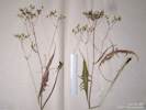 Coll. No. 687, Crepis intermedia Coll. No. 687, Crepis intermedia
687
|
Crepis intermedia A. Gray. Limestone Hawksbeard. | Coll. No. 687, 7 Nov 2011, characters observed while keying: Perennial 6 dm tall; Leaves alternate, pinnately lobed; Infloresence a panicle with 7-19 heads; Involucre 10 mm long; Phyllaries in 2 series, 4 outer << inner, 4 inner black tipped; Receptacle naked; Flowers unable to discern color or ray vs. disk; Achenes 6, pappus of bristles.
|
Other articles:
688
|
|
Coll. No. 688, 7 Nov 2011, characters observed while keying: Perennial herb (not shrub), to 4 dm, without stolons; Stem some hairs weakly glandular; Leaflets 3; Petals yellow, 1.5 mm; Carpels numerous on a convex receptacle; Styles attached at tip of achene (carpel?), 0.6 mm long, widest at base, bumpy; Achene glabrous.
|
Other articles:
689
|
Horkelia fusca Lindl
|
|
Other articles:
|
Small miners cabin and spring in Cottonwood Canyon.
|
|
690
|
Mimulus primuloides
|
|
Other articles:
690.1
|
|
Cottonwood Canyon, Mono County, California. At small spring and miner's cabin 0.6 mi (1 km) south southwest of Sugarloaf. 38.1795°N, 119.0123°W. WGS 1984 Elev. 2440 m.
Coll. No. 690.1, 8 Nov 2011, characters observed while keying: Annual, to 1 dm, glabrous, not tap-rooted; Leaves basal 0, cauline opposite, to 3 cm, 1 cm wide, not reduced above; Ovary inferior; Hypanthium, ±1 mm. (measured from ovary tip? to sepal base); Sepals 4, 3 mm; Petals 4, white to rose; Stamens 2 × 4 = 8, unequal; Stigma entire.
|
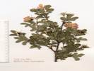 Coll. No. 691, Rosa woodsii var. ultramontana Coll. No. 691, Rosa woodsii var. ultramontana
691
|
Rosa woodsii var. ultramontana
|
|
Other articles:
|
Looking back into the Clearwater Creek drainage. Clearwater Creek is tributary to the East Walker River.
|
|
Other articles:
|
We saw a small herd (6 or 7 animals) of antelope.
|
|
Other articles:
|
Small exclosure alongside the road. I'm seen similar exclosures in Alkali Valley and Big Sand Flat.
|
|
Other articles:
|
Noticed a couple of small fires north of the highway.
|
|
Locations:
Sagehen Meadow.
|
7:20 PM, we take a walk in the meadow after a day of thunderstorms.
|
|
Other articles:
|
| Monday, July 26, 2010Monday July 26th So, we had a little fire drill on MondayYou may know that eastern California has had a lot of thunder and lightning in the past few days. We had quite a lightning show out here, and about a quarter inch of rain. The National Interagency Fire Center listed this event as being 33 fires of varying sizes. Well, late Monday afternoon, I looked out the back window, and saw all this smoke billowing up. It was huge. It was also clear that the smoke was being blown to the northeast, i.e., parallel to the house. But it looked pretty close. We decided to go take a look. The exercise of putting our shoes on became an exercise is gathering whatever stuff we thought we would need for a day or two. A week of pills, a change of clothes, our computers, cameras, etc. As we were driving out the road, the main question to us was whether the fire was on our side of CA Hwy 120 or the other side. But as we got closer to the highway it became apparent the fire was some distance away, about 10 miles away, down by the Mono Crater, Panum Crater and the South Tufa area. We felt a little sheepish, but drove down nearer to the fire, where a nice CHP officer told us that Highway 120 was closed because the fire was about to jump the road. It’s not like CA Highway 120 is the only route by which we can leave the house. We could leave to the southwest, by way of the dirt Bald Mountain Road. Or, we could go south and then east on another dirt road, past Crooked Meadow, Sentinel Meadow and Dexter Canyon. Or, even closer to home is a small 4WD road that comes out on CA Hwy 120 at Gas Pipe Spring. We actually drove that route one day just after we arrived here, just to make sure which little road to take, and where it comes out to the highway. Anyway, after having a nice chat with the CHP officer (AAA with guns), we drove back to the house, had dinner and went about our business. I collected three different plants, and then getting chased back to the house by a rapidly approaching thunderstorm. We have gotten quite a bit of rain the last few days, and this wave of thunderstorms came through. According to the rain gauge, we got about a quarter inch of rain, enough to dampen down the dust. That small amount of rain only soaks into the soil an inch or so, but I imagine it’s enough to benefit the plants somewhat.
|
Locations:
Sagehen Meadow.
692
|
|
|
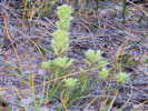 Castilleja pilosa in Sagehen Meadow Castilleja pilosa in Sagehen Meadow
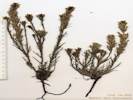 Coll. No. 693, Castilleja pilosa Coll. No. 693, Castilleja pilosa
693
|
Castilleja pilosa (S. Watson) Rydb.
|
|
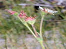 Horkeliella congdonis in Sagehen Meadow Horkeliella congdonis in Sagehen Meadow
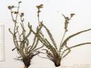 Coll. No, 694, Horkeliella congdonis Coll. No, 694, Horkeliella congdonis
694
|
Horkeliella congdonis (Rydb.) Rydb. Congdon's False Horkelia
|
|
 Leaf of Diplacus mephiticus Leaf of Diplacus mephiticus
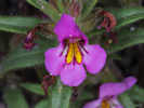 Flower of Diplacus mephiticus Flower of Diplacus mephiticus
|
Photographs of Mimulus nanus, after comparison with Thompson (2005) determined to be var. mephiticus
|
|
|
| Tuesday, July 27, 2010Tuesday morning, we planned to attend a wildflower walk along the Tioga Pass Road, near Ellery Lake. It was to be led by Cathy Rose, a National Park Service volunteer at Tuolumne Meadows. Turns out that Cathy Rose knew Carl Sharsmith (the Mountain Sage, as his biography is titled) and she has been leading wildflower walks for a long time.Of course, to get to Tioga Pass, the best route is still west on California Highway 120 past the location of the fire. I checked the CalTrans and CHP web sites Tuesday morning and learned that the highway was still closed. One of the lines on the CHP web site was, “ 9:15PM They will be keeping the roadway closed all the way out of Benton Crossing because of European tourists running out of gas. I guess American tourists know not to run out of gas, or residents can fend for themselves or something like that. We decided to call CHP when we got out to the road and see if, as residents, we would be allowed to pass through the fire zone, not to mention we were curious about what the fire zone looked like. Well, CHP thought we could get through, but transferred us to the Mono County Sheriff. They thought we could get through also and said, “Come on down, we’ll let you through.” At South Tufa, the highway was barricaded. We drove around the barricade since we’d been invited to “come on down.” The Deputy Sheriff we encountered hadn’t heard of our personal invitation, however, and greeted us with flashing lights and a “Whaddya doin’ out here?!?!?!?” Upon explanation, his passenger recognized our name, and suggested to the Deputy that he let us through. And then it was just kind of interesting to drive slowly through the fire zone. Here and there would be a burning bush (no divine words, however) a smoldering tree, a CalFire, Forest Service, or BLM truck, with guys standing around. We saw a truck marked Stanislaus Hot Shot Team, so I imagine they drove over very early this morning. Basically, I think they were just standing by to see if the afternoon winds came up or not. One thing that was apparent was the fire had not jumped the highway. Our original objective, which you may remember from the previous page, was a Wildflower Walk hosted by Cathy Rose. Our meeting place was the dam behind which Ellery Lake is found. Right off the Tioga Pass road, the elevation is about 9000 ft, so the zone was maybe low Alpine zone. Southern California Edison, who owns the dam, and the powerhouse below, has installed a catwalk across the spillway for fisherman and wildflower walk access. For the walk we followed a little road, probably left over from construction of the dam and penstock. I have driven by this location many times, but never stopped and crossed the dam, and never knew this little road, or hiking trail, was hidden there. We saw a lot of interesting plants, mountain heathers and other things in the Heath family, 5 species of conifer tree, and a little tiny Astragalus (loco weed) with spines on the tips of its leaflets. As the field trip ended at noon, we went by the post office to collect our mail, and then to the Mobil gas station for lunch. We shared the Chicken Caesar Wrap, half of which was just right for lunch. Then we toured the June Lake Loop, and came home. It was pretty clear that CA Hwy 120 would be closed, so we came back via some of the dirt back roads. The forest south of Mono Lake has a lot of good dirt roads. Perhaps this is due in part to a large number of small fires, as the roads pass through many burned areas, and other areas where a lot of fuel reduction work has been done. The route was south on US Hwy 395 to Bald Mountain road, east on that road, and then north on Indiana Summit Road back to Highway 120 in Big Sand Flat. From our road, Sagehen Meadows Road, we could look back toward the Mono Craters, and see that the wind was whipping the fire out of control again.
|
Other articles:
|
Wildflower walk led by Cathy Rose near Ellery Lake.
|
|
|
| Thursday, July 29thAnd then, last Thursday, we attended the opening of an exhibit of Mono Paiute baskets and other woven work at the Forest Service Visitor Center. The Mono Paiutes are not a federally recognized tribe, so they don’t have a reservation and other benefits that come with recognition. They’re working on recognition, but it seems to be a long and difficult road for them. This exhibit features the work of six Mono Paiute women.Finally, after the exhibit opening we went to the Thursday night bluegrass at the Mobil Station. I had the Baby Back Ribs. The bluegrass music was pretty good, and we enjoyed talking with our table mates.
|
|
| Saturday, July 31, 2010Saturday,July 31st Saturday we went to a concert in Parsons Lodge near Tuolumne Meadows. The concert was given by Malcolm Dalglish and his Ooolation Singers. It’s really the performance part of a summer musical camp that Dalglish runs. Their headquarters are at a resort called “Burgers” fairly close to Lee Vining. To get there you have to go up the Log Cabin Mine Road. That’s one of the roads we haven’t done yet. It’s on our list, though. The music was eclectic, there were a couple of traditional Irish songs, some mouth music somewhat like the Bobby McFerrin music, and even a little klezmer, complete with a trombone. This concert was held in Parsons Lodge near Tuoloumne Meadows. To get there you park near Lembert Dome, and then walk about a half mile south. At nearly the same place is Soda Springs, where the water is naturally carbonated. Parsons Lodge was built a long time ago by the Sierra Club, as a place to meet and discuss, and enjoy.
|
Locations:
Soda Springs.
|
Soda Springs with Frasera speciosa
|
|
|
| Sunday, August 1, 2010Sunday, August 1st Sunday, we visited Mono Craters. We went on Sunday to avoid the huge trucks that haul the pumice from the pumice mine down off the craters. I wasn’t quite sure what we’d find. I was very surprised, however, to find the Inyo Green Gentian (Frasera puberulenta). This is a not-so-distant cousin of the little plant (or as some of my bicycle friends like to say, “weed”) that I study in the eastern Mojave. The habitat was also somewhat analogous as well: exposed areas on bare and loose rocky slopes with no soil. We also saw a lot of poison angelica (Angelica lineariloba), one of those Carrot-family things that you really don’t want to eat.
|
Other articles:
695
|
|
Coll. No. 695, 13 Nov 2011, characters observed while keying; Plant short-lived perennial, chlorophyll, without milky sap, dying after flowering, caulescent; Leaves, simple, opposite, linear, sessile, lower clasping, narrow white margin, puberulent, 10 mm wide; Inflorescence open, distal in small cyme; Corolla regular, rotate, lobed to near base, base of sinus between corolla lobes unappendaged; Petals 4, fused at base, 1 prominent nectary pit; Stamens 4, alternate with corolla lobes; Anthers opening longitudinally; Ovary superior, chamber 1; Style 1; Stigma 2-cleft.
|
Other articles:
Locations:
Lower Horse Meadow.
Upper Horse Meadow.
|
| Monday, August 1, 2010
|
|
| Tuesday, August 3, 2010Tuesday, August 3rd Today, we attended another Cathy Rose wild flower walk. This one started at the junction of the Tioga Road (CA Hwy 120) and Saddleback Lake Road. The “destination” of this walk was the mining ghost town of Bennettville. The mine was called the Great Sierra Mining Company. An incredible amount of mining equipment was hauled from Lundy, over Lundy Pass, past Saddlebag Lake to the location of the mine, near Tioga Pass. Alas, the mine owners fell victim to “supergene” enrichment. Often a deposit of ore gets enriched right at the surface of the earth, as erosion wears the mountain away. Once the mine shaft gets below the surface, and below the zone of supergene enrichment, the ore becomes poor, and there is no reason to continue digging. Well, at the Great Sierra Mining Company, the rich ore vein was on top of the ridge, and the clever owners decided to drive a tunnel below the ridge, intersect the vein, and then dig up through the vein. Except … the tunnel, more than 1800 feet long never intercepted any ore worth mining. One by one the owners lost interest or died and Bennettville slipped into decay. It’s a great hike, lots of Sierra plants to see. And when you get to Bennettville you’re on the nearly to the first of a chain of lakes called Shell Lake. In the photo above, you can see our group, from left to right: Yin-Yin, Rachel, Cathy, and Cheryl. I really like that area, and while quite high, nearly 10,000 ft, it’s fairly easy walking.After the wildflower walk we went to the Post Office, got gas, and lunch at the Mobil Station. I had the barbecued baby back ribs, and Cheryl had one of today’ specials, the Black Bean Chicken Tortilla Soup. All very delicious.
|
|
| Wednesday, August 4, 2010The next day after I last wrote was our Mammoth Lakes Shopping Day. It was also time to get the oil changed in Cheryl’s car. We took both cars to Mammoth, and dropped her car off at the Chevron station. They we went to Mammoth Ski area, and bought tickets to ride the tram to the top of Mammoth Mountain. For some strange reason, we also signed up for the lunch on top. I mean, it sounded like a good idea at the time.Well, they put you in one of those little pods that have sides made out of 24 gauge aluminum, windows out of 1/16” Plexiglas, and no handle of any sort to hang on to. I was figuring that there would be something you could grip hard enough to keep the pod attached to the cable. Nope, the best handle was your seat bottom that was hinged loosely so that bicycles and snow boards could be stowed aboard. This experience is heightened by the realization that there are two sequential cable runs and, at the station in the middle, your little pod is automagically removed from one cable and put on another. The test of whether your little pod is securely attached onto the cable is when you are launched out of the station and into thin air. There is also the featured personal quiet time, in which the cable is stopped when you are at the highest point above solid ground, and allowed to swing in the wind (well, OK, jiggle slightly in a very light breeze), until you begin to babble quietly to yourself. As you might expect, they save the best for last, meaning it’s the last section of cable that is the longest and steepest. I’m not saying I was traumatized by this experience. I am admitting, however, that I chose to carry my lunch back down in my backpack, rather than risk littering the floor of our little pod with it. We did enjoy our time on top of Mammoth Mountain, though. The view is fantastic, ranging from the Minarets to the west, Long Valley to the east, Mammoth Lakes Basin to the south, and if you squint a little, Mono Lake to the north. Back at the Mammoth Ski Lodge, we enjoyed our lunch, and watched the kids on the climbing wall. Then it was off to Von’s for another delightful shopping experience, back to the Chevron station to pick up Cheryl’s car, buy some produce at the Farmers Market, and then home again.
|
Locations:
Mammoth Mountain.
|
View from the top of Mammoth Mountain.
|
|
Literature Cited:
Locations:
Red Cones.
|
View of Red Cones, a pair of ca. 8500 yr B.P. basaltic cinder cones.
|
|
Locations:
Mammoth Mountain.
|
View of Mammoth Mountain.
|
|
|
| Friday, August 6, 2010Friday, August 8th Friday the 8th, we set off to Dechambeau Ponds, a series of ponds around a hot spring on the northeast side of Mono Lake. These ponds are a good place to see waterfowl, and find plants that are adapted to a hot spring environment. I couldn’t find the hot spring, although the pond in the photo was warm, maybe 85 or 90 degrees. Having exhausted the possibilities, we headed for the Virginia Lakes basin. This is just north of the Mono Lake basin. In fact, you drive just to the north edge of the Mono Lake basin, at Conway Summit on US 395, and then turn west. After a little lunch, we headed up the trail, ending at the third lake up: Cooney Lake, and behind it is Dunderberg Peak. . Along the way, we saw monument plant (Frasera speciosa) that is a close relative of the little plant that I study in the eastern Mojave. I’m a little curious about why this plant has been collected in the Virginia Lakes Basin, Tuoloumne Meadows, and around Mammoth, but it has never been collected in the Mono Lake basin, even at Tioga Pass. We also saw lots of fishermen and a lot of day hikers. I guess the thing about the Virginia Lakes basin is that the road to the trailhead goes quite high, so with a little bit of hiking, you can be in the alpine areas. It’s a little like Tioga Pass in that way
|
|
| Saturday, August 7, 2010On Saturday the 7th, we followed a local road, called Dexter Canyon Road, from beginning to end. There is a really helpful book of tours in Mono County. It’s about 35 pages long and has about 16 or 17 auto tours that one can take around the county. This particular tour begins near Sagehen Meadow in Big Sand Flat, and then goes through the mountains between the Mono Lake basin and the Long Valley caldera, before coming out in Adobe Valley. Along its route, the road passes some well known research areas. One is the Sentinel Meadow RNA (Research Natural Area) and a place called Wet Meadows. When I was first reviewing plant collections near Mono Lake, I noticed a lot of collections were made in wet meadows. I wondered why the meadows were so wet, and why there were so many of them. Eventually it dawned on me that there was one place called Wet Meadows. Wet Meadows is a pretty place, but a little dry when we saw it. Probably, it is better visited in early July, than in early August.From Wet Meadows we saw some nice views of Dexter Canyon and Glass Mountain. Glass Mountain is probably the largest single volcanic mountain on the rim of the Long Valley caldera. It’s on the northeast wall of the caldera, pretty much opposite of Mammoth Mountain. In this photo, you can see Dexter Canyon Road, as is descends from the foothills of Glass Mountain, and drops down into Taylor Canyon. In the bottom of Taylor Canyon, where is meets with Dexter Canyon, we came upon a ranch for sale. It has a new 2 bdrm house, 200 acres, and a private trout pond. And … it’s for sale for only $2 million. I got a kick out of the realtor’s sign: the Shoulda-Bin-A-Cowboy Land & Cattle Company. Actually, this house could be our nearest neighbor. Sagehen Meadow is just over the distant ridge on the right. Not unlike a lot of places in rural Mono County, it’s not far, but there is just no good way to get there. It’s seven miles by air, and eighteen miles by road, from this house to the house in Sagehen Meadow. We also took a little detour over to River Spring Lakes, where I found the Alkali Ivesia (Ivesia kingii), but I didn’t collect it because there are lots of other collections and it’s outside the Mono Lake basin.
|
Other articles:
Locations:
Wet Meadow.
|
|
|
Other articles:
|
Lower end of Taylor Canyon
|
|
Other articles:
|
Ranch for sale: $2.5 million.
|
|
|
| Sunday, August 8, 2010On Sunday morning, the 8th, we had a little visitor. It’s a baby, probably newly fledged. We’ve had one guess, that it’s a western tanager. There are lots of immature birds around. Bluebirds, finches, sparrows, and maybe tanagers, all immature, have been flocking around the house, flying here and there, and I would guess getting ready to fly south.
|
Locations:
Sagehen Meadow.
696
|
|
Coll. No. 696, 13 Nov 2011, characters observed while keying; Annual; Stem glabrous; Leaves basal; Infloresence elongate; Involucres subtended by bracts, sessile, 2 mm, ribbed; Flowers glabrous, 1.5 mm, white to rose.
|
|
| Monday, August 9, 2010
|
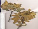 Coll. No. 697, Chrysolepis sempervirens Coll. No. 697, Chrysolepis sempervirens
697
|
Chrysolepis sempervirens
|
|
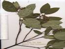 Coll. No. 698, Cornus sericea ssp. sericea Coll. No. 698, Cornus sericea ssp. sericea
698
|
Cornus sericea ssp. sericea
|
|
Other articles:
699
|
Pellaea bridgesii Hook. Bridges' Cliffbrake. | Coll. No. 699, 13 Nov 2011, characters observed while keying; Perennial terrestrial fern, to 15 cm; Fronds many, mono-morphic, once pinnate, underside glabrous; Pinnae flat (not recurved to cover sori), basal unlobed; Sori on margin of frond.
|
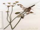 Coll. No. 700, Eriogonum nudum Coll. No. 700, Eriogonum nudum
700
|
Eriogonum nudum var. nudum. | Coll. No. 700, 13 Nov 2011, characters observed while keying; Perennial herbaceous, erect; Leaves basal, 22-32 mm, elliptic, subglabrous above (glabrous with a few cobwebby hairs); Infloresence in cymose heads, glabrous; Tepals glabrous; Perianth base entire (not jointed).
|
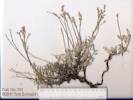 Coll. No. 701, Eriogonum wrightii var. subscaposum Coll. No. 701, Eriogonum wrightii var. subscaposum
701
|
Eriogonum wrightii Torr. ex Benth. var. subscaposum S. Watson. Bastardsage. | Coll. No. 701, 13 Nov 2011, characters observed while keying; Perennial subshrub (as opposed to matted, suggesting var. wrightii), to 2 dm; Stems white tomentose; Leaf blade 8-10 mm, petiole bases not forming a ring around stem; Infloresence raceme-like; Involucres 1 per node, 2.5 mm Bracts 3; Tepals uniform in width; Flower stipe 0.
|
 Coll. No. 702, Penstemon rostriflorus Coll. No. 702, Penstemon rostriflorus
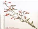 Coll. No. 702, Penstemon rostriflorus Coll. No. 702, Penstemon rostriflorus
702
|
Penstemon rostriflorus Kellogg. Bridge Penstemon. | Coll. No. 702, 14 Nov 2011, characters observed while keying: Perennial terrestrial; Stem round; Leaves cauline, opposite; Calyx segments free; Corolla red, upper lobes not forming a beak or hood, lower lip strongly reflexed, spur 0; Stamens fertile 4, staminode 1, attached at root of corolla tube; Filament base glabrous; Anther sacs not dehiscing full length.
|
|
| Tuesday, August 10, 2010Tuesday the 10th, we went on another wildflower walk with Cathy Rose. This one was to the Dana Gardens, across the canyon from the Yosemite National Park entrance station at Tioga Pass. One of the interesting things Cathy pointed out were rocks that Carl Sharsmith had painted. The story goes that the park service asked Carl to mark the route to climb Mount Dana. So Carl set out and put a little mark of orange paint on rocks along the route. Later, the park service had a change of heart, and told Carl to remove the rocks. So Carl set off again, and turned all the marked rocks around. So I guess they’re good marks if you’re coming back to the trailhead from Mt. Dana. The Dana Gardens themselves are about a mile from the trailhead, and just where the Mt. Dana trail starts it’s steep climb. We saw Goldenrod, lupines, and larkspurs, all in a relatively large size on this hill side. We’re told that the gardens are watered from below, that a soil on top of the usual scree and water moves down the slope in the scree and under the soil . The season is pretty short here, but we learned that early August is a good time to visit.
|
|
| Wednesday, August 11, 2010Wednesday the 11th being Mammoth Lakes market day, we took both cars again, and this time left my truck at the Chevron station for its lube, oil, and filter change. For entertainment, we drove into the Mammoth Lakes basin. We’ve noticed that a bicycle path is being built from the town of Mammoth Lakes into the lakes basin. The path is completed from town up to the edge of the basin, and now bicycle paths are under construction among the lakes in the basin, winding in and out of the trees.Parking at the Twin Falls, we set out on foot. Twin Falls is a nice place to start, and pretty when seen from the distance, but the view from the top is limited to Twin Lakes below the falls. The lakes are beginning to fill in and become meadows. From the Twin Falls parking lot we skirted around Lake Mamie, up the hill to Lake George, and than back down around Lake Mary. At Lake Mary, we arrived at the same time as the Fish & Game truck, with a load of trout. These were pretty big fish, maybe 10-12 inches long. But the poor things were completely confused and not sure what to do when dumped in the lake. Heretofore, I’m sure their life experience was in a nice vertical-sided concrete-lined tank, with overhead bins providing the food. Most of the fish tried to hide in the muddy water stirred up by the pipe. Others tried to hide in the rocks at the shore, and had to be chased out into deeper water, evading a gauntlet of hooks, lures, baits, and … well, I guess nets were considered bad sport at this stage of the game. Quite a spectacle! … and I’m probably exposing my bias about fishing … Wednesday night and Thursday we had visitors. Some years ago, I made acquaintance with Jim through his “Great Basin Bird and Hike” web site. We had visited some of the same places and our web sites overlap geographically. I’m not sure who made first contact. Recently, when Jim finds the little weed I study, Swertia albomarginata, he’ll send me a photo with geographic coordinates, which I put in my data base. Jim and his wife Liz take an annual backpacking trip in Yosemite. Typically, they drive from their house in Las Vegas, and stay in the Sagehen Meadow campground for the night, and then go on to Yosemite the next morning. Writing back and forth, we invited them to stay at the house this year. So it was interesting to meet someone I’ve corresponded with over the Internet. Of course, we had quite a bit in common, given the way we met.
|
|
| Thursday, August 12, 2010We also had an interesting morning on the mouse-trapping front. In the early evening while Jim and Liz were visiting, we caught three baby mice. These were the smallest mice we ever caught. I think the way to understand this was: we caught the other the night before, and this forced the babies to come out the next night and forage for food. We put the three of them together in a bucket, fed them birdseed and apple, and went to bed. In the morning we took photographs, and then let the mice go in the usual spot, out at the main road.
|
|
| Saturday, August 14, 2010Saturday the 14th we hiked in the Harvey Monroe Hall Research Natural Area. This is near Tioga Pass, just off the road to Saddlebag Lake. In the 1930’s the Carnegie Institute of Washington funded some research on the effects of climate on plants. The research took specimens of the same species of plant from different environments and transplanted them to gardens in other environments. The highest altitude garden was here at 10,000 ft. The other gardens were at Camp Mather, about 5,000 feet, and at Stanford University, near sea level. Plants in the same species that were collected at sea level did not do well at 10,000 ft, and vice versa. The studies showed that there were genetic differences between specimens of the same “species” of plant that were adaptive to their natural environment. The study was published as Clausen, Keck, and Heisey, 1940, and it’s discussed in nearly every introduction to ecology class. So for a biologist, it’s almost a pilgrimage, where one can pay homage to seminal thinking in plant ecology.It’s also a pretty nice and relatively easy hike. You start at the Sawmill Campground and walk along the relatively level old road to the garden, crossing Lee Vining Creek on the way. From the research garden at Timberline Station the trail is more of a “Use Trail” for freeform hiking rather than a formal trail. However, there are lots of ways to go, and a few people around, but the area is not heavily used because it is day-use only, and camping or overnight use is not permitted. I think the only other trip we’ve taken recently was local. There was one collection of an unusual Penstemon (think snapdragon) made at a location described as an old World War I airfield in one of the sand flats. Asking around locally no one seemed to know where this airfield was. Searching images of the local sand flats on GoogleEarth, I saw something that looked a long linear feature in a sand flat. It’s about 8 miles from the house by back roads and, actually, quite close to US Hwy 395. A little driving around and we found something that looked like an old airfield. We also found a couple of loading ramps, etc. I can’t tell whether this airfield was built for WWI or not, but it seems more likely it was built to support the WW II war effort. How, I can’t tell. Or maybe it was just an old emergency airfield before there were airports at Mammoth Lakes and Lee Vining. We didn’t find the Penstemon, though, but that’s not surprising. We were a little late in the season, and it could have been anywhere around this two-mile long sand flat. The past few days we have been in Atascadero and San Luis Obispo visiting our parents. We returned to the house last night, the drive being about seven hours through Fresno and Mariposa, then over Tioga Pass. We avoided the Wawona Road because of highway construction and, even though the Mariposa Road is 20 miles longer, it actually takes less time. We stopped for dinner at the Mobil Station, where I had the ribs, and Cheryl had the barbequed chicken sandwich. Today, the weather has turned quite cool and breezy, as apparently there is an upper level low over northern California. Tomorrow, we’re supposed to return to calm, warm, sunny conditions, although, “warm” here means 75°F. It feels like our time here is winding down. Most of the flowers are finished, except at very high altitudes, or the low-altitude sagebrush-like things that bloom in the fall. Our plan, at the moment, is to return to Alameda on Sept 7th. In a way, I’m looking forward to coming home. In another way, I’m not looking forward to seeing (and cleaning up) the yard after three months of being away. Not to mention, it’s about time for the ginko fruit to start falling. I’ll miss seeing our breakfast and dinner time view of Sagehen Peak out the picture windows.
|
Other articles:
Locations:
Lee Vining Creek (Upper).
|
Crossing upper Lee Vining Creek on the way into Slate Creek Valley.
|
|
Other articles:
Locations:
Slate Creek.
|
|
|
|
| Monday, August 16, 2010
|
|
|
|
Other articles:
703
|
Cymopterus cinerarius A. Gray. Gray Springparsley
|
|
Locations:
Airfield Flat.
|
View south through Airfield Flat.
|
|
Other articles:
Locations:
Airfield Flat.
|
|
|
|
| Tuesday, August 17, 2010
|
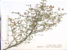 Coll. No. 704, Stephanomeria exigua ssp. exigua Coll. No. 704, Stephanomeria exigua ssp. exigua
704
|
Stephanomeria exigua Nutt. ssp. exigua. Small Wirelettuce.
|
|
 Collection No. 705, Chrysothamnus viscidiflorus var. viscidiflorus near Sagehen Meadow. Collection No. 705, Chrysothamnus viscidiflorus var. viscidiflorus near Sagehen Meadow.
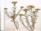 Coll. No. 705, Chrysothamnus viscidiflorus ssp. viscidiflorus Coll. No. 705, Chrysothamnus viscidiflorus ssp. viscidiflorus
705
|
Chrysothamnus viscidiflorus (Hook.) Nutt. ssp. viscidiflorus. Yellow Rabbitbrush. | Coll. No. 705, 15 Nov 2011, characters observed while keyin: Perennial shrub; Stems woody at base, juice latex (?); Leaves entire, lanceolate, twisted > 360°, margin sparsely ciliate; Phyllaries 3 unequal series, tending to be aligned in vertical ranks, not transparent or scarious; Flowers all disc flowers, yellow; Achenes hairy, pappus of hairs/bristles "capillary bristles" (not ornamented).
|
|
| Wednesday, August 18thOne thing: at about two months here in very rural Mono County, I made a transition of sorts. I reached the point where it would be OK if we weren’t here any more. I wouldn’t say I was ready to be home and stay home. Just that we had seen most of what was close by, the newness had worn off, and maybe it wouldn’t be a bad thing to be back home. One thing I notice is that my eyes get tired. Especially in the morning after a full day outside, even with dark glasses and a hat, my eyes just feel a little gravelly and tired. So a day now and then, where we stay at the house and work on projects, is just fine. Cheryl has been working on a quilt for grandson Colin. The other day, I went through all of my plant collections, and sorted them. I have a package of collections that have dried, have been identified, and I have printed labels for them. I have two (big) presses of collections that are still drying. Today, the humidity is 7% outside. Inside the house it’s much more moist … hah! … as the humidity is 9%. So plant collections dry pretty fast, just sitting in the house. Then, of course, there is the package of collections I have labeled “Poorly Identified.” These are the ones I have to work on. Some of them, though, are plants that I didn’t know when I first collected it. Then later, I would collect it again somewhere else, realize what it was, give myself a dope slap, and utter a Homer Simpson “D’Oh” under my breath.
|
|
| Tuesday, August 24, 2010So the next Tuesday, the 24th of August we went on Cathy Roses’ hike to Gaylor Ridge. This is the opposite side of Tioga Pass from Dana Gardens and Mount Dana. We parked the car at Tioga Pass, just outside Yosemite National Park, and walked to the trailhead just inside the park. The first mile or so is a pretty steep hike, with large steps and switchbacks. The view from the top is stunning, and it gives a different perspective on Dana Meadows. The walk ended on the ridge between Tioga Pass and Gaylor Lakes. Not having had enough, Cheryl and I continued down the ridge to the lake. This general area is called Gaylor Lakes, plural, as there are lots of glacial lakes (tarns) or large and small sizes.Along the shore of the largest lake, we saw a gentian. Some of you may know that the little desert plant I study is in the Gentian family. So when I see a gentian in the field I always pay attention. This one is Gentiana newberryi, with a very clever common name of “Newberry’s Gentian.” It about 2 inches tall, and was surrounded by grasses and other plants. This particular spot was the only place we saw this plant. From the lowest Gaylor Lake we started hiking up toward Upper Gaylor Lake. It was about a half mile on a fairly gentle slope. It did it by boulder hopping up the creek, looking for more gentians in the damp areas. Just when I was about to give up, we found a small patch of Gentianopsis holopetala, the Sierra Gentian. Like the Newberry’s Gentian above, we found only a few of these growing together in a small area. Later, I’ll find small patches of a similar plant, Gentianopsis simplex, at Crooked Meadows and Big Sand Flat. At Upper Gaylor Lake, we sat on the rock and had a snack. Thinking we would only hike with Cathy for a couple of hours, we didn’t bring a full lunch. The ice field behind Cheryl is on the north side of Gaylor Peak. It’s show on maps as a glacier, but has gotten quite small. Later, though, when we hiked along the lake below the glacier, you could see that the lake had been scooped out below the glacier, and was quite deep right at the shoreline. I think this would be evidence that the ice extended down into the lake, and only recently has retreated up the slope. We hiked a little way around Upper Gaylor Lake to a pass, where we could look down on Tioga Lake and California Highway 120. As many times as I have passed by Tioga Lake, just east of Tioga Pass, on this highway, I have never seen it from this perspective. From here, we returned to our car. It’s not a bad hike. A little uphill from the lower Gaylor Lake to the ridge, and then quite steep downhill to the trailhead. By this time we were getting pretty hungry. So we availed ourselves of the Mono Cone back in Lee Vining for a hamburger followed by an ice cream.
|
 Typical appearance of Gentianopsis holopetala, the Sierra Fringed Gentian. Typical appearance of Gentianopsis holopetala, the Sierra Fringed Gentian.
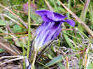 Habit of Gentianopsis holopetala between Lower and Upper Gaylor Lakes. Habit of Gentianopsis holopetala between Lower and Upper Gaylor Lakes.
|
Gentianopsis holopetala between Lower and Upper Gaylor Lakes.
|
|
 Habitat of Gentiana newberryi as seen at the edge of Lower Gaylor Lake. Habitat of Gentiana newberryi as seen at the edge of Lower Gaylor Lake.
 Gentiana newberryi as seen at the edge of Lower Gaylor Lake. Gentiana newberryi as seen at the edge of Lower Gaylor Lake.
|
Gentiana newberryi beside Lower Gaylor Lake.
|
|
|
| Wednesday, August 25, 2010Wednesday, August 25, 2010, we determined to stay at Sagehen Meadow. I had plant collections to work over and Cheryl had a quilt to work on for a grandchild.Traffic on Sagehen Meadows Road always attracts our attention because there is so little of it. However, imagine our interest when the traffic was three fire trucks, with a backdrop of a plume of smoke. Close inspection, though, made it clear that the plume of smoke was quite small and a mile or so in the distance. It was also pretty clear that the fire trucks were on the wrong road. To us it looked like the fire was somewhere between Big Sand Flat and Crooked Meadows. We have a quick check of our emergency evacuation supplies, and then re-settled back into what we were doing. After an hour or so the smoke thinned and then stopped appearing, so we assumed that the fire fighters found it and put it out.
|
|
| Thursday, August 26thThursday the 26th I did a little collecting around Big Sand Flat.
|
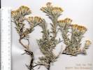 Coll. No. 706, Tetradymia canescens Coll. No. 706, Tetradymia canescens
706
|
Tetradymia canescens DC. Spineless Horsebush. | Coll. No. 706, 15 Nov 2011, characters observed while keying: Perennial woody below; Stems some sharp-pointed, 2nd+ year stems pubesence interrupted by linear glabrescent streaks (Sect. Tetradymia, incl. stenolepis, canescens, and glabrata); Leaves gray tomentose (not green glabrous), not spiny; Phyllaries 4, in one equal series, not scarious or transparent, tips not black; Flowers not ligulate, yellow; Achenes glabrous, with a pappus of bristles.
|
Other articles:
707
|
Drymocallis glandulosa var. nevadensis. | Coll. No. 707, 15 Nov 2011, characters observed while keying: Perennial herb, without stolons; Leaves palmate; Sepals 5, ~= petals; Petals present, 3 mm, 2 mm wide, obovate; Stamens 10-25 (obs: 23); Styles widest in middle, not warty, jointed to fruit, attached below the middle, deciduous; Achenes glabrous.
|
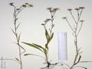 Coll. No. 708, Symphyotrichum spathulatum var. spathulatum Coll. No. 708, Symphyotrichum spathulatum var. spathulatum
708
|
Symphyotrichum spathulatum (Lindl.) G. L. Nesom var. spathulatum. Western Mountain Aster, fibrous roots, rhizomes, upper leaves clasping, lanceolate. | Coll. No. 708, 16 Nov 2011, characters observed while keying: Perennial from fibrous roots, generally < 4 dm tall (obs: 37-38 cm); Leaveslanceolate, > 7 x longer than wide (obs: 13 x longer), glabrous, without spinulose tip, basal present at flowering, mid-cauline leaves smaller than below; Peduncles 2-8 cm, non-glandular; Involucre 15 mm, non-glandular; Phyllaries in 3-4 series, graduated, outer < inner, not paper-like (chartaceous), lower margin scarious, elongate green tip 3x width, tip acute; Receptacle naked; Flowers both ray and disc; Rays conspicuous, blue/lavender; Style branches minutely glandular, not tufted hairy; Achenes with a pappus of bristles, whitish.
|
Other articles:
709
|
Erigeron lonchophyllus Hook. Short Ray Fleabane. | Coll. No. 709, 16 Nov 2011, Characters observed while keying:
Perennial herb to 2 dm;
Leaves basal and cauline, basal narrowly elliptic, petiole 2 cm, blade 5 cm, 7mm wide, cauline alternate linear;
Phyllaries in 3 series, outer 1/2 x inner 2 series, scarious only on edges, purple tips;
Flowers white, rays
|
 Coll. No. 710, Pyrrocoma racemosa var. paniculata Coll. No. 710, Pyrrocoma racemosa var. paniculata
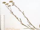 Coll. No. 710, Pyrrocoma racemosa var. paniculata Coll. No. 710, Pyrrocoma racemosa var. paniculata
710
|
Composite, yellow.
|
|
Other articles:
711
|
Galium trifidum L. var. columbianum (Rydb.) Hultén. Three-Petal Bedstraw.
| Big Sand Flat, Mono County, California. East end, wet area where Dry Creek enters Big Sand Flat. 37.8819°N, 118.8853°W. WGS 1984 Elev. 2401 m. Coll. No. 711, 18 Nov 2011, characters observed while keying: Perennial herb, weak, sprawling; Stem glabrous (without prickles); Leaves 4 in a whorl, short-petioled, elliptic to obovate, thin, glabrous; Infloresence not dense (3-4 flowers); Corolla 3-lobed, yellow (?); Fruit 2 nutlets, smooth, hairiness like herbage (glabrous to few hairs).
|
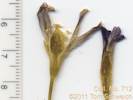 Coll. No. 712, Gentianopsis simplex Coll. No. 712, Gentianopsis simplex
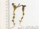 Coll. No. 712, Gentianopsis simplex Coll. No. 712, Gentianopsis simplex
712
|
Gentianopsis simplex | Coll. No. 712, 18 Nov 2011, characters observed while keying: Annual photosynthetic herb, to 8 cm; Stems simple, to 4 cm; Internode 11 mm (compare to peduncle); Leaves cauline, opposite, sessile, simple, elliptic, 12 mm; Peduncle 19 mm (> internode); Infloresence not coiled, single-flowered; Perianth in 2 whorls (sepals and petals present); Flowers single, bisexual; Sepals 4; Corolla 2 cm, distinct tube, not bell shaped; Petals 4, connate (congenitally fused at least at base), 17 mm, blue sinuses between petals not appendaged, lobes serrate; Stamens 4, alternate, filaments fused at base, free upper half; Ovary 1, superior; Pistil 1; Stigma 2-cleft.
|
|
| Saturday, August 28, 2010
|
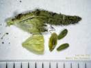 Coll. No. 713, Collomia linearis Coll. No. 713, Collomia linearis
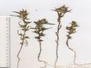 Coll. No. 713, Collomia linearis Coll. No. 713, Collomia linearis
713
|
Collomia linearis | Coll. No. 713, 19 Nov 2011, characters observed while keying: Annual; Stem simple, unbranched; Leaves linear, 20-25 mm; Calyx membrane 0, lobes growing with capsule, becoming papery with age; Corolla white, 6-9 mm;
|
714
|
Lupinus ledipus Douglas ex Lindl. var. confertus (Kellogg) C. P. Sm.
| Coll. No. 714, 20 Nov 2011, characters observed while keying: Perennial herb 25-40 cm tall; Leaves cauline, crowded at base and reduced above, appressed hairy below, hairy above; Leaflets 15-23 mm, gray green; Infloresence 4-11 cm, whorls 6-12 (obs: 6,8,9,12); Bracts persistent; Calyx spur absent; Flower 9 mm; Banner back glabrous, patch yellow, banner fading to brown while small spot remains yellow; Keel ciliate distal end. Redetermined to var. confertus from var. ramosus because of number and density of whorls in infloresence.
|
 Collection No. 715, Symphyotrichum spathulatum Collection No. 715, Symphyotrichum spathulatum
 Collection No. 715, Symphyotrichum spathulatum Collection No. 715, Symphyotrichum spathulatum
715
|
Erigeron philadelphicus, fibrous roots, rhizomes, upper leaves clasping, lanceolate.
|
|
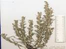 Coll. No. 716, Artemisia cana var. bolanderi Coll. No. 716, Artemisia cana var. bolanderi
716
|
Artemisia cana var. bolanderi
|
|
|
| Sunday, August 29, 2010
|
|
| Monday, August 30, 2010
|
Other articles:
717
|
|
|
 Infloresence of Coll. No. 717.1, Berula erecta Infloresence of Coll. No. 717.1, Berula erecta
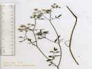 Overview of Coll. No. 717.1, Berula erecta Overview of Coll. No. 717.1, Berula erecta
717.1
|
Berula erecta (Huds.) Coville. | Perennial (?); Habitat wet place other than vernal pool; Rooting, tubers, and rhizomes unknown; Stem ascending, glabrous, hollow; Leaves with sheathing bases, once pinnate; Leaflets toothed or serrate; Infloresence in compound umbels; Bracts and bractlets conspicuous; Flowers white; Style short; Fruit lacking bristles, prickles or tubercles.
|
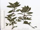 Coll. No. 718, Mentha arvensis Coll. No. 718, Mentha arvensis
718
|
Mentha canadensis L. Wild Mint. | Coll. No. 718, 20 Nov 2011, characters observed while keying: Perennial herb; Stem erect; Internodes visible; Leaves ±equal in size upward; Infloresence axillary clusters distributed along stem; Calyx 5-lobed, radially symmetrical, lobes and tips equally hairy; Flowers radial, 3 mm; Stamens exserted, fertile 4; Style exserted.
|
 Coll. No. 719, Mimetanthe pilosus Coll. No. 719, Mimetanthe pilosus
719
|
Mimulus pilosus (Benth.) S. Watson. False Monkeyflower.
|
|
 Coll. No. 719.1, Gnaphalium palustre Coll. No. 719.1, Gnaphalium palustre
719.1
|
Gnaphalium palustre Nutt. Western Marsh Cudweed. An accidental collection; very small plants were found in a collection of Mimulus pilosa, also found were minute Cyperus squarrosa.
|
|
Other articles:
720
|
|
|
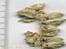 Detail of Coll. No. 721, Atriplex canescens var. canescens Detail of Coll. No. 721, Atriplex canescens var. canescens
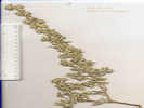 Overview of Coll. No. 721, Atriplex canescens var. canescens Overview of Coll. No. 721, Atriplex canescens var. canescens
721
|
Atriplex canescens (Pursh.) Nutt. var. canescens Four-wing Saltbush. | Shrub 1 m; Twigs 30 cm, 2 mm wide at base to 1 mm wide at tip; Leaves (mature primary) 28-35 mm, 5-7 mm wide, (smallest) 12-15 mm, 2 mm wide; Bracts 8-9 mm, 5 mm wide, entire to dentate (not deeply sharp-dentate).
|
|
| Tuesday, August 31, 2010Tuesday August 31st, wild flower walk to Bennettville with Cathy Rose.We were warned to look out for the sheep herders. Especially, if they tried to graze Sagehen Meadow. Because it’s private property, the sheep herders should ask permission to graze, and the owners said we should tell the sheep herders not to graze the private portion of the meadow. We never saw the sheep herders from the house in Sagehen Meadow. However, one day in mid-July we saw a small stock ramp near Mono Mills, and then a couple of double-decker stock trucks heading up that way. On a hike from the house in late August, we saw an area of devastated sagebrush about a mile east of the house. After looking at it for a while, we decided that the sheep had been there a few days before. So we figured that the sheepherders are pretty good at keeping the sheep out of sight. Then in late August they appeared in the very easternmost portion of Big Sand Flat. The sheepherders kept the sheep in BLM land, and not on Forest land. However, the boundary between the Forest and BLM land is precisely the spot where I collected Astragalus monoensis, the endangered Mono Lake MilkVetch. You can see in the photo what the sheep do. Everything except the sagebrush is eaten, and most of that is trampled.
|
Other articles:
722
|
|
Leaves lower blades < 3.5 mm (actual 2 mm), one-veined from base; Calyx lobes 5, weakly lobed; Seed horizontal. Rush Creek, Mono County, California. In openings of seasonal wetlands, 2.3 mi. downstream from US Highway 395, and 2.0 mi. upstream from Test Station Road. 37.9211°N, 119.0743°W. WGS 1984. Elev. 1969 m.
|
Other articles:
Locations:
Rush Creek.
723
|
|
Rush Creek, Mono County, California. Among willows between the creek and the sagebrush, 3.2 mi. downstream from US Highway 395, and 1.1 mi. upstream from Test Station Road. 37.9336°N, 119.0678°W. WGS 1984. Elev. 1972 m.
|
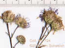 Coll. No. 724, Symphyotrichum lanceolatum var. hesperium Coll. No. 724, Symphyotrichum lanceolatum var. hesperium
 Coll. No. 724, Symphyotrichum spathulatum Coll. No. 724, Symphyotrichum spathulatum
724
|
Symphyotrichum spathulatum (Lindl.) G. L. Nesom var. spathulatum. Western Mountain Aster.
| Rush Creek, Mono County, California. On the bank of Rush Creek, 3.2 mi. downstream from US Highway 395, and 1.1 mi. upstream from Test Station Road. 37.9333°N, 119.0667°W. WGS 1984. Elev. 1975 m. Perennial from fibrous roots and rhizomes. Coll. No. 724, 1 Sep 2010, Characters observed while keying this collection: Perennial from fibrous roots and rhizomes, not thistle-like; generally > 4 dm tall (observed 3.5-4.5 dm); Stem pubesence uniform and sparse; Leaves basal withered at flowering, altho' formerly larger than cauline leaves, without spinulose tip; Peduncle not glandular; Involucre not glandular; Receptacle naked; Phyllaries in multiple series, could be >3; Outer phyllaries not chartaceous (paper-like) but could have scarious margins to half their length, elongate green area at tip, tip acuminate; Flowers not all ligulate; Ray flowers conspicuous, color violet or purple; Disk flowers style branches not tipped with tufted yellow hairs; Achenes with pappus of hairs. Originally guessed to be Erigeron philadelphicus, but in Taylor's (2010) key, phyllaries in multiple series leds one away from Erigeron. Then I got lost in Symphyotrichum over the question of what basal leaves "present at flowering" means relative to "withered." This led me into S. lanceolatum. With the help of John Strother, I came to see that even though the basal leaves were withered, they were clearly formerly larger than the cauline leaves. This put me on a different path leading, eventually, to S. Spathulatum.
|
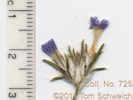 Coll. No. 725, Eriastrum wilcoxii Coll. No. 725, Eriastrum wilcoxii
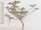 Coll. No. 725, Eriastrum wilcoxii Coll. No. 725, Eriastrum wilcoxii
725
|
Eriastrum wilcoxi
|
|
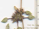 Coll. No. 726, Tiquilia nuttallii Coll. No. 726, Tiquilia nuttallii
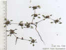 Coll. No. 726, Tiquilia nuttallii Coll. No. 726, Tiquilia nuttallii
726
|
Tiquilia nuttallii (Hook.) A. T. Richardson. Nuttall's Crinklemat.
|
|
 Collection No. 727, Cyperus squarrosus L. Bearded Flatsedge. Collection No. 727, Cyperus squarrosus L. Bearded Flatsedge.
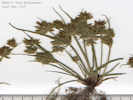 Coll. No. 727, Cyperus squarrosus Coll. No. 727, Cyperus squarrosus
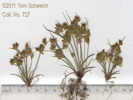 Coll. No. 727, Cyperus squarrosus Coll. No. 727, Cyperus squarrosus
727
|
Cyperus squarrosus L. Bearded Flatsedge.
| Characters observed while keying this collection: Monocot; Perianth without petal-like parts, bristles absent; Flowers borne concealed within axils of stramineous (chaff-like or husk-like) bracts; Floral bracts 2-ranked, 5-11-veined (observed: 7), tip recurved; Perigynia absent; Ovary unilocular; Styles 3; Seed widest near top.
|
Other articles:
Locations:
Rush Creek.
|
|
|
Other articles:
Locations:
Crooked Meadows.
728
|
|
|
Other articles:
|
View across Crooked Meadows.
|
|
Other articles:
|
Caudex of Astragalus monoensis
|
|
Other articles:
|
Sheep grazing in eastern Big Sand Flat.
|
|
|
| September 7, 2010So the next day, we began packing our things and we locked up the house and drove home. What was it like being back in the Bay Area? Well, it’s certainly noisy here, and there are lots of people, and lots of traffic. I especially notice the gasoline-powered garden equipment, the airplanes, and the BART trains early in the morning. The things I miss are: the view out the window, the birds in the morning, the quiet, and the Milky Way.
|
|
| October 30, 2010Death of Paul Schweich.
|
|
[Previous Page]
[Next Page]
| Go to page: [1800s] [1900s] [1910s] [1920s] [1930s] [1940s] [1950s] [1960s] [1970s] [1980s] [1990] [1991] [1992] [1993] [1994] [1995] [1996] [1997] [1998] [1999] [2000] [2001] [2002] [2003] [2004] [2005] [2006] [2007] [2008] [2009] [2010] [2011] [2012] [2013] [2014] [2015] [2016] [2017] [2018] [2019] [2020] [2021] [2022] [2023] [2024] [A]
If you have a question or a comment you may write to me at:
tomas@schweich.com
I sometimes post interesting questions in my FAQ, but I never disclose your full name or address.
|
|
Date and time this article was prepared: 12/9/2024 7:31:30 PM | ||||||||||||||||||||||||||||||||||||||||||||||||||||||||||||||||||||||||||||||||||||||||||||||||||||||||||||||||||||||||||||||||||||||||||||||