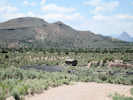
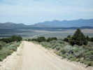
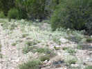
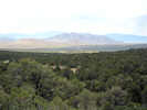
Eastern Mojave Vegetation
Tom Schweich
|
Eastern Mojave Vegetation
| Field Notes (Continued) |
|
Tom Schweich |

Topics in this Article: 1800s 1900s 1910s 1920s 1930s 1940s 1950s 1960s 1970s 1980s 1990 1991 1992 1993 1995 1996 1997 1998 1999 2000 2001 2002 2003 2004 2005 2006 2007 2008 2008 Tour de Swertia albomarginata Mono Lake, August 2008 2009 2010 2011 2012 2013 2014 2015 2016 2017 2018 2019 2020 2021 2022 2023 2024 Contents Literature Cited |
When I first read the field notes of Annie Alexander and Louise Kellogg, I was fascinated by the descriptions they wrote about the places they went and the plants and animals they found there. By publishing my field notes on the Internet I hope to follow a little bit in their tradition. | |||||||||
|
|
2009 | |||||||||
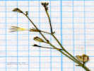
 MBRG Collection of Stellaria longipes. MBRG Collection of Stellaria longipes.
|
||||||||||
|
Other articles:
Locations: Miller Canyon. Miller Canyon. |
Some of the most puzzling collections of Frasera albomarginata have been those made by Marcus E. Jones. On one in particular, the location description was "Millers Canyon, Utah." Since I knew that Jones had been to Mounds, Utah, I searched outward from Mounds until I found Miller Canyon, Carbon County, about 20 miles northwest of Price, Utah, on the the east side of Scofield Reservoir in the Wasatch Plateau. However, a visit there in June 2008, showed the collection was unlikely to have been made there. The habitat, aspens coming down to sagebrush, was not right.
Then, at CAS, I found another voucher of the same collection. The label clearly read, "Millers Canyon, south of Price." Return to the maps I found another Millers Canyon, this one near the town of Emery in Emery County. Millers Canyon is given to the canyon Muddy Creek cuts from Castle Valley through the Coal Cliffs. It is also on the western edge of the San Rafael Swell. Since, Frasera albomarginata is found at other locations on the San Rafael Swell, it seems possible that this is the location of Jones' 1907 collection. Therefore, I have moved my data point there from the location near Scofield Reservoir farther north. | |||||||||
|
Other articles:
|
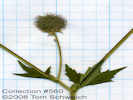
564 |
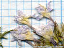
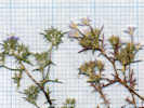
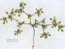
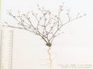
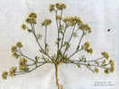
The specimen was scanned on 14 Nov 2009. Grid is 10 x 10 to the inch. | ||||||||
|
|
Thursday, May 28, 2009 | |||||||||
| … a two-day stay in Yosemite with Cheryl's sister and family. It rained every day, clouding up, and raining for an hour, then sunny, then a little more rain, etc. I guess this has been a fairly widespread event, as I heard reports of heavy rain over Sonora Pass, down in the valley, and today Monitor Pass is closed. We didn't let that stop us though. | ||||||||||
|
|
Friday, May 29, 2009 | |||||||||
| One day we rented bicycles, and rode around the floor of Yosemite Valley. | ||||||||||
|
|
Saturday, May 30, 2009 | |||||||||
|
Locations:
Vernal Fall.
|
Saturday we hiked to Vernal Fall, and then took the shuttle bus to Yosemite Village, and then back to our camp at Upper Pines campground. | |||||||||
|
|
Sunday, May 31, 2009 | |||||||||
| This morning everyone was headed home, except me. I drove over Tioga Pass, and stopped at the Mobil Gas Station (the Whoa Nelli Deli!) for lunch. Got the half-pound hamburger. Ate half, and saved the other half for dinner. | ||||||||||
| My plan was to visit some of the experimental plots that were established by the Mono Basin Research Group in 1976 this afternoon, and then camp on the east side of the lake tonight. However, it is raining. | ||||||||||
|
Locations:
Negit Island.
|
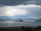
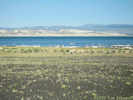
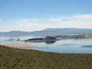
I stopped at the Forest Service Information Center. This is where I took the photo of Negit Island in Mono Lake, as the clouds were coming in. | |||||||||
| The rain was so heavy I could not see as far as the County Park a mile of so away except, of course, for the lightning striking out near Conway Ranch. | ||||||||||
| The forecast here is for rain, rain, and more rain. The forecast discussion says the convection storms should be more "organized" tomorrow, so I can guess what that means -- more rain. | ||||||||||
| I love the smell, though, of wet sagebrush and rabbit brush, it's kind of pungent and sweet at the same time. The line, The Desert Smells Like Rain, is the title of a book by Gary Nabhan. He wrote about the Sonoran Desert around Tucson, and said the same thing, that the smell of rain in the desert was always very pleasant and invigorating. | ||||||||||
| However, I'm afraid the rain will mix with the dust that composes the roads out east of the lake, making what we commonly call mud. Last June, I did the slippin' and slidin' in the mud in central Utah. | ||||||||||
|
Other articles:
|
So, it may be time to head south, and then swing back thru the Mono Lake basin on my trip home. I probably can't get to Mojave National Preserve by a reasonable hour, so I'll stop at Lone Pine for the night. There's a campground there called Portagee Joe, that my friend Janet said was pretty nice. | |||||||||
| It's one of several Inyo County campgrounds along US Hwy 395. Cheryl and I stayed at another one at Independence a few years ago. They are close to town and the highway. They have a creek running through, a few trees and picnic tables. The clientele is mixed. There are the down-and-outers who live in their old, wheezing Winnebagos, but the rent is affordable. There are the tourists that come in late in the afternoon or early evening. Some have motor homes, a few camp. There are also the motorcyclists that come into camp, set up the tent, and then head for the local bar until closing time. Closing time must be 100 AM in Line Pine, as the motorcyclists returned to camp about 115 AM, actually 1:18 AM, as indicated by AT&T digital time on my cell phone. | ||||||||||
|
|
Monday, June 1, 2009 | |||||||||
| Monday was mostly a transit day, as I drove from Lone Pine, to Kramer Junction, Barstow, Valley Wells, and then Mojave National Preserve. I stopped at the Von's in Barstow (the only large market out here) for supplies. Got a sandwich for lunch, and some fried chicken for dinner, in addition to a new toothbrush, some coffee, etc. | ||||||||||
| Stopped at Valley Wells for gas. It's on the I-15 at Cima Road, where I turn off for Mojave National Preserve. It's good to fill up with gas and ice at the last possible stop. Valley Wells was closed for a few years, but has been open at least the last three. Were Valley Wells closed, I would have back tracked to Baker for gas and ice, then entered the preserve by way of Kelso. | ||||||||||
|
Other articles:
|
Stopped at the Cross-in-a-Box for the annual photo and to eat half my sandwich. The Supreme Court is expected to rule this fall on whether the cross can remain or must be torn down. One acre of the land around the cross has been transferred to private ownership, in exchange for five acres or formerly private land elsewhere in the Preserve. But the plantiffs are arguing that the land transfer was a sham, and the cross should be torn down anyway. My sympathies are with the cross. It was erected in 1934 in what was then a wasteland by people who lived nearby, many of whom were sent to live here because of war injuries. It seems like we should be able to respect the original sentiment and not get hung up on the particular symbology which is now looked upon with disfavor on public lands. Anyway it's still there, in it's box, and I took the annual photo. Also ate half my sandwich, saving the other half for dinner later. | |||||||||
| Went straight to my experimental plot at Pinto Mountain. It's about a mile walk from the road up to the plot. There were a lot of Frasera albomarginata in bloom around my plot, but none inside. There are still about 10 rosettes, from last year, a few have died since last year, but none in bloom. Wonder what that's about? Maybe my plot is is a less favorable place that the area around it, or maybe my walking in the plot is affecting the plants. | ||||||||||
| Camped at Mid Hills Campgound for the night. I was the only camper when I arrived, but later more people came, and I think there were about four campsites occupied in this campground of 25 sites. | ||||||||||
|
|
Tuesday June 2, 2009 | |||||||||
|
Other articles:
|
Tuesday, I climbed to my experimental plot on the north face of Wild Horse Mesa. | |||||||||
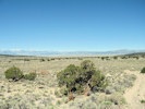
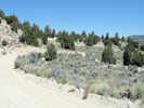
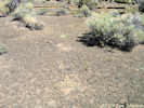
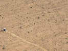
| On the way in I took these photos to show fire recovery, or lack thereof. | ||||||||||
|
Other articles:
|
The hike is a little more than a mile, all on former roads. Some of them have been without traffic for nearly 20 years. Plants are growing on the former road, and little washes are eroding, making the roads hard to follow in places. In my plots, there were a few new rosettes of Frasera albomarginata, and a few plants in bloom, but mostly there were rosettes holding over from previous years. A lot of the plants had been eaten, more so that I remember in the past. Flower stalks were bitten off, and leaves eaten. There were also cow hoof prints in my plot, some of which obliterated my little plants, broke the stakes, etc. | |||||||||
 Fire recovery plot in 2009 Fire recovery plot in 2009
|
At the fire recovery plot, things were mixed also. A few of the Yuccas that sprouted just after the fire in 2005 have now died. The desert verbena (Verbena goddingii) seems to be growing like an annual, here one year, over there the next year, even though the Jepson manual lists it as a perennial. The Desert Four-O'Clock (Mirabilis multiflora) is making a good comeback, and the lone buckwheat is still there. The primary successful early successional plant is Bladder Sage (Salazaria mexicana). It's doing really well, and spreading. I'm thinking it may spread through rhizomes (roots). | |||||||||
| On the road back from Winkler's Cabin the camper came loose. Checking the bolts, I found the right front turnbuckle loose. It's the one that I found broken and replaced before my Idaho trip. I did an emergency tightening, and then back in camp cleaned out the camper and checked all the bolts carefully. I think it's not clear which way to turn the turnbuckles to tighten them, and they don't turn smoothly enough that it's really clear whether you are tightening them or loosening them. Add to that the orientation that changes from front to back, and side to side, and the impossibility of having a clear view of the situation when down on my knees, standing on my head, trying to adjust the d _ _ _ things. | ||||||||||
| That's all the news on a Tuesday afternoon from Camp 24 of the Mid Hills Campground. | ||||||||||
|
|
Wednesday, June 3, 2009 | |||||||||
| Today brought cloudy skies in the morning. I got up, packed up and left Mid Hills for the Virgin Mountains. It seems that I have lost the bag for my "Big Bubba" easy chair. I left it out last night, and this morning it was gone. It was a little breezy last night, but not windy enough to blow the bag from the back of the chair and far away. I checked around the campground, but could not find it. Or, maybe, it's in the truck somewhere, and I just cannot find it. That's possible you know. | ||||||||||
|
Other articles:
Locations:
Virgin Valley.
|
Stopped for gas at Primm, aka Stateline, Nevada, and then blew right through Las Vegas, arriving at Mesquite about Noon. After a quick lunch, I headed for the Virgin Mountains. | |||||||||
|
Other articles:
|
| |||||||||
|
Other articles:
|
At the end of the "paved" road, I followed the very steep uphill climb on a "good" dirt road. I have been lulled into blind expectations about "good" roads, such as those on granite or sandstone substrates. However, I was *jolted* awake by a "good" road built in limestone and limestone cobbles. How quickly I forget what lousy roads limestone makes. So here I am bouncing down Nevada's best dirt road on limestone. Of course, my little plant likes limestones. That's why I'm here. Next time I'm gonna study a little plant that grows on sandstones or granite, maybe at the beach. | |||||||||
|
Other articles:
Locations:
Whitney Pass.
|
| |||||||||
|
Other articles:
|
I returned a short way back down the hill and then turned up a little canyon, locally called Nay Canyon ... more jolting along on limestone cobbles. Where the canyon got narrow I stopped and walked up on a little hill. | |||||||||
|
Locations:
Yant Pit Canyon.
|
From this hill I could see Yant Pit Canyon (my destination) in the middle distance. Yant is a Piute word for Agave, so the name refers to pits that were used to roast the agave roots and shoots. Roasting turned the starches into sugars, and made the roasted agave palatable and nutritious. But, let's see, it's in the 90's, I'm in my 60's, and by myself, maybe I won't go bushwhacking today. | |||||||||
|
Other articles:
|
Turning around I saw the agave pits shown in the photo. So there are “yant” pits in Nay Canyon, as well as Yant Pit Canyon. | |||||||||
|
Other articles:
|
| |||||||||
|
Locations:
Lake Mead.
|
Something is different here in the Virgin Mountains. For one thing the temperature is 15-20 degrees warmer than similar areas, such as the eastern Mojave or central Nevada. I think maybe the heat from the Las Vegas Valley, and Lake Mead sweeps up the slopes and warms the Virgin Mountains. Also, after watching the weather radar for several years, the Virgin Mountains may get a little more rain. Well ... it's a hypothesis ... whether it's testable is another matter. | |||||||||
| Now I'm back in Mesquite, staying at the Best Western. The restaurant next door is closed, as is the big casino across the street. When I inquired about places for dinner, the desk clerk said it was a choice of fast food, or the big casino up the hill. I chose the big casino. | ||||||||||
| Came back to the motel with the little casino song running through my head. | ||||||||||
|
|
Thursday, June 4, 2009 | |||||||||
|
Other articles:
|
I left Mesquite and returned to Glendale/Moapa where I turned west on Nevada 168 to US Hwy 93. At their intersection is a huge golf complex which is nearing completion. It's called Coyote Springs. It's about 45 miles north of Las Vegas. All along Hwy 168, I noticed this large water project, and I guess it's bringing water to the golf course, or taking it away; there is no way to tell. | |||||||||
|
Other articles:
|
Going north on US Hwy 93, one follows the Pahranagat Wash to the Pahranagat National Wildlife Refuge. This consists of two lakes, one full, and one that seems more like a seasonal wetland than a lake. There is a pretty nice campground here. I had intended to stay the night, after a side trip to the Pahranagat Range. | |||||||||
|
Other articles:
|
It took me a while to find the road I wanted. This was described as a good graded road in a Great Basin Bird & Hike web site. I followed the good road for a while, but then the route turned into a narrow rocky canyon route (I backed out) or a rock hop up the side of a hill (which I did not attempt). So the Pahranagat Range goes on the "Check It Out Again" list. | |||||||||
| Stopped in Alamo for gas and ice, and discovered a really nice, well-equipped market with a good deli, a grill, and lots of groceries. There are also a couple of motels and restaurants in Alamo. This is probably the only place between Las Vegas and Caliente where one could stop for the night. | ||||||||||
|
Other articles:
|
Drove to Crystal Springs, at the beginning of Nevada Highway 375 -- the Extraterrestrial Highway -- and ate my sandwich in the shade of some giant cottonwood trees. Then, I headed west for Caliente. Near the summit of the Delamar Range was some pretty good looking Frasera albomarginata habitat. Got out and walked around for a half hour or so, but found none. | |||||||||
|
Other articles:
Locations:
Caliente.
|
Did the slow drive through Caliente, noting many more motels and restaurants than I thought I remembered from previous trips. | |||||||||
|
Other articles:
|
Just north of Caliente is the 35 mile dirt road to Beaver Dam State Park. This park is right on the Nevada-Utah border in the headwaters of Beaver Dam Creek that runs mostly in Utah, and empties into the Colorado River. | |||||||||
|
Other articles:
|
| |||||||||
|
Other articles:
|
| |||||||||
|
Other articles:
|
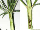
566 | One thing I have discovered in this area nearer to the center of the Frasera albomarginata population is that there are a lot more predators, i.e., things that eat the plant, as opposed to the eastern Mojave on the edge of its natural range. In particular, a lot of plants here have a worm that burrows in at the node and then eats it's way through the pith, mostly below, but also a little above the node. One of the plants I cut open had three worms, each with it's area that began at a node and worked downward. | ||||||||
| Anyway, passed an uneventful night at Beaver Dam State Park, as one of their two patrons, notwithstanding the brief shower sometime in the night. | ||||||||||
|
|
Friday, June 5, 2009 | |||||||||
|
Other articles:
|
This morning I explored the park a little, driving to the bitter end of the road, at the Utah state line. Nice little park, but a long way from nowhere. | |||||||||
| On the way out I saw a sign directing travelers to Crestline, a siding on the Union Pacific Railroad. I had passed through Crestline in 1998, when I was following the trail of Carl Purpus. In May 1898, he went from Enterprise, Utah, to Panaca, Nevada, by way of the road that now goes through this area. | ||||||||||
|
Other articles:
|
567 |
| ||||||||
|
Other articles:
Locations:
Pioche.
|
| |||||||||
|
Other articles:
|
Observation of Frasera albomarginata in Bristol Pass. | |||||||||
|
Other articles:
Locations:
Bristol Pass.
Jackrabbit.
|
| |||||||||
|
Other articles:
|
||||||||||
|
Other articles:
|
||||||||||
|
Other articles:
|
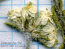
569 | Frasera albomarginata, in open places among sagebrush and Utah juniper. This location is about 2.3 miles (3.7 km) east of Silver King Pass, and at the lower edge of the juniper. Since I was traveling west, and up the slope, this location would place the lower elevation of F. albomarginata at 5745 ft (1751 m). | ||||||||
|
Other articles:
|
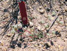
Many Frasera albomarginata in bloom on the road berm. I did not collect here, but determined geographic coordinates with the GPS receiver. | |||||||||
|
Other articles:
Locations:
Silver King Pass.
|
570 | Collection of Frasera albomarginata in Silver King Pass, in open places among Utah juniper, on the north side of the road in carbonate rocks. None seen in the volcanic rocks on the south side if the road. | ||||||||
|
Other articles:
|
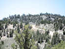
Looking west from Silver King Pass. | |||||||||
|
Other articles:
|
Near Gap Mountain | |||||||||
| My intention was to stop for the day at Adams-McGill Reservoir, home to both Frasera albomarginata and Frasera gypsophila. However, the wind was kicking up lots of dust, the rain was coming down out of the clouds, and I know there is no shelter out in the valley. | ||||||||||
| So I came up north near Murry Summit, camping at the Ward Mountain Forest Service campground among Junipers and Pinyons. There is Frasera albomarginata here, so I should go assess the relative numbers of pinyons and junipers, but maybe not. | ||||||||||
| I was really tempted to continue on into Ely and get a motel room for the night, as the weather was a bit stormy: cloudy, windy, about 55, and a few rain showers. However, I decided to "rough it" in the camper for the night. I confess to heating some water on the stove to wash up with, and even turning the heater on (just for a few minutes). In the process of cleaning up I found the bag for my “Big Bubba” Travel chair mixed in with the dirty clothes. | ||||||||||
| Cleaned up, with a beer and a bowl of Cheez-Its at my right hand, I sat down to summarize the last two days. | ||||||||||
|
|
Saturday , June 6, 2009 | |||||||||
| Spent a chilly night, Friday night, at the Ward Mountain Campground, just southwest of Ely, Nevada. Was alternately bombarded by rain showers, or with the moon in my face. Actually not that bad once I got up and added a fleece jacket to my night clothes, and put my wool socks back on Ward Mountain campground is among junipers and pinyons at 7136 ft elevation. Lots of Frasera albomarginata here. However, because of the elevation, it is still early Spring here, and none of the plants had open flowers yet. | ||||||||||
| Saturday morning, I made a short loop into Ely for gas. Also looked for a place with Internet access. Was thinking mostly coffee, but the closest thing I saw was the Laundromat that claimed to have Wi-Fi. Just wasn't that motivated to watch someone else's laundry spin while I did e-mail. | ||||||||||
|
Other articles:
|
Well, anyway, the weather forecast was for thunderstorms in the morning, thunderstorms at noon, and thunderstorms at night, not to mention the next day. By 1000 AM, the wind was picking up, and half the valley was in the air, so I determined to run for Tonopah and points west. | |||||||||
|
Other articles:
|
Drove through some impressive showers, past the White Pine Range, and came out in the sun at Tonopah. | |||||||||
| Continuing on, it started to rain at Montgomery Pass and continued to rain through Benton and to Lee Vining. I stopped at Big Sand Flat (http://www.schweich.com/imagehtml/IMG_0760sm.html) and checked for flowers, but there were none, as it is still very early Spring in the Mono Lake basin. | ||||||||||
| So after a lunch stop at the Mobil Gas Station, I came on home. It snowed from Lee Vining to Crane Flat, and then mere rain to Groveland. I think I'll wait a couple of weeks and then go back to the Mono Lake basin. Altho' I notice the forecast is for continued very cool weather the next couple of weeks. | ||||||||||
| So what did I learn? I learned that closer to the center of its range, Frasera albomarginata grows like a weed in great numbers. I'm thinking of Beaver Dam State Park, the Bristol Range, and the Schell Creek Range. While it is limited to limestone in the eastern Mojave, it is found on other soil types in areas where it is more common. I also learned that there are predators that are adapted to the species in the center of its range, i.e., the little worms that eat the insides of the stems. So, I have to be careful in attempting to extrapolate the ecology of the species, as I have learned it in the eastern Mojave, to other areas where it is found. | ||||||||||
|
|
July 6, 2009 | |||||||||
| I drove over Tioga Pass on Monday, and had lunch at the Mobil Gas Station, eating half my hamburger and saving the other half for dinner. | ||||||||||
| My first task of this trip was to re-locate several of the sites defined by the Mono Basin Research Group (MBRG). These have been approximately located by rubber-sheeting the MBRG map over a map of Mono Lake, locating the midpoint of the site on the map, and then de-projecting the points to WGS1984 for uploading into my GPS receiver. | ||||||||||
|
Other articles:
Locations:
MBRG P-5.
|
| |||||||||
| The other sites around the northwest corner of the lake (P-12, P-9, P-2, and P-3) appear to me to be on private land, or behind locked gates, so I did not attempt to visit them. | ||||||||||
|
Locations:
Dechambeau Ranch.
|
||||||||||
|
Other articles:
Locations:
MBRG P-4.
|
| |||||||||
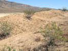
| Drove east on CA Highway 167 and then northwest on Dobie Meadows Road, looking for unstabilized sand dunes, but did not find any. All the dunes I saw had vegetation growing on them. | ||||||||||
| I camped -- actually, selected a place to park my truck -- in Lundy Canyon, at the Mono County Campground. Had a nice little spot in the aspen groves beside Mill Creek. Some of Mill Creek runs wild, but a good part of it is diverted at Lundy Lake to generate electricity for LA. This campground is inhabited mainly by old people with 5th-wheels and RVs. Very few people were out. In fact, I saw my neighbor, Bob of “Bob & Bev” according to the sign on their 5th-wheel, only through their dining room window. | ||||||||||
|
|
July 7, 2009 | |||||||||
|
Other articles:
Locations:
Cedar Hill.
|
| |||||||||
|
Literature Cited:
Other articles:
|
571 |
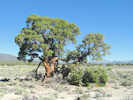
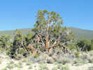
Juniperus osteosperma as grown in Nevada.
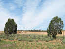
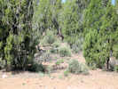
"There is a remarkable stand of Utah juniper east of Mono Lake near the Nevada border. The stand has very little single leaf pinyon, and the Utah juniper trees are very large and have the appearance of very old trees. The stand is growing on wind-eroded volcanic tephra sand with little understory herbaceous vegetation, which may contribute to making the location a fire safe site (Barbour, et al., 2007)." | ||||||||
|
Other articles:
|
572 |
| ||||||||
| On Adobe Valley Road east of Mono Lake, there were a few plants to collect; one here and one over there. There was no one stop with a lot of different species of plants to collect. | ||||||||||
|
Other articles:
|
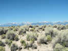
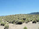
The first stop was a low stabilized dune or former beach strand on the west side of the road. | |||||||||
|
Other articles:
|
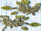
573 | Tiquilia nuttallii (Hook.) A. T. Richardson. (Syn: Coldenia nuttallii Hook. ) Nuttall's Crinklemat. However, note that the corolla is lavender, whereas T. nuttalii is usually described as "pink to white." | ||||||||
|
Other articles:
|
574 |
In Mono Valley, 20 meters west of and above Dobie Meadows Road, 1.7 mi (2.7 km) northwest of Alameda Well. In stabilized dune or beach strand. (38.1212°, -118.8531°, WGS 1984.) Determination tentative. Immature material. Collection discarded. | ||||||||
|
Other articles:
|
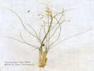
575 | Achnatherum hymenoides | ||||||||
|
Other articles:
|
576 | Psoralidium lanceolatum (Pursh) Rydb. Dune Scurfpea | ||||||||
 Stabilized dune in Mono Valley Stabilized dune in Mono Valley
|
A little further south on Dobie Meadows Road | |||||||||
|
Other articles:
|
577 |
| ||||||||
| Also along the road was an Astragalus. This was the lowest elevation at which I saw this plant. It was much more numerous further south at higher elevation. | ||||||||||
|
Other articles:
|
578 |
| ||||||||
|
Locations:
Deep Wells.
|
Took a little detour up the road to Deep Wells. Did not see anything to collect, or to return to. | |||||||||
|
Other articles:
|
… a little further, just below the spillway. | |||||||||
|
Other articles:
|
579 |
Thelypodium milleflorum A. Nelson. Many-Flower Thelypody.
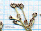
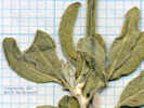
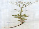
Adobe Hills Spillway, Mono County, California. Along the side of Dobie Meadows Road, just below the Adobe Hills Spillway, 32 km by air east northeast of Lee Vining, California, 16.6 miles east on CA Highway 167 from US Highway 395, then 7.9 miles southeast on Dobie Meadows Road. 38.0606°N, 118.7754°W. WGS 1984. Elev. 2143 m. Coll. No. 579, 7 Jul 2009, characters observed: Perennial (?), to 50 cm.; Hairs 0; Glands 0; Leaves, at least some cauline, basal, petioles unknown (should be ciliate), cauline, not basally lobed or clasping, all petioled, petiole ≤20 mm., blade, ovoid, largest 70 mm. × 40 mm. wide, reduced above, few dentate; Inflorescence, 7-12 cm., single spike per stem, Pedicel upcurved; Flowers, radial, bisexual, all parts spreading; Petals, white, oblanceolate (not linear), 9 mm.; Stamens 6, ±equal in length; Anthers curled >360°; Fruit, (immature) stalk 1.5 mm. + body 12 mm. + style 0.3 mm., erect (not appressed). | ||||||||
|
Other articles:
|
580 |
Aliciella monoensis J. M. Porter.
Adobe Hills Spillway, Mono County, California. Along the side of Dobie Meadows Road, just below the Adobe Hills Spillway of Pleistocene Lake Mono. 38.0605°N, 118.7754°W. WGS 1984. Elev. 2143 m. | ||||||||
 Collection #581 Astragalus lentiginosus var. floribundus near Adobe Hills Spillway. Collection #581 Astragalus lentiginosus var. floribundus near Adobe Hills Spillway.
 Collection #581 Astragalus lentiginosus var. floribundus near Adobe Hills Spillway. Collection #581 Astragalus lentiginosus var. floribundus near Adobe Hills Spillway.
|
581 |
Astragalus lentiginosus Hook. var. floribundus A. Gray. Freckled Milkvetch.
Adobe Hills Spillway, Mono County, California. Along side of Dobie Meadows Road, just below the Adobe Hills Spillway, 32.8 km ENE of Lee Vining, California. 38.0605°N, 118.7754°W. WGS 1984. Elev. 2143 m. | ||||||||
|
Other articles:
Locations:
Adobe Hills Spillway.
|
| |||||||||
|
Other articles:
|
582 |
| ||||||||
|
Other articles:
|
Had lunch on a small point just north of the spillway. This might be a nice place to camp. There is a USGS marker here. | |||||||||
|
Other articles:
|
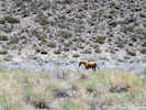
Continuing south into Adobe Valley, I came upon a herd of wild horses (can wild horses be called a "herd?") and managed to video them running and then crossing the road in front of me.
| |||||||||
|
Other articles:
|
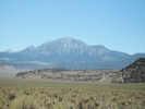
View of Glass Mountain from Adobe Valley. | |||||||||
|
Locations:
Sagehen Meadow Campground.
|
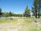
Sagehen Meadow campground | |||||||||
|
Other articles:
Locations:
Big Sand Flat.
|
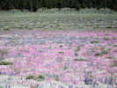
At Big Sand Flat the magenta Skunky Monkey Flower (Diplacus mephiticus (Greene) G.L. Nesom) and blue Mono Lake Lupine (Lupinus duranii Eastw.) were putting quite a show. | |||||||||
|
Other articles:
Locations:
Mono Mills.
|
Mono Mills | |||||||||
| Took a detour to East Craters Sand Flat, by way of 01S07, and then turning north west on 01N24. | ||||||||||
|
Other articles:
|
583 | Calyptridium monospermum E. Greene. 7/7/2009 2:57:15 PM East Craters Sand Flat | ||||||||
 Collection No. 584, Phacelia hastata ssp. hastata Collection No. 584, Phacelia hastata ssp. hastata
 Collection No. 584, Phacelia hastata ssp. hastata Collection No. 584, Phacelia hastata ssp. hastata
 Collection No. 584, Phacelia hastata ssp. hastata Collection No. 584, Phacelia hastata ssp. hastata
|
584 |
Phacelia, 7/7/2009 2:57:15 PM East Craters Sand Flat. I repeatedly key this one out at P. hastata hastata, but everyone else seems to collect P. hastata compacta in the Mono Lake basin. | ||||||||
|
Other articles:
|
585 |
Erysimum capitatum (Douglas ex Hook.) Greene var. capitatum. Sanddune Wallflower.
East Craters Sand Flat, Mono County, California. at the north end of East Craters Sand Flat along Forest Road 1S24, 2.7 mi (4.4 km) southwest of Mono Mills 37.853°N, 118.9869°W. WGS 1984. Elev. 2421 m.
| ||||||||
|
Other articles:
Locations:
Panum Crater.
|
| |||||||||
|
|
July 8, 2009 | |||||||||
| On the web sites of geology field trips, there is often a stop at some very folded lake sediments. The folks at the Forest Service Info Center had no idea where they might be but were sure the Mono Lake Committee would know. | ||||||||||
| They didn't know either, but we settled on me looking around Wilson Creek. | ||||||||||
| The locked gate on the road to Wilson Creek presented a little problem. So as I was driving around trying to find an easy way to hike to Wilson Creek, I saw the outcrop right on Cemetery Road, just above Mill Creek, where I have driven by maybe a dozen times, and didn't recognize the outcrop. | ||||||||||
|
Literature Cited:
Other articles:
|
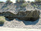
These are lake sediments that were deposited laying flat. But something happened to fold them into some very tight folds. It could have been the weight of Black Point on top of them that caused the folding, or it could have been that they were pushed one way or the other and crinkled up, kind of like pushing a layer of cloth against a barrier. No one really knows how the sediments got folded so tightly. The most common suggestion is that the folding was triggered by seismic schock. | |||||||||
| Black Point is a volcano that erupted under the water of Mono Lake when the lake was higher. Now, it is one of the few underwater volcanoes that are fully exposed, so it is also a destination for many geology field trips. | ||||||||||
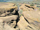
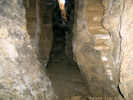
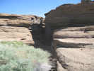
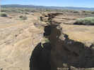
| On top of Black Point is a large fissure, about 18 inches wide and 20-30 feet deep, and hundreds of feet long. You can go inside the fissure and look at the layers of volcanic ash. Well, that sounded interesting and it truly was interesting to see ... except for the mile-long 400 foot climb in the loose ash the makes up Black Point. The climb was about an hour, on the black sand, in the sun, weaving around the sagebrush. There is always a trade-off to make between wearing shorts for coolness, or long stiff jeans to protect your legs from the brush. I opted for the shorts and will live with the decorative marks on my legs for a few days. | ||||||||||
|
Locations:
Black Point.
|
586 |
| ||||||||
|
Other articles:
Locations:
Black Point.
|
| |||||||||
 Lundy Canyon and Copper Mountain from Black Point Lundy Canyon and Copper Mountain from Black Point
|
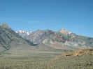
To the west is Lundy Canyon and Copper Mountain. | |||||||||
|
Locations:
Negit Island.
|
To the southeast is Negit Island | |||||||||
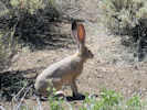 Jack Rabbit on Black Point Jack Rabbit on Black Point
|
On the way back down Black Point, I startled a couple of jackrabbits, one of which posed for me. As long as it could see me, it sat still. But as soon as I was hidden from view by some sagebrush, it ran away. | |||||||||
| Anyway, for my recommendation, the Fissure should definitely be on your list of 10,000 things you plan to do before you die, but probably somewhere near the bottom. | ||||||||||
|
Other articles:
|
587 |
| ||||||||
| Lastly on the beach of Mono Lake at Black Point, I also found Torrey's Blazing-Star (Mentzelia torreyi). There are other Blazing-Stars in the Mono Lake basin, including the very large Smooth-Stem Blazing Star (Mentzelia laevicaulis) with its large bright yellow flowers. However, in the Mono Lake basin, the little Torrey's Blazing Star is only found on the old beaches near Black Point. | ||||||||||
| Came home through Yosemite, stopping at May Lake for lunch. | ||||||||||
|
Other articles:
|
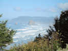
14 September 2009
| |||||||||
|
Other articles:
Locations:
Yachats.
|
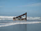
Tuesday, 15 September 2009
| |||||||||
|
Other articles:
|
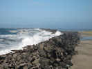
17 September 2009
| |||||||||
|
Other articles:
|
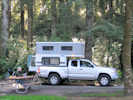
18 September 2009
| |||||||||
|
Locations:
Pilot Spring.
|
560 |
17 Nov 2009: Figured out the collection made at Pilot Spring 13-Aug-08 to be Geum macrophyllum. I knew the seed head, aka achene body, was distinctive, and it was only a matter of time until I found it. The taxon is relatively common on Glass Mountain, and this occurrence could be considered an extension from there. Now, though, I am curious about the other unique collection from Pilot Spring; that of Sanicula graveolens. This is the only collection of S. graveolens from Mono County. I would like to have a look at the specimen at UCR (University of California Riverside) to verify that determination. | ||||||||
 Wall-size map of Alameda Wall-size map of Alameda
 Map of central portion of Alameda. Map of central portion of Alameda.
|
18 Nov 2009: It's been a month since the maps of Alameda were finished. It's time to pack up the files, make a few backup DVD's, and clean up the unneeded files. | |||||||||
|
Other articles:
Locations:
Lobo Point.
|
| |||||||||
|
[Previous Page]
[Next Page]
Go to page: [1800s] [1900s] [1910s] [1920s] [1930s] [1940s] [1950s] [1960s] [1970s] [1980s] [1990] [1991] [1992] [1993] [1994] [1995] [1996] [1997] [1998] [1999] [2000] [2001] [2002] [2003] [2004] [2005] [2006] [2007] [2008] [2009] [2010] [2011] [2012] [2013] [2014] [2015] [2016] [2017] [2018] [2019] [2020] [2021] [2022] [2023] [2024] [A] | ||||||||||
| If you have a question or a comment you may write to me at: tomas@schweich.com I sometimes post interesting questions in my FAQ, but I never disclose your full name or address. |
Date and time this article was prepared: 12/9/2024 7:31:17 PM |
|||||||||