
Topics in this Article:
1800s
1900s
1910s
1920s
1930s
1940s
1950s
1960s
1970s
1980s
1990
1991
1992
1993
1995
1996
1997
1998
1999
2000
2001
2002
2003
2004
2005
2006
2007
2008
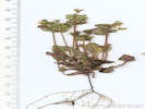
2008 Tour de Swertia albomarginata
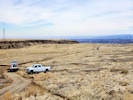
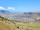
Mono Lake, August 2008
2009
2010
2011
2012
2013
2014
2015
2016
2017
2018
2019
2020
2021
2022
2023
2024
Contents
Literature Cited
|
|
When I first read the field notes of Annie Alexander and Louise Kellogg, I was fascinated by the descriptions they wrote about the places they went and the plants and animals they found there. By publishing my field notes on the Internet I hope to follow a little bit in their tradition.
|
|
|
|
2020
|
|
|
|
Wednesday, 1 January 2020
|
|
Other articles:
• SE-5405:
at trailhead;
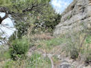
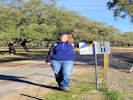 Where the route diverges from the highway. Where the route diverges from the highway.
 Just a little way down the trial with Rachel. Just a little way down the trial with Rachel.
|
|
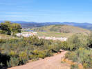
We dropped Rachel off at this trailhead, to pick her up near Almaden de la Plata later.
Down the trail. |
|
|
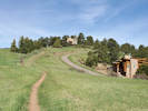
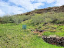
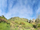
Locations:
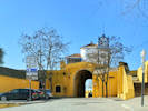
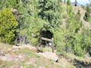
Cortijo El Berrocal.
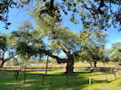 Special old oak tree at Cortijo El Berrocal. Special old oak tree at Cortijo El Berrocal.
|
|
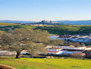
Cortijo El Berrocal, with a visitor center, in a Parque Natural in the Seirra Norte de Sevilla. The visitor center was closed when we visited.
|
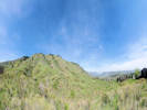
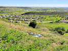
 Almaden de la Plata from the Mirador del Cerro del Calvario. Almaden de la Plata from the Mirador del Cerro del Calvario.
|
|
|
|
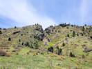
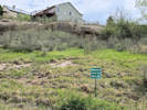
Locations:
El Real de la Jara.
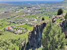
 View across El Real de la Jara to Cortijo de Aguado View across El Real de la Jara to Cortijo de Aguado
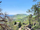
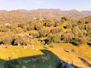 North of El Real de la Jara. North of El Real de la Jara.
|
|

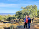
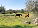
Castillo de los Torres, over there in Extremadura. |
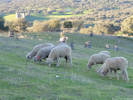
Sheep. |
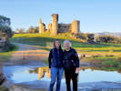
Cheryl and Rachel still in Andalucia. |
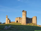
The Castillo de los Torres. |
|
|
|
|
Thursday, 2 January 2020
|
|
Locations:
Santa Olalla del Cala.
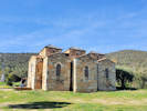
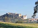 The Castillo de Santa Olalla del Cala. The Castillo de Santa Olalla del Cala.
 The Ermita The Ermita
|
|
First stop at Hostal Restaurante Carmelo for a little breakfast, then west of town for a view of the Castillo de Santa Olalla de Cala. Unfortunately the castle was closed for repairs.
|
|
Literature Cited:
- Venhuis, C., and J. G. B. Oostermeijer, 2004.
Locations:
Aljucen.
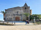 Church of San Andres in Aljucen. Church of San Andres in Aljucen.
|
|
Aljucen for coffee and a visit.
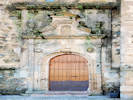
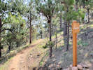
Door of the Church of San Andres. |
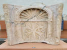
Interpretive panel for Via de la Plata. |
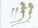
Serapias perez-chiscanoi, a rare species of orchid, is endemic to western Portugal and western Spain, especially in the Guadiana basin around Aljucen. The type locality is near Santa Amalia that is east of Merida (Venhuis and Oostermeijer, 2004).
|
|
Locations:
Santa Lucia del Trampal.
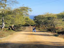
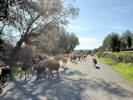 Goats on the road. Goats on the road.
 The Basilica de Santa Lucia del Trampal. The Basilica de Santa Lucia del Trampal.
|
|
The Basilica Santa Lucia del Trampal
|
|
|
|
Lunch at a park on the banks of Rio Aljucen.
|
|
Locations:
Dolmen de Lacara.
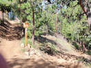
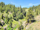
 Hiking to the Dolmen. Hiking to the Dolmen.
 Interpretive Panel. Interpretive Panel.
|
|
Dolmen de Lacara
Interpretive Panel. |

The opening. |
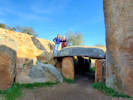
On the dolmen. |
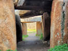
The corriedor of the dolmen. |
|
|
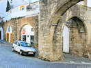
Locations:
Merida.
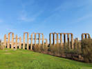 The Roman aqueduct in Merida. The Roman aqueduct in Merida.
|
|
Merida
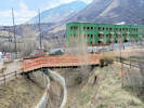
The roman aqueduct over Rio Guadiana.
|
|
Locations:
Merida.
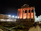 The Temple of Diana. The Temple of Diana.
|
|
The Temple of Diana at night. We ate in an Extremadura restaurant nearby.
|
|
|
|
Friday 3 January 2020
|
|
Locations:
Merida.
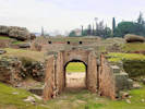 Entrance to Anfiteatro Romano. Entrance to Anfiteatro Romano.
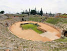 The Roman Amphitheater. The Roman Amphitheater.
|
|
Visit to the Roman Amphitheater.
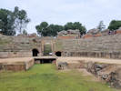
Entrance to Roman Amphitheater. |
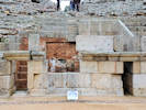
Architectural details of special box for local elite. |
|
|
Locations:
Merida.
 The Roman Theater. The Roman Theater.
|
|
Visit to the Roman Theater.
|
|
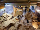
Locations:
Merida.
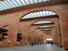
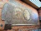
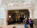
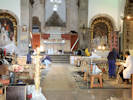
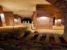 General view of the crypt under the Museo Nacional de Arte Romano. General view of the crypt under the Museo Nacional de Arte Romano.
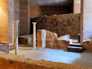 Frescos and columns found under the museum while it was under construction. Frescos and columns found under the museum while it was under construction.
|
|
We arrived at the Museo Nacional de Arte Romano just as a tour of the crypt was forming.
|
|
Locations:
Merida.
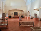
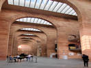 Inside the National Museum of Roman Art. Inside the National Museum of Roman Art.
 Inside the National Museum of Roman Art. Inside the National Museum of Roman Art.
|
|
Visited the National Museum of Roman Art.
A large mosiac on display. |
|
|
Locations:
Merida.
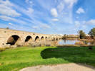 The Roman bridge. The Roman bridge.
|
|
A walk across the Roman bridge.
|
|
Locations:
Merida.
 Inside the Visigoth museum. Inside the Visigoth museum.
 A carved Visigoth capital. A carved Visigoth capital.
|
|
After lunch visit to the Visigoth Museum.
|
|
Locations:
Merida.
 Underneath the Basilica de Santa Eulalia. Underneath the Basilica de Santa Eulalia.
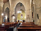 Inside the Basilica de Santa Eulalia. Inside the Basilica de Santa Eulalia.
|
|
A visit to the Basilica de Santa Eulalia. Going underneath was free, visiting the church above was 2.
|
|
|
|
Saturday, 4 January 2020
|
|
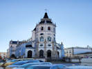
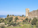
Locations:
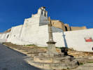
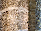
Nossa Senhora da Graça Fort.
 Nossa Senhora da Graça Fort Nossa Senhora da Graça Fort
 View to Elvas from Nossa Senhora da Graça Fort View to Elvas from Nossa Senhora da Graça Fort
|
|
Nossa Senhora da Graça Fort
|
|
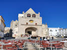
Locations:
Elvas.
 Arco de Santa Clara, Elvas, Portugal. Arco de Santa Clara, Elvas, Portugal.
 Inside the Igreja das Dominicas Inside the Igreja das Dominicas
|
|
A visit to Elvas.
An impromptu concert in the Praça da República |
Esquina Gate, Elvas, Portugal |
|
 Where we stopped for lunch. Where we stopped for lunch.
|
|
We just pulled off the highway about half way between Elvas and Evora. Passed through an interesting marble mining area near Vila Vicosa.
|
|
Locations:
Cromeleque dos Almendres.
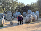 Cheryl and Rachel at Cromeleque dos Almendres Cheryl and Rachel at Cromeleque dos Almendres
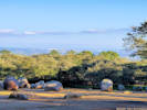 Evora as seen from Cromeleque dos Almendres. Evora as seen from Cromeleque dos Almendres.
|
|
We went to see the Neolithic monument called Cromeleque dos Almendres.
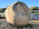
Carved rock at Cromeleque dos Almendres. |
|
|
|
|
Sunday, 5 January 2020
|
|
Locations:
Evora.
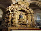
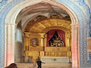
 Chapel of Bones Chapel of Bones
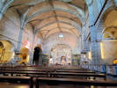 Interior of the Igreja de São Francisco. Interior of the Igreja de São Francisco.
|
|
A visit to the Chapel of the Bones.
|
Chapel of Bones
Built in the first half of the 17th century, as an
extension of the Chapter House of the
convent of São Francisco, the Chapel of the
Bones is an invitation to reflect on the
transitory nature of the human condition,
summarised in the words above its entrance:
| |
WE BONES HERE, FOR YOURS AWAIT.
| |
The decoration of the ceiling, dating from
1810 and full of symbols, allegories and
quotations from the Holy Scriptures, adds
the affirmation of another Life in the
splendor of the glory of God.
| |
At the back of the chapel is the 18th-century
tomb chest of the founders of the Convent
(13th century) and the floor tomb of Bishop
Jacinto Carlos da Silveira, who died during
the invasion of Évora by French troops,
on 29 July 1808.
|
"We bones here, for yours await" |
|
|
Locations:
Evora.
 Evora from the roof of the Cathedral. Evora from the roof of the Cathedral.
 The Cloisters inside the Cathedral of Evora. The Cloisters inside the Cathedral of Evora.
|
|
Visit to the Cathedral of Evora, including a climb to the roof.
An altar in the Cathedral of Evora. |

The nave in the Cathedral of Evora. |
|
|
Locations:
Evora.
 Coffee in the Jardim Diana. Coffee in the Jardim Diana.
|
|
Coffee in the Jardim Diana.
|
|
Locations:
Evora.
 Inside the Igreja de São João Evangelista Inside the Igreja de São João Evangelista
 The altar of the Igreja de São João Evangelista The altar of the Igreja de São João Evangelista
|
|
Igreja de São João Evangelista
|
|
Locations:
Evora.
 Arches from the water aqueduct incorporated into buildings. Arches from the water aqueduct incorporated into buildings.
|
|
|
|
|
|
Monday, 6 January 2020
|
|
Locations:
Evora.
 Leaving our rented house. Leaving our rented house.
|
|
Leaving Evora
|
|
Locations:
Reguengos de Monsaraz.
 Unique church in Reguengos de Monsaraz. Unique church in Reguengos de Monsaraz.
|
|
Short stop in Reguengos de Monsaraz
|
|
Locations:
Monsaraz.
Mourao.
 Church restoration, Igreja Matriz de Nossa Sra sad Candeias. Church restoration, Igreja Matriz de Nossa Sra sad Candeias.
 Castle walls in Mourao; Monsaraz in the distance. Castle walls in Mourao; Monsaraz in the distance.
|
|
Another short stop, this time in Mourao.
|
|
|
|
March 2020
|
|
Other articles:
• 8th Street:
at Church Ditch;
at trail;
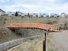 Temporary bridge over Church Ditch. Temporary bridge over Church Ditch.
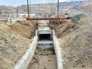 New concrete box culvert for Church Ditch under 8th Street. New concrete box culvert for Church Ditch under 8th Street.
|
|
Saturday, 14 March 2020
Yesterday, the temporary bridge over the Church Street Ditch opened.
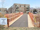
Temporary bridge over Church Ditch. |
Temporary bridge over Church Ditch. |
|
|
Other articles:
• Tilting Mesa Trail:
at pond;
near eph pond;
Locations:
Vaca Lake.
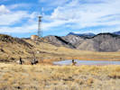 Horsepeople riding in the closed area at Vaca Lake. Horsepeople riding in the closed area at Vaca Lake.
|
|
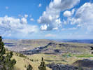
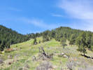
Hike across North Table Mountain from Cottonwood Canyon to North Table Mountain Trailhead.
Open Space trail crew trying to repair damage by Xcel trucks. |
Open Space trail crew trying to repair damage by Xcel trucks. |
|
|
|
|
Tuesday, 17 March 2020
Download GIS data for Spain: http://centrodedescargas.cnig.es
|
|
Literature Cited:
- Fernandez-Mazuecos, Mario, Jose Luis Blanco-Pastor, and Pablo Vargas, 2013.
- Sutton, D. A., 1988.
Other articles:
• Field Notes:
Coll. No. 2077, 14 Jun 2019;
• Glossary:
homoplasy;
|
2077
|
Sunday, 22 March 2020
Pivotal results. Linaria and Nuttallanthus constituted a monophyletic group within the Antirrhineae. Linaria was recovered as a paraphyletic group with Nuttallanthus nested within it. Six major clades were recognized within the Linaria-Nuttallanthus clade. The seed wing, a structure that has been extensively used in systematic treatments, appears to be a homoplasious character in Linaria (Fernandez-Mazuecos, et al., 2013)
|
|
Locations:
Colorado School of Mines Survey Field.
 Hooker's Easter Daisy (Townsendia hookeri just starting to bloom in the survey field. Hooker's Easter Daisy (Townsendia hookeri just starting to bloom in the survey field.
|
|
Tuesday, 7 April 2020
Survey Field, Townsendia hookeri just starting to bloom. Along with
Lomatium officinale,
Taraxacum officinale,
Alyssum simplex,
Erodium cicutarium,
Claytonia rosea, and
Viola nuttallii.
|
|
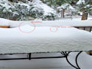 A bit of snow on 16 April 2020 A bit of snow on 16 April 2020
|
|
Thursday, 16 April 2002
It snowed today.
|
|
Locations:
Apex Park - Northern Parcel.
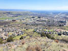 Kinney Run and south Golden from Apex Park. Kinney Run and south Golden from Apex Park.
 Downtown and north Golden from Apex Park. Downtown and north Golden from Apex Park.
|
|
Tuesday, 21 April
Restricted area of Apex Park.
|
 Coll. No. 2246, Holosteum umbellatum Coll. No. 2246, Holosteum umbellatum
 Inflorescence of Coll. No. 2246, Holosteum umbellatum Inflorescence of Coll. No. 2246, Holosteum umbellatum
|
2246
|
Tiny little annual, opposite leaves, 5 sepals free, 5 petals free white laciniate, 2 stigmas.
Plants of Jefferson County Open Space
Jefferson County, Colorado
Caryophyllaceae
Holosteum umbellatum L.
Jagged Chickweed.
Apex Park - Northern Parcel, Jefferson County, Colorado.
Approximate center of area, mid slope, northeast-facing nose of ridge, 4.7 km. south of the GNIS location of Golden.
39.7233°N, 105.2233°W.
WGS 1984
Tiny annual, white petals with jagged ends.
Also here: Collinsia parviflora.
Collected by permit: Jefferson County Open Space, 2020, issued: Apr 13, 2020, to: Tom Schweich.
|
Tom Schweich
2246. |
21-Apr-2020 |
|
Coll. No. 2246, 21 April 2020:
Annual, to 5 cm.;
Stem,
single,
glandular distally;
Stipules,
absent;
Leaves,
cauline,
opposite,
6 mm. × 1.7 mm. wide,
oval,
margins,
entire,
glandular;
Inflorescence,
umbellate;
Pedicels,
2.5-9.0 mm.,
reflexed in flower;
Sepals,
#5,
all distinct,
2.7-3.0 mm. × 1.2 mm. wide,
ovate,
green,
margin scarious;
Petals,
#5,
2.5 mm. × 1.2 mm. wide,
deltoid,
tip erose;
Stamens,
#5;
Styles,
#2(3?),
1 entire,
1 forked (with 2 stigmas).
|
 Coll. No. 2247, Micranthes rhomboidea Coll. No. 2247, Micranthes rhomboidea
|
2247
|
Scappose, glomular head, white flowers -- certainly Saxifragiceae, maybe Micranthes rhomboidea.
Plants of Jefferson County Open Space
Jefferson County, Colorado
Saxifragaceae
Micranthes rhomboidea (Greene) Small.
Diamondleaf Saxifrage.
Apex Park - Northern Parcel, Jefferson County, Colorado.
Approximate mid-slope, second gulch north of area boundary, northeast-facing slope near ephemeral stream, 4.9 km. south of the GNIS location of Golden.
39.722°N, 105.2216°W.
WGS 1984
Elev. 1984 m.
Wet, springy area, no running water.
Collected by permit: Jefferson County Open Space, 2020, issued: Apr 13, 2020, to: Tom Schweich.
|
Tom Schweich
2247. |
21-Apr-2020 |
|
|
|
Locations:
Schweich Hill.
|
|
Friday, 24 April 2020
North Washington Open Space. No collections, a couple of observations, need to return in a week for Chorispora tenella in fruit.
|
|
Other articles:
• Golden Checklist Flora:
Apex Park;
• Grubstake Trail:
along the trail;
Locations:
Apex Park - Northern Parcel.
 Golden, and North and South Table Mountains, from Apex Park. Golden, and North and South Table Mountains, from Apex Park.
|
|
Saturday, 25 April 2020
Apex Park, Restricted Area.
Widened Grubstake Trail. |
|
|
Other articles:
• Golden Checklist Flora:
Ranunculus glaberrimus ellipticus;
 Habitat of Coll. No. 2248, Ranunculus glaberrimus Habitat of Coll. No. 2248, Ranunculus glaberrimus
 Coll. No. 2248, Ranunculus glaberrimus var. ellipticus Coll. No. 2248, Ranunculus glaberrimus var. ellipticus
|
2248
|
Ranunculus sp., probably R. glaberrumus, the Sagebrush buttercup.
Plants of Jefferson County Open Space
Jefferson County, Colorado
Ranunculaceae
Ranunculus glaberrimus Hook. var. ellipticus (Greene) Greene.
Sagebrush Buttercup.
Apex Park - Northern Parcel, Jefferson County, Colorado.
Rocky Mountain Front Range, approximate mid-slope, very close to the southern boundary of the north parcel, 5.0 km. south of the GNIS location of Golden
39.721°N, 105.2211°W.
WGS 1984
Elev. 2080 m.
Northeast-facing rocky slope, but the plants are growing in deep humus between the rocks.
Collected by permit: Jefferson County Open Space, 2020, issued: Apr 13, 2020, to: Tom Schweich.
|
Tom Schweich
2248. |
25-Apr-2020 |
|
Coll. No. 2248 25 Apr 2020, characters observed:
Perennial herb, to 11 cm., terrestrial;
Stem, glabrous;
Leaves,
basal,
petiole,
40 mm.,
blade,
simple,
25 mm. × 13 mm. wide,
elliptic to rhomboid,
cauline,
alternate,
ternate,
24 mm. × 24 mm. wide;
Flowers,
actinomorphic;
Sepals,
4.5 mm., lower surface few long soft white hairs;
Petals,
#5,
6 mm. × 4.5 mm. wide,
bright yellow,
not spurred;
Achenes,
in a globose cluster 5 mm. × 8 mm. wide,
many in number,
1.5 mm. × 1.3 mm. wide,
slightly hairy.
|
|
|
2249
|
Claytonia rosea
Plants of Jefferson County Open Space
Jefferson County, Colorado
Montiaceae
Claytonia rosea Rydb.
Rocky Mountain Springbeauty.
Apex Park - Northern Parcel, Jefferson County, Colorado.
On an old trail, north of and below the Grubstake Trail, 4.85 km. south of the GNIS location of Golden.
39.7223°N, 105.226°W.
WGS 1984
Elev. 2075 m.
In deep forest duff, mixed douglas fir and ponderosa pine forest, and shrubs.
Collected by permit: Jefferson County Open Space, 2020, issued: Apr 13, 2020, to: Tom Schweich.
|
Tom Schweich
2249. |
25-Apr-2020 |
|
|
 Habitat of Coll. No. 2250, Collinsia parviflora Habitat of Coll. No. 2250, Collinsia parviflora
 Coll. No. 2260, Collinsia parviflora Coll. No. 2260, Collinsia parviflora
|
2250
|
Collinsia parviflora
Plants of Jefferson County Open Space
Jefferson County, Colorado
Plantaginaceae
Collinsia parviflora Lindl.
Maiden Blue-eyed Mary.
Apex Park - Northern Parcel, Jefferson County, Colorado.
Northern part of Apex Open Space Park, about mid-slope, along an old road or trail, 4.93 km south of the GNIS location of Golden.
39.7215°N, 105.223°W.
WGS 1984
Elev. 2039 m.
Gravelly swale, wet but no runnng water, with small shrubs, grasses, etc.
Collected by permit: Jefferson County Open Space, 2020, issued: Apr 13, 2020, to: Tom Schweich.
|
Tom Schweich
2250. |
25-Apr-2020 |
|
|
|
Locations:
Kinney Run.
 Two basal leaves of Physaria. Two basal leaves of Physaria.
|
|
Monday, 27 April 2020
|
 Coll. No. 2251, Townsendia hookeri, ray fruit (left) and disk fruit (right). Coll. No. 2251, Townsendia hookeri, ray fruit (left) and disk fruit (right).
|
2251
|
Townsendia hookeri
|
Native and Naturalized Flora of the Golden Area, Jefferson County, Colorado
Asteraceae
Townsendia hookeri Beaman.
Hooker's Townsend Daisy.
Deadman Gulch, Jefferson County, Colorado.
High plains at the base of the Rocky Mountain Front Range, linear northwest trending dry gravelly area, either in a trace of the Golden Fault or adjacent to it, 3.15 km. south of the GNIS location of Golden.
39.734°N, 105.217°W.
WGS 1984
Elev. 1818 m.
The type locality of T. hookeri is Mount Vernon Canyon, about 5 km. south. Also collected here: Packera plattensis, Euphorbia brachycera, and Ipomopsis spicata.
Collected by permit: City of Golden, 2020, issued: Apr 9, 2020, to: Tom Schweich.
|
Tom Schweich
2251. |
27-Apr-2020 |
|
|
|
Other articles:
• Golden Checklist Flora:
Tin Cup Ridge;
Locations:
Tin Cup Ridge.
|
|
Thursday, 30 April 2020
Tin Cup Ridge
|
|
Other articles:
• Golden Checklist Flora:
Balsamorhiza sagittata;
• Glossary:
disjunct;
 Coll. No. 2252, Balsamorhiza sagittata Coll. No. 2252, Balsamorhiza sagittata
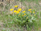 Coll. No. 2252, Balsamorhiza sagittata Coll. No. 2252, Balsamorhiza sagittata
|
2252
|
Balsamorhiza sagittata.
Plants of Jefferson County Open Space
Jefferson County, Colorado
Asteraceae
Balsamorhiza sagittata (Pursh) Nutt.
Arrow-Leaf Balsamroot.
Tin Cup Ridge, Jefferson County, Colorado.
Lower slopes of Tin Cup Ridge, the northward extension of Dinosaur Ridge into Golden, a hogback at the base of the Rocky Mountain Front Range, 6.63 km. south of the GNIS location of Golden.
39.7134°N, 105.2044°W.
WGS 1984
Elev. 1898 m.
About 24 plants here, about half of which are in bloom. Another colony of 60-100 plants a little higher on the hogback.
Usually described as a western slope plant. Perhaps planted here. Regardless, it is naturalized and spreading, if not native.
Collected by permit: Jefferson County Open Space, 2020, issued: Apr 13, 2020, to: Tom Schweich.
|
Tom Schweich
2252. |
30-Apr-2020 |
|
Voucher of Coll. No. 2252, Balsanorhiza sagittata |
|
|
Other articles:
• Golden Checklist Flora:
Saskatoon Serviceberry;
 Coll. No. 2253, Amelanchier alnifolia Coll. No. 2253, Amelanchier alnifolia
|
2253
|
Prunus ???
no maybe Amelanchier alnifolia.
Plants of Jefferson County Open Space
Jefferson County, Colorado
Rosaceae
Amelanchier alnifolia (Nutt.) Nutt. ex M. Roem.
Saskatoon Serviceberry.
Tin Cup Ridge, Jefferson County, Colorado.
Along the top of Tin Cup Ridge, the northward extension of Dinosaur Ridge into Golden, a hogback at the base of the Rocky Mountain Front Range, 6.63 km. south of the GNIS location of Golden.
39.7116°N, 105.2041°W.
WGS 1984
Elev. 1930 m.
Small plant, less than 1 meter in diameter.
Also at this location: Physaria montana.
Collected by permit: Jefferson County Open Space, 2020, issued: Apr 13, 2020, to: Tom Schweich.
|
Tom Schweich
2253. |
30-Apr-2020 |
|
|
|
Other articles:
• Golden Checklist Flora:
Lookout Mtn;
Locations:
Windy Saddle Park.
 Unnamed gulch in Windy Saddle Park. Unnamed gulch in Windy Saddle Park.
|
|
Monday, 4 May 2020
Tent caterpillars on Prunus virginiana |
Upper part of unnamed gulch. |
View down the unnamed gulch. |
|
 Habitat of Coll. No. 2254, Leucocrinum montanum Habitat of Coll. No. 2254, Leucocrinum montanum
|
2254
|
Leucocrinum montanum.
|
Native and Naturalized Flora of the Golden Area, Jefferson County, Colorado
Anthericeae
Leucocrinum montanum Nutt. ex A. Gray.
Star Lily.
Colorado School of Mines Survey Field, Jefferson County, Colorado.
Northernmost Survey Field, highest plains at the base of Lookout Mountain and Rocky Mountain Front Range, exposed east-facing alluvial slope, many plants in bloom.
39.739°N, 105.2305°W.
WGS 1984
Elev. 1870 m.
Also collected nearby: Prunus virginia, Lepidium campestre, Mertensia lanceolata, Ribes cereum, and Lithospermum incisum.
Collected by permit: Colorado School of Mines, 2020, issued: Apr 1, 2020, to: Tom Schweich.
|
Tom Schweich
2254. |
4-May-2020 |
|
|
 Inflorescence of Coll. No. 2255, Carex occidentalis Inflorescence of Coll. No. 2255, Carex occidentalis
|
2255
|
Carex sp.
|
|
Other articles:
• Bonanza Trail:
at Grubstake W;
• Social Trail:
at Parkview;
mid-trail;
• Golden Checklist Flora:
Apex Park;
• Grubstake Trail:
at Bonanza;
• Parkview Avenue:
at end;
Locations:
Apex Park.
Apex Park - Northern Parcel.
 West end of social trail. West end of social trail.
|
|
Wednesday, 6 May 2020
Looking south in Apex Park. |
Looking toward Parkview Avenue from social trail. |
West end of Bonanza Trail at the Grubstake Trail. |
Grubstake Trail at its west junction of the Bonanza Trail. |
Gentle upper slopes of Apex Park. |
Corner of Apex Park. |
Deadman Gulch in Apex Park. |
|
|
|
2256
|
Leucocrinum montanum.
Plants of Jefferson County Open Space
Jefferson County, Colorado
Anthericeae
Leucocrinum montanum Nutt. ex A. Gray.
Star Lily.
Apex Park - Northern Parcel, Jefferson County, Colorado.
North Parcel, western edge, Rocky Mountain Front Range, top of the initial slope, small ravine, 4.8 km south-southwest of the GNIS location of Golden.
39.7229°N, 105.2289°W.
WGS 1984
Elev. 2044 m.
Southeast facing slope, open grassland at edge of ponderosa pine woodland, many leaves have been eaten.
Also collected here: Viola nuttallii, and Cerastium arvense.
Collected by permit: Jefferson County Open Space, 2020, issued: Apr 13, 2020, to: Tom Schweich.
|
Tom Schweich
2256. |
6-May-2020 |
|
|
|
|
2257
|
Viola nuttallii.
Plants of Jefferson County Open Space
Jefferson County, Colorado
Violaceae
Viola nuttallii Pursh.
Nuttall's Violet.
Apex Park - Northern Parcel, Jefferson County, Colorado.
North Parcel, western edge, Rocky Mountain Front Range, top of the initial slope, small ravine, 4.8 km south-southwest of the GNIS location of Golden.
39.7229°N, 105.2289°W.
WGS 1984
Elev. 2101 m.
Few plants, southeast facing slope of ravine, open grassland at edge of ponderosa pine woodland.
Also collected here: Leucocrinum montanum, and Cerastium arvense.
Collected by permit: Jefferson County Open Space, 2020, issued: Apr 13, 2020, to: Tom Schweich.
|
Tom Schweich
2257. |
6-May-2020 |
|
|
|
|
2258
|
Cerastium arvense var. strictum.
Plants of Jefferson County Open Space
Jefferson County, Colorado
Caryophyllaceae
Cerastium arvense L. ssp. strictum Gaudin.
Field Chickweed.
Apex Park - Northern Parcel, Jefferson County, Colorado.
North Parcel, western edge, Rocky Mountain Front Range, top of the initial slope, small ravine, 4.7 km south-southwest of the GNIS location of Golden.
39.7235°N, 105.2289°W.
WGS 1984
Elev. 2094 m.
Drier divide between two swales, open grassland at edge of ponderosa pine woodland, one Delphinium nuttallii here.
Also collected here: Leucocrinum montanum, and Viola nuttallii.
Collected by permit: Jefferson County Open Space, 2020, issued: Apr 13, 2020, to: Tom Schweich.
|
Tom Schweich
2258. |
6-May-2020 |
|
|
 Coll. No. 2259, Viola canadensis Coll. No. 2259, Viola canadensis
|
2259
|
Viola canadensis
Plants of Jefferson County Open Space
Jefferson County, Colorado
Violaceae
Viola canadensis L.
Canadian White Violet.
Apex Park - Northern Parcel, Jefferson County, Colorado.
Northwest corner of Apex Park, wooded south side of Deadman Gulch, 4.65 km south southeast of the GNIS location of Golden.
39.7241°N, 105.2296°W.
WGS 1984
Elev. 2104 m.
Early spring blooming, deep shade, elk bedding area.
Also collected here Mertensia lanceolata, a Prunus, possibly a domestic sp., and Euphorbia myrsinites.
Collected by permit: Jefferson County Open Space, 2020, issued: Apr 13, 2020, to: Tom Schweich.
|
Tom Schweich
2259. |
6-May-2020 |
|
|
|
|
2260
|
Mertensia lanceolata.
Plants of Jefferson County Open Space
Jefferson County, Colorado
Boraginaceae
Mertensia lanceolata (Pursh) DC.
Prairie Bluebells.
Apex Park - Northern Parcel, Jefferson County, Colorado.
Northwest corner of Apex Park, east-facing slope north of Deadman Gulch, 4.60 km south southeast of the GNIS location of Golden.
39.7244°N, 105.2295°W.
WGS 1984
Elev. 2095 m.
Openings in ponderosa pine woodland, also seen here; Mondarda fistulosa, Berberis reptans, and Delphinium nuttallii.
Collected by permit: Jefferson County Open Space, 2020, issued: Apr 13, 2020, to: Tom Schweich.
|
Tom Schweich
2260. |
6-May-2020 |
|
|
|
|
2261
|
Prunus sp. or Malus
Plants of Jefferson County Open Space
Jefferson County, Colorado
Rosaceae
Prunus americana Marshall.
American Plum.
Apex Park - Northern Parcel, Jefferson County, Colorado.
Northwest corner of Apex Park, east-facing slope north of Deadman Gulch, 4.59 km south southwest of the GNIS location of Golden.
39.7245°N, 105.2294°W.
WGS 1984
Elev. 2094 m.
Also collected nearby, Viola canadensis in Ponderosa pine woodland, Mertensia lanceolata, and Euphorbia myrsinites.
Collected by permit: Jefferson County Open Space, 2020, issued: Apr 13, 2020, to: Tom Schweich.
|
Tom Schweich
2261. |
6-May-2020 |
|
|
|
Other articles:
• Golden Checklist Flora:
Micranthes rhomboidea;
Notes on Micranthes rhomboidea;
 Coll. No. 2262, Micranthes rhomboidea Coll. No. 2262, Micranthes rhomboidea
 Coll. No. 2262, Micranthes rhomboidea Coll. No. 2262, Micranthes rhomboidea
|
2262
|
Micranthes rhomboidea.
Plants of Jefferson County Open Space
Jefferson County, Colorado
Saxifragaceae
Micranthes rhomboidea (Greene) Small.
Diamondleaf Saxifrage.
Apex Park - Northern Parcel, Jefferson County, Colorado.
South side of Deadman Gulch, near the top of the initial Front Range scarp, 4.38 km. south southeast of the GNIS location of Golden.
39.7255°N, 105.2255°W.
WGS 1984
Elev. 2041 m.
Flower.
Openings in Ponderosa Pine Woodland. Also collected here: Collinsia parviflora.
Collected by permit: Jefferson County Open Space, 2020, issued: Apr 13, 2020, to: Tom Schweich.
|
Tom Schweich
2262. |
6-May-2020 |
|
|
|
|
2262.1
|
Collinsia parviflora
|
|
Literature Cited:
- Savoca, Matthew, 2019.
- Weber, Alex K., Michael W. Weber, and Matthew S. Savoca, 2019.
Other articles:
• Golden Checklist Flora:
Dakota Ridge;
• Recreational Trail (Pine Ridge Estates):
just south of spur;
Locations:
Cressmans Gulch (lower).
Dakota Ridge.
|
|
Saturday, 9 May 2020
South end of Dakota Ridge, aka North Hogback.
Parking and overflow parking for North Table Mountain. |
It looks like a Titleist to me! |
South end of Dakota Ridge. |
Yard waste disposal in City of Golden open space on the banks of Cressman Gulch. |
Thirteen golf balls collected on Dakota Ridge. |
|
|
|
2263
|
Euphorbia esula.
|
Native and Naturalized Flora of the Golden Area, Jefferson County, Colorado
Euphorbiaceae
Euphorbia esula L.
Leafy Spurge.
Dakota Ridge, Jefferson County, Colorado.
Southern end of the hogback in northernmost Golden, 4.15 km. north northwest of the GNIS location of Golden.
39.7811°N, 105.238°W.
WGS 1984
Elev. 1850 m.
Grassy southwest facing slope. Many plants here.
Colorado Noxious Weed List B.
Collected by permit: City of Golden, 2020, issued: Apr 9, 2020, to: Tom Schweich.
|
Tom Schweich
2263. |
9-May-2020 |
|
|
|
|
2264
|
Alyssum simplex.
|
Native and Naturalized Flora of the Golden Area, Jefferson County, Colorado
Brassicaceae
Alyssum simplex Rudolphi.
European Madwort.
Dakota Ridge, Jefferson County, Colorado.
Southern end of the hogback in northernmost Golden, 4.15 km. north northwest of the GNIS location of Golden.
39.7811°N, 105.2378°W.
WGS 1984
Elev. 1869 m.
Grassy southwest facing slope. Also collected here: Erodium cicutarium, Euphorbia esula, and Castilleja integra.
Collected by permit: City of Golden, 2020, issued: Apr 9, 2020, to: Tom Schweich.
|
Tom Schweich
2264. |
9-May-2020 |
|
|
|
|
2264.1
|
Erodium cicutarium.
|
Native and Naturalized Flora of the Golden Area, Jefferson County, Colorado
Geraniaceae
Erodium cicutarium (L.) L'Her. ex Aiton.
Redstem Stork's Bill.
Dakota Ridge, Jefferson County, Colorado.
Southern end of the hogback in northernmost Golden, 4.15 km. north northwest of the GNIS location of Golden.
39.7811°N, 105.2379°W.
WGS 1984
Elev. 1869 m.
Small plants. Flower and fruit.
Grassy southwest facing slope. Also collected here: Alyssum simplex, Euphorbia esula, and Castilleja integra.
Collected by permit: City of Golden, 2020, issued: Apr 9, 2020, to: Tom Schweich.
|
Tom Schweich
2264.1 |
9-May-2020 |
|
|
|
|
2265
|
Cerastium arvense strictum.
|
Native and Naturalized Flora of the Golden Area, Jefferson County, Colorado
Caryophyllaceae
Cerastium arvense L. ssp. strictum Gaudin.
Field Chickweed.
Dakota Ridge, Jefferson County, Colorado.
Southern end of the hogback in northernmost Golden, 4.16 km. north northwest of the GNIS location of Golden.
39.7813°N, 105.2377°W.
WGS 1984
Elev. 1873 m.
Southwest-facing slope, with Artemisia ludoviciana, Linum lewisii, and Grindelia squarrosa.
Collected by permit: City of Golden, 2020, issued: Apr 9, 2020, to: Tom Schweich.
|
Tom Schweich
2265. |
9-May-2020 |
|
|
|
|
2265.1
|
Lomatium orientale.
|
Native and Naturalized Flora of the Golden Area, Jefferson County, Colorado
Apiaceae
Lomatium orientale J.M. Coult. & Rose.
Northern Idaho Biscuitroot.
Dakota Ridge, Jefferson County, Colorado.
Southern end of the hogback in northernmost Golden, 4.16 km. north northwest of the GNIS location of Golden.
39.7813°N, 105.2377°W.
WGS 1984
Elev. 1873 m.
Fruit.
Mixed-grass prairie just below foothills mountain mahogany shrubland; collected here: Cerastium arvense, Scutellaria brittonii, Amelanchier alnifolia, nearby: Cercocarpus montanus.
Collected by permit: City of Golden, 2020, issued: Apr 9, 2020, to: Tom Schweich.
|
Tom Schweich
2265.1 |
9-May-2020 |
|
|
|
|
2266
|
Scutellaria brittonii.
|
Native and Naturalized Flora of the Golden Area, Jefferson County, Colorado
Lamiaceae
Scutellaria brittonii Porter.
Britton's Skullcap.
Dakota Ridge, Jefferson County, Colorado.
Southern end of the hogback in northernmost Golden, 4.16 km. north northwest of the GNIS location of Golden.
39.7813°N, 105.2376°W.
WGS 1984
Elev. 1874 m.
Mixed-grass prairie just below foothills mountain mahogany shrubland; collected here: Cerastium arvense, Lomatium orientale, Amelanchier alnifolia, nearby: Cercocarpus montanus.
Collected by permit: City of Golden, 2020, issued: Apr 9, 2020, to: Tom Schweich.
|
Tom Schweich
2266. |
9-May-2020 |
|
|
|
Other articles:
• Golden Checklist Flora:
Saskatoon Serviceberry;
|
2267
|
Amelanchier alnifolia.
|
Native and Naturalized Flora of the Golden Area, Jefferson County, Colorado
Rosaceae
Amelanchier alnifolia (Nutt.) Nutt. ex M. Roem.
Saskatoon Serviceberry.
Dakota Ridge, Jefferson County, Colorado.
Southern end of the hogback in northernmost Golden, 4.16 km. north northwest of the GNIS location of Golden.
39.7813°N, 105.2375°W.
WGS 1984
Elev. 1877 m.
Just one shrub, unarmed. Southwest slope.
Above the mixed-grass prairie just into foothills mountain mahogany shrubland; collected here: Ribes cereum, Cercocarpus montanus, and Potentilla recta; nearby: Lomatium orientale, and Scutellaria brittonii.
Collected by permit: City of Golden, 2020, issued: Apr 9, 2020, to: Tom Schweich.
|
Tom Schweich
2267. |
9-May-2020 |
|
|
|
|
2268
|
Bromus tectorum.
|
Native and Naturalized Flora of the Golden Area, Jefferson County, Colorado
Poaceae
Bromus tectorum L.
Cheat Grass.
Dakota Ridge, Jefferson County, Colorado.
Southern end of the hogback in northernmost Golden, 4.16 km. north northwest of the GNIS location of Golden.
39.7813°N, 105.2374°W.
WGS 1984
Elev. 1880 m.
Southwest slope, near top of hogback; foothills mountain mahogany shrubland; also collected here: Ribes cereum, Amelanchier alnifolia, Cercocarpus montanus, Potentilla recta, and Viola nuttallii.
Collected by permit: City of Golden, 2020, issued: Apr 9, 2020, to: Tom Schweich.
|
Tom Schweich
2268. |
9-May-2020 |
|
|
|
|
2269
|
Viola nuttallii.
|
Native and Naturalized Flora of the Golden Area, Jefferson County, Colorado
Violaceae
Viola nuttallii Pursh.
Nuttall's Violet.
Dakota Ridge, Jefferson County, Colorado.
Southern end of the hogback in northernmost Golden, 4.15 km. north northwest of the GNIS location of Golden.
39.7814°N, 105.2374°W.
WGS 1984
Elev. 1884 m.
All were growing underneath Cercocarpus montanus shrubs.
Mixed Foothill Shrubland; also collected here: Ribes cereum, Amelanchier alnifolia, Cercocarpus montanus, Potentilla recta, and Bromus tectorum,
Collected by permit: City of Golden, 2020, issued: Apr 9, 2020, to: Tom Schweich.
|
Tom Schweich
2269. |
9-May-2020 |
|
|
|
|
2270
|
Ribes cereum.
|
Native and Naturalized Flora of the Golden Area, Jefferson County, Colorado
Grossulariaceae
Ribes cereum Douglas.
Wax Currant.
Dakota Ridge, Jefferson County, Colorado.
Southern end of the hogback in northernmost Golden, 4.17 km. north northwest of the GNIS location of Golden.
39.7815°N, 105.2373°W.
WGS 1984
Elev. 1882 m.
Flowers pink.
Most shrubs are Cercocarpus montanus with just a few R, cereum and one Amelanchier alnifolia, plus forbs such as Penstemon virens, Viola nuttallii, and Lappula occidentalis.
Collected by permit: City of Golden, 2020, issued: Apr 9, 2020, to: Tom Schweich.
|
Tom Schweich
2270. |
9-May-2020 |
|
|
|
Other articles:
• Golden Checklist Flora:
Notes on Cercocarpus montanus;
 Coll. No. 2270.1, Cercocarpus montanus in bloom. Coll. No. 2270.1, Cercocarpus montanus in bloom.
|
2270.1
|
Cercocarpus montanus.
|
Native and Naturalized Flora of the Golden Area, Jefferson County, Colorado
Rosaceae
Cercocarpus montanus Raf.
Alder-Leaf Mountain Mahogany.
Dakota Ridge, Jefferson County, Colorado.
Southern end of the hogback in northernmost Golden, 4.17 km. north northwest of the GNIS location of Golden.
39.7815°N, 105.2373°W.
WGS 1984
Elev. 1882 m.
In bloom, no fruit yet.
Foothills shrubland, primarily C. montanus, with Ribes cereum, Rhus trilobata, and Amelanchier alnifolia, and forbs: Physaria montana, Penstemon virens, and Viola nuttallii,
Collected by permit: City of Golden, 2020, issued: Apr 9, 2020, to: Tom Schweich.
|
Tom Schweich
2270.1 |
9-May-2020 |
|
|
|
|
2271
|
Penstemon virens.
|
Native and Naturalized Flora of the Golden Area, Jefferson County, Colorado
Plantaginaceae
Penstemon virens Pennell ex Rydb.
Front Range Beardtongue.
Dakota Ridge, Jefferson County, Colorado.
Southern end of the hogback in northernmost Golden, 4.19 km. north northwest of the GNIS location of Golden.
39.7817°N, 105.2372°W.
WGS 1984
Elev. 1897 m.
Flowers blue.
In upturned rocks on the spine of the hogback, also seen or collected here: Eriogonum umbellatum, Physaria montana, Ribes cereum, Escobaria vivipara, and Cercocarpus montanus.
Collected by permit: City of Golden, 2020, issued: Apr 9, 2020, to: Tom Schweich.
|
Tom Schweich
2271. |
9-May-2020 |
|
|
|
|
2271.1
|
Physaria montana.
|
Native and Naturalized Flora of the Golden Area, Jefferson County, Colorado
Brassicaceae
Physaria montana (A. Gray) Greene.
Mountain Bladderpod.
Dakota Ridge, Jefferson County, Colorado.
Southern end of the hogback in northernmost Golden, 4.19 km. north northwest of the GNIS location of Golden.
39.7817°N, 105.2372°W.
WGS 1984
Elev. 1897 m.
In upturned rocks on the spine of the hogback, also seen or collected here: Eriogonum umbellatum, Penstemon virens, Ribes cereum, Escobaria vivipara, and Cercocarpus montanus.
Collected by permit: City of Golden, 2020, issued: Apr 9, 2020, to: Tom Schweich.
|
Tom Schweich
2271.1 |
9-May-2020 |
|
|
|
|
2272
|
Physaria montana.
|
Native and Naturalized Flora of the Golden Area, Jefferson County, Colorado
Brassicaceae
Physaria montana (A. Gray) Greene.
Mountain Bladderpod.
Dakota Ridge, Jefferson County, Colorado.
Southern end of the hogback in northernmost Golden, 4.21 km. north northwest of the GNIS location of Golden.
39.7818°N, 105.2373°W.
WGS 1984
Elev. 1898 m.
In upturned rocks on the spine of the hogback, also seen or collected here: Eriogonum umbellatum, Penstemon virens, Ribes cereum, Escobaria vivipara, and Cercocarpus montanus.
Collected by permit: City of Golden, 2020, issued: Apr 9, 2020, to: Tom Schweich.
|
Tom Schweich
2272. |
9-May-2020 |
|
|
|
Locations:
Schweich Hill.
Tucker Gulch (lower).
 Astragalus crassicarpus “Groundplum Milkvetch” Astragalus crassicarpus “Groundplum Milkvetch”
 Senecio integerrimus “Columbia Ragwort” in the North Washington Open Space. Senecio integerrimus “Columbia Ragwort” in the North Washington Open Space.
|
|
Tuesday, 12 May 2020
North Washington Open Space and Tucker Gulch.
|
|
|
2273
|
Chorispora tenella.
|
Native and Naturalized Flora of the Golden Area, Jefferson County, Colorado
Brassicaceae
Chorispora tenella (Pall.) DC.
Crossflower.
North Washington Open Space, Jefferson County, Colorado.
Small (4 acre) fallow city-owned parcel in northern Golden, near the intersection of Colorado Highway 93 and Washington Avenue, 2.24 km. northwest of the GNIS location of Golden.
39.7687°N, 105.2318°W.
WGS 1984
Elev. 1801 m.
Beside the primary east-west social trail, in an area mowed by adjacent private landowners in an effort to widen the social trail. Also collected here: Chenopodium album, Cirsium arvense, Lactuca serriola, and Bromus inermis.
Collected by permit: City of Golden, 2020, issued: Apr 9, 2020, to: Tom Schweich.
|
Tom Schweich
2273. |
12-May-2020 |
|
|
|
Other articles:
• Tucker Gulch Trail:
near 1st;
 Coll. No. 2274, Ranunculus sp. Coll. No. 2274, Ranunculus sp.
 More Ranunculus sp. Nearby. More Ranunculus sp. Nearby.
|
2274
|
Ranunculus sp.
|
Native and Naturalized Flora of the Golden Area, Jefferson County, Colorado
Ranunculaceae
Ranunculus acris L.
Tall Buttercup.
Tucker Gulch (lower), Jefferson County, Colorado.
Creekside just below the First Street Bridge, 1.69 km. north northwest of the GNIS location of Golden
39.7665°N, 105.2265°W.
WGS 1984
Elev. 1761 m.
Rooted in the lowest bank of the creek. Also collected nearby: Chorispora tenella, Euphorbia esula, and Poa bulbosa.
Collected by permit: City of Golden, 2020, issued: Apr 9, 2020, to: Tom Schweich.
|
Tom Schweich
2274. |
12-May-2020 |
|
Coll. No. 2274, 12 May 2020, characters observed:
Perennial herb, to 30 cm., aquatic;
Leaves,
mostly basal with few cauline,
compound,
deeply parted,
margins toothed;
Petioles,
spreading hairs;
Flowers,
actinomorphic,
sepals, present, 9 mm. × 2.5 mm. wide, ovate,
hairy, white/translucent,
petals, yellow,
17 mm. × 12.5 mm. wide,
obovate, notched, not spurred;
Pistil, many;
Achenes,
immature,
small, glabrous,
abruptly curved short beak.
Coll. No. 2274, Ranunculus acris |
Flower of Coll. No. 2274, Ranunculus acris |
|
|
Other articles:
• Golden Checklist Flora:
Alopecurus arundinaceus;
• Tucker Gulch Trail:
near 1st;
 Coll. No. 2274.1, Alopecurus arundinaceus. Coll. No. 2274.1, Alopecurus arundinaceus.
|
2274.1
|
Alopecurus arundinaceus.
|
Native and Naturalized Flora of the Golden Area, Jefferson County, Colorado
Poaceae
Alopecurus arundinaceus Poir.
Creeping Reed Foxtail.
Tucker Gulch (lower), Jefferson County, Colorado.
Creekside just below the First Street Bridge, 1.69 km. north northwest of the GNIS location of Golden
39.7665°N, 105.2265°W.
WGS 1984
Elev. 1761 m.
Rhizomatous.
Rooted in the lowest bank of the creek. Also collected nearby: Chorispora tenella, Euphorbia esula, Ranunculus acris, and Poa bulbosa.
Same as Coll. No. 1334, 11 May 2016, made 200 m. upstream.
Collected by permit: City of Golden, 2020, issued: Apr 9, 2020, to: Tom Schweich.
|
Tom Schweich
2274.1 |
12-May-2020 |
|
|
|
Other articles:
• Tucker Gulch Trail:
cross stream;
 Coll. No. 2275, Lemna minor Coll. No. 2275, Lemna minor
|
2275
|
Lemna minor — Duck Weed.
|
Native and Naturalized Flora of the Golden Area, Jefferson County, Colorado
Araceae
Lemna minor L.
Common Duckweed.
Tucker Gulch (lower), Jefferson County, Colorado.
Running water in a little spring-fed perennial stream tributary to Tucker Gulch, 250 m. upstream of the First Street bridge, 1.98 km. north northwest of the GNIS location of Golden.
39.7682°N, 105.2279°W.
WGS 1984
Elev. 1778 m.
Also collected nearby: Salix alba, Berteroa incana, Capsella bursa-pastoris, Heterotheca villosa, Poa bulbosa, and Muscari botryoides.
Collected by permit: City of Golden, 2020, issued: Apr 9, 2020, to: Tom Schweich.
|
Tom Schweich
2275. |
12-May-2020 |
|
|
|
Other articles:
• Kinney Run Trail:
n. end of rock wall;
Locations:
Kinney Run.
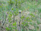
 Townsendia grandiflora in bud. Townsendia grandiflora in bud.
|
|
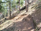
Friday, May 15, 2020
Kinney Run.
Yard waste disposal in Kinney Run. |
Signage |
Signage |
|
|
Other articles:
• Golden Checklist Flora:
Physaria vitulifera;
|
2276
|
Physaria, sp., probably P. vitulifera
|
Native and Naturalized Flora of the Golden Area, Jefferson County, Colorado
Brassicaceae
Physaria vitulifera Rydb.
Roundtip Twinpod.
Kinney Run, Jefferson County, Colorado.
Near the top of steep sandstone outcrops, east side of Kinney Run, just north of Tripp Ranch, 4.4 km. south of the GNIS location of Golden.
39.726°N, 105.2128°W.
WGS 1984
Elev. 1848 m.
Basal leaves nearly entire; fruit apical sinus deeper.
Common on outcrops of Lykens sandstone.
Colorado rare plant: G3/S3: Vulnerable, found locally in a restricted range. Collection made to rule out P. vitulifera × bellii.
Collected by permit: City of Golden, 2020, issued: Apr 9, 2020, to: Tom Schweich.
|
Tom Schweich
2276. |
15-May-2020 |
|
|
|
|
|
Saturday, 16 May 2020
|
|
|
2277
|
Lunaria annua
|
|
Locations:
Apex Park - Northern Parcel.
 Panorama from northeast corner of srudy area. Panorama from northeast corner of srudy area.
 Panorama from up near the water tank, the southeast corner of study area. Panorama from up near the water tank, the southeast corner of study area.
|
|
Monday, 18 May 2020
Apex Park, Restricted Area, lower area.
|
|
|
2278
|
Ribes aureum.
Plants of Jefferson County Open Space
Jefferson County, Colorado
Grossulariaceae
Ribes aureum Pursh.
Golden Currant.
Apex Park - Northern Parcel, Jefferson County, Colorado.
A northeast corner of the north parcel where several ephemeral streams merge before flowing through the Stonebridge HOA enroute to Kinney Run, 4.45 km. south of the GNIS location of Golden
39.7249°N, 105.2171°W.
WGS 1984
Elev. 1845 m.
Common here, on the bank of ephemeral stream, with Prunus americana and Prunus virginiana; one frog heard croaking.
Collected by permit: Jefferson County Open Space, 2020, issued: Apr 13, 2020, to: Tom Schweich.
|
Tom Schweich
2278. |
18-May-2020 |
|
|
|
|
2279
|
Prunus sp., probably P. americana.
Plants of Jefferson County Open Space
Jefferson County, Colorado
Rosaceae
Prunus americana Marshall.
American Plum.
Apex Park - Northern Parcel, Jefferson County, Colorado.
A northeast corner of the north parcel where several ephemeral streams merge before flowing through the Stonebridge HOA enroute to Kinney Run, 4.45 km. south of the GNIS location of Golden
39.7249°N, 105.2171°W.
WGS 1984
Elev. 1848 m.
Petals white. Flowers opening as leaves emerge.
Common here, on the bank of ephemeral stream, with Ribes aureum and Prunus virginiana; one frog heard croaking.
Collected by permit: Jefferson County Open Space, 2020, issued: Apr 13, 2020, to: Tom Schweich.
|
Tom Schweich
2279. |
18-May-2020 |
|
|
|
|
2280
|
Potentilla fissa.
Plants of Jefferson County Open Space
Jefferson County, Colorado
Rosaceae
Potentilla fissa Nutt. ex Torr. & A.Gray.
Bigflower Cinquefoil.
Apex Park - Northern Parcel, Jefferson County, Colorado.
Northeast-facing nose of a small ridge, along the east side of the Apex Park - North parcel, 4.61 km. south of the GNIS location of Golden.
39.7238°N, 105.2173°W.
WGS 1984
Elev. 1869 m.
Petal color yellow.
Mixed grass and patches of foothill shrubland, also seen or collected nearby: Rhus trilobata, Cynoglossum officinale, Antennaria parvifolia, Nothocalais cuspidata, and Senecio integerrimus.
Collected by permit: Jefferson County Open Space, 2020, issued: Apr 13, 2020, to: Tom Schweich.
|
Tom Schweich
2280. |
18-May-2020 |
|
|
|
|
2281
|
Senecio integerrimus.
Plants of Jefferson County Open Space
Jefferson County, Colorado
Asteraceae
Senecio integerrimus Nutt.
Columbia Ragwort.
Apex Park - Northern Parcel, Jefferson County, Colorado.
Along the eastern edge of the Apex Park - North parcel, in a little bowl, 4.70 km. south of the GNIS location of Golden.
39.7232°N, 105.2173°W.
WGS 1984
Elev. 1866 m.
Ray flower color yellow.
Mixed grass and foothill shrubland, around the edge of a thicket of Prunus americana and Rhus trilobata. Cynoglossum officinale also here.
Collected by permit: Jefferson County Open Space, 2020, issued: Apr 13, 2020, to: Tom Schweich.
|
Tom Schweich
2281. |
18-May-2020 |
|
|
 Flower parts of Coll. No. 2282, Antennaria parvifolia. Flower parts of Coll. No. 2282, Antennaria parvifolia.
|
2282
|
Antenaria parviflora.
|
Native and Naturalized Flora of the Golden Area, Jefferson County, Colorado
Asteraceae
Antennaria parvifolia Nutt.
Small-Leaf Pussytoes.
Apex Park - Northern Parcel, Jefferson County, Colorado.
Along the eastern edge of the Apex Park - North parcel, open, north-facing aspect, 4.73 km. south of the GNIS location of Golden.
39.723°N, 105.2174°W.
WGS 1984
Elev. 1878 m.
Disk flower color white.
Mixed grass and foothill shrubland, near a thicket of Prunus americana and Rhus trilobata; Senecio integerrimus and Cynoglossum officinale also here.
Collected by permit: Jefferson County Open Space, 2020, issued: Apr 13, 2020, to: Tom Schweich.
|
Tom Schweich
2282. |
18-May-2020 |
|
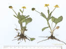
Coll. No. 2282, 18 May 2020, characters observed:
Perennial herb, to 7 cm., stoloniferous;
Leaves,
tomentose both sides,
cuneate-oblanceolate;
Inflorescence,
bracts, 7 mm. × 1.7 mm. wide, lanceolate, arachnose;
Heads, many;
Involucre, 6.5 mm.;
Phyllaries, 6 mm. × 2 mm. wide, proximal green, distal scarious and white.
|
|
|
2283
|
Nothocalais cuspidata.
Plants of Jefferson County Open Space
Jefferson County, Colorado
Asteraceae
Nothocalais cuspidata (Pursh) Greene.
Prairie False Dandelion.
Apex Park - Northern Parcel, Jefferson County, Colorado.
Along the eastern edge of the Apex Park - North parcel, small, north-facing ridge, 75 m. north of the water tank, 4.81 km. south of the GNIS location of Golden.
39.7224°N, 105.2176°W.
WGS 1984
Elev. 1881 m.
Ray flower color yellow with reddish tinge abaxially.
Among grasses below foothills shrubland; collected nearby: Chorispora tenella, Prunus virginiana, Antennaria parvifolia, and Senecio integerrimus.
There were no N. cuspidata to be found in the nearby infestation of smooth brome.
Collected by permit: Jefferson County Open Space, 2020, issued: Apr 13, 2020, to: Tom Schweich.
|
Tom Schweich
2283. |
18-May-2020 |
|
|
|
|
2284
|
Chorispora tenella.
Plants of Jefferson County Open Space
Jefferson County, Colorado
Brassicaceae
Chorispora tenella (Pall.) DC.
Crossflower.
Apex Park - Northern Parcel, Jefferson County, Colorado.
Southeast corner of Apex Park - North parcel, along an ephemeral stream that drains northeastward through Stonebridge HOA to Deadman Gulch, 4.77 km. south of the GNIS location of Golden.
39.7227°N, 105.218°W.
WGS 1984
Elev. 1877 M.
Petal color magenta.
Small patch, collected with Prunus virginiana.
Collected by permit: Jefferson County Open Space, 2020, issued: Apr 13, 2020, to: Tom Schweich.
|
Tom Schweich
2284. |
18-May-2020 |
|
|
|
|
2285
|
Prunus virginiana.
Plants of Jefferson County Open Space
Jefferson County, Colorado
Rosaceae
Prunus virginiana L.
Chokecherry.
Apex Park - Northern Parcel, Jefferson County, Colorado.
Southeast corner of Apex Park - North parcel, along an ephemeral stream that drains northeastward through Stonebridge HOA to Deadman Gulch, 4.77 km. south of the GNIS location of Golden.
39.7227°N, 105.218°W.
WGS 1984
Elev. 1873 m.
Petal color white.
In the bed of a small ephemeral watercourse.
Collected by permit: Jefferson County Open Space, 2020, issued: Apr 13, 2020, to: Tom Schweich.
|
Tom Schweich
2285. |
18-May-2020 |
|
|
|
|
2286
|
Rubus deliciousus.
Plants of Jefferson County Open Space
Jefferson County, Colorado
Rosaceae
Rubus deliciosus Torr.
Delicious raspberry.
Apex Park - Northern Parcel, Jefferson County, Colorado.
Southeast quadrant of the north parcel of Apex Park, 4.76 km. south of the GNIS location of Golden
39.7229°N, 105.2189°W.
WGS 1984
Elev. 1882 m.
Petal color white.
Northeast-facing slope beside ravine, surrounded by Rhus trilobata.
Collected by permit: Jefferson County Open Space, 2020, issued: Apr 13, 2020, to: Tom Schweich.
|
Tom Schweich
2286. |
18-May-2020 |
|
|
 Coll. No. 2287, Docecatheon pulchellum Coll. No. 2287, Docecatheon pulchellum
|
2287
|
Dodecatheon pulchellum.
Plants of Jefferson County Open Space
Jefferson County, Colorado
Primulaceae
Dodecatheon pulchellum (Raf.) Merr.
Beautiful Shootingstar.
Apex Park - Northern Parcel, Jefferson County, Colorado.
Lower part of Front Range scarp, approximate center of eastern quadrant of the Apex Park - North parcel, near the junction of two small ephemeral streams, 4.72 km. south of the GNIS location of Golden
39.723°N, 105.2192°W.
WGS 1984
Elev. 1877 m.
Petal color magenta.
Wet soil, north to northeast-facing slope; also seen or collected here: Holodiscus dumosus, Rubus deliciosus, Toxicodendron rydbergii, Scrophularia lanceolata,
Collected by permit: Jefferson County Open Space, 2020, issued: Apr 13, 2020, to: Tom Schweich.
|
Tom Schweich
2287. |
18-May-2020 |
|
|
|
Other articles:
• Coyote Song Trail:
along trail;
at Prairie Falcon;
along trail;
along trail;
near s. trailhead;
at s. trailhead;
• Lyons Back Trail:
at overlook;
• Columbine Trail:
near Pass Trl;
at Pass Trl;
Locations:
South Valley Park.
 Thick stand of Mullein along the trail. Thick stand of Mullein along the trail.
|
|
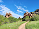
Wednesday, 20 May 2020
South Valley Park, stalking the wild
hmmm
something or other.
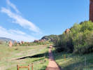
View along the trail. |
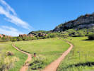
Prairie Falcon Trail to the left. Coyote Song Trail to the right. |
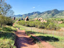
Coyote Song Trail to the south. |
Along the Coyote Song Trail. |
Panorama of South Valley Park from Lyons Back Trail. |
Columbine Trail north. |
Pass Trail into South Valley Park |
Columbine Trail south. |
Scutellaria brittonii “Britton's Skullcap” |
Cliffs near southernmost Coyote Song Trail |
Cliffs at South Trailhead. |
|
|
Other articles:
• Golden Checklist Flora:
Quercus gambelii;
 Coll. No. 2288, Quercus gambelii Coll. No. 2288, Quercus gambelii
|
2288
|
Quercus gambelii.
|
|
|
2289
|
Zigadenus paniculatus
|
|
|
2290
|
Mertensia lanceolata.
Plants of Jefferson County Open Space
Jefferson County, Colorado
Boraginaceae
Mertensia lanceolata (Pursh) DC.
Prairie Bluebells.
South Valley Park, Jefferson County, Colorado.
Between the Coyote Song Trail and the sandstone cliffs on the east side of the park, 4.81 km. west northwest of Chatfield Farms, Denver Botanic Garden.
39.5583°N, 105.1418°W.
WGS 1984
Elev. 1821 m.
Flowers pale blue.
Also collected here: Quercus gambelii, Scutellaria brittonii, Collinsia parviflora, and Toxicoscordion paniculatum.
Collected by permit: Jefferson County Open Space, 2020, issued: Apr 13, 2020, to: Tom Schweich.
|
Tom Schweich
2290. |
20-May-2020 |
|
|
|
|
2291
|
Scutellaria brittonii.
Plants of Jefferson County Open Space
Jefferson County, Colorado
Lamiaceae
Scutellaria brittonii Porter.
Britton's Skullcap.
South Valley Park, Jefferson County, Colorado.
Between the Coyote Song Trail and the sandstone cliffs on the east side of the park, 4.81 km. west northwest of Chatfield Farms, Denver Botanic Garden.
39.5584°N, 105.1415°W.
WGS 1984
Elev. 1826 m.
Openings in Gambel oaks. Also collected here: Quercus gambelii, Mertensia lanceolata, Collinsia parviflora, and Toxicoscordion paniculatum.
Collected by permit: Jefferson County Open Space, 2020, issued: Apr 13, 2020, to: Tom Schweich.
|
Tom Schweich
2291. |
20-May-2020 |
|
|
 Coll. No. 2291.1, Claytonia rubra Coll. No. 2291.1, Claytonia rubra
 Coll. No. 2291.1, Claytonia rubra Coll. No. 2291.1, Claytonia rubra
|
2291.1
|
Plants of Jefferson County Open Space
Jefferson County, Colorado
Montiaceae
Claytonia rubra (T. J. Howell) Tidestrom.
Red-Stem Springbeauty.
South Valley Park, Jefferson County, Colorado.
Between the Coyote Song Trail and the sandstone cliffs on the east side of the park, 4.81 km. west northwest of Chatfield Farms, Denver Botanic Garden.
39.5584°N, 105.1415°W.
WGS 1984
Elev. 1826 m.
Openings in Gambel oaks. Also collected here: Quercus gambelii, Mertensia lanceolata, Scutellaria brittonii, Collinsia parviflora, and Toxicoscordion paniculatum.
Collected by permit: Jefferson County Open Space, 2020, issued: Apr 13, 2020, to: Tom Schweich.
|
Tom Schweich
2291.1 |
20-May-2020 |
| Coll. No. 2291.1, 20 May 2020, characters observed:
Annuals to 7 cm., glabrous;
Leaves,
reddish in maturity,
basal,
petiole to 18 mm., blade trullate to rhomboid, 9 mm. × 9 mm. wide,
cauline,
a single pair, connate on one side;
Flowers,
4 mm.,
pink;
Seeds,
1.5 mm. × 1 mm. wide,
shiny black,
dimpled.
Per FNANM likely subsp. depressa if infraspecific names are to be applied.
|
 Involucre of Coll. No. 2292, Townsendia grandiflora Involucre of Coll. No. 2292, Townsendia grandiflora
|
2292
|
Townsendia grandiflora.
Plants of Jefferson County Open Space
Jefferson County, Colorado
Asteraceae
Townsendia grandiflora Nutt.
Largeflower Townsend Daisy.
South Valley Park, Jefferson County, Colorado.
Between the Coyote Song Trail and the sandstone cliffs on the east side of the park, 4.66 km. west northwest of Chatfield Farms, Denver Botanic Garden.
39.5579°N, 105.1407°W.
WGS 1984
Elev. 1835 m.
Stiff sandstone-derived soil below cliffs, nearly bare of vegetation. Nearby: Quercus gambelii, Cryptantha virgata, Lappula occidentalis, Mertensia lanceolata, Collinsia parviflora, and Toxicoscordion paniculatum.
Collected by permit: Jefferson County Open Space, 2020, issued: Apr 13, 2020, to: Tom Schweich.
|
Tom Schweich
2292. |
20-May-2020 |
|
|
 Fruit of Coll. No. 2292.1, Physaria X1 Fruit of Coll. No. 2292.1, Physaria X1
 Coll. No. 2292.1, Physaria X1 Coll. No. 2292.1, Physaria X1
|
2292.1
|
Physaria hybrid.
Plants of Jefferson County Open Space
Jefferson County, Colorado
Brassicaceae
Physaria X1.
Twinpod Hybrid.
South Valley Park, Jefferson County, Colorado.
Between the Coyote Song Trail and the sandstone cliffs on the east side of the park, 4.66 km. west northwest of Chatfield Farms, Denver Botanic Garden.
39.5579°N, 105.1407°W.
WGS 1984
Elev. 1835 m.
Stiff sandstone-derived soil below cliffs, nearly bare of vegetation. Nearby: Quercus gambelii, Cryptantha virgata, Lappula occidentalis, Mertensia lanceolata, Collinsia parviflora, and Toxicoscordion paniculatum.
Collected by permit: Jefferson County Open Space, 2020, issued: Apr 13, 2020, to: Tom Schweich.
|
Tom Schweich
2292.1 |
20-May-2020 |
|
|
|
Locations:
Apex Park - Northern Parcel.
Deadman Gulch.
 Panorama of today's objective. Panorama of today's objective.
 Elk Trail through chokecherry on an old overgrown road. Elk Trail through chokecherry on an old overgrown road.
|
|
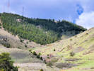
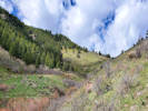
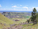
Tuesday, May 26, 2020
Apex Park, Restricted Area.
Cliff on the south side of Deadman Gulch. |
My day pack and field press on the old road, now an elk trail. |
Upper part of Deadman Gulch |
View down Deadman Gulch. |
Green Mountain from Apex Open Space Park. |
|
|
|
2293
|
Linaria dalmatica.
Plants of Jefferson County Open Space
Jefferson County, Colorado
Plantaginaceae
Linaria dalmatica (L.) Mill.
Dalmatian ToadFlax.
Apex Park - Northern Parcel, Jefferson County, Colorado.
Northernmost quadrant of the parcel, north side of Deadman Gulch, right at the base of the Front Range scarp, 4.06 km. south of the GNIS location of Golden
39.7276°N, 105.2228°W.
WGS 1984
Elev. 1893 m.
Flowers yellow.
Also seen or collected here: Juniperus scopulorum, Oenothera suffrutencens, Cynoglossum officinale, and Agoseris parviflora.
Collected by permit: Jefferson County Open Space, 2020, issued: Apr 13, 2020, to: Tom Schweich.
|
Tom Schweich
2293. |
26-May-2020 |
|
|
|
|
2294
|
Cynoglossum officinale.
Plants of Jefferson County Open Space
Jefferson County, Colorado
Boraginaceae
Cynoglossum officinale L.
Gypsyflower.
Apex Park - Northern Parcel, Jefferson County, Colorado.
Northernmost quadrant of the parcel, north side of Deadman Gulch, right at the base of the Front Range scarp, 4.06 km. south of the GNIS location of Golden.
39.7276°N, 105.2228°W.
WGS 1984
Elev. 1897 m.
Basal leaves withered. Flowers red, fading purple.
Also seen or collected here: Juniperus scopulorum, Oenothera suffrutencens, Linaria dalmatica, and Agoseris parviflora.
Colorado Noxious Weed List B.
Collected by permit: Jefferson County Open Space, 2020, issued: Apr 13, 2020, to: Tom Schweich.
|
Tom Schweich
2294. |
26-Maay-2020 |
|
|
|
|
2295
|
Agoseris, identified A. glauca in field but runcinate leaves lead to A. parviflora.
Plants of Jefferson County Open Space
Jefferson County, Colorado
Asteraceae
Agoseris parviflora (Nutt.) D. Dietr.
Steppe Goat-Chicory.
Apex Park - Northern Parcel, Jefferson County, Colorado.
Northernmost quadrant of the parcel, north side of Deadman Gulch, right at the base of the Front Range scarp, 4.06 km. south of the GNIS location of Golden.
39.7276°N, 105.2227°W.
WGS 1984
Elev. 1900 m.
Leaves runcinate. Flowers yellow.
Also seen or collected here: Juniperus scopulorum, Oenothera suffrutescens, Linaria dalmatica, and Cynoglossum officinale.
Collected by permit: Jefferson County Open Space, 2020, issued: Apr 13, 2020, to: Tom Schweich.
|
Tom Schweich
2295. |
26-May-2020 |
|
|
 A Tradescantia occidentalis “Prairie Spiderwort” with intense color. A Tradescantia occidentalis “Prairie Spiderwort” with intense color.
|
2296
|
Tradescantia occidentalis.
Plants of Jefferson County Open Space
Jefferson County, Colorado
Commelinaceae
Tradescantia occidentalis (Britton) Smyth.
Prairie Spiderwort.
Apex Park - Northern Parcel, Jefferson County, Colorado.
Northernmost quadrant of the parcel, steep slope part way up the initial Front Range scarp, 4.08 km. south of the GNIS location of Golden
39.7274°N, 105.2237°W.
WGS 1984
Elev. 1934 m.
These flowers very intense purplish-blue color.
Open southeast-facing slopes.
Collected by permit: Jefferson County Open Space, 2020, issued: Apr 13, 2020, to: Tom Schweich.
|
Tom Schweich
2296. |
26-May-2020 |
|
|
|
|
2296.1
|
Some tall mustard
maybe Turritis glabra.
Plants of Jefferson County Open Space
Jefferson County, Colorado
Brassicaceae
Turritis glabra L.
[Arabis glabra (L.) Bernh.]
Tower Rockcress.
Apex Park - Northern Parcel, Jefferson County, Colorado.
Northernmost quadrant of the parcel, steep slope part way up the initial Front Range scarp, 4.08 km. south of the GNIS location of Golden
39.7274°N, 105.2237°W.
WGS 1984
Elev. 1934 m.
Open southeast-facing slopes. Also collected here: Tradescantia occidentalis.
Collected by permit: Jefferson County Open Space, 2020, issued: Apr 13, 2020, to: Tom Schweich.
|
Tom Schweich
2296.1 |
26-May-2020 |
|
Coll. No. 2296.1, 26 May 2020, characters observed:
Perennial herb, to 60 cm.;
Stem,
hairs simple proximally,
glabrous distally;
Leaves,
basal, withered, but margin teeth and y-shaped hairs visible,
cauline,
sessile,
auriculate,
35-40 mm. × 15 mm. wide,
lanceolate,
auriculate,
glaucous,
glabrous except mid-rib sparsely simple hairy,
apex acute;
Flowers,
white, tips fading purple;
Fruit,
petiolate, 8 mm.,
55 mm. × 1 mm., round;
|
|
|
2297
|
Sisymbrium, maybe S. altissimum.
Plants of Jefferson County Open Space
Jefferson County, Colorado
Brassicaceae
Sisymbrium altissimum L.
Tall Tumblemustard.
Apex Park - Northern Parcel, Jefferson County, Colorado.
Northernmost quadrant of the parcel, steep slope part way up the initial Front Range scarp, 4.08 km. south of the GNIS location of Golden
39.7275°N, 105.2237°W.
WGS 1984
Elev. 1932 m.
Open southeast-facing slopes. Also collected here: Tradescantia occidentalis and Turritis glabra.
Collected by permit: Jefferson County Open Space, 2020, issued: Apr 13, 2020, to: Tom Schweich.
|
Tom Schweich
2297. |
26-May-2020 |
|
|
|
|
2298
|
Erigeron divergens.
Plants of Jefferson County Open Space
Jefferson County, Colorado
Asteraceae
Erigeron tracyi Greene.
Running Fleabane.
Apex Park - Northern Parcel, Jefferson County, Colorado.
Northernmost quadrant of the parcel, steep slope part way up the initial Front Range scarp, just north of a small spring, 4.03 km. south of the GNIS location of Golden
39.7278°N, 105.2237°W.
WGS 1984
Elev. 1933 m.
Heads solitary on (nearly) leafless stems.
Also seen or collected nearby: Juniperus scopulorum, Eriogonum alatum, Turritis glabra, Physalis hederifolia, and Scorzonera laciniata.
Thought to be an stable apomictic hybrid of E flagellaris and E. diverngens (FNANM) and is the most common of the three taxa in Golden and vicinity.
Collected by permit: Jefferson County Open Space, 2020, issued: Apr 13, 2020, to: Tom Schweich.
|
Tom Schweich
2298. |
26-May-2020 |
|
|
|
|
2299
|
Scorzonera laciniata.
Plants of Jefferson County Open Space
Jefferson County, Colorado
Asteraceae
Scorzonera laciniata L.
Cutleaf Vipergrass.
Apex Park - Northern Parcel, Jefferson County, Colorado.
Northernmost quadrant of the parcel, steep slope part way up the initial Front Range scarp, shaded spot between junipers, beside a small trickle of water from a spring, 4.03 km. south of the GNIS location of Golden
39.7278°N, 105.2237°W.
WGS 1984
Elev. 1933 m.
Also seen or collected nearby: Juniperus scopulorum, Eriogonum alatum, Turritis glabra, Physalis hederifolia, and Erigeron tracyi.
Collected by permit: Jefferson County Open Space, 2020, issued: Apr 13, 2020, to: Tom Schweich.
|
Tom Schweich
2299. |
26-May-2020 |
|
|
|
|
2300
|
Castilleja integra.
Plants of Jefferson County Open Space
Jefferson County, Colorado
Orobanchaceae
Castilleja integra A. Gray.
Wholeleaf Indian Paintbrush.
Apex Park - Northern Parcel, Jefferson County, Colorado.
Northernmost quadrant of the parcel, steep slope part way up the initial Front Range scarp, along the edge of an old road, now an elk trail, 4.02 km. south of the GNIS location of Golden
39.7279°N, 105.2243°W.
WGS 1984
Elev. 1952 m.
Large specimens with brilliant red color.
Also collected nearby: Penstemon secundiflorus, Erigeron tracyi, Scorzonera laciniata, and Allium textile.
Collected by permit: Jefferson County Open Space, 2020, issued: Apr 13, 2020, to: Tom Schweich.
|
Tom Schweich
2300. |
26-May-2020 |
|
|
|
|
2300.1
|
Plants of Jefferson County Open Space
Jefferson County, Colorado
Rubiaceae
Galium aparine L.
Sticky Willy, Cleavers.
Apex Park - Northern Parcel, Jefferson County, Colorado.
Northernmost quadrant of the parcel, steep slope part way up the initial Front Range scarp, along the edge of an old road, now an elk trail, 4.02 km. south of the GNIS location of Golden
39.7279°N, 105.2243°W.
WGS 1984
Annuals.
Also collected nearby: Penstemon secundiflorus, Castilleja integra, Erigeron tracyi, Scorzonera laciniata, and Allium textile.
Collected by permit: Jefferson County Open Space, 2020, issued: Apr 13, 2020, to: Tom Schweich.
|
Tom Schweich
2300.1 |
26-May-2020 |
|
|
|
|
2300.2
|
Plants of Jefferson County Open Space
Jefferson County, Colorado
Brassicaceae
Alyssum simplex Rudolphi.
European Madwort.
Apex Park - Northern Parcel, Jefferson County, Colorado.
Northernmost quadrant of the parcel, steep slope part way up the initial Front Range scarp, along the edge of an old road, now an elk trail, 4.02 km. south of the GNIS location of Golden
39.7279°N, 105.2243°W.
WGS 1984
Annuals.
Also collected nearby: Penstemon secundiflorus, Castilleja integra, Erigeron tracyi, Scorzonera laciniata, and Allium textile.
Collected by permit: Jefferson County Open Space, 2020, issued: Apr 13, 2020, to: Tom Schweich.
|
Tom Schweich
2300.2 |
26-May-2020 |
|
|
|
|
2301
|
Penstemon secundiflorus.
Plants of Jefferson County Open Space
Jefferson County, Colorado
Plantaginaceae
Penstemon secundiflorus Benth.
Sidebells Penstemon.
Apex Park - Northern Parcel, Jefferson County, Colorado.
Northernmost quadrant of the parcel, steep slope part way up the initial Front Range scarp, along the edge of an old road, now an elk trail, 3.99 km. south of the GNIS location of Golden
39.7281°N, 105.2247°W.
WGS 1984
Elev. 1964 m.
Corolla pinkish when fresh, fading bluish.
Also collected nearby: Alyssum simplex, Castilleja integra, Erigeron tracyi, Scorzonera laciniata, and Allium textile.
Collected by permit: Jefferson County Open Space, 2020, issued: Apr 13, 2020, to: Tom Schweich.
|
Tom Schweich
2301. |
26-May-2020 |
|
|
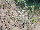 Coll. No. 2302, Allium textile Coll. No. 2302, Allium textile
|
2302
|
Allium textile.
Plants of Jefferson County Open Space
Jefferson County, Colorado
Alliaceae
Allium textile A. Nelson & J.F. Macbr.
Textile Onion.
Apex Park - Northern Parcel, Jefferson County, Colorado.
Northernmost quadrant of the parcel, steep slope part way up the initial Front Range scarp, along the edge of an old road, now an elk trail, 3.99 km. south of the GNIS location of Golden
39.7282°N, 105.2247°W.
WGS 1984
Elev. 1967 m.
East-facing slope in deep forest duff under Cercocarpus montanus and Pinus ponderosa.
Collected by permit: Jefferson County Open Space, 2020, issued: Apr 13, 2020, to: Tom Schweich.
|
Tom Schweich
2302. |
26-May-2020 |
|
|
|
|
2303
|
Penstemon virens.
Plants of Jefferson County Open Space
Jefferson County, Colorado
Plantaginaceae
Penstemon virens Pennell ex Rydb.
Front Range Beardtongue.
Apex Park - Northern Parcel, Jefferson County, Colorado.
Northernmost quadrant of the parcel, north side of Deadman Gulch, on the nose of a small promontory overlooking the cliffs on the south side, 4.19 km. south southwest of the GNIS location of Golden.
39.7267°N, 105.225°W.
WGS 1984
Elev. 2014 m.
Dry, rocky site under scattered ponderosa pine; also here: Physaria montana and Campanula rotundifolia.
Collected by permit: Jefferson County Open Space, 2020, issued: Apr 13, 2020, to: Tom Schweich.
|
Tom Schweich
2303. |
26-May-2020 |
|
|
|
|
2304
|
Poa ?
Plants of Jefferson County Open Space
Jefferson County, Colorado
Poaceae
Poa fendleriana (Steud.) Vasey.
Muttongrass.
Apex Park - Northern Parcel, Jefferson County, Colorado.
Northernmost quadrant of the parcel, north side of Deadman Gulch, on the nose of a small promontory overlooking the cliffs on the south side, 4.19 km. south southwest of the GNIS location of Golden.
39.7268°N, 105.225°W.
WGS 1984
Elev. 2014 m.
Dry, rocky site under scattered ponderosa pine; also here: Physaria montana, Campanula rotundifolia, and Penstemon virens.
Collected by permit: Jefferson County Open Space, 2020, issued: Apr 13, 2020, to: Tom Schweich.
|
Tom Schweich
2304. |
26-May-2020 |
|
Coll. No 2304, 26 May 2020, characters observed:
Annual, to 40 cm., clumped;
Roots, fibrous;
Leaves,
sheath and clade differentiated,
soft,
in good part either basal or proximal;
Sheath,
65 mm.,
mostly open;
Ligule,
membraneous,
4 mm.,
tip, acute;
Auricles, absent;
Blade,
65 mm.,
folded,
margins scabrous,
tip, prow-shaped;
Inflorescence,
1 per culm,
>>leaves,
panicle,
45-60 mm × 7-10 mm. wide;
Rachis,
not extended,
sparsely scabrous;
Spikelets,
many,
some pistillate,
some bisexual,
5 mm. × 1 mm. wide,
similar,
borne singly,
pedicels, 0.5-4.5 mm.;
Compression,
slightly lateral;
Disarticulation,
between florets;
Glumes,
lower,
3 mm.,
veins, #3,
upper,
4 mm.,
<lowest floret,
veins, #5,
keeled,
membraneous,
awns, absent;
Florets,
3+ per spikelet;
Axis,
minutely hairy,
not extended;
Callus,
unremarkable;
Lemma,
4.6 mm.,
>glumes,
keeled,
proximally hairy,
keel, scabrous,
color, green to tan,
veins, #5,
margins, scarious;
Palea,
4 mm.,
<lemma,
membraneous,
veins, green, scabrous,
margins, glabrous,
tip bifid.
|
|
|
2305
|
Physaria montana.
Plants of Jefferson County Open Space
Jefferson County, Colorado
Brassicaceae
Physaria montana (A. Gray) Greene.
Mountain Bladderpod.
Apex Park - Northern Parcel, Jefferson County, Colorado.
Northernmost quadrant of the parcel, north side of Deadman Gulch, in a small saddle near the top of the initial Rocky Mountain Front Range scarp, 4.14 km. south southwest of the GNIS location of Golden
39.7272°N, 105.2252°W.
WGS 1984
Elev. 2011 m.
Among ponderosa pine and Rocky Mountain juniper; also collected here: Harbouria trachypleura and Erysimum capitatum.
Collected by permit: Jefferson County Open Space, 2020, issued: Apr 13, 2020, to: Tom Schweich.
|
Tom Schweich
2305. |
26-May-2020 |
|
|
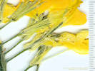 Coll. No. 2306, Erysimum capitatum
lateral pair of sepals saccate basally Coll. No. 2306, Erysimum capitatum
lateral pair of sepals saccate basally
|
2306
|
Erysimum capitatum.
Plants of Jefferson County Open Space
Jefferson County, Colorado
Brassicaceae
Erysimum capitatum (Hook.) Greene.
Sanddune Wallflower.
Apex Park - Northern Parcel, Jefferson County, Colorado.
Northernmost quadrant of the parcel, north side of Deadman Gulch, in a small saddle near the top of the initial Rocky Mountain Front Range scarp, 4.14 km. south southwest of the GNIS location of Golden
39.7271°N, 105.2253°W.
WGS 1984
Elev. 2020 m.
Under a Rocky Mountain juniper among ponderosa pines; also collected here: Harbouria trachypleura and Physaria montana.
Collected by permit: Jefferson County Open Space, 2020, issued: Apr 13, 2020, to: Tom Schweich.
|
Tom Schweich
2306. |
26-May-2020 |
|
|
|
|
2306.1
|
Harbouria trachypleura.
Plants of Jefferson County Open Space
Jefferson County, Colorado
Apiaceae
Harbouria trachypleura (A. Gray) J.M. Coult. & Rose.
Whiskbroom Parsley.
Apex Park - Northern Parcel, Jefferson County, Colorado.
Northernmost quadrant of the parcel, north side of Deadman Gulch, in a small saddle near the top of the initial Rocky Mountain Front Range scarp, 4.14 km. south southwest of the GNIS location of Golden
39.7271°N, 105.2253°W.
WGS 1984
Elev. 2020 m.
Small opening among Rocky Mountain junipers and ponderosa pines; also collected here: Erysimum capitatum and Physaria montana.
Collected by permit: Jefferson County Open Space, 2020, issued: Apr 13, 2020, to: Tom Schweich.
|
Tom Schweich
2306.1 |
26-May-2020 |
|
|
|
Literature Cited:
- Waage, Karl M., 1955.
Other articles:
• Dakota Ridge Trail:
near trailhead;
along ridge;
at viewpoint;
along ridge;
along trail.;
near jct.;
at Zorro Trl;
near jct.;
s. of trl jct;
Locations:
Dinosaur Ridge.
Matthews/Winters Park.
|
|
Friday, 29 May 2020
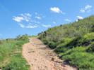
May favorite kind of trail
straight up. |
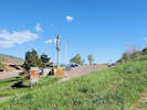
Stegosaurus Lot, trailhead for Dinosaur Ridge. |
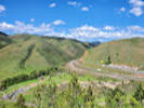
Interstate 70 enters Mount Vernon Canyon. |
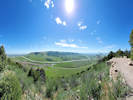
Green Mountain from Dinosaur Ridge |
One of two Physaria seen. |
The other of two Physaria seen. |
Little rattlesnake seen along Dakota Ridge Trail. |
Two young women with unleashed dogs. |
Junction with the Zorro Trail. |
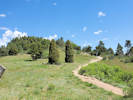
Looking north on the Dakota Ridge Trail. |
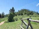
Looking south on the Dakota Ridge Trail. |
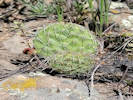
Opuntia macrorhiza |
|
|
Literature Cited:
- Scott, G. R., 1972.
Other articles:
• Dakota Ridge Trail:
at Zorro Trl;
Locations:
Dinosaur Ridge.
Mount Vernon Canyon.
|
|
Scott (1972) wrote about the wind gap in Dinosaur Ridge:
Qrf — Rocky Flats Alluvium.
Inferred Rocky Flats alluvium erosion channel preserved in Mount Vernon Canyon and in the wind gap through Dakota hogback west of Green Mountain.
|
|
Other articles:
• Golden Checklist Flora:
Physaria vitulifera;
• Welch Ditch:
at concrete lid;
along trail;
Locations:
Welch Ditch.
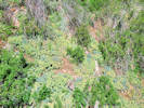 A big patch of Myrtle Spurge beside the ditch. A big patch of Myrtle Spurge beside the ditch.
|
|
Wednesday, 3 June 2020
Welch Ditch
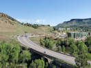
Lots to see in this photo. |
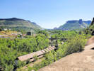
Golden from the Welch Ditch. |
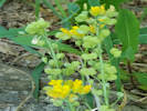
Physaria vitulifera on the edge of the Welch Ditch. |
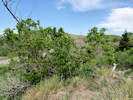
What the heck is this? It looks like a poison ivy tree! |
|
|
|
2307
|
Cynoglossum officinale.
Plants of Jefferson County Open Space
Jefferson County, Colorado
Boraginaceae
Cynoglossum officinale L.
Gypsyflower.
Clear Creek Canyon Park, Jefferson County, Colorado.
Along the former Welch Ditch, in shade inside the ditch, south side of Clear Creek, just inside the mouth of Clear Creek Canyon, 2.73 km. west southwest of the GNIS location of Golden.
39.7515°N, 105.2451°W.
WGS 1984
Elev. 1768 m.
Also colleted here: Scrophularia lanceolata, Bromus tectorum, and Dactylis glomerata.
Popular rock-climbing area with heavy daily use. Colorado Noxious Weed List B.
Collected by permit: Jefferson County Open Space, 2020, issued: Apr 13, 2020, to: Tom Schweich.
|
Tom Schweich
2307. |
3-Jun-2020 |
|
|
|
|
2308
|
Scrophularia lanceolata.
Plants of Jefferson County Open Space
Jefferson County, Colorado
Scrophulariaceae
Scrophularia lanceolata Pursh.
Lanceleaf Figwort.
Clear Creek Canyon Park, Jefferson County, Colorado.
Along the former Welch Ditch, in shade inside the ditch, south side of Clear Creek, just inside the mouth of Clear Creek Canyon, 2.73 km. west southwest of the GNIS location of Golden.
39.7515°N, 105.2451°W.
WGS 1984
Elev. 1774 m.
Also colleted here: Cynoglossum officinale, Bromus tectorum, and Dactylis glomerata.
Popular rock-climbing area with heavy daily use.
Collected by permit: Jefferson County Open Space, 2020, issued: Apr 13, 2020, to: Tom Schweich.
|
Tom Schweich
2308. |
3-Jun-2020 |
|
|
|
|
2309
|
Dactylis glomerata.
Plants of Jefferson County Open Space
Jefferson County, Colorado
Poaceae
Dactylis glomerata L.
Orchard Grass.
Clear Creek Canyon Park, Jefferson County, Colorado.
Along the former Welch Ditch, at the base of aqueduct walls, south side of Clear Creek, just inside the mouth of Clear Creek Canyon, 2.69 km. west southwest of the GNIS location of Golden.
39.7517°N, 105.2448°W.
WGS 1984
Elev. 1781 m.
Also colleted here: Cynoglossum officinale, Scrophularia lanceolata, and Bromus tectorum.
Not a listed Colorado noxious weed.
Collected by permit: Jefferson County Open Space, 2020, issued: Apr 13, 2020, to: Tom Schweich.
|
Tom Schweich
2309. |
3-Jun-2020 |
|
|
|
|
2310
|
Bromus, maybe B. tectorum, but not very hairy and wispy.
Plants of Jefferson County Open Space
Jefferson County, Colorado
Poaceae
Bromus tectorum L.
Cheat Grass.
Clear Creek Canyon Park, Jefferson County, Colorado.
Along the former Welch Ditch, in shade at the base of aqueduct walls, south side of Clear Creek, just inside the mouth of Clear Creek Canyon, 2.71 km. west southwest of the GNIS location of Golden.
39.7517°N, 105.2449°W.
WGS 1984
Elev. 1781 m.
Also colleted here: Cynoglossum officinale, Scrophularia lanceolata, and Dactylis glomerata.
Popular rock-climbing area with heavy daily use. Colorado Noxious Weed List C.
Collected by permit: Jefferson County Open Space, 2020, issued: Apr 13, 2020, to: Tom Schweich.
|
Tom Schweich
2310. |
3-Jun-2020 |
|
|
|
Other articles:
• Welch Ditch:
at Coll. No. 2311;
|
2311
|
Jamesia americana.
Plants of Jefferson County Open Space
Jefferson County, Colorado
Hydrangeaceae
Jamesia americana Torr. & A. Gray.
Fivepetal Cliffbush.
Clear Creek Canyon Park, Jefferson County, Colorado.
Along the former Welch Ditch, south side of Clear Creek, growing in rocks above the ditch, barely reachable, more on slope above, just inside the mouth of Clear Creek Canyon, 2.59 km. west southwest of the GNIS location of Golden.
39.7522°N, 105.244°W.
WGS 1984
Elev. 1780 m.
Collected nearby: Aletes acaulis, Sedum lanceolatum, Eriogonum umbellatum, Acer glabrum, and Koeleria macrantha.
Popular rock-climbing area with heavy daily use.
Collected by permit: Jefferson County Open Space, 2020, issued: Apr 13, 2020, to: Tom Schweich.
|
Tom Schweich
2311. |
3-Jun-2020 |
|
|
|
|
2312.1
|
Eriogonum umbellatum.
Plants of Jefferson County Open Space
Jefferson County, Colorado
Polygonaceae
Eriogonum umbellatum Torr. var. umbellatum.
Sulphur-Flower Buckwheat.
Clear Creek Canyon Park, Jefferson County, Colorado.
Along the former Welch Ditch, south side of Clear Creek, growing in rocks on slope above the ditch, just inside the mouth of Clear Creek Canyon, 2.58 km. west southwest of the GNIS location of Golden.
39.7522°N, 105.2438°W.
WGS 1984
Elev. 1788 m.
Also collected here: Aletes acaulis, Comandra umbellata subsp. pallida, Physocarpus monogynus, and Sedum lanceolatum.
Popular rock-climbing area with heavy daily use.
Collected by permit: Jefferson County Open Space, 2020, issued: Apr 13, 2020, to: Tom Schweich.
|
Tom Schweich
2312.1 |
3-Jun-2020 |
|
|
|
|
2312.2
|
Physocarpus monogynus.
Plants of Jefferson County Open Space
Jefferson County, Colorado
Rosaceae
Physocarpus monogynus (Torr.) J.M. Coult.
Mountain Ninebark.
Clear Creek Canyon Park, Jefferson County, Colorado.
Along the former Welch Ditch, south side of Clear Creek, growing in rocks on slope above the ditch, just inside the mouth of Clear Creek Canyon, 2.58 km. west southwest of the GNIS location of Golden.
39.7522°N, 105.2438°W.
WGS 1984
Elev. 1788 m.
Also collected here: Aletes acaulis, Comandra umbellata subsp. pallida, Eriogonum umbellatum var. umbellatum, and Sedum lanceolatum.
Popular rock-climbing area with heavy daily use.
Collected by permit: Jefferson County Open Space, 2020, issued: Apr 13, 2020, to: Tom Schweich.
|
Tom Schweich
2312.2 |
3-Jun-2020 |
|
|
|
|
2312.3
|
Sedum lanceolatum.
Plants of Jefferson County Open Space
Jefferson County, Colorado
Crassulaceae
Sedum lanceolatum Torr.
Spearleaf Stonecrop.
Clear Creek Canyon Park, Jefferson County, Colorado.
Along the former Welch Ditch, south side of Clear Creek, growing in rocks on slope above the ditch, just inside the mouth of Clear Creek Canyon, 2.58 km. west southwest of the GNIS location of Golden.
39.7522°N, 105.2438°W.
WGS 1984
Elev. 1788 m.
Also collected here: Aletes acaulis, Comandra umbellata subsp. pallida, Eriogonum umbellatum var. umbellatum, and Physocarpus monogynus.
Popular rock-climbing area with heavy daily use.
Collected by permit: Jefferson County Open Space, 2020, issued: Apr 13, 2020, to: Tom Schweich.
|
Tom Schweich
2312.3 |
3-Jun-2020 |
|
|
|
|
2312.4
|
Aletes acaulis.
Plants of Jefferson County Open Space
Jefferson County, Colorado
Apiaceae
Aletes acaulis (Torr.) J.M. Coult. & Rose.
Stemless Indian Parsley.
Clear Creek Canyon Park, Jefferson County, Colorado.
Along the former Welch Ditch, south side of Clear Creek, growing in rocks on slope above the ditch, just inside the mouth of Clear Creek Canyon, 2.58 km. west southwest of the GNIS location of Golden.
39.7522°N, 105.2438°W.
WGS 1984
Elev. 1788 m.
Also collected here: Sedum lanceolatum, Comandra umbellata subsp. pallida, Eriogonum umbellatum var. umbellatum, and Physocarpus monogynus.
Popular rock-climbing area with heavy daily use.
Collected by permit: Jefferson County Open Space, 2020, issued: Apr 13, 2020, to: Tom Schweich.
|
Tom Schweich
2312.4 |
3-Jun-2020 |
|
|
|
|
2312.5
|
Comandra umbellata pallida.
Plants of Jefferson County Open Space
Jefferson County, Colorado
Santalaceae
Comandra umbellata (L.) Nutt. ssp. pallida (A. DC.) Piehl.
Pale Bastard Toadflax.
Clear Creek Canyon Park, Jefferson County, Colorado.
Along the former Welch Ditch, south side of Clear Creek, growing in rocks on slope above the ditch, just inside the mouth of Clear Creek Canyon, 2.58 km. west southwest of the GNIS location of Golden.
39.7522°N, 105.2438°W.
WGS 1984
Elev. 1788 m.
Also collected here: Sedum lanceolatum, Aletes acaulis, Eriogonum umbellatum var. umbellatum, and Physocarpus monogynus.
Popular rock-climbing area with heavy daily use.
Collected by permit: Jefferson County Open Space, 2020, issued: Apr 13, 2020, to: Tom Schweich.
|
Tom Schweich
2312.5 |
3-Jun-2020 |
|
|
|
|
2313
|
Acer glabrum.
Plants of Jefferson County Open Space
Jefferson County, Colorado
Sapindaceae
Acer glabrum Torr.
Rocky Mountain Maple.
Clear Creek Canyon Park, Jefferson County, Colorado.
Along the former Welch Ditch, south side of Clear Creek, growing in rocks on slope just below the ditch, just inside the mouth of Clear Creek Canyon, 2.55 km. west southwest of the GNIS location of Golden.
39.7523°N, 105.2436°W.
WGS 1984
Elev. 1776 m.
Also collected here and nearby: Jamesia americana, Physocarpus monogynus, and Koeleria macrantha.
Popular rock-climbing area with heavy daily use.
Collected by permit: Jefferson County Open Space, 2020, issued: Apr 13, 2020, to: Tom Schweich.
|
Tom Schweich
2313. |
3-Jun-2020 |
|
|
|
|
2314
|
Koeleria macrantha.
Plants of Jefferson County Open Space
Jefferson County, Colorado
Poaceae
Koeleria macrantha (Ledeb.) Schult.
Prairie Junegrass.
Clear Creek Canyon Park, Jefferson County, Colorado.
Along the former Welch Ditch, south side of Clear Creek, growing in rocks and concrete on the edge of the ditch, just inside the mouth of Clear Creek Canyon, 2.55 km. west southwest of the GNIS location of Golden.
39.7523°N, 105.2436°W.
WGS 1984
Elev. 1775 m.
Few plants here; clumped, not rhizomatous.
Popular rock-climbing area with heavy daily use.
Collected by permit: Jefferson County Open Space, 2020, issued: Apr 13, 2020, to: Tom Schweich.
|
Tom Schweich
2314. |
3-Jun-2020 |
|
|
|
Other articles:
• Welch Ditch:
at gulch;
Locations:
Welch Ditch.
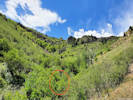 Where I found Cotoneaster lucidus
thanks to Cindy. Where I found Cotoneaster lucidus
thanks to Cindy.
|
2315
|
Cotoneaster lucidus.
Plants of Jefferson County Open Space
Jefferson County, Colorado
Rosaceae
Cotoneaster lucidus Schltdl.
Hairy Stem Cotoneaster.
Welch Ditch, Jefferson County, Colorado.
Along the former Welch Ditch, south side of Clear Creek, in a small gulch south of and above the ditch, just inside the mouth of Clear Creek Canyon, 2.37 km. west southwest of the GNIS location of Golden.
39.752°N, 105.2419°W.
WGS 1984
Elev. 1779 m.
Plants first recognized in the field by Cindy Trujillo.
Collected by permit: Jefferson County Open Space, 2020, issued: Apr 13, 2020, to: Tom Schweich.
|
Tom Schweich
2315. |
3-Jun-2020 |
|
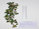
Coll. No. 2315, Cotoneaster lucidus |
|
|
Other articles:
• Welch Ditch:
at Coll 2316;
Locations:
Welch Ditch.
 Hesperis matronalis in the ditch. Hesperis matronalis in the ditch.
|
2316
|
Hesperis matronalis.
Plants of Jefferson County Open Space
Jefferson County, Colorado
Brassicaceae
Hesperis matronalis L.
Dame's Rocket.
Clear Creek Canyon Park, Jefferson County, Colorado.
Inside the former Welch Ditch, south side of Clear Creek, just inside the mouth of Clear Creek Canyon, 2.26 km. west southwest of the GNIS location of Golden.
39.7521°N, 105.2409°W.
WGS 1984
Elev. 1777 m.
Two plants, both collected.
Colorado Noxious Weed List B.
Collected by permit: Jefferson County Open Space, 2020, issued: Apr 13, 2020, to: Tom Schweich.
|
Tom Schweich
2316. |
3-Jun-2020 |
|
What the well-dressed botanist wears while chasing noxious weeds in the grass. |
|
|
|
2317
|
Silene sp.
Plants of Jefferson County Open Space
Jefferson County, Colorado
Caryophyllaceae
Silene latifolia Poir.
Bladder Campion.
Welch Ditch, Jefferson County, Colorado.
Inside and beside the former Welch Ditch, south side of Clear Creek, just inside the mouth of Clear Creek Canyon, 2.19 km. west southwest of the GNIS location of Golden.
39.7519°N, 105.2402°W.
WGS 1984
Elev. 1774 m.
Flowers white, imperfect.
Collected by permit: Jefferson County Open Space, 2020, issued: Apr 13, 2020, to: Tom Schweich.
|
Tom Schweich
2317. |
3-Jun-2020 |
|
|
|
Other articles:
• Welch Ditch:
at Holodiscus;
|
2318
|
Holodiscus dumosus.
Plants of Jefferson County Open Space
Jefferson County, Colorado
Rosaceae
Holodiscus dumosus (Nutt. ex Torr. & A.Gray) A.Heller.
Rock Spirea.
Clear Creek Canyon Park, Jefferson County, Colorado.
Steep slopes above and below the former Welch Ditch, south side of Clear Creek, just inside the mouth of Clear Creek Canyon, 1.87 km. west southwest of the GNIS location of Golden.
39.7515°N, 105.237°W.
WGS 1984
Elev. 1777 m.
In bud, no flowers.
Collected by permit: Jefferson County Open Space, 2020, issued: Apr 13, 2020, to: Tom Schweich.
|
Tom Schweich
2318. |
3-Jun-2020 |
|
|
|
Locations:
Schweich Hill.
|
|
Saturday, June 6, 2020
North Washington Open Space.
|
|
Other articles:
• Golden Checklist Flora:
Evolvulus nuttallianus;
Notes on Evolvulus nuttallianus Roem. & Schult.;
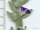 Flower of Coll. No. 2319, Evolvulus nuttallianus Flower of Coll. No. 2319, Evolvulus nuttallianus
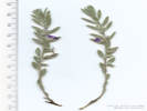 Coll. No. 2319, Evolvulus nuttallianus Coll. No. 2319, Evolvulus nuttallianus
|
2319
|
Something in the Morning-Glory Family
later, Evolvulus nuttallianus
|
Native and Naturalized Flora of the Golden Area, Jefferson County, Colorado
Convolvulaceae
Evolvulus nuttallianus Roem. & Schult.
Shaggy Dwarf Morning Glory.
North Washington Open Space, Jefferson County, Colorado.
Top of hill, north side of social trail.
39.7686°N, 105.2332°W.
WGS 1984
Elev. 1819 m.
Two plants, twelve stems total; two stems collected. Flowers blue, fading darker.
Collected by permit: City of Golden, 2020, issued: Apr 9, 2020, to: Tom Schweich.
|
Tom Schweich, with Margaret Henderson and Nancy von Burske
2319. |
6-Jun-2020 |
|
|
|
Locations:
Apex Park - Northern Parcel.
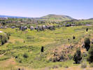 View through Apex Park and Stonebridge to Green Mountain. View through Apex Park and Stonebridge to Green Mountain.
 Obs. No. 1933, Asclepias viridiflora Obs. No. 1933, Asclepias viridiflora
|
|
Wednesday, June 10, 2020
Apex Park, North Parcel.
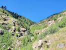
Unnamed gulch in Apex Park. |
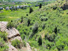
Unnamed gulch in Apex Park. |
|
|
|
2340
|
Linum lewisii.
Plants of Jefferson County Open Space
Jefferson County, Colorado
Linaceae
Linum lewisii Pursh.
Prairie Blue Flax.
Apex Park - Northern Parcel, Jefferson County, Colorado.
Northernmost part of Apex Park, northeast corner, in grasslands on alluvial terrace just below foothill shrublands and the Rocky Mountain foothills scarp, 4.04 km. south of the GNIS location of Golden.
39.7277°N, 105.2218°W.
WGS 1984
Elev. 1880 m.
Homostylous.
Also collected here: Ribes cereum, Prunus virginuana, Astragalus flexuosus, Lupinus argenteus, Bromus japonicus, and Nassella viridula.
Collected by permit: Jefferson County Open Space, 2020, issued: Apr 13, 2020, to: Tom Schweich.
|
Tom Schweich
2340. |
10-Jun-2020 |
|
|
|
|
2341
|
Lupinus sp., the usual suspect being L. argenteus.
Plants of Jefferson County Open Space
Jefferson County, Colorado
Fabaceae
Lupinus argenteus Pursh var. argenteus.
Loosely Flowered Silver Lupine.
Apex Park - Northern Parcel, Jefferson County, Colorado.
Northernmost part of Apex Park, northeast corner, in grasslands on alluvial terrace just below foothill shrublands and the Rocky Mountain foothills scarp, 4.06 km. south of the GNIS location of Golden.
39.7275°N, 105.222°W.
WGS 1984
Elev. 1884 m.
Basal leaves absent, banner back glabrous, banner recurved 4 mm. from apex.
Also collected here: Ribes cereum, Prunus virginuana, Astragalus flexuosus, Linum lewisii, Bromus japonicus, and Nassella viridula.
Collected by permit: Jefferson County Open Space, 2020, issued: Apr 13, 2020, to: Tom Schweich.
|
Tom Schweich
2341. |
10-Jun-2020 |
|
Coll. No. 2341, 10 Jun 2020, characters observed:
Perennial, 50-60 cm.;
Stem,
hairs appressed;
Leaves,
basal absent,
cauline,
alternate,
palmately compound,
leaflets, #8-9,
glabrous adaxially;
Inflorescence,
raceme,
neither crowded nor extended;
Flowers,
spur, bump <1 mm.,
petals generally white proximally to blue distally, not spotted,
banner, 10 mm., recurved from a point 4 mm. from apex, back glabrous,
wing, claw 1 mm. + blade 9 mm.,
keel, 10 mm., tip erect, margins glabrous, blue-plack distally;
Style,
barely exserted.
Fails in Ackerfield (2015) at couplet 5 because the point at which the banner is recurved is 4 mm.
from the apex whereas couplet 5a requires that length to be 3 mm. or less.
Will not key to Lupinus argentea var. argentea in Jepson Manual of California because the banner back is glabrous.
|
|
|
2342
|
Astragalus flexuosus.
Plants of Jefferson County Open Space
Jefferson County, Colorado
Fabaceae
Astragalus flexuosus G. Don.
Flexible Milkvetch.
Apex Park - Northern Parcel, Jefferson County, Colorado.
Northernmost part of Apex Park, northeast corner, in grasslands on alluvial terrace just below foothill shrublands and the Rocky Mountain foothills scarp, 4.03 km. south of the GNIS location of Golden.
39.7277°N, 105.2219°W.
WGS 1984
Elev. 1882 m.
Leaves cauline.
Also collected here: Ribes cereum, Prunus virginuana, Lupinus argenteus, Linum lewisii, Bromus japonicus, and Nassella viridula.
Collected by permit: Jefferson County Open Space, 2020, issued: Apr 13, 2020, to: Tom Schweich.
|
Tom Schweich
2342. |
10-Jun-2020 |
|
|
|
|
2343
|
Bromus japonicus.
Plants of Jefferson County Open Space
Jefferson County, Colorado
Poaceae
Bromus japonicus Thunb.
Japanese Cheat Grass.
Apex Park - Northern Parcel, Jefferson County, Colorado.
Northernmost part of Apex Park, northeast corner, in grasslands on alluvial terrace just below foothill shrublands and the Rocky Mountain foothills scarp, 4.03 km. south of the GNIS location of Golden.
39.7276°N, 105.2219°W.
WGS 1984
Elev. 188 m.
With B. tectorum which it follows by 1 or 2 weeks. Also collected here: Ribes cereum, Prunus virginuana, Astragalus flexuosus, Lupinus argenteus, Linum lewisii, and Nassella viridula.
Collected by permit: Jefferson County Open Space, 2020, issued: Apr 13, 2020, to: Tom Schweich.
|
Tom Schweich
2343. |
10-Jun-2020 |
|
|
|
|
2344
|
Nassella viridula.
Plants of Jefferson County Open Space
Jefferson County, Colorado
Poaceae
Nassella viridula (Trin.) Barkworth.
Green Needlegrass.
Apex Park - Northern Parcel, Jefferson County, Colorado.
Northernmost part of Apex Park, northeast corner, in grasslands on alluvial terrace just below foothill shrublands and the Rocky Mountain foothills scarp, 4.07 km. south of the GNIS location of Golden.
39.7274°N, 105.2217°W.
WGS 1984
Elev. 1882 m.
Also collected here: Ribes cereum, Prunus virginuana, Astragalus flexuosus, Lupinus argenteus, Linum lewisii, and Bromus japonicus.
Collected by permit: Jefferson County Open Space, 2020, issued: Apr 13, 2020, to: Tom Schweich.
|
Tom Schweich
2344. |
10-Jun-2020 |
|
|
|
|
2345
|
Erigeron tracyi.
Plants of Jefferson County Open Space
Jefferson County, Colorado
Asteraceae
Erigeron tracyi Greene.
Running Fleabane.
Apex Park - Northern Parcel, Jefferson County, Colorado.
Northernmost part of Apex Park, northeast corner, in grasslands on alluvial terrace just below foothill shrublands and the Rocky Mountain foothills scarp, 4.09 km. south of the GNIS location of Golden.
39.7273°N, 105.2217°W.
WGS 198
Elev. 1882 m.
Also collected nearby: Ribes cereum, Prunus virginuana, Astragalus flexuosus, Lupinus argenteus, Linum lewisii, Bromus japonicus, and Nassella viridula.
Collected by permit: Jefferson County Open Space, 2020, issued: Apr 13, 2020, to: Tom Schweich.
|
Tom Schweich
2345. |
10-Jun-2020 |
|
|
|
|
2346
|
Potentilla recta.
Plants of Jefferson County Open Space
Jefferson County, Colorado
Rosaceae
Potentilla recta L.
Sulphur Cinquefoil.
Apex Park - Northern Parcel, Jefferson County, Colorado.
Northernmost part of Apex Park, northeast corner, at the base of the Rocky Mountain foothills scarp, 4.10 km. south of the GNIS location of Golden.
39.7272°N, 105.2219°W.
WGS 1984
Elev. 1879 m.
Mixed foothills shrub- and grassland. Also collected here: Erigeron tracyi, and Nassella viridula.
Colorado Noxious Weed List B.
Collected by permit: Jefferson County Open Space, 2020, issued: Apr 13, 2020, to: Tom Schweich.
|
Tom Schweich
2346. |
10-Jun-2020 |
|
|
|
|
2347
|
Oenothera suffrutescens.
Plants of Jefferson County Open Space
Jefferson County, Colorado
Onagraceae
Oenothera suffrutescens (Ser.) W. L. Wagner & Hoch.
Linda Tarde.
Apex Park - Northern Parcel, Jefferson County, Colorado.
Northernmost part of Apex Park, along the east boundary, near base of the Rocky Mountain foothills scarp, 4.23 km. south of the GNIS location of Golden
39.7263°N, 105.2217°W.
WGS 1984
Elev. 1890 m.
A little bedraggled from last week's record high temperature, but also slightly revived by yesterday's 0.29 in. of rain.
Mostly foothills shrubland with grasses, also collected nearby: Arctium minus, Verbascum thapsus, Cynoglossum officinale, and Mondarda fistulosa.
Collected by permit: Jefferson County Open Space, 2020, issued: Apr 13, 2020, to: Tom Schweich.
|
Tom Schweich
2347. |
10-Jun-2020 |
|
|
|
|
2348
|
Delphinium carolinensis var. virescens.
Plants of Jefferson County Open Space
Jefferson County, Colorado
Ranunculaceae
Delphinium carolinianum Walter ssp. virescens (Nutt.) R.E. Brooks.
Plains Larkspur.
Apex Park - Northern Parcel, Jefferson County, Colorado.
Towards the middle of the Apex Park north parcel, lower portion of Rocky Mountains foothill scarp, on a small rocky promontory overlooking an unnamed gulch, 4.39 km. south of the GNIS location of Golden
39.7252°N, 105.2217°W.
WGS 1984
Elev. 1916 m.
Southeast facing rocky slope, with Rhus trilobata, Heterotheca villosa, Aristida purpurea, and Bromus tectorum.
Collected by permit: Jefferson County Open Space, 2020, issued: Apr 13, 2020, to: Tom Schweich.
|
Tom Schweich
2348. |
10-Jun-2020 |
|
|
|
Locations:
Apex Park - Northern Parcel.
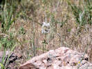 Coll. No. 2349, Monarda pectinata Coll. No. 2349, Monarda pectinata
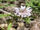 Coll. No. 2349, Monarda pectinata Coll. No. 2349, Monarda pectinata
|
2349
|
Monarda pectinata.
Plants of Jefferson County Open Space
Jefferson County, Colorado
Lamiaceae
Monarda pectinata Nutt.
Plains Beebalm.
Apex Park - Northern Parcel, Jefferson County, Colorado.
Towards the middle of the Apex Park north parcel, lower portion of Rocky Mountains foothill scarp, on a small rocky promontory overlooking an unnamed gulch, 4.39 km. south of the GNIS location of Golden.
39.7252°N, 105.2217°W.
WGS 1984
Elev. 1919 m.
Flowers light pink, darker at lower lip.
Southeast facing rocky slope, with Rhus trilobata, Heterotheca villosa, Aristida purpurea, and Bromus tectorum.
Collected by permit: Jefferson County Open Space, 2020, issued: Apr 13, 2020, to: Tom Schweich.
|
Tom Schweich
2349. |
10-Jun-2020 |
|
|
|
Locations:
Cressmans Gulch (lower).
Dakota Ridge.
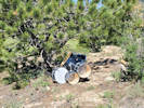 Abandoned drum set on Dakota Ridge. Abandoned drum set on Dakota Ridge.
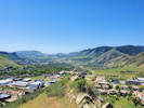 View south through Golden Valley. View south through Golden Valley.
|
|
Friday, June 12, 2020
Cressman Gulch and Dakota Ridge
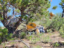
Abandoned drum set on Dakota Ridge. |
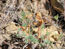
Orobanche fasciculata growing in a small clump of Artemisia frigida |
|
|
Literature Cited:
- Sencer, H. A., and J. G. Hawkes, 1980.
Other articles:
• Golden Checklist Flora:
Secale cereale;
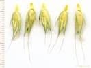 Spikelets of Coll. No. 2350, Secale cereale Spikelets of Coll. No. 2350, Secale cereale
|
2350
|
Elymus canadensis. — Nope!
|
Native and Naturalized Flora of the Golden Area, Jefferson County, Colorado
Poaceae
Secale cereale L.
Cereal Rye.
Cressmans Gulch (lower), Jefferson County, Colorado.
Northwesternmost Golden, between Pine Ridge Road and Dakota Ridge, on a terrace above Cressmans Gulch, 4.50 km. north northwest of the GNIS location of Golden.
39.7831°N, 105.2396°W.
WGS 1984
Elev. 1870 m.
Not rhizomatous, bi-lateral spike, two florets per spikelet, lemma asymetrical and keel ciliate.
Also collected here: Poa secunda, Linum lewisii, and Lupinus argenteus.
Collected by permit: City of Golden, 2020, issued: Apr 9, 2020, to: Tom Schweich.
|
Tom Schweich
2350. |
12-Jun-2020 |
| Annual, erect, 75-100 cm.,
not rhizomatous;
Roots, fibrous;
Stem, herbaceous;
Nodes, constricted, purple;
Leaf,
sheath, 115 mm., open,
ligule, minimal, membraneous,
auricle, 0.6-1.0 mm.,
blade, 170 mm. × 5 mm. wide, flat, minutely scabrous;
Inflorescence,
1 per culm,
terminal 2-sided spike,
100-110 mm. × 9 mm. wide;
Rachis, nodes 2.0-3.5 mm., bilateral tufts of straight hairs;
Spikelets, many, 1 per node, sessile,
bases not embedded in rachis;
Disarticulation,
below the glumes;
Glumes, 2, awl-like, 8-9 mm., ±equal,
<lowest floret,
keeled, purplish distally,
appearing to hide the rachis but not the lemmas;
Florets
2,
appear side-to-side,
fertile;
Lemma, 12-13 mm.,
asymmetric in x-section,
veins, 5,
keeled, keel ciliate,
margins, one ciliate, the other less so, awned;
Awns,
attached end,
11-16 mm.,
short proximally in the inflorescence, lengthening distally,
straight to wavy, some slightly twisted;
Palea,
11-12 mm,
membraneous
(Described from Coll. No. 1110 and 2350).
The rachis is quite brittle, suggesting this is one of the weedy ryes rather than an escaped cultivated rye (Sencer & Hawkes, 1980).
|
|
|
2351
|
Poa secunda Poa pratensis.
|
Native and Naturalized Flora of the Golden Area, Jefferson County, Colorado
Poaceae
Poa pratensis L.
Kentucky Bluegrass.
Cressmans Gulch (lower), Jefferson County, Colorado.
Northwesternmost Golden, between Pine Ridge Road and Dakota Ridge, on a terrace above Cressmans Gulch, 4.50 km. north northwest of the GNIS location of Golden.
39.7832°N, 105.2396°W.
WGS 1984
Elev. 1871 m.
Slender rhizomes, lemma with cobwebby hairs.
Also collected here: Secale cereale, Linum lewisii, and Lupinus argenteus.
Collected by permit: City of Golden, 2020, issued: Apr 9, 2020, to: Tom Schweich.
|
Tom Schweich
2351. |
12-Jun-2020 |
|
|
|
|
2351.1
|
Boraginaceae, past flowering.
|
Native and Naturalized Flora of the Golden Area, Jefferson County, Colorado
Boraginaceae
Lithospermum cf. arvense L.
Corn Gromwell.
Cressmans Gulch (lower), Jefferson County, Colorado.
Northwesternmost Golden, between Pine Ridge Road and Dakota Ridge, on a terrace above Cressmans Gulch, 4.50 km. north northwest of the GNIS location of Golden.
39.7832°N, 105.2396°W.
WGS 1984
Elev. 1871 m.
Fruit, no flowers. Definitely 4 nutlets, but without prickles, etc.
Also collected here: Poa pratensis, Secale cereale, Linum lewisii, and Lupinus argenteus.
Collected by permit: City of Golden, 2020, issued: Apr 9, 2020, to: Tom Schweich.
|
Tom Schweich
2351.1 |
12-Jun-2020 |
|
|
|
|
2352
|
Lupinus argenteus.
|
Native and Naturalized Flora of the Golden Area, Jefferson County, Colorado
Fabaceae
Lupinus argenteus Pursh var. argenteus.
Loosely Flowered Silver Lupine.
Cressmans Gulch (lower), Jefferson County, Colorado.
Northwesternmost Golden, between Pine Ridge Road and Dakota Ridge, on a southwest-facing bank of Cressmans Gulch, 4.42 km. north northwest of the GNIS location of Golden.
39.7829°N, 105.2394°W.
WGS 1984
Elev. 1867 m.
Basal leaves absent. Banner back and keel glabrous.
Also collected here: Poa pratensis, Secale cereale, Linum lewisii, and Lithospermum arvense.
Collected by permit: City of Golden, 2020, issued: Apr 9, 2020, to: Tom Schweich.
|
Tom Schweich
2352. |
12-Jun-2020 |
|
|
|
|
2353
|
Linum lewisii.
|
Native and Naturalized Flora of the Golden Area, Jefferson County, Colorado
Linaceae
Linum lewisii Pursh.
Prairie Blue Flax.
Dakota Ridge, Jefferson County, Colorado.
Northwesternmost Golden, between Pine Ridge Road and Dakota Ridge, on the lower part of the west-facing limb of Dakota Ridge, 4.46 km. north northwest of the GNIS location of Golden.
39.783°N, 105.2393°W.
WGS 1984
Elev. 1870 m.
Homostylous.
Also collected here: Poa pratensis, Secale cereale, Lupinus argenteus, and Lithospermum arvense.
Collected by permit: City of Golden, 2020, issued: Apr 9, 2020, to: Tom Schweich.
|
Tom Schweich
2353. |
12-Jun-2020 |
|
|
|
|
2354
|
Helianthus pumilis.
|
Native and Naturalized Flora of the Golden Area, Jefferson County, Colorado
Asteraceae
Helianthus pumilus Nutt.
Little Sunflower.
Dakota Ridge, Jefferson County, Colorado.
Hogback at the northern city limits of Golden, 3/4 of the way up the west-facing slope, at the lower edge of Cercocarpus montanus, 4.41 km. north northwest of the GNIS location of Golden.
39.7831°N, 105.2381°W.
WGS 198
Elev. 1901 m.
Also collected here: Bromus japonicus, and Nassella viridula, and nearby: Hypericum perforatum, Potentilla recta, and Muhlenbergia montana.
Collected by permit: City of Golden, 2020, issued: Apr 9, 2020, to: Tom Schweich.
|
Tom Schweich
2354. |
12-Jun-2020 |
|
|
|
|
2355
|
Bromus japonicus.
|
Native and Naturalized Flora of the Golden Area, Jefferson County, Colorado
Poaceae
Bromus japonicus Thunb.
Japanese Cheat Grass.
Dakota Ridge, Jefferson County, Colorado.
Hogback at the northern city limits of Golden, 3/4 of the way up the west-facing slope, at the lower edge of Cercocarpus montanus, 4.41 km. north northwest of the GNIS location of Golden.
39.7831°N, 105.2381°W.
WGS 1984
Elev. 1903 m.
Widely distributed on this slope, phenology following Bromus tectorum by about two weeks.
Also collected here: Helianthus pumilis, and Nassella viridula, and nearby: Hypericum perforatum, Potentilla recta, and Muhlenbergia montana.
Collected by permit: City of Golden, 2020, issued: Apr 9, 2020, to: Tom Schweich.
|
Tom Schweich
2355. |
12-Jun-2020 |
|
|
|
|
2356
|
Gaillardia aristata.
|
Native and Naturalized Flora of the Golden Area, Jefferson County, Colorado
Asteraceae
Gaillardia aristata Pursh.
Blanketflower.
Dakota Ridge, Jefferson County, Colorado.
Hogback at the northern city limits of Golden, nearly to the top of the west slopes. 4.40 km. north northwest of the GNIS location of Golden.
39.7831°N, 105.2378°W.
WGS 1984
Elev. 1916 m.
Foothills shrubland, mostly Cercocarpus montanus; also collected here: Hypericum perforatum; nearby: Campanula rotundifolia, and Muhlenbergia montana.
Collected by permit: City of Golden, 2020, issued: Apr 9, 2020, to: Tom Schweich.
|
Tom Schweich
2356. |
12-Jun-2020 |
|
|
|
|
2356.1
|
Hypericum perforatum.
|
Native and Naturalized Flora of the Golden Area, Jefferson County, Colorado
Hypericaceae
Hypericum perforatum L.
Common St. John's Wort.
Dakota Ridge, Jefferson County, Colorado.
Hogback at the northern city limits of Golden, nearly to the top of the west slopes. 4.40 km. north northwest of the GNIS location of Golden.
39.783°N, 105.2378°W.
WGS 1984
Elev. 1916 m.
Foothills shrubland, mostly Cercocarpus montanus; also collected here: Gaillardia aristata; nearby: Campanula rotundifolia, and Muhlenbergia montana.
Collected by permit: City of Golden, 2020, issued: Apr 9, 2020, to: Tom Schweich.
|
Tom Schweich
2356.1 |
12-Jun-2020 |
|
|
|
|
2357
|
Eriogonum umbellatum.
|
Native and Naturalized Flora of the Golden Area, Jefferson County, Colorado
Polygonaceae
Eriogonum umbellatum Torr. var. umbellatum.
Sulphur-Flower Buckwheat.
Dakota Ridge, Jefferson County, Colorado.
Hogback at the northern city limits of Golden, more or less flat area on top of ridge, 4.38 km. north northwest of the GNIS location of Golden.
39.783°N, 105.2376°W.
WGS 1984
Elev. 1926 m.
Open herbaceous vegetation, ponderosa pines and mountan mahogany shrubland nearby. Also collected here: Heterotheca villosa, Hesperostipa comata, and Koeleria macrantha.
Collected by permit: City of Golden, 2020, issued: Apr 9, 2020, to: Tom Schweich.
|
Tom Schweich
2357. |
12-Jun-2020 |
|
|
|
|
2357.1
|
Koeleria macrantha.
|
Native and Naturalized Flora of the Golden Area, Jefferson County, Colorado
Poaceae
Koeleria macrantha (Ledeb.) Schult.
Prairie Junegrass.
Dakota Ridge, Jefferson County, Colorado.
Hogback at the northern city limits of Golden, dry and more or less flat area on top of ridge, 4.38 km. north northwest of the GNIS location of Golden.
39.783°N, 105.2376°W.
WGS 1984
Elev. 1927 m.
Open herbaceous vegetation, ponderosa pines and mountain mahogany shrubland nearby. Also collected here: Heterotheca villosa, Hesperostipa comata, and Eriogonum umbellatum var. umbellatum.
Collected by permit: City of Golden, 2020, issued: Apr 9, 2020, to: Tom Schweich.
|
Tom Schweich
2357.1 |
12-Jun-2020 |
|
|
|
|
2358
|
Heterotheca villosa.
|
Native and Naturalized Flora of the Golden Area, Jefferson County, Colorado
Asteraceae
Heterotheca villosa (Pursh) Shinners.
Hairy False Goldenaster.
Dakota Ridge, Jefferson County, Colorado.
Hogback at the northern city limits of Golden, dry and more or less flat area on top of ridge, 4.38 km. north northwest of the GNIS location of Golden.
39.783°N, 105.2376°W.
WGS 1984
Elev. 1930 m.
Open herbaceous vegetation, ponderosa pines and mountain mahogany shrubland nearby. Also collected here: Koeleria macrantha, Hesperostipa comata, and Eriogonum umbellatum var. umbellatum.
Collected by permit: City of Golden, 2020, issued: Apr 9, 2020, to: Tom Schweich.
|
Tom Schweich
2358. |
12-Jun-2020 |
|
|
|
Other articles:
• Golden Checklist Flora:
Delphinium carolinianum;
Notes on Delphinium carolinianum;
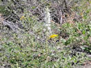 Coll. No. 2359, Delphinium carolinianum subsp. virescens Coll. No. 2359, Delphinium carolinianum subsp. virescens
|
2359
|
Delphinium carolinum virescens.
|
Native and Naturalized Flora of the Golden Area, Jefferson County, Colorado
Ranunculaceae
Delphinium carolinianum Walter ssp. virescens (Nutt.) R.E. Brooks.
Plains Larkspur.
Dakota Ridge, Jefferson County, Colorado.
Hogback at the northern city limits of Golden, 3/4 of the way up the west-facing slope, 4.37 km. north northwest of the GNIS location of Golden.
39.7828°N, 105.2379°W.
WGS 1984
Elev. 1912 m.
Within a band of foothills mountain mahogany shrubland likely aligned with underlying strata; collected nearby: Potentilla recta and Muhlenbergia montana.
Collected by permit: City of Golden, 2020, issued: Apr 9, 2020, to: Tom Schweich.
|
Tom Schweich
2359. |
12-Jun-2020 |
|
|
|
|
2360
|
Melilotus officinalis.
|
Native and Naturalized Flora of the Golden Area, Jefferson County, Colorado
Fabaceae
Melilotus officinalis (L.) Lam.
Yellow Sweet Clover.
Cressmans Gulch (lower), Jefferson County, Colorado.
Northwesternmost Golden, between Pine Ridge Road and Dakota Ridge, on a southwest-facing bank of Cressmans Gulch, 4.42 km. north northwest of the GNIS location of Golden.
39.7827°N, 105.2393°W.
WGS 1984
Elev. 1872 m.
Grassy bank of gulch, also seen or collected here: Rumex acetosella, Linum lewisii, Lupinus argenteus, and Thelesperma megapotamicum.
Collected by permit: City of Golden, 2020, issued: Apr 9, 2020, to: Tom Schweich.
|
Tom Schweich
2360. |
12-Jun-2020 |
|
|
|
 Something is parasitizing my Artemisia Something is parasitizing my Artemisia
|
|
Saturday, 13 June 2020
Noticed that something is parasitizing my Artemisia ludoviciana
|
|
Other articles:
• Eagle Ridge Drive:
bet. Shelton and Rabbit Run;
• Golden Checklist Flora:
Rhus trilobata;
Locations:
Colorado School of Mines Survey Field.
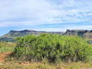 Rhus trilobata at the southern end of the Survey Field. Rhus trilobata at the southern end of the Survey Field.
|
|
Saturday, 20 June 2020
Colorado School of Mines Survey Field.
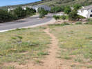
Trail to Survey Field from Eagle Ridge Drive. |
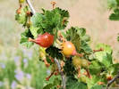
Developing fruit on Ribes cereum. |
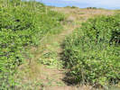
Amateur trailwork in the survey field. |
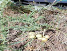
Astragalus crassicarpus seen in the Survey Field. |
|
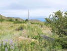 Coll. No. 2361, Lupinus argenteus var. argenteusand Coll. No. 2362, Bromus secalinus Coll. No. 2361, Lupinus argenteus var. argenteusand Coll. No. 2362, Bromus secalinus
|
2361
|
Lupinus argenteus.
|
Native and Naturalized Flora of the Golden Area, Jefferson County, Colorado
Fabaceae
Lupinus argenteus Pursh var. argenteus.
Loosely Flowered Silver Lupine.
Colorado School of Mines Survey Field, Jefferson County, Colorado.
Southernmost edge of the Survey Field, adjacent to Stonebridge HOA lands, high plains at the base of the Rocky Mountain Front Range, 3.27 km. south of the GNIS location of Golden.
39.733°N, 105.2215°W.
WGS 1984
Elev. 1827 m.
Basal leaves 0, flowers blue to lavender.
Mixed foothills shrubs and grasses, also seen or collected here: Toxicodendron rydbergii, Symphoricarpos rotundifolius, Senecio integerrimus, and Bromus japonicus.
Collected by permit: Colorado School of Mines, 2020, issued: Apr 1, 2020, to: Tom Schweich.
|
Tom Schweich
2361. |
20-Jun-2020 |
|
|
Coll. No. 2361, Lupinus argenteus var. argenteusand Coll. No. 2362, Bromus secalinus
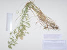 Coll. No. 2362, Bromus secalinus Coll. No. 2362, Bromus secalinus
|
2362
|
Bromus japonicus — Seemed like a really large Bromus japonicus
|
Native and Naturalized Flora of the Golden Area, Jefferson County, Colorado
Poaceae
Bromus secalinus L.
Chess.
Colorado School of Mines Survey Field, Jefferson County, Colorado.
Southernmost edge of the Survey Field, adjacent to Stonebridge HOA lands, high plains at the base of the Rocky Mountain Front Range, 3.27 km. south of the GNIS location of Golden.
39.7329°N, 105.2215°W.
WGS 1984
Elev. 1824 m.
Larger than Bromus japonicus, growing around a pile of rocks.
Mixed foothills shrubs and grasses, also seen or collected here: Toxicodendron rydbergii, Symphoricarpos rotundifolius, Senecio integerrimus, and Lupinus argenteus.
Collected by permit: Colorado School of Mines, 2020, issued: Apr 1, 2020, to: Tom Schweich.
|
Tom Schweich
2362. |
20-Jun-2020 |
|
|
|
|
2362.1
|
Bromus japonicus, smut infested.
|
Native and Naturalized Flora of the Golden Area, Jefferson County, Colorado
Poaceae
Bromus secalinus L.
Chess.
Colorado School of Mines Survey Field, Jefferson County, Colorado.
Southernmost edge of the Survey Field, adjacent to Stonebridge HOA lands, high plains at the base of the Rocky Mountain Front Range, 3.27 km. south of the GNIS location of Golden.
39.7329°N, 105.2215°W.
WGS 1984
Elev. 1824 m.
Same as Coll. No. 2362, except smut infested.
Mixed foothills shrubs and grasses, also seen or collected here: Toxicodendron rydbergii, Symphoricarpos rotundifolius, Senecio integerrimus, and Lupinus argenteus.
Collected by permit: Colorado School of Mines, 2020, issued: Apr 1, 2020, to: Tom Schweich.
|
Tom Schweich
2362.1 |
20-Jun-2020 |
|
|
|
|
2363
|
Symphoricarpos rotundifolia.
|
Native and Naturalized Flora of the Golden Area, Jefferson County, Colorado
Caprifoliaceae
Symphoricarpos rotundifolius A. Gray.
Roundleaf Snowberry.
Colorado School of Mines Survey Field, Jefferson County, Colorado.
Southernmost edge of the Survey Field, adjacent to Stonebridge HOA lands, high plains at the base of the Rocky Mountain Front Range, 3.26 km. south of the GNIS location of Golden.
39.733°N, 105.2213°W.
WGS 1984
Elev. 1826 m.
Around the edges of a larger group of Rhus trilobata.
Mixed foothills shrubs and grasses, also seen or collected here: Toxicodendron rydbergii, Bromus secalinus, Senecio integerrimus, and Lupinus argenteus.
Collected by permit: Colorado School of Mines, 2020, issued: Apr 1, 2020, to: Tom Schweich.
|
Tom Schweich
2363. |
20-Jun-2020 |
|
|
|
|
2364
|
Rosa acicularis var. sayi.
|
Native and Naturalized Flora of the Golden Area, Jefferson County, Colorado
Rosaceae
Rosa acicularis Lindl. ssp. sayi (Schwein.) W. H. Lewis.
Say's Acicular Rose.
Colorado School of Mines Survey Field, Jefferson County, Colorado.
Southernmost edge of the Survey Field, adjacent to Stonebridge HOA lands, high plains at the base of the Rocky Mountain Front Range, 3.27 km. south of the GNIS location of Golden.
39.733°N, 105.2215°W.
WGS 1984
Elev. 1828 m.
Mixed foothills shrubs and grasses, also seen or collected here: Toxicodendron rydbergii, Bromus secalinus, Senecio integerrimus, and Lupinus argenteus.
Collected by permit: Colorado School of Mines, 2020, issued: Apr 1, 2020, to: Tom Schweich.
|
Tom Schweich
2364. |
20-Jun-2020 |
|
|
|
|
2365
|
Castilleja integra.
|
Native and Naturalized Flora of the Golden Area, Jefferson County, Colorado
Orobanchaceae
Castilleja integra A. Gray.
Wholeleaf Indian Paintbrush.
Colorado School of Mines Survey Field, Jefferson County, Colorado.
Southern part of the Survey Field, high plains at the base of the Rocky Mountain Front Range, 3.23 km. south of the GNIS location of Golden
39.7332°N, 105.2219°W.
WGS 198
Elev. 1833 m.
A rather large, robust clump.
Nearby shrubs or forbs are Rhus trilobata, Lupinus argentea, and Rosa acicularis var. sayi. Nearest Artemisia, in this case A. ludoviciana, is quite small and some distance away.
Collected by permit: Colorado School of Mines, 2020, issued: Apr 1, 2020, to: Tom Schweich.
|
Tom Schweich
2365. |
20-Jun-2020 |
|
|
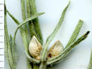 Coll. No. 2365.1, Lithospermum sp., likely L. incisum Coll. No. 2365.1, Lithospermum sp., likely L. incisum
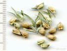 Nutlets of Coll. No. 2365.1, Lithospermum sp., likely L. incisum Nutlets of Coll. No. 2365.1, Lithospermum sp., likely L. incisum
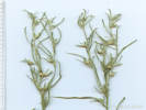 Coll. No. 2365.1, Lithospermum sp., likely L. incisum Coll. No. 2365.1, Lithospermum sp., likely L. incisum
|
2365.1
|
Unknown Boraginaceae, in fruit. Later determined to be likely Lithospermum incisum.
|
|
|
2366
|
Geranium caespitosum.
|
Native and Naturalized Flora of the Golden Area, Jefferson County, Colorado
Geraniaceae
Geranium caespitosum James.
Pineywoods Geranium.
Colorado School of Mines Survey Field, Jefferson County, Colorado.
Southern part of the Survey Field, high plains at the base of the Rocky Mountain Front Range, 3.23 km. south of the GNIS location of Golden
39.7333°N, 105.2218°W.
WGS 1984
Elev. 1832 m.
Basal leaves withering.
Nearby shrubs or forbs are Rhus trilobata, Lupinus argentea, and Rosa acicularis var. sayi. Also collected here: Castilleja integra and Lithospermum incisum.
Collected by permit: Colorado School of Mines, 2020, issued: Apr 1, 2020, to: Tom Schweich.
|
Tom Schweich
2366. |
20-Jun-2020 |
|
|
|
|
2367
|
Helianthus pumilis.
|
Native and Naturalized Flora of the Golden Area, Jefferson County, Colorado
Asteraceae
Helianthus pumilus Nutt.
Little Sunflower.
Colorado School of Mines Survey Field, Jefferson County, Colorado.
Southern part of the Survey Field, high plains at the base of the Rocky Mountain Front Range, 3.18 km. south of the GNIS location of Golden
39.7336°N, 105.2227°W.
WGS 1984
Elev. 1841 m.
Foothills grassland below shrubland; also here: Astragalus crassicarpus, Heterotheca villosa, and Hymenopappus filifolius.
Collected by permit: Colorado School of Mines, 2020, issued: Apr 1, 2020, to: Tom Schweich.
|
Tom Schweich
2367. |
20-Jun-2020 |
|
|
|
|
2368
|
Heterotheca villosa
|
|
|
2369
|
Hymenopappus filifolius var. polycephalous.
|
Native and Naturalized Flora of the Golden Area, Jefferson County, Colorado
Asteraceae
Hymenopappus filifolius Hook. var. polycephalus (Osterh.) B.L. Turner.
Many-Headed Fine-Leaved Wooly-White.
Colorado School of Mines Survey Field, Jefferson County, Colorado.
Southern part of the Survey Field, high plains at the base of the Rocky Mountain Front Range, 3.16 km. south of the GNIS location of Golden
39.7338°N, 105.2228°W.
WGS 198
Elev. 1844 m.
East-facing slope with low forbs and grasses in foothills grassland below shrubland; also collected here: Astragalus crassicarpus, Helianthus pumilus, and Heterotheca villosa.
Collected by permit: Colorado School of Mines, 2020, issued: Apr 1, 2020, to: Tom Schweich.
|
Tom Schweich
2369. |
20-Jun-2020 |
|
|
|
|
2370
|
Cirsium undulatum.
|
Native and Naturalized Flora of the Golden Area, Jefferson County, Colorado
Asteraceae
Cirsium undulatum (Nutt.) Spreng.
Wavy Leaved Thistle.
Colorado School of Mines Survey Field, Jefferson County, Colorado.
Southern part of the Survey Field, high plains at the base of the Rocky Mountain Front Range, 3.15 km. south of the GNIS location of Golden.
39.7339°N, 105.2232°W.
WGS 1984
Elev. 1850 m.
Northeast-facing gentle slope in foothills grassland, also collected or seen nearby: Opuntia macrorhiza, Hymenopappus filifolius, Aegilops cylindrica, and Poa bulbosa.
The common native thistle in Jefferson County, Colorado.
Collected by permit: Colorado School of Mines, 2020, issued: Apr 1, 2020, to: Tom Schweich.
|
Tom Schweich
2370. |
20-Jun-2020 |
|
|
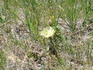 Coll. No. 2371, Opuntia macrorhiza Coll. No. 2371, Opuntia macrorhiza
|
2371
|
Opuntia sp., maybe O. macrorhiza.
|
Native and Naturalized Flora of the Golden Area, Jefferson County, Colorado
Cactaceae
Opuntia macrorhiza Engelm.
Western Pricklypear.
Colorado School of Mines Survey Field, Jefferson County, Colorado.
Southern part of the Survey Field, high plains at the base of the Rocky Mountain Front Range, 3.14 km. south of the GNIS location of Golden.
39.7339°N, 105.2234°W.
WGS 1984
Elev. 1846 m.
Northeast-facing gentle slope in foothills grassland, also collected or seen nearby: Cirsium undulatum, Hymenopappus filifolius, Aegilops cylindrica, and Poa bulbosa.
Coordinates estimated from those of a nearby collection.
Collected by permit: Colorado School of Mines, 2020, issued: Apr 1, 2020, to: Tom Schweich.
|
Tom Schweich
2371. |
20-Jun-2020 |
|
|
|
Other articles:
• Plainview Road:
near Coal Ck;
Locations:
Ranson/Edwards Homestead Open Space Park.
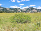 Rhus trilobata at Ranson/Edwards. Rhus trilobata at Ranson/Edwards.
|
|
Tuesday, 23 June 2020
Ranson/Edwards Homestead Open Space
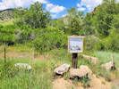
Location of interpretive plaque for the Second Plainview School. |
Interpretive plaque for the Second Plainview School. |
|
|
|
2372
|
Eremogene fendleri.
Plants of Jefferson County Open Space
Jefferson County, Colorado
Caryophyllaceae
Eremogone fendleri (A. Gray) Ikonnikov.
Fendler's Sandwort.
Ranson/Edwards Homestead Open Space Park, Jefferson County, Colorado.
High plains above Rocky Flats, 1.6 mi. west on CO Hwy 72 from CO Hwy 93, 1.6 mi. generally north on Plainview Road, then 90 m. east along a terrace on the south side of an ephemeral stream, 19.8 km. north northwest of the GNIS location of Golden.
39.8894°N, 105.2609°W.
WGS 1984
Elev. 1940 m.
This site a little more dry and rocky than the surrounding area; also collected here or nearby: Tragopogon dubius, Penstemon secundiflorus and P. virens, Carex inops var. heliophila, and Koeleria macrantha.
Collected by permit: Jefferson County Open Space, 2020, issued: Apr 13, 2020, to: Tom Schweich.
|
Tom Schweich
2372. |
23-Jun-2020 |
|
|
|
Literature Cited:
- Kittel, Gwen, 2016.
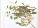 Coll. No. 2373, Salix lasiandra var. caudata Coll. No. 2373, Salix lasiandra var. caudata
|
2373
|
Salix sp.
Plants of Jefferson County Open Space
Jefferson County, Colorado
Salicaceae
Salix lasiandra Benth. var. caudata (Nutt.) Sudw.
Greenleaf Willow.
Ranson/Edwards Homestead Open Space Park, Jefferson County, Colorado.
High plains above Rocky Flats, 1.6 mi. west on CO Hwy 72 from CO Hwy 93, 1.6 mi. generally north on Plainview Road, then 325 m. east along a terrace on the south side of an ephemeral stream, 19.9 km. north northwest of the GNIS location of Golden.
39.8896°N, 105.2588°W.
WGS 1984
Elev. 1932 m.
Beside ephemeral stream; in fruit.
Also collected here or nearby: Galium boreale, Crataegus succulenta, Rosa arkansana, Toxicodendron rydbergii, and Gaillardia aristata.
Collected by permit: Jefferson County Open Space, 2020, issued: Apr 13, 2020, to: Tom Schweich.
|
Tom Schweich
2373. |
23-Jun-2020 |
|
|
|
|
2374
|
Galium boreale.
Plants of Jefferson County Open Space
Jefferson County, Colorado
Rubiaceae
Galium boreale S. Watson.
Bedstraw.
Ranson/Edwards Homestead Open Space Park, Jefferson County, Colorado.
High plains above Rocky Flats, 1.6 mi. west on CO Hwy 72 from CO Hwy 93, 1.6 mi. generally north on Plainview Road, then 325 m. east along a terrace on the south side of an ephemeral stream, 19.9 km. north northwest of the GNIS location of Golden.
39.8896°N, 105.2588°W.
WGS 1984
Elev. 1933 m.
Along the south bank of ephemeral stream from this location extending generally east and downstream.
Collected by permit: Jefferson County Open Space, 2020, issued: Apr 13, 2020, to: Tom Schweich.
|
Tom Schweich
2374. |
23-Jun-2020 |
|
|
|
|
2375
|
Plantago lanceolata.
Plants of Jefferson County Open Space
Jefferson County, Colorado
Plantaginaceae
Plantago lanceolata L.
Narrowleaf Plantain.
Ranson/Edwards Homestead Open Space Park, Jefferson County, Colorado.
High plains above Rocky Flats, 1.6 mi. west on CO Hwy 72 from CO Hwy 93, 1.6 mi. generally north on Plainview Road, then 325 m. east along a terrace on the south side of an ephemeral stream, 19.9 km. north northwest of the GNIS location of Golden.
39.8897°N, 105.2575°W.
WGS 1984
Elev. 1927 m.
Beside ephemeral stream.
Collected by permit: Jefferson County Open Space, 2020, issued: Apr 13, 2020, to: Tom Schweich.
|
Tom Schweich
2375. |
23-Jun-2020 |
|
|
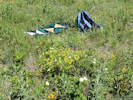 Habitat of Coll. No. 2376, Lithospermum multiflorum Habitat of Coll. No. 2376, Lithospermum multiflorum
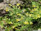 Coll. No. 2376, Lithospermum multiflorum Coll. No. 2376, Lithospermum multiflorum
|
2376
|
Lithospermum multiflorum.
Plants of Jefferson County Open Space
Jefferson County, Colorado
Boraginaceae
Lithospermum multiflorum Torrey ex A. Gray.
Many Flowered Stoneseed.
Ranson/Edwards Homestead Open Space Park, Jefferson County, Colorado.
High plains above Rocky Flats, 1.7 mi. west on CO Hwy 72 from CO Hwy 93, 1.2 mi. generally north on Plainview Road, then 500 m. east along a terrace on the north side of an ephemeral stream, 19.9 km. north northwest of the GNIS location of Golden.
39.8903°N, 105.2573°W.
WGS 1984
Elev. 1931 m.
Adjacent to a colony of Canada thistle.
Collected by permit: Jefferson County Open Space, 2020, issued: Apr 13, 2020, to: Tom Schweich.
|
Tom Schweich
2376. |
23-Jun-2020 |
|
|
|
Other articles:
• Golden Checklist Flora:
Cirsium undulatum;
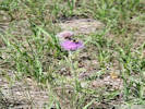 Coll. No. 2377, Cirsium undulatum with bumblebee. Coll. No. 2377, Cirsium undulatum with bumblebee.
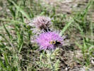 Big bumblebee on Cirsium undulatum Big bumblebee on Cirsium undulatum
|
2377
|
Cirsium undulatum.
Plants of Jefferson County Open Space
Jefferson County, Colorado
Asteraceae
Cirsium undulatum (Nutt.) Spreng.
Wavy Leaved Thistle.
Ranson/Edwards Homestead Open Space Park, Jefferson County, Colorado.
High plains above Rocky Flats, 1.7 mi. west on CO Hwy 72 from CO Hwy 93, 1.2 mi. generally north on Plainview Road, then 450 m. east along the north side of an ephemeral stream, 19.9 km. north northwest of the GNIS location of Golden.
39.8905°N, 105.2579°W.
WGS 1984
Elev. 1932 m.
Scattered on a terrace above ephemeral stream.
Collected by permit: Jefferson County Open Space, 2020, issued: Apr 13, 2020, to: Tom Schweich.
|
Tom Schweich
2377. |
23-Jun-2020 |
|
Coll. No. 2377, Cirsium undulatum in progress. |
|
|
|
2378
|
Apocynum, maybe the hybrid A. ×floribundum.
Plants of Jefferson County Open Space
Jefferson County, Colorado
Apocynaceae
Apocynum ×floribundum Greene.
Dogbane.
Ranson/Edwards Homestead Open Space Park, Jefferson County, Colorado.
High plains above Rocky Flats, 1.7 mi. west on CO Hwy 72 from CO Hwy 93, 1.3 mi. generally north on Plainview Road, then 50 m. northeast on an old ranch road, 20.0 km. north northwest of the GNIS location of Golden.
39.8904°N, 105.2616°W.
WGS 1984
Elev. 1949 m.
Flowers light pink with darker pink stripes inside.
Collected by permit: Jefferson County Open Space, 2020, issued: Apr 13, 2020, to: Tom Schweich.
|
Tom Schweich
2378. |
23-Jun-2020 |
|
|
 Asclepias stenophylla collected at Ranson/Edwards Homestead Open Space. Asclepias stenophylla collected at Ranson/Edwards Homestead Open Space.
|
|
Asclepias stenophylla.
Plants of Jefferson County Open Space
Jefferson County, Colorado
Asclepiadaceae
Asclepias stenophylla A. Gray.
Narrow-leaved Milkweed.
Ranson/Edwards Homestead Open Space Park, Jefferson County, Colorado.
High plains above Rocky Flats, southwestern corner of the park, west of Plainview Road, along the southern fence line, and continuing to the north to an ephemeral steam.
39.8843°N, 105.2663°W.
WGS 1984
Foothills grassland.
|
Irene Weber, with Anthony Massaro and Tanner Marshall
|
8-Jul-2020 |
|
Foothills grassland; also seen or collected here: Polygonum douglasii, Lithospermum multiflorum, Helianthus pauciflorus subsp. subrhomboideus, H. pumilis, Elymus elymoides, and Hesperostipa spartea.
|
|
Locations:
Ranson/Edwards Homestead Open Space Park.
|
|
Sunday, 12 July 2020
Ranson/Edwards
|
 Coll. No. 2379, Asclepias stenophylla Coll. No. 2379, Asclepias stenophylla
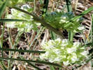 Coll. No. 2379, Asclepias stenophylla Coll. No. 2379, Asclepias stenophylla
 Another habitat shot of Coll. No. 2379, Asclepias stenophylla Another habitat shot of Coll. No. 2379, Asclepias stenophylla
|
2379
|
Asclepias stenophylla
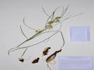
Coll. No. 2739, Asclepias stenophylla |
|
|
Other articles:
• Golden Checklist Flora:
Epilobium hirsutum;
 Coll. No. 2380, Epilobium hirsutum Coll. No. 2380, Epilobium hirsutum
|
2380
|
Epilobium hirsutum.
Plants of Jefferson County Open Space
Jefferson County, Colorado
Onagraceae
Epilobium hirsutum L.
Hairy Willowherb.
Ranson/Edwards Homestead Open Space Park, Jefferson County, Colorado.
High plains above Rocky Flats, 1.7 mi. west on CO Hwy 72 from CO Hwy 93, 0.9 mi. generally north on Plainview Road, then 300 m. west to a small wetland just above a reservoir, 19.4 km. north northwest of the GNIS location of Golden.
39.8865°N, 105.2647°W.
WGS 1984
Elev. 1963 m.
Loose gravelly soil, seasonally inundated.
Colorado Noxious Weed List A.
Collected by permit: Jefferson County Open Space, 2020, issued: Apr 13, 2020, to: Tom Schweich.
|
Tom Schweich
2380. |
12-Jul-2020 |
|
|
|
Locations:
Apex Park - Northern Parcel.
|
|
Friday, 17 July 2020
Apex Open Space Park
|
|
|
2381
|
Mirabilis linearis.
Plants of Jefferson County Open Space
Jefferson County, Colorado
Nyctaginaceae
Mirabilis linearis (Pursh) Heimerl.
Narrowleaf Four O'Clock.
Apex Park - Northern Parcel, Jefferson County, Colorado.
About half way up the initial Rocky Mountain Front Range scarp, near the south edge of the restricted area, 5.1 km. south of the GNIS location of Golden.
39.7203°N, 105.2211°W.
WGS 1984
Elev. 1997 m.
On the edge of trail, usually single plants, widely dispersed, many inflorescences have been eaten.
Collected by permit: Jefferson County Open Space, 2020, issued: Apr 13, 2020, to: Tom Schweich.
|
Tom Schweich
2381. |
17-Jul-2020 |
|
|
|
|
2382
|
Juniperus scopulorum.
Plants of Jefferson County Open Space
Jefferson County, Colorado
Cupressaceae
Juniperus scopulorum Sarg.
Rocky Mountain Juniper.
Apex Park - Northern Parcel, Jefferson County, Colorado.
About half way up the initial Rocky Mountain Front Range scarp, near the south edge of the restricted area, 5.03 km. south of the GNIS location of Golden.
39.7208°N, 105.222°W.
WGS 1984
Elev. 2015 m.
Large specimen, steep northeast-facing slope.
Mostly foothills shrubland with a few junipers, also collected nearby: Mirabilis linearis, Ranunculus glaberrimus, Grindelia squarrosa, and Andropogon gerardii.
Collected by permit: Jefferson County Open Space, 2020, issued: Apr 13, 2020, to: Tom Schweich.
|
Tom Schweich
2382. |
17-Jul-2020 |
|
|
|
|
2383
|
Polygonum douglasii.
Plants of Jefferson County Open Space
Jefferson County, Colorado
Polygonaceae
Polygonum douglasii Greene.
Douglas Knotweed.
Apex Park - Northern Parcel, Jefferson County, Colorado.
About half way up the initial Rocky Mountain Front Range scarp, near the south edge of the restricted area, 5.03 km. south of the GNIS location of Golden.
39.7208°N, 105.2226°W.
WGS 1984
Elev. 2024 m.
In the watercourse at the base of a now dry cascade. Mixed foothills shrubland with a few Rocky Mountain junipers. Also collected here: Grindelia squarrosa.
Collected by permit: Jefferson County Open Space, 2020, issued: Apr 13, 2020, to: Tom Schweich.
|
Tom Schweich
2383. |
17-Jul-2020 |
|
|
|
|
2384
|
Grindelia squarrosa.
Plants of Jefferson County Open Space
Jefferson County, Colorado
Asteraceae
Grindelia squarrosa (Pursh) Dunal.
Curlycup Gumweed.
Apex Park - Northern Parcel, Jefferson County, Colorado.
About half way up the initial Rocky Mountain Front Range scarp, near the south edge of the restricted area, 5.03 km. south of the GNIS location of Golden.
39.7208°N, 105.2226°W.
WGS 1984
Elev. 2026 m.
In a watercourse on the lip of a now dry cascade and in the surrounding area. Mixed foothills shrubland with a few Rocky Mountain junipers. Also collected here: Polygonum douglasii.
Collected by permit: Jefferson County Open Space, 2020, issued: Apr 13, 2020, to: Tom Schweich.
|
Tom Schweich
2384. |
17-Jul-2020 |
|
|
|
|
2385
|
Andropogon gerardii.
Plants of Jefferson County Open Space
Jefferson County, Colorado
Poaceae
Andropogon gerardii Vitman.
Big Bluestem.
Apex Park - Northern Parcel, Jefferson County, Colorado.
Near the top of the initial Rocky Mountain Front Range scarp, near the south edge of the restricted area, 4.96 km. south of the GNIS location of Golden.
39.7214°N, 105.2226°W.
WGS 1984
Elev. 2029 m.
In rocks on nose of east-facing ridge.
Collected by permit: Jefferson County Open Space, 2020, issued: Apr 13, 2020, to: Tom Schweich.
|
Tom Schweich
2385. |
17-Jul-2020 |
|
|
|
|
2386
|
Artemisia dracunculus.
Plants of Jefferson County Open Space
Jefferson County, Colorado
Asteraceae
Artemisia dracunculus L.
Tarragon, Dragon Wort.
Apex Park - Northern Parcel, Jefferson County, Colorado.
Near the top of the initial Rocky Mountain Front Range scarp, southern half of the restricted area, 4.93 km. south of the GNIS location of Golden.
39.7216°N, 105.2232°W.
WGS 1984
Elev. 2047 m.
An early flowering plant, ahead of others nearby.
Mixed foothills shrubland, with a few Rocky Mountain junipers, ponderosa pines are a little higher, also collected here: Collinsia parviflora and Andropogon gerardii.
Collected by permit: Jefferson County Open Space, 2020, issued: Apr 13, 2020, to: Tom Schweich.
|
Tom Schweich
2386. |
17-Jul-2020 |
|
|
|
|
2387
|
Ceanothus fendleri.
Plants of Jefferson County Open Space
Jefferson County, Colorado
Rhamnaceae
Ceanothus fendleri A. Gray.
Fendler's Ceanothus.
Apex Park - Northern Parcel, Jefferson County, Colorado.
Near the top of the initial Rocky Mountain Front Range scarp, southern half of the restricted area, 4.89 km. south of the GNIS location of Golden
39.7219°N, 105.2248°W.
WGS 1984
Elev. 2088 m.
In fruit only.
Mixed foothills shrubland, with a few Rocky Mountain junipers, ponderosa pines are a little higher, also collected nearby: Anaphalis margaritacea and Eriogonum umbellatum var. ramulosum.
Collected by permit: Jefferson County Open Space, 2020, issued: Apr 13, 2020, to: Tom Schweich.
|
Tom Schweich
2387. |
17-Jul-2020 |
|
|
|
|
2388
|
Anaphalis sp. ?
Plants of Jefferson County Open Space
Jefferson County, Colorado
Asteraceae
Anaphalis margaritacea (L.) Bentham & Hooker.
Western Pearly Everlasting.
Apex Park - Northern Parcel, Jefferson County, Colorado.
Near top of initial Rocky Mountain Front Range scarp, on a ridge overlooking an unnamed gulch to the north, about center of Apex Park - North, 4.84 km. south of the GNIS location of Golden
39.7222°N, 105.2251°W.
WGS 1984
Elev. 2082 m.
Numerous plants seen, but long past their prime.
Mixed foothills shrubland, just below the ponderosa pines, also collected nearby: Claytonia rosea, Ceanothus fendleri, and Eriogonum umbellatum var ramulosum.
Collected by permit: Jefferson County Open Space, 2020, issued: Apr 13, 2020, to: Tom Schweich.
|
Tom Schweich
2388. |
17-Jul-2020 |
|
|
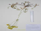 Coll. No. 2389, Eriogonum umbellatum var. ramulosum Coll. No. 2389, Eriogonum umbellatum var. ramulosum
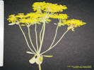 Inflorescence of Coll. No. 2389, Eriogonum umbellatum var. ramulosum Inflorescence of Coll. No. 2389, Eriogonum umbellatum var. ramulosum
|
2389
|
Eriogonum umbellatum var. ramulosum.
Plants of Jefferson County Open Space
Jefferson County, Colorado
Polygonaceae
Eriogonum umbellatum Torr. var. ramulosum Reveal.
Buffalo Bill's Sulphur Flower.
Apex Park - Northern Parcel, Jefferson County, Colorado.
Nearing the top of the initial Rocky Mountain Front Range scarp, approximate center of north parcel, 2.06 km. southeast of Buffalo Bill's grave, and 4.82 km. south of the GNIS location of Golden.
39.7224°N, 105.2255°W.
WGS 1984
Elev. 2082 m.
Seven of eight inflorescences collected have the extra whorl of bracts below the inflorescence branches.
North-facing slope, mixed foothills shrubland at edge of ponderosa pine woodland, also collected here: Claytonia rosea, Ceanothus fendleri, and Anaphalis margaritacea.
Collected by permit: Jefferson County Open Space, 2020, issued: Apr 13, 2020, to: Tom Schweich.
|
Tom Schweich
2389. |
17-Jul-2020 |
|
|
|
Other articles:
• Golden Checklist Flora:
Eriogonum alatum;
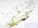 Voucher of Coll. No. 2390, Eriogonum alatum Voucher of Coll. No. 2390, Eriogonum alatum
|
2390
|
Eriogonum alatum.
Plants of Jefferson County Open Space
Jefferson County, Colorado
Polygonaceae
Eriogonum alatum Torr.
Winged Buckwheat.
Apex Park, Jefferson County, Colorado.
East-central Apex Park, about mid-way up the initial Rocky Mountain Front Range scarp, along what may have been a road but is now a social trail, 5.19 km. south of the GNIS location of Golden.
39.7197°N, 105.2202°W.
WGS 1984
Elev. 1977 m.
Southeast facing slope, numerous flowering and non-flowering rosettes above and below trail.
Collected by permit: Jefferson County Open Space, 2020, issued: Apr 13, 2020, to: Tom Schweich.
|
Tom Schweich
2390. |
17-Jul-2020 |
|
|
|
Other articles:
• Golden Checklist Flora:
Quercus gambelii;
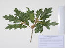 Coll. No. 2391, Quercus gambelii Coll. No. 2391, Quercus gambelii
|
2391
|
Quercus gambelii.
Plants of Jefferson County Open Space
Jefferson County, Colorado
Fagaceae
Quercus gambelii Nutt.
Gambel's oak.
Apex Park, Jefferson County, Colorado.
East-central Apex Park, part-way up the initial Rocky Mountain Front Range scarp, along a social trail in a small canyon, 5.21 km. south of the GNIS location of Golden.
39.7195°N, 105.2196°W.
WGS 1984
Elev. 1956 m.
Collected by permit: Jefferson County Open Space, 2020, issued: Apr 13, 2020, to: Tom Schweich.
|
Tom Schweich
2391. |
17-Jul-2020 |
|
|
|
Locations:
Clear Creek.
Deadman Gulch.
Eagle Ridge.
Kinney Run.
Schweich Hill.
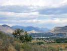 View north through Golden Valley from Eagle Ridge. View north through Golden Valley from Eagle Ridge.
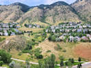 Deadman Gulch from Eagle Ridge. Deadman Gulch from Eagle Ridge.
|
|
Friday, 24 July 2020
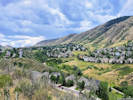
Kinney Run from Eagle Ridge. |
Survey Field from Eagle Ridge. |
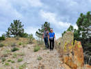
Susan and Zack on Eagle Ridge. |
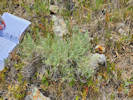
Ericameria nauseosa var. nauseosa on Eagle Ridge |
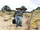
Tom on Eagle Ridge |
|
|
Other articles:
• Golden Checklist Flora:
Muhlenbergia andina;
Notes on Muhlenbergia andina;
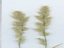 Coll. No. 2392, Muhlenbergia andina. Coll. No. 2392, Muhlenbergia andina.
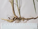 Rhizome of Coll. No. 2392, Muhlenbergia andina. Rhizome of Coll. No. 2392, Muhlenbergia andina.
|
2392
|
Muhlenbergia sp.
|
Native and Naturalized Flora of the Golden Area, Jefferson County, Colorado
Poaceae
Muhlenbergia andina (Nutt.) Hitchc.
Foxtail Muhly.
Clear Creek, Jefferson County, Colorado.
Near the north bank of Clear Creek, on the edge of a now dry distributary channel, approximately 100 m. west of US Highway 6, 1.75 km. west of the GNIS location of Golden
39.7528°N, 105.2365°W.
WGS 1984
Elev. 1731 m.
Also seen here: Dichanthelium sp., probably D. oligosanthes.
Collected by permit: City of Golden, 2020, issued: Apr 9, 2020, to: Tom Schweich.
|
Tom Schweich, with Jessica Smith, Susan Panjabi, and Zachariah Wilson
2392. |
24-JuL-2020 |
|
Coll. No. 2392, 24 Jul 2020, characters observed:
Perennial grass, to 70 cm.;
Rhizomes, robust, scaly;
Internodes glabrous,
except retrorsely hairy just below nodes to lowest part of sheath above;
Leaves,
sheath, open, 60 mm.,
ligules, 1 mm., membraneous,
auricles, absent,
blade, 100 mm. × 2.3 mm. wide, tapered to an acute tip,
margin and mid-rib slightly scabrous;
Inflorescence, 1 per culm,
dense interrupted panicle,
“appearing furry” per Wingate (1994);
Spikelets,
with 1 well developed floret;
Glumes,
lower, 3.5 mm.,
upper, 3.2 mm.,
veins, #1, but otherwise glumes very thin;
Callus, silky hairs to 2 mm.;
Lemma, 2.5 mm., very thin, except 3 green veins,
awn, #1, from entire apex, 7.5 mm, straight to wavy;
Palea, 1.7 mm.
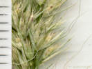
Detail of inflorescence of Coll. No. 2392, Muhlenbergia andina. |
|
|
Locations:
Dakota Ridge.
 Rock Wren and family at Dakota Ridge. Rock Wren and family at Dakota Ridge.
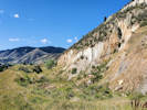 East side of Dakota Ridge. East side of Dakota Ridge.
|
|
Wednesday, 29 July 2020
I was down on my hands and knees collecting Physalis longifolia at Dakota Ridge, north Golden, Jefferson County, Colorado,
when I heard a soft rattlesnake sound.
Took me a while but I finally noticed it was coming from this little gray bird that was hopping back and forth between the rocks in the foreground.
The "clacking" or "chattering" noise was clearly coming from its bill.
There are three more similar birds on the brown rock above and to the right of the bird that was out front.
I would assume that the four birds were a family group, and the bird making the clacking noise was intending to distract me.
Forced to actually look in a bird book, this bird looks similar to but a little smaller than a Townsends Solitaire and a little bigger than a Gray Vireo. Neither of them are known to make a clacking noise or "imitate" a rattlesnake, at least according to my book (Peterson, 1961).
Posted this to Facebook asking my bird-knowledgeable friends for help.
They agreed that the location and the soft rattling/trilling, or rattling chatter
strongly suggested the birds were Rock Wrens.
Also got stabbed by an assassin bug.
It hurt on a scale of 7 of 10 for about 10 minutes, then went away.
|
|
|
2395
|
Dipsacus laciniatus.
|
Native and Naturalized Flora of the Golden Area, Jefferson County, Colorado
Dipsacaceae
Dipsacus laciniatus L.
Cutleaf Teasel.
Dakota Ridge, Jefferson County, Colorado.
Northwestern-most Golden, in the pit of a former clay mine, accessed by way of the City of Golden Cressman Gulch Trail and then a social/game trail, 4.19 km. north northeast of the GNIS location of Golden.
39.7821°N, 105.2361°W.
WGS 1984
Elev. 1855 m.
Also collected here: Chenopodium album and Physalis longifolia.
D. laciniatus more common in Golden than D. fullonum, both of which are Colorado Noxious Weed List B weeds.
Collected by permit: City of Golden, 2020, issued: Apr 9, 2020, to: Tom Schweich.
|
Tom Schweich
2395. |
29-Jul-2020 |
|
|
|
|
2396
|
Physalis sp., P. longifolia.
|
Native and Naturalized Flora of the Golden Area, Jefferson County, Colorado
Solanaceae
Physalis longifolia Nutt.
Longleaf Groundcherry.
Dakota Ridge, Jefferson County, Colorado.
Northwestern-most Golden, in the pit of a former clay mine, accessed by way of the City of Golden Cressman Gulch Trail and then a social/game trail, 4.28 km. north northeast of the GNIS location of Golden.
39.7828°N, 105.236°W.
WGS 1984
Elev. 1857 m.
Top of a waste pile. Also collected here: Chenopodium album and Dipsacus laciniatus.
Collected by permit: City of Golden, 2020, issued: Apr 9, 2020, to: Tom Schweich.
|
Tom Schweich
2396. |
29-Jul-2020 |
|
|
|
|
2396.1
|
Chenopodium, probably C. album.
|
Native and Naturalized Flora of the Golden Area, Jefferson County, Colorado
Chenopodiaceae
Chenopodium album L.
Lambsquarters.
Dakota Ridge, Jefferson County, Colorado.
Northwestern-most Golden, in the pit of a former clay mine, accessed by way of the City of Golden Cressman Gulch Trail and then a social/game trail, 4.28 km. north northeast of the GNIS location of Golden.
39.7828°N, 105.236°W.
WGS 1984
Elev. 1857 m.
Top of a waste pile. Also collected here or nearby: Dipsacus laciniatus and Physalis longifolia.
Collected by permit: City of Golden, 2020, issued: Apr 9, 2020, to: Tom Schweich.
|
Tom Schweich
2396.1 |
29-Jul-2020 |
|
|
|
Other articles:
• Golden Checklist Flora:
Calamovilfa longifolia;
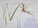 Coll. No. 2397, Calamovilfa longifolia Coll. No. 2397, Calamovilfa longifolia
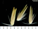 Florets of Coll. No. 2397, Calamovilfa longifolia Florets of Coll. No. 2397, Calamovilfa longifolia
|
2397
|
Bromus sp. ???
|
Native and Naturalized Flora of the Golden Area, Jefferson County, Colorado
Poaceae
Calamovilfa longifolia (Hook.) Scribn.
Prairie Sandreed.
Dakota Ridge, Jefferson County, Colorado.
Northwesternmost Golden, at the south end of the North Hogback, on a small spoils pile of some sort, 4.07 km. north northwest of the GNIS location of Golden.
39.7806°N, 105.2376°W.
WGS 1984
Elev. 1857 m.
Partially in the shade of some cottonwood trees, otherwise foothills grassland, also collected nearby: Alyssum simplex, Erodium cicutarium, Euphorbia esula, and Castilleja integra.
Collected by permit: City of Golden, 2020, issued: Apr 9, 2020, to: Tom Schweich.
|
Tom Schweich
2397. |
29-Jul-2020 |
|
Coll. No. 2397, 29 Jul 2020, characters observed:
Perennial grass, 1 m.,
thick scaly rhizomes;
Nodes,
hidden by sheath;
Leaves,
blade and sheath differentiated;
Sheath,
>75 mm.,
open,
glabrous to long straight hairs distally;
Ligule,
hairs,
1.5 mm.;
Auricles,
absent;
Blade,
350 mm. × 7 mm. wide,
flat;
Inflorescence,
1 per culm,
panicle,
180 mm. × 15 mm. wide,
3-4 branches;
Rachis,
glabrous,
not extended;
Spikelets,
many,
5.5 mm. × 2.5 mm. wide,
borne singly,
subtended by few long silky hairs;
Compression,
lateral.
Disarticulation,
above the glumes;
Glumes,
lower,
3.5 mm.,
keeled,
veins, #1,
upper,
5 mm.,
< lowest floret,
veins, #1,
keeled,
awns, absent;
Callus,
straight silky hairs,
3 mm.;
Lemma,
5 mm.,
>glumes,
lanceolate,
keeled,
glabrous,
scarious,
veins, #1,
forming a tiny awn tip,
awns, absent;
Palea,
4.8 mm.,
<lemma,
colorless,
glabrous;
Stamens, #2;
Anthers,
3.8 mm.
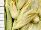
Spikelets of Coll. No. 2397, Calamovilfa longifolia |
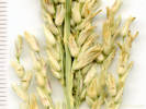
Spikelets of Coll. No. 2397, Calamovilfa longifolia |
|
|
|
2398
|
Eriogonum alatum.
|
Native and Naturalized Flora of the Golden Area, Jefferson County, Colorado
Polygonaceae
Eriogonum alatum Torr.
Winged Buckwheat.
Dakota Ridge, Jefferson County, Colorado.
Northwesternmost city limits of Golden, west side of Dakota Ridge (North Hogback), about 1/4 of the way up the west slope from Cressmans Gulch, 2.65 km. north northwest of the GNIS location of Golden.
39.7819°N, 105.2384°W.
WGS 1984
Elev. 1874 m.
Foothills grassland, below any significant concentration of shrubs, also collected here: Rhus trilobata, Tragia ramosa, Grindelia squarrosa, and Gutierrezia sarothrae.
Collected by permit: City of Golden, 2020, issued: Apr 9, 2020, to: Tom Schweich.
|
Tom Schweich
2398. |
29-Jul-2020 |
|
|
|
|
2399
|
Grindelia squarrosa.
|
Native and Naturalized Flora of the Golden Area, Jefferson County, Colorado
Asteraceae
Grindelia squarrosa (Pursh) Dunal.
Curlycup Gumweed.
Dakota Ridge, Jefferson County, Colorado.
Northwesternmost city limits of Golden, west side of Dakota Ridge (North Hogback), about 1/2 of the way up the west slope from Cressmans Gulch, 2.66 km. north northwest of the GNIS location of Golden.
39.782°N, 105.2382°W.
WGS 1984
Elev. 1881 m.
Flowers beginning to open.
Foothills grassland, below any significant concentration of shrubs, also collected here: Rhus trilobata, Tragia ramosa, Eriogonum alatum, and Gutierrezia sarothrae.
Collected by permit: City of Golden, 2020, issued: Apr 9, 2020, to: Tom Schweich.
|
Tom Schweich
2399. |
29-Jul-2020 |
|
|
|
|
2400
|
Gutierrezia sarothrae.
|
Native and Naturalized Flora of the Golden Area, Jefferson County, Colorado
Asteraceae
Gutierrezia sarothrae (Pursh) Britton & Rusby.
Broom Snakeweed.
Dakota Ridge, Jefferson County, Colorado.
Northwesternmost city limits of Golden, west side of Dakota Ridge (North Hogback), about 1/2 of the way up the west slope from Cressmans Gulch, 2.66 km. north northwest of the GNIS location of Golden.
39.7821°N, 105.2381°W.
WGS 198
Elev. 1888 m.
Flowers just beginning to open.
Foothills grassland, below any significant concentration of shrubs, also collected here: Rhus trilobata, Tragia ramosa, Eriogonum alatum, and Grindelia squarrosa.
Collected by permit: City of Golden, 2020, issued: Apr 9, 2020, to: Tom Schweich.
|
Tom Schweich
2400. |
29-Jul-2020 |
|
|
|
|
2401
|
Rhus trilobata, var. trilobata assumed.
|
Native and Naturalized Flora of the Golden Area, Jefferson County, Colorado
Anacardiaceae
Rhus trilobata Nutt. var. trilobata.
Skunkbush Sumac.
Dakota Ridge, Jefferson County, Colorado.
Northwesternmost city limits of Golden, west side of Dakota Ridge (North Hogback), about 2/3 of the way up the west slope from Cressmans Gulch, 2.66 km. north northwest of the GNIS location of Golden.
39.7821°N, 105.238°W.
WGS 1984
Elev. 1890 m.
Fruit, hairy red berries.
Mixed foothills grassland and shrubland, shrub density increasing above, also collected here: Celtis reticulata, Gutierrezia sarothrae, Tragia ramosa, Eriogonum alatum, and Grindelia squarrosa.
Variety trilobata if infraspecific names are to be applied.
Collected by permit: City of Golden, 2020, issued: Apr 9, 2020, to: Tom Schweich.
|
Tom Schweich
2401. |
29-Jul-2020 |
|
|
|
|
2402
|
Celtis reticulata.
|
Native and Naturalized Flora of the Golden Area, Jefferson County, Colorado
Cannabaceae
Celtis reticulata Torr.
Net-Leaved Hackberry.
Dakota Ridge, Jefferson County, Colorado.
Northwesternmost city limits of Golden, west side of Dakota Ridge (North Hogback), base of a rock outcrop, about 2/3 of the way up the west slope from Cressmans Gulch, 2.67 km. north northwest of the GNIS location of Golden.
39.7823°N, 105.238°W.
WGS 1984
Elev. 1904 m.
Mixed foothills grassland and shrubland, shrub density increasing above, also collected here: Rhus trilobata, Gutierrezia sarothrae, Tragia ramosa, Eriogonum alatum, and Grindelia squarrosa.
Collected by permit: City of Golden, 2020, issued: Apr 9, 2020, to: Tom Schweich.
|
Tom Schweich
2402. |
29-Jul-2020 |
|
|
|
|
2403
|
Pseudognaphalium canescens.
|
Native and Naturalized Flora of the Golden Area, Jefferson County, Colorado
Asteraceae
Pseudognaphalium canescens (DC.) Anderberg.
Wright's Rabbit-Tobacco..
Dakota Ridge, Jefferson County, Colorado.
Northwesternmost city limits of Golden, west side of Dakota Ridge (North Hogback), base of rock outcrop at top of ridge, 2.65 km. north northwest of the GNIS location of Golden.
39.7823°N, 105.2374°W.
WGS 1984
Elev. 1922 m.
Leaf surfaces weakly bicolor, sessile glandular beneath the tomentum.
Sedimentary rock outcrops and foothills shrubland, also collected nearby: Linaria canadensis var. texana, Physaria montana, and Viola nuttallii.
Collected by permit: City of Golden, 2020, issued: Apr 9, 2020, to: Tom Schweich.
|
Tom Schweich
2403. |
29-Jul-2020 |
|
|
|
|
2404
|
Muhlenbergia sp., probably M. montana.
|
Native and Naturalized Flora of the Golden Area, Jefferson County, Colorado
Poaceae
Muhlenbergia montana (Nutt.) Hitchc.
Mountain Muhly.
Dakota Ridge, Jefferson County, Colorado.
Northwesternmost city limits of Golden, west side of Dakota Ridge (North Hogback), near the top of ridge, 2.67 km. north northwest of the GNIS location of Golden.
39.7828°N, 105.2377°W.
WGS 198
Elev. 1921 m.
Mixed foothill shrubland, also collected nearby: Delphinium carolinianum var. virescens, Andropogon gerardii, and Schizachyrium scoparium.
Collected by permit: City of Golden, 2020, issued: Apr 9, 2020, to: Tom Schweich.
|
Tom Schweich
2404. |
29-Jul-2020 |
|
|
|
|
2405
|
Liatris punctata.
|
Native and Naturalized Flora of the Golden Area, Jefferson County, Colorado
Asteraceae
Liatris punctata Hook.
Dotted Blazing Star.
Dakota Ridge, Jefferson County, Colorado.
Northwesternmost city limits of Golden, west side of Dakota Ridge (North Hogback), about half way up the slope above Cressmans Gulch, 2.60 km. north northwest of the GNIS location of Golden.
39.7814°N, 105.238°W.
WGS 1984
Elev. 1851 m.
Foothills grassland with a few Rhus trilobata. Cercocarpus montanus higher up the slope. Also collected here: Cerastium arvense, Scutellaria brittonii, Castilleja integra, and Alyssum simplex.
Collected by permit: City of Golden, 2020, issued: Apr 9, 2020, to: Tom Schweich.
|
Tom Schweich
2405. |
29-Jul-2020 |
|
|
|
Locations:
Deadman Gulch.
Kinney Run.
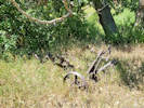 Three bottom plow abandoned in Kinney Run. Three bottom plow abandoned in Kinney Run.
|
|
Friday, 31 July 2020
Kinney Run and Deadman Gulch
|
|
|
2406
|
Epilobium hirsutum.
|
Native and Naturalized Flora of the Golden Area, Jefferson County, Colorado
Onagraceae
Epilobium hirsutum L.
Hairy Willowherb.
Deadman Gulch, Jefferson County, Colorado.
Near the junction of Deadman Gulch and Kinney Run, 2.28 km. south of the GNIS location of Golden
39.7304°N, 105.2167°W.
WGS 1984
Elev. 1810 m.
Forb to 1 meter, flowers magenta.
In streambed. Common along Deadman Gulch below Eagleridge Drive, and Kinney Run below Deadman Gulch to US Highway 6.
Colorado Noxious Weed List A.
Collected by permit: City of Golden, 2020, issued: Apr 9, 2020, to: Tom Schweich.
|
Tom Schweich
2406. |
31-Jul-2020 |
|
|
|
|
2407
|
Cirsium arvense.
|
Native and Naturalized Flora of the Golden Area, Jefferson County, Colorado
Asteraceae
Cirsium arvense (L.) Scop.
Canada Thistle.
Deadman Gulch, Jefferson County, Colorado.
Near the junction of Deadman Gulch and Kinney Run, 2.28 km. south of the GNIS location of Golden
39.7303°N, 105.2167°W.
WGS 1984
Elev. 1812 m.
South side of gulch, growing in woody shrubs. Also collected here: Epilobium hirsutum, Solanum dulcamara, and Dactylis glomerata.
Collected by permit: City of Golden, 2020, issued: Apr 9, 2020, to: Tom Schweich.
|
Tom Schweich
2407. |
31-Jul-2020 |
|
|
|
|
2407.1
|
Dactylis glomerata.
|
Native and Naturalized Flora of the Golden Area, Jefferson County, Colorado
Poaceae
Dactylis glomerata L.
Orchard Grass.
Deadman Gulch, Jefferson County, Colorado.
Near the junction of Deadman Gulch and Kinney Run, north side of creek, 2.28 km. south of the GNIS location of Golden
39.7303°N, 105.2167°W.
WGS 1984
Elev. 1812 m.
Most culms long past maturity. Also collected here: Epilobium hirsutum, Solanum dulcamara, and Cirsium arvense.
Collected by permit: City of Golden, 2020, issued: Apr 9, 2020, to: Tom Schweich.
|
Tom Schweich
2407.1 |
31-Jul-2020 |
|
|
|
|
2408
|
Thinopyrum intermedium.
|
Native and Naturalized Flora of the Golden Area, Jefferson County, Colorado
Poaceae
Thinopyrum intermedium (Host) Barkworth & D.R. Dewey.
Intermediate Wheatgrass.
Deadman Gulch, Jefferson County, Colorado.
Near the junction of Deadman Gulch and Kinney Run, north bank of creek, 2.27 km. south of the GNIS location of Golden
39.7305°N, 105.2165°W.
WGS 1984
Elev. 1810 m.
Foothills grassland north side of creek; foothills shrubland south side of creek; Also collected here: Solanum dulcamara, Epilobium ciliatum, E. hisutum, Cirsium arvense, and Dactylis glomerata.
Collected by permit: City of Golden, 2020, issued: Apr 9, 2020, to: Tom Schweich.
|
Tom Schweich
2408. |
31-Jul-2020 |
|
|
|
|
2409
|
Epilobium ciliatum.
|
Native and Naturalized Flora of the Golden Area, Jefferson County, Colorado
Onagraceae
Epilobium ciliatum Raf.
Fringed Willowherb.
Deadman Gulch, Jefferson County, Colorado.
Near the junction of Deadman Gulch and Kinney Run, south bank of creek, 2.28 km. south of the GNIS location of Golden.
39.7305°N, 105.2163°W.
WGS 1984
Elev. 1806 m.
Flower color: rose. Considered to be native, but weedy. Growing with Epilobium hirsutum (Colorado List A Noxious Weed) in creekbed and adjacent bank.
Foothills grassland north side of creek; foothills shrubland south side of creek; Also collected here: Solanum dulcamara, Cirsium arvense, Dactylis glomerata, and Thinopyrum intermedium.
Collected by permit: City of Golden, 2020, issued: Apr 9, 2020, to: Tom Schweich.
|
Tom Schweich
2409. |
31-Jul-2020 |
|
|
|
|
2409.1
|
Solanum dulcamara.
|
Native and Naturalized Flora of the Golden Area, Jefferson County, Colorado
Solanaceae
Solanum dulcamara L.
Climbing Nightshade.
Deadman Gulch, Jefferson County, Colorado.
Near the junction of Deadman Gulch and Kinney Run, growing in the creek bed, 2.28 km. south of the GNIS location of Golden.
39.7305°N, 105.2163°W.
WGS 1984
Elev. 1806 m.
Foothills grassland north side of creek; foothills shrubland south side of creek; Also collected here: Epilobium ciliatum, E. hirsutum, Cirsium arvense, Dactylis glomerata, and Thinopyrum intermedium.
Collected by permit: City of Golden, 2020, issued: Apr 9, 2020, to: Tom Schweich.
|
Tom Schweich
2409.1 |
31-Jul-2020 |
|
|
|
|
2410
|
Grindelia squarrosa.
|
Native and Naturalized Flora of the Golden Area, Jefferson County, Colorado
Asteraceae
Grindelia squarrosa (Pursh) Dunal.
Curlycup Gumweed.
Kinney Run, Jefferson County, Colorado.
Near the junction of Deadman Gulch with Kinney Run, on a small hill that is a highly eroded hogback continued from the east side of Kinney Run, 2.37 km. south of the GNIS location of Golden.
39.7301°N, 105.216°W.
WGS 1984
Elev. 1817 m.
Foothills shrubland, also collected here: Astragalus shortianus, Cynoglossum officinale, Lithospermum arvense, Scutellaria brittonii, and Toxicoscordion paniculatum.
Collected by permit: City of Golden, 2020, issued: Apr 9, 2020, to: Tom Schweich.
|
Tom Schweich
2410. |
31-Jul-2020 |
|
|
|
|
2411
|
Acer negundo.
|
Native and Naturalized Flora of the Golden Area, Jefferson County, Colorado
Sapindaceae
Acer negundo L.
Box Elder Maple.
Kinney Run, Jefferson County, Colorado.
West side of Kinney Run nearing the houses of Stonebridge HOA, between Deadman Gulch and Tripp Ranch, 2.42 km. south of the GNIS location of Golden.
39.7289°N, 105.2155°W.
WGS 1984
Elev. 1823 m.
Leaves bright green, quickly turning brown in the dryer.
Also seen or collected nearby: Rhus trilobata, Elaeaegnus angustifolia, Dipsacus laciniatus, and Typha latifolia.
Collected by permit: City of Golden, 2020, issued: Apr 9, 2020, to: Tom Schweich.
|
Tom Schweich
2411. |
31-Jul-2020 |
|
|
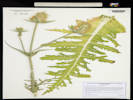 Coll. No. 2412, Dipsacus laciniatus, imaged by COLO. Coll. No. 2412, Dipsacus laciniatus, imaged by COLO.
|
2412
|
Dipsacus laciniata.
|
Native and Naturalized Flora of the Golden Area, Jefferson County, Colorado
Dipsacaceae
Dipsacus laciniatus L.
Cutleaf Teasel.
Kinney Run, Jefferson County, Colorado.
West side of Kinney Run between the creek and the houses of Stonebridge HOA, between Deadman Gulch and Tripp Ranch, 2.45 km. south of the GNIS location of Golden.
39.7287°N, 105.2153°W.
WGS 1984
Elev. 1821 m.
In a thicket of Rhus trilobata; also seen or collected nearby: Elaeagnus angustifolia, and Acer negundo.
Colorado Noxious Weed List B.
Collected by permit: City of Golden, 2020, issued: Apr 9, 2020, to: Tom Schweich.
|
Tom Schweich
2412. |
31-Jul-2020 |
|
|
|
|
2413
|
Pediomelum tenuiflorum.
|
Native and Naturalized Flora of the Golden Area, Jefferson County, Colorado
Fabaceae
Psoralidium tenuiflorum (Pursh) Rydb.
Slimflower Scurfpea.
Kinney Run, Jefferson County, Colorado.
West side of Kinney Run, near the houses of Stonebridge HOA between Deadman Gulch and Tripp Ranch, near an unnamed ephemeral stream draining Apex Park into Kinney Run, 2.56 km. south of the GNIS location of Golden.
39.7274°N, 105.2151°W.
WGS 1984
Elev. 1829 m.
Mostly disturbed grassland at the base of a bank constructed for houses, also seen here: Andropogon gerardii.
Collected by permit: City of Golden, 2020, issued: Apr 9, 2020, to: Tom Schweich.
|
Tom Schweich
2413. |
31-Jul-2020 |
|
|
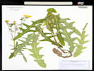 Voucher of my Coll. No. 2414 Sonchus asper at COLO. Voucher of my Coll. No. 2414 Sonchus asper at COLO.
|
2414
|
Sonchus oleraceus?
well, the auricles are rounded, and the cypsela is ribbed but not transversely ribbed
so
|
Native and Naturalized Flora of the Golden Area, Jefferson County, Colorado
Asteraceae
Sonchus asper (L.) Hill.
Spiny Sowthistle.
Kinney Run, Jefferson County, Colorado.
Steep bank of Kinney Run, just north of Tripp Ranch, 2.61 km. south of the GNIS location Golden.
39.7271°N, 105.2138°W.
WGS 1984
Elev. 1834 m.
Moist soil.
Collected by permit: City of Golden, 2020, issued: Apr 9, 2020, to: Tom Schweich.
|
Tom Schweich
2414. |
31-Jul-2020 |
|
|
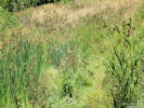 Horticultural Allium escaped to Kinney Run. Horticultural Allium escaped to Kinney Run.
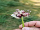 Head of Coll. No. 2415, Allium × proliferum Head of Coll. No. 2415, Allium × proliferum
|
2415
|
Allium sp., garden escapee.
|
Native and Naturalized Flora of the Golden Area, Jefferson County, Colorado
Alliaceae
Allium × proliferum (Moench) Schrad. ex Willd.
Garden Onion.
Kinney Run, Jefferson County, Colorado.
In the streambed of Kinney Run, just north of Tripp Ranch, 2.68 km. south of the GNIS location of Golden.
39.7263°N, 105.2137°W.
WGS 1984
Elev. 1832 m.
Very likely a garden escapee, though a brief review of nearby gardens failed to find any cultivated specimens.
Collected by permit: City of Golden, 2020, issued: Apr 9, 2020, to: Tom Schweich.
|
Tom Schweich
2415. |
31-Jul-2020 |
|
|
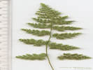 Woodsia neomexicana(?) from Alderfer/Three Sisters Park. Woodsia neomexicana(?) from Alderfer/Three Sisters Park.
|
|
Plants of Jefferson County Open Space
Jefferson County, Colorado
Dryopteridaceae
Woodsia neomexicana Windham.
New Mexico Cliff Fern.
Alderfer/Three Sisters Park, Jefferson County, Colorado.
Buffalo Creek riparian drainage, 2.58 km. west of Evergreen Lake.
39.6325°N, 105.3565°W.
WGS 1984
Elev. 2261 m.
North-facing granitic outcrop, overhanging water.
Collected by permit: Jefferson County Open Space Natural Resources Staff.
|
Anthony Massaro s.n.
|
5-Aug-2020 |
|
|
|
Locations:
Kinney Run.
|
|
Tuesday, 11 August 2020
|
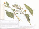 Coll. No. 2416, Oenothera biennis Coll. No. 2416, Oenothera biennis
|
2416
|
Oenothera, probably O. biennis.
|
Native and Naturalized Flora of the Golden Area, Jefferson County, Colorado
Onagraceae
Oenothera biennis L.
King's-Cureall.
Deadman Gulch, Jefferson County, Colorado.
Stonebridge HOA-owned open space between Mourning Dove Lane and Blue Jay Drive, above Eagle Ridge Drive and below Jefferson County Open Space Apex Park, 4.12 km. south of the GNIS location of Golden.
39.7271°N, 105.2198°W.
WGS 1984
Elev. 1850 m.
Hairs lacking red pustular bases.
Mixed foothills shrubland and grassland.
Collected during CNHP survey of Stonebridge HOA open space contracted by Stewards of Golden Open Space.
Collected by permit: City of Golden, 2020, issued: Apr 9, 2020, to: Tom Schweich.
|
Tom Schweich, with Susan Panjabi and Zachariah Wilson
2416. |
11-Aug-2020 |
|
Coll. No. 2416, 11 Aug 2020, characters observed:
Perennial (biennial?), to 60 cm.,
hairy throughout,
hairs lacking red pustular bases;
Stem,
leafy;
Leaves,
basal, unknown,
cauline, 90-115 mm. × 23-35 mm.,
elliptic to falcate,
margin shallowly dentate,
tip acute;
Sepals,
11 mm.,
spreading to reflexed in maturity,
tips barely free in bud;
Flowers,
solitary in leafy bracteate spike,
petals, 10 mm., obovate, yellow, fading both orange and pink;
Stigma,
4-lobed;
Capsules,
17-21 mm.,
not mature;
|
|
|
2417
|
Wild hops.
|
Native and Naturalized Flora of the Golden Area, Jefferson County, Colorado
Cannabaceae
Humulus lupulus L. var. neomexicanus A. Nelson & Cockerel.
Wild Hops.
Deadman Gulch, Jefferson County, Colorado.
In a small wetland in Deadman Gulch about mid-way between Kinney Run and Apex Park, 2.37 km. south of the GNIS location of Golden.
39.7292°N, 105.2182°W.
WGS 1984
Elev. 1827 m.
Sprawling in the grass and climbing on Prunus americana.
Also seen or collected here: Crataegus succulenta, Prunus americana, Epilobium hirsutum, and Arctium minus.
Nomenclature per FNANM.
Collected by permit: City of Golden, 2020, issued: Apr 9, 2020, to: Tom Schweich.
|
Tom Schweich, with Susan Panjabi and Zachariah Wilson
2417. |
11-Aug-2020 |
|
|
|
Other articles:
• Golden Checklist Flora:
Eriocoma scribneri;
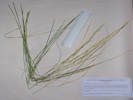 Coll. No. 2418, Coll. No. 2418, Achnatherum Eriocoma scribneri
|
2418
|
Achnatherum, maybe A. scribneri ???
|
Native and Naturalized Flora of the Golden Area, Jefferson County, Colorado
Poaceae
Achnatherum scribneri (Vasey) Barkworth.
Kinney Run, Jefferson County, Colorado.
Along the cliffs on the east side of Kinney Run, south of Tripp Ranch, and north of Heritage Dells Park. 4.7 km. south of the GNIS location of Golden
39.7236°N, 105.2126°W.
WGS 1984
Elev. 1866 m.
Uunder the overhang of sandstone cliff.
Coordinates estimated with GoogleEarth.
Collected by permit: City of Golden, 2020, issued: Apr 9, 2020, to: Tom Schweich.
|
Tom Schweich, with Susan Panjabi and Zachariah Wilson
2418. |
11-Aug-2020 |
|
Coll. No. 2418, 11 August 2020, characters observed:
Perennial grass, to 47 cm., clumped;
Stem, herbaceous;
Leaves,
blade and sheath differentiated,
soft;
Sheath,
96 mm.,
open,
margin villous,
villous at throat;
Ligule,
0.8 mm.,
membraneous,
lacerate or ciliate;
Auricles,
absent;
Blade,
380 mm. × 2.4 mm. wide,
revolute;
Inflorescence,
1 per culm,
≤leaves,
panicle,
120 mm. × 8 mm. wide,
2+ branches;
Rachis,
not extended,
scabrous;
Spikelets,
many,
11 mm.,
similar,
borne singly,
stalked,
pedicels 2-6.5 mm.;
Compression,
unremarkable;
Disarticulation,
above the glumes;
Glumes,
lower,
12.5 mm.,
veins, #3,
upper,
9 mm.,
veins, #3,
±parallel,
rounded,
membranous,
awns, absent;
Florets,
1 per spikelet,
bisexual;
Callus,
sharp;
Lemma,
6.5 mm.,
<glumes,
rolled,
hairy throughout,
longest hairs at apex, 2.7 mm.,
veins, #≥5,
awns,
#1, 15-16 mm.,
bent twice,
twisted,
attached, end;
Palea,
2.5 mm.,
<lemma,
membranous,
keel or mid-vein, hairy,
colorless,
entire.
|
|
Locations:
Deadman Gulch.
Eagle Ridge.
Kinney Run.
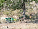 Camp site on Eagle Ridge. Camp site on Eagle Ridge.
 Camp site on Eagle Ridge. Camp site on Eagle Ridge.
|
|
Monday, August 17, 2020
Eagle Ridge and Deadman Gulch
|
 Coll. No. 2419, Humulus lupulus Coll. No. 2419, Humulus lupulus
|
2419
|
Wild hops in the open pit of a former mine.
|
Native and Naturalized Flora of the Golden Area, Jefferson County, Colorado
Cannabaceae
Humulus lupulus L. var. neomexicanus A. Nelson & Cockerel.
Wild Hops.
Eagle Ridge, Jefferson County, Colorado.
In a pit of a former mine on the east side of the locally named “Eagle Ridge”, 400 m. west of the intersection of US Highway 6 and Heritage Road, 3.76 km. south of the GNIS location of Golden.
39.7304°N, 105.2126°W.
WGS 1984
Elev. 1800 m.
A little past its prime, but an interesting collection given the affinity of the Hops Azure butterfly.
With Cercocarpus montanus and Ribes cereum, twining on Cercocarpus montanus.
Nomenclature per FNANM. This area was collected by Handsford T. Shacklette (27 Jun 1959, 24 vouchers at COLO), but Humulus was not among his collections.
Collected by permit: City of Golden, 2020, issued: Apr 9, 2020, to: Tom Schweich.
|
Tom Schweich
2419. |
17-Aug-2020 |
|
|
|
Other articles:
• Field Notes:
Coll. No. 2437, 28 Aug 2020;
|
2419.1
|
A vine, maybe a jasmine(???) Clematis orientalis, see Coll. No. 2437, 28 Aug 2020.
|
|
|
2420
|
Clematis ligustifolia.
|
Native and Naturalized Flora of the Golden Area, Jefferson County, Colorado
Ranunculaceae
Clematis ligusticifolia Nutt.
Western White Clematis.
Eagle Ridge, Jefferson County, Colorado.
In a pit of a former mine on the east side of the locally named “Eagle Ridge,” 430 m. west of the intersection of US Highway 6 and Heritage Road, 3.70 km. south of the GNIS location of Golden.
39.7308°N, 105.213°W.
WGS 1984
Elev. 1847 m.
Also collected in these pits: Clematis orientalis and Humulus lupulus var. neomexicana. Vegetation outside the pits is foothills shrubland, including Cercocarpus montanus and Holodiscus dumosa.
Collected by permit: City of Golden, 2020, issued: Apr 9, 2020, to: Tom Schweich.
|
Tom Schweich
2420. |
17-Aug-2020 |
|
|
|
|
2421
|
Ericameria nauseosa var. nauseosa.
|
Native and Naturalized Flora of the Golden Area, Jefferson County, Colorado
Asteraceae
Ericameria nauseosa (Pall. ex Pursh) G. I. Nesom & G. I. Baird var. nauseosa.
Rubber Rabbitbush.
Eagle Ridge, Jefferson County, Colorado.
Low on the north and east slopes of “Eagle Ridge,” an informally named hogback between US Highway 6 and Deadman Gulch (Kinney Run), 3.26 km. south of the GNIS location of Golden.
39.7336°N, 105.2147°W.
WGS 1984
Elev. 1803 m.
With Rhus trilobata, Cercocarpus montanus, Pediomelum tenuiflorum, Linum lewisii, and dried-up grasses.
See also Coll. No. 2440., same taxon and location, 11 days later.
Collected by permit: City of Golden, 2020, issued: Apr 9, 2020, to: Tom Schweich.
|
Tom Schweich
2421. |
17-Aug-2020 |
|
|
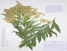 Coll. No. 2422, Solidago gigantea Coll. No. 2422, Solidago gigantea
|
2422
|
Solidago, maybe S. canadensis.
|
Native and Naturalized Flora of the Golden Area, Jefferson County, Colorado
Asteraceae
Solidago gigantea Aiton.
Giant Goldenrod.
Deadman Gulch, Jefferson County, Colorado.
In Deadman Gulch (Kinney Run) between US Highway 6 and Eagle Ridge Drive, on the edge of the perennial creek, around the retention pond, and further upstream along the creek, 3.17 km. south of the GNIS location of Golden.
39.7341°N, 105.2155°W.
WGS 1984
Elev. 1793 m.
Inflorescence full of little crab spiders colored the same yellow as the corollas.
Collected by permit: City of Golden, 2020, issued: Apr 9, 2020, to: Tom Schweich.
|
Tom Schweich
2422. |
17-Aug-2020 |
|
Coll. No. 2422, 17 Aug 2020, characters observed:
Perennial herb, 60 cm.
(growing on a steep stream bank);
Stem,
glabrous,
becoming hairy in the inflorescence;
Leaves,
basal unknown,
cauline,
alternate,
petiole, 5 mm. or subsessile,
blade, 90 mm. × 15 mm. wide,
distally reduced in size but abundant,
lanceolate-elliptic,
entire,
ciliate with small curved hairs,
distally widely-spaced serrate;
Inflorescence,
pyramidal, paniculate, ±secund;
Peduncles,
3-5 mm.;
Involucre,
3 mm. × 4 mm. wide,
spheric(?),
lightly glandular;
Phyllaries,
unequal,
2+ series,
lower <rest of involucre,
green to chartaceous,
margins flat;
Receptacle,
very short scales(?),
definitely not flat;
Flowers,
of 2 kinds;
Rays,
#11,
tube 2 mm. + blade 1.5 mm. × 0.3 mm. wide,
yellow,
fertile;
Disk flowers,
#7
tube 2.8 mm. + lobes 0.9 mm.,
throat expanding gradually,
yellow,
open,
bisexual;
Pappus,
bristles,
2.8 mm.,
equal;
Stamens,
not tailed;
Style,
2-branched,
±brushlike appendages;
Stigma,
0.5 mm., >style appendages (0.4 mm.);
Fruit,
1 mm.,
hairy,
beak-less.
|
|
Other articles:
• Golden Checklist Flora:
Cyclachaena xanthifolia;
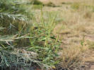 Coll. No. 2423, Cyclachaena xanthiifolia Coll. No. 2423, Cyclachaena xanthiifolia
|
2423
|
Cyclachaena xanthiifolia.
|
Native and Naturalized Flora of the Golden Area, Jefferson County, Colorado
Asteraceae
Cyclachaena xanthiifolia (Nutt.) Fresen.
Carelessweed.
Deadman Gulch, Jefferson County, Colorado.
Along Deadman Gulch (Kinney Run), between US Highway 6 and Eagle Ridge Drive, collected at the edge of the concrete of the retention pond dam, 3.18 km. south of the GNIS location of Golden.
39.734°N, 105.2156°W.
WGS 1984
Elev. 1796 m.
Also seen around the edge of the pond and along the Kinney Run Trail nearly to Eagle Ridge Drive. The pond and dam were reconstructed in late 2016 so these would have established here since then.
Collected by permit: City of Golden, 2020, issued: Apr 9, 2020, to: Tom Schweich.
|
Tom Schweich
2423. |
17-Aug-2020 |
|
|
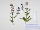 Coll. No. 2424, Salvia cf. pratensis. Coll. No. 2424, Salvia cf. pratensis.
|
2424
|
Salvia, maybe S. farinacea or S. nemorosa &slquo;Blue by You’ from Darwin Perennials, per the CO-HORTS blog.
|
Native and Naturalized Flora of the Golden Area, Jefferson County, Colorado
Lamiaceae
Salvia cf. pratensis L.
Meadow Clary.
Deadman Gulch, Jefferson County, Colorado.
Along Deadman Gulch (Kinney Run), between US Highway 6 and Eagle Ridge Drive, on a bank of the creek, 3.24 km. south of the GNIS location of Golden.
39.7336°N, 105.2157°W.
WGS 1984
Elev. 1792 m.
Likely garden escapee.
Collected by permit: City of Golden, 2020, issued: Apr 9, 2020, to: Tom Schweich.
|
Tom Schweich
2424. |
17-Aug-2020 |
|
|
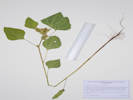 Coll. No. 2425, Arctium minus. Coll. No. 2425, Arctium minus.
|
2425
|
Burdock?
|
Native and Naturalized Flora of the Golden Area, Jefferson County, Colorado
Asteraceae
Arctium minus Bernh.
Lesser Burdock.
Deadman Gulch, Jefferson County, Colorado.
Along Deadman Gulch (Kinney Run), between US Highway 6 and Eagle Ridge Drive, on a bank of the creek, 3.24 km. south of the GNIS location of Golden.
39.7336?N, 105.2156?W.
WGS 1984
Elev. 1792 m.
Also seen in several other places along Deadman Gulch.
Colorado Noxious Weed List C.
Collected by permit: City of Golden, 2020, issued: Apr 9, 2020, to: Tom Schweich.
|
Tom Schweich
2425. |
17-Aug-2020 |
|
|
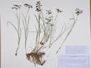 Coll. No. 2426, Juncus articulatus. Coll. No. 2426, Juncus articulatus.
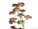 Inflorescence of Coll. No. 2426, Juncus articulatus. Inflorescence of Coll. No. 2426, Juncus articulatus.
|
2426
|
Juncus of some sort.
|
Native and Naturalized Flora of the Golden Area, Jefferson County, Colorado
Juncaceae
Juncus articulatus L.
Joint-Leaf Rush.
Deadman Gulch, Jefferson County, Colorado.
Along Deadman Gulch (Kinney Run), between US Highway 6 and Eagle Ridge Drive, on a bank of the creek, just upstream of a retention pond, 3.24 km. south of the GNIS location of Golden.
39.7336°N, 105.2156°W.
WGS 1984
Elev. 1791 m.
Also collected here: Arctium minus, Cyclachaena xanthiifolia, and a horticultural Salvia.
Collected by permit: City of Golden, 2020, issued: Apr 9, 2020, to: Tom Schweich.
|
Tom Schweich
2426. |
17-Aug-2020 |
| Coll. No. 2426, 17 Aug 2020, characters observed:
Perennial, to 30 cm.,
rooting at lower nodes;
Leaves,
sheath, 35 mm., not terminating in a bristle tip,
auricles, 1.4-1.7 mm.,
blade, 95 mm., terete above the sheath, septate;
Inflorescence,
appears terminal,
subtending bract 26 mm., <inflorescence, not appearing to be a continuation of stem,
paniculate,
many heads,
flowers not subtended by a pair of scarious bracteoles,
bracts subtending each flower brown;
Tepals, 2.3 mm., brown, margins scarious;
Stamens, #6;
Capsule, 3 mm., ellipsoid, exserted 1 mm. beyond tepals.
Generally thought to be circumboreal, although listed as alien by Weber & Wittmann (2012).
|
|
Locations:
Apex Park - Northern Parcel.
|
|
Wednesday, 19 August 2020
Apex Park - North
|
|
|
2427
|
Geranium caespitosum.
Plants of Jefferson County Open Space
Jefferson County, Colorado
Geraniaceae
Geranium caespitosum James.
Pineywoods Geranium.
Apex Park - Northern Parcel, Jefferson County, Colorado.
East-central corner of park where multiple unnamed gulches join before flowing through Stonebridge HOA, 4.42 km. south of the GNIS location of Golden.
39.7251°N, 105.2174°W.
WGS 1984
Elev. 1824 m.
Basal leaves mostly withered.
Around the edges of a thicket of Crataegus succulenta, Prunus americana, and Rhus trilobata.
Collected by permit: Jefferson County Open Space, 2020, issued: Apr 13, 2020, to: Tom Schweich.
|
Tom Schweich
2427. |
19-Aug-2020 |
|
|
|
|
2428
|
Liatris punctata.
Plants of Jefferson County Open Space
Jefferson County, Colorado
Asteraceae
Liatris punctata Hook.
Dotted Blazing Star.
Apex Park - Northern Parcel, Jefferson County, Colorado.
East-central corner of park where multiple unnamed gulches join before flowing through Stonebridge HOA, 4.44 km. south of the GNIS location of Golden.
39.725°N, 105.2177°W.
WGS 1984
Elev. 1853 m.
Very short presumably because of the hot dry summer.
Foothills grassland, with both foothills and riparian shrubland nearby, open southeast-facing slope with Heterotheca villosa, and Hesperostipa comata.
Collected by permit: Jefferson County Open Space, 2020, issued: Apr 13, 2020, to: Tom Schweich.
|
Tom Schweich
2428. |
19-Aug-2020 |
|
|
|
|
2429
|
Gutierrezia sarothrae.
Plants of Jefferson County Open Space
Jefferson County, Colorado
Asteraceae
Gutierrezia sarothrae (Pursh) Britton & Rusby.
Broom Snakeweed.
Apex Park - Northern Parcel, Jefferson County, Colorado.
East-central corner of park where multiple unnamed gulches join before flowing through Stonebridge HOA, 4.44 km. south of the GNIS location of Golden.
39.7249°N, 105.218°W.
WGS 1984
Elev. 1855 m.
Flowers just beginning to open.
Foothills grassland, with both foothills and riparian shrubland nearby, toe of small east-facing ridge with Helianthus pumilus, Artemisia dracunculus, and Koeleria maculata.
Collected by permit: Jefferson County Open Space, 2020, issued: Apr 13, 2020, to: Tom Schweich.
|
Tom Schweich
2429. |
19-Aug-2020 |
|
|
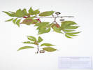 Voucher of Coll. No. 2430, Prunus americana. Voucher of Coll. No. 2430, Prunus americana.
|
2430
|
Prunus americana.
|
Native and Naturalized Flora of the Golden Area, Jefferson County, Colorado
Rosaceae
Prunus americana Marshall.
American Plum.
Apex Park - Northern Parcel, Jefferson County, Colorado.
East-central corner of park where multiple unnamed gulches join before flowing through Stonebridge HOA, 4.44 km. south of the GNIS location of Golden.
39.725°N, 105.2183°W.
WGS 1984
Elev. 1853 m.
In fruit, color reddish and not bluish.
Edge of dry stream bed in thicket with Crataegus succulenta and Rhus trilobata.
Collected by permit: Jefferson County Open Space, 2020, issued: Apr 13, 2020, to: Tom Schweich.
|
Tom Schweich
2430. |
19-Aug-2020 |
|
|
|
|
2431
|
Ericameria nauseosa var. graveolens.
Plants of Jefferson County Open Space
Jefferson County, Colorado
Asteraceae
Ericameria nauseosa (Pall. ex Pursh) G.L.Nesom & G.I.Baird var. graveolens (Nutt.) Reveal & Schuyler.
Apex Park - Northern Parcel, Jefferson County, Colorado.
East-central corner of park where multiple unnamed gulches join before flowing through Stonebridge HOA, small ridge between gulches, 4.47 km. south of the GNIS location of Golden.
39.7247°N, 105.2192°W.
WGS 1984
Elev. 1868 m.
One of the early blooming plants.
Mixed foothills shrubland and grassland, also seen or collected here: Artemisia dracunculus, Senecio spartioides, Solidago missouriensis, and Xanthisma spinulosum.
Collected by permit: Jefferson County Open Space, 2020, issued: Apr 13, 2020, to: Tom Schweich.
|
Tom Schweich
2431. |
19-Aug-2020 |
|
|
|
Other articles:
• Golden Checklist Flora:
Eriogonum effusum;
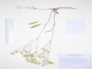 Voucher of Coll. No. 2431.1, Eriogonum effusum Voucher of Coll. No. 2431.1, Eriogonum effusum
|
2431.1
|
Erigonum effusum.
Plants of Jefferson County Open Space
Jefferson County, Colorado
Polygonaceae
Eriogonum effusum Nutt.
Spreading Buckwheat.
Apex Park - Northern Parcel, Jefferson County, Colorado.
East-central corner of park where multiple unnamed gulches join before flowing through Stonebridge HOA, small ridge between gulches, 4.47 km. south of the GNIS location of Golden.
39.7247°N, 105.2192°W.
WGS 1984
Elev. 1868 m.
Most leaves withered. Mixed foothills shrubland and grassland.
Also seen or collected here: Artemisia dracunculus, Ericameria nauseosa var. graveolens, Senecio spartioides (in bud, no flowers), Solidago missouriensis, and Xanthisma spinulosum.
Collected by permit: Jefferson County Open Space, 2020, issued: Apr 13, 2020, to: Tom Schweich.
|
Tom Schweich
2431.1 |
19-August-2020 |
|
|
|
|
2431.2
|
Artemisia dracunculoides.
Plants of Jefferson County Open Space
Jefferson County, Colorado
Asteraceae
Artemisia dracunculus L.
Tarragon, Dragon Wort.
Apex Park - Northern Parcel, Jefferson County, Colorado.
East-central corner of park where multiple unnamed gulches join before flowing through Stonebridge HOA, small ridge between gulches, 4.47 km. south of the GNIS location of Golden.
39.7247°N, 105.2192°W.
WGS 1984
Elev. 1868 m.
These with leaf galls. Mixed foothills shrubland and grassland.
Also seen or collected here: Eriogonum effusum, Ericameria nauseosa var. graveolens, Senecio spartioides (in bud, no flowers), Solidago missouriensis, and Xanthisma spinulosum.
Collected by permit: Jefferson County Open Space, 2020, issued: Apr 13, 2020, to: Tom Schweich.
|
Tom Schweich
2431.2 |
19-Aug-2020 |
|
|
|
Literature Cited:
- Semple, John C., 2016.
- Semple, John C., Katherine Kornobis, and Sofia Bzovsjy, 2018.
- Semple, John C., 2018.
|
2432
|
Solidago missouriensis.
Plants of Jefferson County Open Space
Jefferson County, Colorado
Asteraceae
Solidago nemoralis Aiton var. decemflora (DC.) Brammall ex Semple.
Gray Goldenrod.
Apex Park - Northern Parcel, Jefferson County, Colorado.
Northeast quadrant of Apex Park - North Parcel, base of the Rocky Mountains foothills scarp, 4.46 km. south of the GNIS location of Golden.
39.7248°N, 105.2193°W.
WGS 1984
Elev. 1869 m.
Small patch perhaps 3 meters across. Mixed foothils grass- and shrub-land.
Also collected nearby: Eriogonum effusum, Artemisia dracunculus, Ericameria nauseosa var. graveolens, Senecio spartioides, and Xanthisma spinulosum; the grasses having long since senesced.
Compare to Coll. No. 2433, collected 140 m. southwest.
Collected by permit: Jefferson County Open Space, 2020, issued: Apr 13, 2020, to: Tom Schweich.
|
Tom Schweich
2432. |
19-Aug-2020 |
| Coll. No. 2432 & 2433, 19 Aug 2020, characters observed:
Perennial, 30-47 cm.,
stem and leaves short hairy throughout, getting a little glandular in the inflorescence;
Leaves,
basal, absent, withered(?),
cauline,
alternate, oblanceolate,
75 mm. × 12 mm. wide in #2432 vs.
75 mm. × 27 mm. wide in #2433,
reduced above,
distally shallowly toothed,
veins, #3, lateral veins less prominent but clearly present;
Inflorescence,
panicle,
compact,
branches secund;
Involucre,
4-5 mm.,
Phyllaries,
imbricate in 3+ series,
inner, > outer, oblong, 3.6 mm. × 1 mm. wide,
veins, #1,
tips, rounded;
Flowers,
of 2 kinds;
Rays, #7(8),
tube 2.6 mm. + blade 1.8 mm.,
yellow, fertile;
Disk flowers,
#5,
tube 2.0-2.5 mm. + lobes 1.0-1.3 mm.,
yellow;
Pappus, bristles, 4 mm.
|
I'm not sure what this is.
It keys to Solidago nemoralis var. decemflora in Ackerfield (2015),
but does not look much like photos or voucher images on SEINet.
It keys to S. nana in Weber & Wittmann (2012),
but also does not look much like photos or voucher images on SEINet.
It does seem to fit into Solidago subsect. nemorales per Semple (2018).
I suppose it could be a hybrid of some sort.
I am open to other suggestions.
|
Tom Schweich
tomas@schweich.com
510-701-3418
https://www.schweich.net
|
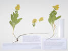
Coll. No. 2432, Solidago nemoralis ssp. decemflora |
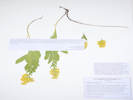
Voucher of Coll. No. 2432, Solidago nemoralis ssp. decemflora. |
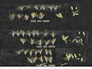
Flower parts of Coll. Nos. 2432 & 2433, Solidago nemoralis ssp. decemflora. |
|
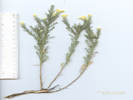 Coll. No. 2434, Xanthisma spinulosum Coll. No. 2434, Xanthisma spinulosum
|
2432.1
|
Comp with spiny leaves, -- Xanthisma spinulosum.
Plants of Jefferson County Open Space
Jefferson County, Colorado
Asteraceae
Xanthisma spinulosum (Pursh) D. R. Morgan & R. L. Hartm.
Spiny Goldenweed.
Apex Park - Northern Parcel, Jefferson County, Colorado.
Northeast quadrant of Apex Park - North Parcel, high plains at the base of the Rocky Mountains foothills scarp, 4.47 km. south of the GNIS location of Golden.
39.7248°N, 105.2193°W.
WGS 1984
Elev. 1869 m.
In the middle of a small patch of Solidago sp. Mixed foothills shrub- and grass-land.
Also collected nearby: Eriogonum effusum, Artemisia dracunculus, Ericameria nauseosa var. graveolens, and Senecio spartioides; the grasses having long since senesced due to the hot dry summer.
Several other collections and observations of this taxon nearby.
Collected by permit: Jefferson County Open Space, 2020, issued: Apr 13, 2020, to: Tom Schweich.
|
Tom Schweich
2432.1 |
19-Aug-2020 |
|
|
|
Other articles:
• Field Notes:
Coll. No. 2735, 1 Sep 21;
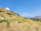 Habit of Coll. No. 2433, Solidago nemoralis ssp. decemflora Habit of Coll. No. 2433, Solidago nemoralis ssp. decemflora
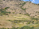 Location of a large colony of Solidago nemoralis ssp. decemflora in Apex Park. Location of a large colony of Solidago nemoralis ssp. decemflora in Apex Park.
|
2433
|
Solidago missouriensis.
Plants of Jefferson County Open Space
Jefferson County, Colorado
Asteraceae
Solidago nemoralis Aiton var. decemflora (DC.) Brammall ex Semple.
Gray Goldenrod.
Apex Park - Northern Parcel, Jefferson County, Colorado.
Northeast quadrant of Apex Park - North Parcel, base of the Rocky Mountains foothills scarp, 4.56 km. south of the GNIS location of Golden.
39.7239°N, 105.2198°W.
WGS 1984
Elev. 1886 m.
Leaves strongly 3-nerved, inflorescences with many mating assassin bugs. Large patch perhaps 40 m. × 10 m.
Mixed foothills grass- and shrub-land, the grasses having long since senesced in this long, hot, dry summer.
Compare to Coll. No. 2432, made 140 m. to the northeast.
Collected by permit: Jefferson County Open Space, 2020, issued: Apr 13, 2020, to: Tom Schweich.
|
Tom Schweich
2433. |
19-Aug-2020 |
|
Coll. No. 2432 & 2433, 19 Aug 2020, characters observed:
Perennial, 30-47 cm.,
stem and leaves short hairy throughout, getting a little glandular in the inflorescence;
Leaves,
basal, absent, withered(?),
cauline,
alternate, oblanceolate,
75 mm. × 12 mm. wide in #2432 vs.
75 mm. × 27 mm. wide in #2433,
reduced above,
distally shallowly toothed,
veins, #3, lateral veins less prominent but clearly present;
Inflorescence,
panicle,
compact,
branches secund;
Involucre,
4-5 mm.,
Phyllaries,
imbricate in 3+ series,
inner, > outer, oblong, 3.6 mm. × 1 mm. wide,
veins, #1,
tips, rounded;
Flowers,
of 2 kinds;
Rays, #7(8),
tube 2.6 mm. + blade 1.8 mm.,
yellow, fertile;
Disk flowers,
#5,
tube 2.0-2.5 mm. + lobes 1.0-1.3 mm.,
yellow;
Pappus, bristles, 4 mm.
Compared to Coll. No. 2439, Solidago nana, below, these are for primary differences:
- Leaf lateral veins more prominent.
- The number and proportion of ray flowers to disk flowers: 7 and 5 vs. 5 and 9.
- Disk flower lobes longer.
- Pappus longer.
|
I'm not sure what this is.
It keys to Solidago nemoralis var. decemflora in Ackerfield (2015),
but does not look much like photos or voucher images on SEINet.
It keys to S. nana in Weber & Wittmann (2012),
but also does not look much like photos or voucher images on SEINet.
It does seem to fit into Solidago subsect. nemorales per Semple (2018).
I suppose it could be a hybrid of some sort.
I am open to other suggestions.
|
Tom Schweich
tomas@schweich.com
510-701-3418
https://www.schweich.net
|
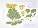
Coll. No. 2433, Solidago nemoralis ssp. decemflora |
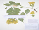
Voucher of Coll. No. 2433, Solidago nemoralis ssp. decemflora. |
Flower parts of Coll. Nos. 2432 & 2433, Solidago nemoralis ssp. decemflora. |
|
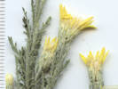 Detail of Coll. No. 2434, Xanthisma spinulosum Detail of Coll. No. 2434, Xanthisma spinulosum
|
2434
|
Xanthisma spinulosum.
Plants of Jefferson County Open Space
Jefferson County, Colorado
Asteraceae
Xanthisma spinulosum (Pursh) D. R. Morgan & R. L. Hartm.
Spiny Goldenweed.
Apex Park - Northern Parcel, Jefferson County, Colorado.
Northeast quadrant of Apex Park - North Parcel, high plains at the base of the Rocky Mountains foothills scarp, 4.63 km. south of the GNIS location of Golden.
39.7236°N, 105.219°W.
WGS 1984
Elev. 1885 m.
Plants in various stages of bud, flower, and fruit.
East-facing slope above an unnamed gulch. Mixed foothills shrub- and grass-land, though mostly grasses here, which have long since senesced because of the hot dry summer.
Same as Coll. No. 2432.1.
Collected by permit: Jefferson County Open Space, 2020, issued: Apr 13, 2020, to: Tom Schweich.
|
Tom Schweich
2434. |
19-Aug-2020 |
|
|
|
Other articles:
• Golden Checklist Flora:
Epilobium hirsutum;
Locations:
Deadman Gulch.
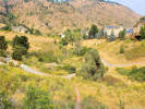 Deadman Gulch in Stonebridge HOA Deadman Gulch in Stonebridge HOA
|
|
Deadman Gulch
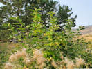
Wild hops growing on Chokecherry, with Hairy Willow herb below. |
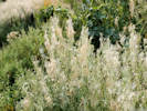
Hairy Willow Herb (Epilobium hirsutum) in Deadman Gulch. |
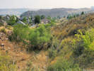
Deadman Gulch on private land between Stonebridge HOA and Jefferson County Open Space. |
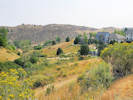
Deadman Gulch from the west. |
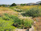
Hairy Willow Herb (Epilobium hirsutum) in Deadman Gulch. |
|
|
Locations:
Deadman Gulch.
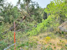 Location of Coll. No. 2435, Parthenocissus vitacea Location of Coll. No. 2435, Parthenocissus vitacea
|
2435
|
Woodbine, for sure, maybe Parthenocissus vitacea, large leaves, but otherwise sterile and unidentifiable.
|
|
|
2436
|
Physalis, probably P. hederifolia.
|
|
Locations:
Deadman Gulch.
Eagle Ridge.
Kinney Run.
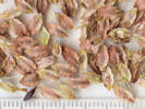 Seed of Eriogonum alatum Seed of Eriogonum alatum
|
|
Friday, 28 August 2020
Eagle Ridge, Deadman Gulch, and Kinney Run
|
|
Other articles:
• Field Notes:
Coll. No. 2419.1, 17 Aug 2020;
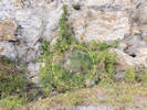 Coll. No. 2437, Clematis orientalis Coll. No. 2437, Clematis orientalis
|
2437
|
Clematis orientalis.
p>
|
Native and Naturalized Flora of the Golden Area, Jefferson County, Colorado
Ranunculaceae
Clematis orientalis L.
Oriental Virginsbower.
Eagle Ridge, Jefferson County, Colorado.
In a former mine pit on the east side of “Eagle Ridge,” an informal name for a hogback between US Highway 6 and Eagle Ridge Drive, 3.76 km. south southeast of the GNIS location of Golden.
39.7305°N, 105.2126°W.
WGS 1984
Elev. 1850 m.
Also found in this pit: Humulus lupulus var. neomexicanus; Clematis ligusticifolia in the next pit to the north, vegetation just outside the pit is foothills shrubland above grassland.
Colorado Noxious Weed List B
Collected by permit: City of Golden, 2020, issued: Apr 9, 2020, to: Tom Schweich.
|
Tom Schweich
2437. |
28-Aug-2020 |
|
|
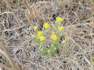 Coll. No. 2438, Xanthisma spinulosum Coll. No. 2438, Xanthisma spinulosum
|
2438
|
Xanthisma spinulosa.
|
Native and Naturalized Flora of the Golden Area, Jefferson County, Colorado
Asteraceae
Xanthisma spinulosum (Pursh) D. R. Morgan & R. L. Hartm.
Spiny Goldenweed.
Eagle Ridge, Jefferson County, Colorado.
Northeast limb of “Eagle Ridge,” an informal name for a hogback between US Highway 6 and Eagle Ridge Drive, 3.66 km. south southeast of the GNIS location of Golden.
39.7311°N, 105.2126°W.
WGS 1984
Elev. 1831 m.
Foothills grassland below shrubland, with Artemisia dracunculus, Ericameria nauseosa var. nauseosa, Helianthus pumilis, Bromus inermis, and a Poa.
Collected by permit: City of Golden, 2020, issued: Apr 9, 2020, to: Tom Schweich.
|
Tom Schweich
2438. |
28-Aug-2020 |
|
|
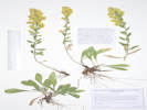 Coll. No. 2439, Solidago nana. Coll. No. 2439, Solidago nana.
|
2439
|
Solidago, maybe S. nana.
|
Native and Naturalized Flora of the Golden Area, Jefferson County, Colorado
Asteraceae
Solidago nana Nutt.
Baby Goldenrod.
Eagle Ridge, Jefferson County, Colorado.
At the north end of “Eagle Ridge,” an informally named hogback between US Highway 6 and Eagle Ridge Drive, under the powerline tower, 3.36 km. south southeast of the GNIS location of Golden.
39.7328°N, 105.215°W.
WGS 1984
Elev. 1846 m.
Ponderosa pines and foothills shrubland, mostly Cercocarpus montanus.
Collected by permit: City of Golden, 2020, issued: Apr 9, 2020, to: Tom Schweich.
|
Tom Schweich
2439. |
28-Aug-2020 |
|
Coll. No. 2439, 28 August 2020, characters observed:
Perennial herb, 25-30 cm.,
from a stout creeping caudex,
short hairy throughout;
Leaves,
basal,
petiole 30 mm. + blade 50 mm. × 18 mm. wide,
obovate (almost spathulate),
cauline,
subsessile,
23 mm. × 8 mm wide,
reduced distally,
oblanceolate,
entire,
veins, #3, but lateral veins very obscure,
eglandular,
margins, entire, ciliate,
tips, acuminate;
Inflorescence,
pyramidal,
branches, secund,
not overtopped by leaves;
Peduncles,
1.0-1.3 mm.;
Involucre,
3.5 mm. × 2.5-3.0 mm. wide,
campanulate;
Phyllaries,
unequal,
in 3+ series,
upper, largest, 3 mm. × 1.3 mm. wide,
veins, 1 prominent, maybe 2 lateral very obscure,
green, margin, chartaceous, flat,
tips, rounded, few little hairs;
Receptacle,
epaleate;
Flowers, of 2 kinds;
Rays,
#5,
tube 2 mm. + blade 1.2 mm. × 0.6 mm. wide,
yellow,
fertile;
Disk flowers,
#9,
tube 3 mm. + lobes 0.7 mm.,
throat expanding gradually,
yellow;
Pappus,
many,
well-developed,
bristles,
2.7 mm.,
±equal.
|
|
Locations:
Eagle Ridge.
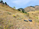 Habitat of Coll. No. 2440, Ericameria nauseosa var. nauseosa Habitat of Coll. No. 2440, Ericameria nauseosa var. nauseosa
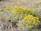 Coll. No. 2440, Ericameria nauseosa var. nauseosa Coll. No. 2440, Ericameria nauseosa var. nauseosa
|
2440
|
Ericameria nauseosa var. nauseosa.
|
Native and Naturalized Flora of the Golden Area, Jefferson County, Colorado
Asteraceae
Ericameria nauseosa (Pall. ex Pursh) G. I. Nesom & G. I. Baird var. nauseosa.
Rubber Rabbitbush.
Eagle Ridge, Jefferson County, Colorado.
North slope of “Eagle Ridge,” an informally named hogback between US Highway 6 and Deadman Gulch (Kinney Run), just below the Cercocarpus montanus, 3.26 km. south of the GNIS location of Golden.
39.7335°N, 105.2149°W.
WGS 1984
Elev. 1806 m.
Shrubs are 15-20 cm. in height, much shorter than our more common variety graveolens. This particular shrub is phenologically ahead of others nearby.
See also Coll. No. 2421, same taxon and location, 11 days earlier.
Collected by permit: City of Golden, 2020, issued: Apr 9, 2020, to: Tom Schweich.
|
Tom Schweich
2440. |
28-Aug-2020 |
|
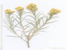
Coll. No. 2440, Ericameria nauseosa var. nauseosa |
|
|
|
2441
|
Symphyotrichum laeve — Nope, hairs in lines decurrent with the leaves.
|
Native and Naturalized Flora of the Golden Area, Jefferson County, Colorado
Asteraceae
Symphyotrichum lanceolatum (Willd.) G. L. Nesom ssp. hesperium (A. Gray) G. L. Nesom.
Western Lance-Leaved Aster.
Deadman Gulch, Jefferson County, Colorado.
On the edge of the streambed in Deadman Gulch (Kinney Run), above US Highway 6 and just below Eagle Ridge Drive, 3.43 km. south of the GNIS location of Golden.
39.7322°N, 105.2159°W.
WGS 1984
Elev. 1794 m.
Riparian, also seen or collected nearby: Clematis ligusticifolia, Mirabilis nyctaginea, Crataegus succulenta, and Epilobium hirsutum.
Collected by permit: City of Golden, 2020, issued: Apr 9, 2020, to: Tom Schweich.
|
Tom Schweich
2441. |
28-Aug-2020 |
|
|
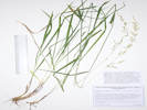 Coll. No. 2442, Arrhenatherum elatius Coll. No. 2442, Arrhenatherum elatius
|
2442
|
Definitely a grass, maybe Muhlenbergia montana.
|
Native and Naturalized Flora of the Golden Area, Jefferson County, Colorado
Poaceae
Arrhenatherum elatius (L.) P. Beauv. ex J. Presl & C. Presl.
Tall Oatgrass.
Deadman Gulch, Jefferson County, Colorado.
On the edge of the streambed in Deadman Gulch (Kinney Run), above US Highway 6 and just below Eagle Ridge Drive, 3.43 km. south of the GNIS location of Golden.
39.7321°N, 105.2158°W.
WGS 1984
Elev. 1803 m.
Riparian, also seen or collected nearby: Clematis ligusticifolia, Mirabilis nyctaginea, Crataegus succulenta, Epilobium hirsutum, and Symphyotrichum lanceolatum var. hesperium.
Collected by permit: City of Golden, 2020, issued: Apr 9, 2020, to: Tom Schweich.
|
Tom Schweich
2442. |
28-Aug-2020 |
| Coll. No. 2442, 28 August 2020, characters observed:
Perennial, to 115 cm.,
tufted, no rhizomes observed;
Leaves,
sheath, 100 mm., open,
ligule, 2.5 mm., membranous, erose,
blade, 30 mm. × 5 mm. wide, flat, barely scabrous;
Inflorescence, 1 per culm, >leaves, panicle, 200 mm. × 40 mm. wide;
Rachis, not extended, delicate;
Spikelets, many, 8 mm. × 2.3 mm. wide + awn, similar, borne singly;
Disarticulation, above the glumes;
Glumes,
very thin, translucent,
lower, 5 mm., veins, #1, tip bifid,
upper, 9 mm., =lowest floret, veins, #3, ±parallel,
awns, absent;
Florets,
2 per spikelet;
Callus, straight hairs, 2.3 mm.;
Lemma, 8 mm., =glumes, veins, #7,
awn, #1, 14 mm., twisted, round, attached near base (2.3/8.0);
Palea, 6 mm., membranous, margin, ciliate.
|
|
|
2442.1
|
Mirabilis nyctaginaea.
|
Native and Naturalized Flora of the Golden Area, Jefferson County, Colorado
Nyctaginaceae
Mirabilis nyctaginea (Michx.) MacMill.
Heartleaf Four O'Clock.
Deadman Gulch, Jefferson County, Colorado.
On the bank southwest side above the creek in Deadman Gulch (Kinney Run), above US Highway 6 and just below Eagle Ridge Drive, 3.43 km. south of the GNIS location of Golden.
39.7321°N, 105.2158°W.
WGS 1984
Elev. 1803 m.
Riparian, also seen or collected nearby: Clematis ligusticifolia, Crataegus succulenta, Epilobium hirsutum, Symphyotrichum lanceolatum var. hesperium, and Arrhenatherum eliatus.
Collected by permit: City of Golden, 2020, issued: Apr 9, 2020, to: Tom Schweich.
|
Tom Schweich
2442.1 |
28-Aug-2020 |
|
|
|
Other articles:
• Golden Checklist Flora:
Clematis orientalis;
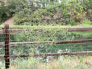 Clematis orientalis, a List B noxious weed on the fence beside the Clear Creek Trail. Clematis orientalis, a List B noxious weed on the fence beside the Clear Creek Trail.
 Clematis orientalis in a tree beside Clear Creek. Clematis orientalis in a tree beside Clear Creek.
|
|
29 August 2020
Walk along Clear Creek Trail.
|
|
Other articles:
• Magpie Gulch Trail:
at New Loveland Mine Park;
Locations:
New Loveland Mine Park.
 Informational sign at New Loveland Mine Park. Informational sign at New Loveland Mine Park.
|
|
Full moon tomorrow night.
Moonrise at New Loveland Mine Park. |
Moonrise at New Loveland Mine Park. |
|
|
Locations:
Deadman Gulch.
|
|
Friday, September 4, 2020
Kinney Run and Deadman Gulch to look at plums.
|
|
Other articles:
• Golden Checklist Flora:
Prunus americana;
Notes on Prunus americana;
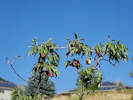 Coll. No. 2443, Prunus americana Coll. No. 2443, Prunus americana
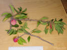 Coll. No. 2443, Prunus americana Coll. No. 2443, Prunus americana
|
2443
|
Prunus americana, in fruit.
|
Native and Naturalized Flora of the Golden Area, Jefferson County, Colorado
Rosaceae
Prunus americana Marshall.
American Plum.
Deadman Gulch, Jefferson County, Colorado.
Around edges of small wetland in Deadman Gulch, 3.80 km. south of the GNIS location of Golden.
39.7294°N, 105.2178°W.
WGS 1984
Elev. 1823 m.
Fruit reddish-purple, slightly glaucous, not bluish at all.
Climbed upon by Humulus lupulus, also here: Epilobium hirsutum, and E. ciliatum, Urtica dioica, and Crataegus succulenta.
Collected by permit: City of Golden, 2020, issued: Apr 9, 2020, to: Tom Schweich.
|
Tom Schweich
2443. |
4-Sep-2020 |
|
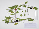
Coll. No. 2443, Prunus americana |
|
|
Other articles:
• 4th Street:
1004 4th Street;
• Golden Checklist Flora:
Senecio spartioides;
Notes on Senecio spartioides;
 1004 4th Street. 1004 4th Street.
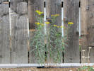 Senecio spartioides adventive in my garden. Senecio spartioides adventive in my garden.
|
|
A Very Smokey Sunday, September 6, 2020
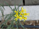
Senecio spartioides adventive in my garden. |
|
|
Other articles:
• Clear Creek Trail:
at bridge;
below 10th;
bet. 9th and 10th;
Locations:
Mount Galbraith.
Tucker Gulch (lower).
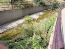 Hairy Willowherb in Tucker Gulch above 10th Street Hairy Willowherb in Tucker Gulch above 10th Street
|
|
Monday, September 14, 2020
Walk down Tucker Gulch, along Clear Creek, and return via the Magpie Gulch Trail.
Hairy Willowherb in Tucker Gulch between 10th and Water Streets |
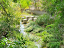
More Hairy Willowherb in Tucker Gulch near Clear Creek. |
View of Mt Galbraith from Magpie Gulch Trail |
|
|
Other articles:
• Recreational Trail (Pine Ridge Estates):
near Jesse Ln;
Locations:
Dakota Ridge.
 Dakota Ridge from the Cul-de-sac at the end of Jesse Lane. Dakota Ridge from the Cul-de-sac at the end of Jesse Lane.
|
|
Thursday, September 17, 2020
Dakota Ridge with the Mines Bighorn Team
Definitely a Escobaria, likely E. vivipara |
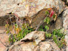
Western Poison Ivy on the backbone of Dakota Ridge. |
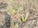
Opuntia polyacantha on Dakota Ridge. |
|
|
Other articles:
• Arapahoe Street:
near 5th;
 Parkway almost ready to plant. Parkway almost ready to plant.
 Parkway almost ready to plant. Parkway almost ready to plant.
|
|
Photographs of parkway at 5th and Arapahoe, the site of my next prairie project.
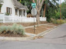
Parkway almost ready to plant. |
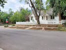
Parkway almost ready to plant. |
|
|
Other articles:
• Glossary:
conglomerate;
Locations:
Dakota Ridge.
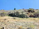 Outcrop with pebble conglomerate on Dakota Ridge. Outcrop with pebble conglomerate on Dakota Ridge.
|
|
Monday, September 21, 2020
Pebbly conglomerate on Dakota Ridge. |
|
|
Other articles:
• Lubahn Trail (South Loop):
at rim;
just below rim;
just above spur;
at Olivine Trl;
at s.b. 5;
at s.b. 4;
at s.b. 3;
at s.b. 2;
at switch back;
at trailhead;
• Lubahn Spur:
at n edge;
center of outcrop;
• Old Quarry Trail:
at w. end;
at Olivine Trl;
at social trail;
along trail;
along trail;
at Dome Flow Trl;
• Olivine Trail:
at Old Quarry Trl;
at s.b. 10;
along trail;
below G;
at s.b. 8;
at s.b. 7;
at Lubahn Trl;
• Glossary:
conglomerate;
Locations:
South Table Mountain.
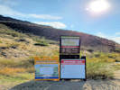 Trailhead at south end of Belvedere Street. Trailhead at south end of Belvedere Street.
|
|
Tuesday, September 22, 2020
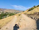
Switchback #1: The view is looking northwest. |
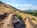
Switchback #2: view to southeast directly into the sun. |
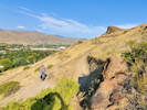
Switchback #3: view to northwest. |
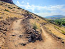
Switchback #4: view southeast, into the sun. |
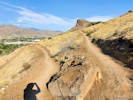
Switchback #5: view northwest. |
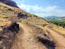
Switchback #6: view southeast. |
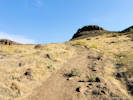
The old Lubahn Trail, eventually goes through the gap at right. |
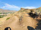
Switchback #7: view of Castle Rock to the northwest. |
Switchback #8: short-cutting the trail already. |

Switchback #8: view southeast. |
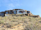
The “G” from the Olivine Trail. |
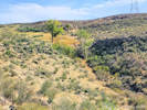
Lower rim of South Table Mountain from Olivine Trail. |
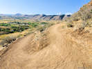
Switchback #9: view southwest. |
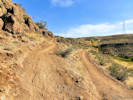
Switchback #10: view northeast. |
Brickellia californica growing in the cliffs. |
West end of Old Quarry Trail. |
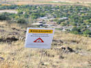
Closed for Restoration. |
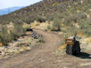
Beginning of the Olivine Trail. |
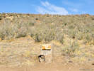
Junction with Old Quarry Trail. |
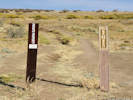
Social trail to Castle Rock. |
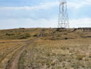
Old Quarry Trail. |
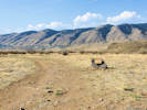
West end of the Dome Flow Trail. |
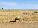
Old Quarry Trail |
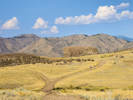
Back side of Castle Rock. |
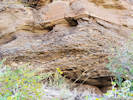
Basal conglomerate. |
Interbedded fluvial deposits. |
South end of outcrop. |
Upcoming restoration. |
|
|
Other articles:
• 5th Street:
at Cheyenne;
 Autumn afternoon light at 5th and Cheyenne. Autumn afternoon light at 5th and Cheyenne.
|
|
Saturday, October 17, 2020
|
|
Locations:
Ranson/Edwards Homestead Open Space Park.
 The chair along the trail. The chair along the trail.
 Old ranch road to original homestead. Old ranch road to original homestead.
|
|
Sunday, November 1st
A little ramble at Ranson/Edwards.
|
|
Locations:
North Table Mountain.
 North Golden from North Table Mountain. North Golden from North Table Mountain.
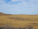 Across the top of North Table Mountain. Across the top of North Table Mountain.
|
|
Friday, November 6th
Climbed the west face of North Table Mountain by way of the City of Golden North Table Mountain trail, and then popping up on the mesa on the social trail. Went up to the highpoint (benchmark) and then came down the Golden Cliffs Trail.
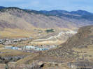
Dakota Ridge (North Hogback) from North Table Mountain. |
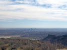
Denver from North Table Mountain |
|
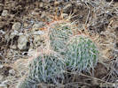 Coll. No. 2445, Opuntia polyacantha Coll. No. 2445, Opuntia polyacantha
|
2445
|
Opuntia polyacantha?
There seems to be two forms here, a short-spined form and a long-spined form.
|
|
Other articles:
• Lookout Mountain Road:
Buffalo Bill Museum;
 Out looking for the comet. Out looking for the comet.
|
|
Monday, December 21, 2020
Out looking for the comet, next to some planet.
|
|
Other articles:
• Cheyenne Street:
at 708 Cheyenne;
 708 Cheyenne, new building. 708 Cheyenne, new building.
|
|
Thursday, December 31, 2020
What we got at 708 Cheyenne.
|
|
|
|
[Previous Page]
[Next Page]
Go to page: [1800s] [1900s] [1910s] [1920s] [1930s] [1940s] [1950s] [1960s] [1970s] [1980s] [1990] [1991] [1992] [1993] [1994] [1995] [1996] [1997] [1998] [1999] [2000] [2001] [2002] [2003] [2004] [2005] [2006] [2007] [2008] [2009] [2010] [2011] [2012] [2013] [2014] [2015] [2016] [2017] [2018] [2019] [2020] [2021] [2022] [2023] [2024] [A]
|
|
If you have a question or a comment you may write to me at:
tomas@schweich.com
I sometimes post interesting questions in my FAQ, but I never disclose your full name or address.
|
[Home Page] [Site Map]
Date and time this article was prepared:
12/9/2024 7:33:25 PM
|
 Eastern Mojave Vegetation