Eastern Mojave Vegetation
Tom Schweich
|
Eastern Mojave Vegetation
| Field Notes (Continued) |
|
Tom Schweich |

Topics in this Article: 1800s 1900s 1910s 1920s 1930s 1940s 1950s 1960s 1970s 1980s 1990 1991 1992 1993 1995 1996 1997 1998 1999 2000 2001 2002 2003 2004 2005 2006 2007 2008 2008 Tour de Swertia albomarginata Mono Lake, August 2008 2009 2010 2011 2012 2013 2014 2015 2016 2017 2018 2019 2020 2021 2022 2023 2024 Contents Literature Cited |
When I first read the field notes of Annie Alexander and Louise Kellogg, I was fascinated by the descriptions they wrote about the places they went and the plants and animals they found there. By publishing my field notes on the Internet I hope to follow a little bit in their tradition. | |||||
|
|
2013 | |||||
|
|
Saturday, January 5th | |||||
|
Other articles:
|
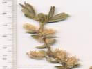
915 |
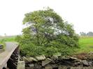
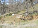
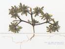
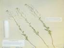
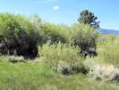
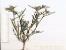
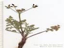
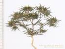
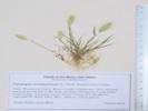
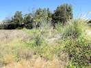
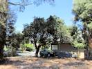
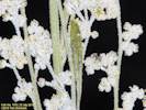
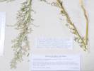
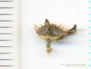
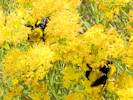
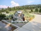
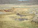
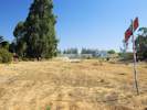
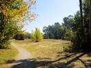
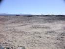
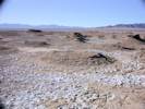
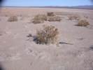
Mount Trashmore, Alameda County, California. Extreme northwest corner of Mount Trashmore, adjacent to the wooden pedestrian bridge and the Bay Farm Bicycle Bridge. 37.748°N, 122.236°W. WGS 1984. Elev. 1 m. Coll. No. 915, 5 Jan 2013, characters observed: Tree, to 8 m., not armed; Twigs, angled (not winged); Leaves, 2-pinnate, 1° leaflets 8-10 pairs, 2° leaflets 4-5 mm., glands at each 1° leaflet; Calyx, inconspicuous; Flower, radial; Corolla, yellow, < 1 mm.; Stamens, > 10 (Obs: 26); Filaments, free; Fruit, glabrous, leathery, dark brown in age. | ||||
|
Other articles:
Locations:
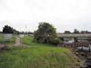
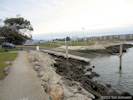
Encinal Boat Ramp.
|
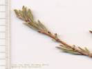
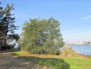
916 |
Encinal Boat Ramp, Alameda County, California. West of the Encinal Boat Ramp and Encinal High School, and south of the parking lot. Two trees of unknown origin plus several smaller plants suggesting naturalization. Coll. No. 916, 5 Jan 2013, characters observed: Tree, to 8 m., not armed; Twigs, angled (not winged); Leaves, 2-pinnate, 1° leaflets 8-10 pairs, 2° leaflets 4-5 mm., glands at each 1° leaflet; Calyx, inconspicuous; Flower, radial; Corolla, yellow, < 1 mm.; Stamens, > 10 (Obs: 26); Filaments, free; Fruit, glabrous, leathery, dark brown in age. | ||||
|
Other articles:
|
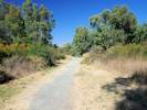
Sunday, 13 JanuaryWalked the shoreline path from the Encinal Boat Ramp to the end of the pier by the Hornet. | |||||
|
|
Sunday, 20 January | |||||
|
Other articles:
Locations:
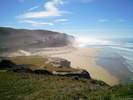
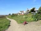
San Gregorio Beach.
|
| |||||
|
|
Friday, 1 February 2013 | |||||
|
Other articles:
Locations:
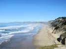
Bradley.
|
| |||||
|
Other articles:
|
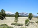
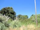
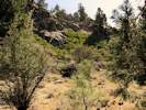
End of the road in Big Sandy Canyon. | |||||
|
Other articles:
|
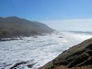
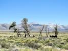
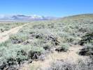
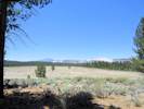
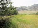
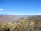
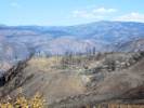
View northeast across the San Andreas Rift Zone. | |||||
|
Other articles:
|
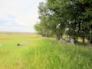
Stockdale Mountain Access Parking | |||||
|
Literature Cited:
Other articles:
Locations: Miller's Field paleoseismic site. |
| |||||
|
Other articles:
Locations:
Harmony Headlands State Park.
|
| |||||
|
|
Monday, February 4th | |||||
|
Other articles:
Locations:
Willow Creek.
|
||||||
|
Other articles:
Locations:
Big Creek.
|
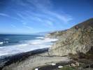
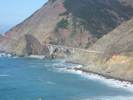
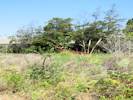
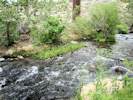
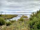
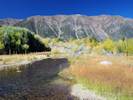
Along the central California coast, the Pacific plate drags the Sierra de Salinas, shown here composed of Jurassic-age Franciscan trench deposits, to its future watery grave in another trench near the Aleutian Islands. While we wait for the inevitable, mankind has built a jewel of a road in California Highway 1, the Cabrillo Highway, across the battleground of the landslides above and the restless sea below. Photograph of the Big Creek bridge, February 4, 2013. at Big Creek, Monterey County, California. | |||||
|
|
Sunday, February 10th | |||||
|
Other articles:
|
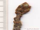
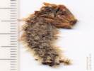
917 |
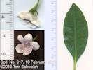
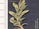
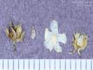
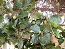
Myoporum laetum G. Forst. Ngaio Tree.
Bay Farm Island, City of Alameda, Alameda County, California. Near the intersection of Doolittle Drive and Harbor Bay Parkway, at the southeast corner of the Bill Osborne model airplane field. 37.7456°N, 122.2268°W. WGS 1984. Elev. 2 m. Just beginning to bloom. Native to New Zealand. Coll. No. 917, 10 Feb 2013, characters observed: Perennial shrub, to 2 m., terrestrial, woody, green and photosynthetic, unarmed; Leaves alternate, simple, pinnately veined, margin entire to finely serrate distally; Inflorescence axillary, bisexual; Sepals 5, 2 mm., wedge-shaped, not fused; Corolla obscurely bilateral (see position of style for a clue), tube 5.5 mm. + lobes 4.5 mm. = 10 mm. x 13 mm. dia., fused at base, white with purple spots, hairy in throat; Stamens 5, alternate, glabrous, fertile; Filaments free, fused to corolla at base; Ovary 1, superior; Pistil 1; Style 1; Stigma simple. | ||||
|
Other articles:
|
918 |
Eucalyptus globulus Labill. Blue Gum.
Mount Trashmore, Alameda County, California. East side of Mount Trashmore, 220 m. north of the intersection of Doolittle Drive and Harbor Bay Parkway, two trees above the EBRPD lagoon. 37.7474°N, 122.2269°W. WGS 1984. Elev. 4 m. | ||||
|
Other articles:
|
918 |
Eucalyptus globulus Labill. Blue Gum.
Mount Trashmore, Alameda County, California. North side of Mount Trashmore, about 160 meters east of the Bay Farm Island Bridge, one tree above the channel into San Leandro Bay. 37.7481°N, 122.2345°W. WGS 1984. | ||||
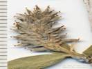
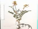
 Coll. No. 920, Poa annua Coll. No. 920, Poa annua
 Coll. No. 920, Poa annua Coll. No. 920, Poa annua
|
920 |
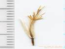
Poa annua L. Annual Blue Grass.
Elsie Roemer Bird Sanctuary, Alameda County, California. About 215 meters southeast of the intersection of Broadway and Shore Line Drive. 37.7522°N, 122.2445°W. WGS 1984. Elev. 1 m. Coll. No. 920, 12 Feb 2012, characters observed: Annual, 15-18 cm.; Stem herbaceous; Sheath open; Inflorescence > leaves; Spikelets similar, 1 per node; Glumes lower 2 mm., upper 3 mm., awns 0, < lowest floret; Axis hidden; Florets 4 per spikelet, lowest 3.5 mm, > lowest glume, bisexual; Callus glabrous; Lemma veins 5, awns 0, short hairy; Palea keels hairy; Stamens, early deciduous; Anthers 2, 0.8 mm.; Ovary glabrous. | ||||
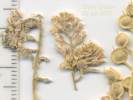
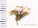
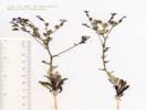
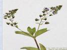
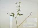
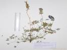
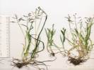
 Veronica biloba L. Veronica biloba L.
 Veronica biloba L. Veronica biloba L.
|
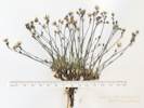
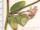
Veronica biloba L. Twolobe Speedwell.
Det. By Margriet Wetherwax, May 24, 2013. Rhymes Campground, Kern County, California. Near Rhymes Campground, west side of Rancheria Road (F. R. 25S15), north of intersecting Forest Service Road 26S19 (Rhymes Road). 35.6855°N, 118.5746°W. WGS 1984. Elev. 6120 ft. Clyde Golden, 21 May 2012, characters observed: Annual, tap-rooted, erect, 10 cm., finely hairy glandular; Cotyledons persistent; Leaves cauline, opposite, petiole 3 mm., elliptic, 15-19 mm. x 3-4 mm. wide, base tapered, not palmate lobed, margin serrate; Inflorescence single flowers in axils, alternate; Pedicels 1 mm (in flower) to 7 mm (in fruit); Bracts 8 mm., lanceolate, prominently veined (i.e., significantly different from leaves); Style 1.2 mm.; Fruit lobed spreading, notched > ½, each lobe 5 mm. x 2.5 mm. wide; Seeds (7 found with capsules open), 1.5 mm., pale yellow brown, surface rugose, not ridged. Ran this collection though the Jepson 2nd edition, and Welch's Utah Flora (since it has V. biloba). A couple of problems I see; first the pedicels are too short for either V. persica or V. biloba. Four other things would push me away from V. persica: it's erect, it's petiolate, leaf blade too narrow, and style too short. For V. biloba, the seeds should be transversely ridged, but they are rugose instead. | |||||
|
Locations:
Convict Lake.
|
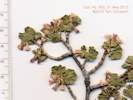
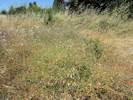
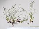
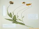
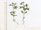
Alyssum simplex Rudolphi. European Madwort.
Convict Lake, Mono County, California. Adjacent to sign posts west of boat ramp. 37.5948°N, 118.8545°W. WGS 1984. Elev. 2420 m. Clyde Golden, 25 Jun 2011, characters observed: Annual, tap-rooted, to 12 cm., stellate hairy; Stem branched at base, ascending; Leaves cauline, alternate, sessile, 28 mm. x 5 mm., oblanceolate; Inflorescence not bracted; Sepals deciduous in fruit; Petals 3 mm., clawed, entire; Filaments winged, not toothed; Style persistent, 1.3 mm., few hairs at base; Fruit hairy, 5 mm., hairs thinning as fruit matures. | |||||
|
|
Saturday, March 2nd | |||||
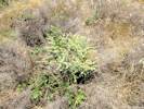
| 921 |
Vicia sativa L. ssp. sativa. Spring Vetch.
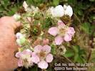
Jean Sweeney Open Space Park, Alameda County, California. Common throughout the undeveloped park. 37.7798°N, 122.2716°W. WGS 1984. Elev. 6 m. Only one open flower, no fruit, collection discarded. Coll. No. 921, 2 March 2013, characters observed: Annual, 40-50 cm.; Stem, ascending; Leaf, stipules toothed, leaf 6 cm., 1 pinnate compound, leaflets 10-12, folded in bud, rachis terminated by tendrils; Sepals, 10 mm., fused > 1/2; Inflorescence 1 axillary flower; Corolla, bilateral, tube 8 mm. + banner lobes 9 mm. = 17 mm.., banner outside wings, pink-purple; Style, ±round, hairy at tip. | |||||
|
|
Monday, May 20th | |||||
|
Other articles:
|
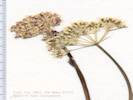
922 |
| ||||
|
Other articles:
|
923 | Salix, just leafing out, no flowers. | ||||
|
Other articles:
|
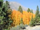
924 | Populus tremuloides, beside Poole Power Station Road, near Aspen Campground | ||||
|
Other articles:
Locations:
Lee Vining Canyon.
|
Pelton Wheel at Poole Hydro-Electric Plant. | |||||
|
Other articles:
|
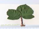
925 |
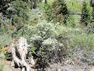
Amelanchier utahensis Koehne. Utah Service-Berry.
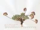
Lee Vining Canyon, Mono County, California. Along Forest Road 01N21 Poole Power Plant, 3.1 miles from its junction with California Highway 120. 37.9451°N, 119.2107°W. WGS 1984. Elev. 2378 m. Same as Coll. No. 926. Coll. No. 925, 25 May 2013, characters observed: Woody shrub, 1-2 m.; Stem, glabrous, thorns 0; Leaves, ±evenly distributed on branches, simple, petiole 4 mm. + blade 18 mm. × 10-12 mm. wide, not leathery, margin entire to distally toothed, abaxially glabrous in flower, few hairs on petioles, adaxial leaf surface, and proximal margins, deciduous unknown; Petals, #5, obovate, 10 mm × 5 mm. wide; Ovary inferior, top glabrous; Styles 3; Fruit, unknown (plant in flower). Although thought to be different when collected, this is the same taxon as Coll. No. 926, including the somewhat unusual combination of characters typical of A. utahensis, i.e., number of styles and narrow shape of leaf, with absence of hairs on ovary and abaxial leaf suggesting A. alnifolia var. pumila. | ||||
|
Other articles:
Letters:
Thursday, April 10, 2014.
|
926 |
Prunus emarginata (Douglas) Eaton Lee Vining Canyon, Mono County, California. Along Forest Road 01N21 Poole Power Plant, 3.1 miles from its junction with California Highway 120. 37.9451°N, 119.2107°W. WGS 1984. Elev. 2378 m. | ||||
|
Other articles:
Letters:
Thursday, April 10, 2014.
|
927 |
Calyptridium roseum S. Watson. Rosy Pussy Paws.
Pumice Valley, Mono County, California. Oil Plant Road at Old Highway 395, 3 1/2 miles by road south of Lee Vining 37.9172°N, 119.1012°W. WGS 1984. Elev. 2098 m. Coll. No. 927, 20 May 2013, characters observed: Annual, spreading, to 2.5 cm.; Leaves, cauline, alternate; Inflorescence, not 1-sided; Pedicel, ≤ 1 mm., slender? or stout? (wider than thread-like); Sepals, 2.5 mm. × 1.5-3.0 mm. wide Petals, #2, 1.5 mm., found at top of ovary when plant in fruit; Stamens, #1, yellow; Stigma, sessile; Fruit, 2-valved, dehiscing from top; Seed, #many (>10), 0.4 mm., margin papillate. At a superficial level, this specimen looks a lot like C. parryi, which in Mono County would be var. nevadense. However, at the character level, such as the length of the pedicel, the number of petals, the number of stamens, and the size of the seed, it keys better into C. roseum than into C. parryi. | ||||
|
Other articles:
|
928 |
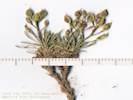
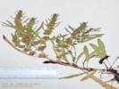
Nama densum Lemmon var. densum. Leafy Nama. Pumice Valley, Mono County, California. Oil Plant Road at Old Highway 395, 3 1/2 miles by road south of Lee Vining 37.9172°N, 119.1012°W. WGS 1984. Elev. 2099 m. Coll. No. 928, 20 May 2014, characters observed: Annual, low, mounded, to 3 cm.; Hairs, dense, spreading; Calyx, free from ovary; Corolla, 3.2 mm., limb 2.0-2.3 mm.; Style, #1, 0.4 mm. | ||||
|
Other articles:
Locations:
Farrington Ranch.
|
Farrington's | |||||
|
Other articles:
|
||||||
|
Other articles:
|
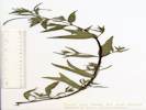
929 | Salix | ||||
| 930 | Salix | |||||
| 931 | Salix, pistillate. | |||||
| 932 | Salix, staminate | |||||
|
Other articles:
Locations:
Bohler Canyon.
|
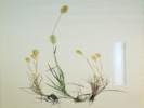
933 |
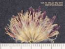
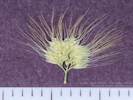
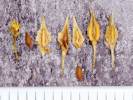
Mentzelia albicaulis Hook. White-Stem Blazing Star. Bohler Canyon, Mono County, California. Opening or meadow near falling-down cabin, near Bohler Creek, and just outside the curve of Forest Road 01N106A where it turns from westerly to northerly and crosses Bohler Creek, 6.1 miles by road south of Lee Vining, CA 37.901°N, 119.13°W. WGS 1984. Elev. 2202 m. Yellow Coll. No. 933, 20 May 2013, characters observed while keying: Annual, young, 13 cm.; Leaves, 60 mm. × 6 mm. wide, deeply lobed; Floral bracts, entire, green throughout; Sepals, 2.2 mm. × 1.2 mm., bases separate; Petals, 5 mm. × 2.5 mm. wide, obovate; Stamens, 3 mm.; Style, 3 mm.; Fruit, 7 mm. × 2 mm., obconic, curved slightly. Determined M. albacaulis mostly because the floral bracts are entire and green throughout. | ||||
|
Other articles:
Locations:
Bohler Canyon.
|
934 |
Allium campanulatum S. Watson. Dusky Onion. Bohler Canyon, Mono County, California. Opening or meadow near falling-down cabin, near Bohler Creek, and just outside the curve of Forest Road 01N106A where it turns from westerly to northerly and crosses Bohler Creek, 6.1 miles by road south of Lee Vining, CA 37.9011°N, 119.13°W. WGS 1984. Elev. 2198 m. Coll. No. 934, 20 May 2013, characters observed while “keying:” Perennial, 15 cm., from bulb; Bulb, 13 mm., ovoid; Leaves, 1–3, withered at flowering; Flowers 18; Perianth, 7-8 mm., keeled, tip margins in-rolled, no special coloration at adaxial base, papery in fruit. Between A. bisceptrum and A. campanulatum, I went with the latter on the strength of leaves withered in flower, perianth keeled and tip margins in-rolled, and ignored perianth papery in fruit, and absence of a basal adaxial purple crescent. | ||||
|
Other articles:
Locations:
Bohler Canyon.
|
935 |
Descurainia sophia (L.) Webb. Tansy Mustard.
Bohler Canyon, Mono County, California. Opening or meadow below falling-down cabin, near Bohler Creek, and just outside the curve of Forest Road 01N106A where it turns from westerly to northerly and crosses Bohler Creek, 6.1 miles by road south of Lee Vining, CA. 37.9011°N, 119.13°W. WGS 1984. Elev. 2198 m. Coll. No. 935, 20 May 2013, characters observed while keying: Annual, to 40 cm., not branched; Hairs, branches, 3–5; Leaves, cauline, sessile, not clasping, 17–23 mm., 2°–3° finely pinnately divided; Flowers, petals, yellow, 2.5 mm,; Fruit, a silique, 12 mm. × 0.6 mm. wide, pedicel 12 mm., diverging 30–45°, not flattened except when pressed; Seeds, multiseriate. | ||||
| 936 | Salix | |||||
| 937 | Salix | |||||
|
Other articles:
Locations:
Bohler Canyon.
|
938 |
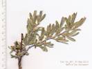
Erysimum capitatum (Hook.) Greene var. capitatum. Sanddune Wallflower. Bohler Canyon, Mono County, California. North slope near base of north limb of Bloody Canyon moraine, near Forest Road 01N106A, 0.2 miles west of Forest Road 01N17 Farrington Siphon, 5.2 miles by road south of Lee Vining, CA. 37.9002°N, 119.1224°W. WGS 1984. Elev. 2146 m. Growing in sagebrush. | ||||
|
Other articles:
|
Arrow-Leaf Balsamroot (Balsamorhiza sagittata in bloom along F. R. 01N17 | |||||
|
Other articles:
Locations:
Mono Craters.
|
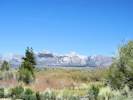
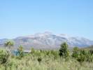
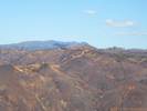
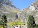
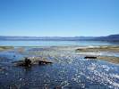
Collecting near Parker Creek. View across Pumice Valley to Mono Craters. | |||||
| 939 | Salix geyeriana | |||||
| 940 | Salix | |||||
|
Other articles:
|
941 | Salix | ||||
|
Other articles:
|
942 | Salix | ||||
|
|
Tuesday, May 21st | |||||
|
Other articles:
Locations:
Sagehen Spring.
|
| |||||
|
Other articles:
|
943 |
Salix geyeriana Andersson. Geyer Willow.
Sagehen Spring, Mono County, California. 37.8659°N, 118.8601°W. WGS 1984. Pistillate collection was made at the spring, staminate collection in the watercourse below the spring. Sixteen staminate and nine pistillate plants counted at this location. Same plants as Coll. Nos. 988 (20 Jun 2013) and 1045 (4 Oct 2013). Coll. No. 943, 21 May 2014, characters observed in Argus (2009): 11. Plant: habit: mid-shrub 0.6-2.0 m.; 116. Catkins, flowering as leaves emerge (coetaneous); 185. Pistillate stipe length: 1 mm.; 192. Pistillate flowers ovary indumentum (hair) type: short silky < 0.5 mm.; 200. Pistillate flowers: style length: 0.2 mm.; Specifying 221. California Geographical Region: 8. East of Sierra Nevada Region (SNE) will cause the determination to fail. Yet there are numerous collections of this taxon in SNE. | ||||
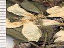
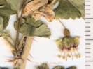
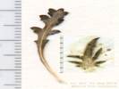
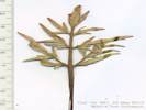
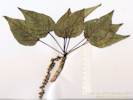
 Bud of Coll. No. 944, Populus tremuloides Bud of Coll. No. 944, Populus tremuloides
 Male catkin of Coll. No. 944, Populus tremuloides Male catkin of Coll. No. 944, Populus tremuloides
|
944 | Populus tremuloides | ||||
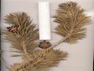
| 945 | Pinus jeffreyi | |||||
 Coll. No. 946, Pinus contorta ssp. murrayana Coll. No. 946, Pinus contorta ssp. murrayana
|
946 |
Pinus contorta Loudon ssp. murrayana (Grev. & Balf.) Critchf. Sierra Lodgepole Pine.
Sagehen Spring, Mono County, California. Along a watercourse just below Sagehen Spring. 37.8665°N, 118.86°W. WGS 1984. Elev. 2555 m. | ||||
|
Literature Cited:
Other articles:
|
947 |
Salix, larger, more yellow green.
Salix lutea Nutt. Yellow Willow. Dry Creek, Mono County, California. Along Dry Creek above Big Sand Flat, about 0.9 km upstream (southeast) of California Highway 120 37.8772°N, 118.8786°W. WGS 1984. Elev. 2447 m. The larger of two willows at this location, leaves more yellow green. Staminate plant. Coll. No. 947, 21 May 2013, characters observed: Woody perennial shrub to 2 mm.; Leaf, margin gland-dotted; Catkins, blooming with leaves on very short leafy shoots, (width pressed 5.5 mm.); Stamens, 2, mostly yellow with few purple tips; Filaments, glabrous; Quickly converges on Salix lutea or S. boothii in Argus (2009), keys poorly in TJM2 and Taylor (2010). | ||||
|
Literature Cited:
Other articles:
|
948 |
Salix geyeriana Andersson. Geyer Willow. Dry Creek, Mono County, California. Along Dry Creek above Big Sand Flat, about 0.9 km upstream (southeast) of California Highway 120 37.8772°N, 118.8786°W. WGS 1984. Elev. 2447 m. Smaller of two willows at this location, leaves deeper green than the other willow found here. Pistillate plant. Coll. No. 948, 21 May 2013, characters observed: Woody perennial shrub, to 1 m.; Stem, glaucus; Leaf, blade 12 mm. × 5 mm. wide, elliptic, entire, adaxially hairy, but less so than abaxially, abaxially hairy, densely silky; Inflorescence, pistillate, with leaves on leafy shoots, 12 mm., slightly elongated rather than spheric; Bracts, persistent, tan, hairy; Ovary, stalk 1 mm. + body 2.2 mm. + style almost 0 mm. + stigma 0.3 mm., short silky hairy throughout. | ||||
|
Other articles:
|
949 |
Dry Creek, Mono County, California. Along Dry Creek above Big Sand Flat, about 0.9 km upstream (southeast) of California Highway 120 37.8772°N, 118.8786°W. WGS 1984. Elev. 2447 m. Prickly, bright green leaves. Ribes cereum Douglas var. cereum also collected here. Coll. No. 949, 21 May 2013, characters observed: Woody perennial shrub, to 1.5 m.; Nodal spines present, internodal bristles present; Leaves, petiole 12 mm. + blade 12 mm. × 17 mm. wide, ovate, palmately lobed; Inflorescence ±2-flowered; Calyx, green; Pedicel, 3 mm., not jointed at ovary; Hypanthium, cup-shaped, 2.5 mm. × 3 mm. diameter; Sepals, 5, 2.5-3.0 mm., reflexed, green, margins purple- tinged; Petals, 5, 1.5 mm. × 1.5 mm. wide, wedge- shaped, white; Anthers, slightly longer than wide, exceeding petals; Filaments exceeding petals by 1 mm.; Styles, fused proximal ⅔, hairy middle ⅓, separated distal ⅓, exceeding anthers. (TJM2 key requires styles hairy at least at base, description is silent about style hairs.) | ||||
|
Other articles:
|
950 |
Ribes cereum Douglas var. cereum. Wax Currant.
Dry Creek, Mono County, California. Along Dry Creek above Big Sand Flat, about 0.9 km upstream (southeast) of California Highway 120 37.8774°N, 118.8795°W. WGS 1984. Elev. 2434 m. Coll. No. 950, 21 May 2013, characters observed: Woody perennial shrub, to 1.5 m., not tendril bearing; Nodal spines 0; Leaf, simple, 10 mm., ovate, palmately 5-lobed; Bract, tip truncate, 3-4 prominent teeth; Flowers, open, bisexual; Perianth, parts 5; Hypanthium, 4 mm. × 2 mm. wide, clearly exceeding the ovary; Sepals, 1 mm., pink, reflexed; Petals, 5, 0.5 mm., white; Stamens, 5, alternate petals, inserted below level of petals; Anther, tip with cup-like depression; Ovary inferior; Pistil, 1 per flower; Style, appears to be 1 (2 fused to tip), glabrous (generally hairy); Ovules, many per chamber. | ||||
|
Other articles:
|
951 |
Salix, sterile, growing in water.
Salix. Willow. Dry Creek, Mono County, California. Along Dry Creek above Big Sand Flat, about 100 m upstream (southeast) of California Highway 120 37.882°N, 118.8854°W. WGS 1984. Elev. 2410 m. Growing in open water, sterile, partially leafed out. | ||||
|
Other articles:
|
952 |
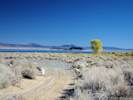
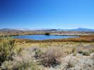
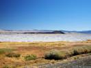
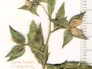
Cryptantha ambigua (A. Gray) Greene. Basin Cryptantha. Mono Valley, Mono County, California. On Forest Road 01N23 about 100 m east of California Highway 120, and 5.6 miles east of the intersection of California Highway 120 with US Highway 395. 37.919°N, 119.007°W. WGS 1984. Elev. 2039 m. with Mimulus, Phacelia bicolor, Purshia, and Ericameria. Collection No. 986 made in same location on 20 June 2015 has mature nutlets. | ||||
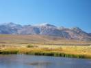
| 953 |
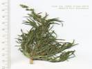
Sarcobatus vermiculatus (Hook.) Torr. Greasewood.
South Tufa Area, Mono County, California. 37.9412°N, 119.0319°W. WGS 1984. Elev. 1950 m. Floral structures just beginning to form. | |||||
|
Other articles:
|
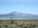
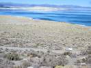
954 |
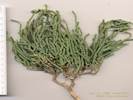
Ephedra viridis Cov. Green Ephedra.
Mono Lake (southwest sector), Mono County, California. Along Test Station Road, about 0.4 m east of Rush Creek, and 1.5 mi northwest of South Tufa Parking Area. 37.9462°N, 119.0501°W. WGS 1984. Elev. 1965 m. Staminate and pistillate plants growing next to each other. | ||||
|
Other articles:
|
955 |
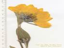
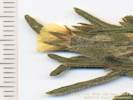
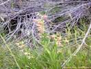
Castilleja chromosa A. Nelson. Desert Indian Paintbrush.
Mono Lake (southwest sector), Mono County, California. Along Test Station Road, about 0.75 mi east southeast of Rush Creek, and 0.9 mi west northwest of the South Tufa parking area. 37.9432°N, 119.0458°W. WGS 1984. Elev. 1965 m. (Not collected, this is likely the location of M. S. Taylor's #4863, CHSC37296, JEPS81454). | ||||
|
|
Wednesday, May 22nd | |||||
|
Other articles:
|
956 |
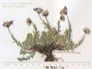
Balsamorhiza sagittata (Pursh) Nutt. Arrow-Leaf Balsamroot.
Pumice Valley, Mono County, California. On Forest Road 01N17 Farrington Siphon, between the Sawmill Canyon and Bloody Canyon moraines, 6.3 miles by road south of Lee Vining, from below the aqueduct to the tops of the moraines. 37.8875°N, 119.1264°W. WGS 1984. Elev. 2193 m. Coll. No. 956, 22 May 2013, characters observed: Perennial herb, to 50 cm.; Leaves, mostly basal, 20 cm. × 12 cm, widely triangular, base sagittate, tomentose, cauline much reduced; Inflorescence, radiate, composed of 2 kinds of flowers, some strap-shaped; Phyllaries, in 2+ series, not all subtending ray flowers, eglandular, bases tomentose; Receptacle, paleate; Paleae, folded, partially surrounding disk flower ovary; Rays, yellow, fruiting, fruit 9 mm. + corolla 32 mm. × 11 mm.; Pappus 0. | ||||
|
Other articles:
|
957 |
Gilia brecciarum M. E. Jones ssp. brecciarum. Nevada Gilia.
Pumice Valley, Mono County, California. On Forest Road 01N17 Farrington Siphon, between the Sawmill Canyon and Bloody Canyon moraines, 6.3 miles by road south of Lee Vining, from below the aqueduct to the tops of the moraines. 37.8875°N, 119.1264°W. WGS 1984. Elev. 2193 m. Coll. No. 957, 22 May 2014, characters observed: Annual, tap-rooted, to 12 cm.; Stem, lower white cobwebby hairs below middle, branches spreading; Leaves, mostly basal, petiole 12 mm. + blade 14 mm. × 5.5 mm. wide, deeply pinnately-lobed, some lobes 2-pinnate, axis 1.7 mm. wide, lobes to 2.5 mm., tips pointed but not bristle-tipped, hairs eglandular, cauline, expanded lobed at base; Inflorescence, not dense, flowers not in heads, pedicelled, glands long- stalked; Calyx, tube 3 mm. + lobes 1.5 mm. = 4.5 mm., membrane narrow in flower; Corolla, radial, funnel-shaped, tube 2.5 mm. + throat 2 mm. + lobes 2 mm. = 6.5 mm., i.e., lobes < tube, white + purple + yellow with purple streaks + white/purple; Style, not persistent; Fruit < calyx; Seeds, 2 per chamber, ±green, gelatinous when wet. | ||||
|
Other articles:
Letters:
Thursday, April 10, 2014.
|
958 |
Pumice Valley, Mono County, California. On Forest Road 01N17 Farrington Siphon, between the Sawmill Canyon and Bloody Canyon moraines, 6.3 miles by road south of Lee Vining. 37.8875°N, 119.1264°W. WGS 1984. Elev. 2193 m. Coll. No. 958, 22 May 2013, characters observed: Annual, to 20 cm.; Floral bracts 3-lobed, not conspicuous, not concealing fruits; Corolla, with orange base and yellow tip; Style, 2.8 mm.; Fruit, mature 16-17 mm., barely curved; Seeds, in more than 1 row above mid-fruit. | ||||
|
Other articles:
|
959 |
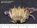
Lewisia rediviva Pursh ssp. minor (Rydb.) Munz. Bitter Root.
Bridgeport Canyon, Mono County, California. Along Coyote Springs Road, about 0.25 mi southeast of the pass, 6.5 miles by road north of California Highway 167. 38.139°N, 119.1181°W. WGS 1984. Elev. 2328 m. Plentiful in gravel. Coll. No. 959, 22 May 2013, characters observed: Perennial, tap-rooted, to 5 cm.; Leaves, basal, shriveled after flowering, turning brown, cauline 0; Sepals, 4-6, 11-12 mm., papery, margin entire; Flowers, pedicelled 1-6 mm.; Petals, 18 mm.; Stamens, 37. | ||||
|
Other articles:
Locations:
Bridgeport Canyon.
|
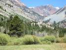
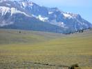
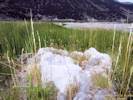
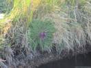
Natural rock garden in Bridgeport Canyon. | |||||
|
Other articles:
|
960 |
Lomatium nevadense (S. Watson) J. M. Coult. & Rose var. nevadense.
Bridgeport Canyon, Mono County, California. Along Coyote Springs Road, about ? mile southeast of the pass, at a watercourse crossing the road from southwest to northeast, 6½ miles by road north of California Highway 167. 38.1383°N, 119.117°W. WGS 1984. Elev. 2322 m. Coll. No. 960, 22 May 2013, characters observed: Perennial, spreading, to 10 cm. above ground, from a stout (6 mm. dia.) tap root ≥ 9 cm., in dry soil at undisturbed places, not scented, plant nearly completely glabrous; Stem, ±0; Leaves, 2-3 pinnate, to 6 cm., basal sheaths purple, leaf segments, many, small, oblong, 1-2 mm. wide, sparse short straight white hairs; Inflorescence, compound umbel, involucel inconspicuous, umbels not head like; Pedicels, in fruit 3 mm.; Petals, white or cream; Ovary, glabrous, tip projection 0; Seed, 5 mm. × 2 mm. wide, elliptic, compressed front to back, not notched at base and tip, ribs ±equal, lateral ribs only slightly expanded as wings, glabrous. | ||||
|
Other articles:
|
961 |
Perideridia bolanderi (A. Gray) A. Nelson & J. F. Macbr. ssp. bolanderi. Bolander Yampah.
Bridgeport Canyon, Mono County, California. Along Coyote Springs Road, about ? mile southeast of the pass, at a watercourse crossing the road from southwest to northeast, 6½ miles by road north of California Highway 167. 38.1381°N, 119.1174°W. WGS 1984. Elev. 2326 m. Coll. No. 961, 22 May 2013, characters observed: Perennial, from elongated (7 cm.) tuber, to 50 cm., undisturbed places in dry rocky soil, glabrous, not scented; Leaves, 2°-pinnate and pinnate-ternate, leaf segments wider than thread-like, ultimate leaflet of mature leaf 3.5 mm. wide, not as dimorphic as Taylor (2010) describes; Inflorescence, compound umbel; Involucel, lobes 3.5 mm.; Pedicel, 2.5 mm.; Corolla, white; Ovary, 1.5 mm.; Styles, 1.5 mm.; Fruit, immature, no ribs expanded as wings at this stage (TJM2 Apiaceae 28-28'). | ||||
|
Other articles:
|
962 |
Trifolium andersonii A. Gray var. beatleyae (J. M. Gillett) Isely.
Bridgeport Canyon, Mono County, California. Along Coyote Springs Road, about ? mile southeast of the pass, at a watercourse crossing the road from southwest to northeast, 6½ miles by road north of California Highway 167. 38.1383°N, 119.1169°W. WGS 1984. Elev. 2320 m. Hairy clover, roots almost impossible to cut. Coll. No. 962, 22 May 2013, characters observed: Perennial, short-tufted, from very tough! roots, to 6 cm., soft hairy throughout; Leaf, petioles 2 cm., palmately compound, leaflets 5, not gland-dotted, Inflorescence, peduncled 6 cm., >> leaves, 2.0-2.5 cm.; Involucre, vestigal ring; Sepals, fused 4 mm. + free 8 mm. = 12 mm., plumose, lobe hairs ±1 mm; Flower, bilateral; Corolla, purple. | ||||
|
Other articles:
|
963 |
Navarretia breweri (A. Gray) Greene. Brewer's Navarretia.
Bridgeport Canyon, Mono County, California. Along Coyote Springs Road, about ? mile southeast of the pass, at a watercourse crossing the road from southwest to northeast, 6½ miles by road north of California Highway 167. 38.1383°N, 119.117°W. WGS 1984. Elev. 2324 m. Best specimens in the road. Coll. No. 963, 22 May 2013, characters observed: Annual, to 6 cm., prickly, minutely glandular; Stem, branches ascending along stem (as opposed to branches just below terminal head); Leaves, alternate except at base, deeply pinnately lobed, lobed portion 7 mm. + terminal lobe 9 mm., few straight white hairs; Inflorescence, dense, flowers in groups of 4-6, sllightly hairy, not wooly; Outer bracts like leaves; Calyx, lobes unequal (3 long, 2 short), tapered, membrane narrow, not spout-like distally; Corolla, lobes yellow; Stamens, exserted. | ||||
| 964 |
Field identification: Arenaria?
Eremogone Fenzl. Sandwort. Bridgeport Canyon, Mono County, California. Along Coyote Springs Road, about 1/3 mi southeast of the pass, at a watercourse crossing the road from southwest to northeast. 38.1383°N, 119.1171°W. WGS 1984. Elev. 2327 m. Not entirely sure what happened to this collection. Perhaps it was determined to be the same as, and therefore combined with, the next collection (TAS, 29 May 2017). | |||||
|
Other articles:
|
965 |
Eremogone kingii (S. Watson) Ikonn. var. glabrescens (S. Watson) Dorn. King's Sandwort.
Bridgeport Canyon, Mono County, California. Along Coyote Springs Road, about ? mile southeast of the pass, at a watercourse crossing the road from southwest to northeast, 6½ miles by road north of California Highway 167. 38.1383°N, 119.1171°W. WGS 1984. Elev. 2327 m. Coll. No. 965, 22 May 2013, characters observed: Perennial, tufted or mat-forming, from woody underground rootstocks, to 8 cm.; Stipules 0; Leaves, congested at base of flower stems, opposite, needle-like, 5.5-6.5 mm. × 0.7 mm.; Inflorescence, not umbel-like; Sepals, ±free, 4 mm. × 1.5 mm., acute (not obtuse or rounded), spine-tipped; Petals, #5, 5 mm., white, entire; Styles, #3; Fruit, a capsule, otherwise immature. | ||||
|
Other articles:
|
966 |
Bridgeport Canyon, Mono County, California. Along Coyote Springs Road, about ? mile southeast of the pass, at a watercourse crossing the road from southwest to northeast, 6½ miles by road north of California Highway 167. 38.1384°N, 119.1169°W. WGS 1984. Elev. 2325 m. Coll. No. 966, 22 May 2013, characters observed: Perennial, tufted herb, to 8 cm.; Stem unarmed; Leaves, alternate, sessile, 5.5 mm. × 2 mm. wide, firm, oblong, tip acuminate, margin white, entire, scabrous; Inflorescence of two kinds of flowers, radiate; Heads solitary; Receptacle, epaleate (single ring of paleae buried among the disk flowers); Phyllaries, in 3 ±defined series, graduated, outer < inner, inner bases white, tips herbaceous, margin scarious, veins 1, resin-filled unknown; Rays, blue, oblong, style present; Disk, corolla, yellow; Pappus of well-developed bristles, #>20, few short outer bristles, many long inner bristles, cylindric, short plumose. | ||||
|
Other articles:
|
967 |
Eriogonum caespitosum Nutt. Matted Buckwheat.
Bridgeport Canyon, Mono County, California. Along Coyote Springs Road, about ? mile southeast of the pass, at a watercourse crossing the road from southwest to northeast, 6½ miles by road north of California Highway 167. 38.1384°N, 119.1168°W. WGS 1984. Elev. 2325 m. | ||||
|
Other articles:
|
968 |
Erigeron eatonii A. Gray var. sonnei (Greene) G. L. Neson. Sonne's Daisy.
Bridgeport Canyon, Mono County, California. Along Coyote Springs Road, about ? mile southeast of the pass, at a watercourse crossing the road from southwest to northeast, 6½ miles by road north of California Highway 167. 38.1384°N, 119.1168°W. WGS 1984. Elev. 2325 m. White flowers. Coll. No. 968, 22 May 2013, characters observed: Perennial herb to 12 cm.; Stem, glandless; Leaves, opposite below, reduced and alternate above, entire, eglandular; Inflorescence, of two kinds of flowers; Heads, solitary; Receptacle epaleate; Phyllaries, in 2+ series, 5.5-6.5 mm., outer slightly smaller, herbaceous throughout, eglandular; Rays, 8 mm., blue/purple, fertile; Disk, flowers, 4 mm., yellow; Pappus, of well-developed bristles, #>20, 3.5 mm., few short bristles. | ||||
|
Other articles:
|
969 |
Grass
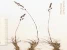
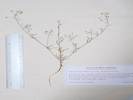
Poa secunda J. Presl ssp. secunda. Sandberg Bluegrass.. Bridgeport Canyon, Mono County, California. Along Coyote Springs Road, about 1/3 mile southeast of the pass, at a watercourse crossing the road from southwest to northeast, 6½ miles by road north of California Highway 167. 38.1383°N, 119.1172°W. WGS 1984. Elev. 2328 m. Coll. No. 969, 22 May 2013, characters observed: Perennial, tufted, to 30 cm.; Stem, base not bulbous; Sheath open; Leaf, blade and sheath differentiated; Inflorescence, >> leaves, branches ascending; Spikelets, many in well-developed inflorescence, all similar, on 2° branches, 1 per node, not subtended by bristles or long-silky hairs, narrowly ovate or lanceolate (not ovate), laterally compressed; Florets, 4+ per spikelet; Callus, glabrous; Glumes, short hairy, awns 0; Lemma, ±evenly short hairy, awns 0; Anther, 1.6 mm. | ||||
|
Other articles:
|
970 |
Cusickiella douglasii (A. Gray) Rollins. Alkali False Whitlow-Grass.
Bridgeport Canyon, Mono County, California. Along Coyote Springs Road, about ? mile southeast of the pass, at a watercourse crossing the road from southwest to northeast, 6½ miles by road north of California Highway 167. 38.1383°N, 119.1172°W. WGS 1984. Elev. 2328 m. Fruit, no flowers. Coll. No. 970, 22 May 2013, characters observed: Perennial herb to 2.5 cm., from a branched woody caudex, scapose; Leaves, 5-7 mm., entire, few short simple hairs; Inflorescence, bract absent; Fruit, 3.5 mm. × 2.7 mm. wide, 2-sided; Seed, #1-2, 2.5 mm. | ||||
|
Other articles:
|
971 |
Yellow comp
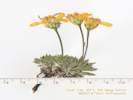
Stenotus acaulis (Nutt.) Nutt. Cushion Goldenweed. Bridgeport Canyon, Mono County, California. Along Coyote Springs Road, about 1/3 mile southeast of the pass, at a watercourse crossing the road from southwest to northeast, 6½ miles by road north of California Highway 167. 38.1383°N, 119.1172°W. WGS 1984. Elev. 2328 m. Yellow flowers. Coll. No. 971, 22 May 2013, characters observed: Perennial tufted herb, to 8 cm., from a branched caudex, few short stalked glands; Leaves, (look opposite to me) alternate, cauline leaves only at base, winged petiole 4 mm. + blade 9 mm. = 13 mm. × 2.5 mm. wide, elliptic, entire, tip acuminate, 3-veined, outer 2 veins irregularly curved; Inflorescence, of 2 kinds of flowers, Heads, solitary, 13 mm. × 10-12 mm. wide; Phyllaries, in 2 graduated series, not in vertical ranks; Receptacle, epaleate; Rays, #4-5, 12 mm., yellow, fertile; Pappus, of well-developed bristles in single series, white. | ||||
|
Other articles:
|
972 |
The other yellow comp
Senecio integerrimus Nutt. var. exaltatus (Nutt.) Cronquist. Columbia Ragwort. Bridgeport Canyon, Mono County, California. Along Coyote Springs Road, about 1/3 mile southeast of the pass, at a watercourse crossing the road from southwest to northeast, 6½ miles by road north of California Highway 167. 38.1385°N, 119.1168°W. WGS 1984. Elev. 2320 m. Yellow flowers. Coll. No. 972, 22 May 2013, characters observed: Perennial herb, to 35 cm.; Leaves of varying shapes, largest proximal, petiole to 7 cm., some slightly winged, + blade to 8 cm. × 2.8 cm. wide, elliptical, margin slightly toothed or scalloped, distal, 5 cm., lance-linear, sessile; Inflorescence, flowers of 2 kinds; Heads, radiate; Phyllaries, in 1+ slightly overlapping series, 6 mm. × 1.5 mm. wide, without oil glands, tip black dotted; Receptacle, epaleate; Rays, yellow, fertile; Disk flowers, yellow; Pappus, of well-developed bristles, in 1 series. | ||||
| 973 | Salix | |||||
| 974 | Salix | |||||
| 975 | Salix | |||||
|
Other articles:
Locations:
Mono Craters.
|
View of Mono Craters to the south. | |||||
| 976 | Salix | |||||
|
Other articles:
|
977 |
Populus trichocarpa Hook. Black Cottonwood.
Mill Creek, Mono County, California. Along Mill Creek where it is crossed by Cemetery Road, 5.8 miles by road north and east of Lee Vining. 38.0232°N, 119.1337°W. WGS 1984. Elev. 1979 m. Pistillate, oldest, largest tree among ±8 growing in immediate vicinity. Coll. No. 977, 22 May 2013, characters observed: Tree; Leaf, petiole round 50 mm + blade ovate 80 mm. × 50 mm. wide, margin finely scalloped, blade glabrous throughout; Catkin, pistillate, pendant, perianth reduced to disk-shaped structure. | ||||
| 978 | Salix | |||||
|
Other articles:
|
979 | Salix | ||||
|
|
Wednesday, June 19th | |||||
|
Other articles:
|
980 | Willow at Warren Ck. | ||||
|
Other articles:
|
981 | Willow | ||||
|
Other articles:
|
982 | Salix . Collection #922 made from same plants on 20 May 2013. Staminate plants have odd leaf dimorphism. Lee Vining Creek, just above bridge and below Aspen Campground | ||||
|
Other articles:
Locations:
Andy Thompson Creek.
|
983 |
Polypogon monspeliensis (L.) Desf. Rabbit's-Foot Grass. Andy Thompson Creek, Mono County, California. On a recently exposed beach bar in the delta of Andy Thompson Creek below Tioga Lodge, 2.6 miles north of Lee Vining, CA. 37.992°N, 119.1398°W. WGS 1984. Elev. 1952 m. Small plants. | ||||
|
Other articles:
Locations:
Andy Thompson Creek.
|
Delta of Andy Thompson Creek. | |||||
|
Other articles:
Locations: Andy Thompson Creek. |
984 |
Platanthera sparsiflora (S. Watson) Schltr. (Syn: Habenaria sparsiflora S. Watson ) Sparse-Flowered Bog Orchid.
Andy Thompson Creek, Mono County, California. In a boggy area of the delta of Andy Thompson Creek, on the western shore of Mono Lake, just below Tioga Lodge, 2.6 miles north of Lee Vining, CA. 37.9916°N, 119.1397°W. WGS 1984. Elev. 1949 m. | ||||
|
Other articles:
Locations: Andy Thompson Creek. |
985 |
Platanthera dilatata (Pursh) Lindl. ex Beck var. leucostachys (Lindl.) Luer. (Syn: Platanthera leucostachys Lindl. ) Sierra Bog Orchid.
Andy Thompson Creek, Mono County, California. In a boggy area of the delta of Andy Thompson Creek, on the western shore of Mono Lake, just below Tioga Lodge, 2.6 miles north of Lee Vining, CA. 37.9916°N, 119.1397°W. WGS 1984. Elev. 1949 m. | ||||
|
|
Thursday, June 20th | |||||
|
Other articles:
|
986 |
Cryptantha ambigua (A. Gray) Greene. Basin Cryptantha. Mono Valley, Mono County, California. On Forest Road 01N23 about 100 m east of California Highway 120, and 5.6 miles east of the intersection of California Highway 120 with US Highway 395. 37.9192°N, 119.0097°W. WGS 1984. Elev. 2013 m. Same as Coll. No. 952, but has mature nutlets, with Mimulus, Phacelia bicolor, Purshia, and Ericameria. Coll. No. 986, 20 June 2013, characters observed while keying: Annual, to 20 cm.; Inflorescence terminal; Bracts 0; Flowers many; Corolla salverform, limb 4.5 mm.; Petals white, appendages white; Ovary deep lobed, style base hidden within lobes; Nutlet, 1.8 mm., erect, abaxial ridge 0, “rough” (≤½surface area short papillate), scar lateral, without thick rim, grooved above scar, margin prickles 0; | ||||
|
Other articles:
|
987 |
Mentzelia monoensis J. M. Brokaw & L. Hufford. Mono Craters Blazing Star.
Mono Valley, Mono County, California. About 100 m east of California Highway 120 on Forest Road 1N23, 5.6 road miles east of the intersection of California Highway 120 and US Highway 395, slightly northeast of the north end of Mono Craters. 37.9193°N, 119.0097°W. WGS 1984. Elev. 2036 m. Coll. No. 987, 20 June 2012, characters observed while keying: Annual, to 40 cm., branched near base; Stem, white-tan, with few barbed hairs; Leaves, cauline, alternate, simple, lanceolate, 30–40 mm. × 11 mm. wide, pinnately lobed, barbed hairs abaxially, less dense adaxially; Floral bracts, 5 mm., not concealing fruit, entire, base white, margin green, barbed hairy; Perianth, 2 or more whorls, 5×n parts; Flowers, open; Petals, free, 4 mm. × 3 mm. wide, obovate, yellow distally, darker proximally; Stamens, many, inserted on hypanthium (not petals); Ovary inferior; Pistil 1; Style, 1, 2.5 mm.; Fruit, 9 mm. × 2 mm., cylindric; Seeds, > 1 row above mid-fruit, coat cells domed (not pointed). In the TJM2 key to Mentzelia, this collection gets lost at 33-33' because the bracts are entire, but the white base is conspicuous, while the fruit is small. In the key supplied in Brokaw & Hufford (2011), this collection keys fairly easily into 8' M. monoensis. | ||||
|
Other articles:
Locations: Sagehen Spring. |
988 | Salix, collections made from some plants as Coll. No. 943 | ||||
|
Other articles:
Locations:
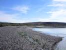
Railroad Sand Flat.
|
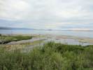
View of Mono Craters across “Railroad Sand Flat.” | |||||
|
Other articles:
Locations:
Railroad Sand Flat.
|
View generally north across “Railroad Sand Flat.” | |||||
|
Other articles:
Locations:
Railroad Sand Flat.
|
||||||
|
Other articles:
|
| |||||
|
Other articles:
Locations:
Railroad Sand Flat.
|
989 |
Elymus elymoides (Raf.) Swezey var. californicus (J. G. Sm.) J. P. sm. Squirreltail Grass. Railroad Sand Flat, Mono County, California. Near the former Bodie & Benton Railway roadbed about 50 m north of Forest Road 01S91 Old Stationhouse Road, 3 miles by that road south of Mono Mills. 37.8498°N, 118.9536°W. WGS 1984. Elev. 2381 m. Dense clumps growing in loose volcanic cinder sand. Coll. No. 989, 20 July 2013, characters observed while keying: Perennial, to 30 cm., clumped, rhizomed; Roots, fibrous; Rhizomes, fibrous, appearing much like roots; Stem, herbaceous; Internodes, hollow; Leaf blades and sheath differentiated, soft; Inflorescence, spike (unbranched central axis), spikelets many; Compression, unremarkable; Disarticulation, infl. axis below glumes; Spikelets, similar, 2-ranked, 2 per node, sessile; Florets, 2+ per spikelet; Glumes, 2, reduced to awns, 45 mm., upper and lower ±equal, entire; Lemma, glabrous, awns 1, 40 mm., straight to bent in maturity/dryness; Palea, veins extended as short bristles. | ||||
|
Other articles:
Locations: Railroad Sand Flat. |
990 |
Erysimum capitatum (Hook.) Greene. Sanddune Wallflower.
Railroad Sand Flat, Mono County, California. Near the former Bodie & Benton Railway roadbed about 50 m north of Forest Road 01S91 Old Stationhouse Road, 3 miles by that road south of Mono Mills. 37.8496°N, 118.9534°W. WGS 1984. Elev. 2382 m. Growing in loose volcanic cinder sand. Coll. No. 990, 20 June 2013, characters observed while keying: Perennial, possibly short-lived, to 35 cm.; Hairs, sessile, branched, mostly 2 branches, occasionally 3 branches; Stem, proximal not woody, Leaves, basal and cauline, basal 70 mm. × 4 mm. wide, narrowly oblanceolate; cauline, appear sessile, but neither lobed, sagittate, nor clasping; Inflorescence not bracted; Pedicels, 4.5 mm., hairs brached; Petals, 13 mm. × 3.5 mm.; Fruit, silique, 15-40 mm. × 0.4-0.8 mm. wide, erect, do not appear to contain seeds, ergo not constricted between seeds. | ||||
|
Other articles:
Locations:
Railroad Sand Flat.
|
991 |
Ericameria parryi (A. Gray) G. L. Nesom & G. I. Baird var. aspera (Greene) Nesom & Baird.
Determination tentative, no flowers when collected. Railroad Sand Flat, Mono County, California. Near the former Bodie & Benton Railway roadbed about 50 m north of Forest Road 01S91 Old Stationhouse Road, 3 miles by that road south of Mono Mills. 37.8492°N, 118.9538°W. WGS 1984. Elev. 2382 m. Growing in loose volcanic cinder sand. Coll. No. 991, 20 June 1991, characters observed while keying: Perennial, woody, low growing; Stem, decumbent, white tomentose; Leaves, 10 mm. × 1 mm. wide, narrowly oblanceolate, tip acuminate, glandular hairy; Inflorescence, none (collected wrong time of year). | ||||
|
Other articles:
|
992 |
Grass, very long straight awns.
Stipa comata Trin. & Rupr. var. comata. Needle and Thread. Railroad Sand Flat, Mono County, California. In openings of second-growth Jeffrey pine forest, near Railroad Sand Flat and the former Bodie & Benton Railway roadbed about 150 m southwest of Forest Road 01S91 Old Stationhouse Road, 2.8 miles by that road south of Mono Mills. 37.8489°N, 118.9574°W. WGS 1984. Elev. 2385 m. Long straight awns catching the sun and waving in the breeze. Coll. No. 992, 20 June 2013, characters observed while keying: Perennial, to 1 m.; Ligule, membraneous, 4 mm.; Spikelets, florets, 1; Glumes, 2, 28–30 mm., ±equal; veins 5, glabrous; Floret, callus 3 mm.; Lemma, 10 mm., hardened at maturity, margins overlapping and enclosing grain, Awn 1, 146 mm., wavy in age, proximally short (<1 mm.) straight hairy. | ||||
|
Other articles:
|
||||||
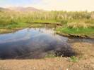
|
Other articles:
Locations:
Old Marina.
|
993 |
Epipactis gigantea Hook. Stream Orchid.
Old Marina, Mono County, California. West shore of Mono Lake, at the Old Marina, just north of the delta of Lee Vining Creek. 37.9804°N, 119.1073°W. WGS 1984. Elev. 1954 m. Growing behind a small beach bar, about a meter above current lake level. | ||||
|
Locations:
Jean Sweeney Open Space Preserve.
|
| |||||
|
Other articles:
|
994 | Tribulus terrestris L. Puncture Vine. | ||||
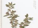
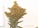
 Coll. No. 995, Paspalum dilatatum Coll. No. 995, Paspalum dilatatum
 Coll. No. 995, Paspalum dilatatum Coll. No. 995, Paspalum dilatatum
|
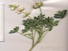
995 |
Paspalum dilatatum Poir. Dallis Grass.
Jean Sweeney Open Space Preserve, Alameda County, California. Shaded area at the southern edge, about mid-way between projections of Wood and Chapin Streets into the preserve. 37.7791°N, 122.2682°W. WGS 1984. Elev. 4 m. Coll. No. 995, 13 July 2013, characters observed while keying: Perennial, tall, but < 1.5 mm.; Stem herbaceous; Leaf sheath and blade differentiated; Ligule membraneous, to 4 mm.; Inflorescence in digitate branches, branches to 8 cm., subtended by silky hairs, 7-8 mm.; Spikelets, many per branch, single proximally, paired distally, stalked on an unbranched central axis, compressed dorsally; Florets, bisexual; Glumes, > florets, enclosing them, mambraneous, flexible; Lemma veins converging; Palea not winged. | ||||
|
Locations:
Jean Sweeney Open Space Preserve.
|
996 |
Jean Sweeney Open Space Preserve, Alameda County, California. South side of preserve, approximate middle from east to west. 37.7793°N, 122.2704°W. WGS 1984. Elev. 4 m. Coll. No. 996, 16 July 2013, characters observed while keying: Perennial of arching, mounded stems, to 2 m. high; Stems 5 angled, not glaucous; Prickles many; Stipules linear, 12 mm. x 1 mm. wide; Leaves compound; Leaflets not dissected, densely white-tomentose abaxially; Terminal leaflets of first year stems wide-elliptic, unevenly ±coarse toothed; Inflorescence panicle-like. | ||||
|
Locations:
Jean Sweeney Open Space Preserve.
|
997 |
Cortaderia selloana (Schult. & Schult. f.) Asch. & Graebn. Uruguayan Pampas Grass.
Jean Sweeney Open Space Preserve, Alameda County, California. South side of preserve, approximate middle from east to west. 37.7792°N, 122.2704°W. WGS 1984. Elev. 4 m. | ||||
|
Locations:
Jean Sweeney Open Space Preserve.
|
998 |
Rubus ulmifolius Schott var. anoplothyrsus Sudre. Thornless Elm-Leaved Blackberry.
Jean Sweeney Open Space Preserve, Alameda County, California. South side of preserve, approximate middle from east to west. 37.7791°N, 122.2702°W. WGS 1984. Elev. 4 m. Coll. No. 998, 16 July 2013, characters observed while keying: Perennial of mounded, arching stems, to 1 m. high; Stems 5 angled, glaucous feeling, tufted short hairs; Prickles 0; Stipules thread-like,6 mm.; Inflorescence panicle-like. | ||||
|
Other articles:
|
999 |
Quercus agrifolia Née var. agrifolia. Coast Live Oak.
Alameda, Alameda County, California. Vacant lot at corner of Buena Vista Avenue and Hibbard Street. 37.7752°N, 122.2547°W. WGS 1984. Elev. 5 m. This tree to be removed to permit construction of a new Fire Station 3 for the Alameda Fire Department. | ||||
|
Locations: Jean Sweeney Open Space Preserve. |
1000 | Quercus agrifolia | ||||
|
Locations:
Jean Sweeney Open Space Preserve.
|
1001 |
Jean Sweeney Open Space Preserve, Alameda County, California. 37.7794°N, 122.271°W. WGS 1984. Coll. No. 1001, 17 July 2013, rekeyed 12/28/2014, characters observed while keying: Annual to 80 cm., sprawling to upright, not gland-dotted; Stipules reduced to small dark bumps; Leaves, sub-palmate compound and simple; Leaflets 3, not gland-dotted, entire, not toothed or wavy; Inflorescence 1-flowered; Peduncle (6) 7-8 (10) mm.; Bracts 1; Sepals fused 2 mm. + free 4 mm., (calyx lobes 2 × tube); Flower bilateral, 1 per axil; Corolla 10 mm., conspicuous; Banner, outside wings, pink-veined; Wings, pink-veined, tip yellow, < keel; Keel, white, tip yellow, not spirally coiled; Stamens, 9 fused, 1 free; Stigma glabrous; Fruit 20-25 mm., straight, exserted from calyx, dehiscent; Seeds 4-6, 2.5 mm., ellipsoid, brown/black-mottled. There are no other collections from the City of Alameda. Other collections from Alameda County are: A. brachycarpus and A. wrangellianus, which have a very short peduncle, A. parviflorus, with calyx lobes ±= tube, and A. glaber, with an indehiscent, curved fruit. | ||||
|
Locations:
Jean Sweeney Open Space Preserve.
|
1002 | Quercus agrifolia | ||||
|
Locations:
Jean Sweeney Open Space Preserve.
|
1003 |
Genista monspessulana (L.) L. A. S. Johnson. French Broom.
Jean Sweeney Open Space Preserve, Alameda County, California. 37.7793°N, 122.2711°W. WGS 1984. Elev. 5 m. Determination tentative; collected too late for flowers. | ||||
|
Locations:
Jean Sweeney Open Space Preserve.
|
1004 |
Lupinus microcarpus Sims var. densiflorus (Benth.) Jeps. White-Whorl Lupine.
Jean Sweeney Open Space Preserve, Alameda County, California. 37.7793°N, 122.2721°W. WGS 1984. Elev. 5 m. One live plant seen, two dried up plants from prior years. Coll. No. 1004, 17 July 2013, characters observed while keying: Most likely an Annual, ascending to erect, to 50 cm., generally hairy with hairs sloughing off; Cotyledons unknown; Stipules 7 mm.; Petioles 4 cm.; Leaves cauline; Leaflets (6)7, 25 mm. x 10 mm. wide, oblanceolate, adaxial surface finely tomentose, abaxial surface finely tomentose and ±appressed hairy; Inflorescence 15-18 cm., whorled; Peduncle 8 cm.; Pedicel 2.5 mm.; Bracts reflexed, sparsely hairy; Calyx, upper 5 mm., notched, lower 8 mm.; Spur 0; Corolla 14 mm.; Banner, yellowish white with six purple spots, back glabrous; Wings sparsely ciliate upper margin near claw; Keel upper margin ciliate 2.5 mm. + glabrous 6 mm., lower margin glabrous; Fruit, young 13 mm., more round than elongate. | ||||
|
|
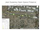
Friday, July 19thFlagged Coast Live Oaks in Jean Sweeey Open Space Preserve today. Found 70 oaks at the locations shown on the map. | |||||
|
Other articles:
Locations:
Picnic Grounds.
|
Sunday, July 21st
| |||||
|
Other articles:
Locations:
Gull Lake.
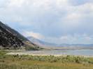
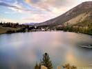
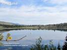
|
View of Gull Lake in the evening. | |||||
|
|
Monday, July 22nd | |||||
|
Other articles:
Locations:
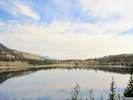
June Lake.
|
| |||||
|
Locations:
Mill Creek.
|
General view of the Mill Creek delta. It was easier to walk down the higher straths on the right bank. | |||||
|
Other articles:
Locations:
Mill Creek.
|
1005 |
Mono Lake, Mono County, California. In the delta of Mill Creek, on the northwest shore of Mono Lake. 38.0166°N, 119.125°W. WGS 1984 Elev. 1949 m. Coll. No. 1005, 22 Jul 2013, characters observed while keying: Perennial herb, to 25 cm., rhizomed, growing in muddy soil at creekside; Stem, rooting at nodes; Herbage, glabrous; Leaves, cauline, opposite, sessile, ovate, 35 mm. × 14 mm., 2.5× longer than wide; Inflorescence, in opposite axillary racemes; Sepals, 4; Corolla, radial, lobes 4, blue; Stamens 2, staminodes 0; Stigma entire; Fruit rounded (not notched). | ||||
|
Other articles:
Locations:
Mill Creek.
|
1006 |
| ||||
|
Locations:
Andy Thompson Creek.
Lee Vining Creek.
Mill Creek.
Rush Creek delta.
|
Location of Collections 1007-1009, this is the westernmost distributary of Mill Creek. Some of the creeks, e.g., Mill Creek and Andy Thompson Creek, seem to be underfit relative to their delta, whereas the larger creeks, e.g., Lee Vining Creek and Rush Creek, are better fit to their delta. | |||||
|
Other articles:
Locations:
Mill Creek.
|
1007 |
Polypogon monspeliensis (L.) Desf. Rabbit's-Foot Grass. Mono Lake, Mono County, California. In the delta of Mill Creek, on the northwest shore of Mono Lake. 38.0158°N, 119.1263°W. WGS 1984. Elev. 1949 m. Coll. No. 1007, 22 Jul 2013, characters observed while keying: Annual, or short-lived perennial, to 35 cm.; Nodes, green; Leaf, blade and sheath differentiated; Inflorescence, >> leaves, 3.5 cm., dense; Spikelets, many, similar, not subtended by bristles or hairs, cylindric, axis not extended beside or above floret, attached to 2°-3° branches, stalk 0.3 mm.; Florets, 1 per spikelet, bisexual; Glumes, 2, 1.5 mm., equal, not keeled or ciliate-keeled, short hairy, lobed, awns 1 per glume, 4.5 mm.; Lemmas, membranous, glabrous, short hair-like “awn”; Palea, membranous, glabrous; Stamens, 3. | ||||
|
Other articles:
Locations:
Mill Creek.
|
1008 |
Epilobium ciliatum Raf. ssp. ciliatum. Fringed Willowherb.
Mono Lake, Mono County, California. In the delta of Mill Creek, on the northwest shore of Mono Lake. 38.0158°N, 119.1263°W. WGS 1984. Elev. 1949 m. Four petals divided, rooting from nodes. Also at this location but not collected, Salix exigua, Ranunculus cymbalaria, and Melilotus alba. Coll. No. 1008, 22 July 2013, characters observed while keying: Erect perennial herb from caudex, to 30 cm.; Leaves, proximal opposite, lanceolate, 33 mm. × 9 mm., distal alternate, lanceolate, 11 mm. × 3 mm., glabrous, margins slightly toothed; Inflorescence, strigose; Petals, 5 mm., white to pink; Seed, ridged. | ||||
|
Other articles:
Locations:
Mill Creek.
|
1009 |
Rumex triangulivalvis (Danser) Rech. f. Triangular-Valved Dock. Mono Lake, Mono County, California. Beside a distributary in the delta of Mill Creek, on the northwest shore of Mono Lake. 38.0158°N, 119.1263°W. WGS 1984. Elev. 1949 m. Also collected at this location: Epilobium ciliatum ssp. ciliatum, Myosotis laxa, Polypogon monspeliensis, and Veronica anagallis-aquatica. Seen at this location, but not collected, Salix exigua, Ranunculus cymbalaria, and Melilotus alba. Coll. No. 1009, 22 July 2013, characters observed while keying: Perennial, to 15 cm., growing beside distributary of Mill Creek; Main stem, herbaceous (not clearly woody), decumbent; Leaves, cauline, lance-linear arcuate, 80 mm. × 10 mm. wide, 8 × longer than wide, margins wavy, adaxial surface sparsely short-hairy, esp. mid-rib, abaxial sparsely cobwebby, esp. mid-rib, petiole, 45 mm., not jointed; Inflorescence, monoecious, axillary, dense, interrupted; Flower, inner perianth lobes 3, 3 mm. × 1.8 mm. wide, triangular, notched bear base, tip acute, tubercule (callosity) 1 × 3 inner lobes = 3, ± equal, width 0.3 mm., 1/6 lobe, minute warty, outer perianth lobes mostly deteriorated and easily overlooked; Stamens, 6, yellow; Styles, 3, fringed; Seed, 3-angled, 1.4 mm × 0.7 mm. wide, brown. | ||||
|
Other articles:
Locations:
Thompson Ranch.
|
| |||||
|
Other articles:
|
1010 |
Myosotis laxa Lehm. Bay Forget-Me-Not.
Thompson Ranch, Mono County, California. Along an irrigation ditch in former Thompson Ranch, about 250 meters northwest of the parking lot of Mono Lake County Park. 38.0171°N, 119.1526°W. WGS 1984. Elev. 1985 m. Collected in tall grass with Hypericum scouleri. The irrigation ditch is fed from Dechambeau Creek, and it is not clear whether it is being maintained or not. The creek was formerly augmented by water brought from Mill Creek by two ditches. | ||||
|
Other articles:
Locations:
Dechambeau Creek.
Thompson Ranch.
|
1011 |
Hypericum scouleri Hook. Scouler's Gold Wire.
Thompson Ranch, Mono County, California. Along an irrigation ditch in former Thompson Ranch, about 250 meters northwest of the parking lot of Mono Lake County Park. 38.0172°N, 119.1524°W. WGS 1984. Elev. 1985 m. Flowers orangish-yellow, three carpels, many stamens. Collected in tall grass with Myosotis laxa. The irrigation ditch is fed from Dechambeau Creek, and it is not clear whether it is being maintained or not. The creek was formerly augmented by water brought from Mill Creek by two ditches. | ||||
|
Other articles:
Locations:
Thompson Ranch.
|
1012 |
Thompson Ranch, Mono County, California. In a drying field in what was Thompson Ranch, about 265 meters north northwest of Mono Lake County Park parking lot. 38.0178°N, 119.1519°W. WGS 1984. Elev. 1982 m. Coll. No. 1012, 22 July 2013, characters observed while keying: Annual, to 80 cm., scaly or powdery throughout; Stem, not jointed, striated; Leaves, weakly fleshy, flattened, primary, 31 mm. × 3.5 mm., lance-linear, 1-veined from base, top acute to rounded, not spine-tipped, short-petioled to sessile, distal not clasping; Flowers, bisexual, calyx lobes 5, appendages 0, condition in fruit unknown; Stamens 5; Ovary superior; Stigma branches 2; Seeds not available, assumed to be horizontal. | ||||
|
Other articles:
|
1013 |
Myosotis laxa Lehm. Bay Forget-Me-Not.
Mill Creek, Mono County, California. On a small island on the edge of Mill Creek, just downstream of US Highway 395. Adjacent to Mono City and accessed from the west end of Twin Lakes Drive. 38.04°N, 119.158°W. WGS 1984. Elev. 2093 m. | ||||
|
Other articles:
|
Lots of Sierra Bog Orchid across Mill Creek from the picnic area. | |||||
|
Literature Cited:
Other articles:
Locations: Lundy Canyon. |
1014 |
Mill Creek, Mono County, California. On the banks of Mill Creek, 2.4 miles west on Lundy Lake Road from US Highway 395. 38.0329°N, 119.1958°W. WGS 1984. Elev. 2285 m. Flowers white. Coll. No. 1014, 22 July 2013, characters observed while keyed: Perennial, herbaceous, green & photosynthetic, to 60 cm.; Leaves, simple, palmately lobed, into 5-7 lobes, largest 44–57 mm. × 87–96 mm. wide, petioles 17–19 mm.; Inflorescence (cymules!) 2-flowered; Pedicels, 9–15 mm., hairs topped with purple glands (per Taylor, 2010); Flowers, open, radial, bisexual, in 5×n parts; Perianth, 2 whorls; Petals, 5, free, hairy ≤½ adaxial surface, 15 mm. × 7 mm. wide, white; tips rounded; Nectaries, not wooly or lanate (per TJM2 & Aedo, 2012), but few small straight hairs, without tuft of hairs on top; Stamens, 10, 2×petals; Ovary superior; Pistil 1; Stigmas, (in fruit) 3–4 mm.; Mericarp with basal callus. | ||||
|
Other articles:
Locations:
Lundy Canyon.
|
1015 |
Sidalcea oregana (Torr. & A. Gray) A. Gray ssp. spicata (Regel) C. L. Hitchc. Oregon Checkerbloom. Mill Creek, Mono County, California. On the banks of Mill Creek, 2.7 miles west on Lundy Lake Road from US Highway 395. 38.0339°N, 119.1997°W. WGS 1984. Elev. 2284 m. Pink flowers Coll. No. 1015, 22 July 2013, characters observed while keying: Perennial herb, to 65 cm.; Leaves, mostly on lower stem, appearing rosette-like; Inflorescence, dense, not interrupted; Flowers, many in near-terminal spike, to 15 mm. wide; Petals, 5, 15 mm. × 5 mm., notched, pink-purple; Anthers, near top of filament tube, in 2 concentric series; Stigmas, 6, linear; Fruit, not available. | ||||
|
Locations:
Andy Thompson Creek.
|
Stream Orchid (Epipactus gigantea) in the delta of Andy Thompson Creek. | |||||
|
|
Tuesday, July 23rd | |||||
 Mount Rose Wild Buckwheat (Eriogonum rosense var. rosense) Mount Rose Wild Buckwheat (Eriogonum rosense var. rosense)
|
Mount Rose Wild Buckwheat (Eriogonum rosense var. rosense) found at the south end of the Ellery Lake dam. | |||||
|
Locations:
Lee Vining Creek.
|
Walked the right bank of Lee Vining Creek to the outlet. | |||||
|
Other articles:
Locations:
Picnic Grounds.
|
1016 |
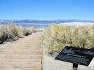
Cleomella parviflora A. Gray. Slender Cleomella. Picnic Grounds, Mono County, California. On tufa-covered rocks along the western shore of Mono Lake, at the end of the David Gaines Memorial Boardwalk, accessed from the Picnic Grounds parking lot off of US Highway 395 one mile north of Lee Vining. 37.978°N, 119.1286°W. WGS 1984. Elev. 1949 m. | ||||
|
|
Wednesday, July 24th | |||||
|
Other articles:
Locations:
Walker Creek (Lower).
|
Collecting locality at the crossing of Walker Creek by old US Highway 395. | |||||
|
Other articles:
|
1017 |
Juncus cf. macrandrus
Walker Creek (Lower), Mono County, California. In Pumice Valley, near the banks of lower Walker Creek, where crossed by an old alignment of US Highway 395, 4.5 miles by road south of Lee Vining. 37.9037°N, 119.1024°W. WGS 1984. Elev. 2088 m. Coll. No. 1017, 24 July 2013, characters observed while keying: Perennial herb, to 50 cm.; Leaf blades flat, iris-like; Inflorescence appearing terminal, bract not mimicking the culm, not cylindric; Flowers, many per cluster; Stamens, 6; Filaments, 0.5 mm.; Anthers, 0.8 mm., anthers > filaments. Resembles J. macrandrus but fruit not well enough developed to be sure. | ||||
|
Other articles:
|
1018 |
Symphyotrichum spathulatum (Lindl.) G. L. Nesom var. intermedium (A. Gray) G. L. Nesom. Larger Western Mountain Aster.
Walker Creek (Lower), Mono County, California. On the edge of Walker Creek, just downstream from the crossing of old US Highway 395, 4.5 miles by road south of Lee Vining. 37.9037°N, 119.1024°W. WGS 1984. Elev. 2088 m. In the bank of the creek. Coll. No. 1018, 24 July 2013, characters observed while keying: Perennial herb, to 70 cm.; Stem, glabrous proximally, hairy distally, hairs not obviously in lines; Leaves, 110 mm. × 8 mm. wide, 13 × longer than wide, largest proximally, gradually reducing above, oblanceolate, entire, margins of short curved hairs; Inflorescence panicle-like; Heads, #20-24; Phyllaries, graduated in 2-3 series, green full length, glabrous, margins white, hairy, outer phyllaries, pale margined at base, green area at tip 1.5 mm. × 0.4 mm. wide, 3.7 × longer than wide, tip obtuse; Receptacle epaleate; Flowers, of two kinds, at least some strap-shaped, rays, 7 mm., blue, fruiting (though style in very difficult to see), disc yellow; Pappus of well-developed bristles, one series, #20-24, cylindric, short plumose. | ||||
|
Other articles:
|
1019 |
Lappula redowskii (Hornem.) Greene var. redowskii. Stickseed.
Walker Creek (Lower), Mono County, California. Dryer spots near the edge of Walker Creek, just downstream from the crossing of old US Highway 395, about 4.5 miles by road south of Lee Vining. 37.9037°N, 119.1024°W. WGS 1984. Elev. 2088 m. Coll. No. 1019, 24 Jul 2013, characters observed while keying: Annual, to 40 cm., without milky juice, ; Flowers 1 per axil; Pedicel erect in fruit; Calyx, lobes w/o teeth in fruit; Corolla, 2 mm., ±tubular, lobes blue; Receptacle, conic, ±=nutlet; Ovary, deep-lobed, style base hidden within lobes; Nutlets, ±erect (not spreading), scar lateral, straight w/o thick rim, margin prickles in 1 row, wider at base, not fused into crown, barbed. | ||||
|
Other articles:
Locations:
Walker Creek (Lower).
|
Western Columbine and Common Yarrow were growing on the bank of Walker Creek. | |||||
|
Other articles:
Locations:
Walker Creek (Lower).
|
1020 |
Aquilegia formosa DC. Western Columbine.
Walker Creek (Lower), Mono County, California. Growing in the banks of Walker Creek in Pumice Valley, just downstream from the crossing of old US Highway 395, about 4.5 miles by road south of Lee Vining. 37.9038°N, 119.1021°W. WGS 1984. Elev. 2088 m. | ||||
|
Other articles:
|
1021 |
Astragalus canadensis L. var. brevidens (Gand.) Barneby. Short-Tooth Canadian Milkvetch.
Walker Creek (Lower), Mono County, California. In Pumice Valley, near the banks of lower Walker Creek, where crossed by an old alignment of US Highway 395, 4.5 miles by road south of Lee Vining. 37.9038°N, 119.1022°W. WGS 1984. Elev. 2088 m. Coll. No. 1021, 24 Jul 2013, characters observed while keying: Perennial herb to 35 cm., from rhizome, not gland-dotted; Stipules, surrounding stem forming a sheath; Leaves, compound, odd pinnate, hairs branched (appearance is more like double-ended and anchored in middle); Leaflets, 17-21, tip without gland; Inflorescence, many flowers in a head-like spike; Flowers, 13 mm., greenish; Keel, 10 mm., tip purple-tinged, rounded. | ||||
|
Other articles:
|
1022 |
Solidago spectabilis (D. C. Eaton) A. Gray. Basin Goldenrod.
Walker Creek (Lower), Mono County, California. In Pumice Valley, near the banks of lower Walker Creek, where crossed by an old alignment of US Highway 395, 4.5 miles by road south of Lee Vining. 37.9038°N, 119.1022°W. WGS 1984. Elev. 2088 m. Coll. No. 1022, 24 July 2014, characters observed while keying: Perennial herb to 75 cm.; Stem hairy distally, fewer hairs proximally, not waxy, distal nodes with axillary leaf clusters; Leaves alternate, lanceolate, 85 mm. × 13 mm. wide, generally glabrous,not resinous, proximal leaves withered at flowering (assumed to having been equal in size to mid-cauline leaves), margins weakly serrate, and with very small hairs; Inflorescence pyramid-shaped; Peduncle bracts not glandular; Involucre 3 mm.; Phyllaries in 2+ graduated series, outer without oil glands; Heads many, small (5 mm. × 4 mm. dia.), not resinous; Flowers of two kinds, at least some strap-shaped; Receptacle epaleate; Rays, yellow, fertile; Disc, yellow, fertile; Pappus of well-developed bristles, in single row. | ||||
|
Other articles:
|
1023 |
Achillea millefolium L. Common Yarrow.
Walker Creek (Lower), Mono County, California. In Pumice Valley, near the banks of lower Walker Creek, where crossed by an old alignment of US Highway 395, 4.5 miles by road south of Lee Vining. 37.9038°N, 119.1021°W. WGS 1984. Elev. 2090 m. Coll. No. 1023, 24 Jul 2013, characters observed while keying: Perennial herb to 50 cm.; Leaves, alternate, tendrils absent, finely dissected; Inflorescence, heads enclosed by an involucre, in flat-topped clusters; Receptacles bearing scale-like bracts (paleate); Perianth in 2 or more whorls, parts in 5s; Phyllaries in 2+ series, not all subtending ray flowers; Flowers open, bisexual, two kinds, some with strap-shaped corollas; Petals fused into a tube; Ray flowers, white, lobe ovate; Disc flowers, white; Stamens = in number to corolla lobes; Ovary inferior; Pistils, 1 per flower. | ||||
|
Other articles:
|
1024 |
Veronica americana (Raf.) Benth. American Speedwell.
Walker Creek (Lower), Mono County, California. In western Pumice Valley, growing on a little muddy bar inside the banks of Walker Creek, just below the crossing of old US Highway 395, about 4.5 miles by road south of Lee Vining. 37.9037°N, 119.1019°W. WGS 1984. Elev. 2088 m. Coll. No. 1024, 24 July 2013, characters observed while keying: Perennial, decumbent, glabrous; Leaves, short-petioled (1.5-3.0 mm.), ovate, 30 mm. × 17 mm. wide, length 1.8 × width; Inflorescence, axillary, racemes opposite; Bracts, 6 mm., wider than linear; Pedicels, 4-6 mm.; Flowers, 15-20 per raceme; Sepals, 2 mm. at flowering, 2.5-3.5 mm. at fruit. | ||||
|
Other articles:
|
1025 |
Ericameria nauseosa (Pall. ex Pursh) G. I. Nesom & G. I. Baird var. oreophila (A.Nelson) G.L.Nesom & G.I.Baird. Rubber Rabbitbush.
Walker Creek (Lower), Mono County, California. In Pumice Valley, along old US Highway 395 just south of the crossing of Walker Creek, about 4.5 miles by road south of Lee Vining. 37.9034°N, 119.1022°W. WGS 1984. Elev. 2090 m. Coll. No. 1025, 24 Jul 2014, characters observed whilst keying: Perennial to 1 m., stem and leaves without round, ±evenly spaced resin-filled pits; Leaves, thread-like; Phyllaries in 4 series, 2-ranked, aligned vertically, tips erect; Rays 0; Disc flowers, corolla lobes 2 mm.; Style, stigma 2.0 mm., appendage 1.8 mm.; Fruit, 2.5 mm. hairy. | ||||
| 1026 |
Elymus triticoides (Buckley) Pilg. Beardless Wildrye.
Walker Creek (Lower), Mono County, California. Pumice Valley, in a low spot near the crossing of Walker Creek by an old alignment of US Highway 395. 37.9038°N, 119.1022°W. WGS 1984. Elev. 2088 m. Coll. No. 1026, 24 July 2013, characters observed whilst keying: Perennial, rhizomatous, to 70 cm.; Internodes glabrous; Leaf, blade and sheath differentiated, soft; Sheath, open; Ligule, 0.5 mm., membraneous; Auricles, very small; Blade, rolled, 6 mm. wide; Inflorescence, single, 10 cm., spike-like, > leaves, spikelets many; Axis, not extended beyond upper floret; Compression, unremarkable; Disarticulation, above the glumes, between florets; Spikelets similar, 2-ranked, 3 per node, stalked, length 21 mm.; Florets, 6 per spikelet; Glumes, awl-shaped, upper > lower, awns 0, margins short hairy; Lemma, > glumes, margins short hairy, awns 1, 1.5 mm., straight, attached near tip; | |||||
|
Other articles:
|
1027 |
Helenium bigelovii A. Gray. Bigelow's Sneeze Weed. Walker Creek (Lower), Mono County, California. Pumice Valley, along the bank of Walker Creek, just above the crossing of old US Highway 395, growing in the creek bank and hanging over the creek. 37.9038°N, 119.1028°W. WGS 1984. Elev. 2090 m. Coll. No. 1027, 24 Jul 2013, characters observed while keying: Perennial, Stems, to 50 cm. (hanging over a creek from the bank); Leaves, alternate, cauline, lanceolate, slightly arcuate, entire, largest 13 cm. × 2.6 cm. wide, decurrent on stem 4.5 cm. forming wings; Heads, single on peduncle 15 cm., composed of two kinds of flowers, some with strap-shaped corollas; Phyllaries, 2 series, overlapping slightly, ±equal, reflexed; Receptacle, epaleate, smooth, spheric; Ray, yellow, corolla withering (not papery); Pappus of well-developed scales, #±6, ± equal. | ||||
| 1028 |
Sidalcea oregana (Torr. & A. Gray) A. Gray ssp. spicata (Regel) C. L. Hitchc. Oregon Checkerbloom. Walker Creek (Lower), Mono County, California. In Pumice Valley, a few meters away from Walker Creek, just above the crossing by an old alignment of US Highway 395. 37.9038°N, 119.1029°W. WGS 1984. Elev. 2090 m. Coll. No. 1028, 24 July 2014, characters observed while keying: Perennial herb, to 65 cm.; Leaf, simple, deeply lobed; Inflorescence dense; Peduncle 1° short; Bracts subtending calyx 1, > youngest buds, not forming involucel; Perianth in 2 or more whorls; Calyx, in fruit 5 mm., stellate hairs; Flowers, open, bisexual, showy; Petals, 5, lavender-purple, free, fused into a ring at base; Stamens, > 2 × as many as petals; Filaments fused into a tube; Anthers near top of filament tube, in 2 concentric series; Ovary superior; Pistil 1; Fruit, multiple segments (obs: #7), smooth, not net veined or pitted. | |||||
|
Other articles:
Locations:
Parker Creek.
|
||||||
|
Other articles:
Locations:
Grant Lake.
|
| |||||
|
Other articles:
|
1029 |
Tetradymia canescens DC. Spineless Horsebush.
Grant Lake, Mono County, California. Along California Highway 158, 0.4 mile south of the entrance to the Grant Lake Marina, west side of Grant Lake, along a trail to the spring box that collects water for the Grant Lake Marina. 37.8251°N, 119.1223°W. WGS 1984. Elev. 2208 m. There is a historic collection from approximately this location: Milo S. Baker, #9154, 29 Jul 1938, UC830618. Coll. No. 1029, 24 Jul 2013, characters observed while keying: Perennial shrub, to 1 m., unarmed; Leaves, distal only, lanceolate, 15 mm. × 2 mm. wide, entire tomentose; Involucre cylindric; Phyllaries, #4, 2-ranked, 9 mm., wooly; Receptacle epaleate; Heads, with only disc flowers (discoid); Disc flowers, 4; Corolla, 5-lobed, yellow; Pappus of many well-developed bristles. | ||||
|
Other articles:
|
1030 |
Eriogonum elatum Douglas ex Benth. var. elatum Jeps. Tall Wooly Buckwheat. Grant Lake, Mono County, California. East facing slopes, near Grant Lake, along California Highway 158, about 0.4 miles south of the entrance to the Grant Lake Marina. 37.8257°N, 119.1219°W. WGS 1984. Elev. 2198 m. Coll. No. 1030, 24 Jul 2013, characters observed while keying: Perennial erect herb from caudex, to 80 cm.; Stem to 50 cm., not jointed, slightly inflated, glabrous; Leaves, petioles 11-13 cm., ovate-elliptic, 8-9 cm. × 2.5-3.5 cm. wide, short-hairy adaxially, hairy to near-tomentose abaxially; Inflorescence branched, branches glabrous; Involucre, 2-3 per node, 15 mm. wide; Pedicels glabrous; Stipe 0; Flower hairy; Perianth lobes 5, all alike. | ||||
| 1031 | Vegetative material of three different willows found at this location. This was an attempt to relocate R. F. Thorne's #32813 (7/16/1963) of Salix scouleriana Barratt ex Hook., Scouler's Willow. | |||||
|
Other articles:
|
1032 |
Galium trifidum L. var. columbianum (Rydb.) Hultén. Three-Petal Bedstraw.
Silver Lake, Mono County, California. Southwest corner of Silver Lake, near a parking lot providing hiking and fishing access. 37.7729°N, 119.1259°W. WGS 1984. Elev. 2208 m. Growing in deep shade along the shore. Coll. No. 1032, 24 Jul 2013, characters observed while keying: Annual or Perennial unknown, Weak, sprawling herb, climbing or trailing, with slender branches, green in color; Stem, to 70 cm., not woody, sparse hooked prickles (described by Munz, 1965, as “±retrorsely scabrous”); Leaves ±sessile, ±equal, in whorls or 5 or 6, distal-most opposite, obovate to oblanceolate, 10-17 mm. × 2-3 mm. wide, entire, thin and flat in cross-section, ±glabrous, to slightly puberulent on adaxial surface; Inflorescence branchlets thread-like; Pedicel, slender, spreading; Flowers terminal, bisexual, many, much exserted from leaves; Corolla rotate, lobes 4, divided 1/2 to base, color white with dark spots; Fruit, 2, spheric, width pair < 4 mm., hairless. | ||||
|
Other articles:
|
1032.1 |
Mentha canadensis L. Wild Mint. Silver Lake, Mono County, California. Southwest corner of Silver Lake, near a parking lot providing hiking and fishing access. 37.7729°N, 119.1259°W. WGS 1984. Elev. 2208 m. Growing in deep shade along the shore. Coll. No. 1032.1, 24 Jul 2013, characters observed while keying: Perennial herb, to 30 cm., spreading by rhizomes; Stem, erect, 4-angles, hairy; Leaves, opposite, ±equal in size, ovate, 37 mm. × 15 mm. wide, margins serrate, surfaces nearly hairless; Petiole 4.5 mm.; Inflorescence axillary, bract margin hairy; Calyx, lobes 5, short hairy outside; Corolla 5 mm.; Stamens 4, exserted. Some characters, such as ovate and near-glabrous leaves, suggest M. arvensis, whereas a short-hairy calyx and 5 mm. corolla suggest M. canadensis. While the TJM2 description says, “bracts minute or 0,” the bracts of this collection are 3 mm. | ||||
| 1033 | Potentilla anserina L. ssp. anserina | |||||
|
Other articles:
|
||||||
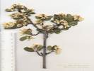
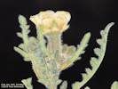
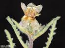
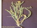
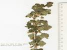
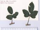
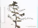
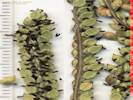
 Coll. No. 1034, Helminthotheca echioides Coll. No. 1034, Helminthotheca echioides
 Coll. No. 1034, Helminthotheca echioides Coll. No. 1034, Helminthotheca echioides
|
1034 |
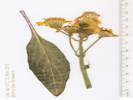
Helminthotheca echioides (L.) Holub. Bristly Ox-Tongue.
Jean Sweeney Open Space Preserve, Alameda County, California. Just inside the preserve, just east of the north end of Nason Street. 37.779°N, 122.2714°W. WGS 1984. Elev. 4 m. Growing the the gravel of a former railroad roadbed. Coll. No. 1034, 31 August 2013, characters observed while keying: Herbaceous annual or biennial, to 35 cm., rigid hairs with hooked branches at tip; Sap slightly milky (seen mostly at base of phyllaries); Leaves basal and cauline, alternate, 11 cm x 18 mm wide, oblanceolate, slightly glandular, margins entire, not spine-tipped; Involucre 14 mm; Phyllaries in 4-5 series, the outer series are wide and stand away from the rest, the inner series are narrow, appendaged at tip; Receptacle epaleate; Flowers all rays; Pappus of well developed bristles, ±equal, broader at base, plumose; Corolla yellow, readily withering; Fruit 3 mm x 0.5 mm wide, brown, annular ridges or decoration giving the appearance of a small insect pupa. | ||||
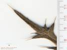 Leaf tip of Cirsium vulgare, Coll. No. 1035 Leaf tip of Cirsium vulgare, Coll. No. 1035
|
1035 |
Cirsium vulgare (Savi) Ten. Bull Thistle.
Jean Sweeney Open Space Preserve, Alameda County, California. Growing in weeds in the preserve, about 200 meters from the west end, and 50 meters north of the end of 8th Street. 37.7793°N, 122.2723°W. WGS 1984. Elev. 4 m. | ||||
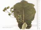 Adaxial surface of cauline leaf, Coll. No. 1036, Lactuca virosa Adaxial surface of cauline leaf, Coll. No. 1036, Lactuca virosa
|
1036 |
Lactuca virosa L. Bitter Lettuce.
Jean Sweeney Open Space Preserve, Alameda County, California. About 230 m east of the west end, approximate north-south middle. 37.7794°N, 122.2719°W. WGS 1984. Coll. No. 1036, 31 August 2013, characters observed while keying: Herbaceous annual or biennial to 1.5 m.; Sap copious milky; Leaves cauline widely clasping; Head with only ray flowers (liguliflorus); Receptacle epaleate; Pappus of bristles, smooth; Corolla yellow; Fruit ±compressed, beaked, slender, 5 ribs per face, wing-margined. | ||||
|
Other articles:
|
1037 |
Quercus agrifolia Née var. agrifolia. Coast Live Oak.
Bay Farm Island, City of Alameda, Alameda County, California. Along the San Francisco Bay Trail and shoreline of San Leandro Bay, about half way between the end of Veterans Court, and the projected end of Packet Landing Road. 37.7479°N, 122.2386°W. WGS 1984. Elev. 2 m. There is nothing to suggest that this tree was purposely planted at this location. | ||||
| 1038 | Salix | |||||
|
Other articles:
|
1039 |
Cuscuta
Coll. No. 1039, 13 September 2013, keyed 29 December 2014, characters observed while keying:
Plants non-green, parasitic, growing on Salicornia in tidal flat;
Leaves absent;
Flowers separate from host inflorescence;
Pedicel 0.5+ mm.;
Calyx, 2.5-3.0 mm., tube 1.3 mm., ±=lobes, net-veined not papillate,
tip acute, not appendaged;
Corolla, bell-shaped,
tube 2.0 mm. + lobes 1.5-2.0 mm. = 3.5-4.0 mm.,
scale | ||||
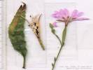 Coll. No. 1040, Epilobium brachycarpum Coll. No. 1040, Epilobium brachycarpum
|
1040 |
Epilobium brachycarpum C. Presl. Autumn Willow Herb.
Jean Sweeney Open Space Preserve, Alameda County, California. Found in several places around the preserve, among dried grasses and weeds. 37.7793°N, 122.2707°W. WGS 1984. Elev. 4 m. Coll. No. 1040, 15 Sep 2013, characters observed while keying: Late-season annual, from taproot, to 1 m, not glandular; Leaves, opposite at base, alternate above, stipules 0, petiole 4 mm + blade 46 mm × 6 mm wide, folded along mid-rib, toothed, glabrous; Flowers, parts in 4s; Sepals, 4.5 mm, deciduous after flowering; Hypantheum, 13 mm; Petals, 9.5 mm, notched; Ovary inferior; Stamens, in 2 unequal whorls of 4; Seeds, 1.3 mm, hair tufted, bug eaten. | ||||
|
|
Wednesday, 2 October 2013 | |||||
|
Other articles:
Locations:
Rim of the World.
|
| |||||
|
Other articles:
|
View to the west of Mount Dana and Mount Gibbs. | |||||
|
|
Thursday, October 3rd | |||||
|
Other articles:
|
Aspens along Nevada Street. | |||||
|
Other articles:
|
1043 |
Arctostaphylos patula Greene. Snowbush Manzanita.
Horseshoe Canyon, Mono County, California. On a low bench of Reversed Peak, above Horseshoe Canyon and the Forest Service Silver Lake Tract. 37.7688°N, 119.119°W. WGS 1984. Elev. 2226 m. with Juniperus, Pinus, Cercocarpus, and Artemisia. Coll. No. 1043, 3 Oct 2013, characters observed while keying: Perennial shrub, >1 m. tall, burl unknown, sprouting after fire unknown; Stems, bark reddish, smooth; Twigs, pubescent with gold-tipped hairs; Leaves, alternate, green, ±shiny, surfaces generally same color, lightly covered with small gold-tipped hairs, ovate to elliptic, 35 mm. × 23 mm. wide, base truncate to rounded, margin entire, tip obtuse, petiole 6 mm., covered with gold-tipped hairs; Inflorescence, nascent infl. pendent; Flowers unknown; Fruit unknown. Plant typically of high Sierra Nevada (SNH) in this region, collected frequently in Mammoth Lakes area. This is possibly the first collection from the Mono Lake basin. | ||||
|
Other articles:
|
Search for Gentiana calycosa. | |||||
|
Other articles:
Locations:
Silver Lake.
|
||||||
|
Other articles:
Locations:
Alger Creek.
|
View of Alger Creek from the Silver Lake Campground. | |||||
|
Other articles:
|
1044 | Gentianopsis holopetala (A. Gray) H. H. Iltis | ||||
|
|
Friday, October 4th | |||||
|
Other articles:
|
988 | 1045Salix sp. at Sagehen Spring, just beginning to form buds. Same plant as my collections nos. #943 and #988. | ||||
|
Other articles:
Locations:
Dry Creek.
|
The spring and pond on Dry Creek at its exit on Big Sand Flat was almost completely dry. There was only a tiny amount of water in one of the mud holes. | |||||
|
Other articles:
Locations:
South Tufa Area.
|
On the 1st of October, 2013, the Mono Lake water level was 6380.6 feet, about 11½ feet below the level mandated in 1994. The sign reads:
| |||||
|
Other articles:
Locations:
Lago.
|
Stopped for a view of, and an amble out to, the ficticious town of Lago from the 1973 Clint Eastwood movie “High Plains Drifter.” The town was later renamed “Hell.” For more information about movies filmed in Mono County, see “Mono in the Movies” at the June Lake branch of the Mono County Library. | |||||
|
|
Saturday, October 5th | |||||
|
Other articles:
|
The parking lot near the Lee Vining Creek delta. | |||||
|
Other articles:
Locations:
Lee Vining Creek.
|
| |||||
|
Other articles:
|
1046 |
Chenopodium glaucum L. Oakleaf Goosefoot.
Lee Vining Creek, Mono County, California. On a gravel bar of the Lee Vining Creek delta, near the shore of Mono Lake. 37.9771°N, 119.1029°W. WGS 1984. Elev. 1948 m. Coll. No. 1046, 5 Oct 2013, characters observed while flopping around in the keys: Annual herb, to 12 cm., growing in flowing water on the shore of Mono Lake; Stem, not succulent; Leaves alternate, wedge-shaped, 10 mm. × 4 mm. wide, 1-veined, margin toothed, powdery (“farinose”) abaxially; Inflorescence, upper axillary, 3 mm. dia., Calyx lobes 5 when seeds horizontal, ±3 when seeds vertical, thin and membraneous; Flowers unknown; Stamens unknown; Stigmas 2, fused at base; Seed, 1 mm., brown. | ||||
|
Literature Cited:
Other articles:
|
1047 |
Lupinus lepidus Douglas ex Lindl. var. confertus (Kellogg) C. P. Sm. Crowded Lupine. Lee Vining Creek, Mono County, California. On the banks of a small distributary in the delta of Lee Vining Creek. 37.9771°N, 119.1029°W. WGS 1984. Elev. 1950 m. Coll. No. 1047, 5 Oct 2013 (late in season!), characters observed while keying: Perennial herb, erect, to 50 cm., not woody except possibly at base; Leaf, basal and cauline, ±along stem, palmate compound, leaflets #±7, 11-27 mm. × 3-5 mm. wide, tips acuminate, hairy, more so abaxially than adaxially, petiole 30-60 mm.; Inflorescence, >leaves, whorls of mature inflorescence ±12; Bracts persistent; Calyx spur 0; Flowers, Banner, 10 mm., blue with white patch, back glabrous; Wing, 10 mm. including claw 2 mm., blue; Keel, ciliate distal half, blue, darkening distally. Keys easily to Lupinus pratensis A. A. Heller var. eriostachyus C. P. Small in Taylor (2010). Keys easily to L. lepidus Douglas ex Lindl. var. confertus (Kellogg) C. P. Small in TJM2. The Plant List, which takes its names for Lupinus from ILDIS (International Legume Database & Information Service), elevates L. lepidus var. confertus to species rank as L. confertus Kellogg. The Plant List also submerges all of L. pratensis A. A. Heller, including var. eriostachyus C. P. Small, in synonomy with L. confertus Kellogg. The family Fabaceae is not published in FNANM (as of 4/27/2015). Weitemier (2010) concludes that varieties of L. lepidus are ecotypes, recommends that they continue to be recognized at the varietal rank per Clausen, et al. (1939). | ||||
|
Other articles:
Locations:
County Ponds.
|
| |||||
|
Other articles:
|
1048 |
Sarcobatus vermiculatus (Hook.) Torr. Greasewood.
County Ponds, Mono County, California. On the northwest margin of the northwest of the County Ponds. 38.0442°N, 119.0753°W. WGS 1984. Common around this pond. Poor collection of a taxon no one needs more of, discarded. | ||||
|
|
Sunday, October 20, 2013Field trip to Ulistac Natural Area, with Dorothy Freeman, Jim Sweeney, and Bill Delaney. | |||||
|
Other articles:
Locations:
Ulistac Natural Area.
|
South entrance Ulistac Natural Area. | |||||
|
Other articles:
|
| |||||
|
Other articles:
|
||||||
|
Other articles:
|
Vernal pond | |||||
|
Other articles:
|
||||||
|
Other articles:
|
| |||||
|
Other articles:
|
||||||
|
Other articles:
|
The Alameda contingent walks the paths of the Ulistac Natural Area. | |||||
|
Other articles:
|
||||||
|
Other articles:
|
The main path was crushed rock, not asphalt. | |||||
|
Locations:
Bormujos.
|
1049 |
Clerodendrum splendens G. Don. Flaming Glorybower.
Bormujos, (Sevilla) Andalucia. Front yard of Avenida San Juan de Dios No. 6. 37.3684°N, 6.0822°W. WGS 1984. Elev. 94 m. Coll. No. 1049, 30 Nov 2013, characters observed: Perennial shrub, to 2 mm, climbing but not a vine; Leaves opposite, 10-12 cm., cordate, entire; Calyx, lobes 5, 14 mm., lanceolate, fused ⅓; Flowers bisexual; Corolla, lobes 5, tube 22 mm. + lobes 7 mm., deep red, bilateral,upper lobes reflexed; Stamens 4, all fertile, arising in pairs, exserted, curled up when flower is young, curled down when flower is mature; Anthers, 2 mm., versatile; Ovary superior; Pistil 1, 47 mm., exserted, rising as flower matures; Stigma forked, 2 lobes. | ||||
|
Other articles:
Locations:
Danby Lake.
|
Danby Lake
| |||||
|
Other articles:
Locations:
Danby Lake.
|
1050 | Allenrolfea occidentalis | ||||
|
Other articles:
Locations:
Danby Lake.
|
1051 | Atriplex polycarpa Collected by Robert E. Reynolds. | ||||
|
Other articles:
Locations:
Danby Lake.
|
1052 | Suaeda nigra. Collected by Robert E. Reynolds. | ||||
|
Other articles:
Locations:
Danby Lake.
|
1053 | Sesuvium verrucosum, Collected by Robert E. Reynolds. | ||||
|
[Previous Page]
[Next Page]
Go to page: [1800s] [1900s] [1910s] [1920s] [1930s] [1940s] [1950s] [1960s] [1970s] [1980s] [1990] [1991] [1992] [1993] [1994] [1995] [1996] [1997] [1998] [1999] [2000] [2001] [2002] [2003] [2004] [2005] [2006] [2007] [2008] [2009] [2010] [2011] [2012] [2013] [2014] [2015] [2016] [2017] [2018] [2019] [2020] [2021] [2022] [2023] [2024] [A] | ||||||
| If you have a question or a comment you may write to me at: tas4@schweich.com I sometimes post interesting questions in my FAQ, but I never disclose your full name or address. |
Date and time this article was prepared: 4/27/2024 3:25:21 PM |
|||||