Eastern Mojave Vegetation
Tom Schweich
|
Eastern Mojave Vegetation
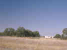
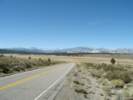
| California Highway 120 |
|
Tom Schweich |

|
Legislative Route Number 40 from 1935 to 1963. | ||||||
|
Other articles:
|
Junction: US Interstate 5 | ||||||
|
Other articles:
|
Junction: California Highway 99, south to Fresno and Bakersfield. | ||||||
|
Other articles:
Locations: Manteca. |
Manteca | ||||||
|
Other articles:
|
Junction: California Highway 99, north to Sacramento. | ||||||
|
|
Escalon | ||||||
|
Other articles:
Locations: Oakdale. |
OakdaleJunction: California Highway 108 | ||||||
|
Other articles:
|
|||||||
|
Other articles:
|
|||||||
|
Other articles:
|
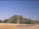
Yosemite Junction | ||||||
|
Other articles:
|
Chinese CampJunction: California Highway 49 | ||||||
|
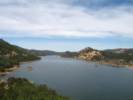
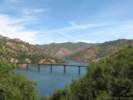
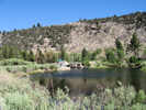
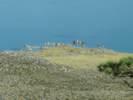
Locations: Don Pedro Reservoir. |
California Highway 120 crosses the Tuolumne River backed up in Don Pedro Reservoir. | ||||||
|
Other articles:
|
Vista point | ||||||
|
Other articles:
|
|||||||
|
Other articles:
|
Junction: California Highway 49 | ||||||
|
Other articles:
|
Junction: Wards Ferry Road | ||||||
|
|
Groveland | ||||||
|
Other articles:
Locations:
Rim of the World.
|
| ||||||
|
|
Yosemite National ParkBig Oak Flat Entrance | ||||||
|
Other articles:
|
Crane Flat | ||||||
|
Other articles:
Locations:
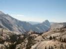
Half Dome.
Olmstead Point.
|
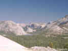
Olmstead PointView point along Highway 120 in Yosemite National Park. | ||||||
|
Other articles:
Locations:
Tenaya Lake.
|
| ||||||
|
Other articles:
|
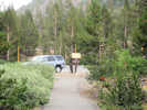
There is a little parking lot here with acces to the lake. I often stop here for lunch. | ||||||
|
Other articles:
Locations: Tenaya Lake. |
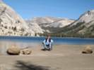
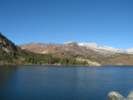
Tenaya Lake | ||||||
|
Literature Cited:
Other articles:
Locations: Pothole Dome. |
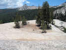
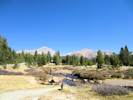
Pothole Dome
One of two places along California Highway 120 where Dühnforth, et al. (2010) measured 10Be and bedrock fracture spacing in a project to analyze bedrock fracture control of glacial erosion and rates. The other is Lembert Dome. | ||||||
|
Other articles:
Locations:
Tuolumne Meadows.
|
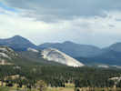
The climb to the top of Pothole Dome is fairly easy. From the top of Pothole Dome, you get a little different perspective on Tuolumne Meadows. | ||||||
|
Other articles:
Locations:
Pothole Dome.
|
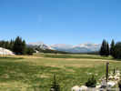
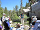
There are many places to stop along the highway in Tuolumne Meadows. However, to minimize damage to the meadow from foot traffic, the Park Service has closed access to much of the meadow. Therefore, if you want to walk out onto the meadow, or to the Tuolumne River, be sure to find a place that permits access. | ||||||
|
Other articles:
Locations:
Tuolumne Meadows.
|
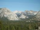
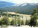
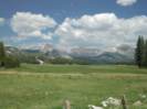
Tuolumne Meadows
| ||||||
|
Literature Cited:
Other articles:
Locations: Lembert Dome. |
Lembert Dome
One of two places along California Highway 120 where Dühnforth, et al. (2010) measured 10Be and bedrock fracture spacing in a project to analyze bedrock fracture control of glacial erosion and rates. The other is Pothole Dome. | ||||||
|
Other articles:
|
View to the west of Mount Dana and Mount Gibbs. | ||||||
|
Tuolumne River basin above, to the west. | |||||||
|
Literature Cited:
Other articles:
Locations: Tioga Pass. Tioga Pass Pond. |
Tioga Pass
About 200 meters east of the entrance station is Tioga Pass Pond. This pond sits directly on the Sierra crest, within Yosemite National Park and rests in a kettlehole depression only slightly larger than the pond itself. There are no inflowing streams. This is one of three Sierra ponds from which Anderson (1990) analyzed pollen and plant macrofossils in sediments. The other two locations are Starkweather Pond and Barrett Lake (sic) near to the Town of Mammoth Lakes. | ||||||
|
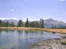
Locations: Mono Basin. |
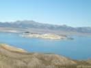
Mono Lake basin below, to the east. | ||||||
|
Other articles:
Locations:
Tioga Lake.
|
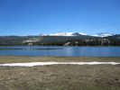
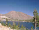
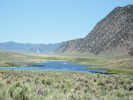
Tioga Lake | ||||||
|
Other articles:
|
Nunatak Nature Trail A nunatak is an isolated knob or peak of bedrock that projects prominently above the surface of a glacier and is surrounded by glacier ice. The word is derived from the Eskimo for "lonely peak." I stopped here to see what this trail was all about. However, it was raining pretty hard with no signs of letting up, so I went on down the canyon. | ||||||
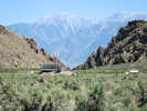
| Tioga Pass Resort | |||||||
|
Other articles:
|
Junction: Saddlebag Lake Road. USFS Junction Campground nearby. | ||||||
|
Locations: Lee Vining Canyon (Upper). |
|||||||
|
Other articles:
Locations:
Ellery Lake.
|
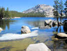
Ellery Lake
| ||||||
|
Other articles:
Locations:
Lee Vining Canyon.
|
| ||||||
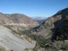
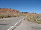
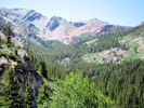 View of Warren Canyon from Tioga Pass Road. View of Warren Canyon from Tioga Pass Road.
|
View of Warren Canyon to the north. | ||||||
|
Other articles:
Locations: Warren Canyon. |
Warren Canyon trailhead. | ||||||
|
Other articles:
Locations:
Lee Vining Canyon.
|
| ||||||
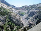
| View of Lee Vining Canyon | |||||||
|
Other articles:
Locations:
Lee Vining Canyon.
|
View of the floor of Lee Vining Canyon. | ||||||
|
Other articles:
|
Junction: Poole Power Station Road | ||||||
|
Literature Cited:
Locations: Lee Vining Canyon. |
Lee Vining Canyon was the site of a study of valley and mountain winds by Clements (1999). He found a valley wind, up the canyon, in the day time, and a mountain wind, down the canyon, at night. Clements also found a day time down canyon wind caused my mixing with upper level westerly flow in the summer months. | ||||||
|
Other articles:
|
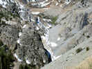
Early morning view of Lee Vining Canyon. | ||||||
|
Other articles:
|
Junction: Forest Road 01N104, to aqueduct intake dam. | ||||||
|
Locations: Lee Vining Ranger Station. |
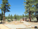
Lee Vining Ranger Station | ||||||
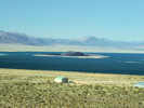 Negit Island from the Mobil Gas Station Negit Island from the Mobil Gas Station
|
Tioga Gas Mart (Mobil Station) and Whoa Nelli Deli. | ||||||
|
Other articles:
|
Junction: US Highway 395, north into Lee Vining and other points north. | ||||||
|
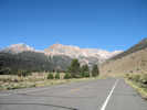
For 4.75 miles, California Highway 120 follows the north-south route of US Highway 395. | |||||||
|
Literature Cited:
Other articles:
|
Junction: US Highway 395, south past June Lakes and Mammoth into the Owens Valley.
I have seen some collections made along California Highway 120 east of US Highway 395 that refer to “Mono Lake Basin Road.” GoogleEarth will supply this name in addition showing the symbol for highway 120. This is a segment of California Highway 120 which is an extension of “Mono Lake Basin state road.” The original portion of Mono Lake basin road was built from local Mono County roads up to the existing Tioga Road, a distance of 9.3 miles, in the period 1904-1909. The extension, from what is now US Highway 395 to Mono Mills, was authorized by the state legislature in 1917.
| ||||||
|
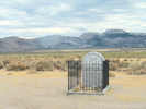
Other articles:
|
Grave of the Unknown Prospector, dedicated in 2003. It seems to me, though, that before Caltrans rebuilt this intersection, the memorial at this site was the Grave of the Unknown Fisherman. | ||||||
|
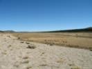
Locations: Pumice Valley. |
Pumice Valley | ||||||
|
Other articles:
|
Junction: Dross Road, guess what you'd find here | ||||||
|
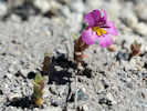
Other articles:
|
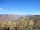
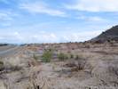
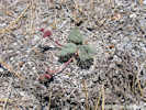
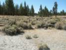
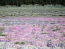
Dense bloom of Eriogonum baileyi two years after the Crater Fire. | ||||||
| Junction: Forest Road 1N55 | |||||||
|
Literature Cited:
Other articles:
Locations: Panum Crater. |
Watkins, et al. (2012) studied H2O and CO2 concentration gradients in pyroclastic obsidian from Mono Craters to develop a tool for evaluating degassing models and inferring time scales of magmatic processes. Since the obsidian was taken from a crater said to have erupted in A. D. 1340, it is assumed the sample was made at Panum Crater. | ||||||
|
Other articles:
|
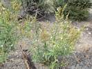
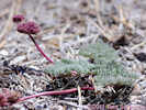
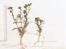
In September, 2011, this Nicotiana attenuata was growing in the burned area alongside CA Highway 120. | ||||||
|
Other articles:
|
In the early morning light, there are excellent views of Bloody Canyon from the vicinity of Panum Crater. | ||||||
|
Other articles:
Locations:
Panum Crater.
|
Panum Crater, with its tephra ring, is to the north. This view shows that a better view would be found from higher on the hill. | ||||||
|
Literature Cited:
Other articles:
Locations: Mount Biedeman. Paoha Island. |
| ||||||
|
Other articles:
Locations:
South Tufa Area.
|
View of South Tufa Area. Parking lot is behind the tree. | ||||||
|
Other articles:
|
View of Cedar Hill across Mono Lake. | ||||||
|
Other articles:
|
Junction: Test Station Road, to South Tufa.
The Forest Service designation for this road is 01N51, and this road is sometimes also called "South Tufa Road." | ||||||
|
Other articles:
|
Junction: Forest Road 1N23, generally in an easterly direction. Along this road I have collected Mentzelia monoensis and Eatonella nivea. | ||||||
|
Other articles:
|
Cymopterus cinerarius A. Gray. Along California Highway 120, 8 miles east of US Highway 395. Around Jeffrey pines, in pine needles, and other places with more organic matter than is usual in these cinder beds. There are plenty of collections of this taxon from this location. Collect it somewhere else and add to its distribution data. | ||||||
|
Other articles:
|
Junction: Forest Road 1N24, south along the east side of Mono Craters to East Crater Sand Flat. | ||||||
|
Other articles:
|
Junction: Forest Road 1S07, to East Craters Sand Flat and Bald Mountain Road (1S05). | ||||||
|
Literature Cited:
Other articles:
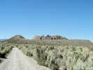
Locations: Mono Mills. |
Mono Mills
| ||||||
|
Other articles:
Locations: Devils Punch Bowl. |
Junction: Forest Road 1S13 | ||||||
| Cross intermittent stream | |||||||
| Benchmark 7468 | |||||||
|
Literature Cited:
Other articles:
|
At turnout about 0.9 miles southeast of Mono Mills. There is a road to the south here, but it is not an Inyo Forest designated route. This is also the approximate location of the type locality of Mentzelia monoensis J. M. Brokaw & L. Hufford. | ||||||
| Junction: Forest Road 01S22, to the northeast. | |||||||
| Junction: Forest Road 01S14, to the south. | |||||||
| Complex Junction: Forest Road 01S21G and 01S27J, on north side of road. | |||||||
| Junction: Forest Road 01S21, to the north. | |||||||
| Benchmark 7913 | |||||||
|
Other articles:
|
Junction: "120 Cutoff," Forest Road 1S06 | ||||||
|
Other articles:
|
| ||||||
|
Other articles:
|
Junction: "Taylor Canyon Road," Forest Road 1S17 | ||||||
|
Other articles:
|
|||||||
|
Other articles:
|
Junction: Forest Road 1S19 “M&R Tank Road” This small road crosses Big Sand Flat to the northwest, and then climbs the slope above flat. | ||||||
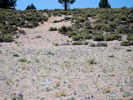
|
Other articles:
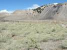
Locations: Big Sand Flat. |
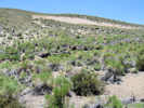
Big Sand Flat | ||||||
|
Other articles:
|
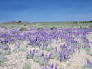
In July 2009, the Skunky Monkey Flower and Mono Lake Lupine were putting a good show. | ||||||
|
Other articles:
|
Junction: "Pilot Springs Road," Forest Road 1S04 | ||||||
|
Other articles:
|
Junction: Forest Road 01S04A, park here for the spring at Dry Creek where it enters Big Sand Flat. | ||||||
|
Other articles:
Locations:
Dry Creek.
|
| ||||||
|
Other articles:
|
Junction: Forest Road 01S27K, northeast from California Highway 120 into the northeastern-most portion of Big Sand Flat. | ||||||
|
Other articles:
|
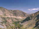
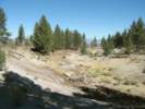
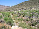
View of Big Sand Flat from the northeast, near Sagehen Summit. | ||||||
|
Locations: Mono Basin. |
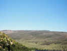
Mono Lake basin above, to the northwest | ||||||
|
Other articles:
Locations: Sagehen Summit. |
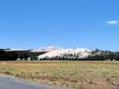
Sagehen SummitElevation: 8139 ft. | ||||||
|
Owens River basin below. | |||||||
|
Other articles:
|
Junction: "Sagehen Meadows Road" or "Dexter Canyon Road," Forest Road 1N02 | ||||||
|
Other articles:
|
Junction: Forest Road 1S191, south toward Sagehen Meadow. | ||||||
|
Other articles:
|
|||||||
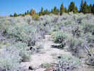
|
Locations: Gaspipe Spring. |
Gaspipe SpringGaspipe Spring on the south side of the highway. | ||||||
|
Other articles:
|
|||||||
|
Other articles:
|
View of Cowtrack Mountain Road. | ||||||
|
Other articles:
|
Junction: Cowtrack Mountain Road | ||||||
|
Other articles:
|
Junction: Forest Road 01S172, McPherson Grade | ||||||
|
Other articles:
|
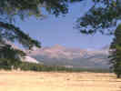
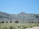
Sagehen Peak southwest of Granite Mountain. | ||||||
|
Other articles:
Locations:
Glass Mountain.
|
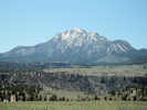
Glass Mountain, south of Granite Mountain. | ||||||
|
Locations: Granite Mountain. |
Granite Mountain to the north of the highway. | ||||||
|
Other articles:
|
|||||||
|
Other articles:
|
Junction: Dobie Meadows Road, generally north through Adobe Valley, over the Adobe Hills Spillway, then across Mono Valley to California Highway 167. | ||||||
|
Other articles:
|
|||||||
|
Other articles:
|
View of Glass Mountain along California Highway 120 near Adobe Creek. | ||||||
| Adobe Creek | |||||||
|
Other articles:
|
Junction: Forest Road 1S17 “Adobe Ranch Road” or “Taylor Canyon Road” | ||||||
|
Locations: Adobe Valley. |
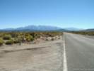
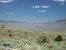
Highway passes through Adobe Valley. | ||||||
|
Other articles:
|
Junction: Forest Road 01S16 “McGee Canyon Road” | ||||||
|
Other articles:
Locations:
Black Lake.
|
Black Lake to east of highway. | ||||||
|
Other articles:
|
Water gap into Queen Valley from Adobe Valley. | ||||||
|
Other articles:
|
Junction: 4WD road northwest, near the Dutch control point. | ||||||
|
Other articles:
|
Junction: Benton Crossing Road | ||||||
|
Other articles:
|
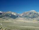
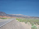
There is a nice view of Benton Valley and the White Mountains, just as the highway passes through the Benton Range. | ||||||
|
Other articles:
|
View of Benton Hot Springs from California Highway 120. | ||||||
|
Literature Cited:
Other articles:
Locations: Benton Hot Springs. |
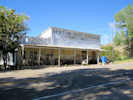
Benton Hot Springs
| ||||||
|
Other articles:
Locations:
Blind Springs Valley.
|
| ||||||
|
Other articles:
|
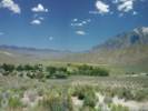
View southwest into Blind Spring Valley and the meadow of Benton Hot Springs Ranch. The Eastern Sierra Land Trust has a conservation easement on this meadow so that it cannot be developed. | ||||||
|
Literature Cited:
Other articles:
Locations: Benton. |
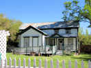
BentonJunction: US Highway 6 | ||||||
| If you have a question or a comment you may write to me at: tas4@schweich.com I sometimes post interesting questions in my FAQ, but I never disclose your full name or address. |
Date and time this article was prepared: 4/27/2024 3:15:14 PM |