Eastern Mojave Vegetation
Tom Schweich
|
Eastern Mojave Vegetation
| Nevada Highway 264 |
|
Tom Schweich |
|
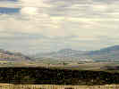
Nevada Highway 264 goes south from U. S. Highway 6 through the Fish Lake Valley to California Highway 266 near Oasis. | |
|
Other articles:
|
Junction: U. S. Highway 6. | |
| The portion of Nevada State Route 264 from here south is known as the "Dicalite Cutoff." | ||
|
Literature Cited:
|
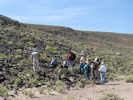
About 1 mile south of US Highway 6, and at the top of the hill to the west, is Field Trip Stop 6: Central Segment of Coaldale Fault of Lee, et al., 2006. | |
|
Other articles:
Locations: Fish Lake Valley. |
| |
|
Locations: Volcanic Hills. |
| |
|
Images:
|
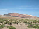
View of the Esmeralda Formation cropping out just south of Nevada State Route 773. | |
| ||
| The portion of Nevada State Route 264 from here north is known as the "Dicalite Cutoff." | ||
|
Other articles:
|
Junction: Nevada Highway 773. | |
|
Other articles:
|
Junction: No Name Road to The Crossing. | |
|
|
Fish Lake Valley | |
|
Locations: Dyer. |
Dyer | |
|
Literature Cited:
Other articles:
|
Junction: Furnace Creek Road | |
|
Other articles:
|
Junction: California Highway 266, south to Oasis and California Highway 168. | |
| If you have a question or a comment you may write to me at: tomas@schweich.com I sometimes post interesting questions in my FAQ, but I never disclose your full name or address. |
Date and time this article was prepared: 10/2/2026 12:52:18 PM |