 Eastern Mojave Vegetation
Edited by Tom Schweich
 Eastern Mojave Vegetation
| Pozo Road, San Luis Obispo County, California |
|
Edited by Tom Schweich |

Topics in this Article: Pozo |
West to East from Santa Margarita, California | |
|
Other articles:
|
Junction: Estrada Road | |
|
Other articles:
|
Junction: California Highway 58, Calf Canyon Highway | |
| Junction: Las Pilitas Road | ||
| Junction: Santa Margarita Lake Road | ||
| Junction: Old Rinconada Road | ||
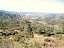
 View northwest from vicinity of Rinconada Mine View northwest from vicinity of Rinconada Mine
|
||
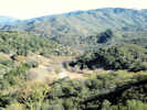
 View northwest across the Rinconada Mine. View northwest across the Rinconada Mine.
|
||
|
Other articles:
Locations:
Rinconada Mine.
|
Rinconada Mine
| |
 View east from near the Rinconada Mine. View east from near the Rinconada Mine.
|
||
| Junction River Road | ||
|
|
Pozo | |
| Junction: Hi Mountain Road | ||
| Junction: Park Hill Road | ||
| Junction: Avenales Ranch Road | ||
|
|
Pozo Summit | |
| Junction: Red Hill Road | ||
|
Junction: NF-29S18 Road to Queen Bee Campground. | ||
| Junction: Placer Creek Road | ||
| Junction: Lewis Ranch Road | ||
|
Other articles:
|
Junction: California Highway 58 | |
| If you have a question or a comment you may write to me at: tomas@schweich.com I sometimes post interesting questions in my FAQ, but I never disclose your full name or address. |
Date and time this article was prepared: 5/12/2025 2:44:59 PM |