Eastern Mojave Vegetation
Tom Schweich
|
Eastern Mojave Vegetation
| California Highway 62 |
|
Tom Schweich |
|
(No Preface) | |
|
Other articles:
|
Junction: U. S. Interstate 10 | |
|
Locations: Morongo Valley. |
Morongo Valley | |
|
Locations: Yucca Valley. |
Yucca Valley | |
|
Other articles:
|
Junction: California Highway 247 | |
|
Locations: Twentynine Palms. |
Twentynine Palms | |
|
Other articles:
|
Junction: Utah Trail, north for Amboy Road, south for Joshua Tree National Park, including Pinto Basin. | |
|
Locations: Dale Dry Lake. |
Dale Dry Lake | |
| Jct: Iron Age Road | ||
| Sheep Hole Mountains, to the north. | ||
| Clarks Pass, between the Sheep Hole Mountains to the north, and the Pinto Mountains to the south. | ||
|
Other articles:
|
FredaJunction: Cadiz Road. | |
|
Other articles:
Locations: Rice. |
RiceRailroad junction in the middle of nowhere. On California Highway 62 paralleling the Colorado River aqueduct. | |
|
Other articles:
|
Vidal JunctionJunction: US Hwy 95, north to Needles. | |
|
Other articles:
|
EarpJunction: Parker Dam Road | |
|
Other articles:
|
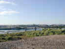
Colorado River Arizona below … Junction: Arizona Highway 72, through Parker, and Bouse to US Hwy 60 in the middle of Nowhere. | |
| If you have a question or a comment you may write to me at: tomas@schweich.com I sometimes post interesting questions in my FAQ, but I never disclose your full name or address. |
Date and time this article was prepared: 10/2/2026 12:35:24 PM |