Eastern Mojave Vegetation
Tom Schweich
|
Eastern Mojave Vegetation
| California Highway 190 |
|
Tom Schweich |

|
California Highway 190 runs west to east from US Highway 395 in the Owens Valley, across Panamint Valley and Death Valley, to Death Valley Junction in the Amargosa Valley. | |||
|
Other articles:
|
OlanchaJunction: U. S. Highway 395, north to Lone Pine, south to Los Angeles, etc. | |||
|
Literature Cited:
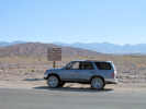
Locations: Olancha Dunes. |
Olancha Sand Dunes south of the highway. | |||
|
Other articles:
|
Junction: CA Highway 136, southeast along the east shore of Owens Lake to California Highway 190. | |||
|
Other articles:
|
Junction: Saline Valley Road | |||
| Junction:Saline Valley Alternate | ||||
| Rainbow Canyon | ||||
|
Other articles:
|
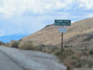
Junction: Olancha Darwin Road, southeast to Darwin. | |||
| Old Toll Road, to Darwin Falls | ||||
| Panamint Springs | ||||
|
Other articles:
|
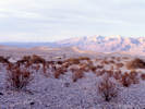
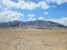
Junction: Panamint Valley Road | |||
 Looking back across Panamint Valley in the direction of Towne Pass. Looking back across Panamint Valley in the direction of Towne Pass.
|
||||
|
Literature Cited:
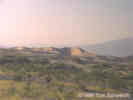
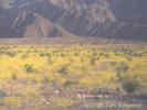
Locations: Panamint Valley. Panamint Valley Dunes. |
The Panamint Dunes are about 8-9 miles north. | |||
|
Other articles:
Locations:
Towne Pass.
|
Towne Pass
| |||
|
Other articles:
|
Junction: Wildrose Road | |||
|
Other articles:
Locations:
Stovepipe Wells.
|
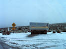
Stovepipe Wells
| |||
 Eriogonum inflatum in bloom near Stovepipe Wells, Death Valley. Eriogonum inflatum in bloom near Stovepipe Wells, Death Valley.
|
Eriogonum inflatum in bloom near Stovepipe Wells. | |||
|
Literature Cited:
Locations:
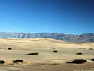
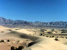
Death Valley Dunes.
Death Valley Dunes.
|
Sand dunes at Stove Pipe Wells in the late afternoon. | |||
|
Other articles:
|
Junction: North Highway,north to Scotty's Castle, Ubehebe Crater, and Racetrack Valley. | |||
|
Other articles:
|
Sea Level
| |||
|
Other articles:
|
Junction: Salt Creek Road | |||
|
Other articles:
|
Beatty Junction | |||
|
Locations:
Corkscrew Peak.
|
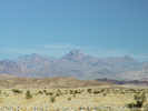
View of Corkscrew Peak to the north. | |||
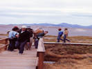
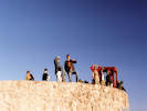
 Lowest point on California State Highway System, 242 feet below sea level. Lowest point on California State Highway System, 242 feet below sea level.
|
Lowest point on California Highway System, 242 feet below sea level. | |||
|
Locations:
Death Valley.
|
Furnace Creek | |||
|
Other articles:
|
Junctions:
| |||
|
Other articles:
Locations:
Zabriskie Point.
|
| |||
|
Literature Cited:
Other articles:
Locations: Gower Gulch. |
| |||
|
Other articles:
|
Junction: Furnace Creek Wash Road, to Ryan and Dantes View. | |||
|
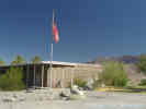
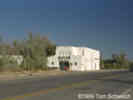
Entrance Payment Kiosk | ||||
|
Other articles:
Locations:
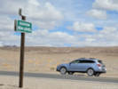
Death Valley Junction.
|
Death Valley JunctionJunction: California Highway 127 | |||
| If you have a question or a comment you may write to me at: tomas@schweich.com I sometimes post interesting questions in my FAQ, but I never disclose your full name or address. |
Date and time this article was prepared: 5/12/2025 2:42:36 PM |