 Eastern Mojave Vegetation
Tom Schweich
 Eastern Mojave Vegetation
| Emery County Route 401, "Green River Cut-Off," Emery County, Utah |
|
Tom Schweich |

|
From Utah Highway 10 near Castle Dale to US Highway 6 near Woodside. The Green River Cut-Off crosses or briefly runs along two of Utah's historic routes: The Old Spanish Trail and the original route of the Denver and Rio Grande Western (DRGW) Railroad. It is often difficult to find the specific route of the Old Spanish Trail as it is now mostly worn away. However, it did go through much the same area as the Green River Cut-Off trail. The original D&RGW roadbed is a bit more defined (though still worn away) and crosses paths with the Green River Cut-Off in several places. |
|
|
Other articles:
|
Junction: Utah Highway 10, just north of Castle Dale. | |
|
Literature Cited:
Locations: Little Cedar Mountain. |
Little Cedar Mountain to the North. On the eastern slopes of Little Cedar MountainNear this location are paleosol collection sites in the Morrison and Cedar Mountain Formations used by Retallack in his 2009 study of greenhouse crises of the past 300 million years. Retallack used stomatal index data for fossil Ginko and related leaves as a proxy for past CO2 spikes and paleosol chemical data as proxies for temperature and humidity changes. These data show that global warming due to CO2 rise is a not a unique event in earth history and that the magnitude of the coming anthropogenic greenhouse pales in comparison with past greenhouse spikes at times of global mass extinctions. | |
| Junction: BLM Road 6707, to the north, and BLM Road 6809, to the south. | ||
|
Literature Cited:
Locations: Summerville Point. |
| |
 Green River Cut-Off Road Green River Cut-Off Road
|
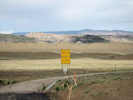
View from the turnoff at US Highway 6. | |
|
Other articles:
|
Junction: US Highway 6, south of Woodside. | |
| If you have a question or a comment you may write to me at: tomas@schweich.com I sometimes post interesting questions in my FAQ, but I never disclose your full name or address. |
Date and time this article was prepared: 5/12/2025 3:00:34 PM |