 Eastern Mojave Vegetation
 Eastern Mojave Vegetation
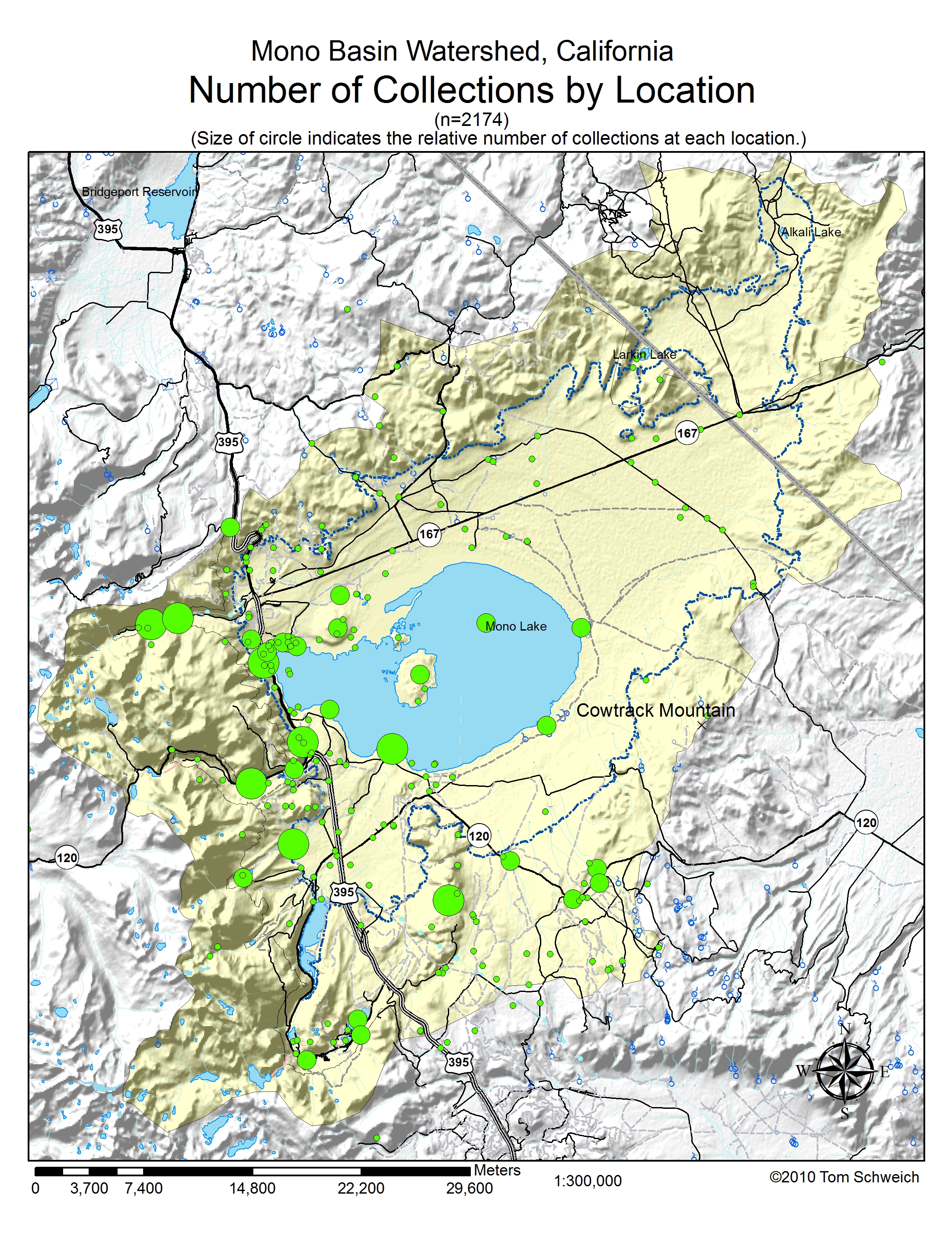
| Number of Collections by Location. |
|
|

If you have a question or a comment about this photograph you may write to me at: tomas@schweich.com I sometimes post interesting questions in my FAQ, but I never disclose your full name or address. |

This map shows where plants have been collected in the Mono Basin. It was prepared by collecting events at each point described by latitude and longitude. Collections made in the Upper Mono Basin (above 8400 feet) are excluded. Some data could not be accurately portrayed and was deleted. For example, some collections give the location as "Mono Lake" or even just "Mono Basin." It's impossible to know where to place a marker for these collections, and they are not shown on this map. Other data has been portrayed as accurately as can be, but may not be the actual place of collection. For example, all of Miss Maud Minthorn's collections give the location as "vicinity of Lundy." These are all plotted at Lundy. Other collections give only creek names as locations, such as "Lee Vining Creek." or "Rush Creek." These have been plotted on the deltas of those respective creeks, where they enter Mono Lake. Collections that have location descriptions such as "Lee Vining Creek near USFS Ranger Station" are plotted at the most specific point possible, in this case, at the Lee Vining Ranger Station in Lee Vining Canyon. The map shows that there are many collections around the northwest shore of Mono Lake, in Lee Vining Canyon, and in Lundy Canyon. Big Sand Flat is also a popular collecting locality. Not unexpectedly, there are few collections from the eastern portions of the Mono Basin. I am a little surprised at how few collections there are in the Bodie Hills, along the north side of the basin.
Other photos about Geography - Mono Lake Basin, California or Mono Lake basin.
|
|
Date and time this page was prepared: 5/12/2025 3:03:31 PM |