
|
(No Preface)
|
|
Other articles:
• Utah Trail:
at Pinto Wye;
|
Junction: Utah Trail, Park Blvd
|
|
Other articles:
• Field Notes:
22-Apr-08;
22-Apr-08;
Locations:
Silver Bell Mine.
 Silver Bell Mine Silver Bell Mine
|
Silver Bell Mine |
| Silver Bell Mine |
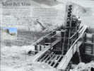
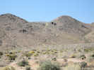
| On the slopes to the south you can see the remains of the Silver Bell Mine, with its tipples still standing. These ore bins held and fed rock to a stamp battery that crushed the ore into a sandy-watery pulp and pushed it onto an amalgamation table where the precious metals were extracted. Though the mines operated some 40 years, ownership and details about the mine's riches are sketchy. Nevertheless, it was a versatile mine: gold in the 1930s, lead in the 1940s, and copper in the 1950s. |
| Prospectors began staking claims in this desert region around 1865. Gold fever gave rise to mine names like Fore Aces, Big Bozo Claim, Lucky Turkey #2, and Hard Digging. Mining reached its peak here by 1917 and tapered off by the 1960s. |
| Ore was hoisted from the Silver Bell Mine by the skip and dumped onto the grizzly, which sorted ore into the tipple. A 1958 assay report showed the Silver Bell Mine as having low gold and silver values, but high copper values -- worth about $90 a ton. | |
|
|
Other articles:
• Field Notes:
22-Apr-08;
22-Apr-08;
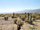 Teddy Bear Cholla Teddy Bear Cholla
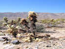 Teddy Bear Cholla Teddy Bear Cholla
|
Cholla Garden
|
|
Other articles:
• Field Notes:
22-Apr-08;
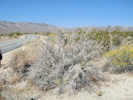 Desert Lavender in Pinto Basin. Desert Lavender in Pinto Basin.
|
|
|
Other articles:
• Field Notes:
22-Apr-08;
22-Apr-08;
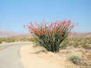 Ocotillo in the Pinto Basin Ocotillo in the Pinto Basin
 Ocotillo in the Pinto Basin Ocotillo in the Pinto Basin
|
|
|
Other articles:
• Field Notes:
22-Apr-08;
22-Apr-08;
Locations:
Turkey Flat.
 Turkey Flats Turkey Flats
|
Turkey Flats |
Turkey Flats
|
|
Other articles:
• Field Notes:
22-Apr-08;
Locations:
Pinto Basin.
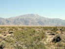
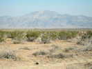 Pinto Mountain, the highest peak in the Pinto Mountains, as seen across the Pinto Basin Pinto Mountain, the highest peak in the Pinto Mountains, as seen across the Pinto Basin
|
View north across Pinto Basin.
|
|
Other articles:
• Field Notes:
22-Apr-08;
Locations:
Pinto Basin.
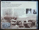 Interpretive Sign About Pinto Basin Interpretive Sign About Pinto Basin
|
Pinto Basin
| Pinto People |
| In the Pinto Basin there lies an extinct river along whose banks we found, for nearly six miles, camps containing a culture different from anything we had already encountered. |
| Elizabeth Campbell (1893-1971) |
| It is hard to imagine the existence of large bodies of water anywhere in this parched landscape, but exist they did. Here in the Pinto Basin evidence of old shorelines lends proof to a cooler, wetter period when a shallow river coursed the basin. The river attracted life, which explains the fossil bones of extinct camel, horse, llama, sheep, tortoise, and rabbit found here. It also explains the discovery of a distinct human culture that camped along the riverbanks. |
| Between 1931 and 1935, self-taught archaeologists Elizabeth and William Campbell searched up and down this valley. They followed the ancient riverbank terraces for miles, discovering many small campsites and collecting chipped stone tools -- leaf-shaped points, scrapers, and choppers. The Campbells recognized that these tools were different from others of the region. When the artifacts were radiocarbon tested years later, they registered more than 9,000 years old and confirmed the existence of a vanished people -- the Pinto Culture. |
|
|
Other articles:
• Cottonwood Springs Road:
at Pinto Basin Rd;
|
Junction: Cottonwood Springs Road
|
|
If you have a question or a comment you may write to me at:
tomas@schweich.com
I sometimes post interesting questions in my FAQ, but I never disclose your full name or address.
|
[Home Page] [Site Map]
Date and time this article was prepared:
5/12/2025 2:44:26 PM
|
 Eastern Mojave Vegetation
 Eastern Mojave Vegetation
