 Eastern Mojave Vegetation
Tom Schweich
 Eastern Mojave Vegetation
| Garlock Road, Central Mojave Desert, California |
|
Tom Schweich |

|
(No Preface) |
|
Other articles:
|
Junction: Redrock Randsburg Road |
|
|
Garlock |
|
Literature Cited:
Locations:
Garlock.
|
Remains of the town of Garlock, California. Garlock flourished in the late 1800s when gold was discovered in Goler Gulch. The best source on Garlock is Paul Hubbard's history and compilation of reminiscences: Garlock Memories, Ridgecrest: Hubbard Printing, 1960. |
|
Literature Cited:
Locations:
Garlock.
|
A group from the San Bernardino Museum learns the history of studies of the Garlock Fault from George I. Smith of the U. S. Geological Survey. George's article, as well as the field trip guide used by this group can be found in Calzia and Reynolds (1998), which is available from the San Bernardino County Museum. |
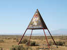
 "Art by Kristal" alongside Garlock Road. "Art by Kristal" alongside Garlock Road.
|
|
|
Locations: Goler Gulch. |
Cross Goler Gulch wash. |
|
Literature Cited:
Other articles:
Locations: Goler Heights. |
A group from the 1998 Desert Research Symposium (San Bernardino County Museum) views the trace of the Garlock Fault. This depression on the south side of the Garlock Fault was formed when Goler Wash was offset left-laterally (Calzia and Reynolds, 1998). The cabins at the base of this 25–30 foot high scarp are owned by the BLM as part of their Adopt-A-Cabin program. A successor to this group visited this location again as Stop 1-1 in the 2009 Desert Symposium. |
| Junction: Goler Road, southeast to Redrock Randsburg Road near the town of Randsburg. | |
|
Other articles:
|
Junction: US Highway 395 |
| If you have a question or a comment you may write to me at: tomas@schweich.com I sometimes post interesting questions in my FAQ, but I never disclose your full name or address. |
Date and time this article was prepared: 5/12/2025 2:42:09 PM |